34
© 2014 HDR, Inc., all rights reserved. Belmont Park Area (South River Road & 3rd Street South)

© 2014 HDR, Inc., all rights reserved.
Belmont Park Area (South River Road & 3rd Street South)

Flood History
0
10,000
20,000
30,000
40,000
50,000
60,000
70,000
1900 1905 1910 1915 1920 1925 1930 1935 1940 1945 1950 1955 1960 1965 1970 1975 1980 1985 1990 1995 2000 2005 2010 ?
Maxim
um D
aily F
low
Rate
(cub
ic-fe
et p
er se
cond
)
Red River of the North at Fargo, North Dakota
500-Year Flood
The 2009 flood is the largest flood
on record and equates to a
50-Year Flood Event.
Source: USGS river flow data from USGS Station
Approximate Major Flood Stage
● 16 flood have exceeded the "Major Flood Stage" since 1900.
● 8 of the 16 "major" floods have
occurred since 2000 through 2014.
100-Year Flood Event
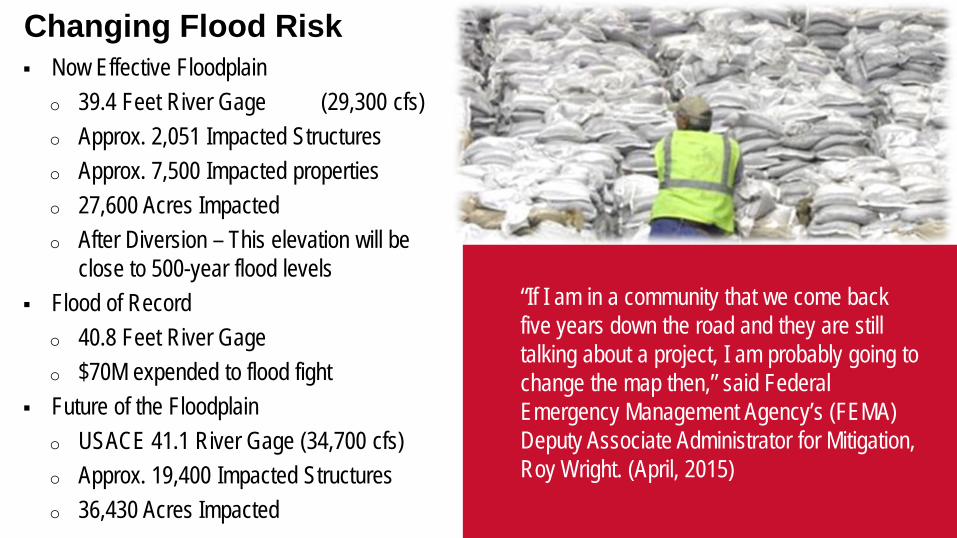
Now Effective Floodplain o 39.4 Feet River Gage (29,300 cfs) o Approx. 2,051 Impacted Structures o Approx. 7,500 Impacted properties o 27,600 Acres Impacted o After Diversion – This elevation will be
close to 500-year flood levels Flood of Record
o 40.8 Feet River Gage o $70M expended to flood fight
Future of the Floodplain o USACE 41.1 River Gage (34,700 cfs) o Approx. 19,400 Impacted Structures o 36,430 Acres Impacted
Changing Flood Risk
“If I am in a community that we come back five years down the road and they are still talking about a project, I am probably going to change the map then,” said Federal Emergency Management Agency’s (FEMA) Deputy Associate Administrator for Mitigation, Roy Wright. (April, 2015)
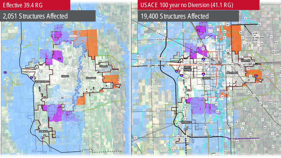
Effective 39.4 RG USACE 100 year no Diversion (41.1 RG)
2,051 Structures Affected 19,400 Structures Affected

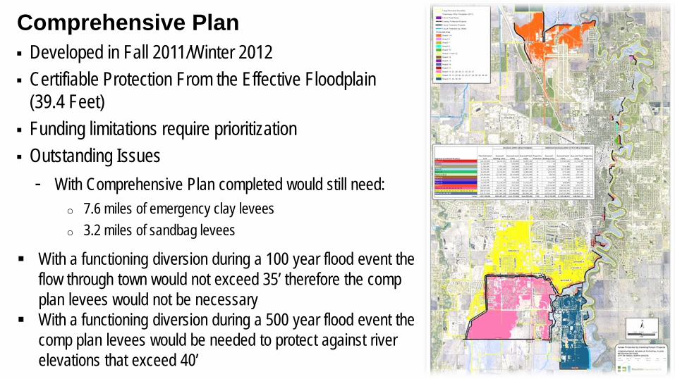
Developed in Fall 2011/Winter 2012 Certifiable Protection From the Effective Floodplain
(39.4 Feet) Funding limitations require prioritization Outstanding Issues
- With Comprehensive Plan completed would still need: o 7.6 miles of emergency clay levees o 3.2 miles of sandbag levees
Comprehensive Plan
With a functioning diversion during a 100 year flood event the flow through town would not exceed 35’ therefore the comp plan levees would not be necessary
With a functioning diversion during a 500 year flood event the comp plan levees would be needed to protect against river elevations that exceed 40’

183 Properties Purchased o Over 320 since 1990
At cost of over $60 million Cass County purchased 14 additional homes needed Diversion Authority is in process of acquiring 17
additional properties within Fargo Remaining Properties Under Comprehensive Plan o 121 properties to be acquired o Approximately $36 million
Property Acquisitions (Since 2009)

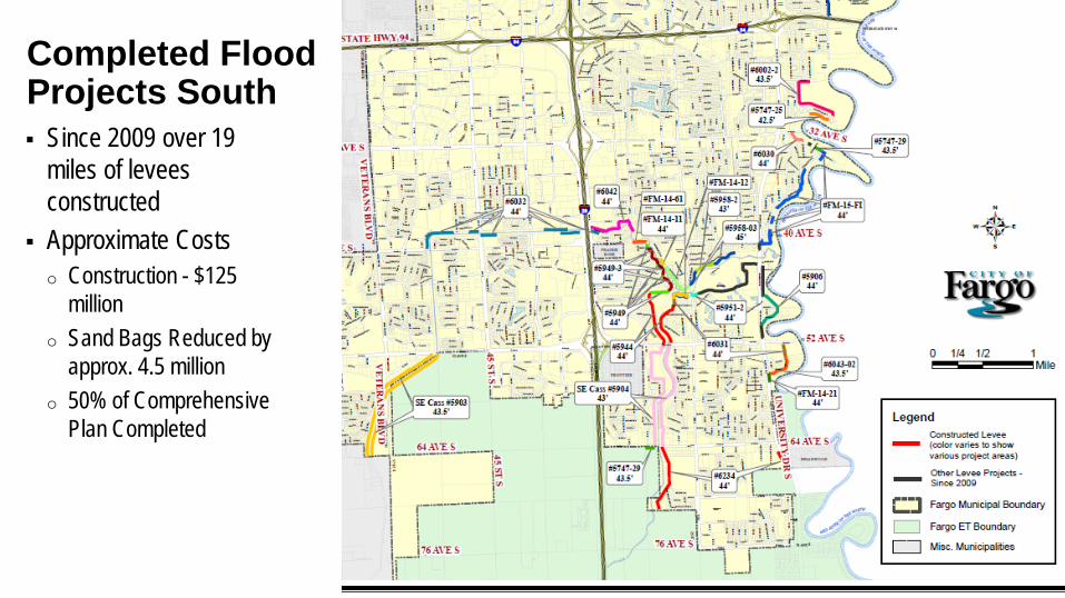
Since 2009 over 19 miles of levees constructed
Approximate Costs o Construction - $125 million o Sand Bags Reduced by approx. 4.5 million o 50% of Comprehensive Plan Completed
Completed Flood Projects North
Since 2009 over 19 miles of levees constructed
Approximate Costs o Construction - $125
million o Sand Bags Reduced by
approx. 4.5 million o 50% of Comprehensive
Plan Completed
Completed Flood Projects South

In Progress Projects Combination of projects under construction
or under design for 2016/2017 construction o 12 City of Fargo Led o 7 Diversion Authority Led
Over 3.5 miles in progress City Project Cost ≈ $68.5 million o Construction Cost ≈ $37million
65% of the Comprehensive Plan completed once these projects are done

Remaining Projects Approx. 10 miles remaining
o *excludes Cass County 20 Area Project Cost ≈ $130 million
o # Does not include south side line of protection o # Does not include 2016 planned projects o # Does not included Diversion Authority More Flow
Through Town Projects Type of Projects:
o Levees along River & Legal Drains o Road Raises
• Includes Interstate 29 at Drain 27 92% of the Comprehensive Plan would be completed
Voluntary Buyouts Negotiations
Land Acquisition Overview
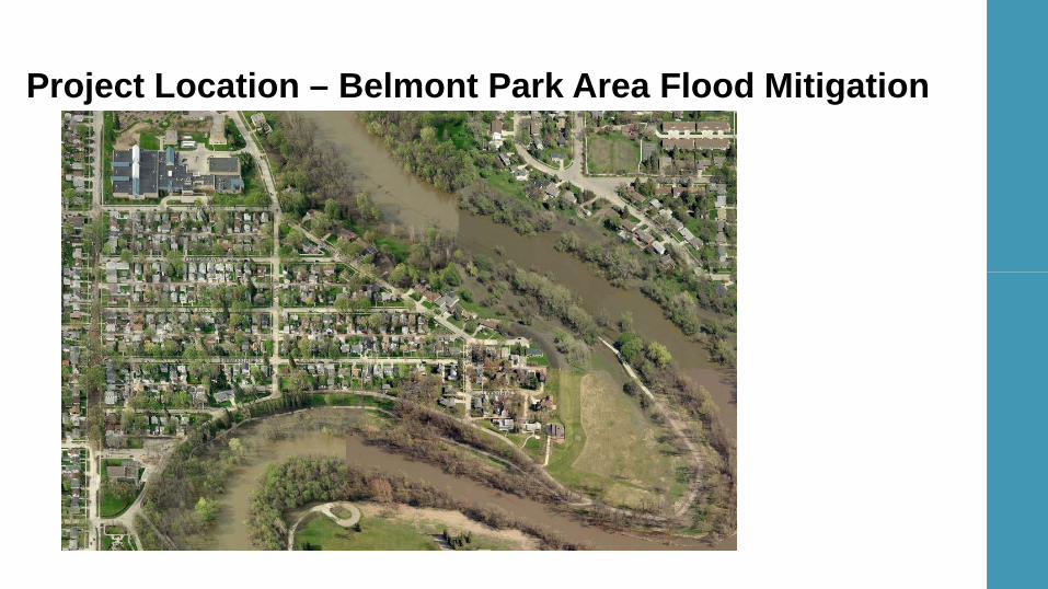
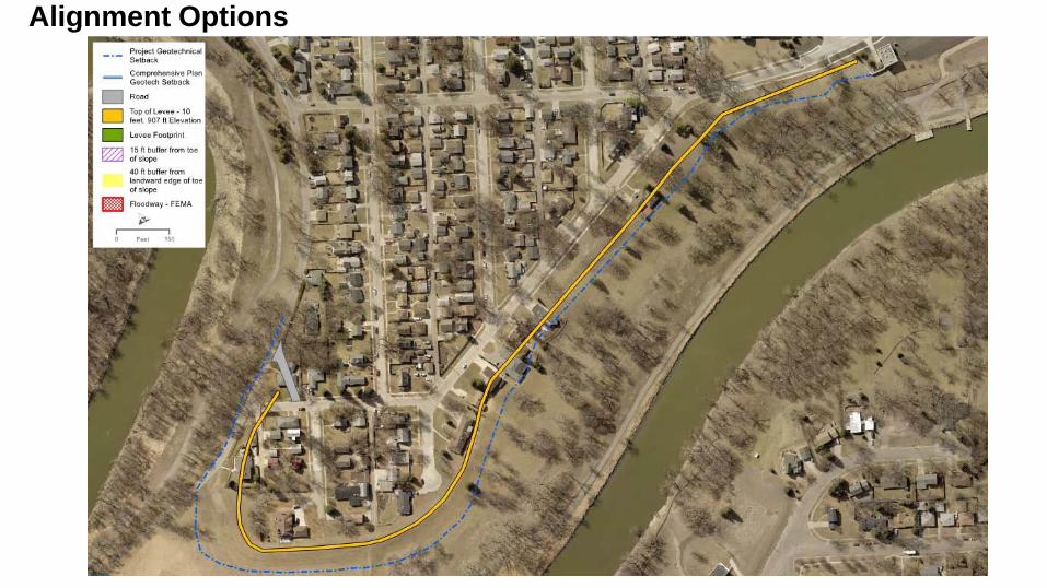
Project Location – Belmont Park Area Flood Mitigation
14th Ave S
Oakland Ave S
15th Ave S
Elmwood Ave S
4 th St S
3 rd St S
Linden Ave S
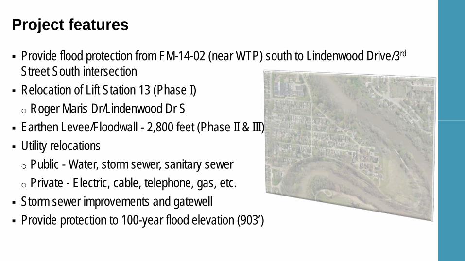
Provide flood protection from FM-14-02 (near WTP) south to Lindenwood Drive/3rd Street South intersection
Relocation of Lift Station 13 (Phase I) o Roger Maris Dr/Lindenwood Dr S
Earthen Levee/Floodwall - 2,800 feet (Phase II & III) Utility relocations o Public - Water, storm sewer, sanitary sewer o Private - Electric, cable, telephone, gas, etc.
Storm sewer improvements and gatewell Provide protection to 100-year flood elevation (903’)
Project features
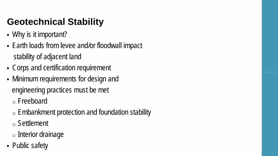
Geotechnical Stability Why is it important? Earth loads from levee and/or floodwall impact stability of adjacent land Corps and certification requirement Minimum requirements for design and engineering practices must be met o Freeboard o Embankment protection and foundation stability o Settlement o Interior drainage
Public safety
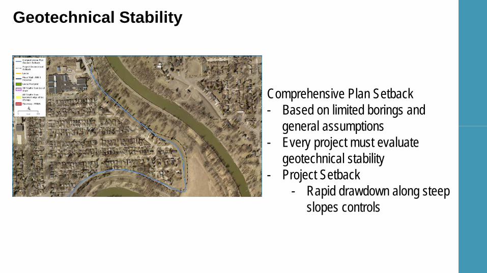
Geotechnical Stability
Comprehensive Plan Setback - Based on limited borings and general assumptions - Every project must evaluate
geotechnical stability - Project Setback
- Rapid drawdown along steep slopes controls
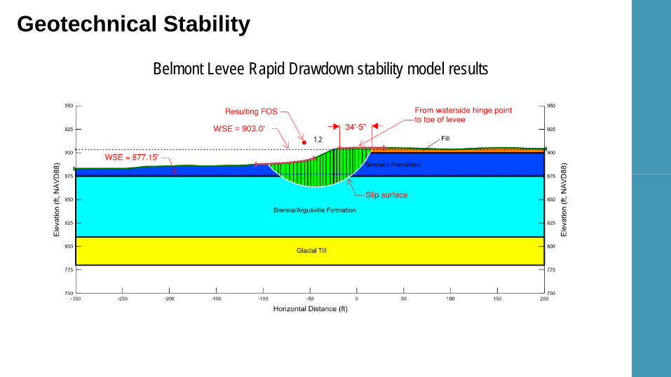
Geotechnical Stability
Belmont Levee Rapid Drawdown stability model results
WSE = 903.0’ 1.2
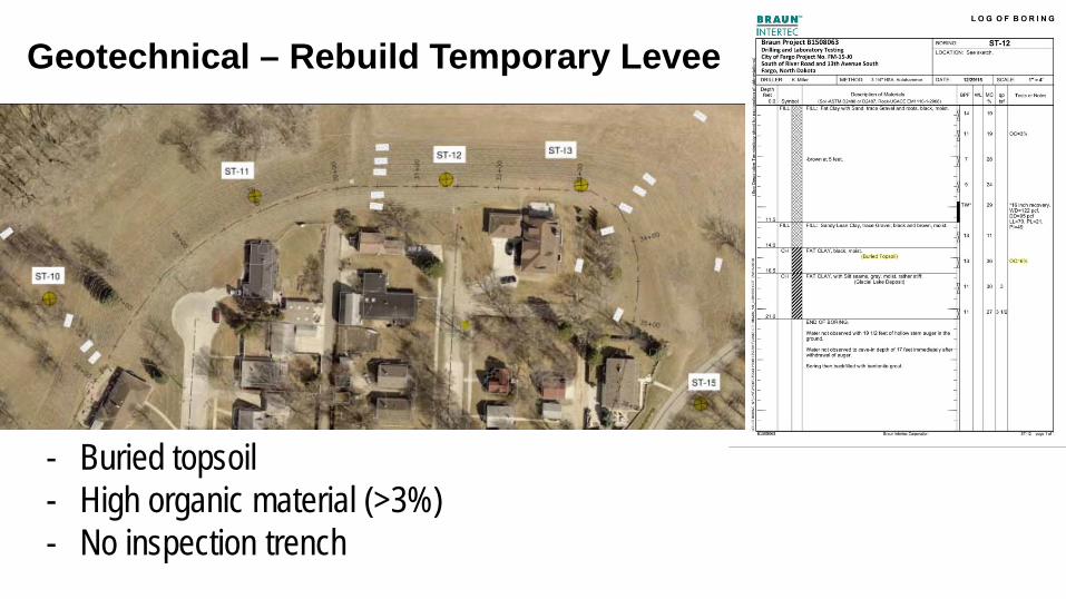
Geotechnical – Rebuild Temporary Levee
- Buried topsoil - High organic material (>3%) - No inspection trench
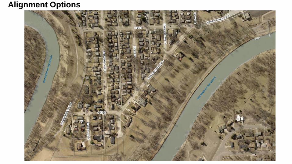
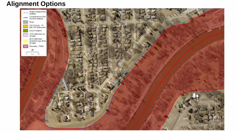
Alignment Options

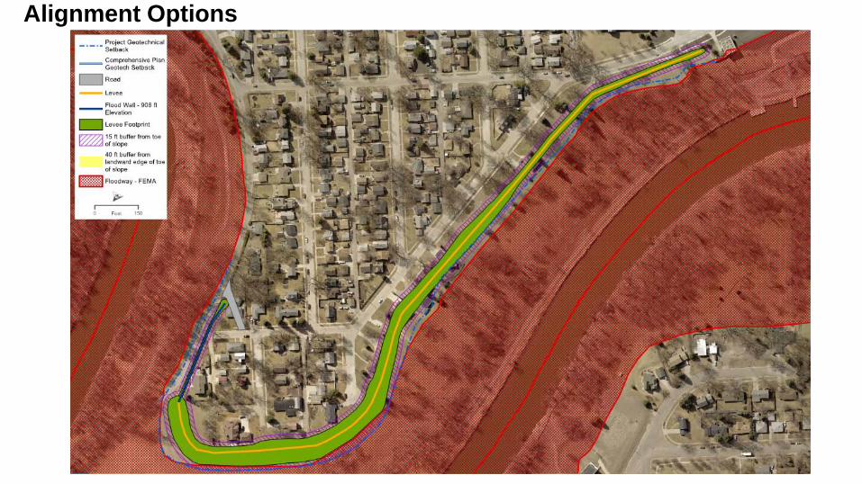
Alignment Options
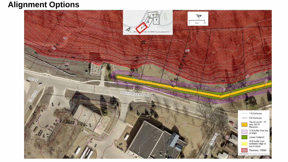
Alignment Options

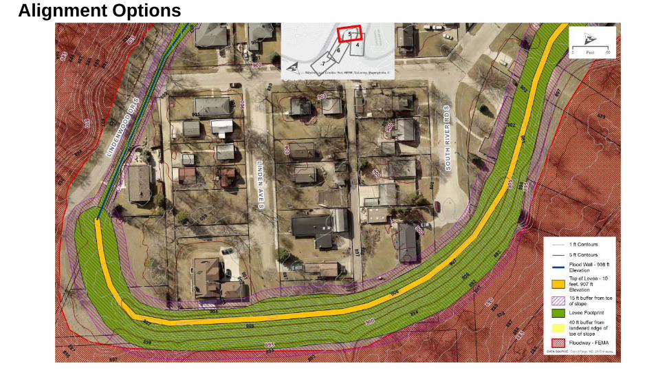
Alignment Options

Alignment Options
Alignment Options
Alignment Options

Alignment Options
Alignment Options
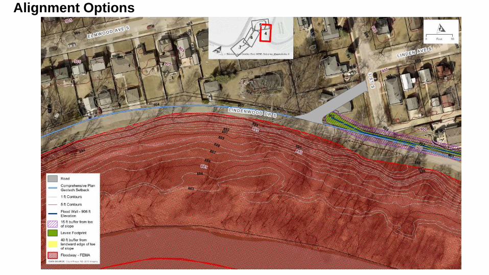
Alignment Options
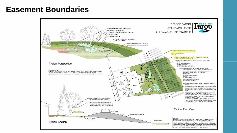
Easement Boundaries
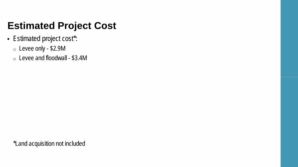
Estimated project cost*: o Levee only - $2.9M o Levee and floodwall - $3.4M
*Land acquisition not included
Estimated Project Cost

Why build levee if Diversion Project is constructed? o Levee will provide real/interim flood protection o Levee will be compatible with the Diversion Project by providing protection on the greater than 100 year
flood events o Levee + Diversion = Increased level of flood protection
Will I be assessed for this levee project? o No – levee is being designed and constructed with Fargo Infrastructure Sales Tax Dollars, as well as
dollars from the State
Frequently Asked Questions
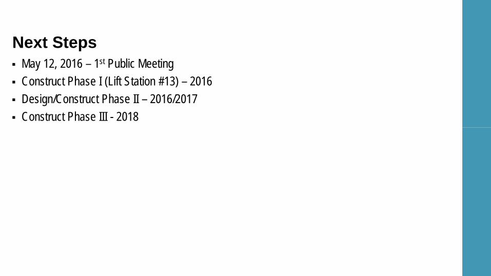
May 12, 2016 – 1st Public Meeting Construct Phase I (Lift Station #13) – 2016 Design/Construct Phase II – 2016/2017 Construct Phase III - 2018
Next Steps

Questions
Alignment Options


