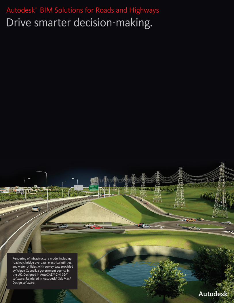
Drive smarter decision-making. Autodesk ® BIM Solutions for Roads and Highways Rendering of infrastructure model including roadway, bridge overpass, electrical utilities, and water utilities, with survey data provided by Wigan Council, a government agency in the UK. Designed in AutoCAD ® Civil 3D ® software. Rendered in Autodesk ® 3ds Max ® Design software.
Transcript
Drive smarter decision-making.Autodesk®
BIM Solutions for Roads and Highways
Rendering of infrastructure model including roadway, bridge overpass, electrical utilities, and water utilities, with survey data provided by Wigan Council, a government agency in the UK. Designed in AutoCAD® Civil 3D® software. Rendered in Autodesk® 3ds Max®
Design software.
Faster, Cheaper, Higher-QualityTransportation engineering teams are facing increased pressure to do the job faster and at a lower cost while delivering high-quality projects. Autodesk provides innovative ways to plan, design, build, and manage roads and highways, and is changing the way the industry tackles the challenges related to improving the roadways that are vital to commerce.
Once considered just for buildings, BIM is delivering tremendous gains in efficiency and quality for the transportation industry. The principles of BIM apply to everything in the built environment—including roads and highways. BIM, an intelligent model-based process, can provide the necessary insight to create and manage projects faster and more economically.
Autodesk BIM Solutions for Roads and Highways can help transportation engineers:• Deliver higher-quality design alternatives faster by evaluating more what-if scenarios earlier in the design process.
• Make design changes more quickly with design and documentation that is dynamically linked.
• Better evaluate project performance, more accurately communicate design intent, and help build stakeholder support for road and highway projects by using intelligent models to generate more realistic simulations and visualizations.
• Help minimize roadway flooding with integrated storm and sanitary analysis capabilities to plan and design urban and highway drainage systems, including storm drain catch basins, culverts, and piping.
• Facilitate time and material savings by using more coordinated, consistent data to more quickly compute earthwork volumes, perform quantity takeoffs, and deliver high-quality models to contractors for automated machine guidance.
Autodesk’s comprehensive portfolio of Building Information Modeling (BIM) solutions helps users gain insight to improve the way they plan, design, build, and manage road and highway projects.
BIM for the Transportation Engineer
Improve productivity in order to realize bigger profits• Compete for bigger, more complex projects. • Expand services to existing clients and open doors to new clients.
• Increase client satisfaction.
• Attract and hire top tier employees.
Combine multiple types of data for a more comprehensive view• Access and integrate CAD and geospatial data to better evaluate existing conditions.
• Perform environmental impact analysis.
• Create conceptual designs and exhibits to help communicate the potential impact of projects.
Design and document more productively • Streamline time-consuming tasks— such as geometry layout and editing, corridor modeling, and sheet creation— with specific tools and configurable standards.
Build more reliably• Plan projects virtually to help identify costly design and scheduling conflicts before you break ground.
• Manage your infrastructure information more dependably.
• Standardize the as-built data collection process with configurable industry models.
• Better capture existing and newly installed utility and street furniture locations, as well as relevant attributes needed to support future decision making for operations, maintenance, and capital planning.
Why BIM? Our BIM approach helped us quickly alter specific features of a design—a bridge crossing or a roadway alignment, for example—to more efficiently create, coordinate, visualize, and evaluate design options.
— Marcos del Nero Millan Engineer Figueiredo Ferraz
Why Autodesk?Through the use of Autodesk products specifically we're staying at the cutting edge of technology. Using BIM for Infrastructure and Autodesk solutions we'll always be faster and more proficient in our project pursuits.
— Jack Lashenik Vice President American Structure Point
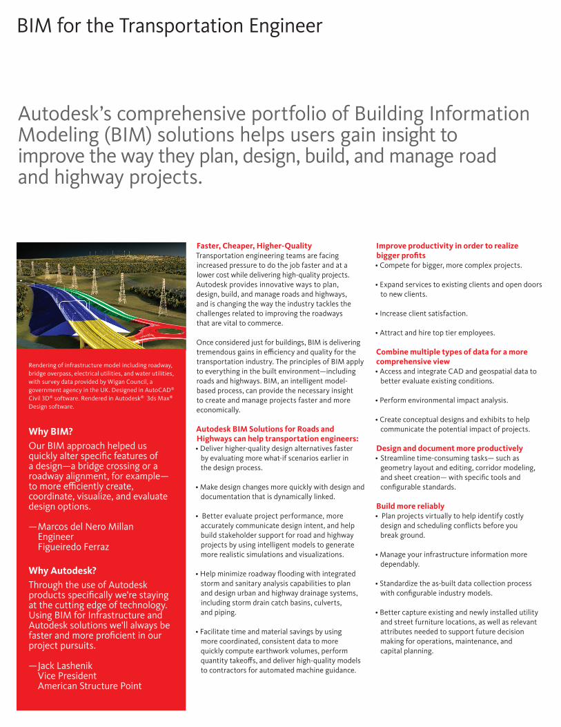
Rendering of infrastructure model including roadway, bridge overpass, electrical utilities, and water utilities, with survey data provided by Wigan Council, a government agency in the UK. Designed in AutoCAD® Civil 3D® software. Rendered in Autodesk® 3ds Max® Design software.
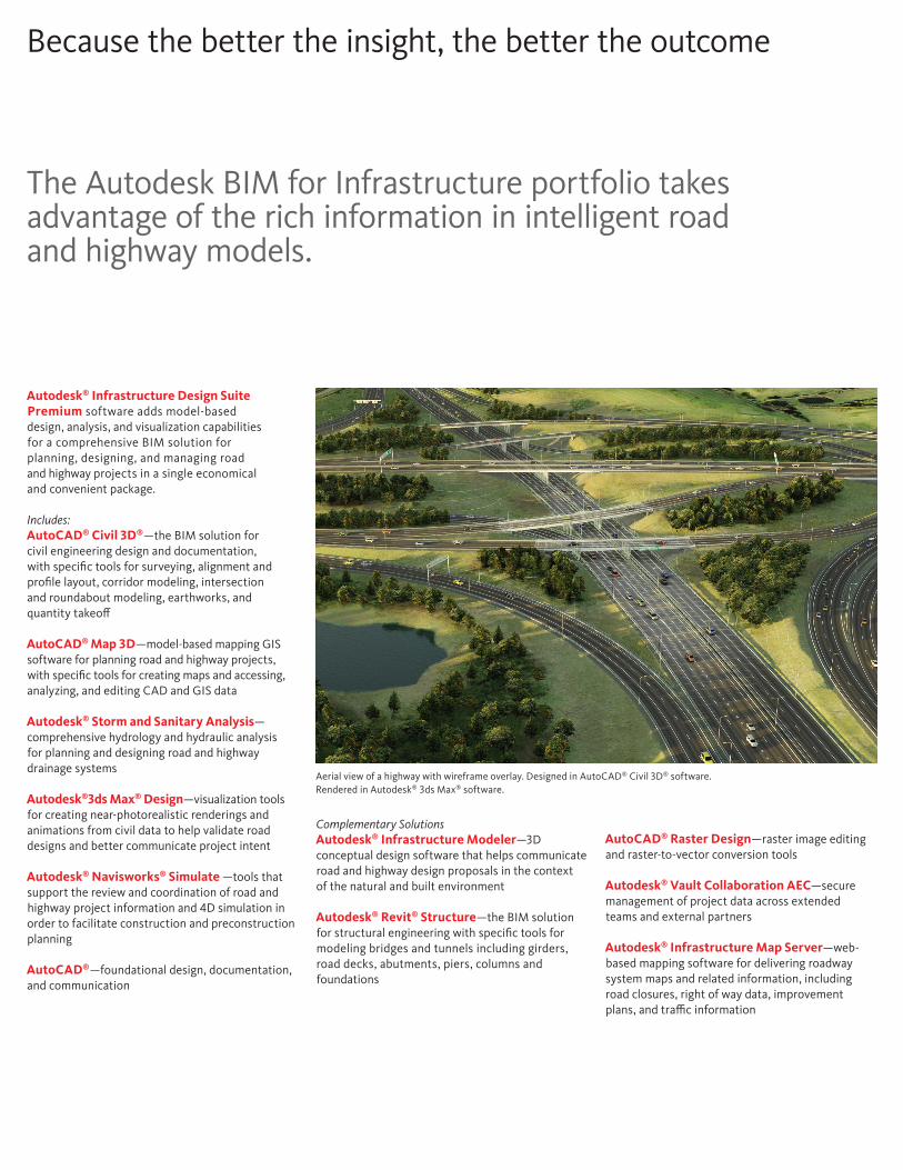
Aerial view of a highway with wireframe overlay. Designed in AutoCAD® Civil 3D® software. Rendered in Autodesk® 3ds Max® software.
Autodesk® Infrastructure Design Suite Premium software adds model-based design, analysis, and visualization capabilities for a comprehensive BIM solution for planning, designing, and managing road and highway projects in a single economical and convenient package.
Includes:AutoCAD® Civil 3D®—the BIM solution for civil engineering design and documentation, with specific tools for surveying, alignment and profile layout, corridor modeling, intersection and roundabout modeling, earthworks, and quantity takeoff
AutoCAD® Map 3D—model-based mapping GIS software for planning road and highway projects, with specific tools for creating maps and accessing, analyzing, and editing CAD and GIS data
Autodesk® Storm and Sanitary Analysis—comprehensive hydrology and hydraulic analysis for planning and designing road and highway drainage systems
Autodesk®3ds Max® Design—visualization tools for creating near-photorealistic renderings and animations from civil data to help validate road designs and better communicate project intent
Autodesk® Navisworks® Simulate —tools that support the review and coordination of road and highway project information and 4D simulation in order to facilitate construction and preconstruction planning
AutoCAD®—foundational design, documentation, and communication
Because the better the insight, the better the outcome
The Autodesk BIM for Infrastructure portfolio takes advantage of the rich information in intelligent road and highway models.
Complementary SolutionsAutodesk® Infrastructure Modeler—3D conceptual design software that helps communicate road and highway design proposals in the context of the natural and built environment
Autodesk® Revit® Structure—the BIM solution for structural engineering with specific tools for modeling bridges and tunnels including girders, road decks, abutments, piers, columns and foundations
AutoCAD® Raster Design—raster image editing and raster-to-vector conversion tools
Autodesk® Vault Collaboration AEC—secure management of project data across extended teams and external partners
Autodesk® Infrastructure Map Server—web-based mapping software for delivering roadway system maps and related information, including road closures, right of way data, improvement plans, and traffic information
*Free products are subject to the terms and conditions of the end-user license and services agreement that accompanies download of the software. The software is for personal use for education purposes and is not intended for classroom or lab use.
Autodesk BIM solutions are helping us optimize our design and build the project safely, on time, and on budget.
— Hugh Woods, Senior Group Engineer Atkins
Learn More or PurchaseAccess specialists worldwide who can provide product expertise, a deep understanding of your industry, and value that extends beyond your software. To license Autodesk® Infrastructure Design Suite Premium software, contact an Autodesk Authorized Reseller. Locate a reseller near you at www.autodesk.com/reseller.
Autodesk EducationFrom instructor-led or self-paced classes to online training or education resources, Autodesk offers learning solutions to fit your needs. Gain access to free* software if you are a student or educator. Get expert guidance at an Autodesk Authorized Training Center (ATC®) site, access learning tools online or at your local bookstore, and validate your experience with Autodesk Certification. Learn more at www.autodesk.com/learning.
Autodesk Services and SupportKeep your Autodesk products current with the latest service packs, updates, and other maintenance releases. Access utilities and drivers, viewers, tools, sample files, and plug-ins. These tools help you make the most of your software—no matter what industry you are in. Learn more at www.autodesk.com/servicesandsupport.
Autodesk SubscriptionAutodesk® Subscription allows customers to extend the value of their software investment with access to the latest releases, powerful web services, and expedited technical support. Learn more at www.autodesk.com/subscription. Learn more at www.autodesk.com/subscription.