29
Buachaille Dash 2012 9 th June 2012 Part of the Rannoch Adventure Series
| Date post: | 02-Aug-2015 |
| Category: |
Sports |
| Upload: | barbara-mills |
| View: | 1,012 times |
| Download: | 2 times |

Buachaille Dash 20129th June 2012
Part of the Rannoch Adventure Series

What is the Buachaille Dash?The Buachaille Dash is an endurance challenge which involves over 30 miles
running/walking and summiting a munro in one dayStage 1: Rannoch Station to the foot of the Buachaille Etive Mor– Distance 16 Miles– Terrain varied including track, open moorland, bogs river crossingsStage 2: Climb The Buachaille Etive Mor Mor– Height: Over 3000ft– Terrain: Varies: includes scree, extremely steep in places, exposed drops of over 50ft, and
some scrambling required.Stage 3: Foot of Buachaille Etive Mor to Rannoch Station.– Distance 16 Miles– Terrain varied including track, open moorland, bogs river crossings
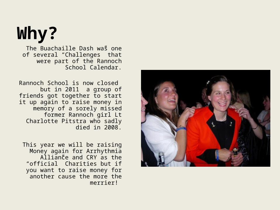
Why?
The Buachaille Dash was one of several “Challenges” that were part
of the Rannoch School Calendar.
Rannoch School is now closed but in 2011 a group of friends got
together to start it up again to raise money in memory of a sorely missed
former Rannoch girl Lt Charlotte Pitstra who sadly died in 2008.
This year we will be raising Money again for Arrhythmia Alliance and
CRY as the “official” Charities but if you want to raise money for another
cause the more the merrier!

Buachaille Dash Event InfoDate: Saturday 9th June 2012 • Start Point: Rannoch Rail Station Car Park• Start Time/Registration TBC but before 06:00• Who can enter? individuals and or relay teams of 3 people.
Sign up details are at the end of this presentation- please read it so you know what you are getting into.
• Want to volunteer ? See end of presentation for sign up details.
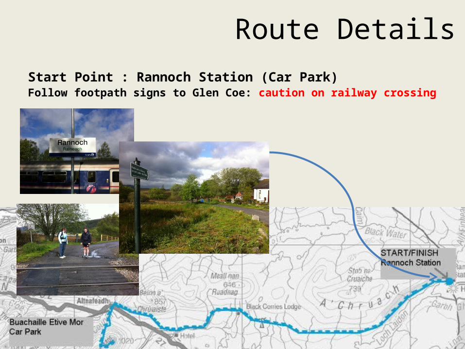
Route DetailsStart Point : Rannoch Station (Car Park)Follow footpath signs to Glen Coe: caution on railway crossing

Section 1: Forestry Track through woodKeep right after house: Caution on river crossings

Section 2Go through Gate and continue on forestry track through cleared woodland to turning point: close dear fence gate behind you.

Follow path onto open Moor ; use electricity poles as guide if you loose the paths; Caution on multiple stream/river crossings and bogs!
Section 3
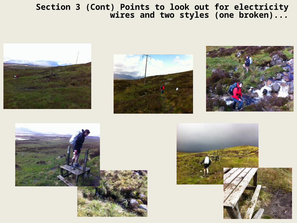
Section 3 (Cont) Points to look out for electricity wires and two styles (one broken)...
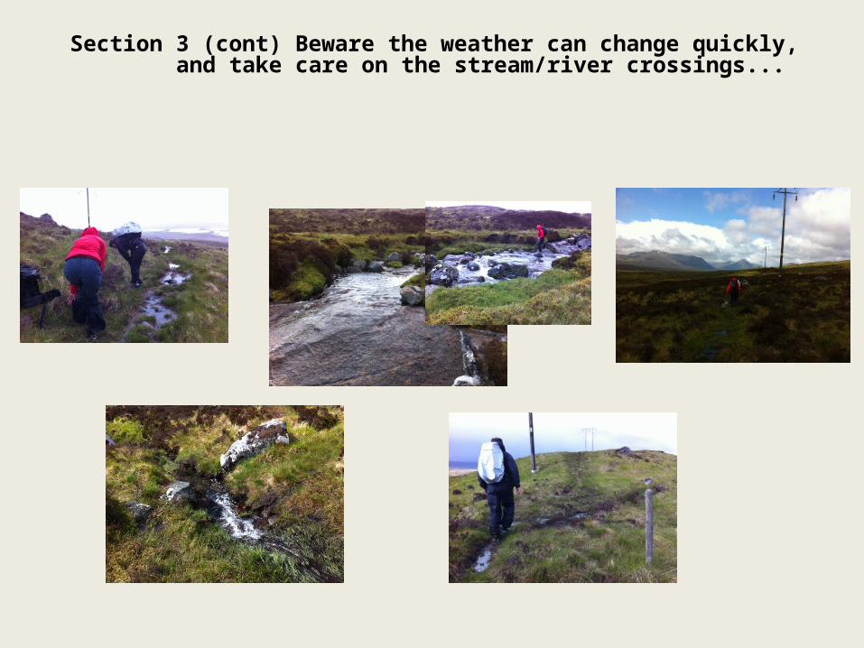
Section 3 (cont) Beware the weather can change quickly, and take care on the stream/river crossings...
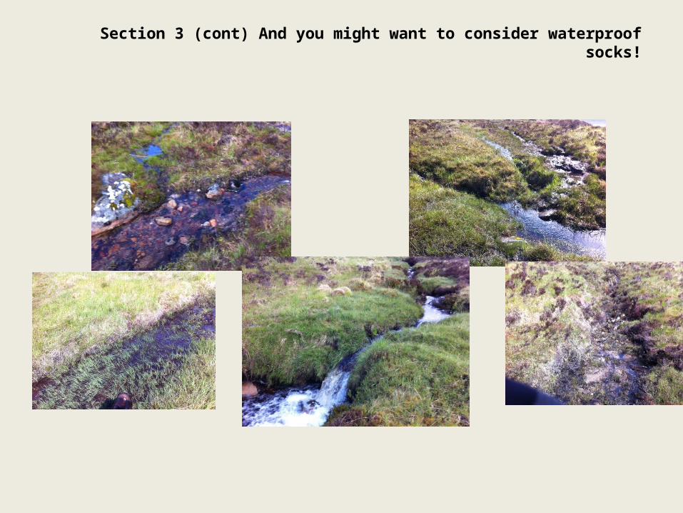
Section 3 (cont) And you might want to consider waterproof socks!
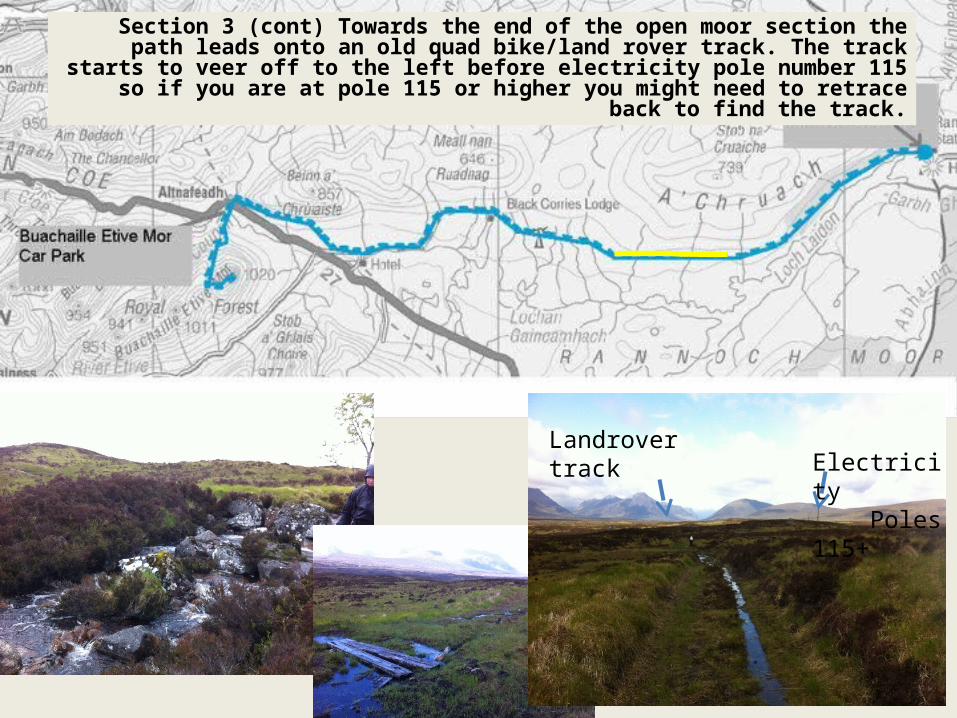
Section 3 (cont) Towards the end of the open moor section the path leads onto an old quad bike/land rover track. The track starts to veer off to the left before electricity pole number 115 so if you are at pole 115 or higher
you might need to retrace back to find the track.
Electricity Poles 115+
Landrover track

Section 4 Rough Landover Track follows the landrover track past a mobile
phone mast to a wood which leads into an estate house.

Section 4 (continued) The track leads to a woodland where a path turns off onto a footpath to go around wood on the footpath NOT THROUGH THE WOOD

Section 4 (cont) the last part of section 4 follows the path which goes round the outside of the wood onto the more established landrover track

Section 5Follow Track from Black Corries to Kingshouse: The track passes another wood and the Kingshouse Pub on the left (where the gate is) on the left
before the route turns left on to the West Highland Way.
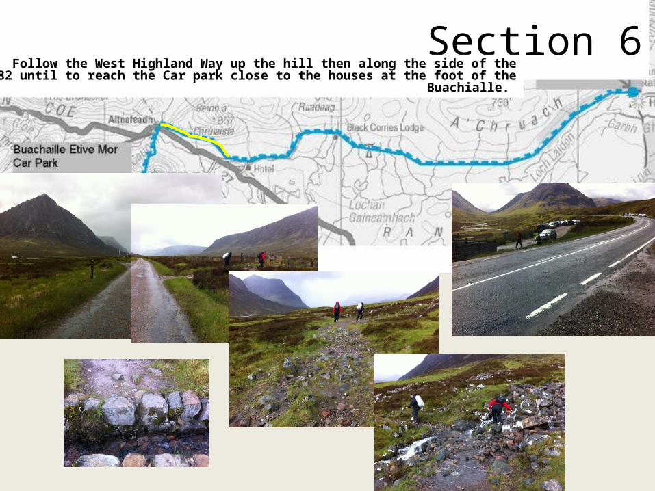
Section 6Follow the West Highland Way up the hill then along the side of the A82 until to
reach the Car park close to the houses at the foot of the Buachialle.
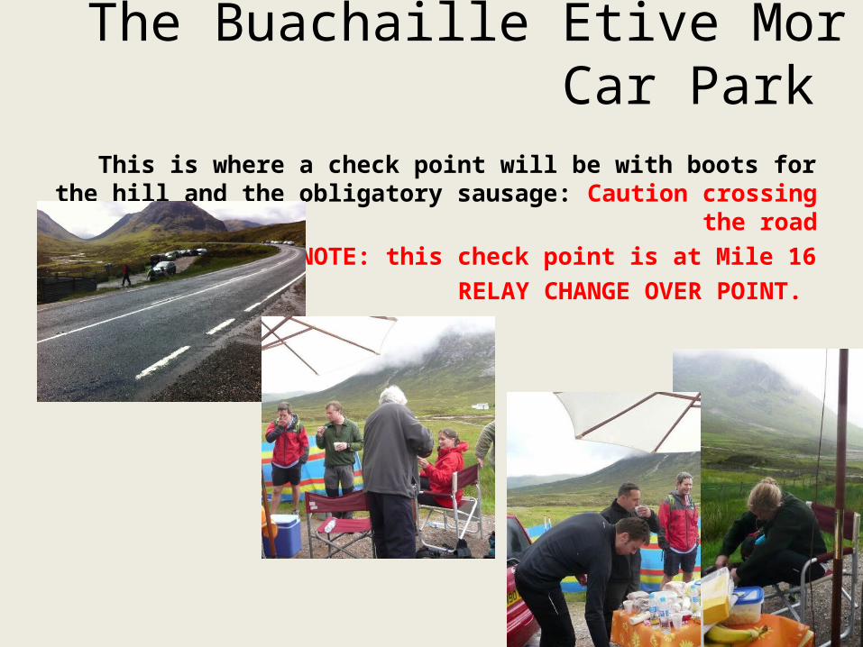
The Buachaille Etive Mor Car Park
This is where a check point will be with boots for the hill and the obligatory sausage: Caution crossing the road
PLEASE NOTE: this check point is at Mile 16RELAY CHANGE OVER POINT.

Section 7: The Buachaille RouteFollow path up corrie over scree to saddle then follow ridge to summit

EXTREME CAUTION ON SCREE and steep sections on climb
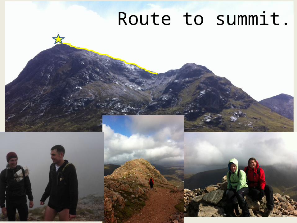
Route to summit.
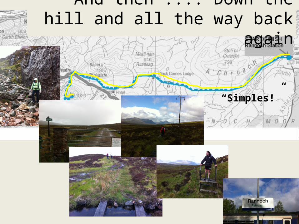
And then .... Down the hill and all the way back again
“Simples!”
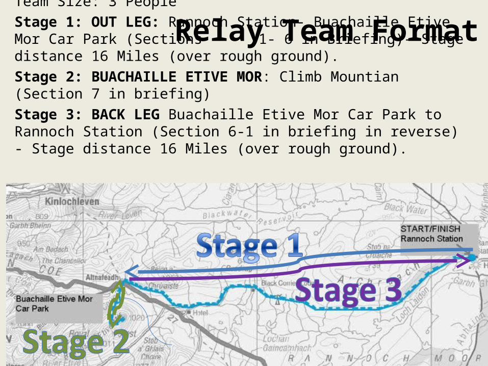
Relay Team FormatTeam Size: 3 PeopleStage 1: OUT LEG: Rannoch Station- Buachaille Etive Mor Car Park (Sections
1- 6 in Briefing)- Stage distance 16 Miles (over rough ground).Stage 2: BUACHAILLE ETIVE MOR: Climb Mountian (Section 7 in briefing) Stage 3: BACK LEG Buachaille Etive Mor Car Park to Rannoch Station (Section 6-1 in briefing in reverse) - Stage distance 16 Miles (over rough ground).

We do want to encourage people to take part HOWEVER it is important that people are appropriately prepared so that they do not endanger themselves or the safety of
others therefore before signing up please consider the following points;• First Rule of Buachaille Dash: ASSUME NOTHING
1. You will be entirely responsible for your own safety and ensuring you do not endanger the safety of others.
2. The event takes place over remote and exposed wild countryside which is in places not accessible by vehicle.
3. There is no way marking or event support for the majority of the route.4. You will need to bring your own clothing and equipment and ensure it is appropriate
for the conditions.5. If you are considering entering as an individual you should be physically fit enough to
complete distance of 34 miles (more than a Marathon) over rough exposed terrain and climb a Munro (Mountain of over 3000ft high) within 12 hours unsupported
(including rest breaks).6. If you are entering a team of 3 people; 2 of the team entrants should be fit enough to
complete a distance of 16 Miles over rough exposed terrain unsupported within 4 hours (including rest breaks) and one team entrant should be fit enough to climb a
3000 ft Mountain over extreme terrain within 3 and a half hours (including rest breaks) .
• All entrants should have experience of hill walking and navigating using a map and compass prior to the event .
BE PREPARED....
Want to Take Part?
• If you are interested in taking part please ;1. Join the Rannoch Adventure Series Facebook Group to stay
up to date.2. email [email protected] to register
your interest, indicating if you would be either entering as an individual or team and providing your contact details for the database .
• Please note an entry fee towards the costs of running the event will apply. You’ll be sent final registration details by the end of March, please note, you will not be officially registered unless you complete the final registration process.
• Happy training!
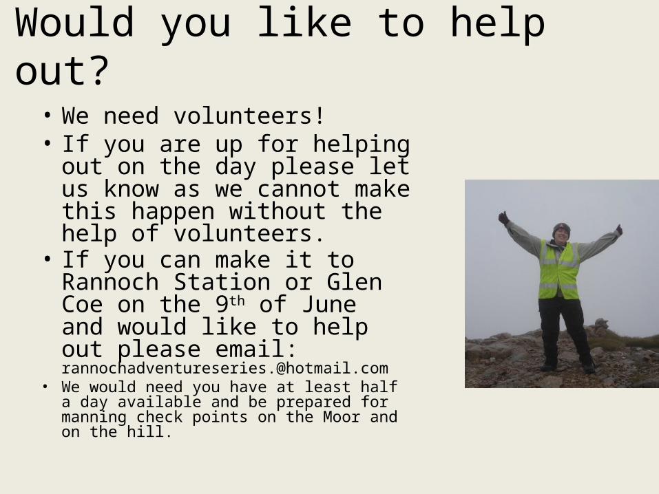
Would you like to help out?
• We need volunteers! • If you are up for helping out
on the day please let us know as we cannot make this happen without the help of volunteers.
• If you can make it to Rannoch Station or Glen Coe on the 9th of June and would like to help out please email: [email protected]
• We would need you have at least half a day available and be prepared for manning check points on the Moor and on the hill.

Getting There...
• You will need to arrive in the area the night before ( more info will follow ion
accommodation options and plans for afterwards)
• If you are staying in KR you need to allow 1 Hour to get to Rannoch Station.
And afterwards
• We are thinking of arranging a get together at the Dunalistair Bar afterwards... More details to follow
• Accommodation Options:Kilverecht Campsite www.forestry.gov.uk/website/recreation.nsf/LUWebDocsByKey/ScotlandPerthandKinrossTayForestParkSouthRannochKilvrechtCampsite Loch Rannoch Hotel (Just outside of KR) www.macdonaldhotels.co.uk/lochrannoch/ Dunalistair Hotel (in KR) www.dunalastair.co.uk Bunrannoch House www.bunrannoch.co.uk/

The Rannoch Adventure Series?
• Watch this space.....
![D-checker User Manual - daikinspare.com.uadaikinspare.com.ua/download/dchecker/User Manual D-Checker v3400 EN.pdf · [Edit info. (F4)] Allows you to edit the customer information](https://static.documents.pub/doc/80x56/5d56bd5a88c99330258b6578/d-checker-user-manual-manual-d-checker-v3400-enpdf-edit-info-f4-allows.jpg)


