29
Burton on the Wolds Village Design Statement Supplementary Planning Document Adopted January 2006

Burton on the WoldsVillage Design Statement
Supplementary Planning DocumentAdopted January 2006
Contents
1. Introduction 2. Executive Summary
3. Statement of Values
4. History of the Village
5. Landscape¨ The Village Setting ¨ In the Village
6. Settlement Patterns¨ Settlement Pattern ¨ Post-War Development ¨ Footpaths ¨ Spaces and Boundaries ¨ Roads and Traffic ¨ Street Furniture and Utilities
7. Buildings and Boundaries¨ Village Development ¨ Listed Buildings ¨ Buildings ¨ Boundaries
8. Guideline link to Local Plan matrix
9. Acknowledgements
10. Village Map

INTRODUCTIONBurton on the Wolds is situated in north Leicestershire some three miles from Loughborough and eleven miles from Melton Mowbray. It currently has a population of about 1,000.
The Burton on the Wolds Village Design Statement reflects the views of the people of Burton. A number of events have been held to encourage participation, including public presentations at different stages in the development process, and full consultation following leaflet drops to solicit interest and invite opinion. Copies of the draft document were made available to every household at the time of the publication of the Parish Plan. All comments by village residents have been considered and incorporated, as appropriate, into the document.
Charnwood Borough Council fully supports the production of Village Design Statements by local people as one way of providing design guidance for residents, builders and developers. The Burton on the Wolds Village Design Statement is fully in line with the design and development principles of government Planning Policy Guidance Notes and Statements, the Leicestershire, Leicester and Rutland Structure Plan and the Borough of Charnwood Local Plan.
The document has been prepared to supplement ‘saved policies’ in the Local Plan, primarily EV1 but also others identified in table 1 at the end of the document. The Borough Council’s Supplementary Planning Document ‘Leading in Design’ should be read in conjunction with this document.

EXECUTIVE SUMMARY
EMBRACING CHANGE AND DEVELOPING OUR COMMUNITYWe believe this Village Design Statement is an opportunity both to detail the history and the current status of our village and its environment and look to the future. Our recommendations are designed to guide individuals, developers and planners to reach the best decisions about changes to the structure and fabric of the village. From all the information we have gathered, analysed, sorted and produced for this document the following is a summary of our work. Specific examples, photographs and further details are contained in the later sections.
SUMMARY OF KEY ISSUES AND GUIDELINESChange in any vibrant lively community is inevitable and healthy. These recommendations are to help people in the development and design of the best solutions to meet the needs of those seeking to change and enhance the existing environment.
The recommendations apply equally to cumulative small-scale additions and alterations and to major new developments.
We believe we have a responsibility to the natural environment in which we live and the recommendations stress the need to take every care to preserve protected species and their habitats.
The village has developed within the natural Wolds landscape and a number of the recommendations reflect the need to ensure that new developments are contained within the existing tree line and natural “bowl”.
Boundaries, connections and pathways throughout the village are important and we believe that existing verges, hedgerows and walls should be preserved and appropriate complementary boundaries be introduced in new developments.
We believe that any future developments should be small in scale to complement the existing mix and density of buildings.
Trees are an important element of the village environment and we should preserve existing trees wherever possible and encourage planting in new developments.
Building designs should avoid monotonous repetition by the inclusion of subtle variations to complement existing styles and materials.
STATEMENT OF VALUESWe value our rural setting within the Wolds landscape.We value the way our landscape looks and the way our village is set out.We value the contribution made to the appearance and setting of the village by the two local estates of Prestwold and Burton Hall.We value the contours and slopes of our village and the way these contribute to variety, views and vistas.We value the contribution made by trees to the appearance of Burton and recognize the importance of planting to preserve this for future generations.We value the residential nature of our village.We value the pattern of small-scale cul-de-sac development within the village which provides relatively traffic-free peaceful environments.We value the intimate nature of our village which we believe is best served by small-scale, thoughtful development.We value development which integrates old with new, serves identified village needs, and avoids one-way, developer-led change.We value change which mixes the best of the past with the best of the present.
History of the villageThe parish of Burton-on-the-Wolds stretches from the Roman Fosse Way in the east to the River Soar in the west. Its name is derived from the Old English - burgh, a fortified place, and tun, a village or farmstead - and the use of the word gate to denote grazing rights on the common is evidence of some Scandinavian occupation. The Domesday Survey of 1086 lists it simply as Burtone; super Waldas was added at the end of the 13th century.
Throughout the medieval period the major landowner was the Cistercian Abbey of Garendon and Burton's economy relied on sheep and cattle farming. Agriculture continued to provide the main source of income until the early 20th century. There is little archaeological evidence for earlier settlements, but the present village was part of the Burton Hall Estate and had its foundation in land and property acquired by Samuel Shalcrosse at the end of the 17th century. Burton Hall itself was built around 1780.
The original highway from Six Hills to Cotes ran through the village along the line of Brook Street. In 1818 this was diverted to the present higher and more southerly route. At the same time a road running by Burton Hall was closed, allowing for the creation of the park. The Hall was extended and walls and gates were constructed, along with the entrance lodge. A fountain was set into the wall close to the village centre to provide a supply of good clean water.
During World War II the communal and living quarters for Wymeswold Airfield were in Burton. Following the War many of the huts were used to house Polish refugees. Over the previous thousand years the size of Burton had never exceeded a hundred households and in 1931 the population was only 297; at the 1951 census it was 938. In the 1950s the military sites became redundant and the Burton Hall Estate was broken up. An abundance of building land came onto the market. Burton never returned to its pre-war size.
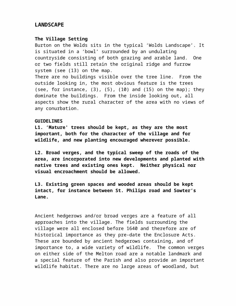
LANDSCAPE
The Village SettingBurton on the Wolds sits in the typical ‘Wolds Landscape’. It is situated in a ‘bowl’ surrounded by an undulating countryside consisting of both grazing and arable land. One or two fields still retain the original ridge and furrow system (see (13) on the map.There are no buildings visible over the tree line. From the outside looking in, the most obvious feature is the trees (see, for instance, (3), (5), (10) and (15) on the map); they dominate the buildings. From the inside looking out, all aspects show the rural character of the area with no views of any conurbation.
GUIDELINESL1. ‘Mature' trees should be kept, as they are the most important, both for the character of the village and for wildlife, and new planting encouraged wherever possible.
L2. Broad verges, and the typical sweep of the roads of the area, are incorporated into new developments and planted with native trees and existing ones kept. Neither physical nor visual encroachment should be allowed.
L3. Existing green spaces and wooded areas should be kept intact, for instance between St. Philips road and Sowter’s Lane.
Ancient hedgerows and/or broad verges are a feature of all approaches into the village. The fields surrounding the village were all enclosed before 1640 and therefore are of historical importance as they pre-date the Enclosure Acts. These are bounded by ancient hedgerows containing, and of importance to, a wide variety of wildlife. The common verges on either side of the Melton road are a notable landmark and a special feature of the Parish and also provide an important wildlife habitat. There are no large areas of woodland, but the countryside immediately surrounding the village is scattered with small copses of native trees.
GUIDELINESL4. No building should rise above the tree line, respecting the view from the edge of the bowl over the village.
L5. The retention of hedgerows, their associated hedgerow trees and existing ditches is important both visually and ecologically as a habitat for wild flora and fauna and as a ‘wildlife corridor’ between different habitats. Their retention also aids the conservation of soils. All parties need to make
every effort to keep and maintain them with native species and encourage further planting. Existing hedgerows should be retained (and supplemented with planting of native species where necessary) to screen any new development.
In the VillageBurton is a nuclear village, centred around a crossroad. Grass verges, some planted with trees, are a feature of many of the roads in the village. Trees, particularly mixed deciduous trees, are an important feature and visible from and in every part of the village. There are a number of green spaces and wooded areas in the village. Hall Drive is a fine example. There are stands of trees running from Sowters Lane through to St. Philips Road and behind the Greyhound public house, which make pleasant walking areas. The Fishponds Plantation, purchased by the Parish Council and the villagers in 2004, has both amenity and landscape value. The wooded footpaths are an unusual and exceptional feature of the village and should be kept and expanded where possible.
GUIDELINESL6. The rural footpath and bridleway network should be sensitively managed, and added to where possible, as these are regularly used by both residents and visitors to the village.
L7. All parties should ensure that ancient ridge and furrow fields surrounding the village are preserved wherever possible, as they are a part of the Village’s heritage.
L8. Any proposals that include the erection of communication masts or towers/ tall chimneys should be very carefully considered by the planning authority to ensure that the village skyline is not obtruded upon. If a mast is considered to be essential, then it should be erected well outside the village boundary and fully screened with natural native planting.
The long random forest stone wall bounding Hall Drive and Melton Road and the red brick wall of the Prestwold Estate alongside the Loughborough Road, both with overhanging trees, are a special feature of the village. There is a brook which runs east to west through the Village (locally known as the Burton Brook). It is fed at various points along its course by locally-rising springs, notably from Hall Drive. The Lion’s Head fountain on the main Melton Road, a special and historic village feature, is spring-fed from the top of Hall Drive.
GUIDELINESL9. Every care must be taken to preserve the protected species and their habitats, particularly Great Crested Newts, Bats and
Badgers as identified in Planning Policy Statement 9: Biodiversity and Geological Conservation. It is essential that an Environmental Impact Survey be undertaken in line with the Local Plan Policy set out in EV/26 prior to any development being allowed.
SETTLEMENT PATTERNS
Settlement PatternThe slopes in Burton are fairly gentle. On the south side the village has spread to the top of the slope on which stands Burton Hall; on the north side the development has also halted at the top of a slope although after a dip the fields rise again to the tree line on the edge of the airfield. This gives Burton a configuration that is typical of other Wolds villages: a village envelope lying in the valley of a watercourse and contained by agricultural land. The slopes help to create vistas and views.
The axis of the village is the B676, the main road from Loughborough to Six Hills. Two old through routes join the B676 in the village: the lane to Wymeswold runs north from the east end and the road to Barrow south from the centre. Following the changes of 1818 in the alignment of what was to become the B676, commercial development to cater for the needs of villagers and travellers took place along the present main road. Within living memory shops and businesses along this road have been converted into private houses, but two commercial establishments important to the village remain: the Greyhound public house and the Wolds Garage. Since the war some small-scale commercial operations have been carried out on Sowters Lane but the main industrial development has been outside the village on the airfield and the Cooper-Bussmann site.
GUIDELINESS1. Flooding is a longstanding village concern. Any proposed development must make clear to the satisfaction of the Environment Agency and the planning authority that it has dealt with the problem of run-off and that it will not increase the risk of flooding. Where works are required in connection with this requirement (e.g. a balancing lagoon) these should be designed to be a visual asset to the village and provision for their upkeep and maintenance must be made explicit. Sustainable design and construction techniques should be considered to help reduce flood risk.
S2. Any development should preserve the character given to the appearance of the village by its position nestling in a valley surrounded by agricultural land. These features should be respected as part of our village heritage:
the historic street and road pattern the curving streetscape the contours of the settlement the settlement pattern of a compact village in a valley the rural character of the village
the use of culs-de-sac
Post-war DevelopmentThe growth of Burton has been influenced by the management of two large estates. The Prestwold Estate is run as an agricultural and leisure business and effectively provides a boundary to development on the northern and western sides of the village. On the other hand, the sale of the Burton Hall Estate in the mid 1950s brought a considerable amount of building land onto the market, some of which had been requisitioned and used for temporary buildings during the war.
The size of the sites that were sold varied greatly from single plots to several acres. Each parcel of land took on the identity chosen for it by the developer in response to the housing needs, styles and pattern books prevailing at that time. With the passage of time the sites have matured and the appearance of many houses has been substantially changed.
Much of the new development has been in the form of culs-de-sac, as can be seen from the names given to the new roads. Not all of them have direct access to the B676 or Barrow Road. They carry little traffic and can be oases of calm. One new road, Springfield Close, was designed in the form of a loop with a single access to the B676. Seymour Road is an old road with bends, a slope and a pavement on one side only. It has to act as a distributor for four culs-de-sac. St Philips Road acts in a similar way for the Saints development.
GUIDELINESS3. Planning applications for anything other than minor developments should be accompanied by a drawing or artist's impression which shows the relationship of the proposed development to the surrounding buildings and the countryside contours. This should be done to show the effect the proposal would have on views both outwards from the village and inwards down into the valley setting.
S4. New developments should reflect the existing mix of house size, pattern, heights and roof levels. Plot shapes and sizes should reflect existing patterns and should provide spaces between buildings to maintain vistas out to the edge of the valley. Every effort should be made to preserve views over the village.
FootpathsOne problem with a cul-de-sac arises from its very nature – that there is only one way in and out. Whilst that may be true for vehicles, in some
cases a footpath or jitty can provide a useful access point for pedestrians, encouraging people to walk to destinations in the village instead of using the car. Jitties can provide welcome visual and spatial contrasts with other areas of the village. Most of the jitties are well used but not all are lit.
There is an unofficial footpath providing a green link between the Saints Estate and Sowters Lane. Public footpaths off Brook Street, Seymour Road and Barrow Road provide quick access into open countryside.
The newer streets in Burton usually have pavements on both sides. Some of the older roads (e.g. Seymour Road, Barrow Road and parts of Melton Road and Loughborough Road) have a single pavement. The lack of a pavement on the south side of Melton Road between the Greyhound and Hall Drive means that children from Seals Close, Sowters Lane and the Saints Estate have to cross the B676 twice on their way to and from the primary school. Hall Drive and Sowters Lane have no pavement. Whilst visually attractive, the lack of a pavement presents danger to pedestrians. Hall Drive is a private road and appears to recognise the danger with a 5mph speed limit and speed humps whereas Sowters Lane, also a private road, is subject only to the normal 30 mph speed limit although it provides access to a number of commercial premises, some of which are serviced by heavy goods vehicles.
GUIDELINESS5. The vital role of footpaths within the village character should be recognised. Existing footpath links within the village are used and valued; this existing network should be protected and enhanced. To discourage the use of cars, and help to ensure a healthy lifestyle, new developments should retain existing footpaths and, wherever possible, introduce new ones, especially ones which enable children to have a safer journey to school. Public routes should be connected, short, direct, well lit and overlooked by frontages.
Footpaths should be managed by cutting back weeds and maintaining lighting. The concrete and tubular steel barriers at the end of paths are not pleasing to the eye nor are they user-friendly. Consideration could perhaps be given to well-designed kerbside rails.
Spaces and BoundariesBurton does not have a village green, nor does it have a churchyard which is often a central open space in a village. The spaces it does have are precious. On the southern fringe are the village playing field and the school playing field but in the centre of the village the largest open spaces (the pub car park and the unofficial car park by the telephone
box) are covered by tarmac. One green open space is the wide verge at the foot of Sowters Lane; another is the balancing lagoon on the south side of the B676; a third is the burial ground at the east end of the village.
The post-war residential developments have usually included some open spaces in the form of verges. The most extensive are to be found on Springfield Close where the wide verges and the green wedge which provide a buffer between the close and the B676 contain a variety of maturing trees. Open plan front gardens also help to create a feeing of space. On the newer developments the area given over to spaces and verges tends to be smaller. Some spaces that should have been left as open amenity strips have been lost to development.
GUIDELINESS6. Where pavements have existing granite sett edges, these should be retained. Concreted-aggregate kerbs should be installed in new developments. Whenever possible, grey concrete kerbstones should be replaced with concreted aggregate types.
S7. The open spaces of Burton and existing gaps between buildings are very important. It is imperative that the open spaces and gaps should be preserved and important views and vistas protected.
S8. The treatment of spaces between buildings is of considerable importance to the design and should be considered at the initial design stages. The design of new open spaces should reflect a rural rather than a suburban character and every opportunity should be taken to maximise their ecological potential.
Grassed verges can be a problem because of the maintenance they require. They are also liable to damage, especially when used for parking by vehicles. Some of the older houses have no garages and no space to park a car. Many houses were built with single garages. Some houses have relatively long drives which permit the parking of several vehicles but many have short drives. On some developments there is room for on street and occasionally off street parking but in many places the number of parked cars creates an eyesore.
Burton has a large number of trees, including many mature specimens. Some new developments have managed to retain older trees and some developers and householders have planted new trees.
Boundaries are indicated in a wide range of ways. Old high walls connected with the Burton Hall Estate have been used as part of more modern residential boundaries, and some developments like The Willows have continued in the same style. Some gardens on Loughborough Road have the Estate's lower old brick walls with rounded stone copings. Modern developments tend to use an open plan layout with the needs of the car and drivers in mind.
GUIDELINESS9. Where grass banks are included in developments they should be managed with careful mowing and trimming at the correct times of year to preserve plants and the environment for wildlife whilst still providing a tidy appearance. Where grass verges are included, provision should be made for their maintenance and the parking of vehicles on them should be discouraged.
S10. Garages should be unobtrusive and preferably set back from the building line. Car parking areas should be landscaped and integrated and allow for good surveillance.
Roads and TrafficAs a direct result of changes made in 1818 the B676 bisects the village and has undulations and sharp bends. These create variety and interest but are a source of danger to drivers and pedestrians. The problem is compounded by the presence of heavy goods vehicles, as the B676 is an approved lorry route. In a number of places the road is below 6m in width. As a result, when two long Lorries meet at a narrow point, especially on a bend, one or both will mount the pavement. Speed is also a problem: a survey in 1999 found fewer than one vehicle in 3 observing the speed limit on Melton Road. The B676 in the village is joined by seven other roads plus the two entrances to the Wolds Garage; it also has five bus stops, only one of which is in a lay-by.
Barrow Road is attractive scenically but presents difficulties for drivers because of the sharp bend at its foot and the bends near the school. Although the road has a 7.5T weight restriction it is used regularly by large buses travelling to schools in Barrow and Quorn. Barrow Road also gives access to the village primary school but because the school is close to the 30 mph limit sign much of the passing traffic exceeds the speed limit.
Wymeswold Lane is used by heavy goods vehicles travelling to and from the industrial estate on the former Wymeswold airfield. The access to the B676 does not have a clear view to the west. The widening of the pavement by the Fountain House corner in the village centre with the installation of railings and their attendant protective 'bells' has improved
pedestrian safety. Elsewhere pedestrians remain vulnerable: a parent and child, for example, cannot walk side by side without being at risk from a vehicle overhang or a vehicle mounting the pavement.
The creation of the mini roundabout at the crossroads in the centre of the village has improved safety but environmental issues arising from its situation remain. Excessive noise is created by last minute braking, the 'bouncing' of empty HGVs, and by vehicles leaving the roundabout at speed with a foot down, through the gears, get out of the village as quickly as possible attitude.
GUIDELINESS11. Existing property boundaries, walls, trees and hedges are important elements of the village scene and should be retained. When new boundaries are constructed, reference should be made to the style, height and materials of existing boundaries – e.g. brick walls with stone capping - so that they harmonise with their surroundings
S12. New developments which increase the amount of traffic in the village should contribute to sensitive traffic calming and road safety solutions which encourage drivers to respect the village environment.
S13. The road geometry and housing layout of new developments should demonstrate an integrated design which encourages awareness of pedestrians and restrains vehicle speed. Designing out crime and the guidance set out in ‘Leading in design needs to be demonstrated.
Street Furniture and UtilitiesWhen electricity first reached Burton, houses received their supply from overhead cables and this is still the case in some parts of the village. More modern developments have underground cables. Many houses in the village are served by overhead telephone wires but the most recent developments have had the wires laid underground, removing the need for tall poles and overhead wires
The number of road signs in the village, particularly on the B676, is a cause of concern. Road signs, road markings and high-powered streetlights combine to give an urban feel to the village. Security lighting and some outside lighting of properties can be intrusive. The design of street furniture and such necessities as bus shelters can also contribute to the character of the village.
GUIDELINES

S14. The design of street lighting should reflect the rural character of the village whilst maintaining high standards for safety and visibility. It should also reflect concerns about light pollution and, where possible, use low-energy lamps and daylight-triggered control units.
S15 Any new development must address the problem of street clutter: underground cables should be installed wherever possible. The design of street furniture should reflect the rural character of the village.
Elsewhere in the village when the opportunity arises, the relevant statutory bodies should be asked to consider the replacement of existing overhead wires with underground cables; and the amount of street furniture and the number of road signs should be subject to regular review and any redundant items removed

BUILDINGS AND BOUNDARIES
IntroductionThe map shows how the buildings of Burton on the Wolds are positioned relative to each other and the overall housing density pattern. The buildings in the village sit within the contours and their roof lines are contained below the tree line. Trees and buildings exist together to create an environment that is harmonious and pleasant to live in.
Village DevelopmentInitially Burton on the Wolds was a farming community with some dozen farms within its boundaries including six in the hamlet itself where almost two thirds of the population lived. Its evolution from a small Wolds hamlet to the village of today has generally been slow up to the relatively large developments of the last forty years.There have been a number of developments from the 1960s around the original buildings to produce the village of today. These developments include:
Hall Drive Springfield Close Barrow Road Somerset Close Huntingdon Close The Saints Brickwood Place The Willows Mundy Close Towles Field Seals Close Sowters Lane.
GUIDELINESB1. New developments should recognise and be sympathetic to established patterns of design and materials. E.g. brickwork and pointing, windows and roofs should reflect the adjacent buildings both in colour and decorative features. Red brick is the predominant building material. Sustainable design and construction techniques also need to be considered.
B2. Roof heights, chimneys, aerials and loft conversions should be in line with neighbouring properties and within the existing overall village “skyline.”
The buildings within these developments reflect a variety of styles and together they produce the “feel” of the current village. There are a mixture of single and two-storey habitations (mainly detached) primarily built from red brick with tile roofs. Many are family dwellings and cater for a working population who commute to surrounding towns and cities for employment (Loughborough, Leicester, Nottingham). Three-storey buildings are limited to Burton Hall and The Greyhound Inn, both of which are contained within the overall village skyline. Some

“affordable” housing has been built in the last few years, but generally properties are in the mid-price range, reflecting the attractiveness of the village and the social mix in the community.
GUIDELINESB3. Plot shapes, sizes and building density should reflect existing patterns and layouts, particularly regarding the use of cells and clusters to create culs-de-sac and maintain open spaces.
B4. Garages should be set back or behind houses with parking off road wherever possible.
Listed BuildingsThere are a number of listed buildings in the village adding to its character and providing links to its history.
No 19 LOUGHBOROUGH ROAD Late C16- early C17 two storey cruck cottage, was formerly two timber framed cottages.
No 4 BARROW ROAD Late C18, two storey house on brick and granite plinth with hipped Swithland slate roof and dentilled eaves.
No 32-34 SEYMOUR ROAD Large two-storey house now divided into two dwellings. Brick construction with variety of bays and sash windows.
BURTON HALL Late C18-mid19, three-storey building with low pitched roof and externally cement rendered. Projecting entrance hall with shallow porch on four Tuscan columns.
BURTON HALL LODGE HOUSE Early C19 single storey polygonal structure with roof gathered to central chimney.
GUIDELINESB5. New developments should respect the existing street patterns, land contours and building lines and maintain the overall village shape.

B6. There should be sufficient space allowed between properties to maintain existing village characteristics whilst recognizing the value of terraced and linked properties where space is restricted.
BuildingsThe majority of buildings are of red brick and tile construction. Some are built on stone bases with slate roofs. The older buildings have brick chimneys with a variety of roof pitches. There is some rendering mainly finished in white and windows are of the appropriate style for the age of the building.
BoundariesBrick walls form many of the boundaries in Burton. In general the walls are below 2 m in height and consist of red or orange brick sometimes on stone plinths. Higher walls are associated with parts of Burton Hall and around the Willows area. Some of the older cottages have low brick walls with brick pillars at gateways. The walls are capped with curved coping stones and the pillars contain brick insets to support the gate hinges. In general Old English Bond is used although there are some examples of both English and Flemish Bond. Modern walls tend to use Running Bonds. The size of many of these walls point to their being functional rather than ornamental.
GUIDELINESB7. Developers should take account of the existing buildings and incorporate the best of historical features with the design of new developments to add variety and individuality.
B8. These guidelines also apply to alterations, extensions and change of use.
There are several Stone walls in the village, the majority of them below 2m in height and predominantly of natural stone, randomly placed and mortared in. Dressed stone has been used around the gateway to Hall Drive and occasionally elsewhere. The longest stretch of stone wall lies along the South side of Melton Rd, stretching from Hall Drive to the Greyhound. In most instances the walls are ornamental although the Melton Rd wall is a retaining wall for the bank on which Hall Drive is located.
Some of the newer houses in the village have Wooden Fences, either of the ‘Larchlap’ type or occasionally post and rail or ‘ranch style’. In general, fences in Burton are not conspicuous from publicly accessible

sites and could not be described as being particularly characteristic. A few Iron Railing boundaries may be seen in the village, ranging from simple post and rail ‘stock fencing’ to elaborate late Georgian / Victorian style. A modern design surrounds the Village Hall. For both wooden and metal fencing, the simple post and rail approach seems most in keeping with the rural nature of the village.


This document has been produced by the following:Rosemary Adams;Maggie and John Bantick;Sally Davies;Tony Edmonds;Eileen and Mike Gunn;Pam and Peter Harrison;Pam and John Hindley;Catherine Holmes;Fran Howkins;Di Hughes;John Kenney;David McDermott;Peter Mitchell;Anne and David Murphy;Gay Pepper;Margaret Pickford;John Saunders;Brian Searson;Joan and Peter Shaw;Barbara and John Stead;Linda and Paul Sutton.
ACKNOWLEDGEMENTSThe cartographer was Anne Murphy; the artist was John Saunders; the historians were Joan and Peter Shaw. Valuable information about the older houses in the village was provided by Dennis Minkley. Members of the group took all the photographs apart from one by Brian Rowell. John Hindley, John Kenney and Paul Sutton were the team leaders, and Paul Sutton put it all together on the computer.
The group is very grateful to the villagers of Burton for their interest and contributions; to Burton on the Wolds Parish Council for its help and support; to Martin Tincknell and the officers of Charnwood Borough Council for their encouragement and advice; to Hazel Fish of the Leicestershire and Rutland Rural Community Council for her enthusiasm and inspiration.
We are grateful for funding received from the Countryside Agency and Burton on the Wolds, Cotes and Prestwold Parish Council.


