8
By: Eva Mahoney
| Date post: | 28-Dec-2015 |
| Category: |
Documents |
| Upload: | elvin-webb |
| View: | 213 times |
| Download: | 0 times |

By: Eva Mahoney

• Region: Southwest• State: Utah• Capital: Salt Lake City• Longitude: 113.0500°W• Latitude: 37.3000°N
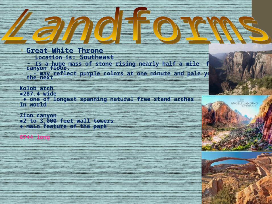
• Great White Throne• Location is: Southeast
- Is a huge mass of stone rising nearly half a mile from the canyon floor. - may reflect purple colors at one minute and pale yellow the next
Kolob arch●287.4 wide ● one of longest spanning natural free stand archesIn world
Zion canyon●2 to 3,000 feet wall towers ● main feature of the park
6744 long

• Native Americans (also known as Anasazi)• ●American Indians lived in Zion 2,000• Years ago• ●ancestral puebloans• ●Brigham Young and his Mormon followers were the
first European Americans in the area in the 1840’s• ●The park was preserved for 81 years• ●2010 2,825,505 visited park

culture• Anasazi and the settlers Brigham young believed in respecting
the land. They both believed the land should be preserved.

• These are the most important waterways in the park. They are Virgin river and weeping rock.
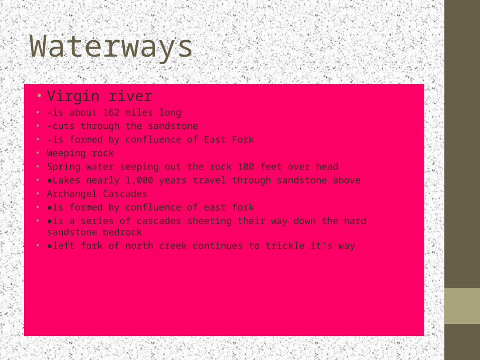
Waterways• Virgin river• -is about 162 miles long• -cuts through the sandstone• -is formed by confluence of East Fork• Weeping rock• Spring water seeping out the rock 100 feet over head• ●Lakes nearly 1,000 years travel through sandstone above• Archangel Cascades• ●is formed by confluence of east fork• ●is a series of cascades sheeting their way down the hard sandstone bedrock• ●left fork of north creek continues to trickle it's way

●Layers of sandstone, mud and gravel●Rock forms range in color●Dark red and range to light purple and pink●


