UNITED STATES DEPARTMENT OF THE INTERIOR GEOLOGICAL SURVEY GEOLOGICAL FIELD EXCURSION FROM BELO HORIZONTE TO OURO PRETO MINAS GERAIS, BRAZIL REGIONAL STRATIGRAPHY AND TECTONICS OF THE ARCHEAN RIO DAS VELHAS GREENSTONE BELT AND THE PROTEROZOIC MINAS SUPERGROUP AS BACKGROUND FOR GOLD METALLOGENESIS By Eduardo A. Ladeira^ Edited by Charles H. Thorman2 and David P. Buscher 2 Open-File Report 88-0656 1988 This report is preliminary and has not been reviewed for conformity with U.S. Geological Survey editorial standards and stratigraphic nomenclature. "-Departamento de Geologia Institute de Geoci&ncias Universidade Federal de Minas Gerais Belo Horizonte, Brazil 2 U.S. Geological Survey Denver, Colorado
Transcript
UNITED STATES DEPARTMENT OF THE INTERIOR
GEOLOGICAL SURVEY
GEOLOGICAL FIELD EXCURSION FROM BELO HORIZONTE TO OURO PRETO
MINAS GERAIS, BRAZIL
REGIONAL STRATIGRAPHY AND TECTONICS
OF THE
ARCHEAN RIO DAS VELHAS GREENSTONE BELT
AND THE
PROTEROZOIC MINAS SUPERGROUP
AS BACKGROUND FOR GOLD METALLOGENESIS
By
Eduardo A. Ladeira^
Edited by
Charles H. Thorman2 and David P. Buscher2
Open-File Report 88-0656
1988
This report is preliminary and has not been reviewed for conformity with U.S. Geological Survey editorial standards and stratigraphic nomenclature.
"-Departamento de Geologia Institute de Geoci&ncias Universidade Federal de Minas Gerais Belo Horizonte, Brazil
2U.S. Geological Survey Denver, Colorado
CONTENTS PageIntroduction 1 Scope of excursion 1Roadlog 1
FIGURES1. Geologic map of the Quadrilatero Ferrifero
(simplified after Dorr, 1969) showing the stops for the field excursion and the location of major gold mines and occurrences in the area.
2. Geologic map of the Quadrilatero Ferrifero(simplified after Dorr, 1969) showing the location of major gold mines and occurrences in the area.
3. Generalized stratigraphic column of the Quadrilatero Ferrifero.
TABLES1. Analyses of samples taken from bauxite prospect 14
pit at Morro do Cruzeiro, Ouro Preto, MinasGerais, Brazil.
INTRODUCTIONThis paper is one of several that are being prepared for publication as chapters in a U.S. Geological Survey Bulletin reporting on a workshop held in Belo Horizonte, Brazil, from December 1-10, 1986. The workshop was sponsored by the IUGS/UNESCO Deposit Modeling Program, which is designed to advance geoscientific knowledge and expertise in mineral deposit modeling for use in exploration, assessment, and development of resources. The topic of this workshop was "Gold in Precambrian greenstone belts and base metals associated with volcanogenic rocks." The host agency in Brazil was the Institute Brasileiro de Mineracao (IBRAM). Workshop leaders and coordinators were: Charles H. Thorman (U.S. Geological Survey), workshop coordinator and leader; Charles G. Cunningham (U.S. Geological Survey), IUGS/UNESCO coordinator and leader; Katherine Dorr Abreu (IBRAM), coordinator for all logistical functions and support for the workshop; Eduardo A. Ladeira (Universidade Federal de Minas Gerais), field trip coordinator and leader; Carl R. Anhaeusser (University of Witwatersrand), leader: Stanton W. Caddey (Homestake Mining Company), leader; and John A. Kerswill (Geological Survey of Canada), leader.
SCOPE OF THE EXCURSIONThe purpose of this field excursion is to provide insight into the regional stratigraphy and tectonics of the Archean Rio das Velhas Greenstone Belt and the Proterozoic Minas Supergroup, which will aid in understanding the geological setting and the metallogenesis of the Passagem, Morro Velho, Cuiaba, and Sao Bento gold deposits. These deposits are the topics of separate papers that will be part of the above mentioned U.S. Geological Survey Bulletin. A side trip (Ladeira and Fleischer, 1988) that is an integral part of understanding the tec tonics and the basal Minas Supergroup begins at the junction of Highway BR-040 and the Rodovia dos Inconfidentes (kilometer 27 in the following roadlog).
Figure 1 shows the field trip route on a geologic map of the Quadrilatero Ferrifero (Iron Quadrangle) that has been simplified from Dorr (1969) and figure 2 shows the location of major gold mines and occurrences in the same area. Figure 3 is a generalized stratigraphic column of the area. For the convenience of the user, the highway (BR-040) kilometric marks (kmM), which are located on the right margin of the southbound lane, when one travels south, arc listed as reference points. When necessary, additional kilometrage has also been used.
ROADLOGkmMMarks kilometrage0 0 Intersection of Contorno Avenue and Federal Highway
BR-040, which links Belo Horizonte to Rio de Janeiro. Belo Horizonte was built on a granitic migmatitic terrane, but this part of the city lies along the contact of this terrane and rocks of the Sabara Group.
1.8 To the right and left, the road intersects schists and phyllites (some of volcanic origin) of the Sabara Group. The range to the left is the Serra do Curral, which was carved in an inverted homoclinal structure formed by metasedimentary rocks of the Minas Supergroup in such a way that the ridge is made up of Caue Itabirite overlying the dolomites, phyllites and dolomitic itabirites of the Gandarela Formation. The dolomites have been mined at several quarries to be used as flux in metallurgy or for
43°
07'
30"
ro
STO
P 3:
:::::X
:::X:
:::x:
::::::
x::
)P
4 xv
iiiiii
iiiiji
jiiiii
iiiiji
iiiiii
iiii
[STO
P 5:
::::::
:: :::
: :::
:: :::
: :::
:::: :
:::::
6 :-:
:::x':
::::::
:::;:;
i;:;:;:
;:;:;:
;:;:;:
;:j
Figu
re 1.
Geol
ogic
ma
p of the
Quadrilatero Fe
rrif
ero
(simplified
after
Dorr,1969) sh
owin
g the
stop
s for
the
fiel
d excursion.
43°
07'
30"
1. Ouro Fino de Cl
ma2.
Ouro Fino de
Ba
lxo
3. Mo
rro
do Adas
5. Ju
ca V
ieir
a6. Fazenda
Velh
a7.
Carrapato
8. Fazenda
Cutao
9. Fa
zend
a Oj
eriz
a10
. Luis Soares
12.
Camara
..v^
, t
13.
Taqu
aril
/Coc
aes
' '
XJV
j ,-|
14.
Bruc
utu
"
15.
Pari
16.
Santa
Quiteria
17.
Sao
Jorge
19.
Queb
ra Osso
20.
Pica
rra
21.
Pita
ngi
22.
Paracatu/Agua
Quente
23.
Faze
ndao
24.
Cata Pr
eta
25.
Bento Rodngues
0 5
10
58
Mor
ro V
elho
(a
cti
ve)
59.
Cui
aba
(acti
ve)
60.
S3o
Ben
to
(acti
ve)
GO
LD
OC
CU
RR
EN
CE
S
ted
Anto
nio
Pereira
Maquine
Morro
Redo
ndo
Mata
Cavalo
Taqu
aral
Bom
Jesus
das
Flores
Pala
cio
Velho
Velo
soBico de
Pedra
Ouro Preto
Ajud
aPassa
Tempo
Ouro Fino
Paci
enci
aMa
rzag
aoBahu
Cata Br
anca
Casa de Pedra
Gord
ura
Urub
uLimeiro
do Su
lLimeiro
do No
rte
Galo
55.
Bela Fama
56.
Espi
rito
Santo
57.
Rapo
sos
61.
Passagem de Mariana
(inactive/
bein
g re
eval
uate
d)
SCALE
Figure 2.
Geologic ma
p of th
e Quadrildtero Fe
rrif
ero
(sim
plif
ied
after
Dorr
,196
9) showing
the
loca
tion
of ma
jor
gold
mines
and
occurrences
in th
e ar
ea.
p
R
0
T
E
R
0
Z
0
I
c
A
R
C
H
E
A
N
Piracicaba Group
Itacolomi Group
AAAAA/\AAAAAAA/\AAAAAAAAAAAAA/\/\A/VV\AA/\/
Sabara Formation
Barreiro Formation
Tabooes Formation
Fecho do Funil Formation
Cercadinho Formation
Gandarela Formation
Caue Itabirite
Batatal Formation Caraca Group
Moeda Formation
Tamandua Group (Espinhaco Group)
AAAAAAAAAAAAAAAAAAAAAAAAAAAAAAAAAAAA/
| Casa Forte Formation
Minas SupergroupItabira Group
Maquine Group
Rio das Velhas
Supergroup Nova Lima Group
Palmital Formation
Upper unit(includes Lapa Seca Formation)
Middle unit Lower unit
Quebra Ossos Group (not shown on map)
AAAAAAAAAAAAAAAAAAAAAAAAAAAAAAAAAAA/V
Granitic-gneissic basement, including granitoids of various ages
Figure 3. Generalized stratigraphic column of Precambrian rocks of the Quadrilatero Ferrifero. The granitic-gneissic basement unit includes several informal units, including the Bacao Complex or Bacao Granitic Complex, which is the oval-shaped basement body in the south-central part of figures 1 and 2.
the production of refractory material. The lower hills are formed by strata of the Piracicaba Group.
2.0 2.0 to 2.5 STOP 1Contact of Sabara Group (the author prefers raising the Sabara Formation to Group status). In an inverted sequence along the road to the left, one finds the Sabara Group overlain by the graphitic phyllite of the Barreiro Formation. The Barreiro is overlain by very thin and brecciated Tabooes Quartzite, which is overlain by the weathered phyllites and dolomites of the Fecho do Funil Formation.
3.0 3.0 to 4.0 STOP 2The cuts to the left are in the Cercadinho Formation, a sequence of interbedded silvery phyllites and ferruginous quartzites thrown into various asymmetric folds. The quartzites are medium to coarse grained and display crossbedding and graded bedding that are used to determine the overturned nature of the beds. The road-cuts are now covered with concrete.
4.0 4.0 STOP 3Gravity fault transecting the Cercadinho Formation shows drag structures and "fault horses" along the fault zone. When the observer faces the structure, the drag structures indicate that the left block has moved up relative to the right block.
5.0 5.0 Belo Horizonte Shopping Center to the left, built on afilled-in karst lake that formed in dolomites of the Gandarela Formation. The hills to the right are on the Cercadinho Formation (ferruginous quartzites and phyllites).
6.0 Weathered dolomites of the Gandarela Formation with ochreas a weathered product, overlain by the Caue Itabirite, which is covered by a thick lateritic crust ("canga"). At the open pits, iron and iron-manganese ore has been mined.
6.5 Railway bridge to Aguas Claras iron ore deposits.
8.0 STOP 4Outcrop of fresh dolomite of the Gandarela Formation, weathers to a peculiar soil known as "coffee powder."S0//s l : N - 55° E -> 60° SE - Gash quartz veins have attitude N. 10° E., 50° NW. S 2 : N. 55°-60° W., 55° NE. Crenulations display attitude of E. 35° or S. 85° E., 35°.
Highway to the right is the road to Sao Paulo; it passes
5
through Cidade Industrial de Contagem, seen in the distance.
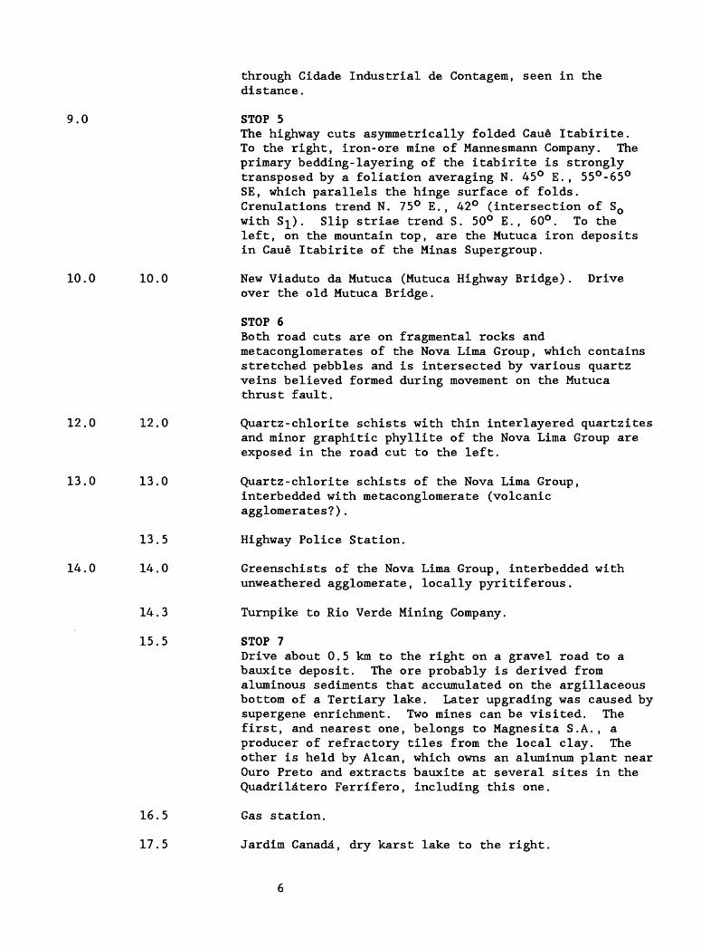
9.0 STOP 5The highway cuts asymmetrically folded Caue Itabirite. To the right, iron-ore mine of Mannesmann Company. The primary bedding-layering of the itabirite is strongly transposed by a foliation averaging N. 45° E., 55°-65° SE, which parallels the hinge surface of folds. Crenulations trend N. 75° E., 42° (intersection of S0 with S;L). Slip striae trend S. 50° E. , 60°. To the left, on the mountain top, are the Mutuca iron deposits in Caue Itabirite of the Minas Supergroup.
10.0 10.0 New Viaduto da Mutuca (Mutuca Highway Bridge). Driveover the old Mutuca Bridge.
STOP 6Both road cuts are on fragmental rocks and metaconglomerates of the Nova Lima Group, which contains stretched pebbles and is intersected by various quartz veins believed formed during movement on the Mutuca thrust fault.
12.0 12.0 Quartz-chlorite schists with thin interlayered quartzitesand minor graphitic phyllite of the Nova Lima Group are exposed in the road cut to the left.
13.0 13.0 Quartz-chlorite schists of the Nova Lima Group,interbedded with metaconglomerate (volcanic agglomerates?).
13.5 Highway Police Station.
14.0 14.0 Greenschists of the Nova Lima Group, interbedded withunweathered agglomerate, locally pyritiferous.
14.3 Turnpike to Rio Verde Mining Company.
15.5 STOP 7Drive about 0.5 km to the right on a gravel road to a bauxite deposit. The ore probably is derived from aluminous sediments that accumulated on the argillaceous bottom of a Tertiary lake. Later upgrading was caused by supergene enrichment. Two mines can be visited. The first, and nearest one, belongs to Magnesita S.A., a producer of refractory tiles from the local clay. The other is held by Alcan, which owns an aluminum plant near Ouro Preto and extracts bauxite at several sites in the Quadrilatero Ferrifero, including this one.
16.5 Gas station.
17.5 Jardim Canada, dry karst lake to the right.
20.2 Skol Brewery to the left.
22.1 Thick canga crust with pebbles, cobbles and fragments of hematite and itabirite. This crust covers both the Gandarela Formation (which doesn't crop out) and part of the Caue Itabirite.
22.7 About 40 degrees to the left, if it is not a cloudy day, one can see the Pico do Itabirito (Itabirito Peak) , carved in hard hematite ore, which will be seen again a couple of times during our trip; it is part of the range with the same name that constitutes the inverted limb of the Moeda synform, whose normal limb is to the right and is evidenced by the dip slopes to the right of the road and farther on. The inverted limb will be seen shortly.
27.0 27.0 Rodovia dos Inconfidentes (BR/MG--356, Inconf idente ' sHighway). Drive to the left to Ouro Preto, former capital of Minas Gerais State.
27.3 Highway Police Station.
29.0 29.0 Exposure of ferruginous grayish quartzites and silveryphyllites of the Cercadinho Formation overlain by weathered dolomites (which produce a brownish to black saprolite) and silvery phyllites of the Fecho do Funil Formation. Tight asymmetric folds have enveloping surfaces whose attitude is N. 15° E. , 58°NW. SQ//SI is N
, 45°-50° NW.
31.0 29.5 to 31.0 Cercadinho and Fecho do Funil Formations, as above.
34.0 34.3 STOP 8Folded and faulted metaconglomerates mapped by Wallace (1965) as the Itacolomi Group, with distorted pebbles and cobbles of quartz and quartzite. SQ//S^: N. 15° W. , 58° W. , 65° NE. The current author, Ladeira, believes this may be a fragmental volcanic rock.
34.5 This area was a former Horto Florestal (Forest Station).
34.5 To the left, Codornas Lake. Three hundred meters before the bridge to the right, varicolored phyllite interlayered with graphitic phyllite, both of Barreiro Formation, overlain by the younger, thin, saccharoidal Tabooes Quartzite. Dip of beds is vertical to near vertical. Strike is northeast.
35.8 Bridge over the Codornas Creek. Road cuts are on the varicolored argillaceous phyllite and interlayered dolomites of the Fecho do Funil Formation.
36.0 36.0 to 36.5 Varicolored argillaceous phyllites of the Fecho do FunilFormation interlayered with "splash rock" (Guild, 1957),
a name given to the saprolite of dolomite--here the saprolite of Fecho do Funil Formation. Reduction or bleached spots with ellipsoidal shape and light color are oriented parallel to fold hinges. S0 : N. 30° W., vertical; N. 16° W., 30° NE.
37.0 37.0 STOP 9Alluvial deposit of a Tertiary lake, with quartz pebbles and cobbles in an arenaceous, argillaceous matrix, covers "splash rock" and phyllites of the Fecho do Funil Formation.
38.0 38.0 Cercadinho Formation (ferruginous quartzites andphyllites) overlain by the Fecho do Funil Formation. SQ//SI: N. 60°-70° E., 60° SE. Contact with laterite and canga.
39.0 38.5 to 39.5 Road cuts are successively cut deeper into the CercadinhoFormation due to folding with the underlying weathered dolomites of the Gandarela Formation. The weathered product of the Gandarela Formation is commonly referred to as "splash rock."
39.8 Highway Police Station and Truck Balance.
40.0 40.0 As one approaches this station, the hidden contactbetween the Gandarela Formation and the Caue Itabirite will be crossed. The section is the inverted limb of the Moeda synform in which the younger Gandarela Formation is overlain by the Caue Itabirite. To the right is Itabirite Peak.
40.1 Folded Caue Itabirite with kink folds. Canga crustderived from the itabirite caps the road cut. To the left ITAMINAS Mining Co. iron ore deposit, hosted in Caue Itabirite.
40.8 The road cuts the inverted sequence consisting of CaueItabirite overlain by Batatal Formation, which in turn is overlain by the older Moeda Formation. Beds have a general trend of N. 15°-25° W., and are overturned 60°-70° NE. More incompetent Batatal Phyllite is crumpled between the Caue and Moeda Formations. Note thick canga crust on top of mountain to the right, carved in Caue Itabirite.
41.0 41.0 Bonga strike-slip fault, with attitude N. 70° E., 60°-70°NW. The northern block moved northeast relative to the southern block, with a total strike-slip of about 250 m; this movement caused repetition of the inverted sequence: Caue Itabirite, Batatal and Moeda formations, which have steeper dips of 80° SE.
41.5 Quartzite quarry to the left, from which quartz sand is extracted, cleaned, and stockpiled (to the right).
8
42.0 42.0 to 43.5 From here to 43.5 km, the road swings through quartzitesand minor interlayered phyllites of the Moeda Formation, which crop out to the right, forming cuneiform controlled by a strong lineation ("pencil structure"). To the left, is the Rio das Velhas Valley carved in the Nova Lima Group (Rio das Velhas Supergroup) of the Rio das Velhas Greenstone Belt (Ladeira, 1980).
43.5 STOP 10 "Santa" at the Serra do Itabirito.Angular and erosional unconformity between the variegated schists of the Nova Lima Group and the Moeda Formation. The contact zone trends about N. 10° E. Immediately to the west of the rest area, the Nova Lima schists have two schistosities. The older, S x (N. 40° W., 65° NE), locally parallels bedding SQ of the schists; the younger, S2 (N. 10°-35° E, 70° SE), parallels the contact. Fracture cleavages are 83 (N. 70° W., 30° NE) and 84 (N. 70° E., 65° SE). The Moeda Formation begins with a basal polymictic metaconglomerate with pebbles of quartz, quartzite and greenschist (the latter similar to Nova Lima Group greenschists). SQ in the Moeda quartzite trends N. 15° E., 80° SE, forming an angle of about 70° with SQ of Nova Lima Group schists. The S 2 schistosity in Nova Lima schists is also common to the Moeda Formation quartzites. Fracture cleavages parallel to 83 and S^ of the Nova Lima Group also intersect the Moeda quartzite. The angular pattern of SQ in both the Nova Lima Group and Moeda quartzite indicates the unconformable relation, which is proven by the presence of a basal conglomerate with clasts of schist from the Rio das Velhas Supergroup. However, the unconformity was disrupted during the deformation of the Minas Supergroup and is now a fault surface.
44.0 44.0 STOP 11Cata Branca strike-slip fault. This structure follows the valley to the right. Nova Lima schists crop out along the highway. The fault trends northwest-southeast and dips 80° NE and the hanging-wall (northern block) has a total slip of 500 m towards the west. Gold associated with stibnite hosted in the Moeda quartzite and related to this fault was mined nearby. The Cata Branca fault shifts the Bac£o Complex-Nova Lima Group (see figs. 1, 2, and 3) contact near the Esperanca Steel Plant to the east of this plant.
44.0 to 49.0 The highway swings through weathered Nova Lima variegated schists, derived from interlayered metavolcanic and metasedimentary rocks.
49.0 49,0 STOP 12Near the head of highway bridge over RFN (Rede Ferroviara National) railway. To the right, Esperanca Co. blast furnace. Contact of the Nova Lima Group metavolcanic and
metasedimentary rocks with the Bacao Granitic Complex, which thermally metamorphosed the rocks resulting in a garnet-staurolite metamorphic aureole. These rocks are cut by numerous tourmaline-quartz veins, which elsewhere have low gold values. Metamafic rock and lean (low-grade) Archean type banded iron formation (BIF), not reported earlier by the DNPM-USGS (Departamento Nacional da Producao Mineral-United States Geological Survey) DNPM-USGS team, and similar to those of the Nova Lima District, are interlayered in the local succession. See side road cut (dirt road to the left to Rio Acima).
50.0 After the highway bridge, weathered metamafic dike cutsweathered Bacao granite. To the right, a view of Esperanca Co. Iron blast furnace.
51.0 51.0 to 52.5 Fresh exposure of Bacao Granitic Complex. ItabiritoCountry Club to the left; city of Itabirito to the right. From here to Cachoeira do Campo (20 km ahead) and back to STOP 12, the highway runs through and exposes the granitic-migmatitic rocks of the Bacao Complex.
52.0 52.0 Bacao Complex rocks.
54.0 54.0 Bacao Complex rocks
54.5 Southeastern Itabirito turnoff.
57.0 CEMIG plant turnoff.
59.0 To the left, road to Acurui village (15 km) and Camping Club do Brasil (22 km).
60.0 Alluvial flat.
62.5 Road to Minas Serra Geral (iron ore). Capanema mine.
72.0 Town of Cachoeira do Campo, built on Bacao Granitic Complex.
74.0 Alluvial flat.
78.0 Outcrop of migmatites of the Bacao complex withsubvertical shear zones transecting earlier folded foliation.
78.5 STOP 13Intersection of Inconfidente's Highway and CVRD (Companhia Vale do Rio Doce) Railway. Funil railway bridge. At the exposures to the right of the highway, the Moeda quartzite is tectonically concordant with the underlying Nova Lima schists (mostly staurolite-chlorite- garnet schists), derived from volcanic and sedimentary rocks. These rocks are intruded by the Bacao Granitic Complex in an intricate contact zone in which Nova Lima
10
schists are penetrated or invaded by numerous pegmatitic and aplitic bodies. The Bacao Complex is interpreted to be a mantled gneiss dome derived from a reworked basement (Ladeira, 1980). The Moeda quartzite is tectonically thinned, boudinaged, and cut by minor faults. Fresh Caue Itabirite crops out at the bottom of the valley, and, in addition to the normal itabirite, it also includes carbonate-amphibole (grunerite-cummingtonite) itabirite. The discordant relations can be observed only in the railway cuts above you, through which we will be driving.
SIDE STOPDrive back 500 m, turn right on the dirt road, and drive up hill for 2 km to the CVRD railway station. Walk 500 m to the south along the railway tracks.
78.5 STOP 14Faulted, originally discordant unconformable contact between the Moeda quartzites and fresh Nova Lima chlorite-garnet staurolite schist (greenschists). No conglomerate has been found at the base of Moeda quartzite at this site, but the unconformable relation (established at many localities in the region) can be deduced because the Nova Lima schists have two penetrative schistosities that are truncated at the contact, whereas the Moeda has just one schistosity; two sets of fracture cleavage intersect both units. In addition, the schists and Moeda quartzite have distinct structural styles that cannot be explained solely by the difference of competency. The schists are asymmetrically folded and refolded, with axial surfaces trending differently from those in the quartzite. The present contact is clearly a tectonic one (thrust), which has been healed by metamorphism. The structural data indicate that the units were deformed under different conditions, lending support to the statement that the two are stratigraphically distinct units.
Attitude of S surfaces:S0 (schist, folded): N. 60° E., 35° SE.S;L (schist): N. 60° E. , 35°-40° SE.S 2 (schist): N. 15°-25° E., 45° SE.83 (common to schist and quartzite): N. 15°-25° E., 55°SE refracts through the quartzite and changes to N. 25°E., 60°-70° SE.
Thrust faults with related minor structures such as "mullions", slip striae, and sheath folds that have been dismembered and now appear as tectonic inclusions can be observed along the section. The Nova Lima schists locally display interlayers of Archean type BIF (200 m north of this contact) that were not described at this locality by the DNPM-USGS team nor by other previous workers. Recently, the author, along this section, found intrafolial tight recumbent folds in the Moeda quartzite,
11
which are also associated with shear zone and sigmoidal folds. Apparently these are the first reported recumbent folds in this formation at this site. Drive back to Inconfidente's Highway and head towards Ouro Preto.
78.7 Folded dolomites of Gandarela Formation; 800 m aheadalong the road, the dolomites contain an intraformational metabreccia.
79.0 BEMIL crushing and milling plant for production ofdolomite "dust," for soil correction, and broken stone.
80.0 80.0 Conformable contact between the Gandarela and CercadinhoFormations.
81.0 81.0 Contact of Cercadinho and Fecho do Funil Formations.
81.3 Road cut of Fecho do Funil dolomites and silveryphyllites, with recumbent fold associated with thrust fault.
82.0 82.0 Fine-grained banded ferruginous quartzites interbeddedwith silvery phyllites of the Cercadinho and Fecho do Funil Formations.
82.0 83.0 Farther to the right, at the mountain top, asymmetricsynform in Cercadinho and Fecho do Funil Formations.
83.6 Cercadinho Formation, normal and ferruginous quartzite with crossbedding and flaser structures; on right are asymmetric folds, with thin laminae of silvery phyllite.
84.0 84.0 Fine-grained, fine-banded ferruginous quartzite of theCercadinho Formation.
86.0 86.0 STOP 15"Black and White." This section has been mapped by Miranda Barbosa (in Dorr, 1969) as Caue Itabirite. The "black" material is a tightly folded and laminated specular hematite rock. The "white" rock is a quartz-muscovite schist.
Si (schistosity): N. 70° E., 55° SE. Crenulations: S. 30° E., 50°; S. 20° W., 50°.
87.0 to 88.0 The road intersects a thrust fault that juxtaposes the Sabard Formation on top of Caue Itabirite and then cuts down through the Caue Itabirite; farther ahead, another fault juxtaposes ferruginous quartzite of the Cercadinho Formation in thrust contact on the Sabard Formation, near the intersection of the Ouro Preto to Saramenha roads.
Drive to Ouro Preto to the left.
12
View of Pico do Itacolomi (Itacolomi Peak) at 15° to the right.
89.0 to 90.0 This section of the road is mainly Cercadinho Formation ferruginous quartzite and silvery phyllites.
92.8 Cercadinho Formation underlying Fecho do Funil Formation.
93.0 93.0 to 94.0 Road follows the strike of Caue Itabirite, which overliesthe Moeda quartzites (not seen).
95.0 Ouro Preto, Praca Tiradentes.
From here drive to Morro do Cruzeiro.
STOP 16Bauxite deposit of Morro do Cruzeiro. This deposit is located next to and partly underlies the campus of Universidade Federal de Ouro Preto. The Morro do Cruzeiro (Hill of the Cross) is a small plateau 1,230 m above sea level and is superficially covered by a lateritic crust ("canga11 ) and lateritic soil. The "canga" maintains the leveled surface and ranges in thickness from 1 to 1.5 m. The bauxite layer, which has been almost entirely mined out, overlies phyllite and dolomites of Fecho do Funil Formation. Before mining, the layer covered about 130,000 m^ and had an average thickness of 1.5 m. The bauxite is light pink to intense red, which is a function of variable proportions of ^e2^3 ^ *- s compact, has a specific gravity of 2.6, and occurs as disseminated concretions in laterite. Analyses of the bauxite ore in table 1 indicate vertical migration of iron and alumina. Exploration and mining work demonstrated the presence of a large clay deposit underlying the bauxite layer.
13
Tab
le
1.
Anal
yse
s of
sa
mpl
es
taken
fr
om
bau
xit
e pro
spec
t p
it
(alt
itu
de
1,22
3 ra
) at
Mor
ro
do C
ruze
iro,
Our
o P
reto
, M
inas
G
erai
s,
Bra
zil
[All
v
alu
es
show
n in
per
cent;
L
.O.I
.,
loss
on
ig
nit
ion;
lead
ers
(
)
indic
ate
in
terv
al
not
anal
yze
d;
n.d
.,
not
det
erm
ined
]
Dep
th,
in
met
ers
0.0
-0.3
0.3
-0.9
0.9
-2.1
2.1
-3.6
3-6
-5.1
5.1
-6.5
A120
3
36
.79
38.7
0
40.6
1
42.3
0
Fe0
3
9.6
5
3.4
6
1.73
1.7
0
Si0
2
32.8
0
40.1
4
40
.30
43.7
8
Ti0
2
2.2
1
1.74
1.95
0.5
0
P2°5
---
0.1
16
0.07
5
0.0
43
MgO
Tra
ces
Tra
ces
Tra
ces
0.8
7
CaO
0.4
5
0.6
7
0.5
0
0.7
0
Na2
0/K
20
0.0
6
nil
0.0
9
n.d
.
L.O
.I.
17.8
0
14.9
6
14.7
6
9.77
TOTA
L
99.8
8
99.7
4
99.9
8
99.6
2
Mat
eria
l
Late
riti
c cru
st.
Bau
xit
e la
teri
te.
Fer
rug
ino
us
cla
y.
Lig
ht-
yel
low
cla
y.
Yel
low
cla
y.
Whi
te
cla
y.
Tab
le
pre
par
ed
by
Pro
fess
or
Mes
sias
G
ilm
ar
Men
zes
from
G
uim
arae
s an
d C
oel
ho
, 19
45.
REFERENCES CITEDDorr, J.V.N., 2nd, 1969, Physiographic, stratigraphic and structural development
of the Quadrilatero Ferrifero, Minas Gerais, Brazil: U.S. Geological SurveyProfessional Paper 641-A, 110 p.
Guild, P.W., 1957, Geology and mineral resources of the Congonhas district,Minas Gerais, Brazil: U.S. Geological Survey Professional Paper 290, 90 p.
Guimaraes, G.D., and Coelho, I.S., 1945, Bauxita do Morro do Cruzeiro en OuroPreto, Minas Gerais: Departamento Nacional da Producao Mineral, Divisao deFomento da Producao Mineral, Buletim 67, 41 p.
Ladeira, E.A., 1980, Metallogenesis of gold at the Morro Velho mine, and in theNova Lima District, Quadrilatero Ferrifero, Minas Gerais, Brazil: London,Ontario, Canada, University of Western Ontario, unpublished Ph.D. thesis,272 p.
Ladeira, E.A., and Fleischer, Ronald, 1988, Field excursion from Belo Horizonteto Ouro Preto, side excursion along the road to Moeda: U.S. GeologicalSurvey Open-File Report OF 88-0655, 6 p.
Wallace, R.M., 1965, Geology and mineral resources of the Pico de ItabiritoDistrict, Minas Gerais, Brazil: U.S. Geological Survey Professional Paper341-F, 68 p.