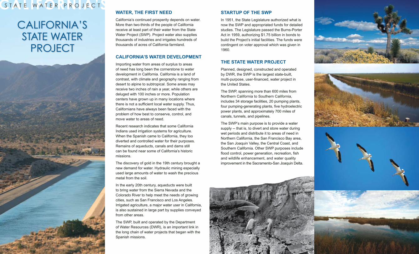
WATER, THE FIRST NEED California’s continued prosperity depends on water. More than two-thirds of the people of California receive at least part of their water from the State Water Project (SWP). Project water also supplies thousands of industries and irrigates hundreds of thousands of acres of California farmland. CALIFORNIA’S WATER DEVELOPMENT Importing water from areas of surplus to areas of need has long been the cornerstone to water development in California. California is a land of contrast, with climate and geography ranging from desert to alpine to subtropical. Some areas may receive two inches of rain a year, while others are deluged with 100 inches or more. Population centers have grown up in many locations where there is not a sufficient local water supply. Thus, Californians have always been faced with the problem of how best to conserve, control, and move water to areas of need. Recent research indicates that some California Indians used irrigation systems for agriculture. When the Spanish came to California, they too diverted and controlled water for their purposes. Remains of aqueducts, canals and dams still can be found near some of California’s historic missions. The discovery of gold in the 19th century brought a new demand for water. Hydraulic mining especially used large amounts of water to wash the precious metal from the soil. In the early 20th century, aqueducts were built to bring water from the Sierra Nevada and the Colorado River to help meet the needs of growing cities, such as San Francisco and Los Angeles. Irrigated agriculture, a major water user in California, is also sustained in large part by supplies conveyed from other areas. The SWP, built and operated by the Department of Water Resources (DWR), is an important link in the long chain of water projects that began with the Spanish missions. CALIFORNIA’S STATE WATER PROJECT CALIFORNIA’S STATE WATER PROJECT STARTUP OF THE SWP In 1951, the State Legislature authorized what is now the SWP and appropriated funds for detailed studies. The Legislature passed the Burns-Porter Act in 1959, authorizing $1.75 billion in bonds to build the Project’s initial facilities. The funds were contingent on voter approval which was given in 1960. THE STATE WATER PROJECT Planned, designed, constructed and operated by DWR, the SWP is the largest state-built, multi-purpose, user-financed, water project in the United States. The SWP, spanning more than 600 miles from Northern California to Southern California, includes 34 storage facilities, 20 pumping plants, four pumping-generating plants, five hydroelectric power plants, and approximately 700 miles of canals, tunnels, and pipelines. The SWP’s main purpose is to provide a water supply -- that is, to divert and store water during wet periods and distribute it to areas of need in Northern California, the San Francisco Bay area, the San Joaquin Valley, the Central Coast, and Southern California. Other SWP purposes include flood control, power generation, recreation, fish and wildlife enhancement, and water quality improvement in the Sacramento-San Joaquin Delta.
Transcript
WATER, THE FIRST NEED
California’s continued prosperity depends on water. More than two-thirds of the people of California receive at least part of their water from the State Water Project (SWP). Project water also supplies thousands of industries and irrigates hundreds of thousands of acres of California farmland.
CALIFORNIA’S WATER DEVELOPMENT
Importing water from areas of surplus to areas of need has long been the cornerstone to water development in California. California is a land of contrast, with climate and geography ranging from desert to alpine to subtropical. Some areas may receive two inches of rain a year, while others are deluged with 100 inches or more. Population centers have grown up in many locations where there is not a sufficient local water supply. Thus, Californians have always been faced with the problem of how best to conserve, control, and move water to areas of need.
Recent research indicates that some California Indians used irrigation systems for agriculture. When the Spanish came to California, they too diverted and controlled water for their purposes. Remains of aqueducts, canals and dams still can be found near some of California’s historic missions.
The discovery of gold in the 19th century brought a new demand for water. Hydraulic mining especially used large amounts of water to wash the precious metal from the soil.
In the early 20th century, aqueducts were built to bring water from the Sierra Nevada and the Colorado River to help meet the needs of growing cities, such as San Francisco and Los Angeles. Irrigated agriculture, a major water user in California, is also sustained in large part by supplies conveyed from other areas.
The SWP, built and operated by the Department of Water Resources (DWR), is an important link in the long chain of water projects that began with the Spanish missions.
CALIFORNIA’SS T A T E W A T E R P R O J E C T
CALIFORNIA’S STATE WATER
PROJECT
STARTUP OF THE SWP
In 1951, the State Legislature authorized what is now the SWP and appropriated funds for detailed studies. The Legislature passed the Burns-Porter Act in 1959, authorizing $1.75 billion in bonds to build the Project’s initial facilities. The funds were contingent on voter approval which was given in 1960.
THE STATE WATER PROJECT
Planned, designed, constructed and operated by DWR, the SWP is the largest state-built, multi-purpose, user-financed, water project in the United States.
The SWP, spanning more than 600 miles from Northern California to Southern California, includes 34 storage facilities, 20 pumping plants, four pumping-generating plants, five hydroelectric power plants, and approximately 700 miles of canals, tunnels, and pipelines.
The SWP’s main purpose is to provide a water supply -- that is, to divert and store water during wet periods and distribute it to areas of need in Northern California, the San Francisco Bay area, the San Joaquin Valley, the Central Coast, and Southern California. Other SWP purposes include flood control, power generation, recreation, fish and wildlife enhancement, and water quality improvement in the Sacramento-San Joaquin Delta.
THE SWP AND THE ENVIRONMENT
Even before the SWP began its deliveries in the 1960s, environmental concerns began to rise, with some later taking shape in legislation such as the Clean Water Act and the federal and state Endangered Species Acts. These laws have changed how DWR manages and operates the Project.
Fresh water releases are made from upstream reservoirs to meet state and federal water quality standards in the Delta. Pumping operations are scheduled to minimize impacts to fish.
The Department also established several programs and built facilities to protect fish and wildlife, such as the Feather River Fish Hatchery and Skinner Fish Facility.
The Feather River Fish Hatchery, funded by DWR and operated by the California Department of Fish and Game, was built because the construction of Oroville Dam made many miles of Feather River spawning grounds inaccessible to steelhead and salmon.
The Skinner Fish Facility, operated by DWR since 1968, serves as a giant fish screen to keep fish away from the pumps that lift water into the California Aqueduct at Banks Pumping Plant. At the facility, as many as 10 million juvenile fish a month are saved and returned to the Delta.
Other major environmental programs involving the SWP include preserving riparian vegetation along the Delta levees or replanting berms (low areas that extend 4 to 20 feet from a levee on the waterside), monitoring and evaluating the estuary’s water quality and aquatic resources through the Interagency Ecological Program to understand changes in the Bay-Delta ecosystem, developing programs to maintain brackish water and tidal wetland habitats in Suisun Marsh, enhancement of river corridors including spawn-ing gravel placement and riparian plantings, and purchasing land for mitigation. Today, the SWP is operated to benefit fish and wildlife, recreation, and water quality.
THE SWP, FROM NORTHERN TO SOUTHERN CALIFORNIA
The Upper Feather River Lakes to the Delta
The SWP begins with Lake Davis, Frenchman Lake, and Antelope Lake on Feather River tribu-taries in Plumas County. In addition to providing fishing and recreation, releases from these lakes enhance the downstream environment as they flow to the Feather River.
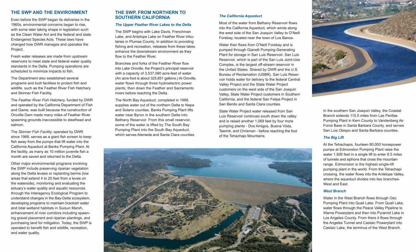
Branches and forks of the Feather River flow into Lake Oroville, the Project’s principal reservoir with a capacity of 3,537,580 acre-feet of water. (An acre-foot is about 325,851 gallons.) At Oroville, water flows through three hydroelectric power plants, then down the Feather and Sacramento rivers before reaching the Delta.
The North Bay Aqueduct, completed in 1988, supplies water out of the northern Delta to Napa and Solano counties. Banks Pumping Plant lifts water near Byron in the southern Delta into Bethany Reservoir. From this small reservoir, some of the water is lifted by The South Bay Pumping Plant into the South Bay Aqueduct, which serves Alameda and Santa Clara counties.
The California Aqueduct
Most of the water from Bethany Reservoir flows into the California Aqueduct, which winds along the west side of the San Joaquin Valley to O’Neill Forebay, located near the town of Los Banos.
Water then flows from O’Neill Forebay and is pumped through Gianelli Pumping-Generating Plant for storage in San Luis Reservoir. San Luis Reservoir, which is part of the San Luis Joint-Use Complex, is the largest off-stream reservoir in the United States. Shared by DWR and the U.S. Bureau of Reclamation (USBR), San Luis Reser-voir holds water for delivery to the federal Central Valley Project and the State Water Project customers on the west side of the San Joaquin Valley, State Water Project customers in Southern California, and the federal San Felipe Project in San Benito and Santa Clara counties.
State Water Project water released from San Luis Reservoir continues south down the valley and is raised another 1,069 feet by four more pumping plants - Dos Amigos, Buena Vista, Teerink, and Chrisman - before reaching the foot of the Tehachapi Mountains.
In the southern San Joaquin Valley, the Coastal Branch extends 115.5 miles from Las Perillas Pumping Plant in Kern County to Vandenberg Air Force Base in Santa Barbara County, and serves San Luis Obispo and Santa Barbara counties.
The Big Lift
At the Tehachapis, fourteen 80,000 horsepower pumps at Edmonston Pumping Plant raise the water 1,926 feet in a single lift to enter 8.5 miles of tunnels and siphons that cross the mountain range. Edmonston is the highest single-lift pumping plant in the world. From the Tehachapi crossing, the water flows into the Antelope Valley, where the aqueduct divides into two branches-West and East.
West Branch
Water in the West Branch flows through Oso Pumping Plant into Quail Lake. From Quail Lake, water flows through the Peace Valley Pipeline to Warne Powerplant and then into Pyramid Lake in Los Angeles County. From there it flows through the Angeles Tunnel and Castaic Powerplant into Castaic Lake, the terminus of the West Branch.
The
rmal
ito
Cor
delia
Bar
ker
Slo
ugh
Sou
th B
ay
Gia
nelli
Ban
ks
Las
Per
illas
Dos
Am
igos
NO
RT
H B
AY
AQ
UE
DU
CT
CALIFORNIA AQUEDUCT
Dev
il’s
Den
Teer
ink
Bad
ger
Hill
Chr
ism
an
Ala
mo
Cas
taic
Blu
esto
ne
Bue
na V
ista
Pol
onio
Pas
s
War
ne
Moj
ave
Sip
hon
Dev
il C
anyo
nPea
rblo
ssom
Edm
onst
on Oso
EA
ST
BR
AN
CH
EX
TE
NS
ION
SO
UT
H B
AY
AQ
UE
DU
CT
Hya
tt
3500 ft
3000 ft
2000 ft
1000 ft
Sea Level
The
rmal
ito D
iver
sion
Dam Pyr
amid
Lak
e
Silv
erw
oo
d L
ake
Lak
e O
rovi
lle
San
Lu
is R
eser
voir
Cas
taic
Lak
e
Lak
e P
erri
s
Pyr
amid
Lak
e
Silv
erw
oo
d L
ake
Lak
e O
rovi
lle
San
Lu
is R
eser
voir
Cas
taic
Lak
e
Lak
e P
erri
s
NORTH
REDDING
CaliforniaA
queduct
LOSANGELES
SAN DIEGO
FRESNO
AntelopeLake
LakeDavis
LakeOroville
Lake DelValle
San LuisReservoir
CastaicLake
LakePerris
SACRAMENTO
FrenchmanLake
Thermalito PGP
Cordelia PP Barker Slough PP
South Bay PP
Gianelli PGP
Del�Valle PP
Banks PP
North Bay Interim PP
Dos Amigos PP
Las Perillas PP
NORTH BAY AQUEDUCT
Devil’s Den PP
Teerink PP
Badger Hill PP
Chrisman PP
Alamo P
Castaic PGP
COASTAL BRANCH AQUEDUCTBluestone PP Buena Vista PP
Polonio�Pass�PP
Warne P
Mojave Siphon PDevil Canyon P
Pearblossom PP
Edmonston PP
Oso PP
EAST BRANCH EXTENSION
SOUTH BAY AQUEDUCT
Hyatt PGPThermalito Diversion Dam P
NORTH
Pyramid Lake
Silverwood Lake
Pumping-Generating Plant
Pumping Plant
Powerplant
East Branch
The East Branch carries water through Antelope Valley via Pearblossom Pumping Plant and Alamo and Mojave Siphon Powerplants into Silverwood Lake in the San Bernardino Moun-tains. From Silverwood, the water enters the San Bernardino Tunnel and drops 1,406 feet into Devil Canyon Powerplant, then flows to Lake Perris, the southernmost reservoir in the Project. At Devil Canyon, the Project also extends east into Riverside County via the East Branch Extension’s Foothill Pipeline. Water is pumped at Greenspot Pump Station, then into Crafton Hills Reservoir and into Crafton Hills Pump Station. From Crafton Hills the water flows to Cherry Valley Pump Station, where water is delivered to customers or into spreading basins for groundwater recharge.
STATE WATER PROJECT FACILITIES
Pumping and Powerplants
Because of the amount of energy needed to pump water, the State Water Project is one of the largest electricity users in California.
From the Delta through the San Joaquin Valley, the Project must pump water repeatedly until it reaches elevations of more than 3,400 feet before flowing by gravity into Southern California reservoirs.
The energy needed to operate the Project comes from a variety of sources, including hydroelectric power plants and energy exchanged and purchased from other utilities.
Hydroelectric
The Project’s nine hydroelectric power plants produce much of the power needed to move SWP water to areas of need in California. The power produced – which although highly variable due to the water year, averages around six billion kilowatt-hours (kWh) a year - is enough to serve the entire needs of the City of San Francisco, or 780,000 average households, for one year.
Hyatt Powerplant, housed in solid rock beneath Oroville Dam, is the Project’s largest power plant, generating nearly 2.2 billion kWh each year. A few miles to the west, Thermalito Pumping-Generating Plant produces 320 million kWh and Thermalito Diversion Dam Powerplant generates 17 million kWh annually.
Both the Hyatt and Thermalito power plants are pumping-generating plants, capable of pumping water back upstream for storage to improve operational flexibility and provide generation capacity during times of high power demand.
FOR MORE INFORMATION
Please visit the California Department of Water Resources’ Web site at
www.water.ca.gov
or the DWR’s Public Affairs Office at www.publicaffairs.water.ca.gov
If you need this publication in an alternate form,
please contact the Public Affairs Office at
1-800-272-8869
2/08
Further south, SWP water is pumped from O’Neill Forebay and stored in San Luis Reservoir by the Gianelli Pumping-Generating Plant. As water is released from storage to meet Project needs, it produces an average of 180 million kWh a year. Other power plants - Devil Canyon, Castaic (operated under an exchange agreement by the Los Angeles Department of Water and Power), Warne, Alamo, and Mojave Siphon – annually generate a total of about 3.4 billion kWh as water that is pumped over the mountains flows back down to lower elevations.
PROJECT FINANCING
The $1.75 billion bond issue of 1960 provided initial funding for the Project and payments received from 29 contracting agencies are paying off the bonds.
These 29 urban and agricultural water agencies have long-term contracts for the delivery of SWP water. Approximately 70 percent of SWP water goes to urban users and 30 percent to agricultural users. These SWP contracting agencies are repaying the cost, including interest, of financing, building, operating and maintaining the SWP water storage and delivery system.
The federal government paid $77 million of Oroville Dam and Del Valle Dam construction costs allocated to flood control. Another $188 million for recreation and for fish and wildlife enhancement, which benefit all Californians, has been paid from the State general fund.
The San Luis Joint-Use Complex, which serves both the SWP and the CVP, was built by the USBR and is operated and maintained by DWR. Costs and use of these joint facilities are shared approximately 55 percent by the State and 45 percent by the federal government.
DWR has also issued revenue bonds to finance certain features of the Project such as hydroelectric plants. By the end of 2000, about $5.3 billion had been spent to build the State Water Project.
OTHER PROJECT BENEFITS
Flood Control
The SWP has played an essential role in flood control. For example, in 1964 the partially built Oroville Dam prevented flooding by the Feather River. Since its completion, the dam has contin-ued to provide flood control in the Feather and Sacramento rivers. The Kern Intertie, a Project feature not originally planned, helps prevent flooding of San Joaquin Valley farmlands during years of high runoff. This interconnection was built in 1977 to allow excess flows of the Kern River to be diverted into the California Aqueduct. The water can flow south for Southern California use, or can be pumped some distance north for agriculture. Diverting the river flows not only reduces flooding, but also saves energy by reducing the need to pump water from the Delta.
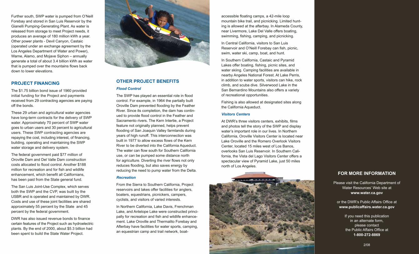
Recreation
From the Sierra to Southern California, Project reservoirs and lakes offer facilities for anglers, boaters, equestrians, picnickers, campers, cyclists, and visitors of varied interests.
In Northern California, Lake Davis, Frenchman Lake, and Antelope Lake were constructed princi-pally for recreation and fish and wildlife enhance-ment. Lake Oroville and Thermalito Forebay and Afterbay have facilities for water sports, camping, an equestrian camp and trail network, boat-
accessible floating camps, a 42-mile loop mountain bike trail, and picnicking. Limited hunt-ing is allowed at the afterbay. In Alameda County, near Livermore, Lake Del Valle offers boating, swimming, fishing, camping, and picnicking.
In Central California, visitors to San Luis Reservoir and O’Neill Forebay can fish, picnic, swim, water ski, camp, boat, and hunt.
In Southern California, Castaic and Pyramid Lakes offer boating, fishing, picnic sites, and water skiing. Camping facilities are available in nearby Angeles National Forest. At Lake Perris, in addition to water sports, visitors can hike, rock climb, and scuba dive. Silverwood Lake in the San Bernardino Mountains also offers a variety of recreational opportunities.
Fishing is also allowed at designated sites along the California Aqueduct.
Visitors Centers
At DWR’s three visitors centers, exhibits, films and photos tell the story of the SWP and display water’s important role in our lives. In Northern California, Oroville Visitors Center is located near Lake Oroville and the Romero Overlook Visitors Center, located 15 miles west of Los Banos, overlooks San Luis Reservoir. In Southern Cali-fornia, the Vista del Lago Visitors Center offers a spectacular view of Pyramid Lake, just 50 miles north of Los Angeles.