84
Cambourne Leading landscapes A mul-award winning development Canada House, 3 Chepstow Street, Manchester. M1 5FW T: 0161 228 7721 E: [email protected] randallthorp.co.uk

CambourneLeading landscapes
A multi-award winning development
Canada House, 3 Chepstow Street, Manchester. M1 5FWT: 0161 228 7721 E: [email protected] randallthorp.co.uk
ii
Front cover and opposite:Aerial view over Lower Cambourne and Cambourne Country Park
Copyright © 2018 Randall Thorp
All rights reserved
First published in 2018 byIndependent Publishing Network
No parts of this publication may be reproduced, stored in a retrieval system, or transmitted in any form or by any means, electronic, mechanical, photocopying, recording, or otherwise, without the prior written permission of the copyright owner.
Under no circumstances may any part of this book be photocopied for resale.
ISBN 978-1-78926-529-3
Editor: Dick Longdin, Randall ThorpGraphic Design: Anita Lomas, Randall Thorp

iii
CambourneLeading landscapes
A multi-award winning development

iv
Awards
Randall Thorp’s work on behalf of our clients at Cambourne has won design awards and been cited as best practice by CABE, Natural England, The Landscape Institute, The County Wildlife Trust, Milton Keynes Growth Area, TCPA and within PPS25: Development and Flood Risk and Planning for Biodiversity and Geological Conservation: A Good Practice Guide which accompanied PPS9
What House 2012Landscape DesignSilver award
Landscape Institute Awards 2010Design over 5 ha: Cambourne Green Infrastructure: Winner
Local Landscape Planning: Cambourne, 21 years in the making: Highly Commended
Homebuilder’s Federation Awards 2005Greenleaf award Cambourne Landscapes
Mail on SundayNational Home Builder Design Awards 2004Best landscaping of a development: Cambourne: Highly Commended

v
Credits
ClientThe Cambourne Consortium Taylor Wimpey, Bovis
Project director1998-2009
David Chare (Chare Associates)2009-2014
Neville Stebbing (Taylor Wimpey)
Project managementCambourne West 2018-present
Ellipsis Solicitor
Laytons
Local planning authority:South Cambridgeshire District Council
Masterplan consultantCambourne original 1989-1998
Farrells (Cambourne original) 1999-presentCambourne 950: 2007-presentCambourne West 2009-present
Randall Thorp
Landscape architectsCambourne original 1999-presentCambourne 950: 2007-presentCambourne West 2009-present
Randall ThorpPlanning & Design lead 1987-1998: Pauline RandallPlanning & Design lead 1998 - present: Dick LongdinConstruction lead 1997- 2007: Edward ThorpConstruction lead 2007 - present: Lindsay Cordall
Ecologists:Cambourne original 1999-presentCambourne 950: 2007-presentCambourne West 2009-2018
ESL Ecological Services Ltd
Services and on-site highway engineersCambourne original 1999-2012
WSP Group plcCambourne 950: 2012-2014
CreateCambourne 950: 2014-present
VineCambourne West 2010-2011
RPSCambourne West 2011-2015
Royal Haskoning LtdCambourne West 2015-present
Wormald Burrows Partnership Ltd
Off site highways and transport engineers:Cambourne original 1999-2006
RPS Group PLCCambourne West 2011-2014
Royal Haskoning LtdCambourne West 2014-2017
TPACambourne West 2015-present
Wormald Burrows Partnership Ltd
Archaeologists:Cambourne original 1999-2014
Wessex ArchaeologyCambourne West 2011-2014
Royal Haskoning Ltd
Landscape contractors:Tilbrooks LtdPro-Scape Ltd
Landscape maintenance:Tilbrooks LtdPro-Scape Ltd,A & F Landscapes LtdCambridgeshire Wildlife TrustCambourne Parish Council

vi

1
Contents
01 Introduction 3
02 Background 11
03 The Masterplans 15
04 Design direction 23
05 Engineering infrastructure 33
06 Green infrastructure 37
07 Adding value 53
08 Ecology 57
09 Homes for all 63
10 Community infrastructure 67
11 Landscape management 73
“ Cambourne is increasingly being seen as a model for the new garden villages.
Ed Durrent, Principle Planning Officer; South Cambridgeshire District Council, July 2018
“
Image left: 1820 OS survey map showing the site Cambourne

2Sunrise over Cambourne Country Park, Lower Cambourne

3
Introduction01

4Daybreak over Upper Cambourne
5
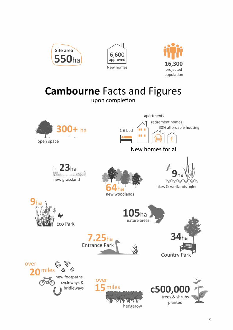
300+ ha
550haSite area
6,600 approved
New homes16,300projected
population
Cambourne Facts and Figuresupon completion
open space
23ha
new grassland9ha
lakes & wetlands64hanew woodlands
34ha
Country Park
7.25haEntrance Park
9ha
Eco Park
105hanature areas
trees & shrubsplanted
15hedgerow
miles
new footpaths,cycleways &
bridleways
20miles
c500,000over
over
New homes for all
1-6 bed
apartmentsretirement homes
30% affordable housing

6
Cambourne is a 550 ha (1,360 acre) new settlement, 7 miles west of Cambridge that aims to provide a whole new ‘living environment’ of over 6,000 homes plus schools, shops, employment and services, encompassing the best of the past with modern facilities and sound ecological principles.
The developers, (now Taylor Wimpey and Bovis) have retained Randall Thorp as key consultants since the site selection process in 1989.
The original 1996 landscape led masterplan (by Terry Farrell with Randall Thorp as landscape consultants) envisaged a 3,300 home settlement within a 405 ha site.
In 2012 a revised masterplan by Randall Thorp was approved to increase the number of homes by 950 to 4,250.
In 2018 Randall Thorp’s masterplan for an additional 2,350 homes and associated facilities on 145 ha of land as an extension to the west of Cambourne was approved by South Cambridgeshire District Council.
Introduction

7
• 50 ha business park
• 6 primary schools, 2 secondary schools
• Sports centre, swimming pool
• Nursery school
• Health centre and library
• Vets and dentist
• Church, vicarage & burial ground
• Community buildings
• Care homes and assisted living
• 30% affordable housing
• Hotels and pub
• Police and fire stations
• Supermarket, local stores
• Beauty salons, pharmacy, hairdressers
• Take-a-ways, restaurants, bookies
• Dry cleaners, estate agents, building societies
• Skate board park, BMX track, MUGA
• 18 play areas
• 9 ha of allotments and community orchard
“ The process (Randall Thorp) adopted ... is now
widely published in good practice guidance.Making it Home, Landscape Institute Position Statement. March 2010
“
Cambourne (original) - PurpleCambourne 950 - Blue
Cambourne West - Red
Plan reproduced from O
rdnance Survey digital map data
© Crow
n copyright 2018. All rights reserved. Licence number 100000073

8
Cambridgeshire County Council Household Survey of Cambourne, 2006
51%
Number one reason given when asked,
of resident’s leisure trips are within Cambourne(This is before the indoor leisure centre was built!)
% of leisure journeys by non-vehicular modes
National 26%Cambourne 53%
% of journeys to school by non-vehicular modes
National 47%Cambourne 68%
“ the environment ”
“ What do you like most about living at Cambourne? ”

View over Lake Redgrave towards Lower Cambourne and the Business Park from Crow Hill in the Country Park
9

10Aerial view of Cambourne site in 1994 prior to development

11
Background02
12
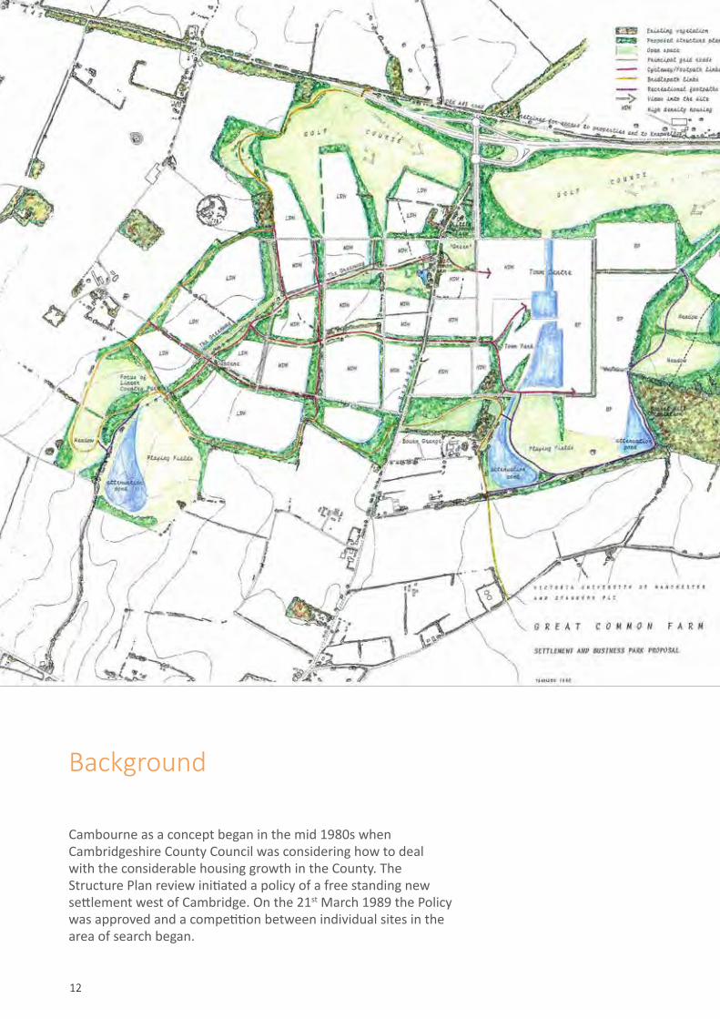
Background
Cambourne as a concept began in the mid 1980s when Cambridgeshire County Council was considering how to deal with the considerable housing growth in the County. The Structure Plan review initiated a policy of a free standing new settlement west of Cambridge. On the 21st March 1989 the Policy was approved and a competition between individual sites in the area of search began.
13
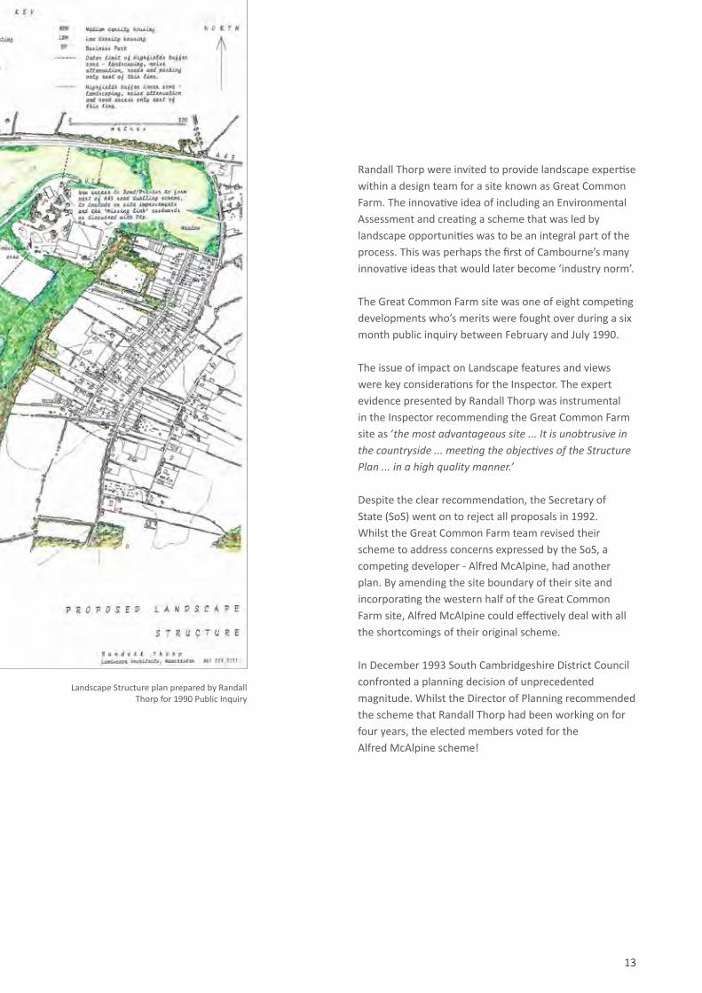
Randall Thorp were invited to provide landscape expertise within a design team for a site known as Great Common Farm. The innovative idea of including an Environmental Assessment and creating a scheme that was led by landscape opportunities was to be an integral part of the process. This was perhaps the first of Cambourne’s many innovative ideas that would later become ‘industry norm’.
The Great Common Farm site was one of eight competing developments who’s merits were fought over during a six month public inquiry between February and July 1990.
The issue of impact on Landscape features and views were key considerations for the Inspector. The expert evidence presented by Randall Thorp was instrumental in the Inspector recommending the Great Common Farm site as ‘the most advantageous site ... It is unobtrusive in the countryside ... meeting the objectives of the Structure Plan ... in a high quality manner.’
Despite the clear recommendation, the Secretary of State (SoS) went on to reject all proposals in 1992. Whilst the Great Common Farm team revised their scheme to address concerns expressed by the SoS, a competing developer - Alfred McAlpine, had another plan. By amending the site boundary of their site and incorporating the western half of the Great Common Farm site, Alfred McAlpine could effectively deal with all the shortcomings of their original scheme.
In December 1993 South Cambridgeshire District Council confronted a planning decision of unprecedented magnitude. Whilst the Director of Planning recommended the scheme that Randall Thorp had been working on for four years, the elected members voted for the Alfred McAlpine scheme!
Landscape Structure plan prepared by Randall Thorp for 1990 Public Inquiry

14
Cambourne Masterplan 2007 (RT)
Cambourne Landscape Structure Plan 1996 (RT)

1515
The Masterplans03

16
The original Masterplan (1995-97)
Randall Thorp ensured the existing landscape features were retained and enhanced to create a masterplan that was truly ‘landscape led’. Working closely with ecologists ESL, active measures were incorporated into the landscape structure plan to ensure that Cambourne would be a model development in terms of habitat creation and ecological enhancement.
Randall Thorp also worked with WSP engineers, to create a site wide sustainable flood control system incorporating open ditches and lakes. At the time it was described by Anglian Water as ‘revolutionary’ yet was another example of Cambourne leading in what is now best practice.
The highway design was also innovative for its time. Randall Thorp developed a site specific Highway Design Guide that placed the emphasis on people and places rather than vehicles, much like Manual For Streets would later do.
Vision and innovation
To avoid the pitfalls of grey uniformity and soullessness so often found in new settlements, Alfred McAlpine appointed renowned architects, Terry Farrell & Partners, to draw up a ‘Masterplan’ to outline the way in which Cambourne would evolve. Having seen Randall Thorp’s work for the Great Common Farm scheme, these new clients were keen to have Randall Thorp join their masterplan team to work alongside Farrells to ensure the scheme responded sensitively to the landscape.
Cambourne was to be split into three distinct neighbourhoods: Lower Cambourne, Great Cambourne and Upper Cambourne - each with its own central green and each separated by, and accessible to, green open space.
Cambourne was planned to be an almost self-contained community incorporating:• High Street with shops, offices, restaurant, pub,
community facilities and apartments• Supermarket with petrol filling station
and car wash• Three primary schools, multi-purpose sports centre,
playing fields, hotel and nursery school• Ecumenical (multi-denominational) church
and cemetery• Police and Fire Station• Medical centre• Sports centre and playing fields• A country park• Village greens and play areas at the heart of each
neighbourhood• Acres of nature reserves with lakes, wetlands,
woodland and meadows• A comprehensive network of footpaths, cycleways
and bridleways

17
“ We can build to the quality of Cambourne
or the standard of Slough.John Rouse, Chief Executive CABE
18 March 2004
“ 3,300 Great Cambourne
Lower CambourneUpper Cambourne 7,920
Home to
primary schools2 17ha
sports
20habusinessparks
Landscape structure plan submitted as part of 1995 Masterplan (RT)

18
The Masterplan evolves (1997-2009)
Change and flexibility
When Farrells left the design team in 1997 Randall Thorp’s overarching knowledge of all aspects of the scheme made them the natural successor to assist the client as masterplan consultant and lead designer.
Unforeseen influences meant the masterplan was forced to change and adapt as the scheme developed. The practical requirements of a supermarket and hotel meant far more space was required in the town centre for these uses than the original plan anticipated. Government planning policy forced the developers to build homes at a higher density than originally envisaged. The Highways Agency diverted the adjacent A428 through the north of the site.
Each of these changes caused ripple effects through the rest of the masterplan, yet the original vision and structure was strong enough to absorb these changes through the careful, ongoing masterplanning work led by Randall Thorp.
“ ...(landscape architects) can
lead on local development issues and make a lasting impact... Good examples of this are Randall Thorp’s work for Cambourne New Settlement.
Anne Joluzot:Towards Sustainability: Landscape Institute. 2011
“
1996 Masterplan (Terry Farrell)
1999 Masterplan (RT)
2009 Masterplan (RT)
19
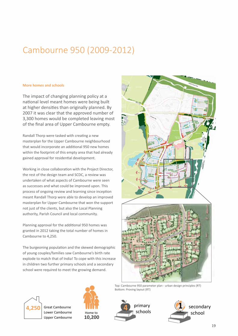
Cambourne 950 (2009-2012)
More homes and schools
The impact of changing planning policy at a national level meant homes were being built at higher densities than originally planned. By 2007 it was clear that the approved number of 3,300 homes would be completed leaving most of the final area of Upper Cambourne empty.
Randall Thorp were tasked with creating a new masterplan for the Upper Cambourne neighbourhood that would incorporate an additional 950 new homes within the footprint of this empty area that had already gained approval for residential development.
Working in close collaboration with the Project Director, the rest of the design team and SCDC, a review was undertaken of what aspects of Cambourne were seen as successes and what could be improved upon. This process of ongoing review and learning since inception meant Randall Thorp were able to develop an improved masterplan for Upper Cambourne that won the support not just of the clients, but also the Local Planning authority, Parish Council and local community.
Planning approval for the additional 950 homes was granted in 2012 taking the total number of homes in Cambourne to 4,250.
The burgeoning population and the skewed demographic of young couples/families saw Cambourne’s birth rate explode to match that of India! To cope with this increase in children two further primary schools and a secondary school were required to meet the growing demand.
4,250 Great CambourneLower CambourneUpper Cambourne 10,200
Home to
primary schools4 secondary
school1
Top: Cambourne 950 parameter plan - urban design principles (RT)Bottom: Proving layout (RT)
20
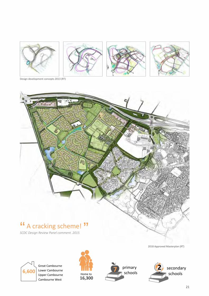
Cambourne West (2009-2018)
Cambourne grows
The pressure for housing growth continued in Cambridgeshire meaning that the emerging Local Plan required suitable, deliverable and sustainable locations for new homes. Despite the Local Authority reluctance, Cambourne’s developers saw the potential for an expanded Cambourne to help meet this need.
Between 2009 and 2015 Randall Thorp developed a series of masterplan options for land to the west of Cambourne. Through lengthy negotiations and a willingness to work together, the developer team eventually won the Local Authority and Parish Council round to the idea of this area of land being a preferred option for housing growth.
Cambourne West extends the settlement and enhances its sustainability by providing an additional:• 2,350 new homes (30% affordable)• 1 additional secondary school and 2 additional
primary schools• 6.25 ha of employment land• Local shops and community buildings• 2.68 ha of allotments and food growing • 10.3 ha of additional formal sports fields, including
an all weather athletics track and contributions to a swimming pool as an extension to the original leisure centre
• 14 new play areas and a BMX track• New woodlands, wetlands, lakes and grasslands
The masterplan was prepared by Randall Thorp and the first Outline planning application was submitted in 2014. Post submission consultation required design changes resulting in a second submission in November 2015. This was granted approval in principle by Committee in January 2017, with final planning approval being gained with the signing of the S106 agreement in January 2018.
Sketch masterplan 2013 (RT)
Measured sketch 2013 (RT)
2014 Masterplan (RT)
21
“ A cracking scheme!
SCDC Design Review Panel comment. 2015
“ Design development concepts 2013 (RT)
6,600Great CambourneLower CambourneUpper CambourneCambourne West 16,300
Home to
primary schools7 secondary
schools2
2018 Approved Masterplan (RT)

Members of Randall Thorp team preparing Strategic Documents
22

232323
Design direction04

24
Learning and development
Randall Thorp’s continued involvement in the scheme since 1989 mean they have an almost unique level of experience as designers of such a large residential project. The ability to revisit design work and see at first hand what works well and what can be improved upon means the Practice has an unrivalled level of expertise in designing and delivering residential and mixed-use developments of all scales.
As part of the project’s large multidisciplinary team Randall Thorp have assisted their clients through:• Planning• Design• Implementation• Management• Research
Strategic planning
Randall Thorp have produced a variety of strategic documents to help guide the design of Cambourne including:• Landscape chapters of the
Cambourne Masterplan• Landscape chapters of the Cambourne
Design Guide• Options for Management of open spaces
at Cambourne• The Landscape Structure plan • Cambourne phasing plan• Cambourne spoil disposal plan• Cambourne Highway Design Guide• Cambourne Play Strategy• Cambourne Landscape Management Plan• Detailed Design Briefs for all Housing areas• Upper Cambourne Masterplan• Upper Cambourne Design & Access Statement• Upper Cambourne Design Code• Cambourne West Masterplan• Cambourne West Design Code• Cambourne West youth and play strategy• Cambourne West landscape structure plan• Cambourne West Landscape management plan
Design Direction
1. Cycling along Cambourne’s greenway
2. Newt pond at entrance to Lower Cambourne
3. Traditional village vernacular in Lower Cambourne
4. Traditional rural vernacular on edges of Lower Cambourne
1
2
3
4

25
Architects Planners
Engineers Ecologists
QuantitySurveyors
LocalCommunities
Local PlanningAuthority
Local Wildlife Trust
LandscapeManagers
Parish Council
Agronomists
THE CLIENT
THE CLIENT
THE ROLE OF THE LANDSCAPE ARCHITECT
Planning
• Masterplan input• Design guide input• Open space strategies• Highway Design Guide
Design
• Scheme design: housing, play, parks, nature areas
• Public realm masterplans and strategies
• SUDs Strategies• Consultation/Stakeholder
engagement• Development briefs• Habitat creation
Implementation
• Contract management• Site supervision• Cost control• Negotiation of
planning issues
Management
• Development of management plans
• Management/ownership strategy
• Production of legal conveyancing plan
• Supervision of management operations
Research
• Formulation of site specific grass seed mixes
• Habitat creation• Wildlife translocation

26
Phasing: and spoil disposal: A 4 dimensional plan
A key element of ensuring the scheme was both commercially viable and sustainable was the consideration of spoil disposal and phasing, as part of the masterplanning process.
Randall Thorp developed the phasing and spoil disposal strategies in tandem, considering not just the three dimensional landform design required to keep all spoil on site, but also the fourth dimensional aspect of timing.
Residential areas were phased to maximise the use of early infrastructure such as roads and drainage, prior to the next phase of infrastructure being required. The phasing of landscape areas considered advance works to minimise costs and the realisation that landscape phases and residential phases were both separate and overlapping.
A weakness of the original masterplan was the lack of consideration given to haul routes. The later masterplanning work by Randall Thorp for Upper Cambourne and Cambourne West carefully considered these routes from the outset. In these later areas, haul routes have been designed to follow future highway routes avoiding abortive construction costs and ensuring that construction traffic is kept separate from visitor and resident’s traffic to improve safety and reduce nuisance.
1
2
3

27
Series of plans for 2001 ‘Spoil Disposal & Haul Routes’ document (RT)
4
5
6
7
8
Key
Development commencedDevelopment under constructionDevelopment completedLandscape works commencedLandscape works under construction
Landscape works completed
28
Guides, briefs and codes
A condition of the original Outline Planning Approval was the submission of a Cambourne Design Guide. This was produced in 1995 by the design team with Randall Thorp responsible for writing all landscape and open space sections. This was just the first of a series of design briefing documents that Randall Thorp would have a major role in.
Between 1996 and 2009 Randall Thorp were responsible for producing a series of plans that would interpret the original Design Guide as a design brief for each individual housing parcel.
A panel of stakeholders was created to oversee the Reserved Matters applications and smooth the planning process. This Environment and Design Group included:
• The Project Director• Representatives from each client (Taylor Wimpey and
Bovis)• The LPA Principal Planning Officer responsible
for Cambourne• The County Council Highway Officer• A representative of the County Council
services provider• A representative of the affordable housing provider• The Police Architectural Design officer• The LPA Architectural advisor• The LPA Landscape advisor• The LPA Tree officer• The Cambourne Design Team Masterplan and
landscape consultant (Randall Thorp)• The Cambourne Design Team Highways and
Engineering consultant (WSP)• The Cambourne Design Team Ecologist (ESL)
This group approved each briefing plan and then examined pre-application designs together to ensure they met the brief and to resolve conflicts between the different interested parties. The result was a smoother application process with delegated powers given to the planning officer and speedier approvals for the developers.
Although this process worked well for many years, it was disbanded prior to the start of Upper Cambourne.
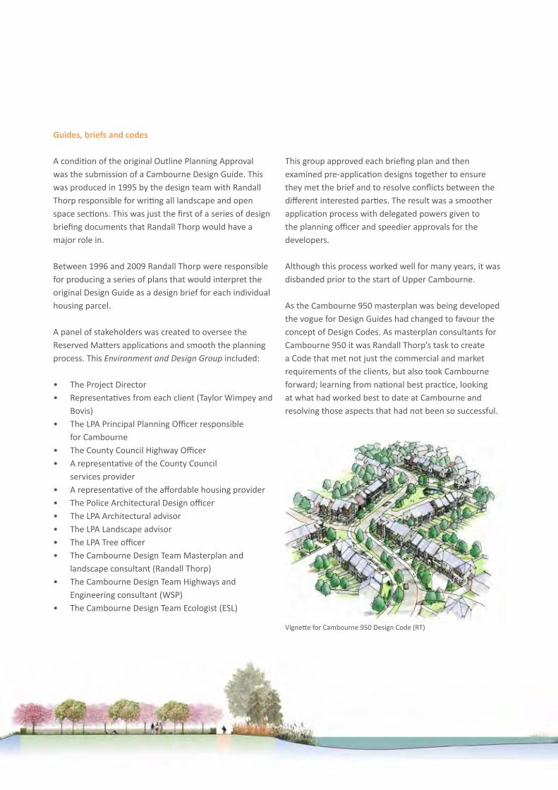
As the Cambourne 950 masterplan was being developed the vogue for Design Guides had changed to favour the concept of Design Codes. As masterplan consultants for Cambourne 950 it was Randall Thorp’s task to create a Code that met not just the commercial and market requirements of the clients, but also took Cambourne forward; learning from national best practice, looking at what had worked best to date at Cambourne and resolving those aspects that had not been so successful.
Vignette for Cambourne 950 Design Code (RT)

29
A co-ordinating role
The role of lead designer or masterplan consultant is not just about ensuring all other design consultants are properly briefed, it also requires all emerging designs and approved designs to fit seamlessly together with each other and with the overall masterplan.
Randall Thorp have been developing their skills in this since they first became masterplan consultant for Cambourne in 1998.
Practical issues include: retaining control of hundreds of individual digital files that fit together coherently to create the masterplan which all members of the team rely upon; updating these files once reserved matters applications are approved and designs for different areas are fixed; co-ordination and issuing land parcel boundaries and conveyancing boundaries so no legal issues arise through overlapping land ownerships or areas of ‘no man’s land’; understanding gross developable areas, net developable areas and net-net developable areas, to ensure the scheme remains viable as it flexes and changes over time; even looking at historic mapping and land ownership to create a list of potential street names with local relevance that imbue the scheme with a unique sense of history and place.
Through this ongoing work and a pragmatic approach, Randall Thorp has gained the trust of the client group, the entire design team and more importantly, the new community.
Extract from Cambourne 950 Design Guide (RT)
Section through Central Green. Extract from Cambourne West Design Code (RT)

30
Lead designer, Cambourne West
Randall Thorp’s skills in managing multi-disciplinary design teams, preparing large and complex planning applications, masterplanning, landscape design and Landscape and Visual Impact Assessment were all brought together to lead and input into the design for this 2,350 home, mixed use extension to Cambourne.
The shared vision for Cambourne West is to create a thriving, vibrant, sustainable urban extension with a strong sense of community and identity where people enjoy living. It will be a collection of neighbourhoods, as well as schools and community and sport facilities, that will extend and integrate into Cambourne. It will adopt and take forward the best elements of Cambourne, to enhance the settlement in terms of environmental, social and economic sustainability.
Cambourne West’s unique character will be derived from its strong landscape structure: the central green spine, forming the heart of the place and boundary woodlands enclosing the place. Built form and spaces will be integrally linked to the landscape setting to create a place that exploits this authentic and distinct identity, deriving character from the immediate landscape: formal and informal landscape, views, open spaces, lakes, meadows, greens, woodlands, skylines and enclosure.
Three distinct character areas will be formed: Swansley Park, Sheepfold Green and Woodfields.
Vision for Cambourne West. Extract from Cambourne West Design Code (RT)
Swansley Park
Woodfields
Sheepfold
31
Following the preparation of the masterplan and the Design & Access Statement, Randall Thorp were asked to assist the client to discharge a number of planning conditions, prior to, or concurrent with, the first Reserved Matters application. These conditions included preparation of:• Cambourne West phasing plan• The Cambourne West Design Code• Cambourne West play and youth strategy• Cambourne West landscape structure plan• Cambourne West green infrastructure and
landscape management plan
The first reserved matters application covers an area of land approximately 54ha and includes over 950 homes.
It will be a joint application by Taylor Wimpey and Bovis including engineering infrastructure such as highways, drainage and services to serve this number of new homes as well as green infrastructure such as wetlands, lakes, woodlands and greenways.
As lead designer, it is Randall Thorp’s role to co-ordinate this design work, ensuring that the multidisciplinary team of housing developers, layout specialists, engineers, ecologists, landscape architects and quantity surveyors, all work together to create a cohesive scheme that delivers the commercial requirements of the clients as well as the shared vision of the developers, the planning authority and the local community.
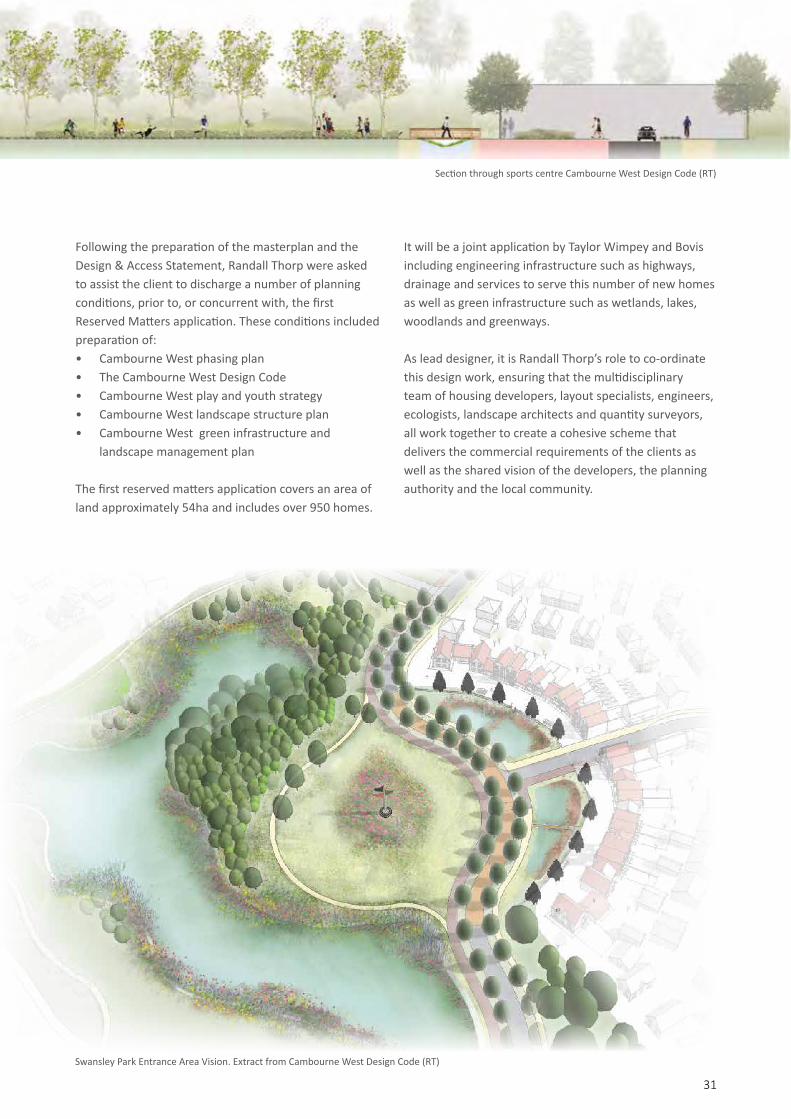
Section through sports centre Cambourne West Design Code (RT)
Swansley Park Entrance Area Vision. Extract from Cambourne West Design Code (RT)

Arriving at Cambourne from the A428
32

333333
Engineering infrastructure
05
34
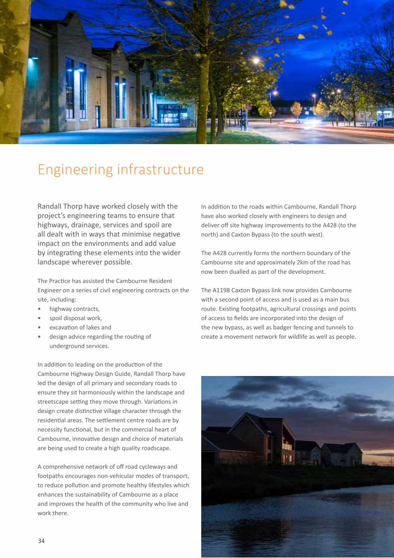
Randall Thorp have worked closely with the project’s engineering teams to ensure that highways, drainage, services and spoil are all dealt with in ways that minimise negative impact on the environments and add value by integrating these elements into the wider landscape wherever possible.
The Practice has assisted the Cambourne Resident Engineer on a series of civil engineering contracts on the site, including: • highway contracts, • spoil disposal work, • excavation of lakes and • design advice regarding the routing of
underground services.
In addition to leading on the production of the Cambourne Highway Design Guide, Randall Thorp have led the design of all primary and secondary roads to ensure they sit harmoniously within the landscape and streetscape setting they move through. Variations in design create distinctive village character through the residential areas. The settlement centre roads are by necessity functional, but in the commercial heart of Cambourne, innovative design and choice of materials are being used to create a high quality roadscape.
A comprehensive network of off road cycleways and footpaths encourages non-vehicular modes of transport, to reduce pollution and promote healthy lifestyles which enhances the sustainability of Cambourne as a place and improves the health of the community who live and work there.
In addition to the roads within Cambourne, Randall Thorp have also worked closely with engineers to design and deliver off site highway improvements to the A428 (to the north) and Caxton Bypass (to the south west).
The A428 currently forms the northern boundary of the Cambourne site and approximately 2km of the road has now been dualled as part of the development.
The A1198 Caxton Bypass link now provides Cambourne with a second point of access and is used as a main bus route. Existing footpaths, agricultural crossings and points of access to fields are incorporated into the design of the new bypass, as well as badger fencing and tunnels to create a movement network for wildlife as well as people.
Engineering infrastructure
35
“ (The team behind Cambourne)
will be seen as market leaders in what can be achieved.
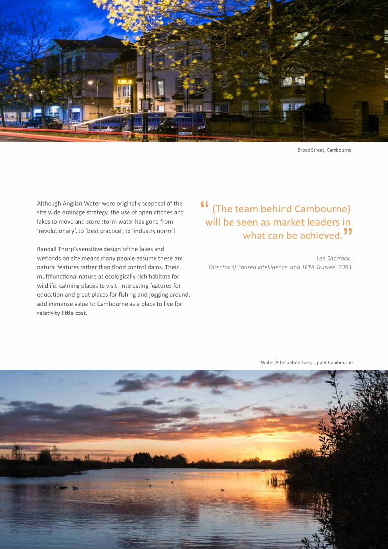
Although Anglian Water were originally sceptical of the site wide drainage strategy, the use of open ditches and lakes to move and store storm water has gone from ‘revolutionary’, to ‘best practice’, to ‘industry norm’!
Randall Thorp’s sensitive design of the lakes and wetlands on site means many people assume these are natural features rather than flood control dams. Their multifunctional nature as ecologically rich habitats for wildlife, calming places to visit, interesting features for education and great places for fishing and jogging around, add immense value to Cambourne as a place to live for relativity little cost.
“
Lee Shorrock, Director of Shared Intelligence and TCPA Trustee. 2003
Broad Street, Cambourne
Water Attenuation Lake, Upper Cambourne

Cambourne Country Park, Lake Redgrave, Allotments, Lower Cambourne and Business Park
36

373737
Green Infrastructure06

38
Green infrastructure
Randall Thorp has been responsible for the successful delivery and maintenance of all elements of Green Infrastructure from inception to delivery. Detailed design work for Green Infrastructure commenced in 1997 with the first landscape contract let in 1998. Since then over 100 reserved matters planning applications have been prepared by Randall Thorp for the Green infrastructure elements of Cambourne.
Design and delivery
The design work has been delivered on the ground through individual landscape construction contracts administered by Randall Thorp all using JCLI form of contract.
Landscape overview
Late 20th century agriculture had removed much vegetation previously on the site to create large (40 hectare) fields. As a result, the original site was relatively devoid of trees, hedgerows, and woodlands and those that did remain were neglected and often of poor health and landscape quality.
The site is now a mosaic of landscape typologies and one of the richest, most varied wildlife areas in the region.
Lower, Great and Upper Cambourne and Cambourne West are separated by large areas of green open space - a 34 ha country park and a 9 ha Eco Park, 44 ha of new woodland, 15 miles of new hedgerows, 20 miles of footpaths, cycleways and bridleways, and 4 ha of wetlands with over 500,000 trees and shrubs planted in the areas of public open space and hundreds of thousands more planted within gardens, the business park and the school grounds.

The country park
The country park provides a major recreational resource at both a neighbourhood and sub-regional level. The lakes provide a facility for fishing that is lacking elsewhere in the county. On a more local level the country park is used for walking, jogging, bird watching, dog walking and other informal recreation activities. It contains an orchard of old Cambridgeshire fruit trees and it is the venue for community events such as bonfire night celebrations and an annual 10K run. The newly constructed Crow Hill provides a dramatic panoramic view over much of South Cambridgeshire and beyond and is one of the few places you can sledge in Cambridgeshire!
In addition to these human functions the country park also provides a range of important habitats for wildlife made up of grassland, open water, reed beds and woodland.
Some of its other functions are less obvious but no less important. The new landform and woodland, although designed to look natural are carefully designed to screen the settlement from surrounding key viewpoints. The lakes are engineered dams designed to hold back flood water. Crow Hill was the site of the main spoil disposal for the first half of the development and contains over 450,000 m3 of spoil that would otherwise need to have been hauled off site.
Lake Redgrave is a popular destination in the Country Park
39

40
The entrance park
Arrivals to Cambourne from the A428 enter through the the new Northern Woods into the Entrance Park. This 18th century English parkland inspired landscape, forms the main approach to the development with the lakes, creating strong threshold features, beyond which lies the settlement centre.
The rolling landscape is designed to disguise the dual carriageway. Groups of parkland trees direct views and frame a series of vistas to the wider open spaces and towards the entrance lakes. The entrance lakes have been stocked with over 1,000 fish rescued from redundant ponds elsewhere on site. They are designed to maximise reflections and create a strong feature that works with the ‘Stately Home’ character of the Belfry Hotel sitting behind them, which creates an attractive, memorable, physical boundary to the built edge of Cambourne.
The eco Park
Centred on the existing Oaks Wood and Poplar Plantation, the Eco Park provides a space for recreation and environmental interpretation. The park acts as Cambourne’s ‘town park’ providing a green link between the town centre and the Business Park and Lower Cambourne.
The design philosophy was to create a naturalistic landscape that showed off many of the traditional landscape features of South Cambridgeshire to create a landscape that is imaginative, rich in wildlife, attractive and educational.
A range of habitats once common in this area are recreated including:• Hedgerows, hedge banks and hedge margins• Grasslands, ridge and furrow meadows and
arable headlands • Woodlands, carr and scrub • Lakes, ponds, reedbeds, marshes and streams • An arboretum of local trees and shrubs
The Cambourne Belfry Hotel reflected in the Entrance Lake

Lakes, ponds and ditches
Cambourne was one of the first developments to adopt a site wide environmentally sustainable approach to flood management, now referred to as SuDs.
Existing ponds, watercourses and ditches on site were retained and new open ditches, ponds and lakes were created to link these all together. The resulting system takes all of Cambourne’s surface water and flood discharge, holding it back in open lakes after periods of heavy rainfall and letting it leave the site in a gentle, controlled way. Despite its natural appearance and wildlife rich edges, Lake Redgrave is an engineered flood defence dam.
This flood control system creates over 6 ha of new lakes and wetlands for biodiversity. New species of bird, mammal and insect have moved on to the site as a result of these areas. Water voles inhabit the new ditches, whilst kingfishers nest in the specially designed ‘cliffs’ by the lakes. Over a dozen new species of dragonfly and damselfly now feed over the waters.
In addition to their engineering and wildlife roles the lakes also provide informal recreation for fishing and bird watching, and as an area for walkers and joggers.
Lake Redgrave
41

42
Trees and woodlands
Cambourne’s new woodland and miles of new hedges contain over 500,000 trees and shrubs. In addition to creating valuable wildlife habitats these woodlands also screen the development from key viewpoints outside the site and shelter the housing from the prevailing westerly winds.
The woodlands provide a setting for informal recreation, containing as they do, miles of footpaths, cycleways and bridleways. They create a setting for the development to sit within and contribute to its strong sense of character. Careful design used woodland to create a dramatic approach as visitors enter Cambourne, whilst detailed design of the woodlands mark each entrance to the settlement with subtle changes in the species composition.Greenways and pedestrian networks
Cambourne was planned from the outset to be a community that encouraged walking and cycling. The network of footpaths and cycleways permeate the whole development encouraging healthy lifestyles and discouraging the use of vehicles. The routes create a network connecting the centre of each village to each other and to the wider open spaces beyond Cambourne.
Village greens
Each of Cambourne’s neighbourhoods has a village green at its centre. These provide space for formal and informal recreation, play and sport. They imbue each neighbourhood with its own sense of character creating landmark places to aid orientation and navigability. They provide space for tree planting and include ponds and ditches to enhance the site’s biodiversity.
The green setting they create for the built development improves the saleability of houses adjacent to them and provides marketing potential for the development as a whole. Each village green is connected to the other areas of Green Infrastructure by a series of greenways creating a network of green spaces throughout the development.
Allotments and community orchard
The two original allotments in Great Cambourne and Upper Cambourne have proved a huge success and all plots were quickly snapped up. A large new allotment and community orchard is part of Cambourne West.
Lower Cambourne village green and cricket pitch
Cycling along Cambourne’s 20km of new greenways and cycle routes

43
Upper Cambourne village green
Great Cambourne allotments

44
Play areas
A comprehensive play strategy was developed for Cambourne that was pioneering when first approved in 2002. In addition to the familiar concept of LAPs, LEAPs and NEAPs it also introduced the idea of Spaces for Imaginative Play (SIP). These are broadly identical to the idea of Local Landscaped Areas for Play now advocated through the replacement to the Six Acre Standard, ‘Planning and Design for Outdoor Sport and Play.
The strategy was also a pioneer of the concept of ‘natural play’ now advocated on best practice by Play England.
“ Randall Thorp have succeeded in creating a
community play space that demonstrates best practice in play design and one that we are sure will be well loved by local families. Paul Collings, MD Timberplay.
“

45
A variety of play features for children of all ages

46
Upper Cambourne Big Leap: A play area designed for all ages and all abilities

47
Expertise and innovation
Randall Thorp worked closely with the local authority to produce an innovative play strategy that promoted the concept of natural play over a reliance on traditional play equipment. The idea of natural play is now seen as best practice by Play England.
Thanks to the design and delivery of play areas in Great Cambourne, Lower Cambourne, and the Eco Park Randall Thorp had gained an extensive knowledge of what worked well in terms of play.
Following publication of Play England’s research from the National Play Builder programme and as a result of Randall Thorp’s own experience of play area design, the area at Upper Cambourne adopted a more innovative approach to play.
Working closely with the Parish Council and the local community, it was agreed to incorporate water play and sand play elements as well as do-away with the traditional play area fencing. The resulting scheme has been described as best practice by:• BALI• Horticulture Week• External Works magazine
“ The play area includes an
abundance of playful landscaping touches showcasing the creative flair of the designers. Horticulture Week. December 2015
“
1. Space for adults
2. Space for imagination
3. Space for excitement
4. Space for discovery
1
2
3
4
48
Lower Cambourne cricket field
All weather football, Cambourne Fitness & Sports Centre

49
Sports fields
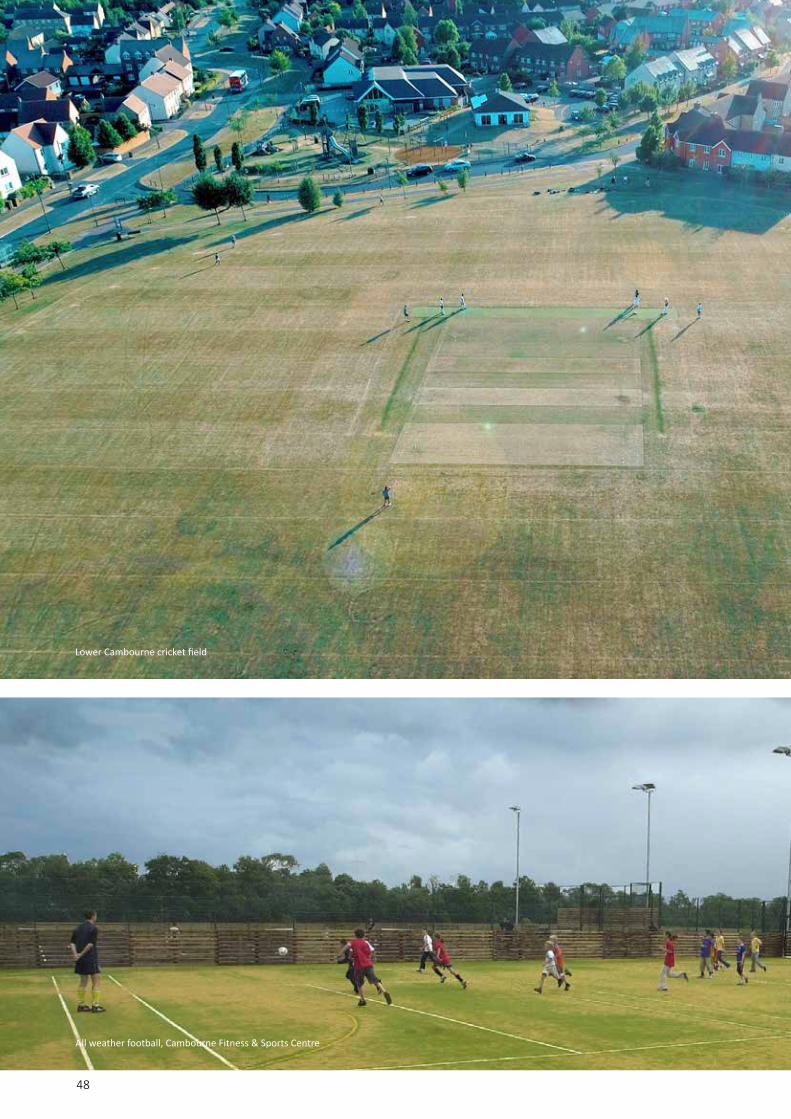
Randall Thorp have produced a sport strategy for Cambourne and carried out the detailed design of all open space sports facilities on the development, including:• 9.5 ha of playing fields for football, rugby, etc.
including 3 adult pitches, 3 9v9 pitches, 3 junior pitches and 3 mini pitches
• 2 full size cricket pitches• 5 artificial surfaced tennis courts, with 2 courts
including netball• 1 bowling green• 3 informal kickabout areas• Associated landscaping, car parking and
viewing facilities• An additional 10.3ha of playing fields at
Cambourne West
Cambourne now boasts over 20 league sports clubs. The play surfaces and general environment is the envy of every visiting sports club. In 2018 Cambourne Parish Council won Best Kept Wicket trophy awarded by Cambridgeshire Cricket Association for the best kept ground in the CCA Senior League (which includes 30 clubs from across Cambridgeshire).
Artificial Turf Pitch (MUGA)
The MUGA provides space for floodlit 11-a-side, 2 9v9, 2 7v7 and 5-a-side football.
Skateboard park
The skateboard park caters not only for skateboarders, but also rollerbladers and BMX biking. It features two flat banks, a driveway, four quarter pipes, a jump box, a spine, a stepped grind box, a grind rail and a grind bench. There is also a ring around the perimeter for in-line skating. Due to the success of this facility Cambourne West has a dedicated BMX track.

50
Imaginative natural play area, Great Cambourne

51
“ This good practice example shows how the existing
biodiversity was protected and how new wildlife interest can be created.Planning for Biodiversity & Geological Conservation: A Good Practice Guide to Accompany PPS9: 2006
“
Reducing human discomfortTree planting and careful landform design, have and will continue to reduce the windswept nature of the site.
Meeting energy demandsTree planting and woodlands will increase shading and cooling from evapotranspiration over the site and so reduce energy demand, as climate change is predicted to raise temperature levels.
Dealing with wasteLandform design will accommodate over 1.5M cubic metres of spoil and demolition waste on site. Open spaces provide sensitively located areas for recycled waste collection facilities.
Flood managementThe swales, ditches, ponds and lakes on site provide for surface water drainage and flood protection in a sustainable way that incorporates biodiversity enhancements and opportunities for informal recreation.
Green infrastructure benefits
Cambourne demonstrates that Green Infrastructure is more than green space provision and management. It has been integrated into the design and philosophy of Cambourne from the outset. It recognises the vital life support systems that Cambourne’s natural environment can provide and the wide array of benefits it can offer.
Food productionAllotments and community orchards provide space for local food production on site as well as creating educational opportunities enhancing social cohesion and reducing food miles.
Local distinctivenessRetaining and enhancing existing landscape and wildlife features, creates a scheme with real local distinctiveness in a cost effective way.
Biodiversity enhancement, corridors and linkagesGreenways link and extend all elements of Green Infrastructure to provide a movement network for both humans and wildlife.
Recreation and healthGreenspace provision provides opportunities for informal and active recreation close to people’s homes. The greenspace network links the heart of each neighbourhood with the surrounding countryside, encouraging people to explore their community whilst improving their health and well being
Community needsThe Green Infrastructure helps create and strengthen the sense of community. It creates spaces with a strong sense of place and encourages people to meet and interact in comfortable neutral environments. It meets a range of social, environmental and economic needs at a local level for the benefit of local people, the local community and the wider community.

52Randall Thorp team members discuss strategic plans for Cambourne

535353
Adding value07

54
The value of added value
Randall Thorp’s philosophy has always been: ‘Our clients are our most important asset.’ The practice understands that good design is about balancing ‘commodity, firmess and delight’
For clients, delight is more than just aesthetics, its about adding value. As designers there are many ways valuecan be added to a scheme:• Reduce design and planning time/costs• Reduce build costs• Increase value• Build trust and relationships.
Make the most of what you’ve got
At the very beginning of the design process Randall Thorp conducted detailed desktop and site-based research to identify and categorise all existing features of landscape value within the project area, including trees, hedges, woodlands, ditches, ponds, topographical features, grasslands and verges. This assessment enabled the retention of those features of most importance, maintaining the character of the location in a way that was cost effective. View lines were planned through built development and from the highways to ensure that features such as mature trees were visible to visitors and potential house buyers.
Accommodating ‘waste’
From the outset, the landscape and open spaces were designed and phased to accommodate all spoil from the site. This required careful design to ensure that existing features were not buried or harmed and the resulting new landform looked natural. Upon completion, the project will have generated over 1 million m3 of spoil. Thanks to the careful landscape design, the cost of organising and administrating the spoil disposal is approximately 1/3 the cost of disposal off site, resulting in a cost saving of about £12M by 2010.
Retention of site features
At Great Cambourne Village Green, retention of existing features resulted in the following approximate savings (1999 rates):
Minimising costs
400m3Disposal of spoil
450m hedgerow
3 ponds
25Mature feature trees
75 woodland trees
meadow/wildflower area
9,500m2
tennis court1
6benches
drainage600m2
8k
Saving (£)
3.5k
1.5k
17.5k
9k
17.1k
3.4k
17.6k
2.7k
Total savings£80.5k
Adding value
Great Cambourne village green; planned to save £80k on traditional construction costs
55
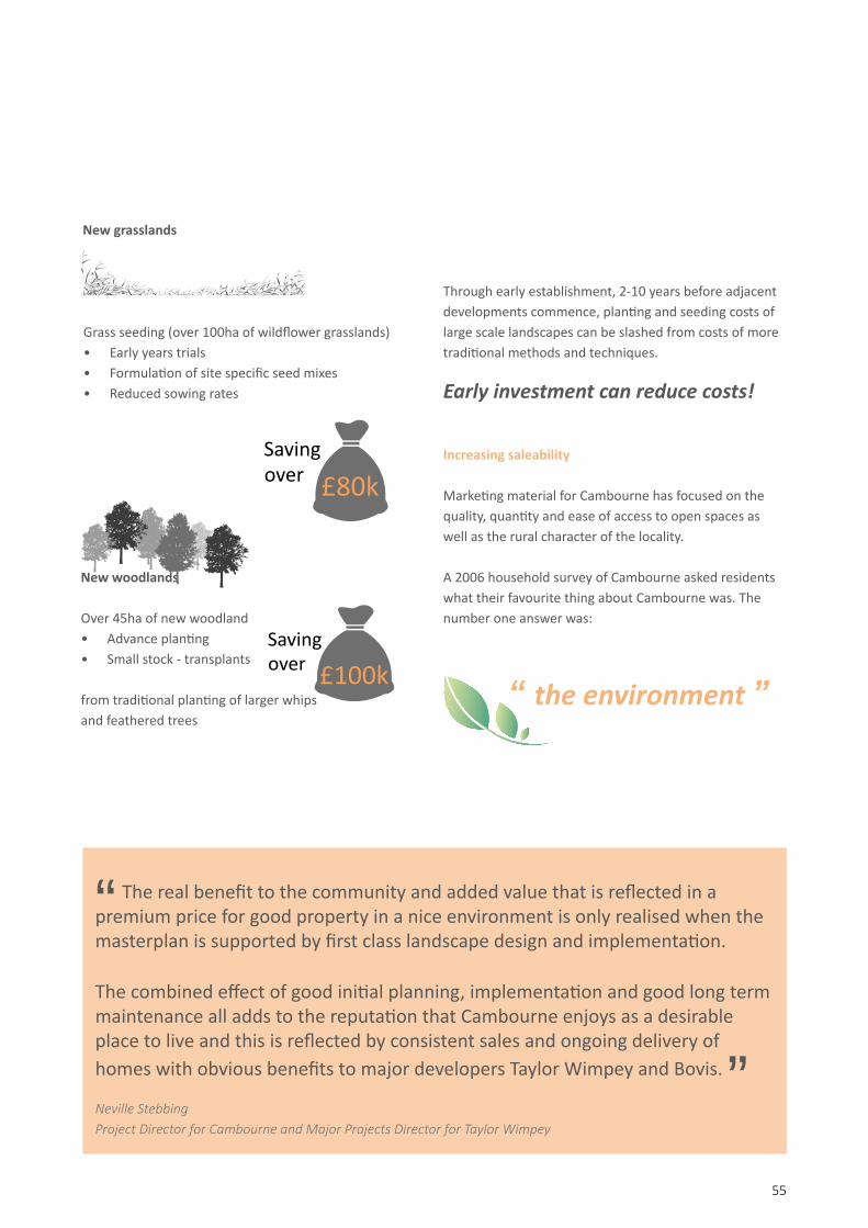
New grasslands
“ The real benefit to the community and added value that is reflected in a
premium price for good property in a nice environment is only realised when the masterplan is supported by first class landscape design and implementation.
The combined effect of good initial planning, implementation and good long term maintenance all adds to the reputation that Cambourne enjoys as a desirable place to live and this is reflected by consistent sales and ongoing delivery of homes with obvious benefits to major developers Taylor Wimpey and Bovis.
Neville StebbingProject Director for Cambourne and Major Projects Director for Taylor Wimpey
New woodlands
Over 45ha of new woodland• Advance planting• Small stock - transplants
Savingover £80k
Savingover £100k
from traditional planting of larger whips and feathered trees
Through early establishment, 2-10 years before adjacent developments commence, planting and seeding costs of large scale landscapes can be slashed from costs of more traditional methods and techniques.
Early investment can reduce costs!
Increasing saleability
Marketing material for Cambourne has focused on the quality, quantity and ease of access to open spaces as well as the rural character of the locality.
A 2006 household survey of Cambourne asked residents what their favourite thing about Cambourne was. The number one answer was:
”
Grass seeding (over 100ha of wildflower grasslands)• Early years trials• Formulation of site specific seed mixes• Reduced sowing rates
“ the environment ”
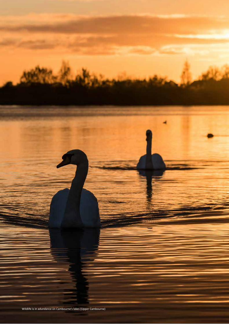
56Wildlife is in adundance on Cambourne’s lakes (Upper Cambourne)

57
Ecology08

58
Ecological achievements:Results of ongoing ecological surveys on site
The badger population has been protected and continues to thrive as do bats and
Pipistrelle bats now breed on site and Noctules and Daubenton bats have also been recorded.
Kingfishers now inhabit the new lakeside cliffs
Water voles and water shrews have moved onto the site and colonised the new ditches and streams.
Butterfly and dragonfly species have increased steadily from 8 and 4 to 25 and 17 respectively.
As the lakes mature the number and the variety of waterfowl is increasing.
65 species of bird have bred on site.
115 species of birds have been recorded on site, about 40 of which are new since 1996.
Great Crested Newts

59
Ecology
Since development commenced, the Cambourne site has gone from being a mono-culture of agricultural crops devoid of wildlife interest to become one of the most ecologically rich areas and the site of the County Wildlife Trust’s largest nature reserve.
Ecological studies
Ecological surveys of the area began in December 1994. Over the first year every area of semi-natural habitat was studied and characterised. Surveys undertaken included:
• recording species composition, dimensions and past and present management of every hedgerow;
• examining all trees and tree groups;• studying the structure of each existing small
farm woodland;• recording depth, substratum, aquatic vegetation,
aquatic invertebrates and any use by amphibians for every pond and watercourse;
• examining all small remnants of grassland;• searching the site and surrounding area for signs of
use by protected species, including bats, badgers, water voles, otters and great crested newts.
Ongoing studies monitoring protected species include:
• ‘Stage 2’ surveys for badgers - mapping signs of activity every two months;
• ‘Stage 3 surveys for badgers - feeding them bait and tracking their feeding habits in March of each year;
• surveying local watercourses for otter, mink and water voles in Spring-Summer of each year;
• checking all ponds, lakes, ditches and drains for the presence of great crested newts in April-May of each year;
• examining all trees for possible use by bats - surveys are carried out in Summer, Autumn, and mid-Winter;
• locating habitats suitable for use by protected bird species in early spring each year, keeping this habitat under supervision and locating their nesting territories;
• carrying out breeding bird surveys over all development sites locating nests of ground nesting birds.
“ We hope that developers elsewhere will learn
lessons from Cambourne and realise that places that are good for wildlife are places people want to live.
Brian Eversham, Director: Wildlife Trust for Cambridgeshire.Natural World Magazine. 2005
“Homes in Upper Cambourne enjoy stunning views over the adjacent lakes
60
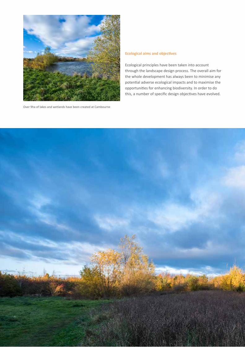
Ecological aims and objectives
Ecological principles have been taken into account through the landscape design process. The overall aim for the whole development has always been to minimise any potential adverse ecological impacts and to maximise the opportunities for enhancing biodiversity. In order to do this, a number of specific design objectives have evolved.
Over 9ha of lakes and wetlands have been created at Cambourne

61
These include:• protecting the existing habitats and species
of nature conservation value;• creating a microcosm of the ecological features of a
natural area;• using only native plant species, outside the villages
and formal entrance area, and planting in mixtures, situations and patterns appropriate to the area;
• extending and linking areas of existing habitats to create corridors and networks of wildlife habitat throughout the site;
• increasing public awareness and appreciation of nature conservation by providing interpretive facilities and resources and by encouraging community involvement.
New habitats include: woodland, scrub, carr, reed beds and wet meadows

Aerial view over Lower Cambourne
62

63
Homes for all
09

64

65
Homes for all
A range of homes: Variety and choice
Cambourne aims to deliver a range of homes of different types, tenures, sizes and styles to meet the needs of its growing community.

66Informal after school party on Upper Cambourne village green

67
Community infrastructure
10

68
Cambourne library and health centre
The ‘Copper Box’, Cambourne Police Station

69
Community infrastructure
A growing town
To complement the exceptional landscapes and wildlife rich ecology of the site, Cambourne also has a growing range of built facilities for the local community.
Schools:• 4 primary schools and 1 secondary school• Sunflower children’s nursery
Community• The Hub community hall• Cambourne parish council office• Cambourne library• Cambourne police station• Cambourne fire station• Cambridgeshire Wildlife Trust HQ• South Cambridgeshire District Council office• Cambourne burial ground• Cambourne trailer park
Health and fitness• Cambourne medical centre• Cambourne dentists• Cromwell veterinary practice• Lloyds pharmacy• Cambourne fitness and sports centre• Lower Cambourne cricket pavilion• Great Cambourne cricket pavilion• Cambourne sports and social club
Faith• Churches together ecumenical centre• Cambourne vicarage
1. The Belfry Hotel
2. Monkfield Primary School
3. The Hub’ community centre
1
2
3
70
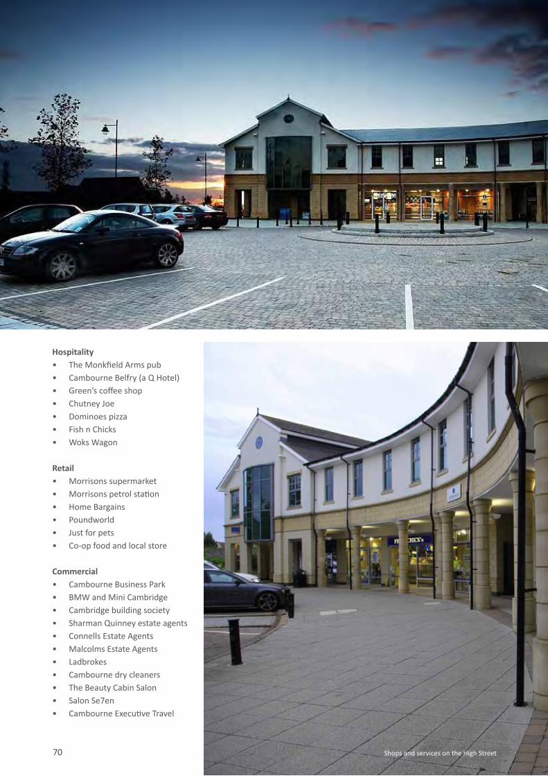
Hospitality• The Monkfield Arms pub• Cambourne Belfry (a Q Hotel)• Green’s coffee shop• Chutney Joe• Dominoes pizza• Fish n Chicks• Woks Wagon
Retail• Morrisons supermarket• Morrisons petrol station• Home Bargains• Poundworld• Just for pets• Co-op food and local store
Commercial• Cambourne Business Park• BMW and Mini Cambridge• Cambridge building society• Sharman Quinney estate agents• Connells Estate Agents• Malcolms Estate Agents• Ladbrokes• Cambourne dry cleaners• The Beauty Cabin Salon• Salon Se7en• Cambourne Executive Travel
Shops and services on the High Street

71
“ Cambourne is what many
consider to be a model Eco Town.Landscape Institute Awards:
Local Landscape Planning (Highly Commended). November 2010
“
Aerial view showing development of Cambourne High Street at 2011

72
Extract from Cambourne Landscape Structure Plan 1996 (RT)

73
LandscapeManagement
11

74
Landscape Management
With over 300 ha of open space at Cambourne, its long term management has been a major consideration for the clients consortium.
Randall Thorp have assisted the client by suggesting innovative partnership working with the County Wildlife Trust and Parish Council to minimise costs and maximise benefit for the client, the community and the environment. Randall Thorp have drawn up management proposals and maintenance contracts that meet the aims of all stakeholders and have taken these forward as traditional maintenance contracts and overseen the long term maintenance when this was transferred to other stakeholders.

75
Key objectives:• Habitat enhancement and creation• Establishment of ecologically diverse landscapes
(including open water and wildflower meadows)• Management and enhancement of existing
landscapes (trees, woodland and hedgerow)• Establishment of large scale new woodland planting• Management of large scale sustainable drainage
schemes (including lake and pond system)
Randall Thorp’s role:• Research into long term, site wide
management options • Negotiation of management aims• Production of site wide Landscape
Management Plans• Procurement and monitoring of maintenance
and management contracts• Overseeing standards of long term management• Drafting and implementing Woodland
Management Plans• Drafting and implementation of
Tree Management Plans
Cambourne country park is the centrepiece of a 100ha County Wildlife Trust nature reserve
Entrance to the country park

76
Randall Thorp Document ControlDoc Reference: Cambourne brochureAuthor(s): DLGraphic Design: ALChecker: DL/LCProduct status: PublishedQM status: CheckedChecked date: 2018-07-19
Photo credits:
Cambourne consortium:pgs 10, 48 (bottom), 68 (top & bottom), 69 (middle & bottom), 70 (top & bottom)
Randall Thorp (RT):pgs 24 (all), 38, 39, 40, 42 (top), 44, 45, 46, 47, 54, 64, 65, 66, 69 (top)
Clayton Hudson:front cover, pgs 62, 71
Dronescape (for RT):pgs 32, 36, 41, 43 (bottom), 48 (top), 50, 75 (bottom)
Nick Harrison (for RT):pgs 2, 7, 9, 22, 34, 35, 42 (bottom), 43 (top), 52, 56, 59, 60,61, 65 (top), 74, back cover
Back page: Upper Cambourne lakes at dusk

77

randallthorp.co.uk
An award winning landscape consultancy based in Manchester City centre, with over 30 years of experience providing landscape solutions for all types and scales of development across the UK.
Our large scale masterplanning and implementation work has won planning and design awards and is widely recognised as an exemplar of best practice. Over 25 years of experience at Cambourne has provided us with a range of skills and expertise resulting in our involvement in some of the UK’s major developments, including the expansion of Pinewood Film Studios into the UK’s largest media production facility and NW Bicester the UK’s first eco-town.


