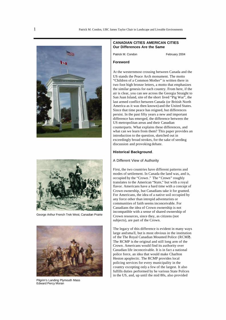
1 Patrick M. Condon, UBC James Taylor Chair in Landscape and Liveable Environments CANADIAN CITIES AMERICAN CITIES Our Differences Are the Same Patrick M. Condon February 2004 Foreword At the westernmost crossing between Canada and the US stands the Peace Arch monument. The motto “Children of a Common Mother” is written there in two foot high bronze letters, a motto that emphasizes the similar genesis for each country. From here, if the air is clear, you can see across the Georgia Straight to San Juan Island, site of the short lived “Pig War”, the last armed conflict between Canada (or British North America as it was then known) and the United States. Since that time peace has reigned, but differences persist. In the past fifty years a new and important difference has emerged, the difference between the US metropolitan areas and their Canadian counterparts. What explains these differences, and what can we learn from them? This paper provides an introduction to the question, sketched out in exceedingly broad strokes, for the sake of seeding discussion and provoking debate. Historical Background . A Different View of Authority First, the two countries have different patterns and modes of settlement. In Canada the land was, and is, occupied by the “Crown .” The “Crown” roughly translates to the American “State,” but with a royal flavor. Americans have a hard time with a concept of Crown ownership, but Canadians take it for granted. For Americans, the idea of a native soil occupied by any force other than intrepid adventurists or communities of faith seems inconceivable. For Canadians the idea of Crown ownership is not incompatible with a sense of shared ownership of Crown resources, since they, as citizens (not subjects), are part of the Crown. The legacy of this difference is evident in many ways large and sma ll, but is most obvious in the institution of the The Royal Canadian Mounted Police (RCMP). The RCMP is the original and still long arm of the Crown. Americans would find its authority over Canadian life inconceivable. It is in fact a national police force, an idea that would make Charlton Heston apoplectic. The RCMP provides local policing services for every municipality in the country excepting only a few of the largest. It also fulfills duties performed by he various State Polices in the US, and, up until the mid 80s, also provided George Arthur French Trek West, Canadia n Prairie Pilgrim’s Landing Plymouth Mass Edward Percy Moran
Transcript
1 Patrick M. Condon, UBC James Taylor Chair in Landscape and Liveable Environments
CANADIAN CITIES AMERICAN CITIES Our Differences Are the Same Patrick M. Condon February 2004 Foreword At the westernmost crossing between Canada and the US stands the Peace Arch monument. The motto “Children of a Common Mother” is written there in two foot high bronze letters, a motto that emphasizes the similar genesis for each country. From here, if the air is clear, you can see across the Georgia Straight to San Juan Island, site of the short lived “Pig War”, the last armed conflict between Canada (or British North America as it was then known) and the United States. Since that time peace has reigned, but differences persist. In the past fifty years a new and important difference has emerged, the difference between the US metropolitan areas and their Canadian counterparts. What explains these differences, and what can we learn from them? This paper provides an introduction to the question, sketched out in exceedingly broad strokes, for the sake of seeding discussion and provoking debate. Historical Background . A Different View of Authority First, the two countries have different patterns and modes of settlement. In Canada the land was, and is, occupied by the “Crown .” The “Crown” roughly translates to the American “State,” but with a royal flavor. Americans have a hard time with a concept of Crown ownership, but Canadians take it for granted. For Americans, the idea of a native soil occupied by any force other than intrepid adventurists or communities of faith seems inconceivable. For Canadians the idea of Crown ownership is not incompatible with a sense of shared ownership of Crown resources, since they, as citizens (not subjects), are part of the Crown. The legacy of this difference is evident in many ways large and sma ll, but is most obvious in the institution of the The Royal Canadian Mounted Police (RCMP). The RCMP is the original and still long arm of the Crown. Americans would find its authority over Canadian life inconceivable. It is in fact a national police force, an idea that would make Charlton Heston apoplectic. The RCMP provides local policing services for every municipality in the country excepting only a few of the largest. It also fulfills duties performed by he various State Polices in the US, and, up until the mid 80s, also provided
George Arthur French Trek West, Canadian Prairie
Pilgrim’s Landing Plymouth Mass Edward Percy Moran
2 Patrick M. Condon, UBC James Taylor Chair in Landscape and Liveable Environments
the services associated with the FBI, the Secret Service, the CIA, and the National Security Council. Yet not once have I heard Canadians suggest that this agency, often derided for incompetence but nearly always still viewed with affection, be broken up into more governable and less powerful units. The basic distrust of Americans to authority, born of revolution against the same Crown that Canadians still honor, bred a deep hostility to national law enforcement, such that in Canada where there is one law enforcement agency, in the US there are thousands. A Different Economy Canada was settled more by a corporation than by a people. The Hudson Bay Company, originally a “Crown Corporation” and therefore a corporate arm of the “state,” was one of the first global corporations. Against this background, the aversion of American Colonists to the corporate arm of the state can be more readily understood. This author grew up in Boston yet I could never figure out the revolutionary appeal of dumping tea off a boat. I can now more readily understand why tea was seen as the instrument for British global imperialism. In Canada the evidence of Crown Corporation influence is all around. It now seems a benign if not quaint presence. The Hudson Bay Company and the East India Tea company still exist, despite the temporary troubles in the American colonies. A Different National Ethos The two countries have starkly different national mottos. Life, Liberty, and the Pursuit of Happiness is America’s valiant Enlightenment Era call to arms. Just hearing it stiffens the backs of Americans and makes them ready to risk national blood and treasure
Canada: The RCMP. A national police force, symbol of the kinder gentler State/Crown
Revolution: East India Company, temporary losses at Boston Tea Party
3 Patrick M. Condon, UBC James Taylor Chair in Landscape and Liveable Environments
for this concept. How different from Canada’s motto: Peace, Order and Good Government. The former speaks of the romantic and sometimes arrogant battle for individual power and rights, the later of the pragmatic if not downright boring long term business of keeping things orderly and quiet. This difference is particularly obvious when engaged in official meetings or public discourse. Canadians can be just as assertive as Americans but will seldom argue a point on the basis of their individual “rights”. A Different Way of Settling the Land These differences in culture generated different settlement patterns. In the USA, the areas west of the Appalachians were settled by individual homesteaders, ranchers, and prospectors looking for a new life and financial gain. In Canada the arm of the Crown was more significant. Police power, corporate presence, and missionaries pioneered strategic locations together, establishing forts that were Christian mission, corporate branch office, and police station all in one. A Different City Form Flush from the victories of the American Revolution, Thomas Jefferson speculated on the ideal street plan for the American capital, the first democracy since the fall of Athens. It was natural for him and others to associate classical Greek forms with democratic ideals. Thomas Jefferson’s plan for Washington DC revived the democratically uniform and
Canada: “Peace Order and Good Government” 1867 Constitution Act
USA: Prairie Homestead. People first, churches and military second. Corporations much later
Fort Simpson: Hudson Bay Company, missionaries and Military all at once
Plan in Jefferson’s hand for Washington D.C.
4 Patrick M. Condon, UBC James Taylor Chair in Landscape and Liveable Environments
undifferentiated grid of Classical Greek colonial cities. Jefferson was understandably dismayed when President Washington chose L’Enfant’s more hierarchical radial forms for the new capital. In Canada no such debate took place. Canada was simply a successful and relatively stable outpost of the British Empire where Enlightenment ideas were slower to penetrate. The Agrarian Utopia Despite the setback at Washington D.C., Jefferson’s ideas eventually prevailed on a much wider field of play, the continent itself. The astonishing continental scale checkerboard pattern of the great Mississippi basin expresses perfectly his concepts for a democratic agrarian utopia, one where honest farmers could extracted earth’s gifts from individual effort in concert with their fellow citizens. In Canada the utopian ambitions of the survey project are much less in evidence, even though the same measuring tools (Gunter’s Chain) and land disposal techniques were employed. The Democratic City When laying out new cities, US authorities applied the democratic grid (and even the same Gunter’s Chain instrument) at a more intimate scale, laying out urban blocks on a cardinal axis, ten chains long and five chains wide. Relatively uniform parcels and streets meant that no citizen would be situated in an exalted status. If any location was raised to prominence it was inevitably a public building such as a court house or city hall. The scale of the city building enterprise did not influence this ethos, as the plan for Seattle demonstrates.
USA: Ideal form for agrarian utopia in Iowa
Block and street plat for Seattle
L’Enfant’s plan for Washington D.C.
5 Patrick M. Condon, UBC James Taylor Chair in Landscape and Liveable Environments
Unsettled Differences The Issue of Quebec Americans should resist the temptation to see Canada as without problems. A number of apparently intractable ones exist; largest among them is the issue of Quebec. Canada contains a defeated nation within it, French Quebec. Brought into the country under force of arms by British North America, the insult has not been forgiven, the wound has not healed. This ongoing conflict makes it nearly impossible to finalize a Canadian constitution or extend federal authority much beyond colonial era institutions such as the RCMP. For example, air quality and water quality standards are set by the individual provinces since, absent a firm constitutional foundation, Canadian federal authority over health and welfare of citizens has never been established. The First Nations within our Nation Americans should also resist the temptation to think all is well between Canadians and aboriginal cultures within the country. While nothing like the famous and tragic American “Indian wars” occurred here, aboriginals were the victims of often well meaning but in the end equally tragic acts. BC was and is home to scores of separate aboriginal nations, each with their own language and culture. The Vancouver urban area was populated by the Coast Salish peoples. While only rarely were the Salish forcibly removed from their coastal villages (villages that were inevitably on south facing outwash areas where fresh water met salt water) they were forced to move from traditional structures and desist from traditional sacred rites and art forms. Salish children were taken to boarding schools without parental consent. Abuse, it has been revealed, was all too common at these schools . North Vancouver, Vancouver, Nanaimo, Squamish, and many other BC municipalities were literally built around aboriginal settlements. These settlements are a legacy and daily reminder of a colonial issue that lives on, a dramatic and in many cases contentious and troubling reminder of a colonialist legacy. Evidence of this this legacy is not confined to reserves but is also apparent on Vancouver’s streets to a much greater extent than is American officials would tolerate. Here prostitution is legal (only pimping is illegal) and obvious. Native peoples are
British General Wolf as British take Quebec on the Plains of Abraham
Typical Salish village
First Nations reserve, North Vancouver/West Vancouver
6 Patrick M. Condon, UBC James Taylor Chair in Landscape and Liveable Environments
disproportionately represented among street sex workers where they are typically drug addicted and always at risk. Nearly half of the scores of the Vancouver women kidnapped and killed by a serial killer over the course of four years were aboriginal. Their disappearance, although reported by friends and family to police over the years, did not provoke a comprehensive investigation until recent months. An Underclass Legacy The First Nations problem can be seen as a part of or as related to the larger problem of inequality and inequity in Canadian culture. The physical pattern of the downtown east side can be read as a legacy of this inequity. While density is now back in fashion, there is something unseemly about this crowded landscape, particularly since Chinese residents of Vancouver were at one time confined by law to this area. The Downtown East Side, for generations the home of down on their luck and alcoholic middle aged men living in single room occupancy hotels, has more recently become home to younger drug addicts of both sexes. The Downtown East Side has the highest concentration of AIDs cases of any urban district in North America. It is also now the location of North America’s first and only legal injection site. A Country on a Fringe While Canadians understandably resist any notion of dependence on the US, nighttime Satellite mosaics make this dependence transparently clear. Eighty percent of all Canadians live within 70 miles of the US border. The US is Canada’s number one trading partner, and Canadians were as concerned as Americans over who Carrie would pick, with national sentiment leaning toward Mr. Big. Impressive Rails, Modest Roads Canada has always feared the much larger economy of the US. In the late 1800s Canada nearly bankrupted itself building not one but two east to west railroads. This investment ma kes the Marshall plan look cheap in comparison, particularly since east west trade was virtually nonexistent at the time and never has been strong enough to justify the expense, particularly when the American system was accessible. The Trans Canada Highway has a similar rationale, although Americans accustomed to choosing from 7 different limited access four lane highways to cross a seemingly endless prairie are surprised to find tha the “Trans Canadian Highway” is, for the most part, just a two lane surface road.
Ethnic Chinese at one time restricted to the one small section of downtown Vancouver
State sponsored rail building insured, at great cost, an east-west national economy
7 Patrick M. Condon, UBC James Taylor Chair in Landscape and Liveable Environments
A Bulge of Bulging Baby Boomers Native Canadians are not having children fast enough to replace themselves. If it were not for immigration Canada would have negative population growth (like Italy, Japan and Sweden). The United States is the only Western nation avoiding this trend. Canada has traditionally felt compelled to accept immigration at a rate sufficient such that our population does not fall below 10% of that of the US (currently Canada at 30 million, USA at 270 million). Even with immigration, Canada will have difficulty adjusting to the aging of the boomers as they require more health care and cease to be economically productive. Our Differences are the Same But despite all that, and after much consideration, this author has concluded that US and Canadian cities had become, by 1940, virtually identical. Examination of aerial photographs from the early twentieth century show and identical city form: the gridded city, with 600 foot by 300 foot urban blocks, was a standard for both Canada and the US. Urban densities were similar, as was the land use mix (the notable exception, which still persists, was and is in the number of churches - Americans are twice as likely to go to church as Canadians and thus have twice as many churches per capita). The gradual congruence of the pre WWII Canadian and American city appears to be driven by technology rather than ideology, and that technology appears to be the streetcar.
Vancouver? Seattle?
Seattle? Vancouver ?
8 Patrick M. Condon, UBC James Taylor Chair in Landscape and Liveable Environments
Roads Make It America That congruence was short lived. After WWII American neighborhoods, previously the same as their Canadian counterparts, begin to change. In Vancouver and Toronto, streetcar neighborhoods stay recognizably the same. In Los Angeles and other US cities they begin to change dramatically. Previously continuous commercial street walls are eroded for surface parking. This raises the question, what happened to provoke this rapid divergence. What happened was the freeway. While it seems impossible to us today, Los Angeles once had the world’s largest and most extensive system of streetcars and interurban rail lines. This system was completely dismantled by 1960. National City Lines, a “transit” company owned outright by GM, Firestone, and Phillips Petroleum was formed to purchase urban streetcar lines, notably in Los Angeles, with the intention of dismantling them. In 1949 GM was convicted of anti trust violations for this practice, but by then it was too late. With the passing of the National Defense Highway Act in 1953, the US committed itself to a radically different transportation strategy than did Canada. In the US 90% of all cost for building limited access highways was borne by the federal government. In Canada the federal contribution averaged less than 10%. In the US the entire federal tax on gas at the pump was put into a “Highway Trust Fund” for use exclusively for building highways. In Canada, the federal gas tax went into general revenue. Very little of this money ever came back to the province for highways. The comparison between Canadian cities and US cities in this respect is stark. Compare the maps (same scale) of LA to that of Vancouver.
City of Los Angeles streetcar system
Los Angeles County by the 80’s
Vancouver region freeways
9 Patrick M. Condon, UBC James Taylor Chair in Landscape and Liveable Environments
The Case of St. Louis and Urban Decline In the US, opinion about the influences of highways on urban decline differs widely. These differences are understandable, as powerful interests are involved. However, in the case of St. Louis it is difficult to escape the conclusion that highway building has done a good deal of harm to the center city, whatever value it has had elsewhere in the region. Vast areas of abandoned blocks can be seen in aerial photos. Certainly billions of dollars worth of infrastructure investment lies wasted. The blocks shown are by no means unrepresentative. Canadian cities exhibit nothing remotely similar. While factors of race are most certainly involved in this US phenomenon, the monumental investment in highways made in St. Louis, even though population there was relatively stable, would certainly have tended to oversupply the amount of accessible lands relative to population and regional GDP. In this way, from a Canadian perspective, it appears that the highway building efforts in St. Louis might have been designed to devalue these previously high density walk able areas, setting in motion a gradual migration to more suburban car dependant locations. The US has many proponents for this approach. Many think tank and lobbyist groups exist to provide the rationale. The Public Purpose located in St. Louis is only one of them. This and similar groups tie highway building to the aforementioned American ethos of life liberty and the pursuit of happiness. They equate mobility with fundamental notions of freedom and opportunity. When confronted with the example of St. Louis they are likely not troubled, seeing this abandonment as a natural consequence of folks voting with their feet when other lower density, and inevitably more car dependant options are available to them. Yet one notices a disturbing persistence of certain interests in supporting this position. The list of foundations and corporations that support the Public Purpose includes a depressing number of corporations whose motivations may not be solely patriotic. It is also worth noting that two of the three corporations involved in the conspiracy to dismantle the Los Angeles transit system are also on this list of supporters. Perhaps Canada has resisted this highway building urge because Canada lacks such a dedicated group of corporate givers.
St. Louis highway network
St. Louis city center
The Public Purpose think tank
10 Patrick M. Condon, UBC James Taylor Chair in Landscape and Liveable Environments
Density Matters Certainly everyone here knows how difficult it is to promote smart growth options in already car dependant metropolitan areas. As density decreases car dependence increases such that in certain sprawling US Metropolitan areas the per capita vehicle miles traveled exceeds 20,000. In most Canadian cities, even though car ownership per capita is similar, vehicle miles traveled per capita is 30 to 40 percent less. Highways Support Understandable Urges Toward Low Density And while many traditional cities like Boston still show respectable transit ridership numbers, the trends are not favorable . Closer examination shows that the large majority of that ridership comes from pre WWII “streetcar” neighborhoods. Newer neighborhoods are becoming less and less dense and thus more and more car dependent. Entire Massachusetts second and third ring suburbs are restricted to low and very low density development, with 5 acre minimum lot sizes not unheard of. This trend seems to be fueled by what is, in Canadian terms, an oversupply of accessible urban land. The instrument for that access is, again in Canadian terms, an oversupply of freeways. When the supply of metropolitan land is immense (and in the case of the Boston metro area even includes portions of three states), raw land is available for less, and sometimes far less, than $200,000 an acre. At this price upper middle class home buyers can afford large lot homes, undercutting the market for more pedestrian and transit friendly alternatives. Fewer Highways Supports Pedestrian Friendly Marketplace Canadian Cities, Vancouver, Toronto, and Montreal in particular, exhibit a different pattern of development. The vast majority of new development occurring at the rural metropolitan interface is, by American standards, high density. The 4 to 5,000 square foot lot is the norm, with a gross density of about 6-8 du/acre typical. Why such a big difference? It seems that land price is more of a factor than policy, or national culture. With the supply of accessible land limited by fewer high speed highways to the hinterlands, land prices are high. M iddle class and upper middle class Canadians quite reasonably favor housing at densities where land price constitutes a reasonable proportion of the final purchase price.
1 – 5 acre lots cut into the forest are the norm in most of Boston’s second and third ring suburbs
1/8th acre lots are the norm at the fringes of most Canadian metropolitan areas
11 Patrick M. Condon, UBC James Taylor Chair in Landscape and Liveable Environments
St. Louis and Vancouver Compared – A Case Study In short, the hypothesis is simp le: The more highway miles per capita the less will be the real appreciation of established neighborhoods close to the center. This idea is not entirely new so we were disappointed at the dearth of research that spoke specifically to our question, and found none that cross compared US and Canadian cities. Consequently we have been exploring this hypothesis on our own. We cross-compared the Canadian cities, Vancouver, Toronto, and Calgary with US Cities Seattle, Portland, and St. Louis. The most revealing of these cross comparisons was that between Vancouver and St. Louis , Vancouver and St. Louis began their highway building period at roughly the same time and both have a population of about two million. St. Louis, Binging on Highways 1960 Of the metropolitan areas that we studied, St . Louis had by far the most lane miles per capita. Six times more freeway lane miles per capita than Vancouver and twice as much freeway per capita than Seattle. 1970 Forty years of highway building has transformed North American metropolitan areas. Vancouver is unique in the group in one important respect. It is the only large North American metropolitan area with no freeway miles within the core metropolitan municipality.
St. Louis 1960
Vancouver 1960
St. Louis 1970
St Louis 1960
Vancouver 1970
12 Patrick M. Condon, UBC James Taylor Chair in Landscape and Liveable Environments
1980 After many years living in Vancouver this author is now convinced that a modern city can survive and prosper without freeways. The alternative to the freeway is surface roads, and lots of them 1990 Careful study of the operation of the Vancouver regional street system reveals the crucial role played by surface arterials and the local fine grain street grid. The fine grain and widely distributed grid of local streets and “streetcar” arterials has a much greater capacity to move traffic than a concentrated freeway system. The downside is, of course, speed. But with morning commutes on the LA Freeway system averaging about 12 miles per hour, speed is no longer a factor. 2000 Freeways compromise the surface arterial system in the older neighborhoods traversed, while eliminating the local street grids capacity to allow beneficial “rat running” during congested periods. In the case of St Louis the data provided below, while inadequate by itself to show a direct cause-effect relationship between highways and declining value, does not contradict the hypothesis. And while crime and race most certainly played a role in St. Louis’s fate, those same factors existed in other US cities where the collapse of urban value has somehow been avoided.
St. Louis 1990
Vancouver 1990
Vancouver 2000
St. Louis 2000
13 Patrick M. Condon, UBC James Taylor Chair in Landscape and Liveable Environments
St. Louis Census Tracts The chosen census tracts were all inner ring “trolley car neighborhoods” equidistant from the core and, from what we could observe, represented the typical range of conditions and basic house values common to this era. St. Louis Charts Financial values taken from census information were adjusted for inflation. Two of the three St . Louis neighborhoods experienced significant drops in value over the forty years and one stayed stable. In one of the St. Louis neighborhoods examined the value per dwelling unit dropped to just 20,000, too low to prevent the abandonment which was prevalent in this tract. During this period there was a doubling of highway miles per capita. The Hypothetical Mr. Rangel Using these figures we can examine the case of the hypothetical Mr. Rangel, who bought a home in the most unfortunate tract in 1960 for 33,000 US (in inflation adjusted year 2000) dollars. In the year 3000 he sold his home for 21,000 dollars, a loss of 12,000 in real valu e. He might take some consolation in the fact that his share of the regional highway system is among the highest in America, at 3 feet 6 inches. St. Louis was the only metropolitan area examined that has consistently increased the number of freeway miles per capita over the 40-year period studied.
St. Louis, Missouri
$0.00
$10,000.00
$20,000.00
$30,000.00
$40,000.00
$50,000.00
$60,000.00
$70,000.00
1960s 1970s 1980s 1990s 2000 and beyond
Pro
per
ty V
alu
es (
US
$)
Tract1241
Tract 1181
Tract 1114
0.00000
0.20000
0.40000
0.60000
0.80000
1.00000
1.20000
1960s 1970s 1980s 1990s 2000 and beyond
Hig
hw
ay m
eter
s p
er c
apit
a
St. Louis Census Tracts
Property values over time
Highway meters per capita
14 Patrick M. Condon, UBC James Taylor Chair in Landscape and Liveable Environments
Vancouver Census Tracts The Vancouver tracts chosen were similar to those studied in St . Louis in density, house and parcel type, and distance from the center. Vancouver Charts In 1960, all three tracts had a similar average value in 1960, about $80,000 Canadian in inflation-adjusted year 2000 dollars. By the year 2000 the average value of homes in the three tracts had risen to about 350,000, or a 400% real value increase. The Hypothetical Mrs. Campbell Using these figures we can do a comparative case study for Vancouver, on a hypothetical Vancouver retiree named, inevitably, Campbell. Mrs. Campbell’s real gain on the home was over $300,000, value available to her for her retirement or to assist her children. Unfortunately her share of a regional freeway system, at a mere six inches, is only 15% of that enjoyed by Mr. Rangel.
Vancouver, British Columbia
$0.00
$100,000.00
$200,000.00
$300,000.00
$400,000.00
$500,000.00
$600,000.00
1960s 1970s 1980s 1990s 2000 and beyond
Pro
per
ty V
alu
e (C
DN
$)
Tract 18
Tract 45
Tract 54
Vancouver Census Tracts
Property values over time
Highway meters per capita
0.00000
0.05000
0.10000
0.15000
0.20000
0.25000
0.30000
0.35000
1960s 1970s 1980s 1990s 2000 and beyond
Hig
hw
ay M
eter
s p
er C
apit
a
15 Patrick M. Condon, UBC James Taylor Chair in Landscape and Liveable Environments
Calgary Charts The pattern for Calgary supports the hypothesis, showing maximum value gains during times of declining per capita freeway share . Toronto Charts Toronto tracts show a doubling of real value over the same 40 year period. Toronto performance ranks in the middle, and interestingly ranks in the middle for freeway miles as well. It has twice as much freeway per capita as Vancouver and less than half that of St. Louis.
Calgary, Alberta
$0.00
$50,000.00
$100,000.00
$150,000.00
$200,000.00
$250,000.00
$300,000.00
1960s 1970s 1980s 1990s 2000 and beyond
Pro
per
ty V
alu
e (C
DN
$)
Tract 21/25
Tract 57
Tract 62
0.00000
0.10000
0.20000
0.30000
0.40000
0.50000
0.60000
0.70000
0.80000
0.90000
1960s 1970s 1980s 1990s 2000 and beyond
Hig
hw
ay (
met
ers
per
cap
ita)
Toronto, Ontario
$0.00
$100,000.00
$200,000.00
$300,000.00
$400,000.00
$500,000.00
$600,000.00
$700,000.00
1960s 1970s 1980s 1990s 2000 and beyond
Pro
per
ty V
alu
e (C
DN
$)
Tract 82
Tract 94
Tract 122
Property values over time
Property values over time
Highway meters per capita
0.00000
0.10000
0.20000
0.30000
0.40000
0.50000
0.60000
1960s 1970s 1980s 1990s 2000 and beyond
Hig
hw
ay m
eter
s p
er c
apit
a
Highway meters per capita
16 Patrick M. Condon, UBC James Taylor Chair in Landscape and Liveable Environments
Seattle Charts The values in Seattle tracts take off at the same time that the per capita share of freeways drops off. Seattle residents have half the freeway miles per capita as residents of St. Louis, but three times more than Vancouver residents. Portland Charts Finally, Portland tracts also confirm the pattern. Portland area residents have the lowest per capita share of highways of the US cities studied, but still have twice that of Vancouver residents. The value of their homes has increased, over the same period, by an average of 300%.
Seattle, Washington
0
50000
100000
150000
200000
250000
300000
350000
400000
1960s 1970s 1980s 1990s 2000 and beyond
Pro
pert
y V
alue
s (U
S$)
Tract 60
Tract 75
Tract 103
Property values over time
0.00000
0.10000
0.20000
0.30000
0.40000
0.50000
0.60000
0.70000
1960s 1970s 1980s 1990s 2000 and beyond
Hig
hway
met
ers
per c
apita
Highway meters per capita
Portland, Oregon
0
50000
100000
150000
200000
250000
300000
1960
s19
70s
1980
s19
90s
2000 a
nd bey
ond
Pro
per
ty V
alu
es (U
S$)
Tract 11.01
Tract 39.01
Tract 49
0.00000
0.10000
0.20000
0.30000
0.40000
0.50000
0.60000
1960s 1970s 1980s 1990s 2000 and beyond
Property values over time
Highway meters per capita
17 Patrick M. Condon, UBC James Taylor Chair in Landscape and Liveable Environments
The Affordable Housing Question While we can feel happy for Mrs. Campbell and sad for Mr. Rangel, this information might raise a different and troubling question. Doesn’t this information lend credence to those who argue that smart growth discriminates against the poor and minorities, making housing costs climb beyond reach? Again, Vancouver provides an instructive case study. The very dramatic increases in house costs have, interestingly and counterintuitively, led to an explosion in the number of affordable rental units in the City. Here is why. When Mrs. Campbell sold her three bedroom bungalow, the market price for her home was nearly $400,000. But the average Vancouver home buyer could only afford about $250,000. Who bought the house and how did they pay for it? Vancouver buyers of average family income found a solution: the illegal suite. In thirty years, the number of Vancouver secondary suites, most of them technically illegal, has risen from practically none to the tens of thousands. Without the income from rental suites, young families could not afford to purchase the home. Without homeowners who are willing to rent out portions of their homes, thousands of lower income earners would be hard pressed to find decent and affordable accommodations. This market context provides three main benefits: 1. It provides an economic motive for dividing houses that are overlarge for today’s small families. 2. It provides more customers within walking distance of local shopping and regional transit . 3. It provides a market mechanism for creating affordable rental units for lower income citizens. Sustainable Methods for a Sustainable World - The Damascus Design Workshop Turning around such a powerful machine is a daunting challenge. But changing the city for the better is possible or we would not be here. And while many vested interests are supporting the status quo, groups such as your own can blunt and possibly reverse the influence of this thinking. I would like to provide an example of a foundation supported project that has already changed the terms of debate in Portland. Two years ago 1000 Friends of Oregon and The Coalition for a Livable Future invited us to help them organize a major regional design initiative.
Average rental prices for secondary suites are than prices charged in apartment buildings
High property values and allowance for two to three DU per lot is promoting radical re-investment in Vancouver Neighborhoods .
18 Patrick M. Condon, UBC James Taylor Chair in Landscape and Liveable Environments
Collectively we designed and implemented a multi party planning and design exercise centered on a week long design charrette. The subject area was a 25,000 acre potential UGB expansion in the Damascus area of the Portland Metro. This initiative provided an extra -governmental forum where urban development assumptions that lead to sprawl, particularly those relating to transportation and infrastructure, could be effectively challenged. At the same time, the design workshop provided an effective means to field test state, federal and regional policies for more sustainable planning. The workshop proved that parties from disparate stakeholder interest groups can work collectively and find consensus quickly on often contentious issues – issues including density, traffic, and environmental protection. Of particular importance: the workshop group proved, to the satisfaction of many if not all of the experts in attendance, that a distributed transportation network comprised of “transit” arterials, rural parkways, and local streets could function as well or better than a proposed freeway, and at much lower cost. The full report from this project can be downloaded at http://www.sustainable-communities.agsci.ubc.ca/Damascus/Final%20Report.htm I mention just this one example of productive collaborative processes that can reverse the trend towards increasingly unsustainable communities. Attendees at this conference certainly have hundreds more . Conclusion To return then to the theme of this overview: The only truly significant difference we find between the modern American city and its Canadian counterpart is the dramatic disparity in per capita expenditure on highways. This seems to have affected the economic playing field in both obvious and unanticipated ways. Our hope is that this cross comparison will provide clues to help US foundations make strategic investments as American freeway miles per capita continue to fall. For our Canadian members we hope that this information sheds some additional light on the fortuitous circumstances we are in when comparing ourselves to many US cities, and allows us to reflect on ways to extend and enhance these relative benefits in the future.
Damascus urban design proposal
Proposed Damascus area land use plan
Damascus center illustration, 2040 vision. ACKNOWLEDGEMENTS. Research for this article was conducted by Center for Landscape Research Apprentices Hongbing Hochen, Erika Mashig, Leigh Sifton and Claire Tebbs. Claire Tebbs also acted as team leader and performed additional preliminary research work. Partial funding to support this project comes from the Funder’s Network for Smart Growth.