Service Assessment Central Florida Tornado Outbreak February 22-23, 1998 U.S. DEPARTMENT OF COMMERCE National Oceanic and Atmospheric Administration National Weather Service Silver Spring, Maryland
Transcript
Service Assessment
Central Florida Tornado OutbreakFebruary 22-23, 1998
U.S. DEPARTMENT OF COMMERCENational Oceanic and Atmospheric AdministrationNational Weather ServiceSilver Spring, Maryland
Cover: Aerial view of the Ponderosa RV park in Kissimmee, Florida, showing a narrow path ofnearly total destruction. Three permanent structures in the park (office, laundry, shower/bathhouse) provided safe shelter. However, numerous fatalities occurred in this park. Photo courtesyof Robert Sheets.
Service Assessment
Central Florida Tornado OutbreakFebruary 22-23, 1998
June 1998
U.S. DEPARTMENT OF COMMERCEWilliam M. Daley, Secretary
National Oceanic and Atmospheric AdministrationD. James Baker, Administrator
National Weather ServiceJohn J. Kelly, Jr., Assistant Administrator
ii
Preface
The devastating tornadoes that struck central Florida the night of February 22-23, 1998,resulted in a decision by the National Weather Service (NWS) to conduct a Service Assessment. Service Assessments and their subsequent reports are used by the NWS to examine theperformance of its offices in providing timely warnings, accurate forecasts and other services toenable the public to minimize loss of life and property damage.
The findings and recommendations developed by the Service Assessment Team will beincorporated into the ongoing process of improving NWS products and services to the citizens ofthe Nation.
John J. Kelly, Jr.Assistant Administrator for Weather Services
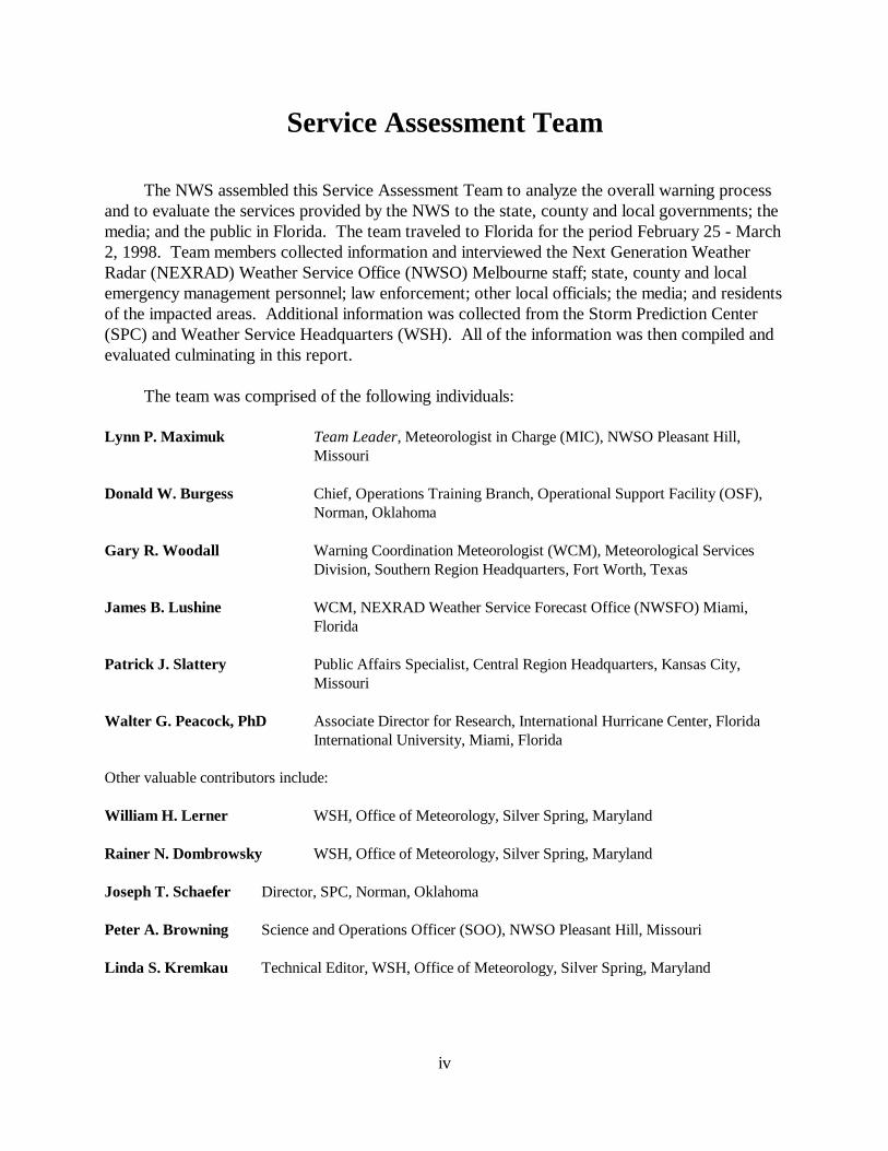
The NWS assembled this Service Assessment Team to analyze the overall warning processand to evaluate the services provided by the NWS to the state, county and local governments; themedia; and the public in Florida. The team traveled to Florida for the period February 25 - March2, 1998. Team members collected information and interviewed the Next Generation WeatherRadar (NEXRAD) Weather Service Office (NWSO) Melbourne staff; state, county and localemergency management personnel; law enforcement; other local officials; the media; and residentsof the impacted areas. Additional information was collected from the Storm Prediction Center(SPC) and Weather Service Headquarters (WSH). All of the information was then compiled andevaluated culminating in this report.
The team was comprised of the following individuals:
Lynn P. Maximuk Team Leader, Meteorologist in Charge (MIC), NWSO Pleasant Hill,Missouri
Donald W. Burgess Chief, Operations Training Branch, Operational Support Facility (OSF),Norman, Oklahoma
Gary R. Woodall Warning Coordination Meteorologist (WCM), Meteorological ServicesDivision, Southern Region Headquarters, Fort Worth, Texas
James B. Lushine WCM, NEXRAD Weather Service Forecast Office (NWSFO) Miami,Florida
Patrick J. Slattery Public Affairs Specialist, Central Region Headquarters, Kansas City,Missouri
Walter G. Peacock, PhD Associate Director for Research, International Hurricane Center, FloridaInternational University, Miami, Florida
Other valuable contributors include:
William H. Lerner WSH, Office of Meteorology, Silver Spring, Maryland
Rainer N. Dombrowsky WSH, Office of Meteorology, Silver Spring, Maryland
Joseph T. Schaefer Director, SPC, Norman, Oklahoma
Peter A. Browning Science and Operations Officer (SOO), NWSO Pleasant Hill, Missouri
Linda S. Kremkau Technical Editor, WSH, Office of Meteorology, Silver Spring, Maryland
v
Acronyms
AFOS Automated Field Observing SystemAWIPS Automated Weather Interactive Processing SystemCRS Console Replacement SystemCWA County Warning AreaEAS Emergency Alert SystemESATCOM State Satellite Communication SystemEST Eastern Standard TimeFAA Federal Aviation AdministrationFAR False Alarm RatioHWO Hazardous Weather OutlookITWS Integrated Terminal Weather SystemMIC Meteorologist in ChargeNEXRAD Next Generation Weather RadarNOAA National Oceanic and Atmospheric AdministrationNSSL National Severe Storms LaboratoryNWR NOAA Weather RadioNWS National Weather ServiceNWSO NEXRAD Weather Service OfficeNWSFO NEXRAD Weather Service Forecast OfficeOSF Operational Support FacilityPC Personal ComputerPOD Probability of DetectionPUP Principal User ProcessorROAMS Remote On Air Monitoring SystemRPG Radar Product GeneratorSOO Science and Operations OfficerSPC Storm Prediction CenterSPS Special Weather StatementSVS Severe Weather StatementTDA Tornado Detection AlgorithmTDWR Terminal Doppler Weather RadarWCM Warning Coordination MeteorologistWDSS Warning Decision Support SystemWSH Weather Service HeadquartersWSR-88D Weather Surveillance Radar-1988 DopplerWISE Warning and Interactive Statement Editor
1
Event Summary
Overview
An outbreak of unusually strong tornadoes in east-central Florida during the late night andearly morning hours of February 22-23, 1998, was the most deadly in the state’s history. Between approximately 11 p.m. and 2:30 a.m. Eastern Standard Time (EST) (EST will be usedthroughout this report), seven tornadoes swept through the NWSO Melbourne county warningarea (CWA), killing 42 people and injuring more than 260 others. The previous high tornadodeath toll in Florida was 17, which occurred on March 31, 1962, in the Florida Panhandle (SantaRosa County). In terms of single-event, weather-related fatalities in Florida, this event ranks asthe ninth greatest in loss of life. The largest number of single-event, weather-related deaths inFlorida occurred during the 1928 hurricane that killed more than 1,842 people near LakeOkeechobee.
The tornadoes were unusually strong for the area and produced damage estimated in excessof $100 million. Three of the storms were rated in the F3 category (158-206 mph) on the FujitaTornado Intensity Scale (see Appendix A). More than 3,000 structures were damaged and morethan 700 destroyed. This Service Assessment focused on the NWSO Melbourne CWA, althoughthere were two brief tornado touchdowns in the NWSO Tampa Bay CWA earlier in the evening.
Storm Summary
During the evening of February 22, the atmosphere over east-central Florida was primed fora devastating severe weather outbreak (Figure 1). A strong upper trough associated with astronger-than-normal subtropical jet stream (wind speeds of 140 knots) was approaching theFlorida Peninsula from the west. From a surface low near Mobile, Alabama, a surface cold frontarced southeastward over the Gulf of Mexico, nearing the western Florida coast. A line ofthunderstorms was moving eastward just ahead of the frontal boundary. Afternoon pre-frontalthunderstorms over southern Georgia and northern Florida had left behind a surface outflowboundary, stretching from near Daytona Beach on the east coast to northeast of Tampa on thewest coast. The air mass south of the outflow boundary and east of the front was warm, moist,and very unstable. The formation of a strong, nocturnal, low-level jet (winds greater than 50knots just 1,000 feet above ground level) was coupled with the subtropical jet further aloft toproduce very strong vertical wind shear over the peninsula.
Three supercell thunderstorms formed as the storm line moved ashore from the Gulf ofMexico and interacted with the stationary outflow boundary, the instability, and the strong windshear. Supercell storms are hazardous because they last for long periods of time, rotate, and arethe parents of many strong and violent tornadoes. As the three supercells quickly moved acrosseast-central Florida, they produced seven tornadoes in the NWSO Melbourne CWA (Figure 2).
2
Figure 1. Synoptic Setting, 7 p.m. EST, February 22, 1998.
3
#1 F2 tornado touched down in Volusia County at 10:55 p.m.—1 fatality, 3 injuries.#2 F3 tornado touched down in Lake County at 11:37 p.m., entered Orange County at 11:41 p.m., first fatalities
around 11:50 p.m., lifting at midnight—3 fatalities, approximately 70 injuries.#3 F3 tornado touched down in Seminole County at 12:10 a.m., first fatalities around 12:15 a.m. near Sanford, lifting
at Volusia County at 12:25 a.m.—13 fatalities (12 - Seminole County, 1 - Volusia County), approximately 36injuries.
#4 F3 tornado touched down in Osceola County at 12:40 a.m., first fatalities at 12:50 a.m. in Kissimmee, crossedinto Orange County at 12:55 a.m., lifting at 1:28 a.m.—25 fatalities, 150+ injuries.
#5 F2 tornado touched down in Volusia County at 12:45 a.m.—no fatalities or injuries.#6 F1 tornado touched down in Brevard County at 1:38 a.m.—no fatalities or injuries.#7 F1 tornado touched down in Brevard County at 2:30 a.m. near Port Canaveral—no fatalities or injuries.
Figure 2. Central Florida Tornadoes, February 22-23, 1998.
4
The northern supercell produced two brief tornado touchdowns in rural Sumter County in theNWSO Tampa Bay CWA shortly before 10 p.m. Later, that supercell produced a strongertornado that struck just southwest of Daytona Beach (Volusia County) at 10:55 p.m. Thistornado continued east-northeastward for approximately 8 miles, dissipating in southern DaytonaBeach. Tornado #1 (Figure 2) resulted in one fatality along Route 92 east of Interstate 95, threeinjuries, and damage to or destruction of more than 600 structures (F2 category on the FujitaTornado Intensity Scale).
The middle supercell produced the first of its tornadoes (#2 on Figure 2) at 11:37 p.m. inrural eastern Lake County. Tornado #2 was not very destructive until it moved into westernOrange County at 11:41 p.m., severely striking Winter Garden and Ocoee between 11:47 and11:55 p.m. Tornado #2 (approximately 18 miles long) ended about midnight near theOrange/Seminole County line. In all, tornado #2 was responsible for three fatalities in WinterGarden, approximately 70 injuries, and damage to or destruction of about 500 structures (F3category).
The middle supercell’s next tornado (#3) formed in Seminole County just northeast ofLongwood at 12:10 a.m., February 23. It moved northeast for 14 miles, hitting severalneighborhoods in the southeast portion of Sanford. Tornado #3 dissipated just after crossing theSt. Johns River in Volusia County at about 12:25 a.m. Along the path of tornado #3, there were13 deaths, 36 injuries, and damage to or destruction of more than 625 structures (F3 category). Twelve of the deaths were in Seminole County, and one was along Route 46 in Volusia County.
The last tornado (#5) from the middle supercell struck rural eastern Volusia County about12:45 a.m., crossing Interstate 95 and damaging only a few structures (F2 category). Nocasualties were reported from tornado #5.
The southern supercell produced the longest tornado track of the outbreak (tornado #4). The tornado first touched down at 12:40 a.m. in northwest Osceola County just southwest ofKissimmee and moved northeastward for about 38 miles, dissipating in extreme eastern OrangeCounty at about 1:28 a.m. The first tornado fatalities occurred at approximately 12:50 a.m. in thePonderosa RV Park. The tornado’s touchdown point was approximately 8 miles southeast ofcentral Florida’s popular area of theme parks, entertainment centers, and hotels/motels. Damagefrom tornado #4 was severe in southern, eastern, and northeastern Kissimmee and adjoining ruralareas of Osceola County before the tornado crossed into Orange County (about 4 miles southeastof Orlando International Airport) at 12:55 a.m. In Orange County, the tornado mostly affectedrural swampy areas, striking few structures except for lakeside neighborhoods on the shores ofLakes Hart and Mary Jane. Totals for tornado #4, coming mostly from Osceola County, were 25fatalities, more than 150 injuries, and damage to or destruction of more than 1,000 structures (F3category).
5
The last tornado (#6) from the southern supercell struck the southwest portion of Titusvillein Brevard County just after 1:38 a.m. No casualties were reported from tornado #6, but morethan 100 structures were damaged or destroyed (F1 category). The short, few-mile skip betweentornado #4 and tornado #6 prevented damage at the Great Outdoors RV Park, one of the largestin the United States, housing 1,000 recreational vehicle lots.
Tornado #7 occurred at approximately 2:30 a.m. in Brevard County near Port Canaveral. The tornado formed over the Banana River and moved east-northeast for about 4 miles, crossingPort Canaveral and dissipating before reaching the Atlantic Ocean. No casualties were reportedwith this storm, but approximately 30 structures were damaged (F1 category).
All of the tornadoes were relatively narrow with a path width of 50-100 yards in mostplaces. The widest damage areas in the paths of the tornadoes were approximately 200 yards atthe Boggy Creek Shopping Center in Kissimmee, Osceola County, and in the Sanford area,Seminole County.
Analysis of Performance
This analysis focused on the three supercells that passed through the NWSO MelbourneCWA between approximately 10:30 p.m. Sunday, February 22, and 2:30 a.m. Monday, February23.
The potential for severe weather in central Florida Sunday afternoon and evening, February22, was evident to NWS meteorologists as early as Friday afternoon, February 20. The first alertto the potential for severe weather late in the weekend was a Special Weather Statement (SPS)issued by the NWSFO Miami at 2:33 p.m. Friday, after coordination with other NWS offices inFlorida. This severe weather threat information was updated and relayed to media weathercastersand the emergency management community throughout the weekend.
At 2:45 a.m. Saturday, February 21, the SPC in Norman, Oklahoma, issued the Day 2Convective Outlook, highlighting the potential for supercell storms and tornadoes movingthrough Florida Sunday evening, 45 hours before the tornadoes struck. The 6 a.m. Sunday SPCDay 1 Convective Outlook upgraded the threat for severe weather in northern and central Floridato a moderate risk, emphasizing again the threat for supercell storms and tornadoes. SubsequentMesoscale Discussions and Watch Status Messages issued Sunday by SPC forecasters stressedthe threat of supercell storms and tornadoes over central and northern Florida. The first tornadowatch (No. 57) for the area was issued at 1:44 p.m., valid from 2:15 p.m. until 9 p.m. At 8:13 p.m., Tornado Watch No. 58 was issued for central Florida, valid from 9 p.m. to 3 a.m.
NWSO Melbourne forecasters were well aware of the severe weather threat and issuedseveral products to alert their customers. A Hazardous Weather Outlook (HWO) was issued bythe office at 4:08 p.m. Saturday, February 21, mentioning the potential for damaging winds,isolated tornadoes, hail and heavy rain on Sunday. The 5:25 a.m. Sunday, February 22, HWO
6
reinforced the threat for tornadoes during the afternoon and evening hours. An updated HWOwas issued at 11:55 a.m. Sunday, headlining a “SIGNIFICANT THREAT OF DAMAGINGTHUNDERSTORM WINDS...HAIL...AND TORNADOES THIS AFTERNOON ANDEVENING.” At this point, the on-duty personnel began to assess the staffing requirements forlater in the day and contacted off-duty staff to line up additional resources when the severeweather developed.
During the afternoon hours, severe storms moved through the NWSO Melbourne CWA. These storms produced wind damage and a weak tornado. Another updated HWO was issued at10:40 p.m. Sunday, February 22, in time for the evening television newscasts, highlighting that“ANOTHER ROUND OF SEVERE WEATHER IS EXPECTED.” This product was intendedto heighten the level of awareness and contained the following paragraphs:
“EMERGENCY MANAGEMENT OFFICIALS AND LAW ENFORCEMENTAGENCIES ARE URGED TO COORDINATE WITH THE LOCAL NATIONALWEATHER SERVICE. THIS IS A DANGEROUS SITUATION! SPOTTERS AREENCOURAGED TO KEEP AN EYE TO THE SKY AND RELAY ALL INFORMATIONBACK TO THE NATIONAL WEATHER SERVICE.”
“AREA RESIDENTS SHOULD BE READY TO REACT QUICKLY IF A TORNADOWARNING IS ISSUED FOR THEIR AREA. REMAIN INFORMED OF THE LATESTWEATHER SITUATION FOR YOUR COUNTY BY LISTENING TO NOAAWEATHER RADIO OR OTHER LOCAL NEWS MEDIA.”
Interviews with local weathercasters, the emergency management community and the generalpublic indicated that these SPC and NWSO products heightened awareness of the threat beforethe storms moved into the area. The updated HWO products were very effective, especially theproduct issued just before the 11 p.m. newscast.
Between 9:45 p.m., February 22, and 3:16 a.m., February 23, NWSO Melbourne issued 14tornado warnings. In addition, flash flood warnings, special marine warnings, local airportadvisories, numerous statements and hourly short-term forecasts were issued. Appendix Bcontains a listing of products issued by the office and significant storm reports. The Melbourneforecasters were well aware of the meteorological situation and the high threat of tornadoes withthe supercells. As a result, all of the warnings issued during this time period were tornadowarnings. All seven of the confirmed tornadoes during this time period were in areas covered byTornado Watch No. 58 and were preceded by tornado warnings. The average warning lead timebefore a tornado occurred in a warned county was 15 minutes, ranging from 3 minutes fortornado #7 in Brevard County near Port Canaveral, to 33 minutes for tornado #1, touching downin Volusia County near Daytona Beach. In areas where fatalities occurred, the average warninglead time before the initial fatality was 23 minutes, ranging from 10 minutes for tornado #2 inWinter Garden and tornado #3 in Volusia County along Route 46, to 33 minutes for tornado #1near Daytona Beach.
7
All available observation and analysis tools were used by the Melbourne forecasters. Weather Surveillance Radar-1988 Doppler (WSR-88D) radar data and storm spotter reports werethe primary data used in the warning decision process. In addition to the WSR-88D PrincipalUser Processor (PUP) workstation displays and baseline guidance algorithms, the NWSO hadaccess to the National Severe Storms Laboratory’s (NSSL) Warning Decision Support System(WDSS) with its enhanced display capabilities and experimental guidance algorithms. WDSSdisplays and algorithm outputs provided forecasters with excellent radar data displays that couldbe used quickly and interpreted easily. The Warning and Interactive Statement Editor-II (WISE-II) warning preparation software (running on a personal computer [PC]) was used to prepare anddisseminate the warning messages. The staff switched to generator power for the office and radarduring the afternoon hours, well before thunderstorms moved into the area. This ensured minimaldisruption in case of a lightning strike or power outage.
Storm spotters played a vital role during the severe weather event. Melbourne staff alertedamateur radio operators to the threat of severe weather well in advance, and a radio operator wasin the Melbourne NWSO throughout the event. Radio communication was established with all ofthe impacted counties during the evening. Eyewitness reports were received in the office almostsimultaneously with tornado damage in several instances. The first eyewitness report via amateurradio was received at 11:50 p.m., February 22, as a deadly tornado struck the Winter Gardenarea. Within a minute of receipt, this report was disseminated in a Severe Weather Statement(SVS). This report also confirmed the threat and prompted issuance of a tornado warning forSeminole County at 11:56 p.m. In addition to gathering storm reports into the office, the radiooperators also were able to provide warning and statement information from the Melbourne officeto emergency management officials and other radio operators in the impacted areas. All of theMelbourne staff interviewed during the assessment had high praise for the amateur radiooperator’s contributions to the office.
Due to the perceived seriousness of the tornado threat Sunday evening, February 22, theMelbourne staff took the extraordinary step of calling the emergency management orcommunications centers in the threatened counties of the office’s CWA prior to the onset of thestorms. Station logs indicate contact with all of the affected counties, alerting them to thepotential for severe storms. In Volusia County, the Melbourne staff contacted the sheriff’sdispatcher at 10:33 p.m. and stayed on the phone, at her request, for several minutes giving scanby scan updates on the radar data. Shortly after hanging up, this dispatcher called the NWSO at11:08 p.m. to report the 10:55 p.m. tornado touchdown near Daytona Beach. The additionaladvanced notice through these phone contacts was cited by some emergency management officialsas allowing them to be better prepared for the recovery efforts after the storms hit.
All indications are that NWSO Melbourne provided an excellent warning service to itsCWA. The media, county and local government agencies, safety force and emergencymanagement personnel all acknowledged that the outlook, watch and warning informationprovided by the NWS allowed them to be better prepared to respond to this situation. They wereespecially appreciative of the advance notice in the HWO the day before the event took place. Allof the television stations in Orlando provided excellent weather coverage during the 11 p.m.newscast and interrupted programming throughout the event to provide warnings and updates.
8
Several residents impacted by the tornadoes commented that they were made aware of the threatof tornadoes by viewing the television news coverage. A tornado watch and tornado warningswere issued by the NWS prior to the beginning of all of the tornadoes. No outdoor warningsirens systems were in place in the affected areas to further alert residents to the tornado threat.
Four problem areas in the warning system were identified during the assessment.
First, even though advance watch and warning information was available and a severeweather education effort has existed in the CWA, numerous residents failed to receive or respondproperly to the warnings and approaching weather. The problem was made worse by the timingof the event. The tornadoes struck at a time when many of the residents had already gone to bedand had turned off commercial television and radio. Interviews with more than 50 residents in thepath of the storms revealed that only one person knew of and had the National Oceanic andAtmospheric Administration (NOAA) Weather Radio (NWR). That person did not have awarning alarm receiver nor did he use it as the primary source of weather information.
Second, the Orlando NWR transmitter was off the air for a time most likely due to a powerinterruption near the transmitter location. Since the transmitter is outside of the listening range ofthe Melbourne NWSO and no Remote On Air Monitoring System (ROAMS) is in place, it tookseveral minutes before the transmitter problem was identified and the broadcast put back on theair. During the outage, it appears that two tornado warnings and multiple SVSs were notbroadcast over the air and into the Emergency Alert System (EAS).
Third, for some tornado warnings, there was a delay of up to 8 minutes from issuance timeto the broadcast of warnings on the NWR.
Fourth, there was a communications line problem between the WSR-88D and the WDSS. The wideband line that delivered data to the WDSS failed at approximately 11:05 p.m., February22, and could not be restarted through routine procedures. Because of the importance of theWDSS output, the Radar Product Generator (RPG) was brought down at about 11:30 p.m. andrebooted/restarted. This cleared the problem and data were restarted to the PUP and WDSS atapproximately 11:45 p.m. During the time when the RPG was down, the PUP was operationaland dialed into the WSR-88D radars at Tampa and Jacksonville as required to support warningoperations. The staff also had access to the Federal Aviation Administration (FAA) OrlandoTerminal Doppler Weather Radar (TDWR) data through a display in the Melbourne office.
These areas are addressed in more detail in the facts, findings and recommendations sectionof this report.
9
Extensive damage to mobile homes and recreational vehicles at the Ponderosa RV Parkin Kissimmee, Florida. Main office building on extreme right of photograph receivedminor roof damage. Photograph courtesy of Lynn Maximuk.
Nearly total devastation occurred in a narrow corridor through Ponderosa RV Park inKissimmee, Florida. Multiple fatalities occurred at this location. Photograph courtesyof Robert Sheets.
10
Aerial view of damage to homes in Lakeside subdivision in Kissimmee, Florida. Thetornado moved from the upper right to the lower left, narrowly missing a school. Photograph courtesy of Robert Sheets.
While there was significant structural damage to a block home in the Lakesidesubdivision in Kissimmee, Florida, no fatalities occurred in this area. Photographcourtesy of Lynn Maximuk.
11
Facts, Findings and Recommendations
Observations
FACT 1: The NWSFO Melbourne used WSR-88D data as the primary toolfor examining storm structure and issuing warnings. Each of thethree supercell thunderstorms that produced the tornado outbreakwere easily observable on the radar displays, producing well-definedvelocity signatures and occasional reflectivity signatures.
FACT 2: Confirmation of massive destruction, injuries, and fatalities viainformation from storm spotters (Ham radio) and emergencymanagers was sought out and received by the Melbourneforecasters. This information influenced warning decisions and wasrelayed to customers in warning and statement messages. Thishelped to reinforce the seriousness of the tornado threat. Groundtruth information is an important companion to radar information intornado warning situations.
Finding A: In addition to the PUP workstation displays and baseline guidancealgorithms, the NWSFO had access to NSSL’s WDSS with itsenhanced displays and experimental guidance algorithms. WDSSdisplays and algorithm outputs provided forecasters withconsiderably better information that could be more quickly andeasily interpreted. For volume scans when tornadoes wereoccurring, the experimental NSSL Tornado Detection Algorithm(TDA) produced detections 100 percent of the time. This can becompared to the baseline TVS Algorithm which produced detections22 percent of the time.
Recommendation A1: The NWS System for Convective Analysis and Nowcasting Programshould continue its plan to integrate full WDSS capability into thedesign of future NWS Automated Weather Interactive ProcessingSystem (AWIPS) software.
Recommendation A2: The AWIPS Program Office should continue its plan to integratelimited WDSS capability into a near-future AWIPS software build.
Recommendation A3: The OSF should continue its plans to incorporate TDA into its nextsoftware build (Build 10; due in the summer of 1998).
12
Finding B: The Melbourne NWSO staff proficiently used the many weather dataanalysis and display systems available in its operations area:
# WDSS (with Radar Utilities and Doppler Radar Streams); # Lightning Imaging Sensor and Data Application Demonstration; # Lightning Detection and Ranging;# National Lightning Detection Network;# PUP;# Meteorological Interactive Data Display System;# WISE-II;# Skew T/Hodograph Analysis and Research Program;# Integrated Terminal Weather System (ITWS);# Automated Field Observing System (AFOS);# two PCs running miscellaneous software; and# the Science Applications Computer.
However, operation and management of such a wide array ofsystems was time consuming and subject to possible error ormisinterpretation. Integration of outputs from the variousanalysis/display systems would facilitate ease in interpretation anddecision making.
Recommendation B: The NWS should continue deployment of AWIPS as rapidly aspossible to provide integrated workstations that meet the needs offorecasters in stressful warning situations.
Guidance
FACT 3: The Melbourne NWSO alerted people in east-central Florida aboutthe possible consequences of El Niño-enhanced severe weather asearly as October 1997. This information was posted on the office’s“Home page” (http://sunmlb.nws.fit.edu/mlbnino.html) andpresented by the Melbourne MIC at a state of Florida-sponsored “ElNiño Summit” in Tallahassee on December 15, 1997. Twosubsequent messages were posted on the NWSO Melbourne Homepage informing persons in east-central Florida about the hazards ofEl Niño-spawned severe weather.
FACT 4: Guidance products from the SPC forecast the threat of significantsevere weather in Florida as early as 45 hours in advance. The Day2 Severe Thunderstorm Outlook issued at 2:45 a.m. Saturday,February 21, placed the area in a Slight Risk Area. The Outlookstated that conditions were “MORE THAN SUFFICIENT TO
13
SUPPORT SUPERCELLS/TORNADOES.” The Day 1 ConvectiveOutlook updated at 6:59 a.m. Sunday, February 22, upgraded therisk over the area from Slight to Moderate. The Outlook stated that“ISOLATED SUPERCELLS COULD DEVELOP...AND A FEWTORNADOES WILL BE POSSIBLE.”
FACT 5: Forecast model guidance packages were available and used by theforecasters. The packages were in good agreement in forecastingsevere weather conditions in the area as early as 48 hours inadvance.
Warnings/Predictions (Includes Watches, Statements and Warnings)
FACT 6: The potential for severe weather in central Florida was advertisedwell in advance. At 2:33 p.m. Friday, February 20, aftercoordination with other Florida NWSOs, including Melbourne, theMiami NWSFO issued a “Special Weather Statement” (SPS),alerting people that a strong weather system would affect Floridalate in the weekend.
FACT 7: The head of the Florida Department of Emergency Managementstated that one of the most valuable services the NWS can provideto the emergency management community is awareness of the threatof hazardous weather with the greatest lead time possible. TheOrange County Emergency Manager and Winter Garden CityManager stated that they were alerted to the possibility of severeweather in this instance 2 to 3 days in advance.
FACT 8: Prior to the development of the three supercells and during theirtraverse across the peninsula, the Melbourne NWSO issued timelyoutlooks, short-term forecasts, and statements that highlighted thedevelopment and evolution of the outbreak. In particular, an EastCentral Florida Hazardous Weather Outlook issued at 10:40 p.m.contained a banner that mentioned “ANOTHER ROUND OFSEVERE WEATHER IS EXPECTED!” It also read in part“...MOISTURE AND ...SHEAR HAVE PRIMED THEENVIRONMENT FOR THE POTENTIAL FOR TORNADOES.” It issued a call for emergency managers and spotters to coordinatewith the NWS office and said, “THIS IS A DANGEROUSSITUATION.” The product was very timely since it was issuedwhen information from it could be included in local television 11p.m. news and weathercasts, a major source for public information.
14
FACT 9: The Melbourne NWSO issued very accurate and timely tornadowarnings. During the outbreak, the NWSO issued 14 tornadowarnings for 15 counties (some were new warnings for previouslywarned counties). Those warnings had a Probability of Detection(POD) of 1.0 and a False Alarm Ratio (FAR) of .31, both statisticsmuch higher than national averages. On a county by county basis,the average lead time before tornado touchdown was 15 minutes(range from 3 to 33 minutes). Average lead time before fatalities ineach of the four counties experiencing fatalities was even higher—at23 minutes (range from 10 to 33 minutes). The 1997 national PODwas .59, while the 1997 national FAR was .78.
Finding C: The SPC issued Tornado Watch No. 58 at 8:13 p.m. on February22, valid from 9 p.m. until 2 a.m. for central Florida. This watchwell covered the area and time period of the tornado outbreak. Tornado Watch No. 58 immediately followed Tornado Watch No.57, which had been issued for the same area from 2:15 p.m. until 9p.m. These watches followed several tornado watches forpeninsular Florida in the days and weeks preceding the outbreak.
Recommendation C: The SPC is concerned that persons included in tornado watches forextended periods of time (13 consecutive hours on February 22-23)or several days in close proximity might become desensitized to thethreats for which the watches are issued. How much “watch” is toomuch? Careful study of public response to continuous watchesneeds to be performed.
Service Coordination
Internal
FACT 10: The potential for severe weather in the CWA on Sunday wasdiscussed by the NWSO forecasters early in the day. Plans foradditional staffing were developed. The on-duty personnel calledoff-duty staff to determine availability should severe weatherdevelop. The SOO checked with the office three times during theday to keep abreast of the situation. This early planning allowed foradequate staffing resources during the event.
FACT 11: The NWSO Melbourne forecaster called the SPC Lead Forecaster at6:10 p.m. to coordinate the possibility of severe weather theremainder of the night. Around 8 p.m., the SPC Lead Forecaster
15
contacted the Melbourne NWSO (as well as Tampa, Jacksonvilleand Miami) to discuss the need for another tornado watch afterWatch No. 57 expired. The SPC forecaster was concerned aboutthe area being under a Tornado Watch since 2:15 p.m., but alloffices agreed that a new Tornado Watch (No. 58) should be issued. The coordination between the SPC and the NWSOs/NWSFOworked well.
FACT 12: The NWSO Melbourne forecasters contacted NWSOs Tampa andJacksonville to exchange storm report and radar informationthroughout the event. The Melbourne NWSO dialed into the TampaWSR-88D to view storms from a different angle.
FACT 13: The NWSO Melbourne staff communication seemed adequate. Allstaff on duty during the event felt that they were informed of whatwas going on and clearly understood their roles and responsibilities.
External
FACT 14: A long-term relationship between the NWS and local mediaweathercasters led to a very good working relationship between themedia, in general, and the NWS. The media broadcast NWSinformation immediately and stressed the importance of messages tolisteners and viewers. Some of the media weathercasters stayed onthe air live for long periods of time relaying warnings, statementsand radar information to viewers.
FACT 15: The NWSO Melbourne forecasters began as early as Friday,February 20, to emphasize the potential of the approaching storm inoutlooks and routine forecasts. This potential was stressed to mediaand emergency management agencies, which relayed thatinformation to the public, warning residents to be prepared to takenecessary actions to protect themselves from severe weather.
FACT 16: Early on Sunday, February 22, the NWSO Melbourne forecastersdiscussed the potential for severe weather in the CWA with localamateur radio storm spotter groups. An amateur radio operatorcame into the office before the onset of severe weather, andoperators remained on-station throughout the event. Their presenceprovided a nearly continuous flow of information to and from theoffice to spotter groups and emergency management personnel.
16
Finding D: Due to the unusually high threat of tornadic activity, the NWSOMelbourne forecasters took the time to call emergency managers orsheriffs’ offices in the affected counties prior to the onset of tornadoactivity. Some of the conversations with these offices were detailedand lengthy. The direct phone contact allowed forecasters to impartthe seriousness of the threat and provide detailed information on thelocation of the severe storms. Several of the emergency managersand sheriffs’ offices noted that this contact undoubtedly enabledthem to respond to the storm damage areas more quickly. Whiletelephone contacts of this nature are extremely effective duringlarge-scale severe weather events, there may be insufficientresources to guarantee this service consistently. Telephone, or otherlocalized direct contacts, are encouraged to the extent possiblewithin NWS office staffing resources available.
Recommendation D: The potential limitations of this type of contact due to high activitylevels, or minimal staffing, should be made clear to emergencymanagement and safety forces personnel. WCMs should work toensure that existing mass communication systems are identified andfully utilized and work with local emergency management personnelto develop new or enhanced mass communication systems.
Dissemination
FACT 17: The NWSO Melbourne’s AFOS dissemination system functionedwell during the event. Warning and statement messages wereprepared utilizing the WISE-II software on the LAN and transmittedthrough AFOS communications without a problem.
FACT 18: According to emergency management and safety forces personneland interviewed members of the public, local televisionweathercasters did a good job of relaying NWS warnings andaugmenting them with radar and storm report information. Presentations ranged from crawls to warning map overlays to liveinterruptions of programming. Feedback from interviews indicatethat the live interruptions of programming were the most effectivefor relaying information and confirming the threat. In addition,several interviewees stated that they tuned to The Weather Channelon their cable system to receive watch and warning information oncethey were aware of the severe weather threat.
17
FACT 19: Emergency management agencies and safety forces utilized multiplemethods for receiving severe weather information. These methodsinclude: NOAA Weather Wire Service, Emergency ManagementWeather Information Network, private sector vendors, Internet,pagers, ESATCOM (state satellite communication system), andNWR. These systems functioned properly during the event, with theexception of the NWR (see Finding F below).
FACT 20: The Service Assessment Team was unable to locate any outdoorwarning siren systems in the impact areas.
FACT 21: The NWSO Melbourne NWR operators effectively utilized theWarning Alarm Tone when broadcasting SVSs that containedspecific information about tornado locations and projected paths. This technique enhanced the dissemination of critical information.
Finding E: According to broadcast media, the EAS functioned during the event. Local broadcast stations monitor the NWR and/or the LP1 station(WDBO) for EAS activations. Station logs from WXXL-FM radioshowed that EAS activations from NWR were received about aminute after they were transmitted. The LP1 station (WDBO)captures the NWR activation, then manually relays the broadcastthrough the EAS. To expedite dissemination when messages arerelayed, they are keyed to all counties in the EAS area. Stationsprimarily monitoring WDBO commented that there was a delay inthe EAS activations and that having all warnings keyed to allcounties in the service area was problematic.
Recommendation E: The local EAS committee should review operating and monitoringprocedures to ensure timely activation during weather emergencies. The Melbourne WCM should work to ensure that broadcast mediareceivers are properly tuned and programmed to receive NWSwarning products.
Finding F: The Orlando NWR transmitter was off the air for several minutesduring the Orange/Seminole County tornadoes. The transmitter wasapparently knocked off the air at approximately 11:39 p.m.,February 22, due to a power outage or fluctuation. The transmittersite is in the vicinity of the Winter Garden tornado. The outage wasnot discovered by the NWSO Melbourne staff until reported byamateur radio storm spotters in the area at approximately 11:50 p.m. The outage report was relayed to the NWR operator shortly aftermidnight, at which time he immediately took corrective actions toreturn the broadcast to the air. He remotely switched transmitters at
18
the site, and the broadcast returned to the air on low power at 12:04a.m., February 23. During the outage, before the NWR operatorwas aware of the outage, two tornado warnings and two SVSs wereprogrammed on the NWR console. None of these products weredisseminated via the Orlando NWR during the outage. Themessages were in the program cycle after the broadcast resumed,however, the warning alarm and the Weather Radio Specific AreaMessage Encoding tones were not retransmitted. NWS offices needcapability to monitor on-air NWR broadcasts at remote transmitterlocations. This system should contain a feature to alert theprogramming office when the broadcast goes off the air. Such asystem, ROAMS, is being evaluated on some NWR transmitters.
Recommendation F: The NWS should proceed with deployment of a functional ROAMS-type system as quickly as possible.
Finding G: Broadcast of tornado warnings on NWR took an average of 4.2minutes from the time of warning issuance, ranging from 2 to 8minutes. There are multiple variables which could lead to a delay inNWR transmission, including available staff, delay in getting warninginformation to the broadcaster, broadcast methods and location ofNWR programming consoles. Interviews with staff indicated thatduring this event the staff waited for a hard copy of the warningmessage, then took the message to the NWR broadcaster, whorecorded the warning message before activating the warning tonesand broadcasting the recorded message. This procedure has severalpotentials for delay, including the need to wait for printed copy. Theremote broadcast console location led to delay in getting informationto the NWR broadcaster. Also, recording the messages beforeactivation of warning tones and broadcast added time todissemination. Deployment of the NWR Console ReplacementSystem (CRS) is underway, and this system provides capabilities forbroadcast of warning messages with minimal delay. Thesecapabilities include: simplified operator procedures for manualbroadcast of warning tones and recorded or live voice messages; andthe ability to automatically broadcast warning tones and synthesizedvoice messages of warning text simultaneously on multipletransmitters immediately upon receipt of warning text.
Recommendation G: The NWS should evaluate the NWR warning broadcastmethodologies employed at field offices and develop more efficientmeans to provide quicker broadcast of warning messages. Until theCRS is fully deployed and utilized, the NWS offices should consider
19
interim methods for reducing the lag time in the broadcast ofwarning messages.
Finding H: While emergency management agencies and the media were awareof and utilized NWR to receive information and warnings, the surveyteam encountered only one person who owned or used an NWRreceiver. Most people interviewed had no, or limited, knowledge ofthe NWR broadcasts and warning alarm features. Due to the time ofthis tornado outbreak when many people were in bed sleeping, thewarning alarm feature of the NWR had great potential to reduce thenumber of deaths and injuries.
Recommendation H: The NWS should work with the emergency managementcommunity, NWR receiver manufacturers, and the media to renewefforts in developing a comprehensive public education effort withrespect to NWR alerting capabilities.
Finding I: Some cable viewers watching “out-of-region” stations did not haveaccess to warning information since some local cable providerseither do not have or do not use all-channel override capabilities.
Recommendation I: NWS offices should coordinate with cable providers to educate themon the life-saving potential of all-channel override.
Finding J: A number of people impacted by the tornadoes said they feltoutdoor warning sirens would have improved their ability to bealerted to the storms, especially those in recreational vehicles andmanufactured housing units. Some out-of-state visitors stated thatthey took no protective action, even though they were aware ofwarnings for their county because they expected outdoor sirens toalert them to imminent danger.
Recommendation J: The NWS should work with local governmental and emergencyresponse officials to explore several methods of communicatingwarning information to the general public.
Response
FACT 22: The day of the week and time of occurrence (Sunday aroundmidnight) made people more vulnerable to death and injury, as mostwere at home and many were asleep or in bed, not watchingtelevision or listening to commercial radio.
20
FACT 23: Of the 42 tornado fatalities, 40 were in recreational vehicles, mobilehomes or manufactured housing; one was in an automobile; and onewas in a permanent framed structure.
FACT 24: There was wide variation among the interviewees regarding theperceived amount of warning lead time received; however, mosthouseholds were aware that threatening weather was in their areaand that a tornado watch was in effect. Some people receivedwarning that a tornado was heading their way several minutes beforeimpact, while others were seemingly less informed. Still others whowere asleep had no idea that a threat existed until being awakenedby debris hitting their homes or accommodations.
FACT 25: Residents of permanent homes who were interviewed stated thateven if they received little or no advanced warning for the tornadoes,they generally took proper safety actions, moving to lower floorsand interior rooms or hallways.
Finding K: Some people in recreational vehicle parks stated that they receivedNWS warnings. However, they took no protective action becausethey were unaware of their location in relation to the warned areas.
Recommendation K: Due to the large number of visitors and seasonal residents in hightourist areas, the NWS should work with local emergencymanagement, state, county and city officials, and the private sectorto encourage and assist in the development of information that canbe provided to new arrivals, or posted at recreational vehicle parks,campgrounds, and hotels, motels and resorts.
Finding L: While there was extensive destruction to recreational vehicles andmobile homes in one recreational vehicle park, three permanentbuildings suffered only minor damage. Several park residentsescaped serious injury by taking shelter in these buildings. Manyout-of-state visitors stated that they made no effort to seek adequateshelter because they did not know where that shelter could be found.
Recommendation L: The NWS should work with Federal, state, county, and city officialsto develop policies promoting the creation, or identification, of “saferefuge” structures, or areas, within highly vulnerable neighborhoods,such as recreational vehicle parks and mobile home parks. Information about these locations should be provided upon check-in,and safe locations should be clearly identified.
21
Preparedness
FACT 26: The Melbourne NWSO staff had prepared, both internally andexternally, for a significant winter severe weather season, possiblyenhanced by the presence of El Niño and an unusually strong sub-tropical jet stream over the Gulf of Mexico and Florida. Specialstudies of potential severe weather occurrence and its meaning foreast-central Florida were developed and shared with the media, thepreparedness community and the public. The staff preparedinternally by developing specialized tornado warning guidance forFlorida (in part based on general tornado warning guidance preparedby the OSF and NSSL). Training modules and review exerciseswere placed on the local intranet, and all forecasters studied theinformation prior to the beginning of significant severe weatherepisodes in January. The staff was well trained and well drilled onsevere weather operations.
FACT 27: The Melbourne NWSO has an active outreach program, and thestaff has a good working relationship with emergency managementofficials and the media in the CWA. An annual Florida HazardousWeather Awareness Week is held as a cooperative effort among theNWS and state, county and local governments. An activity duringthat week is a statewide tornado drill. In 1998, the awareness weekwas February 22-28 with the statewide drill occurring February 25. Three of the four counties in which deaths and injuries occurred hadreceived at least one formal spotter training session within the pastyear.
Finding M: Fewer than half of the people interviewed by the Service AssessmentTeam had a pre-defined family action plan to be used in the event ofa tornado. Statements indicated that public preparedness planning inthe area revolves more around the threat of hurricanes than thethreat of tornadoes/severe weather. A tornado drill earlier in theyear is recommended for central and south Florida.
Recommendation M: The NWS should work with concerned national, state, county andlocal agencies to discover ways to increase public awareness of life-saving actions to be taken during tornadoes.
22
System/Infrastructure
Finding N: One problem occurred with the WSR-88D communications lines. The wideband line that delivered data to Radar Interface DataDistribution System/WDSS (WIDEBAND 3) failed at approximately11:05 p.m. Sunday, February 22, and could not be restarted withsimple RPG commands. Because of the importance of WDSSoutput to the office severe weather operations, the RPG wasbrought down at about 11:30 p.m. and rebooted/restarted. Thiscleared the problem, and data were restarted to the PUP and WDSSat approximately 11:45 p.m. During the time when the RPG wasdown, the PUP was up and dial-ins to WSR-88Ds at Tampa andJacksonville were accomplished. In addition, forecasters had accessto the FAA’s ITWS system with input from the Orlando-areaTDWR and ASR9 radars. The Melbourne staff advised the ServiceAssessment Team that the WIDEBAND 3 line has failed duringother severe weather episodes and is considered a “chronic”problem. Although the Melbourne staff used resourcefulness insolving the communications line problem, and there is no evidencethat severe/tornadic events were missed during the RPG reboot, thepotential for missed warnings is large during a data outage—as longas 15 minutes in a critical weather situation.
Recommendation N1: The OSF should continue to search for ways to preventWIDEBAND 3 problems for those sites where that communicationslink is installed and in operational use.
Recommendation N2: The NWS and the entire NEXRAD Program should continue theNEXRAD Product Improvement initiative.
Finding O: As part of an FAA radar development project, the MelbourneNWSO had available a display of FAA radar data (TDWR andASR9) from Orlando-area radars. In addition to near-rangereflectivity and velocity data, algorithm output (Tornado Detectionand Gust Front) was available to the forecasters as guidanceinformation. This radar display proved valuable as a back-up to theWSR-88D during the time when the RPG was down for arestart/reboot. Consideration should be given to the use ofappropriate FAA radar data as back-up to the WSR-88D in theevent of radar outages. Although not a consideration in the currentcase, FAA radar data might also be used in areas where WSR-88Dradars have beam blockage or some other sampling limitation thatprevents full cover of the CWA.
23
Recommendation O: The NWS should continue its study into the use of FAA radar datain NWS offices.
24
Substantial damage to the Boggy Creek Shopping Center on the east side of Kissimmee,Florida. Photograph courtesy of Robert Sheets.
Several apartment buildings were damaged in the Country Garden Apartment complexin Winter Garden, Florida. Photograph courtesy of Robert Sheets.
A-1
Appendix A
Fujita Tornado Intensity Scale
The Fujita Tornado Intensity Scale is a scale of wind damage intensity which wind speeds areinferred from an analysis of wind damage.
Category Definition and Effect
F0 Gale tornado (40-72 mph): Light damage. Some damage to chimneys; breakbranches off trees; push over shallow-rooted trees; damage sign boards.
F1 Moderate tornado (73-112 mph): Moderate damage. The lower limit is thebeginning of hurricane wind speed; peel surface off roofs; mobile homespushed off foundations or overturned; moving autos pushed off the roads.
F2 Significant tornado (113-157 mph): Considerable damage. Roofs torn offframe houses; mobile homes demolished; boxcars pushed over; large treessnapped or uprooted; light-object missiles generated.
F3 Severe tornado (158-206 mph): Severe damage. Roofs and some walls tornoff well-constructed houses; trains overturned; most trees in forest uprooted;heavy cars lifted off ground and thrown.
F4 Devastating tornado (207-260 mph): Devastating damage. Well-constructedhouses leveled; structure with weak foundation blown off some distance; carsthrown and large missiles generated.
F5 Incredible tornado (261-318 mph): Incredible damage. Strong frame houseslifted off foundations and carried considerable distance to disintegrate;automobile-sized missiles fly through the air in excess of 100 yards; treesdebarked; steel-reinforced structures badly damaged; incredible phenomenawill occur.
B-1
Appendix B
Central Florida Tornado OutbreakFebruary 22-23, 1998
Chronological Log
VALID TIME PRODUCT COUNTIES NWR LOG EAS LOG REMARKSEST TYPE AFFECTED TIME TIME
2100-0300 SEL8 ALL 2031 2033 TOR WATCH#58
2130-2230 TORTBW SUMTER 2136 ?
2145-2250 TORMLB LAKE 2147 2148 NO TOR-BGNGOF DAYTONATOR CELL
2158 SVSMLB LAKE 2200 2202 EAS TONED
2210 SVSMLB LAKE 2213 2214 EAS TONED
2222-2315 TORMLB VOLUSIA 2225 2226 W OFDAYTONA TOR
2233-0000 FFSMLB LAKE VOLUSIA 2238 ? URB FLOODADVISORY
2240 SPSMLB ALL NA NA WATCHUPDATE-EMALERT
2241 SVSMLB LAKE VOLUSIA 2243 2244 EAS TONEDSTRONGWORDS-TRNGTO DAB
2245-2330 TAPMLB DAB NA NA LCL AIRPORTADVISORY
2249-0050 SMWMLB FLAGLER BCH- NA NA SPCL MARINEMOSQUITO WARNINGLAGOON
B-2
VALID TIME PRODUCT COUNTIES NWR LOG EAS LOG REMARKSEST TYPE AFFECTED TIME TIME
2255 TORNADO HIT VOLUSIA TCHDWN SWDAB APPROX1ST DEATH
2259 SVSMLB LAKE VOLUSIA 2301 2303 EAS TONEDMNTN TOR