Chapter 12 Other Tropical Ecosystems: From the Mountains to the Rivers to the Sea PowerPoint Tips (Refer to the Microsoft Help feature for specific questions about PowerPoint. Copyright The Princeton University Press. Permission required for reproduction or display. FIGURE 12-1 Vegetation belts in the Cordillera Oriental (Colombia) shown schematically.
Transcript
Chapter 12
Other Tropical Ecosystems: From the Mountains to
the Rivers to the Sea
PowerPoint Tips (Refer to the Microsoft Help feature for specific questions about PowerPoint.
Copyright The Princeton University Press. Permission required for reproduction or display.
FIGURE 12-1
Vegetation belts in the Cordillera Oriental (Colombia) shown schematically.
PLATE 12-1 Clouds are beginning to cover this Ecuadorian cloud forest as afternoon approaches.
PLATE 12-2
This cloud forest in Venezuela contains numerous conifers (foreground). The fog has fully engulfed the forest.
PLATE 12-3
Tree ferns are common in cloud forests.
PLATE 12-4
Cloud forests have an abundance of epiphytes, as is
evident in this image.
PLATE 12-5
ELFIN-WOODS WARBLER
PLATE 12-7 GRASS-GREEN TANAGER
PLATE 12-6
SPECTACLED BEAR
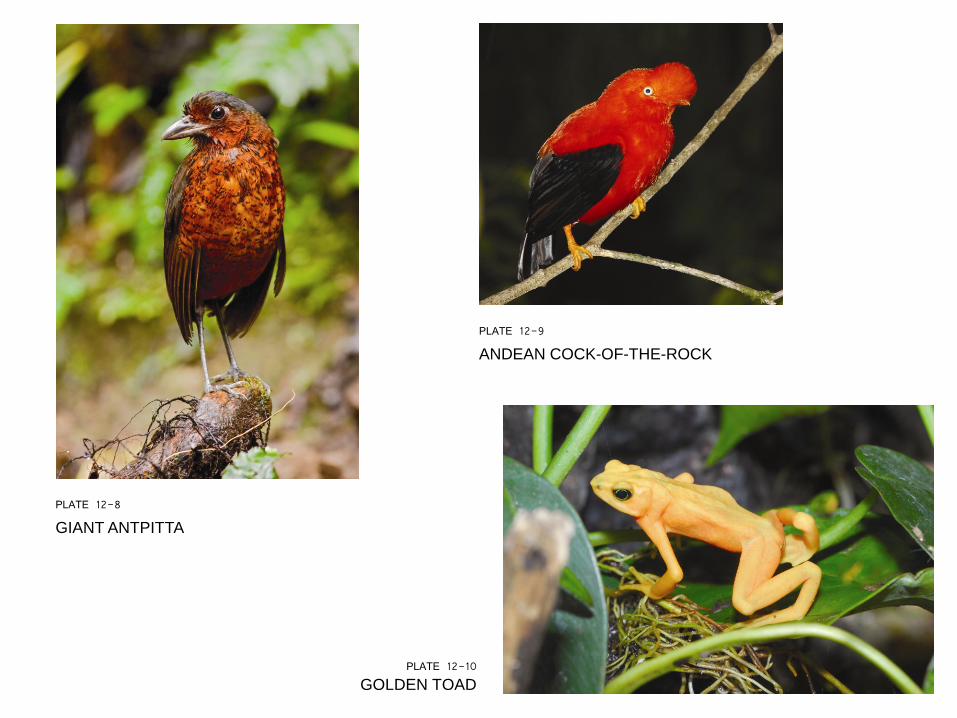
PLATE 12-10 GOLDEN TOAD
PLATE 12-8
GIANT ANTPITTA
PLATE 12-9
ANDEAN COCK-OF-THE-ROCK
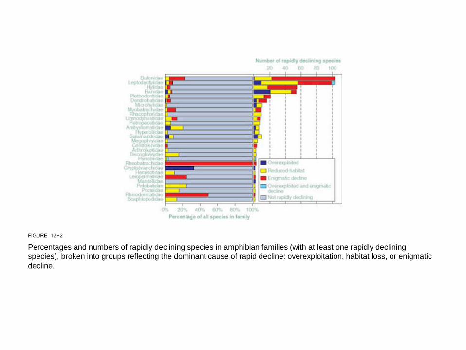
FIGURE 12-2
Percentages and numbers of rapidly declining species in amphibian families (with at least one rapidly declining
species), broken into groups reflecting the dominant cause of rapid decline: overexploitation, habitat loss, or enigmatic
decline.
FIGURE 12-3
Predicted distribution of the fundamental niche of Batrachochytrium dendro-batidis. Darker regions are those where B. dendrobatidis niche presence was predicted by more models (i.e., overlap index 1 means that 10 out of 10 models predicted presence; overlap index 0 means that none of the 10 models did).
PLATE 12-11
The Andes Mountains are extensive and active and include numerous snow-capped peaks. The top image shows terraced
plots and a village.
(a) (b)
FIGURE 12-4
A general map showing the extensive range of the Andes Mountains.
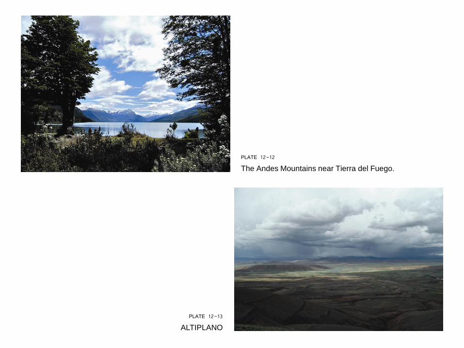
PLATE 12-12
The Andes Mountains near Tierra del Fuego.
PLATE 12-13
ALTIPLANO
PLATE 12-14
Polylepis forest enshrouded in mist.
PLATE 12-16
This combination of grasses, shrubs, and forbs
characterizes páramo at high elevations in the Ecuadorian
Andes.
PLATE 12-15
GIANT CONEBILL
PLATE 12-17
(a) Espeletias dominate the landscape high in the Venezuelan Andes. (b) Espeletia in flower. Note the thick leaves.
(a) (b)
PLATE 12-18
SWORD-BILLED HUMMINGBIRD
PLATE 12-20
ECUADORIAN HILLSTAR
PLATE 12-19
WHITE-TIPPED SICKLEBILL
PLATE 12-22
Puna is windswept and dominated by tussock grass, as shown here.
PLATE 12-21
BEARDED HELMETCREST
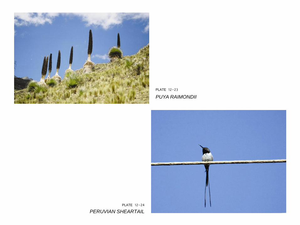
PLATE 12-24
PERUVIAN SHEARTAIL
PLATE 12-23
PUYA RAIMONDII
PLATE 12-26 JAMES’S FLAMINGO
PLATE 12-25
ANDEAN CONDOR
PLATE 12-27
TORRENT DUCK
PLATE 12-28
RESPLENDENT QUETZAL (PHARAMACHUS MOCINNO)
PLATE 12-29 Many butterfly species are elevational migrants.
FIGURE 12-5
ORINOCO RIVER
PLATE 12-30
The “sky islands” that are the Venezuelan tepuis.
FIGURE 12-6
Amazon River, with all major tributaries labeled.
PLATE 12-31
Amazon River at one of its wider areas.
FIGURE 12-7
The Amazon has an amazing
diversity of fish species. (a)
FIGURE 12-7
Continued from page 452
(b)
PLATE 12-32
PIRARUCU
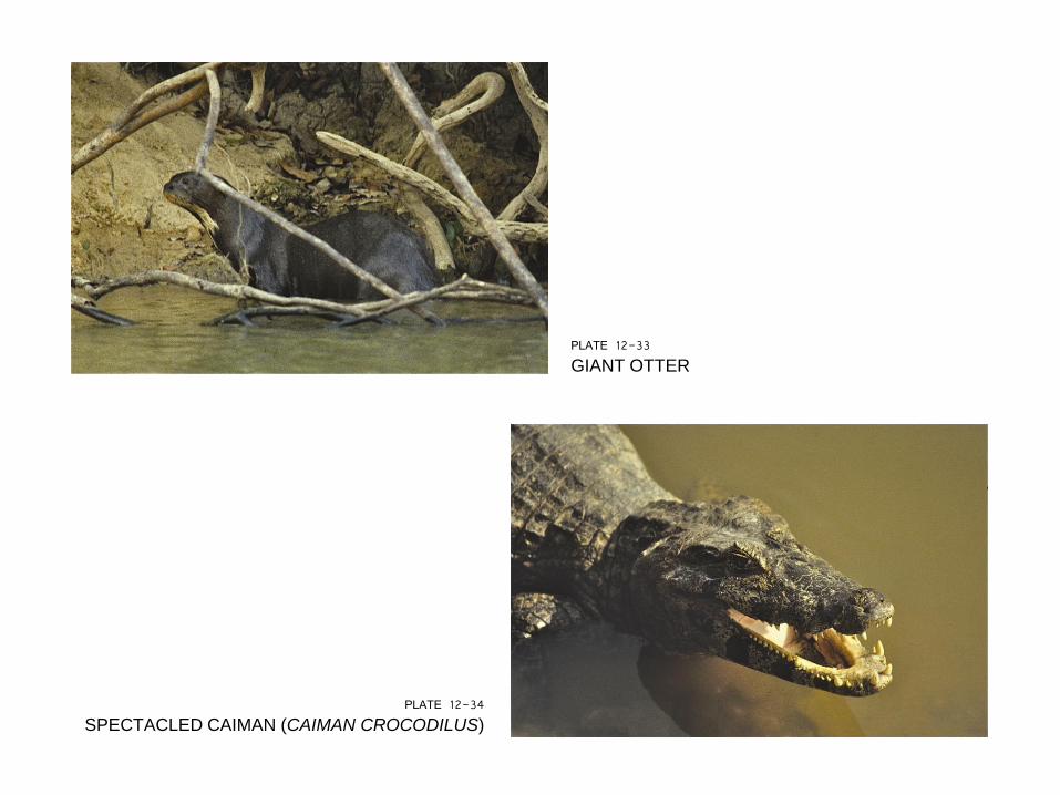
PLATE 12-34
SPECTACLED CAIMAN (CAIMAN CROCODILUS)
PLATE 12-33
GIANT OTTER
PLATE 12-36
CAPYBARA
PLATE 12-35
Black-collared hawk (Busarellus nigricollis), common along
rivers and streams. It feeds primarily on fish.
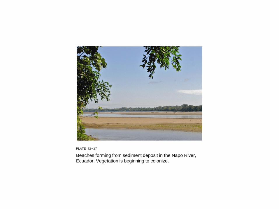
PLATE 12-37
Beaches forming from sediment deposit in the Napo River,
Ecuador. Vegetation is beginning to colonize.
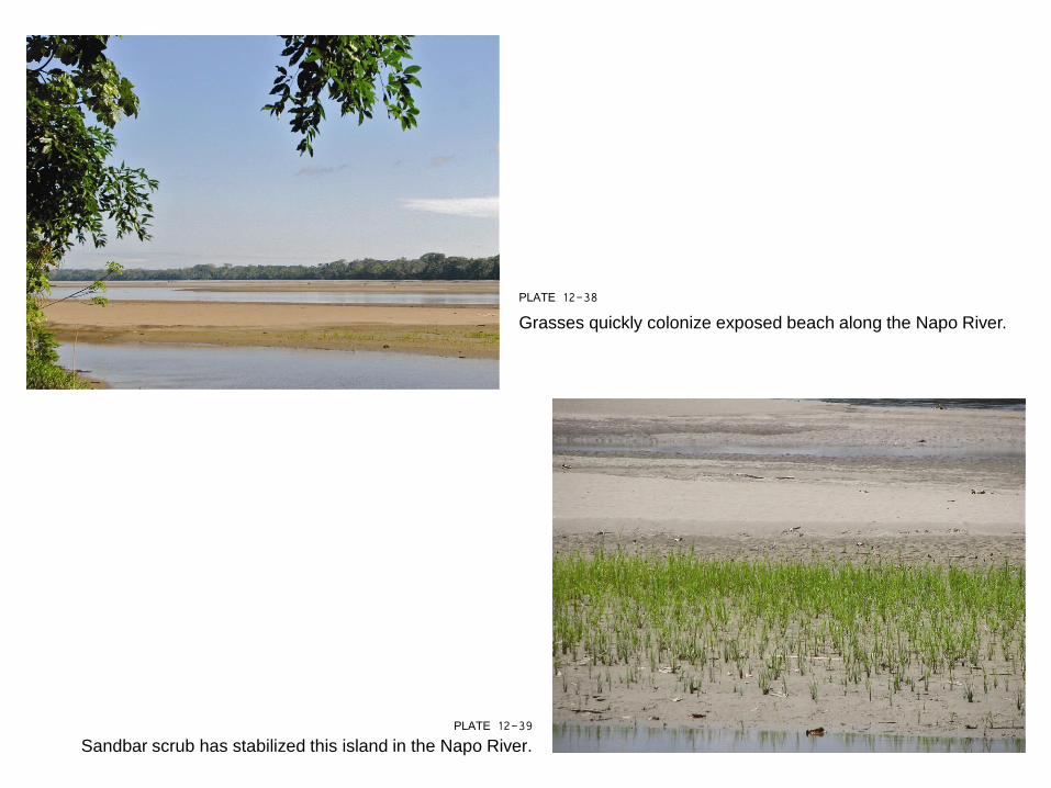
PLATE 12-39 Sandbar scrub has stabilized this island in the Napo River.
PLATE 12-38
Grasses quickly colonize exposed beach along the Napo River.
PLATE 12-40
River island on the Napo River.
PLATE 12-42
The point bar shown in this image is already being
colonized by plants that will eventually stabilize it,
contributing to its expansion.
PLATE 12-41
Oxbows are common along the
tributaries of the Amazon, Napo, and
Orinoco rivers.
PLATE 12-43
HOATZIN
PLATE 12-44
MORICHE PALM SWAMP
PLATE 12-45
MORICHE ORIOLE
PLATE 12-47
This male frigatebird has its throat pouch fully
expanded, an attempt to attract a female.
PLATE 12-46
This mangrove forest on a cay in Belize is a nesting colony
of magnificent frigatebirds (Fregata magnificens). The red
spots visible in the foliage are the expanded throat pouches
of the male birds.
PLATE 12-48
Propagules of red mangrove attach to sediment, and the plant begins to
grow quickly, forming prop roots.
PLATE 12-49
The interior of a mangrove swamp is dense with roots, stabilizing the
sediment and helping expand the forest.
PLATE 12-50
This is Bird Cay off Dangriga, Belize, in 1978, some 17 years
after Hurricane Hattie.
PLATE 12-51
Scarlet ibis flock near sunset at Caroni Swamp, a coastal mangrove forest