190 Chapter 14 Hydrogeology of the Marathon Basin Brewster County, Texas Richard Smith 1 Introduction The Marathon Basin lies in the northeastern part of Brewster County in western Texas (fig. 14-1). The region, referred to as Trans-Pecos Texas in the literature, is in the westward-projecting part of the state that lies along the Rio Grande west of the Pecos River. Physiographically, the region is closer to Mexico and New Mexico than to the rest of Texas. It is a region of high plateaus, broad cuestas, rugged mountains, and gently sloping intermontane plains. Very little vegetation is present except in sheltered valleys and on the higher summits. This factor allows an uncluttered view of the bedrock geology. Ephemeral streams, which are little more than dry gravel beds for the vast majority of the year, gather runoff from the mountains and flow across the plains during the summer rainy season. These include Maravillas Creek, San Francisco Creek, Dugout Creek, Pena Blanca Creek, Pena Colorada Creek, and Woods Hollow Creek, to name a few. Several springs that flowed in historical times have now ceased and very little year round surface water is present in the area. The basin includes about 760 mi 2 centered on the town of Marathon. The basin is bounded on the north and west by the Glass Mountains and Del Norte Mountains, respectively. On the east, the boundary is recognized at Lemons Gap between Spencer and Housetop Mountains (fig. 14-2). The southern extent of the basin basically ends at Maravillas Gap, where Maravillas Creek cuts through the southwest end of the Dagger Flat anticlinorium. The Influence of Water on Area History Water resources, particularly groundwater in the form of springs, have guided the history of the area. Most of Brewster County and specifically the Marathon Basin drain into the Rio Grande, although the northern part drains into the Pecos River. Soils are generally shallow and stony, with some loamy to sandy soils and clayey subsoils. Less than 1 percent of the land in the county is considered prime farmland. Vegetation at lower elevations in the county is drought resistant. Sparse grasses; desert shrubs such as ocotillo, lechuguilla, sotol, acacias, tarbrush, and creosote bush; some mesquite; and 1 Texas Water Development Board
Transcript
190
Chapter 14
Hydrogeology of the Marathon BasinBrewster County, Texas
Richard Smith1
IntroductionThe Marathon Basin lies in the northeastern part of Brewster County in western Texas(fig. 14-1). The region, referred to as Trans-Pecos Texas in the literature, is in thewestward-projecting part of the state that lies along the Rio Grande west of the PecosRiver. Physiographically, the region is closer to Mexico and New Mexico than to the restof Texas. It is a region of high plateaus, broad cuestas, rugged mountains, and gentlysloping intermontane plains. Very little vegetation is present except in sheltered valleysand on the higher summits. This factor allows an uncluttered view of the bedrockgeology.
Ephemeral streams, which are little more than dry gravel beds for the vast majority of theyear, gather runoff from the mountains and flow across the plains during the summerrainy season. These include Maravillas Creek, San Francisco Creek, Dugout Creek, PenaBlanca Creek, Pena Colorada Creek, and Woods Hollow Creek, to name a few. Severalsprings that flowed in historical times have now ceased and very little year round surfacewater is present in the area. The basin includes about 760 mi2 centered on the town ofMarathon. The basin is bounded on the north and west by the Glass Mountains and DelNorte Mountains, respectively. On the east, the boundary is recognized at Lemons Gapbetween Spencer and Housetop Mountains (fig. 14-2). The southern extent of the basinbasically ends at Maravillas Gap, where Maravillas Creek cuts through the southwest endof the Dagger Flat anticlinorium.
The Influence of Water on Area HistoryWater resources, particularly groundwater in the form of springs, have guided the historyof the area. Most of Brewster County and specifically the Marathon Basin drain into theRio Grande, although the northern part drains into the Pecos River. Soils are generallyshallow and stony, with some loamy to sandy soils and clayey subsoils. Less than 1percent of the land in the county is considered prime farmland. Vegetation at lowerelevations in the county is drought resistant. Sparse grasses; desert shrubs such asocotillo, lechuguilla, sotol, acacias, tarbrush, and creosote bush; some mesquite; and
1 Texas Water Development Board
191
Figure 14-1: Location map of the Marathon Basin showing the Marathon Limestoneaquifer outline. Additional points indicate wells within the basin thatproduce from Quaternary alluvium and terrace gravel.
192
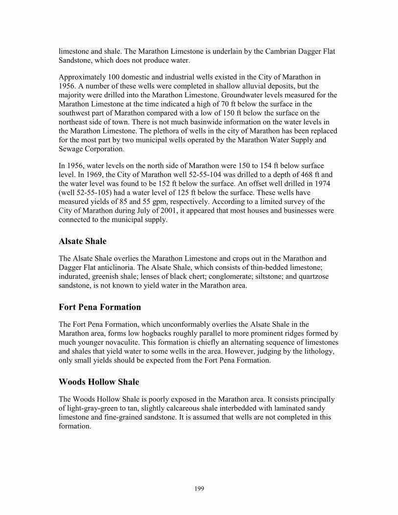
Figure 14-2: The entrance to the Marathon Basin on Hwy 90 at Lemons Gap. Thisphoto, taken looking to the west, shows a few of the low hills that aresurficial remnants of Paleozoic structures once buried beneathCretaceous sediments.
cactus are the dominant plants of this zone. At intermediate elevations vast grasslandsoccur in mountain basins, with white oak, juniper, and piñon woodlands dominating theslopes. Douglas fir, aspen, Arizona cypress, maple, Arizona pine, oaks, and madrone arefound at the higher elevations. The fauna in Brewster County includes the pronghornantelope, mule deer, white-tail deer, bobcat, mountain lion, desert bighorn sheep, blackbear, coyote, raccoon, badger, prairie dog, pack rat, kangaroo rat, skunk, ringtail cat,porcupine, jackrabbit, cottontail, golden eagle, roadrunner, quail, dove, rock wren, white-winged dove, mourning dove, Canyon Wren, painted bunting, zone-tailed black hawk,and Colima warbler. Mineral resources include mercury, silver, lead, fluorspar,nonceramic clay, and lignite coal. Of these, the most important to the historicaldevelopment of Brewster County was mercury. For most of the first half of the twentiethcentury the Terlingua Mining District in southern Brewster County was among thenation’s leading producers.
193
The first European to set foot in what is now Brewster County may have been ÁlvarNúñez Cabeza de Vaca in 1535 (Casey, 1972). The presence in August 1583 of Antoniode Espejo’s expedition, which probably passed the future site of Alpine via the MarathonBasin en route to La Junta de los Ríos, is more certain (Casey, 1972). Juan Domínguez deMendoza is thought to have camped at Kokernot Spring, just northeast of Alpine, in1684. But there was no extensive European presence in the Big Bend until the middle ofthe eighteenth century, when the Spanish began to explore the area in an effort to combatIndian raids into Mexico from the north (Gomez, 1990). In 1747, Governor Pedro deRábago y Terán of Coahuila led an expedition into the Chisos Mountains, and, in 1772,Lt. Col. Hugo Oconór led an expedition to locate sites for forts along the Rio Grande.Oconór placed Capt. Francisco Martínez in command of the presidio at San Vicente, onthe Comanche Trail on the Mexican side of the river. This was the first permanentEuropean presence in the region (Gomez, 1990).
For much of the nineteenth century, the presence of Comanche raiding parties on theirway to and from Mexico, combined with the forbidding local topography, discouragedEuropean exploration of the Big Bend. The first Mexican and American explorers of thearea, who arrived after the Mexican War, found harsh country indeed. In the summer of1859 a camel expedition under 2d Lt. Edward L. Hartz set out from Fort Davis to explorethe Comanche Trail and recommend a possible site for a fort on the Mexican border toprotect against Indian raids. Hartz went south through the Marathon Basin to PersimmonGap and down Tornillo Creek to the Rio Grande. A year later, a second camel expeditionunder 2d Lt. William Echols also explored along the Rio Grande, with the same goal asthe Hartz expedition’s. Before a fort could be built, however, the outbreak of the CivilWar put an end to the plans.
After the war, three interrelated factors led to white settlement of what later becameBrewster County: the presence of the United States Army, the development of the cattleindustry, and the arrival of the railroad, all of which happened more or lesssimultaneously. Taking advantage of the Civil War, Indian cattle-rustling raids via theComanche Trail rose sharply during the early 1860’s and greatly reduced the number ofcattle in northern Mexico. The high prices consequently paid by Mexican ranchers forimported cattle convinced Central Texas cattlemen to chance the long drive across theBig Bend country.
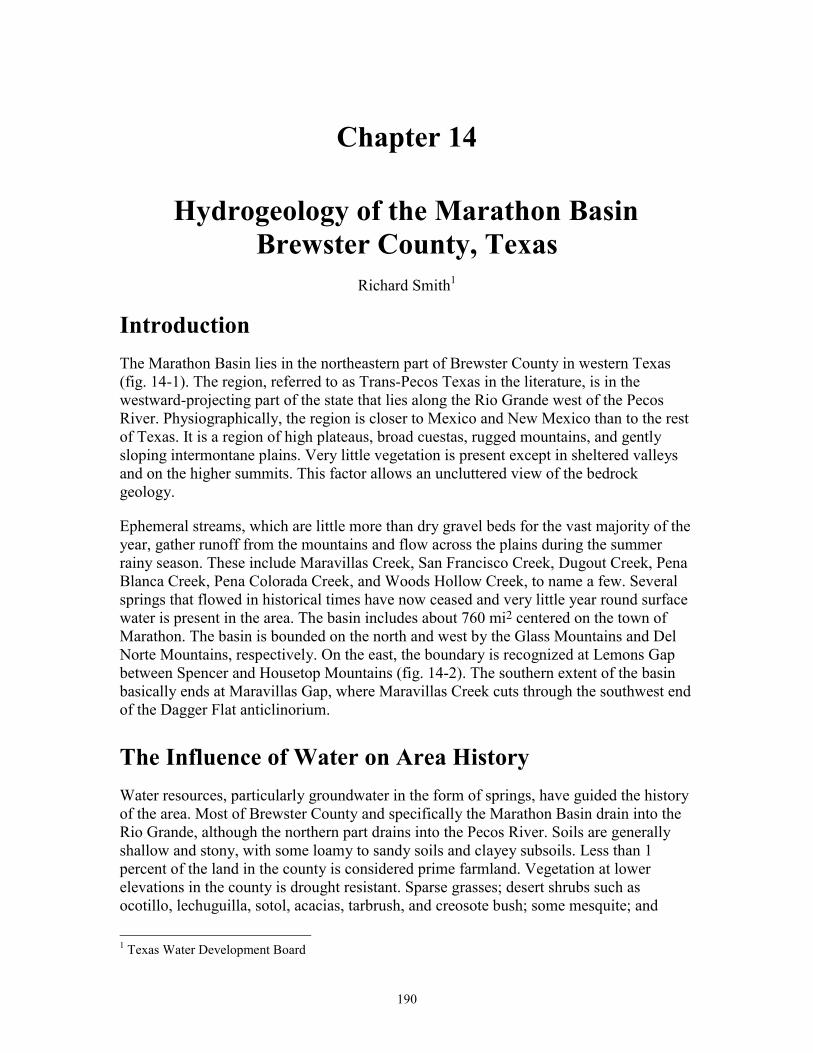
The revival of trade between Texas and Mexico along what has been called theChihuahua Trail brought freighters and other transients to the future Brewster County.Kokernot Spring, where Mendoza had camped 2 centuries earlier, became a principalstopping place on the trail, renamed Burgess Waterhole after pioneering freighter John D.Burgess, whose wagon train was attacked by Indians there. In response to such threats,officials at Fort Davis established Camp Peña Colorada a few miles south of the futuresite of Marathon in 1879 (fig. 14-3).
Burgess and other freighters such as August Santleben helped spread the word about theopen rangeland available in the Big Bend, and in the 1870’s many ranchers from otherparts of the state made plans to come west and investigate the area. Among them wasBeverly Greenwood, from the Del Rio area, who came in 1878 and spent several months
194
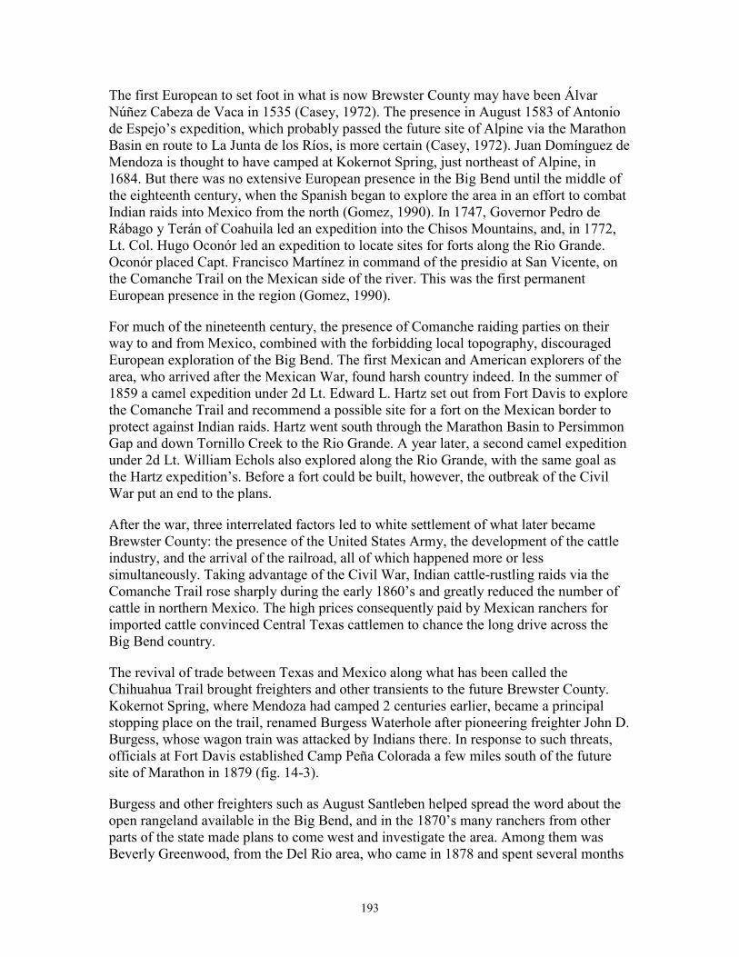
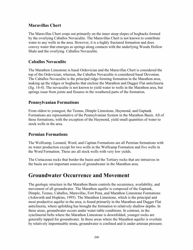
Figure 14-3: Peña Colorada Springs, an oasis in the desert, was the site of Fort PeñaColorada during the mid- to late nineteenth century. Indians used thesprings for thousands of years prior to European exploration. Thesprings flow from gravel deposits, and the water comes to the surfacewhere Peña Colorada Creek crosses the very hard Caballos Novaculite.Flow has been measured at 150 to 450 gpm (DeCook, 1961).
exploring northern Brewster County. Mayer and Solomon Halff were San Antoniomerchants who leased to the government the land on which Camp Peña Colorada waslocated. Later they became the first men to ship cattle into what is now Brewster County,along with John Beckwith, who in 1879 drove a herd of cattle to the vicinity of PeñaColorado Springs. These men contracted to supply meat to Camp Peña Colorada.
The burgeoning cattle industry got a major boost in 1882 when the Galveston,Harrisburg, and San Antonio Railway was built through the area. The gradual influx ofcattlemen suddenly became a veritable flood, as a number of surveyors who had comewith the railroad and the Texas Rangers who had been assigned to protect them, electedto stay. Among them were such men as Alfred S. Gage, James B. Gillett, and Joseph D.Jackson, who soon became the leading citizens of Brewster County. Initially, at least,ranchers generally settled in the northern part of what is now Brewster County for ease of
195
shipping their cattle via the railroad. However, the Gage Ranch and the G4 Ranch, whichstarted in the mid- to early 1880’s, were the first major cattle operations in what is nowsouthern Brewster County. Gage soon moved north to be nearer the railhead. Severaltowns sprang up along the rails, the most significant of which were Alpine, then calledMurphyville, and Marathon.
These two towns quickly became shipping points and important supply centers for thebooming cattle industry. Five years after the coming of the railroad, in 1887, BrewsterCounty was marked off from Presidio County, as were Jeff Davis, Buchel, and FoleyCounties. Brewster County was named for Henry P. Brewster, Secretary of War underDavid G. Burnet. Buchel and Foley Counties were not organized and were attached toBrewster County for judicial purposes. The first Brewster County elections were held onFebruary 4, 1887, when Murphyville was selected as county seat; on March 14 of thatyear a contract was let for the construction of the Brewster County courthouse and jail. In1890 Brewster County had just 710 residents, while Buchel and Foley Counties had only298 and 25 residents, respectively. By 1897 Buchel and Foley Counties had still not beenorganized, and in that year their territory was officially added to that of Brewster County,making the latter the largest county in Texas.
Cattle ranching and mining have never regained the prominence in Brewster County thatthey had in the late nineteenth and early twentieth centuries. The county population rosefrom 6,478 in 1940 to 7,309 in 1950; dropped to 6,434 in 1960; and climbed again, to anall-time high of 7,780, in 1970, before declining slightly to 7,573 in 1980. The number ofpeople employed in agriculture, however, steadily declined, from 712 in 1930 to 507 in1950 and only 202 in 1970. Similarly, the number of people employed in mining droppedfrom 206 in 1930 to 147 in 1940 and 11 in 1950. In subsequent years, when the mercurymines enjoyed a brief renaissance, that figure rose again, to 32 in 1970 and 80 in 1980.
In the early 1980’s Brewster County was 53rd among United States counties in land areaand one of the most sparsely populated in Texas. The largest ancestry groups wereHispanic and English, both at 43 percent. In 1990 the population was 8,681. The largesttown, Alpine, had 5,637 residents. By 1999, the population of Brewster County hadincreased to 8,793, with most of that growth in Alpine. Given the dry climate, coupledwith the magnificent scenery, the Brewster County economy has become increasinglydependent on tourism.
Physiography of the BasinThe Marathon Basin is in the Mexican Highlands physiographic province. The landsurface consists of high plateaus, rugged peaks and sierras, and broad, shallowintermontane valleys. The Marathon area is situated on a structural uplift of the Ouachitafold belt. The crest has been eroded to a lower level than the flanks so that the central partis an irregular, circular basin surrounded by steep escarpments. The north and west basinmargins formed by the Glass and Del Norte Mountains, respectively, consist chiefly ofPermian and Cretaceous rocks that dip gently northward and westward. The relief on the
196
Figure 14-4: Location map of the Marathon Basin showing physiographic featuresand basin boundary.
rather steep inward-facing escarpments is about 1,000 to 1,500 ft. The highest peak inthese ranges has an altitude of slightly more than 6,000 ft MSL (fig. 14-4).
The basin is composed of a series of shallow valleys and comparatively flat erosionalsurfaces separated by northeastward-trending, low, abrupt ridges. The valley floor in thebasin varies in altitude from about 3,500 ft in the south to a high of 4,500 ft in the northalong the base of the Glass Mountains. Relief within the basin is not great, the summits ofthe ridges being generally only about 300 to 700 ft higher than the adjacent valleys. Thehighest peak within the basin is Horse Mountain (southeast section) at 5,010 ft MSL.
ClimateThe mean annual temperature at Marathon is about 62° Fahrenheit (°F). The observedextremes vary from a high of about 110°F in the summer months to a low of below 0 inthe winter. The mean monthly temperature varies from less than 46°F in December tomore than 75°F in July and August.
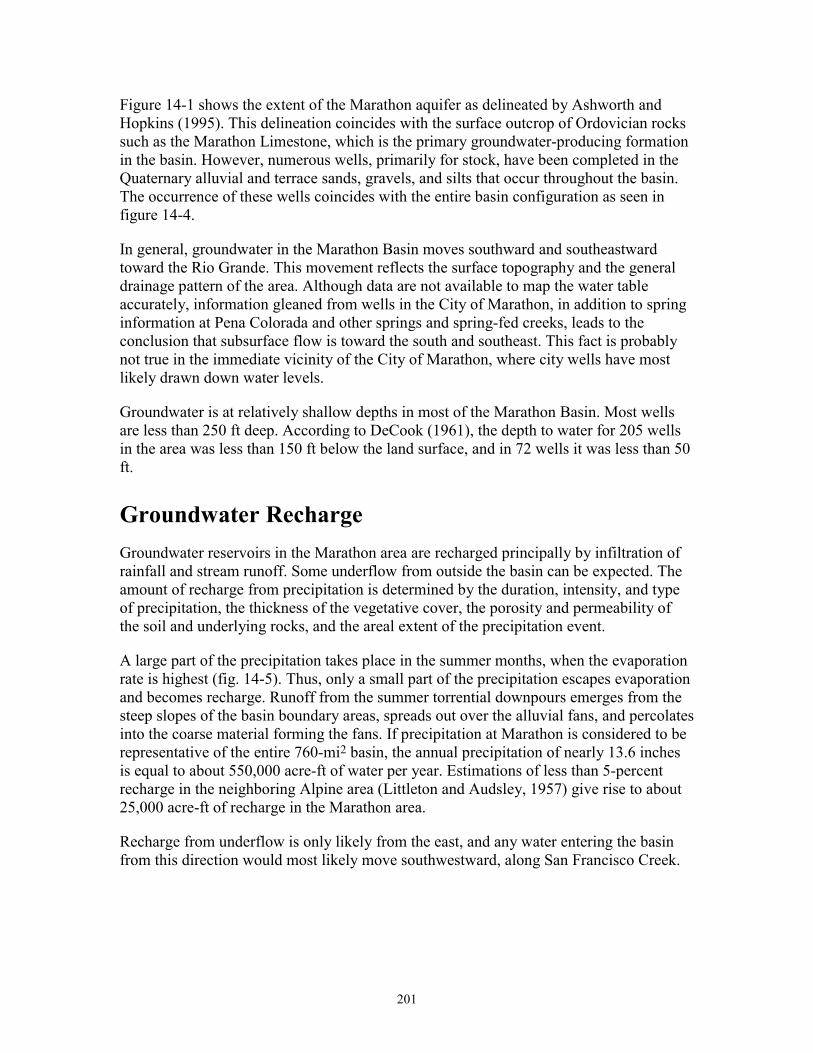
According to records of the U.S. Weather Service, the long-term annual precipitation atMarathon is 13.59 inches. Most precipitation occurs during the summer months (fig. 14-5), largely in torrential rainstorms of irregular areal distribution.
197
0
0.5
1
1.5
2
2.5
3
Jan Feb Mar Apr May June July Aug Sept Oct Nov Dec
Long Term Mean Monthly Precipitation
Figure 14-5: Annual precipitation distribution at Marathon, Brewster County, Texas1946–1997. The value of the y-axis is inches.
The hot summers and low humidity contribute to high evaporation rates in the basin. Thenearest long-term evaporation station is located at Balmorhea, 60 mi northwest ofMarathon. Pan evaporation has been measured at about 70 inches per year, or over fourtimes the mean annual precipitation at Marathon.
Marathon Basin DrainagesThe largest part of the Marathon area drains to the south owing to a southward slope.Maravillas, San Francisco, and some smaller creeks flow into the Rio Grande. Thetributaries of Maravillas Creek include Dugout, Pena Colorada, Monument, WoodHollow, and Hackberry Creeks. They drain the central and western sides of the basin.The eastern side of the basin is drained by San Francisco Creek, with its main tributarybeing Pena Blanca Creek. The northern extent of the basin is drained by Big Canyon,which flows generally eastward to the Pecos River.
These drainages and the unnamed tributaries to them are the principal recharge sourcesfor the water-producing formations within the basin and the spring flow that issues fromvarious points within the basin.
198
General Geology of the Marathon BasinThe consolidated rocks exposed in the basin range in age from Paleozoic Cambrian toCenozoic Tertiary. Intrusive igneous rocks occur in scattered areas, but extrusive rockscrop out only along the rim of the Del Norte Mountains to the west (King, 1937).
The Paleozoic rocks in the basin have a total thickness of about 21,000 ft. The majority ofthis thickness is composed of Pennsylvanian and Permian strata. Prior to the deposition ofthe Permian, the underlying rocks in the Marathon area were strongly folded and faulted,producing a series of northeastward-trending anticlinoria and synclinoria (King, 1937).Permian rocks, which are restricted to the south flank of the Glass Mountains and thenortheast end of the Del Norte Mountains, lie unconformably on the folded and faultedsurface of older rocks (Tauvers, 1988). The area was subjected to erosion prior to thedeposition of the Cretaceous rocks, which resulted in the truncation of the folded andfaulted rocks of the basement. Cretaceous sediments, measuring about 1,200 ft, weredeposited on this erosional surface. The resulting Cretaceous surface was uplifted to formthe Marathon Dome, which in turn was eroded to form a topographic basin (King, 1980).Finally, during the early part of the Tertiary period, igneous rocks intruded theCretaceous strata (King, 1980).
Quaternary sediments mantle the present-day stream valleys and form alluvial-fandeposits at the base of the escarpments up to 125 ft thick. These units are generally verythin and serve as a catchment area for rainfall that then enhances recharge to theunderlying Paleozoic rocks.
Principal Water-Bearing Units of the Marathon Basin
Marathon Limestone
The Marathon Limestone is the most productive aquifer in the Marathon area. DeCook(1961) noted that 92 wells, most in the town of Marathon, had yields from this formationthat varied from a few gallons per minute (gpm) to over 300 gpm. The aquifer can best becharacterized as a highly fractured limestone aquifer. Groundwater in the MarathonLimestone generally occurs under water-table conditions, but is locally (i.e., the City ofMarathon) under artesian pressure and may rise a few feet above the point where it is firstencountered.
The Marathon Limestone, which is Ordovician, crops out in the Marathon anticlinoriumand at the northeast end of the Dagger Flat anticlinorium. The City of Marathon issituated at the north end of the Marathon anticlinorium, and wells in the city arecompleted in the Marathon Limestone. The thickness of the Marathon Limestonedecreases from north to south, ranging from 800 to 900 ft at Marathon to about 350 ft atDagger Flat. The Marathon Limestone is a dark-gray, flaggy limestone with gray togreenish clayey shale streaks. Sandstone and conglomerate are interbedded with the
199
limestone and shale. The Marathon Limestone is underlain by the Cambrian Dagger FlatSandstone, which does not produce water.
Approximately 100 domestic and industrial wells existed in the City of Marathon in1956. A number of these wells were completed in shallow alluvial deposits, but themajority were drilled into the Marathon Limestone. Groundwater levels measured for theMarathon Limestone at the time indicated a high of 70 ft below the surface in thesouthwest part of Marathon compared with a low of 150 ft below the surface on thenortheast side of town. There is not much basinwide information on the water levels inthe Marathon Limestone. The plethora of wells in the city of Marathon has been replacedfor the most part by two municipal wells operated by the Marathon Water Supply andSewage Corporation.
In 1956, water levels on the north side of Marathon were 150 to 154 ft below surfacelevel. In 1969, the City of Marathon well 52-55-104 was drilled to a depth of 468 ft andthe water level was found to be 152 ft below the surface. An offset well drilled in 1974(well 52-55-105) had a water level of 125 ft below the surface. These wells havemeasured yields of 85 and 55 gpm, respectively. According to a limited survey of theCity of Marathon during July of 2001, it appeared that most houses and businesses wereconnected to the municipal supply.
Alsate Shale
The Alsate Shale overlies the Marathon Limestone and crops out in the Marathon andDagger Flat anticlinoria. The Alsate Shale, which consists of thin-bedded limestone;indurated, greenish shale; lenses of black chert; conglomerate; siltstone; and quartzosesandstone, is not known to yield water in the Marathon area.
Fort Pena Formation
The Fort Pena Formation, which unconformably overlies the Alsate Shale in theMarathon area, forms low hogbacks roughly parallel to more prominent ridges formed bymuch younger novaculite. This formation is chiefly an alternating sequence of limestonesand shales that yield water to some wells in the area. However, judging by the lithology,only small yields should be expected from the Fort Pena Formation.
Woods Hollow Shale
The Woods Hollow Shale is poorly exposed in the Marathon area. It consists principallyof light-gray-green to tan, slightly calcareous shale interbedded with laminated sandylimestone and fine-grained sandstone. It is assumed that wells are not completed in thisformation.
200
Maravillas Chert
The Maravillas Chert crops out primarily on the inner steep slopes of hogbacks formedby the overlying Caballos Novaculite. The Maravillas Chert is not known to contributewater to any wells in the area. However, it is a highly fractured formation and doesconvey water that emerges as springs along contacts with the underlying Woods HollowShale and the overlying Caballos Novaculite.
Caballos Novaculite
The Marathon Limestone is basal Ordovician and the Maravillas Chert is considered thetop of the Ordovician; whereas, the Caballos Novaculite is considered basal Devonian.The Caballos Novaculite is the principal ridge-forming formation in the Marathon area,making up the ridges or hogbacks that enclose the Marathon and Dagger Flat anticlinoria(fig. 14-4). The novaculite is not known to yield water to wells in the Marathon area, butsprings issue from joints and fissures in the weathered parts of the formation.
Pennsylvanian Formations
From oldest to youngest, the Tesnus, Dimple Limestone, Haymond, and GaptankFormations are representative of the Pennsylvanian System in the Marathon Basin. All ofthese formations, with the exception of the Haymond, yield small quantities of water tostock wells in the area.
Permian Formations
The Wolfcamp, Leonard, Word, and Capitan Formations are all Permian formations withno water production except for two wells in the Wolfcamp Formation and five wells inthe Word Formation. These are all stock wells with very low yields.
The Cretaceous rocks that border the basin and the Tertiary rocks that are intrusives inthe basin are not important sources of groundwater in the Marathon area.
Groundwater Occurrence and MovementThe geologic structure in the Marathon Basin controls the occurrence, availability, andmovement of all groundwater. The Marathon aquifer is composed of the Gaptank,Dimple, Tesnus, Caballos, Maravillas, Fort Pena, and Marathon Limestone Formations(Ashworth and Hopkins, 1995). The Marathon Limestone, which is the principal andmost productive aquifer in the area, is found primarily in the Marathon and Dagger Flatanticlinoria, where upfolding has brought the formation to relatively shallow depths. Inthese areas, groundwater occurs under water-table conditions. In contrast, in thesynclinorial belts where the Marathon Limestone is downfolded, younger rocks aregenerally tapped for groundwater. In those areas where the Marathon aquifer is overlainby relatively impermeable strata, groundwater is confined and is under artesian pressure.
201
Figure 14-1 shows the extent of the Marathon aquifer as delineated by Ashworth andHopkins (1995). This delineation coincides with the surface outcrop of Ordovician rockssuch as the Marathon Limestone, which is the primary groundwater-producing formationin the basin. However, numerous wells, primarily for stock, have been completed in theQuaternary alluvial and terrace sands, gravels, and silts that occur throughout the basin.The occurrence of these wells coincides with the entire basin configuration as seen infigure 14-4.
In general, groundwater in the Marathon Basin moves southward and southeastwardtoward the Rio Grande. This movement reflects the surface topography and the generaldrainage pattern of the area. Although data are not available to map the water tableaccurately, information gleaned from wells in the City of Marathon, in addition to springinformation at Pena Colorada and other springs and spring-fed creeks, leads to theconclusion that subsurface flow is toward the south and southeast. This fact is probablynot true in the immediate vicinity of the City of Marathon, where city wells have mostlikely drawn down water levels.
Groundwater is at relatively shallow depths in most of the Marathon Basin. Most wellsare less than 250 ft deep. According to DeCook (1961), the depth to water for 205 wellsin the area was less than 150 ft below the land surface, and in 72 wells it was less than 50ft.
Groundwater RechargeGroundwater reservoirs in the Marathon area are recharged principally by infiltration ofrainfall and stream runoff. Some underflow from outside the basin can be expected. Theamount of recharge from precipitation is determined by the duration, intensity, and typeof precipitation, the thickness of the vegetative cover, the porosity and permeability ofthe soil and underlying rocks, and the areal extent of the precipitation event.
A large part of the precipitation takes place in the summer months, when the evaporationrate is highest (fig. 14-5). Thus, only a small part of the precipitation escapes evaporationand becomes recharge. Runoff from the summer torrential downpours emerges from thesteep slopes of the basin boundary areas, spreads out over the alluvial fans, and percolatesinto the coarse material forming the fans. If precipitation at Marathon is considered to berepresentative of the entire 760-mi2 basin, the annual precipitation of nearly 13.6 inchesis equal to about 550,000 acre-ft of water per year. Estimations of less than 5-percentrecharge in the neighboring Alpine area (Littleton and Audsley, 1957) give rise to about25,000 acre-ft of recharge in the Marathon area.
Recharge from underflow is only likely from the east, and any water entering the basinfrom this direction would most likely move southwestward, along San Francisco Creek.
202
Groundwater DischargeGroundwater is discharged from the basin via spring flow, evapotranspiration, underflowsouthward to the Rio Grande and pumpage from wells. Good estimates for spring flowand pumpage exist, but the other parameters can only be grossly estimated.
The amount of spring discharge was approximately 880 acre-ft in 1957 and 902 acre-ft in1976. An undetermined, but probably large, part of the groundwater moves out of theMarathon Basin as underflow through the alluvium and permeable Paleozoic rocks.These preferential pathways include the stream valleys of Maravillas, Woods Hollow,Hackberry, and San Francisco Creeks, in addition to other minor drainages.
An additional quantity of water is removed via evapotranspiration. This varies with theseason, with the summer months being the greatest with the highest temperatures.Discharge by direct evaporation occurs at several places along Pena Colorada Creek,Maravillas Creek, and other streams where the water table is at or near the land surface.
Groundwater is also discharged through pumpage of wells in the basin. In 1957, about280 wells were known in the area. The total withdrawal was probably less than 400,00gallons per day or 450 acre-ft per year. This amount is less than 2 percent of estimatednatural recharge. Although the number of wells has been reduced owing to the MarathonWater Supply Corporation, the amount of pumpage has probably increased in the basin asa result of increased tourism and expanding development.
Water QualityThe water quality of the groundwater in the Marathon Basin is generally good. Samplingof water from well 52-55-104 started in 1972, and samples have been taken and analyzedthrough 1998. Total dissolved solids (TDS) have averaged between 525 and 550 mg/L,chloride—115 mg/L, nitrate—11.5 to 12 mg/L, sulfate—84 mg/L, and sodium 72—mg/L. The TDS is a little high but still within acceptable limits (Ashworth andNordstrom, 1989).
Some reports of contamination by oil, gas, and saline water have been noted, but itappears that these zones can be sealed off and uncontaminated water productionachieved.
ConclusionsThe Marathon Basin contains two principal aquifers, the Marathon Limestone and theQuaternary alluvium near the streams and escarpments. The Marathon Limestone yieldslarge quantities of good-quality water in the Marathon and Dagger Flat anticlinoria. In thesynclinorial areas, production is generally from shallower producers.
203
Yields in the basin are low because most wells are for stock purposes. Larger yields couldbe achieved in numerous places through proper completion techniques.
Precipitation contributes about 25,000 acre-ft of recharge per year. Discharge is about900 acre-ft/yr from springs, 450 acre-ft/yr from pumpage, and an unknown amount fromunderflow and evapotranspiration.
Water quality is generally good, although the water is hard. Some oil pollution exists andshould be isolated.
RecommendationsThe Marathon Basin is a very undeveloped area of the State of Texas. Studies need to beconducted to expand databases throughout the basin. Well records, drillers’ logs,geophysical logs, and field examinations of existing wells need to be gathered andanalyzed. Water-level measurements need to be made throughout the basin. Pumpingtests should be conducted to establish aquifer parameters.
References CitedAshworth, J. B., and Hopkins, J., 1995, Aquifers of Texas: Texas Water Development
Board, Report 345, 69 p.
Ashworth, J. B., and Nordstrom, P., 1989, Public supply ground-water use in westernTexas: in Texas Water Development Board, Report 311, p. 16-17.
Casey, C. B., 1972, Mirages, mysteries and reality: Brewster County, Texas, the BigBend of the Rio Grande: Hereford, Texas: Pioneer Press.
DeCook, K. J., 1961, A reconnaissance of the ground-water resources of the Marathonarea, Brewster County, Texas: Texas Board of Water Engineers, Bulletin 6111, 49 p.
Gomez, A. R., 1990, A most singular country—a history of occupation in the Big Bend:Santa Fe: National Park Service; Salt Lake City: Charles Redd Center for WesternStudies, Brigham Young University.
King, P. B., 1937, Geology of the Marathon region, Texas: U.S. Geological SurveyProfessional Paper 187, 148 p.
King, P. B., 1980, Geology of the eastern part of the Marathon basin, Texas: U.S.Geological Survey Professional Paper 1157, 40 p.
Littleton, R. T., and Audsley, G. L., 1957, Ground-water geology of the Alpine area,Brewster, Jeff Davis, and Presidio Counties, Texas: Texas Board of Water Engineers,Bulletin 5712, 88 p.
Tauvers, P. R., 1988, Structure sections through the Marathon basin, Trans-Pecos Texas,—Implications for basement-influenced deformation: Ph.D. Dissertation, TheUniversity of Texas at Austin, 137 p.
204
BibliographyBaker, C. L., 1928, The date of major diastrophism and other problems of the Marathon
Basin, Trans-Pecos Texas: American Association of Petroleum Geologists Bulletin, v.12, p. 1111-1117.
Baker, C. L., and Bowman, W. F., 1917, Geological exploration of the southeastern frontof Trans-Pecos Texas: University of Texas, Austin, Bulletin 1753, p. 61-117.
Barker, D. S., 1977, Northern Trans-Pecos magmatic province: introduction andcomparison with the Kenya rift: Geological Society of America Bulletin, v. 88, p.1421-1427.
Barker, D. S., 1987, Tertiary alkaline magmatism in Trans-Pecos Texas, in Fitton, J. G.,and Upton, B. G. J., eds., Alkaline igneous rocks: Geological Society SpecialPublication No. 30, p. 415-431.
Barrick, J. E., 1987, Conodont biostratigraphy of the Caballos novaculite (EarlyDevonian-Early Mississippian), northwestern Marathon Uplift, West Texas: inAustin, R. L., ed., Conodonts: investigative techniques and applications: BritishMicropaleontology Society Series, Wiley & Sons, New York, p. 120-135.
Beaumont, C., Quinlan, G., and Hamilton, J., 1988, Orogeny and stratigraphy: numericalmodels of the Paleozoic in the eastern interior of North America: Tectonics, v. 7, p.389-416.
Bennett, R. E., 1959, Geology of East Bourland and Simpson Springs Mountains,Brewster County, Texas: The University of Texas at Austin, Master’s thesis, 172 p.
Berry, W. B. N., 1960, Graptolite faunas of the Marathon region, West Texas: TexasUniversity Publication 6005, 179 p.
Bjorkland, T. K., 1962, Structure of Horse Mountain anticline (southwest extension),Brewster County, Texas: The University of Texas at Austin, Master’s thesis, 74 p.
Byrd, W. M., 1958, The geology of a portion of the Combs Ranch, Brewster County,Texas: The University of Texas at Austin, Master’s thesis, 68 p.
Coley, K. L., 1987, Structural evolution of the Warwick Hills, Marathon Basin, westTexas: The University of Texas at Austin, Master’s thesis, 141 p.
Connors, H.E., 1977, Structure of the Heart Mountain-Tinaja Spring area, BrewsterCounty, Texas: The University of Texas at Austin, Master’s thesis, 67 p.
DeMis, W. D., 1985, Geology of Hell’s Half Acre and its significance to the structuralevolution of the Marathon Basin, West Texas: West Texas Geological SocietyPublication 85-81, p. 37-43.
Dickerson, P. W., 1985, Evidence for late Cretaceous- early Tertiary transgression inTrans-Pecos Texas and adjacent Mexico: West Texas Geological Society Guidebook,Publication 85-81, p. 185-194.
205
Duncan, M. A., 1985, Deformation of flysch formations in the West Bourland Mountainarea, western Marathon Basin, Texas: West Texas Geological Society Guidebook,Publication 85-81, p. 45-51.
Everett, J. R., 1964, Post-Cretaceous structural geology near Del Norte Gap, BrewsterCounty, Texas: The University of Texas at Austin, Master’s thesis, 61 p.
Folk, R. L., and McBride, E. F., 1976, The Caballos Novaculite revisited Part I—originof novaculite members: Journal of Sedimentary Petrology, v. 46, p. 659-669.
Graves, R. W., 1954, Geology of Hood Spring Quadrangle, Brewster County, Texas: TheUniversity of Texas at Austin, Bureau of Economic Geology, Report of InvestigationsNo. 21, 51 p.
Hall, W. E., 1956, Marathon folded belt in the Big Bend area of Texas: AmericanAssociation of Petroleum Geologists Bulletin, v. 40, p. 2247-2255.
Henry, C. D., and Price, J. G., 1986, Early Basin and Range development in Trans-PecosTexas and adjacent Chihuahua—magmatism and orientation, timing, and style ofextension: Journal of Geophysical Research, v. 91, p. 6213-6224.
King, P. B., 1930, Geology of the Glass Mountains, Texas—Part I, descriptive geology:University of Texas, Austin, Bulletin 3038, 167 p.
King, P. B., 1937, Geology of the Marathon region, Texas: U.S. Geological SurveyProfessional Paper 187, 148 p.
King, P. B., 1980, Geology of the eastern part of the Marathon basin, Texas: U.S.Geological Survey Professional Paper 1157, 40 p.
Kraft, J. L., 1985, Structural geology of the Sunshine Springs thrust area, MarathonBasin, Texas: West Texas Geological Society Guidebook, Publication 85-81, p. 57-62.
Leason, J. O., 1983, Structural geology of the Horse Mountain area, Marathon Basin,Texas: The University of Texas at Austin, Master’s thesis, 84 p.
McBride, E. F., ed., 1969, A guidebook to the stratigraphy, sedimentary structures andorigin of flysch and pre-flysch rocks of the Marathon Basin, Texas: Dallas GeologicalSociety, Dallas, Texas, 104 p.
McBride, E. F., and Thomson, A., 1970, The Caballos Novaculite, Marathon region,Texas: Geological Society of America Special Paper 122, 129 p.
Moore, G. E., Mendenhall, G. V., and Saultz, W. L., 1981, Northern extent of theMarathon Thrust, Elsinore area, Pecos County, Texas: in Marathon-Marfa region ofWest Texas, Permian Basin Section, SEPM Symposium and Guidebook, p. 131-133.
Muehlberger, W. R., 1978, Notes on the structural domains of the Marathon Region: inSEPM Permian Basin Section, Publication 78-17, p. 51-54.
Muehlberger, W. R., DeMis, W. D., and Leason, J. O., 1984, Geologic map and cross-sections, Marathon region, Trans-Pecos Texas: Geological Society of America Mapand Chart Series MC-28T, scale 1:250,000.
206
Tauvers, P. R., 1988, Structure sections through the Marathon basin, Trans-PecosTexas—Implications for basement-influenced deformation: The University of Texasat Austin, Ph.D. dissertation, 137 p.
Witebsky, S. N., 1988, Paleontology and sedimentology of the Haymond boulder beds(Martin Ranch), Marathon Basin, Trans-Pecos Texas: The University of Texas atAustin, Master’s thesis, 121 p.