16
Chapter 31: China Section 2: Regions of China
| Date post: | 03-Jan-2016 |
| Category: |
Documents |
| Upload: | mary-curtis |
| View: | 217 times |
| Download: | 1 times |

Chapter 31: ChinaSection 2: Regions of China

The Northeast
• Amur River in the north• China Plain in the south• Greater Khingan Range• Contains China’s major
lowland ares

Beijing• China’s Northeast
province• Capital• Greatest
concentration of China’s population
• Major industrial center

Loess: Fertile Soil• Vast agricultural area• Loess: fine, yellow-
brown loam deposited by seasonal dust storms
• Blown in from Mongolia and the Gobi Desert
• Deposited along the Huang He River
• Area very fertile

Yellow River
• Huang He also known as the Yellow River
• Color the loess gives the water
• Also serves as a transportation route
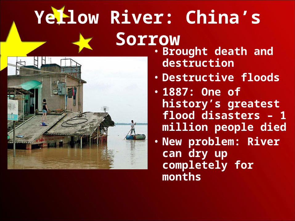
Yellow River: China’s Sorrow• Brought death and
destruction• Destructive floods• 1887: One of history’s
greatest flood disasters – 1 million people died
• New problem: River can dry up completely for months
The Southeast• North China Plain down to the
country’s southern border• East coast to the western
highland areas• More mountainous than the
northeast region• Warmer, wetter climate

Agriculture
• Climate + fertile soil = excellent region for farming
• Double cropping: growing more than one crop a year on the same land
• Carve steplike terraces onto the slopes of hills to increase the area of farmable land

Yangzi River• Valley: Some of China’s
most productive farmland• One of the country’s
busiest and most crowded areas
• East-West Highway• Shanghai, China’s major
port, is on the mouth of the Yangzi
• Three Gorges Dam: control flooding and generate electricity

Special Economic Zones• Original zones: Southeast• Attract foreign businesses– Government set low tax rates – Reduced the amount of official
forms and licenses needed to set-up a business
• 1991: Foreign investors poured $22 billion into the Special Economic Zones

The Northwest• Stark, rugged, and
barren• Gobi Desert:
Northern boundary• Very little grows• Mountains
surround and separate 2 large basins

Silk Road • Great trade route in ancient times
• Stations developed in the Northwest around oases fed by mountain streams
• Stations grew into cities– Farmed– Nomadic herding

The Southwest• Plateau of Tibet• 14,000 feet (4,300
meters)• Surrounding
mountains: 20,000 feet (6,100 meters)
• Highest region in the world
• Isolated

Tibet • Distinct, traditional society
• Farmers and herders
• Ruled by Buddhist customs and decrees of the Dalai Lama
• Theocratic leader: claims to rule by religious or divine authority

1950: Chinese Invasion• Ended Tibet’s isolation• Destroyed Buddhist
monasteries• Farmers had to join
agricultural communes• Dalia Lama: exiled to
India

1959: Uprising• Chinese government: Program
to destroy Tibet’s ancient culture
• 1965: Installed a Communist government
• Autonomous region, region with limited self-government
• Renamed Tibet: Xizang• Tibetans: Hold onto their
culture and religions


![nhbs monthly cataloguemedia.nhbs.com/monthcat/mc0816d.pdf · Population and Habitat of Amur Leopard in China [English / Chinese] Jiang Guangshun The Amur leopard may well be one of](https://static.documents.pub/doc/80x56/5f4290e56b64597acf064efc/nhbs-monthly-population-and-habitat-of-amur-leopard-in-china-english-chinese.jpg)


