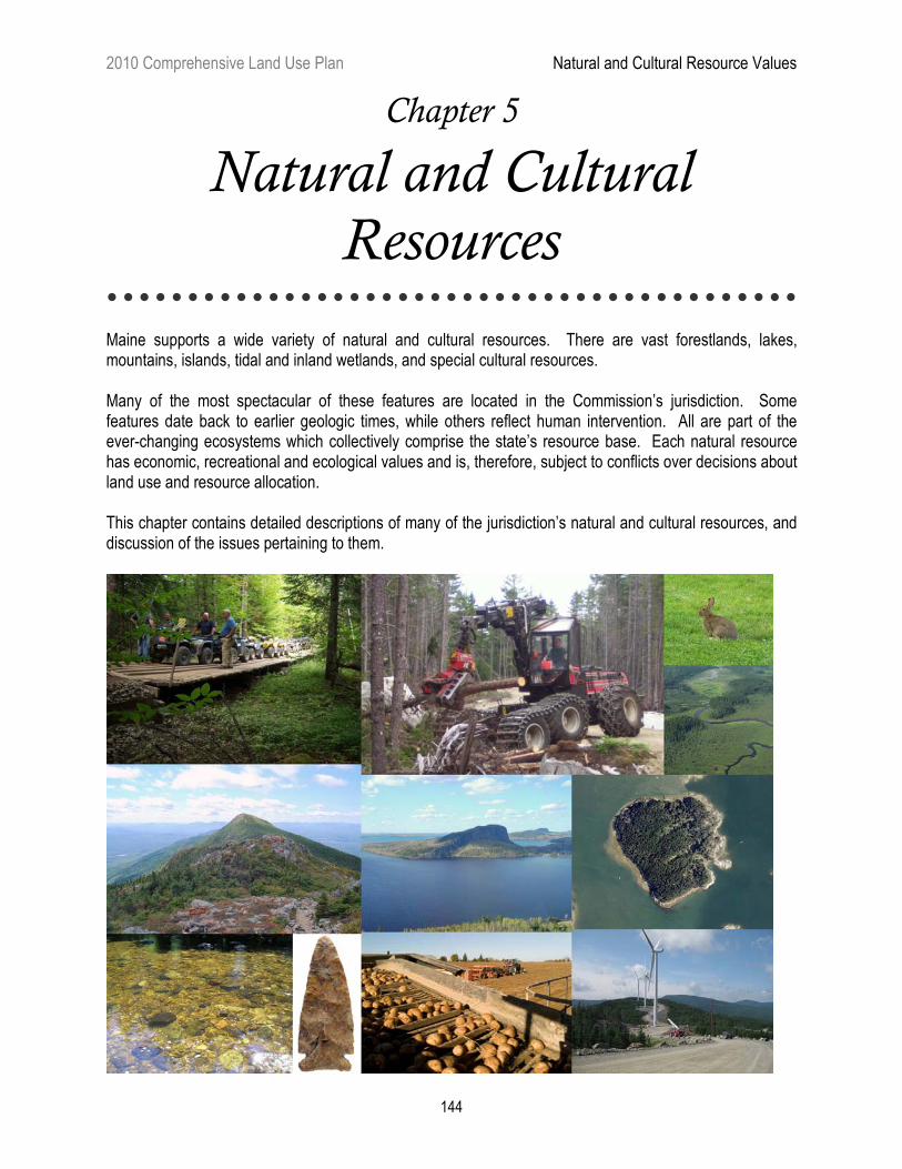
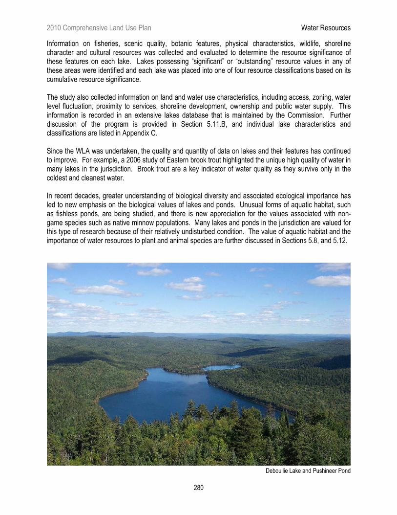
2010 Comprehensive Land Use Plan Natural and Cultural Resource Values 144 Chapter 5 Natural and Cultural Resources Maine supports a wide variety of natural and cultural resources. There are vast forestlands, lakes, mountains, islands, tidal and inland wetlands, and special cultural resources. Many of the most spectacular of these features are located in the Commission’s jurisdiction. Some features date back to earlier geologic times, while others reflect human intervention. All are part of the ever-changing ecosystems which collectively comprise the state’s resource base. Each natural resource has economic, recreational and ecological values and is, therefore, subject to conflicts over decisions about land use and resource allocation. This chapter contains detailed descriptions of many of the jurisdiction’s natural and cultural resources, and discussion of the issues pertaining to them.
Transcript
2010 Comprehensive Land Use Plan Natural and Cultural Resource Values
144
Chapter 5
Natural and Cultural
Resources
� � � � � � � � � � � � � � � � � � � � � � � � � � � � � � � � � � � � � � � � � � � Maine supports a wide variety of natural and cultural resources. There are vast forestlands, lakes, mountains, islands, tidal and inland wetlands, and special cultural resources. Many of the most spectacular of these features are located in the Commission’s jurisdiction. Some features date back to earlier geologic times, while others reflect human intervention. All are part of the ever-changing ecosystems which collectively comprise the state’s resource base. Each natural resource has economic, recreational and ecological values and is, therefore, subject to conflicts over decisions about land use and resource allocation. This chapter contains detailed descriptions of many of the jurisdiction’s natural and cultural resources, and discussion of the issues pertaining to them.
2010 Comprehensive Land Use Plan Natural and Cultural Resource Values
Despite its limited presence, agriculture is important to the jurisdiction. Agriculture makes a significant contribution to local and regional economies, and is an important part of the culture and heritage of many rural areas. Working farms keep significant lands in open space and help to maintain the tradition of the jurisdiction as a place where resource-based uses predominate.
A relatively small portion of the area within the jurisdiction is used for agricultural production. A number of factors contribute to agriculture's limited presence here: The availability of seasonal and trained year-round workers is limited; productivity is constrained by weather, soils which are poorly suited to agriculture, and the lack of large contiguous tracts of suitable land; and processing services and distribution centers are difficult to access without high-volume production.
While agriculture is not presently widespread in the jurisdiction, there remains potential for future expansion. The predominance of undeveloped land, general absence of incompatible uses and presence of pockets of good soil make some areas suitable for agriculture. To survive and expand, new types of agricultural enterprises may be needed. Farmers’ efforts to diversify into new markets, such as agritourism, direct marketing and specialty products, has been dubbed the “Agricultural Creative Economy” and is a promising new trend in Maine, with approximately 15% of Maine’s farmers participating and an estimated $75 million in sales. 5.1.A PREDOMINANT AGRICULTURAL CROPS
Potatoes and blueberries are the major cultivated crops in the jurisdiction. In 2008, Maine cultivated 57,100 acres of potatoes (this includes acreage in towns not within the jurisdiction). Maine potato acreage has remained stable in the past five years, with 68% of the acreage shifting to processing potatoes, 19% to seed stock and 13% to tablestock production. Innovation in production and marketing is occurring: Growers are using GPS technology for planting, advanced storage technology and digital imaging for potato grading. Markets are now global, due in large part to the internet and the availability of high-quality seed. Some of the acreage that had been taken out of potato production in the late 1990s and early 2000s continues to be used for other agricultural crops, such as Christmas trees.
Most blueberry production in the state takes place in Washington County, with a substantial amount occurring in the jurisdiction. Maine’s dominance in blueberry production has been challenged in recent years by an increase in production in Canada. To remain competitive, Maine producers have improved large tracts of blueberry acreage — much within the jurisdiction — by using irrigation and other technologies to increase production. Maine blueberry production hit a landmark level of 110
2010 Comprehensive Land Use Plan Agricultural Resources
146
million pounds in the year 2000, but has generally varied between 60 million and 80 million pounds per year, depending on weather-related factors. Market demand has skyrocketed in the last decade, as illustrated by blueberry prices: In 2000, the price per pound was $0.40, but had more than doubled to $0.94 by 2007. The acreage dedicated to blueberry production in Maine is expected to remain relatively stable and the market is expected to remain strong.
While cranberry production has increased in recent years, and the market is continuing to grow, it is not yet considered a significant agricultural sector in the state. Historically, cranberry plantations were created in wetlands, mostly along streambeds that could be dammed to provide flooding. More recent cranberry plantations were developed using the upland plantation development model, whereby upland sites are constructed with contained water sources such as ponds or bogs. These upland plantations have fewer environmental impacts and are generally easier to permit. When market factors make the expansion of cranberry production profitable, this upland model may make it easier for Maine growers to develop new production sites.
Smaller amounts of land in the jurisdiction are devoted to other forms of agricultural production, including poultry, apples, broccoli and other vegetables, and dairy and beef cattle. Canola production is also increasingly seen in the jurisdiction as a crop in rotation with potatoes. The production of maple syrup has expanded significantly in recent years. An approximately $2 million industry in the early 1990s, Maine’s maple syrup production reached nearly $8.8 million in 2008. This increase in value is largely due to improved marketing methods: While Maine historically sold much of its maple syrup in 50 gallon drums, it now markets increasing amounts in small value-added containers. Other forest-based agricultural products in the jurisdiction include “tipping” of evergreen boughs for wreath production and harvesting of fiddleheads. 5.1.B LURC REGULATORY APPROACH
Most agricultural operations are located in the General Management (M-GN) Subdistrict. The M-GN Subdistrict is intended to enable forestry and agriculture to occur with minimal interference from unrelated development in areas where the resource protection afforded by protection districts is not necessary. Agricultural management activities are statutorily exempt from regulation by the Commission in management subdistricts.
The Highly Productive Management (M-HP) Subdistrict is designed to ensure the continued availability of products from high-yield or high-value forest and/or agricultural lands by reserving areas for these uses. To date, this subdistrict has not been applied due to the difficulty of defining qualifying lands. Until this issue is resolved, the Commission reaffirms its commitment to maintaining prime agricultural lands where they have been identified. The Commission has a limited role in regulating agricultural practices, but does, in some cases, regulate nutrient management and water withdrawal. Many other practices, such as integrated pest management or the use of genetically modified organisms, are addressed by the Maine Department of Agriculture.
2010 Comprehensive Land Use Plan Agricultural Resources
147
Potato Harvest
5.1.C AGRICULTURAL RESOURCE ISSUES
The major factors affecting the future of agricultural resources are economic. The removal of land from food production is an issue of global and national importance, yet is extremely difficult to address due to the dynamic and interconnected nature of the marketplace. Diversification and innovation may prove to be key to the future viability of agriculture within the jurisdiction. In light of prior acreage reductions in potato production, the stabilization of that industry is encouraging, as are the increases in blueberry prices and maple syrup production. The development of the agricultural creative economy is also very encouraging, and the Commission will align its policies with the needs of diversifying farms whenever possible. The issue of greatest concern is development and fragmentation of the jurisdiction's remaining working farms and cleared farmlands, especially those that have prime agricultural soils and are close to markets and community services. Prime agricultural soils are a limited and irreplaceable resource. These soils are considered a valuable resource worthy of protection wherever they are found, particularly when they are located near areas that have the infrastructure to support farming. While the location of these soils are not presently known, extensive soils mapping is currently being conducted in the jurisdiction by the Natural Resource Conservation Service and information about the occurrence of prime agricultural soils is expected to be available in 2011. Working farms and cleared agricultural soils are especially important to maintain because, once a farm is forested, it can be difficult to find a farmer with sufficient capital to return it to production. When agricultural land is abandoned, the opportunity still remains to return it to agricultural use in the future in response to changing circumstances and markets, if sufficient capital is available. Once land is developed or topsoil removed and sold, however, the option of restoring the land to agricultural use is essentially eliminated. For these reasons, the Commission will discourage fragmentation of working farms and prime agricultural land, and will guide development away from these areas.
2010 Comprehensive Land Use Plan Agricultural Resources
148
Existing methods for reducing the conversion of farmland include tax advantages such as the open space program or the sale of conservation easements through private and public programs such as Land for Maine’s Future. However, the survival of farms may be partially tied to the ability of the farmer to capitalize on other values of the land, including areas of the farmer’s holdings that are not prime agricultural soils. The Commission will consider the complex factors that influence the retention of farms and farmlands when it implements measures to guide development. Land conservation is discussed further in Chapter 4. In order to remain competitive, most agricultural operations must use the land intensively and take measures to reduce crop and soil loss. The use of fertilizers and pesticides, and the withdrawal of water for irrigation, boosts productivity and improves crop quality and consistency. However, these activities need to be conducted with care to ensure that they do not create excessive impacts on natural resources and neighboring land uses. The listing of the Atlantic salmon as a federally endangered species has meant even closer scrutiny of the effects on stream flow of water withdrawal for irrigation. Water use is the focus of new regulation, including the 2007 adoption of statewide major water use laws and rules. LURC’s permits must be in compliance with these standards, including withdrawals for agricultural use. Soil erosion and sedimentation are also potential effects of agricultural operations. The state has regulatory programs for nutrient management and control of pesticides and also has developed best management practices and integrated pest management programs for agriculture and other significant land uses. Compliance with these programs can significantly minimize adverse impacts on surrounding resources. The Commission will continue to work actively with federal and state environmental and agriculture agencies and with industry to appropriately manage voluntary best management practices and, where necessary, permits for agricultural use of pesticides and surface and ground water. In managing irrigation and pest issues, Maine farmers will also be facing changes in climate that will have significant impacts. According to “Maine’s Climate Future,” published in February 2009 by the University of Maine, Maine farmers are already seeing northward shifts in the plant hardiness zones. They are also likely to experience greater needs for irrigation and new challenges from a changing suite of crop pests and pathogens and increased pressure from invasive plants. The Commission will be sensitive to the changing needs of farmers over time and will adapt permit requirements and land use standards as appropriate. Climate change is discussed further in Section 5.2.
The trend toward larger maple syrup sugaring operations, many of which are in remote locations, has brought with it a need for more extensive accommodations to house workers and equipment. When issuing permits for these facilities, the Commission has generally stipulated that the facilities shall not be used for other purposes, unless it specifically approves the other uses. Agriculture is not always compatible with residential or commercial uses because of nuisance conditions such as noise, dust and smells. As residential development encroaches on farmland, conflicts sometimes arise between established and emerging land uses. Maine’s Right to Farm law is designed to allow farms to persist and thrive, even in areas with recent residential development. However, it may be preferable to avoid situations where such conflicts are likely. By separating incompatible land uses and encouraging residential development to locate away from working farms, the Commission will help to prevent these conflicts. As the Commission considers how future regulatory actions may encourage the conservation of existing farms and the development of new farms, it will explore a range of options, including the use of better soils data and innovative conservation tools such as transfer of development rights, to identify and protect areas of prime agricultural land.
2010 Comprehensive Land Use Plan Agricultural Resources
149
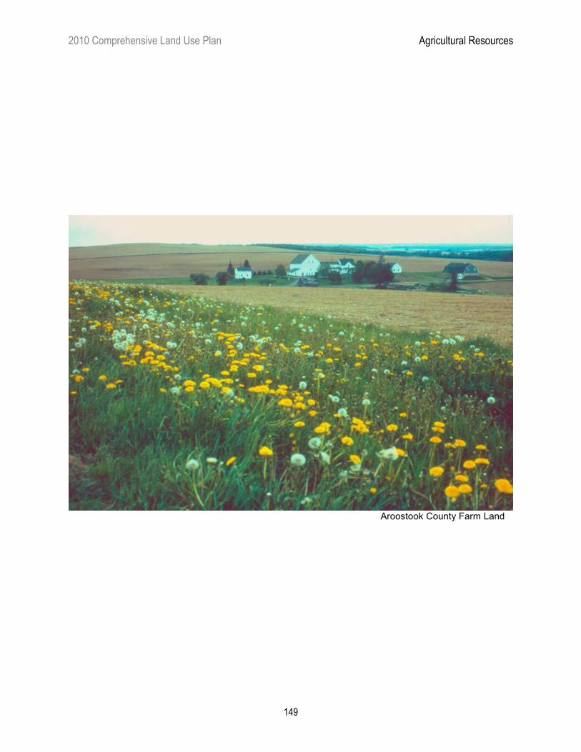
Aroostook County Farm Land
2010 Comprehensive Land Use Plan Air and Climate Resources
While areas within LURC jurisdiction are generally characterized by clean air and good visibility when compared to some parts of the U.S., there are still significant air quality issues that affect the jurisdiction as well as the surrounding New England and Atlantic Provinces region. Air issues are often quite complex and include not only ambient air quality issues, but also air pollutant deposition issues and climate change. Unlike some resources of the jurisdiction, air resources are particularly transient in nature and therefore influenced by factors well outside the boundaries of the jurisdiction.
Air quality has far reaching effects on the health of forests, water bodies and wildlife in the region. Additionally, clean air and smog-free skies are important to residents and recreational visitors in terms of the impacts on human health, as well as visibility and scenic resources. In the past, Maine has exceeded health-based standards for particulates, sulfur dioxide, carbon monoxide and ground-level ozone, but implementation of a wide variety of local and regional emission reduction strategies has been successful in helping Maine meet most of the National Ambient Air Quality Standards. However, the incidence of non-attainment is expected to increase when stricter standards are promulgated by the federal government in the coming years as ongoing research suggests that current standards may not be stringent enough to protect human health, vegetation and ecosystems and do not account for the effects of biomagnification and persistence of pollutants in the environment. As an example, Maine was in attainment of the previous ozone standard of 0.08 parts per million (ppm), but monitored concentrations along the coast from Kittery to Acadia National Park are violating the more current 0.075 ppm ozone standard. 5.2.A AIR QUALITY AND FORESTS The forest plays an important role in maintaining good air quality, regionally and globally. It produces oxygen, necessary to human survival, and absorbs carbon dioxide, a greenhouse gas that plays an important role in regulating the earth's climate. The value of forests for their ability to absorb and store carbon (“carbon sequestration”) is of growing interest, given rising concern about greenhouse gas emissions.
While the forest removes some air pollutants from the atmosphere, it is also vulnerable to damage by other compounds. Forests at high elevations are especially vulnerable to damage by air pollutants. Subject to greater precipitation, cloud frequency and exposure, these forests receive much higher levels of certain pollutants than lowland areas. This pollution may have contributed to declines in high elevation spruce and fir forests in the Appalachian Mountains of the Eastern United States over the past two decades.
The impact of air pollutants on the forest is a topic of ongoing research. Trees weakened by exposure to pollutants may be more susceptible to damage by insects and disease. A decline in forest health and productivity could dramatically affect the region’s ecology and economy. 5.2.B AIR POLLUTANTS Nonlocal sources of air pollution account for the greatest percentage of the pollutants influencing the air quality of the jurisdiction. These sources are principally population and industrial centers on the east coast, in the Midwest and in southern Canada. These areas generate primary emissions of suspended particulate matter, sulfur oxides, carbon monoxide, hydrocarbons, heavy metals and nitrogen oxides, all of which are
2010 Comprehensive Land Use Plan Air and Climate Resources
151
transported long distances in the atmosphere. Regional haze, particle pollution, ozone and other secondary pollutants are formed in the atmosphere along the route from those primary emissions.
Local sources of air pollution, which account for a very minor percentage of the pollutants influencing the jurisdiction, include sulfate-processing pulp mills adjacent to the jurisdiction, insecticide and herbicide spraying associated with timber management and agriculture, forest fires, woodburning stoves and furnaces, vehicle emissions, logging roads (dust) and biomass plants.
While the Commission has no direct authority to control sources of air pollution outside of its jurisdiction, Maine along with other states has legal standing to pursue air pollutant transport issues through regional bodies, such as the Ozone Transport Commission established by the Federal Clean Air Act. The Commission supports such efforts and has a vested interest in tracking air quality. Additionally, the Commission will continue to consider the effect of its zoning and permitting decisions on air quality in the region because of the potential of poor air quality to affect other natural resources. Acidic Deposition Acid rain occurs when air pollutants, particularly sulfur dioxide and nitrogen oxides, combine with water to form acids. Since the phenomenon of acid rain was first identified, there has been considerable concern about its potential impacts on lakes, streams and forests. Although sulfur emissions have decreased as a result of control programs, projected emissions of sulfur and nitrogen compounds are expected to have continuing negative impacts on forests, presenting some of the most serious long-term threats to forest health and productivity in northeastern North America.
Excess sulfur and nitrogen deposition may reduce the supply of nutrients available for plant growth. Nutrient depletion leads to increases in the susceptibility of forests to climate, pest and pathogen stress which result in reduced forest health, reduced timber yield, and eventual changes in forest species composition. Factors that increase forest sensitivity include: high levels of nitrogen and sulfur deposition, low mineral weathering rates, tree species with high nutrient demands, and biomass extraction rates. High elevation forests and areas closest to emission sources experience the highest levels of nitrogen and sulfur deposition. Low mineral weathering rates occur in association with particular geologic and climatic factors. Requirements for soil nutrients vary according to the species currently growing in a forest because tree species have different nutrient requirements for health and growth. Sugar maples, for example, have a high demand for calcium.
Critical load approaches offer air quality and natural resource managers a powerful tool with which to identify ecosystems at risk and to tailor monitoring and management strategies to address specific resource issues. As it applies to the atmospheric deposition of acid forming compounds, a critical load is that level of exposure to sulfur and nitrogen compounds below which no harmful effects are known to occur within a specified environment or ecosystem.
A critical load map for Maine was recently completed and critical loads have been calculated for Maine’s forest ecosystem. Atmospheric deposition of sulfur and nitrogen from 1993 through 2003 exceeded the critical load in 36% of Maine’s forested area. This occurred most in northern Maine where critical load values are among the lowest due to geologic conditions and high timber utilization.
Increased acidity of soil moisture also mobilizes some toxic metals normally occurring in most forest soils, including zinc, manganese and aluminum. Usually benign in trace amounts, research has shown that elevated concentrations of these metals in acidic soils damage root systems and slow growth in some tree species. This may reduce harvests under sustainable forestry practices.
2010 Comprehensive Land Use Plan Air and Climate Resources
152
Sulfur and nitrogen compounds also impact the chemistry of lakes. Acid deposition degrades water quality by lowering pH levels, decreasing acid-neutralizing capacity and increasing aluminum concentrations. About 100 lakes in Maine are considered acidic; half are naturally acidic while the other half have elevated levels of acidity due to human causes like acid rain. Acid rain research has revealed that 26.7% of surveyed lakes in Maine exceed critical load values for acidity, compared to 11.6% in the Northeast region. Despite decreased deposition of sulfur associated with the Clean Air Act Amendments, recovery of chemical water quality has been slow across the Northeast. This is due in part to complex changes in both soil and water chemistry. Heavy Metals Heavy metals such as lead, zinc, cadmium, copper, chromium, mercury and vanadium generally originate from fossil fuel combustion, refuse incineration and industrial processes, as well as from natural sources such as volcanic emissions. These heavy metals can travel long distances in the air to remote Maine forests. Once deposited in the forest, the metals remain in the ecosystem for a very long time. The presence of mercury in the environment is a topic of growing concern and study. Research indicates that recent mercury deposition exceeds background levels by a factor of three or more. High levels of mercury have been found in some fish, including fish from “pristine” inland lakes. Air pollution, and sediments contaminated by industrial discharges are sources of mercury. Researchers suspect that lake conditions of low pH and low alkalinity make mercury available for uptake by organisms. Air pollution models have been used to explore patterns of mercury transport and deposition in the Northeast. Results suggest that measurable quantities of mercury are being deposited throughout the Northeast states, including in remote areas. For example, research has revealed high concentrations of mercury in Flagstaff and Aziscohos Lakes. Some common loons and river otters from the interior of Nova Scotia and several New England states have among the highest tissue mercury concentrations reported for these species. Mercury is a widespread problem, and research continues in this area. New England Governors and Eastern Canadian Premiers have been working together on ways to develop and implement national and continental responses aimed at the elimination of mercury discharges into the environment. Ozone Ozone is a key constituent of both the troposphere and stratosphere (the first two layers of Earth’s atmosphere). At abnormally high concentrations, tropospheric ozone is considered a pollutant. Tropospheric ozone is not emitted directly from a source, but is formed from hydrocarbons, nitrogen oxides and sunlight at the earth's surface. Hydrocarbons are emitted principally by automobiles and industrial uses utilizing petroleum-based products. Nitrogen oxides are emitted by combustion sources. It is estimated that most ozone in Maine is transported here from urban areas outside the state or generated in the atmosphere en route to Maine, although some is generated from local sources. Widespread regions of the Eastern U.S. experience episodes of elevated ozone levels. Considered one of the most damaging air pollutants on a regional basis, elevated ozone levels are harmful to human health as well as tree growth. Eastern white pine is particularly sensitive to ozone. Ozone levels throughout Maine periodically exceed state and federal standards (14 days in 2007, four days in 2008 and two days in 2009), and researchers suspect that chronic and possibly acute ozone damage does exist in Maine’s forest. Achieving attainment of the eight-hour Ozone National Ambient Air Quality Standard of 0.075 ppm within all of Maine continues to be a state priority. However, ozone levels and resulting air quality will continue to be influenced by the amounts of ozone-forming pollutants being emitted.
2010 Comprehensive Land Use Plan Air and Climate Resources
153
5.2.C CLIMATE Climate is defined as the 30-year average weather conditions of a given place and includes temperature, precipitation and wind, among other factors. The National Weather Service has identified three different climate divisions in Maine: Coastal, Southern Interior, and Northern. These climate divisions present a range of climates more geographically compressed than most similarly sized areas in the world. These climates vary in temperatures and amounts of annual precipitation (Table 6). Table 6 – Maine Annual Average Temperature and Precipitation Over the Past 100 Years
Maine Climate Division Annual Average Temperature
Annual Average Precipitation
Coastal 44.30 °F 46.49 in. Southern Interior 43.15 °F 44.12 in. Northern 39.31 °F 41.13 in.
(Source: Jacobson, G.L., I.J. Fernandez, P.A. Mayewski, and C.V. Schmitt)
Much of what Maine is today is the result of its climate. The climate currently supports numerous existing resources, such as the sub-boreal forests and the wildlife that depends upon them, extensive lobster fisheries, renowned snowmobiling and coldwater fisheries. Much of the economy of Maine depends upon the persistence of these existing resources, as discussed in other sections of Chapter 5. Climate Change Scientific data show that the earth has undergone warming and cooling cycles over hundreds of thousands of years. However, the global temperature has been rising an annual average of 0.08 °F per decade over the past 150 years, while the average for the past 50 years has been at the rate of 0.23 °F per decade. According to the Intergovernmental Panel on Climate Change, there is new and stronger evidence that most of the warming observed over the last 50 years is attributable to human activities, and climate scientists have arrived at a broad consensus about air pollution and climate change: Simply put, carbon dioxide and other global warming emissions are heating up our planet. Carbon dioxide emitted into the atmosphere has the effect of trapping energy from the sun within the Earth’s atmosphere. While initially this results in a warming trend, the secondary impacts are expected to present a range of variations, a distinction that has resulted in no longer referring to the issue as global warming, but rather as global climate change. Since the pre-industrial era, atmospheric concentrations of carbon dioxide have increased nearly 30%, methane concentrations have more than doubled, and nitrous oxide concentrations have risen by about 14%. The present carbon dioxide concentration has not been exceeded during the past 420,000 years and likely not during the past 20 million years. Increases in temperature and the consequent regional changes in climate have already affected both physical and biological systems in many parts of the world. Changes have been evident in Maine as well. Over the last century, the average temperature in Lewiston, for example, has increased 3.4 °F, and precipitation has decreased by up to 20% in many parts of the state. According to data collected in 2002, the ocean near Boothbay Harbor was 6.5 °F warmer than any August since 1905.
2010 Comprehensive Land Use Plan Air and Climate Resources
154
Predicting specific outcomes of climate change is difficult given the complexities of environmental systems involved. Based on best available information, outcomes will likely include:
� Changes in average air temperatures;
� Changes in precipitation, either by amount, duration, or event frequency;
� Changes in ocean currents and/or the jet stream; and
� Extreme weather events, whether by amount, frequency, intensity or duration.
Individual and incremental changes, even if relatively small, could collectively produce dramatic outcomes. Increasing average air temperature is expected to shift forest composition toward hardwood forests, create a climate for new pests or diseases, reduce the duration of winter months or amounts of snow, and expand or shift some growing seasons. Shifting habitat conditions may impact wildlife persistence, particularly for those species already at the edge of their ranges. Changes in ocean currents or the jet stream could easily introduce new species of insects, plants or animals, or could cause additional changes in average air temperatures or precipitation. Climate change is poised to affect many aspects of the economies and ecosystems of the state and the jurisdiction. Projections of Maine’s future climate vary widely depending upon the assumptions used in the models. However, considered collectively, even widely varying projections can provide valuable insight into the likely range of results. According to projections made by the Intergovernmental Panel on Climate Change and results from the United Kingdom Hadley Centre Climate Model, temperatures in Maine could increase
CLIMATE CHANGE AND LOBSTERS
“More than half of the annual U.S. lobster catch is landed in Maine, and landings here have increased steadily since the early 1970s. The remarkable increase in lobster landings over the past two decades could be the result of bottom water warming over that period, which would enhance conditions for settling juvenile lobsters. Growth rates of lobsters increase with warmer temperatures, as they reach reproductive maturity at a smaller size and at an earlier age.
Yet fish predation on lobsters is higher in southern New England than in Maine, likely owing to a more diverse assemblage of predators. As the Gulf warms, the southern fish community could expand northward, resulting in higher predation. And, finally, at very warm temperatures (above 77°F), lobsters become physiologically stressed.
Fishermen are already noticing significant changes in the lobster fishery, including altered growth and migration behavior. Changes in the lobster fishery have serious implications for Maine’s coastal communities, where thousands of licensed lobstermen and women support numerous related industries such as boatbuilding, lobster trap production, bait distribution and transport, and marketing infrastructure. In the event of a collapse, the social landscape along the coast would shift away from commercial fishing with little chance for reversion back to a working waterfront should stocks recover in the future.”
Jacobson, G.L., I.J. Fernandez, P.A. Mayewski, and C.V. Schmitt (editors). 2009 Maine’s Climate Future: An Initial Assessment. Orono, ME: University of Maine.
2010 Comprehensive Land Use Plan Air and Climate Resources
155
by 4 °F by 2100. However, projections made by the University of Maine show temperatures increasing between 0.09 to 2.82 °F by 2100. Precipitation is projected to show little change in spring, increase by 10% in summer and fall, and increase by 30% in winter. The University of Maine projects an average change of -1.35 to 8.07 inches of precipitation over the same period for the state. Sea level is projected to continue rising. At Rockland, sea level has already risen by 3.9 inches in the past century, and it is likely to rise another 14 inches by 2100.
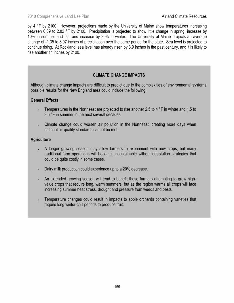
CLIMATE CHANGE IMPACTS
Although climate change impacts are difficult to predict due to the complexities of environmental systems, possible results for the New England area could include the following:
General Effects
� Temperatures in the Northeast are projected to rise another 2.5 to 4 °F in winter and 1.5 to 3.5 °F in summer in the next several decades.
� Climate change could worsen air pollution in the Northeast, creating more days when national air quality standards cannot be met.
Agriculture
� A longer growing season may allow farmers to experiment with new crops, but many traditional farm operations will become unsustainable without adaptation strategies that could be quite costly in some cases.
� Dairy milk production could experience up to a 20% decrease.
� An extended growing season will tend to benefit those farmers attempting to grow high-value crops that require long, warm summers, but as the region warms all crops will face increasing summer heat stress, drought and pressure from weeds and pests.
� Temperature changes could result in impacts to apple orchards containing varieties that require long winter-chill periods to produce fruit.
2010 Comprehensive Land Use Plan Air and Climate Resources
156
CLIMATE CHANGE IMPACTS (CONTINUED)
Forests
� The effects of a changing climate on forest resources could include changes in species composition, geographic range and health and productivity. While many tree species may be able to persist during this century even if their optimal climate zones shift northward, some may succumb to climate stress, increased competition and other pressures.
� Productivity of spruce-fir forests is expected to decline and suitable habitat for these species will all but disappear from the Northeast by the end of the century. This would greatly exacerbate stresses on the pulp and paper industry in the Northeast, particularly in Maine, where the forest-based manufacturing industry is key to the state’s economic health.
� Winter warming will threaten hemlock stands, not only by reducing suitable habitat for this species, but also by allowing northward expansion of a fatal pest known as the Hemlock Woolly Adelgid.
� Warmer temperatures and reduced rainfall may increase the threats of forest fires.
Coasts and Shorelines
� Global sea level is projected to rise by 7 to 34 inches, by the end of this century. The erosive impacts of waves (especially storm waves) will contribute more to shoreline retreat and wetland loss than the loss of land caused by the rise in sea level itself.
Marine Impacts
� Warming of the region’s colder northern waters (particularly the eastern Gulf of Maine) may actually boost lobster productivity. It may also make the environment more hospitable to “lobster shell disease”.
Winter Recreation
� The length of the winter snow season could be cut in half across Maine, New Hampshire, northern New York and Vermont.
� Global warming is projected to profoundly affect winter recreation and tourism in the Northeast as winter temperatures continue to rise and snow cover declines. Snowmobiling is the most vulnerable of the region’s economically important winter recreation activities because, unlike the ski industry, it cannot rely upon machine-made snow.
2010 Comprehensive Land Use Plan Air and Climate Resources
157
5.2.C LURC REGULATORY APPROACH Most air pollutants are regulated by the Maine Department of Environmental Protection (“DEP”), which administers air quality standards. Nevertheless, the Commission does play a role in monitoring and protecting air quality, principally through the permitting process. The Commission's authority in regulating air quality is broad, deriving from two statutory criteria: (1) that the Commission approve no application, unless "adequate technical and financial provision has been made for complying with the requirements of the state's air and water pollution control and other environmental laws...", and (2) that "adequate provision has been made... to assure there will be no undue adverse effect on..." natural resources. In reviewing individual projects within its jurisdiction, the Commission considers air quality issues, but relies heavily on DEP review under other air quality laws, especially on larger projects. However, the Commission has not reviewed its land use regulations in regard to their impacts on climate. In 2001, Maine signed on to the Conference of New England Governors and Eastern Canadian Premiers 2001 Climate Change Action Plan. The plan identifies three major reduction targets for greenhouse gases in the region: A return to 1990 levels by 2010, a 10% reduction from 1990 levels by 2020, and recognition of the long term need to reduce our present day emissions by 75-85%. It calls upon each state and province to create its own Climate Change Action Plan. In 2003, the Maine Legislature enacted “An Act to Provide Leadership in Addressing the Threat of Climate Change” (LD 845), placing into law a policy of reduction in greenhouse gases. As a result, the DEP convened a group of over 30 stakeholders to develop a climate action plan for Maine aimed at responding to global climate change and achieving greenhouse gas emission reductions in Maine. During the 2009 legislative session, two bills (LD 460 and 891) were passed or carried over by the Legislature that focus on possible solutions and adaptations to climate change. While most of these actions do not directly affect the Commission or its charge, they do reflect a commitment by the Legislature, and the state as a whole, to address climate change. The Commission will continue to monitor these efforts and act in accordance with Legislative direction. 5.2.D AIR RESOURCE ISSUES Air Pollutants
Maine forests bear the chemical signature of exposure to air pollutants, but the long-term effects on forest health and productivity are still unknown. Air pollution delivers elevated levels of nitrogen, sulfur, ozone, heavy metals, carbon dioxide and other compounds to forest ecosystems. These materials are changing the chemical and biological characteristics of forest soils. Accumulated trace metals are evident in forest soils, and although levels in Maine forests are lower than those in states to the south, they are still clearly above pre-industrial conditions. Air pollutants also have the potential to adversely affect human health. Most health effects are respiratory in nature. High concentrations of particular pollutants can cause breathing problems for specific population groups, such as the elderly, children and people with respiratory conditions. Ground-level ozone periodically exceeds state and federal standards in some areas of the jurisdiction during the summer and affects many such groups. Long-term exposure to low levels of certain air pollutants is suspected as a possible cause of some diseases. Degradation of stratospheric ozone, which shields the earth from cancer-causing ultraviolet rays, is also of concern.
2010 Comprehensive Land Use Plan Air and Climate Resources
158
The Commission will consider both the beneficial and adverse impacts to air resources in its evaluation of residential and nonresidential development projects. Additionally, the Commission recognizes the importance of understanding and tracking the effects of air pollution on other valued resources, such as lakes and forests, and will participate in dialogue concerning these resources. Climate Change Global climate change will influence Maine and the jurisdiction in many ways. Some industries, activities and species will thrive in the new conditions, while others will be harmed or eliminated. The degree of potential disruption to Maine’s natural and human systems is a cause for significant concern. Predicting specific outcomes is difficult given the complexities of environmental systems involved; however disregarding the issue and its likely effects is no longer an option. Solutions pursued at the state or federal level to slow or mitigate climate change are likely to range from minor policy shifts to stringent emission or energy efficiency standards, though many of these solutions are beyond the purview or expertise of the Commission. However, land use patterns do play a role in climate change. Development clustered near jobs and services can significantly reduce energy consumption for transportation. Clustered development and infrastructure can consume less forestland, leaving larger areas available for forest management activities. The Intergovernmental Panel on Climate Change asserts that (1) a climate-conscious development policy might discourage sprawling subdivisions, instead promoting high-density neighborhoods that would reduce travel distances, as well as smaller homes that would require less energy to heat and cool; (2) it is possible to capture greenhouse gases, most notably carbon dioxide, through increasing the size and nature of forested areas, encouraging natural carbon sinks; and (3) the sustainable use of forest products, including bioenergy to displace the use of fossil fuels and manufacturing of products to replace higher energy input versions, may make a significant contribution to mitigating climate change in the longer term, because it avoids the introduction of new carbon into the active carbon cycle. Effective action will require changes to all aspects of land use, including residential and commercial development, transportation, energy consumption and production, and the provision of services. Although other governmental agencies regulate air and climate resources, the Commission is the only agency that reviews land uses with respect to geographic location or pattern of development for Maine’s unorganized territory. While the Commission has worked to implement policies promoting sound planning principles and sustainable development, and will continue to do so based on its statutory charge, the critical issue of climate change provides particular affirmation and a certain level of urgency to those efforts. Maine has within its borders, a large part of the largest contiguous block of undeveloped forestland east of the Mississippi River. Because this area is a working forest, it is sequestering carbon within the trees and ultimately in the products made from these resources, thus making this area a valuable carbon sink. Programs are being developed that compensate landowners for maintaining healthy forests specifically for this carbon sequestration value. These and other similar programs are likely to be an important part of Maine’s contribution to mitigating the causes of global climate change. Climate change will not be addressed solely by actions taken within the Commission’s jurisdiction or even the state. However, the Commission takes seriously its responsibility to undertake reasonable efforts to contribute to the solution. Accordingly, the Commission is committed to working collaboratively to identify and implement appropriate measures to mitigate climate change.
2010 Comprehensive Land Use Plan Coastal Resources
A small portion of the Commission’s jurisdiction borders the coast, comprising part of Maine’s magnificent coastline. Two mainland townships, Trescott and Edmunds, have considerable ocean frontage between Machias and Eastport. The jurisdiction's most significant coastal resources, however, are 780 islands, located mostly in the mid-coastal part of the state. These resources include two island plantations, 280 named islands, and 498 unnamed islands and ledges, and represent about 5% of the total number of coastal islands in Maine. Although the total land area of these islands is small in relation to the rest of the jurisdiction, they warrant extended discussion and special consideration for several reasons. First, taken together, the coastal islands are a defining feature of Maine's spectacular coast, and they exhibit many of the jurisdiction’s principal values: they are numerous and diverse, with unique natural resources; a few of them support one of the original working landscapes — fishing settlements; their lands and surrounding marine environment offer many varied recreational opportunities; and, accessible only by air or water, many of them are relatively remote and possess outstanding scenic character. Second, their natural and human environments differ significantly from those of mainland areas and present a distinct set of planning and land use issues. Third, as coastal areas, many islands are attractive locations for development and have experienced increased development pressure and recreational use as well as conservation efforts during the past two decades — trends that are likely to continue. 5.3.A PHYSICAL AND NATURAL CHARACTERISTICS Most of the islands in the jurisdiction can be cast into four geographic groups. The Muscongus Bay group is located at the mouth of the Medomak River near Bristol. The Muscle Ridge group is located east of St. George. The East Penobscot Bay group is situated west of Deer Isle. The outer island group is composed of islands more than five miles from the mainland. The remaining islands lie Downeast (Marshall and Ringtown Islands in Toothacher Bay near Swan’s Island and numerous islands within the boundaries of Edmunds and Trescott Townships). Many unique features of islands are a result of their isolation, small size and exposure to the marine environment. Surrounded by ocean, islands have evolved separately from mainland areas, resulting in an environment that is distinctive yet sensitive to natural disturbance. The small size of the islands — the largest within the jurisdiction is only 980 acres — and their exposure also make them vulnerable to the constant stresses of winds, waves, tides, salt, ice and animals, and to human activities. Generally, the larger the island, the more diverse its ecosystem, the more varied and numerous its plant and animal life, and the more tolerant it is of disturbance. The ocean, which acts as a moderating agent, strongly influences island climate. Summers are generally cooler and wetter than on the mainland, with many more foggy days. This cooler climate allows for the growth of some boreal and sub-arctic plant species that are found further to the north on the mainland. Island winters, on the other hand, are warmer and rainier than on the mainland, allowing some plant species to extend their range northward.
2010 Comprehensive Land Use Plan Coastal Resources
160
Island soils are typically acidic, infertile and shallow, with a thin organic layer. Larger islands often contain marshes and bogs. Vegetative cover varies depending on local conditions, soil type and past vegetation clearing practices. Most larger islands are forested and mature softwood stands predominate on many islands. Maine’s coastal islands, in fact, have abundant concentrations of mature spruce (100+ years) forests. Groundwater is the main source of freshwater on islands, but supplies are generally limited and sensitive to contamination and depletion. Island groundwater is generated entirely by rain and snowfall on the island itself, which percolates into the soil and rock. On islands, recharge of groundwater supplies can be greatly reduced by impervious surfaces that cause stormwater to flow to the ocean rather than infiltrate into the ground. The interface between groundwater and the salt water that lies around and often under the island is always moving, depending on rainfall, tides, the characteristics of the groundwater supply and, if the island is populated, water usage. In many cases, island groundwater actually floats on top of a more dense layer of saltwater. High groundwater demand or the siting of wells near this interface can cause intrusions of saltwater into the groundwater supply. Although a number of ecosystems may comprise larger islands, each island can be viewed as a distinct ecological unit with limited outside interactions and a unique set of local conditions. This means the ecology of individual islands varies considerably from that of the mainland and of other islands. It also means that the level of biological diversity and equilibrium on islands is more often a result of relative isolation than of continuous interactions with diverse ecological and human forces, as is the case on the mainland. Under these conditions, the introduction of new forces or activities can have a particularly dramatic impact on island ecology. Island wildlife resources are typically less diverse and more fragile than on mainland areas. Species generally are limited to those that can swim or fly, or those that have been introduced, intentionally or unintentionally. A number of species fill ecological niches usually occupied by other animals on the mainland, and lack of predators has resulted in large communities of certain species. Many islands have an abundance of whitetailed deer, as well as large populations of small rodents. As mentioned previously, larger islands tend to have more diverse and stable wildlife populations. Coastal islands are especially valuable for the migratory and resident birds they harbor, some of which are endangered or threatened. Many islands within the jurisdiction provide essential nesting sites for a variety of significant seabirds including eider ducks, puffins, black guillemots, terns, leach's storm petrels, razorbill auks, cormorants and gulls. Shorebirds and tidal waterfowl and wading birds are abundant on islands, and a variety of terrestrial birds is also present. Two large raptor species, ospreys and bald eagles, often nest on islands, as do herons. A number of bald eagle nest sites have been identified on islands in the jurisdiction. The Maine Department of Inland Fisheries and Wildlife (“DIFW”) recently completed an updated inventory, mapping and rating important seabird nesting islands, shorebird feeding and roosting sites, and tidal waterfowl and wading bird habitat for many islands. This recently available information will facilitate planning for their protection. An initial impetus for use and settlement of islands was their proximity to fishery resources. A variety of fish species inhabit coastal island waters, with lobsters an especially important resource, particularly since other
2010 Comprehensive Land Use Plan Coastal Resources
161
fisheries have significantly declined in recent decades. Marine mammals also frequent nearby waters, and seal haulouts have been identified on a number of islands and ledges.
The global climate changes that have been documented over the past few decades have a number of implications for the entire jurisdiction, not just for coastal communities and natural resources, although that is the focus here. Sea level rise, one of the primary concerns related to global climate change, has direct implications for coastal human and natural communities. Potential impacts involve coastal flooding; loss of marine ecosystems, saltwater fisheries and coastal property; and accelerated erosion.
Additional impacts of global climate change on coastal natural resources and ecosystems are not certain. Climate change is affecting both the physical and chemical properties of waters in the Gulf of Maine. Changes in water temperatures affect the timing of life stages, ecological interaction, disease and invasive species. Changing water circulation alters the dispersal of young, migration, nutrients and temperatures, as well as species range limits. The oceans absorb more carbon dioxide as levels of atmospheric carbon dioxide increase, making ocean waters more acidic. While increased carbon dioxide may spur sea grass growth to some extent, it is also likely that warming waters will result in greater phytoplankton blooms and epiphytic algal growth that have the potential to shade and smother eel grass. Acidification could reduce growth and survival of carbonate shells and body parts of mussels, snails, sea urchins and coralline algae, as certain shelled animals are particularly sensitive to the acidity. Marine ecosystem-level effects could result in changes in biodiversity and leverage (linchpin roles) species. Current model projections are not able to predict exactly how the Gulf of Maine will change in the future.
The implications of such changes on Maine’s island and coastal communities may be quite dramatic over the long term. A more extended discussion of global climate change appears in Section 5.2.
Matinicus Island
2010 Comprehensive Land Use Plan Coastal Resources
162
5.3.B LAND USE CHARACTERISTICS AND TRENDS Up until the early 1900s, many Maine islands were intensively logged, farmed, grazed and quarried. Year-round island communities were common. In many cases, island settlement preceded that of mainland areas. Fishing was the economic mainstay of most island communities. Depletion of island resources and declining markets in the late 19th and early 20th century led to abandonment of settlements on many islands. Today, the only islands within the jurisdiction with year-round populations are Monhegan Island and Matinicus Isle Plantations and Eagle Island. Most islands reverted to a relatively natural state after being abandoned. On many islands, there has been no significant timber harvesting or vegetation clearing since the early 1900s. Sustained development pressures over the past 20 years, however, have the potential to alter significantly Maine’s island landscape. Improvements in transportation and growing recreational boat ownership make islands more accessible now than ever. While year-round settlement has declined, second home development in the form of both new construction and conversions of year-round dwellings to seasonal use is a trend that accelerated in the 1990s and has continued into the 2000s. Tourism and recreational use are also an established trend on Maine islands, especially on larger, populated ones. Monhegan has seen a sustained increase in "daytrippers" since the 1980s, and visits to other islands have grown as well. Boating, hiking, biking, painting, photography and nature study are the most popular island recreational activities. On islands with mature stands of spruce and fir, timber harvesting is a likely future trend. According to the Maine Forest Service (“MFS”), the lack of forest management over the years on many islands has led to the development of unstable spruce stands, particularly with respect to disease and wind throw. Establishing ongoing forest management could help restore and maintain long-term stand vigor. These management operations can yield economic benefits, help control disease and remove the fire danger posed by dead and dying trees. Yet harvests on islands have potential to be highly visible — especially on islands with significant changes in topography — which can lead to controversy over harvesting activities. Development Trends Land use and development activities on particular islands vary tremendously, so for planning purposes it is helpful to make distinctions among islands within the jurisdiction. Generally, over the past ten years, permit applications and development activities on Monhegan and Matinicus, the two islands with significant year-round communities, have exceeded those occurring on the hundreds of islands with seasonal populations or no development. Islands with Year-Round Populations The two island plantations, Monhegan and Matinicus, stand apart due to their year-round communities, large seasonal populations, full-range of services and regular ferry service. The communities that have evolved on these islands are unique: the combination of social, cultural and economic factors, vernacular architecture and distinctive physical environments has created a special character that is an important resource in its own right.
2010 Comprehensive Land Use Plan Coastal Resources
163
Some of the land use and development characteristics of Monhegan and Matinicus parallel those of small mainland coastal towns. The constraints of size and isolation, however, have accentuated certain land use characteristics and resulted in some unique patterns and trends. The harbor areas of both islands are the focus of most land use and development activities. Distinct villages have evolved on the slopes adjacent to the harbors. On Monhegan, almost all housing and businesses are located within or near the village area; on Matinicus, several additional concentrations of development are located along the island's interior road system. While development activities in the last few years have continued within or near the village on Monhegan, the pattern on Matinicus may be changing somewhat. New construction is taking place more often along the roads and near the north end of Matinicus, while more additions and expansions are occurring adjacent to the harbors. Economic options on Matinicus and Monhegan are considerably more limited than those on the mainland; most working islanders are involved in fishing, tourism or both. Fishing has historically been the economic mainstay of both islands, and it remains so, with wintertime lobstering the most profitable pursuit. The large influx of seasonal residents has long provided a boost to the local economies of both islands. On Monhegan, increased numbers of "daytrippers" and short-term visitors in recent years have supported a somewhat more diversified service economy. Development activity on both islands was generally light over the last three decades. While the 2000 Census showed a slight increase in year-round homes during the 1990s, that trend was accompanied by a more substantial increase in seasonal housing numbers. Many year-round dwellings were converted to seasonal use. Much development has been in the form of enlargement of existing buildings, conversions to commercial and lodging facilities, and occasional construction of new seasonal and year-round dwellings. The pace of new construction on Matinicus has increased somewhat in the first decade of the 2000s, as indicated by building permit applications. It isn’t yet clear if that trend will continue. Other Islands The islands within the jurisdiction with smaller seasonal populations are generally less intensively developed and used than Monhegan and Matinicus. However, these islands may experience more development pressure during the 2000s, especially those located close to mainland population centers. Approximately 15 islands in the jurisdiction have summer communities comprised of five or more residences. These are mostly larger islands (50 acres or more) and, with the exception of Metinic, Large Green and Criehaven Islands, are located relatively close to the mainland. Services on these islands are generally limited, with visitors dependent on their own transportation. Many of these islands once had thriving year-round communities and some retain the character of those earlier times. Criehaven Township (also known as Ragged Island) was the last to have a significant year-round community. An intact harbor village remains, and during the summer months a number of fishermen return to live and work there. The construction of new seasonal homes and improvements to existing dwellings dominate development activities. Other development activities have involved the issuance of more permits for the construction or expansion of permanent wharves to seasonal residents on several of these islands. The trend has been toward docking facilities that can accommodate larger recreational boats and allow seasonal access at low tide.
2010 Comprehensive Land Use Plan Coastal Resources
164
A number of smaller islands in the jurisdiction (10 to 15) are developed with a few seasonal camps. Many of these islands are owned by a single owner or family. On some islands these seasonal dwellings get little use, leaving the island relatively undisturbed. The vast majority of islands in the jurisdiction are undeveloped, and probably most will remain so in the near future due to environmental constraints, inaccessibility and ownership patterns and preferences. Some have remained undeveloped due to their small size. But modern engineering, construction and transportation technologies allow many long-standing constraints to be overcome. And land ownership patterns and preferences are subject to change. Many smaller islands remain in single ownership, are held in trust or are owned by older individuals who have preferred to keep them undeveloped. But as trusts are dissolved or land passed on to family members, island interests often are subdivided, making the potential for development much greater. Changes in ownership combined with increased tourism and recreational use of coastal islands might add to development pressure across Maine’s island landscape in the future. Island Carrying Capacity The innate limits and sensitivity of the island environment become particularly important when considering islands with existing or proposed development. With a natural resource pool that is more circumscribed than mainland areas, the island environment is generally less forgiving of adverse impacts. Once an island resource such as groundwater or bird habitat has been degraded, options for mitigation are often limited and recovery, if possible, is slow. The ability of land and water resources to support human activities and development is termed "carrying capacity." This concept is particularly relevant to island environments. The limited carrying capacity of most islands will be a major consideration in evaluating land use and development. While several of the carrying capacity issues discussed below focus on Monhegan and Matinicus (the two islands with significant year-round populations), many other islands in the jurisdiction already experience some of the issues faced by the year-round island communities, and as seasonal use increases, more of these issues will arise. Groundwater use and overboard or subsurface waste disposal impacts are particularly important considerations, especially on smaller islands. And if summer communities become larger, issues such as solid waste disposal will grow in importance. Development and Land Use On Monhegan and Matinicus, the concept of carrying capacity is particularly useful for several reasons. First, existing year-round and seasonal development already "consumes" a significant portion of available carrying capacity, making wise use of remaining capacity essential. Second, carrying capacity evaluation can be broadened to include impacts on island infrastructure and services, and on the character of the community as a whole. While development activity on Monhegan and Matinicus has been relatively light in recent years compared with other parts of the jurisdiction, the limited carrying capacity of these islands requires that any development be evaluated carefully. Even one poorly sited building or new use can have a marked impact on existing resources.
2010 Comprehensive Land Use Plan Coastal Resources
165
Increased tourism and recreational use can also deplete island carrying capacity. The rapid and sustained increase of daytrippers on Monhegan during the past three decades brought concerns that island trails, services and businesses would be unable to accommodate the influx. A 2005 study of tourism on Monhegan investigated the relationship between the numbers and type of visitors to the island and the attitudes of permanent and seasonal residents as well as visitors toward resulting impacts. The study found that most survey respondents perceived a balance between maintaining Monhegan’s heritage and its economic well-being at the present time, but that visitation and the quality of life on the island is sensitive to perceptions of crowding and degradation of the island’s unique village character and unspoiled natural setting. The amount of tourism is largely dependent on the availability of ferry service, and thus is not an easy impact for island residents to control. The Monhegan study also looked at placing limits on the numbers of visitors, primarily through establishing visitor fees and using them to fund improvements and maintenance of island facilities and trails. Opinions on the concept of visitor fees were fairly evenly split among survey respondents. Drinking Water The quantity and quality of drinking water is a primary carrying capacity issue on both these islands. Monhegan is served by a public system and private wells, while Matinicus is served solely by private wells. Although the amount of groundwater varies considerably based on local rainfall, increased water use (especially during summer months) has the potential to create shortages. On Monhegan, water shortages due to overuse of the island's meadow aquifer were reported in 1985 but have since been attributed to limitations of the distribution system. Nonetheless, the island has instituted a number of water conservation measures, which indicates the importance of groundwater supplies to the community. High water use can cause saltwater intrusion problems, with potential for long-term degradation of the water supply. This is especially true of drilled wells located near the ocean, a preferred location for new homes. Water quality problems can also be caused by the septic systems that accompany new development or by malfunctions of existing systems. Unsuitable soils limit the ability of islands to accommodate subsurface waste disposal. Not only is the shallowness of island soils a problem, but the areas most apt to meet plumbing code requirements are coarse, excessively drained soils that provide easy access to groundwater. Waste Disposal State policy prohibits new overboard wastewater discharges, allowing existing overboard discharges to continue only if wastewater flows to the ocean are not increased. Changes to state law in 2003 require current or new property owners with overboard discharges to submit designs for alternative subsurface wastewater disposal systems or upgrades to secondary treatment when renewing their licenses or transferring ownership. While this policy protects marine water quality, it requires discharging more treated wastewater into an island's groundwater. The issue of solid waste disposal relates to both environmental and community capacity. On the one hand, siting an island landfill is generally not feasible due to space constraints, poor soils, possible adverse groundwater impacts and costs. On the other hand, transporting waste to the mainland is expensive and logistically difficult. The cost of transporting waste is the probable cause of unsightly accumulations of
2010 Comprehensive Land Use Plan Coastal Resources
166
unused items and abandoned vehicles on some islands. Recycling and composting have been embraced by Monhegan and Matinicus as a way of reducing solid waste generation. Plant and Animal Habitat Although the ability of an island to support particular animal or plant species is largely dependent on natural and ecological factors, human activities can have direct detrimental impacts on these resources or indirect impacts by altering island ecology. The small size and isolation of islands accentuate these impacts. On mainland areas, development and human activities often reduce plant or animal communities in a particular area. On islands, these impacts may lead to the elimination of an entire community. New development often results in the loss of wildlife habitat and disturbance of wildlife by increased human traffic and the introduction of household pets. Impact on nesting birds is the most critical issue. Some species have an extremely low tolerance for disturbance. A number of seasonally developed islands are sites of mapped essential habitat for bald eagles. Others are significant habitat for colonial nesting seabirds, shorebird feeding and roosting areas, and tidal waterfowl and wading bird habitat. The majority of mapped sites for colonial nesting seabirds and identified seal haulouts are on undeveloped islands. Human activities can easily disturb these areas. According to DIFW, after human activities and development on coastal islands, oil spills in coastal waters probably pose the biggest threat to coastal wildlife resources. A number of state and federal agencies now coordinate efforts to plan for and respond to oil spills. The planning includes the identification of “places of refuge,” which are locations where vessels needing assistance can be moved in order to take action to stabilize them and address various related hazards. Plant communities are also sensitive to human activities and local management practices and decisions. Wildflowers abound, but their numbers and variety can be greatly reduced by hungry deer, picking by humans and foot traffic. A number of rare plant species listed on the state’s Rare, Threatened and Endangered Plant Taxa occur on various coastal islands in the jurisdiction. Monhegan and Matinicus as well as other islands have significant populations of older spruce trees. Cathedral Woods on Monhegan is a late successional red spruce stand with trees averaging more than 120 years in age. As trees on these islands continue to age, more aggressive forest management may be needed to reduce fire danger, prevent the spread of disease, reduce the risk of insect infestation and promote regeneration. A recent study of Monhegan’s vegetation conducted by the University of Maine indicated that the island’s red spruce forest is healthy and that white spruce forests, even though susceptible to mistletoe, will recover naturally. The study identified several invasive species that pose problems to Monhegan’s ecosystems. People have introduced non-native species, which have all expanded their range on the island. Japanese barberry is regenerating on the entire island, spread in the past by browsing deer and currently by birds feeding on berries. The barberry’s spread is so extensive that it may exclude the regeneration of other plant species and restrict forest access in future years. The extent of human introduction of non-native species on other islands in the jurisdiction is unknown.
2010 Comprehensive Land Use Plan Coastal Resources
167
Cultural and Scenic Resources Aesthetic concerns are often heightened on islands due to their small scale, exposed rocky coastline and prevalence of ocean views. This is especially true on Monhegan and Matinicus with their sloping topography and distinctive, historic village areas. While coastal villages can be aesthetically pleasing, newer buildings or additions can easily block existing ocean views or be in conflict with the prevailing architectural character. Another concern is the visual impact of new structures on a previously undeveloped island landscape. A new house located on an exposed bluff can be a highly intrusive addition that is visible not only from the island but also from points far out at sea. To island residents and visitors, the visual and scenic qualities of islands are an important component of what makes these areas special. Many other factors also contribute to island community character: close-knit social relationships, a slower pace of life, independence from the automobile, a seeming timelessness and lack of change, and a set of cultural traditions and rituals that have evolved over the years. As islands are incrementally developed or more heavily visited by tourists, community character may be eroded long before environmental carrying capacity is surpassed. In some instances, these negative impacts can be minimized by proper management and by working to fit new developments into the community. Ultimately, however, a point is reached when even the most sensitively designed project begins to significantly erode community character. As early centers of trade and settlement, islands are often rich in historical and archaeological resources. Abandoned quarries, cemeteries and foundations of early buildings are especially common. While many of these features may have only local historical importance, new development or neglect can result in the loss of significant sites that are an integral part of an island's heritage. A number of historical and prehistorical archaeological sites have been identified on islands within the jurisdiction, but survey work has generally been limited. New development has the potential to alter or obliterate unidentified sites. Archaeological sites on the coast are quite often located close to the water, which also makes them susceptible to the coastal flooding impacts of global climate change. Hazard Mitigation and Public Safety Carrying capacity extends to the ability of local facilities and infrastructure to handle hazards that may face a community. Fires on islands, whether occurring within a developed or forested setting, are a specific public safety and environmental concern. In village areas or small residential settlements where structures are on small lots with nonconforming setbacks, the potential threat from fire is particularly high. Once started, closely spaced structures facilitate its rapid spread. Diseased, overly mature or tightly spaced forest stands with dead or dying trees also offer potential fire hazards. The threat of forest fire may be mitigated by high relative humidity and usually adequate precipitation, but is accentuated by shorter and constant drying times afforded by offshore winds. The amount, configuration and location of the forest “fuel” figure significantly in the hazard equation. A lack of fire response resources, in terms of both people and equipment, is a common island issue. Mutual aid is for the most part nonexistent due to isolation, boats needed to transport equipment and time required to reach the various islands.
2010 Comprehensive Land Use Plan Coastal Resources
168
Island Conservation Several agencies and organizations (including Maine Coast Heritage Trust, The Nature Conservancy, local land trusts, the DIFW, the Maine Department of Conservation, the National Park Service, and the U.S. Fisheries and Wildlife Service) have made concerted and coordinated efforts over the past few decades to protect selected islands because of their outstanding and unique natural resource values. Working together in many instances, these agencies and organizations have helped establish conservation easements or fee ownership protection on a number of islands in the jurisdiction by working closely with private landowners interested in island protection. These islands include Hungry Island, the southern tip of Louds, and Ross Island in Muscongus Bay; small islands south of the Muscle Ridge group; Pond and Western Islands in East Penobscot Bay; Marshall Island in Toothacher Bay; and Falls Island in Edmunds. The land trusts’ conservation goals for islands include biological diversity, ecological and scenic protection and recreational and working waterfront access protection where appropriate, while state and federal island conservation efforts focus upon the protection of diverse coastal habitats (particularly coastal nesting islands) and outdoor recreation and working waterfront access. Land conservation is discussed further in Chapter 4. Island and Municipal Interactions The jurisdiction’s islands are intermixed with adjacent municipalities, resulting in a certain amount of co-dependency. Seasonal development and tourism associated with the jurisdiction’s islands also have an impact on the mainland communities that serve as points of departure and arrival. Accommodating the parking needs of island visitors and summer residents is usually the most pressing problem. But other issues such as adequate boat mooring space and use of mainland services and facilities may also arise. Some of these issues can be addressed by good communication and coordination between island communities and their mainland neighbors. Others may require some form of regional planning and management for island clusters in order to assure balanced long-term use of coastal island resources. In 2004, the Legislature directed the Maine Department of Marine Resources and Maine State Planning Office (“SPO”) to research innovative ways to manage Maine’s embayments. The state’s nearshore resources are comprised of both bays and open coastal areas and the water and land immediately adjacent to the coast. The study documented a complex mosaic of local, state and federal entities currently managing these resources, and resulted in a 2007 report to the Legislature that contained a number of issues and recommendations regarding the use and management of coastal waters. Recommendations to improve the state’s framework for nearshore management and to move towards regional management of nearshore waters are most pertinent to the Commission’s responsibilities. Implementation actions contained in the report include the establishment of an oversight committee and interagency coastal strategic planning. 5.3.C LURC REGULATORY APPROACH The Commission generally applies the same land use regulations and standards to islands as to the mainland. Coastal mainland and island zoning consists of a similar mix of development, management and protection subdistricts with one notable exception: the Maritime Development (D-MT) Subdistrict is available to protect working waterfronts and water-dependent uses, such as fishing, from competing and
2010 Comprehensive Land Use Plan Coastal Resources
169
incompatible uses. Monhegan and Criehaven are the only islands that have D-MT Subdistricts on segments of their waterfronts, and none have been designated in the two coastal mainland townships. While the zoning pattern for Monhegan and Matinicus is relatively complex, it is quite simple for most undeveloped islands, often consisting of a General Management (M-GN) Subdistrict surrounded by a Shoreland Protection (P-SL) Subdistrict, or for quite a few small islands, only a P-SL Subdistrict. Other subdistricts commonly found on islands include Residential Development (D-RS) Subdistricts, Fish and Wildlife (P-FW) Protection Subdistricts for protecting significant seabird nesting areas and Resource Plan (P-RP) Subdistricts for islands with special management needs. Due to the presence of diverse resources, a number of islands have overlapping zones to protect multiple resources.
Coastal Island
Green Island
2010 Comprehensive Land Use Plan Coastal Resources
170
5.3.D COASTAL RESOURCE ISSUES
Unique Planning Challenges
The coastal islands share an array of issues concerning both the human and natural environments that present unique planning challenges. The overarching issue related to coastal islands and resources involves the complexity of planning for and managing their very unique and vulnerable environments. This Plan identifies coastal islands as one of the jurisdiction’s regions with special planning needs, even though compared with high-growth inland areas, coastal islands have experienced moderate rates of development. Nonetheless, they deserve special consideration due to the high value and fragility of their natural resources and the likelihood of continued development pressure. Thus, the Commission recognizes coastal islands’ unique characteristics and has established policies and rules intended to reflect their special planning needs. It supports continued planning efforts, acknowledging the complexity of protecting these sensitive environments while preserving valuable cultural resources and human communities.
Some coastal land use issues are at least partially addressed through the Commission's policies and regulations; however, other issues go well beyond the scope of LURC's powers and duties. Local information-gathering, education and non-regulatory actions can help to document and address many concerns. The Commission will strive to respond flexibly to the needs of the year-round and seasonal residents and landowners of islands under its jurisdiction. Affordable Housing
Changes in ownership and the conversion of houses from year-round to seasonal use have had major unintended consequences for the year-round community on Monhegan. Land and housing costs have increased dramatically in recent years as non-residents have competed with islanders for the few available houses coming on the market each year, pricing residents out of the market. Monhegan Associates, the local land trust, owns roughly two-thirds of the island, further limiting the land available for future housing development. The result is that the survival of the year-round community itself has come into question, spurring the creation of a local affordable housing initiative led by the Monhegan Island Sustainable Community Association.
The Commission recognizes the need to facilitate the provision of more affordable housing opportunities to the jurisdiction’s year-round residents. Through a coordinated series of actions in 2006 and 2007, the Commission reviewed and revised its land use standards in collaboration with year-round coastal residents and agencies and organizations involved in addressing housing affordability issues. That effort resulted in a reduction in required dimensional standards for the purpose of providing affordable year-round housing. One aspect of the affordable housing issue for islands will involve balancing changes in the Commission’s land use standards with the continued protection of island resources, particularly groundwater supplies. Affordable housing is discussed further in Chapter 4. Adjacency
The Commission may need to reexamine how its adjacency criterion is applied to proposed rezonings on islands. One mile is a relatively short distance on mainland areas, but on islands this same distance may exceed the diameter of the island. To avoid sprawl outside of island village areas or other settlements, a very small adjacency threshold may be needed. Further discussion of adjacency can be found in Chapter 4.
2010 Comprehensive Land Use Plan Coastal Resources
171
Maritime Development Zoning Island-based industries are often water dependent, and the Commission recognizes the need to accommodate such uses in its regulations. The Maritime Development (D-MT1 and D-MT2) Subdistricts, established initially on Monhegan and more recently on Criehaven, are examples of how the Commission can accommodate such uses. The original intent of establishing the D-MT1 and D-MT2 Subdistricts was to reserve a portion of the jurisdiction’s coastal waterfront for water-dependent uses, conserve points of public access and give preference to commercial water-dependent uses in such areas. An evaluation of the effectiveness of the D-MT Subdistricts on Monhegan is in order now that they have been in place for over 15 years, with a focus on evaluating the mix of allowed uses and setback standards in these subdistricts in the context of the small village area, the limited availability of commercial sites and the limited number of economic opportunities on the island. Nevertheless, protection of commercial water-dependent uses and working waterfronts remains paramount, as loss of water access can often not be regained. Any changes to the D-MT Subdistricts must keep in mind the subdistricts’ purpose, not just for Monhegan but on Criehaven and in other potential locations. Dimensional Requirements Many island dwellings were constructed prior to 1971 and do not conform to the Commission’s standards for lot sizes and shoreline setbacks. The Commission allows for continuation and, in some instances, modest expansion of these structures, but it strives to ensure that these uses do not have adverse impacts on the island or ocean environment. When the Commission undertook a comprehensive review and revision of its rules on nonconforming uses and structures in 1999, it considered situations typical on islands and will continue to do so in the future. The Commission also reexamined its property line and road setback requirements regarding islands and adopted amendments to those setbacks that accommodate island land use patterns. Some island villages and settlements are extremely densely developed with very small nonconforming lots. Many of the structures on these lots are nonconforming with respect to setbacks. Many island roads are no more than unimproved byways or footpaths, and even the more substantial roads see little motorized traffic. Requiring the usual road and property line setbacks in these instances may not be reasonable, and the Commission will continue to be receptive to considering the need for refinements to its standards to address these situations. The goal of compact development itself may not be desirable on some islands, where a more dispersed settlement pattern is needed to avoid groundwater problems. Clustered development, often promoted by the Commission in mainland waterfront areas, may be appropriate in some island settings but not in others. The Commission will carefully consider site specific conditions on islands when reviewing applications that include clustered layouts of development. Permanent Wharf Construction The development trend toward the construction of more and bigger permanent wharves presents increased potential for adverse impacts to the island environment, and in some situations, navigation. Effects upon eel grass beds, initially from construction activities and subsequently from the structure’s shade, are a particular concern. Another consideration in evaluating eel grass impacts is boat propeller wash from vessel traffic approaching and leaving piers. Wharf construction sometimes involves dredging, which can
2010 Comprehensive Land Use Plan Coastal Resources
172
cause additional environmental effects. More numerous and longer docking structures also have potentially greater impacts on scenic character. Amendments of the Commission’s docking standards in 2005 limited the size of all such structures to that necessary for the intended use and contained additional restrictions on private, non-commercial permanent docking structures. The Commission will monitor the effectiveness of the revised standards as it reviews future applications for permanent wharf construction. Forest Stand Management The lack of management operations on island forest stands has led to many unstable spruce stands, which are susceptible to damage from wind throw or disease. Trees are large, overly mature, tightly spaced and located on generally poor sites that cannot support much additional growth. The trees have such high height to diameter ratios and are growing on such thin soil that silvicultural options are very limited. MFS states that regeneration, through the removal of overstory trees in groups, patches or clearcuts, and subsequent regeneration management, may be the most appropriate silvicultural treatment. Forest management on islands is difficult because transporting equipment to, and removing harvested wood from, islands pose logistical challenges which result in higher operational costs than on the mainland. Since transportation costs are significantly higher, the volume of wood needed to turn a profit is also higher. More intensive cutting practices, whether for forest stand regeneration or for financial reasons, may result in even more visible harvest sites, at least in the short term. The potential increase in timber harvesting on islands has a number of planning and zoning implications. Changes in island landscapes resulting from harvests often evoke public concern, and the Commission is likely to field complaints regarding future logging operations. Although harvesting is allowed without a permit in General Management (M-GN) Subdistricts, the Commission encourages those contemplating harvesting operations to work cooperatively with interested parties. The Commission recognizes the challenges of harvesting timber on coastal islands in that, with the Shoreland Protection (P-SL) Subdistrict encompassing the island, there may be little management subdistrict left within which the landowner has maximum flexibility for managing timber stands. The Commission will attempt to balance the needs of landowners conducting harvests in the P-SL Subdistrict and other protection subdistricts with potential impacts upon various resources. The Commission requires a permit to transport logs through island shoreland subdistricts. This requirement is appropriate in order to minimize adverse impacts on the island and ocean environment, but should not unnecessarily impede harvesting operations. Habitat Protection Currently, the Commission’s Fish and Wildlife Protection (P-FW) Subdistrict applies to a number of identified seabird nesting islands. Updated information generated in recent years by DIFW pursuant to the Natural Resources Protection Act (“NRPA”) refined definitions and identified new areas of significant bird habitat on some of the islands in the jurisdiction. That information provides the basis for considering revisions to the Commissions P-FW Subdistrict provisions in order to better protect seabird nesting islands and to expand protection to shorebird feeding and staging areas and tidal waterfowl and wading bird habitat in a manner consistent with DEP regulation of such resources under NRPA as well as municipal regulation under the Shoreland Zoning Act.
2010 Comprehensive Land Use Plan Coastal Resources
173
Public Access and Recreational Use Public access to coastal waters on the mainland and on islands is crucial to many coastal economic and recreational activities. Two state agencies, the Maine Department of Conservation’s Bureau of Parks and Lands (”BPL”) and DIFW, have active recreational boating access programs for providing and protecting public coastal access points. In addition, the Maine Department of Transportation (“MaineDOT”) has an active policy to add public access improvements at bridge and highway projects crossing public waters. BPL is currently leading an effort to update the state water access plan, working in close partnership with SPO, DIFW, MaineDOT and others. While residents of and visitors to coastal islands enjoy many different kinds of recreational activities, boat cruising and kayaking have increased greatly in the last ten years. Ever-growing boat traffic, powered by motor, sail or paddle, to islands both close to the mainland and in more remote locations can stress the capacity of islands, large and small. Many of the undeveloped islands are popular picnic or fishing spots. Several are regularly used as stopovers by the Hurricane Island Outward Bound School and users of the Maine Island Trail. The impacts of such use range from competition for off-shore anchoring and mooring space to increased foot traffic on shorelines, trails and campsites. Some of the organizations that oversee the use of islands have intensified their management activities in the last ten years in order to lessen detrimental impacts and maintain landowner permission to use them. When the use or development of such areas involves the Commission’s land use authority, the Commission will coordinate its regulatory activities with appropriate agencies and organizations. Common Ownership Common and undivided ownership is a form of property ownership that occurs on many islands in the jurisdiction. Owners sometimes inherit or purchase interests in island property that are held in common. Over time, as islands or portions of them change ownership (particularly through inheritance), the numbers of owners can multiply to such an extent that hundreds of interests may exist in a relatively small parcel of land. The situation poses a challenge to permitting actions by the Commission since title, right and interest must be established before applications can be processed. Determining who possesses the ability to construct a new residence or other structure can be extremely complex.
2010 Comprehensive Land Use Plan Coastal Resources
174
Monhegan & Manana Islands
2010 Comprehensive Land Use Plan Cultural, Archaeological and Historical Resources
A long history of human activity throughout the jurisdiction has left behind a variety of cultural resources. These resources possess educational, scientific and social values that help us understand our heritage and contribute to our sense of the Maine Woods as an exceptional place. Cultural resources include Indian canoe routes, prehistoric archaeological sites, historic archaeological sites and historical structures, districts, trails and landmarks. Archaeological resources, both prehistoric and historic, provide us with evidence of human life and culture in past ages. Prehistoric archaeology attempts to reconstruct the lifestyle of the original human inhabitants of Maine from the end of the Ice Age to the arrival of the Europeans and written history. Historic archaeology analyzes the settlements and forts of the period from 1600 on, helping to expand the historical record. Historical resources in the form of structures, sites or landmarks are associated with past events or people of significance in the history of the state, represent an architectural style of a distinct period, or both. Criteria exist at both the federal and state level for evaluating the significance of such resources for placement on the National Register of Historic Places, Maine's Historic Places, Maine's Archaeological Survey and the Statewide Historic Archaeological Inventory. 5.4.A EARLY HISTORY AND ARCHAEOLOGICAL RESOURCES The first people known to inhabit Maine, the Paleoindians, moved in from the south or west about 11,000 years ago as the land area of Maine was recovering from its last glaciation. They tended to camp on very well-drained soils away from river valleys and were probably the only prehistoric people to have lived in such areas in Maine. Trees spread across Maine toward the end of the Paleoindian period, forcing subsequent inhabitants to live and travel along lakes, waterways and coastal areas. Travel on the ocean, main rivers and major lakes in dugout canoes characterized the Archaic period between 10,000 and 3,000 years ago. Native American settlements concentrated at the inlets and outlets of major and medium-sized lakes, along the main river valleys and in coastal sites. The development of the birchbark canoe sometime between 4,000 and 3,500 years ago opened up the Maine interior away from major lakes and rivers. Canoes enabled an increasingly dispersed settlement pattern around lakes and smaller streams during the late Archaic and Ceramic periods.
Native American Stone Arrow Head
Native Americans in Maine began to construct and use pottery about 3,000 years ago. During the Ceramic period, from around 1,000 B.C. to 1,500 A.D., Native Americans developed a generalized hunting, fishing and gathering economy based upon the mobility of birchbark canoes. They combined subsistence and settlement strategies to move people to seasonally available resources, or to move food and other resources to population concentrations. Life over most of Maine remained based almost entirely upon harvesting wild resources until well after contact with Europeans.
2010 Comprehensive Land Use Plan Cultural, Archaeological and Historical Resources
176
When the first European explorers arrived in the 1500s, the Early Contact period began, marking the end of the prehistoric archaeological period in Maine. Contact with the explorers initially added European materials to Native American material culture, followed later by other impacts upon Native American life, including intensified fur trapping and trade, changes in intertribal networks, intermittent warfare, widespread disease and. eventually, significant loss of lands. For most of prehistory, Maine Native Americans were hunter-gatherers. They were generally mobile in lifestyle and lived in relatively small groups. The largest communities consisted of several hundred individuals in villages, which most of the population left at certain seasons.
Stone Axe
Five types of archaeological sites are known to exist in Maine: (1) habitation and workshop sites, (2) lithic quarries, (3) cemeteries, (4) rock art and (5) waterlogged sites preserving wood or other perishables. There are hundreds of known prehistoric archaeological sites in the jurisdiction, as well as hundreds more that are undiscovered. since archaeological surveys have been done on less than 10% of the land area. Habitation and workshop sites comprise the vast majority (over 95%) of the known archaeological locations in Maine. They exhibit evidence of a range of activities from food procurement and processing to tool manufacture and maintenance. More than 95% of these sites are located adjacent to canoe-navigable waters — whether coast, lake, river, stream or wetland — or former shorelines of the same. The majority of sites are shallowly buried on till, sand, gravel or silt soils within 1.5 feet of the surface. Some deeply buried sites (up to three meters in depth) occur in alluvial settings along rivers and streams. The other types of known archaeological locations are far fewer in number than habitation sites. Lithic quarry sites are mines for rock used in making stone tools. They are highly localized sites, occurring at bedrock outcrops or along exposed, stony stream and river bottoms with extensive cobble materials. Cemetery sites always exist in locations with well-drained sandy or gravelly-sand soils near a large or small river or lake shore, or within 100 yards of a major habitation site. Rock art sites occur immediately adjacent to canoe-navigable water on particular kinds of bedrock outcrops. They include both petroglyphs and pictographs and probably date within the last 2,000 years. The Sebasticook fish weir is the best example of a waterlogged site, where wooden stakes from a fish trap structure, and some associated birchbark container fragments, have been preserved in anaerobic mud for between 2,000 and 6,000 years. Examples of significant archaeological sites in the jurisdiction include both prehistoric and historic habitation and workshop sites and prehistoric quarry sites. The Chase Lake-Munsungun Lake Archaeological District incorporates at least 18 prehistoric habitation and quarry sites within 0.1 square kilometers centered on the Chase Lake-Munsungun Lake thoroughfare. The sites range in elevation from lake level to the summits of adjacent hills, and in age from 11,000 year old Paleoindian occupations to 500-year-old Late Ceramic period campsites. The sites away from the lake are associated either with glacial outwash landforms, or with quarry outcrops of a high-quality chert. This area was investigated in the late 1970s by the University of Maine and listed on the National Register of Historic Places in 1979.
2010 Comprehensive Land Use Plan Cultural, Archaeological and Historical Resources
177
The Vail site in the Magalloway Valley near Lake Aziscohos in western Maine is an example of a large Paleoindian habitation site. It is surrounded by many smaller habitation sites, one with a stone meat cache, as well as two killing grounds. The sites occur on sandy soils and are associated with the valley, stream and a kettle hole. Following identification of Paleoindian tools in the collection of Francis Vail in the early 1980s, subsequent professional excavation of eight or nine locations recovered over 4,000 tools and a survey of most of the Magalloway Valley revealed at least eight more sites. Prior to the identification of the killing grounds and stone cache, neither had been recorded east of the Mississippi River. The Vail site and associated killing ground are listed on the National Register of Historic Places as an individual site.
Archaeological Dig
5.4.B EUROPEAN SETTLEMENT Shortly after European explorers came to Maine's coast in the 1500s, European settlers followed, stopping on coastal shores and islands for fishing and fur trading, and later turning to farming, shipbuilding, quarrying and timber harvesting. Settlement did not begin in the interior of the mainland until around 1800, spreading inland from both southern areas as well as from northern areas along the St. John Valley. The earliest settlements depended upon subsistence agriculture and small-scale timber harvesting.
Chesuncook Village on Chesuncook Lake
2010 Comprehensive Land Use Plan Cultural, Archaeological and Historical Resources
178
Timber harvesting operations advanced eastward and northward from river to river, from the Saco to the Presumpscot, and then on to the Kennebec as far north as Moosehead Lake. The peak of the lumbering activity occurred along the Penobscot River during the 19th century, following the river's East and West Branches deep into the Maine Woods. Throughout the 18th and 19th centuries, timber was transported by oxen, horses, and water. Elaborate systems of dams, lakes, canals, rivers and booms were devised to control and facilitate log movement. Lumber camps were built to house loggers. Farms were carved out of the wilderness to supply forage, bedding, produce, meat and shelter. The opening of the Maine Woods to logging also opened the interior of Maine to other human activities during the 19th century. In addition to settlers, people came from the industrializing cities of the East Coast to vacation, exploring the forests, waterways, mountains and islands. Some stayed in resorts like Kineo, Harford’s Point and Seboomook; others chose sporting camps which offered guide services to the choicest hunting and fishing spots; still others came with their own canoes, tents and guidebooks to explore on their own. In any case, areas of the jurisdiction were on the map as a vacation and recreation destination. The jurisdiction never became heavily populated and, by 1890, the population of the area had already peaked. Although new communities were settled, particularly in the northern part of the jurisdiction, the area as a whole was depopulating by the turn of the century. That trend continued until 1970, when the population began to grow slowly. The most well-known historical resources in the jurisdiction relate to the early days of the timber industry and consist of canals, dams, railways, sluiceways, logging settlements and farms. Other resources include architecturally significant structures and districts, historical commercial sites such as sporting camps, historical industrial sites and military fortifications and artifacts. Some examples of historic archaeological period habitations and workshop sites are farm settlements established in northwestern Maine in the 1830s such as Seboomook Farm and Chesuncook. Sites such as these generally featured a large farm which produced quantities of hay and grain to support logging operations in the nearby areas. Sites would generally consist of dwellings and several barns and outbuildings and were located along a river or lake and functioned as a depot. These sites are important by virtue of their early dates for the region and their symbiotic relationship with the logging industry. 5.4.C CULTURAL RESOURCES The jurisdiction possesses a variety of historical resources, all of which contribute to the cultural heritage of the state. Though many of these resources are embedded in the past, their legacy continues to influence and shape the jurisdiction’s current sense of culture and heritage. Continued forest management activities, the maintenance of a working landscape, wilderness guiding and numerous craft and family traditions remain part of this culture and heritage. Regional populations with Franco American and other European heritages continue to contribute to the jurisdiction’s distinct cultural mix. Similarly, Native American tribes — including the Aroostook band of Micmacs, Houlton band of Maliseets, Passamaquoddy Tribe of Indian Township, Passamaquoddy Tribe at Pleasant Point, and the Penobscot Nation — continue to contribute to the cultural resources of the jurisdiction and the state.
2010 Comprehensive Land Use Plan Cultural, Archaeological and Historical Resources
179
Katahdin Iron Works, Katahdin Iron Works Township
2010 Comprehensive Land Use Plan Cultural, Archaeological and Historical Resources
180
There are many state and regional ecotourism efforts to promote cultural resources. Efforts range from creating specific centers to creating narrative guides to important historical travel routes, and specifically include: The Natural Resources Education Center in Greenville, The Maine Indian Basketmakers Alliance, The Western Maine Cultural Alliance, The Abbe Museum, and the Thoreau-Wabanaki Trail initiative. While not all of these efforts are focused exclusively on the jurisdiction, they do identify sites, settlements and cultural activities within the jurisdiction. 5.4.D LURC REGULATORY APPROACH The Commission employs the Unusual Area Protection (P-UA) Subdistrict to protect (among other resources) important historical, archaeological and cultural resources that have special land management requirements that cannot be sufficiently addressed by other zoning. The Commission also protects a number of historical sites and trails through P-UA Subdistrict designation. These include the Arnold Trail, Pittston Farm, Katahdin Iron Works, and the Monhegan Island Lighthouse area. Other protection subdistricts encompass additional historical, archaeological and cultural resources such as Telos Canal, which is zoned as a Recreation Protection (P-RR) Subdistrict. Due to the vastness of the jurisdiction, not all of the important historical resources in the jurisdiction have been identified and protected through zoning or other measures. Consequently, the Commission and the Maine Historic Preservation Commission (“MHPC”) have worked together to assess the cultural significance of lakes and ponds, and the Commission has incorporated the results into its lakes management program. (Further information regarding this program is found in Appendix C.) This assessment was based on an evaluation of features listed in the National Register of Historic Places, Maine's Archaeological Survey, Statewide Historic Archaeological Inventory and in the publication, “Above the Gravel Bar: Indian Canoe Routes in Maine.” Additionally, MHPC houses data of known archaeological and culturally significant sites in the jurisdiction, as well as areas identified as archaeologically sensitive where significant sites may be found in the future. Access to these data provides the Commission with a valuable tool for assessing the potential archaeological and cultural impacts associated with development proposals.18 When the Commission reviews a permit application which the Commission’s or MHPC’s data indicate are near a potentially significant archaeological or historical area or feature, MHPC receives a copy of the permit application and site plan for review and comment. In some cases, MHPC recommends that an archaeological survey be conducted by the applicant. These surveys are typically required in cases of large development proposals, such as wind farms and significant subdivisions. The surveys are evaluations of the presence of historical or archaeological resources and consist of three separate phases of investigation: Phase 0 is a preliminary landscape-scale survey that serves as a background study to guide future field work; Phase 1 includes extensive field work to detect the presence or absence of archaeological sites in particular areas; and Phase 2 involves intense archaeological surveys that are focused on individual sites and generates information necessary to determine the site’s significance (i.e., its eligibility for placement on the National Register of Historic Places).
18 Pursuant to its authority under 27 M.R.S.A. § 371-387, much of the information housed by MHPC is confidential and exempt from public disclosure in order to protect sensitive archaeological and historical resources from vandalism, looting and other forms of damage.
2010 Comprehensive Land Use Plan Cultural, Archaeological and Historical Resources
181
These surveys are essential to protect the cultural, archaeological and historical values of the jurisdiction. Accordingly, the Commission is committed to consistently requiring archaeological surveys for large development proposals, including subdivisions.
5.4.E CULTURAL, ARCHAEOLOGICAL AND HISTORICAL RESOURCE ISSUES Erosion, Development and Vandalism Significant archaeological sites and historical resources are eligible for listing on the National Register of Historic Places. Significant archaeological sites are those worthy of protection or excavation with public funds. Criteria for eligibility consider content and condition of the site with specifics varying depending on the age of the site. The oldest sites (Paleoindian) are eligible even if they have been heavily disturbed. The youngest sites (Ceramic period age sites, historic sites) must be minimally disturbed and must yield archaeological data, such as fire hearths or separable layers of occupation in addition to stone tools and other objects. Erosion, development and vandalism can all destroy the significance of archaeological sites. To be properly protected from threats or excavated by professionals, these sites must first be identified. At this time, erosion by water poses the greatest threat to archaeological sites. Artificially raised water levels on many interior lakes, as well as natural land subsidence along the coast, have resulted in water covering or eroding many sites from the Archaic period to the present. The greatest source of material that survives erosion fairly intact tends to be those sites sealed in the stratified sediments of floodplains along the rivers. Development runs a close second to erosion as a threat to archaeological resources. Since most of the sites are shallowly buried and over 95% of the habitation and workshop sites occur along shorelines, any activity in shoreland areas that disturbs the top two feet of earth has the potential to severely damage a site. Problems involving known historical resources include inappropriate alterations that compromise architectural design and values, abandonment and deterioration of structures, and adjacent development which is incompatible with the historic context of a particular resource. Finally, vandalism caused by nonsystematic digging for artifacts can destroy both the site and the artifacts themselves. Vandalism usually takes the form of unauthorized excavations by artifact collectors who loot sites once locations are publicized. This has resulted in the legal restriction of public access to information concerning the location of known or potential archaeological resources. Information Needs A complete inventory of archaeological and historical resources in the jurisdiction is not presently available. Limited state and federal funds hinder efforts to identify the resources. This lack of information — combined with the variety and low density of known sites, structures and trails scattered across the jurisdiction's millions of acres (often in remote locations) — makes it difficult to develop effective preservation strategies. As discussed earlier, an assessment of the overall cultural significance of lakes and ponds is incorporated into the Commission’s lakes management program. These data are housed in a database maintained by the Commission. However, of over 1,500 lakes contained in the database, only 10 to 15% were surveyed to determine their archaeological potential. Consequently, the primary source of cultural resource information for the agency’s review of development proposals is not complete. Since the majority of
2010 Comprehensive Land Use Plan Cultural, Archaeological and Historical Resources
182
archeological sites are located within 300 to 400 yards of the shorelines of canoe-navigable water bodies, protection efforts may be enhanced by establishing criteria for determining when to request MHPC review of permit application on lakes that have not yet been assessed. Given the lack of a complete inventory, both LURC and MHPC could strengthen their efforts to protect these cultural resources through further cooperation. The following needs warrant specific consideration: (1) a strengthened process for assuring that all applications with potential impacts on significant archaeological or historical resources are being adequately reviewed; (2) criteria for identifying potential archaeological sites not located near shorelines; (3) an estimate of the costs of professional reconnaissance and survey activities; (4) an approach to address architectural design issues for both clustered and isolated historical structures and sites within the jurisdiction; and (5) joint efforts to obtain funding to further investigate the extensive areas of the jurisdiction not yet surveyed.
The jurisdiction has a diverse array of energy resources. Some of these resources, such as hydropower and biomass, have been valued for centuries as relatively inexpensive sources of indigenous power for Maine homes and industry. More recently, technological advances have produced new energy sources, such as wind, and opened the door to the future potential of others, such as biofuels, geothermal power and tidal power. These indigenous, renewable energy resources have considerable potential, particularly given growing concern about carbon emissions. Their present and future viability will continue to fluctuate based on many factors, including the pace of technological advance, changes in the larger energy markets and state and national energy policies. While the future is difficult to predict, Maine’s energy resources will likely remain attractive as indigenous power sources that can reduce the state’s heavy reliance on natural gas and oil imports. In the coming decade, the Commission must be prepared for reviewing more energy projects. Its principal challenge will lie in crafting approaches that enable the state to take advantage of the economic and environmental benefits of renewable energy projects while maintaining the jurisdiction’s principal values. 5.5.A THE ENERGY PICTURE IN MAINE The energy picture in Maine has changed significantly over the past decade with the restructuring of the electric industry, dramatic changes in energy markets and growing concern over climate change. Little is certain regarding future energy markets, but demand for Maine’s indigenous, renewable energy resources will likely continue to grow. During the 1990s, Congress and the Federal Energy Regulatory Commission (“FERC”) implemented changes to enable restructuring of the wholesale electric power industry. The federal government took these actions in response to the perception that competition was needed to lower prices and improve the function of the power industry. As a result, Maine utilities, which belong to the New England Power Pool (“NEPOOL”), became part of Independent System Operator of New England (“ISO-NE”) – an independent nonprofit power operator created by FERC to oversee regional restructuring that ensures the reliability of the New England power grid, establishes competitive wholesale electric markets for the region and manages regional energy planning (primarily transmission) efforts. The restructuring of Maine’s electric energy industry in 2000 led to many changes. Maine utilities sold their energy generation resources. ISO-NE became the price-setting entity for the New England regional market, and became responsible for the assessment of the stability and reliability of the grid when a new generator is brought online. As a result, the state lost much of its control over the mix of generating resources used to supply electricity to Maine residents. Other factors accentuated the changes brought by restructuring (i.e., “deregulation”). The closing of the Maine Yankee nuclear power plant in 1996 and subsequent expansion of natural gas in the state dramatically changed the energy mix. Nuclear power, which is no longer produced in Maine, still makes up 25% of Maine’s energy mix. The installed capacity of hydropower and biomass declined by a total of 12% between 1991 and 2003, while natural gas increased from 0% to 45%. This overreliance on natural gas in
2010 Comprehensive Land Use Plan Energy Resources
184
the state and region has resulted in large increases in electricity prices, substantial price volatility and a less reliable power system. The rising price of and demand for electricity, as well as an increased demand for renewable energy sources, have spawned a growing number of energy-related proposals in the state over the past few decades, including hydropower dams, wind power facilities, natural gas transmission pipelines and liquefied natural gas plants. Since Maine has in recent years been a net exporter of energy, these energy project proposals have included extensive debates over the relative costs and benefits of energy projects to the state as a whole. The jurisdiction has been the site of numerous energy generation and transmission proposals in recent decades. Maine’s energy policy has long favored diverse generation resources as a means to minimize electricity and price volatility. Prior to the electrical industry restructuring, the state operated under legislation that promoted energy efficiency and fuel diversity, particularly the use of indigenous and renewable energy resources. Almost 50% of Maine’s electricity was generated from renewable sources in the 1980s and 1990s. The state’s Electrical Restructuring Act, which took effect in 2000, continued these policies as evidenced in the following:
“In order to ensure an adequate and reliable supply of electricity for Maine residents and to encourage the use of renewable, efficient and indigenous resources, it is the policy of this State to encourage the generation of electricity from renewable and efficient sources and to diversify electricity production on which residents of this State rely in a manner consistent with this section.” 35-A M.R.S.A. § 3210(1)
The Electrical Restructuring Act included a portfolio requirement mandating that at least 30% of electricity supplying retail customers in the state come from renewable or efficient resources. This requirement was strengthened by the Legislature in 2007 in its enactment of LD 1920, which requires that 10% of electricity supply come from newly created renewable resources by the end of 2017. Growing concern over climate change has also influenced state policy. Maine is participating in a greenhouse gas emissions reduction effort as a member of the Conference of New England Governors and Eastern Canada Premiers (“NEG/ECP”). This group adopted a climate action plan in 2001 that included a goal of reducing total greenhouse gas emissions to 10% below 1990 levels by 2020. This goal was enacted into Maine law in 2004 (38 M.R.S.A. § 576). Maine is also participating in a Northeast regional effort to reduce emissions from the electricity sector. The Regional Greenhouse Gas Initiative (“RGGI”) is a ten-state cap-and-trade program covering carbon dioxide emissions from power plants. Under this agreement, the region capped carbon dioxide emissions from power plants starting in 2009. The cap will remain in place until 2014, at which time it will decrease the cap by 10% by 2018. Climate change is discussed further in Section 5.2. In sum, Maine state policy has continued to support renewable resources over the past decade. Recent support is grounded in growing concern over climate change and a desire for greater energy security, price stability and system reliability. These policies and other factors will likely stimulate continued exploration of renewable energy sources in the jurisdiction and state. However, development of new generation sources requires sufficient transmission capacity. Most of Maine’s transmission system was developed over four decades ago and has become a limiting factor to
2010 Comprehensive Land Use Plan Energy Resources
185
additional energy generation in some parts of the state. Some increases in transmission capacity are possible through upgrade of existing lines, but the coming decade will almost certainly bring proposals for new transmission lines, either adjacent to existing lines or in new locations. In fact, Maine Public Service and Central Maine Power Company are considering a 345 kilovolt transmission line over approximately 200 miles from central Maine to northern Maine to connect northern Maine directly to the U.S. power grid. The northern Maine system is currently connected directly to the eastern Canadian power grid through New Brunswick. Hydropower
Hydropower has long been a staple of Maine’s energy mix. In 2003, hydropower accounted for approximately 17% of the state's utility, industrial and self-generated electricity. It has accounted for a larger percentage in the past, as high as 30%. The State Planning Office estimates that untapped hydropower sources statewide could provide up to 297 megawatts of additional installed hydropower capacity, including improvements and upgrades of existing facilities, and new projects at sites where hydro development is not prohibited under the Maine Rivers Act. Hydropower is reliable, renewable and generally nonpolluting, although it can have adverse environmental impacts on the aquatic environment, such as oxygen depletion, impaired fish migration and other impacts. These adverse impacts can be mitigated to varying degrees. Historically, Maine’s hydropower facilities provided some of the least costly electricity for decades. During months of flowing water, these facilities provide power (at approximately 40% capacity) 24 hours a day.
Harris Dam
2010 Comprehensive Land Use Plan Energy Resources
186
The Maine Waterway Development and Conservation Act, initially adopted in 1983, recognizes hydropower’s unique value to the state as an indigenous, renewable energy resource. The Act establishes policy that the state “support and encourage the development of hydropower projects” through a streamlined permitting process. A number of major new dam sites were considered by the Commission and the Maine Department of Environmental Protection (“DEP”) during the 1980s. A proposal for a new dam at Big Ambejackmockamus Falls ("Big A") on the Penobscot River was approved by the Commission in 1985, but failed to receive water quality certification from DEP. The project was subsequently abandoned. A large dam was approved by DEP at Basin Mills in Orono in 1994 following a lengthy permitting process, but was subsequently denied by FERC and was never built. As of 2009, no new dams or hydro projects are being considered in the jurisdiction. The focus in hydropower has shifted over the past decade from constructing new dams to relicensing existing dams. The FERC relicensing process is lengthy and sometimes results in costly improvements such as fishway accommodations. These improvements can drive up the cost of the power produced. Some dam owners have utilized FERC’s alternative process for hydropower licensing, pursuing collaborative, negotiated settlement agreements with interested parties. Several negotiated agreements in Maine have successfully integrated economic and other interests, resulting in increased energy production or stable flows, recreational improvements, increased land protection and improved aquatic habitat. A number of dams in the jurisdiction are approaching or beginning the FERC relicensing process, which generally takes five to seven years. The Commission reviews hydropower facilities when expansion is proposed as part of the relicensing, and DEP reviews projects in the jurisdiction when no expansion is proposed. This division of responsibility was established as part of efforts to streamline state permitting. Where DEP is the permitting authority for hydropower projects, it is responsible for granting water quality certification, including projects in the jurisdiction being relicensed where no expansion is involved. LURC is responsible for granting water quality certification for projects in the jurisdiction where expansion is involved. As with other indigenous energy resources, hydropower’s viability will continue to rise and fall depending upon factors such as natural gas and oil prices, the percentage of wind power in the mix, energy markets and the ability of specific projects to meet federal and state regulatory requirements. The Maine Public Utilities Commission’s 2003 report on renewable resources predicted that no new hydropower facilities were likely to be built in the near future, although additional capacity may be added to existing facilities. Biomass and Biofuels Prior to the 1980s, use of wood for energy in the jurisdiction was limited to a few co-generation facilities producing electricity and process steam principally for the generator’s use. During the 1980s, federal policies created the opportunity for a small biomass power industry and resulted in 21 co-generation and free-standing plants capable of providing over 500 megawatts of generating capacity. Although these facilities were not located in the jurisdiction, many were adjacent to it and utilized wood from the region. Use of these biomass plants has fluctuated considerably over the years due to changes in the energy industry and markets, with many running well below capacity or not at all for periods of time. They were built at a time when utilities were paying a relatively high price for electricity. When those contracts expired, the generators were left with substantially lower prices for their electricity. These plants also had older, less efficient technology and, as a result, their economic viability fluctuated with energy prices. During the first
2010 Comprehensive Land Use Plan Energy Resources
187
half of 2000, several plants were idled for periods of time as a result of unpredictable fuel supply and energy markets. When energy prices rose, most returned to operation. Some upgraded to more efficient technology so as to meet renewable portfolio standards and qualify for premium pricing. This history highlights the challenges of doing business in the current rapidly changing energy landscape. Nevertheless, the significant natural gas and oil price increases of the 2000s, improved technology and government policies have the potential to stabilize the outlook for biomass. For example, adoption of renewable portfolio standards by some Northeastern states has strengthened the market for biomass energy. Also, new biofuels technologies have the potential to create new markets for Maine’s extensive biomass resources. On the other hand, transportation of biomass to the plant is a significant cost and will continue to influence the feasibility of this energy resource. If biomass and biofuels develop as viable energy options, the Commission could see proposals for centrally located or decentralized power plants and bio-refineries, self-generation by local industry, and possibly pipelines and transmission lines carrying power and fuel to areas of demand. Like other energy resources, biomass has positive and negative impacts. Combustion of biomass produces air pollutants, although emissions vary widely depending on the technology. However, biomass facilities that are operated in a sustainable manner (e.g., close to the wood source and using fuel from sustainably-managed forests) contribute to the reduction of greenhouse gases by using a carbon dioxide neutral fuel — that is, the amount of carbon dioxide released when biomass is burned can be the same as that consumed by the trees that replace the harvested stock. These plants also provide a valuable form of economic development to Maine’s rural economy and play an important economic role in the forest products industry. Sawmills are particularly dependent on these plants for disposal of wood by-products. Utilization of sawmill wood waste for energy avoids disposal costs and provides mills with another revenue stream. In 2005, Maine had ten forest industry co-generation plants using biomass supplemented with coal, oil, and hydropower. In addition, Maine has ten standalone biomass plants. As of 2007, the combined capacity of the standalone and co-generation facilities was 612 megawatts. Wind Power Wind power is increasingly recognized as the most significant renewable source of electricity that is economically viable at the utility scale. Maine has a significant wind resource - the largest of the New England states and 19th in the U.S. This wind resource is attractive for several reasons. It can reduce the region’s dependence on imported fossil fuels, reduce greenhouse gas emissions, increase fuel diversity and price stability, and provide economic and employment benefits for Maine citizens. The best wind resources in Maine are located in high-mountain and off-shore coastal areas, but technological advances and a growing market for clean energy has increased the number of areas where utility-scale wind power is economically viable. Map 17 depicts annual wind resource estimates for Maine. Maine has attracted considerable interest from wind power developers since the 1990s. Although not located in the jurisdiction, Maine’s first utility-scale wind farm (42 megawatts) began generating power in Mars Hill in 2007. LURC first granted rezoning approval for the Kenetech wind power project in the Western Mountains in 1995, and granted permits for a 57-megawatt facility on Stetson Mountain in Washington County and a 132 megawatt facility on the Kibby Range in the western mountains in 2008. A wind power proposal on Black Nubble Mountain in the Western Mountains was denied in 2008. Exploration of numerous other areas in the jurisdiction continues, including low-elevation ridgelines, agricultural fields in the St. John Valley and blueberry barrens in Washington County.
2010 Comprehensive Land Use Plan Energy Resources
188
Proposed wind power developments in Maine and elsewhere have generated considerable public attention. There is support for wind power as a renewable resource, but also concern about noise, avian and bat mortality, visual impacts, effects of extensive road construction in high mountain areas, and other impacts. In 2007, the Governor created a Task Force on Wind Power Development to study wind power development and make recommendations designed to facilitate the siting of wind power while protecting the state’s quality of place and natural resources and maximizing the benefits of wind power development to Maine people. In its final report, the task force concluded that Maine can become a leader in wind power development while protecting its quality of place and natural resources, and delivering meaningful economic and environmental benefits to Maine people. It recommended that Maine strive to host at least 2,000 megawatts of wind power capacity by 2015 and 3,000 megawatts by 2020. Much of the task force’s report focused on the need to streamline and improve the regulatory process for wind power projects. The task force identified a number of problems with the regulatory process. It attributed many of the problems to the fact that Maine’s regulatory systems were created almost 40 years ago and were not designed to handle the unique circumstances of modern, grid-scale wind power development. The task force recommended creating a streamlined permitting process in the expedited permitting area, which include all organized towns and about one-third of the jurisdiction — in particular areas proximate to public highways or adjacent to organized towns (Map 18). It further recommended changes to update and clarify the regulatory criteria applied to wind power development in the expedited permitting area, including measures designed to optimize wind power benefits to the state.
2010 Comprehensive Land Use Plan Energy Resources
189
Map 17 – Annual Wind Power Estimates for Maine
2010 Comprehensive Land Use Plan Energy Resources
190
Map 18 –Expedited Wind Energy Development Area
2010 Comprehensive Land Use Plan Energy Resources
191
Grid-Scale Wind Development
By identifying the area for expedited permit review and clarifying the regulatory criteria applied within them, the task force intended to send a clear signal to wind power developers about those areas within the state that appear to be most appropriate for wind power development. The task force’s recommendations were implemented through statutory changes in 2008, with the Commission subsequently adopting rules consistent with the statutory changes. The state’s policy regarding wind energy is now set forth in the Maine Wind Energy Act:
“The Legislature finds that it is in the public interest to explore opportunities for and encourage the development, where appropriate, of wind energy production in the State in a manner that is consistent with high environmental standards and that achieves reliable, cost-effective, sustainable energy production on those sites in the State that will attract investment and permit the development of viable wind energy projects.” 35-A M.R.S.A. § 3402
Peat The high oil prices of the 1970s and early 1980s and associated desire to decrease the state's dependence on oil led to consideration of peat as an energy resource. However, peat has not become a significant energy resource for a variety of reasons. In 1988, Maine became host to the only electrical co-generation facility designed to burn peat in the U.S. Peat generation at this facility has not proved to be generally economic. The facility has closed and restarted several times since opening and principally uses fuels other than peat.
2010 Comprehensive Land Use Plan Energy Resources
192
The jurisdiction has considerable areas of peatland, although not all peatlands are appropriate for harvesting for fuel. Some support rare plant species and animal habitats or are otherwise ecologically or culturally valuable. Peatlands are further discussed in Section 5.12. Tidal Power Although research into the tidal resource and the best technology for harnessing it is still in the early stages, there is renewed interest in tidal power. Downeast areas of Maine, with their significant tidal range and numerous narrow channels, have considerable energy generating potential. Tidal power technically includes older technology (i.e., impoundments) as well as new technology (i.e., submerged turbines). However, only a few commercial-scale tidal generating facilities exist in the world, and all of these are impoundments. There are currently no utility-scale tidal facilities employing new technologies, although they are being actively explored. At best, commercial generation using tidal power in Maine is several years away. Like other renewable energy sources, many factors will influence the viability of tidal power in Maine, including environmental and other impacts, proximity to transmission lines and generation potential. If tidal energy projects come to fruition in the coming years, the facilities would be located principally on nearshore submerged lands. Land-based facilities would likely be limited to switching stations and transmission lines. Solar Power Grid-scale solar generation is not considered likely to be economically viable in Maine in the foreseeable future due to high capital costs and limited hours of sun. However, Maine has several hundred small, residential on-site solar generators. Some are off-grid, and some are used to defray electricity costs and/or sell power to a utility. The Legislature created a solar rebate program in 2005 as part of its effort to encourage renewable resources. To prevent these rebates from facilitating sprawl in remote areas, the Legislature limited their use to residences which are connected to the power grid. 5.5.B LURC REGULATORY APPROACH The Commission’s regulatory approach to utility-scale energy projects has generally involved rezoning and site review. The Commission considers the appropriateness of a proposed energy generation project’s location and associated zoning. Most utility-scale energy projects require rezoning the subject area to an appropriate subdistrict to ensure that the proposed use is compatible with adjacent land uses. Proposed rezonings are reviewed under specific approval criteria, which include a requirement that certain types of development be proximate to existing, compatible development. Large commercial or industrial facilities, such as biomass plants, are typically rezoned to a Commercial Industrial Development (D-CI) Subdistrict. Other development subdistricts may be appropriate depending on the nature and location of the project. Once an area has been rezoned to an appropriate development subdistrict, the Commission evaluates the proposal’s site-specific impacts through a site review process. There are some exceptions to this zoning approach to utility-scale energy projects, most notably the Commission’s approach to wind power and hydropower project review. These unique regulatory approaches are described below.
2010 Comprehensive Land Use Plan Energy Resources
193
Wind Power Regulation Utility-scale wind power projects in approximately two-thirds of the jurisdiction require rezoning the affected area to a Planned Development (D-PD) Subdistrict. In 2002, the Commission amended the D-PD Subdistrict to specifically accommodate wind energy generation facilities by exempting such facilities from a minimum gross building floor area requirement that otherwise applies to commercial and industrial land uses that depend upon a particular natural feature or location. Petitions to rezone an area to a D-PD Subdistrict are not required to be proximate to existing development or meet the Commission’s adjacency criterion, as are petitions to rezone to other types of development subdistricts. Expedited Permitting Area In 2008, statutory changes enacted to implement the recommendations of the Governor’s Task Force on Wind Power Development altered the process and criteria for reviewing wind energy development in the expedited permitting area, which cover about one-third of the land in the jurisdiction, including the coastal islands, but do not extend below mean high water (Map 18). In the expedited permitting area, wind energy developments do not require a rezoning and are considered a permitted use in all subdistricts. The new process is intended to reward well-sited projects with a predictable, expedited review. The Commission is responsible for reviewing projects within the expedited permitting area that fall entirely within its jurisdiction, while DEP may choose to assume full permitting responsibility for projects that include both organized and unorganized areas. LURC and DEP processes have been made consistent in the expedited permitting area. The two agencies apply similar submission requirements, approval criteria and guidelines on bird and bat impacts, noise, shadow flicker, public safety-related setbacks, and scenic impacts. Statutory deadlines have been established for review of projects in the expedited permitting area. The implementing legislation also established a process whereby the Commission may add acreage to the expedited permitting area. Acreage can be added if the Commission determines that it: (a) involves a logical geographic extension of the existing expedited permitting area; (b) is important to meeting state goals for wind energy development; and (c) will not compromise the principal values and the goals identified in this Plan. This process gives the Commission the flexibility to explore, independently or in collaboration with interested parties, whether other areas in the jurisdiction merit inclusion in the expedited permitting area in the future. Implementation of the task force’s recommendations will hopefully limit future controversy over wind power projects by clarifying the state’s policy toward wind power and improving regulatory processes. The task force recognized that confusion among the public and decision makers over the degree to which wind power displaces fossil fuels and associated greenhouse gas emissions had complicated the review process. To address this, implementation included the following statutory language:
“Wind energy is an economically feasible, large-scale energy resource that does not rely on fossil fuel combustion or nuclear fission, thereby displacing electrical energy provided by these other sources and avoiding air pollution, waste disposal problems and hazards to human health from emissions, waste and by-products; consequently, wind energy development may address energy needs while making a significant contribution to achievement of the State’s renewable energy and greenhouse gas reduction objectives… wind energy may be used to displace electrical power that is generated from fossil fuel
2010 Comprehensive Land Use Plan Energy Resources
194
combustion and thus reduce our citizens’ dependence on imported oil and natural gas and improve environmental quality and state and regional energy security.” 35-A M.R.S.A. § 3402
This statement resolves at a state policy level the debate over the nature and extent of off-site benefits associated with wind power facilities. A new energy policy based on the above language has been added to make this Plan consistent with the statute, to reflect the state’s goals of supporting indigenous renewable resources, and to guide the Commission’s future deliberations over wind power projects. This includes recognition that renewable energy displaces fossil fuels and thus carries benefits such as reducing the state’s dependence on imported fuels, improving environmental quality, enhancing state and regional security, and making progress toward meeting the state’s renewable energy and greenhouse gas reduction objectives. These policies should help to provide a more predictable framework for evaluating utility-scale renewable energy projects, both within and outside the expedited permitting area. Delegation of Regulatory Authority If wind energy facilities or their transmission lines extend into organized towns, DEP may choose to assume permitting responsibility for the entire project. When DEP assumes this responsibility, a permit from the Commission is not required. This division of responsibilities is articulated in statutory provisions in the Land Use Regulation Law, Site Location of Development Law, and Natural Resource Protection Act. Utility transmission lines (which carry electricity to the grid) and utility distribution lines (which carry electricity to the users) are allowed in all subdistricts and so do not require rezoning, but they do require site review. As described above, the Commission is the permitting agency for utility transmission and distribution lines that fall completely within its jurisdiction, but DEP may assume permitting responsibility for projects that extend into organized towns. Utility distribution lines are further discussed in Section 4.6.D. Hydropower Regulation The Maine Waterway Development and Conservation Act requires a single application and permit for the construction of all new hydropower projects. The Commission and Board of Environmental Protection jointly adopted administrative regulations for hydropower projects in the late 1980s. These regulations, which provide for a single application and permit for hydropower, are administered by LURC for hydropower projects located completely within the jurisdiction. As of 2009, all tidal power projects, which are a type of hydropower generation facility, are reviewed by DEP regardless of location within the state. 5.5.C ENERGY RESOURCE ISSUES Review of Utility-Scale Energy Projects, Including Wind Power Over the past decade, steadily rising energy prices and concern over climate change have led to a growing emphasis on renewable energy. Most recently, wind power has been at the center of discussion as the most viable, utility-scale renewable resource. The Commission will likely entertain more proposals to develop the jurisdiction’s indigenous energy resources, including wind power, in the coming decade. Some of these proposals may raise questions about the compatibility of utility-scale energy with existing uses of the jurisdiction, particularly in interior areas distinguished by their remoteness and lack of development.
2010 Comprehensive Land Use Plan Energy Resources
195
While an updated and streamlined regulatory process now exists for wind projects in the expedited permitting area, LURC’s process for handling wind power projects outside this area — which includes about two-thirds of the jurisdiction — has not been modified. In fact, the Governor’s Task Force on Wind Power Development stated that it did not intend to change, expressly or by implication, the criteria for evaluating projects outside the expedited permitting area. Some of the task force’s recommendations, however, could improve the process if applied to other renewable energy projects as well. Proposals for wind power and other forms of renewable energy elsewhere in the jurisdiction will likely continue to raise challenging questions in the coming decade. In part for this reason, the Governor has created the Ocean Energy Task Force, which is currently exploring issues surrounding off-shore wind power development. Most utility-scale energy projects, given the nature of the use and the scale of the facilities, have the potential to negatively impact surrounding resources and uses and typically stimulate extensive debate about their appropriateness. Permitting challenges are seen by many as one of the largest hurdles to siting new, renewable energy projects. Nothing can eliminate these challenges entirely, but the Commission can work to improve the process in some ways. Accordingly, the Commission will incorporate updated administrative and technical requirements (such as technical guidelines on bird and bat impacts, noise, shadow flicker and setbacks) into its review of wind power projects outside of the expedited permitting area, as long as it can do so without compromising its ability to protect the qualities that distinguish these areas. The Commission will monitor New England region efforts to meet carbon goals to ensure the jurisdiction does not bear a disproportionate share of regional carbon reduction efforts. Moving forward, the Commission will review projects to develop renewable energy resources using an approach that reflects both the jurisdiction’s unique combination of resources and characteristics and the state’s goals. It will continue to assess, on a case-by-case basis, whether adverse impacts are balanced by environmental, economic and other benefits. The Commission’s decisions will be informed by state energy goals and guided by its statute and policies. When evaluating energy projects, the Commission will include in its consideration the following factors:
� Potential to generate significant energy in the proposed location;
� Consistency with state energy and environmental policies;
� Availability of infrastructure within the geographic vicinity to meet access, transmission, and maintenance requirements;
� Degree to which existing development within geographic proximity has already diminished natural, remote values;
� Consistency with existing land uses in geographic proximity;
� Extent to which site-specific construction measures are proposed to avoid and minimize adverse environmental impacts;
� Potential to adversely impact significant habitat, protected natural resources and other resources of statewide significance; and
� Scenic impacts, including adequacy of efforts to avoid and minimize these impacts.
2010 Comprehensive Land Use Plan Energy Resources
196
The Commission will continue to work cooperatively with other entities, including DEP, to develop consistent regulatory processes, review criteria and performance standards that address site suitability as well as the specific impacts associated with utility-scale energy installations. The Commission will continue to guide all energy generation installations in a manner that is protective of the jurisdiction’s principal values, paying particular attention to those located in remote areas. It will carefully evaluate such projects, considering size and scale, compatibility with existing uses and natural resources, and whether the proposed location is the best reasonably available for the use, in addition to the factors listed above. The siting of wind energy facilities in high mountain areas is further discussed in Section 5.7. New Transmission Lines LURC rules allow utility facilities, including transmission lines, in all zones as a permitted use or by special exception. When transmission lines pass into organized towns, as is generally the case, DEP may choose to assume permitting responsibility for the entire project. This division of responsibility is established in statute. Within this framework, the Commission’s oversight of transmission lines is very limited. Allowing transmission lines in all subdistricts reflects the historical cultural recognition of the importance of utility infrastructure and the cost effectiveness of maintaining fairly direct paths to the users. While this remains true, it may be important to re-evaluate whether some parts of the jurisdiction are more appropriate for transmission lines than others. As demand for renewable energy rises, the possibility of multiple new transmission lines carrying energy from the jurisdiction and Canada to southern population centers is a very real prospect. Multiple transmission lines transecting the interior could significantly affect the principal values in some parts of the jurisdiction. The Commission believes it would be beneficial to encourage and participate in a state-wide conversation exploring co-location of transmission lines, where possible, or other minimization of impacts due to new transmission line corridors. Utility Connections The Commission will likely see more proposals for energy generation in the jurisdiction. Consequently, it must anticipate and prepare for the possible introduction of transmission lines into remote parts of the jurisdiction that have not been previously connected to the power grid. When the Commission approves an energy generation project and associated utilities, including interconnection and transmission lines, these facilities shall not be used subsequently to justify development that is otherwise demonstrate appropriateness in terms of location.
Proportionately, Maine is the most heavily forested state in the nation, with approximately 90% of its land area (17.7 million acres) in forest. The state’s forestland base has remained essentially stable for the last several decades and is close to the estimated acreage of forest land present at the time of European settlement. The Commission's jurisdiction is nearly 95% forested, making it even more extensively wooded than the state as a whole. The forests of the jurisdiction are part of the largest contiguous block of undeveloped forestland east of the Mississippi. This expansive forestland, with the economic value that it provides for fiber production as well as the relatively undeveloped and remote landscape that it creates, is in large part what defines the jurisdiction’s distinctive character. The vastness of this forest resource contributes to the impression of the North Woods as a wild and remote place. The forests offer a variety of opportunities and values, including timber harvesting, recreation, energy production, wildlife habitat and watershed protection. The jurisdiction’s forestland, along with the economic health of the forest products industry, provides a working landscape upon which many communities rely. 5.6.A FOREST CHARACTERISTICS The composition of Maine's forests is heavily influenced by three factors: (1) extensive areas of thin, rocky, and poorly drained soils intermixed with scattered areas of deeper, better-drained soils; (2) a cool climate and abundant precipitation; and (3) recurrent insect outbreaks. Situated between the eastern boreal forest and the temperate deciduous forest, much of Maine lies in an ecological transitional zone referred to as the Acadian forest. A mixture of hardwoods and softwoods comprise the forest, changing in composition as one moves to higher elevations and north and east. The sub-boreal Acadian forest occurs more in northern and eastern portions of the state and tends to be dominated by spruce and fir. Of Maine’s approximately 17.7 million acres of forestland, 17.1 million acres are considered timberland and the other half million acres are in parks and wildlife preserves. The principal softwoods found in Maine are spruce, fir, white pine, cedar, tamarack and hemlock; the principal hardwoods are maple, birch, beech, oak, ash and aspen. LURC’s jurisdiction encompasses over half of the forestland in Maine (9.5 million acres) and includes much of the state's spruce-fir forest. Maine’s forest stands are generally diverse and more closely resemble “natural” forests than more intensively managed forests in other parts of the world. The state’s timberlands are roughly evenly distributed among sawtimber, poletimber and seedlings/sapling sized stands. Maine’s forest inventory has stabilized over the last several years at 275 million cords — 87% more than in the 1950s. Harvesting has stabilized at just over 500,000 acres per year with a total harvest of just over six million cords per year. Most recent data show that growth exceeds harvest by approximately 15%. The spruce budworm has had a major impact on the forest over the past century, recurring cyclically every 40 to 60 years, concurrent with the maturation of large volumes of balsam fir. The forest resource was affected by a major outbreak of spruce budworm which lasted from the early 1970s to the mid-1980s. This outbreak damaged or killed millions of trees, prompting harvest of many fir and spruce stands. The Maine Forest Service (“MFS”) continues to monitor the development of young stands resulting from the combined impacts of the spruce budworm epidemic and extensive harvesting. Efforts to predict the timing and initial merchantability of these young stands is underway. Over the last five years of data collection under the
2010 Comprehensive Land Use Plan Forest Resources
198
new annualized inventory design (1999-2003), annual estimates of in-growth (trees that have just reached merchantable size classes) have improved from 1.53 million cords in 1999 to 1.86 million cords in 2003. If current trends continue, growth is expected to increase to 2.2 to 2.3 million cords per year in 2010. 5.6.B FOREST USE AND VALUES Maine’s forest resources are vitally important — economically, culturally and biologically — to the state, New England and beyond. Economically, forest resources have supplied a continuous stream of raw materials for lumber, pulp and paper production which has provided an economic base throughout the state's history. Maine’s forest products economy relies heavily on the wood supply from areas within the jurisdiction. Today, Maine’s forest products industry remains an important component of the state's economy. The health of this industry, consequent maintenance of large tracts of undeveloped land, and the public access policies of many large landowners also provide an environment for nontimber forest-based activities, such as recreation. Culturally, the seemingly endless expanse of the forest is an integral part of Maine's heritage, a place where residents have earned their livelihoods, hunted and fished for both food and sport, and explored and recreated, alongside visitors "from away." Biologically, the forests provide genetic and ecosystem diversity, natural systems for counteracting air and water pollution, animal and plant habitats, and many other values. The past three decades have seen increasing diversity in the use and value of Maine's forest resources, including construction of biomass plants, use of lands for purposes other than timber production (e.g., wind power, mining, and other forms of resource development, residential development, as well as new forms of recreation), and growing interest in its biodiversity and carbon sequestration potential. Appreciation of Maine’s forest resources values independent of economic and other uses has also grown. Biological diversity, or biodiversity, is a value of increasingly recognized importance associated with forest resources. There is increasing interest in maintaining a wide range of species and ecosystems across the landscape to preserve genetic diversity and important functions played by natural systems.
Historical Photo of Horse-powered Twitching
2010 Comprehensive Land Use Plan Forest Resources
199
Fish River Checkpoint, T13 R7 WELS
The Northern Forest’s biodiversity is made up of many different types of ecosystems, ranging from forested wetlands to upland forests, and the many species of animals, plants and microorganisms that inhabit these ecosystems. There is growing concern that timber harvesting practiced on a large scale disrupts ecosystems and can reduce some aspects of biological diversity. Biodiversity impacts depend on the size of the disturbed area; the size, shape and distribution of undisturbed forest fragments and the extent to which they are interconnected; the presence of undisturbed habitat to serve as source pools for recolonization of disturbed areas; and the amount of time allowed for the disturbed areas to recover. Some aspects of biodiversity can be enhanced by certain timber harvesting practices. For example, many species of animals, ranging from deer to Canada lynx and neo-tropical warblers, need clear-cut areas or early successional forests to survive. Other species, such as pine martin, thrive in intact older forest stands. Thus, maintaining all aspects of biodiversity requires a representative array of ecosystems and well-distributed age classes across the landscape. (Section 5.8 includes additional discussion of biodiversity.) In the foreseeable future, timber production will continue to be the most significant economic use of the forest resources in the jurisdiction, but other economic uses of the forestland base continue to be explored. A number of new land uses, such as wind power and mining, have surfaced in the past decade. The value of land for development has also increased, particularly near shorelines and scenic places, due to demand for recreational homes. And carbon sequestration and other ecosystem services are likely to become important economic uses in the future.
2010 Comprehensive Land Use Plan Forest Resources
200
5.6.C FOREST PRODUCTS INDUSTRY Maine’s forest products manufacturing industry is crucial to Maine’s economic and environmental health. Today, the forest provides raw material for pulp and paper, lumber and other forest products, and the forest products industry is the largest single manufacturing contributor to Maine’s economy. The industry provides not only manufacturing jobs and beneficial economic impacts throughout the state, but is critical to the maintenance of undeveloped forestland which supports a traditional way of life in many Maine communities and serves as an anchor for the state’s resource-based economy. Maintenance of a robust and diverse forest products industry has important environmental, social and economic benefits for Maine. Historically, timber harvesting — first for lumber and later for pulp and paper production — has been the major use of Maine's forests. Today, the forest products industry continues as a key player in the state’s economy. Its direct annual economic contributions to Maine gross domestic product have been reported to be $1.8 billion, with indirect contributions amounting to $4.3 billion. Forest products represent 36% of the state’s total manufacturing output. Maine is the second most productive paper producing state in the U.S. Maine’s lumber production from over 200 sawmills has more than doubled since the mid-1970s. Since 1975, Maine softwood production (the bulk of the state’s sawmill production) has increased by 250%. Hardwood production has increased by roughly 400%. Maine produces over half of the wood output of the four-state region that includes New Hampshire, Vermont and New York and accounts for 40% of the value of shipments in this same region. Spruce and fir dominated the forest products industry for years, but their importance (as measured in terms of percentage of the harvest) has decreased. Starting in the 1980s, there has been a major shift away from use of spruce and fir and toward hardwood as a source of pulpwood. Today, more hardwood than softwood is harvested in Maine to make paper. The decline in use of spruce and fir pulpwood is attributed to budworm outbreaks, its rising cost and concerns over its long-term supply. Sawlog production of spruce and fir has expanded, but overall harvest levels have dropped concurrent with significant increases in the use of other species. Spruce and fir trees of sawlog size will become scarcer for the next 20 or so years. This shortage has been predicted for some time, although its specific length and severity remain uncertain. The declining use of softwood in pulp production and increased management of young spruce and fir stands to improve productivity may help to alleviate future shortfalls. Partial harvest methods dominate forest management, accounting for just under 60% of the harvest acreage. What landowners report as shelterwood harvesting accounts for 36% of harvest acreage. Clearcutting now accounts for less than 5% of harvest acreage, a significant decline over the last 15 years. Maine has the largest and most diverse forest products industry “cluster” in New England, consisting of paper companies, sawmills, secondary wood product manufacturers, forest landowners and managers, loggers, equipment manufacturers and distributors, biomass energy firms and power facilities, university programs, financial institutions, government agencies, trade associations, forest-based recreation businesses and transportation firms. Maine’s forest products cluster provides markets for waste products from manufacturing facilities as well as high-grade material. Consequently, landowners have markets for everything they harvest, from the lowest grades of wood that go to biomass generation to dimension lumber and high-end furniture products. In general, while levels of outputs are up significantly in some sectors of Maine’s forest products industry over the last few decades, Maine forest product manufacturers are facing challenges in an increasingly competitive global marketplace. The rapid growth of a global marketplace has provided increased trade
2010 Comprehensive Land Use Plan Forest Resources
201
opportunities for Maine forest products, while at the same time allowing new competitors into markets that Maine companies have long enjoyed. Maine’s forest economy is in the midst of significant changes, and some of these changes are difficult for both the state and the industry. Employment in the forest products industry has declined steadily (the industry currently provides approximately 24,000 jobs for Maine people) as mills and harvesting technology become more efficient. While employment is down, worker productivity, average wage and capital expenditures have increased. This is the natural evolution of a manufacturing industry going through transition and taking steps to remain competitive in the global market place. In order to remain competitive in the future, it is likely that existing manufacturers will need to increase productivity, which will likely lead to fewer, more highly skilled employees in the forest products industry. If Maine is to maintain the forest products industry as the strong and diverse cluster that exists today, the state needs to encourage innovation and new investments in the latest technologies. Maine has a small number of engineered wood composites facilities. Engineered wood composites are products in which wood fiber is reconstituted with resins or other additives to produce a new product. These operations include some of the earliest oriented strand board (“OSB”) facilities in the nation. In part because they are older, these Maine OSB facilities are now high-cost producers and will face significant pressure to curtail operations or close if, as predicted, capacity utilization industry-wide shrinks. For newer, emerging engineered products, the Advanced Engineered Wood Composites Center at the University of Maine is a world-class research institute that is developing new applications and uses for wood. Some of the advancements from this facility are quite promising.
Mill near Ashland
2010 Comprehensive Land Use Plan Forest Resources
202
Harvesting Near Trout Pond
Maine has ten biomass facilities. In addition, a large number of forest products manufacturing firms burn wood to generate heat, steam and electricity for internal use or sale. These facilities are important to supporting the entire forest products cluster and allowing more opportunities for forest management as they provide a market for waste products from manufacturing as well as for trees of low economic value. New uses and markets for forest products may continue to evolve in the future. 5.6.D LURC REGULATORY APPROACH The most common zoning designation of forestland is the General Management (M-GN) Subdistrict. The M-GN Subdistrict is intended to enable forestry and agriculture to occur with minimal interference from unrelated development in areas where the resource protection afforded by protection subdistricts is not necessary. The Commission has established two other management subdistricts which are appropriate for forestland: the Natural Character (M-NC) and Highly Productive (M-HP) Management Subdistricts. However, neither of these subdistricts has been applied yet. The M-NC Subdistrict was designed to maintain the character of certain large undeveloped areas of the jurisdiction and to promote their use primarily for forest and agricultural management activities and primitive recreation. As in the M-GN Subdistrict, forest management, including land management roads, is exempt from regulation. But whereas the M-GN Subdistrict allows residential dwellings of any size, M-NC Subdistricts allow only remote camps, which have building size limitations and prohibitions on certain utilities. Campgrounds, mineral extraction, buildings relating to forestry and agricultural management are allowed in the M-NC Subdistrict, and public utilities are allowed by special exception.
2010 Comprehensive Land Use Plan Forest Resources
203
The M-HP Subdistrict was designed to prevent highly productive agricultural and forestlands from being lost to other incompatible uses. This subdistrict has not been applied due to the difficulty of defining qualifying lands, but the Commission remains committed to maintaining prime and other important agricultural and forestlands. MFS, as enabled by the state’s forest practices laws, regulates forestry activity in the state. MFS administers rules and standards pertaining to clearcutting and regeneration and tracks forest utilization by requiring landowners to file notifications of intent to harvest commercial forest products for sale and report the volume of products harvested. The Commission's regulation of timber harvesting and related uses is statutorily limited to areas zoned as protection and development subdistricts, although the statute requires land management roads in management subdistricts to be built and maintained according to road guidelines adopted by the Commission. In most protection subdistricts, the Commission prescribes specific performance standards for harvesting and road-building activities in order to preserve water quality, and recreational and aesthetic values. Where landowners have reason to exceed these standards, they may apply for a permit from the Commission to do so. A permit is required for all harvesting and related activities in development subdistricts.
Reasonable regulation of forest practices in environmentally sensitive areas is a high priority of the Commission. The purpose of such regulation is to minimize adverse effects on water quality, fisheries, wildlife and aesthetic and recreational values, while allowing for economic utilization of the forest resource. The Commission's approach to forestry regulation is perhaps unique in the U.S. Tailored to the circumstances of the jurisdiction, this framework provides protection in sensitive areas while allowing for a substantial degree of discretion and flexibility by landowners in managing the bulk of their land for timber production. The state’s forest practices laws, administered by MFS, regulate certain aspects of timber harvesting in these areas (e.g., the size and separation of clearcuts). The Commission finds that the overall approach to zoning of forestland is sound, but there continue to be issues which bear attention. As areas in the M-GN Subdistrict are rezoned to development, the M-GN Subdistrict has come to be viewed by some as a holding zone for land that is appropriate for conversion to other uses. The Commission is committed to limiting the conversion of working forestland. One approach to addressing this trend is to consider measures which will direct development away from these areas. (Further discussion of this issue is in Chapter 4).
POTENTIAL CHANGES TO THE COMMISSION’S REGULATORY APPROACH
In the future, the Commission’s regulation of timber harvesting and related uses may be further limited to development subdistricts and a small portion of protection subdistricts. According to LD 188 (“An Act to Promote the Uniform Implementation of the Statewide Standards for Timber Harvesting and Related Activities in Shoreland Areas”), MFS may become responsible for administering and enforcing the regulation of timber harvesting in areas adjacent to rivers, streams, ponds, wetlands and tidal waters for the entire state. By law, these rules will become effective on the first day of January of the second year following the year in which 251 of 334 municipalities have either accepted the statewide standards or have adopted an ordinance identical to the statewide standards.
2010 Comprehensive Land Use Plan Forest Resources
204
5.6.E OTHER INITIATIVES There are many nonregulatory initiatives and cooperative efforts taking place in the jurisdiction that further the maintenance of healthy working forests. These initiatives and landowner efforts include working forest conservation easements, wood supply agreements, certification programs, and tree growth tax program. As discussed in more detail in Chapter 4, an unprecedented acreage of land has become subject to conservation easement protections over the last decade. Many, though not all, of these easements are working forest easements aimed at retaining timber production on these lands. A number of landowners have signed long-term timber supply agreements with mills to ensure a steady stream of raw materials. While the details of these agreements are confidential, in general, they indicate a commitment to keeping lands in timber production.
Independent, third-party certification of forest management is a rapidly evolving market-driven tool that has the potential to change the face of Maine’s forest products industry and forest landscape. Through certification programs, independent third-party auditors assess whether the management practices of a landowner are in accordance with standards of sustainable forestry. The amount of certified forestland in Maine has increased substantially since 1995 and there are currently about 7.5 million acres of land certified through one of the three major systems. This includes approximately 500,000 acres of public land, 6 million acres of large-parcel private lands, and 350,000 acres of small-parcel private lands.
The Tree Growth Tax Law provides for tax assessment based upon the ability of the land to grow timber, rather than valuation for other potential uses, such as commercial or residential development. Landowners enrolling in the program commit to manage enrolled land for long-term forestry-related uses, or suffer substantial withdrawal penalties. Over 11.2 million acres of land are currently enrolled in this program statewide, 7.6 million of which are located in the jurisdiction.
Certified Forest Products
2010 Comprehensive Land Use Plan Forest Resources
205
5.6.F FOREST RESOURCES ISSUES The extensive forest resources of the jurisdiction have many diverse values, ranging from timber production to recreation. Historically, these resources have been maintained as a result of landowner objectives, access and other factors, as well as Commission policies. Recent decades have brought changes, which may reduce this de facto protection of the forest and its myriad values. As the Northern Forest Lands Council stated in its final report, "The conditions which up to now have conserved the Northern Forest can no longer ensure its perpetuation. The forces for change and current problems... may be stronger or weaker depending on economic cycles, but over the long run they will bring about change that, if left to proceed on its own, is likely to damage both the forest and the people who live there." The challenge for the Commission is to determine how to maintain the many diverse values of the forest resources while recognizing that much of this land is privately owned. Global Market Forces in the Forest Products Industry By far, the most significant economic force affecting the Northern Forest has been the huge increase in the global supply of wood products over the past decade and its consequent downward pressure on prices. Global wood production in all major regions except Africa has increased dramatically. This increase has been the result of heavier harvesting on existing forestland, the opening up of new forestland to international trade, and the development of new forest plantations (primarily in South America and Asia). Most observers of world forestry trends expect this expansion of production to continue. This increase in wood supply has created downward pressure on lumber and wood prices, particularly in the U.S. Producer price trends for paper and lumber products in the U.S. have fluctuated throughout the last decade, but have generally been declining. This has increased the pressure to get more product value per acre. In addition, by and large, the wood products manufacturing facilities in the northeastern U.S., compared to a worldwide average, are older and smaller, have higher labor costs, and have higher transportation costs because most new mills are located closer to their raw materials. Because of the high cost of supply, many Maine mills cannot compete with mills elsewhere in the U.S. and throughout the world. Several of these mills have shut down or endured major cutbacks in production in the past decade. However, production has been stable overall as other mills have modernized and increased their productivity. In order to remain competitive, forest products businesses have had to invest in capital equipment in order to generate more and more product per worker. This trend will likely have to continue if the Maine forest products industry is to remain viable. Changing Patterns of Ownership In Maine, nearly 95% of the forestland is privately owned, one of the highest percentages in the country. Industrial owners have been the primary forestland owner in the state for most of the 20th century. Industrial owners are those that generally own forestland as well as wood processing facilities, usually pulp mills or sawmills. However, over the last two decades, the ownership of Maine’s large private forests has changed rapidly. Industrial owners have largely eliminated their holdings (there are a few exceptions) while a new category of investor owners that includes timber investment management organizations, real estate investment trusts, and limited liability corporations have increased their holdings. Conservation buyers
2010 Comprehensive Land Use Plan Forest Resources
206
have increased their land holdings as well. In Maine, the shift from industrial forest ownership to various new owner types has occurred with increasing rapidity. In 1994, the forest products industry owned about 60% (4.6 million acres) of the large tracts (greater than 5,000 acres) of timberland and financial investors owned about 3%. By May 2005, financial investors owned about one-third of the large forest tracts and industry owned only 15.5% (1.8 million acres). It should be noted that there are some large private ownerships, constituting several million acres, which have remained largely unchanged.
The historical industrial landowners had hundreds of millions of dollars invested in their wood products plants and had an interest in maintaining a predictable flow of wood fiber to feed their operations. However, in response to cost pressures, the forest products industry (both worldwide and in Maine) has gravitated towards more specialized niches of the market. Entities that owned large tracts of timberland in Maine have divested their timber holdings, as they could obtain long-term contracts to buy timber without the responsibility of owning and managing the timberlands, and could then use land sales proceeds to finance consumer products, niche acquisitions and other specialized strategic endeavors. As a result, land ownership has become increasingly separated from product manufacturing. Owning and managing timberlands has become its own niche market with specialized players, rather than a common requirement for all forest product companies. In Maine, this trend has been evident in the tremendous increase in sales of large tracts of land over the past decade.
Lots for Sale
New landowners generally have different objectives than the traditional Maine industrial owners. For example, financial investors tend to have a time horizon of 10 to 15 years. While many of these new landowners have signed long-term timber supply agreements, their responsibility is to maximize the asset value of the timberland rather than to meet the needs of a mill. So long as it remains profitable to grow and harvest trees, the vast majority of these lands will likely stay productive. If this is not the case, it becomes more likely that the land will be sold, developed or converted to other uses. Conservation buyers often have different objectives than the traditional Maine industrial owners as well. While in most cases, one of the expressed intents of these conservation purchases is to maintain the land as working forest, this is not always so. The objectives of some conservation buyers do not include active forest management at all. It is not yet clear how great the implication of land ownership changes will be on the forest resources and the forest products industry in Maine.
2010 Comprehensive Land Use Plan Forest Resources
207
Fragmentation of Ownership19 Many of the jurisdiction's values are closely linked to forest resources, including large-scale commercial forestry, ecological diversity and recreation in a remote setting. Stability of ownership and dominance of large, landscape-scale parcels are most compatible with these values. Fragmentation of ownership and associated changes in use and management creates uncertainty and could undermine the integrity of the forest resource in a way that compromises these values. For Maine forestland, there is a trend toward increased forestland owners and decreased parcel sizes. For example, the 2.3 million acre Great Northern Paper ownership of 1989 now resides among at least 15 different landowners. While the average ownership size in the jurisdiction is still fairly large (approximately 118,000 acres), there has been a decrease in mean land ownership size since 1999. There has also been an increase in the number of landowners owning smaller parcels. Between 1991 and 2007, the number of the jurisdiction’s landowners owning parcels less than 500 acres in size increased from approximately 9,000 to approximately 13,000. Data from the Tree Growth Tax Law program point to some increasing parcelization of forestland as well: While the number of acres in parcels containing tree growth acreage remained relatively constant at approximately 8.25 million in the unorganized territory from 2000 to 2009, the number of parcels increased by 10.5% (from 4,300 parcels in 2000 to 4,750 parcels in 2009). While average parcel sizes have not crossed the threshold where active forest management becomes less likely, the trends illustrated by these figures are noteworthy. The increase in number of landowners and parcels, and consequent decrease in parcel size, has occurred to a greater extent on the edge of the jurisdiction than in the interior. There is continuing debate regarding the extent of fragmentation in the jurisdiction that has taken place and the degree to which it poses a threat to the jurisdiction’s values. However, the Commission believes that in selected areas, fragmentation of ownership has negatively affected forest productivity and resulted in some undesirable development. The Commission's primary concern is the longer-term uncertainty created by a continuation of these trends. In light of other changes taking place in the jurisdiction, fragmentation of ownership can have important implications for the forest products industry. In general, as lot sizes decrease, the likelihood that owners will manage land for commercial forestry decreases. Some parcels become too small to operate commercially, and some small landowners are not interested in commercial timber harvesting. When small parcels are managed for timber, productivity typically declines between 33% and 66% due to the lack or discontinuity of sound forest management practices. A 1991 survey of small woodland owners in Maine confirms this notion, finding that respondents with more woodland acres were more likely to harvest timber for sale and to follow a plan or schedule for growing and harvesting timber. This leads to the complementary conclusion that smaller ownerships are less likely to be actively managed for timber. In short, as ownership becomes increasingly fragmented and parcel sizes decrease, some land is effectively removed from commercial timber production and productivity is reduced on others. Of equal concern is that land divided into smaller lots becomes more ripe for development, whether that is the original intent of the division or not. There is an increasing level of interest in seasonal housing in remote regions of the state. Demographics, changes in recreational preferences and improvements in the economy will likely increase the demand for residential and recreational lots. This interest, and the
19 Fragmentation of forest ownership is used here to describe land sales that incrementally result in forestlands comprised of
smaller lots and more owners.
2010 Comprehensive Land Use Plan Forest Resources
208
resulting disparity between the value of land for forestry and its value for development, could serve as a powerful economic incentive for converting high-value forestlands to development.
While isolated hunting camps have coexisted with forestry for many years, more broad-based residential development is not as compatible with industrial forestry activities, such as harvesting and heavy truck transport on logging roads. New residential areas within or near commercial forestlands increase the potential for conflicts between uses. The term, "shadow conversion," is used to describe the effect residential development tends to have on adjacent woodlands, often forcing commercial forest activities near developed areas to be curtailed or modified.
Timber Harvesting
In the past, landowner objectives and the market have limited land conversion in the heart of the jurisdiction as much or more than the Commission’s policies. Many large landowners have chosen not to pursue development on their lands for a variety of reasons, including tax policies, potential for conflicts of uses and other disincentives. However, as landowners, their objectives, tax policies and other factors influencing land use patterns change, these factors alone cannot be relied on to protect the traditional form of the forest and associated values.
The Commission's goal is to maintain forest resources in a way that preserves their important values, including large-scale commercial forestry, ecological diversity and recreation in a remote setting. The Commission will pursue this goal on several fronts. As outlined in greater detail in Chapter 4, the Commission proposes development policies to guide future growth to appropriate areas, with specific implementation measures to be developed through a collaborative effort. The Commission will also seek to encourage conservation of select areas of the jurisdiction that are particularly representative of the jurisdiction’s principal values and are especially valued for their remote and relatively undeveloped condition.
2010 Comprehensive Land Use Plan Forest Resources
209
Conflicts Among Uses As use and ownership of the forest diversifies, the potential for conflicts among uses increases. Each user group has different, sometimes conflicting, ideas of how forest resources should be used. Those pursuing recreational development may object to certain forest management practices; those pursuing low-impact recreation may object to the use of the forest for more intensive recreational development. The M-GN Subdistrict, as presently structured, assumes that many activities can coexist without adversely affecting each other or the forest resources. The effectiveness of the management subdistrict will continue to be examined in light of the increasingly diverse and intensive uses of the forest. The Commission will continue to identify which uses are most compatible with the subdistrict's primary purpose — permitting forestry and agricultural management activities with minimal interference. Development which commits land irrevocably to other uses and detracts from the forest resource will be directed to locations where it will not significantly affect this valuable economic and recreational resource. Management for multiple use, which calls for the most judicious use of the resource for a variety of compatible purposes, will be encouraged whenever possible. Insect and Disease Outbreaks Maine’s forests face increasing threats from the potential introduction and expansion of foreign invasive species. While Maine's forest resources have been affected by outbreaks of insects and diseases as long as they have existed, the ecosystem is to a degree adapted to the perturbation of native insects like the spruce budworm that periodically kill vast number of trees in Maine’s forests. Foreign pests can result in far more devastating and permanent situations. Non-native pests and diseases, such as beech bark disease, chestnut blight, Dutch elm disease and gypsy moth, have already diminished the character and diversity of Maine’s forests. The most recent forest inventory shows that beech mortality associated with beech bark disease and drought exceeds growth. This has resulted in a 20% decline in beech volume since the 1995 inventory. Other foreign pests such as the browntail moth and balsam woolly adelgid are intensifying and expanding their range. From 1999 to 2004, the balsam woolly adelgid killed 9% of the balsam fir basal area in the 6.4 million acres of eastern and midcoast Maine. The expansion of these pests into the jurisdiction, as well as the introduction of other foreign pests into Maine (such as the hemlock woolly adelgid — the organism causing sudden oak death, asian longhorned beetles, and the emerald ash borer), could have major impacts on the forest. Climate change may well accelerate or exacerbate these threats. MFS has engaged a broad range of cooperators to improve survey and detection of these pests. The Commission developed a number of specific responses to the spruce budworm outbreak of the 1970s and 1980s. The Commission may draw upon these responses in the future as needed to address future natural threats that cannot be predicted. Climate Change As discussed further in Section 5.2, long-term observations confirm that Maine’s climate is changing. While exact implications for the forests of the jurisdiction are not known, global climate changes have the potential to radically change the composition and structure of Maine’s forests. Climate change models suggest the following effects on forests:
2010 Comprehensive Land Use Plan Forest Resources
210
� The character of the Northeast’s forests may change dramatically over the next century as suitable habitat for the region’s tree species shifts northward.
� Some of Maine’s tree species with larger ranges, such as red maple, may be adapted to wider climate regimes and may increase in abundance, while other species with more limited resilience like red spruce may face local extirpation.
� Forest productivity may increase in the near term, particularly for hardwoods.
� Productivity of spruce fir forests is expected to decline.
� Winter warming will threaten hemlock stands, not only by reducing suitable habitat for these trees, but also by allowing northward expansion of a fatal pest known as the hemlock woolly adelgid.
Forests offer a major opportunity to mitigate atmospheric greenhouse gas levels by increasing sequestration in both forest stands and products, substituting wood for other materials that require more energy to produce. Large forest areas are also important to allow adaptation to a changing climate. In the future, forests and forest products may be more important than ever in terms of carbon sequestration, climate adaptation, energy supplies, and producing materials that substitute for others with higher emissions.
Log Yard
2010 Comprehensive Land Use Plan Forest Resources
211
Forest Regeneration
2010 Comprehensive Land Use Plan Geologic Resources
Every Maine landscape, from the rocky coast to the heights of Mount Katahdin, is the product of a complex geologic history that spans hundreds of millions of years. Cycles of weathering, erosion and deposition concomitant with episodes of mountain building, volcanic activity and glacial sculpting have left behind an intriguing and distinctive landscape comprised of bedrock formations and surficial deposits that are an important part of the state's natural resource base. Maine's landscape generally reflects the shape of the underlying bedrock. Bedrock usually lies within 20 feet of the land surface and provides the skeletal framework of hills and valleys, while the more recent glacial activity substantially modified this landscape. The nature of the underlying bedrock continues to exert the primary control on the morphology of the landscape, but the history of glaciation exerts an important secondary control on the landscape, most notably the formation of most of the lake basins in the state. Most areas within the jurisdiction fall into one of four physiographic regions: Mountain Uplands, Downeast Mountains, Central Uplands and the Northern region. The Mountain Uplands region stretches from the state's western border to Mount Katahdin; the Downeast Mountain region lies just inland from the coast and is distinguished by prominent, rounded granite peaks; the Central Uplands region is bounded on the south by the Downeast Mountains and to the north by the Mountain Uplands region and is distinguished by rolling terrain with relatively little elevation change; the Northern region lies in the northwest corner of the state and is marked by hills and some low mountains. Elevations throughout the jurisdiction are generally greater than 500 feet except along the coast and in the major river valleys. 5.7.A CHARACTERISTICS Bedrock Resources Taken as a whole, Maine's bedrock is comprised of a vast array of rock types, some common and some rare, each with variations in mineral content, color, texture and structure. Geologists classify rocks and assign them names based on certain basic characteristics, but the degree of natural variation is almost limitless. All three major rock groups — sedimentary, igneous and metamorphic — are represented in Maine. Sedimentary rocks are those that formed from deposition of sedimentary material and are characterized by the nature of that material such as sand (sandstone) or silt (siltstone). Igneous rocks form through the cooling of molten magma. Metamorphic rocks form from one of the other two types when subjected to such intense heat and pressure that new minerals form through recrystallization. The intensity of metamorphism in Maine increases dramatically from north to south and from east to west. Most of the jurisdiction is underlain with weakly metamorphosed or low-grade metamorphic rocks (sandstone and shale). Western Maine is the exception where metamorphic grades are higher, producing gneisses and schists. Bedrock in Maine has been through several periods of intense deformation and mountain building over several hundred million years. These events defined the general northeast-southwest “grain” of the rock units that is apparent on even very generalized geologic maps. The mountain-building events were
2010 Comprehensive Land Use Plan Geologic Resources
213
punctuated by igneous activity. Igneous rocks are located in two broad belts. One extends from the Sebago Lake region north to Rangeley, then northeast to Houlton. The other belt runs from an area southeast of Penobscot Bay to Eastport. Both metamorphic and igneous rocks are generally resistant to chemical weathering. Major tectonic activity in Maine ceased more than 200 million years ago. The state is distant from sites of tectonic activity, which are distinguished by volcanoes, earthquakes, and other geologic events. Maine experiences a few small earthquakes every year, but most are too small to be felt or damage property. While there are many old faults in Maine, geologists have not found any correlation between the frequency of modern earthquakes and the locations of old faults. Similarly, Maine has many areas underlain with volcanic rocks formed eons ago, but none of these represent a threat of renewed volcanic activity. Several episodes of intense widespread deformation and erosion are partially responsible for the fractures and joints in bedrock which store groundwater, sometimes in significant quantities. Bedrock sometimes provides a valuable record of the early development of life through fossils — the remains, trace or imprint of a plant or animal that has been preserved in the earth's crust. Most of Maine's fossil sites are in the northern part of the state and are associated with rocks that have not been greatly affected by metamorphism. Unusual geological features were inventoried as part of the Commission's Wildland Lakes Assessment in 1987. The inventory contains information on physical features that are: (1) a type locality or rare occurrence; (2) critical to the interpretation and understanding of the geology of a region; or (3) an outstanding example of a particular feature. Bedrock features surveyed include significant outcrops, cliffs, caves and waterfalls. While this inventory is impressive, it is not comprehensive — it only identifies features located within 250 feet of a lake and features that dominate the view from a lake. Surficial Resources For nearly 400 million years, the dominant geological process on Maine’s landscape has been erosion. Nature’s most potent agent of erosion — glacial ice — exerted major influence on the shape of Maine's landscape through several episodes of advance and retreat over the last two million years. Between 25,000 and 10,000 years ago, the Laurentide ice sheet advanced into and retreated from the region. The topography of the jurisdiction today is a direct result of this glacial activity. The glaciers scraped the soil off of the landscape, scoured the underlying bedrock, transported rock debris for miles, and deposited quantities of sand, gravel and other unconsolidated sediments as they receded, creating new landforms and subtly altering the landscape. Drumlins are elongated hills formed from glacial till. These hills parallel each other and are oriented in the direction of ice flow. Eskers are sand and gravel deposits that lay parallel to the line of movement of ice. They form narrow, winding ridges across the landscape. Some of Maine's esker systems are among the longest in the country — up to 100 miles long. Glaciation also created thousands of lakes and ponds as water collected in kettleholes left by blocks of ice and behind dams of glacial debris. Flowing glacial meltwater deposited sorted sands and gravels in the form of eskers, other ice-contact deposits and glacial marine deltas, many of which form aquifers that store large quantities of groundwater. Elsewhere, the receding glacier deposited till, an unsorted mixture of sand, silt, clay and rocks. As the ice sheets melted, sea level rose, flooding major river valleys and lowlands as far inland as Bingham and
2010 Comprehensive Land Use Plan Geologic Resources
214
Millinocket. The sea subsequently receded to its present location, but its inundation of these areas resulted in widespread deposition of marine silt and clay. Where sediment-laden glacial meltwaters gave way into the elevated sea, large sand and gravel deltas formed that now sit well above sea level. Unusual geological features inventoried as part of the Commission's Wildlands Lake Assessment included surficial geologic features such as sand beaches, reverse deltas, moraines, kettleholes, boulder trains and exceptional lake depth. Additionally, the Maine Geological Survey (“MGS”) has mapped high-yield sand and gravel aquifers in portions of the jurisdiction. The only areas not yet mapped are north and west of Moosehead Lake, including northern portions of Piscataquis and Somerset Counties and northwest portions of Aroostook County. The MGS sand and gravel aquifer maps depict known deposits of coarse-grained material that, in all probability, can supply useful quantities of groundwater. The maps are best used to locate sites favorable for activities that require large volumes of groundwater, such as public water supplies or irrigation. The maps are also useful to identify areas poorly suited for activities that have the potential to degrade groundwater, including storage or disposal of hazardous and other waste. Additionally, the Sand and Gravel Aquifer maps can be used to update the Commission’s Aquifer Protection (P-AR) Subdistrict.
Gravel Pit
Soil Resources Soil is the product of thousands of years of physical and chemical weathering of bedrock and surficial deposits such as glacial till, outwash, and marine and lake sediments. Soil formation is influenced by climate, particularly temperature and precipitation, living organisms, type of parent material, topography and time.
2010 Comprehensive Land Use Plan Geologic Resources
215
Soils in Maine have developed primarily on glacial, marine and alluvial deposits overlying bedrock. Much of the parent material is till, an unsorted mixture of clay, sand and broken rock which is usually similar in composition to the underlying bedrock. Soils in Maine are predominantly shallow, stony, sandy to silty glacial tills which are acidic. Soil types in the jurisdiction vary widely, ranging from excessively drained gravels to very poorly drained swamps and bogs. The majority of soils are classified as spodosols or inceptisols, in which iron, aluminum and organic materials have been leached from the upper layers of soil. Many soil types found in the jurisdiction are inappropriate for most forms of development because of wetness, slope or shallowness to bedrock. The Natural Resources Conservation Service (“NRCS”) maps soils at two different intensity levels in areas within the jurisdiction. In forested areas, NRCS generally conducts order 3 (low intensity) soil surveys where the smallest delineations are approximately 20 acres in size and usually consist of two or three primary soil types grouped together on similar landforms. These soil groups, or soil map units, also include smaller areas of other soils. In more developed regions and open fields, order 2 (medium intensity) soil surveys are used. These surveys identify soils in map units as small as three to six acres in size, but these too contain areas of other soils. NRCS soil surveys are intended for broad planning and general informational uses only. They are not intended to take the place of on-site investigations. Over 80% of the state has been mapped by NRCS; however, most of the area that has not been mapped falls within the jurisdiction. Mapping has been completed in most of Somerset County, all of Franklin and Oxford Counties, northern Hancock County and western Washington County. The maps are digitized and are available on the web. Mapping in western Aroostook County and in northern Piscataquis and northern Somerset Counties will be completed by 2010.
2010 Comprehensive Land Use Plan Geologic Resources
216
Mountain Resources The Appalachian Mountains, the spine of the eastern seaboard, extend from Alabama to Newfoundland. They stretch northeast across Maine and include the state’s highest peak, Mount Katahdin (5,267 feet). Many of Maine's mountains are composed of granite, particularly those in the Downeast Mountain and Mountain Upland regions. Others are composed of volcanic rock, such as Mount Kineo, or metamorphic rock, such as Bigelow Mountain. Mountaintops are fragile environments with harsh, subalpine climates characterized by lower temperatures, higher wind velocities, higher humidity and more precipitation than areas at lower elevations. The growing season is shorter, soils are often fragile, shallow, acidic and infertile, and slopes are steep, resulting in greater vulnerability to erosion. The diversity of vegetation decreases as elevation increases, a reflection of the harshness of the environment. Mountain areas are important sources of high-quality surface water and groundwater. Mountains receive more precipitation than lower elevations. This water filters through soil and fractured rock and ultimately adds to stream flows, springs, and groundwater supplies at lower elevations within the watershed.
Bigelow Mountain view of Avery Peak
2010 Comprehensive Land Use Plan Geologic Resources
217
5.7.B USES OF GEOLOGIC RESOURCES Bedrock and Mineral Resources Some bedrock formations have specific economic values. Development and utilization of Maine's mineral resources have contributed to the state's economy for more than 150 years. Historically, the state is best known for its granite quarries, but limestone and metallic ores have also been mined, as have feldspar, mica, shale, mineral specimens and gemstones. The Katahdin Iron Works, located in the jurisdiction near Brownville, is the site of Maine's only 19th century iron works operation. Iron was extracted from iron sulphide ore at the Iron Works from 1844 until 1890. The deposit that hosts Katahdin Iron Works is one of the largest deposits of massive sulfide minerals in the world. A past national effort to identify more of the country's mineral resources, with the goal of making the U.S. less dependent on foreign sources generated interest in the state's mineral resources. During that time, concentrated exploration sought a number of metals in the jurisdiction, including copper, lead, zinc, nickel, cobalt, tin, tungsten, silver, gold and bismuth. In 1978, a large deposit of copper, gold and zinc was discovered near Bald Mountain in Aroostook County. Perhaps half a dozen deposits and smaller prospects were identified in the jurisdiction through this explorative effort. Interest in mining Bald Mountain and other sites has fluctuated, reflecting the changing economics of mining as metal prices rise and fall. Several permits have been issued by the Commission for various levels of metallic mineral exploration. Most activity has focused on the Bald Mountain site in T12 R8 WELS in Aroostook County and the Alder Pond site in Lower Enchanted Township in Somerset County. Economically valuable deposits of certain semi-precious stones are also present in the jurisdiction. Tourmaline and (less commonly) beryl and topaz are sometimes found in pegmatite, a coarse-grained cousin to granite that contains much larger minerals than typical granite. Most gemstone mining, generally on a small scale, occurs in the Western Mountains. In 1972, a series of tourmaline pockets were found at a mine in Newry, which abuts the jurisdiction in the Western Mountains. Interest in gemstone mining has been rejuvenated by recent activities and discoveries at Mount Mica and Newry. Fractured bedrock is an important repository of potable water. Most of the jurisdiction is not serviced by public water supplies, so the availability of potable water on-site is an important land use consideration. Groundwater is discussed in greater detail in Section 5.11. Soils and Surficial Resources Soil, the primary medium supporting plant growth, is critical to biological life. Timber production continues to be the principal use of soil resources in the jurisdiction, with a small amount of land remaining in agricultural use. Another relatively minor use of the jurisdiction’s soil resources is as a base for building sites. Soils and subsoils, along with the unconsolidated material they overlay, also play an important role in the disposal of wastes. They absorb and purify domestic wastes in septic systems and, on a larger scale, they dictate what areas are appropriate for disposal of municipal or special waste in landfills. Because of their distance from population centers, sites with suitable soils within the jurisdiction have been potential candidates for waste disposal facilities.
2010 Comprehensive Land Use Plan Geologic Resources
218
Surficial deposits are economically valuable for sand and gravel extraction. Recent studies suggest that the distance materials are being transported to job sites is increasing, but there are limits on how far aggregates can be transported economically. As existing supplies in production are exhausted, demand for materials in southern Maine and neighboring states may increase demand for material from more remote regions of Maine, including the jurisdiction. Many surficial deposits have important natural values as well. For example, sand dunes and eskers are unusual landforms that are limited in number, and some areas support distinctive plant communities. Mountain Resources Timber production is the most common economic use of mountain areas. Between 1996 and 2008, the Commission issued 28 forestry operations permits (“FOPs”) for harvesting in Mountain Area Protection (P-MA) Subdistricts, affecting thousands of acres of forestland. Intensive recreational development, ranging from ski areas and four-season resorts to vacation homes, is also located in some mountainous areas. Wind power development is the newest use of mountain resources. Some wind power projects have been permitted, with more proposals expected to arise, some of which may be located in high mountain areas. Metallic mineral mining is another possible use of mountain areas. Primitive and some forms of motorized recreation are common activities in mountainous areas. Hiking, cross-country skiing, hunting, snowmobiling, snowshoeing and other forms of recreation in these areas are generally compatible with the natural and cultural values associated with mountains.
2010 Comprehensive Land Use Plan Geologic Resources
219
5.7.C LURC REGULATORY APPROACH Bedrock and Mineral Resources In 1991, the Commission and the Department of Environmental Protection (“DEP”) jointly adopted comprehensive rules regulating metallic mineral mining activities in the state (Chapter 13 of the Commission's rules). These rules provide for a permitting process that consolidates a number of previously separate permits required by DEP and the Commission. Concurrently, the Commission adopted rule changes regarding zoning issues associated with mining. Consequently, mineral exploration is allowed in most subdistricts, but major exploration and mining are only allowed in Planned Development (D-PD) Subdistricts. The Commission's procedures establish a two-stage permitting process for metallic mineral mining operations. First, a developer must petition to rezone the area proposed for mining and related facilities to the D-PD Subdistrict. If the Commission deems the area appropriate for this type of use and rezones it, the site review process follows, focusing on design, engineering and environmental protection. Chapter 12 of the Commission's rules provides more specific guidance regarding how the Commission evaluates proposals to rezone areas to the D-PD Subdistrict for purposes of metallic mineral mining. The Commission's approach to mining is aimed at providing an appropriate mix of flexibility and control, as reflected in Chapters 12 and 13 of the Commission's rules. In recognition of the site-specific nature of mining, large-scale mining facilities are allowed in Planned Development (D-PD) Subdistricts, which are not required to be adjacent to existing developed areas. The rezoning phase focuses on the socio-economic and environmental effects associated with metallic mining facilities. The site review process is designed to ensure a high-quality operation that is protective of existing uses and natural resources, and establishes specific data gathering requirements and standards regarding facility design, operation and closure. Soils and Surficial Resources The Commission has established a Soils and Geology Protection (P-SG) Subdistrict to protect areas that have precipitous slopes (slopes greater than 60%) or unstable characteristics from uses or development that could cause accelerated erosion, water sedimentation, mass movement or structural damage. The Commission has also adopted standards for timber harvesting in sensitive areas, roads and water crossings, residential driveways and filling and grading, to establish sound land use practices designed to minimize erosion and prevent sediment from entering surface waters. Under the Commission's rules, small gravel operations (less than 5 acres in size) and pits used solely for road purposes can occur in General Management (M-GN) Subdistricts. Larger commercial operations generally must occur in areas zoned for commercial and industrial development. The Commission also has specific standards governing mineral exploration and extraction activities. Mountain Resources To protect the fragile environment associated with high mountain areas, the Commission has placed lands at elevations above 2,700 feet in the Mountain Area Protection (P-MA) Subdistrict. The P-MA Subdistrict includes provisions to include areas below 2,700 feet in this zone, where site conditions warrant, and to exclude areas above 2,700 feet where it is demonstrated that other designations will not jeopardize the resources of these areas.
2010 Comprehensive Land Use Plan Geologic Resources
220
The P-MA Subdistrict regulates certain land use activities in high mountain areas to preserve the natural equilibrium of vegetation, geology, slope, soil and climate. This protection subdistrict reduces the risks to public health and safety created by misuse of unstable mountain areas, protects water quality, and preserves mountain areas for their scenic qualities and remoteness, wildlife habitat, recreational opportunities and other uses. Approximately one hundred mountains in the jurisdiction meet the general criteria for P-MA zoning. The D-PD Subdistrict can be proposed to replace the P-MA Subdistrict in cases where the proposed use depends on a particular natural feature or resource which is available at the site. The D-PD Subdistrict has been used to site ski areas and related development and utility-scale wind power development in high mountain areas. Special Natural Areas The Commission designates certain natural areas displaying natural, recreational, historic, scenic, scientific or aesthetic values as Unusual Area Protection (P-UA) Subdistricts. Some of the distinctive geologic and hydrologic features of the state are zoned P-UA, such as Mother Walk Falls, Screw Auger Falls and Table Rock in Grafton Notch State Park, and Gulf Hagas (a narrow, slate-walled canyon three miles long with numerous waterfalls).
Gulf Hagas
2010 Comprehensive Land Use Plan Geologic Resources
221
5.7.D GEOLOGIC RESOURCE ISSUES Bedrock and Mineral Resources Modern metallic mineral mining has not been practiced in Maine on a large scale, so it is difficult to predict the economic and environmental implications of this land use. A large mining facility can bring significant economic benefits to the state, expanding its economic base and creating employment opportunities. Such benefits are particularly valuable in rural areas which lack such a base. But this activity has the potential to cause serious environmental problems, and the Commission will evaluate proposals for metallic mining operations with particular care. Contamination of surface water and groundwater is the greatest potential environmental risk associated with mining and encompasses several aspects of the mining process. First, water used in processing may become contaminated and must be properly treated before it is discharged to the receiving water body. Second, water and air interacting with the mine pit surface and waste material in some types of deposits can generate sulfuric acid, which leaches heavy metals from rocks and soil with which it comes into contact. Measures must be taken to prevent contamination of groundwater by tailings impoundments, and water must be prevented from coming into contact with exposed metal-bearing rock and waste material. These measures must be permanent to ensure long-term protection of water resources. Surficial Resources Gravel extraction operations, if performed improperly, have the potential to adversely affect their surroundings. Historically, most gravel pits in the jurisdiction have been at small scales and low densities. If demand for gravel increases, the Commission may see more proposals for large-scale extraction operations. The Commission will continue to differentiate between small pits needed to accommodate localized demand and larger pits used to service a larger, more regional demand. Because of their proportionately greater impact, large extraction facilities will receive greater scrutiny on issues of location, need and impact on existing uses and resources. The Commission will periodically review its standards for gravel pits to ensure that existing uses and resources are adequately protected. It will also seek to review its permitting process to promote consistency with rules administered by DEP and to ensure these facilities receive an appropriate level of review in a timely manner. The Commission will maintain a policy of prohibiting excavation below the water table in most cases and requiring reclamation of excavated areas. As information about the location of sand and gravel aquifers improves and more Aquifer Protection (P-AR) Subdistricts are designated, the Commission must address the potentially competing demands for water supply and gravel extraction. Identification and protection of other values associated with surficial deposits will also continue.
2010 Comprehensive Land Use Plan Geologic Resources
222
Soil Resources Soil mapping in the jurisdiction is incomplete, and the Commission is frequently without the benefit of readily available, detailed information on soils when it reviews applications. The Commission needs comprehensive soils information to ensure that development is not located on inappropriate soils and that proper stormwater and erosion control measures are implemented. Detailed soils information will not likely become available for the entire jurisdiction, however, and the information available is often appropriate only for very general use. Therefore, the Commission will continue to assess when it needs better soils information and will require applicants to provide site-specific soil surveys when necessary. Topsoil removal, a land use activity that permanently reduces land’s productive capacity, warrants careful evaluation when extraction operations require Commission review. In addition to permanently affecting the land, topsoil removal results in the exposure of mineral soils, which can result in erosion during or following operations if the site’s soils are not promptly stabilized. As topsoil is lost, the land's productive capacity declines and it becomes less able to support vegetation. The land’s ability to absorb and infiltrate water is also greatly reduced, resulting in decreased groundwater recharge and accelerated soil erosion by surface runoff. One of the greatest threats to soil resources, however, is erosion. Erosion is the detachment of soil particles and loss of soil from an area by the action of water, ice, gravity or wind. Natural erosion is that which occurs under the natural environmental conditions of climate and vegetation, undisturbed by man. Natural erosion has been occurring at a slow rate since the earth was formed, accounting for the leveling of mountains over geologic time and the associated development of landscape features such as plains, valleys and deltas from transported sediment. It has been the dominant process of geological change on the Maine landscape for the past 400 million years. The normal process of erosion can be accelerated by disturbance of the natural environment through clearing, earthmoving, excavating and other land use activities that expose soil or alter normal drainage patterns. These activities can increase erosion to rates that significantly exceed natural rates and adversely affect natural resources. Erosion is a major threat to the productivity of the jurisdiction’s water resources and land base. Eroded sediment that enters water bodies adversely affects the aquatic environment by causing eutrophication, which decreases dissolved oxygen levels and disrupts organisms in those water bodies. The greatest potential causes of erosion and associated sedimentation in the jurisdiction are poorly sited, constructed or maintained land management roads and development. The Commission's standards for roads and water crossings have helped to minimize erosion problems associated with land management roads. The Commission will continue to pursue ways of promoting effective erosion control measures for land development, including measures designed to minimize short-term erosion and sedimentation associated with the construction phase and permanent measures designed to prevent long-term increases in erosion. The Commission will continue to base its considerations and decision-making on the most current information available, and will always give preference to nonstructural measures to minimize erosion, such as limiting clearing, retaining vegetative buffer strips and careful siting. Mountain Resources
Mountains and the scenic, natural, recreational, economic and other values they possess are a limited resource in Maine. Mountain areas are increasingly popular sites for recreational facilities, vacation homes and wind power generation. Mountain development carries a significant risk of erosion due to steep slopes
2010 Comprehensive Land Use Plan Geologic Resources
223
and the high erosion potential of many mountain soils. It also threatens to diminish the resources associated with mountain areas, including scenic qualities and vegetative communities. Consequently, proposed uses of mountain areas must be carefully evaluated to ensure that important resources associated with these areas will be protected. The Commission recognizes that there is disagreement about the significance of high mountain values. It will continue to consider all perspectives when evaluating specific proposals. Ski areas, popular for recreation and as destination resorts, are frequently located at least in part in Mountain Area Protection (P-MA) Subdistricts. While the proposal of new ski areas is unlikely, the Commission will probably continue to receive proposals to expand existing areas. Such proposals must be evaluated carefully to ensure that high mountain resources are not degraded. Some of the jurisdiction's mountain areas have excellent wind energy resources. However, wind turbines and associated infrastructure have the potential to compromise the resources the P-MA Subdistrict is designed to protect. A number of wind power developments have been proposed in mountainous areas in the jurisdiction, raising the question of whether all mountain areas should be available for this and comparable uses. Some wind power developments have been approved by the Commission and some have been denied following extensive debate over the impacts. In 2008, the Legislature created a new process for wind power development in expedited permitting areas, which include about one-third of the jurisdiction. The rezoning process in the remaining two-thirds of the jurisdiction has not changed. Given the finite number of high mountain areas and the value of their scenic, recreational and natural resources, it is unlikely that the Commission will consider all mountain areas in the jurisdiction suitable for wind power development or comparable uses. Further discussion of issues regarding wind energy resources can be found in Section 5.5.
2010 Comprehensive Land Use Plan Geologic Resources
224
The Horns
2010 Comprehensive Land Use Plan Plant and Animal Habitat Resources
The jurisdiction is a vast expanse of forestland surrounded by more settled agricultural, rural and, in some cases, urban lands. It is host to spruce-fir forests, alpine habitats, extensive bog systems and thousands of water bodies with excellent water quality. Ecologically, it is more similar to eastern Canada, the Adirondacks and northern Vermont and New Hampshire than it is to southern Maine. Its plant and animal diversity is somewhat lower than southern Maine where many species reach the northern limit of their range. Nevertheless, species diversity and abundance in the jurisdiction are a valuable regional resource. While Maine is best known for its deer, black bear, moose, bobcat and other mammals, many other animals and plants occupy the landscape and are important parts of the web of life. “Habitat” includes all of the places where plants and animals live, and everything plants and animals need to survive and reproduce. Over the past few decades, many scientists have started to move away from the historical focus on specific rare or game species and move towards the idea of protecting biological diversity or “biodiversity.” Biodiversity is defined as the variety of all forms of life at its various levels of organization — species and their constituent populations and genetic diversity; communities and ecosystems; and the processes by which all of these interact. Individual plant and animal species remain important, but a broad view is needed to effectively maintain the biological diversity that is so important to the health of all living things.
2010 Comprehensive Land Use Plan Plant and Animal Habitat Resources
226
People use and enjoy lands in the jurisdiction, and this use can affect the integrity of natural communities and the associated habitat values. It is important to monitor the impact of land use on sensitive habitats to ensure these uses do not compromise the goal of maintaining existing plant and animal species and the habitats they occupy, and thus Maine’s biodiversity. The body of knowledge about plant and animal habitat continues to grow and will be invaluable to future management of the biological landscape. So far, existing information does not indicate that Maine or the jurisdiction is in a crisis in terms of loss of species. Nevertheless, appropriate planning and management will help to avoid unnecessary degradation of habitat and other changes that have made extirpations20 common in many other states. The Commission will continue to work to preserve the ecological and natural values reflected in the jurisdiction’s habitat resources. 5.8.A COMMUNITIES AND HABITATS The living things of the jurisdiction — plants (including mosses, fungi and lichens) and animals (vertebrates and invertebrates) — are an important component of the jurisdiction’s character and value. The jurisdiction is distinguished by an assemblage of plant and animal communities and habitat, including:
� Some of the largest undeveloped habitat in the state and region. Many mammal and bird species are dependent on these large undeveloped blocks of interior forest for breeding habitat, such as deer wintering areas which are critical to the survival of white tailed deer. The jurisdiction is also a population source for many neo-tropical migrants and other northern forest breeding birds that winter in the southern U.S.
� Boreal spruce-fir forests that harbor species such as spruce grouse, black-backed woodpecker, and boreal chickadee, and draw birders from across the country.
� Numerous large peatland systems, including bog and fen complexes, which provide habitat for rare plants such as Lapland buttercup and rare invertebrates such as Clayton’s copper butterfly.
� Significant alpine areas supporting rare or uncommon species such as Diapensia (a plant) that are specially adapted to survive in the ecological challenges of the alpine environment.
� Regional endemic21 terrestrial and aquatic species found principally in the jurisdiction and nowhere else in the world, including Furbish’s lousewort and the Tomah mayfly.
� The sand cherry – tufted hairgrass river beach natural community (associated with Furbish’s lousewort), found exclusively in northwestern Maine and principally in the jurisdiction.
� The relative absence of invasive22 plant species, common elsewhere in Maine, which often degrade habitat quality for native plants and animals.
20 Complete extinction by destruction of a species’ means of reproduction. 21 Native species restricted to a particular locality or region. 22 Invasive plants are non-native plants with very high reproductive potential and the ability to establish new populations across long distances. Invasive plants can compete with native plants in natural areas and disrupt natural communities.
2010 Comprehensive Land Use Plan Plant and Animal Habitat Resources
227
� Many game species, including populations of bear, moose, ruffed grouse, and white-tailed deer, particularly large, trophy-class bucks that are highly valued by hunters. Deer hunting is particularly important, culturally and economically, to northern parts of the state.
� A majority of the pine marten range in Maine, and robust populations of other furbearers including beaver, otter, coyote, bobcat and fisher.
� The only extensive, intact populations of wild, self-reproducing brook trout in lakes and ponds in the 17-state Appalachian region. Of Maine’s 305 heritage ponds (ponds supporting wild, self-sustaining populations of native brook trout), 256 are located in the jurisdiction.
� Over twice as many intact subwatersheds of documented brook trout populations as all other states in the Appalachian region combined (with many streams still unsurveyed but presumed to have healthy populations).
� Populations of federally endangered wild Atlantic salmon in 11 Maine rivers.
� Populations of native Arctic char, a fish found within the U.S. only in a small number of ponds in Maine and Alaska.
� Populations of native lake trout and lake whitefish, important fish resources found primarily in the jurisdiction.
� A small number of naturally “fishless” ponds, which are distinctive ecosystems that support unusual macro-invertebrate and non-fish vertebrate populations. Located primarily in western and Downeast regions, these ponds are fishless for reasons including topography (through waterfalls or high gradient stream sections), highly acidic water and/or extensive anaerobic conditions.
� High species richness in damselflies, dragonflies, mayflies, stoneflies, caddisflies and freshwater mussels (one of the most threatened animal groups worldwide), all of which require high-quality aquatic habitat.
� The only breeding Canada lynx population, listed as a federally threatened species, in the Northeast.
� Two hundred eighty-one bald eagle nest sites, of 521 identified statewide.
� Nesting habitat for roseate terns, listed as a state endangered species, on several coastal islands.
� Approximately 600,000 acres of wetland and adjacent riparian and upland areas identified by the Maine Department of Inland Fisheries and Wildlife (”DIFW”) as high-quality habitat for inland waterfowl and wading birds.
Importance of Habitat
Maintaining a variety of plants and animals protects biodiversity and has particular relevance to the Commission’s statutory obligation to preserve ecological and natural values. The value of biodiversity lies in variety — the basic property of nature that sustains healthy ecosystems upon which humans depend for survival. Protection of this variety ultimately preserves genetic diversity and adaptability. Because Maine
2010 Comprehensive Land Use Plan Plant and Animal Habitat Resources
228
lies in the transition zone between temperate and boreal environments, it has many peripheral species.23 These species can be important reservoirs of genetic diversity.
Keeping healthy natural systems functioning reduces the need for costly and challenging efforts to save individual species or re-create lost natural communities and habitat. Protection of plant and animal habitat also has many specific economic benefits ranging from avoided costs (e.g., costs of flood damage or water filtration) to the dollar value of nature- and wildlife-based recreation in Maine to carbon sequestration. A 2006 study found that hunting, inland fishing, and wildlife-associated recreation generate more than $1.5 billion annually in direct and indirect economic activity statewide. This economic impact reaches deep into the state, particularly in rural Maine. The economic value of nature-based recreation is further discussed in Section 5.9. Secondary benefits of habitat conservation, such as the potential for carbon sequestration, are just beginning to be analyzed. High-Value Plant and Animal Habitats
High-value plant and animal habitats include rare plant locations, rare or exemplary natural communities, essential habitat, significant wildlife habitat, and rare animal locations. Mapping and research of these plants and animals provides information that is important to maintaining viable populations. Plants and animals are identified and mapped by the Maine Natural Areas Program ("MNAP”) and DIFW, respectively.
Rare plants and animals have long been studied and protected, both to preserve them for their ecological value and to learn how to avoid further loss of species. Maine has lost a number of native species (at least 14), most of which were habitat specialists, due to overexploitation and/or changes to their habitats caused by humans. High-Value Plant Habitat
MNAP maintains a list of several hundred plants that are considered rare, threatened or endangered in Maine. Degrees of rarity are categorized as shown in Table 7. Thirty percent of rare plant species in Maine occupy forests, with the remainder occupying specialized, non-forested habitats that are uncommon, such as certain rare, non-forested wetlands, rivershore environments and alpine areas. Fifteen percent of rare plant species in Maine are found only in northern Maine.
Cypripedium Reginae or Showy Lady’s Slipper,
a rare plant in Maine
23 Peripheral species are species at the edge of their geographic range.
2010 Comprehensive Land Use Plan Plant and Animal Habitat Resources
229
Table 7 – Rare and Threatened Species Rankings
Rare Plant Ranking
Explanation
S1 Critically imperiled in Maine because of extreme rarity (five or fewer occurrences or very few remaining individuals or acres) or because some aspect of its biology makes it especially vulnerable to extirpation from the State of Maine.
S2 Imperiled in Maine because of rarity (6-20 occurrences or few remaining individuals or acres) or because of other factors making it vulnerable to further decline.
S3 Rare in Maine (on the order of 20-100 occurrences).
S4 Apparently secure in Maine.
S5 Demonstrably secure in Maine.
High-Value Animal Habitat The jurisdiction is home to a number of wildlife species of conservation concern.24 Loss of habitat is not the major factor limiting recovery of some of these species, but it is important to monitor and manage these populations appropriately. Of the 48 animal species listed as endangered or threatened by the state, over 20 occur in or are identified as having a portion of their range in the jurisdiction. Most are coastal, aquatic or wetland species, but include several forest and alpine species as well. Several additional species in the jurisdiction are listed as endangered or threatened by the federal government, including Atlantic salmon and Canada lynx.
24 While Maine and the jurisdiction are home to a number of rare species, Maine is distinguished by the relative health of its wildlife. For example, over half of the owl, salamander, frog and toad species that breed in Maine are identified as threatened, endangered or species of special concern in other northeastern states. This fact speaks volumes about the quality of Maine’s habitat resource relative to other parts of the Northeast.
FURBISH’S LOUSEWORT
Furbish’s lousewort is a perennial wildflower endemic to the St. John River. A 140-mile stretch of riverbank hosts the only recorded locations of Furbish’s lousewort in the world. Ninety-five percent of the plants occur upriver of Fort Kent, principally in the jurisdiction. The plants are vulnerable to permanent alteration of riverbank habitat, particularly by clearing trees on the top and slope of the riverbank. Logging and farming are generally acceptable provided enough tall trees are left to shade and stabilize the river bank. Most lousewort locations are protected voluntarily by landowners through initiatives such as the St. John River Resource Protection Plan, which was proposed by landowners and approved by the Commission. The resource plan, designed to safeguard the natural values and traditional uses of the St. John River, prohibits commercial and residential development, subdivisions, dams and utility projects. It allows management for non-intensive recreational use and timber harvesting in accordance with prescribed standards that include protection of this rare plant resource.
2010 Comprehensive Land Use Plan Plant and Animal Habitat Resources
230
In 2005, DIFW comprehensively examined the abundance and distribution of Maine’s fauna, including birds, herpetofauna (reptiles and amphibians), invertebrates, inland fish, mammals (non-marine) and marine wildlife. It identified species that have moderate to high potential for state extirpation without management intervention and/or protection. These are known as Species of Greatest Conservation Need (“SGCN”). Of 213 SGCN in the state, 157 (74%) occur in the jurisdiction. SGCN are distributed by taxon (Table 8). Statewide, freshwater habitats accounted for 39% of the primary habitats identified for SGCN species and upland habitats for 37%. Table 8 – Species of Greatest Conservation Need Occurring in LURC Jurisdiction
Wildlife Taxon
Priority 1 High potential for state extirpation without
management intervention and/or protection
Priority 2 Moderate to high potential for state extirpation without management intervention
and/or protection
Threatened or Endangered
State or Federal
Birds 7 77 18
Non-Marine Mammals 1 4 6
Reptiles 3 2 1
Amphibians 0 1 0
Fish 7 7 1
Invertebrates (Non-Arthropods)
3 8 3
Invertebrates (Arthropods)
4 34 6
DIFW and MNAP have been working cooperatively to develop information about areas that have the highest concentrations of rare flora and fauna and high-quality habitats. This information is intended to guide future collaborative efforts by local, state and federal governments, tribes, conservation partners, landowners and other entities in their planning, management and conservation efforts. DIFW and MNAP are in the process of developing this information for northern areas of the state. Natural Communities A natural community is a group of interacting plants and animals and their common environment, recurring across the landscape, in which the effects of human intervention are minimal. Maine is home to 104 different natural community types and 24 ecosystem types, which are broader aggregations of natural communities. Approximately three-fourths of these natural communities occur in northern and eastern Maine and include habitat ranging from alpine summits to coastal bogs, and upland forests to floodplain forests. MNAP assigns rankings to natural communities based on their relative rarity, geographic distribution and threats from competing uses. Rarity ranks range from S1 (the rarest) to S5 (the most common). MNAP recognizes two classes of natural communities as important for conservation: “Rare” community types (ranked S1, S2 or S3) and “exemplary” communities (i.e., an outstanding example of a more common type; ranked S4 or S5). Examples of rare natural communities in northern Maine include circumneutral riverside
2010 Comprehensive Land Use Plan Plant and Animal Habitat Resources
231
seeps and jack pine forests. Examples of more common natural community types that might be termed “exemplary” include beech-birch-maple forests and sheep laurel dwarf shrub bogs. Because most upland common natural communities have been influenced by land use practices, it is unusual to find large exemplary areas that are relatively undisturbed by humans. Prior to 1995, there were no systematic inventories of rare plants and natural communities in Maine. Over the past 14 years, MNAP has undertaken eco-regional surveys for threatened and endangered species, plants and natural communities to assess their status and condition. Many northern Maine landowners have coordinated with MNAP to conduct surveys on their lands. These surveys have produced an abundance of new information. One result of these surveys is that some species and communities are not as rare as believed. Since 1995, 30 plants have been downlisted (i.e., removed from the state’s threatened and endangered list) as a result of the inventories. Currently there are 122 records of the rarest botanical features (those ranked S1) in the jurisdiction, representing 49 different plant species and two different natural communities (Table 9). Table 9 – MNAP Natural Community Rankings
State Rank Number of Records
within the Jurisdiction Number of
Plant Species Number of Natural
Communities/Ecosystems
S1 122 49 2
S2 376 53 13
S3 449 26 24
S4 357 NA 34
S5 18 NA 5
Moose
2010 Comprehensive Land Use Plan Plant and Animal Habitat Resources
232
Many landowners have taken voluntary steps to protect rare plants and natural communities. Such efforts have been encouraged by forest certification and large-scale conservation easements. The two dominant forest certification systems, Sustainable Forestry Initiative (SFI) and Forest Stewardship Council (FSC), require consideration of biodiversity in forest management and planning. Conservation is discussed further in Chapter 4. Maine has an Ecological Reserve System under which some state-owned lands are set aside to protect and monitor the state’s natural ecosystems. The statutory purposes of these reserves are to:
� Maintain natural communities in a natural condition to conserve biodiversity;
� Provide benchmarks for long-range monitoring and research; and
� Protect habitat for species whose habitat needs might not otherwise be met.
About 84,000 acres in 19 public land units are part of this ecological reserve system, and all but two are located in the jurisdiction. Most of the reserves are oriented around lakes, wetlands or mountain areas. By protecting these reserves, Maine is protecting reservoirs of biological diversity at multiple scales. Additional forest areas have been reserved through private conservation and landowner initiatives. Nevertheless, as noted in the 1996 publication, Biological Diversity in Maine, natural forest diversity is not adequately represented in lands currently in public and private conservation ownership. Riparian Areas and Aquatic Habitat
Riparian areas — the transitional area between aquatic and upland areas — include the banks and shores of streams, rivers, ponds, lakes and wetlands, and adjacent uplands. They provide important habitat as evidenced by the diversity and number of animals known to use these areas in their daily and seasonal movements. Riparian areas and associated wetland systems are utilized by over 90% of the northeastern region’s vertebrate species and provide preferred habitat for over 40% of these species. Riparian areas benefit the full suite of species ranging from aquatic species to riparian specialists to upland forest species. Riparian areas form valuable linkages between other habitat types and are a critical habitat component for certain species. For example, large areas of dense conifers adjacent to rivers and streams are used by white-tailed deer for shelter in winter. Without the protection afforded by these areas during harsh northern winters, deer populations decline. In areas where intensive forest management is practiced, forested riparian areas often serve as refuges for late successional species that prefer the structural complexity of mature forests. In addition to providing important plant and animal habitat, well-managed, ecologically functioning riparian areas help to maintain high-quality aquatic habitat through streambank stabilization, sediment reduction, chemical and nutrient removal, in-stream complexity and shade production with its associated thermal moderation. The quality of aquatic habitat in the lakes and rivers of the jurisdiction is generally quite high, especially as compared to other parts of the Northeast. The health of Maine’s brook trout population attests to the relative health of aquatic habitat in the jurisdiction. While brook trout have been eliminated from approximately 90% of their historic habitat in the Eastern U.S., waters in Maine, and particularly in the jurisdiction, remain their last stronghold. However, even in the jurisdiction trout are being threatened in waterways such as the main stem of the St. John River and the Upper Moose River drainage by invasive
2010 Comprehensive Land Use Plan Plant and Animal Habitat Resources
233
fish species (e.g., smallmouth bass and muskellunge). Southern Maine has experienced greater reductions in brook trout populations due to urbanization and associated increases in water temperature and sedimentation, the spread of invasive fish species, and fish passage issues caused by poorly installed culverts and road crossing structures. A 2006 report by the Eastern Brook Trout Joint Venture cited excellent water quality, the high percentage of forest cover, and the lack of dams and development on streams as factors contributing to the present distribution and abundance of Maine’s brook trout populations in lakes and streams. Most of these brook trout populations are located in the jurisdiction. Water quality in the jurisdiction is discussed further in Section 5.11. The jurisdiction’s waters also include warm-water ponds, vernal pools, peatlands and other wetlands, which provide habitat for a wide range of fish, waterfowl, wading birds, amphibians, aquatic invertebrates and other species. Vernal pools provide particularly valuable habitat for amphibian and invertebrate breeding and reptile and mammal foraging. Significant vernal pools have not yet been comprehensively mapped in the jurisdiction or in the state. DIFW has mapped inland waterfowl and wading bird habitat throughout the jurisdiction that highlight marshes and swamps particularly valuable for many species of ducks and declining species such as bitterns, rails and rusty blackbirds. Approximately 600,000 acres of inland waterfowl and wading bird habitat, comprised principally of wetland and adjacent riparian and upland areas, have been identified in the jurisdiction. Large Forest Blocks Scientists are increasingly aware of the value of managing forests in large blocks as part of habitat conservation efforts. Large forest blocks provide habitat for interior species and large-home-range vertebrates. They also provide an umbrella of protection for commonly occurring species for which specific protection plans might not otherwise be a priority. Protection of large forest blocks also ensures preservation of the full complement of species from invertebrates and fungi to birds, herbivores and wide-ranging predators. Large forest blocks are important to area-sensitive species, such as certain forest birds, large mammals and some turtles, and include a wider diversity of species than smaller blocks. However, even large habitat blocks have less value if they lack connections or corridors linking them to other habitat patches that allow genetic flow from one patch to another. Some scientists have developed landscape-level habitat management strategies using the American pine marten as an indicator species. Martens are considered the most area-sensitive, forest-specialized mammals inhabiting northern Maine because they require large blocks dominated by relatively mature forest. Research indicates that planning for marten habitat would benefit more than 75% of forest-dependent generalist and specialist vertebrates in northern Maine. Maintenance of large forest blocks of habitat for marten can be a useful tool in achieving broad scale biodiversity objectives in northern forests. Early and Late Successional Habitat Early successional habitats are those stages of vegetation that naturally follow a forest stand destroyed or removed by timber harvesting, fire, insects or wind. These habitats provide a range of foods and cover that are valuable to numerous species, such as American woodcock, snowshoe hare, and Canada lynx. Until passage of the Forest Practices Act in 1989, clearcutting produced most of the early successional habitat in Maine. Now that partial cutting (i.e., selection and shelterwood harvesting) is more prevalent, there is concern that species associated with early successional habitat may be negatively affected, though arguably their populations are returning to levels more similar to those of Maine’s pre-settlement forests.
2010 Comprehensive Land Use Plan Plant and Animal Habitat Resources
234
Late successional forests are those nearing a later stage of forest development following a relatively long period without a major stand-replacing disturbance (by humans or natural causes). For the jurisdiction, any mature forest stand with canopy trees over 120 years old may be acquiring late-successional characteristics. Many of these older forests are rapidly disappearing. While it is unknown whether any species are dependent on late-successional or old growth forests, many species are likely to be at risk if late successional forests vanish, particularly some of the less conspicuous components comprising the state’s biodiversity such as some mosses, lichens, fungi and insects. The 5,000-acre old-growth forest at Big Reed Pond is a good example of a late successional forest. While it supports no rare natural community types, it is considered exemplary because of its size, condition, variety of communities and lack of past human disturbance. The Big Reed Pond area, which is in conservation ownership, is thus valuable as a living laboratory for research and as a reservoir for certain elements of biological diversity. More generally, high-quality natural examples of common forest types — particularly late successional types — are notably uncommon in northern Maine and are worthy of conservation. The creation of ecological reserves on public and private lands is one example of efforts to retain or encourage development of late successional habitats in and near the jurisdiction. 5.8.B LURC REGULATORY APPROACH As described above, the landscape of the jurisdiction supports a wide array of plant and animal habitat. Some habitat has been deemed under sufficient threat to warrant protection through zoning, while other habitat is protected through other tools, such as land use standards. For many areas, there is no specific protection beyond that afforded by the management subdistrict. This approach reflects the belief that certain types of habitat are generally compatible with and reasonably protected from the impacts of land use activities allowed in the management subdistrict, including forest management. Information about the nature, quality, quantity and appropriate management of habitat in the jurisdiction continues to improve and will require ongoing evaluation and response as appropriate. Some types of valuable habitat have simply not yet been mapped. Protection Zoning The Commission employs numerous protection subdistricts as part of its effort to provide protection for certain types of habitat. In some cases, a subdistrict’s primary purpose is to protect sensitive habitats. In others, habitat protection is one of several objectives. The Fish and Wildlife Protection (P-FW) Subdistrict provides direct protection for habitat. It is currently used to protect deer wintering areas and seabird nesting islands from uses that could adversely affect those habitats. As of 2006, approximately 175,000 acres of deer wintering areas and the critical seabird nesting portions of 26 coastal islands were zoned P-FW. The P-FW Subdistrict can also be applied to significant fish spawning, nursery and feeding areas, critical habitat of endangered and threatened fish and wildlife species, and habitat of other fish and wildlife species needing special protection. Several subdistricts provide some habitat protection, although that is not necessarily the primarily purpose of the subdistrict. For example, the Mountain Area Protection (P-MA) Subdistrict protects areas above 2,700 feet in elevation. Some of these areas contain rare or distinctive alpine habitat. A number of subdistricts, such as the Unusual Area Protection (P-UA) Subdistrict and the Resource Plan Protection (P-
2010 Comprehensive Land Use Plan Plant and Animal Habitat Resources
235
RP) Subdistrict, have been applied to areas that provide valuable habitat. For example, The Hermitage (an exemplary old-growth white pine stand) is zoned P-UA and areas of St. John River shoreland (where the rare Furbish’s lousewort grows) are zoned P-RP. Many other subdistricts provide direct or indirect protection to habitat. All shoreland zones provide some protection for riparian and aquatic habitat. The shoreland zones include the Accessible Lake Protection (P-AL), Flood Prone Area Protection (P-FP), Great Pond Protection (P-GP), Recreation Protection (P-RR), Special River Transition Protection (P-RT), and Shoreland Protection (P-SL) Subdistricts. The Wetland Protection (P-WL) Subdistrict, which applies to wetlands, the upland edges of certain wetlands and all areas below the normal high water mark, provides protection to areas that serve as important habitat for terrestrial and aquatic species. Land Use Standards Many of the Commission’s land use standards contribute to the protection of both terrestrial and aquatic habitat. These standards are designed to minimize the potential adverse impacts of development and other land uses while allowing a reasonable amount of use. Standards for vegetation clearing and timber harvesting apply to shoreland areas, generally within 250 feet of lakes, rivers and wetlands and within 75 feet of ponds, streams and smaller wetlands. These provisions, in combination with setbacks, help to limit disturbance of riparian habitat. Cluster and open space provisions help to concentrate development in smaller areas, promoting or requiring permanent protection for adjacent areas. The Commission works closely with other agencies, particularly DIFW and MNAP, to ensure appropriate protection for plant and animal habitat. The Commission relies on these agencies for surveying and mapping important resources, providing information and reviewing development proposals for potential harm to important habitat. DIFW and MNAP review all subdivisions and large development projects. They also participate in pre-application conferences for unusually large or significant proposals to ensure that habitat needs are factored into the early planning and design of these projects. 5.8.C OTHER STATE AGENCY AND FEDERAL REGULATORY APPROACHES Certain species and/or their habitat receive protection through other laws and agencies. Rare plants do not receive specific statutory protection, but the official list of endangered and threatened plants, maintained by MNAP, is used in scientific research, environmental assessment, permit review by other agencies — mainly the Maine Department of Environmental Protection (“DEP”) and LURC —, land management and education. MNAP works cooperatively with many landowners to ensure protection of these species. Maine’s Endangered Species Act (“MESA”) identifies endangered wildlife species (those in immediate danger of extermination within the state), threatened species (those that will become endangered if populations experience further decline), and species of special concern (those potentially requiring special attention to prevent them from becoming endangered or threatened). Under MESA, DIFW has the authority to identify areas of essential habitat, which provide physical or biological features essential to the conservation of endangered or threatened wildlife. Designation as essential habitat occurs only when habitat loss has been identified as a major factor limiting species recovery. Essential habitat has been mapped for only four species to date: bald eagle, roseate tern, least tern and piping plover. The mapped habitat includes numerous bald eagle nesting sites and several roseate tern nesting areas in the jurisdiction. Nursery areas for Atlantic salmon have been identified as important, but have not yet been
2010 Comprehensive Land Use Plan Plant and Animal Habitat Resources
236
mapped statewide. Regardless of whether essential habitat is mapped, all of Maine’s state-listed species are protected from hunting, trapping, possession, take (killing) and harassment. DIFW administers rules which require approval of certain projects located partly or wholly within areas designated as essential habitat. DIFW approval must be obtained prior to issuance of a permit by any state or local government entity, including LURC. The rules exempt projects that address protection of essential habitat and the affected species through a Resource Protection Plan (P-RP) to which DIFW is a party. Any development activities planned within an area of mapped habitat for a state endangered or threatened species should be informed by consultations with DIFW biologists to avoid potential violations of the take or harassment provisions of MESA.
The federal Endangered Species Act protects identified species from “take” — loss or capture as a result of an intentional or inadvertent action.25 A number of species in the jurisdiction have been placed on the federal list of endangered or threatened species, including the Atlantic salmon and Canada lynx. Habitat for federally listed species is called critical habitat. A recovery plan for Atlantic salmon has been developed by the U.S. Fish and Wildlife Service and is in place. A recovery plan, which includes habitat management guidelines, is being developed for Canada lynx. In 1988, Maine’s Legislature passed the Natural Resources Protection Act (“NRPA”), which included provisions for the protection of significant wildlife habitat, including identified high and moderate value deer wintering areas and travel corridors, seabird nesting islands, critical spawning and nursery areas for Atlantic salmon, significant vernal pools, high and moderate value waterfowl and wading bird habitat, and shorebird nesting, feeding and staging areas. LURC has statutory authority to issue permits under NRPA in its jurisdiction while DEP administers NRPA in organized municipalities. In the jurisdiction, deer wintering areas and seabird nesting islands were mapped by DIFW prior to passage of NRPA. DIFW completed mapping waterfowl and wading bird habitat in the jurisdiction in 2006. DEP also administers the rules that help prevent the spread of invasive aquatic plants in the state. MNAP and the University of Maine Cooperative Extension conduct education and outreach efforts on invasive species. More discussion on invasive species can be found in Sections 5.6 and 5.11.
25 The law also provides for some incidental take.
MAINE’S BALD EAGLES
The comeback of Maine’s bald eagle population has been remarkable. The state’s population, believed to be approximately 1,000 pairs historically, sank to less than 50 pairs in 1962. Since then, over 500 bald eagle nest sites have been identified by DIFW as essential habitat. Stewardship of this habitat by private landowners has been key to the eagles’ recovery. Many activities are allowed near nesting sites, but appropriate timing of activities is critically important.
The eagle population reached over 370 pairs in 2005 and continues to grow by about 8% annually. Because of this success, bald eagles were downlisted from endangered to threatened and will likely be completely downlisted in the coming years when the goals of DIFW’s species management plan are met. Maintenance of suitable habitat remains the greatest challenge to their continued success.
2010 Comprehensive Land Use Plan Plant and Animal Habitat Resources
237
5.8.D COLLABORATIVE EFFORTS AND LANDOWNER INITIATIVES In addition to the governmental regulatory efforts aimed at protecting plant and animal habitat resources described above, habitat management and protection is practiced by many private landowners and nonprofit organizations. Voluntary efforts by landowners and organizations are important in protecting the jurisdiction’s plant and animal habitat resources. The fee purchase of lands containing high-value habitat resources and the execution of conservation easements containing enhanced resource protections by private and public entities, are examples of these efforts. The participation and support of landowners in programs such as the Forest Stewardship Council, Sustainable Forestry Initiative, Maine Forest Biodiversity Project and Cooperative Forestry Research Unit are also an important component in the continuing efforts to protect the jurisdiction’s important habitat areas. Other efforts such as land managers’ voluntary use of water quality best management practices (“BMPs”), deer wintering area management guidelines, and forest habitat management guidelines for vernal pool wildlife aid in the protection of these valuable resources. Continuing these partnerships and supporting future incentives for more landowners to participate in these efforts should be a priority for all participants. To that end, the Commission will continue to be involved in and support these initiatives as appropriate. 5.8.E PLANT AND ANIMAL HABITAT ISSUES Landscape-Level Habitat Protection The knowledge base for understanding Maine’s plants and animals and their life requirements is expanding rapidly thanks to ongoing surveys of natural communities, habitat and individual species. While much remains to be learned, it is evident that Maine and the jurisdiction have a diversity and abundance of plant and animal communities that are locally and regionally significant. Since all land and water provide habitat, it has always been necessary to identify habitat that is particularly sensitive or at risk. LURC utilizes the expertise of DIFW and MNAP in identifying areas of critical importance that need protection through zoning or other regulatory or non-regulatory measures. The Commission’s existing program to protect habitat reflects the historic focus on individual species. Since its inception, the Commission has protected certain types of species-specific high-value habitat, principally deer wintering habitat and coastal nesting islands, through zoning. In recent decades, attention has been focused on areas that contain concentrations of at-risk species. However, it is no longer clear whether focusing on at-risk species will effectively maintain biodiversity and the health of more common species. In response, DIFW and MNAP have been working collaboratively to develop landscape-level approaches to plant and animal conservation that benefit many species and preserve multiple types of habitats. This developing body of knowledge may be used by public and private entities in the future to optimize habitat management and protection efforts. As of 2009, approximately 1.2 million acres of conservation land (both publicly and privately owned) exist in the jurisdiction. Many conservation owners manage their lands for biodiversity and plant and animal habitat protection. An additional 1.4 million acres in the jurisdiction are now under various types of conservation easements, some of which may contain general or specific biodiversity and habitat protections. Additionally, forest certification efforts have encouraged voluntary actions to protect and/or manage certain plant and animal populations. Collectively, these efforts are a valuable complement to the Commission’s regulatory program. However, more information and landscape-level planning is needed to focus future conservation and habitat protection efforts.
2010 Comprehensive Land Use Plan Plant and Animal Habitat Resources
238
DIFW, in collaboration with MNAP, is working to develop appropriate landscape-level planning recommendations for northern and eastern areas of the state, modeled on the "Beginning with Habitat program. DIFW’s recommendations will provide an important planning tool to inform public and private efforts to protect areas of important habitat. The Commission will continue to encourage proactive, collaborative efforts to maintain plant and animal resources in the jurisdiction. As noted in DIFW’s Comprehensive Wildlife Conservation Strategy, Maine has a long history of successful collaboration among federal, state and local agencies, as well as many tribes and non-governmental organizations, to manage and conserve the state’s wildlife resources and habitat. This is also true for plant communities. Maintaining adequate habitat to support the full array of plants and wildlife in the state will require continued cooperation and collaboration. LURC’s habitat protection programs will remain an important part of these efforts. The Commission will continue to evaluate the proper role of regulation, considering the effectiveness and longevity of other habitat protection efforts, including voluntary public and private habitat management, land conservation and other efforts.
Bald Eagle
BEGINNING WITH HABITAT
The adequacy of habitat protection has been widely discussed in southern Maine over the past decade. Triggered by concern over habitat loss and the cumulative impacts of development, MNAP and DIFW spearheaded development of a process for identifying landscape-scale areas meriting special attention and providing complete resource data to municipalities for planning purposes. Utilizing digital information, the Beginning with Habitat program has developed a process for overlaying the locations of rare plants, animals and natural communities, high-quality common communities, and significant wildlife habitat to determine where these resources intersect with riparian areas and large blocks of undeveloped habitat. Areas that have a diverse convergence of high-value plant and animal resources are highlighted, reviewed by ecologists and termed “Focus Areas of Statewide Ecological Significance.”
In southern Maine, municipalities are encouraged to use a variety of tools, including resource protection zoning, land use standards and land acquisition, to protect identified areas. They are also encouraged to maintain large blocks of undeveloped forest and grassland habitat by concentrating development and protecting rural areas from suburbanization.
2010 Comprehensive Land Use Plan Plant and Animal Habitat Resources
239
Land Use and Habitat Forest Management All uses of land alter habitat. Forest management, the dominant use of the jurisdiction, is generally compatible with maintaining habitat for many species when conducted according to best management practices. While timber harvesting has the potential to dramatically alter habitat, sometimes with long-term effects, forest management in the jurisdiction has historically been more compatible with plant and animal conservation than most other intensive land uses. Forest management and timber harvesting add to the mosaic of habitat types represented in the jurisdiction. For example, the early successional forest that follows a clearcut supports a different species mix than that found in a mature forest. The clearcuts of the 1970s and 1980s created habitat favorable for snowshoe hare and Canada lynx — a species that is rare elsewhere in the northeast region. At the same time, timber harvesting can adversely affect late successional forest habitat, which is rapidly disappearing. The challenge of habitat protection lies in finding creative ways to ensure that a continuum of habitat types exist across the managed forest, sufficient to sustain the diverse array of species currently inhabiting Maine. Timber harvesting can be detrimental to some specialized habitat. For example, rare or declining species of plants or animals with very specific habitat requirements can be negatively impacted by certain timber harvesting practices. Timber harvesting can also degrade riparian and aquatic habitat if not conducted in accordance with best management practices. Soil disturbance resulting in erosion to water bodies can alter the basic physical, chemical or biological characteristics of aquatic habitat. Significant canopy removal in these areas can alter water temperatures and increase light penetration. These changes are particularly harmful to the less adaptable species, such as coldwater fish. The Maine Forest Service, DIFW and Maine Department of Marine Resources are in the process of producing a manual entitled, “Protecting and Enhancing Cold Water Fisheries,” for foresters and loggers, which may help encourage good management practices for this habitat. While the effects of large-scale landscape alterations are readily identified, the cumulative effects of small-scale alterations are often less evident, but equally important. For example, a 2006 report by the Eastern Brook Trout Joint Venture cites sedimentation and stream channel fragmentation associated with culvert installation on land management roads north and east of Bangor as problematic for brook trout populations. While the report notes that these problems are less severe than in southern Maine and elsewhere in the Eastern U.S., given the regional rarity of Maine’s brook trout resource, it underscores the importance of aggressive education and enforcement of road construction standards. Landowners have generally been good stewards of rare plant and animal habitat. For example, many landowners have assisted in voluntary surveys for rare plants and natural communities on their land and taken steps to protect important plant communities. However, valued habitat that is more broadly distributed across the landscape has been more challenging to protect in a way that meets both ecological and human needs. The Commission will continue to monitor research that explores the relationship between forest management and habitat. It will maintain and adjust, as necessary, riparian and other standards that are protective of the jurisdiction’s high-quality aquatic and terrestrial habitats. Development Residential development generally has more lasting consequences on habitat. Construction of new dwellings and other development is less widespread than forest management in the jurisdiction, but it tends to result in permanent rather than short-term changes to habitat. Habitat in the developed area is
2010 Comprehensive Land Use Plan Plant and Animal Habitat Resources
240
significantly altered, and adjacent habitat is often affected by changes in moisture, light, noise, introduced species and amount of human activity. Roads leading to development fragment the habitat they pass through, with effects that vary depending on the width and traffic volume of the roads. (Fragmentation of habitat associated with roads is discussed in greater detail, below.) The jurisdiction can accommodate a reasonable amount of development. Nevertheless, the Commission will strengthen existing policies designed to direct development to appropriate areas and away from sensitive resources such as important habitat. While low-impact, low density development may be compatible with some habitats, the continuation of unplanned dispersed development threatens to undermine many of the jurisdiction’s principal values over time, including the ecological and natural values associated with maintaining the existing diversity of plant and animal species. The Commission will monitor development densities throughout the jurisdiction, along with research on the relationship between development density and habitat impacts. It will continue to pursue protection of plant and animal habitat by promoting a working forest landscape, directing most development to appropriate areas, and encouraging public and private measures designed to achieve an interconnected network of habitat types and conditions. Sometimes, the Commission must deal with conflicts between land use and habitat on a small scale. For example, development is sometimes proposed in habitat that is zoned for protection, such as a coastal island. In a few cases, large portions of coastal islands are zoned as seabird nesting habitat. A relatively small development on an island can significantly disrupt an entire nesting colony of seabirds. In evaluating these situations, the Commission will continue to give careful consideration to the value of the resource, including rarity and sensitivity to disturbance, and the options available to landowners. The Commission will also strongly encourage cooperative agreements that are acceptable to the landowner and the pertinent resource agency. Updating LURC’s Habitat Protection In accordance with NRPA, the Commission must review and update its habitat protection provisions in conjunction with DEP. For example, DIFW has now mapped more significant wildlife habitat in the jurisdiction — specifically, tidal and inland waterfowl and wading bird habitat totaling approximately 600,000 acres. This habitat tends to overlay wetlands that are presently included in the Commission’s Wetland Protection (P-WL) Subdistricts. The Commission must determine whether the P-WL Subdistrict alone provides sufficient protection for this newly mapped habitat or whether additional protections are merited. The Commission must also develop a program for regulating development activities affecting significant vernal pools, which provide valuable habitat and are protected under NRPA. It will strive to develop a program that is comparable to DEP’s program, while addressing any unique circumstances presented in the jurisdiction. Vernal pools are further discussed in Section 5.12. Global climate change will have an effect on habitat and wildlife composition in the jurisdiction. While it is unknown how and to what degree, the ranges of certain species may change in response to temperature and precipitation changes, possibly causing an influx of new species and possibly eliminating others that currently inhabit the jurisdiction. Given the complexities of the issue and the interconnectedness of environmental systems, the effects are impossible to predict. However, the Commission and other state agencies must be proactive in mitigating contributions to climate change and prepared to react and adjust as necessary to any impacts that may arise due to climate change. While there is some uncertainty on the part of biologists as to specific approaches for mitigating potential negative effects of climate change, there is general agreement that one of the most promising strategies involves efforts to maintain large blocks of relatively intact natural habitat through which species can disperse and shift their ranges in response to
2010 Comprehensive Land Use Plan Plant and Animal Habitat Resources
241
new climate constraints. Further discussion on climate change and possible related effects can be found in Section 5.2.
Fragmentation of Habitat Scientists have identified fragmentation26 of habitat as a serious concern. Roads, utility corridors, certain types of recreation trails, structures and clearings create breaks in the landscape. These breaks can act as barriers to animals and isolate populations of both plants and animals. Most research to date has been conducted on the impacts of roads on fragmentation. Roads and their associated vehicular traffic have the following general effects: mortality from road construction; mortality from collisions with vehicles; modification of animal behavior; alteration of the physical and chemical environment; spread of exotic species; and secondary impacts from increased human use. Some of these effects extend well beyond the actual footprint of the roadbed. It is also true that some road effects do not result in immediate changes to wildlife populations, but rather occur over several wildlife generations. In general, roads fragment habitat blocks and create more “edge” habitat, thereby favoring edge-dwelling species. Humans have created ample habitat for edge species, while habitat for interior-dwelling species is generally less commonly available. Road mortality of common large mammals such as deer and moose is not a major ecological concern on lower speed forest management roads, but it is a concern for small, slow-moving migratory animals, such as amphibians and turtles. Also, some sensitive species may avoid roads, which can lead to population isolation and reductions in habitat size. Fragmentation of habitat in the jurisdiction is not yet as significant an issue as it is in southern Maine. Nevertheless, the jurisdiction does have over 25,000 miles of land management roads, several major transmission lines, and development (structures and clearings) in riparian areas. Roads in the jurisdiction range from wide, permanent high-traffic state routes to narrow, grassy woods trails. The Commission is limited in its authority to regulate the location of land management roads, and it recognizes the importance of roads to forest management. However, the Commission also recognizes the importance of habitat that is relatively unfragmented by permanent human features. As part of its interest in minimizing fragmentation, the Commission will look carefully at the conversion of land management roads from forestry to development purposes and will discourage such conversions when they are likely to adversely affect areas of high-value habitat. It will also monitor research on the relationship between roads and fragmentation of plant and animal populations. It will promote road-building practices that facilitate wildlife movement and minimize fragmentation. The Commission will continue to encourage the retirement of land management roads in certain areas when such retirement provides valuable habitat restoration opportunities. Fragmentation of stream habitat results from poorly designed and installed road crossings, with impacts on passage of fish and other organisms. Fragmentation of fringing aquatic beds on lakeshores can result from private dock construction and “cleaning” of shorelines in front of residences. Scientists are just beginning to understand the implications of the associated loss of woody shoreline debris and emergent aquatic plant stands on aquatic invertebrate populations. The Commission will monitor research in these areas and utilize new information in its regulatory framework as appropriate. In 2008, the Maine Department of Transportation produced a manual entitled, “Waterway and Wildlife Crossing Policy and Design Guide for Aquatic Organism, Wildlife Habitat, and Hydrologic Connectivity” which contains guidelines designed to 26 The term “fragmentation” as used here refers to the division of a forest or other habitat into isolated patches, accompanied by the loss of a certain portion of the original habitat to the cause of the fragmentation (such as roads, clearings, etc).
2010 Comprehensive Land Use Plan Plant and Animal Habitat Resources
242
minimize the adverse effects of waterway crossings on wildlife and other organisms. The Commission will consider how best to utilize this information to improve stream habitat quality in the jurisdiction. Deer Wintering Areas The Commission protects deer wintering areas through P-FW zoning when DIFW demonstrates that the area meets specific criteria regarding vegetative conditions and use by deer for shelter. Timber harvesting within the P-FW subdistrict is regulated, usually according to a plan worked out in the field by DIFW regional biologists and the landowner. The goal is to maintain an appropriate level of winter shelter for deer while allowing for periodic timber harvesting on a sustained yield basis over the long term. The Commission has comprehensively reviewed and discussed its deer wintering area program twice in response to specific concerns and changes affecting the program. No other aspect of the Commission’s programs has elicited such singular attention over the years — a measure of the value of the resource to all parties. After both reviews, the Commission concluded that the fundamental structure and function of the program were appropriate, but took measures to improve it following both reviews. The Commission expressed its thinking about the deer wintering area program in a policy document originally published in its 1997 Comprehensive Land Use Plan. This document is reproduced as Appendix E of this Plan, and remains an active expression of the Commission’s thinking about its deer wintering area program. It provides guidance and perspective on the following issues: the scope of the program; whether the program is a burden for landowners; problems created by the budworm outbreak; administrative burdens associated with managing deer wintering areas; deer wintering area zoning criteria and the rezoning process; deer wintering area cutting prescription criteria; future study needs; and the permanence of P-FW Subdistricts. Despite the Commission’s efforts, the deer wintering area program continues to challenge landowners and DIFW. As part of the last program review, DIFW and a number of landowners worked cooperatively to develop innovative long-range management plans for deer wintering areas. DIFW and landowners invested considerable resources in developing and implementing these plans as cooperative agreements outside of the regulatory framework. Since then, many timberlands have changed hands and DIFW is working with many new landowners to renegotiate these agreements. Most recently, DIFW has expressed two related concerns: (1) deer management goals and objectives are not being met in northern and Downeast regions, and (2) there is little formal protection for significant deer wintering areas in some of these areas. DIFW has had difficulty meeting the documentation requirements of the P-FW Subdistrict due to limited resources, landowner notification issues and other factors, and so has been unable to increase the amount of zoned deer wintering area. In 2007, the Legislature created a Northern and Eastern Deer Task Force to develop recommendations in response to these and other issues. Among other things, the task force concluded that cooperative efforts between DIFW and landowners are the preferred option for addressing deer management concerns in northern and eastern Maine. It created a working group to develop deer wintering area management guidelines. These guidelines will be provided to all forest landowners along with information about current and historical deer use. Implementation will be voluntary, but landowners will be strongly encouraged to manage active deer wintering areas. The task force must report annually to the Legislature on its progress toward meeting deer management goals in northern and eastern regions and on the success of the approach described above. LURC zoning will remain the baseline tool for conserving deer wintering areas on ownerships that do not participate in cooperative initiatives. The Commission understands the cultural and economic importance of the deer population to the state and will closely monitor the progress of this new initiative.
2010 Comprehensive Land Use Plan Plant and Animal Habitat Resources
243
The task force also made some other noteworthy recommendations, including that DIFW work to integrate the separate population and habitat management goals for deer, moose, bear, marten and Canada lynx into a unified set of habitat goals for northern and eastern Maine. This work will facilitate future habitat planning and management for public and private entities. The Commission welcomes this integrated management approach and will carefully monitor its effectiveness at protecting deer and a broad array of other species.
Big Sag Brook, Stetsontown Township
2010 Comprehensive Land Use Plan Recreational Resources
One of the defining values of the jurisdiction is its diverse and abundant recreational opportunities.27 The jurisdiction presents an unusual collection of opportunities for diverse recreational activities ranging from multi-day boating trips to extensive snowmobiling and all-terrain vehicle (“ATV”) trails to hunting, fishing and hiking. The jurisdiction’s exceptional recreational resources are unparalleled in the Eastern United States and provide the setting for many outstanding recreational experiences which are fundamentally shaped by the area’s natural resources, relative absence of development, distance from population centers and working forest landscape with its history of public access. As exceptional as the jurisdiction’s natural resources are, it is the jurisdiction’s distance from population centers, sense of remoteness and relative lack of development that sets it apart. There is something special about hunting, snowmobiling, fishing, hiking or camping surrounded by over 10 million acres of largely undeveloped forestland. For many users, these remote, undeveloped qualities not only enhance, but essentially define, their recreational experience, distinguishing it from excursions in more populous areas. As recreational lands elsewhere are increasingly developed, opportunities for backcountry experiences will become scarcer, and the remote values of the jurisdiction will become even more highly prized. Recreation in the jurisdiction is important to the economic well-being of the communities within and near the jurisdiction as well as to the state as a whole. Recreation plays an important role in the economy for a number of towns which have traditionally served as gateways to the jurisdiction (Rangeley, Greenville, Millinocket, Jackman, Ashland and Allagash). These communities rely on the recreational opportunities afforded by the jurisdiction’s distinctive qualities. 5.9.A THE RECREATION LANDSCAPE The Natural Landscape Most recreational pursuits in the jurisdiction rely heavily on the area’s exceptional natural resource values. These values serve both as the basis for recreational activities and as the setting which enhances the quality of the recreational experiences. Depending on the activity, recreationists enjoy the jurisdiction’s lakes, ponds, rivers, streams and other water resources; fish and wildlife resources; botanical resources; ecological values; scenic and cultural resources; coastal islands; and mountain areas. Some of the distinctive recreational resources in the jurisdiction include:
� More than 2,600 lakes and ponds, ranging from tiny kettle holes to Moosehead Lake, totaling over 622,000 acres of surface area.
� Roughly 100 mountain peaks over 3,000 feet high, including the Bigelow Range and Saddleback Mountain.
27 This plan generally uses the term “recreation” rather than “tourism” to categorize uses and facilities related to the many outdoor pursuits enjoyed by residents of and visitors to the jurisdiction. Recreation is the term used in the Commission’s statute, in previous comprehensive plans and in the Commission’s rules. Many outdoor sports enthusiasts do not consider themselves tourists, and the term tourism encompasses many activities and facilities that do not occur within the jurisdiction.
2010 Comprehensive Land Use Plan Recreational Resources
245
� Over 21,000 miles of rivers and streams, from mountain rivulets to the St. John River. The jurisdiction possesses the highest concentration of undeveloped rivers in the East, and includes the Allagash, the nation’s first state-administered wild and scenic river. Renowned canoe routes follow this and other rivers.
� Abundant and diverse wildlife and fishery resources that include moose, deer and bear, wild landlocked salmon and trout, and populations of rare species such as the Canada lynx and golden eagles.
� Five significant whitewater river segments with dependable summer flows. These include several heavily used whitewater rafting areas.
� Over 300 miles of coastline, including 780 coastal islands.
� 268 miles of the Appalachian Trail, a nationally known and utilized hiking trail system.
Family Paddle on Flagstaff Lake
The Human Landscape The recreational experience in the jurisdiction is heavily influenced by the preferences of recreationists and a changing land ownership pattern of publicly and privately owned lands, including a substantial amount of land subject to conservation easements. Currently, the dominant setting for recreation in the jurisdiction is within the working forest. However, there is a spectrum of settings with a wide range of levels of human presence. This dynamic human landscape shapes recreational opportunities in the jurisdiction, as lands become either accessible or closed to recreationists.
2010 Comprehensive Land Use Plan Recreational Resources
246
Privately Owned Lands Traditionally, the public has enjoyed recreational use of millions of acres of relatively undeveloped private land for free or at minimal cost. Private forestlands continue to dominate most of the jurisdiction’s landscape and, in spite of changing ownership patterns, most of these lands remain open for many recreational activities. Private roads, some with checkpoints, others ungated, provide access to most of these areas. Recreation is of secondary use for most landowners, however most landowners recognize the long tradition of respectful public use of private lands and support this use by maintaining roads or campsites or allowing snowmobile trail routes on their lands. Recreational uses that have historically occurred in the Maine Woods are generally those that are compatible with the working forest. Hunting, trapping, fishing, canoeing, gathering (berries, fiddleheads) and snowmobiling are among the recreational pursuits long associated with the Maine Woods and compatible with forest management. Horse-packing, mountain biking and ATV riding are newer uses that may be compatible when road safety issues can be addressed satisfactorily. Hut-to-hut trail systems are among the emerging uses on privately owned land that also have the potential to grow and be compatible with a working forest. Recreational use of most private lands is managed by individual owners, and landowner policies on public access vary to some degree. North Maine Woods, Inc. (“NMW”), a non-profit organization representing a consortium of diverse landowners, oversees recreation on 3.5 million acres in the northwest portion of Maine and 175,000 acres in the KI Jo-Mary Multiple Use Forest west of Millinocket. The organization also collects information on public use trends that can be used for recreational planning. NMW works cooperatively with a number of state agencies and is under contract to collect fees and maintain campsites on some state-owned lands. The existence of this unique organization helps in maintaining valuable recreational opportunities within a vast portion of the jurisdiction. Increasingly, privately owned lands held by non-profit conservation organizations play a part in the recreation landscape of the jurisdiction. Recreational activities like hunting, fishing, boating, camping and hiking are allowed to continue on much of this land, although restrictions occur from place to place, particularly for motor vehicle and off-road vehicle access. Within the jurisdiction, non-profit conservation organizations increased their fee holdings from approximately 57,000 acres in 1985 (largely held by the Coburn Land Trust) to approximately 307,000 acres in 2009 (largely held by The Nature Conservancy). Many of the recreational opportunities in the jurisdiction are dependent upon a private land base and landowner permission. Without the traditional open use policy of landowners, the recreation landscape would be strikingly different. Publicly Owned Lands Over 672,000 acres of conservation and recreation land in Maine are owned by state or federal agencies. Approximately 592,000 acres of land in the jurisdiction are owned by state agencies, with approximately 267,000 additional acres of land in the jurisdiction being managed under conservation easements by state agencies. In the last 20 years, the state has increased its ownership in the jurisdiction by more than 50,000 acres. The Department of Conservation’s Bureau of Parks and Lands owns and manages most of the state-held conservation and recreation lands in the jurisdiction. These lands are administered as public reserved lands and non-reserved public lands; state parks, historic sites and other park lands; the Allagash Wilderness Waterway and Penobscot River Corridor; and public boating facilities. The Department of Inland Fisheries and Wildlife also administers wildlife management areas, fish hatcheries and boat access
2010 Comprehensive Land Use Plan Recreational Resources
247
facilities throughout the state. The Baxter Park Authority manages Baxter State Park, Maine’s largest park encompassing over 210,000 acres in Piscataquis County.28 Not included in the numbers on state ownership are the Great Ponds (all bodies of standing water ten or more acres in size), which are owned by the state with Common Law rights of public access across unimproved lands, and allow pedestrian access and use by the public. There are 1,345 such lakes in the Commission’s jurisdiction, totaling roughly 617,000 acres in surface area. Most federal recreation lands in Maine are administered by the National Park Service, U.S. Fish and Wildlife Service and National Forest Service. The federal government administers approximately 79,827 acres within the jurisdiction, including a portion of the White Mountain National Forest in Oxford County, the Umbagog National Wildlife Refuge in Oxford County, and portions of the Moosehorn National Wildlife Refuge in Washington County. In the last 20 years, the federal government has increased its ownership in the jurisdiction by approximately 28,400 acres. While these lands are managed for a variety of public purposes, forestry, recreation and wildlife habitat preservation are the most significant. The White Mountain National Forest is managed pursuant to a detailed management plan, which has been approved by the Commission and is implemented through a Resource Plan Protection (P-RP) Subdistrict. Maine’s portion of the Appalachian National Scenic Trail stretches from Mount Success on the New Hampshire border to Mount Katahdin in Baxter State Park. Of the 281 miles of the Appalachian Trail in Maine, almost all are located in the jurisdiction. The National Park Service now owns 34,592 acres, which protect 180 miles of the trail. Approximately 95 miles pass through state-owned lands.
Nordic Skier
28 By opinion of the Attorney General, the original trust lands of Baxter State Park are not subject to the Commission’s regulatory authority.
2010 Comprehensive Land Use Plan Recreational Resources
248
About North Maine Woods, Inc.
North Maine Woods, Inc. (“NMW”), is a nonprofit organization representing a diverse group of land owners — big and small, corporations, individuals, families and Maine’s natural resource agencies — who have joined to create uniform recreation and visitor use policies for the northwestern corner of Maine encompassing over 3.5 million acres and 155 townships. The area’s diversified ownership pattern is the primary reason for the NMW organization. Recreational users of the area are guided by one set of uniform regulations and fees. As a result, users do not have to obtain several permits or pay different user fees to many separate land owners.
The NMW concept evolved from a landowner committee organized in the mid-1960s to resolve differences over road use and maintenance between logging contractors. Log drives were ending and the major access road systems were expanding. As a result of the improved access, there was a significant increase in recreational traffic as more people took to the woods to hunt, fish and camp. Individual landowners began to establish their own control gates to manage these new pressures. During the 1970s, travel within the interior of the area was restricted by as many as 26 unmanned locked gates.
Over the past 30 years, land owners have become comfortable with having recreationists in the managed area and most interior gates were removed. Today, travel is possible throughout the entire area with only a few restrictions. This was accomplished through agreements made between adjacent landowners and between landowners and government agencies. In the early 1970s, NMW began as an association and assumed the operation of several checkpoints on the perimeter of the area. In 1975, the association changed to a partnership. NMW became a non-profit corporation under Maine law in 1981.
The North Maine Woods area has experienced several expansions. In 1985, the size of the managed area increased by 300,000 acres along the southwest border with the addition of lands surrounding Baker Lake and Wadleigh Pond. In 1999, approximately 700,000 acres of the Ragmuff-Seboomook forest were added to the southern boundary to include property from Chesuncook Lake west to the Quebec border. These expansions have resulted in many gates being eliminated to allow recreationists the ability to travel from Greenville, Rockwood or Millinocket all the way to Fort Kent or Ashland.
Another important change occurred in 1986 when NMW was contracted by several landowners to manage the approximately 175,000-acre KI Jo-Mary Multiple Use Forest to address rapidly increasing public demand for recreational opportunities in the Forest. The Forest, located between Millinocket, Greenville and Brownville, includes within its boundaries over 30 miles of the Appalachian Trail, the Gulf Hagas Reserve, the Hermitage, the East and West Branches of the Pleasant River, White Brook, more than 50 lakes and ponds and over 100 miles of brooks, streams and rivers.
The organization’s main goal remains management of public use in concert with timber production. The day-to-day functions of the organization include maintenance of 13 checkpoints that welcome and register over 110,000 visitors annually, maintenance of over 450 campsites, emergency assistance, information and education and logging road safety.
2010 Comprehensive Land Use Plan Recreational Resources
249
Conservation Easements Conservation easements have become an increasingly important feature in the recreation landscape of the jurisdiction by creating extensive areas where development rights are eliminated or limited. Conservation easements are voluntary legal agreements which transfer certain property rights, such as development rights or road closure rights, from a landowner to a qualified entity, such as a land trust, government agency or non-profit conservation organization. The landowner retains ownership and may convey it like any other property, subject to the easement’s restrictions, which are permanent and apply to all future landowners. Today, more than 1.4 million acres in the jurisdiction are under some form of conservation easement protection held largely by non-profit conservation organizations and land trusts. There are several notable landscape-scale conservation easements that provide for public recreational use of land — the Pingree Forest Partnership, the West Branch Project and the Downeast Lakes Project. In 2001 the Pingree Forest Partnership with the New England Forestry Foundation removed development rights and guaranteed public pedestrian access on 762,000 acres in northern and western Maine. In 2003, roughly 282,000 acres in the upper reaches of the West Branch of the Penobscot River and the headwaters of the St. John River were placed under a conservation easement. The easement provides permanent public access for recreational uses such as fishing, hunting, hiking, nature observation, cross-country skiing, canoeing and kayaking. In 2005, over 342,000 acres of woodlands and waterways in Washington County were conserved through a combination of fee purchases of land and conservation easement protections. Permanent public access within the protected area provides the opportunity to recreate on a wide array of lakes, ponds, rivers and streams, travel on an existing snowmobile trail system, and traverse the area on foot. Although each conservation easement sets its own terms for public access and use of lands, easements can serve to provide the public with permanent rights of access to diverse recreational opportunities. Conservation easements are discussed further in Chapter 4. 5.9.B RECREATIONAL ACTIVITIES AND FACILITIES Recreational Activities Motorized recreation within the jurisdiction includes snowmobiling, motor boating and use of backcountry vehicles such as ATVs, dirt bikes, and four-wheel-drive trucks. While most users of motorized vehicles are attracted by the jurisdiction's remote qualities, they are generally tolerant of the presence of other recreational users and some forms of development.
Snowmobiling
2010 Comprehensive Land Use Plan Recreational Resources
250
ATV Riding
Snowmobiling is a popular wintertime activity within the jurisdiction that depends on snowy winters and the maintenance of trail systems. Extensive networks of trails, typically maintained by snowmobile clubs, pass over privately and publicly owned land. There are currently over 9,400 miles of snowmobile trails in the Maine’s northern counties, and over 14,100 miles statewide. Backcountry vehicles are used extensively within the jurisdiction, both as a means of accessing remote areas to engage in other recreational pursuits and as a form of recreation themselves. Use of ATVs is probably the most common activity in this group, although a number of private landowners restrict ATV use on private roads and trails. There are currently approximately 3,800 miles of ATV trails in Maine’s northern counties, and over 5,400 miles statewide. Sightseeing and nature viewing depend on the maintenance of scenic resources and wildlife habitat. Sightseeing and foliage viewing are most common in the more accessible parts of the jurisdiction. Hiking, mountain climbing, mountain biking, backpacking, primitive camping, ski touring, snowshoeing, canoeing and kayaking generally depend on the availability of trails or accessibility to backcountry areas or water resources. A major aim of most of these activities is to “get away from it all” and to recreate in a remote setting. These activities are therefore very sensitive to intrusions by development and more intensive land uses. There are approximately 2,400 miles of hiking trails throughout Maine, with 34% on state-owned lands, 31% on private lands and 23% on federally-owned lands. Hunting, fishing and trapping are recreation pursuits that have a rich tradition in the Maine Woods. These activities depend on the maintenance of high-value wildlife resources and the habitats that support them.
2010 Comprehensive Land Use Plan Recreational Resources
251
The abundance and diversity of wildlife in the jurisdiction makes for exceptional hunting and fishing, but users are also attracted by the opportunity to engage in these activities amidst a remote setting. Whitewater rafting is an organized, high-volume activity that utilizes outstanding stretches of rapids, primarily on the West Branch of the Penobscot and Kennebec Rivers. Recreational Facilities Recreational facilities within the jurisdiction provide either direct recreational opportunities or support services such as lodging and equipment outfitting that cater to recreationists. While some facilities are located in state parks and other public lands, most are located on private lands. The jurisdiction's recreational facilities include boat launches, campsites, campgrounds, trail systems, sporting camps, whitewater rafting bases, as well as nordic and alpine ski resorts. Most of the jurisdiction’s recreational facilities are nonexclusive in that they offer opportunities to enjoy the area at a reasonable cost. Although second home or seasonal residential housing is often classified as recreational, it is exclusive compared with most other types of recreational facilities. Cumulatively, residential development may have significant impact on recreational resources within the jurisdiction. The characteristics and impacts of residential development are covered in more detail in Chapter 4. 5.9.C HISTORIC TRENDS AND FUTURE DEMAND Recreational use patterns are complex and subject to change. Trends often vary from one geographic area to another and participation can change rapidly depending on a variety of factors such as social and economic conditions, technology changes and even changes in weather. The lack of data specific to the Commission’s jurisdiction further complicates efforts to identify trends and understand future demand. There is, however, one main source for reliable information on certain types of recreational use in the jurisdiction: the visitor statistics compiled by NMW for the summer months (May through November). The NMW area does not allow ATVs, horses or bikes, so jurisdiction-specific data on these activities are unavailable. Data from the Statewide Comprehensive Outdoor Recreation Plan, which is updated every five years by the Department of Conservation’s Bureau of Parks and Lands, is a reliable source for statewide recreational data.
Camping along the Penobscot River
2010 Comprehensive Land Use Plan Recreational Resources
252
DATA SOURCES: ADVANTAGES, AND LIMITATIONS
North Maine Woods, Inc (NMW)
Data from NMW compares the types of recreation being undertaken by visitors in certain areas of the jurisdiction during summer months (May through November). This information is collected within the jurisdiction on a yearly basis. However, it does not reflect wintertime activities such as snowmobiling and only represents approximately one-third of the jurisdiction’s total area. This information is included to indicate types of summer activities within one section of the jurisdiction.
Maine Department of Economic and Community Development (DECD)
DECD surveys travelers throughout Maine in terms of number of trips and length of stays. The data are collected on a yearly basis and give an indication of the amount and duration of typical recreation trips in Maine. However, the data are for the entire state, and so do not strictly apply to the jurisdiction and do not indicate specific recreational activities performed. This information is included to indicate the general volume of recreation trips taken to and within the state in a single year.
Statewide Comprehensive Outdoor Recreation Plan (SCORP)
The Maine Department of Conservation’s Bureau of Parks and Lands compiles data from several reliable sources, including from the Department of Inland Fisheries and Wildlife, state and national parks, and other clubs and non-profit organizations. The broad range of information provided (number of licenses and registrations issued per year, number of visitors per year, etc.) represents several years of data, which allows for analysis of trends. However, this information applies to the state as a whole and may not accurately reflect activities within the jurisdiction. This information can be relied on to make general statements on a statewide basis for trends in recreational activities over longer time periods.
2006 National Survey of Fishing, Hunting and Wildlife-Associated Recreation – Maine
The U.S. Fish and Wildlife Service, in conjunction with other federal agencies, compiles data on rates of fishing, hunting and wildlife watching on a state-by-state basis. This information, collected over time, records activities in Maine by both residents and non-residents of Maine and tracks economic expenditures for each activity. However, this information applies to the state as a whole and may not accurately reflect activities within the jurisdiction. This information is included to make general statements for recreational rates in Maine and for the economic benefits to Maine of those activities.
“Outdoor Recreation for the 21st Century America” report published by Venture Publishing, Inc., 2004
This book is a compilation of participation ranks and trends for recreation activities divided by state and region over the past 45 years. The Nationwide Survey on Recreation and the Environment (“NSRE”) encompasses many years of surveys and it includes both summer and winter activities. However, the NSRE applIES to the state as a whole and may not accurately reflect activities within the jurisdiction. This information can be relied on to make general statements on a statewide basis for rates of recreational activities.
2010 Comprehensive Land Use Plan Recreational Resources
253
Recreational Use Levels Northern Maine During the past decade, data from NMW show significant numbers of summer recreationists visit the North Maine Woods region to hunt and fish; however, the most frequently cited purpose for travel has been to visit private camps located within the area (Figure 6). (It should be noted that in 1999, the NMW region increased by 700,000 acres (Ragmuff-Seboomook forest), making comparisons of recreational use data to years before 1999 impractical.) Figure 6 – Percentage of summer visitor days by purpose in the North Maine Woods region, 1976-2008.
0%
10%
20%
30%
40%
50%
60%
70%
80%
90%
100%
1976
1977
1978
1979
1980
1981
1982
1983
1984
1985
1986
1987
1988
1989
1990
1991
1992
1993
1994
1995
1996
1997
1998
1999
2000
2001
2002
2003
2004
2005
2006
2007
2008
Other
VisitingCamps
Hunting
Fishing
Canoeing
Camping
The most popular outdoor land or water-based recreation activities among Maine residents include walking, scenery and wildlife viewing, swimming, car touring, picnicking, sightseeing, attending sporting events, bicycling, boating, fishing, swimming and visiting cultural or historic sites. The most popular snow- and ice-based recreation activities for Maine residents are sledding, snowmobiling, snowshoeing, cross country skiing, ice fishing and outdoor ice skating. Among visitors to Maine, sightseeing is a top activity, with Maine’s villages and natural environment being the points of interest. Data on marketable pleasure trips29 for the entire state indicate that, of the 23.2 million such trips to Maine in 2006, 79% (18.3 million) were day trips and the remaining 21% (4.9 million)
29 A marketable pleasure trip is a day or overnight journey outside one’s community and not part of normal routine. It does not include trips taken to visit friends or relatives, or for business. The term marketable trips is used because choice of destination on these trips is discretionary and therefore open to marketing influence.
2010 Comprehensive Land Use Plan Recreational Resources
254
were overnight trips. Thus, many people are recreating in Maine, but are staying for relatively short periods of time. Of the 2006 marketable pleasure trips to Maine, the most important reasons for visiting Maine included touring the state (32%) and enjoying the outdoors (21%). Trends in Recreational Uses Northern Maine Over the past decade, the level of recreational use in the jurisdiction appears to have changed. Within the North Maine Woods region, summer recreational use has experienced a slowly declining trend in both number of visitors and in length of stays (Figure 7). A similar trend of declining public use has also been evident in other remote recreation areas of the state, including Baxter State Park where total visitor days declined by approximately 23% between 1999 and 2008, and the Allagash Wilderness Waterway where total visitor days declined by approximately 46% from 1999 to 2008. Figure 7 – Use trends for the North Maine Woods region, 1999-2008.
0
50,000
100,000
150,000
200,000
250,000
300,000
350,000
1999 2000 2001 2002 2003 2004 2005 2006 2007 2008
NMW Visitors
NMW Visitor Days
Statewide Analyzing recreational activities across the state reveals a number of trends:
� Fishing and hunting participation is in flux. Between 1999 and 2008, the number of hunting and fishing licenses issued to Maine residents increased by approximately 4% and 10%, respectively. The number of nonresident hunting and fishing licenses issued during the same timeframe declined by approximately 18% and 7% respectively. The associated economic expenditure (food, lodging, transportation, equipment, etc.) in Maine by all people who hunted and fished was approximately $634 million for 2006.
2010 Comprehensive Land Use Plan Recreational Resources
255
Bird Hunting
� Motorized recreation is increasingly popular in Maine. Snowmobile registrations grew by
approximately 16% between 1999 and 2008, with approximately 102,000 snowmobiles registered in 2008. ATV registrations grew by approximately 40% during that time, with more than 67,000 ATVs registered in 2008. Motorboat registrations remained at a relatively consistent level of approximately 128,000 registrations per year from 1999 to 2007, with a slight decline to approximately 124,000 registrations for 2008. For the 2003/2004 season, total expenditure in Maine for ATV use was approximately $156 million. The most recent data for the economic expenditure for snowmobiling in Maine are from the 1997/1998 season and show expenditures to be approximately $176 million. The annual economic expenditures for both snowmobiling and ATV riding have likely increased since these studies were conducted.
� Whitewater rafting is on the decline. Maine has three rivers that carry the majority of commercial whitewater rafting visitors — the Kennebec, Penobscot and Dead Rivers. Whitewater rafting use increased during the 1980s and 1990s; however, since 1999 the number of whitewater rafting passengers has seen a slow and relatively consistent decrease of approximately 4% on average per year up through 2008.
� Wildlife watching characteristics are changing. The number of people participating in wildlife watching (this includes observing, photographing and feeding wildlife) in Maine has decreased by 14% from 1996 to 2006 for those traveling away from home to participate, but has increased by 33% from 1996 to 2006 for those participating near home. In 2006, total expenditures in Maine for wildlife watching activities were approximately $866 million.
� Public use of state facilities appears steady. Declining public use has been evident in some of the more remote recreation areas of the state such as Baxter State Park and the Allagash Wilderness Waterway. However, the total public use of Maine’s state parks has remained consistent at approximately 2 million visitor days per year from 1999 through 2008. The associated economic expenditure by visitors to state parks was approximately $60 million in 2005.
2010 Comprehensive Land Use Plan Recreational Resources
256
� There is increasing interest in nature-based tourism. In recent years, a variety of tourism market studies have documented the traveling public’s increasing desire for experiences that allow them to learn first-hand the lifestyle, culture and history of rural areas. According to the Travel Industry Association of America (“TIA”), 48% of U.S. travelers are interested in visiting a place that is “remote and untouched.” TIA research also shows that cultural and historical tourists, as well as tourists whose main purpose is to learn about new places, constitute a significant portion of the American travel market and that enrichment, health/revitalization/enhancement, and “soft adventure” type eco-tourism are among the tourism areas most likely to grow in the U.S. market. A more detailed discussion of nature-based tourism continues below in Section 5.9.E.
Recreationist Attributes Maine has, and will continue to have, increasing numbers of older recreationists. As baby boomers move into middle and senior age, recreation activity participation will likely shift to those activities that reflect the age, ability, income, leisure time and interests of an older population. The aging of the population may also result in an increased need for certain recreational facilities. For instance, older recreationists may demand lodging and support facilities that offer more services and amenities. As the more affluent of this group move toward retirement age, there may be an increased interest in destination resorts and new and upgraded dwellings for primary or vacation residences. Given the growing older population and the fact that in 2000 nearly one-fifth of Maine’s population was disabled in some way, recreation facilities will need to be accessible to a growing number of people with disabilities. The majority of Northern Maine’s recreationists has been, and continues to be, Maine residents. The remaining percentage comes largely from other northeastern states and Canada. Over the past decade, there has been a decline in the number of visitors to the North Maine Woods region from all regions. However, the ratio of residents to nonresidents visiting the region remains consistently near 75%. Although the majority of recreationists are Maine residents, nonresident visitors make a significant contribution to the state’s tourism economy.
Fly Fishing
2010 Comprehensive Land Use Plan Recreational Resources
257
Future Demand In evaluating available recreational use data, it appears that there are two main categories of recreational use — recreational experiences tied to a strong demand for amenities (including both motorized recreation and nature-based experiences) and backcountry non-motorized primitive recreational experiences associated with minimal accommodations. The changing character of recreational use and the increased demand for some types of recreational opportunities in the jurisdiction is likely to continue in the future. Whether recreational use in the coming decade increases rapidly or slowly and whether the nature of recreating continues to fluctuate will depend on many factors, including the rate of loss of recreational opportunities in more developed parts of the Northeast and Maine, the level of focus on tourism marketing by state agencies and the private sector, as well as the economic health of Maine and the Northeast. 5.9.D LURC REGULATORY APPROACH The Commission recognizes the value — both in terms of quality of life benefits and economic benefits — of diverse recreational opportunities, including nonintensive, intensive, motorized and nonmotorized activities. Accordingly, the Commission promotes diversified, nonintensive, nonexclusive use of recreational resources. It does so while recognizing that significant recreational opportunities exist in the jurisdiction due to the voluntary public access provided by permission of landowners. The Commission also recognizes that, in many locations, multiple uses can coexist. However, due to the sensitivity of some types of primitive recreation to use conflicts, the Commission has long-standing policies of protecting primitive recreational activities in certain locations. The term "recreation" encompasses a wide range of recreational activities and facilities that differ markedly in regard to the types of recreationists they attract, types of facilities and equipment they require, costs to participate, intensity of use, compatibility with other recreational and non-recreational uses, dependence on particular natural resources and features, and distance from population centers and public services infrastructure. The Commission has long recognized such differences in its policies of promoting diversified, nonintensive, nonexclusive use of recreational resources, including primitive recreational activities in certain locations. Evaluating activities and facilities according to these characteristics provides guidance to the Commission on which uses are most compatible with the jurisdiction’s values and which have potential to cause adverse impacts. The most obvious kinds of impacts are those that cause harm to surroundings and natural resources: trail and campsite damage, slope and shoreline erosion, water pollution and harm to fish and wildlife. But there are also a number of impacts that, while not causing serious environmental damage, may affect the recreational experience for other users. These include noise, traffic, smells and emissions, trash, lighting and other visual effects. The potential impact that a particular recreational use has on the jurisdiction’s natural character and remoteness values is closely tied to its location. In general, intensive recreational uses and large-scale recreational facilities are more appropriate in places where infrastructure is easily accessed and roadways directly connect such facilities to those places identified by the Commission as the most appropriate for growth. Low-impact recreational activities that do not require facilities or need only small-scale primitive facilities, on the other hand, can usually be accommodated in the interior of the jurisdiction.
2010 Comprehensive Land Use Plan Recreational Resources
258
PRIMITIVE AND NONINTENSIVE, WHAT DO THEY REALLY MEAN?
Recreation planning is an important part of the Comprehensive Land Use Plan, and the words that are used to describe the Commission’s recreation policies should be understandable for the reader. Many of the key terms are defined in Appendix A of this Plan, and a few are repeated here. Encouraging the availability of nonexclusive recreational uses flows directly from the Commission’s statutory charge, and is for the benefit of the residents of the jurisdiction, all the people of Maine and the state’s many visitors.
� Primitive Recreation: Those types of recreational activities associated with non-motorized travel, including fishing, hiking, hunting, wildlife study and photography, wild crop harvesting, trapping, horseback riding, tent and shelter camping, canoe portaging, cross country skiing, and snowshoeing. (Section 10.02 of the Commission's Land Use Districts and Standards)
� Intensive Recreation: A recreational land use which involves relatively high levels of use and requires structural development or more than minimal land alteration. These uses are characterized by potentially substantial impacts on traffic, the natural environment, and the surrounding area and include such activities as whitewater rafting and downhill skiing.
� Nonintensive Recreation: A recreational land use which usually involves relatively low levels of use and requires minimal structural development or land alteration. These uses are characterized by minimal impacts on traffic, the natural environment, and surrounding areas and include such activities as hiking, hunting, and fishing.
� Nonexclusive Recreation: Those recreational uses in which a wide range of people can participate, generally at reasonable cost.
2010 Comprehensive Land Use Plan Recreational Resources
259
For recreational uses in most of the jurisdiction, there is no specific protection beyond that afforded by the General Management (M-GN) Subdistrict or that is applied normally to shoreland areas. The rationale behind this approach is that many nonintensive outdoor recreational activities in the jurisdiction can coexist with other land use activities such as forest management. However, impacts on recreational resources and uses, including on primitive recreational uses, are major review considerations in the Commission’s evaluation of any development proposal. In accordance with its statutory mandate, the Commission is responsible for ensuring that any impacts potentially caused by development to these resources and uses are avoided, minimized and mitigated. Recreational facilities are generally regulated like other types of development. Low-impact facilities such as campsites are allowed in management subdistricts without a permit and in most protection subdistricts with a permit. Facilities with more substantial improvements such as sporting camps and campgrounds are permitted less universally, but are still allowed in M-GN Subdistricts and as a special exception in Great Pond Protection (P-GP) Subdistricts. Large-scale or high-impact recreational facilities have the potential to dramatically affect recreational resources and uses, and the Commission’s policies and regulations direct these to be located near compatible patterns of development. Areas near population and employment centers with available infrastructure and low resource values are generally the most suitable locations for these facilities. While primitive recreational activities are allowed in all subdistricts without a permit, the Commission has applied special protection zoning to especially significant primitive recreational resources. The Recreation Protection (P-RR) Subdistrict has been applied to areas that support or have opportunities for unusually significant primitive recreational activities in order to protect them from incompatible development and other intensive land uses. The Commission’s rules recognize that the natural environment is essential to those primitive recreational activities protected by P-RR Subdistricts. To date, the Commission has placed P-RR Subdistricts on approximately 300 miles of hiking trails, including nearly the entire Appalachian Trail within Maine; major portions of the Lower Dead, the Moose, the Penobscot and Allagash Rivers, and a number of other rivers and streams because of their significance as canoe trails or for other forms of recreational boating; and 177 remote, undeveloped ponds having a cold water game fishery. The Commission protects some of the jurisdiction’s other significant recreational resources through several other protection subdistricts. The Special River Transition Protection (P-RT) Subdistrict serves to protect the special resource values of Maine’s outstanding river segments through certain communities. The Resource Plan Protection (P-RP) Subdistrict provides for more efficient and effective management of single or multiple protection subdistricts, and has been applied through landowner petition to major portions of the St. John and Penobscot Rivers. And the Unusual Area (P-UA) Subdistrict covers areas with a variety of significant values that may also possess important recreational resources. There are many factors that influence the mix of recreational opportunities in the jurisdiction. For example, landowners have discretion regarding the public’s use of their property for outdoor recreation by accommodating and/or prohibiting certain public use of their property. Within this dynamic environment, the Commission’s responsibility is to ensure that recreational resources and uses in the jurisdiction are not degraded through its planning and zoning tools (e.g., development review and protective zoning of sensitive recreational resources). While the Commission does not actively manage lands for public recreation, it recognizes that active recreation management by landowners (e.g., by building and maintaining motorized and non-motorized trails, campsites and other recreational infrastructure) can significantly enhance public recreational opportunities and thus encourages local, state, federal and regional recreation groups and government agencies to provide support, coordination and funding for such efforts.
2010 Comprehensive Land Use Plan Recreational Resources
260
While the Commission's approach to protecting recreational uses and resources through zoning, land use standards and development review is generally sound, there are a number of existing and emerging issues that warrant consideration as discussed in Section 5.9.E, below. Some of these issues suggest possible changes to the Commission's zoning framework, but most can be addressed by fine-tuning of policies and standards, by education and outreach, and by working with landowners and groups representing recreation users and suppliers. 5.9.E RECREATIONAL RESOURCE ISSUES The most obvious kinds of impacts from recreational uses and facilities are those that cause harm to surroundings and natural resources (for instance, trail and campsite damage, shoreline erosion, water pollution, and harm to fish and wildlife) and those that, while not causing serious environmental damage, may affect the recreational experiences for other users (including noise, smells and emissions, trash, lighting, and other visual effects). But there are also impacts that result in the incremental loss of natural character values and a sense of remoteness which, once lost, are difficult if not impossible to restore. These types of impacts are difficult to quantify and tend to occur slowly and cumulatively, making them a challenge to detect. Public Use of Private Land The overwhelming majority of land used by recreationists in the jurisdiction is in private ownership. Such recreational use of private land has historically occurred because of long-established open lands policies of many large landowners. Land ownership changes and associated changes to public use policies, therefore, have potential to impact recreation in areas of the jurisdiction. Changing land ownership patterns are discussed in greater detail in Section 5.6 and Chapter 4. Land ownership in some areas of the jurisdiction is becoming more fragmented — there are more landowners and these owners own smaller pieces of land. At the same time, ownerships are becoming more complex and more diverse. Today, land holdings are more likely to be owned by an array of individuals, subsidiaries, corporate cousins, timber investment management organizations, real estate investment trusts, utilities, and nonprofit organizations, each with different land ownership interests and management objectives. Combined with rising land values and global changes in the forest products market, today’s large landowners face increased pressure to derive profits beyond what traditional forest products can offer. Thus, current or future landowners may be looking to recreational access as a means to derive income. Although private lands have generally remained open to many recreationists at no or modest cost, there is increasing uncertainty about whether this time-honored practice of allowing the public free or low-cost access over and use of much of these lands for recreational pursuits can continue forever. The concern over public access is particularly heightened since many publicly owned recreation lands in the jurisdiction, including the Allagash Wilderness Waterway and many of Maine’s public reserve lots, can only be reached by crossing private lands. As access to and recreational use of private lands has increased, so too have landowner concerns over the real and potential costs and impacts of such use. Even responsible use of private lands entails wear and tear on roads, trails and campsites. Furthermore, abuses such as trespassing, littering, vandalism, illegal dumping and site alterations can impose substantial costs on land owners. Just the presence of recreationists creates liability worries and the possibility that an errant camp fire could spark a devastating forest fire. Such concerns have caused some landowners and their management companies to reconsider
2010 Comprehensive Land Use Plan Recreational Resources
261
their stance regarding public access. Some have responded by gating land while others have taken a more active role in managing recreational use. Posting of land is increasing among smaller landowners. Changes to the liability laws on public use of private land have been enacted by the Legislature, addressing some liability concerns, but others remain. The concern over actual and potential changes to traditional public access and use policies has been an important impetus in the purchase or protection via conservation easement of high-value recreation lands in the jurisdiction. Increasingly, conservation easements provide guaranteed public access and often include terms that either tolerate or prohibit certain recreational activities and facilities on the conserved lands. The permanency of conservation easements, however, may have unintended consequences — for better or worse, such easements could permanently preclude new or emerging recreational uses or facilities on large tracts within the jurisdiction. Private lands play an important role in meeting public recreational demand and their continued availability to the public is critical. While many of the decisions regarding public access are in the hands of landowners, state agencies, recreational organizations and other interested parties can work together cooperatively to address problems. The North Maine Woods organization is a model of such a cooperative arrangement. Hence, the Commission supports efforts that ensure continued public access across and recreational use of private lands in the jurisdiction. Impacts of Development While the impacts of growth and development are discussed in greater detail in Chapter 4, the encroachment of development on recreational resources is an issue that deserves highlighting here. Potential impacts of development include adverse effects on natural resources and diminishment of remote and natural character values, which enhance — and are often essential for — the recreational experience. Incremental lot-by-lot residential development can result in a gradual erosion of recreational and natural resources that goes unnoticed or is accepted as inevitable. Over a period of time, this type of development can transform the character of an area as the number of cleared areas, roads, buildings, utility lines, docks and boats increase. Development and posting of land can also cut off or reduce public access to areas traditionally used by recreationists or destroy the connectivity of existing recreational trails, both motorized and non-motorized. Compared with most recreational facilities, second home or seasonal residential development is of particular concern because it gives relatively few people the opportunity to experience the jurisdiction's recreational resources. Owning a piece of remote Maine is a widely shared dream, but it presumes an unending supply of water frontage or scenic lands whose qualities are unaffected by others pursuing the same dream. Although residential development is appropriate in some areas of the jurisdiction, it can conflict with the Commission's goals of protecting primitive recreational opportunities in certain locations and promoting diversified, nonintensive and nonexclusive use of recreational resources. The construction of new roads and utility lines associated with development and other land uses can also greatly impact recreational resources, especially where such construction creates new access to areas with significant resource values. New or improved travel routes can lead to unexpectedly high levels of use, or ultimately to increased pressure for residential development. While the Commission has enacted a number of measures to protect some of the jurisdiction's highest value recreational resources (e.g., P-RR zoning), it will work to ensure that development and associated road or utility infrastructure does not erode the values of other recreational resources. In the review of
2010 Comprehensive Land Use Plan Recreational Resources
262
proposed developments, the Commission will consider impacts of development on existing access routes and recreational trails, and whether the development will create significant changes in the recreational setting. The Commission will work with landowners and other state agencies to ensure that plans to extend or improve land management and other roads include consideration of the potential impacts of increased use and increased development pressure. The Commission will also be supportive of efforts by landowners to close land management roads when they are no longer used for hauling timber, are not deemed essential for fire protection, and when doing so would help preserve the recreational and natural character values of an area. Most significantly, the Commission will continue to guide growth in a manner that protects the jurisdiction’s principal values, including directing well-planned development to places where the jurisdiction’s recreational resources are not harmed. Recreational Use Conflicts As a place characterized by diverse and abundant recreational opportunities, the jurisdiction is at times subject to conflicts among different recreational user groups. Recreational use conflicts arise when groups perceive that the quality of their recreational experience is threatened by another use. Various recreational activities and facilities create very different impacts, and some groups of users are more sensitive to these effects than others. For instance, many people who participate in non-motorized recreation can have their experience negatively impacted by the sounds and smells created by motorized recreation, which can travel considerable distances. As more types of recreationists use a particular area, the likelihood of conflict is heightened. Tensions between human-powered boaters (canoes, kayaks) and motorized watercraft users resulted in the designation of more than 250 lakes and one river in the jurisdiction on which the use of personal watercraft (jet skis) was prohibited. Concern over lake-related use conflicts also led the Commission to embrace a lakefront development density guideline of allowing a maximum of one dwelling unit per 10 acres of lake surface area. Conflicts arising from multiple use of trails are not uncommon either. Multiple use trails are an important component of the supply of land trails in Maine. How well motorized and non-motorized uses blend on these trails remains to be seen. To date, the Commission’s approach to trail regulation has been largely unobtrusive. Trails are defined broadly in the Commission’s rules and may be constructed in most subdistricts without a permit, provided they do not cause sedimentation into water bodies. Some trails, however, are designed and constructed to accommodate intensive year-round recreational uses. Such potentially high-impact uses were not envisioned in the creation of the Commission’s current regulatory approach. Thus, any serious effort to address recreational use conflicts will need to include an examination of the Commission’s trail definition as well as consideration of the appropriate location and design of various types of trails. The issue of recreational trail impacts should be evaluated in terms of anticipated effects not only on natural resources, but also on the jurisdiction’s remote values. The Commission will work with state agencies, landowners, recreation groups and other interested parties in addressing this issue. The Commission will also work closely with state agencies and affected groups concerning the siting of new or improved boat ramps on waters in the jurisdiction. These facilities have the potential to significantly change the level and type of use on lakes and rivers. While increased motorized boat access may be appropriate on many waters in the jurisdiction, it may have negative impacts on others. The Commission will therefore work to ensure that the type of boat access (hand-carry launch, trailered launch, etc.), and the associated recreational uses that such a site might bring, does not adversely affect the natural and
2010 Comprehensive Land Use Plan Recreational Resources
263
recreational values of the water resource. And, consistent with its lakes program, the Commission will review proposals for boat ramps allowing motorized access with particular care and focus on recreational use conflict issues. The Commission recognizes that the various needs of many diverse recreational uses must be balanced, with some uses needing isolation and others able to successfully function as part of a multi-use arrangement. The Commission also appreciates that portions of the jurisdiction provide a unique and increasingly rare opportunity for non-motorized backcountry recreation experiences, which are extremely sensitive to intrusions from other recreational and other land uses. Therefore, the Commission will continually strive to protect certain remote areas for their natural character values, which enhance primitive recreational activities. The Commission will also strive to ensure that motorized and high-impact recreational uses have a place in the jurisdiction that reflects the increasing popularity of those uses. Nature-Based Tourism Tourism is an industry comprised of a diffuse group of thousands of businesses that derive some or all of their profits from leisure travelers. They range from commercial sporting camps to gas stations and convenience stores. Tourism is important to the economy of every Maine region, although the industry is primarily focused on southern and coastal areas. Leisure travel directly generates nearly 7% (approximately $2.5 billion) of Maine’s gross state product, and tourism’s employment (87,000 direct jobs) is greater than the combined contributions of agriculture, commercial marine fisheries and forest products. Maine’s tradition as a major Northeast outdoor recreation destination extends back over a century to an era when nearly all visitors arrived by rail or steamer. Today, the vast majority (92%) of Maine’s 26 million visitors from away come by personal vehicle. Four of five overnight visitors come from the New England and Mid-Atlantic states, a figure that has changed very little in 30 years. All Maine tourism is dependent on the state’s outstanding natural attractions or its natural and cultural heritage. Fishing villages, open farm landscapes and vast forests are all tourism resources. The jurisdiction has tremendous tourism growth potential due to a variety of factors, including its multiple outstanding natural resource values; its tradition of recreational access to private land; its 25,000 miles of logging roads that opened up much of the region to vehicle access in the 1970s and 1980s; and its marketing advantage as a unique place that appears wild and at the same time is accessible from major population centers. Maine Woods Discovery is an example of a current collaborative effort to attract more recreationists to Western and Northern Maine.
2010 Comprehensive Land Use Plan Recreational Resources
264
However, tourism in its current form — small-scale scattered recreation by relatively small numbers of people visiting for short-term day trips — does not fully take advantage of this sector’s growth potential. Some economists believe that the tourism potential lies in drawing a certain demographic of visitors to a limited number of high-quality nature-based destination resorts for multi-night stays. Several state and regional initiatives in recent years have explored the possibility of such a tourism model. In 2004, for instance, the Department of Economic and Community Development retained FERMATA, an experiential tourism development consulting firm, to assess Maine’s opportunities in nature-based tourism. The firm worked in three rural pilot project areas — the Western Mountains, the Highlands, and Downeast — to demonstrate how nature-based tourism development can be planned and implemented across Maine. In their report published in 2005, the firm found, among other things, that lodging opportunities were in ample supply within the pilot project areas, but not all lodging would meet the quality expectations of many nature-based tourists. As a complement to the increased interest in nature-based tourism, Maine significantly expanded its commitment to tourism in the 1990s. Maine’s tourism marketing budget has grown to more than $4.6 million annually. The efforts of Maine’s Office of Tourism are now directed by strategic marketing plans that guide both state and industry efforts. If the increasing interest in nature-based tourism and the state-wide focus on marketing the Maine Woods as a tourist destination is an indicator of continued tourism growth, then such growth is likely to present a number of new challenges to the jurisdiction and the Commission. One major challenge may be an increased demand for nature-based tourism development in the jurisdiction, including the development of new destination resorts or the upgrading of existing small-scale recreational facilities to accommodate the quality and service expectations of nature-based tourists. Such facilities would likely be proposed in or near areas with high scenic and recreational values, such as on a lake or pond or on a hillside with exceptional views. Like many recreation-based businesses (for instance, sporting camps, remote campgrounds, guide services, nature tours and outdoor leadership schools), large-scale recreational facilities benefit from the remote and undeveloped character of areas of the jurisdiction. However, they also have the potential to jeopardize these characteristics if they lead to encroachment of development into, or excessive recreational use of, remote areas. As formerly remote areas become developed, nature-based businesses may lose clientele or be forced to move their operations elsewhere. The Commission’s current zoning framework generally encourages intensive recreational development in the General Development (D-GN) Subdistrict. Where facilities exceed a gross floor area of 2,500 square feet, the development may be allowed as a special exception, subject to additional review criteria. Although the current zoning and permitting approach gives the Commission considerable control over protecting recreational resources, the Commission will evaluate the merits of prospectively identifying sites for large-scale nature-based facilities either through its current zoning framework or by means of a modified zoning approach. In the interim, the Commission will rely on its sound policies of guiding growth to appropriate locations when evaluating nature-based tourism facilities, and will generally promote intensive recreational uses and large-scale resort facilities where infrastructure is easily accessed and roadways directly connect such facilities to those places identified as the most appropriate for growth. Existing and Emerging Recreational Uses and Facilities All-Terrain Vehicles ATVs and other motorized backcountry vehicles such as dirt bikes and four-wheel-drive trucks are used extensively within the jurisdiction both as a form of recreation and as a means of accessing remote areas to
2010 Comprehensive Land Use Plan Recreational Resources
265
engage in other recreational pursuits. In 1999, approximately 40,000 ATVs were registered in Maine. Today, more than 67,000 ATVs are registered. This recreational use is the fastest growing motorized outdoor sport in Maine and may exceed the popularity of snowmobiles due to the vehicles’ capacity for nearly year-round operation. The primary physical impacts of motorized backcountry vehicles are trail wear and accelerated soil erosion, especially when conducted in areas without adequate base. The noise levels generated by these vehicles can be high and have potential to disrupt other recreational users. There is concern regarding ATV usage and the law enforcement issues that such use has created, especially since much of this type of recreation occurs on private land. As a result, a number of private land owners have restricted ATV use on their roads and trails, and some conservation easements include terms that prohibit ATVs on conserved lands. At the same time, many landowners and state agencies recognize that there is a need to find ways to accommodate this increasingly popular recreational pursuit. In 2006, the Maine Department of Inland Fisheries and Wildlife (“DIFW”) adopted a policy to address ATV use on the roughly 120,000 acres of the department’s state-owned lands. The department identified areas within its ownership that should be protected and areas that can reasonably accommodate ATV usage, and is directing ATV use toward appropriate areas. DIFW emulated much of what snowmobile clubs have done to create its ATV policy. The Department of Conservation’s Bureau of Parks and Lands (“BPL”) also has a policy on ATV use on public lands. BPL identified areas within its ownership where ATVs are allowed, allowed under certain conditions, or prohibited. BPL also has adopted a multiple use policy whereby roads and trails on public lands are posted with “shared use” signs that indicate ATVs, passenger vehicles, horses and bicycles are allowed. Where only a single specific use is allowed, appropriate signs are posted at trailheads or intersections. ATV use on roads and trails within state parks is prohibited unless they are a part of a trail system designated for such use by BPL. As ATV use increases, it is likely that there will be continued pressure to accommodate ATV use on both public and private lands. The Commission will support state and landowner efforts to direct ATV use to appropriate places within the jurisdiction, consistent with its recreation goals and policies, via efforts such as trail siting or recreation management plans. Any such efforts should provide enough flexibility to encourage responsible use of ATVs while discouraging use in sensitive areas, particularly in places where opportunity exists for non-motorized backcountry recreation and where conflicts between motorized and non-motorized recreational uses are likely. Sporting Camps Sporting camps are a traditional feature of the jurisdiction, which function primarily as destinations for primitive recreation and some motorized activities such as boating and snowmobiling. By the Commission’s definition, sporting camps are distinguished from other recreational facilities in that they are destinations, rather than transient lodging facilities or bases of operations for activities in another location. Sporting camps must also have a resident on-site attendant available full time to meet the needs of guests and must not exceed 10,000 square feet of total floor area for all principal buildings associated with the facility. There are serious challenges facing the sporting camp industry today. In some areas the quality of hunting and fishing has declined in part due to increased road access to more remote areas. Also, sporting camps are seeing a drop in hunting and fishing guests in recent years, potentially as a result of the declining interest in hunting and fishing among nonresident hunters and anglers. Increasing land values in many
2010 Comprehensive Land Use Plan Recreational Resources
266
parts of the jurisdiction make financing sporting camp operations very difficult. To address some of these challenges, sporting camps are now trying to focus more on other nature-based activities, such as canoeing, hiking and bird-watching, as well as promoting family-oriented vacations to fill off-season times and to offset the decline in hunting and fishing guests. Sporting camp owners are finding that amenities sought by guests who participate in nature-based activities are different than those of the past, and are trying to adapt to new expectations. Sporting camp owners benefit significantly from the natural resource and remoteness values in their immediate vicinity. Maintenance of relatively pristine surroundings and the feeling of remoteness is essential to most of the camps in attracting and maintaining clientele. Thus, one of the challenges facing sporting camps is the instability brought on by land ownership changes. Such changes raise questions as to whether the features important to the marketability of sporting camps — a remote landscape, high-value natural resources, and the tradition of open access to private lands — will continue. As a result of these and other factors, the number of operating sporting camps within the jurisdiction has dwindled over the past 50 years to the point where today fewer than 40 traditional camps operate. Considering their cultural value and compatibility with remote recreational settings, a basic question is whether the Commission’s policies and regulations are adequately supportive and protective of these facilities. The Commission has at its disposal a number of mechanisms that can help protect sporting camps. Recognizing a sporting camp’s dependence on its remote setting and the sensitivity of many sporting camps to intrusions from other intensive uses, the Commission maintains that isolated patterns of development in remote locations, such as sporting camps, should not be used as the basis for rezoning adjacent lands for development. Likewise, the Commission will evaluate not just rezoning petitions but any development proposals within the immediate vicinity of any existing sporting camps with particular care in order to ensure that the recreational and cultural values that sporting camps offer are protected from incompatible land uses.
Moose Point Camps on Fish River Lake
2010 Comprehensive Land Use Plan Recreational Resources
267
Given the small number of sporting camps and large number of people for whom they provide recreation, the Commission also gives special consideration to sporting camps in its development standards. Such consideration includes allowing in-place reconstruction of nonconforming sporting camps and permitting guest cottages associated with new sporting camps to meet the dimensional requirements of private residences rather than commercial structures. In addition to the considerations currently in place for sporting camps, the Commission will consider other ways to be supportive of the continued viability of sporting camps, such as considering an increase in the total allowed floor area of such facilities. Although the Commission’s approach to sporting camps is generally sound, one significant issue remains. While the Commission does not consider existing sporting camps as “nodes” to justify rezonings for new development, sporting camps in existence prior to 1971 have been zoned General Development (D-GN). As the challenges facing sporting camp operations increase, so does the potential for conversion or expansion of sporting camps to facilities or uses that are more intensive or less compatible with remote values (such as condominiums, family compounds or large-scale resorts). Although new sporting camps are today allowed in most development and management subdistricts, as well as by special exception in many protection subdistricts, the appropriateness of the present General Development (D-GN) Subdistrict of sporting camp facilities, particularly those in more remote settings, must be reexamined. Commercial Whitewater Rafting The rapid growth of commercial whitewater rafting during the 1980s raised a number of concerns regarding its potential impacts on, and compatibility with, the jurisdiction's principal values. While there is now considerably less concern that commercial whitewater rafting will dramatically change the character of the jurisdiction, a number of considerations remain. On the rivers where it occurs, commercial whitewater rafting is an intensive use that periodically crowds stretches of whitewater with boats and exuberant rafters. Others using the river, particularly anglers, may see rafting as an intrusion on their enjoyment of the resource. The levels of use evident in the early 1990s, however, seemed to strike an appropriate balance in controlling river congestion and recognizing other values and uses along these rivers. In recent years, use has declined from a peak in the 1990s, and so river congestion does not appear to be a significant issue at this time. The appropriateness of these use levels needs to be periodically evaluated and any proposals to increase use levels beyond historical peaks should be reviewed with extreme care. The high-volume, high-turnover nature of most rafting bases distinguishes them from sporting camps and most campgrounds where users engage primarily in primitive recreational pursuits or dispersed motorized uses, and where use levels are relatively low. While some rafting operations have diversified to provide other recreational opportunities the Commission views businesses with a rafting component as fundamentally different from traditional sporting camps and primitive camping facilities. From the Commission's perspective, businesses with rafting operations are intensive recreational facilities, which are best sited in appropriately located development subdistricts, away from potential conflicts with existing uses, significant natural resources and other values of the jurisdiction. Larger rafting operations are most appropriately viewed as outdoor adventure resorts that are ideally located near existing services and infrastructure. In reviewing new businesses with rafting bases and expansions of existing ones, careful consideration will be given to on- and off-site impacts due to the high-volume use of these facilities. Traffic, parking, septic and solid waste considerations are especially important, as are screening and careful management of activity areas for existing bases near shoreland, residential or sensitive areas.
2010 Comprehensive Land Use Plan Recreational Resources
268
Whitewater rafting
Campsites and Campgrounds Camping is an activity that occurs at many different types of facilities, ranging from primitive sites consisting only of small cleared areas and fire rings to sites in a full-service campground with sewer, water and electrical hookups. Most of the issues involving campsites and campgrounds relate to the development, management and regulation of these facilities in all their different forms. The Commission's approach to camping facilities is to classify them into three subcategories — remote campsites, campsites and campgrounds — and to regulate them according to their expected level of improvements, accessibility and impacts. The Commission will review these subcategories to determine whether they can be refined to deal with issues regarding which category particular facilities belong in and the appropriateness of standards or requirements for facilities once they are so classified. For instance, the term "campground" encompasses a broad range of facilities, from relatively primitive and low-impact clusters of sites that can accommodate a relatively small number of people, to fully improved facilities with utility service that more closely resemble seasonal trailer parks. Like sporting camps, many campgrounds within the jurisdiction benefit from their location in a remote setting, as well as their low use levels and privacy to attract and maintain clientele. In this regard, they are quite different from larger campgrounds elsewhere in the state, which become full-blown communities during summer months, with all the services and impacts of relatively high-density housing development. In general, low-impact campground facilities are more compatible with the Commission’s vision for the jurisdiction.
2010 Comprehensive Land Use Plan Recreational Resources
269
Lean-to
Both within campgrounds and elsewhere, issues have arisen regarding the length of residency of "camping" trailers, and at what point they should be treated as single-family homes. Although the Commission has a statutory definition of “transient occupancy” (occupancy that does not exceed 120 consecutive days), without consistent enforcement, there is greater likelihood that permanent siting of trailers will be used to circumvent the Commission's requirements and may lead to high-impact, high-density development in remote locations.
These and other issues will be addressed by refining the standards and definitions governing camping facilities. In any revisions, the Commission will continue to adhere to the principles that camping facilities should be treated according to the intensity of use and the potential impacts and characteristics of the resources on which they are sited. In remote locations, preference will be given to facilities most supportive of primitive recreational uses.
Alpine Ski Areas Alpine ski areas are some of the jurisdiction's most intensive recreational facilities, and most of the issues relating to them involve their potential impacts on natural resources and adjacent land uses and activities. The most likely future trend is continued expansion of Sugarloaf, Saddleback and Sunday River ski areas, with a considerable amount of "spill-over" development — seasonal homes, lodging accommodations, restaurants and sports outfitters — in adjacent areas. These areas are all located on the edge or just outside the jurisdiction and are near major highway corridors. From an overall planning perspective, expansion of existing areas is preferable to the development of a new ski mountain, especially one located in a remote area. However, expansion of existing areas must be accomplished with extreme care to address the environmental constraints of mountainside development and to preserve the natural and recreational values of these areas.
2010 Comprehensive Land Use Plan Recreational Resources
270
Saddleback Mountain and Saddleback Ski Area,
For any future ski area expansion or related support service development within the jurisdiction, the Commission will pay particular attention to the effect of wastewater disposal on surface and groundwater water resources, impacts of snowmaking facilities on the quantity and quality of surface and groundwater resources, visual impact of ski area and related development on scenic values in the vicinity (especially from the Appalachian Trail and other significant trails and view points), and the secondary impacts of ski area development on roadside sprawl. Climate Change Tourism and recreation in Maine are closely tied to its natural resources and seasonal climate variations that supply cold snowy winters and warm clear summers. A changing climate may lengthen some seasons and shorten others, which would in turn impact associated recreational activities in either positive or negative ways. While the effects of climate change on recreation and tourism are likely to differ across the state, warmer temperatures in Northern Maine could negatively impact winter activities such as snowmobiling, skiing, ice fishing and dog mushing. It is unclear what the types of changes or the extent of those changes will be for the jurisdiction; it is clear, however, that in the event of significant climate change, there will be need for adaptation. Further discussion on climate change and possible related effects can be found in Section 5.2. Emerging Recreational Uses/Facilities Recreational uses and facilities exist today that were probably not contemplated in the early 1970s. Likewise, in the future there are likely to be new recreational uses not considered by this Plan. A likely future trend for campgrounds, sporting camps and whitewater rafting operations is diversification into secondary activities as a means of attracting more business. For example, some sporting camps now remain open year-round to cater to snowmobilers and other winter recreationists. Several rafting bases and sporting camps have added campground areas and have dining facilities open to the general public. A number of campground stores cater to both campers and to the public at large. As this trend continues, it may become increasingly difficult to clearly distinguish between different types of recreational facilities and to assess potential impacts.
2010 Comprehensive Land Use Plan Recreational Resources
271
The Commission recognizes that it must be flexible in its approach to this evolving field, and adapt its policies, zones and standards to address new uses. On the other hand, the Commission will carefully consider the potential impacts of any new uses on the principal values of the jurisdiction. While the Commission encourages recreational diversity, it will ensure that new uses and facilities do not diminish the experience for existing recreational users. People visit the jurisdiction to participate in a multitude of different recreational activities. The unifying principle that attracts this diverse array of recreationists is the setting within which they participate in their activities. Whether it is a hike or a snowmobile ride, recreating in a place that offers such a vast area for uninterrupted exploration in a natural setting provides an experience that is unmatched in much of the country. Approaching recreation from a standpoint that considers the experience of the individual and the opportunities available for a range of experiences is a well-established methodology in recreational planning that has been applied in national parks, and is an emerging approach in the Commission’s assessment of development impacts on recreational resources and uses. The Commission will further develop appropriate and consistent policies with which to continue to utilize this approach to recreation in the jurisdiction.
Scenic resources are those landscape patterns and features which are visually or aesthetically pleasing and which positively contribute to the definition of a distinct community or region. Resources such as lakes, rivers and streams, mountains, coastal islands and forestlands, including working forests, are some of the most notable attributes of the jurisdiction and make it a place of outstanding scenic value. Scenic qualities are in part what make the jurisdiction attractive to recreationists and tourists as well as year-round residents. These attributes drive the tourism industry, contribute to the economic health of the area and are integral to defining its character and shaping the way of life of its residents and visitors.
The scenic resources of the jurisdiction are intricately tied to its other resources and principal values. Open spaces might be working agricultural landscapes or actively managed timberlands; harbors and marinas, part of a working maritime waterfront; wetlands and woodlands, important habitats. As with many of the jurisdiction’s other resources, its scenic resources are fundamentally shaped by the area’s natural resource values, relative absence of development, remoteness from population centers and tradition of a working landscape. The scenic resources of the jurisdiction are many and varied. There are millions of acres of actively managed forestlands which help give the jurisdiction its characteristic landscape. There are also thousands of miles of scenic rivers as well as thousands of lakes and ponds scattered across the jurisdiction — one of the primary reasons that the area is perceived to be exceptionally attractive to outdoor enthusiasts of all kinds. This perception is intimately linked to the visual experience that lakes and rivers provide. Research shows that there is no greater positive influence on people’s perceptions of the quality of the landscape than the presence of water. The scenic beauty of Maine lakes and rivers is invaluable to the quality of life and economy of this state. There are also dozens of scenic waterfalls in the jurisdiction, most notably Little Wilson Falls Gorge, Screw Auger Falls, and Gulf Hagas, which is so striking that it is often referred to as the Grand Canyon of Maine.
Aziscohos Lake
2010 Comprehensive Land Use Plan Scenic Resources
273
Approximately 100 mountain peaks over 3,000 feet high exist within the jurisdiction, including the mountains of the Bigelow Range and Saddleback Mountain. There are smaller peaks that have distinctive properties that make them of particular scenic value as well. For example, Kineo is a flint outcropping that rises dramatically up 800 feet from Moosehead Lake and is a well known scenic feature in the area. The Height of Land in Township D is a popular spot for tourists seeking an expansive vista, especially during fall foliage season. The jurisdiction includes much of the Maine section of the Appalachian Trail — a resource of national as well as world-wide significance, valued for the scenic qualities that surround it.
Many areas of cultural significance are also valued for their scenic qualities. Chesuncook Village is a surviving example of a picturesque 19th century logging village. The village on the coastal island of Monhegan with its working waterfront draws tourists from all over the world to experience its scenic beauty. Preserving the scenic quality of these cultural resources enables inhabitants and visitors to the jurisdiction to maintain a link to past traditions while bringing economic benefits through tourism.
Several routes within the jurisdiction have been designated as National Scenic Byways, recognized by the U.S. Secretary of Transportation as roads with certain intrinsic qualities — archeological, cultural, historic, natural, recreational and scenic. To be designated as a National Scenic Byway, a road must possess characteristics of regional significance within at least one of these intrinsic qualities. National Scenic Byways within the jurisdiction include the Old Canada Roads Scenic Byway, which winds its way alongside the Kennebec River, Wyman Lake, the Dead River and through large tracts of forest, and the Rangeley Lakes Scenic Byway, which runs through the mountains and valleys of Western Maine and passes through Rangeley. 5.10.A SCENIC RESOURCE EVALUATION TECHNIQUES The evaluation of scenic resources is not an entirely subjective exercise. There are established, relatively objective ways to determine the scenic quality of a landscape. While various techniques exist, seven key factors are often instrumental in evaluating scenic quality: landform, vegetation, water, color, adjacent scenery, scarcity and cultural modifications. Each of these factors can be ranked on a comparative basis with similar features within the area. Some techniques use the cumulative ranking of these seven key features to assess the overall ranking of an area in terms of scenic quality. In general, areas with the most variety and most harmonious composition have the greatest scenic value. 5.10.B SCENIC IMPACT EVALUATION TECHNIQUES Landscapes vary widely in their ability to accept changes, particularly new development, without negative impact on existing scenic character. Landforms that are the most tolerant of change are complex rolling hills, while the least tolerant are very flat or very steep slopes. Landscapes composed of complex vegetation — i.e., mixed forests composed of vegetation of varied species, age and type — are more tolerant of change than open landscapes composed of a single species, age and type. More complex and dense cultural landscapes, such as densely settled towns, are more tolerant of new development than large expanses of forest or agricultural land with no or few existing structures or other cultural elements. In general, the greater the contrast is between structural development and the landscape, the greater will be the visual impact of that development, especially if the development is located on a hillside, which increases its visibility across the landscape. There are various ways to assess the degree of contrast created by a project. One method relies on an evaluation of the elements of color, breaks in forested
2010 Comprehensive Land Use Plan Scenic Resources
274
ridgelines, area of visible structure(s), amount of cleared area, presence of reflective surfaces, visible perimeter of structures, number and density of structures, and degree of night lighting. Night lighting is a particularly important element since lights visible at night indicate the extensiveness of development and can undermine enjoyment of the rural night sky. Evaluation of all of the criteria may determine that the project creates a low contrast with the surrounding landscape and is not visible or perceived, creates moderate contrast with the landscape and begins to attract attention, or creates strong contrast and demands attention, and thus will not be overlooked and is dominant in the landscape. Contrast ratings are generally done from areas with public values, or public vantage points, usually along public roads, great ponds, rivers, and/or other high-value scenic resources such as those of state or national significance. Factors that are often cited when considering observation points include the angle of observation, number of viewers, sensitivity of viewers, length of time the project is in view, season of use, and light conditions. Selecting a time frame for evaluating contrast is also important. Changes to the landscape may be rated on either a short-term (five years) or long-term (life of the project) basis. These different time frames may have different contrast ratings. Visual simulations, when used appropriately, can be an effective tool in evaluating the impacts of a proposed change in the scenic landscape. Simulations help to portray the relative scale and extent of a proposal. Different alternatives can be simulated in order to compare their relative contrast ratings. 5.10.C LURC REGULATORY APPROACH Careful management and protection of significant scenic resources is important since, once degraded or destroyed, those resources are difficult or impossible to restore. The Commission is charged, under its enabling statute, with protecting the significant scenic features of the jurisdiction. The Commission addresses the protection of scenic resources through zoning, land use standards and its development review process. Zoning The Commission seeks to conserve particularly significant scenic resources of the jurisdiction in part through zoning. One of the purposes of the Mountain Area Protection (P-MA) Subdistrict is to preserve mountain areas for their scenic values. Approximately 100 mountains in the jurisdiction meet the general elevation criteria for P-MA zoning. The P-MA Subdistrict regulates certain land use activities, such as timber harvesting, and excludes activities, such as development, in part to preserve mountain areas for their scenic value as well as to protect water quality and recreational opportunities. Similarly, both the Great Pond Protection (P-GP) and the Shoreland Protection (P-SL) Subdistricts regulate development in part to protect and enhance scenic character (as well as water quality, fishery and wildlife habitat and recreational opportunities along water bodies). The Unusual Area Protection (P-UA) Subdistrict includes areas identified by the Commission as important in preserving significant historic, scenic, scientific, recreational, aesthetic or natural resources of the region or state. The major purpose of development subdistricts, such as the Extended Settlement Development (D-ES), General Development (D-GN) and Community Center Development (D-GN2) Subdistricts, is to concentrate development in order to avoid the impacts of sprawl, including its visual impacts. The prospective zoning process, such as that completed in the Rangeley area, affords the Commission the opportunity to conduct a more comprehensive assessment of scenic and other resources of a discrete area and plan for the future in such a way as to help protect those resources. In this way, it enables the
2010 Comprehensive Land Use Plan Scenic Resources
275
Commission to apply new or additional standards in order to address region-specific concerns regarding the scenic resources of an area. In the Rangeley prospective zoning plan, new standards were developed in order to ensure that parking areas are located and designed to minimize their visibility, exterior lighting sources are shielded and the scale, mass and rooflines of new commercial and institutional development complement existing historical architectural styles. A number of these Rangeley-specific standards have now been applied to the entirety of the jurisdiction. Land Use Standards In addition to the zoning framework, the Commission’s land use standards are also aimed in part at protecting the scenic resources of the jurisdiction. These standards include vegetation clearing standards near water bodies, lighting standards, layout and design standards for all subdivisions and, more specifically, scenic impact standards. The shoreland vegetation clearing standards help to maintain the natural character of shorelines along water bodies and wetlands in part to preserve the view from water bodies and roadways. The lighting standards also help to reduce the impact of development on the visual character of an area especially at night by reducing light pollution. Many of the subdivision design standards are aimed at reducing the visual impact of development on the landscape. For example, the Commission encourages structures and lots in subdivisions to be clustered or oriented so as to preserve open space and provide visual harmony. Visual compatibility — the degree of congruity or fit between the visual elements of a project and the setting in which it is located — is also considered. The Commission encourages, and in some cases requires, the conservation of open space, natural areas and cultural resources as another way of protecting scenic resources.
Kineo Mountain, Kineo Township
2010 Comprehensive Land Use Plan Scenic Resources
276
The scenic impact standards specify that the design of proposed development should take into account the scenic character of the surrounding area. Specifically, development should be located and designed to minimize its visual impact on the surrounding area, particularly when viewed from existing roadways or shorelines. The Commission also has standards aimed at retaining the natural character of ridgelines. Development Review In addition to its zoning and land use standards, the Commission considers the scenic qualities of an area and evaluates scenic impacts during its review of specific development proposals. The Commission requires that adequate provisions be made to fit the proposal harmoniously into the existing natural environment in order to ensure there will be no undue adverse effect on scenic character. Integrated into all of these tools are the results of the scenic lakes character evaluation conducted as part of the Commission’s Wildlands Lake Assessment. In 1986 and 1987, using methods based on similar concepts to those described above, the Commission conducted a comprehensive evaluation of all of the great ponds within the jurisdiction for their scenic quality. Relief, physical features, shoreline configuration, vegetation diversity, special features and inharmonious development were included as the key components of evaluating the scenic values of each lake. Of the 1,509 lakes evaluated, 118 (8%) were identified as having outstanding scenic values, and 162 (11%) were identified as having significant scenic values. As expected, lakes with outstanding scenic values were located around mountainous regions. In conjunction with information about other natural resource values, the Commission uses the lakes evaluation to identify and manage lakes requiring especially sensitive land use controls and to guide growth towards those with greater capacity for development. 5.10.D COLLABORATIVE INITIATIVES The establishment of conservation easements by landowners and the purchasing of areas containing significant scenic features by public entities are examples of important steps in what needs to be an ongoing collaborative effort between all parties holding an interest in the future of the jurisdiction. The Commission will continue to encourage and be involved in these collaborative efforts as appropriate. 5.10.E SCENIC RESOURCE ISSUES Inventory Needs
One of the biggest challenges to protecting the scenic resources of the jurisdiction may be the fact that the jurisdiction covers such a large and diverse geographic area. A comprehensive inventory of significant scenic resources is the most effective way to plan for the protection of resources from visual impacts of development. A scenic resources inventory would identify those resources needing special protection or consideration in the Commission’s review of development proposals, and might include resources such as those identified in the Maine Wind Energy Act as “scenic resources of state or national significance” (35-A M.R.S.A. § 3451(9)). These are areas or places owned by the public or to which the public has a legal right of access. Examples of such places are federally designated wilderness areas, national natural landmarks,
2010 Comprehensive Land Use Plan Scenic Resources
277
national or state parks and the great ponds in the jurisdiction designated as having outstanding scenic quality. This detailed information can be used in the analysis of future zoning and planning efforts. Inventorying scenic resources involves a considerable investment of resources. While there are well-defined methods for conducting such inventories, they are most often applied to a much smaller geographic area than that of the jurisdiction or to a specific type of feature, such as that done for lakes in the jurisdiction. The Commission may undertake studies to inventory additional scenic resources in the future, but the extent of these efforts will depend on available resources. Evaluation Guidelines Protection of scenic resources has been an emerging issue in the jurisdiction due to recent proposals for large-scale development projects. It is likely that additional large-scale development projects, as well as increasing numbers of medium- and small-scale development projects, will continue to be proposed in the jurisdiction, making it necessary to identify, evaluate and protect significant scenic resources. Establishing techniques for evaluating structural development that can be used to minimize the visual impacts of those developments is one of the steps necessary to address this issue. One-third of the jurisdiction has been identified as areas for expedited permit review. In this expedited permitting area (illustrated on Map 18 in Section 5.5), scenic evaluations for wind power proposals have an abbreviated process that utilizes specific evaluation criteria, such as the project’s impact on a scenic resource of state or national significance, in lieu of the Commission’s general requirement to fit harmoniously into the existing natural environment. Regardless of the extent or type of scenic resource inventories that the Commission undertakes and any policies or rules that result, there will undoubtedly always be some need to evaluate scenic resource impacts during the review of specific development projects, generally for those projects that are large-scale or located in particularly sensitive areas. There are two potential issues that can arise from this case-by-case evaluation of development proposals. First, due to the fact that scenic resources can be hard to quantify, the focus during project review can shift towards more tangible resource protection issues (such as preservation of water quality and wildlife habitat), leaving scenic resources more vulnerable. Second, a case-by-case approach, without underlying guidelines, can lead to inconsistencies in Commission decisions. Consequently, the Commission will explore possibilities for establishing more definitive guidelines for evaluating scenic impacts to use in the review of development proposals when appropriate. Impact of Development on Scenic Character While large-scale development — whether industrial, commercial or residential — is the most likely type of development to affect the aesthetic characteristics of an area, even a single structure or road, if poorly located, can impact the scenic quality of that area. This is an emerging issue due to the fact that the character and location of residential development in the jurisdiction has been changing over time. As residences get larger, are more dispersed across the landscape and include more window area, they may have a greater visual impact on the surrounding area both during the day and at night. In addition, indirect impacts may result from infrastructure and other activities that accompany development, such as utility lines and transportation networks. All of these may lead to reductions in scenic quality. While the Commission has taken steps to conserve and protect the scenic resources of shoreline areas from the impacts of development through shoreland vegetation clearing standards, the Commission has
2010 Comprehensive Land Use Plan Scenic Resources
278
only begun to address the conservation of the scenic resources associated with hillside and ridgeline development. There is increasing pressure to locate development in areas that have views of the surrounding landscape. Often the vegetation clearing associated with this type of development and the types of structures built makes the development visible from public vantage points. In particular, structures with large windows that are intensively lit can be seen at night across long distances. This pattern impacts qualities such as remoteness that draw people to various areas of the jurisdiction in the first place. Issues associated with hillside development are further discussed in Section 4.9.C. Ridgeline zoning has been employed in numerous areas of the country in response to the increasing pressure for development on ridgelines. Ridgeline regulations are often based on a combination of objectives, both aesthetic and non-aesthetic. Their primary intent is to maintain the unbroken natural appearance of ridgelines from major public viewing points. Such regulations often specify that structures are prohibited from breaking the skyline (the line between the vegetation on top of a relevant landform and the sky) when viewed from any public viewing point. Other regulations more generally state that structures shall not be sited on top of or within a certain distance of high points, outcroppings or prominent knolls. The Commission will explore various methods for avoiding and minimizing the visual impacts of non-forestry activities such as hillside and ridgeline development, utilizing impact evaluation criteria as discussed above. Specific goals for this task are set forth in Section 4.9.C.
Water is abundant in the jurisdiction with 2,635 lakes larger than one acre, over 21,000 river and stream miles, and billions of gallons of groundwater. But purity, rather than abundance, sets these waters apart from other regions of the United States. Most of these waters provide stable, high-quality aquatic habitat for many species that require such conditions, such as freshwater mussels, damselflies and brook trout. These outstanding water resources are integral to the principal values of the jurisdiction. Taken as a whole, they represent an unusually high-quality natural resource with significant ecological value. They support a healthy forest and continued fiber and food production, and are a focal point for recreation. Consequently, the Commission recognizes a special responsibility to ensure that use of land and water does not compromise the quality of this valuable resource which is so essential to the jurisdiction’s character. The dwindling supply of high-quality water resources elsewhere makes the jurisdiction’s resource increasingly rare and valuable. People are attracted to these waters and relatively remote settings, manifested by steady demand for water-related recreation and shoreland development. In the face of this demand, the Commission must take special care to maintain the conditions that foster such outstanding water quality. Most of Maine’s rivers originate in the region. Therefore, the Commission is responsible for preserving good water quality not only in the jurisdiction, but also in much of the state. 5.11.A DESCRIPTION Lakes and Ponds — Characteristics and Uses The jurisdiction is host to a wealth of lakes and ponds unparalleled in most regions of the nation. Largely the gift of receding glaciers, these lakes display such variety that it is impossible to characterize a typical Maine lake. Some are shallow; others are deep and cold. Some are regular in shape and ringed with dense forest; others have irregular shorelines, islands, rock outcroppings and beaches. These waters range in size from unnamed ponds of less than one acre in size to Moosehead Lake, the state’s largest lake with 75,470 acres, and include some of the largest and least developed water bodies in the northeastern U.S. Fourteen of Maine's 15 largest lakes are wholly or partially within the jurisdiction. In addition to more than 2,600 lakes and ponds of one or more acres in size, the jurisdiction is home to another 7,000 ponds smaller than one acre that, despite their small size, play an important role in the ecology and hydrology of the region. Taken together, these lakes and ponds span over 622,000 acres — approximately two-thirds of the state’s total lake area — and approximately 7,000 miles of shoreline. The Maine wildland lakes assessment (“WLA”) was initiated in 1986 to establish a systematic base of natural resource and land use information on lakes of 10 acres or more in the jurisdiction. Known as great ponds, approximately 1,500 lakes(representing over 98% of the jurisdiction’s lake surface area) meet this 10-acre size requirement. A number of smaller lakes were added to the study because they were found to possess especially noteworthy natural resource values.
2010 Comprehensive Land Use Plan Water Resources
280
Information on fisheries, scenic quality, botanic features, physical characteristics, wildlife, shoreline character and cultural resources was collected and evaluated to determine the resource significance of these features on each lake. Lakes possessing “significant” or “outstanding” resource values in any of these areas were identified and each lake was placed into one of four resource classifications based on its cumulative resource significance. The study also collected information on land and water use characteristics, including access, zoning, water level fluctuation, proximity to services, shoreline development, ownership and public water supply. This information is recorded in an extensive lakes database that is maintained by the Commission. Further discussion of the program is provided in Section 5.11.B, and individual lake characteristics and classifications are listed in Appendix C. Since the WLA was undertaken, the quality and quantity of data on lakes and their features has continued to improve. For example, a 2006 study of Eastern brook trout highlighted the unique high quality of water in many lakes in the jurisdiction. Brook trout are a key indicator of water quality as they survive only in the coldest and cleanest water. In recent decades, greater understanding of biological diversity and associated ecological importance has led to new emphasis on the biological values of lakes and ponds. Unusual forms of aquatic habitat, such as fishless ponds, are being studied, and there is new appreciation for the values associated with non-game species such as native minnow populations. Many lakes and ponds in the jurisdiction are valued for this type of research because of their relatively undisturbed condition. The value of aquatic habitat and the importance of water resources to plant and animal species are further discussed in Sections 5.8, and 5.12.
Deboullie Lake and Pushineer Pond
2010 Comprehensive Land Use Plan Water Resources
281
Lakes also have important cultural values. They have significantly influenced transportation and settlement patterns throughout Maine’s history, and have contributed much to the state's social, economic and environmental well-being. Lakes provided convenient transportation routes for Native Americans, early settlers and Maine's timber industry. They also served as sites for early hunting camps and resorts, establishing Maine as the nation's premier sporting camp state. Today, lakes continue to be a magnet for outdoor enthusiasts, offering experiences ranging from remote, backcountry fishing and canoeing to vacationing at nature-based recreational facilities. Recreational use of lakes is further discussed in Section 5.9. The value of economic activity associated with Maine lakes has been studied in recent decades and is significant. Maine lakes contribute over $1.8 billion into the economy annually, 60% of which is associated with recreational use. Much of this money goes into local economies where it has a multiplier effect. It has also been found that lakes with compromised water quality have lower net economic values, lower use rates and decreased direct and indirect sales. While no information has been gathered regarding economic activity associated with lakes in the jurisdiction specifically, the economic contribution is likely significant and its value will increase if lake water quality in more developed areas declines. Water resources continue to attract a considerable amount of recreation-based development and seasonal homes. As discussed in more detail in Section 5.9, there is growing demand for nature-based recreation facilities, particularly in scenic settings. Also, since the Commission established the opportunity to undertake concept plans as part of its lakes action program in 1990, five concept plans have been reviewed, all of which proposed shorefront development. The four plans approved by the Commission as of 2008 have resulted in zoning approvals contemplating approximately 250 lots on nine lakes and ponds, including two Management Class 3 lakes. Water bodies attract more residential development than any other geographic feature in the jurisdiction. Since the Commission was established, approximately 46% of building permits have been issued to parcels within 500 feet of a water body (lakes, rivers, ponds and streams). Another 8% have been issued between 500 and 1,500 feet of a water body. Jurisdiction-wide, six of every 10 subdivisions have been located within 500 feet of a water body, with variation from region to region. In the interior, all approved subdivisions were proximate to water, reflecting the dominance of water bodies as a development-attracting feature in that region. Three-fourths of subdivisions in the Moosehead Lake and Downeast regions were close to water. Fewer than 50% of subdivisions in the Western Mountains and Central regions were water-related, reflecting a number of factors, including growing year-round populations, the influence of four-season development, nearly complete build-out along some shorefronts, and the increased cost of waterfront land. Other forms of development also occupy shoreland, including sporting camps, recreational development and some commercial uses. Between 1971 and 1991, 42% of new commercial development was associated with a water body. This pattern of development has remained relatively constant, with 39% of new commercial activity locating within 500 feet of a water body between 1992 and 2005. Seventy-one percent (71%) of all camps and lodges and 50% of commercial recreation were located proximate to a water body. River and Stream Resources — Characteristics and Uses Maine is unique in the Northeast in the number and diversity of significant natural and recreational river resources that it possesses, including:
2010 Comprehensive Land Use Plan Water Resources
282
� River gorges, waterfalls and white water rapids identified as being outstanding geological
or hydrological features;
� More miles of undeveloped free-flowing rivers than any other state in the Northeast, including particularly significant undeveloped stretches along the Allagash, Aroostook, East Machias, Machias, Penobscot, Pleasant, St. Croix and St. John River systems;
� River corridor segments which provide habitat for diverse populations of rare and endangered plant species;
� The highest quality aquatic habitat for brook trout in the eastern U.S.;
� Over 2,000 miles of rivers with Maine’s highest water quality classifications — class AA or class A;
� Protected Atlantic salmon and renowned landlocked salmon, trout and other game fisheries; and
� Significant whitewater, backcountry and other canoeing and rafting experiences.
Six major drainage basins span the jurisdiction: the St. John/Aroostook River Basin, Penobscot River Basin, Kennebec River Basin, Eastern and Central Coastal Basins, Androscoggin River Basin and Western Coastal Basins. Large portions of four of these basins are located in New Hampshire, Quebec or New Brunswick. Over 21,000 miles of rivers and streams flow through these watersheds, including the headwaters of most of the state’s large rivers. Of the major rivers in the state, many of those with the most outstanding water quality, class AA, lie within the jurisdiction. They include the Allagash, Dead, East Branch of the Penobscot and Fish Rivers. Other rivers in the jurisdiction that possess excellent water quality in their upper watersheds, with AA and A classifications, include the Androscoggin, Aroostook, Kennebec, Penobscot, Presumpscot, St. Croix and St. John Rivers. The Maine Rivers Study, carried out in the early 1980s, comprehensively inventoried and assessed 32,000 miles of the state's streams and rivers. Over 1,000 miles of these rivers were identified as "A" rivers of highest significance because they possess a variety of unique and/or outstanding recreational or natural values of greater than state significance. Nearly 760 miles of the "A" rivers lie in the jurisdiction. In addition, the study identified several hundred miles of rivers and tributaries as "B," having natural and recreational values with outstanding statewide significance.
Long Falls, Dead River
2010 Comprehensive Land Use Plan Water Resources
283
As noted earlier, the 2006 brook trout study documented the significance and uniqueness of Maine’s brook trout resource, an indicator of excellent water quality and high-quality habitat. The strongest populations are located in the jurisdiction’s rivers and streams. This study and a growing body of research on other biological values associated with rivers and streams in the jurisdiction emphasize the diverse values of these resources. Maine's rivers have always been an important part of the state's culture and economy. They were used for travel by Native Americans, European settlers and 19th-century tourists. Millions of logs were floated down the Penobscot, the Kennebec and the Androscoggin Rivers during annual spring log drives until the 1970s. Today, recreation is the most common use of rivers and streams. Several rivers in the jurisdiction provide spawning grounds for trout, salmon and other important game fish and attract people from all over the Northeast to fish. Other recreational opportunities include boating, particularly whitewater canoeing, kayaking and rafting. Recreational use of rivers is further discussed in Section 5.9. Development on rivers and streams, while less common than along lakeshores, is nonetheless a common land use. Some of this development is vulnerable to flooding, especially in late winter and early spring. Spring rains, coupled with snowmelt, sometimes produce severe flooding. Ice buildup complicates the situation as ice jams often obstruct water flows. The volumes of water released when these jams break can threaten human life, devastate buildings and damage infrastructure. Poorly conceived uses of flood prone areas contribute to damage caused by floods and can result in severe economic losses and environmental degradation for individual landowners and the public in general. Collectively, even small structures in flood prone areas reduce flood storage capacity. Bridges, structures and other artificial obstructions in flood prone areas can impede water and ice flow, causing adjacent and upstream flooding to increase. Demolished structures can become hazardous debris, as well as create pollution downstream. Submerged waste disposal systems pollute surrounding and downstream waters. Preserving flood prone areas in their natural condition maintains the carrying capacities of river channels and provides temporary storage areas for flood waters. Rivers and streams are also used as sources of water. In past decades, the volume of surface water utilized in the jurisdiction increased, although more recently the volume has declined. Surface water use, principally for agriculture, generated concern based on growing awareness of potentially adverse impacts of water withdrawal on river ecology and aquatic habitat. Over the last decade, Maine experienced a number of direct conflicts between surface water use and ecological needs. These cases highlighted the reality that surface water supplies can be a limiting factor in a particular geographic area, during certain seasons or during periods of drought. Major water withdrawals for agricultural purposes from rivers and streams within the jurisdiction have now largely been replaced with groundwater wells. Another significant use on certain river and stream segments is hydropower. Since hydropower development can conflict with a river's other resource values such as recreation, scenic preservation and fisheries, in the 1980s the state moved to establish a balance among these values. The 1981 State Energy Policy recommended developing hydropower on all sites where the advantages of a facility outweigh the adverse impacts. Recognizing that hydropower development permanently alters the resource, the State Energy Policy directed the Department of Conservation to work with environmental, economic, energy and other appropriate interests to identify river stretches in the state that provide unique recreational opportunities or natural values and to develop a strategy for the protection of these areas. This led to the Maine Rivers Study and subsequent enactment of the Maine Rivers Policy in 1983. Hydropower is also discussed in Section 5.5.
2010 Comprehensive Land Use Plan Water Resources
284
Groundwater — Characteristics and Uses Groundwater supplies 60% of human demand and 75% of livestock demand for water in Maine. While the state’s groundwater is generally of high quality, it is particularly vulnerable to contamination from landfills, septic systems, leaking storage facilities, agriculture and hazardous materials sites. Because these threats have a relatively low presence in the jurisdiction, groundwater is generally of very high quality in the region. The jurisdiction has vast groundwater supplies in surficial deposits of sand and gravel and fractured bedrock, both of which provide pathways and storage for percolating ground water. Water in these underground aquifers is replenished primarily by precipitation. Groundwater plays an important role in maintaining healthy aquatic habitat by supplying many streams and brooks with clean, cold water. The Maine Geological Survey (“MGS”) has completed mapping significant sand and gravel aquifers for most of the state of Maine. The areas that have not been mapped within the jurisdiction include the northern portions of Piscataquis and Somerset Counties and the northwestern portion of Aroostook County. The mapping effort included upgrading all of the 1:50,000-scale maps to a scale of 1:24,000. The maps are designed for use in locating sites favorable for activities that require large volumes of groundwater, such as public water supplies or irrigation, or for identifying areas unsuitable for activities with the potential to degrade groundwater, such as the storage or disposal of hazardous or other waste. No maps of bedrock aquifers are available for the jurisdiction, but some information regarding this resource is available from MGS. Until recently, the most common use of groundwater in the jurisdiction was for on-site drinking water supplies, principally for individual dwellings and camps, and also for commercial uses such as lodging establishments, restaurants and recreational facilities. A few public water suppliers serving adjacent towns have wellheads in the jurisdiction. Interest in the jurisdiction’s groundwater supplies has risen significantly during the past decade. Some conflicts between surface water extraction and ecological needs have arisen and have precipitated a shift toward groundwater as a water source. Agricultural users are turning increasingly to groundwater wells, and industrial uses may follow. At the same time, growing demand for commercial bottled water has resulted in several groundwater extraction facilities in the jurisdiction and more may follow. 5.11.B STATE REGULATORY FRAMEWORK State Water Quality Policy State water policy is established in 38 M.R.S.A. § 464-470, in which the Legislature declares that it is the state’s objective to restore and maintain the chemical, physical and biological integrity of surface waters and to preserve certain pristine waters. The Maine Department of Environmental Protection (“DEP”) is given responsibility for implementing this goal through establishment of a water quality classification system which allows greater control over activities on waters within a particular classification, such as types of discharges to water bodies. DEP’s classifications reflect the state’s goals for the water body and do not necessarily represent current water quality conditions. DEP periodically assesses all waters to determine whether they are attaining designated uses and water quality standards or are “impaired.” An impaired listing can set in motion certain specific management activities designed to bring the water body back into full compliance. Statewide, about 10% of lakes and about 2% of rivers and streams are impaired. Only a very small number
2010 Comprehensive Land Use Plan Water Resources
285
of these are located in the jurisdiction, again reflecting the high quality of the region’s water resources. The Commission’s land use standards specifically reference state water quality classifications to ensure that development will not adversely affect water quality goals. An “impaired” listing can also influence the Commission’s work, such as the withholding of Square Lake from Management Class 3 designation under the Commission’s lake management program until water quality concerns have been addressed. Table 10 – State Water Quality Classifications
RIVERS AND STREAMS
Class AA
waters
� Applied to waters which are outstanding natural resources and which should be preserved because of their ecological, social, scenic or recreational importance.
� Class AA waters must be of such quality that they are suitable for the designated uses of drinking water after disinfection, fishing, agriculture, recreation in and on the water, navigation and as habitat for fish and other aquatic life.
� The habitat must be characterized as free-flowing and natural.
Class A
waters
� Class A waters must be of such quality that they are suitable for the designated uses of drinking water after disinfection, fishing, agriculture, recreation in and on the water, industrial process and cooling water supply, hydroelectric power generation (except as prohibited under 12 M.R.S.A. § 403), navigation and as habitat for fish and other aquatic life.
� The habitat must be characterized as natural.
Class B
waters
� Class B waters must be of such quality that they are suitable for the designated uses of drinking water supply after treatment, fishing, agriculture, recreation in and on the water, industrial process and cooling water supply, hydroelectric power generation (except as prohibited under 12M.R.S.A. § 403), navigation and as habitat for fish and other aquatic life.
� The habitat must be characterized as unimpaired.
Class C
waters
� Class C waters must be of such quality that they are suitable for the designated uses of drinking water supply after treatment, fishing, agriculture, recreation in and on the water, industrial process and cooling water supply, hydroelectric power generation (except as prohibited under 12 M.R.S.A. § 403), navigation and as a habitat for fish and other aquatic life.
LAKES
GPA � GPA waters must be of such quality that they are suitable for the designated uses of drinking water after disinfection, recreation in and on the water, fishing, agriculture, industrial process and cooling water supply, hydroelectric power generation, navigation and as habitat for fish and other aquatic life. The habitat must be characterized as natural.
GROUNDWATER
GW-A � GW-A waters must be suitable for drinking water purposes (potable).
GW-B � GW-B waters are not suitable for drinking water purposes (unpotable).
2010 Comprehensive Land Use Plan Water Resources
286
Stormwater Programs
Regulation of stormwater runoff reflects growing understanding of the impact of land use, including development, on water quality. While initial concerns focused on controlling the quantity of stormwater, the focus has now broadened to address its quality. The Legislature passed the Stormwater Management Law (38 M.R.S.A. § 420) in 1996. DEP initially adopted stormwater rules in 1997 and made substantive revisions in 2005 to improve the effectiveness of the program. DEP’s rules now require a stormwater permit prior to construction for any project that disturbs one or more acres of land. By statute, these rules apply only to organized areas.
DEP administers the National Pollution Discharge Elimination System (“NPDES”), including the federal stormwater program, in Maine. It also administers Phase 2 of the U.S. Environmental Protection Agency (“EPA”) stormwater program, which addresses stormwater runoff from smaller generators, including construction sites disturbing between one and five acres. This program, administered under the authority of Maine’s Waste Discharge Law, applies statewide. Consumptive Water Use
Consumptive water use is the large-scale withdrawal of water from surface waters or groundwater for purposes that do not result in the direct return of the water to its source. Up until the late 1990s, Maine’s regulatory efforts focused on water quality with little attention to issues of quantity. However, the combination of growing water withdrawals from surface waters and drought conditions in the late 1990s triggered a new look at issues of water quantity.
In 2001, the legislature charged DEP with developing statewide standards for surface water quantity, and established an interim reporting process and thresholds defining major use. Following extensive collaboration with stakeholders, DEP developed new statewide standards which took effect in 2007. These standards establish stream flow and lake water level standards that are protective of all uses, particularly aquatic life, and reflect the importance of natural variation of flow and water level. The rules recognize the special needs of public water districts and give agricultural users extra time to comply with requirements. The standards will be applied independently by DEP and the Commission in their respective jurisdictions, but the two agencies cooperate in implementing water flow and water level standards as outlined in a memorandum of agreement between DEP and LURC.
In 2005, legislative attention turned to consumptive use of groundwater when the Legislature passed a law designed to clarify and enhance the state's role with regard to large-scale groundwater withdrawal. Pursuant to this directive, a policy group coordinated by MGS reviewed the state’s regulations governing groundwater withdrawal. In 2007, this group issued its report, which included a recommendation that LURC review its rules governing water withdrawal for clarity and consistency with other agencies. The Legislature subsequently revised LURC’s statutory criteria for the approval of applications to specifically incorporate Commission consideration of the effects of proposals for groundwater withdrawals. Water use is discussed further in Section 5.7. Personal Watercraft
In 1998, the Legislature enacted a law prohibiting the operation of personal watercraft on certain high-value lakes and ponds in the jurisdiction. This prohibition applies to Management Class 1, 2, and 6 lakes as well as certain Resource Class 1A lakes located substantially in the jurisdiction with significant public and private conservation ownership. The Maine Department of Inland Fisheries and Wildlife enforces these restrictions.
2010 Comprehensive Land Use Plan Water Resources
287
5.11.C LURC REGULATORY APPROACH Shoreland Regulation The Commission has always made a special effort to provide for shoreland development while maintaining protection of significant natural values. It administers a variety of protection subdistricts for shoreland areas around lakes, ponds and wetlands and along rivers and streams. The type of subdistrict varies depending on the type and size of the water body. The Great Pond Protection (P-GP) Subdistrict encompasses the shorelands of lakes and ponds 10 acres and larger, “to regulate residential and recreational development on Great Ponds to protect water quality, recreation potential, fishery habitat, and scenic character.” The Shoreland Protection (P-SL) Subdistrict applies to shorelands surrounding small ponds and all wetlands and along rivers and streams, “to regulate certain land use activities in certain shoreland areas in order to maintain water quality, plant, fish and wildlife habitat and in order to protect and enhance scenic and recreational opportunities.” Other protection subdistricts that apply to certain lake management classes and river segments are described later in this section. Shoreland areas can be considered for rezoning to a development subdistrict if applicable criteria are met. The Commission has established a variety of land use standards designed to prevent environmental harm and protect ecological and natural values while providing reasonable development opportunities in shoreland areas. Minimum shoreline frontage and setback requirements apply to shoreland development in areas where development is allowed. Standards governing vegetation clearing associated with development and timber harvesting adjacent to water bodies protect water quality, in addition to maintaining riparian habitat and preserving scenic character. Significant development, including subdivisions and nonresidential projects, within the watershed of a lake or pond must meet performance standards and design requirements. These address phosphorus control, scenic character, natural and historic features, noise and lighting, and other concerns. Subdivisions must also adhere to standards governing layout and design, cluster development and provision of open space. Lake Management Program
While the amount of lakeshore development fluctuates from year to year, overall demand for recreational development in recent decades has grown steadily in the Northeast as reflected in the steadily rising prices of waterfront land and homes. Faced with growing demand for waterfront property and associated challenges, the Commission undertook a comprehensive lake planning effort beginning in 1986, acknowledging that existing standards were not sufficient to protect the unique character of lakes in its jurisdiction in the face of sustained incremental development. The Commission identified a number of needs, including the following: additional protection for lakes with exceptional values; a mechanism for guiding lakeshore development toward lakes best suited to accommodate growth; and a clearly stated lakes policy. The effort began with development of the WLA to establish a systematic base of natural resource and land use information for lakes.
The Commission established a committee comprised of public and private entities which worked collaboratively to develop recommendations. The product, “An Action Program for Management of Lakes in Maine’s Unorganized Areas,” sought a balanced approach to lake conservation and development and recommended a variety of innovative regulatory and non-regulatory lake management techniques. The proposal was discussed extensively at public meetings, accepted by the Commission in 1989, and implemented in 1990 through rulemaking changes and adoption of an amendment to the 1983 Comprehensive Land Use Plan. This entire 1990 amendment is included as Appendix C.
2010 Comprehensive Land Use Plan Water Resources
288
The main purposes of the Commission’s lake management program are to: (1) maintain a comprehensive database on the values and characteristics of lakes in the jurisdiction, and (2) administer policy and rules that provide more comprehensive protection for lakes. It is the Commission's intention that its lake management program be updated periodically to ensure that it responds to changing needs in a comprehensive manner. Ideally, to maintain consistency of policy, this review and update should occur concurrent with the periodic revision of the Comprehensive Land Use Plan and as needed to address changing circumstances and new trends. Lake Management Classes
Under the Commission’s lake management program, lakes in the jurisdiction are grouped into seven management classes based on natural resource values and land use characteristics identified in the WLA. Each management class has specific planning and management objectives designed to protect and enhance its values which are implemented through lake protection subdistricts and land use standards (Table 11).
A number of important elements from the lake management program have been incorporated into the Commission’s rules. Two lake management classes, MC 1(high-value, least accessible lakes) and MC 6 (remote ponds), have been placed in the Recreation Protection (P-RR) Subdistrict in which motorized access for non-forestry purposes and development is prohibited. Lakes in another management class, MC 2 (high-value, accessible lakes), have been placed in the Accessible Lake Protection (P-AL) Subdistrict, which limits development densities to one development unit per mile of shore frontage.
Third and Fourth Roach Ponds
Policy Guidance One of the lake management program’s major planning policies is to “guide lake development based on identified land use characteristics and natural resource values, conserving important values and directing development toward those lakes or lake areas most capable of absorbing new development.” The program also establishes a general planning guideline that development on lakes will remain below an average of one dwelling unit per 400 feet of shore frontage, and one dwelling unit per 10 acres of lake surface area. The purpose of this guideline is to preserve the natural character of lakes and maintain the traditional pattern of lake development, which includes considerable undeveloped shoreline, and to prevent conflicts between incompatible uses and minimize surface use conflicts by limiting density.
2010 Comprehensive Land Use Plan Water Resources
289
Review Criteria for Lakes
One of the statutory review criteria for all applications is environmental fit. The Commission adopted seven additional review criteria to guide its determination of whether adequate provision has been made for fitting subdivisions and other development on lakes harmoniously into the existing natural environment. The same review is also applied to rezoning petitions that precede such proposals on lakes. The review criteria, which were developed as part of the lake management program, appear in Appendix C. The criteria address natural and cultural resource values, water quality, traditional uses, regional diversity, natural character, lake management goals and landowner equity, and have been incorporated into the Commission’s rules in an abbreviated form. Table 11 – Lake Management Classes
Management
Class and Description Management Objective
1 High-value, least accessible, undeveloped lakes
Preserve the best examples of these pristine lakes in their natural state by prohibiting development within 1/4 mile of their shores and restricting permanent vehicular access to these lakes. The Recreation Protection (P-RR) Subdistrict has been applied to these lakes. Existing timber harvesting standards are currently considered sufficient to protect the values associated with these lakes from forest management activities. (A number of lakes that met the criteria for Management Class 1 were not designated as such because they were already protected by P-RR zoning.)
2 High-value, accessible, undeveloped lakes
Conserve the special values of these lakes by significantly restricting the density and intensity of development to one development unit per mile of shoreline. These restrictions are applied to the area within 500 feet of the lakeshore to enable the Commission to regulate back lot development which could affect the lake's special values and is consistent with the management intent of the lake. The Accessible Lake Protection (P-AL) Subdistrict has been applied to Management Class 2 lakes. Variation of density requirements may only be sought as part of a concept plan which is demonstrated by clear and convincing evidence to be fully protective of the special values associated with the lake.
3 Lakes potentially suitable for development
Consider these lakes potentially suitable for development based on available information on water quality, access, conflicting uses, shoreland availability, water level fluctuation, location, regional considerations, and special planning needs. Soils were not considered in the designation of these lakes due to lack of information and may affect the appropriateness of this designation for some lakes. The Commission supports responsible development around these lakes, yet will take care to ensure that their significant natural resource values are conserved. The Commission will waive the adjacency criterion for development proposals on these lakes provided it can be demonstrated to its satisfaction by clear and convincing evidence that the lake has no existing or potential water quality problems and that soils are suitable for development. This waiver is strictly limited to shoreland, and proximate areas may not subsequently use shoreland development on Management Class 3 lakes to meet the adjacency criterion.
4 High-value, developed lakes
Allow a reasonable level of residential and recreational development while conserving natural resource values and maintaining undeveloped shoreland areas. The Commission takes special care in evaluating and regulating new
2010 Comprehensive Land Use Plan Water Resources
290
subdivisions proposed on these lakes and requires cluster development to protect natural values except where clearly inappropriate due to site characteristics.
5 Heavily developed lakes
Maintain natural qualities associated with these lakes, enhance scenic values, and retain some undeveloped shoreline by requiring cluster development on these lakes except where clearly inappropriate due to site characteristics. The Commission has identified lakes approaching heavily developed status and will pursue similar goals on these lakes.
6 Remote ponds – inaccessible, undeveloped lakes with coldwater game fisheries
Prohibit development within 1/2 mile of these ponds to protect the primitive recreational experience and coldwater lake fisheries in remote settings. The Recreation Protection (P-RR) Subdistrict has been applied to Management Class 6 lakes.
7 Lakes not otherwise classified
Manage these lakes for multiple use, including resource conservation, recreation, and timber production, giving specific consideration to identified resource values when evaluating the merits of lake-related rezoning and permit applications. This category includes many lakes which have multiple outstanding or significant resource values. It is the Commission's intention that the majority of these lakes remains in Management Class 7 and be managed under applicable requirements.
Concept Plans The Commission developed concept plans as part of the lake management program to provide an alternative to traditional shoreland regulation — an alternative designed to achieve a balanced approach to shoreland development and conservation, to recognize both public and private objectives, and to support the integrity of large forest holdings. Concept plans are landowner-initiated, long-range plans for the development and conservation of a large block of land on a lake, group of lakes or backlands. The plan is a clarification of long-term landowner intent that indicates: (1) all areas where development will be focused and the relative density of proposed development, (2) resource values or shoreland areas that will be protected, (3) mechanisms that will be used to conserve or protect important resources or areas and (4) the life span of the plan. While concept plans were originally conceived as a planning tool that would be used exclusively for lake shorelands, the Commission expanded their applicability to backlands in 2000. Although they are initiated by landowners, concept plans must be approved by the Commission and are implemented through rezoning to the Resource Plan Protection (P-RP) Subdistrict. Concept plans differ from traditional resource plans in that resource protection is included within their purpose but is not their primary purpose. Concept plans are further discussed in Sections 4.3.B and 4.9.B, and in Appendix C.
River Management Following publication of the Maine Rivers Study in 1982, an executive order established the protection of certain rivers (substantially the "A" rivers) and urged independent regulatory agencies such as LURC to take action consistent with that policy. The Commission responded in 1983 by amending its rules to place river and stream segments identified in the Governor's executive order as meriting special protection in Recreation Protection (P-RR) Subdistrict zoning. Water impoundments and commercial and residential
2010 Comprehensive Land Use Plan Water Resources
291
development are prohibited in the P-RR Subdistrict. The rule change adopted by the Commission and approved by the Legislature was based upon the Commission's enabling statute, its stated goal of protecting significant natural and recreational river resources, the Maine Rivers Study, and the Executive Order on Maine Rivers Policy. It provided a solid foundation for application of protection zones to river resources of documented importance. The Commission has employed a variety of measures to protect important recreational river stretches from incompatible development. Approximately 690 miles of rivers are protected by Recreation Protection (P-RR) and Resource Plan (P-RP) Subdistricts. Most high-value rivers have been placed in P-RR Subdistricts. Significant stretches of the St. John and Penobscot Rivers have been placed in P-RP Subdistricts, whereby a special management plan provides for the protection and management of the river resource. Resource plans provide for the more efficient and effective management of areas within protection (and sometimes adjacent management) subdistricts, and their primary purpose is resource protection. Sections of the Aroostook and Big Machias Rivers have been placed in the Special River Transition Protection (P-RT) Subdistrict. This subdistrict is designed specifically for stretches of river that have significant recreational resource values, lie in "transitional" areas between "big woods" and downstream organized areas, and have a significant community present. The subdistrict is similar to the P-RR Subdistrict but allows for limited residential development utilizing an increased shoreline setback standard. A list of specific river segments with special protection zoning is provided in Appendix B. Under Maine law, hydropower development is regulated by the Maine Rivers Policy and the Maine Waterway Development and Conservation Act. The Maine Rivers Policy protects outstanding segments of rivers and streams in the state from the construction of new dams, and provides for more stringent review of the additional development of dams existing on these segments. Hydropower regulation is discussed in Section 5.5. Groundwater Protection The Commission has an Aquifer Protection (P-AR) Subdistrict designed to limit potentially polluting activities on aquifers which are used or anticipated to be used for public, industrial or agricultural purposes. This subdistrict reflects the risk that certain types or densities of development can adversely affect the quality and quantity of groundwater in an aquifer. Such impacts can cause long-term damage that is extremely expensive or impossible to remedy. The P-AR Subdistrict has been applied in only a few areas, principally due to limited information on aquifer location and limited use of groundwater supplies. It has been applied to a federally-designated sole-source aquifer (which supplies 50% or more of local drinking water and has no reasonably available alternative source), aquifers in areas recently added to the Commission’s jurisdiction, and recharge areas of public water wells.
2010 Comprehensive Land Use Plan Water Resources
292
Information on the location and quantity of groundwater resources is improving, as demand for groundwater is increasing. The Commission will continue to collaborate with MGS and Maine’s Drinking Water Program for technical assistance regarding identification of areas appropriate for the P-AR Subdistrict. Wetland Protection
Wetlands have been placed in the Wetland Protection (P-WL) Subdistrict and are fully discussed in Section 5.12. Flood Prone Area Regulation
The Commission administers a Flood Prone Area Protection (P-FP) Subdistrict using soil survey information on floodplain soils as well as designated “areas of special flood hazard”, more commonly known as the 100-year flood plain, for purposes of delineating flood prone areas and establishing appropriate land protection strategies. “Areas of special flood hazard” are those areas which have a 1% chance of being flooded in any given year. The Federal Emergency Management Agency (“FEMA”) delineates these areas on flood insurance rate maps, which the P-FP Subdistrict incorporates by reference. The P-FP Subdistrict greatly restricts most forms of building and strictly regulates existing development. New construction is allowed only by special exception and subject to development standards established in 2005. This approach reflects the fact that preventive controls are far more effective and less expensive than after-the-fact protection such as flood walls and dams. The restrictions in this subdistrict comply with an agreement between the Commission and FEMA requiring that building development be regulated so that flood insurance can be made available to owners of property within the jurisdiction.
Limited mapping of flood prone areas has been completed for the jurisdiction. FEMA, which administers the national flood insurance program, has mapped flood prone areas in 35 minor civil divisions (“MCDs”) in the jurisdiction. However, detailed studies with specific flood elevation levels have been completed for only five communities in the jurisdiction and several adjacent organized municipalities. In the absence of FEMA information for many MCDs, the Commission has identified flood prone areas in some MCDs based on soils information. This has not provided complete coverage, as soils information is lacking for some parts of the jurisdiction.
Periodically, the Commission reviews applications for structures or other regulated activities in or adjacent to flood prone areas, and the lack of detailed flood elevations continues to be a problem. In addition, in a few situations where knowledge of local flooding exists but federal flood maps or floodplain soils information do not, the Commission’s staff must try to determine flood prone areas based upon available local information. More data on flood levels on lakes and rivers as well as the coast are needed to enable the Commission to make better decisions about where development can safely be allowed. When the Commission receives notification from FEMA of new or revised flood maps, it can then respond by adopting those maps by reference. Consumptive Water Use
The Commission has stepped up its oversight of surface water and groundwater use over the past decade in response to concern over the potential impacts of large-scale water withdrawals on aquatic habitat and growing demand for high-volume water sources. Since the late 1990s, the Commission has worked collaboratively with numerous state and federal agencies to enhance its review and permitting of large-scale surface water and groundwater withdrawals in the jurisdiction.
2010 Comprehensive Land Use Plan Water Resources
293
Surface water and groundwater extraction is treated as an allowed use in many subdistricts, including the General Management (M-GN) Subdistrict, because it is a relatively low-impact form of natural resource activity at the extraction site in terms of structural development. However, water extraction requires a permit and usually involves extensive monitoring, reporting and other requirements to assess effects upon the water and other natural resources. 5.11.D WATER RESOURCE ISSUES Lake Management Program
More than 20 years have passed since the WLA was initiated, and 20 years since the lake management program was adopted. When the Commission adopted the lake management program, it explicitly contemplated periodic review and update of the program. In the intervening years, considerable new information about natural resources and land use in the jurisdiction has become available and should be considered as part of a review and update of the WLA. For example, fisheries surveys are now available for some ponds which had not been surveyed at the time of the WLA. Likewise, eco-regional surveys have greatly added to information on the location and extent of botanic resources. The Commission will consider updating the resource assessments of all lakes to reflect this information.
At the same time, it is important to acknowledge that a factual update of the WLA will raise some potentially complicated policy questions. For example, fishless ponds have been identified in recent years as a relatively rare and somewhat unique resource. Should the fisheries resource assessment be revised to reflect the value of this recently identified resource? Or, if ponds designated as Management Class 6 have been surveyed and no longer support a coldwater fishery, should they be removed from this designation?
The lake management program was developed largely to address concerns that development was incrementally eroding the values of lakes in the jurisdiction. Since then, appreciation for the uniqueness of many high-value lakes has only increased. In addition to updating the inventory that was used as the basis for the lake management classes, the Commission will assess the effectiveness of the management classes at addressing these concerns.
For example, the program has been demonstrably successful in protecting certain classes of ponds, particularly those designated as Management Classes 1, 2 and 6. (The Commission will, however, consider whether existing access and motor restrictions on remote ponds are being adequately enforced when it reviews the lake classes.) It is less clear whether the values of lakes in other management classes have been effectively protected, especially Resource Class 1A lakes which have multiple outstanding values. It is also unclear whether the Management Class 3 designation has effectively guided growth to these lakes while still protecting their special values. Development on Management Class 3 lakes has been a feature of several concept plans. The adjacency waiver associated with these lakes has resulted in some fairly intensive development on lakes with remote characteristics. The adjacency waiver creates a presumption of appropriateness of development that may not always be justified for all parts of these lakes, particularly the larger lakes. As part of its review, the Commission will consider whether a more refined application of the adjacency waiver on Management Class 3 lakes is warranted. In summary, closer study and assessment will clarify whether the management classes have effectively accomplished the program’s objectives.
Since the introduction of concept plans as a new planning tool, the Commission has learned from its experience reviewing a number of these plans which range in size and complexity. The Commission wishes to evaluate the concept plan process based on its experience and in the context of its current
2010 Comprehensive Land Use Plan Water Resources
294
regulatory framework, weighing issues of flexibility versus predictability, landowner-initiated concept plans versus LURC-initiated prospective planning, and implementation issues. Concept plans are further discussed in Chapter 4.
Chase Stream Pond, Misery Township, Management Class 6
First Roach Pond, Management Class 3
The Commission is committed to periodically evaluating and updating, as appropriate, its lake management program to ensure that the special values of lake resources in the jurisdiction will be protected while recognizing the need to consider landowner equity.
2010 Comprehensive Land Use Plan Water Resources
295
Consumptive Water Use Use of groundwater and surface water for drinking water, agriculture, industry and other purposes has been a common practice in Maine for many years. However, as the scale of this use has changed in recent decades, with unprecedented volumes of water being removed for agriculture, snowmaking and drinking water, some concerns have developed. There is a new awareness of the potential for water withdrawal to adversely affect other resources. Maintaining both the volume and the quality of groundwater and surface water is critical to the protection of healthy aquatic habitat in Maine’s lakes, ponds, rivers and streams. In 1995, excessive surface water withdrawal for crop irrigation in northern Maine caused fish kills and damage to lake beds. Similar concerns of reduced lake levels and stream flows in the Downeast region arose in 1997, raising questions of whether surface water withdrawal for agricultural irrigation was adversely affecting endangered Atlantic salmon habitat. There is growing appreciation for the ecological and economic value of the jurisdiction’s high-quality water resources at a time when demand for their use is on the rise. The jurisdiction has abundant water supplies, more than enough to meet current and expected future demand. Nevertheless, the above examples made it clear that there are limits to how much surface water can be removed without adverse effects on the ecology of lakes and flowing waters, depending on factors such as site characteristics, time of year and the presence or absence of drought conditions. As reliance on surface water has proved to be problematic under certain circumstances, water users have increasingly turned to groundwater. Similar questions have been raised regarding the potential impacts of high-volume groundwater withdrawal, particularly when proximate to streams. Accurate predictions on the complex interaction between groundwater and surface water are still a long way off, making protection of adjacent aquatic habitat in these situations an evolving science. Another issue regarding consumptive use is competition for the resource. There are a limited number of resources that can support sustainable, high-volume withdrawals and are conveniently located. This has led to cases of multiple users competing for a particular water source — both in the jurisdiction and in organized areas — resulting in complex negotiations regarding allocation of the resource among the involved parties. The rise in consumptive water use has been rapid, but the Commission and other agencies have worked diligently to address associated issues of adverse impact in an informed and appropriate manner. DEP adopted rules governing surface water withdrawal in 2007. The Commission has incorporated these rules into its existing permitting process and will continue to collaborate with other agencies to refine its approach. Regulation of stream flow and water level continues to evolve and monitoring and assessment of use and impacts will remain important to regulatory efforts to minimize environmental harm while accommodating use. Groundwater extraction has also been studied in recent years. In response to growing demands on groundwater, the Legislature established a policy group to review Maine’s regulations governing groundwater withdrawal. The group recommended a watershed-based approach to groundwater issues, which focuses on watersheds at risk, and outlined a process for implementing this recommendation. Its recommendations included that the Commission review its standards governing water withdrawal as needed to (1) clarify the existing regulations, (2) assure consistency with DEP and the Division of Health and Human Services, and (3) assure that the Commission's statutory authority over groundwater
2010 Comprehensive Land Use Plan Water Resources
296
withdrawal is clear. The group also recommended that the Commission explore the development of a guidance document to ensure its review is consistent and coordinated with other agencies. Since groundwater extraction on a large scale is relatively new to the jurisdiction, the Commission’s policies and procedures will continue to evolve, reflecting developing knowledge about and experience with the use and its impacts. While the state is moving to address issues associated with the environmental impacts of consumptive water use, a number of land use issues have also been raised by these facilities. One involves whether water extraction activities should require rezoning to a development subdistrict. Surface water and groundwater extraction has been allowed by the Commission in the General Management (M-GN) Subdistrict as a location-dependent natural resource extraction land use, similar to timber harvesting, mineral extraction (gravel pits), peat extraction and maple sugar processing. Most of these uses involve forestry or agriculture, or are resource extractive, require modest facilities and involve minimal processing. By contrast, mineral extraction exceeding certain size thresholds and involving the use of mineral processing equipment and associated structural development requires rezoning to the Commercial Industrial Development (D-CI) Subdistrict, and metallic mineral mining requires rezoning to a Planned Development (D-PD) Subdistrict. These rezoning requirements are based on both the scale and intensity of these uses.
Facilities associated with surface water and groundwater extraction have the potential to conflict with other uses based on transportation or other impacts. The Commission’s permitting requirements and statutory review criteria provide sufficient opportunity to address these impacts. However, given the increased interest in groundwater extraction, it is appropriate to specifically identify water extraction as a permitted use in the appropriate subdistricts in order to clarify permitting procedures.
The “Meadow” on Monhegan is an aquifer, the island’s primary water source
2010 Comprehensive Land Use Plan Water Resources
297
Water Quality
Evidence of the high quality of waters in Maine, the most outstanding of which are concentrated in the jurisdiction, continues to grow. With 814 miles of rivers classified as class AA for water quality purposes, 1,317 miles classified as class A, and thousands of clear lakes, water quality is undeniably one of the region’s greatest assets. Maintenance of excellent water quality is critical to protection of the jurisdiction’s principal values. The value of the jurisdiction’s natural resources includes not only the quantity of water resources but also the outstanding quality of that water.
There is a growing body of evidence documenting the critical relationship between riparian habitat and water quality. Strong standards for riparian areas also serve a dual purpose of maintaining very valuable habitat for plants and animals. The Commission has revised its vegetation clearing and timber harvesting standards a number of times over the years, most often to ensure consistency with statewide standards. However, the quality of water in the jurisdiction’s lakes and streams, overall, is markedly better than other parts of the state. Very few water bodies in the jurisdiction are on the state’s list of impaired waters, even though they represent half of the state’s water resources. Consequently, it is worth evaluating existing riparian and other standards to determine whether they are adequate to maintain the very high quality of water in the jurisdiction in the face of continued development.
Since its inception, the Commission has made a special effort to protect lake water quality. Many years ago, the Commission identified “water quality limiting lakes” — lakes on which a density of one dwelling unit per 150 feet of shoreline would increase the phosphorus concentration of the lake water by 5 parts per billion (ppb) or more. Since this assessment was made, significant advances in scientific knowledge have led to more accurate ways to evaluate the impact of watershed development on lake water quality. The Commission now requires intensive development such as subdivision) in lake watersheds to submit phosphorus control studies and utilizes DEP’s expertise in reviewing them. It recognizes a 1 ppb change in a lake’s phosphorus concentration as an indicator of unacceptable water quality degradation, consistent with DEP’s policy statewide.
Since the Commission has adopted a more effective approach to protecting lake water quality, it is appropriate to remove the water quality limiting lake designation from LURC regulations and zoning. However, a significant amount of small-scale development (such as dwellings on individual lots) is not reviewed using DEP’s phosphorus control methodology. Accordingly the Commission will consider measures to limit the phosphorus export of such development. Driveway length and design are key factors, and the Commission will consider including performance standards for driveways that are greater than 100 feet in length, as well as standards to minimize interruption of natural drainage ways. The Commission will continue to adapt its approach to protection of lake water quality as needed to reflect the most current information and will aggressively pursue its goal of maintaining the excellent water quality that distinguishes most lakes in the jurisdiction.
As more information becomes available regarding groundwater resources, the Commission will also assess the adequacy of the Commission’s protection of these resources.
Stormwater Regulation
While the jurisdiction generally lacks the extensive development and impervious areas (more common to southern Maine) that require substantive stormwater regulation such as that implemented by DEP in 1997 for organized areas, the quality of the jurisdiction’s water resources is very high. Consequently, consideration of additional standards to minimize the impact of land development and use on the jurisdiction’s high-quality water resources is appropriate. The Commission will work collaboratively with
2010 Comprehensive Land Use Plan Water Resources
298
DEP to develop appropriate stormwater standards that will protect the generally excellent water quality that is found throughout the jurisdiction.
DEP presently administers phase 2 of EPA’s stormwater program. This program, which applies statewide, addresses stormwater runoff from smaller generators, including construction sites disturbing between one and five acres. Consequently, some developers in the jurisdiction must obtain permits from both DEP and the Commission prior to beginning work. The Commission will work with DEP to consider the transfer of this authority to LURC to streamline the state’s permitting efforts. Invasive Aquatic Species
Invasive aquatic species have become a significant issue in many states because of the threats these non-native species pose to lake ecology and other values. Invasive aquatics are the primary cause of freshwater species extinctions. In 2006, Maine had 26 identified infestations of lakes by invasive aquatic plants, none of which were in the jurisdiction. Nevertheless, infested lakes in central and southwestern Maine are nearby, and containing further spread of invasive plants remains a significant challenge. Unfortunately, the situation regarding invasive animals is different. Invasive fish species, such as black crappies, smallmouth bass, northern pike and muskellunge, have been illegally introduced into a number of the jurisdiction’s waters and pose serious threats to the native species in those watersheds.
DEP administers statewide rules which help prevent the spread of invasive aquatic plants. These rules prohibit the transportation, cultivation or distribution of invasive plant species on state roads or into state water bodies. The Maine Natural Areas Program conducts outreach and education on invasive plants in Maine and also produced the Invasive Plant Atlas of Maine in 2002, which shows the distribution of many invasive plant species. In addition, the University of Maine Cooperative Extension develops and distributes information bulletins on how to identify and avoid introducing invasive plant species. Many of the major forest landowners in the jurisdiction are certified by either the Sustainable Forestry Initiative or the Forest Stewardship Council, which have requirements for addressing exotic and invasive species.
The spread of invasive aquatic plants to the jurisdiction, and further incursion of invasive fish species in the jurisdiction would clearly undermine natural resources and values in the region. Support for preventive measures is essential. New infestations require management, and tend to divert financial and other resources from other water quality needs. As the state gains experience with this issue, the Commission will remain open to innovative ideas designed to reduce the risk of spread, including recommendations regarding boat launch siting and design, as well as float plane use.
2010 Comprehensive Land Use Plan Wetland Resources
Wetlands occupy an estimated 17% to 19% of Maine’s land area, more than the combined wetland area of the other five New England states. In recent decades, public awareness and appreciation of the ecological, social and economic values of wetlands has grown, along with recognition of the need for better information about them. New tools for gathering and managing wetland information continue to be developed and are vital for the protection of critical wetland functions. 5.12.A CHARACTERISTICS Generally, wetlands are areas where the water table is at, near or above the land surface for extended periods of time. Wetlands are regulated as “waters of the state” under Maine law (38 M.R.S.A., § 361-A(7)), and waters of the United States under the federal Clean Water Act. In accordance with the 1987 U.S. Army Corps of Engineers (“ACE”) Wetland Delineation Manual, wetlands are identified by the presence of wetland hydrology, soils that result from periodic saturation or inundation, and vegetation tolerant of these conditions. Although many wetlands in Maine are hydrologically and physically connected to lakes, ponds, rivers, streams and brooks, some wetlands are geographically isolated and their saturated condition is sustained by groundwater seepage, precipitation, temperature or soil conditions.
Wetland
2010 Comprehensive Land Use Plan Wetland Resources
300
Maine has an estimated 3.3 to 3.7 million acres of wetlands, including forested and scrub shrub swamps, bogs, fens, freshwater meadows, marshes, intertidal areas and deep water habitats (excluding marine deepwater). The U.S. Fish and Wildlife Service has classified and mapped wetlands and deep water habitats across the country as part of the National Wetlands Inventory (“NWI”). The classification system follows Cowardin, et al., 1979. The NWI maps for Maine show approximate wetland boundaries and classifications at a scale of 1:24,000. Most maps are based on aerial photography taken in the 1980s, although efforts are underway to update and enhance maps for Maine’s coastal and southern areas. The NWI maps depict the wide variety of wetland conditions in the state, which range from intertidal wetlands to inland forested wetlands and also include deep water habitats (although the latter, while regulated, do not meet the ACE strict definition of a wetland). Many mapped wetland areas include more than one wetland type. The most abundant wetland types throughout the jurisdiction are forested or scrub shrub. Other somewhat less abundant but equally important wetland types in the jurisdiction are emergent and scrub shrub marshes along lake and river shorelines, which provide a variety of ecological functions. Documentation of wetland communities and conditions in the jurisdiction continues to improve. In addition to the NWI, the Maine Natural Areas Program (“MNAP”) has developed a classification system for all ecosystems and natural communities throughout the state, including both wetlands and uplands. This classification system describes the natural communities of Maine and outlines how different communities occur together as larger-scale ecosystems over the landscape. Additionally, MNAP identified a number of exemplary or rare wetland community types that occur in the Commission’s jurisdiction. Wetlands that have organic soils are collectively referred to as peatlands. Some peatlands, commonly known as bogs or fens, contain substantial peat deposits. Peatlands are particularly abundant in eastern and northern Maine and are a relatively common feature of the jurisdiction. While the jurisdiction has many coastal islands, it has relatively few large coastal wetlands. However, intertidal areas, which often contain small tidal marshlands and adjoin freshwater wetlands, are important habitat for migrating or breeding birds along Maine’s coast. Certain areas of coastal wetland associated with Cobscook Bay, some of which occur in the jurisdiction, have been identified as providing high-value habitat. Wetlands change from one subclass or water regime to another as a result of natural succession, human-induced changes and sometimes even animal activities (primarily beaver in Maine). They are dynamic systems, underscoring the need to periodically update mapped wetland information to maintain an accurate information base. Since European settlement, by the mid-1980s Maine had lost an estimated 20% of its wetlands. The rate of wetland loss, nationally and in Maine, has declined in recent decades as a result of efforts to protect wetlands and their functions. In the organized areas of Maine, approximately 750 acres of wetland were filled or altered as part of permitted activities between 2000 and 2007. During the same time period, approximately 1,750 acres of wetland were created, restored, enhanced or protected as mitigation for those wetland losses. Historically, hydropower impoundments were probably responsible for the greatest amount of wetland losses in the jurisdiction. However, in addition to wetland losses due to development, over time some natural and man-made activities, such as beaver dams and hydropower, may also result in the creation of wetlands. Currently wetland acreage losses associated with permitted activities are low in the
2010 Comprehensive Land Use Plan Wetland Resources
301
jurisdiction when compared to the organized areas of the state, largely because of the slower pace of development and other land uses. Loss of wetland functions and values due to the loss of wetland acreage are discussed in more detail below. 5.12.B WETLAND VALUES Wetlands are appreciated today for their multiple ecological functions, as well as their social and economic values. The centuries-old perception of a wetland as useless land that could be redeemed only by filling or draining is gone. It has been replaced by recognition of the vital role wetlands play in sustaining important natural processes and communities. Wetlands provide critically important ecological functions, many of which have associated social and economic value. First, wetlands attenuate flood flow by retaining water that enters the system as precipitation and surface runoff, and slowly releasing it to streams and lakes. As a result, wetlands reduce flood damage during times of peak water levels and maintain stream flow during periods of low water. Second, wetlands protect water quality by acting as settling basins, filtering out suspended sediments and absorbing and transforming nutrients and pollutants. Third, by absorbing wave action and storm energy, wetlands stabilize shorelines and reduce erosion. Fourth, wetlands function as an important part of the hydrologic pathway for recharge and discharge of groundwater. Finally, wetlands provide vital habitat for plants and animals. Even though wetlands occupy only 5% of our nation’s land area, they contain 30% of its vascular flora. The mix of water and rich plant resources make wetlands valuable breeding, feeding, nesting, resting and wintering areas for a wide variety of birds, fish, insects, reptiles, amphibians and mammals. According to the U.S. Environmental Protection Agency (“EPA”), more than one-third of the federally threatened and endangered animal species live only in wetlands and nearly half use wetlands. One-third of Maine’s rare and endangered animal species are found in wetlands during part of their life cycles. Over the past decade, awareness of the extent and significance of vernal pools in Maine has grown. Vernal pools are small, temporary pools in shallow depressions in uplands, wetlands and floodplains that fill with water in spring and dry up in summer. Vernal pools are fishless, making them critically important to the successful breeding of amphibians such as salamanders and frogs. They also support many water-dependent species and are important stepping stones for wetland-dependent wildlife traveling across the landscape. The characteristics of vernal pools vary considerably based on factors such as landscape setting, surficial geology, soil type and surrounding vegetation. While the knowledge base about the function, value and location of vernal pools on the northern landscape continues to develop, many agree that vernal pools are among the most unique and productive wetlands in New England and vitally important to the food chain of forests. In recent years, the Maine Department of Environmental Protection developed a definition of and rules protecting significant vernal pools occurring in the organized areas of the state. Likewise, ACE now protects vernal pools at the federal level. Because wetlands are host to a wide range of flora and fauna, they offer rich opportunities for use and enjoyment by people. Wetlands are valued for many traditional uses such as hunting, fishing and trapping, as well as photography, nature appreciation and environmental education. Both consumptive and non-consumptive uses of wetlands have indirect economic values, as well as important social values.
2010 Comprehensive Land Use Plan Wetland Resources
302
Wetlands also have a number of direct economic uses, including production of food and fiber. Historically, considerable wetland acreage in southern Maine was drained for agricultural use, but relatively few such areas have occurred in the jurisdiction, mostly in the St. John River valley. By contrast, timber harvesting in forested wetlands has been common in the jurisdiction for many years. Red maple, black spruce, larch and, to a lesser extent, ash and northern white cedar in forested wetlands provide wood for the state's forest products industry. Due to soil properties and seasonal wetness, forested wetlands generally produce timber at a slower rate than upland areas. Most harvesting activities take place during the winter months when the ground is frozen to reduce environmental damage. Some peatlands contain substantial peat deposits that have economic value: at least 35,000 acres of commercially valuable peat exists in the jurisdiction. Some peatlands in the jurisdiction have been mined for peat, principally in Washington County. In North America, peat is mined principally for use as a horticultural or agricultural product. While Maine has several active peat mining operations and some old, abandoned ones, new operations in the jurisdiction have not recently been pursued. Maine’s largest active operation is at Denbo Heath in T16 MD and Deblois where, in 1988, North America’s first electrical co-generation facility designed to burn peat was built. However, the use of peat for energy generation has not proven particularly successful at this site, but it is actively mined for peat as a horticultural product. Because peat takes hundreds to thousands of years to form, it is not viewed as a renewable resource. Peat’s value as an energy resource is discussed in Section 5.5.
2010 Comprehensive Land Use Plan Wetland Resources
303
It has been difficult to track the long-term loss of wetlands in the jurisdiction. Before 1998, only non-forested wetlands larger than 10 acres were shown on LURC’s zoning maps as Wetland Protection (P-WL) Subdistricts, and as such impacts to smaller wetlands were not regulated by LURC. The most common activity in wetlands — timber harvesting — is generally allowed without a permit if conducted according to standards and regardless of the size of the wetland. Most landowners have avoided development activities in large wetlands because of the challenges and costs associated with working in wet environments. Several other common activities that can cause wetland alterations (such as stream crossings) are allowed without a permit, though subject to standards, in many subdistricts. In recent years, the Commission has developed a mechanism for tracking wetland losses resulting from permitted activities in the jurisdiction. Because the cumulative effect of frequent minor alterations and occasional major alterations of wetlands may present a threat to the environment and economy of the state and its quality of life, the Commission will continue to track wetland losses in the jurisdiction. Despite the Commission’s adoption of an expanded wetland regulatory program in 1998 resulting in significantly more mapped wetlands, permitting trends have not changed significantly. Landowners continue to avoid wetlands as much as possible. The Commission’s wetland impacts tracking system, in place since 2002, reveals that the most frequent type of impact has involved very small areas (less than 500 square feet) and is associated with dock reconstruction, shoreline stabilization and similar activities. Larger disturbances of wetland acreage are associated with activities such as construction and repair of public and private roads. Overall, the total wetland acreage affected by permitted activities is small, generally less than 10 acres annually. This level of disturbance remains well below the rest of the state, which averages about 100 acres per year. 5.12.C REGULATORY APPROACH Federal Regulatory Approach Historically, the authority to regulate wetlands in the jurisdiction has been shared among several government agencies. ACE regulates wetland alterations of any size under Section 404 of the Clean Water Act. Section 404 regulates discharge of dredged or fill material into waters of the U.S., including wetlands. Section 401 of the Clean Water Act, administered by the EPA, requires those applying for federal licenses or permits for discharges to U.S. waters, including wetlands, to either obtain water quality certification or a waiver from the appropriate state certifying agency. The Commission and Department of Environmental Protection (“DEP”) have been designated as the state agencies responsible for water quality certification in Maine. In 2005, ACE re-issued a programmatic general permit (“PGP”) that expedites its review of low-impact work in wetlands and other areas in Maine. PGPs are intended to reduce duplicative review between ACE and state regulatory agencies. While the ACE permit process remains independent from state processes, ACE is able to “piggy back” on much of the state review and uses the state applications for its processes. In a select number of cases, projects that are regulated by the state and have very minor impact to aquatic resources may not have to be reviewed by ACE. Over the years, there has been an effort to reduce duplicative review between state and federal agencies. Steps were taken, both legislatively and administratively, to make DEP’s and ACE’s wetland programs comparable and to consolidate their permitting processes. The Commission has participated in these efforts as much as possible, although it is sometimes constrained by the fact that its regulatory mandate is different. It carries out planning functions in addition to natural resource protection. As part of this effort,
2010 Comprehensive Land Use Plan Wetland Resources
304
LURC and DEP agreed to waive water quality certification for activities covered under the 2005 PGP to facilitate the ACE’s permitting process. The Commission also has a practice of forwarding all applications involving wetlands to ACE, and ACE determines whether a federal permit is required. State Regulatory Approach The Commission and DEP administered independent wetland programs for many years. The statutory authority for DEP’s program came from the Natural Resources Protection Act (“NRPA”), while LURC’s program originated from the mandate to protect resources which is embedded in its enabling statute. During the 1990s, in response to interest in streamlining permitting processes, Maine passed several pieces of legislation designed to improve wetland protection, reduce duplicative review and create a consistent approach statewide. These legislative initiatives were implemented through the cooperative efforts of the Commission and DEP, resulting in separate but equivalent wetland programs. DEP administers NRPA in organized areas, while LURC administers NRPA in its jurisdiction through a program which reflects its unique planning and permitting function. Since 1999, the Commission has held sole authority to regulate wetlands in its jurisdiction and administers wetland rules designed to be consistent with NRPA and DEP rules while also reflecting LURC’s broader role. LURC Regulatory Approach The Commission regulates land use activities in coastal and freshwater wetlands designated as Wetland Protection (P-WL) Subdistricts, as well as wetlands delineated during the permitting process. Although some activities are allowed in these subdistricts, the purpose of the P-WL Subdistrict is to conserve wetlands in essentially their natural state because of their indispensable biologic, hydrologic and environmental functions. The Commission’s regulatory program establishes three types of wetland subdistricts, P-WL1, P-WL2 and P-WL3, which reflect the different functions and values of wetlands. This three-tiered approach was designed to be similar to DEP’s wetland regulatory program to provide statewide consistency. The wetland subdistricts cover approximately 909,000 acres of land, not including submerged lands such as lakes and ponds, which are also included in the P-WL1 Subdistrict. Wetlands of special significance are zoned P-WL1, spanning over 218,000 acres. These P-WL1 wetlands include areas below the normal high water mark, coastal wetlands and freshwater wetlands that are considered significant based on criteria outlined in the Commission’s standards. As defined in the standards, certain scrub shrub and non-forested wetlands and small constructed ponds are zoned P-WL2, and most forested wetlands are zoned P-WL3. A limited number of uses and activities, most of which are low-impact, are allowed in wetland subdistricts without a permit. Forest management activities (excluding timber harvesting) and land management roads, which have some potential to impact wetlands, in P-WL3 Subdistricts are the principal uses allowed without a permit. Additionally, a number of uses are allowed without a permit provided the activities are conducted in accordance with standards. Examples include certain activities affecting less than 4,300 square feet of P-WL2 or P-WL3 wetlands, limited extent land management roads and timber harvesting. Permits are required for more intensive uses and activities affecting larger areas. Permitting requirements vary depending on the size of the proposed alteration and the type of subdistrict affected. Activities in high-value wetlands (such as P-WL1 wetlands) and larger alterations receive a higher level of scrutiny. The Commission’s standards promote avoidance and minimization of wetland alteration
2010 Comprehensive Land Use Plan Wetland Resources
305
and include provisions for compensation, with a goal of no net loss of wetland functions and values. These permitting standards were specifically designed to provide a level of protection consistent with the goals of NRPA and DEP regulations. As noted earlier, wetland subdistricts were identified based on NWI maps. While the NWI maps are an excellent tool for identifying approximate wetland boundaries across very large areas, the Commission recognizes the accuracy issues associated with using them as the basis for delineating wetland subdistricts. Identification of wetlands from aerial photographs invariably results in some omission of wetlands, misclassification of wetlands and incorrect wetland/upland boundaries. Also, some wetlands are too small to be identified on zoning maps. In response to these limitations, the Commission requires on-site wetland delineation using the 1987 ACE Wetland Delineation Manual for most intensive uses requiring a permit. If an unmapped wetland is identified pursuant to a wetland delineation, the Commission considers all relevant information to determine whether the area should be rezoned to a P-WL1, P-WL2, or P-WL3 Subdistrict. The Commission will undertake expansion of its wetland program to include significant vernal pools to reflect their identification in NRPA as significant wildlife habitat. 5.12.D WETLAND RESOURCE ISSUES Consistency of Wetland Regulation Wetlands in Maine are regulated under several state statutes, including the Land Use Regulation Law, the NRPA, and the Mandatory Shoreland Zoning Act. There are some differences in how wetlands are handled in different jurisdictions. Even though the Shoreland Zoning Act applies only to municipalities, most parties agree upon the value of maintaining similar standards statewide. However, perfect consistency is not always possible. For example, there are differences in the Commission’s approach to wetland regulation and the approach outlined in DEP’s shoreland zoning guidelines. Many of these differences are related to LURC’s map-based regulatory framework, the size and nature of its jurisdiction, and its broader planning function. A wetland is zoned somewhat differently under LURC’s framework than under the Shoreland Zoning Act, although the overall outcome is similar. As noted earlier, the Commission administers NRPA within its jurisdiction while DEP administers NRPA in organized areas. Each agency carries out its mandate under this law through different, yet equivalent programs. Maintaining regulatory consistency within these separate programs can be challenging. Vernal pools provide a good example of this challenge. Because of their small size and ephemeral nature, vernal pools are not easily identified year-round. Consequently, the identification and protection of vernal pools pose some unique challenges. However, as a part of maintaining consistency with NRPA, updates to LURC’s rules, which will include provisions for protection of vernal pools, will be made. In 2006, pursuant to NRPA revisions extending protection to vernal pools, DEP adopted rule changes regulating significant vernal pools, including mandatory on-site delineation of vernal pools for most state-regulated development. Forestry activities in significant vernal pools are exempted by statute from regulation. The Commission will pursue rule changes to provide comparable protection to vernal pools in
2010 Comprehensive Land Use Plan Wetland Resources
306
its jurisdiction, but its approach may not exactly mirror DEP’s program. A number of factors will influence the type of program the Commission develops, including ease of identification, location of vernal pools on the northern landscape, relative threats to the resource and staff resources. In 2008, DEP in cooperation with a federal program administered by the ACE, initiated a program referred to as “in lieu fee” (“ILF”), which allows compensation for wetland impacts by way of money paid into a mitigation fund to be used for conservation of selected high value wetlands. DEP’s ILF compensation program was established to provide applicants with a flexible compensation option over and above the traditional options. LURC’s wetlands compensation guidelines allow for mitigation banking as a type of compensation. The guidelines will be updated to better coordinate with the ILF programs now being administered by DEP and ACE. In addressing these and other wetland issues, the Commission will continue to strive for consistency with other wetland programs. It will not always achieve perfect consistency because of its unique role and mandate, but differences will likely not be substantive. The Commission will initiate rule changes to its wetland program as needed, considering factors such as the importance of the change to protection of the resource, the impact on regulatory predictability, and availability of staff resources. Pursuant to NRPA, the Commission is directed, in consultation with DEP, to review its land use standards annually to ensure that they afford a level of protection consistent with NRPA goals, the goals of the Land Use Regulation Law, and this Plan. The Commission will conduct these annual reviews and will amend its wetland program as needed in accordance with this directive. It will continue to work with its federal and state regulatory partners to provide a wetland program that fulfills its statutory obligation to plan and to protect resources, and is consistent with and not duplicative with other regulatory entities. Wetland Mapping The Commission used NWI maps, as the basis for its wetland subdistricts. These maps are the best readily available source of information on wetland type and location for purposes of mapping wetlands in LURC’s vast jurisdiction. The P-WL Subdistricts derived from the NWI maps provide valuable guidance to landowners as they plan land use activities. There are accuracy issues associated with using NWI maps as a basis for zoning. The Commission’s standards partly address these issues by incorporating provisions requiring on-site wetland delineation to address inaccuracies. Nevertheless, the Commission may need to revisit its wetland protection program as new, more accurate information becomes available. While there are no plans to redo the NWI maps in the near future, maps for southern and coastal regions are being updated with available information so as to facilitate assessment of wetland functions. The availability of NWI maps made it possible to establish wetland districts in the jurisdiction, but the Commission has no comparable source of mapped vernal pools. The DEP, in cooperation with the Maine Department of Inland Fisheries and Wildlife, is now developing a database of and mapping vernal pools identified statewide during the project review process or other efforts, although most are not in the jurisdiction. The deficiency of such information on vernal pools in the jurisdiction will add to the challenge of protecting these resources because the Commission has traditionally preferred the predictability provided by map-based zones. However, the Commission will seek an approach that protects the resource, provides as much predictability as possible, and may be efficiently administered.
2010 Comprehensive Land Use Plan Wetland Resources
307
While the existing information base is not perfect, the amount and quality of natural resource information will continue to improve, coupled with technological advances in the ability to evaluate this information. These advances will continue to guide the Commission’s wetland protection efforts in the years to come. Climate Change In addition to wetland losses due to individual development, the growing awareness of the adverse effects of climate change on wetlands has additionally underscored the need to limit wetland losses. Adverse effects on wetlands due to climate change may include, but are not limited to, surface drying during the growing season leading to habitat changes such as loss of drier-end wetlands or habitat important for wetland-dependent species; or increased or decreased precipitation resulting in hydrologic changes to wetland systems. The Commission understands the role of wetlands in maintaining Maine’s environmental and economic health, and the importance of implementing its regulatory program for protection of wetlands within the jurisdiction. Climate change is further discussed in Section 5.2.
Program Administration The 1999 rule changes and associated expansion of the P-WL Subdistrict increased both the scope and complexity of the Commission’s wetland protection program. The number of wetland alteration permits has increased somewhat since these changes, reflecting the expansion of zoned wetland acreage on the ground. Permitting staff field more questions from applicants regarding the wetland program, and many of these questions require expertise in wetland delineation and technical regulations. Since 1999, LURC staff has received training to improve field skills in recognizing wetland boundaries and to assure consistency in the application of the wetland alteration standards. Nevertheless, staff turnover and the level of expertise required to effectively administer this program continue to challenge the agency. The acreage of wetlands proposed for alteration annually remains relatively small, so the Commission has time to evaluate program administration and consider changes to address the issues identified above. Staff training will continue to be critically important to the success of this program.