The Rationale for Sustainable Resource Management...1 A Vision for a Sustainable Quality of Life...2 DNR Resource Management Principles...2 Trails and Waterways Responsibilities...3 Before We Get Started: What the Guidelines Are... and What They Are Not...4 What the Guidelines Are...4 ...and What They Are Not...4 The Ecological Classification System: A Framework for Sustainable Resource Management...5 A Framework for Managing Natural Resources...5 Level 1: Province...6 Level 2: Section...6 Level 3: Subsection...6 Level 4: Land Type Association...8 Level 5: Land Type...8 Level 6: Land Type Phases...8 The Importance of Understanding the ECS...8 The Guiding Principles...9 The Rationale for Our Actions...9 Action Steps To Implement Guiding Principles...10 For Further Information...11 A Mandate for Sustainable Resource Management CONTENTS CHAPTER 1 (continued)
Transcript
The Rationale for Sustainable Resource Management...1
A Vision for a Sustainable Quality of Life...2DNR Resource Management Principles...2Trails and Waterways Responsibilities...3
Before We Get Started: What the Guidelines Are...and What They Are Not...4
What the Guidelines Are...4...and What They Are Not...4
The Ecological Classification System: A Frameworkfor Sustainable Resource Management...5
A Framework for Managing Natural Resources...5
Level 1: Province...6Level 2: Section...6Level 3: Subsection...6Level 4: Land Type Association...8Level 5: Land Type...8Level 6: Land Type Phases...8
The Importance of Understanding the ECS...8
The Guiding Principles...9
The Rationale for Our Actions...9Action Steps To Implement Guiding Principles...10
For Further Information...11
A Mandatefor Sustainable Resource Management
CONTENTS
CHAPTER 1
(continued)
FIGURES
Figure 1: Ecological regions of North America...1Figure 2: ECS province map...6Figure 3: ECS section map...6Figure 4: ECS subsection map...7
The Rationale forSustainable Resource Management
Minnesota’s state trails, canoeing and boating routes, and water accesssites provide recreational opportunities for Minnesota residents andvisitors throughout the seasons:
❒ State trails link urban places to country spaces and otherrecreation facilities, such as state parks and state forests.
❒ Designated canoeing and boating routes provide many milesof river recreation.
❒ Public water access sites provide boating and fishingopportunities on numerous Minnesota lakes and rivers.
These recreation facilities enable users to experience Minnesota’snatural and cultural landscapes, as exemplified by the state’s diversegeologic features and rich vegetation patterns. Unlike many other states,Minnesota is blessed with three major ecological regions,or biomes, which provide a high diversity of experiences forrecreational users. (See Figure 1.)
A Mandatefor Sustainable Resource Management
These recreational facilities
enable users to experience
Minnesota’s natural
and cultural landscapes.
Figure 1: Ecological regions of North America
CHAPTER 1
2
A land ethic changes the role of
homo sapiens from conqueror
of the land-community to
plain member and citizen of
it. It implies respect for his
fellow-members, and also
respect for the community
as such.
Aldo LeopoldA Sand County Almanac
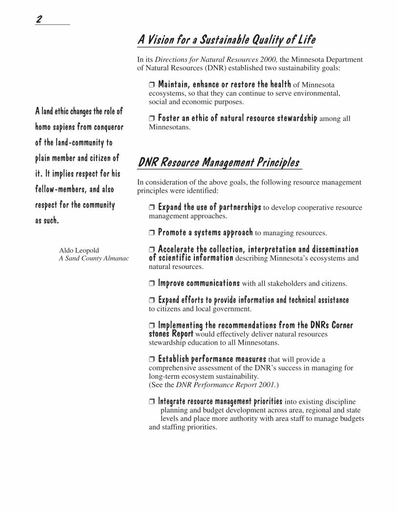
A Vision for a Sustainable Quality of Life
In its Directions for Natural Resources 2000, the Minnesota Departmentof Natural Resources (DNR) established two sustainability goals:
❒ Maintain, enhance or restore the health of Minnesotaecosystems, so that they can continue to serve environmental,social and economic purposes.
❒ Foster an ethic of natural resource stewardship among allMinnesotans.
DNR Resource Management Principles
In consideration of the above goals, the following resource managementprinciples were identified:
❒ Expand the use of partnerships to develop cooperative resourcemanagement approaches.
❒ Promote a systems approach to managing resources.
❒ Accelerate the collection, interpretation and disseminationof scientific information describing Minnesota’s ecosystems andnatural resources.
❒ Improve communications with all stakeholders and citizens.
❒ Expand efforts to provide information and technical assistanceto citizens and local government.
❒ Implementing the recommendations from the DNRs Cornerstones Report would effectively deliver natural resourcesstewardship education to all Minnesotans.
❒ Establish performance measures that will provide acomprehensive assessment of the DNR’s success in managing forlong-term ecosystem sustainability.(See the DNR Performance Report 2001.)
❒ Integrate resource management priorities into existing disciplineplanning and budget development across area, regional and statelevels and place more authority with area staff to manage budgets
and staffing priorities.
3
Trails and Waterways Responsibilities
The guidelines are designed to assist resource managers in conducting manage-ment activities that enhance the quality of natural plant communities, wildlifehabitat, regional landscape integrity and visual quality. DNR Trails and Waterwayswill strive to accomplish the following objectives:
❒ Identify, manage and restore natural plant communities duringplanning and development of new trails and water access sites.
❒ Manage natural plant communities according to ecologicalprinciples.
❒ Expand partnerships with citizens and local government toenhance the ecological quality of state trails, canoeing and boatingroutes, and water access sites.
❒ Engage recreational users in management activities.
❒ Inform recreational users about management successesand continuing challenges.
4
Wild ginger
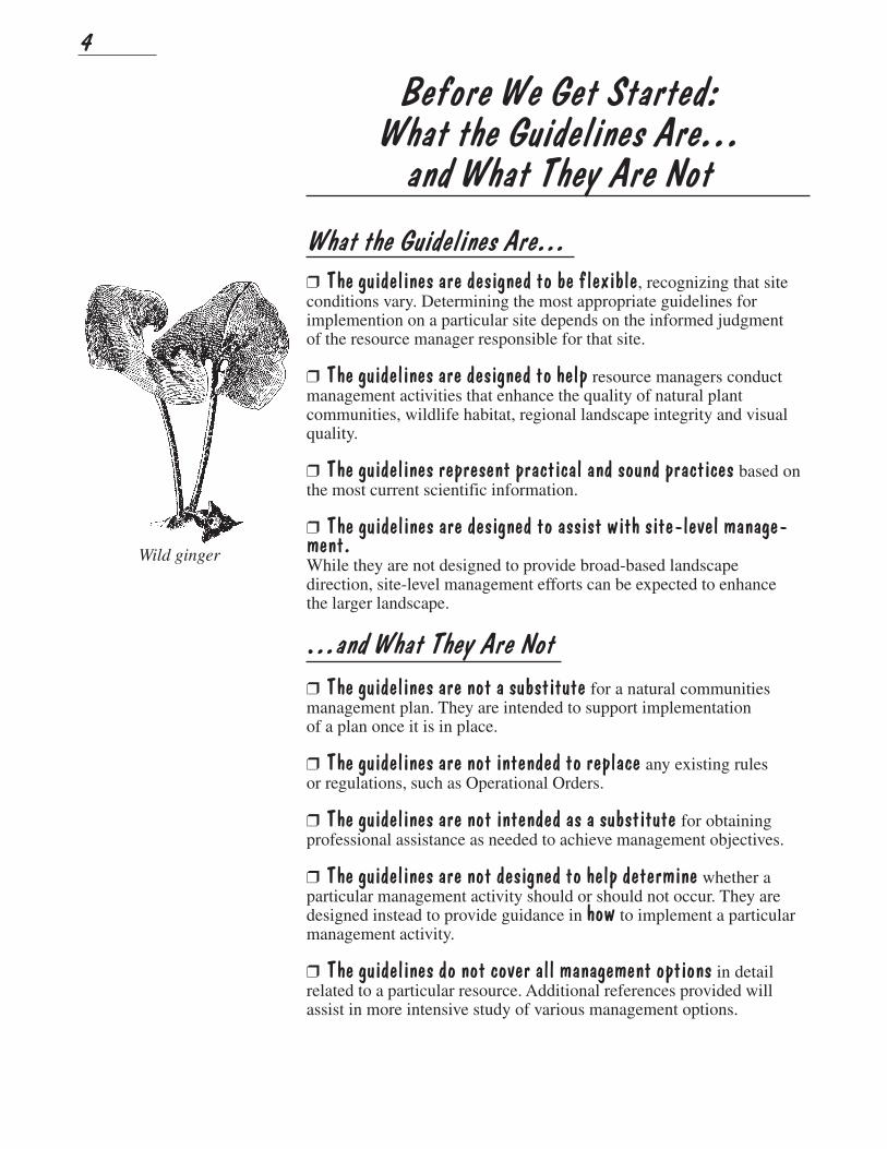
Before We Get Started:What the Guidelines Are...
and What They Are Not
What the Guidelines Are...
❒ The guidelines are designed to be flexible, recognizing that siteconditions vary. Determining the most appropriate guidelines forimplemention on a particular site depends on the informed judgmentof the resource manager responsible for that site.
❒ The guidelines are designed to help resource managers conductmanagement activities that enhance the quality of natural plantcommunities, wildlife habitat, regional landscape integrity and visualquality.
❒ The guidelines represent practical and sound practices based onthe most current scientific information.
❒ The guidelines are designed to assist with site-level manage-ment.While they are not designed to provide broad-based landscapedirection, site-level management efforts can be expected to enhancethe larger landscape.
...and What They Are Not
❒ The guidelines are not a substitute for a natural communitiesmanagement plan. They are intended to support implementationof a plan once it is in place.
❒ The guidelines are not intended to replace any existing rulesor regulations, such as Operational Orders.
❒ The guidelines are not intended as a substitute for obtainingprofessional assistance as needed to achieve management objectives.
❒ The guidelines are not designed to help determine whether aparticular management activity should or should not occur. They aredesigned instead to provide guidance in how to implement a particularmanagement activity.
❒ The guidelines do not cover all management options in detailrelated to a particular resource. Additional references provided willassist in more intensive study of various management options.
5
Spiderwort
The Ecological Classification System:A Framework for
Sustainable Resource ManagementThe Ecological Classification System (ECS) is part of a nationwidemapping initiative developed to improve our ability to manage all naturalresources on a sustainable basis.
The ECS scientifically delineates and describes meaningful unitsof the natural landscape to form a basic framework for researchand management. It identifies interrelationships and interactionsamong ecological components, such as climate, geomorphology,soil, topography, vegetation, hydrology, animals and land history.
As a framework for sustainabile natural resource management, theECS:
❒ Provides a common means of communication among a varietyof resource managers, as well as with the public.
❒ Improves predictions about how vegetation will change overtime in response to various influences.
❒ Improves our understanding of the interrelationships amongplant communities, wildlife habitat, water quality and human needs.
A Framework for Managing Natural Resources
The Minnesota Ecological Classification System (ECS) identifiessix ecological units in its classification and mapping. It followsthe methodology used by the U.S. Forest Service and is partof the Great Lakes Region ECS. The classification is hierarchicalor nested; small ecological units are contained within larger units.
The six ecological units are province, section, subsection, land typeassociation (LTA), land type (LT) and land type phases (LTP).
6
Minnesota’s
Four Provinces
Figure 2: ECS province map
Minnesota’sTen Sections
Figure 3: ECS section map
Prairie Parklandabout 16 million acres
Tallgrass Aspen Parklandsabout 3 million acres
Eastern Broadleaf Forestabout 12 million acres
Laurentian Mixed Forestabout 23 million acres
Level 1: Province
Minnesota has four provinces. Provinces are defined by climate(temperature and moisture), geology, and associated major vegetationpatterns. The state’s four provinces represent four broad climate/vegeta-tion patterns: prairie/savanna, deciduous forest and boreal forest. (SeeFigure 2.)
Prairie Parkland Province: The Prairie Parkland Province coversabout 16 million acres of southern and southwestern Minnesota. Beforesettlement, this area was primarily covered by tall grass prairie.Its topography is mostly level to gently rolling, and major landformsinclude lake plains and ground moraines.
Tallgrass Aspen Parklands Province: This Province covers about3 million acres in northwestern Minnesota. Part of an extensive lakeplain, it is level in the western portion with small dunes and a series oflow beach ridges and swales to the east. Before settlement the vegeta-tion consisted of aspen savannah, tallgrass prairie, wet prairie, gravelprairie, and floodplain forest along rivers.
Eastern Broadleaf Forest Province: The Eastern Broadleaf ForestProvince covers another 12 million acres through the heart of the state.It forms a transitional zone between the prairie to the west and theboreal forest (conifer, conifer-hardwood mix or hardwood forest)to the northeast. Topography varies from level lake plains to very steepslopes in the Paleozoic Plateau of the southeast. Major landformsinclude lake plains, outwash plains, moraines and drumlin fields.
Laurentian Mixed Forest Province: The Laurentian Mixed ForestProvince covers the northeastern 23 million acres of Minnesota. It is theboreal forest region of our state. Before settlement, this area consistedprimarily of coniferous forest, coniferous-hardwood mix or northernhardwood forest. Topography is variable. Landforms range from lakeplains and outwash plains to ground and end moraines.
Level 2: Section
Provinces are subdivided into sections. Sections are defined bythe origin of glacial deposits, regional elevation, distribution of plantsand regional climate. Minnesota has 10 sections. (See Figure 3.)
Level 3: Subsection
Sections are further divided into subsections. These county-sizedareas within sections are defined by glacial land-forming processes,bedrock formations, local climate, topographic relief and thedistribution of plants. Minnesota has 25 subsections. (See Figure 4.)
A
B
C
DE
F GH
I
J
L
M
N
O
P
QR
S
T
UV
W
X
K
Y
A - Red River PrairieB - Aspen ParklandsC - Agassiz LowlandsD - Littlefork-Vermilion UplandsE - Border LakesF - Chippewa PlainsG - St. Louis MorainesH - Nashwauk UplandsI - Pine Moraines & Outwash PlainsJ - Tamarack LowlandsK - Laurentian UplandsY - Toimi UplandsL - North Shore HighlandsM - Hardwood HillsN - Mille Lacs UplandsO - Glacial Lake Superior PlainP - Anoka Sand PlainQ - Minnesota River PrairieR - Big WoodsS - St. Paul-Baldwin Plains and MorainesT - Inner CoteauU - Coteau MorainesV - Oak SavannaW - Rochester PlateauX - The Blufflands
Minnesota's 25 ECS Subsections
Figure 4: ECS subsection map
ECS Subsections
7
Figure 4: ECS subsection map
8
Each biotic province needs
its own wilderness for
comparative studies of used
and unused land.
Aldo LeopoldA Sand County Almanac
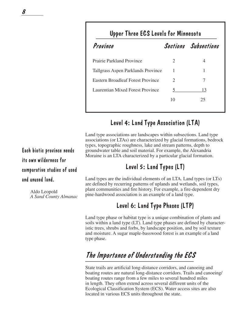
Upper Three ECS Levels for Minnesota
Province Sections Subsections
Prairie Parkland Province 2 4
Tallgrass Aspen Parklands Province 1 1
Eastern Broadleaf Forest Province 2 7
Laurentian Mixed Forest Province 5___________13
10 25
Level 4: Land Type Association (LTA)
Land type associations are landscapes within subsections. Land typeassociations (or LTAs) are characterized by glacial formations, bedrocktypes, topographic roughness, lake and stream patterns, depth togroundwater table and soil material. For example, the AlexandriaMoraine is an LTA characterized by a particular glacial formation.
Level 5: Land Types (LT)
Land types are the individual elements of an LTA. Land types (or LTs)are defined by recurring patterns of uplands and wetlands, soil types,plant communities and fire history. For example, a fire-dependent drypine-hardwood association is an example of a land type.
Level 6: Land Type Phases (LTP)
Land type phase or habitat type is a unique combination of plants andsoils within a land type (LT). Land type phases are defined by character-istic trees, shrubs and forbs, by landscape position, and by soil textureand moisture. A sugar maple-basswood forest is an example of a landtype phase.
The Importance of Understanding the ECS
State trails are artificial long-distance corridors, and canoeing andboating routes are natural long-distance corridors. Trails and canoeing/boating routes range from a few miles to several hundred milesin length. They often extend across several different units of theEcological Classification System (ECS). Water access sites are alsolocated in various ECS units throughout the state.
9
Three guiding principles
provide the rationale for
actions related to managing
and restoring natural plant
communities on Trails and
Waterways sites.
The Guiding Principles
The Rationale for Our Actions
Three guiding principles provide the rationale for actions relatedto managing and restoring natural plant communities on Trails andWaterways sites:
1. Restoration and management of natural plant communities:
• Enhances the ecological quality of all sites
• Contributes to the integrity and aethestic quality of theregional landscape
• Improves the quality of the recreational experience
• Reduces air and water pollution induced by motor drivenmaintenance procedures
2. New development should occur primarily in environmentsalready influenced by human activity, with emphasis on restoringand re-establishing native vegetation in these environments forthe benefit of people, and remaining natural systems.
3.New development must avoid:
• Critical habitat of endangered, threatened and special concernspecies (as identified by the Natural Heritage Program)
• Large remaining natural areas
• Patches of high quality habitat
A basic understanding of the ECS is essential for effective managementof natural resources along these corridors and sites, as well as under-standing their relationship to the surrounding landscape.
The ECS can also help us understand the interrelationships amongplant communities, wildlife habitat and water quality, thereby helpingus recognize the potential impact of recreational activities on naturalresources.
The ECS also serves as a framework for planning and developmentof new trails and water access sites, and for the management andrestoration of natural plant communities on existing sites.
10
Rue anemone
Action Steps To Implement Guiding Principles
❒ Collaborate with an interdisciplinary team of resource managersduring all stages of new development, including site selection, planningand development.
❒ Consider existing landscape-level and watershed-level planningactivities, which engage citizens in defining desired resource conditions.
❒ Site new trail alignments consistent with regional landscapemanagement goals.
❒ Incorporate guiding principles into existing management objectivesand activities.
❒ Minimize the crossing of natural corridors, such as streamcorridors, which are important for wildlife movement.
❒ Use native plant material that is landscape and site appropriateto revegetate areas disturbed by construction.
❒ Strive to enhance the overall quality of remnant native plantcommunities by applying appropriate management practices.
❒ Collect and use native seed from existing sites for restoration andexpansion of native plant communities.
❒ Encourage adjacent landowners to become partners in managingexisting natural plant communities beyond Trails and Waterways sites.
❒ Foster user awareness through information and interpretationregarding natural plant communities and associated managementpractices.
❒ Engage local communities to become better stewards of their naturalresources.
❒ Provide a safe recreational environment by removing hazardoustrees, creating buffer plantings, and assuring that vegetation does notimpede visibility.
11
Bur oak
For Further InformationEcology of Greenways: Design and Function of Linear ConservationAreas, by Daniel S. Smith and Paul Cawood Hellmund. Universityof Minnesota Press, Minneapolis, Minnesota, 1993.
Field Guide to the Native Plant Communities of Minnesota, TheLaurentian Mixed Forest Province, Minnesota Department of NaturalResources, Division of Ecological Services, 2003.
Landscape Ecology, by Richard T. T. Forman and Michel Godron.John Wiley & Sons, New York, 1986.
Minnesota’s Native Vegetation: A Key to Natural Communities inMinnesota, Version 1.5. Minnesota Department of Natural Resources,Natural Heritage Program, St. Paul, Minnesota, 1999.
Minnesota’s Natural Heritage: An Ecological Perspective, by John R.Tester. University of Minnesota Press, Minneapolis, Minnesota, 1995.
The Upper Levels of an Ecological Classification System for Minnesota(ECS), General Description of Sections and Subsections, MinnesotaDepartment of Natural Resources, St. Paul, Minnesota, 1996.Web: www.dnr.state.mn.us/ecological_services/ecs/index.html