Citizen Science and Cultural Heritage Milan Antonovic 1 , Maria Antonia Brovelli 2 , Massimiliano Cannata 1 , Mirko Cardoso 1 , Candan Eylül Kilsedar 2 , Marco Minghini 2 , Giorgio Zamboni 2 1 Institute of Earth Sciences, SUPSI, Campus Trevano, 6952 Canobbio, Switzerland 2 Politecnico di Milano, Como Campus, DICA, Via Valleggio 11, 22100, Como, Italy Siena, Italy 24-25 November 2016
Transcript
Citizen Science and Cultural Heritage
Milan Antonovic1, Maria Antonia Brovelli2, Massimiliano Cannata1, Mirko Cardoso1, Candan Eylül Kilsedar2, Marco Minghini2, Giorgio Zamboni2
1 Institute of Earth Sciences, SUPSI, Campus Trevano, 6952 Canobbio, Switzerland
2 Politecnico di Milano, Como Campus, DICA, Via Valleggio 11, 22100, Como, Italy
Siena, Italy
24-25 November 2016
Via Regina: a European cultural route
Via Regina defines a cross-border area between Italy
and Switzerland.
trade and cultural route since Roman times
transalpine system of soft mobility links
Via Regina: a European cultural route
Via Regina defines a cross-border area between Italy and Switzerland.
Via Regina
Tabula Peutingeriana (IV century AD)
The project “The paths of Regina”
The Paths of Regina is an INTERREG project (Italy/Switzerland).
purpose: to valorise the cultural heritage of the area and foster tourism
beneficiaries: local communities, administrations, pilgrims, tourists
expertise involved: cultural heritage, land use and design, geomatics
Partners:
universities
local administrations
cultural associations
Slow tourism at a glance
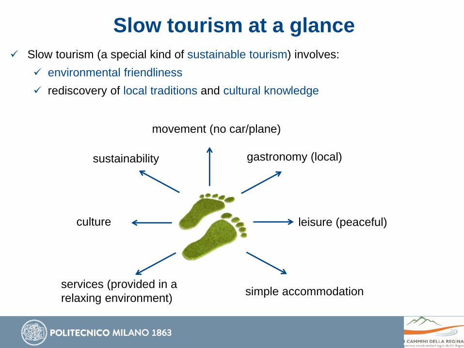
Slow tourism (a special kind of sustainable tourism) involves:
environmental friendliness
rediscovery of local traditions and cultural knowledge
movement (no car/plane)
sustainability gastronomy (local)
culture leisure (peaceful)
simple accommodationservices (provided in a
relaxing environment)
The main Web GIS of Via Regina project
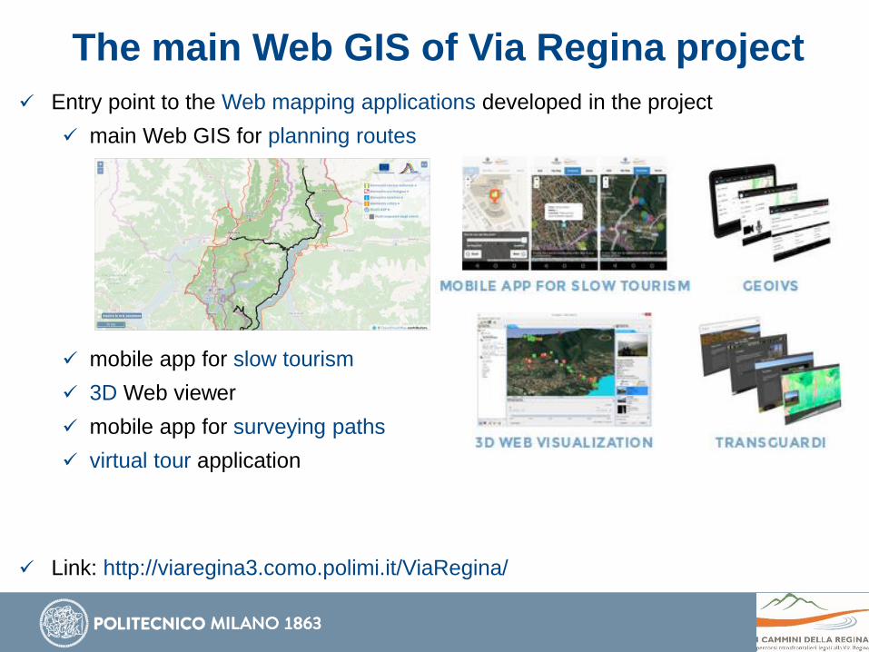
Entry point to the Web mapping applications developed in the project
main Web GIS for planning routes
mobile app for slow tourism
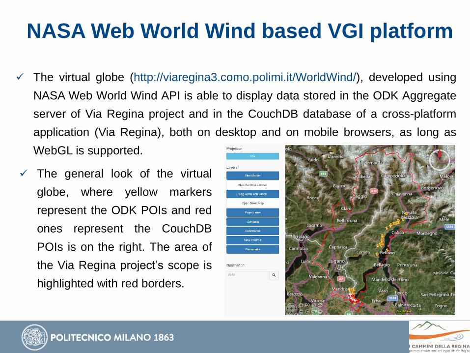
3D Web viewer
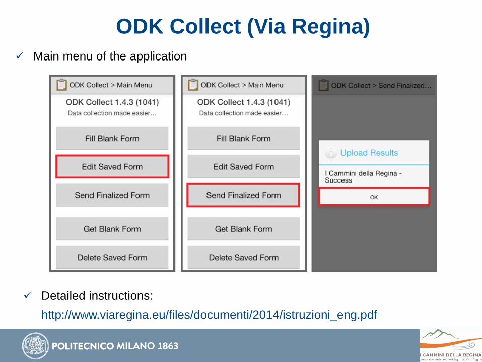
mobile app for surveying paths
virtual tour application
Link: http://viaregina3.como.polimi.it/ViaRegina/
The main Web GIS of Via Regina project
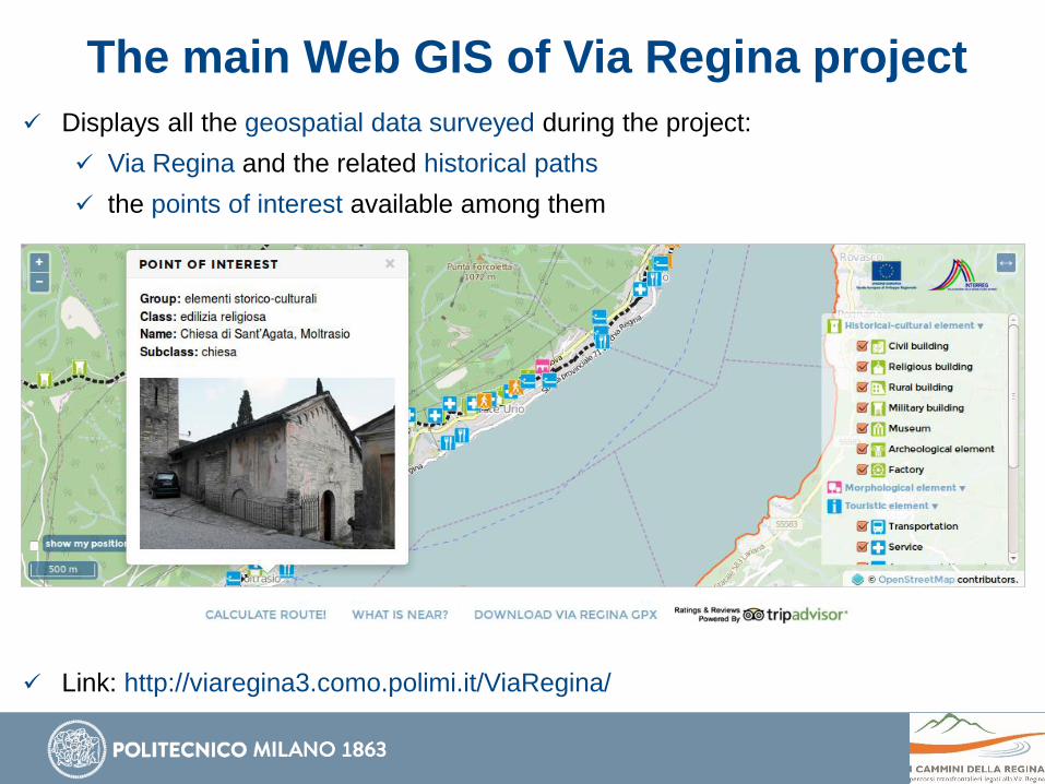
Displays all the geospatial data surveyed during the project:
Via Regina and the related historical paths
the points of interest available among them
Link: http://viaregina3.como.polimi.it/ViaRegina/
The main Web GIS of Via Regina project
Displays all the geospatial data surveyed during the project:
Via Regina and the related historical paths
the points of interest available among them
Link: http://viaregina3.como.polimi.it/ViaRegina/
The main Web GIS of Via Regina project
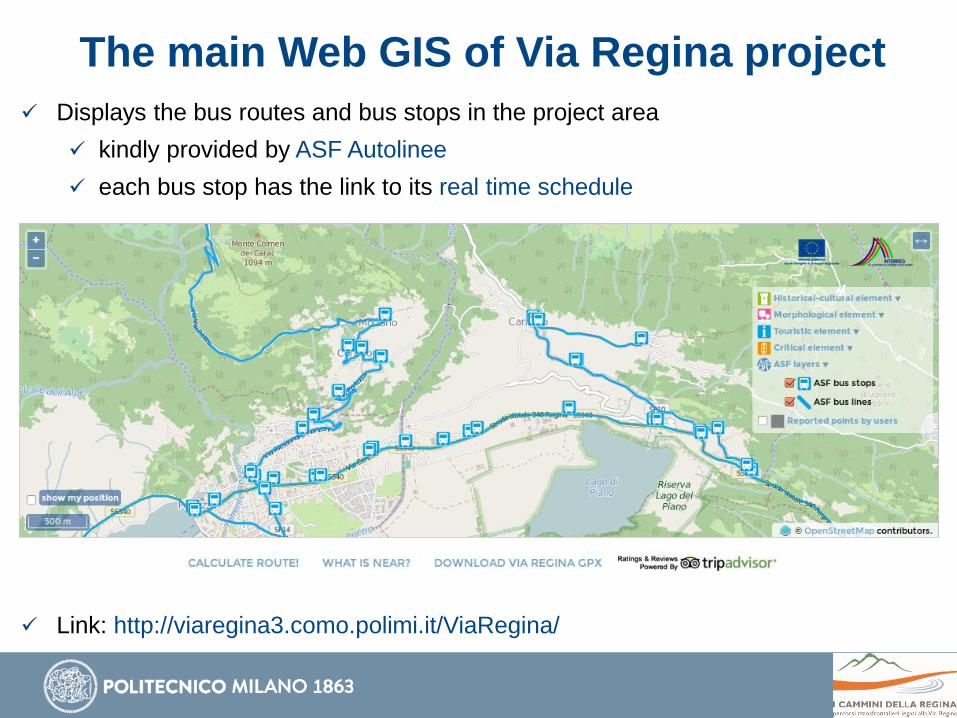
Displays the bus routes and bus stops in the project area
kindly provided by ASF Autolinee
each bus stop has the link to its real time schedule
Link: http://viaregina3.como.polimi.it/ViaRegina/
The main Web GIS of Via Regina project
Displays the bus routes and bus stops in the project area
kindly provided by ASF Autolinee
each bus stop has the link to its real time schedule
Link: http://viaregina3.como.polimi.it/ViaRegina/
The main Web GIS of Via Regina project
Allows to plan customized routes:
based on the type of points of interests chosen by the user
Link: http://viaregina3.como.polimi.it/ViaRegina/
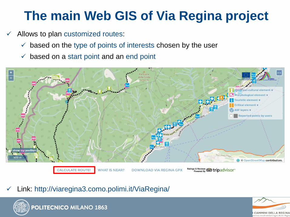
The main Web GIS of Via Regina project
Allows to plan customized routes:
based on the type of points of interests chosen by the user
based on a start point and an end point
Link: http://viaregina3.como.polimi.it/ViaRegina/
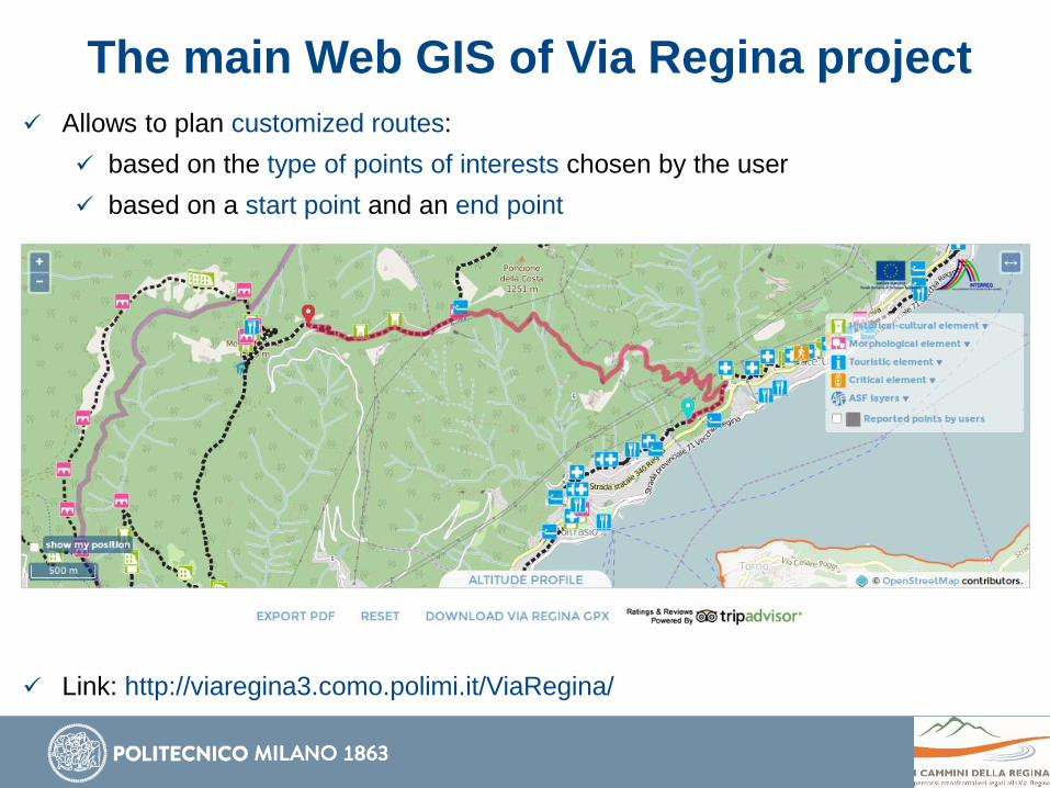
The main Web GIS of Via Regina project
Allows to plan customized routes:
based on the type of points of interests chosen by the user
based on a start point and an end point
Link: http://viaregina3.como.polimi.it/ViaRegina/
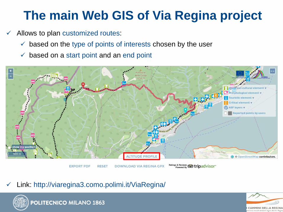
The main Web GIS of Via Regina project
Allows to plan customized routes:
based on the type of points of interests chosen by the user
based on a start point and an end point
Link: http://viaregina3.como.polimi.it/ViaRegina/
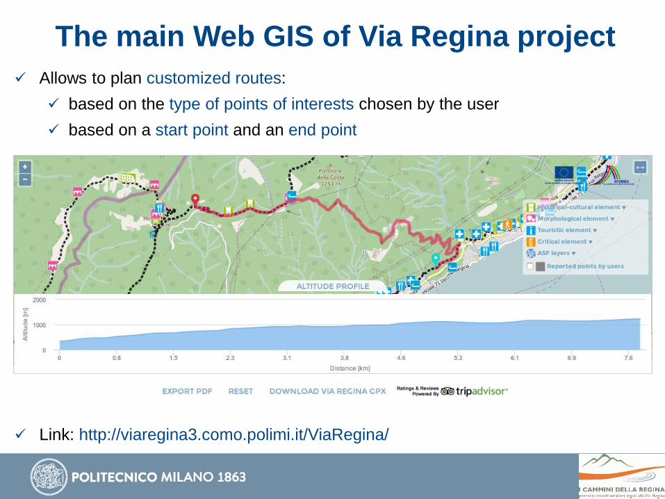
The main Web GIS of Via Regina project
Allows to plan customized routes:
based on the type of points of interests chosen by the user
based on a start point and an end point
Link: http://viaregina3.como.polimi.it/ViaRegina/
The main Web GIS of Via Regina project
Allows to plan customized routes:
based on the type of points of interests chosen by the user
based on a start point and an end point
Link: http://viaregina3.como.polimi.it/ViaRegina/
The main Web GIS of Via Regina project
Allows to plan customized routes:
based on the type of points of interests chosen by the user
based on a start point and an end point
Link: http://viaregina3.como.polimi.it/ViaRegina/
The main Web GIS of Via Regina project
Print the information on the computed route:
2D/3D distance, average slope, height increase/decrease
Link: http://viaregina3.como.polimi.it/ViaRegina/
The main Web GIS of Via Regina project
Print the information on the computed route:
2D/3D distance, average slope, height increase/decrease
Link: http://viaregina3.como.polimi.it/ViaRegina/
The main Web GIS of Via Regina project
Print the information on the computed route:
2D/3D distance, average slope, height increase/decrease
Link: http://viaregina3.como.polimi.it/ViaRegina/
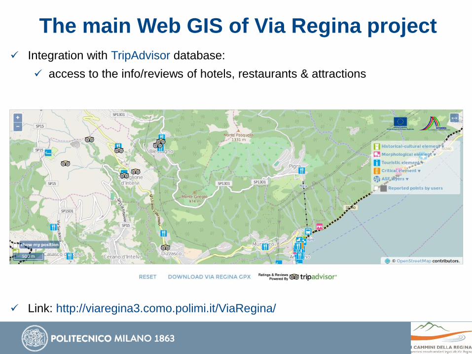
The main Web GIS of Via Regina project
Integration with TripAdvisor database:
access to the info/reviews of hotels, restaurants & attractions
Link: http://viaregina3.como.polimi.it/ViaRegina/
The main Web GIS of Via Regina project
Integration with TripAdvisor database:
access to the info/reviews of hotels, restaurants & attractions
Link: http://viaregina3.como.polimi.it/ViaRegina/
The main Web GIS of Via Regina project
Integration with TripAdvisor database:
access to the info/reviews of hotels, restaurants & attractions
Link: http://viaregina3.como.polimi.it/ViaRegina/
The main Web GIS of Via Regina project
Integration with TripAdvisor database:
access to the info/reviews of hotels, restaurants & attractions
Link: http://viaregina3.como.polimi.it/ViaRegina/
The main Web GIS of Via Regina project
Download of Via Regina GPS Track (in GPX format):
useful for people willing to walk along the path!
Link: http://viaregina3.como.polimi.it/ViaRegina/
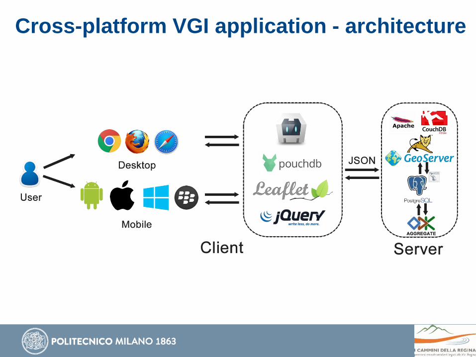
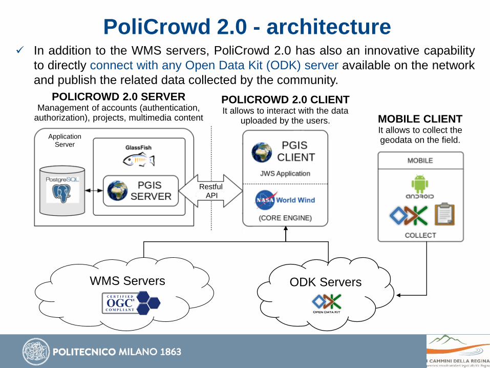
The main Web GIS of Via Regina
project - architecture
Link: http://viaregina3.como.polimi.it/ViaRegina/
Cross-platform VGI application - purpose
Allows everyone to report georeferenced points of interest:
historical and cultural elements
morphological elements
tourism elements
critical elements
Cross-platform VGI application - purpose
Historical and Cultural Elements
museum
religious building
civil building
archeological element
rural building
military building
factory
Morphological Elements
surface
bounding escarpment
traffic support and manufactured products
Cross-platform VGI application - purpose
Tourist Elements
accommodation
transport
products
food service
services
Critical Elements
morphological
structural
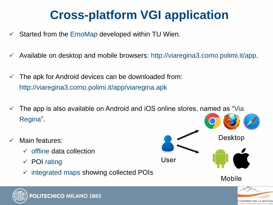
Cross-platform VGI application
Started from the EmoMap developed within TU Wien.
Available on desktop and mobile browsers: http://viaregina3.como.polimi.it/app.
The apk for Android devices can be downloaded from: