34
New York City Department of Transportation Presented to Community Board 2 Transportation Committee on March 31, 2015 Queens Boulevard Proposed Corridor Safety Improvements 2015
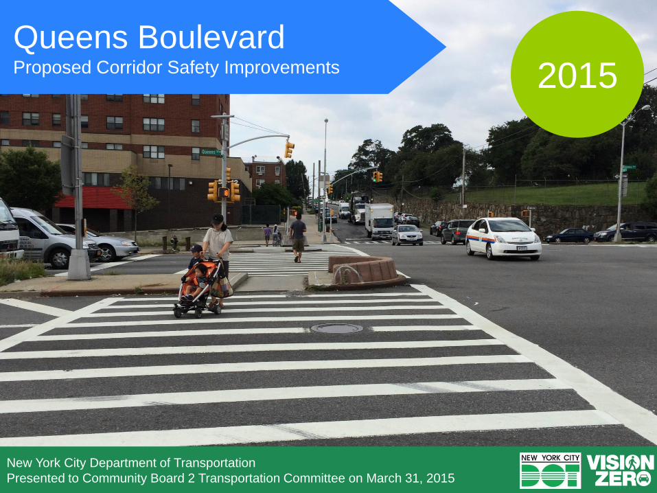
New York City Department of Transportation
Presented to Community Board 2 Transportation Committee on March 31, 2015
Queens Boulevard Proposed Corridor Safety Improvements 2015
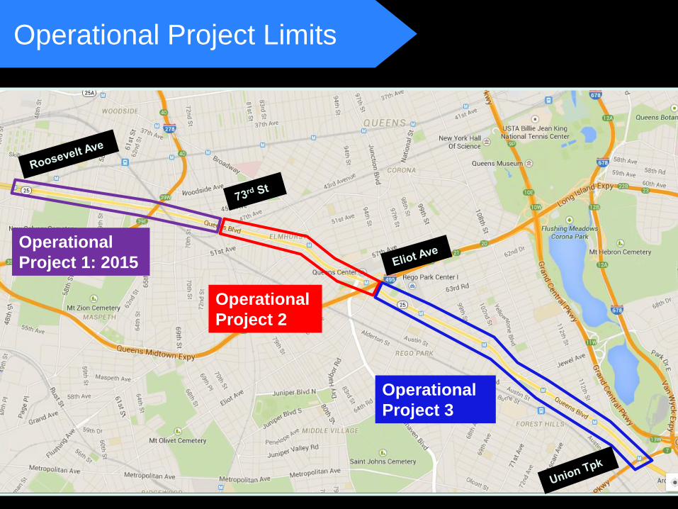
Operational Project Limits
Operational
Project 3
Operational
Project 2
Operational
Project 1: 2015
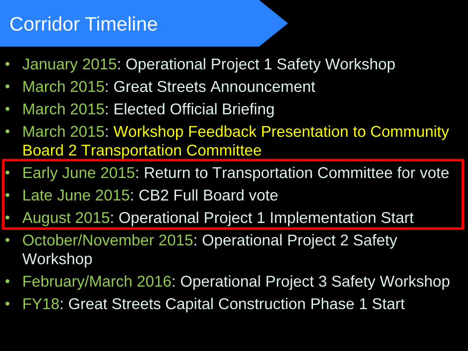
• January 2015: Operational Project 1 Safety Workshop
• March 2015: Great Streets Announcement
• March 2015: Elected Official Briefing
• March 2015: Workshop Feedback Presentation to Community
Board 2 Transportation Committee
• Early June 2015: Return to Transportation Committee for vote
• Late June 2015: CB2 Full Board vote
• August 2015: Operational Project 1 Implementation Start
• October/November 2015: Operational Project 2 Safety
Workshop
• February/March 2016: Operational Project 3 Safety Workshop
• FY18: Great Streets Capital Construction Phase 1 Start
Corridor Timeline
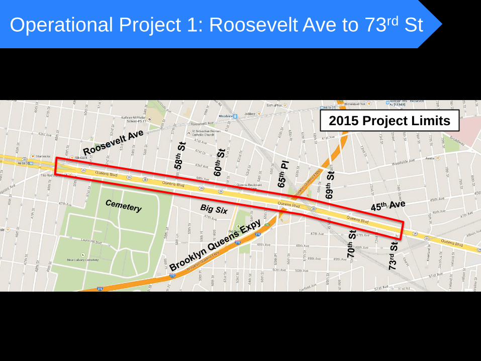
Operational Project 1: Roosevelt Ave to 73rd St
2015 Project Limits
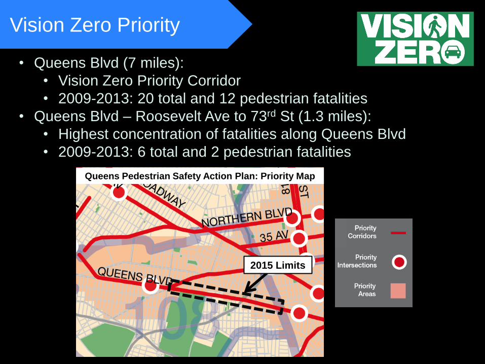
Vision Zero Priority
Queens Pedestrian Safety Action Plan: Priority Map
2015 Limits
• Queens Blvd (7 miles):
• Vision Zero Priority Corridor
• 2009-2013: 20 total and 12 pedestrian fatalities
• Queens Blvd – Roosevelt Ave to 73rd St (1.3 miles):
• Highest concentration of fatalities along Queens Blvd
• 2009-2013: 6 total and 2 pedestrian fatalities
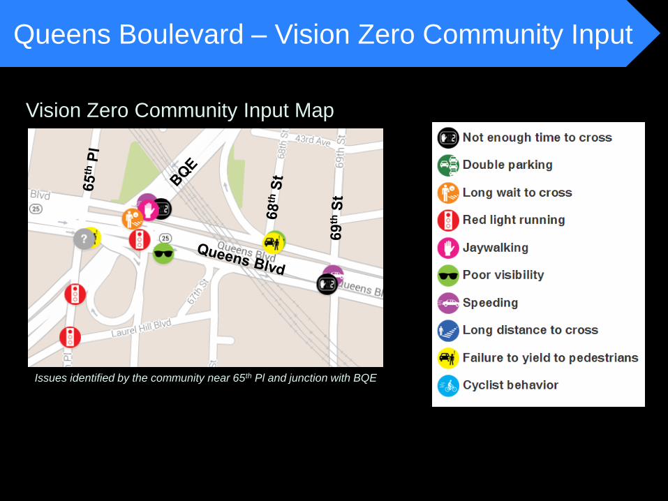
Queens Boulevard – Vision Zero Community Input
Vision Zero Community Input Map
Issues identified by the community near 65th Pl and junction with BQE
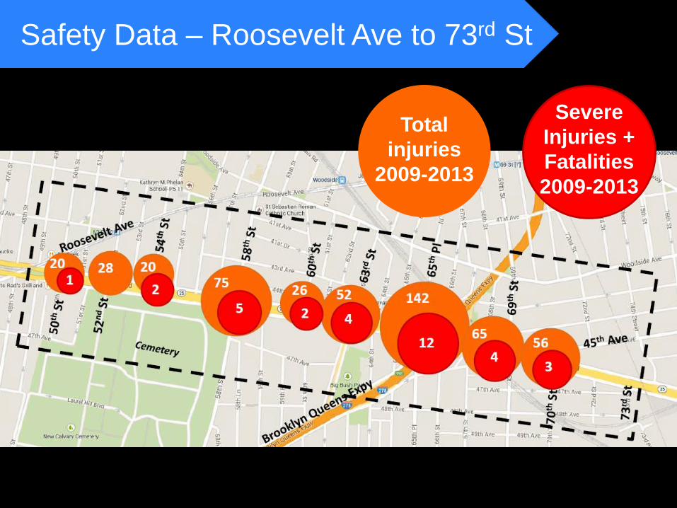
Safety Data – Roosevelt Ave to 73rd St
Total
injuries
2009-2013
Severe
Injuries +
Fatalities
2009-2013
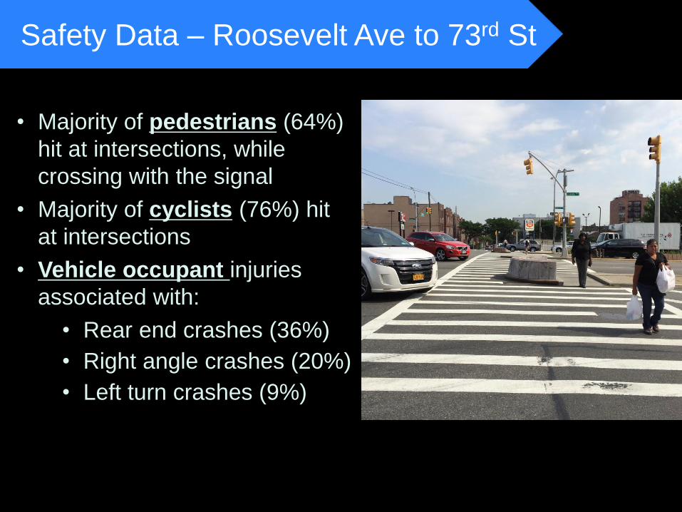
• Majority of pedestrians (64%)
hit at intersections, while
crossing with the signal
• Majority of cyclists (76%) hit
at intersections
• Vehicle occupant injuries
associated with:
• Rear end crashes (36%)
• Right angle crashes (20%)
• Left turn crashes (9%)
Safety Data – Roosevelt Ave to 73rd St
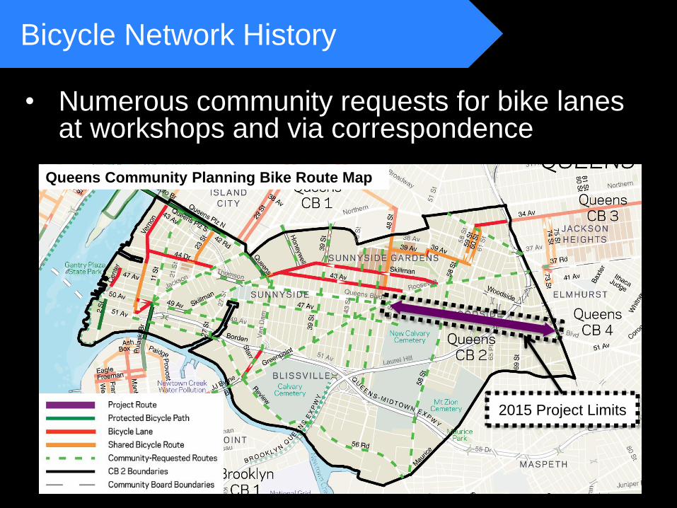
• Numerous community requests for bike lanes at workshops and via correspondence
Proposal
Bicycle Network History
Queens Community Planning Bike Route Map
2015 Project Limits
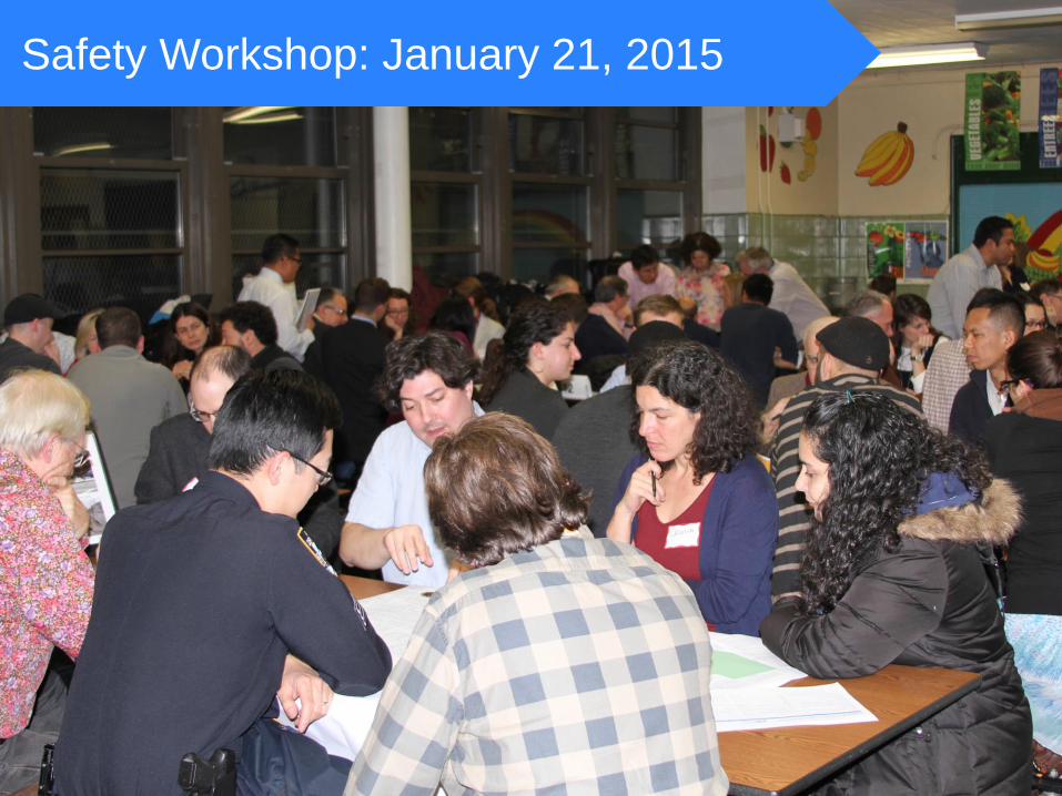
Safety Workshop: January 21, 2015
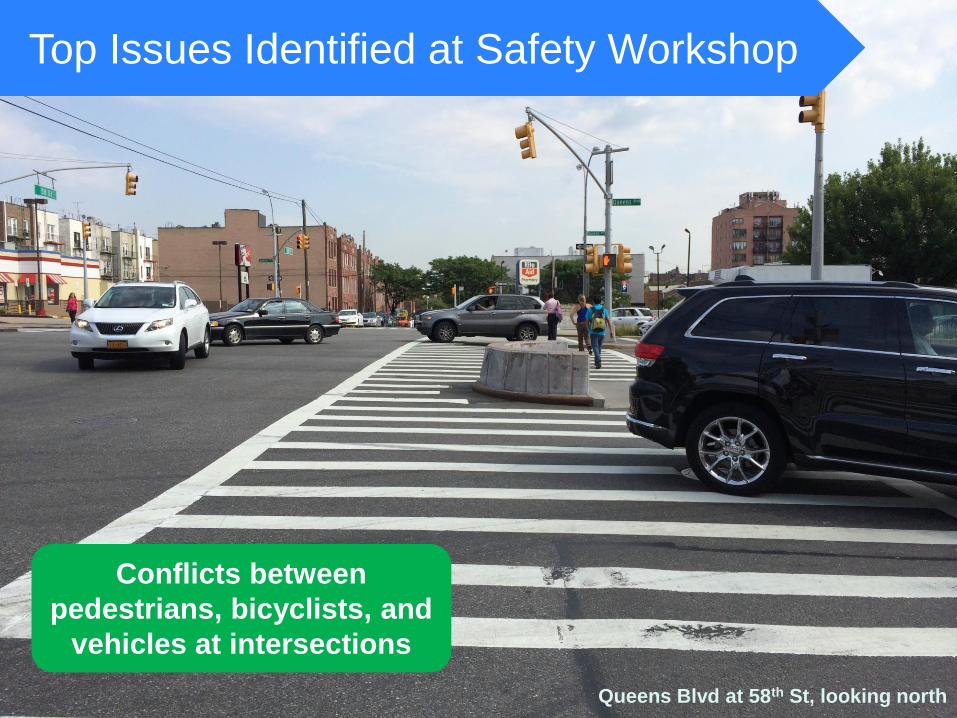
Top Issues Identified at Safety Workshop
Conflicts between
pedestrians, bicyclists, and
vehicles at intersections
Queens Blvd at 58th St, looking north
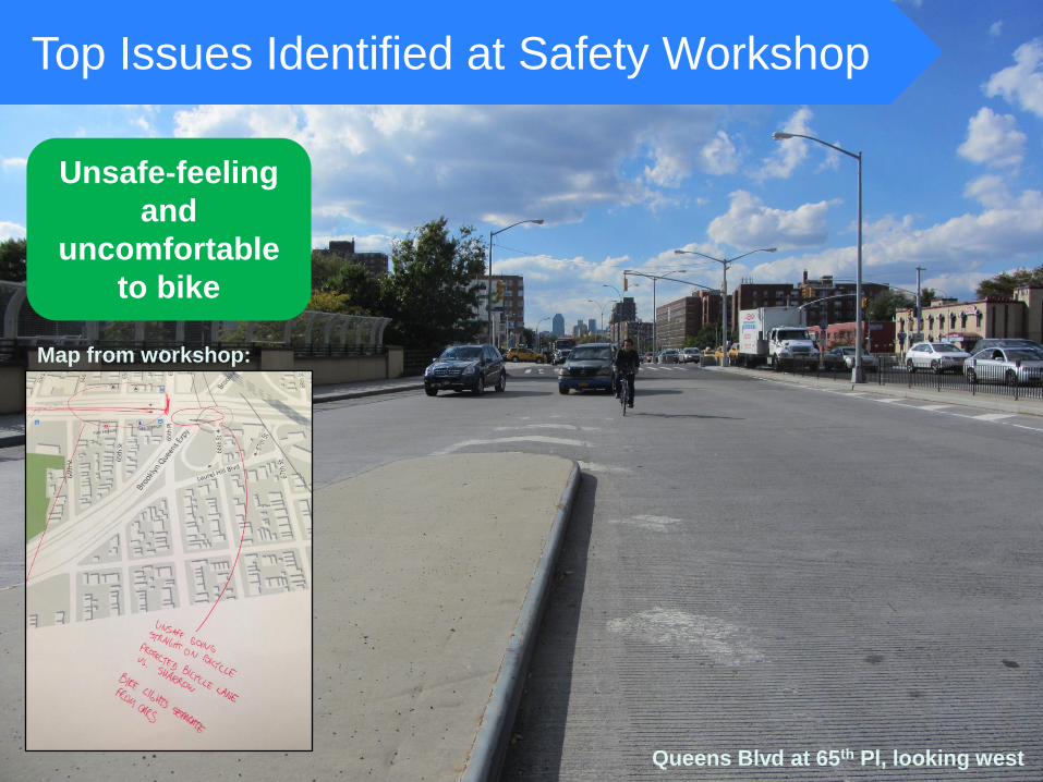
Top Issues Identified at Safety Workshop
Unsafe-feeling
and
uncomfortable
to bike
Queens Blvd at 65th Pl, looking west
Map from workshop:
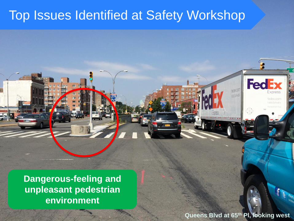
Top Issues Identified at Safety Workshop
Dangerous-feeling and
unpleasant pedestrian
environment
Queens Blvd at 65th Pl, looking west
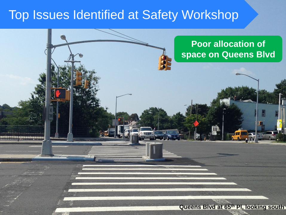
Top Issues Identified at Safety Workshop
Poor allocation of
space on Queens Blvd
Queens Blvd at 65th Pl, looking south
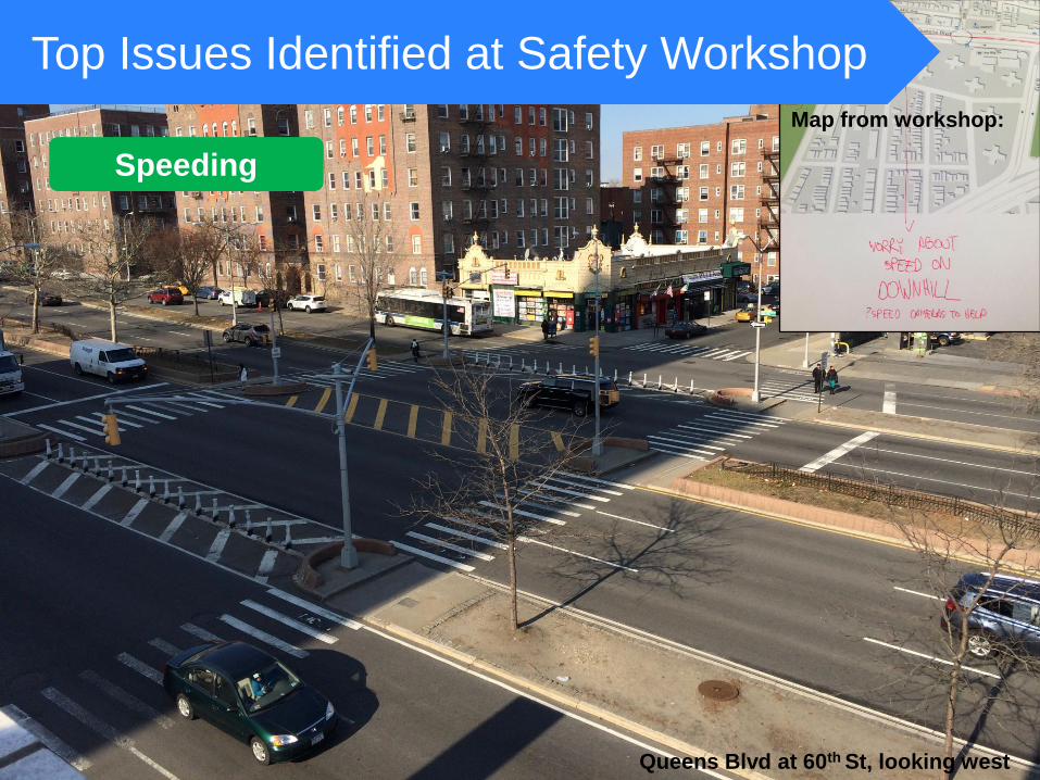
Top Issues Identified at Safety Workshop
Speeding
Queens Blvd at 60th St, looking west
Map from workshop:
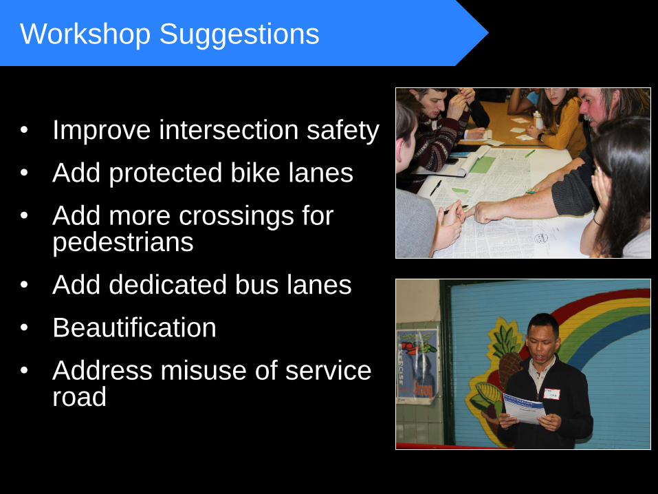
• Improve intersection safety
• Add protected bike lanes
• Add more crossings for pedestrians
• Add dedicated bus lanes
• Beautification
• Address misuse of service road
Proposal
Workshop Suggestions
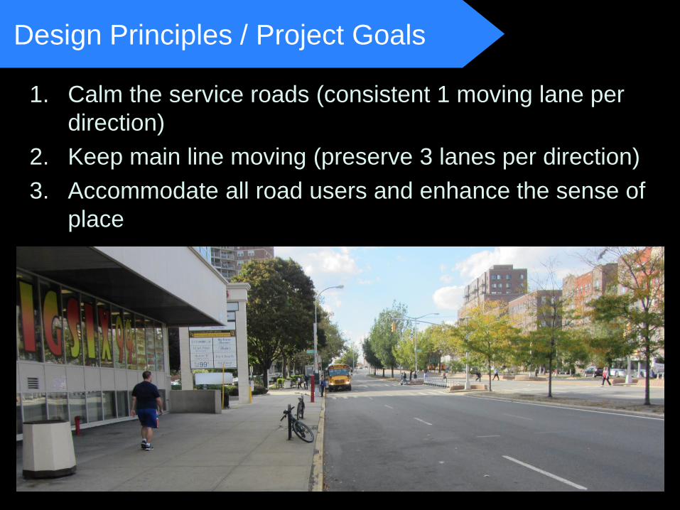
Design Principles / Project Goals
1. Calm the service roads (consistent 1 moving lane per
direction)
2. Keep main line moving (preserve 3 lanes per direction)
3. Accommodate all road users and enhance the sense of
place
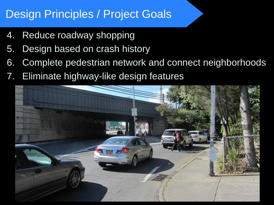
Design Principles / Project Goals
4. Reduce roadway shopping
5. Design based on crash history
6. Complete pedestrian network and connect neighborhoods
7. Eliminate highway-like design features
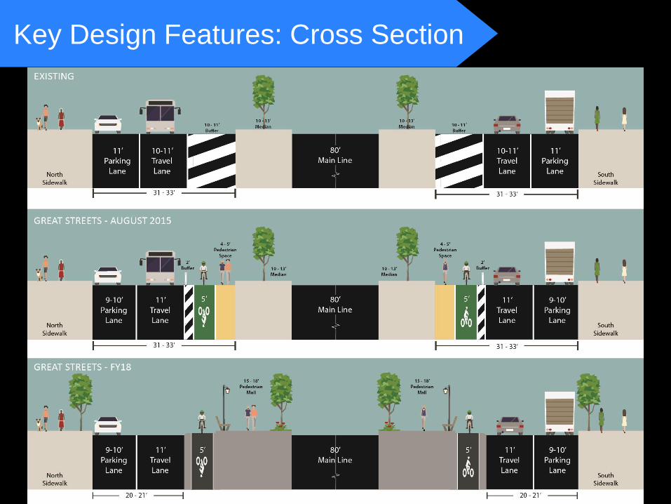
Key Design Features: Cross Section
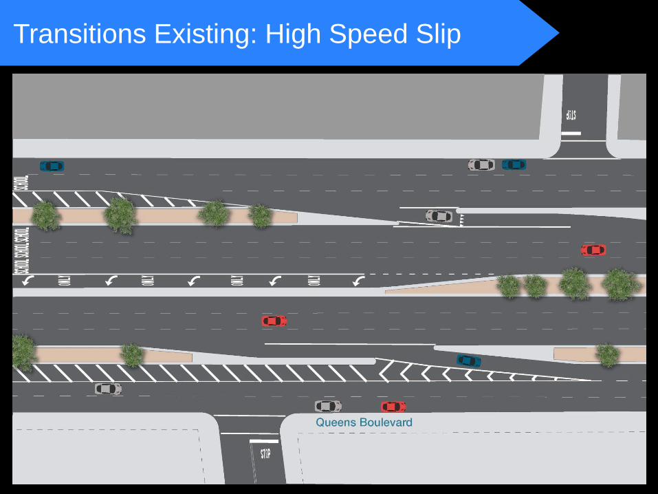
Transitions Existing: High Speed Slip
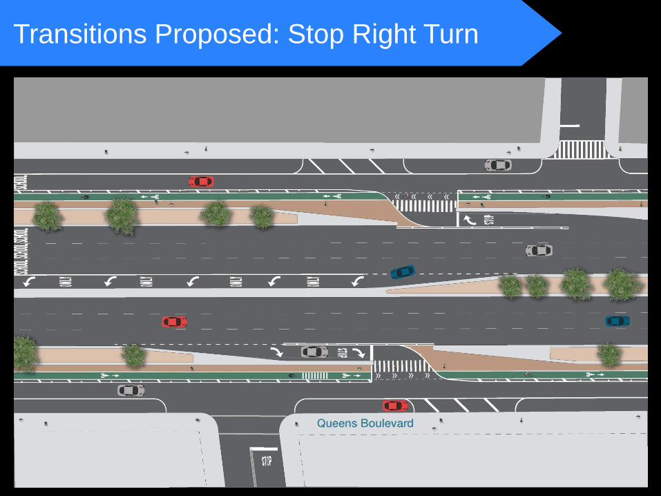
Transitions Proposed: Stop Right Turn
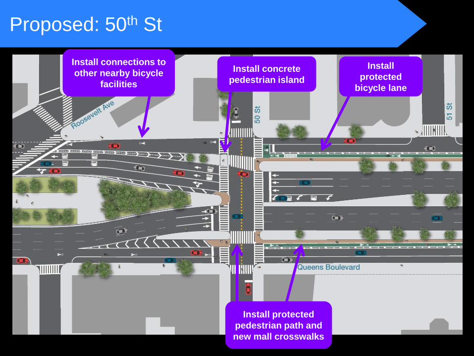
Proposed: 50th St
Install protected
pedestrian path and
new mall crosswalks
Install
protected
bicycle lane
Install concrete
pedestrian island
Install connections to
other nearby bicycle
facilities
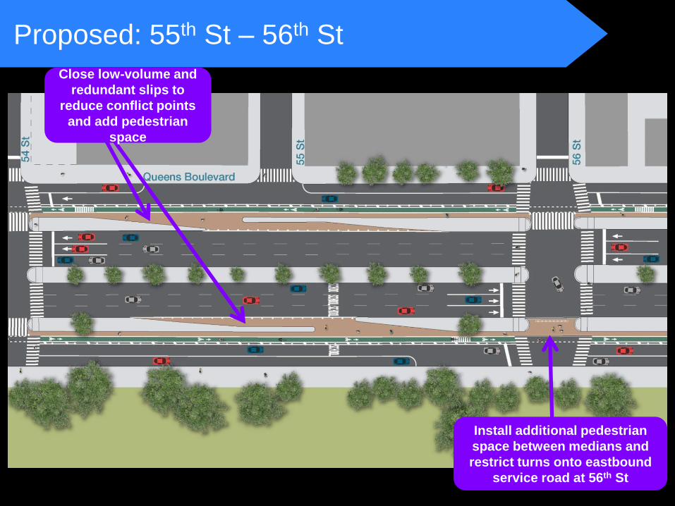
Install additional pedestrian
space between medians and
restrict turns onto eastbound
service road at 56th St
Proposed: 55th St – 56th St
Close low-volume and
redundant slips to
reduce conflict points
and add pedestrian
space
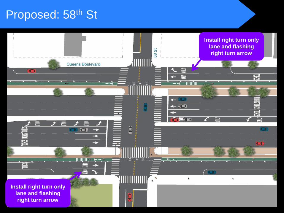
Proposed: 58th St
Install right turn only
lane and flashing
right turn arrow
Install right turn only
lane and flashing
right turn arrow
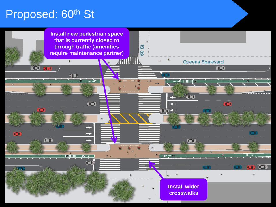
Proposed: 60th St
Install wider
crosswalks
Install new pedestrian space
that is currently closed to
through traffic (amenities
require maintenance partner)
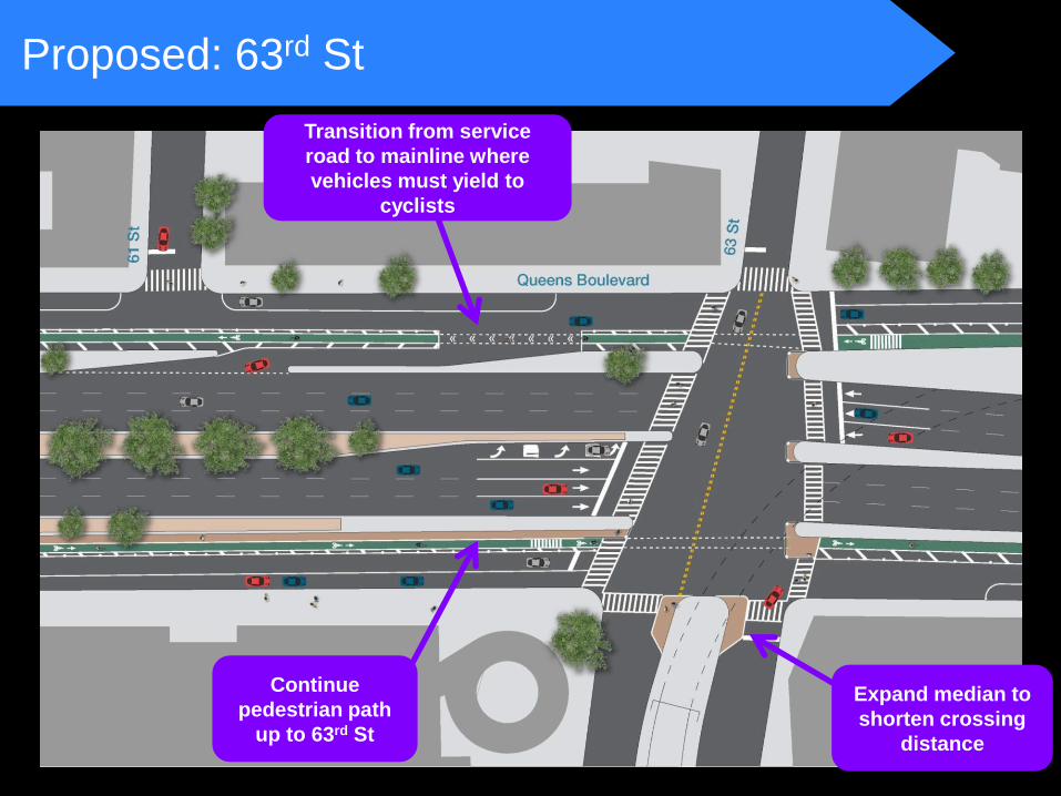
Proposed: 63rd St
Expand median to
shorten crossing
distance
Transition from service
road to mainline where
vehicles must yield to
cyclists
Continue
pedestrian path
up to 63rd St
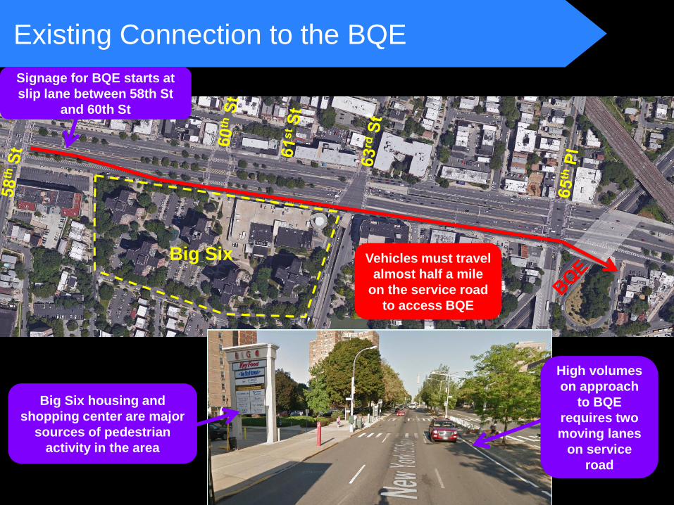
Existing Connection to the BQE
Big Six
Signage for BQE starts at
slip lane between 58th St
and 60th St
Big Six housing and
shopping center are major
sources of pedestrian
activity in the area
Vehicles must travel
almost half a mile
on the service road
to access BQE
High volumes
on approach
to BQE
requires two
moving lanes
on service
road
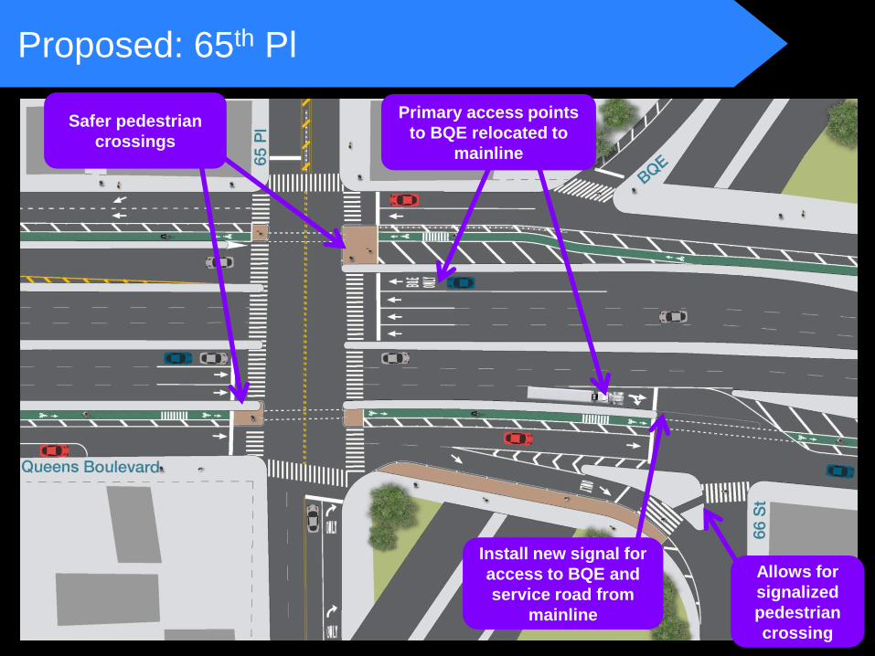
Proposed: 65th Pl
Safer pedestrian
crossings
Primary access points
to BQE relocated to
mainline
Install new signal for
access to BQE and
service road from
mainline
Allows for
signalized
pedestrian
crossing
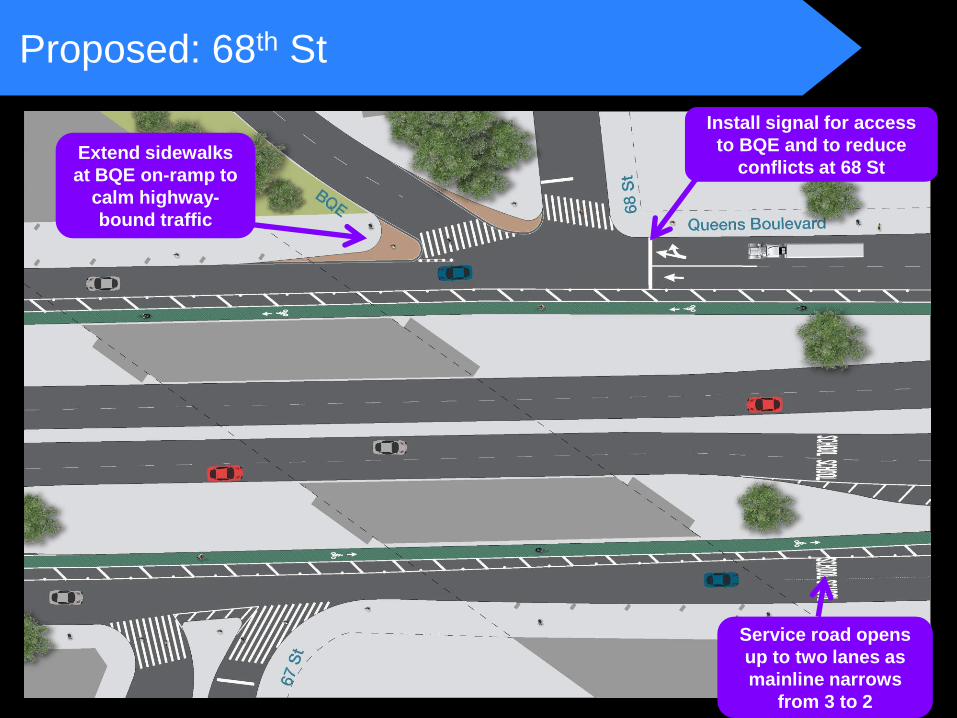
Proposed: 68th St
Service road opens
up to two lanes as
mainline narrows
from 3 to 2
Install signal for access
to BQE and to reduce
conflicts at 68 St Extend sidewalks
at BQE on-ramp to
calm highway-
bound traffic
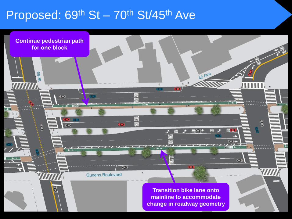
Proposed: 69th St – 70th St/45th Ave
Continue pedestrian path
for one block
Transition bike lane onto
mainline to accommodate
change in roadway geometry
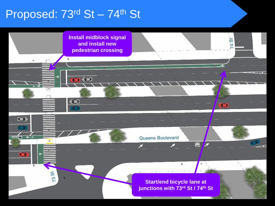
Proposed: 73rd St – 74th St
Install midblock signal
and install new
pedestrian crossing
Start/end bicycle lane at
junctions with 73rd St / 74th St
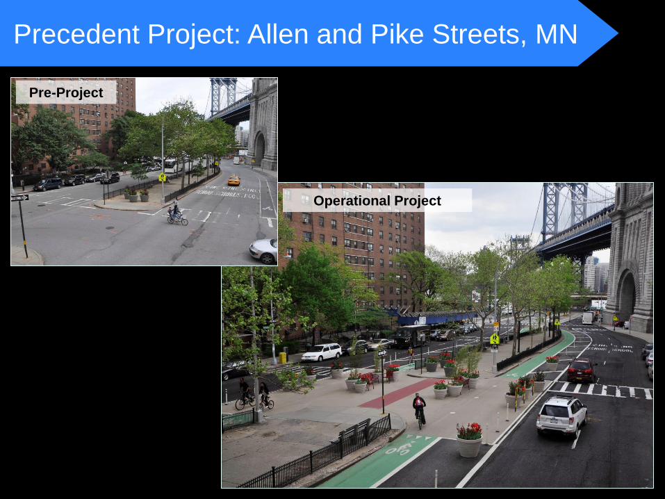
Precedent Project: Allen and Pike Streets, MN
Pre-Project
Operational Project
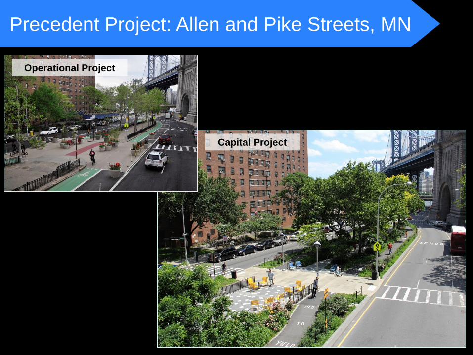
Precedent Project: Allen and Pike Streets, MN
Operational Project
Capital Project

www.nyc.gov/dot Thank
You
Contact:
Queens Borough Commissioner’s Office at 212-839-2510 or [email protected]


