40
CREATE MAINTAIN DISTRIBUTE CityGML-based SDIs Implementation requirements and examples Geospatial World Forum, May 23-26, 2016, Rotterdam Dr. Lutz Ross | [email protected] GWF 2016

CREATE MAINTAIN
DISTRIBUTE
CityGML-based SDIs Implementation requirements and examples
Geospatial World Forum, May 23-26, 2016, Rotterdam
Dr. Lutz Ross | [email protected]
GWF 2016
CityGML-based SDIs
Implementation requirements and
examples
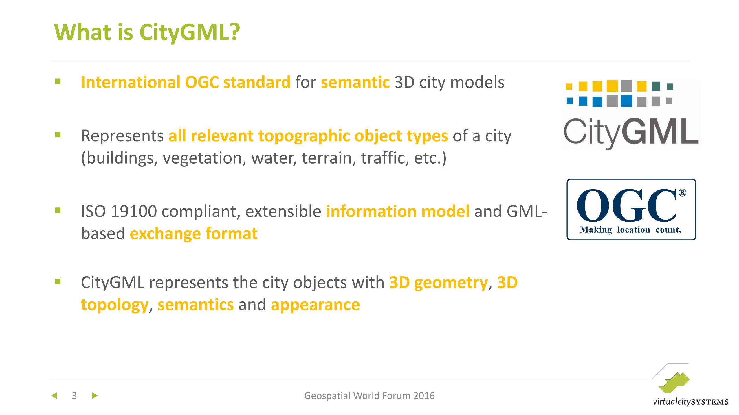
International OGC standard for semantic 3D city models
Represents all relevant topographic object types of a city
(buildings, vegetation, water, terrain, traffic, etc.)
ISO 19100 compliant, extensible information model and GML-
based exchange format
CityGML represents the city objects with 3D geometry, 3D
topology, semantics and appearance
What is CityGML?
3 Geospatial World Forum 2016
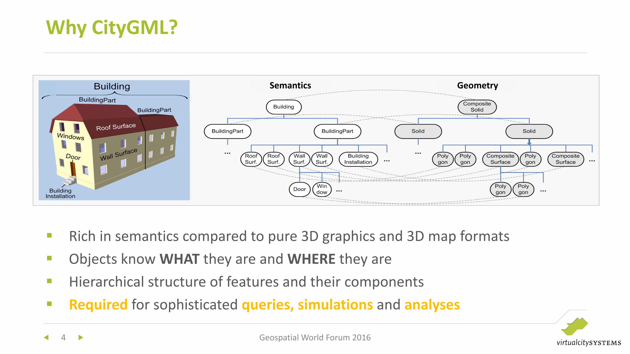
Rich in semantics compared to pure 3D graphics and 3D map formats
Objects know WHAT they are and WHERE they are
Hierarchical structure of features and their components
Required for sophisticated queries, simulations and analyses
Why CityGML?
4 Geospatial World Forum 2016
Semantics Geometry
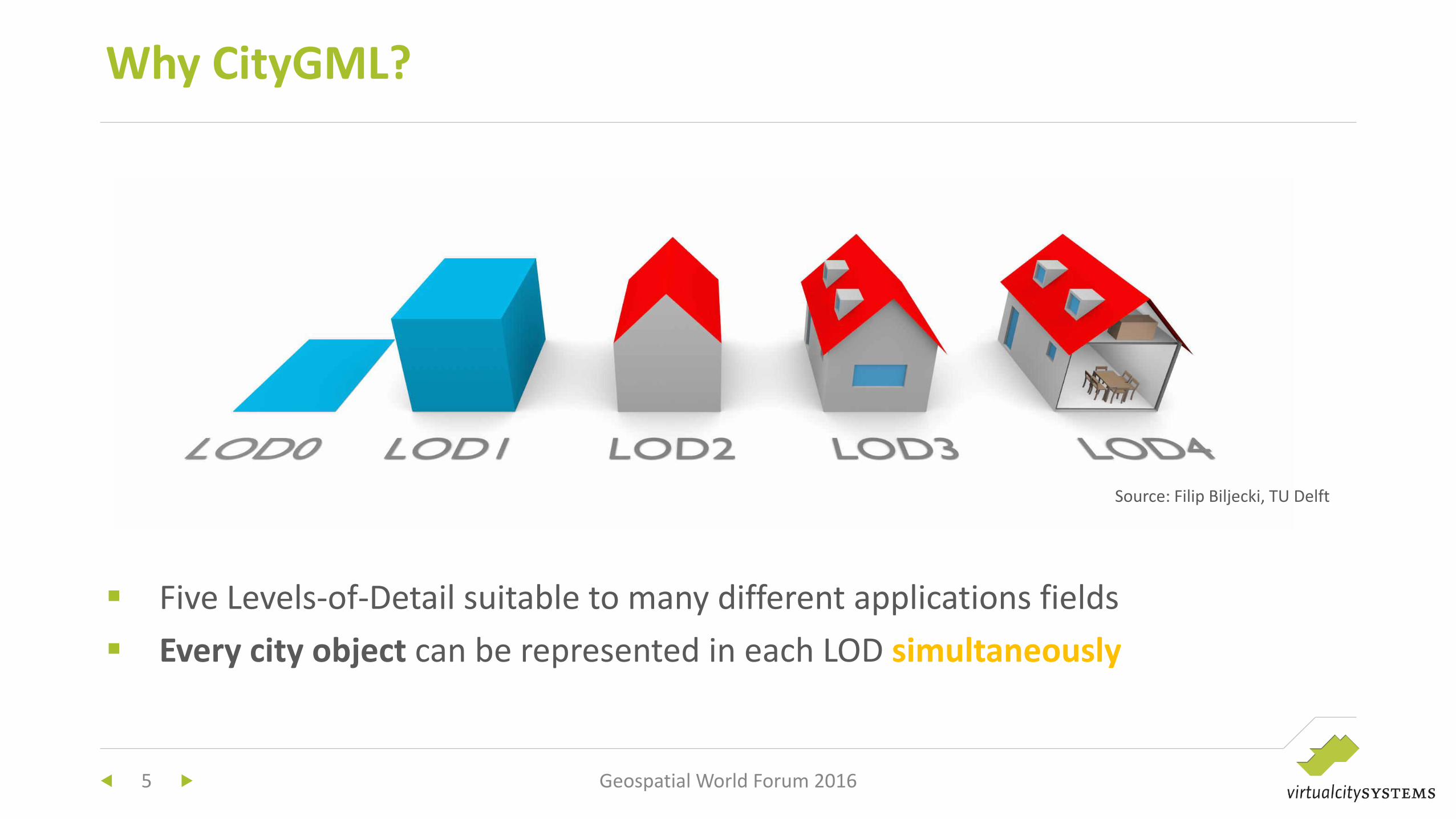
Five Levels-of-Detail suitable to many different applications fields
Every city object can be represented in each LOD simultaneously
Why CityGML?
5 Geospatial World Forum 2016
Source: Filip Biljecki, TU Delft
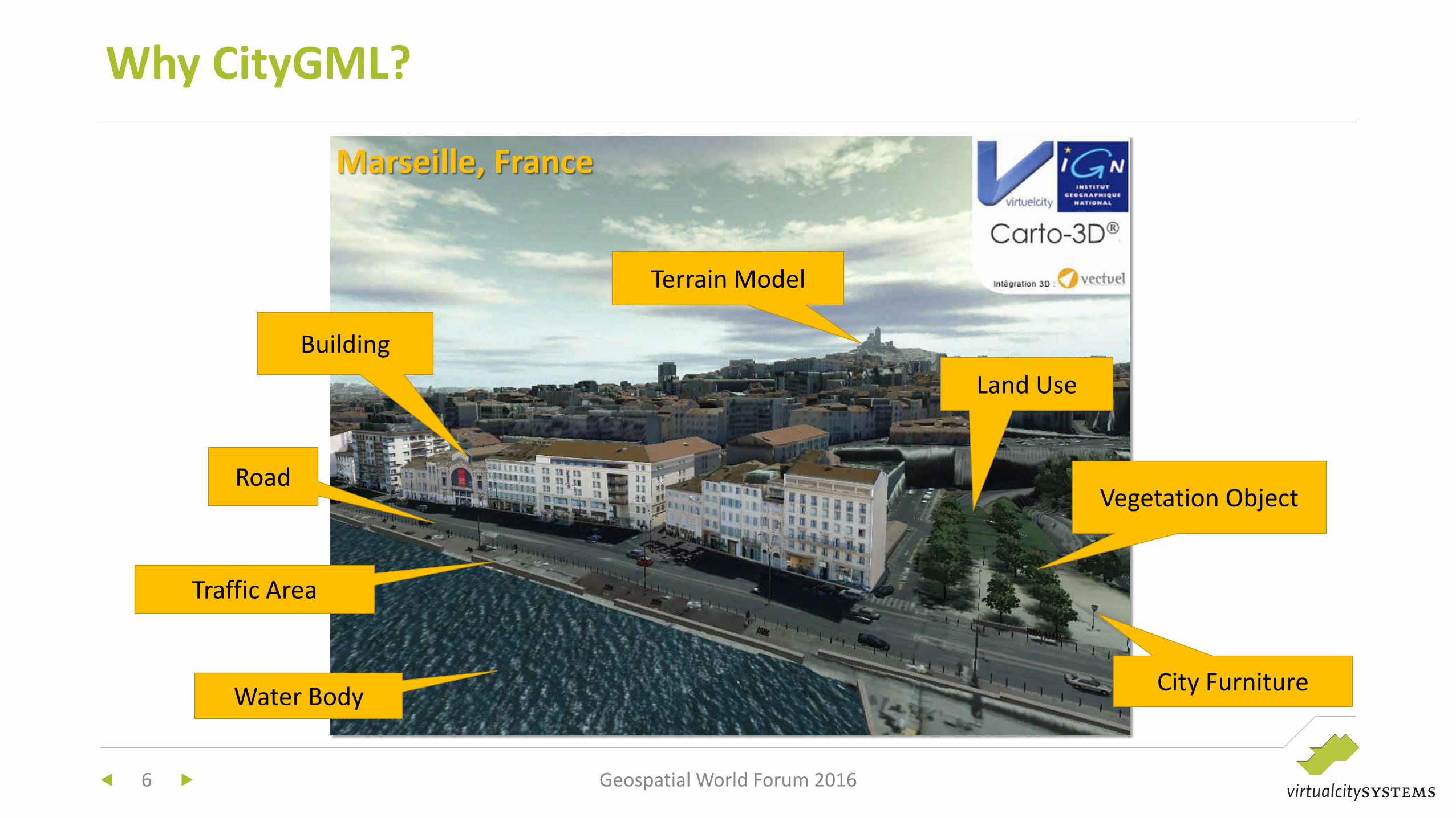
Why CityGML?
6 Geospatial World Forum 2016
Water Body
Terrain Model
City Furniture
Road Vegetation Object
Building
Land Use
Traffic Area
Marseille, France
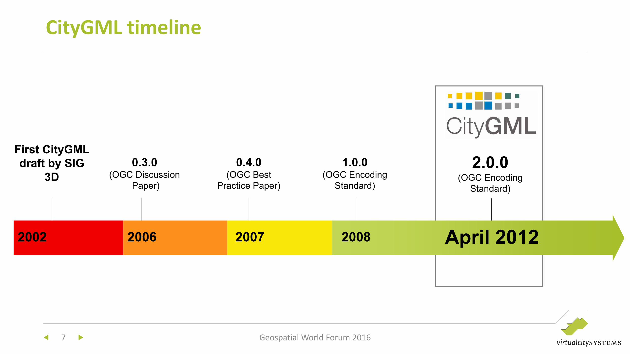
CityGML timeline
7 Geospatial World Forum 2016
2002
First CityGML
draft by SIG
3D
2006
0.3.0 (OGC Discussion
Paper)
2007
0.4.0 (OGC Best
Practice Paper)
2008
1.0.0 (OGC Encoding
Standard)
April 2012
2.0.0 (OGC Encoding
Standard)
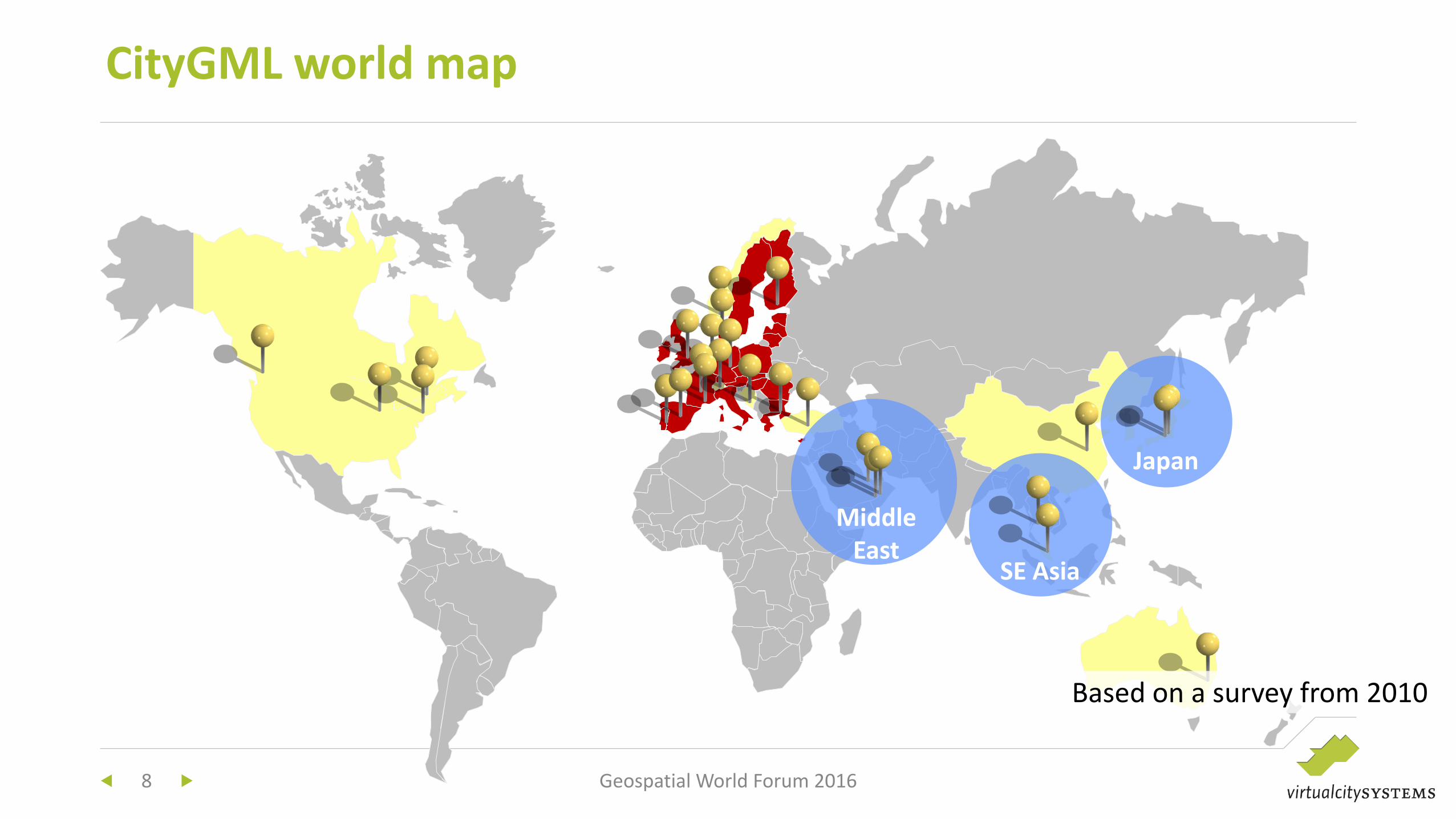
CityGML world map
8 Geospatial World Forum 2016
Based on a survey from 2010
Middle
East SE Asia
Japan
CityGML-based SDIs
Implementation requirements and
examples
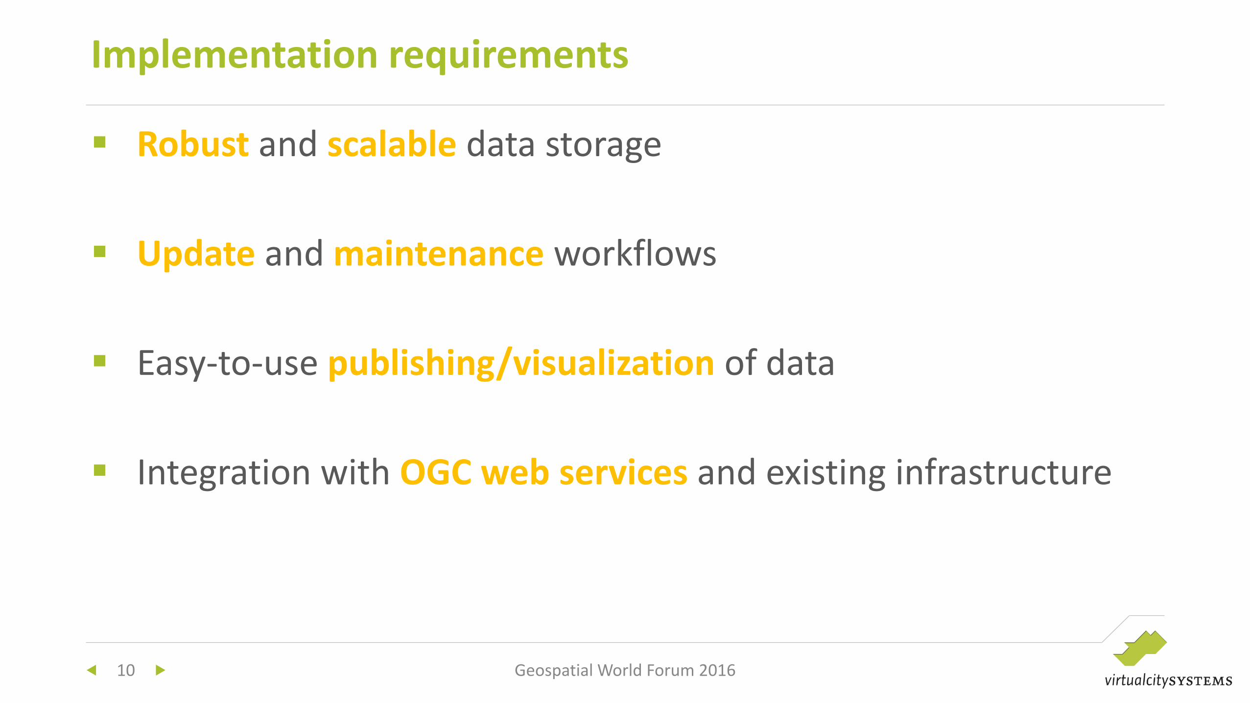
Robust and scalable data storage
Update and maintenance workflows
Easy-to-use publishing/visualization of data
Integration with OGC web services and existing infrastructure
Implementation requirements
Geospatial World Forum 2016 10
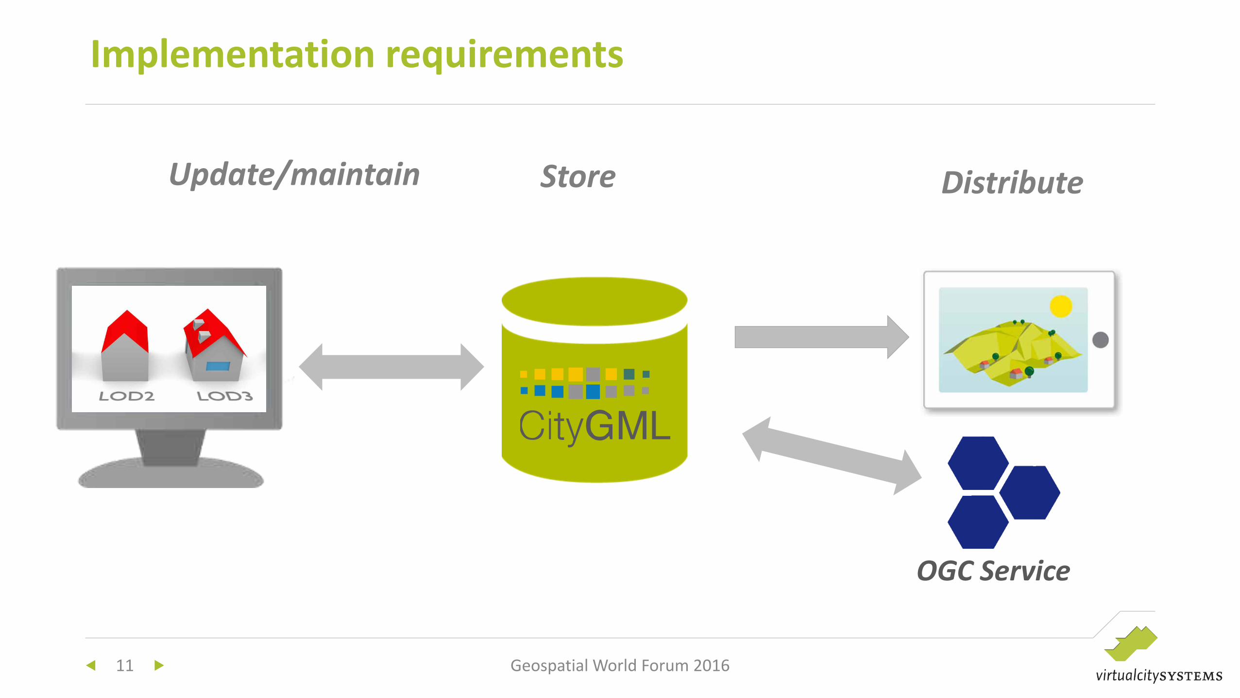
Implementation requirements
11 Geospatial World Forum 2016
OGC Service
Update/maintain Store Distribute
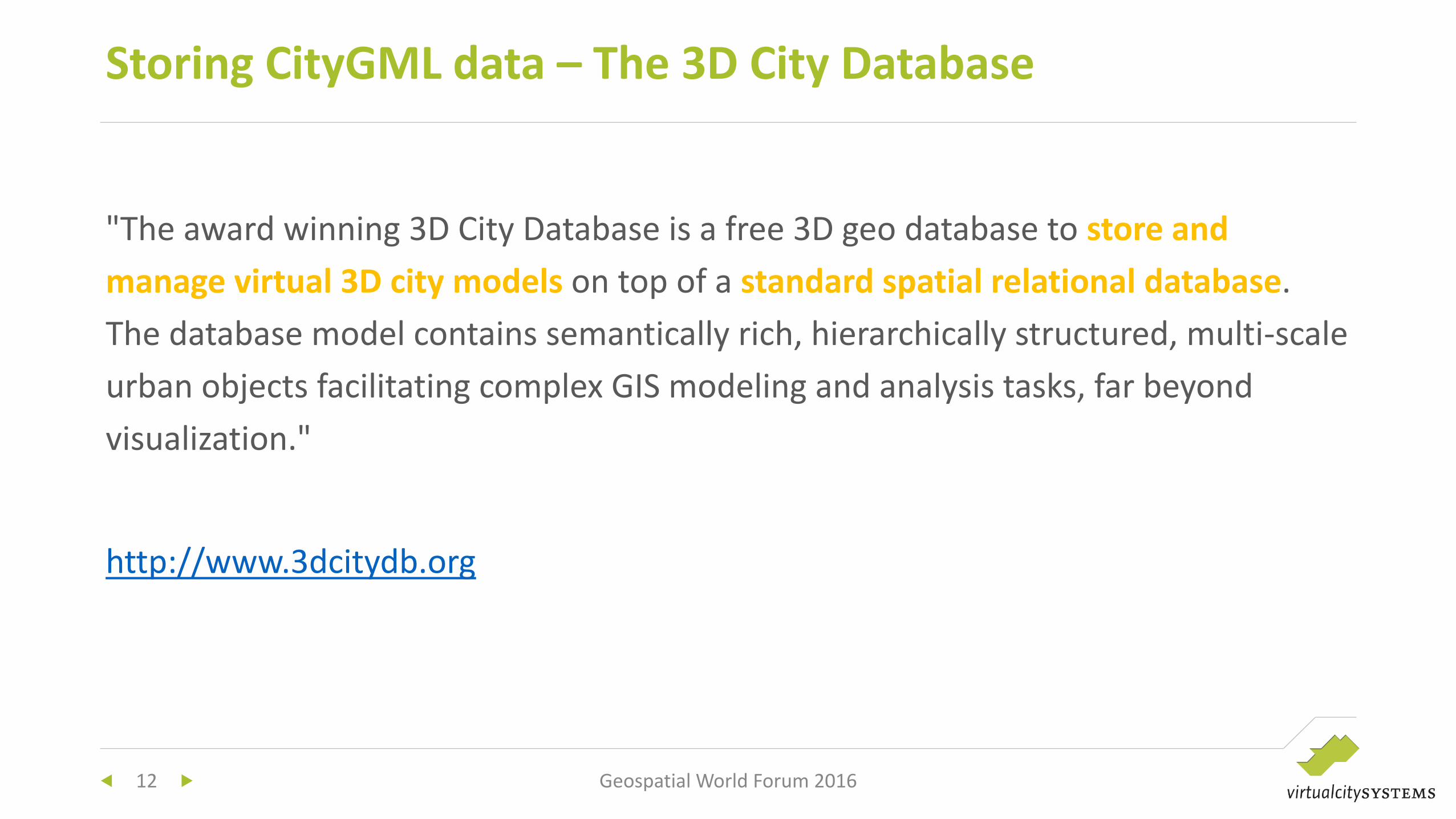
"The award winning 3D City Database is a free 3D geo database to store and
manage virtual 3D city models on top of a standard spatial relational database.
The database model contains semantically rich, hierarchically structured, multi-scale
urban objects facilitating complex GIS modeling and analysis tasks, far beyond
visualization."
http://www.3dcitydb.org
Storing CityGML data – The 3D City Database
12 Geospatial World Forum 2016
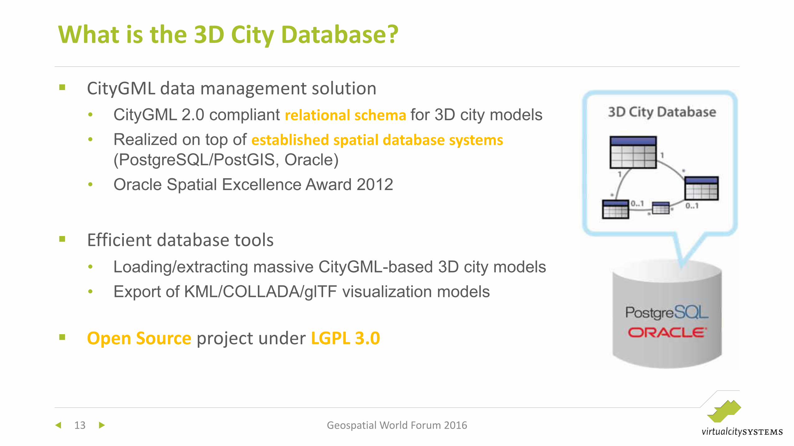
CityGML data management solution
• CityGML 2.0 compliant relational schema for 3D city models
• Realized on top of established spatial database systems
(PostgreSQL/PostGIS, Oracle)
• Oracle Spatial Excellence Award 2012
Efficient database tools
• Loading/extracting massive CityGML-based 3D city models
• Export of KML/COLLADA/glTF visualization models
Open Source project under LGPL 3.0
What is the 3D City Database?
13 Geospatial World Forum 2016
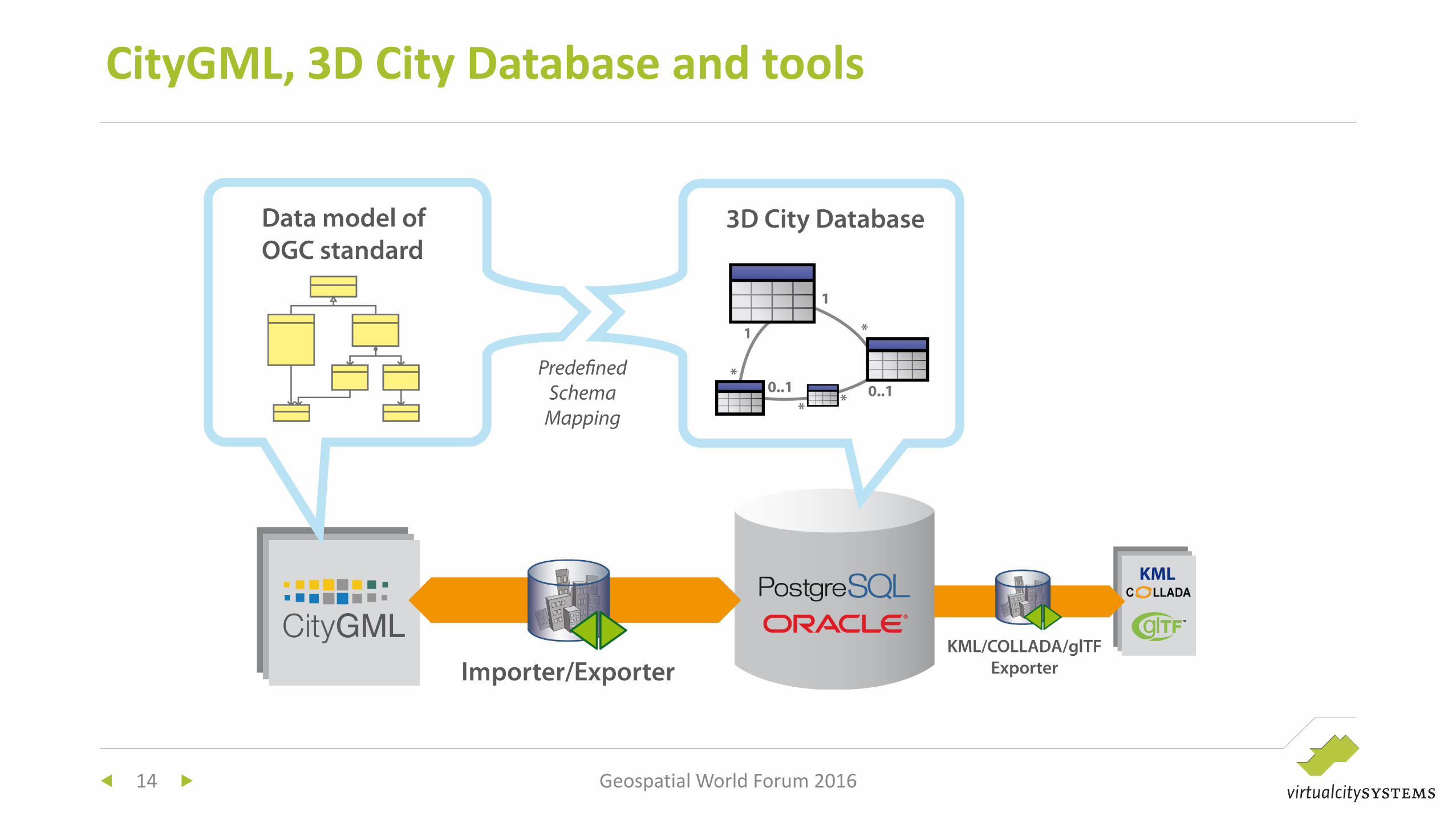
CityGML, 3D City Database and tools
14 Geospatial World Forum 2016
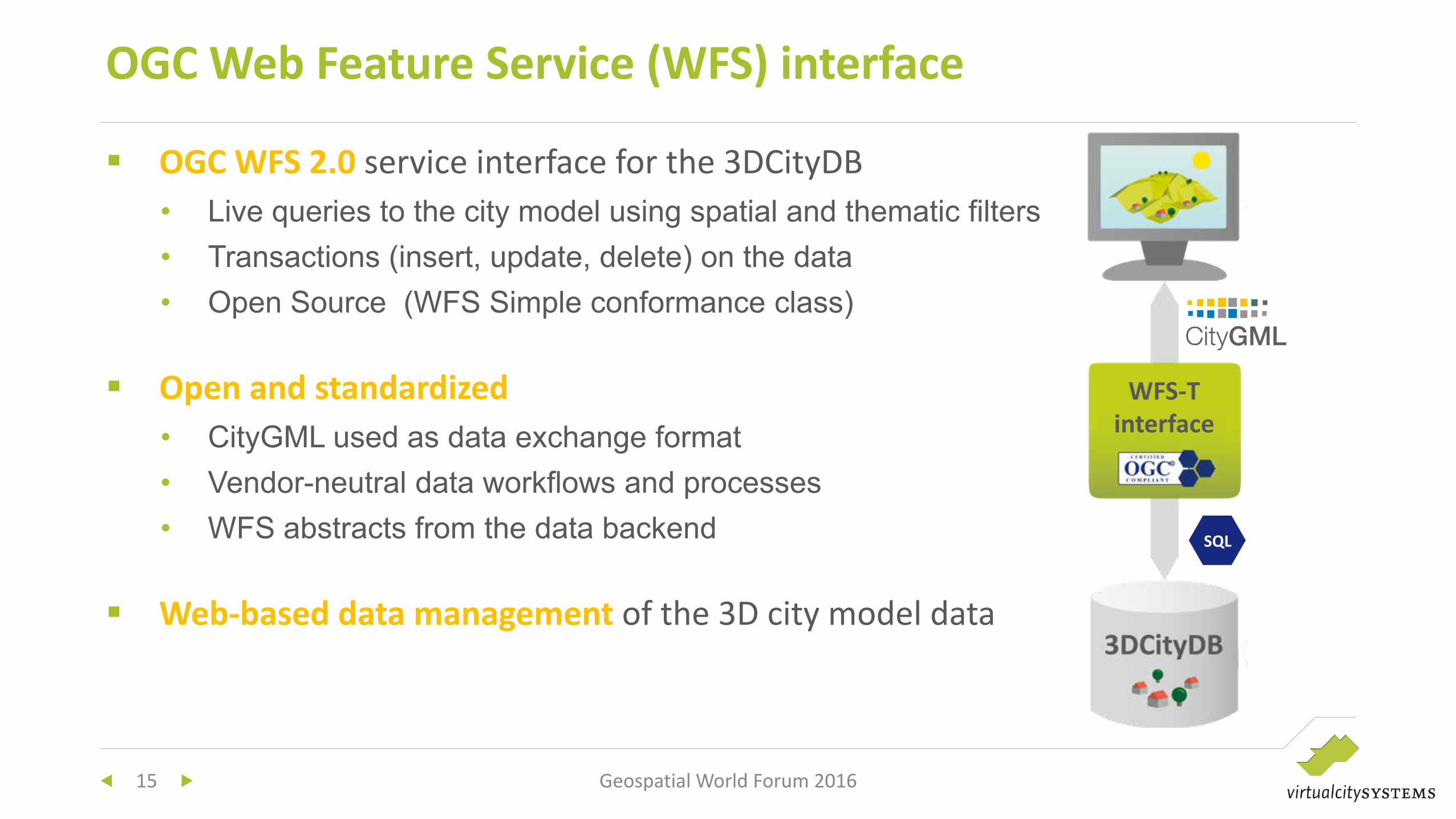
OGC WFS 2.0 service interface for the 3DCityDB
• Live queries to the city model using spatial and thematic filters
• Transactions (insert, update, delete) on the data
• Open Source (WFS Simple conformance class)
Open and standardized
• CityGML used as data exchange format
• Vendor-neutral data workflows and processes
• WFS abstracts from the data backend
Web-based data management of the 3D city model data
OGC Web Feature Service (WFS) interface
15 Geospatial World Forum 2016
WFS-T
interface
SQL
16 Geospatial World Forum 2016
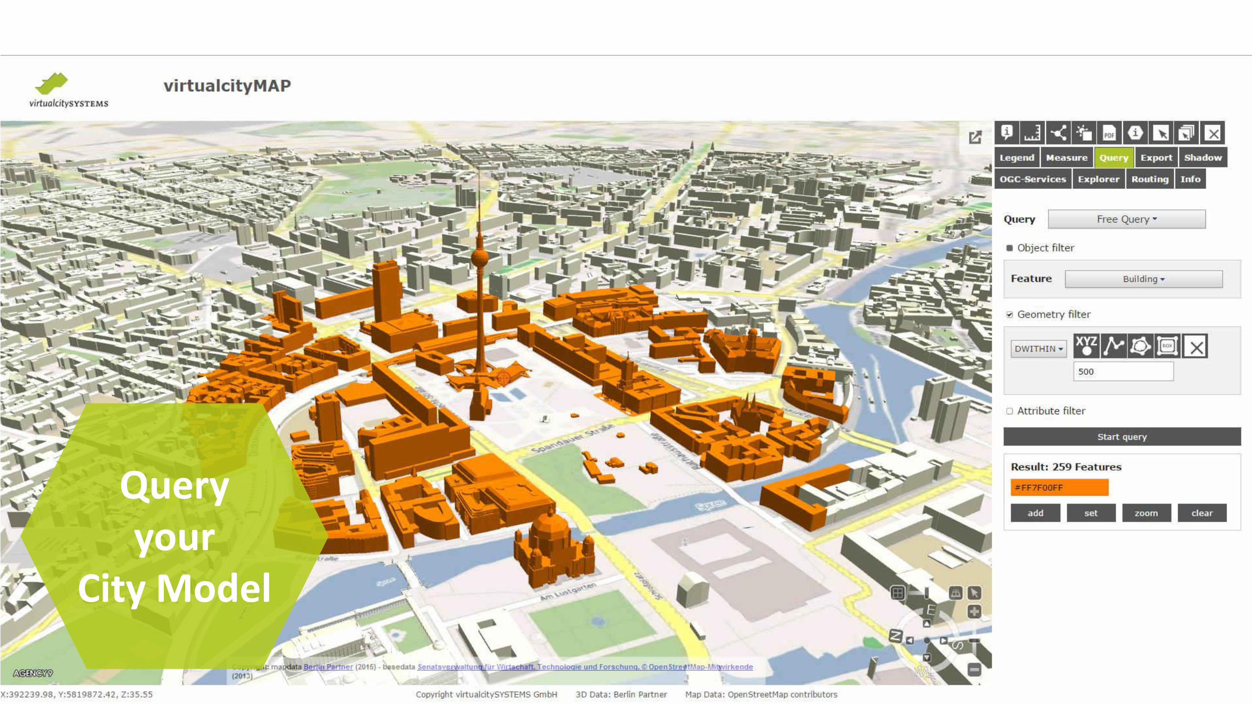
Query
your
City Model
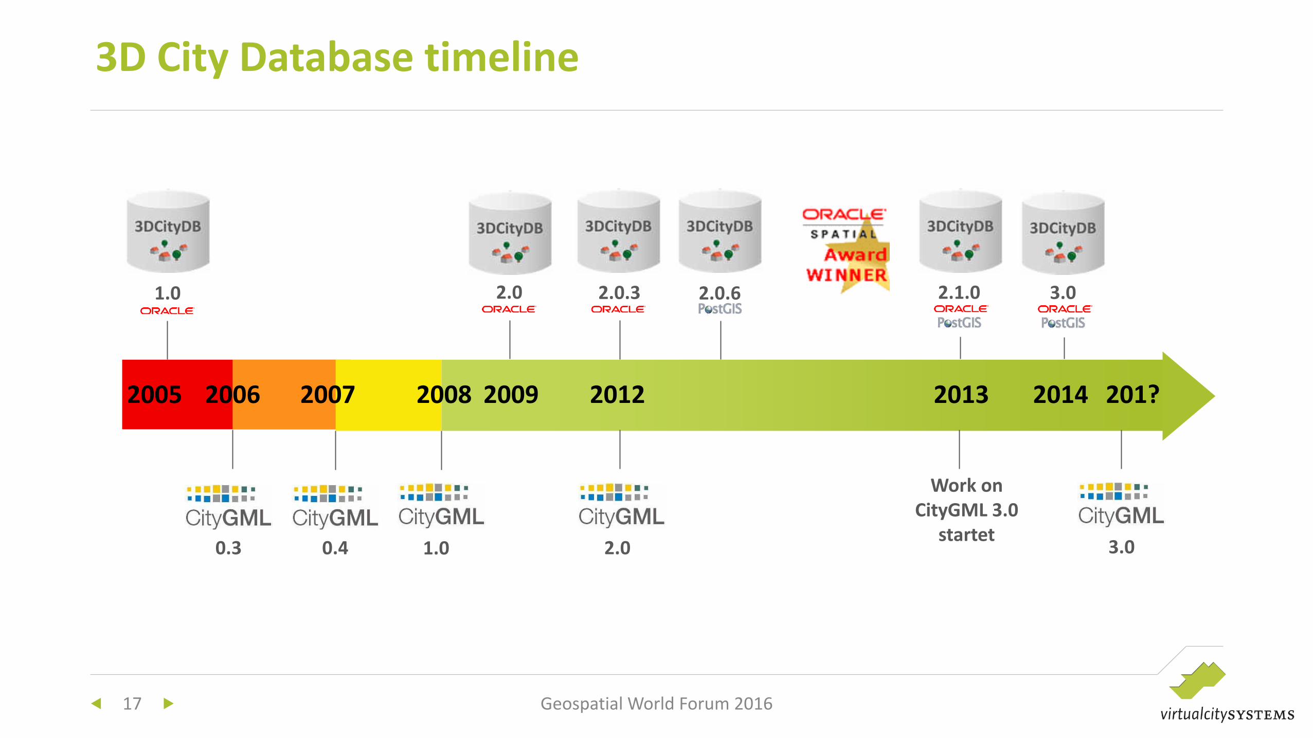
3D City Database timeline
17
2005 2006 2007 2008 2012
Work on
CityGML 3.0
startet
2013 201? 2009
2.0 2.0.3 2.0.6 2.1.0 3.0
2014
1.0 2.0 0.3 0.4
1.0
3.0
Geospatial World Forum 2016

CityGML-based SDIs
Implementation requirements and
examples
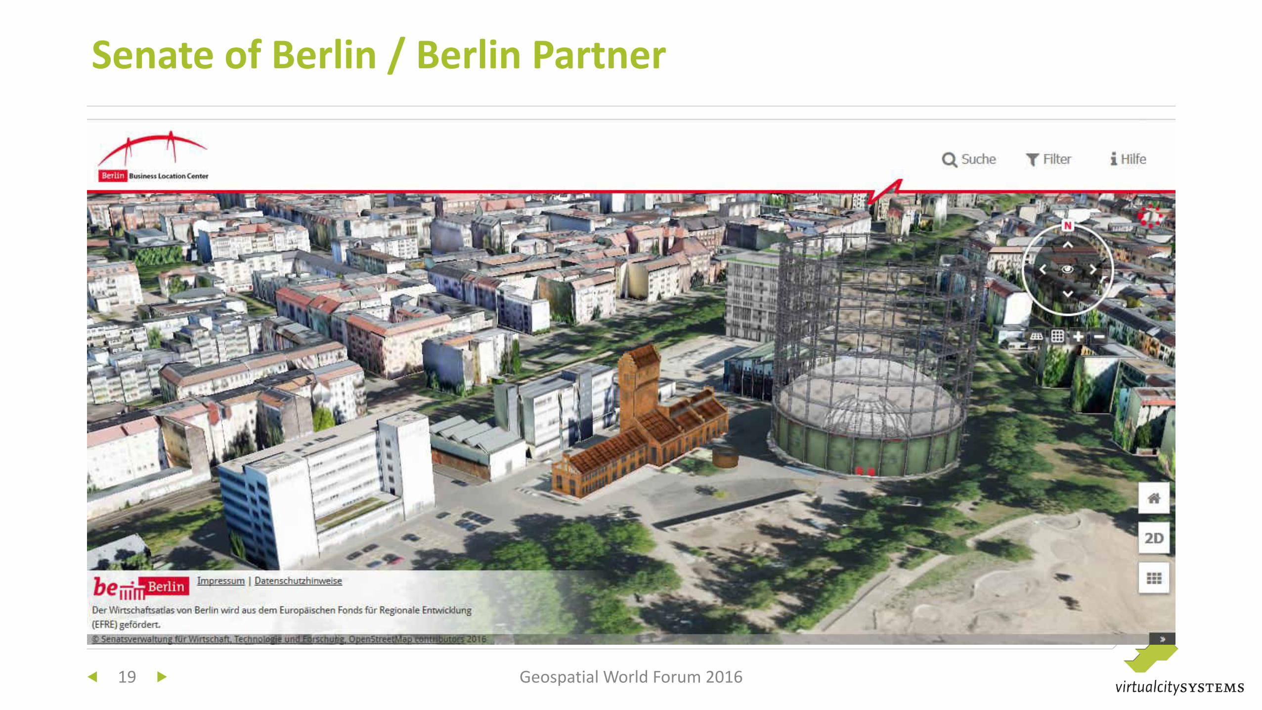
Senate of Berlin / Berlin Partner
Geospatial World Forum 2016 19
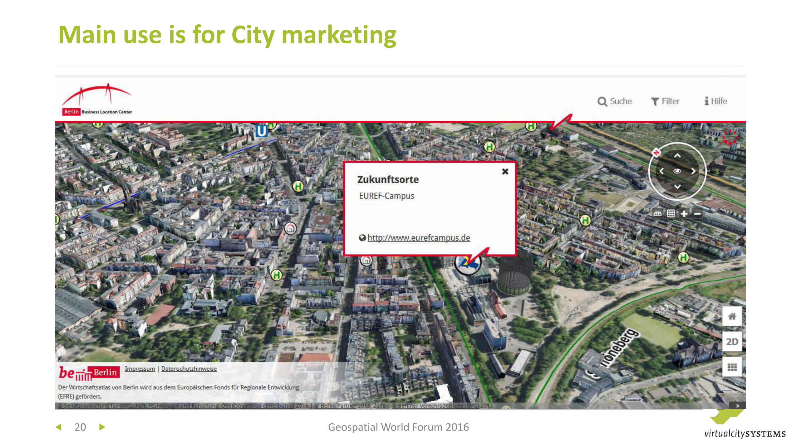
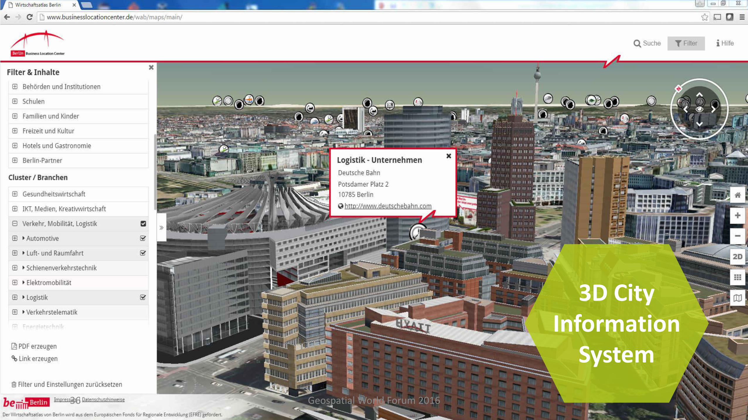
Main use is for City marketing
20 Geospatial World Forum 2016
Update and maintenance
• on a project base
• Change detection and update every 3-5 years
Storage
• Since 2009 in 3DCityDB
Visualization
• 2009: Autodesk LandXplorer (Desktop) and Google Earth (Web)
• 2011: virtualcityMAP / 3DMaps from Agency9 (Web)
• 2016: virtualcityMAP / CesiumJS
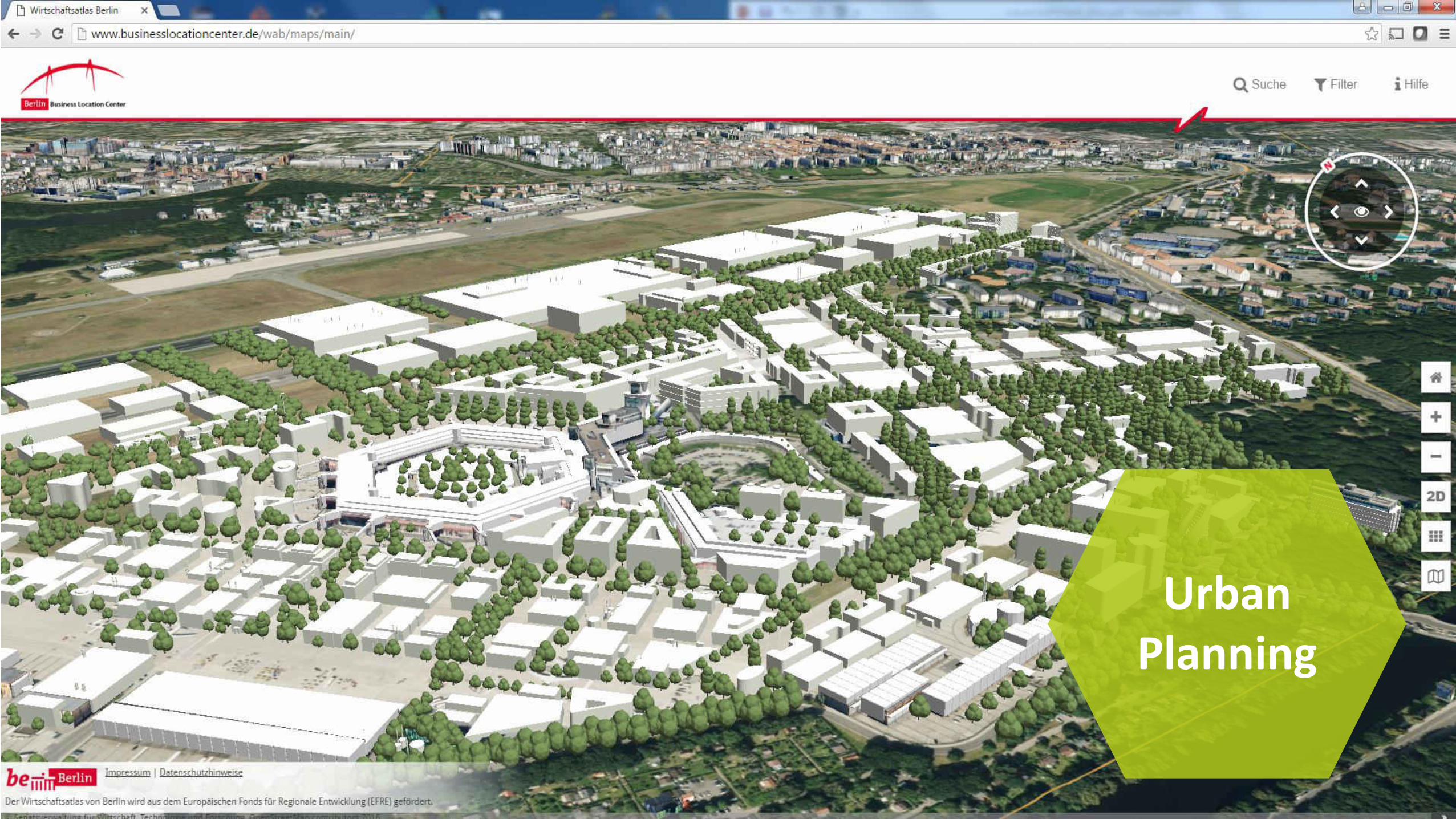
Berlin
21 Geospatial World Forum 2016
URL: http://www.businesslocationcenter.de/wab/maps/main/
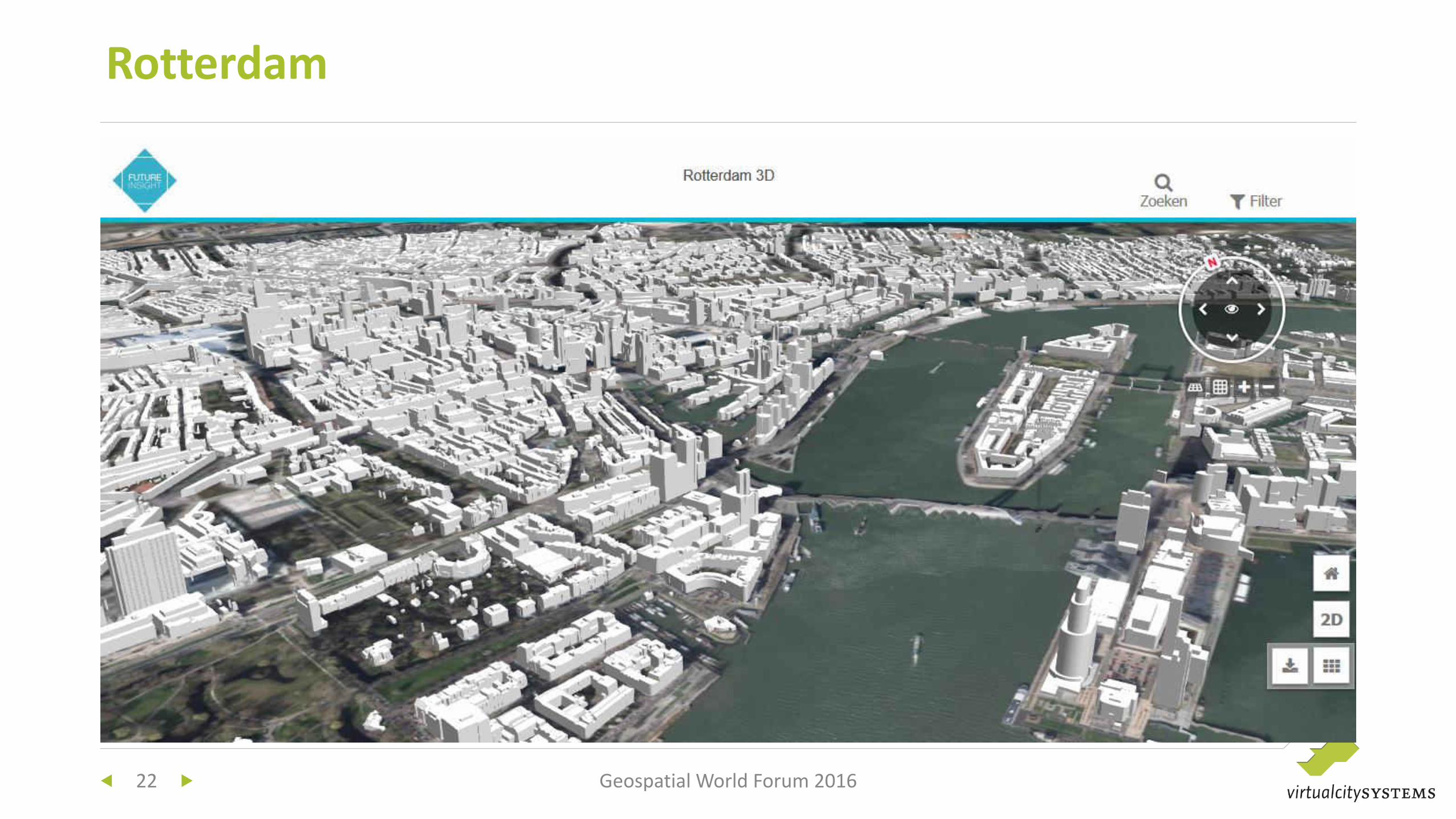
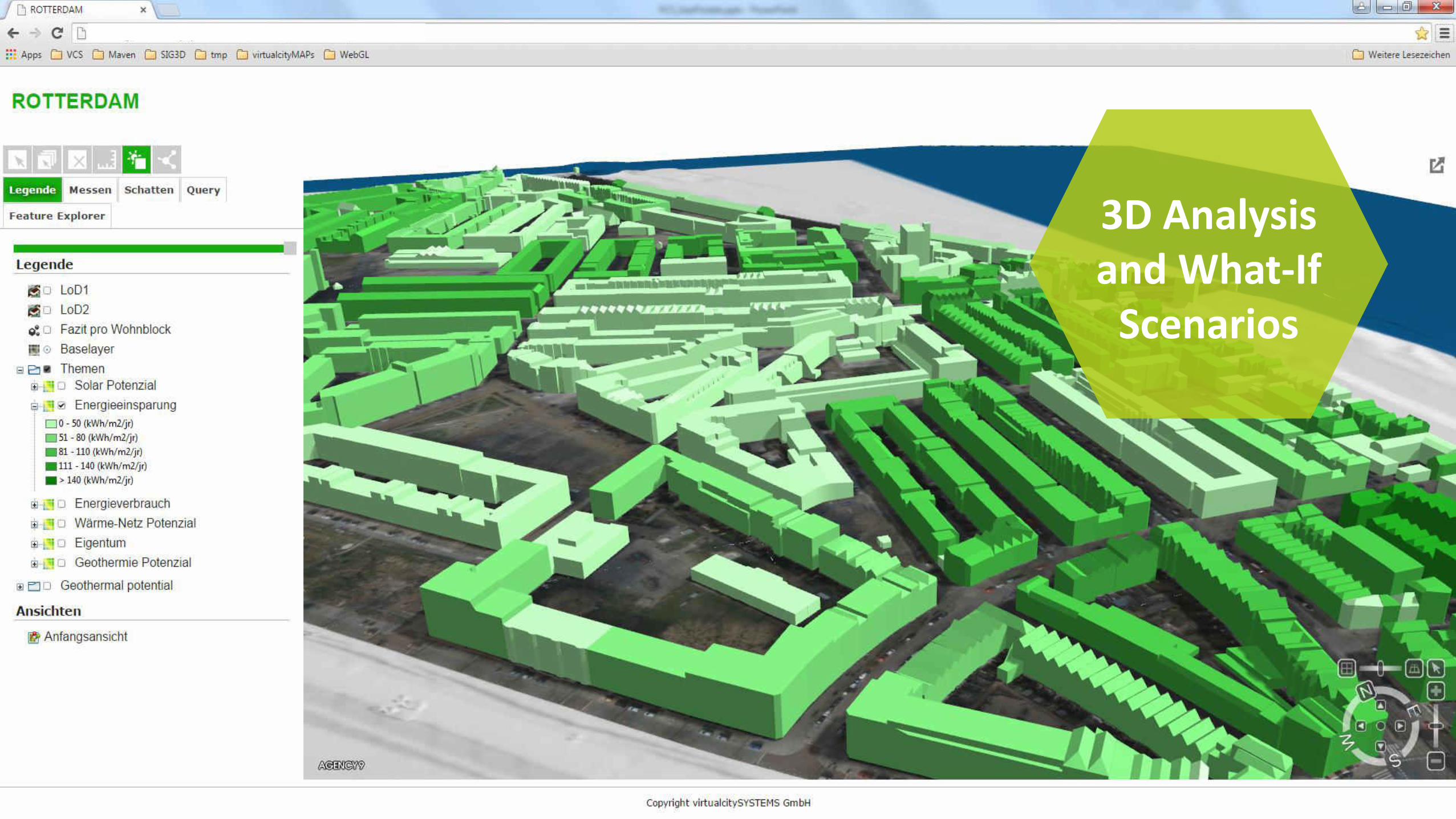
Rotterdam
22 Geospatial World Forum 2016
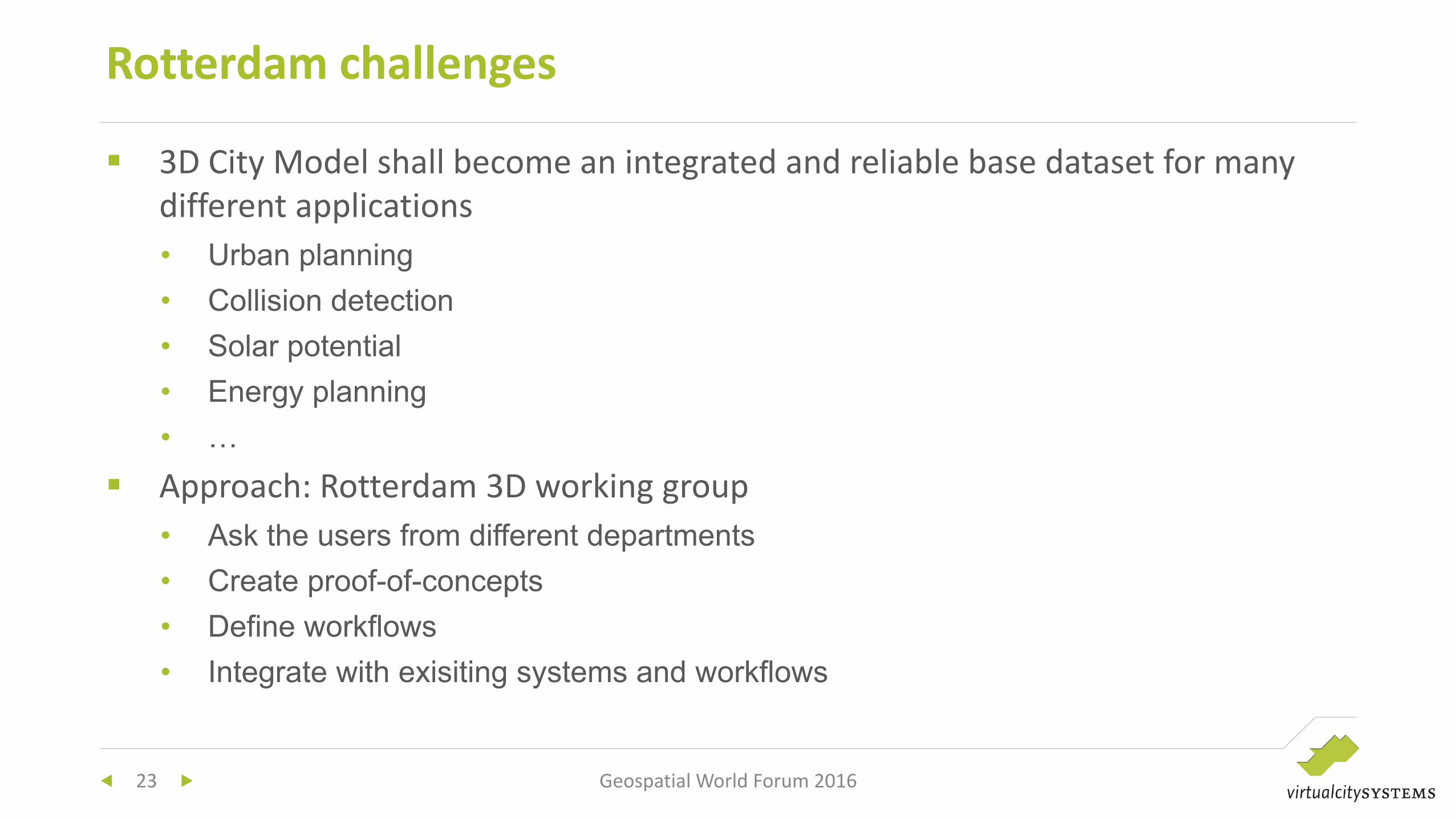
3D City Model shall become an integrated and reliable base dataset for many
different applications
• Urban planning
• Collision detection
• Solar potential
• Energy planning
• …
Approach: Rotterdam 3D working group
• Ask the users from different departments
• Create proof-of-concepts
• Define workflows
• Integrate with exisiting systems and workflows
Rotterdam challenges
23 Geospatial World Forum 2016
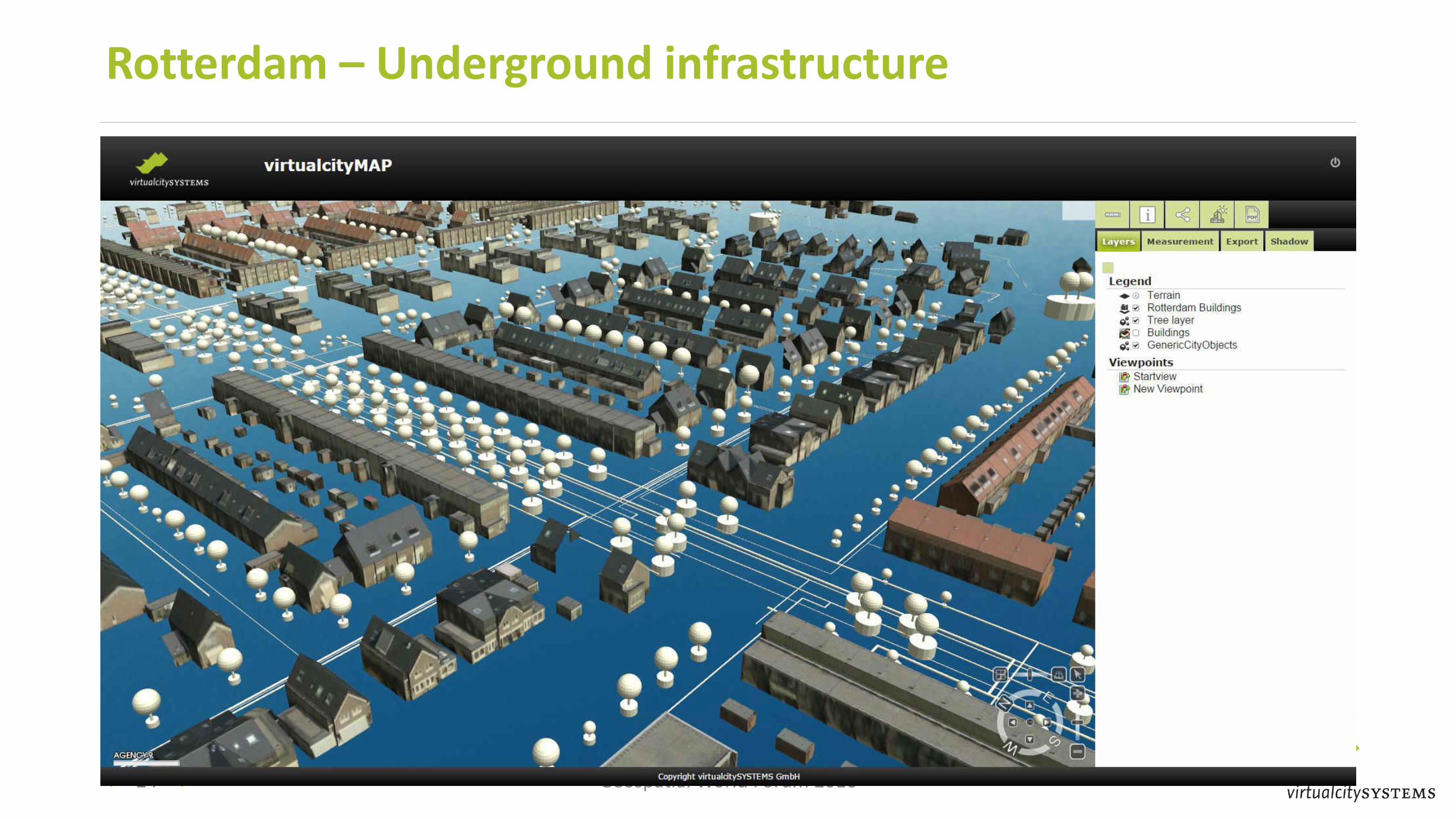
Rotterdam – Underground infrastructure
24 Geospatial World Forum 2016
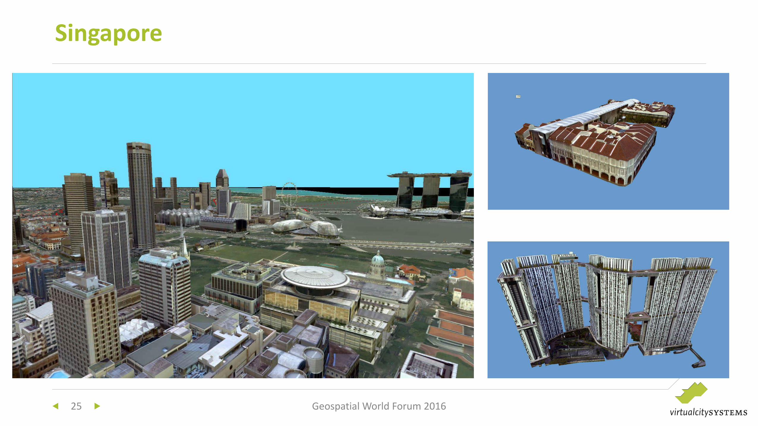
Singapore
25 Geospatial World Forum 2016
Data creation: Bentley Map
Data storage: 3DCityDB
Core requirement: Data update and maintenance is still unsolved
• Direct connection between Bentley Map and 3DCityDB
• Check out and feature look mechanism
• Support of the complete CityGML information model
In 2D solved but in 3D still a challenge
Singapore
26 Geospatial World Forum 2016
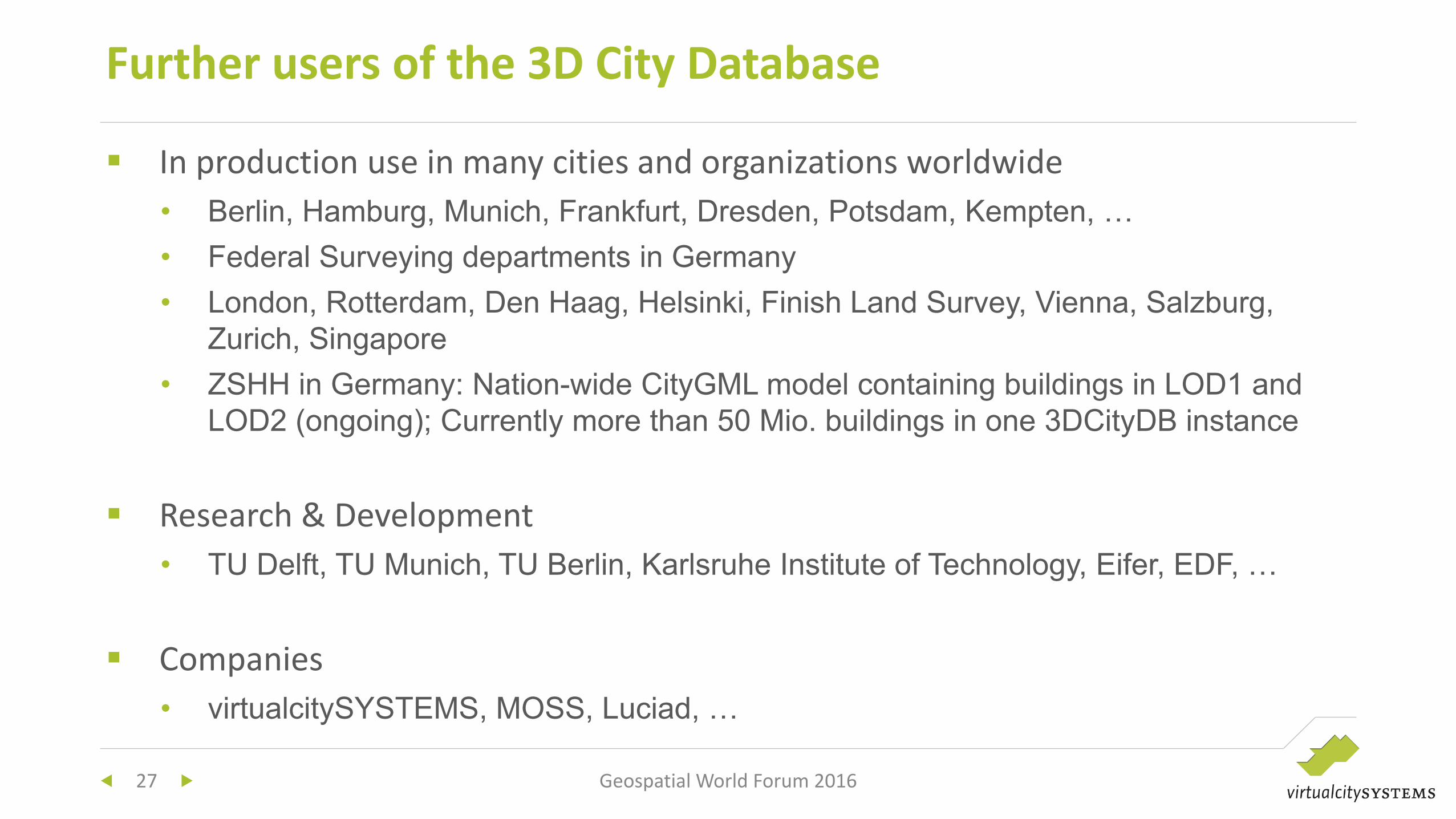
In production use in many cities and organizations worldwide
• Berlin, Hamburg, Munich, Frankfurt, Dresden, Potsdam, Kempten, …
• Federal Surveying departments in Germany
• London, Rotterdam, Den Haag, Helsinki, Finish Land Survey, Vienna, Salzburg,
Zurich, Singapore
• ZSHH in Germany: Nation-wide CityGML model containing buildings in LOD1 and
LOD2 (ongoing); Currently more than 50 Mio. buildings in one 3DCityDB instance
Research & Development
• TU Delft, TU Munich, TU Berlin, Karlsruhe Institute of Technology, Eifer, EDF, …
Companies
• virtualcitySYSTEMS, MOSS, Luciad, …
Further users of the 3D City Database
27 Geospatial World Forum 2016
28 Geospatial World Forum 2016
Interested in 3D SDIs?
Open Source tools to get you started
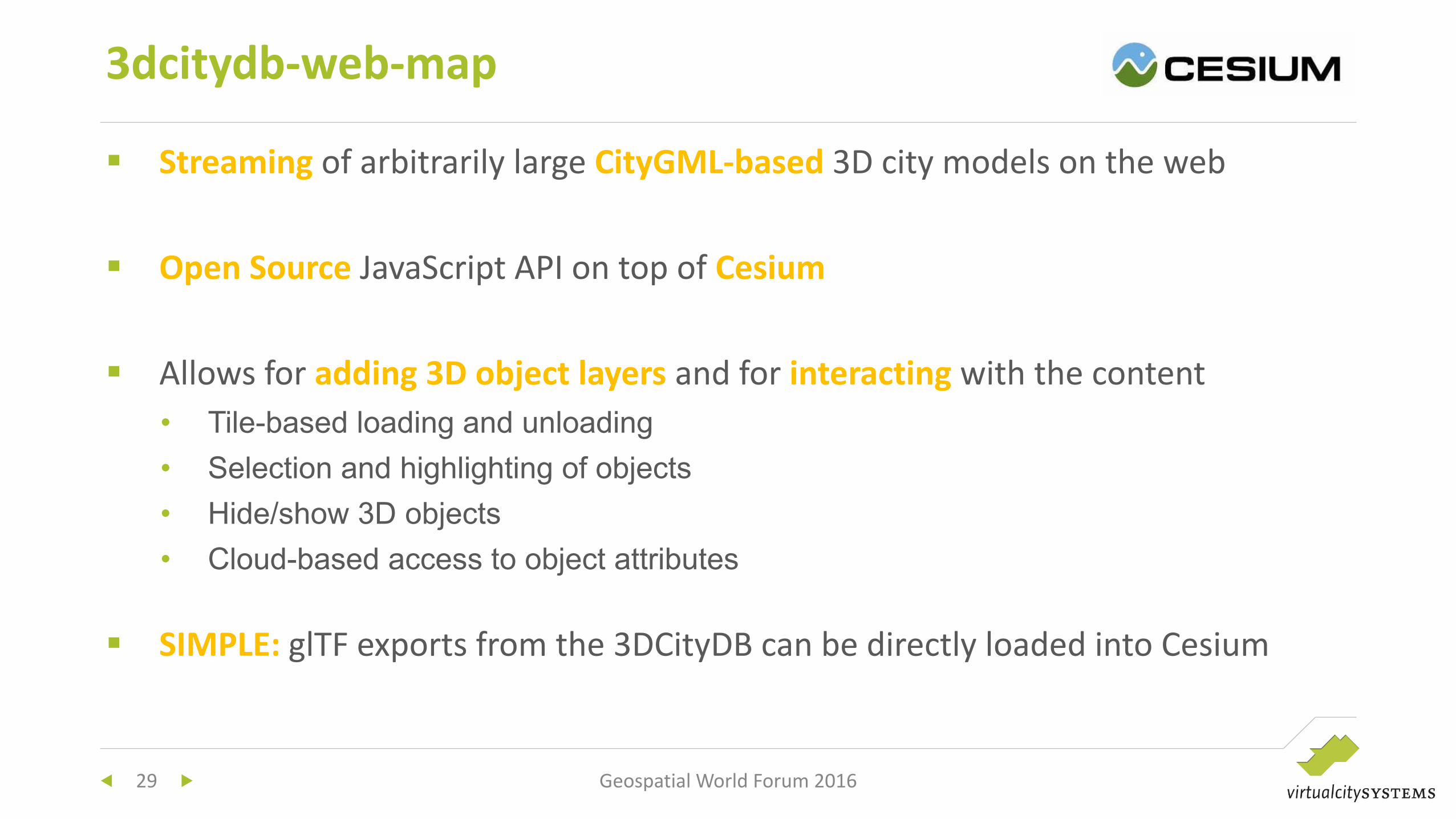
Streaming of arbitrarily large CityGML-based 3D city models on the web
Open Source JavaScript API on top of Cesium
Allows for adding 3D object layers and for interacting with the content
• Tile-based loading and unloading
• Selection and highlighting of objects
• Hide/show 3D objects
• Cloud-based access to object attributes
SIMPLE: glTF exports from the 3DCityDB can be directly loaded into Cesium
3dcitydb-web-map
29 Geospatial World Forum 2016
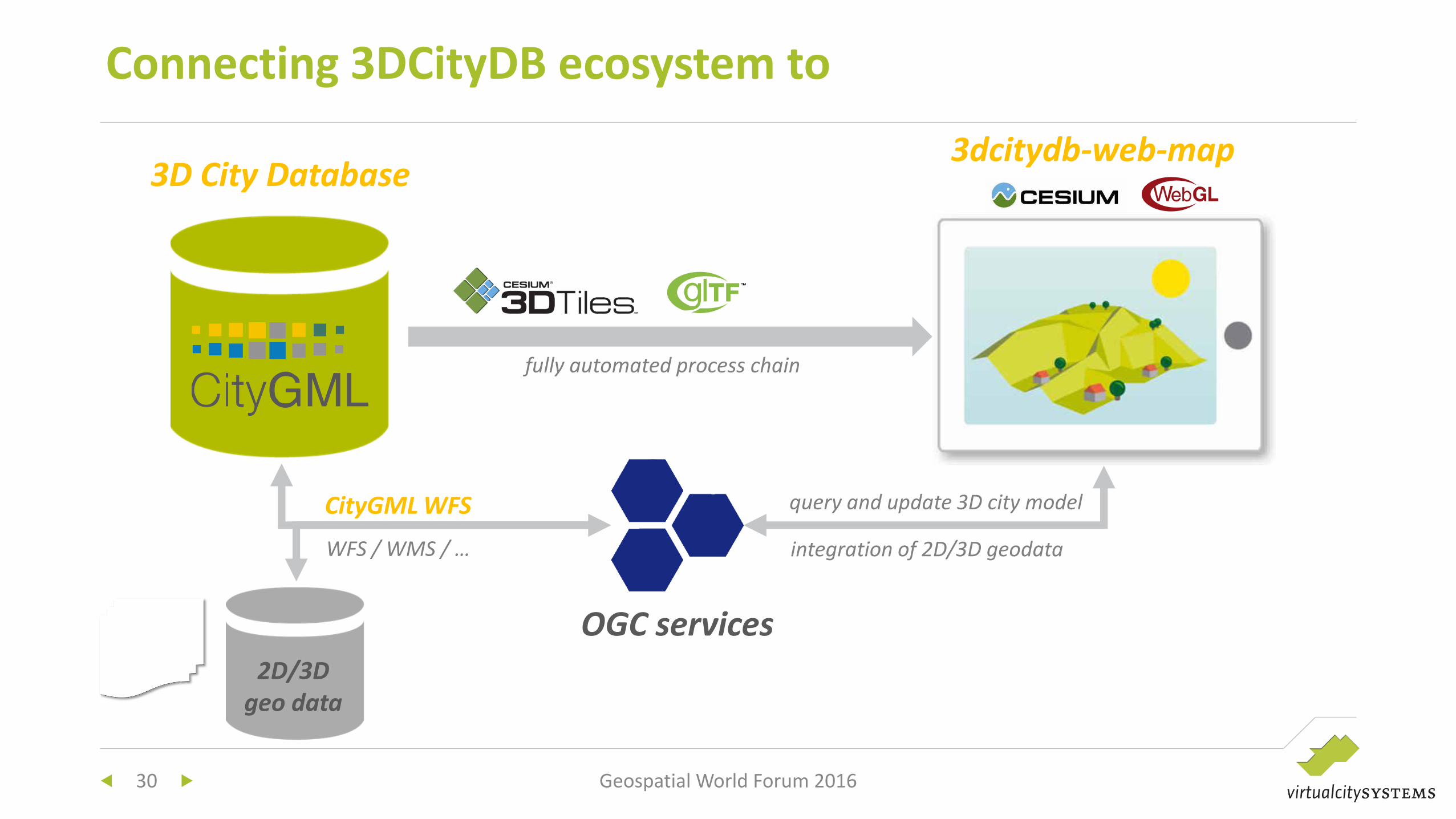
Connecting 3DCityDB ecosystem to
30 Geospatial World Forum 2016
3D City Database 3dcitydb-web-map
fully automated process chain
2D/3D
geo data
CityGML WFS
WFS / WMS / …
query and update 3D city model
integration of 2D/3D geodata
OGC services
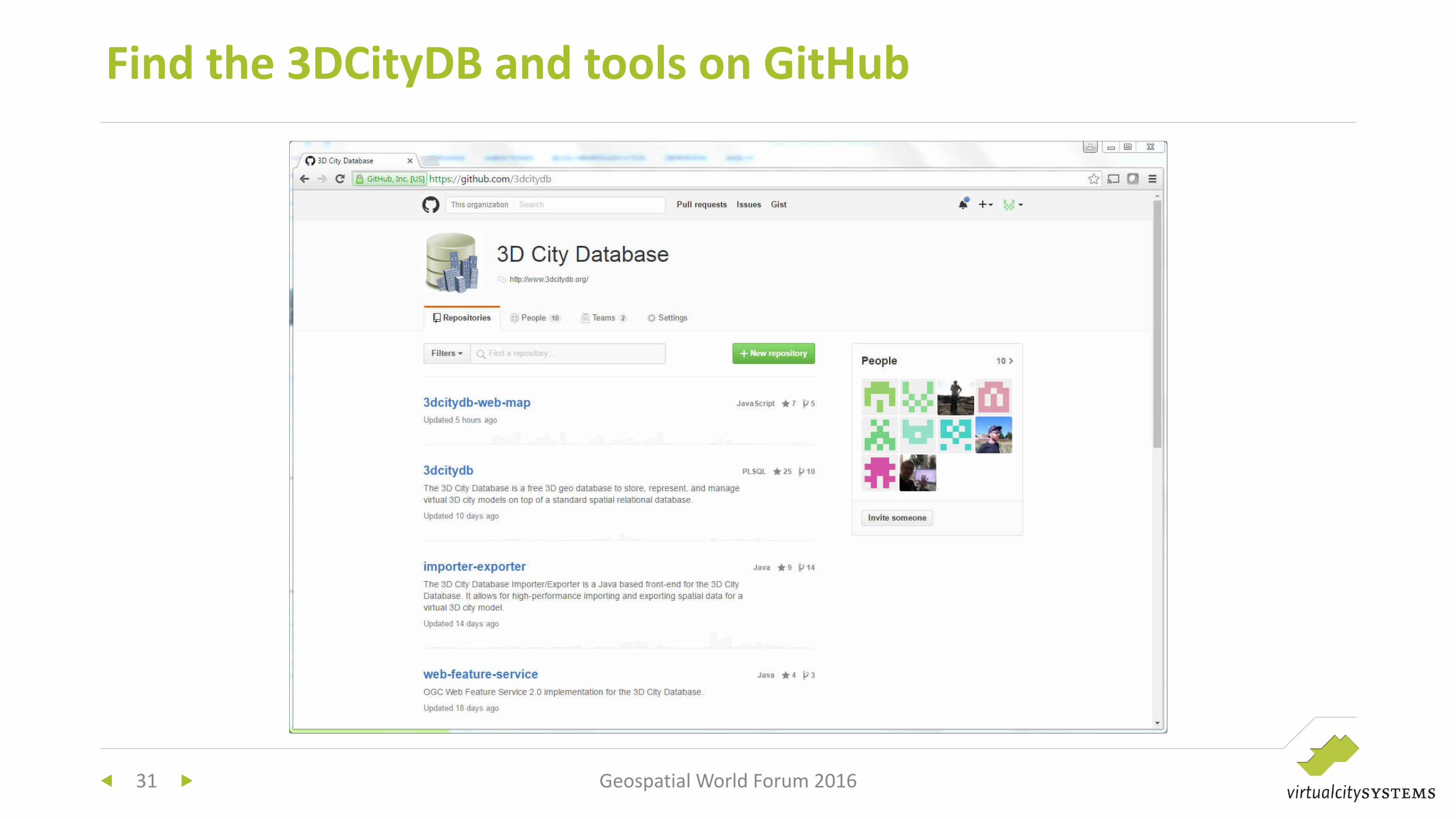
Find the 3DCityDB and tools on GitHub
31 Geospatial World Forum 2016
32 Geospatial World Forum 2016
CityGML-based SDIs
Implementation requirements and
examples

Reliable solutions for data storage and data distribution are available
• 3DCityDB
• 3DCityDB Web Feature Service
• virtualcityMAP / virtualcityPUBLISHER
Data creation, maintenance and update is still not fully solved
• Deleting and replacing features – ok
• Replacing the complete model – ok
• Continuous updates through import and export workflows – ok
• Direct database connection using an editor – not yet implemented
Conclusions
Geospatial World Forum 2016 33
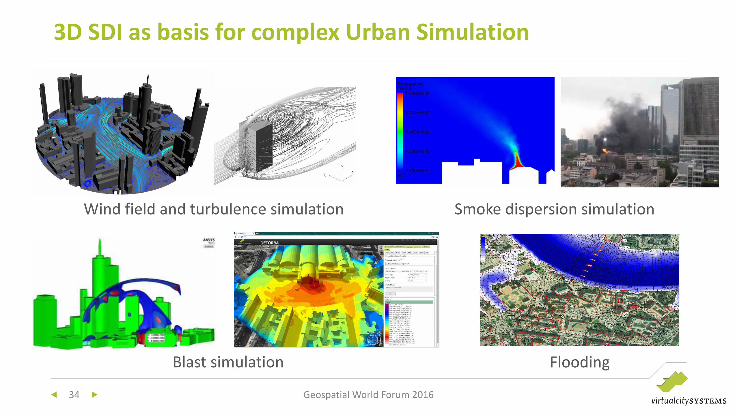
3D SDI as basis for complex Urban Simulation
34 Geospatial World Forum 2016
Wind field and turbulence simulation Smoke dispersion simulation
Blast simulation Flooding
The next generation of 3D city models
virtualcitySYSTEMS
Follow us on virtualcitysystems.de or on
Dr. Lutz Ross
36 Geospatial World Forum 2016
3D City
Information
System
37 Geospatial World Forum 2016
3D Analysis
and What-If
Scenarios
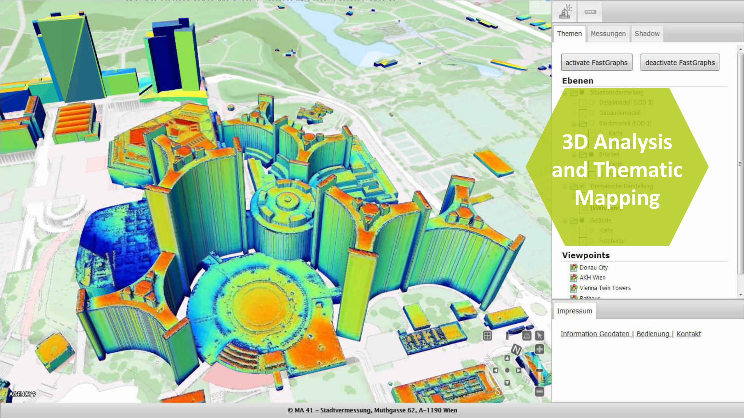
38 Geospatial World Forum 2016
3D Analysis
and Thematic
Mapping
39 Geospatial World Forum 2016
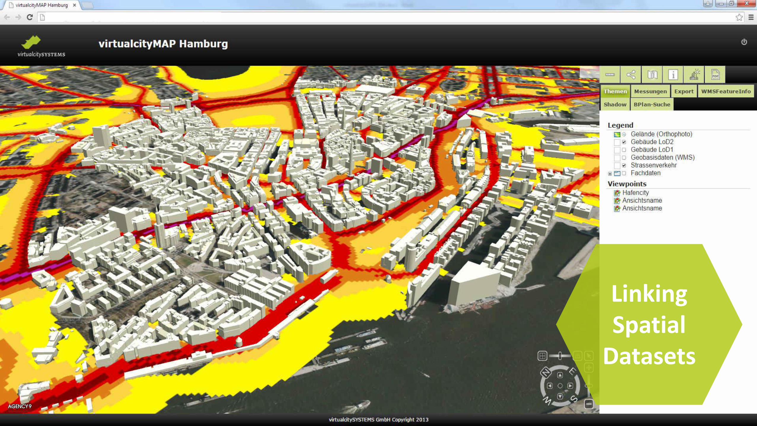
Linking
Spatial
Datasets
40 Geospatial World Forum 2016
Urban
Planning


