CLAIMING TERRITORY: COLONIAL STATE SPACE AND THE MAKING OF BRITISH INDIA’S NORTH-WEST FRONTIER A Thesis Presented to the Faculty of the Graduate School of Cornell University In Partial Fulfillment of the Requirements for the Degree of Master of Science by Jason G. Cons January 2005
Transcript
CLAIMING TERRITORY: COLONIAL STATE SPACE AND THE MAKING OF
BRITISH INDIA’S NORTH-WEST FRONTIER
A Thesis
Presented to the Faculty of the Graduate School
of Cornell University
In Partial Fulfillment of the Requirements for the Degree of
In this thesis, I examine the discursive construction of colonial state space in
the context of British India’s turn of the century North-West Frontier. My central
argument is that notions of a uniform state space posited in official theorizations of the
frontier need to be reexamined not as evidence of a particular kind of rule, but rather
as a claim to having accomplished it. Drawing on new colonial historiographies that
suggest ways of reading archives and archival documents for their silences and on
historical sociological understandings of state-formation, I offer close readings of
three different kinds of documents: writing about the North-West Frontier by members
of the colonial administration, annual general reports of the Survey of India, and
narratives written by colonial frontier officers detailing their time and experience of
“making” the frontier. I begin by looking at the writings of George Nathanial Curzon
and others attempting to theorize the concept of frontiers in turn of the century
political discourse. Framed against the backdrop of the “Great Game” for empire with
Russia and the progressive territorial consolidation of colonial frontiers into borders in
the late 19th century, these arguments constitute what I call a “colonial theory of
frontiers.” This theory simultaneously naturalizes colonial space and presents borders
as the inevitable result of colonial expansion. This theorization, I argue, is particularly
important to reexamine as it operates on a set of assumptions that have been adopted
into social science notions of territory. These assumptions take space as “given” and
static as opposed to fluid, contingent, and contested.
I explore this late colonial theory of frontiers as “claims” to territorial rule by
looking at the discourse of cartography in the context of the North-West Frontier.
Cartography, like colonial frontier theory, posits a uniform state space where the
boundaries of rule are neatly demarcated by borders. A closer examination of maps
ii
along the North-West Frontier, however, suggests that processes of territory making in
this region neither conform to simple notions of cartographic demarcation nor to
colonial frontier theory more generally. Finally, I suggest that these spaces are better
understood as zones of negotiation and state formation where claims of colonial
territorial integrity are anything but certain. Such an understanding of territory
displaces approaches that tacitly designate places as either state or non-state and
demonstrates that claims to territorial control must always be understood in the
context of the contingent, contested, and negotiated claims for making space into
place.
iii
BIOGRAPHICAL SKETCH
Jason Cons, who was born and raised in Maine, completed a BA with honors in
English Literature and American Studies at Wesleyan University. Before returning to
graduate school he worked as a freelance writer and reviewer for a number of
publications, edited The Bookpress in Ithaca, New York, and worked for several years
as an instructional designer. He is currently a doctoral student in the Department of
Development Sociology at Cornell University.
iv
ACKNOWLEDGMENTS
Thanks to Alex De Costa, Nosheen Ali, and especially Karuna Morarji for feedback
on the early stages of this project. An abbreviated version of this thesis was presented
at the 2004 Annual Conference on South Asia at Madison Wisconsin on a panel titled
“Merely Conventional Signs? Map-Making on South Asian Borders.” Thanks to my
panel members, Farhana Ibrahim, Nosheen Ali, and Ed Simpson for their participation
and thoughts and to K. Siviramakrishnan for careful and detailed commentary on all of
our papers. Mahesh Rangarajan was a patient listener and inexhaustible source of
information, not to mention inspiration, while I was still trying to formulate this thesis.
Methodological and theoretical ideas for the mapping section of this paper were also
initially worked out in a paper I wrote for his Environmental History class. The
conceptual approach to space that I have used in this paper was initially discussed in
the Polson Institute Working Group on Displacement, Impoverishment, and
Development. Many thanks to the members of that group for their thoughts, feedback,
and ideas. Those ideas took specific shape in a paper co-authored with Shelley
Feldman and Chuck Geisler, both of whom have provided constant encouragement,
support and engagement in the project of rethinking space and displacement. Thanks
to Adam Berenstain for his help with making color maps readable in black and white.
Thanks to Phil McMichael for his patience and careful criticism, not to mention gentle
prodding, throughout this project. Shelley Feldman, who directed this Masters Thesis,
has been a source of inspiration throughout writing. I couldn’t hope to work with a
better, more careful, and more encouraging critic. Most of all, thanks to Erin Lentz,
who not only lived with this project for longer than either of us care to remember, but
who has listened to and critiqued all of the ideas presented here with her characteristic
thoughtfulness, care, and interest.
v
TABLE OF CONTENTS
1) Introduction 1
2) A Late Colonial Theory of Frontiers 10
3) Colonial Frontier Theory and the Social Science Assumption of Territory 27
4) Exploring the Reconnaissance Zone 37
5) Negotiating Colonial State Space 53
6) Conclusion: Territory at the Border 65
7) Appendix 69
8) References 72
vi
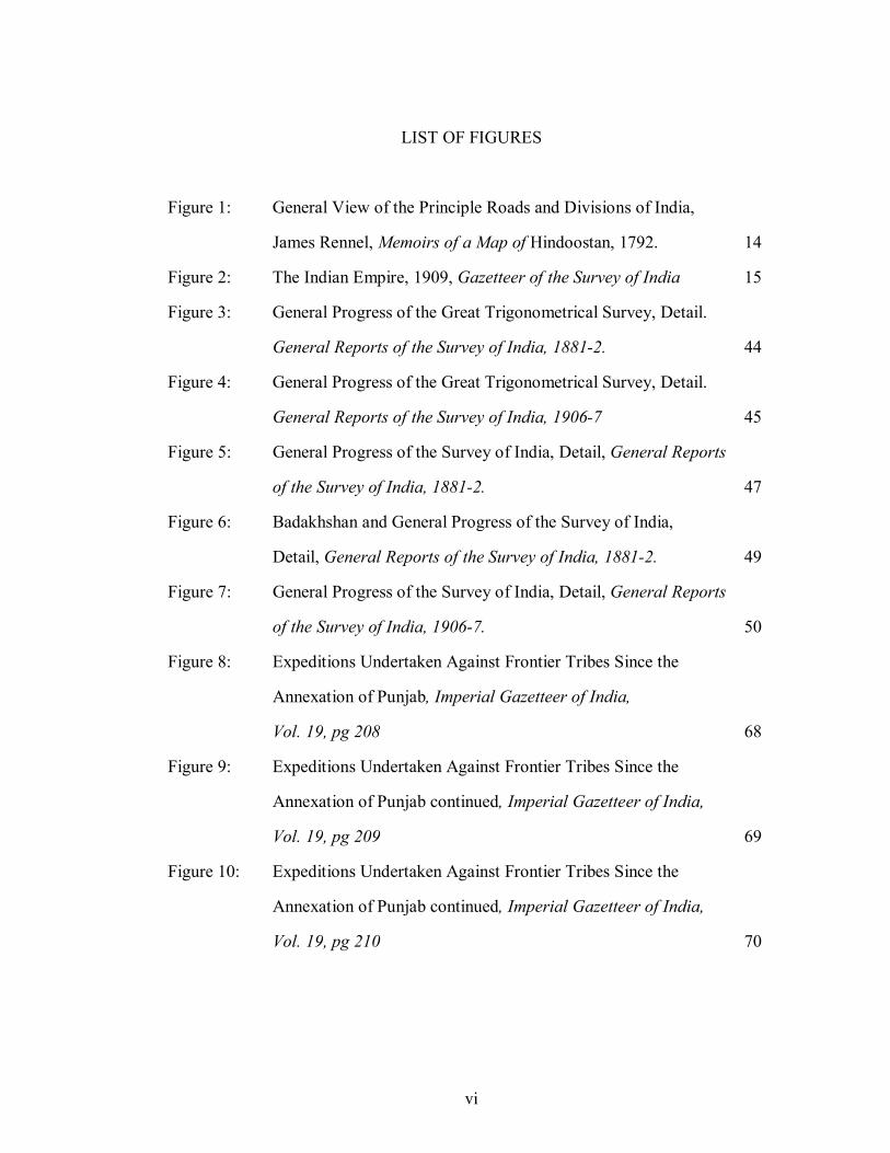
LIST OF FIGURES
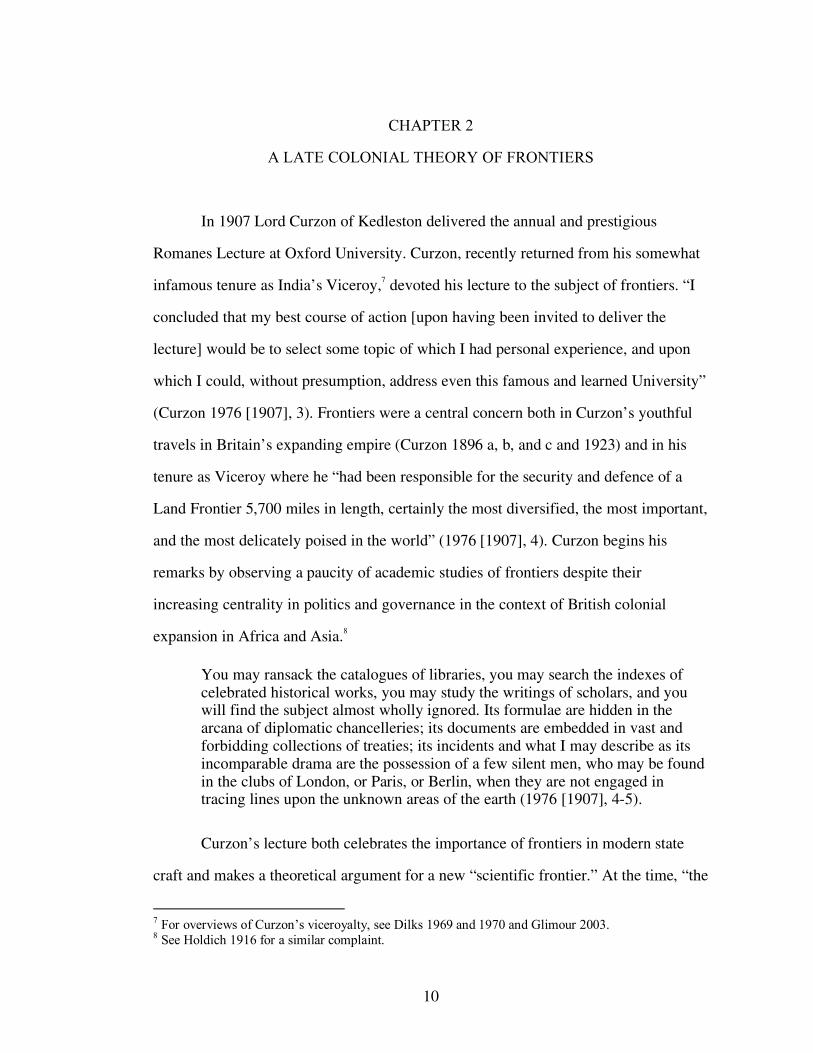
Figure 1: General View of the Principle Roads and Divisions of India,
James Rennel, Memoirs of a Map of Hindoostan, 1792. 14
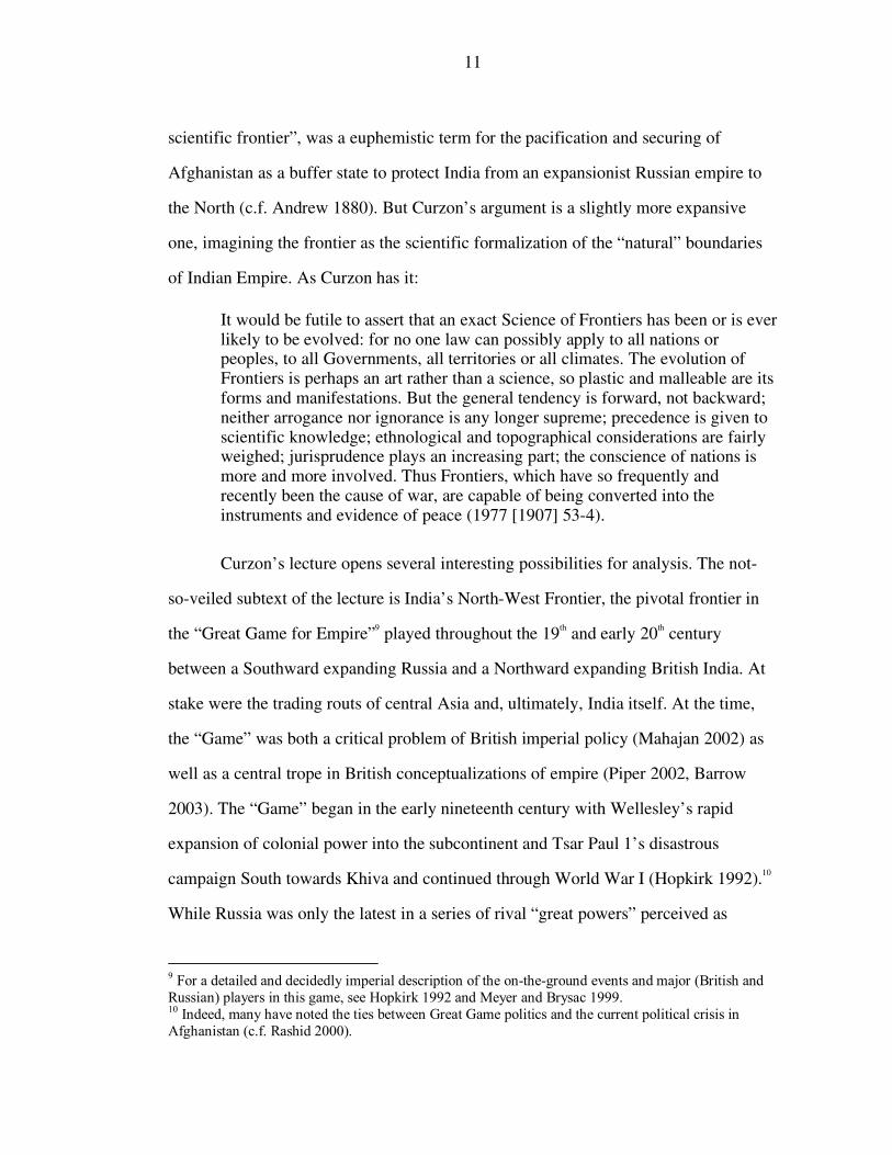
Figure 2: The Indian Empire, 1909, Gazetteer of the Survey of India 15
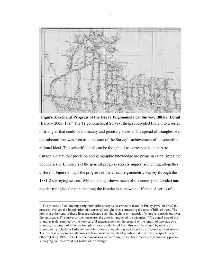
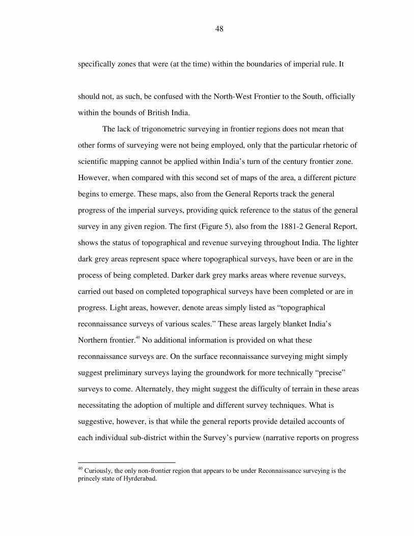
Figure 3: General Progress of the Great Trigonometrical Survey, Detail.
General Reports of the Survey of India, 1881-2. 44
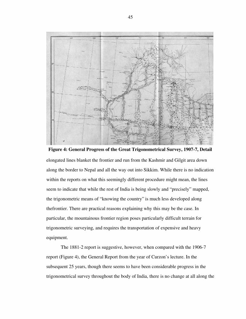
Figure 4: General Progress of the Great Trigonometrical Survey, Detail.
General Reports of the Survey of India, 1906-7 45
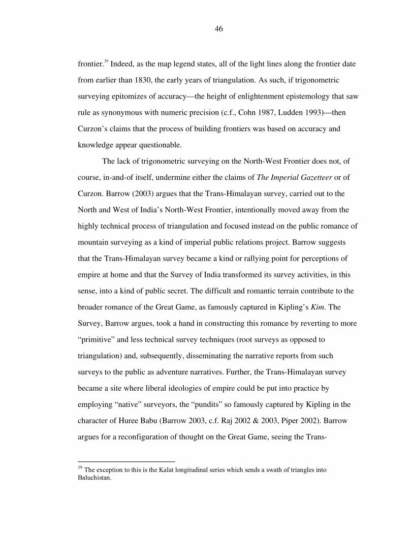
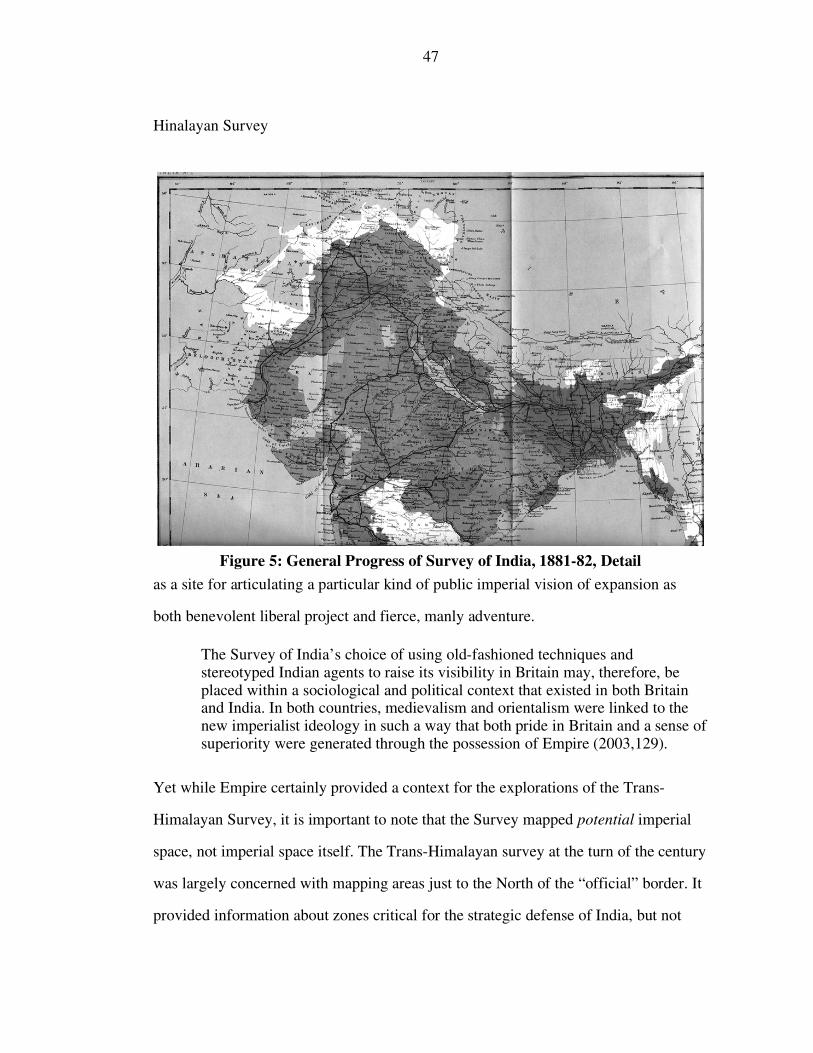
Figure 5: General Progress of the Survey of India, Detail, General Reports
of the Survey of India, 1881-2. 47
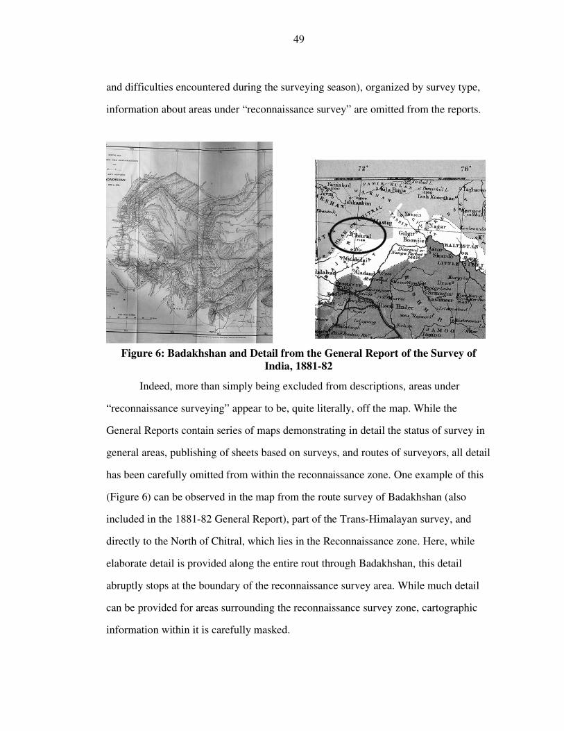
Figure 6: Badakhshan and General Progress of the Survey of India,
Detail, General Reports of the Survey of India, 1881-2. 49
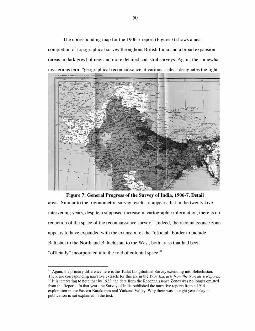
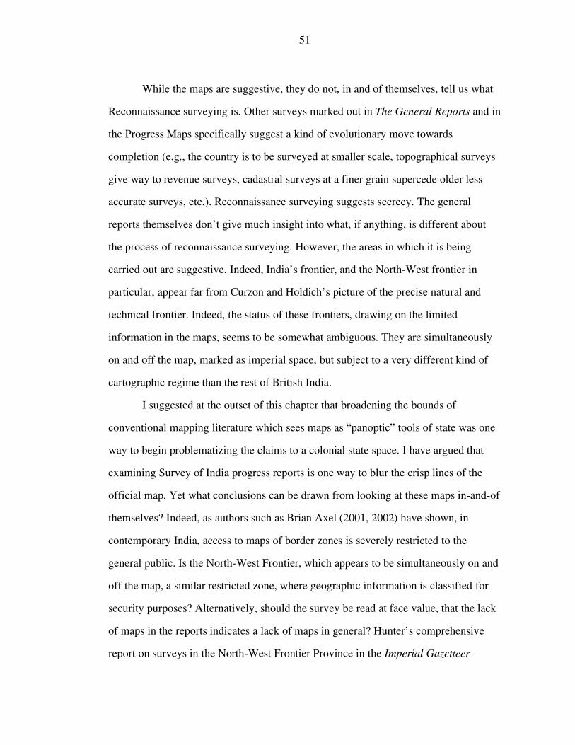
Figure 7: General Progress of the Survey of India, Detail, General Reports
of the Survey of India, 1906-7. 50
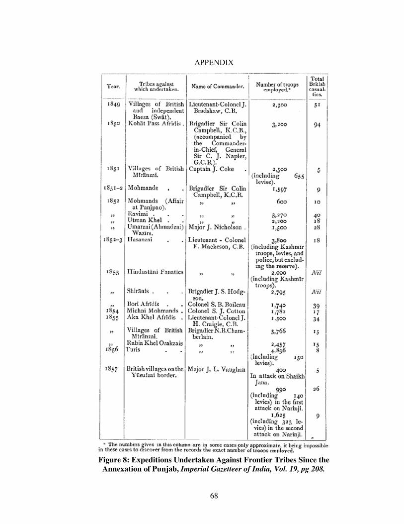
Figure 8: Expeditions Undertaken Against Frontier Tribes Since the
Annexation of Punjab, Imperial Gazetteer of India,
Vol. 19, pg 208 68
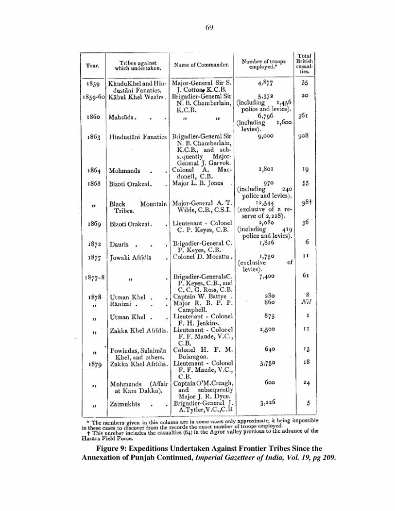
Figure 9: Expeditions Undertaken Against Frontier Tribes Since the
Annexation of Punjab continued, Imperial Gazetteer of India,
Vol. 19, pg 209 69
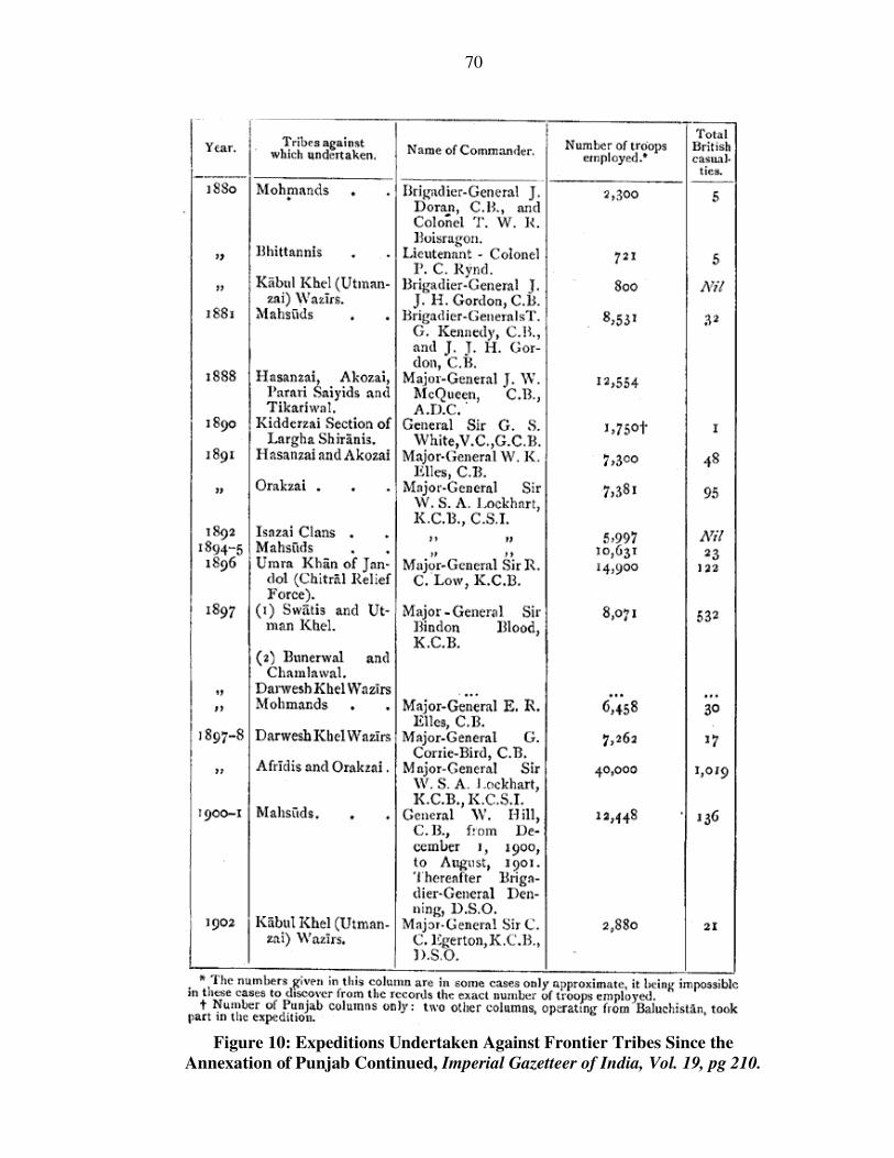
Figure 10: Expeditions Undertaken Against Frontier Tribes Since the
Annexation of Punjab continued, Imperial Gazetteer of India,
Vol. 19, pg 210 70
CHAPTER 1
INTRODUCTION
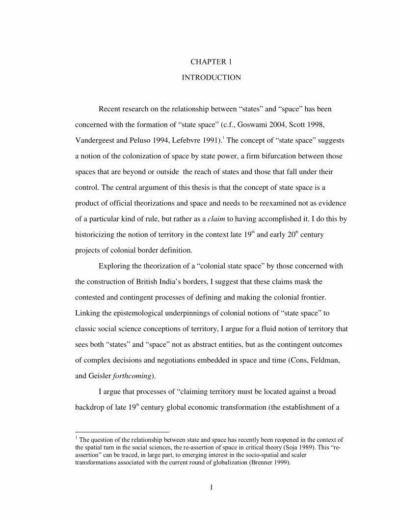
Recent research on the relationship between “states” and “space” has been
concerned with the formation of “state space” (c.f., Goswami 2004, Scott 1998,
Vandergeest and Peluso 1994, Lefebvre 1991).1 The concept of “state space” suggests
a notion of the colonization of space by state power, a firm bifurcation between those
spaces that are beyond or outside the reach of states and those that fall under their
control. The central argument of this thesis is that the concept of state space is a
product of official theorizations and space and needs to be reexamined not as evidence
of a particular kind of rule, but rather as a claim to having accomplished it. I do this by
historicizing the notion of territory in the context late 19th and early 20th century
projects of colonial border definition.
Exploring the theorization of a “colonial state space” by those concerned with
the construction of British India’s borders, I suggest that these claims mask the
contested and contingent processes of defining and making the colonial frontier.
Linking the epistemological underpinnings of colonial notions of “state space” to
classic social science conceptions of territory, I argue for a fluid notion of territory that
sees both “states” and “space” not as abstract entities, but as the contingent outcomes
of complex decisions and negotiations embedded in space and time (Cons, Feldman,
and Geisler forthcoming).
I argue that processes of “claiming territory must be located against a broad
backdrop of late 19th century global economic transformation (the establishment of a
1 The question of the relationship between state and space has recently been reopened in the context of the spatial turn in the social sciences, the re-assertion of space in critical theory (Soja 1989). This “re-assertion” can be traced, in large part, to emerging interest in the socio-spatial and scaler transformations associated with the current round of globalization (Brenner 1999).
1
2
world market dominated by England) and territorial partition and redefinition (the
constitution of emergent colonial states and negotiations for territorial control amongst
European powers). But more specifically, I am concerned with the making of India’s
North-West Frontier. By looking at the actual practices of state and border formation
along this frontier in late 19th and early 20th century, I offer an alternative view which
is sensitive to the contingent, contested, and negotiated production of the frontier. My
intent here is not so much to rewrite the history of the North-West Frontier or to
catalog the resistance to British spatial expansion, though this is a critical project.2
Rather, I use my reading of frontier-building as a way to uncover some of what is
obscured by the notions of territory as “state space” that have been adopted as
scholarly common sense.
In so doing, I suggest a notion of territory that avoids reifying notions of state
and space at the same time that it recognizes that the making of territory as a project
involves particular kinds of social and geographical reconfigurations and negotiations.
Making frontiers is a universalizing task that gives territorial boundaries to colonial
power at the same time that it differentiates and homogenizes populations as either
inside or outside the bounds of colonial authority. I suggest that exploring the logics
and rationales employed by those involved in border demarcation, while examining
the processes that such logics and rationales mask, is one way to preserve and
understand “the tension between exclusionary practices and universalizing claims of
bourgeois culture [that] were crucial to shaping the age of empire” (Cooper and Stoler
1997, 37).
Frontiers and borders are places where conceptions of states as centralized
entities, radiating power and influence from centralized locations (c.f., Tambiah 1977),
2 See Banerjee 2000 for an account of Pathan resistance to British frontier policy in the early 20th century.
3
can be problamatized and turned on their head (Sahlins 1989, Wilson and Donnan
1998). Studies of such areas also unsettle social science views that imagine states “as a
series of blocks defined by state territorial boundaries” (Agnew and Corbridge1995,
79). Works such as Peter Sahlins’ classic study of the French-Spanish border in the
Pyrenees demonstrate that borders, as “sites and metaphors in the political and cultural
construction of a modern world of nation-states” (Sahlins 1998, 31), are critical places
to rethink the assumptions about the relationships between state power, ethnicity, and
national identity.
Yet borderlands and frontiers are also sites that are critical to the modern
concept and perception of the state. The power of maps to visualize both state and
nation as a unified whole (c.f. Thongchai 1994, Krishnan 1996, Ramaswamy 2002,
Trivedi 2003) is intimately tied to the existence of borders, which are central to
constructing state and national space as bounded, continuous, and whole. In this sense,
borders, in their power to smooth our view of the uneven contours of states, are central
to the production of the state-idea, “the mask which prevents our seeing political
practice as it is”3 (Abrams 1988 [1977], 82). Borders and frontiers lend credence to
ideas of something that can be called a “state space,” seemingly to delimit the
boundaries of uniform state control.
Taking seriously Abrams’ argument that the “relationship between the state-
system and the state-idea to other forms of power should and can be central concerns
of political analysis” (1988, 82), I read state-formation along turn of the century
British India’s North-West Frontier against “official theorizations” produced by
members of the Colonial government on the role and function of frontiers and borders
3 A striking assertion of this idea is the relationship between notions of territorial integrity in postcolonial India, campaigns of national unity (Rashtria Ekta), and the careful legal regulation of mapping processes and cartographic representation discussed by Brian Axel (2001, 2002)on his work in the struggle for independent Khalistan.
4
in colonial politics. These arguments constitute what I will call a “colonial theory of
frontiers”. This theory discursively constructs frontiers as the simultaneously “natural”
boundaries of an emergent colonial state and the necessary political divisions between
expanding empire. It posits a natural and uniform boundary of expanding empire, a
smooth colonial state space. This discourse, I will suggest, obscures the complex and
negotiated processes of state formation at work in making the frontier.
My goal is to undermine simplified notions of territory that, I suggest, can be
traced to Weber’s classic definition of the state as possessing the legitimate monopoly
on violence within a given territory. New literature on the relationship between state
and space implicitly critique Weber’s classic definition (Brenner et al. 2001). Yet
much of it implicitly or explicitly continues to adopt Weber’s reified notion of state
and space, reproducing critiques that imagine the state as an abstracted entity,
something outside acting on people and place to transform “non-state” space to “state”
space (Cons, Feldman, and Geisler forthcoming). I historicize this view as emerging
against the backdrop of both late 19th century colonial territorial consolidation and,
indeed, against a colonial theorization of frontiers with which the Weberian notion of
state space shares fundamental assumptions.4 Sharing concerns with a growing body of
literature interested in understanding the colonial production (c.f. Goswami 2004,
Carter 1987) and classification (c.f. Sivaramkrishnan 1999, Rangarajan 1996) of space
as a technology of rule and with critics seeking to unpack the mutual constitution of
empire and the social sciences (c.f., Mitchell 2003, Godlewska 1994), I will read the
discursive construction of the frontier against the partices of state formation and
negotiations over space at the border. Territory emerges, in such a view, not as a fixed
space, contained and controlled by a given entity, but rather as a site where relations of
4 My argument is not that Weber’s ideal typical state is based on colonial notions of state formation, rather that colonial reconfigurations of space make up part of the historical/epistemic backdrop of Weber’s methodological innovations.
5
rule, the politics of access and defense, and contested and multiple meanings of place
are worked out (Massey 1994).
Numerous authors have remarked both on the emergence of the nation-state as
the enabling moment of the social sciences (c.f., Agnew and Corbridge 1995,
Wallerstein 1991, Giddens 1979) and of the fundamental centrality of colonialism in
both the development of social scientific thought and analytic conceptions of the
European nation-state5 (Stoler 1995a and 1995b, Stoler and Cooper 1997, Connell
1997, Mitchell 2000; 2003). Authors concerned with this latter view have argued that
the colonies should be understood as “laboratories of modernity” (Stoler 1995a and
1994b)—places where the social and scientific projects of modernity were worked out
before being returned to the “West”—and that processes of enumeration central to the
emergence of the “modern state” in the colonies (Cohn 1987) have constituted the
staging ground and unspoken conceptual core of both social science inquiry and
modern technologies of rule. Of particular interest to such authors is the bifurcation of
state and society as “objects” of inquiry. As Bernard Cohn and Nicholas Dirks have it, As society has been separated and freed from the state, social science (the handmaiden of the documentation and certification project) has claimed that society must simultaneously be subjected to scientific study, which itself has the purpose and function of control and manipulation. A combination of paradoxes conspire to make the tentacles of state power (and related forms of state knowledge) appear to be discrete, disinterested, and diffuse; but we believe this to be an illusion” (1988, 227).
Understanding the link between colonial border theory and the emergence of a notion
5 Indeed, as Timothy Mitchell has argued, the partitioning of society as the subject of individual disciplines within the social sciences is founded, first, on the appropriation of the nation-state as the primary unit of analysis and, second, on the assumption of a fundamental similarity between each of these units such that they can be seen as similar to Western concepts of state and society. “Each geographical unit was imagined… to possess an economy, portrayed in terms of the novel statistical trope entitled national income; a self-contained political system or state; a homogenous body called society; and even a distinctive national culture. Each unit also came to have an imagined national history” (Mitchell 2003, 155).
6
of states that naturalizes the category of territory can help identify the ways that social
science has helped constitute this notion of state power by adopting “official” theory
into “social” theory. Thus, it can begin to show the links, as well as the disjunctures,
between the “tentacles of state power.” As importantly, it can help point ways towards
alternate approaches.
I would like to make two theoretical clarifications before I begin. The
discourse of frontiers that I analyze was more than a simple construction or story
created by colonial officials. It had material effects. In this sense, this discourse is
bound-up in processes of colonial state formation. In recent work, Timothy Mitchell
(2002) has shown that the emergence of a category called “the economy”—a slippage
from the broader term “economy”—can be traced to late 19th and early 20th century
bureaucratic/statistical conception of “national economies” which could be
analytically measured and compared to one another. Mitchell’s argument is of
particular interest in that he makes an analytic move from claims that the emergence
of such terms, and their naturalization and adoption within social science inquiry, are
social constructions to demonstrate that such concepts are created as things by
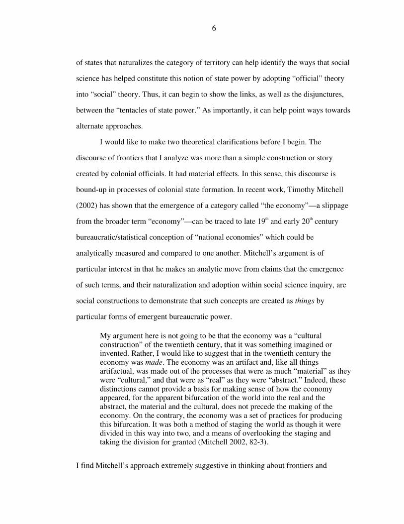
particular forms of emergent bureaucratic power. My argument here is not going to be that the economy was a “cultural construction” of the twentieth century, that it was something imagined or invented. Rather, I would like to suggest that in the twentieth century the economy was made. The economy was an artifact and, like all things artifactual, was made out of the processes that were as much “material” as they were “cultural,” and that were as “real” as they were “abstract.” Indeed, these distinctions cannot provide a basis for making sense of how the economy appeared, for the apparent bifurcation of the world into the real and the abstract, the material and the cultural, does not precede the making of the economy. On the contrary, the economy was a set of practices for producing this bifurcation. It was both a method of staging the world as though it were divided in this way into two, and a means of overlooking the staging and taking the division for granted (Mitchell 2002, 82-3).
I find Mitchell’s approach extremely suggestive in thinking about frontiers and
7
borders in the context of colonial border theory and emerging sociological
understandings of the state. He provides a way to imagine the simultaneous process of
constructing frontiers in the context of late colonial power and the emergence of an
understanding of frontiers as particular kinds of boundaries to be imagined in the
context of social science discourse. The formation of borders and frontiers, I suggest,
should be understood in the same context as what Mitchell calls the “making” of the
economy. The process of marking space through the creation of borders and
boundaries on the one hand defines a space designated as state and at the same time
has real material impacts on the lives of those in border areas. Border-making is, as
such, are one of the processes through which a bifurcation between “real” and
“abstract” emerged. This abstraction, I argue, can be read in the colonial theory of
borders that abstracts territory into state and non-state space. The process of drawing
borders and frontiers, maintaining them, and defending them was critical to the 19th
century imagination and the “making” of states as discrete, territorially bounded units.
This making had real and material consequences that are tied to and masked by the
abstract notions of space produced within colonial border theory. To understand these
processes, we must look not simply at the process of delimiting a particular territorial
claim, but also in the attempts at incorporation, exclusion, and negotiation necessary
for their creation.
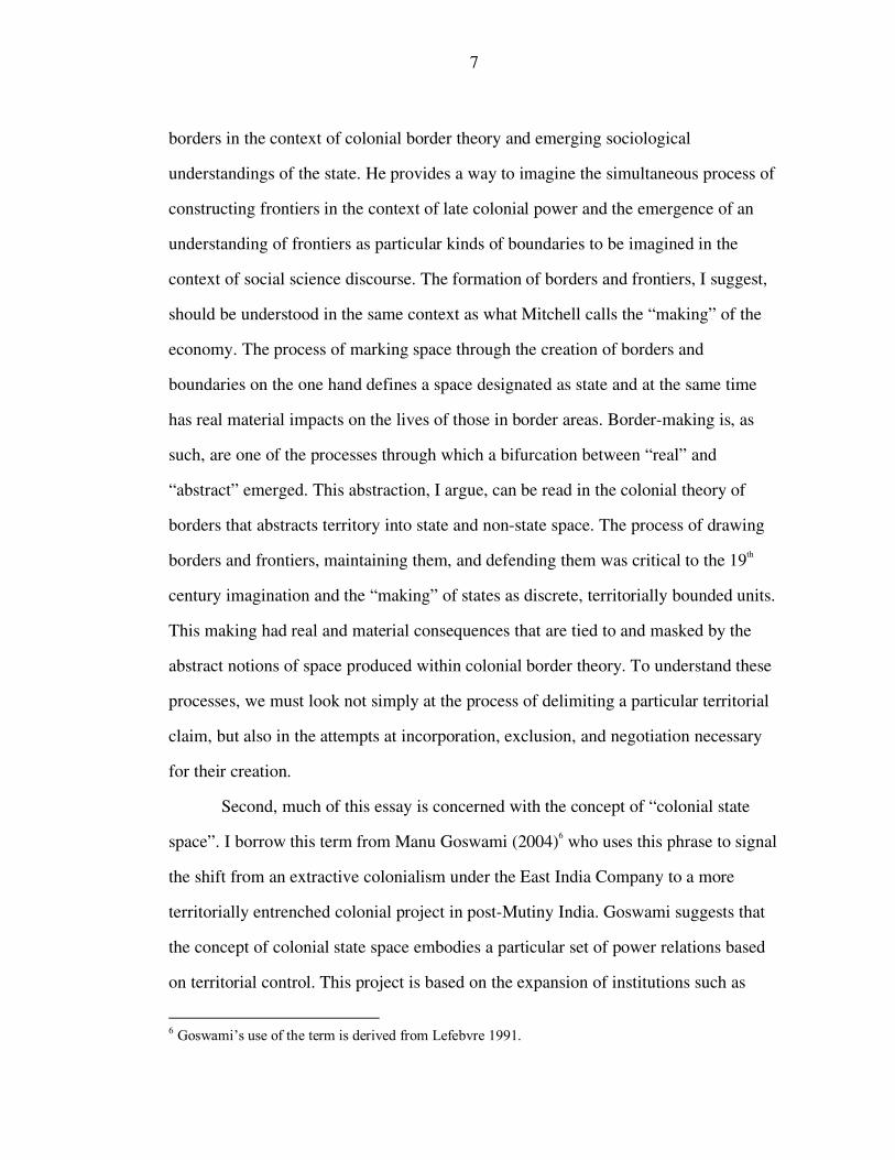
Second, much of this essay is concerned with the concept of “colonial state
space”. I borrow this term from Manu Goswami (2004)6 who uses this phrase to signal
the shift from an extractive colonialism under the East India Company to a more
territorially entrenched colonial project in post-Mutiny India. Goswami suggests that
the concept of colonial state space embodies a particular set of power relations based
on territorial control. This project is based on the expansion of institutions such as
6 Goswami’s use of the term is derived from Lefebvre 1991.
8
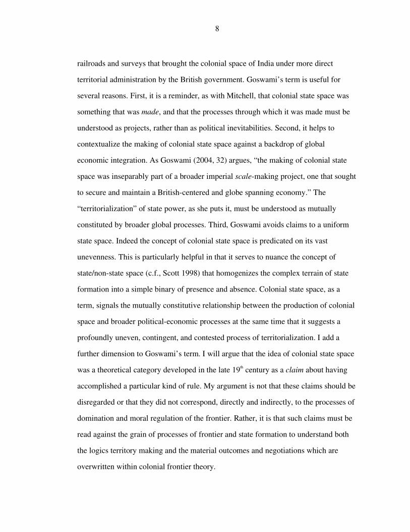
railroads and surveys that brought the colonial space of India under more direct
territorial administration by the British government. Goswami’s term is useful for
several reasons. First, it is a reminder, as with Mitchell, that colonial state space was
something that was made, and that the processes through which it was made must be
understood as projects, rather than as political inevitabilities. Second, it helps to
contextualize the making of colonial state space against a backdrop of global
economic integration. As Goswami (2004, 32) argues, “the making of colonial state
space was inseparably part of a broader imperial scale-making project, one that sought
to secure and maintain a British-centered and globe spanning economy.” The
“territorialization” of state power, as she puts it, must be understood as mutually
constituted by broader global processes. Third, Goswami avoids claims to a uniform
state space. Indeed the concept of colonial state space is predicated on its vast
unevenness. This is particularly helpful in that it serves to nuance the concept of
state/non-state space (c.f., Scott 1998) that homogenizes the complex terrain of state
formation into a simple binary of presence and absence. Colonial state space, as a
term, signals the mutually constitutive relationship between the production of colonial
space and broader political-economic processes at the same time that it suggests a
profoundly uneven, contingent, and contested process of territorialization. I add a
further dimension to Goswami’s term. I will argue that the idea of colonial state space
was a theoretical category developed in the late 19th century as a claim about having
accomplished a particular kind of rule. My argument is not that these claims should be
disregarded or that they did not correspond, directly and indirectly, to the processes of
domination and moral regulation of the frontier. Rather, it is that such claims must be
read against the grain of processes of frontier and state formation to understand both
the logics territory making and the material outcomes and negotiations which are
overwritten within colonial frontier theory.
9
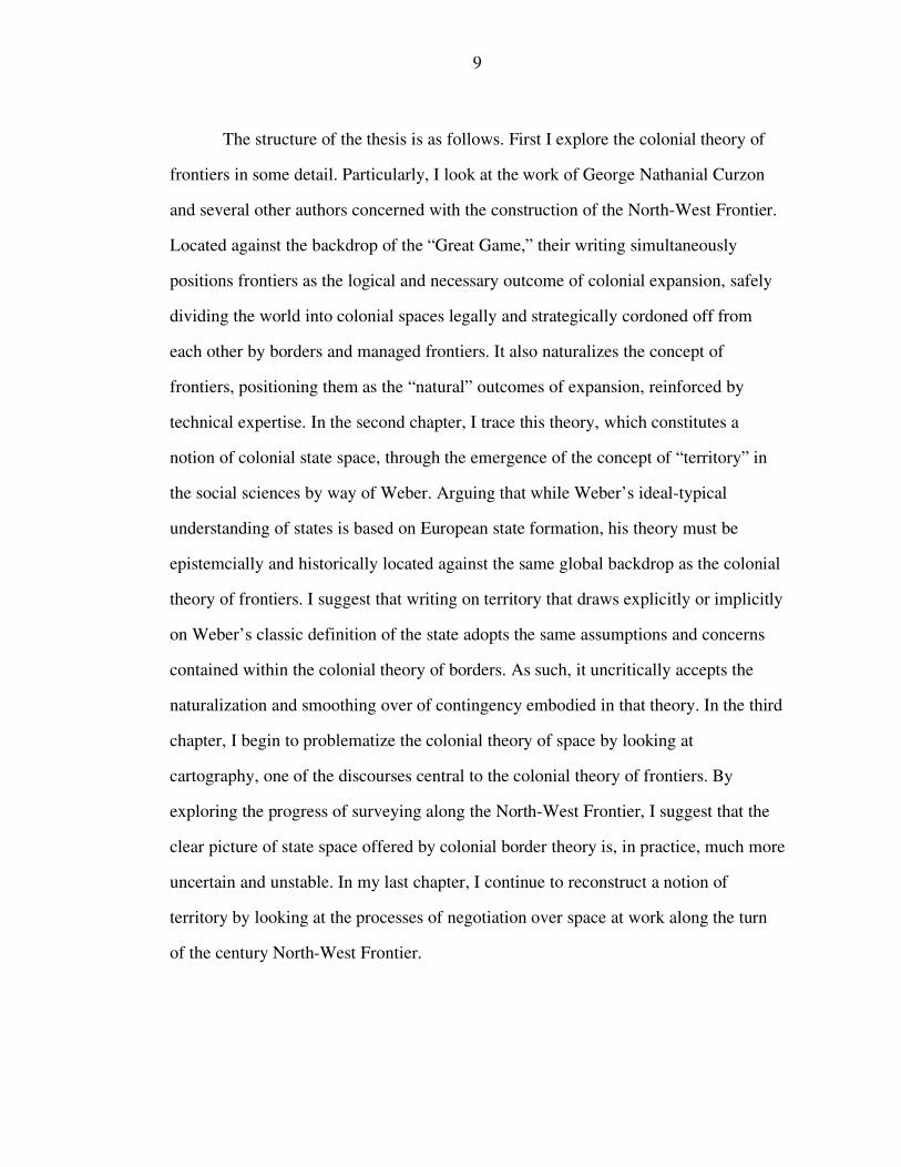
The structure of the thesis is as follows. First I explore the colonial theory of
frontiers in some detail. Particularly, I look at the work of George Nathanial Curzon
and several other authors concerned with the construction of the North-West Frontier.
Located against the backdrop of the “Great Game,” their writing simultaneously
positions frontiers as the logical and necessary outcome of colonial expansion, safely
dividing the world into colonial spaces legally and strategically cordoned off from
each other by borders and managed frontiers. It also naturalizes the concept of
frontiers, positioning them as the “natural” outcomes of expansion, reinforced by
technical expertise. In the second chapter, I trace this theory, which constitutes a
notion of colonial state space, through the emergence of the concept of “territory” in
the social sciences by way of Weber. Arguing that while Weber’s ideal-typical
understanding of states is based on European state formation, his theory must be
epistemcially and historically located against the same global backdrop as the colonial
theory of frontiers. I suggest that writing on territory that draws explicitly or implicitly
on Weber’s classic definition of the state adopts the same assumptions and concerns
contained within the colonial theory of borders. As such, it uncritically accepts the
naturalization and smoothing over of contingency embodied in that theory. In the third
chapter, I begin to problematize the colonial theory of space by looking at
cartography, one of the discourses central to the colonial theory of frontiers. By
exploring the progress of surveying along the North-West Frontier, I suggest that the
clear picture of state space offered by colonial border theory is, in practice, much more
uncertain and unstable. In my last chapter, I continue to reconstruct a notion of
territory by looking at the processes of negotiation over space at work along the turn
of the century North-West Frontier.
CHAPTER 2
A LATE COLONIAL THEORY OF FRONTIERS
In 1907 Lord Curzon of Kedleston delivered the annual and prestigious
Romanes Lecture at Oxford University. Curzon, recently returned from his somewhat
infamous tenure as India’s Viceroy,7 devoted his lecture to the subject of frontiers. “I
concluded that my best course of action [upon having been invited to deliver the
lecture] would be to select some topic of which I had personal experience, and upon
which I could, without presumption, address even this famous and learned University”
(Curzon 1976 [1907], 3). Frontiers were a central concern both in Curzon’s youthful
travels in Britain’s expanding empire (Curzon 1896 a, b, and c and 1923) and in his
tenure as Viceroy where he “had been responsible for the security and defence of a
Land Frontier 5,700 miles in length, certainly the most diversified, the most important,
and the most delicately poised in the world” (1976 [1907], 4). Curzon begins his
remarks by observing a paucity of academic studies of frontiers despite their
increasing centrality in politics and governance in the context of British colonial
expansion in Africa and Asia.8 You may ransack the catalogues of libraries, you may search the indexes of celebrated historical works, you may study the writings of scholars, and you will find the subject almost wholly ignored. Its formulae are hidden in the arcana of diplomatic chancelleries; its documents are embedded in vast and forbidding collections of treaties; its incidents and what I may describe as its incomparable drama are the possession of a few silent men, who may be found in the clubs of London, or Paris, or Berlin, when they are not engaged in tracing lines upon the unknown areas of the earth (1976 [1907], 4-5).
Curzon’s lecture both celebrates the importance of frontiers in modern state
craft and makes a theoretical argument for a new “scientific frontier.” At the time, “the
7 For overviews of Curzon’s viceroyalty, see Dilks 1969 and 1970 and Glimour 2003. 8 See Holdich 1916 for a similar complaint.
10
11
scientific frontier”, was a euphemistic term for the pacification and securing of
Afghanistan as a buffer state to protect India from an expansionist Russian empire to
the North (c.f. Andrew 1880). But Curzon’s argument is a slightly more expansive
one, imagining the frontier as the scientific formalization of the “natural” boundaries
of Indian Empire. As Curzon has it: It would be futile to assert that an exact Science of Frontiers has been or is ever likely to be evolved: for no one law can possibly apply to all nations or peoples, to all Governments, all territories or all climates. The evolution of Frontiers is perhaps an art rather than a science, so plastic and malleable are its forms and manifestations. But the general tendency is forward, not backward; neither arrogance nor ignorance is any longer supreme; precedence is given to scientific knowledge; ethnological and topographical considerations are fairly weighed; jurisprudence plays an increasing part; the conscience of nations is more and more involved. Thus Frontiers, which have so frequently and recently been the cause of war, are capable of being converted into the instruments and evidence of peace (1977 [1907] 53-4).
Curzon’s lecture opens several interesting possibilities for analysis. The not-
so-veiled subtext of the lecture is India’s North-West Frontier, the pivotal frontier in
the “Great Game for Empire”9 played throughout the 19th and early 20th century
between a Southward expanding Russia and a Northward expanding British India. At
stake were the trading routs of central Asia and, ultimately, India itself. At the time,
the “Game” was both a critical problem of British imperial policy (Mahajan 2002) as
well as a central trope in British conceptualizations of empire (Piper 2002, Barrow
2003). The “Game” began in the early nineteenth century with Wellesley’s rapid
expansion of colonial power into the subcontinent and Tsar Paul 1’s disastrous
campaign South towards Khiva and continued through World War I (Hopkirk 1992).10
While Russia was only the latest in a series of rival “great powers” perceived as
9 For a detailed and decidedly imperial description of the on-the-ground events and major (British and Russian) players in this game, see Hopkirk 1992 and Meyer and Brysac 1999. 10 Indeed, many have noted the ties between Great Game politics and the current political crisis in Afghanistan (c.f. Rashid 2000).
12
threatening India, the expansion of Russian imperial power into central Asia was cast
as the harbinger of invasion from the North through Afghanistan—the Northern
“Gates of India” (Holdich 1910)—following the trajectory of waves of Indian invasion
throughout the preceding centuries. Against the backdrop of the Great Game, Curzon’s
claims that frontiers stand to become instruments of peace reads like a colonial
manifestation of a “good fences make good neighbors” approach to foreign policy; a
belief that formalized frontiers could successfully stem expanding colonial empires
before they disastrously and violently collided in the high passes of central Asia.
Curzon’s argument directly highlights both the official North-West Frontier of
India and the “protectorate” of Afghanistan beyond it as central to India’s security. His
concerns, in this sense, echo and reiterate broad policy arguments over the defense of
India’s Northern borders throughout the late 19th and early 20th century. Upon
assuming the Viceroyalty in 1876, for example, Lord Lytton, exasperated by what he
saw as a “do nothing” policy towards the frontier and dissatisfied with the informal
boundary with Afghanistan observed that “the value of an obstacle such as a great
river, or a mountain range, depends upon the command on both sides of the obstacle”
(quoted in Sharma 1986, 214). Lytton, “urged forward by considerations of military
and political expediency, and by the instinct of self-preservation, towards the
Hindukush, the great natural boundary between India and Central Asia” (quoted in
Sharma 1986, 214), argued a need for both the demarcation of a formal border with
Afghanistan and a push to bring the country within the sphere of British political
influence.
In 1902, 26 years later, the question of Afghanistan and the North-West
frontier still loomed large in British policy debates. As Former Viceroy of India and
then Foreign Secretary Lord Lansdowne argued at the time: It has…been one of our principal objectives to encourage and strengthen the
13
states lying outside of the frontier of our Indian empire, with the hope that we should find in them an intervening zone sufficient to prevent direct contact between the dominions of Great Britain and those of other great military Powers. We could not however maintain this policy if in any particular instance we should find that one of these intervening states was being crushed out of national existence, and falling practically under the complete domination of any other power (quoted in Mahajan 2002, 20. Emphasis Mahajan).
Indeed concerns about Russian territorial aggression led to England’s Defense
Committee of the Cabinet establishing the Committee of Imperial defense in 1902. As
Mahajan notes, the nominal goal of the Committee was to plan for defense of the
empire at large, yet “of the eighty-two meetings held during Balfour’s tenure as Prime
Minister, forty-three were devoted almost entirely to the vexed problem of
safeguarding the Indian Empire” (Mahajan 2002, 148).
The question of dealing with Russia and establishing Afghanistan as a buffer
state served to consolidate the complex debates on imperial expansion and policy that
had raged in Parliament throughout the 19th century into two primary schools. The
first, the “Closed Border School,” influenced by the disastrous results of India’s
second war in Afghanistan (1866-7), advocated a policy, of non-interference in
Afghan affairs. The second, euphemistically known as the “Forward School,” derided
its opponents as pursuing a policy of “masterly inactivity” and advocated using the
Kabul-Kandahar line as a forward defense against Russian advancement. This policy
eventually led to the third Afghan war in 1880, which comfortably brought
Afghanistan within the Government of India’s sphere of influence and led to a large
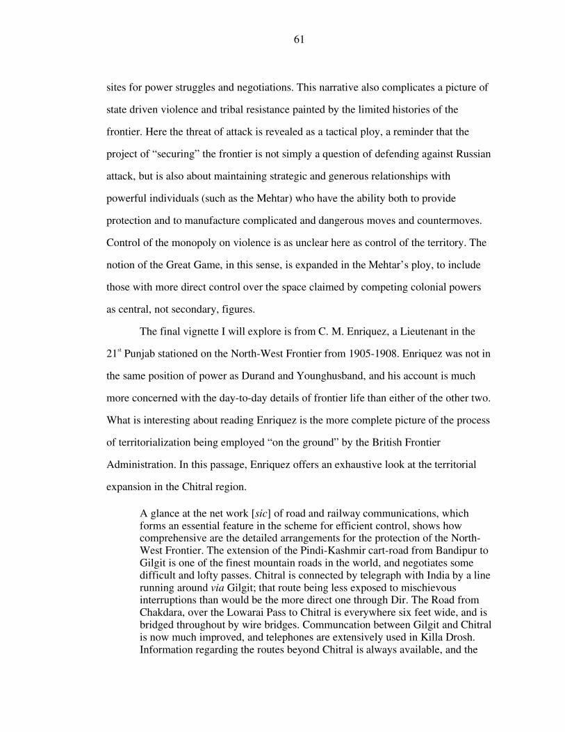
project of demarcating Afghanistan’s northern border (Davies 1975 [1932]). Yet, in India, the project of defending against Russian expansion also involved
the process of physically creating the kind of frontier described by Curzon, not just
through establishing buffer states to protect against Russian advance, but also through
mapping the network of mountain ranges along India’s North-West Frontier, constant
14
p
p
ar
In
fi
su
(P
b
b
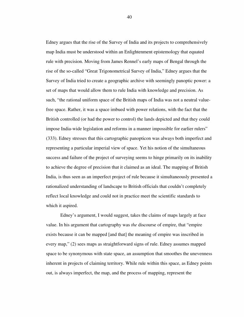
Figure 1: General View of the Principle Roads and Divisions of India, JamesRennel, 1792
rocesses of negotiating and demarcating boundary lines, and “managing” the
opulations living in what Curzon refers to as these “unexplored” and “uninhabited”
eas. Part of this process involved an unprecedented project of defining and managing
dia’s borders and the “frontier” zones around them. This project can be seen in the
xing of borders on colonial maps. In the late 18th and early 19th century, as Surveyors
ch as James Rennel began to assemble the infrastructure of the Survey of India
hilimore 1945, Edney 1997, Barrow 2003), India’s borders, and particularly the
orders of the North-West Frontier, were fuzzy and ill-defined, largely abutting the
lank space on maps where surveyors, explorers, and mapping projects were yet to be
15
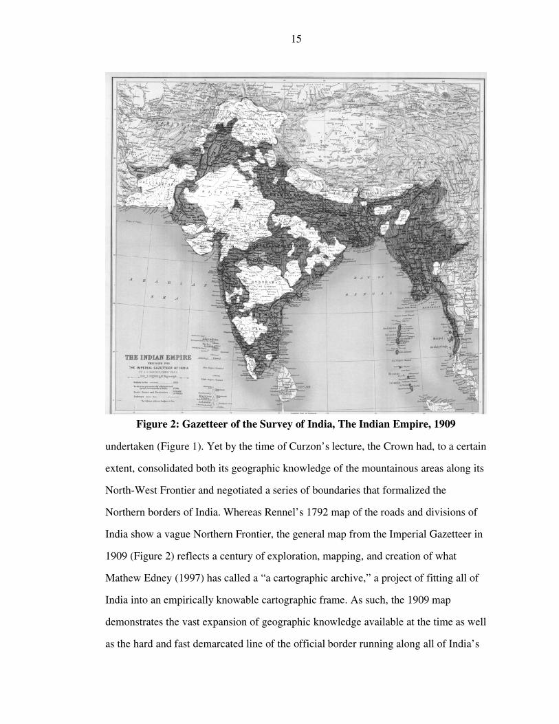
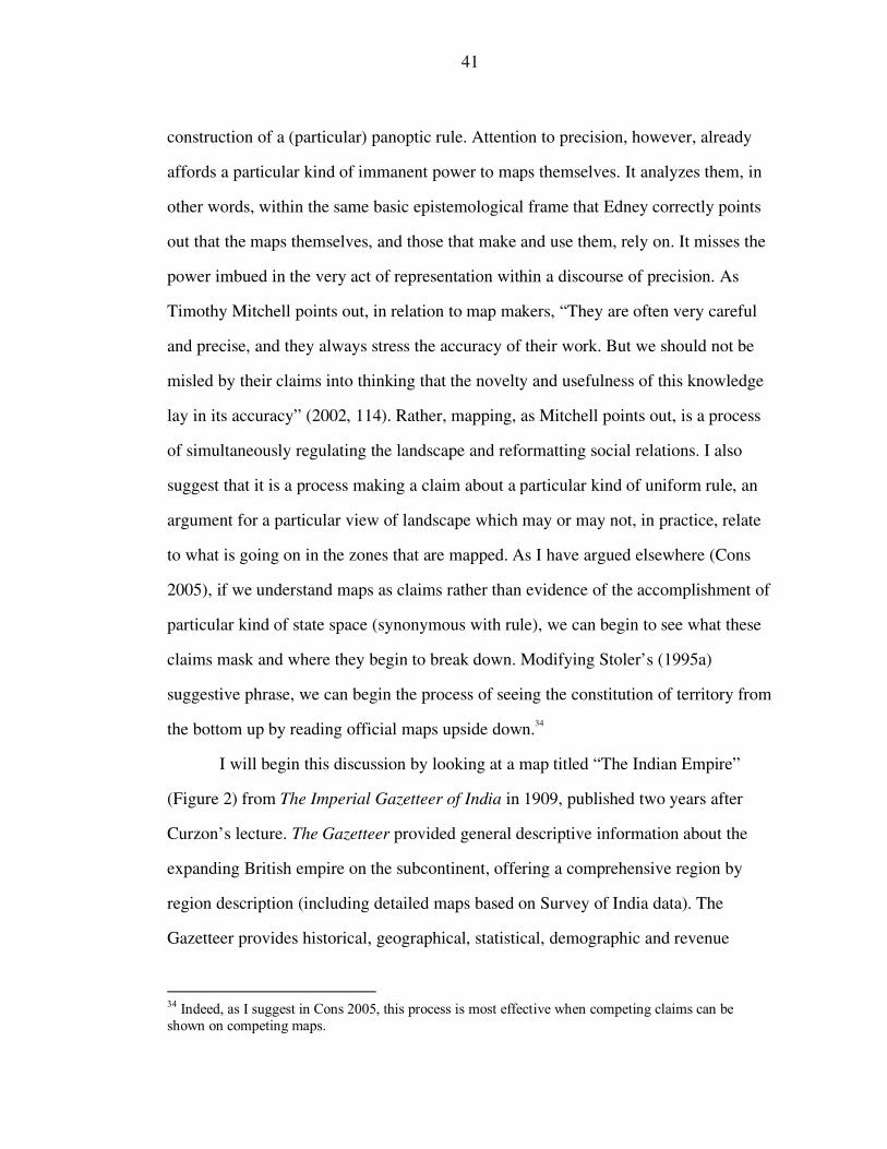
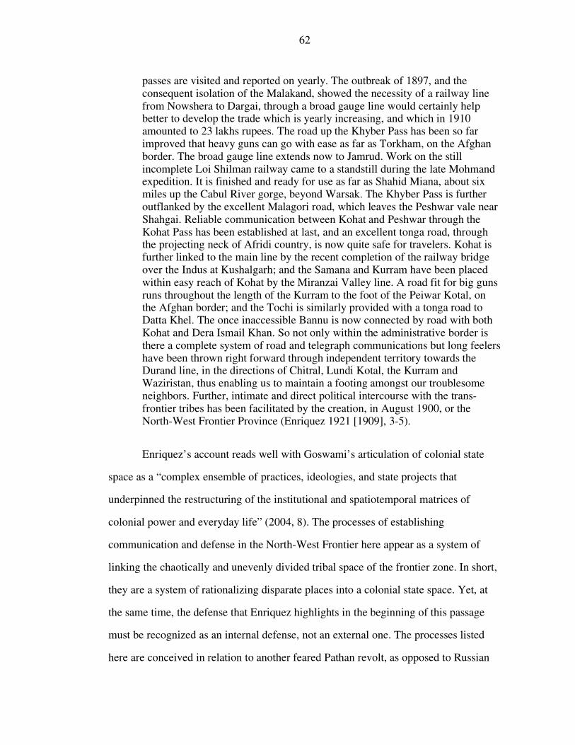
Figure 2: Gazetteer of the Survey of India, The Indian Empire, 1909
undertaken (Figure 1). Yet by the time of Curzon’s lecture, the Crown had, to a certain
extent, consolidated both its geographic knowledge of the mountainous areas along its
North-West Frontier and negotiated a series of boundaries that formalized the
Northern borders of India. Whereas Rennel’s 1792 map of the roads and divisions of
India show a vague Northern Frontier, the general map from the Imperial Gazetteer in
1909 (Figure 2) reflects a century of exploration, mapping, and creation of what
Mathew Edney (1997) has called a “a cartographic archive,” a project of fitting all of
India into an empirically knowable cartographic frame. As such, the 1909 map
demonstrates the vast expansion of geographic knowledge available at the time as well
as the hard and fast demarcated line of the official border running along all of India’s
16
land frontiers, the product of a century of British expansion and consolidation.
Curzon’s methodical hierarchy ultimately and self-consciously positions this newly
formed and defined frontier, particularly the North-West portion of it, as the safest and
“most scientific” of frontiers, simultaneously protected by a line of demarcation
negotiated by treaty, a steep and inhospitable mountain range, and the protectorate of
Afghanistan. Curzon’s essay, in its explication and justification of frontiers as tools of
statecraft might be read as an attempt to valorize and legitimize both the historical
project of demarcating India’s Northern borders in general, and the making of the
North-West Frontier, a project his viceroyalty had been centrally concerned with
(Dilks 1970, Curzon 1925), in particular.11
However, I wish to undertake a slightly different reading of Curzon’s lecture.
Curzon’s argument is historically grounded against this struggle for Empire in Central
Asia, as well as the broader frame of the division of Africa at the Berlin Conference in
1884-5. Curzon might further be seen against the backdrop of what Arrighi (1994)
refers to as the dialectic of capitalism and territorialism, the creative tension between
the proximate emergences of a British dominated world market and nation-states. As
Goswami argues, The reconfiguration of political-economic space along self-consciously national developmentalist and statist principles, during the late 1870s and 1880s, not only entailed a crisis for Britain’s global hegemony but made the contradictions of colonial practices both more apparent and acute” (2004, 33).
This point is similar to Mitchell’s (2002) observation that the emergence of “national
economies” in this period was intimately tied to the territorialization and definition of
space. Curzon’s lecture, then, comes at a moment when questions of territory,
frontiers, and states where critical political and economic issues. Curzon’s argument,
11 Indeed, from Curzon’s perspective this project may have looked quite successful in 1907 with a new atmosphere of entent with Russia in relation to an increasingly antagonistic relationship with Germany (Mahajan 2002).
17
and the arguments of a number of his contemporaries concerned with the defense of
the North-West Frontier, is a particular kind of political theorization of territory. These
arguments rationalize a notion of colonial state space,12 one that is either directly under
colonial control, within the sphere of colonial political influence (Afghanistan), or
beyond administrative reach.13 These visions are important not just because they
provide a teleological legitimation for empire, and particularly for British expansion
towards Afghanistan, but also because, I will suggest, views of territory which
naturalize the idea of a colonial state space have been broadly adopted into social
science literature, by way of Weber, on both borders and territory.
Curzon theorizes frontiers and borders as the definitive sign and site of the
emergent colonial state. Frontiers are indeed the razor’s edge on which hang suspended the modern issues of war or peace, of life or death to nations. Nor is this surprising. Just as the protection of the home is the most vital care of the private citizen, so the integrity of her borders is the condition of existence of the State” (1976 [1907, 7).
If frontiers are a razor’s edge of war and peace, then they also emerge as critical sites
of state-craft. The science of frontiers (or the movement towards a scientific frontier)
becomes, for Curzon, the defining moment of the emergent state system. Frontiers are
the critical boundaries of diplomacy. Their “intrigue and romance” is the story of war
and peace. Further, they are the problems of a particularly modern form of state power
intimately tied to colonial expansion. “Frontier wars will not, in the nature of things,
disappear. But the scramble for new lands, or for the heritage of decaying States, will
12 This term is not explicitly used by either Curzon or any of the other writers thinking about the North-West Frontier in this time period. I borrow this term from Goswami (2004) who in turn borrows it from Lefebvre 1991). As will be apparent from my critique, I wish to criticize its adoption into the social sciences rather than leverage it as an analytic term for understanding empire. 13 It may be observed that these categories correspond, at least in part, to the concepts of direct and indirect rule of the princely states. I argue, however, that a critical component of Curzon’s and others’ theorization of the “frontier” is the concept of bounding state space, less critical to the concept of the princely state.
18
become less acute as there is less territory to be absorbed and less chance of doing it
with impunity, or as the feebler units are either neutralized, or divided, or fall within
the undisputed Protectorate of a stronger power” (1976 [1907], 8).
The projects of border definition might be thought of as the process of
transforming the frontier from a horizon of expansion, as in Fredrick Jackson Turner’s
classic definition, to a formalized political zone. As former surveyor and leader of the
Russo-Afghan boundary commission Thomas Holditch14 described it, “the first and
greatest object of a national frontier is to ensure peace and goodwill between
contiguous peoples by putting a definite edge to the national political horizon, so as to
limit unauthorized expansion and trespass” (Holditch 1916, x) .15 It is in this sense that
Curzon uses the term “frontier” in his Romaines lecture, as a formalized political zone
legally designating a space between two expanding powers.16
Notable in both Holdich and Curzon is the definition of frontiers in relation to
an external presence. The frontier is here presented as a means of defining space
between nations. The implicit other here is Russia. As Holdich writes, The greatest historical example of the expansion of a civilised nation into regions where there was little or nothing of the natural wilderness of nature, but where step by step new territory was acquired and new frontiers pushed forward in spite of the determined resistance of a whole series of minor nationalities not so far removed ethnically or socially from their conquerors, is afforded us by the advance of Russia into Central Asia” (1916, 77).17
14 Holdich wrote extensively not just on his experiences as a surveyor but on the correct and proper definitions of borders and frontiers. His theoretical writing bears a remarkable similarity to Curzon’s argument, though the two do not directly reference each other. 15 The term “peoples” in Holditch’s definition should be recognized as designating western, white, imperial power. 16 There is a slippage in much of the writing on the “frontier” which easily modulates between the frontier as a demarcated border and a frontier zone of varying width around that border (Wilson and Donnan 1999). 17 It’s worth observing, here, Holdich’s imperial linguistic frame which simultaneously racializes the “minor nationalities” of Central Asia and biologically dismisses Russia’s claim to legitimate occupation by linking them to these Central Asian minorities through ethnicity. Holdich here echoes racialized liberal notions of empire that justify colonial expansion as a “civilizing” mission (Mehta 1999).
19
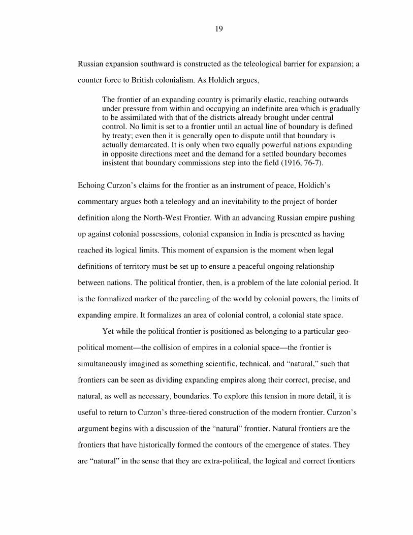
Russian expansion southward is constructed as the teleological barrier for expansion; a
counter force to British colonialism. As Holdich argues, The frontier of an expanding country is primarily elastic, reaching outwards under pressure from within and occupying an indefinite area which is gradually to be assimilated with that of the districts already brought under central control. No limit is set to a frontier until an actual line of boundary is defined by treaty; even then it is generally open to dispute until that boundary is actually demarcated. It is only when two equally powerful nations expanding in opposite directions meet and the demand for a settled boundary becomes insistent that boundary commissions step into the field (1916, 76-7).
Echoing Curzon’s claims for the frontier as an instrument of peace, Holdich’s
commentary argues both a teleology and an inevitability to the project of border
definition along the North-West Frontier. With an advancing Russian empire pushing
up against colonial possessions, colonial expansion in India is presented as having
reached its logical limits. This moment of expansion is the moment when legal
definitions of territory must be set up to ensure a peaceful ongoing relationship
between nations. The political frontier, then, is a problem of the late colonial period. It
is the formalized marker of the parceling of the world by colonial powers, the limits of
expanding empire. It formalizes an area of colonial control, a colonial state space.
Yet while the political frontier is positioned as belonging to a particular geo-
political moment—the collision of empires in a colonial space—the frontier is
simultaneously imagined as something scientific, technical, and “natural,” such that
frontiers can be seen as dividing expanding empires along their correct, precise, and
natural, as well as necessary, boundaries. To explore this tension in more detail, it is
useful to return to Curzon’s three-tiered construction of the modern frontier. Curzon’s
argument begins with a discussion of the “natural” frontier. Natural frontiers are the
frontiers that have historically formed the contours of the emergence of states. They
are “natural” in the sense that they are extra-political, the logical and correct frontiers
20
between states. Natural frontiers are conceptualized as geographic formations—such
as deserts, rivers, oceans, and mountains—that naturally divide civilizations or
nations. “Natural frontiers,” as Holdich writes, “possess many advantages over
artificial ones. They are readily delimited and demarcated; they are inexpensive and
immovable; they last well under all conditions of climate, and they are, as a rule, plain
and unmistakable” (1916, 147). In this rationale, imperial expansion into the
subcontinent throughout the 19th century is seen as a natural movement towards the
network of mountains surrounding India to the North.
It is useful to recall, here, Lucien Febvre’s words on the concept of the
“natural” frontier. Febvre, in his historical reexamination of the fluid linguistic and
conceptual meanings of “frontière,” famously observed that the claims of a “natural”
frontier between France and its neighbors were, far from unproblematic recognitions
of the boundaries of French political and cultural sway, in fact political claims to
rights of domination. Febvre treats this insight as an obvious interpretation of national
rhetoric. Do we really have to spend time showing that river or coastal frontiers have nothing ‘natural’ about them or, more generally speaking, that the concept of natural frontiers corresponds to nothing whatsoever for the geographer, that there is nothing ‘given ready made’ to man by nature and nothing that geography can impose upon politics? It is quite pointless to prove yet again something that has been shown many times, that, in reality, in the concept ‘limits marked out by nature’ nature only serves as a mask; it is the mask worn by long-standing historical and political facts, the memory of which men had retained over centuries. For the Rhine, the Alps, and the Pyrenees are nothing but the limits of ancient Gual. They are not natural frontiers. They are historical frontiers… (1973, 215).
Febvre’s somewhat curt dismissal, resonant with Abrams’ (1988) notion of “the state”
as the mask which simultaneously obscures and gives coherent organized shape to
political practice, undermines the notion of natural frontiers as the most thinly veiled
of ideological claims. His missive is a reminder that there is nothing natural about
21
national territory, that borders are the outcomes of protracted political process, and
that these historical processes, far from inevitable, are always contested and contingent
(for similar critiques of the nation-state see Anderson 1992 [1983], Sahlins 1989,
Thongchai 1994). This observation is, no doubt, true of the North-West frontier (and
the colonial theorization of borders in general), but it over hastily dismisses the
salience of these concepts in the theorization of colonial space. Indeed the concepts of
“natural” are here freely mixed by Curzon and Holdich in a way that highlights the
issue of security and the need for the construction and maintenance of frontiers at the
same time that it positions them as inevitable, the outcomes of geological processes.
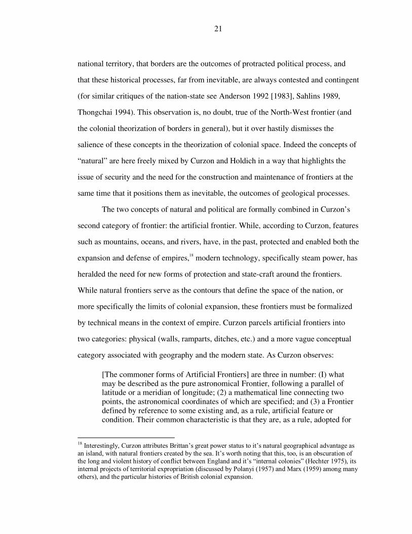
The two concepts of natural and political are formally combined in Curzon’s
second category of frontier: the artificial frontier. While, according to Curzon, features
such as mountains, oceans, and rivers, have, in the past, protected and enabled both the
expansion and defense of empires,18 modern technology, specifically steam power, has
heralded the need for new forms of protection and state-craft around the frontiers.
While natural frontiers serve as the contours that define the space of the nation, or
more specifically the limits of colonial expansion, these frontiers must be formalized
by technical means in the context of empire. Curzon parcels artificial frontiers into
two categories: physical (walls, ramparts, ditches, etc.) and a more vague conceptual
category associated with geography and the modern state. As Curzon observes: [The commoner forms of Artificial Frontiers] are three in number: (I) what may be described as the pure astronomical Frontier, following a parallel of latitude or a meridian of longitude; (2) a mathematical line connecting two points, the astronomical coordinates of which are specified; and (3) a Frontier defined by reference to some existing and, as a rule, artificial feature or condition. Their common characteristic is that they are, as a rule, adopted for
18 Interestingly, Curzon attributes Brittan’s great power status to it’s natural geographical advantage as an island, with natural frontiers created by the sea. It’s worth noting that this, too, is an obscuration of the long and violent history of conflict between England and it’s “internal colonies” (Hechter 1975), its internal projects of territorial expropriation (discussed by Polanyi (1957) and Marx (1959) among many others), and the particular histories of British colonial expansion.
22
purposes of political convenience, that they are applied in new countries where the rights of communities or tribes have not been stereotyped, and where it is possible to deal in a rough and ready manner with unexplored and often uninhabited tracks (1976 [1907], 34).
Curzon’s argument dismisses the notion of a purely artificial frontier as an imperfect
political expedient, an empty concept in and of itself. His language suggests particular
kinds of abstract notions of measurement and demarcation. Artificial frontiers draw
specifically on enlightenment notions of scientific exactness. Through the technical
expertise of surveyors and cartographers, artificial frontiers (maps) demarcate and
delineate state spaces, marking them with a rational cartographic language of precision
that organizes space within a specific frame of imperial knowledge (Mitchell 2002).
This category of “frontier” might be thought of, more specifically, as the demarcation
of exact borders, or the location of administrative, as opposed to natural, divisions
between states that have expanded to their logical (imagined as simultaneously natural
and abutting competing expanding empires) geographic limits. But it is important to
note the tentative nature of Curzon’s argument. They, like natural frontiers, are
incomplete in and of themselves. The powerful and effective modern frontier is found
in their combination. As Holdich argues, It will need but little historical knowledge to reveal that these seas and rivers, mountains and lakes, where they occur, have proved to be the most lasting and the most effective barriers that have been accepted as political frontiers. Nevertheless, artificial boundaries have had their use in the making and dividing of nationalities, and there seem to be indications that such artificial methods of keeping communities apart may figure far more largely in the future—in combination with natural topographical features—than they have done in the past (1916, 161-2).
Artificial frontiers, in this sense, add technical and legal precision to the historical
“natural” frontiers of states.
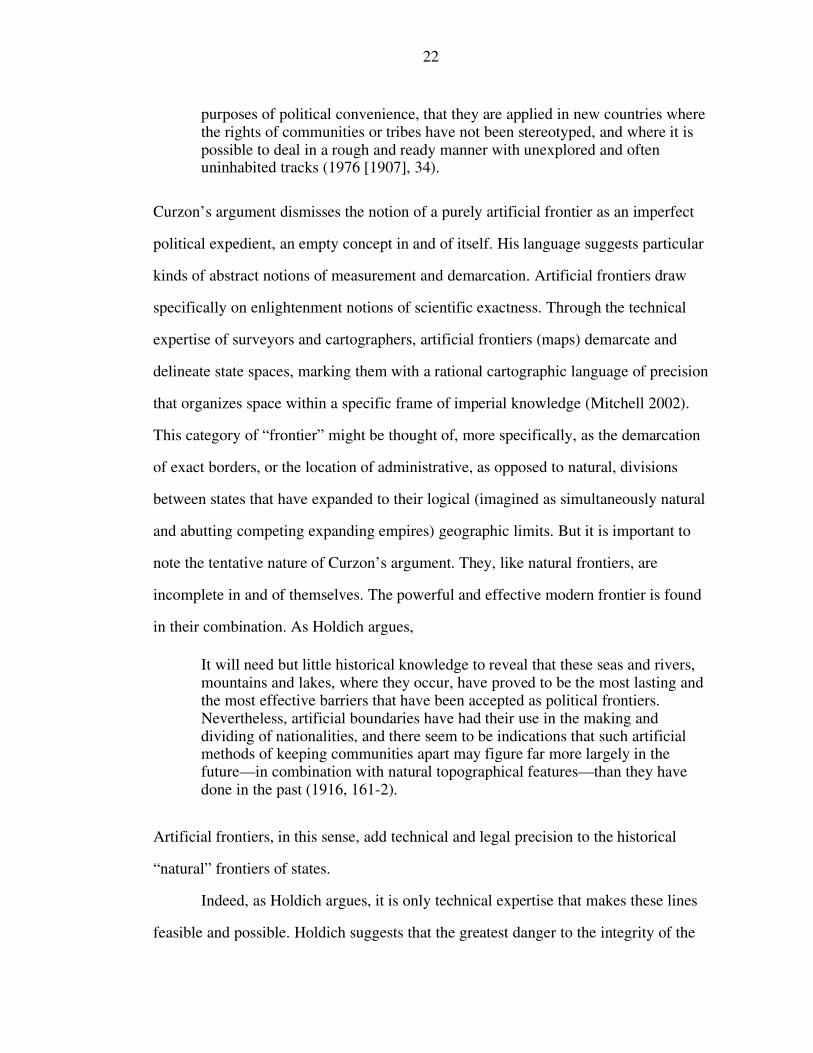
Indeed, as Holdich argues, it is only technical expertise that makes these lines
feasible and possible. Holdich suggests that the greatest danger to the integrity of the
23
frontier is the hasty line adopted by necessity, as opposed to the carefully demarcated
one based on measurement, knowledge, and patience, as expanding empires meet.19
Indeed, in a phrase that has chilling resonance with the British rationalization of
Partition in 1947, Holdich states, The delimitation of a frontier is the business for treaty makers, who should decide on trustworthy evidence the line of frontier limitation which will be acceptable to both the high contracting parties with all due regard to the local conditions of topography and the will of the peoples who are thus to have a barrier placed between them. These are the two first and greatest considerations, and they involve a knowledge of local geography and ethnographical distribution (1916, 179).
Drawing on a rhetoric of geodetic accuracy, which as Holdich suggests is the only way
in which maps covering the expanding geographically known world can be resolved
with one another, artificial frontiers are political formalizations of the “natural”
frontier. In essence, they are natural frontiers written in an international legal language
that can be recognized by the expanding great powers and accepted by the passive
populations who are divided by them. These two categories of frontiers, then, fuse
legitimizing rhetorics of empire: they naturalize an emergent colonial space at the
same time that they claim formal accuracy through an enlightenment epistemology of
measurement and precision (c.f., Cohn 1987, Ludden 1993).
Curzon’s final category of frontiers shifts emphasis away from the borders of
the emergent colonial state and into spheres of political influence. As Curzon writes, In the last quarter of a century, largely owing to the international scramble for the ownerless or undefended territories of Africa and Asia, fresh developments have occurred in the expansion of Frontiers…. All of the expedients to which I am about to refer are varieties in differing stages of the doctrine of Protectorates which has existed from the remotest days of Empire” (1976 [1907], 37).
19 Holdich’s own project of delimiting Afghanistan’s northern boundary is exhaustively detailed in his The Indian Borderland, 1880-1900 (1987 [1910]).
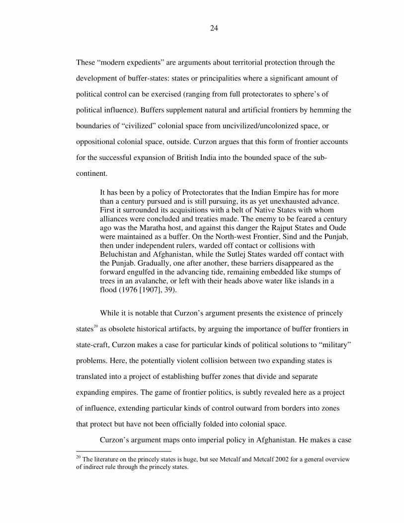
24
These “modern expedients” are arguments about territorial protection through the
development of buffer-states: states or principalities where a significant amount of
political control can be exercised (ranging from full protectorates to sphere’s of
political influence). Buffers supplement natural and artificial frontiers by hemming the
boundaries of “civilized” colonial space from uncivilized/uncolonized space, or
oppositional colonial space, outside. Curzon argues that this form of frontier accounts
for the successful expansion of British India into the bounded space of the sub-
continent.
It has been by a policy of Protectorates that the Indian Empire has for more than a century pursued and is still pursuing, its as yet unexhausted advance. First it surrounded its acquisitions with a belt of Native States with whom alliances were concluded and treaties made. The enemy to be feared a century ago was the Maratha host, and against this danger the Rajput States and Oude were maintained as a buffer. On the North-west Frontier, Sind and the Punjab, then under independent rulers, warded off contact or collisions with Beluchistan and Afghanistan, while the Sutlej States warded off contact with the Punjab. Gradually, one after another, these barriers disappeared as the forward engulfed in the advancing tide, remaining embedded like stumps of trees in an avalanche, or left with their heads above water like islands in a flood (1976 [1907], 39).
While it is notable that Curzon’s argument presents the existence of princely
states20 as obsolete historical artifacts, by arguing the importance of buffer frontiers in
state-craft, Curzon makes a case for particular kinds of political solutions to “military”
problems. Here, the potentially violent collision between two expanding states is
translated into a project of establishing buffer zones that divide and separate
expanding empires. The game of frontier politics, is subtly revealed here as a project
of influence, extending particular kinds of control outward from borders into zones
that protect but have not been officially folded into colonial space.
Curzon’s argument maps onto imperial policy in Afghanistan. He makes a case
20 The literature on the princely states is huge, but see Metcalf and Metcalf 2002 for a general overview of indirect rule through the princely states.
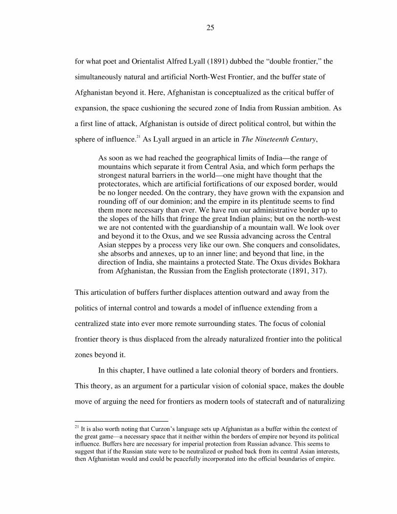
25
for what poet and Orientalist Alfred Lyall (1891) dubbed the “double frontier,” the
simultaneously natural and artificial North-West Frontier, and the buffer state of
Afghanistan beyond it. Here, Afghanistan is conceptualized as the critical buffer of
expansion, the space cushioning the secured zone of India from Russian ambition. As
a first line of attack, Afghanistan is outside of direct political control, but within the
sphere of influence.21 As Lyall argued in an article in The Nineteenth Century, As soon as we had reached the geographical limits of India—the range of mountains which separate it from Central Asia, and which form perhaps the strongest natural barriers in the world—one might have thought that the protectorates, which are artificial fortifications of our exposed border, would be no longer needed. On the contrary, they have grown with the expansion and rounding off of our dominion; and the empire in its plentitude seems to find them more necessary than ever. We have run our administrative border up to the slopes of the hills that fringe the great Indian plains; but on the north-west we are not contented with the guardianship of a mountain wall. We look over and beyond it to the Oxus, and we see Russia advancing across the Central Asian steppes by a process very like our own. She conquers and consolidates, she absorbs and annexes, up to an inner line; and beyond that line, in the direction of India, she maintains a protected State. The Oxus divides Bokhara from Afghanistan, the Russian from the English protectorate (1891, 317).
This articulation of buffers further displaces attention outward and away from the
politics of internal control and towards a model of influence extending from a
centralized state into ever more remote surrounding states. The focus of colonial
frontier theory is thus displaced from the already naturalized frontier into the political
zones beyond it.
In this chapter, I have outlined a late colonial theory of borders and frontiers.
This theory, as an argument for a particular vision of colonial space, makes the double
move of arguing the need for frontiers as modern tools of statecraft and of naturalizing
21 It is also worth noting that Curzon’s language sets up Afghanistan as a buffer within the context of the great game—a necessary space that it neither within the borders of empire nor beyond its political influence. Buffers here are necessary for imperial protection from Russian advance. This seems to suggest that if the Russian state were to be neutralized or pushed back from its central Asian interests, then Afghanistan would and could be peacefully incorporated into the official boundaries of empire.
26
the concept of frontiers as the legal and natural boundaries of empire. This
theorization offers a legitimizing narrative of territory and borders that naturalizes a
particular kind of expansionist view of colonial space. It will be my goal in the rest of
this essay to understand these as claims to a particular kind of rule, to take Ann
Stoler’s observation that, “Colonial rhetoric was not a reflection or legitimation of
European power, but a site of negotiation over its nature” seriously (Stoler 1995a,
xxiii). However, first I would like to emphasize the importance of this colonial
theorization by taking a brief look at the similarities and differences between this
colonial theory of frontiers and the emergence of the concept of territory in the social
sciences. While, on the face of things, colonial border theory and the Weberian
territorial state appear different, I will suggest both draw on the same naturalized
notion of space. This reliance has serious implications for the ways that frontiers,
borders, and territory have been explored in the social sciences.
CHAPTER 3
COLONIAL FRONTIER THEORY AND THE SOCIAL SCIENCE ASSUMPTION
OF TERRITORY
The colonial theorization of borders is important not just in its claims to
accomplishing a particular kind of rule. Its teleological legitimation of colonial
expansion, as Ian Barrow (1994) observes, has been adopted in much of the writing on
territory in colonial India. The view, for example, of the creation and incorporation of
buffer zones to protect an imperial core has been used as to explain and rationalize
imperial expansion in the face of anti-expansionist sentiments in British parliament. In
one articulation of this view, Galbraith argues that imperial expansion was primarily a
policy of absorbing unruly frontier conflict zones to bring them under the power of
centralized colonial authority. The conflict between the stated policy of non-expansion and the fact of expansion cannot be understood in terms of insincerity, for aversion to territorial acquisition was undoubtedly genuine. Part of the explanation lies in the pull exerted by “turbulent frontiers” adjacent to the area of Imperial authority and in the wide powers exercised by Imperial viceroys in the era of primitive communications (1960, 151).
The expansion of British power in India is glossed as a movement to contain
troublesome populations at the frontier by bringing them within the official purview of
the colonial state. Expansion is logically checked only when state territory runs up
against another expanding colonial power (Russia), too powerful or large to be
brought within territorial boundaries. Similarly, the view of the Himalayas as the
natural boundaries of India has been adopted to explain the rapid British expansion
North through the Sub-continent.
27
28
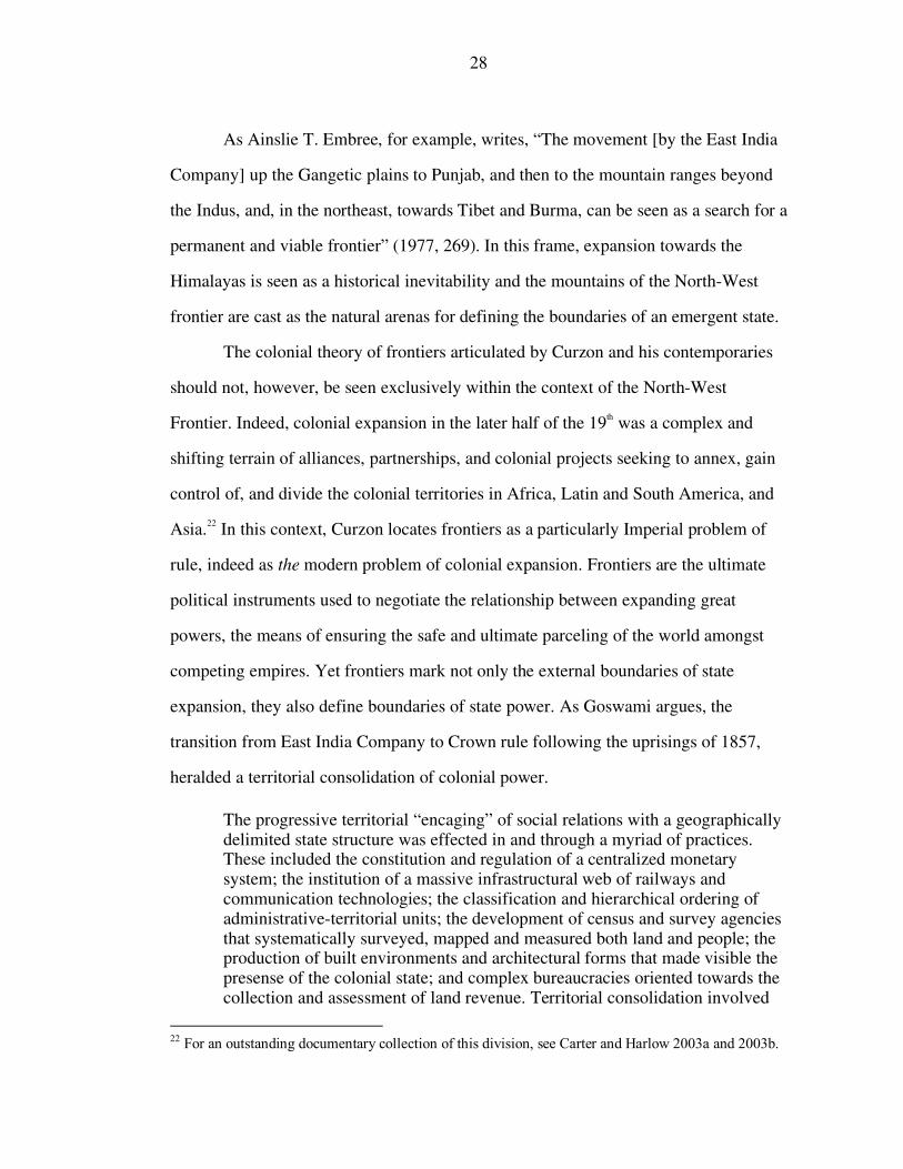
As Ainslie T. Embree, for example, writes, “The movement [by the East India
Company] up the Gangetic plains to Punjab, and then to the mountain ranges beyond
the Indus, and, in the northeast, towards Tibet and Burma, can be seen as a search for a
permanent and viable frontier” (1977, 269). In this frame, expansion towards the
Himalayas is seen as a historical inevitability and the mountains of the North-West
frontier are cast as the natural arenas for defining the boundaries of an emergent state.
The colonial theory of frontiers articulated by Curzon and his contemporaries
should not, however, be seen exclusively within the context of the North-West
Frontier. Indeed, colonial expansion in the later half of the 19th was a complex and
shifting terrain of alliances, partnerships, and colonial projects seeking to annex, gain
control of, and divide the colonial territories in Africa, Latin and South America, and
Asia.22 In this context, Curzon locates frontiers as a particularly Imperial problem of
rule, indeed as the modern problem of colonial expansion. Frontiers are the ultimate
political instruments used to negotiate the relationship between expanding great
powers, the means of ensuring the safe and ultimate parceling of the world amongst
competing empires. Yet frontiers mark not only the external boundaries of state
expansion, they also define boundaries of state power. As Goswami argues, the
transition from East India Company to Crown rule following the uprisings of 1857,
heralded a territorial consolidation of colonial power. The progressive territorial “encaging” of social relations with a geographically delimited state structure was effected in and through a myriad of practices. These included the constitution and regulation of a centralized monetary system; the institution of a massive infrastructural web of railways and communication technologies; the classification and hierarchical ordering of administrative-territorial units; the development of census and survey agencies that systematically surveyed, mapped and measured both land and people; the production of built environments and architectural forms that made visible the presense of the colonial state; and complex bureaucracies oriented towards the collection and assessment of land revenue. Territorial consolidation involved
22 For an outstanding documentary collection of this division, see Carter and Harlow 2003a and 2003b.
29
the monopolization of power of rule by a single, central authority and the creation of an externally bounded economic, juridical, and political space. The deepening of the structural powers of the state was integrally linked to broader shifts in global, imperial economy. There were determinate links between the post-1858 restructuring of the colonial state and the accelerated integration of colonial South Asia into the world economy dominated by metropolitan British capital (Goswami 1998, 612).
Against this backdrop, the production of a frontier and, indeed, Curzon’s argument in
general should be seen within a broader context that looks beyond the perceived threat
to the North. The project of defining and delimiting a territorial boundary along
India’s North-West frontier can be read in the context of other imperial projects of
carving out a distinct and territorially bounded series of colonial states.
Curzon’s analysis is not so much a call or even an opening salvo in the
development of an academic discourse that takes frontiers and territory seriously, but
rather as an argument that specifically posits a particular, historically contextual
theory of territory that naturalizes and legitimizes colonial visions of expansion and
rule. Curzon’s three tiered notion of frontier stability that sees boundaries as
simultaneously natural, scientific, and political posits a notion of territory as
technically delimited along geographically logical terrain secured by political
negotiations between buffer states and expanding great powers. This argument, I
suggest, presents a teleological notion of territory that views the formation of frontiers
and borders as inevitable, naturalizing the production of space and obscuring the
complex processes of domination and regulation that are central to the making of the
colonial frontier.
Such an argument is particularly significant in the context of the development
and adoption of notions of territory into social science imagination at the turn of the
century. At the time of Curzon’s lecture, political theory largely centered on critiques
of the obligations, rights, and limitations of the liberal state (Held 1983). Territory was
conceptualized in relationship to shifting forms of sovereignty and relations between
30
government and population associated with the rise of modern state power (Foucault
2000). As Agnew and Corbridge argue, this conceptualization of the state relied on a
particular notion of a common and homogenous juridical space based on legal and
administrative state authority. Territory entered political theory largely as an abstract
notion of demarcated space within which the state could exercise sovereign power.
Thus, in Hegel, for example, individuals became agents through the legal definition
and enforcement of private property rights (Agnew and Corbridge 1995) while in
Hobbes, contract theory is the constitutive element in forging a relationship between
rulers and subjects as well as the formulation of general principles of public law
(Foucault 2000). Territory does not overtly enter into a theorization of relations of rule
yet is implicit in both of these perspectives. “Only within the homogeneous territorial
space of the modern state could the self-conscious subject of modern history emerge”
(Agnew and Corbridge 1995, 85).
The adoption of territory as an analytic within explanatory theories of the state
is linked to the turn of the century emergence of the discipline of sociology in the
work of Durkheim and Weber.23 As Agnew and Corbridge observe, territory within the
work of Durkheim largely can be understood within the frame of the territorial state as
a container of society.24 “The state guaranteed social order. But as a ‘container’ it also
provided a territorial unit for the collection of the statistics about social and economic
23 Land, and to a lesser extent, territory also play a role in Marx’s writings. But see Coronil (1997) for a discussion of Marx’s subjugation/feminization of land (Madame la Terre) in relation to capital (Monsieur le Capitale). Here, the control and pacification of space might be productively linked to other forms of gendered control and regulation. On this point, see Massey’s discussion of the feminization of space in the space/time binary and its consequences for the production of history. 24 Agnew and Corbridge also argue that Weber’s definition of the modern state should be understood similarly, taking territory as an unproblematic category of container of society. While agreeing that territory is viewed as unproblematic by Weber, I wish to preserve Weber’s understanding of territory in relation to violence and legitimation. The presence of violence as an analytic in Weber distinguishes his views of territory from Durkheim’s in important ways.
31
processes that empirical social science required” (Agnew and Corbridge 1995).25 It is
in Weber’s classic definition of the state that the term “territory” acquires a specific
analytic importance. Developed within a similar context and timeframe as Curzon’s
argument—the simultaneous partitioning of colonial space along lines of imperial
conflict and expansion and the territorial consolidation of power in colonial space in
the late 19th/early 20th century—Weber offers a definition that explicitly defines a
relationship between state and space.26 While other classical views understand territory
in the context of sovereignty, the dialectic of domestic/foreign, or simplified notions
of territory as a container for society, Weber centralizes territory as one of three
primary components of the analysis of state power. In Weber’s 1918 lecture “Politics
as a Vocation,” he famously writes: Today… we have to say that the state is a human community that (successfully) claims the monopoly of the legitimate use of physical force within a given territory. Note that ‘territory’ is one of the characteristics of the state. Specifically, at the present time, the right to use physical force is ascribed to other institutions or to individuals only to the extent to which the state permits it. The state is considered the sole source of the ‘right’ to use violence. Hence, ‘politics’ for us means striving to share power or striving to influence the distribution of power, either among states or among groups within a state (italics in original, Weber 1948, 78).27
Weber’s link of territory to violence and legitimacy is a departure from liberal and
25 As many authors have argued, these statistics themselves, administered through social sciences, constituted technologies of rule and, as such, were critical components of state formation (c.f. Corrigan and Sayer 1985, Mitchell 2002). 26 As Connell (1997) notes, territorial expansion, and in particular, Prussian expansion, provided a context for much of Weber’s early work. 27 This definition is reiterated in Economy and Society as “A ‘ruling organization’ will be called ‘political’ insofar is its existence and order is continuously safeguarded within a given territorial are by the threat and application of physical force on the part of the administrative staff. A compulsory political organization with continuous operations (politischer Anstaltbetreib) will be called a ‘state’ insofar as its administrative staff successfully upholds the claim to the monopoly of legitimate use of physical force in the enforcement of its order” (1978, 54). Notice, here that while territory appears as critical (italicized) in the first part of Weber’s definition, it appears to drop out of the second. Thus, territory remains “given.” It is an important, yet unproblematic component of Weber’s understanding of states and politics.
32
liberal democratic political theory/philosophy. Here territory emerges as a component
of statecraft through the focus on territorial distribution of domination, “a relation
supported by means of legitimate (i.e., considered to be legitimate) violence” (78).
The state is conceptualized as an explicitly territorial entity, with territory as the
contested boundaries of its violent power. The ability of the state to exercise legitimate
violence within a given space is accompanied by the implicit corollary that the
exercise of such violence is spatially bounded. Here, rather than conceptualized as an
external relationship between states/empires regulating territorial expansion, borders
are seen as the limits of the state’s legitimate right to dominate populations and bring
them under the sway of bureaucratic power.
While territory here emerges as an important feature of the state, Weber’s
attention to territory is also limited. As the italics in his definition emphasize, the
focus of critique is placed upon the terms “legitimate” and “violence.” These terms
constitute the substantive content of Weber’s ideal typical definition: the subject of a
political sociology of the state. Territory is a backdrop, the space upon within which
the relationship between ideal type and empirical evidence can be measured. As in
Marx’s Madame la Terre and Monsieur le Capitale (Coronil 1997), territory emerges
in Weber as the unproblematic component of his explanatory critique. Territory is
“given” and simply marks separate state spaces. This view obscures important
questions about the relationship between states and “their” territories. As Brendan
O’Leary has recently put it, “But surely territories are not given? Surely they are
made, and re-made? Surely they are, in our contemporary parlance, variables, rather
than constants?” (O’Leary 2001, 5). Territory is not simply the stage on which state
formation takes place, it is a critical and material part of the drama itself. While Weber
critically highlights the dynamics of internal regulation, he adopts the analytic
33
pacification and smoothing of territory implicit in the concept of colonial state space.28
Despite its limitations, Weber’s definition has become a central trope in social
science analyses of the state, particularly those concerned with the dynamic of
territory (Brenner et al 2003). In particular, it has served as a central analytic in
comparative historical sociologies seeking to understand “states as organizational
structures or as potentially autonomous actors” (Evans et al. 1985. vii). In this view,
Weber’s ideal typical definition becomes a way to emphasize the individual
problematics of particular states and their relation with other states within the state
system. Territory is the ground on which the state sits, the particular “block” of land
which abuts against, delimits, and defines an individual state in relation to its allies,
partners, and competitors within the international state system. Yet again, in this
formulation, territory is allotted an important yet under-theorized place in analysis.
Territory appears as a marker of difference, suggesting that the geography (e.g., access
to natural resources, maritime and over-land trade routes, location in relation to other
states, etc.) of a particular state space is determinant in its position within the broader
state-system, which both determines and is further determined by its particular
relationship to violence, legitimation, and interstate commerce and politics. Again,
territory appears as a stage on which history is carried out, rather than the product of
competing and contingent interests, multiple and overlapping connections to other
“spaces,” and complex conflicts and negotiations to transform space into “place”
(Massey 1994).29
This adoption, I suggest becomes important if we can read Curzon’s logic in
28 My argument parallel’s Doreen Massey’s observation that within the social sciences, space has been conceived as passive while time (history) is active, or the source of change. Like Massey, my goal is not to reverse this position, but to try to think space and time within the same analytic frame without subordinating one to the other. 29 The Weberian conception of the territorial state is central to a broader group of projects than those seeking to “bring the state back in.” See Cons, Feldman, and Geisler (forthcoming) for a critique of the centrality of this logic in projects relying on analytics of territorialization and deterritorialization.
34
Weber’s acknowledgement, but failure to problematize, notions of territory. I don’t
wish to make an argument here that Weber’s definition of states is an adoption or
critical re-reading of Curzon’s concepts. Indeed, Weber’s ideal typical notion of the
state was explicitly based on European state formation. As numerous authors have
argued (c.f., Mignolo 2000), Weber’s construction overtly avoids consideration of
colonial space either in-and-of itself, or as a constitutive element in state formation in
Europe. While there is no evidence to suggest that Weber was aware of Curzon’s
lecture or debates around the North-West Frontier. I suggest that his epistemic frame
can be historicized in relation to particular kinds of late colonial claims about space:
claims that smooth over particular practices in the production of frontiers while
valorizing others.30 My suggestion is that a discussion of the colonial production of
space and the imagination of emergent colonial states (c.f. Mitchell 2000 and 20002)
needs to be included in Weberian arguments about the history of European state
formation (c.f. various essays in Tilly 1975, Tilly 2004). As Mitchell (2002) argues,
the imagination of colonial space as a series of “economies” that could be abstracted
and compared to one another (in a not dissimilar fashion to the way that ideal types
can be used to compare states) required the production of particular notions of state
rule. One of these was the territorial bounding of space, a distinct region that could be
both imagined and defined as British India. I further suggest that these spatial
imaginings—the notion of a colonial state space—be seen as part of the historical
context within which Weber articulated his theory of states as a series of territorial
blocks, each governed by an entity called the state which claims legitimate monopoly
on violence within that territory. Indeed, my interest is not to discard Weber’s classic
30 Though in this thesis I look specifically at frontiers, my argument need not be confined to borderlands. Indeed, I would argue, drawing on the growing literature on territoriality (c.f., Vandergeest and Peluso 1995) and marginality (various essays in Das and Poole 2004b) that state space needs to be thought of as just as problematic at “centers” as at “frontiers.”
35
definition. As I hope the following chapters will show, an understanding of struggles
over legitimation and the monopoly on violence were central problematics in claims to
colonial territory. Rather, I wish to add a different view of territory to Weber’s
definition, both as a way to problematize colonial state space and to show the intimate
links between processes of territory, violence, and legitmation.
Curzon’s theory naturalizes frontiers as “tools of peace” rendering the process
of making territory at the frontier, deeply problematic at the time, unimportant or
secondary considerations in the project of demarcating “British” territory. The notion
of a colonial state space, an easily recognized and marked inside and outside of state
control, should be recognized as part of the official narrative of colonial rule. The
simple marking and definition of space in and of itself is constitutive of territory. As
Das and Poole put it, “Legitimacy… emerged as a function of this boundary-making
effect of state practice” (2004a, 6). In this sense, Weberian critiques of the state might
be said to adopt the “official story” as a critical, interpretive tool within social science
inquiry.
What I’d like to highlight in drawing together Curzon and Weber is the genesis
of an idea of a colonial state space. The idea of a simplified notion of state space,
where territory is simply demarcated by borders and boundaries and, subsequently,
seen as uniform within those boundaries,31 is part and parcel of both the colonial
theory of frontiers and of Weber’s territorial state. This concept tends to radically
reduce our language for talking about space, imagining an abstract notion of states as
acting on a place from a perceived analytic distance (Cons, Feldman, and Geisler
forthcoming). The concept of state space is thus theoretically limiting. Within these
frames, spaces are either under the purview of state power (i.e are “state” space) or are
31 In some ways, the notion of spheres of control and spheres of influence implicit in colonial frontier theory offer more nuance than Weber’s uniform conception of terrirtory.
36
seen outside of and in opposition to such space (c.f. Scott 1998). At the same time,
states are imagined as abstract entities, working on places from an analytic distance to
bring them within the fold of bureaucratic power (c.f., Debrix 1998). As such, while
this literature expands our understandings of the processes involved in producing and
regulating state space (Lefebvre 1991), it elides how states are formed through
complex negotiations over the meaning of territory and of belonging carried out in
particular places (Massey 1994).
More to the point however, the language of state spaces, produced in colonial
frontier theory and adopted into the social sciences through Weber, is more than
simply an analytically weak concept. As Goswami argues: Committed to spreading its authority evenly throughout the territory, to filling up the geographic space of colonial India with its authoritative presence, the post-1857 colonial regime made territorially comprehensive claims to rule. Territorial consolidation involved the attempted monopolization of regulatory powers by an increasingly centralized apparatus, the development of an elaborate, hierarchical bureaucracy that surveyed, mapped, and measured both land and people, the deepening and widening of the administrative and military reach of the state, and a determined reinvestment in epistemic modalities of rule (2004, 31).
If we accept Goswami’s observation that the production of colonial space was a
profoundly uneven process and that the territorial expansion of rule in post-1857 India
was a claim to comprehensive rule rather than the realization of it, we must not start
from a theoretical position that assumes an a prioiri presence or absence of state
power. Rather, that presence and the claim to that presence must be the subject of
critique. I explore this problem in the context of cartography and the North-West
Frontier in the next chapter.
CHAPTER 4
EXPLORING THE RECONAISSANCE ZONE
I would like to begin questioning imperial claims about territory as colonial
state space by looking specifically at the discourse of precision so critical to the
colonial theory of frontiers. I will do this by examining cartography, one of the
practices that Curzon identifies as “central” to producing colonial state space. I
recognize that doing this at the expense of attending to other competing and
synergistic discourses, such as ethnology, risks eliding the complexity of the ways
territorial claims are made and also tells an incomplete story about the suite of
practices employed by colonial officials in an attempt to accomplish rule. Cartography
does, however, provide a direct window onto the imperial conceptualization of
territory and the space that is “claimed” as under imperial rule. While an exploration
of competing discourses might begin to show the rationalization of liberal imperial
projects (Mehta 1999) or the specific practices of disciplining colonial subjects
(Mitchell 1991), cartography helps to show the marking of place as a particular kind of
space. My interest in looking at maps, then, is to better understand and problematize
the “claims” to colonial space. Maps, and particularly the maps examined in this
chapter, mark state space. In stark terms, it declares what is inside and outside of
particular jurisdictions, zones, and states. What I hope to show through an
examination of Survey of India documents, however, is that while, on the face of
things, cartography offers an unambiguous picture of rule, comparative examination
can show these to be claims that are both contingent and contested. Maps of British
India are statements about rule, statements that can be unpacked and shown as part of
a discourse of rule, but also as claims to having accomplished that rule (Corrigan and
37
38
Sayer 1985, Abrams 1988). As I will try to show in this chapter, they can also be used
to problematize these claims.
The frontier/border, as the limits of the emergent colonial state space, is a
particularly important place to begin this investigation, not simply because it is the
subject of Curzon’s and others’ theorization, but also because it is a place where the
claims of control represented by maps are particularly tenuous. I do not wish to make
a claim that the picture represented in maps is any more “real” in non-frontier zones.
Indeed, the friction between colonial partitionings of space through a range of
territorializing practices and the people and places that are the subject of these
territorializations (Vandergeest and Peluso1995) has been suggestively demonstrated
by a growing number of authors.32 Rather, my argument, which adds to this literature,
looks at the North-West frontier as one place where the claim to a colonial state space
is particularly thin at the same time that the claim to having accomplished a particular
kind of rule is particularly urgent.
My interest in unpacking cartography is not simply confined to its importance
in the project of defining the frontier. Indeed, the literature on cartography, I would
suggest, is one academic discourse where the concepts of state and non-state space
have been too easily adopted and assumed. While a new and exciting literature on
cartography has provided a plethora of ways to “deconstruct the map” (Harley 2001),
this literature still tends to reduce cartography to two problematics. The first views
maps as central to the construction of territorial nationalism, making it possible to
envision the nations “geo-body (Thongchai 1997, Trivedi 2003, Ramaswamy 2002).
This literature identifies maps as productive documents in structuring national
32 Researchers interested in space from a political ecology perspective have convincingly explored this problem in the context of parks, forests, and other zones of colonial spatial regulation (c.f., Sivaramakrishnan 1999, Rangarajan 1996, Guha and Gadgil 1989, Neumann 1998). For a more detailed discussion of this literature in relation to maps, see Cons 2005.
39
consionsness. As Thongchai states, “the map was a model for, rather than a model of,
what it purports to represent” (Thongchai quoted in Anderson 1991 [1983], 174).
Maps are seen as tools through which the nation is discursively constructed: a visual
language “locating places within and outside the nation” (Trivedi 2003, 15) that
present “powerful stories about the past and the present, replete with their own
ideological presuppositions” (Craib, 2002, 66).
A second branch of this literature focuses more directly on the role that maps
play in statecraft. Drawing on J.B. Harley’s project of bringing post structural theory
to bear on cartographic analysis and history, this literature understands maps as
technologies of power and as part of a particularly modern set of practices of rule.33
It’s worth taking a moment to examine one of these texts, Mathew Edney’s exhaustive
Mapping an Empire, in a bit more detail both because it is a seminal text in South
Asian cartographic history and in cartographic history more generally, and because it
illustrates some of the assumptions this essay tries to work against.
Edney’s project traces the rise of cartographic discourse in South Asia from the
early colonial period through 1843, shortly before the Sepoy Mutiny in 1857. Edney,
following Christopher Bayly’s work on British information networks (1993, 1997)
argues that cartography was the principle means through which the British came to
“know the country” (Bayly 1993) they ruled. As he further argues, this was an
imperfect rule. [This] is a study of how the British represented their India. I say “their India” because they did not map the “real India. They mapped the India that they perceived and that they governed. To the extent that many aspects of India’s societies and cultures remained beyond British experience and to the extent that Indians resisted and negotiated with the British, India could never be entirely and perfectly known. The British deluded themselves that their science enabled them to know the “real” India” (1997, 2-3).
33 For suggestive discussions of cartography and the emergence of European states, see Buisseret 1992 and Biggs 1999.
40
Edney argues that the rise of the Survey of India and its projects to comprehensively
map India must be understood within an Enlightenment epistemology that equated
rule with precision. Moving from James Rennel’s early maps of Bengal through the
rise of the so-called “Great Trigonometrical Survey of India,” Edney argues that the
Survey of India tried to create a geographic archive with seemingly panoptic power: a
set of maps that would allow them to rule India with knowledge and precision. As
such, “the rational uniform space of the British maps of India was not a neutral value-
free space. Rather, it was a space imbued with power relations, with the fact that the
British controlled (or had the power to control) the lands depicted and that they could
impose India-wide legislation and reforms in a manner impossible for earlier rulers”
(333). Edney stresses that this cartographic panopticon was always both imperfect and
representing a particular imperial view of space. Yet his notion of the simultaneous
success and failure of the project of surveying seems to hinge primarily on its inability
to achieve the degree of precision that it claimed as an ideal. The mapping of British
India, is thus seen as an imperfect project of rule because it simultaneously presented a
rationalized understanding of landscape to British officials that couldn’t completely
reflect local knowledge and could not in practice meet the scientific standards to
which it aspired.
Edney’s argument, I would suggest, takes the claims of maps largely at face
value. In his argument that cartography was the discourse of empire, that “empire
exists because it can be mapped [and that] the meaning of empire was inscribed in
every map,” (2) sees maps as straightforward signs of rule. Edney assumes mapped
space to be synonymous with state space, an assumption that smoothes the unevenness
inherent in projects of claiming territory. While rule within this space, as Edney points
out, is always imperfect, the map, and the process of mapping, represent the
41
construction of a (particular) panoptic rule. Attention to precision, however, already
affords a particular kind of immanent power to maps themselves. It analyzes them, in
other words, within the same basic epistemological frame that Edney correctly points
out that the maps themselves, and those that make and use them, rely on. It misses the
power imbued in the very act of representation within a discourse of precision. As
Timothy Mitchell points out, in relation to map makers, “They are often very careful
and precise, and they always stress the accuracy of their work. But we should not be
misled by their claims into thinking that the novelty and usefulness of this knowledge
lay in its accuracy” (2002, 114). Rather, mapping, as Mitchell points out, is a process
of simultaneously regulating the landscape and reformatting social relations. I also
suggest that it is a process making a claim about a particular kind of uniform rule, an
argument for a particular view of landscape which may or may not, in practice, relate
to what is going on in the zones that are mapped. As I have argued elsewhere (Cons
2005), if we understand maps as claims rather than evidence of the accomplishment of
particular kind of state space (synonymous with rule), we can begin to see what these
claims mask and where they begin to break down. Modifying Stoler’s (1995a)
suggestive phrase, we can begin the process of seeing the constitution of territory from
the bottom up by reading official maps upside down.34
I will begin this discussion by looking at a map titled “The Indian Empire”
(Figure 2) from The Imperial Gazetteer of India in 1909, published two years after
Curzon’s lecture. The Gazetteer provided general descriptive information about the
expanding British empire on the subcontinent, offering a comprehensive region by
region description (including detailed maps based on Survey of India data). The
Gazetteer provides historical, geographical, statistical, demographic and revenue
34 Indeed, as I suggest in Cons 2005, this process is most effective when competing claims can be shown on competing maps.
42
information by both province and village and, as such, offers the “official” and public
narrative of Imperial India. “The Indian Empire” represents the formal and legal
boundaries of India. The map, which appeared on the inside cover of each volume of
The Gazetteer shows India painted in bright yellows (lighter areas) and reds (darker
areas), the former signifying the indirectly ruled princely states and the later zones
under direct colonial administration. Nepal and Bhutan appear in green (in the
originals). Though it is unclear as to why the two independent states are distinguished
from the rest of the zones surrounding the subcontinent, a suggestive note in the
legend states “Native states and territories colored yellow and green.”35 The areas
surrounding the Indian borders are presented in dull earth tones. This map offers an
unproblematic picture of British Empire, complete with neatly defined borders of rule.
It is interesting to note here that while Nepal and Bhutan are worthy of a green
unproblematically beige.36 What this map suggests is that the colonial state space of
India has been neatly cordoned off. It is surrounded on its outskirts by vast and only
topographically differentiated spaces that have little bearing on its internal affairs.
While this map, the public statement of imperial space, appears to neatly
demarcate the boundaries of empire,37 the uniformity of this space can be
problematized when contrasted with the practice of the Survey of India in the periods
leading up Curzon’s lecture. I will contrast this map with several from the Survey of
35 This is particularly suggestive as Nepal and Bhutan were nominally independent and not part of the system of princely states. There is an interesting double suggestion here, that simultaneously distances British imperial power from processes of indirect rule, painting the princely states as collaborators with, rather than tributaries to, British colonial rule. At the same time, Nepal and Bhutan here are highlighted as related to, though different from, British India, not as threats, but rather as extensions, zones of potential colonial space. 36 This seemingly downplays the importance of Afghanistan in arguments about imperial defense. This may be a sign of the continually contentious place of Arghanistan within debates over Empire in England (Mahajan 2002). Afghanistan, like Nepal and Bhutan, was not a princely state. 37 Indeed this narrative is born out throughout the 25 volumes of The Gazetteer by the individual area maps, which present a more detailed, but equally unproblematic view of the space demarcated as British India.
43
India’s Annual General Reports. The General Reports are not private or secret
documents, but neither are they public in the same way that The Gazetteer is. Intended
primarily for bureaucratic use by employees of the Survey, administrative officials in
both India and London tracking the Survey’s progress, and cabinets holding the
Survey’s purse strings, the General Reports provide data on the Survey of India’s
progress on a district by district scale. The General Reports also provide several broad
maps that serve as indexes tracking the progress of the Survey in creating
topographical and revenue maps in a given area. It is these that I’d like to begin to
examine.
As Edney has argued, the major project of the Survey of India in the 19th
century was to implement the “Great Trigonmetric Survey,” a scientific mapping
project that would serve to fix the imperial vision of space. The trigonometric survey
was a cartographic panacea, or, as Edney puts it, an “archival structure to which all
data could be fitted, by which any inaccuracies could be cured, or fixed like a dog, to
stop them from propagating” (289). The Trigonometrical Survey, then, provided an
epistemological grounding for a great, and precise, land-map of India: an exact,
precise, and measurable space that could be governed from within an Enlightenment
episteme that fused nominal accuracy, rule, and legitimation. As Barrow puts it,
“[The] trigonmetrical survey… had the mantle of science. It was explanatory (using
data as a basis for determining the shape of the earth), instrumental (employing
extraordinarily valuable instruments in order to further the interests of a disninterested
science), and universalizing (requiring all other surveys to rely upon its results for
their success)” (2003, 83). Trigonometric surveying provided a totalizing scientific
approach to colonial space that promised to fuse the processes of topographical and
revenue surveying, “encouraging the thought that the British could rule India (the land
and the people) with the same order and control that they exercised over the map”
44
(Barrow 2003, 18).38 The Trigonometrical Survey, then, subdivided India into a series
of triangles that could be intimately and precisely known. The spread of triangles over
the subcontinent was seen as a measure of the Survey’s achievement of its scientific
rational ideal. This scientific ideal can be thought of as corresponds, in part, to
Curzon’s claim that precision and geographic knowledge are prime in establishing the
boundaries of Empire. Yet the general progress reports suggest something altogether
different. Figure 3 maps the progress of the Great Triginometric Survey through the
1881-2 surveying season. While this map shows much of the country subdivided into
regular triangles, the picture along the frontier is somewhat different. A series of
Figure 3: General Progress of the Great Trigonometrical Survey, 1881-2. Detail
38 The process of conducting a trigonometric survey is described in detail in Endey 1997. In brief, the process involves the imagination of a series of straight lines connecting the tops of hills of trees. The points at either end of these lines are selected such that a chain or network of triangles spreads out over the landscape. The surveyor then measures the anterior angles of the triangles. “The actual size of the triangles is determined by the very careful measurement on the ground of the length of one side of a triangle; the length of all other triangle sides are calculated from this one “baseline” by means of trigonometry. The later Enlightenment term for a triangulation was therefore a trigonometrical survey. The result is a rigorous mathematical framework in which all points are defined with respect to each other” (Edney 1997, 19). Once the dimensions of the triangle have been measured, technically precise surveying can be carried out inside of the triangle.
45
Figure 4: General Progress of the Great Trigonometrical Survey, 1907-7, Detail
elongated lines blanket the frontier and run from the Kashmir and Gilgit area down
along the border to Nepal and all the way out into Sikkim. While there is no indication
within the reports on what this seemingly different procedure might mean, the lines
seem to indicate that while the rest of India is being slowly and “precisely” mapped,
the trigonometric means of “knowing the country” is much less developed along
thefrontier. There are practical reasons explaining why this may be the case. In
particular, the mountainous frontier region poses particularly difficult terrain for
trigonometric surveying, and requires the transportation of expensive and heavy
equipment.
The 1881-2 report is suggestive, however, when compared with the 1906-7
report (Figure 4), the General Report from the year of Curzon’s lecture. In the
subsequent 25 years, though there seems to have been considerable progress in the
trigonometrical survey throughout the body of India, there is no change at all along the
46
frontier.39 Indeed, as the map legend states, all of the light lines along the frontier date
from earlier than 1830, the early years of triangulation. As such, if trigonometric
surveying epitomizes of accuracy—the height of enlightenment epistemology that saw
rule as synonymous with numeric precision (c.f., Cohn 1987, Ludden 1993)—then
Curzon’s claims that the process of building frontiers was based on accuracy and
knowledge appear questionable.
The lack of trigonometric surveying on the North-West Frontier does not, of
course, in-and-of itself, undermine either the claims of The Imperial Gazetteer or of
Curzon. Barrow (2003) argues that the Trans-Himalayan survey, carried out to the
North and West of India’s North-West Frontier, intentionally moved away from the
highly technical process of triangulation and focused instead on the public romance of
mountain surveying as a kind of imperial public relations project. Barrow suggests
that the Trans-Himalayan survey became a kind or rallying point for perceptions of
empire at home and that the Survey of India transformed its survey activities, in this
sense, into a kind of public secret. The difficult and romantic terrain contribute to the
broader romance of the Great Game, as famously captured in Kipling’s Kim. The
Survey, Barrow argues, took a hand in constructing this romance by reverting to more
“primitive” and less technical survey techniques (root surveys as opposed to
triangulation) and, subsequently, disseminating the narrative reports from such
surveys to the public as adventure narratives. Further, the Trans-Himalayan survey
became a site where liberal ideologies of empire could be put into practice by
employing “native” surveyors, the “pundits” so famously captured by Kipling in the
character of Huree Babu (Barrow 2003, c.f. Raj 2002 & 2003, Piper 2002). Barrow
argues for a reconfiguration of thought on the Great Game, seeing the Trans-
39 The exception to this is the Kalat longitudinal series which sends a swath of triangles into Baluchistan.
47
Hinalayan Survey
as a site for articulating a particular kind of public imperial vision of expansion as
both benevolent liberal project and fierce, manly adventure.
Figure 5: General Progress of Survey of India, 1881-82, Detail
The Survey of India’s choice of using old-fashioned techniques and stereotyped Indian agents to raise its visibility in Britain may, therefore, be placed within a sociological and political context that existed in both Britain and India. In both countries, medievalism and orientalism were linked to the new imperialist ideology in such a way that both pride in Britain and a sense of superiority were generated through the possession of Empire (2003,129).
Yet while Empire certainly provided a context for the explorations of the Trans-
Himalayan Survey, it is important to note that the Survey mapped potential imperial
space, not imperial space itself. The Trans-Himalayan survey at the turn of the century
was largely concerned with mapping areas just to the North of the “official” border. It
provided information about zones critical for the strategic defense of India, but not
48
specifically zones that were (at the time) within the boundaries of imperial rule. It
should not, as such, be confused with the North-West Frontier to the South, officially
within the bounds of British India.
The lack of trigonometric surveying in frontier regions does not mean that
other forms of surveying were not being employed, only that the particular rhetoric of
scientific mapping cannot be applied within India’s turn of the century frontier zone.
However, when compared with this second set of maps of the area, a different picture
begins to emerge. These maps, also from the General Reports track the general
progress of the imperial surveys, providing quick reference to the status of the general
survey in any given region. The first (Figure 5), also from the 1881-2 General Report,
shows the status of topographical and revenue surveying throughout India. The lighter
dark grey areas represent space where topographical surveys, have been or are in the
process of being completed. Darker dark grey marks areas where revenue surveys,
carried out based on completed topographical surveys have been completed or are in
progress. Light areas, however, denote areas simply listed as “topographical
reconnaissance surveys of various scales.” These areas largely blanket India’s
Northern frontier.40 No additional information is provided on what these
reconnaissance surveys are. On the surface reconnaissance surveying might simply
suggest preliminary surveys laying the groundwork for more technically “precise”
surveys to come. Alternately, they might suggest the difficulty of terrain in these areas
necessitating the adoption of multiple and different survey techniques. What is
suggestive, however, is that while the general reports provide detailed accounts of
each individual sub-district within the Survey’s purview (narrative reports on progress
40 Curiously, the only non-frontier region that appears to be under Reconnaissance surveying is the princely state of Hyrderabad.
49
and difficulties encountered during the surveying season), organized by survey type,
information about areas under “reconnaissance survey” are omitted from the reports.
Figure 6: Badakhshan and Detail from the General Report of the Survey of India, 1881-82
Indeed, more than simply being excluded from descriptions, areas under
“reconnaissance surveying” appear to be, quite literally, off the map. While the
General Reports contain series of maps demonstrating in detail the status of survey in
general areas, publishing of sheets based on surveys, and routes of surveyors, all detail
has been carefully omitted from within the reconnaissance zone. One example of this
(Figure 6) can be observed in the map from the route survey of Badakhshan (also
included in the 1881-82 General Report), part of the Trans-Himalayan survey, and
directly to the North of Chitral, which lies in the Reconnaissance zone. Here, while
elaborate detail is provided along the entire rout through Badakhshan, this detail
abruptly stops at the boundary of the reconnaissance survey area. While much detail
can be provided for areas surrounding the reconnaissance survey zone, cartographic
information within it is carefully masked.
50
The corresponding map for the 1906-7 report (Figure 7) shows a near
completion of topographical survey throughout British India and a broad expansion
(areas in dark grey) of new and more detailed cadastral surveys. Again, the somewhat
mysterious term “geographical reconnaissance at various scales” designates the light
areas. Similar to the trigonometric survey results, it appears that in the twenty-five
intervening years, despite a supposed increase in cartographic information, there is no
reduction of the space of the reconnaissance survey.41 Indeed, the reconnaissance zone
appears to have expanded with the extension of the “official” border to include
Baltistan to the North and Baluchistan to the West, both areas that had been
“officially” incorporated into the fold of colonial space.42
Figure 7: General Progress of the Survey of India, 1906-7, Detail
41 Again, the primary difference here is the Kalat Longitudinal Survey extending into Beluchistan. There are corresponding narrative extracts for this arc in the 1907 Extracts from the Narrative Reports. 42 It is interesting to note that by 1922, the data from the Reconnaissance Zones was no longer omitted from the Reports. In that year, the Survey of India published the narrative reports from a 1914 exploration in the Eastern Karakoram and Yarkand Valley. Why there was an eight year delay in publication is not explained in the text.
51
While the maps are suggestive, they do not, in and of themselves, tell us what
Reconnaissance surveying is. Other surveys marked out in The General Reports and in
the Progress Maps specifically suggest a kind of evolutionary move towards
completion (e.g., the country is to be surveyed at smaller scale, topographical surveys
give way to revenue surveys, cadastral surveys at a finer grain supercede older less
accurate surveys, etc.). Reconnaissance surveying suggests secrecy. The general
reports themselves don’t give much insight into what, if anything, is different about
the process of reconnaissance surveying. However, the areas in which it is being
carried out are suggestive. Indeed, India’s frontier, and the North-West frontier in
particular, appear far from Curzon and Holdich’s picture of the precise natural and
technical frontier. Indeed, the status of these frontiers, drawing on the limited
information in the maps, seems to be somewhat ambiguous. They are simultaneously
on and off the map, marked as imperial space, but subject to a very different kind of
cartographic regime than the rest of British India.
I suggested at the outset of this chapter that broadening the bounds of
conventional mapping literature which sees maps as “panoptic” tools of state was one
way to begin problematizing the claims to a colonial state space. I have argued that
examining Survey of India progress reports is one way to blur the crisp lines of the
official map. Yet what conclusions can be drawn from looking at these maps in-and-of
themselves? Indeed, as authors such as Brian Axel (2001, 2002) have shown, in
contemporary India, access to maps of border zones is severely restricted to the
general public. Is the North-West Frontier, which appears to be simultaneously on and
off the map, a similar restricted zone, where geographic information is classified for
security purposes? Alternatively, should the survey be read at face value, that the lack
of maps in the reports indicates a lack of maps in general? Hunter’s comprehensive
report on surveys in the North-West Frontier Province in the Imperial Gazetteer
52
suggests calls doubt on the lack of surveying projects in the area. In independent territory surveys have until the last two years been possible only when an expedition was in progress. Geographical reconnaissances based on triangulation were carried out in Chitral, Dir, and Swat in 1885, 1892, 1893, 1895, and 1901, and maps on the quarter-inch scale have been prepared. The more important passes in Chitral were again surveyed in 1904-5. A survey of the Khyber and part of Tirah on the one inch scale was carried out in 1878-9, and survey operations in the latter country were extended during 1897-8. The settlement maps of Peshawar were revised in 1890-4; those of Hazara, Kohat, Dera Ismail Khan, and Bannu are either still under revision or have been recently brought up to date. Reconnaissance maps of the Kurram valley on the quarter-inch scale were made in 1978-80, and the valley was again surveyed on the one-inch scale in 1894 and 1898. The cultivated area is now again under survey, in connexion with the settlement operations (Hunter et al. Vol. 19, p. 206).43
I argue, then, that the Reconnaissance zone might be productively read another
way, as a zone that marks a space where ongoing negotiations over territory and
access problematize a simplified and naturalized notion of the frontier, as expressed by
Curzon. The maps themselves are not adequate to represent these negotiations, even,
indeed, if this had been their intent. However, they do help to bring the North-West
Frontier into a particular kind of focus, where the claims of the Survey of India maps
and, more broadly, the Government of India, can be questioned. In the next chapter, I
will explore this question in the context of narratives of British officers who
participated in what I hope to show was an ongoing and tenuous negotiation over
territory.
43 Interestingly, Hunter uses the language of “reconnaissance” as well. The term remains vague in the Gazetteer, as in the General Reports. No specific definition of the term is given in the comprehensive Manual of Surveying for India, published in 1875.
CHAPTER 5
NEGOTIATING COLONIAL STATE SPACE
What I suggest is masked by the vague term “reconnaissance” is a negotiation
over territory than cannot be explained by the simple map. Indeed, this negotiation
calls the claims made by the map into severe question. While the history of the areas
that make up India’s North-West Frontier is complex and beyond the scope of this
paper to reconstruct in detail, I argue that the North-West Frontier, conceived by
Curzon and others as a question of relations with Russian expansion to the North, is
better understood as a history of negotiation and state formation centered around the
populations characterized as tribes by the British Administration in the latter half of
the 19th century.
The limited amount written about the North-West Frontier tends to adopt the
perspective of colonial frontier theory, focusing on territorialization and boundary
construction and moving from what Dorothy Woodman (1969) argued are a series of
“assumed” boundaries to a series of formalized ones. This process was accomplished
differently in different regions and the history of the frontier zone of Ladakh is not, for
example, easily subsumed within the history of Chitral or Baluchistan.44 The discourse
of colonial state space, however, masks a history that was highly focused on tribal
management and violence. The annexation of Punjab in 1849, which effectively
brought India into direct contact with Afghanistan, made the question of “managing”
tribes—making sure that they allowed British access to and through the areas in their
direct control and securing their allegiance against Russian and/or Chinese interests—
in the frontier zone particularly urgent (Obharai 1983). Comprising what Obharai has
44 Indeed as Woodman (1969) and Fisher et al.(1963) point out, the question of the Ladakhi frontier was constructed not simply in relation to the Russian empire, but also in relation to Chinese interests and control in Tibet.
53
54
called “an ethnographic jigsaw of frightening complexity,” the many competing
interests, and frequent conflicts, between the tribes and the difficult and relatively
unknown geography of the region made the question of management especially
challenging. Colonial administrators frequently found themselves embroiled in
complex intrigues over rule in regions that they could not, officially, enter without
invitation (Hopkirk 1990).
This led to a series of policies for dealing with tribal groups aimed at bringing
them within the purview of colonial power. This process involved both the attempted
purchasing of many of these groups’ loyalties and the armed suppression of those
groups that didn’t conform to British will. As Hunter et al. document in the Gazetteer,
between 1849, the year the frontier came under nominal British control and 1902, no
fewer than 55 expeditions were carried out against various “frontier tribes” (See
Appendix A for the exact figures). As Hunter has it, “the operations were simply of
importance as being measures required for the establishment of a strong rule and a
peaceful border, in countries which had never before known law and order” (155).
During these expeditions, by Hunter’s accounts, the British sustained almost 4,200
casualties and employed, cumulatively almost 260,000 troops.45 Even with such
frequent expeditions, however, control of many of the most sensitive areas, such as
Chitral, was tenuous at best and areas passed in and out of direct rule by British
authority.
The policy of tribal management along the frontier was by no means even, and
application of the policy depended largely on who administered what parts of the
frontier. In the 1860s and 70s, two broad based schools of thought on tribal
45 Casualties for the tribes themselves are not mentioned. The “glory” of these raids, mainly accomplished by well-armed British and Gurkha troops with the occasional assistance of recruits from tribes under the British sway, and the numerous “treacheries” of the tribes is recounted in lurid detail in Hopkirk 1990 and Meyer and Brysac 1999.
55
management existed. The first, the “Punjab system,” depended on political
management of the tribes to keep trade roots open and minimize frontier violence. The
second, the “Sindh system,” managed the frontier by force, organizing armed
repression in response to “violations” on the part of the tribes. Under Lytton’s
administration (1876-80), these questions were resolved and consolidated through a
policy of “treating all frontier questions as parts of a whole question, and not as
separate questions having no relation to each other” (Lytton quoted in Sharma 1986,
213). Lytton largely adopted the policy of the Punjab school as spearheaded by Robert
Sandman. Further, as Sharma argues: Complete knowledge of the region by its thorough investigation and survey was the first principle that Lytton adopted to replace the “know-nothing” policy of his predecessors. Efficient administration of the frontier and its proper political management and military control was another thing dear to him as was the control and befriending of the frontier tribes to wean them away from Kabul. Occupation of places of strategic importance was another essential requirement of his frontier policy, as pointed out earlier (Sharma 1986, 215).
This involved not just heightened projects of information gathering, but also the
territorial entrenchment of military power and territorial reconfigurations to bring the
areas under more direct political control. These projects were carried out, respectively,
through the establishment in 1876 and re-establishment in 1888 of the Gilgit Agency
as a British outpost from which a trusted officer could access, negotiate with and
control tribal leaders in surrounding areas (Keay 1979) and through the creation of the
“North-West Frontier Province,” a partitioning of the sensitive frontier zone from the
rest of Punjab, by Curzon in 1901.46
Indeed, British colonial management led to a series of conflicts with tribal
46 It is interesting to note here Curzon’s penchant for solving political problems through a colonial form of redistricting. This project was to be decidedly less effective and more contentious in the partition of Bengal four years later.
56
groups in the area. Alder (1963), in his study of frontier policy describes the period
from 1888-1895 as a series of “Pamir Crises”, characterized by the continual uprising
and settlement of groups along the frontier. In 1897, partly in response to the
establishment of the Durand Line, which officially marked the boundary between
British India and Afghanistan, the North-West Frontier exploded in revolt against
colonial rule and village after village rose and attacked British outposts and regiments.
The uprising lasted for over six months.
Even from this brief history,47 largely drawn from research either seeking to
detail British policy or valorize England’s role in the Great Game, it is apparent that
questions of negotiation over territory were critical and ongoing along the North-West
Frontier. That this history is marginalized in Curzon’s narrative and presented from a
top-down perspective in official histories of the region is not surprising48. Indeed,
while much of this writing has highlighted the violence inherent in state-formation
along the frontier, I would like to return to the ambiguity represented in the
Reconnaissance zone and briefly suggest that, beyond violent suppression and armed
uprisings, imperial policy and territorial reorganization, what was happening along the
North-West Frontier was also a process of negotiation for access to space and political
power. I will do this by looking at three vignettes from narratives produced by
colonial officers stationed in or traveling through the North-West frontier in the years
leading up to the turn of the century. I make no claim that this represents a
comprehensive retelling of frontier history, only that such narratives can be shown to
further puncture the idea of a neatly defined colonial state space as imagined by
47 It is beyond the scope of this essay to offer a complete history of the enormously complex politics of the North-West Frontier management. What I have tried to do is offer a brief sketch that highlights the importance of negotiations over territory in the administration of this critical colonial zone. 48 Indeed, a history of the North-West Frontier written from a subaltern perspective is yet to be written An initial foray has been offered, in the context of Baluchistan, by Simanti Dutta in her Imperial Mappings (2002). Mukulika Banerjee offers an account of Pathan resistance in a period slightly later than the one discussed here in her The Pathan Armed (2000).
57
Curzon and adopted into the social sciences through Weber. These particular
negotiations suggest a historical encounter that can only be described within specific
zones of encounter.
This first excerpt is from Francis Younghusband’s narrative of travel into
Northern Kashmir, Ladakh, and Yarkand in 1889. Younghusband, one of the key
players in the great game (Hopkirk 1990), was sent on a mission both directly
cartographic and diplomatic. While nominally surveying the area to increase
cartographic knowledge, Younghusband and his team explored a series of passes
along their route to evaluate the possibility of a Russian invasion.49 More importantly,
Younghusband was sent to negotiate territorial control and patronage with the Raja of
Hunza, who had been, at the time, conducting raids on neighboring areas within
nominal British control, attacking merchant caravans, and proving to be generally
difficult for other British officials and outposts in the area.50 This excerpt is from
Younghusband’s interview with the Raja:
He then came to the real point of the interview, and asked me why the Mehtar of Chitral had been made so great and he had not. I answered that a few years ago Colonel Lockhart had visited both this country and Chitral, and had made the Mehtar great, and that, as since then he had served the British Government well, Captail Durand had this year been sent to make him still greater; but that when Colonel Lockhart visited Hunza, he (Safder Ali Khan) was not then Raja, so, till this year, we knew nothing of him; and as he had received a Russian last year, we could not, till we had visited him, tell whether he was our friend or the Russians’, and therefore at present, would not make him very great. He then asked that a difference might be made between him and the Nagar Raja, and that he might be made equal with the Mehtar. I replied that this was Captain Durand’s business and had nothing to do with me, but that I hoped that when he had given good proof of his loyalty to the British, his subsidy might be increased in the same way as the Mehtar of Chitral’s had
49 The urgency of this exploration was punctuated by Younghusband’s encounter “on the roof of the world” with his Russian counterpart, Colonel Grombtchevski who, over tea, recounted his recent expedition into nominally British territory in Chitral. 50 It is important to note that these were charges that were regularly leveled at tribes singled out for military “punishment.” Further, the discourse of Hunza residents as raiders was part of a colonial ethnology of the North-West Frontier (Shafqat Hussain, personal communication). Therefore Younghusband’s account of Hunza transgressions is to be taken with a large grain of salt.
58
been in return for doing us good service. He then asked that he might receive his Kashmir subsidy at Gilgit
instead of having to send to Jamu for it. I again told him that all this was Captain Durand’s business and that I could only inform him of his wish, but could say nothing definite myself. He pressed me again, saying it was the one thing he wanted, and evidently believing that I could, if I chose, accede to his request, but I would only repeat my former answer. After this he was rather churlish for a short time, but subsequently recovered his better temper and we parted quite friendly, and he told me that he liked me because I looked him in the face, and he could see through me like glass, that there was nothing behind what I said; and this, indeed, was the case, for I spoke to him decidedly and clearly on matters of business, though making a number of polite speeches when politeness required, as this is evidently the best plan when dealing with these wild people” (Younghusband 1890, 82-3).
The meeting between Younghusband and the Raja of Hunza is, very much, a
negotiation for space, access, and control. Here, in Younghusband’s visit to discipline
the unruly Raja, one can see a particular kind of negotiated power that is resonant with
Corrigan and Sayer’s notion of state formation as cultural revolution. As the two
authors suggests, States, if the pun be forgiven, state; the arcane rituals of a court of law, the formulae of royal assents to an Act of Parliament, visits of school inspectors, are all statements. They define, in great detail, acceptable forms and images of social activity and individual and collective identity; they regulate, in empirically specifiable ways, much… of social life. Indeed, in this sense, the state never stops talking” (Corrigan and Sayer 1985, 3).
The visit of a colonial frontier officer to an “unruly” tribe must also be read, in this
sense, as a statement: a bid to discipline and regulate the Raja’s behavior, a claim for
control, and an implicit threat of force. Yet it is also a negotiation for position and
advantage. The Raja of Hunza’s iterative demands can be understood both as an
attempt to win money, power, and influence—to be made “great”—in exchange for
loyalty and as a probing of the limits of colonial knowledge and individual authority.
While the Raja’s negotiations are, at least in Younghusband’s account, unsuccessful,
they suggest a particular power-laden dialogue around defining the contours of rule.
59
At stake is the tenuous access to space controlled by the Raja of Hunza, a space that,
as the presence of a Russian officer suggests, is, though nominally within the
boundaries of British empire, very much in question.51 This suggests of a tension in
state formation, a process that can best be thought of as a negotiation. Going beyond a
colonial articulation of the master/slave dialectic (c.f. Comaroff and Comaroff 1988),
territory here shown to be a negotiation over space, power, fealty, and rule. What is at
stake in Younghusband’s negotiations is the working out of particular positions, the
establishment of the boundaries and tensions of power. The securing of territory is
based around negotiations for position between a colonial officer and the Raja of one
of Curzon’s “unpopulated” zones. Here, the notion of reconnaissance can be rethought
not as a process of scientifically or panoptically marking territory, but rather
negotiating claims to an imperial vision of state space.
These themes are further articulated in this second passage from Algeron
Durand’s memoir of his time as a frontier officer, suggestively titled The Making of a
Frontier. Durand was head of the Gilgit Agency, one of Lytton’s innovations for
establishing more direct control of the frontier. Indeed Durrand’s posting at Gilgit and
his subsequent demarcation of the boundary between Afghanistan and British India,
were major factors contributing to the outbreak of armed revolt in 1897. This account
relates to an 1889 visit by Durand to Chitral at roughly the same time as
Younghusband’s visit to Hunza. His goal was to re-affirm the loyalty of the Mehtar of
Chitral to the Crown, to explore the possibilities of the construction of a road
connecting Gilgit and Chitral, and to position himself near Hunza in case
Younghusband needed support. On arrival at Gakuch I found letters from the Mehtar warning me that
51 Earlier in Younghusband’s travels, he had been expelled from a section of the frontier by a Colonel Yanov, a Russian officer claiming that Younghusband, who was nominally within the Indian border, was on “Russian” territory.
60
Raja Akbar Khan of Punyal, in league with the people of Darel and Tangir, in the Indus Valley, had arranged to attack my camp a day’s march from Gakuch. The Mehtar solemnly warned me against coming by the direct road over the Shandur to Chitral, and begged me to wait till Nizam-ul-Mulk came to escort me with a suitable force. I was then to march by the Yasin Valley, cross the Darkot Pass, and reach Chitral by the upper road. The whole thing was a plot got up to embroil me if possible with Akbar Khan, whom the Mehtar hated, and to show the necessity for his being able to repel attacks from Yaghistan, as the independent territory in the Indus Valley is called. The Mehtar had over-reached himself for once, for I had sent trustworthy men into both Darel and Tangir some time before, and they had just returned reporting everything quiet. Further, he had mentioned as Akbar Khan’s accomplice in the plot the man whom I knew to be the latter’s bitterest enemy. I wrote at once to the Mehtar saying that I should come by the Shandur or not at all, and that I expected him to make the necessary arrangements for the safety of our party. At the same time I wrote to our native Agent who would, I knew, pass on the gist of my letter to the Mehtar, that the latter’s story was untrue. I told him that if my camp was attacked it would be at the Mehtar’s instigation, and that if he could not guarantee the safety of a small country the Government of India would attach very little importance to his friendship, and that there would certainly be no question of receiving any proof of its good will.
I then sat down at Gakuch for a week to give my letters time to arrive, knowing my hint would be sufficient, and that I should hear no more of impending attacks. It would have been stupid to go on at once, for had an attack come off I should have been naturally blamed by Government for disregarding the Mehtar’s warning, and I should have played into my old friend’s hands. I knew he was quite capable of arranging a small fight, so that he might reap the reward of having come to my assistance (Durand, 177-8).
Durand’s account, like Younghusband’s, glorifies himself as the knowledgable
frontier officer. Not only does Durand’s understanding of the complicated politics of
the frontier make him an ideal “man on the spot,” but they also allow him to play a
game of frontier politics that involves positioning different tribal factions against one
another. What lies underneath Durand’s self valorization is, again, a more interesting
story about the negotiation for territory along the North-West Frontier. The politics of
allegiance and fealty make the easy marking off of territory as state/non-state
impossible. Indeed, the shifting terrain of tribal politics and the ambiguous state of
Durand as a British official are highlighted in the Mehtar’s attempted ruse. Here, even
the routs that Durand takes to move from one section of the frontier to the next are
61
sites for power struggles and negotiations. This narrative also complicates a picture of
state driven violence and tribal resistance painted by the limited histories of the
frontier. Here the threat of attack is revealed as a tactical ploy, a reminder that the
project of “securing” the frontier is not simply a question of defending against Russian
attack, but is also about maintaining strategic and generous relationships with
powerful individuals (such as the Mehtar) who have the ability both to provide
protection and to manufacture complicated and dangerous moves and countermoves.
Control of the monopoly on violence is as unclear here as control of the territory. The
notion of the Great Game, in this sense, is expanded in the Mehtar’s ploy, to include
those with more direct control over the space claimed by competing colonial powers
as central, not secondary, figures.
The final vignette I will explore is from C. M. Enriquez, a Lieutenant in the
21st Punjab stationed on the North-West Frontier from 1905-1908. Enriquez was not in
the same position of power as Durand and Younghusband, and his account is much
more concerned with the day-to-day details of frontier life than either of the other two.
What is interesting about reading Enriquez is the more complete picture of the process
of territorialization being employed “on the ground” by the British Frontier
Administration. In this passage, Enriquez offers an exhaustive look at the territorial
expansion in the Chitral region.
A glance at the net work [sic] of road and railway communications, which forms an essential feature in the scheme for efficient control, shows how comprehensive are the detailed arrangements for the protection of the North-West Frontier. The extension of the Pindi-Kashmir cart-road from Bandipur to Gilgit is one of the finest mountain roads in the world, and negotiates some difficult and lofty passes. Chitral is connected by telegraph with India by a line running around via Gilgit; that route being less exposed to mischievous interruptions than would be the more direct one through Dir. The Road from Chakdara, over the Lowarai Pass to Chitral is everywhere six feet wide, and is bridged throughout by wire bridges. Communcation between Gilgit and Chitral is now much improved, and telephones are extensively used in Killa Drosh. Information regarding the routes beyond Chitral is always available, and the
62
passes are visited and reported on yearly. The outbreak of 1897, and the consequent isolation of the Malakand, showed the necessity of a railway line from Nowshera to Dargai, through a broad gauge line would certainly help better to develop the trade which is yearly increasing, and which in 1910 amounted to 23 lakhs rupees. The road up the Khyber Pass has been so far improved that heavy guns can go with ease as far as Torkham, on the Afghan border. The broad gauge line extends now to Jamrud. Work on the still incomplete Loi Shilman railway came to a standstill during the late Mohmand expedition. It is finished and ready for use as far as Shahid Miana, about six miles up the Cabul River gorge, beyond Warsak. The Khyber Pass is further outflanked by the excellent Malagori road, which leaves the Peshwar vale near Shahgai. Reliable communication between Kohat and Peshwar through the Kohat Pass has been established at last, and an excellent tonga road, through the projecting neck of Afridi country, is now quite safe for travelers. Kohat is further linked to the main line by the recent completion of the railway bridge over the Indus at Kushalgarh; and the Samana and Kurram have been placed within easy reach of Kohat by the Miranzai Valley line. A road fit for big guns runs throughout the length of the Kurram to the foot of the Peiwar Kotal, on the Afghan border; and the Tochi is similarly provided with a tonga road to Datta Khel. The once inaccessible Bannu is now connected by road with both Kohat and Dera Ismail Khan. So not only within the administrative border is there a complete system of road and telegraph communications but long feelers have been thrown right forward through independent territory towards the Durand line, in the directions of Chitral, Lundi Kotal, the Kurram and Waziristan, thus enabling us to maintain a footing amongst our troublesome neighbors. Further, intimate and direct political intercourse with the trans-frontier tribes has been facilitated by the creation, in August 1900, or the North-West Frontier Province (Enriquez 1921 [1909], 3-5).
Enriquez’s account reads well with Goswami’s articulation of colonial state
space as a “complex ensemble of practices, ideologies, and state projects that
underpinned the restructuring of the institutional and spatiotemporal matrices of
colonial power and everyday life” (2004, 8). The processes of establishing
communication and defense in the North-West Frontier here appear as a system of
linking the chaotically and unevenly divided tribal space of the frontier zone. In short,
they are a system of rationalizing disparate places into a colonial state space. Yet, at
the same time, the defense that Enriquez highlights in the beginning of this passage
must be recognized as an internal defense, not an external one. The processes listed
here are conceived in relation to another feared Pathan revolt, as opposed to Russian
63
incursion into Indian territory. Enriquez’s account, almost fifteen years later than
Durand and Younghusband’s, suggests a progressive entrenchment of British
infrastructure along the North-West Frontier, yet it also suggests a virtual explosion of
tactics for trying to regularize and solidify territorial claims. At the same time, the
particular configuration of these projects highlights the instability of colonial state
space (for example, in the need to establish roundabout communication networks
between Gilgit and Chitral to avoid “mischievous interruptions”). As such, the
emphasis on the development of roads and communication networks should not be
read as the successful creation of colonial state space, but rather as projects that
attempt its accomplishment at the same time that they betray the incomplete nature of
the production of such space. One might read, in Enriquez’s narrative, negotiation for
access being replaced by more “permanent” claims for control. Yet, as much of
Enriquez’s account suggests, fifteen years after Durand and Younghusband’s
narratives, the encaging of social relations within territorial projects of rule (Goswami
2004) was still an incomplete and uneven project. Indeed, much of Enriquez’s book
relates the ongoing and regular negotiations, competing rituals of control and rule, and
uncertainties of British colonial control in the North-West Frontier.
What is suggestive about these three narratives is their demonstration that the
colonial state space posited within what I have called the colonial theory of frontiers
can be understood as no more than an unrealized claim. To modify Thongchai’s
suggestive phrase, these claims were models for, rather than models of, what they
claimed to represent. They masked the tenuous hold on space in frontier zones and the
struggles to establish territorial control, power, and access that made up the contours
of frontier life. Indeed, the three narratives discussed in this chapter are notable not so
much for their uniqueness, but rather as examples of quotidian, everyday process
“managing” territory along the North-West Frontier. My interest is not to deny the
64
brutal violence employed by British officers in securing the frontier, nor to suggest
that agency was held solely by the tribal leaders who were the regular subject of
colonial projects of state formation. Rather, I simply wish to processes of defining
territory along the North-West Frontier cannot be easily subsumed within colonial
theories of frontiers that posit a simplistic notion of colonial state space. Rather,
territory and access, power and control were the subject of regular struggles and
negotiations between colonial officers attempting to “make” the frontier and those
who stood in their way.
CHAPTER 6
CONCLUSION: TERRITORY AT THE BORDERS
At the beginning of this thesis, I suggest that borders and frontiers were places
that contributed to what Abrams (1988) calls the “state idea,” the mask of political
power that prevents us from seeing the state system as it is, a system of organized
political subjection. Abrams, in his classic essay “Notes on the Difficulty of Studying
the State,” argues that notions of “the state” passed down from Marxist historical and
political theory and Weberian and Durkheimian political sociology accepted a reified,
uniform, centralized and abstracted notion of “the state” that afforded the concept a
unity of logic, power, and control that do not, in practice, exist. Indeed, Abrams
suggests that these notions of the state unquestioningly accept an ideological
construction of state power, a mask created through political practice and theorization
by the state system itself. The theoretical and methodological challenge put forward by
Abrams, the “difficulty of studying the state,” was to simultaneously explore the
construction of this ideological “mask” which obscures as it constitutes political
power, and to understand the uneven contours of political practice. This project, as
Abrams suggests, allows us to see “the state” as a claim to unified logic that smoothes
and legitimizes the uneven, violent, and, possibly, illegitimate practice52 of organized
political subjection.
In this thesis, I have tried to take Abrams’ call for a double examination, the
study of the ideological mask of political power and the political practice which it
obscures, seriously. By exploring the theorization of frontiers as the protective
boundaries of the colonial space, I suggest that Curzon and his contemporaries were
52 As Abrams observes, if the activities of the state are indeed legitimate, why is there a need for, what he calls, all the legitimation work?
65
66
involved in a project of constructing a notion of colonial state space that implicitly
naturalized and smoothed over the instabilities and negotiated character of territory
within the claimed colonial borders. At the same time, I problematize this view by
looking at one of the discourses (maps) involved in the construction of borders and
frontiers by reading narratives of frontier officers against the grain of the official
theorization of colonial state space. While this latter part of my project is far from a
complete reconstruction, by reading colonial frontier theory and the “on the ground”
practices of making the frontier, I hope to have shown two things. We can, first, begin
to understand colonial frontier theory as a claim to having accomplished a particular
kind of rule and, second, understand what this claim obscures.
Also, I have attempted to make a case for a reevaluation of social science
common sense understandings of “territory.” In a separate paper, my co-authors and I
argue for a sociology of displacement that understands states not as abstract entities
but rather as the outcomes of complex sets of decisions embedded in space and time;
as a social process that reconfigures and is reconfigured by particular power
relationships; and as constituted and experienced through the interplay of multiple
agencies, struggles, and interests (Cons, Feldman, and Geisler forthcoming). Drawing
on this approach, which necessarily sees all processes of territory making as
displacing, I have tried to posit a more fluid understanding of territory than that
suggested by Weberian political sociology. Here, we might understand territory as a
site of multiple and negotiated claims to controlling space. These claims are always
contingent and contested, mediated by other competing claims, and situated within the
particular spatial and historical politics that constitute both the particularities of place
and its relationship with broader world-historical processes.
Curzon’s theorization of frontiers erases the negotiation and violence,
contingency and instability involved in making the frontier at the “ground level.” Yet
67
the colonial project of theorizing frontiers be seen as independent or outside of this
process. Rather, Curzon’s conscious configuration of frontiers in relation to colonial
expansion, an expansion that is necessarily seen as natural and limited by collision
with another expanding colonial power, must be understood as part of the legitimating
project of state power. This colonial theory of frontiers collapses complex practices of
creating something called British India into a uniform, manageable, and contained
colonial state space. As such, we should not take Curzon’s suggestion that processes
of tribal management, negotiation, and access are secondary to the grand imperial
purpose of the colonial frontier at face value. In this sense, Curzon’s writing bears
interesting comparisons to what Sankaran Krishnan has usefully termed “cartographic
anxiety.” Krishnan uses the term to capture the tensions around the imagining of post-
colonial India’s geo-body, the fears of losing particular pieces off the map, and the
tensions and difficulties that insistence on national territorial unity cause for those
living in border zones. As he writes, “this preoccupation with a national space and
with borders can only approximate a historical original that never existed except as the
teleos of the narrative of modernity: a pure, unambiguous community called the
homeland” (1996, 209). Though Krishnan posits this as a particularly postcolonial
condition, I would suggest that looking at colonial frontier theory and the making of
the North-West Frontier is one place where cartographic anxiety might be seen in the
production of colonial space, as well. Here, we can see both Curzon’s lecture and
maps as claims to a pure and unambiguous state territorial unity at the same time as
we can read them as indicators of incomplete negotiations to impose such views of
space on place. Understanding colonial cartographic anxiety in and about the North-
West Frontier shows the tensions inherent in producing colonial state space and the
uneven terrain of negotiated power and resistance that are masked by the
unproblematic map
APPENDIX
Figure 8: Expeditions Undertaken Against Frontier Tribes Since the Annexation of Punjab, Imperial Gazetteer of India, Vol. 19, pg 208.
68
69
Figure 9: Expeditions Undertaken Against Frontier Tribes Since the
Annexation of Punjab Continued, Imperial Gazetteer of India, Vol. 19, pg 209.
70
Figure 10: Expeditions Undertaken Against Frontier Tribes Since the Annexation of Punjab Continued, Imperial Gazetteer of India, Vol. 19, pg 210.
REFERENCES
Abrams, Philip. 1988 [1977]. “Notes on the Difficulty of Studying the State.” Journal
of Historical Sociology. Volume 1, Number 1. 58-89.
Adler, G. J. 1963. British India’s Northern Frontier 1865-95: A Study in Imperial
Policy. London: Longmans.
Agnew, John and Stuart Corbridge. 1995. Mastering Space: Hegemony, Territory, and
International Political Economy. New York: Routledge.
Anderson, Benedict. 1991 [1983]. Imagined Communities: Reflections on the Origin
and Spread of Nationalism. Verso: London and New York.
Andrew, W. P. 1880. Our Scientific Frontier. London: W.H. Allen & Co.
Arrighi, Giovanni. 1994. The Long Twentieth Century: Money, Power, and the
Origins of Our Times. New York: Verso.
Axel, Brian. 2001. The Nation’s Tortured Body: Violence, Representation, and the
Formation of a Sikh “Diaspora”. Durham: Duke University Press.
______. 2002. “Fantastic Community.” In From the Margins: Historical
Anthropology and Its Futures. Ed. Brian Axel. Durham: Duke University Press.
Banerjee, Mukulika. 2000. The Pathan Unarmed: Opposition and Memory in the
North-West Frontier. Karachi: Oxford University Press.
Barrow, Ian. 1994. “Moving Frontiers: Changing Colonial Notions of the Indian
Frontiers.” South Asia Graduate Research Journal. Volume 1, Number 2.
______. 2003. Making History, Drawing Territory: British Mapping in India, c. 1756-
1905. New York: Oxford University Press.
71
72
Bayly, Christopher. 1993. ‘Knowing the Country: Empire and Information in India.’ Modern Asian Studies. Volume 27, Number 1. 3-43.
______. 1997. Empire and Information: Intelligence Gathering and Social
Communication in India, 1780-1870. New Delhi: Cambridge University Press.
Biggs, Michael. 1999. “Putting the State on the Map: Cartography, Territory, and
European State Formation.” Comparative Studies in Society and History. Volume 41, Number 2. 374-405.
Brenner, Neil. 1999. “Beyond State-Centrism? Space, Territoriality, and Geographical
Scale in Globalization Studies.” Theory and Society. Number 28. 39-78.
Brenner, Neil et al Eds. 2003. State/Space: A Reader. Malden, MA: Blackwell.
Buisseret, David (Ed). 1992. Monarchs, Ministers, and Maps: The Emergence of
Cartography as a Tool of Government in Early Modern Europe. Chicago: University of Chicago Press.
Carter, Mia and Barbara Harlow. 2003a. Archives of Empire: From the East India
Company to the Suez Canal. Durham: Duke University Press.
______. 2003b. Archives of Empire: The Scramble for Africa. Durham: Duke
University Press.
Carter, Paul. 1987. The Road to Botany Bay: An Essay in Spatial History. London:
Faber and Faber.
Cohn, Bernard. 1987. An Anthropologist Among the Historians and Other Essays.
Delhi: Oxford University Press.
Cohn, Bernanrd and Nicholas Dirks. 1988. “Beyond the Fringe: The Nation State,
Colonialism, and the Technologies of Power.” Journal of Historical Sociology. Volume1, Number 2. 224-229.
Comaroff, John and Jean Comaroff. 1988. “Through the Looking Glass: Colonial
Encounters of the First Kind.” Journal of Historical Sociology. Volume 1, Issue 1. 6-32.
73
Connell, RW. 1997. “What Makes Classical Theory Classical.” The American Journal
of Sociology. Volume 102, Number 6. 1511-1557.
Cons, Jason. 2005. “What’s the Good of Mercators?: Cartography & the Political
Ecology of Place.” Graduate Journal of Social Sciences. Number 3.
Cons, Jason, Shelley Feldman, and Charles Geisler. Forthcoming. Displacing States:
Beyond Territorialization and Deterritorialization.
Coronil, Fernando. 1997. The Magical State: Nature Money and Modernity in
Venezuela. Chicago: Chicago University Press.
Corrigan, Philip and Derek Sayer. 1985. The Great Arch: English State Formation as
Cultural Revolution. New York: Blackwell.
Craib, Raymond. 2002. ‘A Nationalist Metaphysics: State Fixations, National Maps,
and the Geo-Historical Imagination in Nineteenth-Century Mexico.’ Hispanic American Historical Review. Volume 82, Number 1. 33-68.
Curzon, George Nathaniel. 1806a. “The Pamirs and the Source of the Oxus ”.
Geographical Journal. Volume 8, Number 1. 15-54.
______. 1896b. “The Pamirs and the Source of the Oxus, Part II ”. Geographical
Journal. Volume 8, Number 2. 97-119.
______. 1896c. “The Pamirs and the Source of the Oxus, Conclusion ”. Geographical
Journal. Volume 8, Number 3. 239-260.
______. 1923. Tales of Travel. London: Hodder and Stroughton, Ltd.
______. 1925. British Government in India: The Story of Viceroys and Government
Houses (2 Volumes). London: Cassel & Co.
______. 1976 [1907]. Frontiers: The Romanes Lecture. Westport, Connecticut:
Greenwood Press.
74
Das, Veena and Deborah Poole. 2004. “The State and Its Margins.” In Anthropology
in the Margins of the State. Eds. Veena Das and Deborah Poole. Santa Fe: School of American Research Press.
______. 2004b. Anthropology in the Margins of the State. Santa Fe: School of
American Research Press.
Davies, C. Colin. 1975 [1932]. The Problem of the North-West Frontier 1890-1908:
With a Survey of Policy Since 1849. London: Curzon Press.
Debrix, Francois. 1998. “Deterritorialised Territories, Borderless Borders: The New
Geography of International Medical Assistance.” Third World Quarterly. Volume 19, Issue 5. 827-846.
Dilks, David. 1969. Curzon in India: Achievement. London: Rupert Hart-Davis.
______. 1970. Curzon in India: Frustration. London: Rupert Hart-Davis.
Durrand, Algernon. 1899. The Making of a Frontier: Five Years’ Experience and
Adventure in Gilgit, Hunza, Nagar, Chitral, and the Eastern Hindu-Kush. London: J. Murray.
Dutta, Simanti. 2002. Imperial Mappings in Savage Spaces: Baluchistan and British
India. Delhi: B.R. Publishing Corporation.
Edney, Mathew. 1997. Mapping an Empire : The Geographical Construction of
British India, 1765-1843. Chicago: University of Chicago Press.
Embree, Ainslie. 1977. “Frontiers into Boundaries: From the Traditional to the
Modern State.” In Realm and Region in Traditional India. Ed. Richard Fox. Durham: Duke University Program in Comparative Studies on Southern Asia.
Evans, Peter et al. 1985. Brining the State Back In. Cambridge: Cambridge University
Press.
75
Enriquez, C. M. 1921 [1909]. The Pathan Borderland: A Consecutive Account of the Country and People On and Beyond the Indian Frontier from Chitral to Dera Ismail Khan. Calcutta: Thacker, Spink, & Co.
Febvre, Lucien. 1973. “Frontière: The Word and the Concept.” In A New Kind of
History: From the Writings of Febvre. Ed. Peter Burke. London: Routledge & Keegan Paul.
Fisher, Margaret et al. 1963. Himalayan Battleground: Sino-Indian Rivalry in Ladakh.
London: Pall Mall Press.
Foucault, Michel. 2000. “Governmentality.” In Power: Essential Works of Foucault
1954-1984. Ed. James Faubion. New York: The New Press.
Galbraith, John. 1960. “The ‘Turbulent Frontier’ as a Factor in British Expansion.”
Comparative Studies in Society and History. Volume 2, Number 2. 150-168.
Giddens, Anthony. 1979. Central Problems in Social Theory: Action, Structure, and
Contradiction in Social Analysis. Berkeley: University of California Press.
Glimour, David. 2003. Curzon: Imperial Statesman. New York: Farrar, Straus, and
Giroux.
Godlewska, Anne. 1994. “Napoleon’s Geographers (1797-1815): Imperialists and
Soldiers of Modernity.” In Geography and Empire. Eds. Anne Godlewska and Neil Smith. Oxford: Blackwell.
Goswami, Manu. 1998. “From Swadeshi to Swaraj: Nation, Economy, Territory in
Colonial South Asia, 1870-1907.” Comparative Studies in Society and History. Volume 40, Number 4. 609-636.
______. 2004. Producing India: From Colonial Economy to National Space. Chicago:
University of Chicago Press.
Guha, Ramachandra and Madhav Gadgil. 1989. “State Forestry and Social Conflict in
British India.” Past and Present. Number 123. 141-177.
76
Harley, J. B. 2001. The New Nature of Maps. Baltimore: Johns Hopkins University Press.
Hechter, Michael. 1977. Internal Colonialism: The Celtic Fringe and British National
Development, 1536-1966. Berkeley: University of California Press.
Held, David. 1983. “Central Perspectives on the Modern State.” In States and
Societies. Edited by David Held, et al. New York: New York University Press.
Holdich. Thomas. 1910. The Gates of India: Being an Historical Narrative. London:
Macmillan and Co., Ltd.
_______. 1916. Political Frontiers and Boundary Making. London: Macmillan and
Co., Ltd.
_______. 1987 [1910]. The Indian Borderland 1880-1900. Delhi: Gain Publishing
House.
Hopkirk, Peter. 1992. The Great Game: The Struggle for Empire in Central Asia. New
York: Kodansha International.
Hunter, William Wilson et al. 1909. The Imperial Gazetteer of India: A New Edition
Published Under the Authority of His Majesty’s Secretary of State for India in Council, Vol. 1-25. Oxford: Clarendon Press. Available online from Digital South Asia at http://dsal.uchicago.edu/reference/gazetteer/.
Keay, John. 1979. The Gilgit Game: The Explorers of the Western Himalayas, 1865-
95. Oxford: Oxford University Press.
Kipling, Rudyard. 2004 [1901]. Kim. New York: The Modern Library.
Krishna, Sankaran. 1996. “Cartographic Anxiety: Mapping the Body Politic in India.”
In Challenging Boundaries: Global Flows, Territorial Identities. Eds. Hayward Alker Jr. & Michael Shapiro. Minneapolis: University of Minnesota Press.
Lefebvre, Henri. 1991. The Production of Space. Cambridge: Blackwell.
Ludden, David. 1993. “Orientalist Empiricism: Transformations in Colonial
Knowledge.” In Orientalism and the Postcolonial Predicament: Perspectives on South Asia. Eds. Carol Breckenridge and Peter Van der Veer. Philadelphia: University of Pennsylvania Press.
Lyall, Alfred. 1891. “Frontiers and Protectorates.” The Nineteenth Century. Volume
30. August. 312-328.
Mahajan, Sneh. 2002. British Foreign Policy 1874-1914: The Role of India. New
Massey, Doreen. 1994. Space, Place, and Gender. Minneapolis: University of
Minnesota Press.
Mehta, Uday Singh. 1999. Liberalism and Empire: A Study in Nineteenth-Century
British Liberal Thought. Chicago: University of Chicago Press.
Metcalf, Barbara and Thomas Metcalf. 2002. A Concise History of India. Cambridge:
Cambridge University Press.
Meyer, Karl and Shareen Brysac. 1999. Tournament of Shadows: The Great Game
and the Race for Empire in Central Asia. Washington, D.C.: Counterpoint.
Mignolo, Walter. 2000. Local Histories/Global Designs: Coloniality, Subaltern
Knowledges, and Border Thinking. Princeton: Princeton University Press.
Mitchell, Timothy. 1991. Colonizing Egypt. Berkeley: University of California Press.
______. 2000. “The Stage of Modernity.” In Questions of Modernity. Ed. Timothy
Mitchell. Minneapolis: University of Minnesota Press.
______. 2002. Rule of Experts: Egypt, Techno-Politics, Modernity. Berkeley:
University of California Press.
78
______. 2003. “Deterritorialization and the Crisis of the Social Sciences.” In Localizing Knowledge in a Globalizing World: Recasting the Area Studies Debate. Eds Mirsepassi, Ali et al. Syracuse: Syracuse University Press.
Polanyi, Karl. 1957. The Great Transformation: The Political and Economic Origins
of Our Time. Boston: Beacon Press.
Neumann, Roderick. 1998. Imposing Wilderness: Struggles Over Livelihood and
Nature Preservation in Africa. Berkeley: University of California Press.
Obhrai, Rai Bahadur Diwan Chand. 1983. The Evolution of North-West Frontier
Province being A Survey of the History and Constitutional Development of the N.-W. F. Province, in India. Peshawar Cantt.: Saeed Book Bank & Subscription Agency.
O’Leary Brendan. 2001. “Introduction”. In Right-sizing the State: The Politics of
Moving Borders. Eds. Brendan O’Leary et al. Oxford: Oxford University Press.
Phillimore, R. H. 1945. Historical Records of the Survey of India, 4 Volumes. Dehra
Dun: Office of the Geodetic Branch, Survey of India.
Piper, Karen. 2002. Cartographic Fictions: Maps, Race, and Identity. New
Brunswick, NJ: Rutgers University Press.
Raj, Kapil. 2002. “When Human Travellers Become Instruments: The Indo-British
Exploration of Central Asia in the Nineteenth Century.” In Instruments, Travel and Science: Itineraries of Precisison from the Seventeenth to the Twentieth Century. Eds. Marie-Noelle Bourguet et al. London: Routledge.
______. 2003. “Circulation and the Emergence of Modern Mapping: Great Britain and
Early Colonial India, 1764-1820.” In Society and Circulation. Mobile People and Itinerant Cultures in South Asia, 1750-1950. Ed. Claude Markovits, et al. New Delhi: Permanent Black Books.
Bodyscapes.” Contributions to Indian Sociology. Volume 36, Numbers 1&2. 151-187.
79
Rangarajan, Mahesh. 1996. Fencing the Forest: Conservation and Ecological Change in India’s Central Provinces, 1860-1914. Delhi: Oxford University Press.
Rashid, Ahmed. 2000. Taliban: Islam, Oil, and the New Great Game in Central Asia.
New Haven: Yale University Press.
Rennell, James. 1792. Memoir of a Map of Hindoostan; or the Mogul Empire: With an
Introduction, Illustrative of the Geography and Present Division of that Country: and a Map of the Countries Situated Between the Heads of the Indian Rivers, and the Caspian Sea. London: RW Bloomer and Co.
Sahlins, Peter. 1989. Boundaries: The Making of France and Spain in the Pyrenees.
Berkeley: University of California Press.
______. 1998. “State formation and national identity in the Catalan Borderlands
During the Eighteenth and Nineteenth Centuries.” In Border Identities: Nation and State and International Frontiers. In Thomas Wilson and Hastings Donnan Eds. New York: Cambridge University Press.
Scott, James. 1998. Seeing Like a State: How Certain Schemes to Improve the Human
Condition Have Failed. New Haven: Yale University Press.
Sharma, Ramesh Chandra. 1986. “Lord Lytton and the Northern Frontier of Inda.” In
Himalaya Frontier in Historical Perspective. N. R. Ray Ed. Calcutta: Institute of Historical Studies.
Sivaramakrishnan, K. 1999. Modern Forests: Statemaking and Environmental Change
in Colonial Eastern India. California: University of California Press.
Skocpol, Theda. 1985. “Bringing the State Back In: Current Research.” In Brining the
State Back In. Edited by Peter Evans et al. Cambridge: Cambridge University Press.
Soja, Edward. 1989. Postmodern Geographies: The Reassertion of Space in Critical
Theory. New York: Verso.
Stoler, Ann. 1995a [1985]. Capitalism and Confrontation in Sumatra’s Plantation
Belt, 1870-1979. Ann Arbor: University of Michigan Press.
80
_______. 1995. Race and the Education of Desire: Foucault’s History of Sexuality
and the Colonial Order of Things. Durham: Duke University Press.
Stoler, Ann and Frederick Cooper. 1997. “Between Metropole and Colony:
Rethinking a Research Agenda.” In Tensions of Empire: Colonial Cultures in a Bourgeois World. Eds. Frederick Cooper and Ann Stoler. Berkeley: University of California Press.
Survey of India. 1883. General Report of the Operations of the Survey of India 1881-
1882. Calcutta: Bengal Secretariat Press.
______. 1908. General Report of the Operations of the Survey of India 1906-07.
Calcutta: Superintendent Government Printing, India.
______. 1909. Extracts from Narrative Reports of the Survey of India for the Season
1906-07. Calcutta: Superintendent Government Printing, India.
______. 1922. Explorations in the Eastern Kara-Koram and the Upper Yarkand
Valley: Narrative Report of the Survey of India Detachment with the De Filippi Scientific Expedition, 1914. Dehra Dun: Office of the Trigonometrical Survey.
Tambiah, Stanley. 1977 “The Galactic Polity: the Structure of Traditional Kingdoms
in Southeast Asia.” In Anthropology and the Climate of Opinion. Ed. M. Freed. New York: Annals of the New York Academy of Sciences.
Thongchai Winichakul. 1994. Siam Mapped: A History of the Geo-Body of a Nation.
Honolulu: University of Hawai Press.
Thuillier, H.L and Smyth, R. 1875. A Manual of Survey for India: Dealing the Mode
of Operations on the Trigonometrical, Togographical and Revenue Surveys of India. Calcutta: Thacker, Spink and Co.
Tilly, Charles. 2004. Contention and Democracy in Euorpe1650-2000. Cambridge:
Cambridge University Press.
Tilly, Charles (Ed.) 1975. The Formation of Nation States in Western Europe.
Princeton: Princeton University Press.
81
Trivedi, Lisa. 2003. “Visually Mapping the “Nation”: Swadeshi Politics in Nationalist
India, 1920-1930”. Journal of Asian Studies. Volume 62, Number 1. 11-42.
Vandergeest, Peter and Nancy Peluso. 1995. “Territorialization and State Power in
Thailand.” Theory and Society. Number 24. 385-426.
Wallerstein, Immanuel. 1991. Unthinking Social Science: The Limits of Nineteenth-
Century Paradigms. Cambridge: Polity Press.
Weber, Max. 1946. From Max Weber: Essays in Sociology. Edited by H. H. Gerth and
C. Wright Mills. New York: Oxford University Press.
______. 1978. Economy and Society: Outline of an Interpretive Sociology. Berkeley:
University of California Press.
Wilson, Thomas and Hastings Donnan. 1998. “Nation, State, and Identity at
International Borders.” In Border Identities: Nation and State and International Frontiers. In Thomas Wilson and Hastings Donnan Eds. New York: Cambridge University Press.
Woodman, Dorothy. 1969. Himalayan Frontiers: A Political Review of British,
Chinese, and Indian and Russian Rivalries. London: Barie and Rockliff The Cresset Press.
Younghusband, Francis. 1890. Report of a Mission to the Northern Frontier of
Kashmir in 1889. Calcutta: Superintendent of Government Printing, India.
______. 1904 [1896]. The Heart of a Continent: A Narrative of Travels in Manchuria
Across the Gobi Desert, Through the Himalayas, the Pamirs, and Hunza 1884-1894. London: John Murray.