Climate Data, Information and Knowled for Agricultural Production, Water Resources Management and Food Security Dr Seydou B. TRAORE AGRHYMET Regional Center Niamey, Niger 4th Conference on Climate Change and Development in Africa
Transcript
Climate Data, Information and Knowledfor Agricultural Production, Water Resources Management and Food
Security
Dr Seydou B. TRAOREAGRHYMET Regional Center
Niamey, Niger
4th Conference on Climate Change and Development in Africa
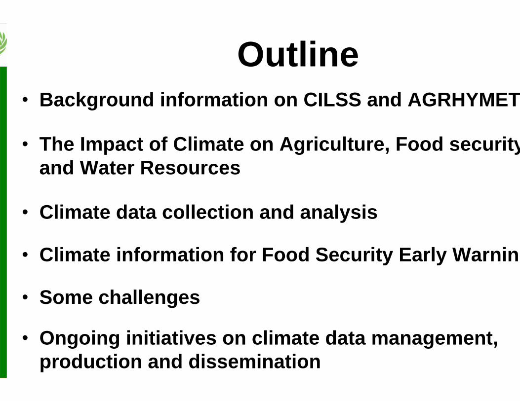
Outline• Background information on CILSS and AGRHYMET
• The Impact of Climate on Agriculture, Food securityand Water Resources
• Climate data collection and analysis
• Climate information for Food Security Early Warning
• Some challenges
• Ongoing initiatives on climate data management, production and dissemination
Background information on CILSS and Background information on CILSS and AGRHYMETAGRHYMET
CILSS: Permanent InterPermanent Inter--State Committee for Drought Control in the Sahel State Committee for Drought Control in the Sahel Created in 1973 at the aftermath of the great Sahel drought
13 member states :
Benin, Burkina Faso, Cape Verde, Chad,
Côte d’Ivoire, The Gambia, Guinea,
Guinea Bissau, Mali, Mauritania, Niger,
Senegal, Togo
3 sites
•The Executive Secretariat in Ouagadougou (Policy issues)
•The AGRHYMET Regional Centre in Niamey (Information and Training)
• The Sahel Institute (INSAH) in Bamako (Research coordination)
Mandate: invest itself in research on food security and combat the effects of drought and desertification for a new ecological balance in the Sahel
•• AGRHYMETAGRHYMET: Created in 1974: Created in 1974,
•• MissionMission : to contribute to achievingsustainable food security and rational natural resourcemanagement through:
– Capacity building of member States Meteorological and Hydrological offices (training,
equipment and financial support)
– Production and dissemination of information to various decision makers (national authorities,
cooperation partners, NGOs and farmers)
4
The AGRHYMET Regional CenterThe AGRHYMET Regional Center
The AGRHYMET Operating schemeThe AGRHYMET Operating scheme
Agriculture
Hydrology
Animal Husbandry
Meteorology
Crop protectionAGRHYMET
DATA COLLECTIONAND STORAGE
Agriculture
Hydrology
Animalhusbandry
Meteorology
Crop protectionCountries
ANALYSISDIFFUSIONTRAINING
Satellite Data
Ground Observation and Surveys DataMali
Niger Tchad
Burkina
Liberia
Benin
Togo Nigeria
Cote-d'Ivoire
Mauritanie
Guinee
Senegal
Sierr a-
Leone
Cap-Vert
G.-BissauGambie
Ghana
Partners
Financial and Technical assistance
Data and Information
Extension to ECOWASmember countries
5
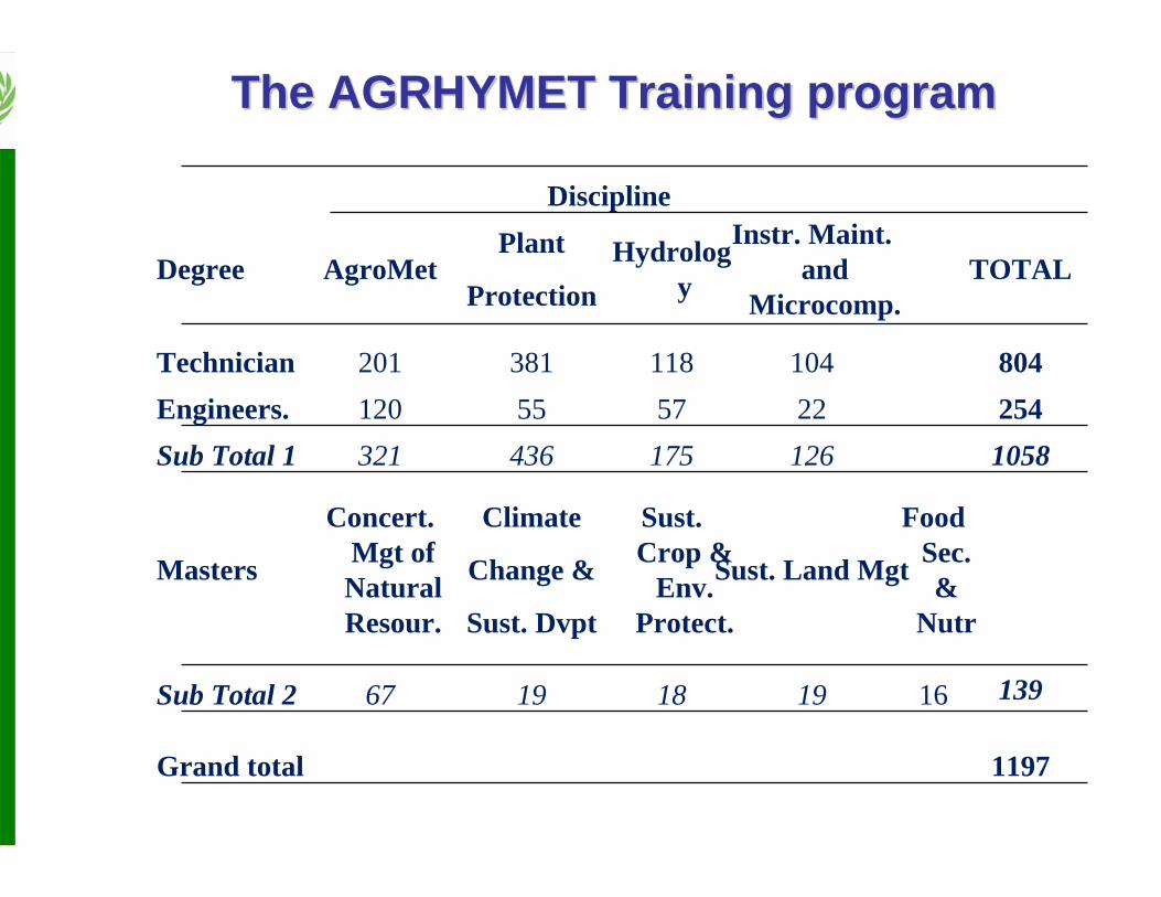
The AGRHYMET Training programThe AGRHYMET Training program
– Importance of natural variability than extremes !!!!
– Up to 80% of the variability of agricultural production can attributed to the variability of climatic conditions
• a big difference among developed and non developed countries10
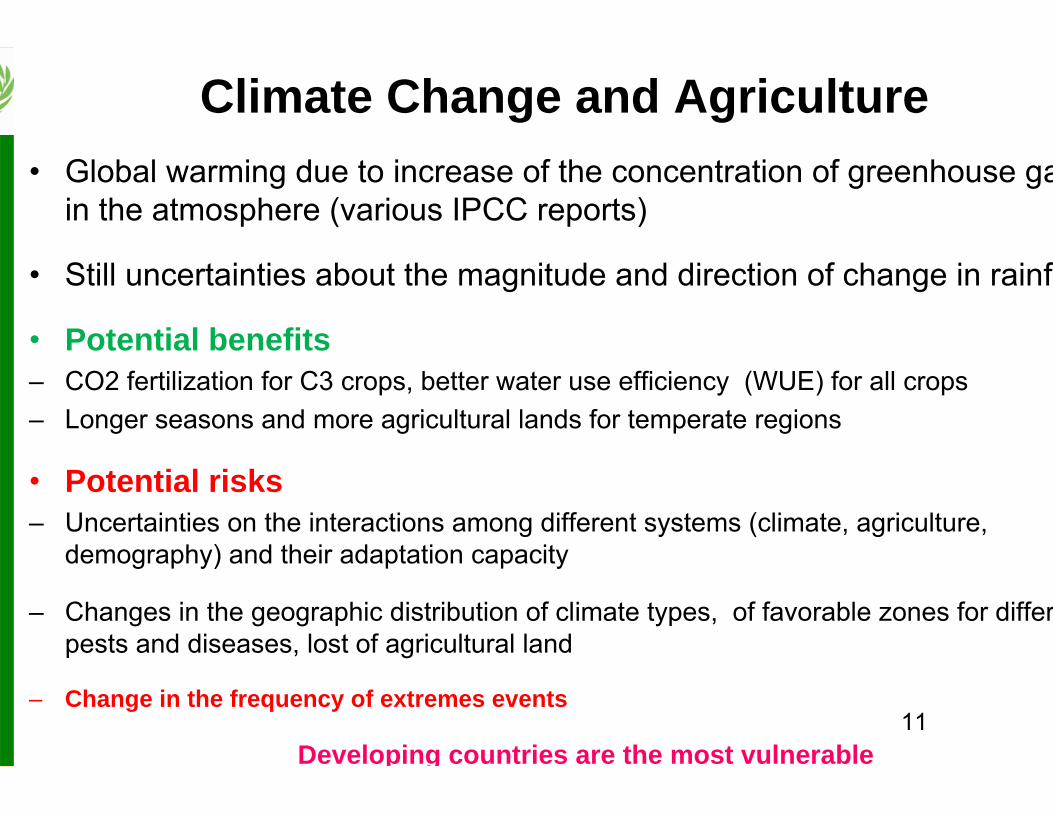
Climate Change and Agriculture• Global warming due to increase of the concentration of greenhouse ga
in the atmosphere (various IPCC reports)
• Still uncertainties about the magnitude and direction of change in rainf
• Potential benefits– CO2 fertilization for C3 crops, better water use efficiency (WUE) for all crops– Longer seasons and more agricultural lands for temperate regions
• Potential risks– Uncertainties on the interactions among different systems (climate, agriculture,
demography) and their adaptation capacity
– Changes in the geographic distribution of climate types, of favorable zones for differpests and diseases, lost of agricultural land
– Change in the frequency of extremes events
Developing countries are the most vulnerable11
Climate data collection and analysis
13
Climate data collection and analysis
AGRHYMET regional rainfall network includes 700 rain gauges in total from which 300 are used in near-real time for the agricultural campaign monitoring (80 synoptic)
in-situ rainfall measurement network
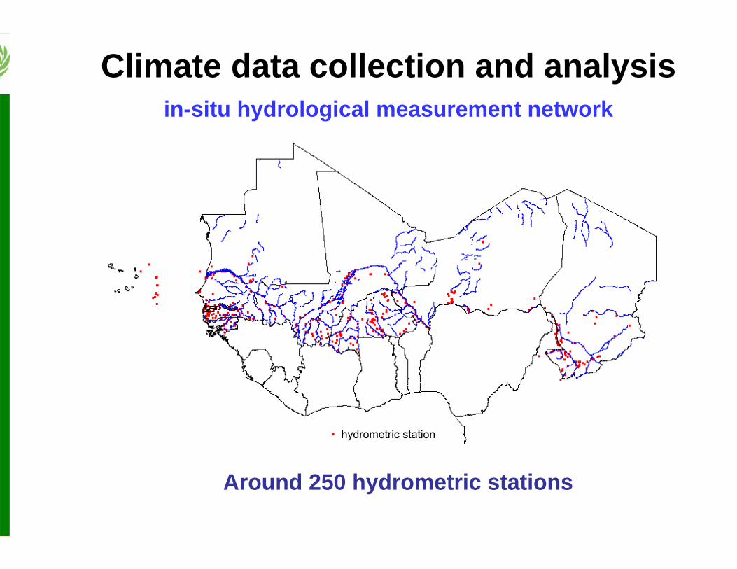
Around 250 hydrometric stations
Climate data collection and analysisin-situ hydrological measurement network
• hydrometric station
15
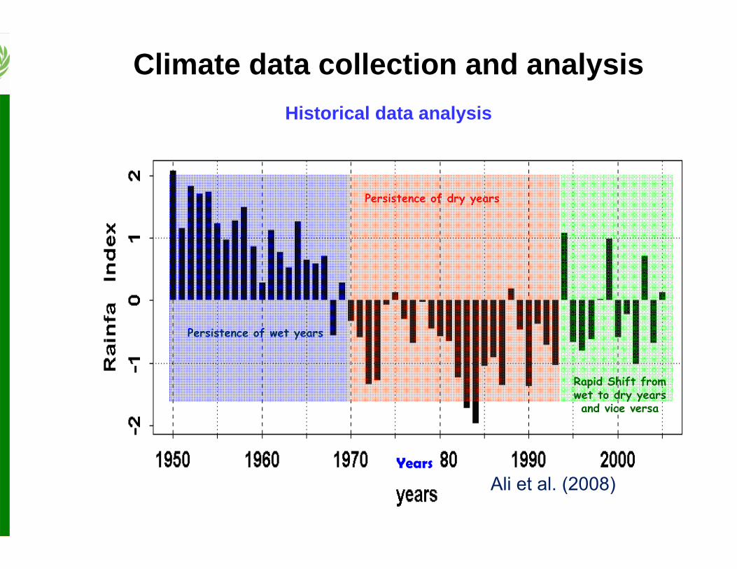
Displacement of isohyets: 200 km to the south
Climate data collection and analysisHistorical data analysis
Climate data collection and analysisHistorical data analysis
18
Climate data collection and analysisHistorical data analysis
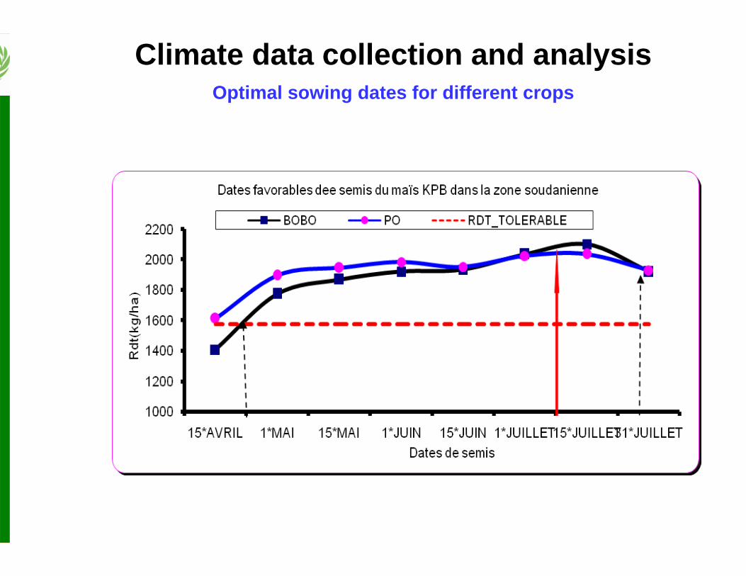
Climate data collection and analysisOptimal sowing dates for different crops
Climate change studies
21
Sahelian zone
Sudanian zone
Minimum TemperatureMinimum Temperature MaximumTemperatureMaximumTemperature
Climate change studies
22
Climate change studiesEvaluation of Climate Models (GCMs)
23 23
• Yields decrease as we go further into the century because of higher temperatures
• Some increase during the early part of the century because of the C02 fertilization effect (C3 crop)
• Yields decrease as we go further into the century because of higher temperatures
• Some increase during the early part of the century because of the C02 fertilization effect (C3 crop)
IR1529
‐25
‐15
‐5
5
15
25
35
45
2011
‐204
0
2041
‐207
0
2071
‐210
0
% par rap
port à 196
1‐19
90
A0
A2
B2
Climate change studiesImpacts on Crop Yields
24
CCMA A2
GISS A2
UKMO A2
GFDL B1
Scenarios of monthly discharges at the 2030 horizon. The red dots correspond to deficit and the black dots to increased discharges
Climate change studiesImpacts on Water resources
Food Security Early Warning
26
Agricultural Campaign Monitoring
•Seasonal forecast of rainfall and maximum river discharges
•Dekadal briefings to closely monitor the situation
•Identification of zones where rainfall conditions allowed sowing– Focus on zones with late sowing relatively to the average date
•Crop water requirement satisfaction indices
•Vegetation indices derived from EO satellites (NDVI, VCI, ICN)
•Status of crop pests and diseases
•Prediction of potential crop yields using crop models
•Publication of Monthly and Special alert bulletins
Food Security Early Warning
27
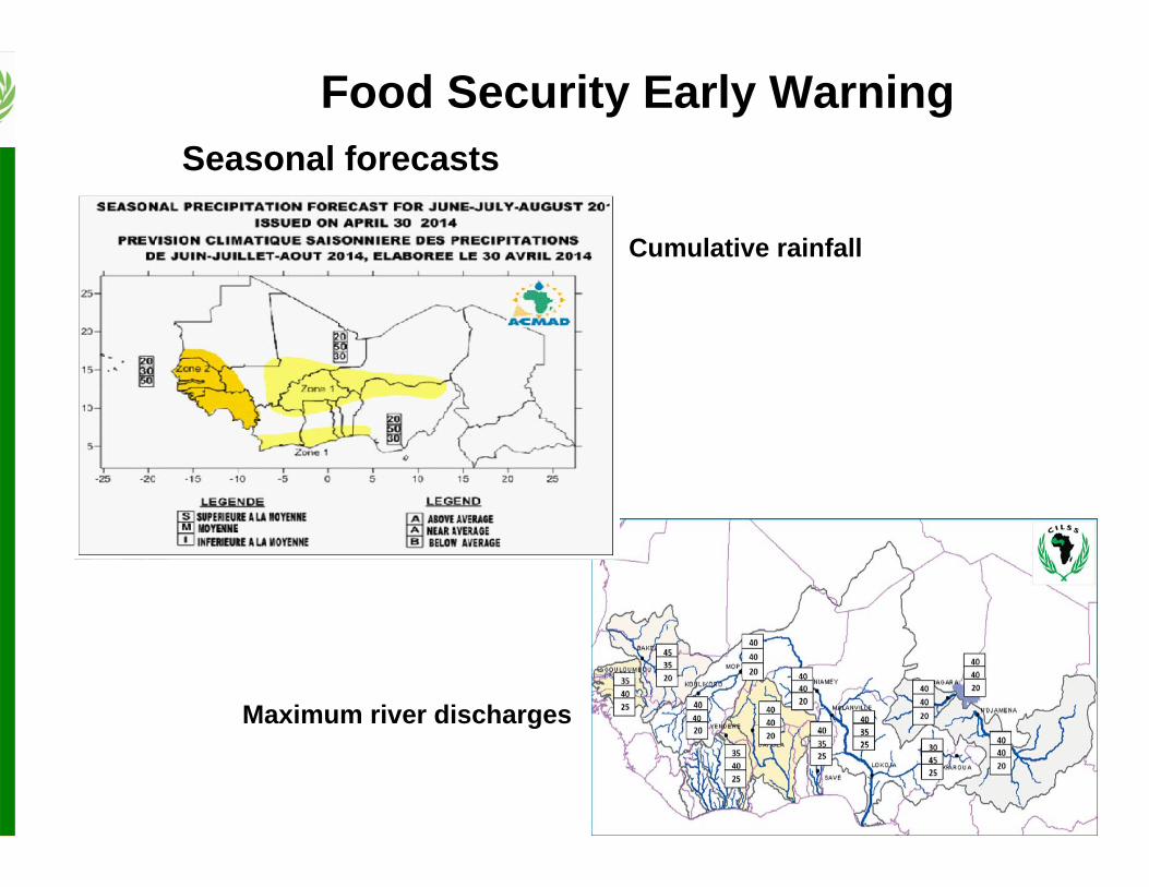
Food Security Early WarningSeasonal forecasts
Cumulative rainfall
Maximum river discharges
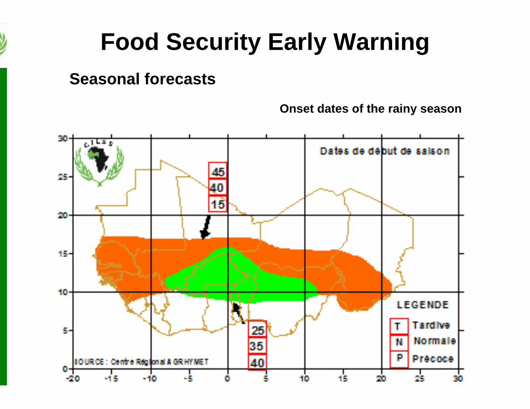
Food Security Early WarningSeasonal forecasts
Onset dates of the rainy season
Food Security Early WarningSeasonal forecasts
Cessation dates of the rainy season
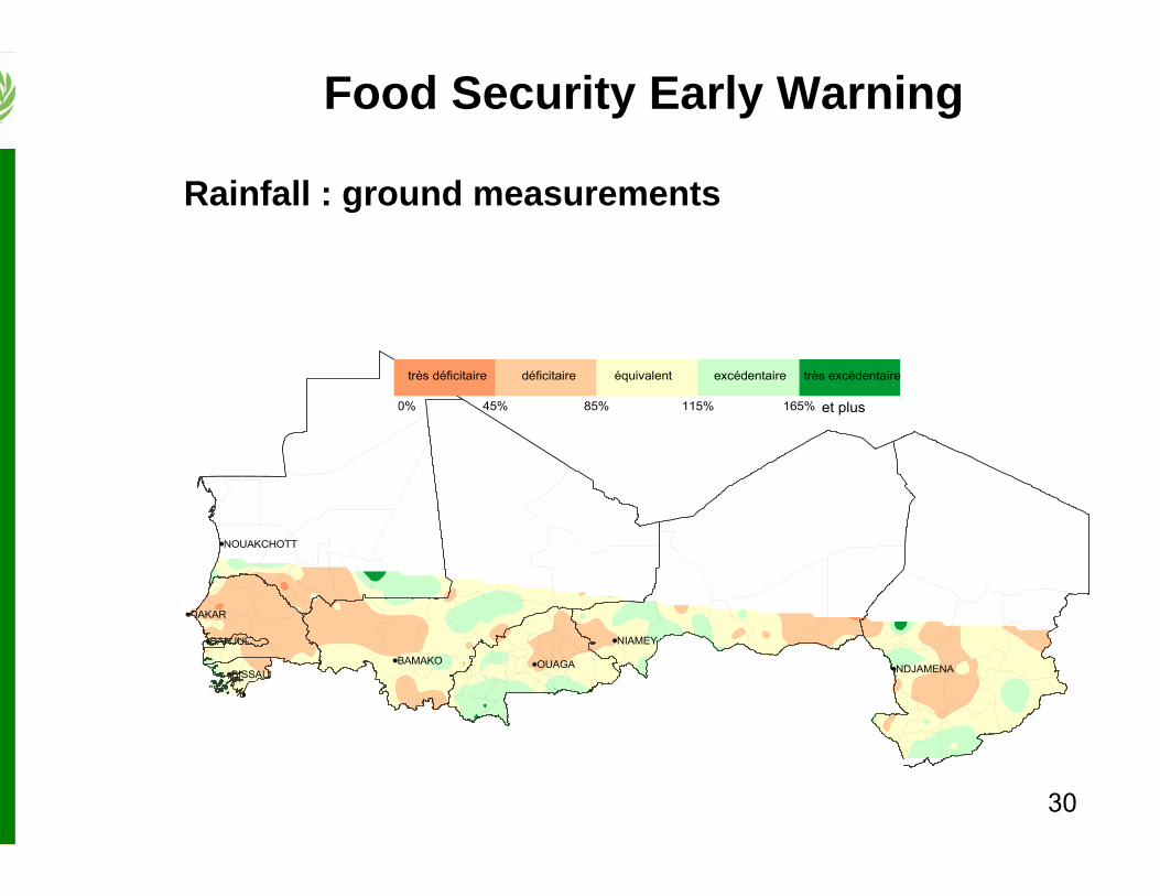
30
Rainfall : ground measurements
OUAGABISSAU
BAMAKO
NOUAKCHOTT
NIAMEY
DAKAR
NDJAMENA
BANJUL
-5000% 45% 85% 115% 165% 5000%
très déficitaire déficitaire équivalent excédentaire très excédentaire
et plus
Food Security Early Warning
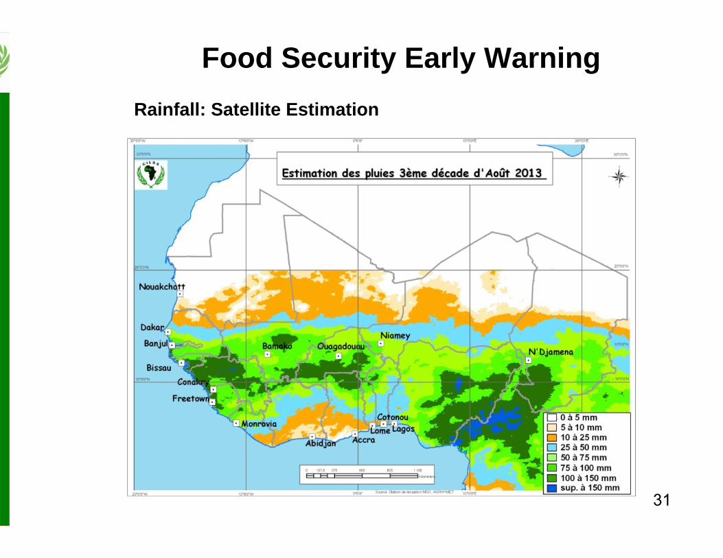
31
Rainfall: Satellite Estimation
Food Security Early Warning
32
River discharges and dam water levels
Food Security Early Warning
33
Starting dates of the season
Crop Water Requirement Satisfaction Indices
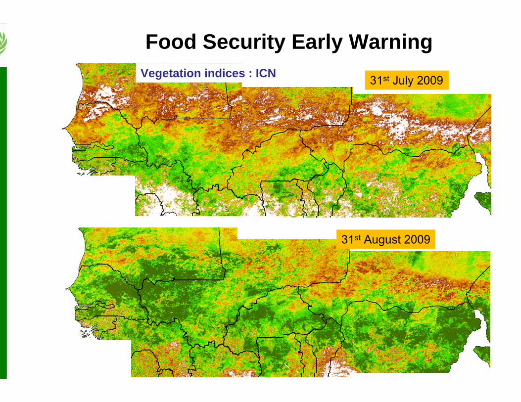
Food Security Early WarningCrop growing conditions (agrometeorological models)
31st July 2009
31st August 2009
Vegetation indices : ICN
Food Security Early Warning
35
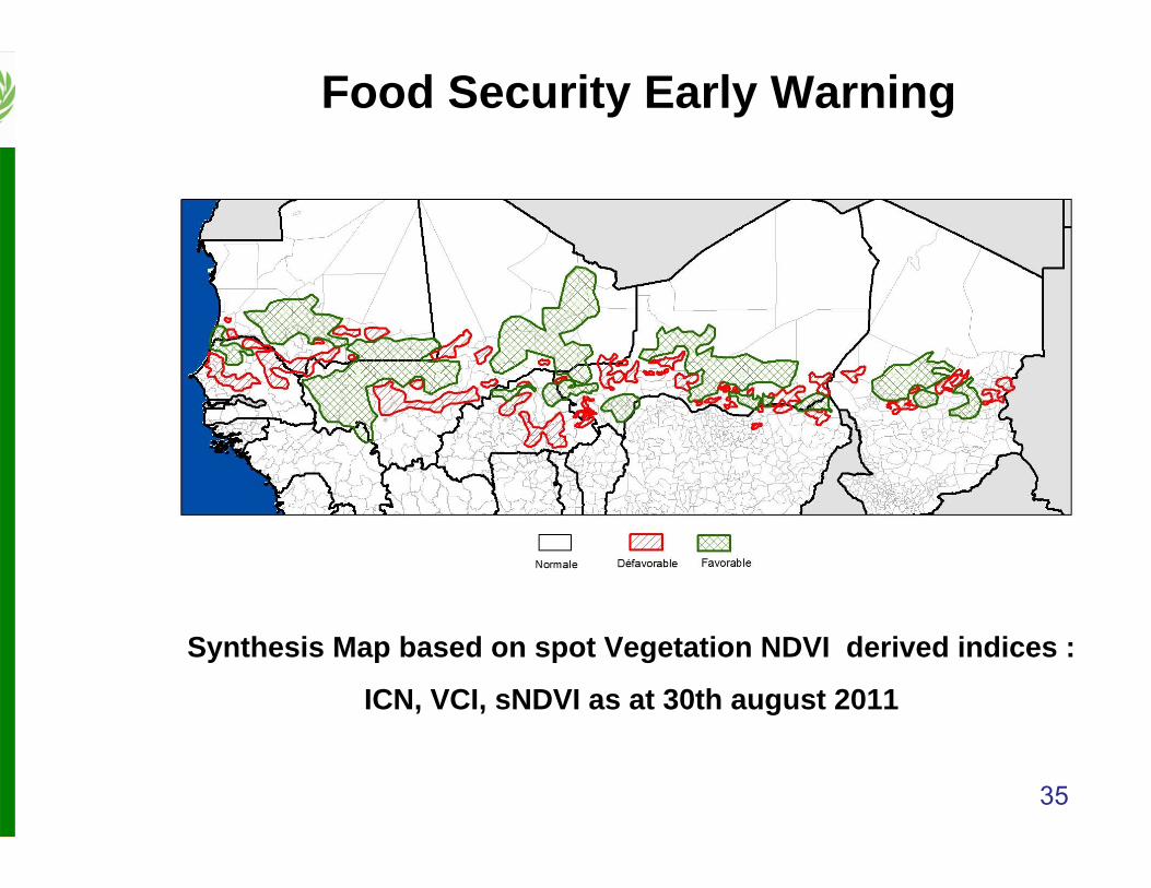
Synthesis Map based on spot Vegetation NDVI derived indices :
ICN, VCI, sNDVI as at 30th august 2011
Food Security Early Warning
36
Crop pests and diseases
Food Security Early Warning
37
Food Security Early WarningCrop yields forecast (agrometeorological models)
Comité permanent Inter-Etats de Lutte contre la Sècheresse dans le Sahel Permanent Inter-State Committee For Drought Control in the Sahel
Centre Régional AGRHYMET
BULLETIN DE SUIVI DE LA CAMPAGNE AGROPASTORALE EN AFRIQUE DE L’OUEST
Bulletin spécial N° 01 - Mai 2013
Prévision des caractéristiques Agro-Hydro-Climatiques de la campagne d’hivernage
2013 en Afrique de l’Ouest, au Tchad et au Cameroun
Centre Régional AGRHYMET
Bulletin spécial
Cadre Harmonisé d’analyse et d’identification des zones à risque et des populations vulnérables au Sahel et en Afrique de l’Ouest
Insécurité alimentaire en Afrique de l’Ouest - Mars 2013
Insécurité alimentaire critique (phase 3 ou plus) dans le nord du Mali
Food Security Early Warning
Assistance to farmers and herders
40
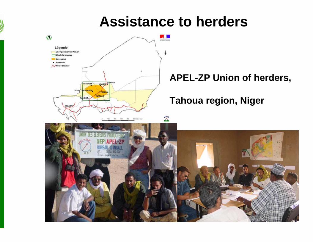
Assistance to herders
APEL-ZP Union of herders,
Tahoua region, Niger
CSP 2004 Unité GRN 41
Abalak
Tchin Tabaraden
Aderbissinat
TamayaTofaminir
NWagarTchikolanene
Ingighran
Tassara
Tillia
In Gall
Tchirozerine
Tahoua
Assistance to herdersNDVI map indicating areas with good pastures
Communication of Seasonal Forecast Results to Farmers
• AGRHYMET/CCAFS Partnership – Produce and disseminate climate information
adapted to users (farmers) needs
– Identify and disseminate adaptation strategies to Climate Variability and Climate Change
– Organize national communication workshops with users at the different CCAFS benchmark sites.
Communication Workshops with Users
CCAFS benchmark sites in West Africa• Burkina Faso : Tougou (Yatenga province)• Mali : Cinzana (Ségou region)• Ghana : Lawra and Jirapa (Upper-West region)• Niger : Dantiandou (Tillaberi Fakara region,)
Communication Workshops with Users
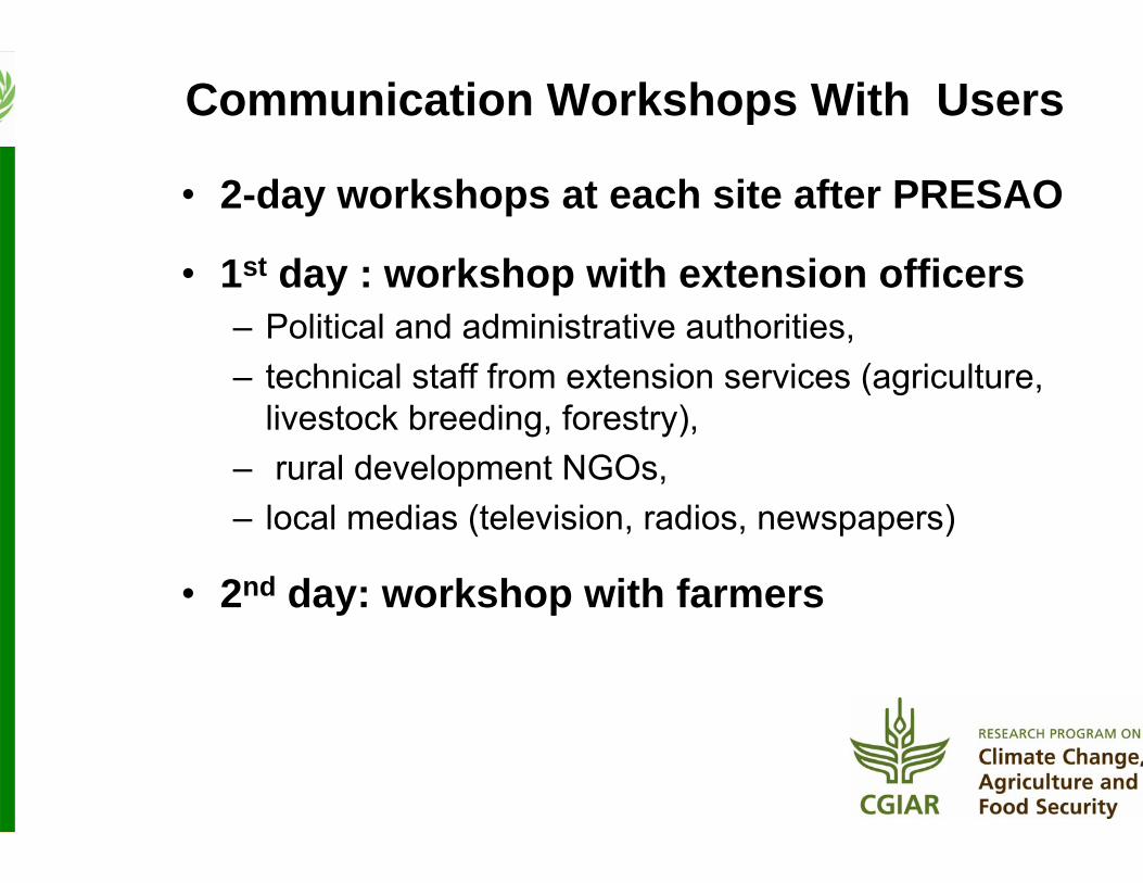
Communication Workshops With Users
• 2-day workshops at each site after PRESAO
• 1st day : workshop with extension officers– Political and administrative authorities, – technical staff from extension services (agriculture,
livestock breeding, forestry),– rural development NGOs, – local medias (television, radios, newspapers)
• 2nd day: workshop with farmers
• With extension workers– What forecasts do say? Probabilities of seasonal
cumulative rainfall being above, equivalent or below the 30-year average
– What forecasts do not say?• Rainfall distribution during the season (dry/wet spells,
early/late onset, or cessation)
• Forecasts are about rainfall quantities, not the quality of the season, nor of the expected yields
– Emphasis on the probabilistic nature of forecasts: a category may have the highest probability to occur, but this does not mean that the others categories are not likely to happen
Communication Workshops With Users
Communication Workshops With Users
• With extension workers– The concept of normal : average of the last 30 years
• With farmers– Discussion on Indigenous methods of seasonal forecast
– Their forecast for the upcoming season
– Presentation of the results of the current PRESAO results
– Discussions and consensus building around the current year forecast
– Working groups to define management strategies to adopt with regards to the consensus forecast
– Plenary session to come up with recommendations for the e upcoming season
– Evaluation of the forecasts and the outcomes of the season afterthe end of rains
Communication Workshops With Users
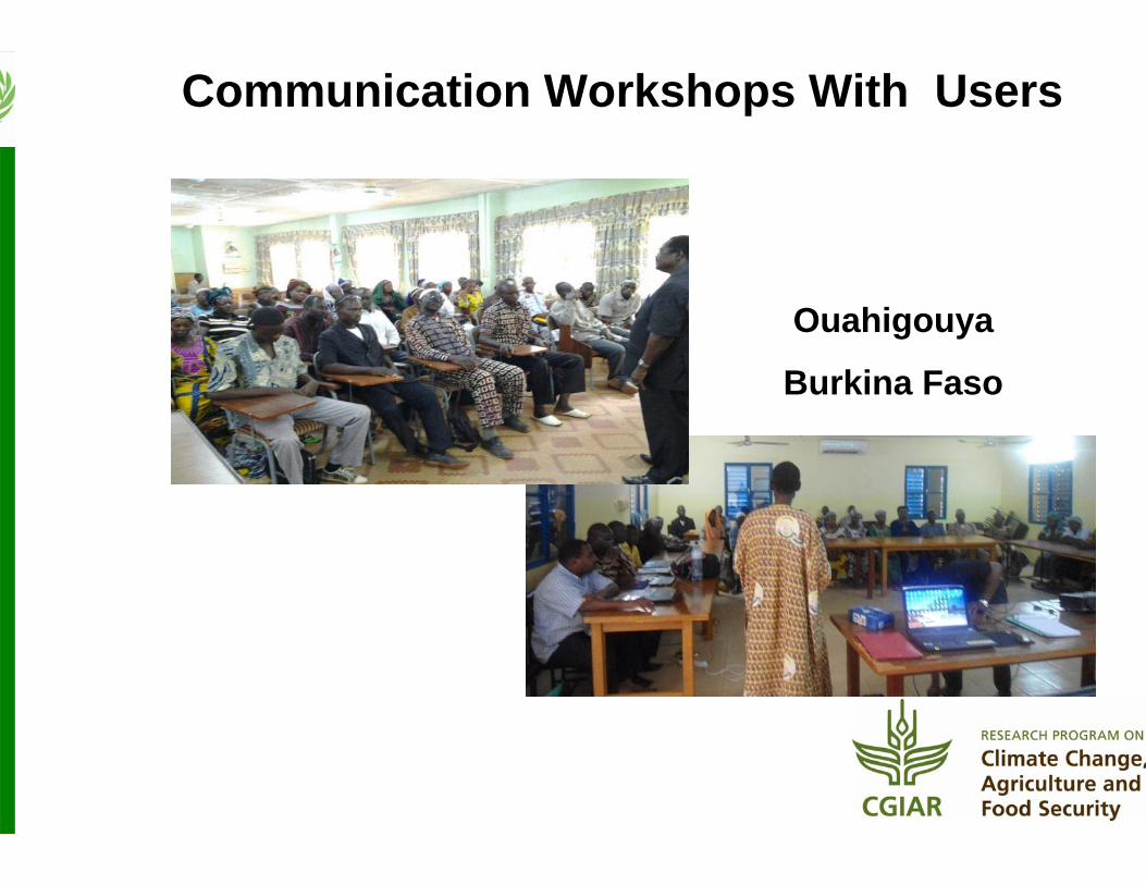
Ouahigouya
Burkina Faso
Communication Workshops With Users
CinzanaMali
Communication Workshops With Users
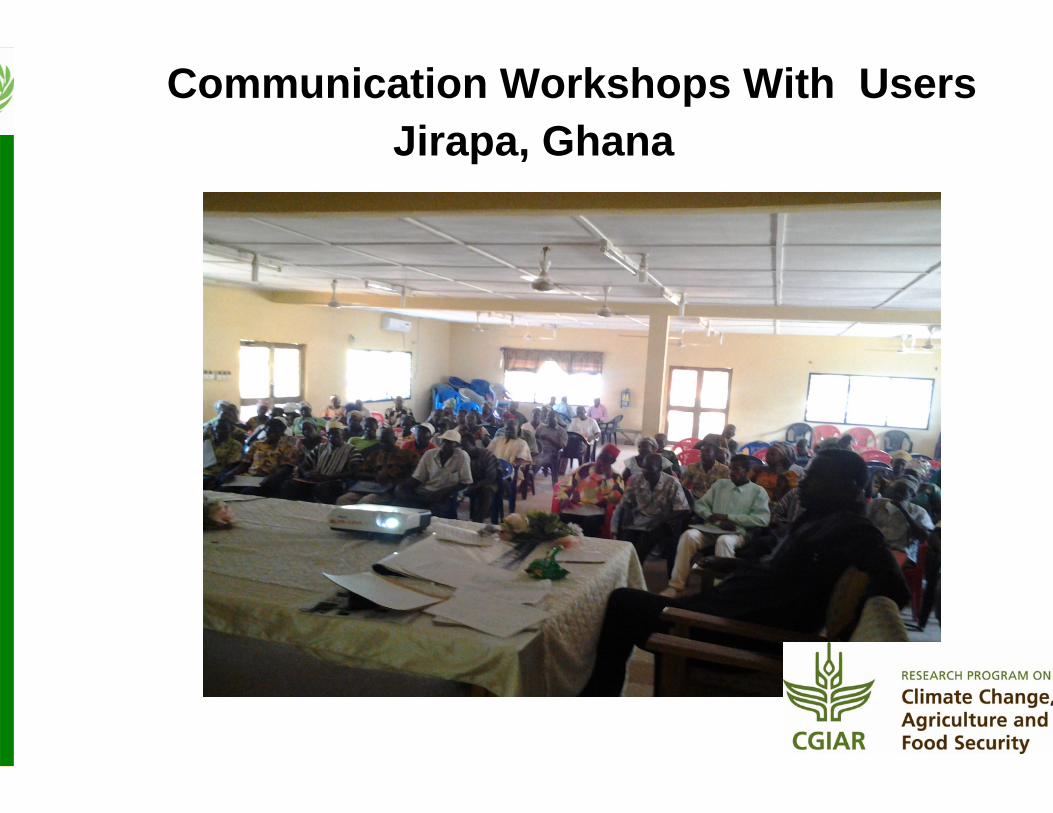
Jirapa, GhanaCommunication Workshops With Users
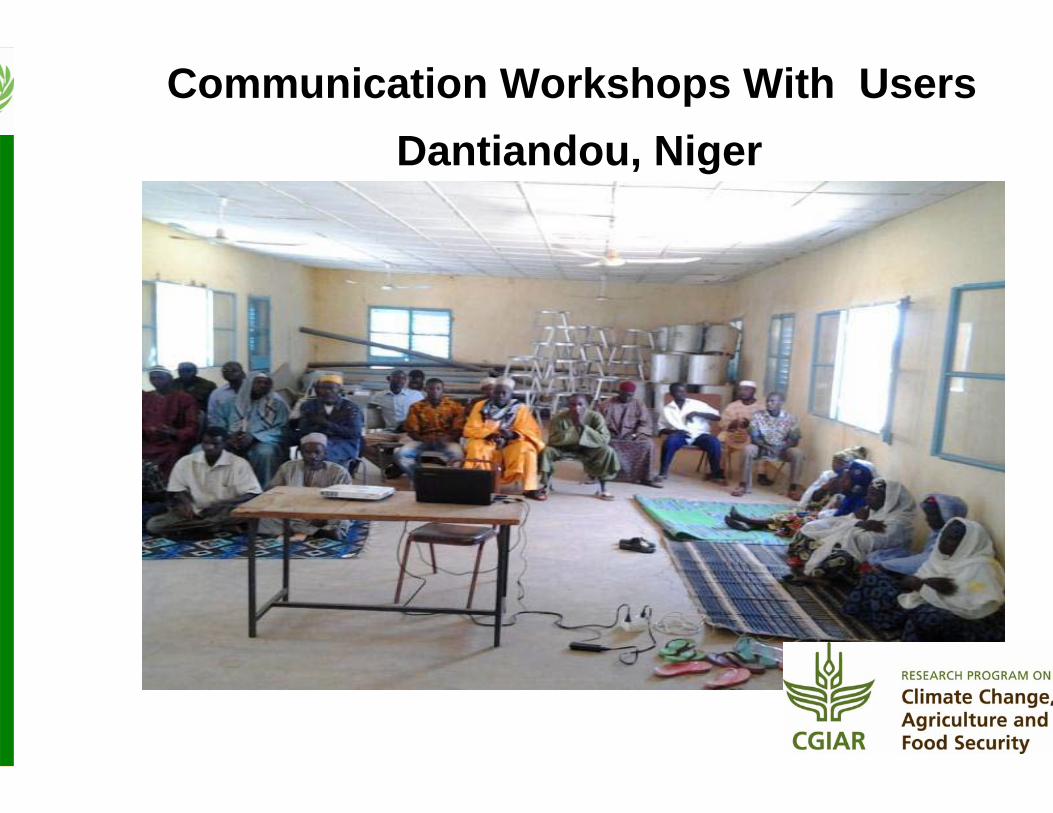
Dantiandou, NigerCommunication Workshops With Users
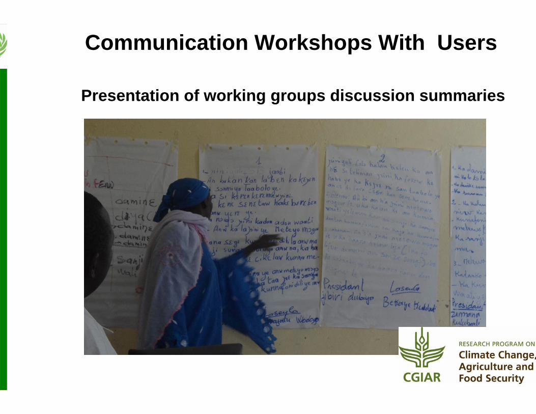
Presentation of working groups discussion summaries
Communication Workshops With Users
Summary of the discussions with farmers
• When the likelihood of water constraint is minimal, they take the opportunity to intensify
– By applying more inputs (manure, mineral fertilizers, labor, vaccination of animals, etc…)
– By privileging high yielding crop species/varieties (improved seeds, swamp rice, maize, long duration millet and sorghum varieties)
– By reducing cropped areas to allow for better management
Communication Workshops With Users
• Communication with users– Forecast precisions
• Probabilistic nature• Demand for localized forecasts (at village or even farm • Temporal distribution (start, end, dry/wet spells)• Interpretation of the forecasts
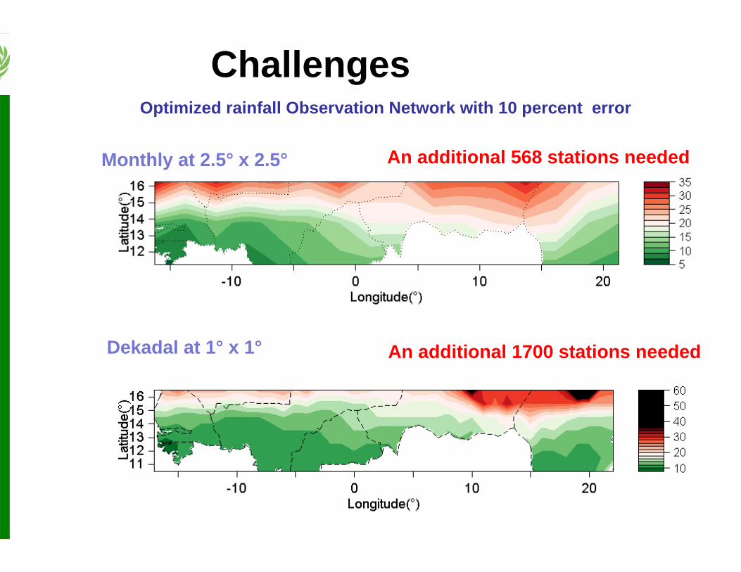
Challenges
Africa wide, the number of gauges have declined significantly in recent decades
R. Maidment, 2014, TAMSAT Group • Drastic decline in thnumber of rain gaudata transmitted through WMO GTS
Challenges
57
Monthly at 2.5° x 2.5°
Dekadal at 1° x 1°
An additional 568 stations needed
An additional 1700 stations needed
Optimized rainfall Observation Network with 10 percent error
Challenges
Cumulative Rainfall
May 2014 July 2014
58
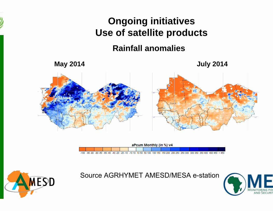
Ongoing initiativesUse of satellite products
Source AGRHYMET AMESD/MESA e-station
Rainfall anomalies
May 2014 July 2014
59
Ongoing initiativesUse of satellite products
Source AGRHYMET AMESD/MESA e-station
Ongoing initiativesUse of satellite products
Rainfall and vegetation indices profiles per administrative units
Source AGRHYMET AMESD/MESA e-
t ti
61
• Organize training workshops on:
─ Climate Database Management
─ Quality Control of station data
─ Blending satellite and ground based products (rainfall, temperature, radiation, etc…)
─ Generating climate time series of blended products
─ Use of the time series for various applications
Ongoing initiatives
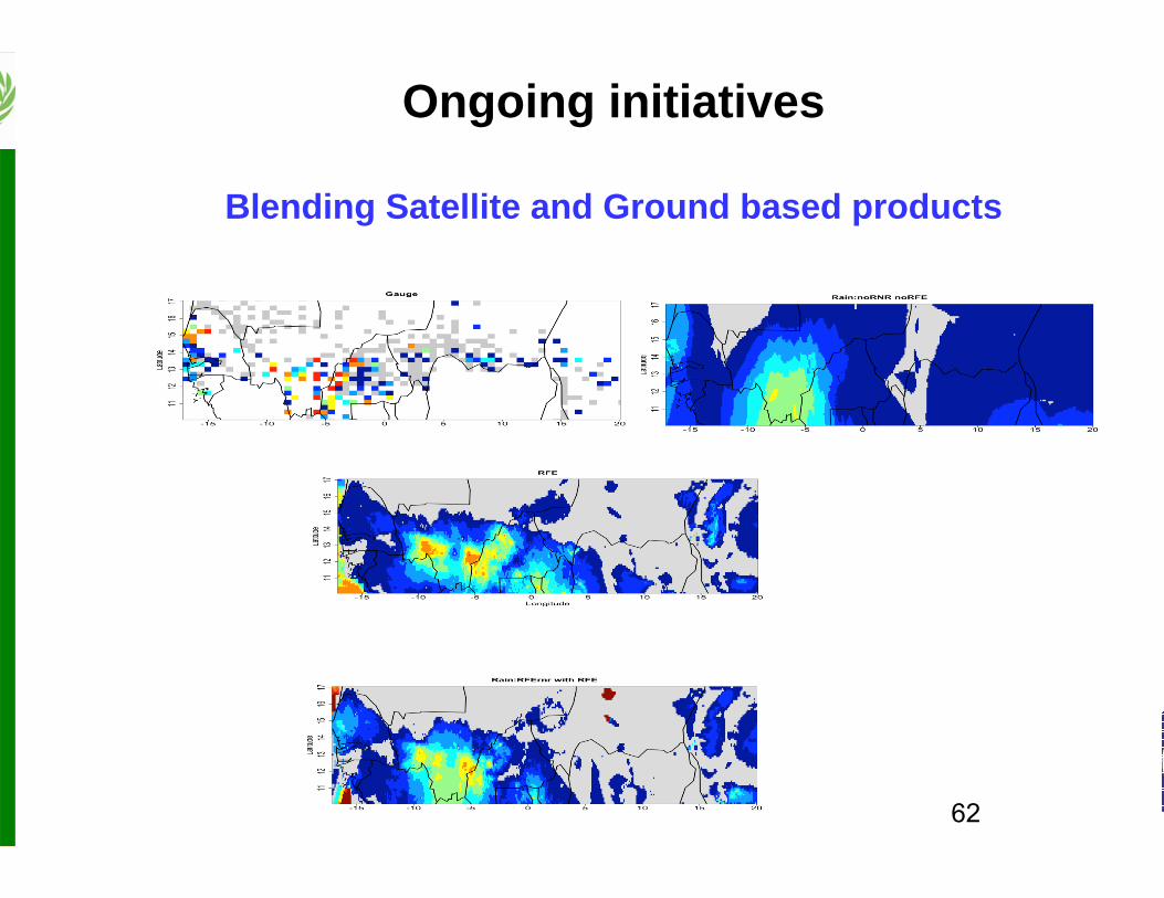
Blending Satellite and Ground based products
62
Ongoing initiatives
Blending Satellite and Ground based products
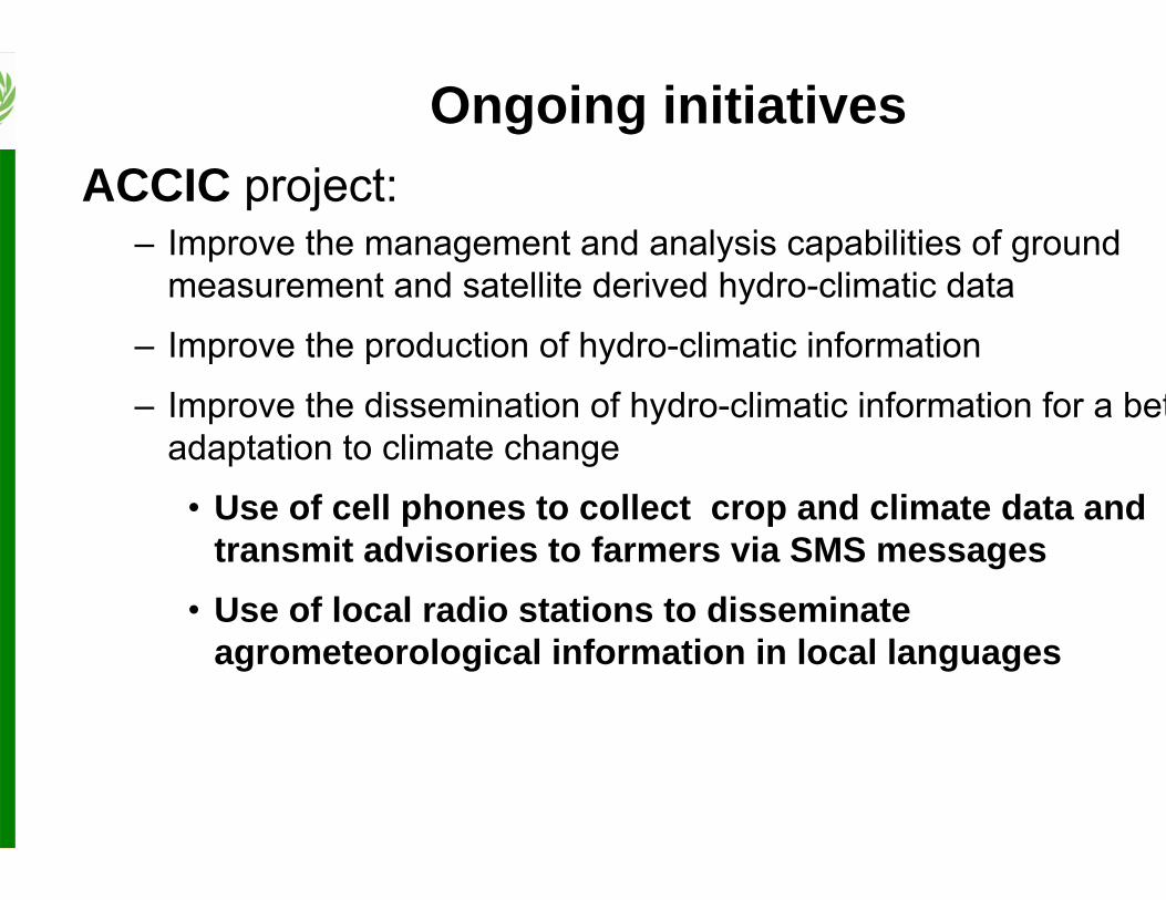
Ongoing initiativesACCIC project:
– Improve the management and analysis capabilities of ground measurement and satellite derived hydro-climatic data
– Improve the production of hydro-climatic information
– Improve the dissemination of hydro-climatic information for a betadaptation to climate change
• Use of cell phones to collect crop and climate data and transmit advisories to farmers via SMS messages
• Use of local radio stations to disseminate agrometeorological information in local languages
Ongoing initiatives
• CLIDATA Database management software• ISACIP and CCAFS projects on Data quality control
workshops• IRI data library• ACCIC project on good quality data• Merging Satellite and ground observations rainfall da• AMESD / MESA, SIGMA projects on EO data• WMO ECOWAS Regional Climate Center Network• …..• Looking forward to contribute to CR4D goals