Basic Infrastructure for Inclusive Growth in the Northeastern Provinces Sector Project (RRP VIE 49026-002) BASIC INFRASTRUCTURE FOR INCLUSIVE GROWTH IN THE NORTHEASTERN PROVINCES SECTOR PROJECT CLIMATE RISK AND VULNERABILITY ASSESSMENT Prepared for Provincial People’s Committees and Asian Development Bank BY ADB TA 8957-VIE July 2017
Transcript
Basic Infrastructure for Inclusive Growth in the Northeastern Provinces Sector Project (RRP VIE 49026-002)
BASIC INFRASTRUCTURE FOR INCLUSIVE GROWTH IN THE NORTHEASTERN PROVINCES SECTOR PROJECT
ADB : Asian Development Bank AMSL : Above mean sea level BIIG : Basic Infrastructure for Inclusive Growth CC : Climate Change CCA : Climate change adaptation cm : Centimeter cmd : Cubic meters per day CMIP : Coupled Model Intercomparison Project CRVA : Climate Risk and Vulnerability Assessment CSIRO : Commonwealth Scientific and Industrial Research Organisation DARD : Department of Agriculture and Rural Development DED : Detailed engineering design DoC : Department of Construction DoNRE : Department of Natural Resources and Environment DPI : Department of Planning and Investment EA : Executing Agency EARF : Environmental Assessment and Review Framework ENSO : El Niño–Southern Oscillation GCM : Global Climate Model GHG : Greenhouse gas GoV : Government of Viet Nam IMHEN : Institute of Meteorology, Hydrology and Environment IPCC : Inter-Governmental Panel on Climate Change LST : Longshore sediment transport MCM : Million cubic meters mm : Millimeter MoNRE : Ministry of Natural Resources and Environment NH : National Highway
PPC : Provincial People’s Committee
PPMU : Provincial Project Management Unit
PPTA : Project Preparation Technical Assistance
PRECIS : Providing Regional Climates for Impacts Studies
RCM : Regional Climate Model
RCP : Representative Concentration Pathway
RUSLE : Revised Universal Soil Loss Equation
SLR : Sea Level Rise
SRES : IPCC Special Report on Emission Scenarios
CONTENTS
EXECUTIVE SUMMARY
I. INTRODUCTION ............................................................................................................................. 1
A. The Project .................................................................................................................................. 1
B. Purpose of the CRVA .................................................................................................................. 2
II. CLIMATE SENSITIVITY OF BIIG-1 INFRASTRUCTURE TYPES ................................................. 3
A. Critical Climate Parameters ........................................................................................................ 3
B. Effects of Climate Parameters on Infrastructure Performance and Durability ............................ 4
C. Effects of Ongoing Weather Variability and Extremes ................................................................ 5
III. CLIMATE CHANGE PROJECTIONS FOR CRITICAL PARAMETERS ..................................... 6
A. Climate Change Modeling and Database ................................................................................... 6
B. Projected Country-wide Climate Change .................................................................................... 6
C. Projected Climate Change in BIIG-1 Provinces for Critical Parameters ..................................... 7
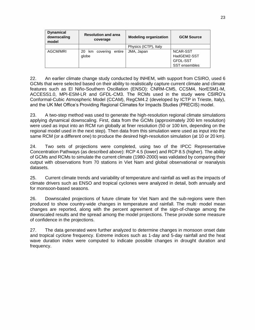
IV. NON-CLIMATE FACTORS CONTRIBUTING TO VULNERABILITY ......................................... 8
A. Geographic Factors ..................................................................................................................... 8
B. Other Factors .............................................................................................................................. 8
V. VULNERABILITY ASSESSMENT OF REPRESENTATIVE SUBPROJECTS ............................... 9
A. Vulnerability of Mountain Road Subprojects ............................................................................... 9
B. Vulnerability of Water Supply Infrastructure .............................................................................. 12
C. Vulnerability of Other Infrastructure .......................................................................................... 13
VI. ADAPTATION MEASURES ...................................................................................................... 14
A. Mountain Roads ........................................................................................................................ 14
B. Water Supply ............................................................................................................................. 15
C. Agricultural Value Chain ............................................................................................................ 15
ANNEX B: BASELINE AND PROJECTED CLIMATE IN BIIG-1 PROVINCES .................................... 24
ANNEX C: CRVA FRAMEWORK AND METHOD ................................................................................ 27
LIST OF TABLES
Table 1. Representative Subprojects in BIIG-1....................................................................................... 1
Table 2. Projected change in heat wave duration (number of consecutive days with Tmax>35°C) ...... 7
Table 3. Projected change in annual rainfall (%) ................................................................................... 7
Table 4. Projected change in extreme rainfall (%) .................................................................................. 8
Table 6. Latest Scenarios Used in the IPCC Fifth Assessment Report (2013) ................................... 21
Table 7. Models Used in Setting up the Climate Change Database .................................................... 22
Table 8. Projected Change in Average Temperature (°C) .................................................................... 25
Table 9. Projected Percentage Change in Annual Rainfall (with reference to 1986-2005) .................. 26
i
EXECUTIVE SUMMARY
1. The Basic Infrastructure for Inclusive Growth in the Northeastern Provinces Sector Project (BIIG1) covering Bac Kan, Cao Bang, Ha Giang And Lang Son provinces will enhance opportunities for inclusive economic growth through improved transport, water supply, and agricultural value chain infrastructure in Lang Son province. Representative subprojects were examined to assess climate change risks based on preliminary engineering specifications and site conditions that, together with climate change projections for the subregion, determine vulnerability.
2. Risk in this assessment considers the likelihood of an adverse event and its consequence—the event being the climate hazard, and the consequence depending on exposure and sensitivity of the infrastructure.
3. Climate risk for BIIG1 is indicated by a projected increase in annual rainfall ranging approximately from 3% to 19% across the 4 provinces by the 2030s and up to mid-century. Rainfall will also be more intense. Based on Representative Concentration Pathway (RCP) 4.5 scenario, (using ensemble climate modeling) the annual maximum 1-day rainfall is projected to increase from 10% to 82% by 2030s relative to 1986-2005. At mid-century, the models indicate a reduced amount of increase relative to baseline, with projected increase at 25% to 54%. For the 5-day maximum rainfall, an indicator of inundation flood risk, the projected increase is from 8% to 92% by 2030s, and by 21% to 52% at mid-century.
4. The projected change in average temperature is modest at 0.6°C by 2030 and 1.7°C by mid-century, however, the projected change in extreme temperatures is significant. As a key indicator, the number of consecutive days with maximum temperatures exceeding 35°C is projected to increase across all 4 provinces (e.g., from current 4 to 7 days in Bac Kan by 2030s, and up to 15 days by mid-century).
5. The Climate Risk and Vulnerability Assessment (CRVA) addressed (i) which climate parameters are critical to infrastructure performance and durability, (ii) how these climate parameters are projected to change in future decades, (iii) if existing assets are already being affected by increasing climate variability and extremes, (iv) if non-climate factors aggravate or mitigate the impact of climate change, (v) the vulnerability of the proposed infrastructure, (vi) what measures could be adopted during the DED assessments and decisions, and (vii) what modification to the Environmental Assessment and Review Framework (EARF) is necessary for processing additional subprojects.
6. The four selected representative subprojects with completed feasibility studies include (i) upgrading of a 21-km mountain road in Bac Kan (asphalt-paved), (ii) upgrading of a 23-km mountain road in Lang Son (concrete-paved), (iii) a river-sourced district water supply system in Bac Kan, and (iv) agricultural value chain development in Lang Son province focused on horticulture.
7. Assessment of mountain roads covered vertical clearance of bridges, provisions for road drainage and slope stability, and pavement quality. The assessment of water supply risk was primarily on the dependability of the proposed sources and watershed maintenance. For the agriculture subproject, focus was on water availability and risk of pests and diseases. Findings are summarized below.
8. For the two mountain roads, a critical vulnerability is the vertical clearance of bridges and the level of spillway crossings above high water during flood events. Historical records are unlikely
ii
to provide reliable basis for determining future flood levels due to projected significant increase in future rainfall intensity, combined with ongoing watershed cover modifications.
9. It is important to assess the probable change in maximum rainfall intensities between the historical period and in the future (at least up to 2030s covering the road’s design life). Essentially, what is expected under various climate change scenarios is for extreme rainfall events to increase in magnitude for any specified return-period, or conversely for the return periods to be shorter for any given an extreme rainfall event. Results can be factored into empirical equations or hydro-dynamic models to estimate probable changes in peak flows and flood levels.
10. Geological tests the during detailed engineering design (DED) should check measures for stabilization of road cuts, which may involve cutting back vulnerable slopes to reduce steepness, reinforcing critical sections, supporting with retaining structures or landslide guard walls, and reforming the cut areas with surface soil layer and vegetation cover.
11. Fortifying especially the culvert sections in contact with fast-flowing water will be important, particularly their foundation, aprons and wing walls, as this is where the water can undermine the structures. With projected more intense future rainfall and stream discharge, water-damage to the road in this way is a significant risk. Embankment slopes should be protected from erosion, and the base protected from scouring. Culverts should be wider (at least 1 meter in diameter) to facilitate cleaning and removal of soil deposits and debris. Roadside ditches should have discharge outlets at their ends to keep the canals from merely impounding water.
12. Proper compaction and moisture conditions during construction, quality of asphalt mix and gravel materials, and accurate layer thickness (after compaction) are important for durable pavement performance. This requires good inspection and quality control procedures during construction. During road operation, pavement cracks and potholes should not be left to deteriorate and allow water to penetrate the road structure—given future projected climate conditions characterized by heavier rainfall.
13. DED of the asphalt-paved road in Bac Kan needs to reflect the sensitivity of the flexible pavement stiffness to high temperatures, including potential problems with migration of liquid asphalt under prolonged hot weather, the quality of asphalt material used in road construction and maintenance is an important resilience measure. Heat wave duration is projected to increase. DED work on the road should consider and include developments in asphalt technology to check for modified binders that improve the performance of asphalt under increasingly hot weather.
14. The preliminary designs for the two mountain road subprojects have incorporated various measures for climate resilience. For instance, the downslope face of upgraded road embankments next to the river are to be protected by a concrete retaining wall. At road-cut sections with high risk of landslides, the base of the slope will be protected with rock gabion retaining walls. Upslope sections on vulnerable hill cuts are to be protected with gabion rockfill at their base.
15. If implemented properly, these slope stabilization and protection measures incorporated in the preliminary designs will increase future climate resilience of the mountain roads. Nevertheless, any new or extended hill cut—unless completely armored--is bound to be unstable in the initial years after construction. A program for continuous landslide monitoring, including post-completion upgrading of landslide-prone sections, is warranted by the risk associated with future heavier rainfall regime.
iii
16. For the water supply subproject at Boc Bo in Bac Kan, the main vulnerability consideration is dependability of the water supply source. Water is to be taken from an existing weir used for irrigation. During the dry season, feasibility calculations show that, despite the large variation in seasonal rainfall, there is adequate water to supply both irrigation and drinking water demand. The assumed irrigation demand of 1 l/sec/ha for the irrigated area amounts to an estimated abstraction of about 1,380 cmd. When added to the daily water supply demand of 1,300 m3 from the subproject, the total abstracted volume is equal to about half of the measured minimum daily flow (5,477 m3). This leaves a comfortable surplus of 2,795 cmd. The Boc Bo river has never been observed to dry up.
17. Climate change projections indicate that the climate risk to the dependability of water supply from the Boc Bo river is low.
18. After treatment, water will be distributed through a 21-km pipe network (including main and service pipelines) to six villages. The distribution pipelines will run alongside existing roads and bridges to minimize disruption and cost. Existing small bridges and culvert crossings along the water distribution route are likely to be used to hang/support the pipeline. Since the clearance of the bridges above high water is at risk due to climate change, the pipeline’s river crossings should be secured. In this case, where the pipeline crosses bridges and similar structures, galvanized steel will be used to prevent risk of damage in case bridges are overtopped or hit by floating debris.
19. The agricultural value chain infrastructure subproject will facilitate commercial-focused production, access to export markets, and development of value chains through a combination of production-enhancing infrastructure, value addition and logistics infrastructure, quality assurance and traceability systems that enable secure market access, increased returns and employment within Lang Son. The building of a private sector led sector institution will enhance the sustainability and efficiency of the investment through time.
20. Climate change will have mixed impacts. On the one hand, increased minimum temperatures during winter may make it possible to introduce new crops. On the other hand, deciduous fruit tree varieties in high-altitude areas may be adversely affected due to potential reduction in winter chill (needed for flowering). Another downside is potential for increased incidence of pests and plant diseases, including unfamiliar ones, associated with the general increase in temperature and wetness as well as changing the ambient environment required to achieve quality standards for dried products.
21. A proposed investment will support establishing a Horticultural Sector Industry Organization to spur market-focused production of high value horticultural crops. The representative value chain for Star Anise (Illicium verum) spice is harvested from an indigenous tree that is at low risk of being adversely affected by potentially reduced winter chill.
22. Related added value activities target reduced post-harvest losses and fruit drying/processing and packaging. Wet days are projected to increase with climate change and, combined with likely increase in cloud cover and humidity, raises a risk for traditional sun-drying of fruits. However, the proposed interventions will enable farmers to access new technologies for fruit drying and processing that are resilient to effects of variable and extreme weather. Finding solutions to unfamiliar plant pests and diseases would likewise be facilitated through collective action. Activities envisioned under this subproject are expected to enhance farmers’ adaptive capacity to respond to climate change.
iv
23. Vegetable production is vulnerable to extremes and variability of temperature. Subproject infrastructure intended to test and promote vegetable-growing inside shed houses will increase resilience. A planned shift to high-value crops that are not as water-intensive as paddy rice will increase resilience to future water scarcity risks. Other fruit tree value chain initiatives should emphasize testing and dispersal of low-chilling deciduous varieties, which can be sourced from international germplasm collections.
24. Construction of feeder roads to link agricultural production areas to the existing road networks where collection and processing centers and markets are located are subject to the same vulnerability concerns and risk reduction measures described earlier for mountain roads.
1
I. INTRODUCTION
A. The Project
1. The Basic Infrastructure for Inclusive Growth in theNortheastern Provinces Sector Project (BIIG1) is proposed to be implemented in Bac Kan, Cao Bang, Ha Giang and Lang Son Provinces.1 BIIG1 will be executed by each Provincial People’s Committee as Executing Agency, with their respective Departments of Investment and Planning (DPI) assigned as project owners.
2. The project will rehabilitate and upgrade up to 270 kilometers of roads in the four provinces; install 10 rural domestic water supply schemes; provide infrastructure support for at least 5 horticultural value chains in Lang Son province; and strengthen provincial infrastructure asset management. The expected Project outcome will be sustainably increased production, service delivery, and movement of goods and passengers in four northeastern provinces.
3. Using ADB’s sector project approach, selected subprojects representing the range of infrastructure types in BIIG1 are used to test the feasibility of the proposed investment. The assessment of climate risk and vulnerability is focused on four selected representative subprojects with completed feasibility studies that reflect the range of investments, and whose main design features are presented in Table 1.
Table 1. Representative Subprojects in BIIG-1
Subproject Features
Construction and upgrading of Boc Bo - Bang Thanh - Son Lo Road
Bac Kan Province
Twenty-one km of existing rural road will be upgraded to category 5 mountain road meeting TCVN 4054-05 standards: 6.5 m road base width, 3.5 m surface width, and 1 m hard shoulder each side. Pavement is 3.5 cm asphalt, with 15 cm base and 18 cm sub-base. The road cuts through the slopes of hills with interweaving rock and soil formations. In some low sections, the road embankment runs parallel to the river. There are 2 newly constructed beam-slab bridges (33 m long). Six 6 small slab bridges (6 m long) are to be upgraded, and 2 new big bridges (33 m and 48 m) are to be constructed along the route. Design frequency for road drainage and small bridges is P4% (25-yr return period), and for medium to large bridges, P1% (100-yr return period).
Construction and upgrading of Road No 61 at Hoa Tham, Quy Hoa and Vinh Yen communes
Lang Son Province
Twenty-three km of existing rural road will be upgraded to category 5 mountain road meeting TCVN 4054-05 standards: 6.5 m road base width, 5.5 m road surface width and 0.5 m earth shoulder on each side. Pavement is cement concrete. There are 2 medium-size bridges (33 m and 66 m long) to be constructed, plus one small bridge (6 m). The spillway crossing at the end of the route was constructed in 2015 and to be maintained. Design frequency for road drainage and small bridges is P4% (25-yr return period), and for medium to large bridges, P1% (100-yr return period).
Water supply for Boc Bo commune
Bac Kan Province
Water will be sourced from an existing low weir on the Boc Bo River which used for irrigation, and pumped to a treatment plant 50 meters in elevation above the river on a ridgetop, 200 meters away from the off-take. The system will deliver 1,300 cubic meters per day to 6 villages. A screened wet-well will be set into the riverbed and two pumps (alternating use) will be installed. Treated water will be distributed through a 21-km pipe network (including main and service pipes) to the service areas.
Agricultural value chain infrastructure
The subproject will facilitate commercial-focused production, access to export markets, and development of value chains through a combination of production-enhancing infrastructure and institutional strengthening for sustainability and efficiency. Each value chain will develop productive infrastructure including irrigation
1The four BIIG-1 provinces are inland and have no coastline.
2
Lang Son Province
(e.g., drip and trickle irrigation for vegetables), shade houses, collection and grading centers, and feeder roads at the producer level. Post-harvest support will enable groups or enterprises to invest in drying facilities, quality control assurance during processing, and product packaging,
B. Purpose of the CRVA
4. The CRVA purpose is to identify and assess risks based on the preliminary engineering specifications and site conditions of representative subprojects in BIIG-1 that, together with climate change (CC) projections for the four provinces, determine their vulnerability to climate-based risk. Based on the characterization of projected climate change risks the CRVA seeks to inform design decision making and to adapt the project infrastructure and investment in order to improve the resilience of project outputs.
5. Risk in this assessment follows the conventional definition of likelihood of an adverse event and its consequence—the event being the climate hazard, and the consequence depending on the vulnerability of the infrastructure. The latter in turn depends on sensitivity factors (due to the nature of the infrastructure), its degree of exposure (e.g., location) and relevant non-climate factors.
6. Based on the risk and vulnerability assessment, subproject-specific climate resilience measures are identified along with recommendations for the detailed engineering and design phase. Specific measures to be incorporated in the subproject design at that stage will be based on further analysis of (modeling-derived) projected changes in frequency and magnitude of key parameters, such as one-day maximum rainfall.
7. The CRVA framework and steps follow guidelines issued by ADB for climate proofing of roads, water supply and agricultural development projects.2 For this assessment, we followed the steps below (discussed in Annex C). These need to be incorporated into the EARF which will be used in processing future subprojects under the sector loan.
i. Review, based on literature of the sensitivity of major subproject types to specific climate parameters (i.e., which climate parameters are critical to performance and durability, and in what way are existing assets already being affected by increasing variability and extremes in these parameters under the current climate).
ii. Using model-based projections, assess how the critical climate parameters are expected to change relative to historic (1986-2005) and future (during early-century (2016-35) and mid-century (2046-65), including levels of confidence based on degree of agreement among the models used.
iii. Examine non-climate factors that aggravate or mitigate the impact of climate change, including geographic factors (e.g., proximity to waterways, nature of terrain), geologic factors (e.g., strength and erodibility of soils), watershed features (e.g., land use, state of degradation) and relevant socio-economic drivers.
2 Relevant ADB publications: (i) Guidelines for Climate Proofing Investment in the Transport Sector Road Infrastructure Projects. Manila, 2011; (ii) Guidelines for Climate Proofing Investment in the Water Sector: Water Supply and Sanitation. Manila, 2016; (iii) Guidelines for Climate Proofing Investment in Agriculture, Rural Development and Food Security. Manila, 2012.
3
iv. Assess the vulnerability of the subprojects to climate risk considering the combined effects of future climate change and related non-climate factors.
v. Identify risk reduction measures, including follow-up assessments needed during DED phase.
8. This assessment focuses on the vulnerability of representative subprojects under standard scenarios of climate change (RCP 4.5 and RCP 8.5) as used by the Ministry of Environment and Natural Resources (MoNRE). It does not compare vulnerability on a with-project or without-project basis3, but rather examines directly the vulnerability of the proposed subprojects based on their preliminary engineering designs, location and other relevant factors. The Project has three types of outputs being roads (mostly mountainous road upgrading to category 4 and 5, rural domestic water supply schemes, and agricultural value chain infrastructure in Lang Son province. The CRVA uses two roads subprojects, one water supply and the proposed horticultural value chains for Star Anise and Safe vegetables as the basis for characterizing projected climatic risk and the effects of these climatic risks on project infrastructure.4
II. CLIMATE SENSITIVITY OF BIIG-1 INFRASTRUCTURE TYPES
A. Critical Climate Parameters
9. For roads, the critical climate parameter is precipitation in terms of volume and intensity, and their impact on occurrences of flooding and landslide depending on location. In combination with geology and geography, a related variable is soil moisture as it affects road foundation stability.
10. Hot days temperature is also an important consideration for road design, particularly for asphalt roads, due to its effect on stiffness of the pavement. The stiffness modulus of asphalt is affected by temperature. Migration/bleeding of liquid asphalt is a concern at sustained air temperatures above 32°C. For concrete roads, the range of temperature variation determines the proper width of joints, including the composition of the joint sealants.
11. For causeways and bridges, the critical design parameter derived from precipitation and catchment characteristics is flood level which determines the required vertical clearance of the bridge deck or freeboard of the causeway top. The high-water level is estimated for a design frequency of occurrence (return period) depending on the type/category of bridge usually P4 (25-year return) for smaller bridges and P1 (100-year return) for large bridge structures. The design level of the bridge then affects the positioning of abutments, height of the supporting pillars, and the height of the approach embankments.
12. For water supply and agriculture projects, precipitation and temperature are critical parameters—precipitation and its seasonal distribution because, together with the characteristics of the watershed or groundwater system, it ultimately determines the reliable amount of water that can be extracted (dependable yield or safe yield). Time series data on maximum duration of consecutive dry days is a proxy indicator used to determine the probable recurrence interval of droughts and need for water storage (and other water-conserving measures).
13. Temperature change, especially for maximum temperatures, is important because it affects water demand including rate of water loss to evaporation, and because of potential heat
3 The road subprojects mostly involve upgrading of existing roads. In adopting higher design standards for drainage and slope protection, the upgraded roads are more climate-resilient. 4 From of a total of 9 representative subprojects developed under the PPTA for BIIG-1.
4
stress to crops. At the other extreme, the effect of extreme low temperatures depends on the crop. Paddy rice, vegetables and evergreen fruit trees do not tolerate extreme low temperatures, whereas some deciduous fruit trees (e.g., apple, peach, plum) found in Viet Nam’s northern mountainous regions above 700 m altitude need a minimum period of cold weather in order to stimulate flowering (i.e., winter chilling requirement).5
B. Effects of Climate Parameters on Infrastructure Performance and Durability
14. A main concern for roads under climate change threat is protection from water penetration and damage to the pavement and foundation (sub-base and subgrade). Foundation support is at risk if water saturation occurs, which is then reflected onto the pavement as cracks and deformations. Subgrade soils with high plasticity (e.g., clay) will decrease in strength once saturated. Saturation also reduces the amount of contact and interlock in the base/sub-base layers, so the aggregates move when repetitive load is applied. This leads to pavement deformations that contribute to accelerated deterioration. Water saturation can also cause road embankments to become unstable and slip, and for cut slopes to collapse on the pavement.
15. The road structure must therefore be well drained to protect from the effects of excessive water penetration. Water will enter the surface through cracks, ruts and potholes. It can also enter laterally through unlined canals and even from the underlying water table through capillary action. Optimum pavement performance is achieved by preventing water entry in the first instance (through good surface drainage), and by removing any water that does enter through a well-designed subsurface drainage (adequate sub-base thickness and gravel aggregate sizing). Repairing damage to the subbase and subgrade generally costs more than water-proofing measures to ensure that no water enters the road structure.
16. For asphalt-paved roads, the impact of temperature rise under climate change is primarily on the pavement through its influence on stiffness of the asphalt. Asphalt pavements flex with the base layer absorbing the load. If the asphalt layer flexes too much, strain is induced on the subbase and subgrade. Too much strain there causes fatigue cracking in the pavement. Higher temperatures also accelerate hardening of the bitumen, and causes the binder to become brittle resulting in increased incidence of surface cracking.
17. The river and stream crossings for the road subprojects range from submersible spillways or causeways on low-lying areas, to beam-slab concrete bridges across small streams, and to multi-span bridges exceeding 100 meters in length. The submersible crossings are vulnerable to increased depth and duration of flood levels under future climate change, rendering them impassable to traffic. Bridges are even more vulnerable if over-topped due to the force of floodwater on the abutments and superstructure, and impact from floating debris. Water supply networks use bridges as support for transmission pipe crossings, and these too become vulnerable as a result.
18. Roads aligned along rivers are susceptible to scouring of their downslope embankments during flood events, weakening the structure and leading to collapse. Road sections that border steep river banks must be formed on full cut, requiring hillside slope modifications that expose soil to erosion and potential slides.
5 Temperate perennial fruit trees annually enter a dormant phase over winter. For the trees to resume growth in spring this dormant phase must be broken; they break dormancy after a prescribed “winter chill”. At this point, the tree has determined that winter has finished and will begin to flower in response to warm temperatures. The amount of winter chill (in terms of temperature and duration) required to break dormancy differs by species, fruit type and variety.
5
19. Seasonal quantity and variability of rainfall affects the performance of water supply systems and agriculture through an imbalance usually created by having too much water in the wet season and too little in the dry season. Thus, the distribution of rainfall over the year, in relation to demand, determines the need for, and sizing of, water storage facilities to even out the water availability. Rainfall intensity affects surface water quality through increased water turbidity and cost of treatment. Whereas water demand usually increases with higher temperature due to increased consumption and water loss to evaporation.
20. For agriculture, a climate warming poses both opportunities and challenges. It may expand the geographical suitability of crops, as in the case of the BIIG-1 provinces in view of projected future warmer winters. However, warmer summers can also lead to more frequent heat stress and increased water demand, and may trigger the proliferation of pests and diseases. Increased variability of climate (e.g., arrival time of monsoon) may make it harder for farmers to plan their crops.
C. Effects of Ongoing Weather Variability and Extremes
21. Along the existing Boc Bo to Son Lo earth road, landslides and rockfall are a common occurrence along hill cuts and steep portions of the route during periods of intense rain. The two river crossings (at KM8 and KM24) are impassable to cars and buses during the wet season, and residents must rely on makeshift bridges suitable only for motorcycles and pedestrians. Three other river crossings that are equipped with spillways are overtopped on average 10 times per year, lasting 2 to 3 days.
22. At Road No. 61 in Lang Son, there are 5 locations currently prone to flooding during heavy rains. During floods, the Bac Giang river which runs roughly parallel to the road backs up into tributary streams intersecting the route; these overflow, submerging low-lying road sections and culvert crossings.6 Persistent rain can rapidly collect water in depressions that spill onto the road. On steep grades, muddy surface conditions during the wet season make the road too slippery for heavy vehicles to pass. Landslides on hill cuts are a common occurrence after intense or prolonged rain.
23. Effects of extreme weather under the current climate are evident in the two road subprojects. Many ditches and culverts have been buried in silt and flood debris. While such conditions are partly due to the lack of road maintenance and other non-climate factors (watershed degradation), the effect of heavy rainfall events on flooding and landslide frequency, and consequent damage to the road is evident. At the Boc Bo to Son Lo road, 58 of the 98 existing culverts are half-buried in soil deposited by floods. At Road No. 61 in Lang Son, the existing drainage culverts are mostly filled with soil and rocks such that flooding of the road surface is common during the rainy season.
24. At both road subproject sites above, the existing earth road is in bad condition with many ruts and potholes--signs of chronic water damage to the road structure (combined with traffic loading). Rain season flooding regularly cuts off road sections near streams and depressions, and existing spillway bridges become impassable even after only several hours of intense rain.
25. Bac Kan’s annual rainfall ranges from 1,400 mm to 1,800 mm. Seasonal imbalance is high, with 88 to 90% of rainfall occurring from May to October. Water shortages are common from November to April when drinking water is often scarce, and with less water available for farming and livestock. The months of June to August have the highest rainfall (accounting for about half
6 Backwater from a hydropower construction site at Khuoi Nganh also contributes to flooding in the area.
6
of annual rainfall), and Pac Nam district is prone to flooding of low-lying areas during these months.
26. At Van Quan district in Lang Son, farmers are expanding production of spice and oil derived from the star anise tree (Illicium verum) for trade and export through a subproject on agricultural value chain development. Commune officials and farmers reported an insect infestation in 2015 (which has now abated), followed recently by growing incidence of leaf fungus affecting the health of the star anise trees. Increasing temperatures combined with rain and high humidity could be contributory factors. Early arrival of rains in 2017 damaged some watermelon farms.
III. CLIMATE CHANGE PROJECTIONS FOR CRITICAL PARAMETERS
A. Climate Change Modeling and Database
27. Five regional climate models were used by MoNRE’s Institute of Meteorology, Hydrology and Environment (IMHEN) to dynamically downscale and produce high-resolution simulations for Viet Nam based on 9 global climate models (GCM). Two sets of projections were completed using two IPCC climate change scenarios: RCP 4.5 (representing an optimistic scenario) and RCP 8.5 (pessimistic scenario).7 Data from the existing MoNRE climate change databases were used for the assessment to demonstrate the potential use of such data in infrastructure agencies.8
B. Projected Country-wide Climate Change
28. Weather conditions that affect infrastructure performance are projected to intensify under future climate change. According to MoNRE, average annual temperatures throughout the country increased by 0.62°C from 1958 to 2014, at an average of approximately 0.1°C per decade.
29. Projected temperatures have higher increases in the north, under RCP 4.5, mid-century (2046-65) temperatures would increase by 1.3 to 1.7°C relative to 1986-2005, while under RCP 8.5, the increase is 1.8 to 2.3°C. Extreme temperatures are projected to increase in all climate zones. The number of hot days (maximum temperatures exceeding 35°C) show increasing trends in most parts of the country.9
30. Rainfall is projected to increase. Under RCP 4.5, by early century, annual rainfall is projected to increase by 5 to 10% relative to 1986-2005. By mid-century, rainfall would increase 5 to 15% overall. Under RCP 8.5, the projected increase is of roughly the same magnitude. Projected change in 1-day and 5-day maximum rainfall are higher than annual changes, increasing by 10 to 70% relative to 1986-2005.
7 Ministry of Environment and Natural Resources. Climate Change and Sea Level Rise Scenarios for Viet Nam. Hanoi, 2016. (The summary report is in English; the full report in Vietnamese.) 8 Details of MoNRE’s 2016 climate change database and how it was set up are described in Annex A, which also
provides a guide on interpreting the scenarios and modeling outputs. 9 At the other extreme, average annual minimum temperatures are projected to increase by 1.8 to 2.2°C under RCP 4.5, and by 3 to 4°C under RCP 8.5 at late century--with the highest increase in the northern mountainous provinces.
7
C. Projected Climate Change in BIIG-1 Provinces for Critical Parameters
31. Based on 50-year historical data (1961-2010), annual temperature in the northeast region of Viet Nam increased by 0.11 to 0.25°C per decade.10
32. Under Scenario RCP 4.5, the mean value of (multi-model) projections for the increase in average temperature across the 4 provinces is 0.6°C by early-century (2016-35), and 1.7°C by mid-century (2046-65). Under RCP 8.5, the corresponding projected increase is by 1.1°C and 2.2°C, respectively for early and mid-century.
33. Although increases in average temperature look modest, the changes in extreme temperatures are more significant. Heat wave occurrence, defined as number of consecutive days with maximum temperatures exceeding 35°C, is projected to increase across all four provinces. Projections obtained from 8 downscaling model-runs are summarized in Table 2.11
Table 2. Projected change in heat wave duration (number of consecutive days with Tmax>35°C)
Province Baseline
No. of days
RCP 4.5 RCP 8.5
2016-2035 2046-2065 2016-2035 2046-2065
Bac Kan 4 7 15 11 20
Cao Bang 6 9 16 12 20
Ha Giang 5 7 14 10 19
Lang Son 1 2 7 3 10
34. Observations from inland stations during 1961 to 2010 show slight decreasing trend in annual rainfall. However, future rainfall is generally projected to increase in all four provinces. In terms of percentage change relative to reference period (1986-2005), mean values derived from climate modeling are shown in Table 3. The ranges of projections with reference to 10% and 90% percentile values (i.e., 80% confidence interval) are shown in Annex B.
Table 3. Projected change in annual rainfall (%)
Province RCP 4.5 RCP 8.5
2016-35 2046-65 2016-35 2046-65
Bac Kan +17.4 +18.3 +6.6 +15.4
Cao Bang +14.2 +16.0 +3.8 +12.8
Ha Giang +5.8 +7.8 -3.3 +4.0
Lang Son +18.7 +18.7 +10.5 +17.9
Note: A plus sign means increase as percentage of baseline; negative means decrease.
35. Extreme rainfall events are projected to increase by an even greater degree. This means that much of the additional annual rainfall will come in the form of more intense precipitation during the wet season, and as a consequence of intense storms that accompany tropical depressions as typhoons move inland and which are projected to intensify although become less frequent. Percentage changes, averaged from three modeling runs (or computational cases) using the
10 This refers to change across each decade, not the annual change within each decade, as reported by INHEM (2015). 11 The 8 climate change simulation-runs adopted by MoNRE were: CCAM-CCSM4, CCAM-CNRM-CM5, CCAM-GFDL-
CM3, CCAM-NorESM1-M, clWRF-NorESM1-M, PRECIS-CNRM-CM5, PRECIS-GFDL-CM3, PRECIS-HadGEM2-ES. Three regional climate models were used to downscale GCMs: CCAM, cIWRF and PRECIS. CCAM was used on 4 GCMs; cIWRF was used on 1 GCM; and PRECIS was used on 3 GCMs.
8
regional climate model PRECIS,12 are shown in Table 4 for the maximum one-day rainfall and the maximum five-day rainfall.
Table 4. Projected change in extreme rainfall (%)
Province
Annual maximum one-day rainfall Annual maximum five-day rainfall
Baseline (mm)
RCP 4.5 RCP 8.5 Baseline
(mm)
RCP 4.5 RCP 8.5
2016-2035
2046-2065
2016-2035
2046-2065
2016-2035
2046-2065
2016-2035
2046-2065
Bac Kan 101 +82 +52 +47 +58 223 +83 +46 +40 +58
Cao Bang 92 +70 +54 +41 +58 211 +66 +46 +32 +46
Ha Giang 151 +10 +25 0 +17 359 +8 +21 -4 +15
Lang Son 102 +42 +44 +77 +65 197 +92 +52 +69 +69
IV. NON-CLIMATE FACTORS CONTRIBUTING TO VULNERABILITY
A. Geographic Factors
36. Bak Kan province has varied topography, with high hills and narrow valleys resulting in rapid evacuation of rain and fast response of river flow levels. The water supply subproject site at Pac Nam is located along the Boc Bo river, on a narrow valley between hills and flat irrigated areas. River flooding tends to rise and dissipate quickly. Overbank flooding during heavy rain occurs on the flat side of the river where the off-take structure, immediately upstream of an existing irrigation weir, is to be constructed. However, overbank flooding dissipates rapidly and poses a low risk to river bank stability and stream alignment.
37. To reach distribution points the Boc Bo water supply pipeline will traverse hillsides and cross streams. Since the existing small bridges and culvert crossings along the water distribution route are likely to be used to hang/support the pipeline, their clearance above high water may affect structural stability of the pipeline waterway crossings.
38. The two mountain roads run along hills with existing cuts that in some sections are prone to landslide and rockfall during heavy rain. The geology is generally stable along the routes but of mixed composition. Rock and shale formations interweave with softer clay and gravel at some sections. On the cut slopes which range in height from 4 to 13 meters, landslides occur where the formation is loose and gravelly.
39. Some road subproject sections run close to the riverbank, especially at Road 61. This exposes the downslope face of the road embankment to potential scouring during floods, which can lead to collapse. At Road 61, some sections adjacent to the river have very steep banks, requiring the road to be formed on full cut for stability. This also increases the required depth and height of the hill cut, which exposes more soil to erosion and landslide risk.
B. Other Factors
40. Watershed modifications that increase the volume of runoff contribute to climate vulnerability. Along the two mountain roads, surrounding areas are being developed for tree
12 Of the 5 regional climate models used by MoNRE to downscale various global climate models, PRECIS was found
to have the best fit between baseline projections and historical data. A modeling run refers to a downscaling application of PRECIS to a global climate model. See Annex A. In this case, PRECIS was used to downscale 3 GCMs: CNRM-CM5, GFDL-CM3 and HadGEM2-ES. The tabulated values are the average from the three modeling runs.
9
plantations and cash crops. Associated land clearing and cultivation activities expose the soil to erosive rainfall, which is projected to increase in intensity with climate change.
41. Large patches of the watershed at Boc Bo – Son Lo mountain road are being transformed into short rotation acacia tree plantations (for pulpwood and plywood) and annual crops (e.g., maize and cassava). These land use involve significant periods of no vegetative cover and for forestry extended periods where vegetative cover is replaced exposing soils to increased erosion risk. Erosion is high and existing ditches are buried in soil and rock material. Tree plantation spur roads intersecting down to the main road become water channels during heavy rain, depositing eroded soil and rock debris on the road. Cut poles are dumped at the side of the road for pick up by trucks--in the weak sections damaging the hillside cut/slope and increasing risk of slide. The standard of current forest management and harvest practices is very poor resulting in significant risks to the associated infrastructure. At Road 61 in Lang Son, watershed clearing is not evident and the residual forest cover remains in moderate to fair condition. The improvement of the road there could encourage tree plantation development in future.
42. A combination of changing climate and watershed conditions imply that future flows in rivers and streams will differ from the historical data record with increased speed of water evacuation. Such potential changes are not systematically integrated into the design standards of infrastructure. The design of road drainage systems, bridges and embankments generally use unadjusted historical data on rainfall and streamflow. However, for any design return period, the magnitude of the future event is likely be higher than the past, leading to potentially under-designed and vulnerable structures (and consequently reduced benefit due to frequent disruptions, and increased cost of maintenance and repair).
V. VULNERABILITY ASSESSMENT OF REPRESENTATIVE SUBPROJECTS
A. Vulnerability of Mountain Road Subprojects
1. Construction and upgrading of Boc Bo - Bang Thanh - Son Lo Road, Bac Kan
43. A critical climate change vulnerability consideration is the vertical clearance of bridges and the level of submersible crossings (spillways and culvert bridges) above high water during flood events. Submersible crossings are particularly vulnerable to increased frequency and duration of overtopping since they are designed for 25-year flood events based on historical records unadjusted for climate change effect. Historical stream flows are either non-existent for minor rivers or are too short to derive reliable flood projections. In the absence of records, the design flow is estimated based on the 25-year rainfall intensity, the area of the catchment, and its runoff parameters (using a formula specified in the TCVN).
44. For Bac Kan, the projected increase in intensity of the 1-day annual maximum rainfall during 2016-2035 is 82% from a baseline of 101 mm/day under RCP 4.513 (refer to Table 4). The projected increase in the 5-day annual maximum rainfall is 83% from a baseline of 223 mm over the same period. Estimated future flows using rainfall intensity adjusted for such climate change would be higher, assuming the catchment and rainfall-runoff parameters remain unchanged. The risk of using unadjusted rainfall data to estimate design flows and corresponding flood levels is that submersible crossings/spillways—even if designed structurally to be overtopped--are likely
13 Although in this case, the projected increase over the same period under RCP 8.5 is 47%.
10
to experience more frequent and longer periods of overtopping unless their levels are raised higher.14
45. In the case of a small beam-slab bridge, 6 meters long, at KM4—one of six small bridges along route--the current preliminary design level of the structure’s soffit (underside of the bridge deck) is about half-meter above the historical maximum flood level which was recorded in 2001, which in this case was assumed to equal the 25-year flood (or P4%)15. The preliminary design complies with the TCVN standard for small bridges. However, it is likely that, with the projected significant increase in rainfall intensity, future flood levels corresponding to the P4% design frequency will be higher.
46. There are two big bridges to be constructed (48 m long at KM7, and 33 m long at KM15) whose designs are based on the 100-year flood event (P1%) with reference to the TCVN standards. Since there are no rainfall and stream flow gauging stations at the site, records from the nearest hydro-meteorological station at Ba Be, some 30 km downstream of KM7 bridge, were used. The historical P1% rainfall was calculated at 198 mm/day, although the corresponding future value is likely to be higher. Fortunately, the riverbank at the KM7 bridge site is naturally high, resulting in a preliminary design level for the bridge’s underside (soffit) that is 4.5 m above the highest observed flood level in 2003. This gives a comfortable margin against the risk that the design flood based on unadjusted historical data is under-estimated.
47. However, for the second big bridge at KM 15, the soffit level set in the preliminary engineering design is only 0.9 m above the highest historical flood recorded in 2008, which in this case was assumed to equal the 100-year flood16. This assumption appears arbitrary and needs to be checked during DED. It is likely that the 100-year flood event--if it can be estimated based on climate-adjusted rainfall records at the nearest hydro-meteorological station in Ba Be-would be higher.
48. Another vulnerability consideration for the Boc Bo mountain road is the design of the drainage system, and the slope stability/protection for embankment sides and at road-cut sections to anticipate increased rainfall intensity in future.
49. The drainage design follows typical design standards set by the Ministry of Transport for mountain roads (minimum of 3 culverts per km). Design pipe culverts range in diameter from 0.75 to 1.5 m, and box/slab culverts at 1 m height. The drainage design spacing and slope also comply with MOT’s design standards: culvert headwalls and foundation will be of stone masonry, and side ditches will be of trapezoidal cross-section 0.4 m deep and 1.2 m wide at the top. The latter will be lined with mortar riprap, and they feature a 30-cm vertical lip on cliff sides to prevent eroded soil from falling directly into the ditch and silting up the culverts. Since the overall drainage design is also based on historical record of rainfall intensity, the culvert sizing and spacing specifications need to be checked during DED with reference to rainfall data adjusted for climate change.
50. Preliminary engineering specifications for excavation of slope on road-cut sections are based on the geology of the section, as determined from surveys. For excavation through soil, the cut slope is 1:1, and through rock the slope is from 1:0.5 to 1:0.75. If the height of the cut
14 Another way of looking at this is to say that the 25-year design flood as presently estimated based on historical records is likely to have an average interval of less than 25 years in the future; or to say that the actual magnitude of that 25-year flood in the future will be higher than it was in the past. 15 The probability of occurrence (equaled or exceeded) of an extreme event in any given year, abbreviated as Px%, is
equal to the inverse of the return period. The 50-year flood for example may be denoted as the P2% event. 16 This is according to the engineering consultant of the DPI.
11
exceeds 12 m, the slope will be benched for increased stability. The highest cut along the route is around 13 m. Since the road already exists, widening of the carriageway will mainly involve extending and stabilizing the existing cuts along the alignment.
51. The downslope face of upgraded road embankments next to the river will be protected by a concrete retaining wall. At road-cut sections with high risk of landslides, the base of the slope will be protected with rock gabion retaining walls.
52. If implemented properly, these slope stabilization and protection measures will increase future climate resilience. Nevertheless, any new hill cut—unless completely armored--is likely to be unstable in the initial years after construction. A program for continuous landslide monitoring, including post-completion upgrading of landslide-prone sections, is warranted by the risk associated with future heavier rainfall regime.
2. Construction and upgrading of Road No 61 at Hoa Tham, Quy Hoa and Vinh Yen communes, Lang Son
53. A critical vulnerability consideration is the vertical clearance of bridges and the level of the spillway decks above high water during flood events. The route presently crosses a spillway at KM0 which is to be replaced by a 33-m long beam-slab bridge; a slab bridge at KM6 which is to be replaced; and a spillway crossing at KM21 which was recently built and is not planned to be upgraded. A new long bridge (3 spans, each 33 m) will be constructed across Bac Giang river at KM14.
54. The two bridges at KM0 and K14 (lengths: 33 m and 3x33 m, respectively) have preliminary design elevations (at the underside level of the bridge deck) that are above the highest historical flood levels. The vertical clearance for the 33-m bridge which is to be re-built is 0.87 m. For the longer, new bridge across Bac Giang river the preliminary design clearance is 3 m.
55. As explained in the case of the Boc Bo road subproject, historical maximum flood levels are unlikely to provide reliable basis for determining bridge deck elevations due to projected significant increase in future rainfall intensity. For Lan Son province, the projected increase in intensity of the 1-day maximum rainfall during 2016-2035 is 42% from a baseline of 102 mm/day under RCP 4.5 (refer to Table 4). The projected increase in the 5-day annual maximum rainfall is 92% from a baseline of 197 mm over the same period. Thus, future maximum flood levels are likely to be higher.
56. For small bridges across streams, which are designed at P4% flood frequency, the risk associated with equating the historical maximum flood level with the 25-year flood may be low. However, for major bridges like the two in this case, the risk associated with equating the historical maximum flood with the 100-year flood, or with estimating the 100-year flood based on historical rainfall, is significant. The future 100-year rainfall event, if calculated based on projected increased rainfall intensities, is likely to be higher than the historical observed maximum (and also the calculated historical 100-year event).
57. The risk that the bridge deck level may be overtopped by future extreme flooding is, therefore, significant for the new 33-m bridge at KM0 due to its present design clearance of less than 1 meter. For the longer bridge, the risk is comparatively lower given the present estimated clearance of 3 m above the historical maximum flood which provides an acceptable margin for future climate change.
12
58. Based on preliminary engineering specifications for the road upgrading, the spillway at
KM21, which was recently built (2015) and is still in good condition, will not be modified/upgraded.
However, this crossing is already frequently flooded during the rainy season, and incidences and
duration of flooding may be expected to worsen in future under the impact of climate change.
59. Some sections of the road are adjacent to the river with steep banks, requiring that any
widening be done by further cutting away at the hillside slope to keep the road base on full cut for
stability. This will expose more soil to erosion and potential for slide under heavy rains. Upslope
sections on vulnerable hill cuts are to be protected with gabion rockfill at the base, according to
the preliminary design.
60. The design of the road drainage system, embankments and cut slope protection measures
are like those adopted for the Boc Bo subproject described above--in large part because the road
category and terrain are similar, and the same engineering consultant was engaged by the DPI
to prepare the preliminary engineering design or the road based on the same TCVN standards.
Similar considerations for climate risk apply.
B. Vulnerability of Water Supply Infrastructure
3. Water supply for Boc Bo commune, Bang Than district, Bac Kan
61. The main vulnerability consideration is dependability of the water supply source. The subproject is designed to deliver 1,300 cubic meters per day (cmd) which is to be pumped from the Boc Bo river.
62. The water diversion point is at an existing (12-m wide) weir used for irrigation. During the dry season, PPTA feasibility calculations show that, despite the large variation in seasonal rainfall, there is adequate water to supply both irrigation and drinking water demand during the dry season. The assumed irrigation demand of 1 l/sec/ha for the irrigated area amounts to an estimated abstraction of about 1,380 cmd. When added to the daily water supply demand of 1,300 m3 from the subproject, the total abstracted volume is equal to about half of the measured minimum daily flow (5,477 m3). This leaves a comfortable surplus of 2,795 cmd.17 The Boc Bo river has never been observed to dry up.
63. The feasibility study refers to projections of seasonal change in rainfall for Bac Kan as reported by FAO and MARD in a 2012 climate change assessment.18 The FAO/MARD study indicated that rainfall over the province during the driest months (March to May) will decline in future decades, whereas rainfall in the wet season is expected to increase. By 2030, the projected reduction in dry season rainfall is 4% relative to 2014, equivalent to around 20 cmd. The reduction is small compared with the dry season surplus calculated above for the Boc Bo river after deducing irrigation and water supply demands.
64. More recent climate modeling projections from MoNRE (2015-16), which were derived from three modeling runs of the regional climate model PRECIS, show that for Bac Kan province the annual maximum duration of continuous dry days—an indicator of potential drought occurrence—will not change significantly from baseline 1986-2005 (28 days) to 2016-2035 (30
17 ADB PPTA 8957. Construction of a Water Supply System for Boc Bo Commune in Pac Nam District. Feasibility
Study, December 2016. 18 FAO/MARD. Guidelines for Integrating Disaster Risk Reduction and Climate Change Adaptation into Agriculture
Development Planning. Viet Nam, 2012. (The study covered 25 provinces.)
13
days) under RCP 4.5. Under RCP 8.5, the corresponding projected change is from 28 days to 32 days.
65. Climate change projections with reference to the 2 data sets above indicate that the climate risk to the dependability of water supply from the Boc Bo river is low.
66. The water treatment plant is to be constructed on top of a ridge 50 meters in elevation above the river, and is secure from flooding. A screened wet-well (or sump) will be constructed on the right side (facing downstream) of the river bed, which will pump water to the treatment plant 200 meters away on the ridgetop. Since the right side of the river is where overbank flow occurs during floods, the placement of the wet-well will be reinforced.
67. After treatment, water will be distributed through a 21-km pipe network (including main and service pipelines) to six villages. The distribution pipelines will run alongside existing roads and bridges to minimize disruption and cost. Existing small bridges and culvert crossings along the water distribution route are likely to be used to hang/support the pipeline. Since the clearance of the bridges above high water is at risk due to climate change, the pipeline’s river crossings should be secured. In this case, where the pipeline crosses bridges and similar structures, galvanized steel will be used to prevent risk of damage in case bridges are overtopped or hit by floating debris.
C. Vulnerability of Other Infrastructure
4. Agricultural value chain development, Van Quan and Trang Dinh districts, Lang Son
68. Climate change will have mixed impacts on agriculture. On one hand, a favorable effect is that minimum temperatures during winter are projected to increase, making it possible to expand or introduce new crops. Annual rainfall is projected to increase, although accompanied by increased variation between dry and wet seasons. Some deciduous fruit tree varieties in high-altitude areas may be adversely affected by warmer winter temperatures due to reduction in winter chill (needed for these trees to blossom). Another downside is potential for increased incidence of pests and plant diseases, including unfamiliar ones, associated with the general increase in temperature and wetness. During 2016, 5 hectares of star anise trees was infested with as yet unidentified leaf disease in the district of Van Quan. In 2015, an insect infestation reportedly affected 800 ha of star anise trees that had to be controlled with pesticides.
69. The value chain infrastructure subproject, aside from physical infrastructure provisioning, includes organizational strengthening and linkages to improve product quality and gain access to export markets. One proposed investment will support establishing a Horticultural Sector Industry Organization that will initiate and sustain market-focused production from at least five horticultural commodities
70. The main value creation activities for horticultural crops center on fruit drying/processing and packaging. Wet days are projected to increase with climate change and, combined with likely increase in cloud cover and humidity, raises a risk for traditional sun-drying of fruits. On the other hand, the subproject’s market-linking and organizational initiatives will enable farmers to access new technologies for fruit drying and processing that are resilient to the effects of variable and extreme weather. Finding solutions to unfamiliar plant pests and diseases would likewise be facilitated through collective action. Indeed, the activities envisioned under this subproject are expected to enhance farmers’ adaptive capacity to manage risks and respond to climate change.
14
71. Vegetable production is vulnerable to extremes and variability of temperature. Subproject infrastructure intended to test and promote vegetable-growing inside shed houses will increase resilience. A planned shift to high-value crops that are not as water-intensive as paddy rice will increase resilience to future water scarcity risks.
VI. ADAPTATION MEASURES
A. Mountain Roads
72. The preliminary engineering specifications (road embankment heights, bridge heights, drainage system) which are based on historical hydro-climate records, need to be re-visited during detailed engineering and design with a view to determining of the need to adjust the design to incorporate projected climate change effects. Future maximum flood levels are likely to be higher than magnitudes and frequencies derived primarily from historical data.
73. It is important to assess the probably change in maximum rainfall intensities between the historical period and in the future (at least up to 2030s covering the road’s design life). Essentially, what may be expected under various climate change scenarios is for extreme rainfall events to increase in magnitude for any specified return-period, or conversely for the return periods to be shorter for any given an extreme rainfall event. Results can be factored into empirical equations or hydro-dynamic models to estimate probable changes in peak flows and flood levels. The risk of using unadjusted data to estimate extreme events and corresponding flood levels for design purposes is that the structures would likely be under-designed and vulnerable to more frequent disruption and damage during operation.
74. Geological tests undertaken during DED will need to verify the need for stabilization of road cuts. Adaptations may involve cutting back vulnerable slopes to reduce steepness, reinforcing critical sections, supporting with retaining structures or landslide guard walls, and reforming the cut areas with surface soil layer and vegetation cover.
75. Fill for building up the road embankment near waterways should not use the erodible soil from the site. This applies to locations near culverts and spillway bridges where flowing water can initiate scouring—and in view of the projected future increased intensity of rainfall and volume of stream flows. Fortifying infrastructure, especially the culvert sections, in contact with fast-flowing water will be important, particularly their foundation, aprons and wing walls, as this is where the water can undermine the structures. With projected more intense future rainfall and stream discharge, water-damage to the road in this way is a significant risk.
76. Embankment slopes should be protected from erosion, and the base protected from scouring because of proximity to the perennially flooded river. Cross drains should be of bigger diameters (at least 1 meter) to facilitate cleaning and removal of soil deposits and debris. A range of bio-engineering measures have been demonstrated and evaluated by ADB in the northern mountains; lessons learned from these demonstrations should be incorporated into the detailed engineering design of subprojects19.
77. Ditches should have discharge outlets at their ends to keep the canals from merely impounding drainage water than may penetrate through cracks into the road foundation. The pavement should be maintained to prevent cracks and potholes from forming/enlarging, as these allow water to penetrate the road structure and progressively weaken the foundation due to water
saturation. Traffic loading is the most important factor influencing pavement performance, and in the subproject areas, truck traffic carrying agricultural and forestry products is expected to increase resulting in considerable dynamic loading on the roads. Saturated soil loses its ability to adequately support such loading and leads to premature pavement failure.
78. Proper compaction and moisture conditions during construction, quality of asphalt mix and gravel materials, and accurate layer thickness (after compaction) are important for durable pavement performance. This requires good inspection and quality control procedures during construction. During road operation, pavement cracks and potholes should not be left to deteriorate and allow water to penetrate the road structure—given future projected climate conditions characterized by heavier rainfall.
79. For the Boc Bo - Son Lo Road, which is to be asphalt-paved, DED needs to reflect the sensitivity of the flexible pavement stiffness to high temperatures, including potential problems with migration of liquid asphalt under prolonged hot weather, the quality of asphalt material used in road construction and maintenance is an important resilience measure. Heat wave duration is projected to increase. DED work on the road should consider and include developments in asphalt technology to check for modified binders that improve the performance of asphalt under increasingly hot weather.20
B. Water Supply
80. Adequate vegetation cover must be maintained in the watershed of the water supply system at Boc Bo to protect from projected future increase in rainfall intensity, which will increase rates of erosion and levels of water turbidity—and in turn the cost of water purification.
81. Erosion control measures are important because projected increases in future rainfall intensity are quite considerable. According to MoNRE’s climate change projections for Bac Kan, the annual maximum one-day rainfall is projected to increase by 47 to 82% in the 2030s (under the 2 RCP scenarios). About the same magnitude of increase is projected for the 5-day annual maximum rainfall. Projected increases for the other provinces are similarly significant.
C. Agricultural Value Chain infrastructure
82. For the agricultural value chain infrastructure, resilience to future increased dry season water scarcity requires thinking beyond new supply measures. Adaptation should combine these with measures to increase water use productivity and efficiency. Numerous technical innovations and management measures are available that can improve the efficiency of water use for agriculture, including the choice of crops
83. Shifting to high-value crops—such as safe vegetables, herbs and spices--that are less water-intensive than traditional rice farming, which is already planned to be promoted under the subproject, should also be considered as a climate resilience measure.
84. Current climate conditions in mountainous parts of northeast Viet Nam (above 700 m altitude) provide sufficient winter chilling for the production of deciduous fruits. However, warming temperatures may result in reduced winter chill which can affect production. Emphasis of horticultural value chain initiatives should be placed on testing and dispersal of low-chilling deciduous fruit tree cultivars. These can be sourced from international germplasm collections. The range of deciduous fruit tree varieties planted should also be
20 According to MoNRE’s climate projections for Bac Kan, the duration of consecutive days with maximum temperatures
exceeding 35°C is projected to increase to 7 days under RCP 4.5 by 2030s, and under RCP 8.5 up to 11 days (from a baseline of 13 days).
16
diversified or alternately cultivars more resilient to higher temperatures needs to be identified and germplasm tested and multiplied to develop planting stocks to mitigate vulnerability to reduced winter chill.
85. Construction of feeder roads to link agricultural production areas to processing centers and markets are subject to the same vulnerability concerns and risk reduction measures described earlier for mountain roads.
86. Overall, it is important to ensure that BIIG-1 infrastructure development is not planned “as-usual”. Investment decisions must be made robust to risks of future climate change and its interaction with other change drivers, such as land use change and watershed degradation.
17
REFERENCES
Adlinge, S. and A.K.Gupta. Pavement Deterioration and its Causes. IOSR Journal of Mechanical
Ministry of Environment and Natural Resources. Climate Change and Sea Level Rise Scenarios
for Viet Nam: Summary for Policymakers. Hanoi, 2016.
Ministry of Planning and Investment. Financing Viet Nam’s Response to Climate Change: Smart
Investment for a Sustainable Future. Hanoi, 2015.
Nordic Development Fund and ADB. Climate Resilient Roads - Cambodia Rural Roads
Improvement Project: Results from Climate Change Adaptation. Conference version report.
Undated.
Schmidt-Thomé, P., T. H. Nguyen, T.L. Pham, J. Jarva and K. Nuottimäki. Climate Change
Adaptation: Measures in Viet Nam Development and Implementation. Springer Briefs in Earth
Sciences, Hanoi, 2015.
UNDP. Viet Nam: Promoting Climate Resilient Infrastructure in Northern Mountain Provinces of
Viet Nam. Project Brief, 2010.
18
USAID. Climate Change in Viet Nam: Assessment of Issues and Options for USAID Funding.
Prepared by the US Forest Service, Final Report, February 2011
Willway, T., L. Baldachin, S. Reeves, M. Harding, M. McHale and M. Nunn. The Effects of Climate
Change on Highway Pavements and How to Minimize Them: Technical Report. Published Project
Report PPR 184. TRL Limited, UK, 2008.
World Bank–GFDRR. Viet Nam Climate Risk and Adaptation Country Profile: Vulnerability, Risk
Reduction, and Adaptation to Climate Change. Hanoi, 2011
19
ANNEX A: CLIMATE CHANGE DATABASE
A. Climate Modeling Principles
1. Assessing exposure to climate change hazards depends on predicting the direction and magnitude of climate change over a long period. Climate projections are based on plausible scenarios of what future greenhouse gas emissions will be like, as driven by population and economic development patterns. Despite significant advances in scientific understanding and climate modeling techniques, however, climate projections cannot preclude uncertainty. Projections derived from models, no matter how advanced, are not to be regarded as predictions of actual future climate. Rather, such projections provide simulations of future climate under a variety of hypothetical development and GHG emissions scenarios and global mitigation policies.
2. Uncertainty in climate projections is managed by using climate models that capture well a region’s dominant climate features and by not relying on just one model. Another aim is to quantify uncertainty so that the range of probable outcomes can be expressed probabilistically. This is done by using an ensemble of models. By producing a range of projections, the ensemble enables statistical analysis to be applied.
3. Projections are driven by assumptions and should therefore be interpreted properly and with caution considering the unavoidable uncertainty that remains. It is unwise, however, to wait for the uncertainty to disappear.
B. Global Climate Models Used
4. Coupled Atmosphere-Ocean General Circulation Models (GCMs) are used to project climate change. Such models simulate the processes, interactions and feedback loops between components of the global climate system they are typically run with low spatial resolutions (more than 200 km).
5. The World Climate Research Program develops global climate projections through its Coupled Model Intercomparison Project (CMIP) roughly every 5 to 7 years. These projections are used by the Intergovernmental Panel on Climate Change (IPCC) to prepare periodic assessment reports. The fourth assessment report was issued in 2007, based on findings from the CMIP Phase 3 family of climate models. During 2012-2013, WCRP released global climate projections from CMIP phase 5 modeling (or CMIP5), and these became the basis for preparing the fifth IPCC assessment report.
6. Although increasingly powerful computers are enabling a new generation of GCMs to produce high-resolution projections, outputs from most existing GCMs are too coarse for use at sub-regional levels, especially in areas with rugged topography. For realistic assessments of climate change impacts, higher-resolution information is needed.
7. Downscaling or regionalization techniques allow spatial refinement of existing GCM outputs. These techniques add fine-scale information to a parent GCM’s low-resolution projections, and in doing so can resolve features down to a scale of 50 km or less. Such downscaling enables more precise representation of geographic features, such as mountain topographies and river basins – hence the projections are more useful for planning.
20
C. GCM Downscaling Methods
8. Two methods are available for downscaling GCMs: dynamical downscaling and statistical downscaling. In dynamical downscaling, a regional climate model (e.g., CCAM which was used by CSIRO for Viet Nam) is run for a delineated area in which the boundary conditions are generated or “driven” by a parent GCM. Since this method of downscaling is based on physical laws (rather than statistical properties of historical climate) it has the advantage of being able to produce a large suite of climate variables. The disadvantage is that it is computationally very demanding which limits the number of models that can be downscaled. For robust analysis of climate change uncertainty, it is preferable to use a set or ensemble of GCMs.
9. The other downscaling method uses empirical statistical methods. Since it is not based on physical laws, statistical downscaling is not as computationally demanding as dynamical downscaling; it can be applied to a set or ensemble of GCM simulations, enabling quantification of consensus which can serve as basis for assigning confidence in the projections.
10. All climate projections are adjusted to better match the statistical properties of the observed climate—a process known as “bias correction.” This correction is done so that the climate simulation for the historical period statistically matches the actual observations. The correction factor derived is then applied to the future projections from the climate model.
D. Climate Change Scenarios
11. Scenarios used in climate modeling are primarily images of alternative futures. They are neither predictions nor forecasts (unlike weather forecasts). Rather, each climate scenario is one alternative picture of how the future might unfold, specifically in terms of greenhouse gas emissions and global policy responses. It is important to test all plausible scenarios, including the worst possible case, to come with robust plans for adaptation.
12. Emission scenarios used in climate change modeling are prescribed by the Inter-Governmental Panel of Climate Change (IPCC). An earlier set of so-called “SRES scenarios”, used as basis for the Fourth Assessment Report of the IPCC in 2007, explored uncertainties in global socio-economic development trends that drive future greenhouse gas emissions.21
13. After 2007, new scenarios were developed provided flexibility in exploring the influence of policy choices, specifically regarding mitigating greenhouse gas emissions and corresponding total radiative forcing, defined as the difference of the solar energy absorbed by the Earth and the energy radiated back to space. The new scenarios, termed Representative Concentration Pathways (RCPs), were developed by the IPCC and are identified by their total radiative forcing, measured in watts per square meter (W/m2) in year 2100 relative to 1750. Essentially, these scenarios describe the degree in which GHG emissions are actively mitigated, stabilized, or increased.
21 The three previous SRES scenarios were: A2: Describes a very heterogeneous world; economic development is
primarily regionally oriented and per capita economic growth and technological change are more fragmented and slower than other storylines. A1B: Depicts technological change in the global energy system that is balanced, i.e., not relying too heavily on one energy source; global population peaks during mid-century and declines thereafter, accompanied by rapid introduction of more efficient technologies. B1: Describes a convergent world with global population peaking in mid-century and declines thereafter, accompanied by rapid change in economic structures toward a service and information economy, and associated with reductions in material intensity and introduction of clean- and resource-efficient technologies.
21
14. The RCP scenarios guide current climate modeling work. Together, four RCPs span the range of plausible radiative forcing values from 2.6 to 8.5 W/m2. The scenarios are named according to their radiative forcings, with one scenario leading to a very low forcing level (RCP2.6), two medium stabilization scenarios (RCP4.5 and RCP6) and one very high emission scenario (RCP8.5). Note, by way of perspective, that the global net effect of human activities since 1750 has been estimated as being equivalent to a radiative forcing of 0.6 to 2.4 W/m2.
15. The climate models used as basis for the IPCC Fifth Assessment Report issued in 2013 were run using the new set of RCP scenarios. Again, the aim was to generate projections that more directly reflect global policy choices for mitigating GHG emissions. Table 6 shows these new scenarios and the corresponding radiative forcing, CO2 concentration, and representative climate policy.
Table 5. Latest Scenarios Used in the IPCC Fifth Assessment Report (2013)
RCP Scenarios Radiative Forcing (W/m2)
Projected CO2 atmospheric
concentration by 2100
Representative Climate Policy
RCP 2.6 2.6 421 Mitigation
RCP 4.5 4.5 538 Stabilization
RCP 6.0 6.0 670 Stabilization
RCP 8.5 8.0 936 Business as usual
Source: IPCC (2013)
RCP = representative concentration pathway, CO2 = carbon dioxide, W = watts, m2 = square meter
16. RCPs, in a strict sense, cannot be compared with the earlier SRES scenarios. Nonetheless, scenarios A1B and B1 may be equated approximately to the two medium stabilization pathways, RCP6 and RCP4.5, respectively. A2 can be approximately equated to RCP8.5 which is the high emissions pathway. Both sets of scenarios are relevant for producing climate change projections.
17. Note that there is no preferred climate change scenario. The IPCC does not provide suggestions on which SRES or RCP scenario pathway is more likely. Hence, no assumptions are made in climate change impact studies about the most probable future outcome. Rather, a range of scenarios representing high and low greenhouse gas emissions (often described as pessimistic and optimistic scenarios) should be included in the climate change simulations and used to test the robustness of adaptation measures.
E. MoNRE Climate Change Database for Viet Nam
18. Regional climate models were by MoNRE’s Institute of Meteorology, Hydrology and Environment, with support from CSIRO/AusAid, to produce high-resolution simulations for Viet Nam using the latest available GCM simulations from the CMIP5 family of models. For the 2016 MoNRE report, state of the art results of 9 global climate models (under CMIP5 project) were used, namely: NorESM1-M, CNRM-CM5, GFDL-CM3, HadGEM2-ES, ACCESS1-0, MPI-ESM-LR, NCARSST, HadGEM2-SST and GFDL-SST.
19. Dynamical downscaling (as explained above) was done using five high-resolution regional climate models, namely: (i) the AGCM/MRI model from Japan Meteorological Agency (JMA), (ii) the PRECIS model from the UK MetOffice, (iii) the CCAM model from CSIRO - Australia, (iv) the RegCM model from ICTP - Italy and the clWRF model from Santander Meteorology Group - Spain. There were 16 computational cases (model-runs) in total. Statistical methods were applied for
22
bias correction of the model output based on the observed data to minimize the bias of model results. See Table 7.
20. Likelihood levels in terms of percentile were estimated for climate change and sea level rise projections based on multiple models. In such model ensemble analysis, the multiple climate model results are aggregated using percentile ranking.
Source: World Bank Climate Portal. For illustration purposes only.
21. As illustrated above, this maps out the 10, 20, 50, 80 and 90th percentiles. That is, the 10th percentile means that 90% of the models predict values equal to or higher than the corresponding percentile value. At the other end, the 90th percentile means that 10% of the models predict values equal to or higher than the corresponding percentile value. Hence, one can say that there is an 80% likelihood that the actual value falls between the 10th and 90th percentile. Percentile values are used to assess the range of projections from the different models and to quantify uncertainty, i.e., based on the degree of agreement among models.
Table 6. Models Used in Setting up the Climate Change Database
Dynamical
downscaling
model
Resolution and area
coverage Modeling organization GCM Source
cIWRF 30 km,
3.5-27oN and
97.5-116oE
NCAR, NCEP, FSL,
AFWA
NorESM1-M
PRECIS 25 km,
6.5-25oN and
99.5-115oE
Hadley - UK CNRM-CM5
GFDL-CM3
HadGEM2-ES
CCAM 10 km,
5-30oN and
98-115oE
CSIRO, Australia ACCESS1-0
CCSM4
CNRM-CM5
GFDL-CM3
MPI-ESM-LR
NorESM1-M
RegCM 20 km,
6.5-30oN and
99.5-119.5oE
Abdus Salam
International
Centre for Theoretical
ACCESS1-0
NorESM1-M
23
Dynamical
downscaling
model
Resolution and area
coverage Modeling organization GCM Source
Physics (ICTP), Italy
AGCM/MRI 20 km covering entire
globe
JMA, Japan NCAR-SST
HadGEM2-SST
GFDL-SST
SST ensembles
22. An earlier climate change study conducted by INHEM, with support from CSIRO, used 6 GCMs that were selected based on their ability to realistically capture current climate and climate features such as El Niño-Southern Oscillation (ENSO): CNRM-CM5, CCSM4, NorESM1-M, ACCESS1.0, MPI-ESM-LR and GFDL-CM3. The RCMs used in the study were CSIRO’s Conformal-Cubic Atmospheric Model (CCAM), RegCM4.2 (developed by ICTP in Trieste, Italy), and the UK Met Office’s Providing Regional Climates for Impacts Studies (PRECIS) model.
23. A two-step method was used to generate the high-resolution regional climate simulations applying dynamical downscaling. First, data from the GCMs (approximately 200 km resolution) were used as input into an RCM run globally at finer resolution (50 or 100 km, depending on the regional model used in the next step). Then data from this simulation were used as input into the same RCM (or a different one) to produce the desired high-resolution simulation (at 10 or 20 km).
24. Two sets of projections were completed, using two of the IPCC Representative Concentration Pathways (as described above): RCP 4.5 (lower) and RCP 8.5 (higher). The ability of GCMs and RCMs to simulate the current climate (1980-2000) was validated by comparing their output with observations from 70 stations in Viet Nam and global observational or reanalysis datasets.
25. Current climate trends and variability of temperature and rainfall as well as the impacts of climate drivers such as ENSO and tropical cyclones were analyzed in detail, both annually and for monsoon-based seasons.
26. Downscaled projections of future climate for Viet Nam and the sub-regions were then produced to show country-wide changes in temperature and rainfall. The multi‑model mean changes are reported, along with the percent agreement of the sign-of-change among the downscaled results and the spread among the model projections. These provide some measure of confidence in the projections.
27. The data generated were further analyzed to determine changes in monsoon onset date and tropical cyclone frequency. Extreme indices such as 1-day and 5-day rainfall and the heat wave duration index were computed to indicate possible changes in drought duration and frequency.
24
ANNEX B: BASELINE AND PROJECTED CLIMATE IN BIIG-1 PROVINCES
A. Baseline
1. Baseline and climate change projections for the northeast region of Viet Nam, which covers the four BIIG-1 provinces, are taken from MoNRE’s Climate Change and Sea Level Rise Scenarios for Viet Nam, published in 2016. Supplemental information was taken from the INHEM’s High-Resolution Climate Projections for Viet Nam’s North Central Region, published in 2015 and used to support the updating of Viet Nam’s official climate change and sea-level rise scenarios.22
2. Current climate features:
• Annual average temperature: 18 to 23°C
• Maximum temperature: 38 to 41°C
• Minimum temperature: -2 to 2°C
• Annual average rainfall: 1,400 to 2,000mm
• Daily maximum rainfall: 150 to 500mm
• Rainfall season: May to Sep
3. An analysis of trend reported by IMHEN and CSIRO, based on available data over a period
of 50 years (1961–2010), showed that:
• Annual temperature has increased: Annual temperature in the northeast region has increased by 0.11 to 0.25°C per decade.23
• Minimum temperature has increased more than the maximum temperature: While minimum daily temperature has significantly increased by up to approximately 0.26°C per decade, the trend in maximum daily temperature was slightly smaller, with increases of approximately 0.21°C per decade.
• More hot days and fewer cold nights: The number of hot days (Temperature above 35°C) significantly increased by up to 6 days per decade, while the number of cold nights (T below 15°C) has significantly decreased at almost all stations by up to 5 days per decade.
• Annual rainfall has decreased: Observations of most inland stations showed a decreasing trend in annual rainfall.
• Extreme one-day rainfall is unchanged but five-day rainfall has decreased: Annual maximum 1-day rainfall amounts and the number of very wet days remain unchanged for almost all stations in this region, while annual maximum 5-day rainfall amounts have decreased.
B. Temperature change projections
4. The following projections are based on the ensemble of 16 computational cases (high resolution climate modeling runs) adopted by MoNRE for its 2016 report on climate change in
22 Regional summaries of climate change were developed as part of the High-resolution Climate Projections for Viet
Nam Project funded by Australia’s Agency for International Development. 23 According to MoNRE’s report, trends less than 0.1°C per decade are not statistically significant.
25
Viet Nam, as described in Section E of Annex A. These are supplementary to the projections described in the main report.
5. Surface air temperatures, annual and seasonal temperatures (winter, spring, summer, autumn), show increasing trends for the northeast region compared to the reference period (1986-2005). In general, temperature change in the northern regions of Viet Nam is projected to be higher than in the south.
6. Under Scenario RCP 4.5, the mean value of projections from various models on change in average temperature in the four BIIG1 provinces is an increase by 0.6°C in early century (2015-2035), with 80% likelihood of being in the range of 0.1°C to 1.1°C. By mid-century (2046-2065), it is projected the change in average temperature would be 1.7°C, with 80% likelihood of being in the range of 1.1°C to 2.6°C.24
7. Under Scenario RCP 8.5, the mean model prediction on change in average temperature in the 4 provinces is 1.1°C, with 80% likelihood of falling in the range 0.6°C to 1.6°C. By mid-century, it is projected that the change in average temperature would be 2.2°C, with 80% likelihood of falling in the range 1.4°C to 3.4°C.25
Table 7. Projected Change in Average Temperature (°C)
8. Extreme temperatures are projected to increase in all climate zones of Viet Nam. By late century, for the RCP4.5 scenario, average annual maximum temperature is projected to increase by 1.7°C to 2.7°C (80% probability). The highest increase would be in the Northeast (including the Red River Delta). Under this scenario, the average annual minimum temperature would also increase by 1.8 to 2.2°C (80% probability). Under RCP8.5, the average annual maximum temperature would increase by 3.0°C to 4.8°C, with the highest increase in the northern mountainous provinces.
9. The average annual minimum temperature would increase by 3.0 to 4.0°C, with higher rates associated with the northern provinces. The number of extreme cold days is projected to decrease in the northern mountainous provinces (also in the Red River Delta and the north central provinces).
C. Rainfall change projections
10. Both annual and extreme rainfall are projected to increase in all climate zones of Viet Nam.
24 The range of the indicated temperature change refers to the 10% and 90% percentile values of the projections from
the 16 model runs, hence representing 80% likelihood that the actual value falls in that range. 25 A statement like “change ranging from 1.6°C to 3.2°C” means that if the upper and lower range limits correspond,
respectively, to the 10th and 90th percentile values derived from the modeling simulations, then it is inferred that there is an 80% probability or likelihood that the actual value is between 1.6°C to 3.2°C. The value placed in front of the range represents the average of the simulation results.
26
11. Under Scenario RCP 4.5 for the four BIIG 1 provinces, the mean value of modeling projections on the increase in annual rainfall by early century is 14% compared to the reference period (1986-2005), i.e., with 80% likelihood of being in the range of 2.7% to 29.8%. By mid-century, it is projected that the average increase in annual rainfall over the 4 provinces would be 15.2% compared to the reference period.
12. Under Scenario RCP 8.5, the mean of the model predictions for the increase in annual rainfall over the four BIIG 1 provinces is 4.4%, i.e., compared to the reference period. By mid-century, it is projected that the change in annual rainfall would be 12.5% compared to baseline.
Table 8. Projected Percentage Change in Annual Rainfall (with reference to 1986-2005)
1. Vulnerability is defined as the degree to which a system is susceptible to the adverse effects of change. In the climate context, change is manifested by increasing weather variability and a projected long-term shift in climate patterns, particularly for extreme weather events. 2. Vulnerability is a function of the nature, magnitude, and speed of climate change to which an area or sector is exposed, as well as its sensitivity and its adaptive capacity. Specifically, exposure is defined as "the nature and degree to which a system is exposed to significant climatic variations"; sensitivity is defined as "the degree to which a system is affected, either adversely or beneficially, by climate-related stimuli"; and adaptive capacity is defined as "the ability of a system to adjust to climate change (including climate variability and extremes), to moderate the potential damage from it, to take advantage of its opportunities, or to cope with its consequences".
3. Exposure to climate hazards is influenced mainly by geographical location. Sensitivity and adaptive capacity, on the other hand, are context-dependent. Adaptive capacity are non-climate factors that either aggravate or mitigate the effects of climate change. The latter depends on access to resources and support systems, management capacity, and in the case of BIIG-1 the design standards for infrastructure planning.
Framework for Climate Change and Vulnerability Assessment
4. Following this framework, information is collected on climate change exposure derived from regional climate modeling data, sensitivity of affected areas, and adaptive capacity.
• Exposure captures the level of potential exposure to extreme climate-related events (drought, storm surge, landslides, flooding and sea-level rise) and predicted change to baseline climate parameters (temperature and precipitation), by combining future climate model data with information on past (extreme) events.
Climate change
projections
Exposure to
climate hazards
Sensitivity of
sector/area
Adaptive
capacityImpacts
Vulnerability
Adaptation
measures
Physical,
institutional and
socio-economic
factors
28
• Sensitivity measures the sensitivity of the system of interest—in this case, infrastructure--to climate change hazards because of location, nature of the infrastructure (e.g., bridges that are sensitive to flood levels) and so on.
• Adaptive Capacity reflects natural, physical or institutional factors that influence capacity to adapt to climate change impacts. This includes various non-climate factors like development pressures, watershed condition, engineering design parameters, resources, etc.
B. Method
• Determine sensitivity of infrastructure types to specific climate parameters (i.e., Which climate parameters are critical to performance and durability? Are existing assets already being affected by increasing variability and extremes in these parameters under current climate?).
• Using modeling-based projections, assess how the critical climate parameters are expected to change, including levels of confidence based on degree of agreement among models.
• Examine non-climate factors that aggravate or mitigate the impact of climate change, including geographic factors (e.g., proximity to waterways, nature of terrain), geologic factors (e.g., strength and erodibility of soils), watershed features (e.g., land use, state of degradation) and relevant socio-economic drivers.
• Assess vulnerability of subprojects considering the combined effects of future climate change and related non-climate factors.
• Identify key risk reduction measures and follow-up assessments during the DED to specify the measures.
C. Steps during feasibility studies
5. Scoping: Identify the climate parameters to which subprojects are vulnerable (e.g., precipitation, temperature, extreme weather events). Focus the information collection on the relevant parameters. Different types of subprojects may involve different sets of climate change parameters (e.g., if the water source is river, groundwater, reservoir) and site (coastal, upland).
6. Impact assessment: Understand how the climate parameters may affect the subprojects (e.g., precipitation's effect on dependable water, supply, extreme rain events on structural integrity, etc.). Combine with understanding the role of other factors, e.g., watershed conditions, topography, population density.
7. Vulnerability assessment and strategic resilience measures: Understand how the climate parameters are expected to change under climate change scenarios as predicted for Viet Nam (using whatever climate projection databases are "approved" by MoNRE's hydromet department). Then examine the impact of those changes on the structural viability, operational performance (especially on their maintenance and periodic rehabilitation requirements), and longevity/sustainability of the subprojects. Identify strategies/measures for adaptation.
29
D. Steps during detailed engineering design
8. Adaptation planning: What specific measures, provisions and planning considerations are warranted to address the assessed vulnerable aspects of the subprojects (e.g., design parameters, materials and construction methods, maintenance scheme). Assess how/when these measures can be applied: immediately at the time of implementation? not immediately, but build the project so that retrofits can be made as and when necessitated? not at all? what other strategies are acceptable to decision makers and stakeholders?
9. Implementation arrangements: How will the adaptation measures be implemented, who are responsible, and how will the measures be financed? Arrangements will vary depending on the nature of the measures (engineering vs non-engineering) as well as on the degree of coordination and funding required. Financing considerations are important, especially on how to tap into climate change adaptation support funds.
10. Monitoring and feedback: Very important because adaptation is a site-specific and iterative process of adjustment/learning, given also the inherent uncertainty in the severity and timing of climate change impacts. As lessons are gained, these can be fed back to policy makers and mainstreamed into sector policy and planning.
E. Some issues and challenges
11. A central issue is understanding, communicating and handling uncertainty—using the term “uncertainty” as understood in science, rather than in the commonly mistaken sense of not being sure or lacking information with which to act.
12. There is scientific consensus that climate change will alter the hydrologic cycle in important ways (water is the entry point). But despite continuing advances in climate change science, uncertainty about impacts and outcomes remain. The difficulty is that the science community and its terminology uses terms like “risk”, “likelihood” and “uncertainty” that policy makers and the public, including even engineers, mistake for lack of information needed to act, encouraging either skepticism or a wait-and-see attitude.
13. But planners and decision makers cannot wait for climate change uncertainty to somehow be cleared up by science or more evidence before acting, for such uncertainty is unavoidable and will not disappear. Rather, there is a need to fundamentally change the planning and decision-making strategies by taking on an adaptive approach to development, one that confronts uncertainty directly and proactively manages its implications. The old planning paradigm which shuns uncertainty is no longer appropriate. Climate change resilience is fundamentally about managing uncertainty. Water resource management decisions must pay attention to present-day risks of increasing climate variability and extreme weather, and be robust to the uncertainties of future climate change.
14. The sequencing of weather events as simulated in models, e.g., occurrences of the El Nino Southern Oscillation, will not correspond to observations, since the models are not constrained to reproduce the timing of the natural climate variations. Users of climate change data should thus bear in mind that projections derived from models, no matter how sophisticated, are not to be regarded as predictions of actual future climate. Rather, such projections provide simulations of future climate under a variety of hypothetical development and GHG emissions scenarios, and (recently through the RCPs) also alternative global policy choices.
30
15. Climate projections are driven by assumptions in any case, and should be interpreted properly and with caution considering the unavoidable uncertainty. The occurrence of any discrete climate change event cannot be pinpointed exactly, except through use of probabilities or likelihood estimates. And it is not possible to precisely predict the size and form of climate change impacts, particularly at the local level where water adaptation measures must be implemented.
16. Since uncertainty in climate change management is unavoidable, the aim is to minimize it. This is done, for example, by choosing climate models that capture well the dominant climate feature of a region and, preferably, by not relying on just one model. The other aim is to quantify uncertainty so that the range of probable outcomes can be expressed probabilistically, to be useful for planning and decision making (by producing a range of projections, an ensemble of models enables statistical analysis to be applied).
F. Two-step adaptation planning
17. A two-step procedure for risk-based infrastructure planning is usually followed, and which also serves as basis for justifying supplemental adaptation funding, e.g., from climate funds.
18. To quantify and assess the risk/uncertainty implications of climate change on water resources planning, a two-step planning procedure may be followed:
• In the first step, a baseline planning scenario is established; this is defined as 'business-as-usual' water resources development with no consideration of the likely implications of long-term climate change. It uses data derived from historical records.
• In the second step, an alternative scenario is defined as the basis for planning. The alternative scenario(s) is based on climate change projections and it includes outcomes that are to be achieved by a set of adaptation measures that explicitly address climate change risk. In short, this is an altered plan that includes measures for climate resilience.
19. This two-step procedure enables decision-makers to better assess the risk posed by climate change on water development plans, and to quantify the cost implications of providing measures for climate adaptation/resilience. However, it is not yet routinely done in water planning unless the projects in question are being co-financed by climate funds that mandate such two-step procedure (so that the basis for justifying the cost of adaptation is easier to assess).
20. Developing an alternative project planning scenario incorporating climate change projections requires using climate modeling data, for instance, to examine climate change hazard exposure. This two-step logic applies more readily in the case of climate-proofing types infrastructure. For instance, one can assess the design difference and estimate the cost implications between that of upgrading infrastructure to meet current service standards (which serves as the baseline scenario), versus that of upgrading it to higher standards to anticipate climate change effects.
21. The benefit measurement of an adaptation measure that addresses a climate change scenario in development planning derives from the damages avoided with reference to a baseline. In practice, such avoided damages are difficult to estimate given the uncertainty inherent in the modeling tools for climate change prediction. Occurrences of any discrete climate change event cannot be pinpointed, except through use of probabilities. And as only the frequency and severity of events over time can be projected, damages can only be estimated in a probabilistic sense.
31
Nonetheless, this framework enables decision-makers to systematically account for risk and to assess the robustness of the plan.
G. General strategies for adaptation
22. Ensure that infrastructure development is not planned “as-usual”. Investment decisions must be made robust to the uncertainties of future climate change (and its interaction with other change pressures, such as land use change, watershed degradation, population pressure and so on).
23. Adaptive learning approach
• consider a variety of plausible futures/scenarios for planning, including climate change (and other change drivers)
• consider a variety of possible adaptation strategies that bear in mind constraints (e.g., limited knowledge base and tools, financial capacity)
• favor actions that are flexible, robust to uncertainties, and are scalable and reversible as needed
• use a learning approach based on hedging, probing and incremental actions, which can lead to better understanding of key uncertainties, interrelationships and consequences
• enforce routine of monitoring and updating assessments • adjust plan considering knowledge gained
24. The mainstreaming of CCA into infrastructure planning should be viewed in the context of their inter-dependence: activities to achieve infrastructure development objectives incidentally achieve also adaptation objectives, whereas adaptation measures that are incorporated into infrastructure development plans ensure the latter’s sustainability.