INTERNATIONAL JOURNAL OF GEOMATICS AND GEOSCIENCES
Volume 3, No 3, 2013
© Copyright by the authors - Licensee IPA- Under Creative Commons license 3.0
Review article ISSN 0976 – 4380
Submitted on March 2013 published on March 2013 668
Climatic balance on coastal ecosystems in Gulf of Mannar: Geoclimatic
techniques
Muthukrishnan A1, Aruchamy S2, Banukumar K3, Alaguraja P 4
1- Professor and Head, Department of Civil Engineering, Ponnaiyah Ramajayam College of
Engineering Technology, Anna University,Vallam, Thanjavur, Tamil Nadu
2- Professor and Head Department of Geography, Bharathidasan University,
Tiruchirappalli, Tamil Nadu, India
3- Assistant Professor and Head, Department of Geography, Govt.Arts College, Coimbatore,
Tamil Nadu
4- DST Inspire Fellow, Department of Geology, Bharathidasan University,
Tiruchirappalli, Tamil Nadu, India
[email protected]
Abstract
This region is defined here as Tuticorin Coast, India, and their outlying islands. Tuticorin
Coast climate is strongly influenced by the surrounding sea water. Key climatic features
include tropical cyclones and monsoons in entire; migratory equatorial storm systems in the
west, including mainland; and the temperature oscillation phenomenon, which causes floods
and prolonged droughts, especially in southern part of Tuticorin Coast. Unfortunately, the
Tuticorin Coast has well-developed coastal ecosystem (geomorphological landforms on the
land and sea side) is dominated by coastal climate, it reaching elevations of 2-28m. Tuticorin
Coast, the area for the present study is located in the south eastern coastal zone of Tamil
Nadu State in India. It lies between 8°4’49” N – 9°22’20” N latitudes and 78°3’56” E-
79°26’6” E longitudes, covering an area of 1437.20Sq.km. Much of the study area is
undeveloped and retains a wide array of coastal land forms in near natural condition.
However, there are a number of residential communities, primarily on the very near to the
coast, that have altered the climate and ecosystem processes. The controlled inlets at either
end of the coast are a type of interactive feature that have particular roles in the passage of
land along the shore. Thus, the ecosystem characteristics and configuration of the coast are
products of a suite of natural processes, complemented by human actions. This paper
describes the coastal ecosystem were drawn from remotely sensed data and checked the
doubtful areas in the field. Tuticoirn coastal zone has been classified into three major origin
of ecosystems such as Fluvial,(deep buried pediment, natural levee, river, alluvial plain, flood
plain, deltaic plain and delta), Fluvio-Marine identified in the study area are estuary and shoal
and Marine origin (sandy plain, coastal plain, beach ridge-swale complex, stabilized dune,
coastal dune, sandy beach, marine terrace, spit, cliff, sand bar, creek, salt flat, mud flat, tidal
flat/tidal inlet, tombolo, island, lagoon/paleo lagoon, and coral reef) based on theoretical
explanations and image interpretation elements. The region's climatic trends are consistent
with those of other parts of the world.
Keywords: Climatology, Tuticorin coastal zone, coastal ecosystem, Geoclimatic techniques.
Climatic balance on coastal ecosystems in Gulf of Mannar: Geoclimatic techniques
Muthukrishnan A
International Journal of Geomatics and Geosciences
Volume 3 Issue 3, 2013 669
1. Introduction
Coastal environment plays a vital role in nation's economy by virtue of the resources,
productive habitats and rich biodiversity. India has a coastline of about 7,500 km. The
coastline of Tamil Nadu has a length of about 1076 kms constitutes about 15% of the total
coastal length of India and stretches along the Bay of Bengal, Indian Ocean and Arabian Sea.
Tamil Nadu is endowed with one of the largest and richest fisheries in India. The
consequences of accelerated urbanisation are many and various pressure on the natural spaces
and landscape, impermeabilisation of soil, multiplication of infrastructures, increase in water
consumption, wastewater and refuse, atmospheric and noise pollution. In this perspective, the
Tuticorin coast has launched a study which consists in selecting and applying relevant criteria
for dividing up and qualifying the littoral. The State has 21 coral islands in the Gulf of
Mannar, with rich habitats of corals, coastal lagoons (Pulicat Lake and Muthupet swamp) and
estuaries. The unique topography of Tamil Nadu with the Gulf of Mannar and Kaniyakumari
in the south, and Pulicat Lake, which is the second largest lagoon in the country, in the north,
has resulted in an abundance of endemic species and a large number of high value potential
resources. They include spiny lobsters, crabs, flower shrimps, coral fish, sea bass, groupers,
sea breams, mullets, gastropods (abalones, chunks) pearl oysters, etc. Nearly one-third of the
seaweed resources of the Indian Ocean are found along the coast of Tamil Nadu, particularly
the Gulf of Mannar (CASI, 2000).
1.1 Study area
The Tuticorin Coastal Zone has been demarcated by ten kilometers off set distance towards
landward side from the coast line (above the high water line). To carry out the phase of
spatialisation, the littoral environment considered as an individual territory which comprises
in the coastal zone. Subsequently, it has been segmented, taking essentially the
geomorphology of the coast into account. By dividing up the coastal zone it has been possible
to qualify these units (sometimes also referred as littoral regions), it is the most
comprehensive scale. In the present study area the Tuticorin coast runs for 193km including
Rameswaram Island. Thus, the littoral villages (facets of human habitants) have an average
density of 136 persons per sq.km regarding census of India 2001. The present study area is a
part of the Gulf of Mannar Marine Biosphere Reserve. It is the first marine reserve not only
in India but also in the entire south and south East Asia. It was established jointly by the
Government of India and the Government of Tamil Nadu with effect from 18 Feb 1989. The
Indian part of Gulf of Mannar lies between India and Sri Lanka and has an area
approximately 10,500sq.km. There are 21 uninhabited islands lying off the coast in
Ramanathapuram and Tuticorin districts. Most of the islands are of coral origin. The 21
islands altogether have an area of 623ha. This area is the last refuge of any significance off
Indian coast of the highly endangered sea-mammal, the Dugong. The reserve is one of the
richest areas of marine biodiversity in India. It encompasses diverse ecosystems like coral,
mangrove, sea grass, and Island ecosystems. It is sea-algal resources, ornamental reef fishes,
shell and fin fish resources, marine mammals and marine turtles. The Gulf of Mannar Marine
National Park comprises the core area of the Reserve and is made-up of 21 uninhabited
islands ranging in size from 0.25 ha to 130 ha and lying between one and four km offshore,
surrounded by shallow waters. The buffer zone is comprised of Gulf waters to the south and
an inhabited coastline to the north.
1.2 Marine species of Tuticorin Coast
Climatic balance on coastal ecosystems in Gulf of Mannar: Geoclimatic techniques
Muthukrishnan A
International Journal of Geomatics and Geosciences
Volume 3 Issue 3, 2013 670
There are Seventeen different mangrove species occur within the Reserve and act as
important nursery habitats. A species namely, Pemphis acidula is endemic to the Reserve;
five other mangrove species occur here and nowhere else in India. The shallow waters of the
Park have the highest concentration of seagrass species along the Indian coastline for about
7500km. All six genera and 11 species of seagrass recorded in India occur in the Reserve.
Six of the world’s twelve seagrass genera and eleven of the world’s fifty species occur here.
A species of seagrass, Enhalus acoroides, a monospecific genus of seagrass is endemic to the
Reserve. These same shallow waters are also known to have at least 147 species of marine
algae (seaweed). These seagrass and algal beds support complex ecological communities and
provide feeding grounds for many animals, including the globally endangered marine
mammal dugong (Dugong dugong-sea cow). Productive fringing and patchy coral reef
surrounding the Park’s islands are comprised of at least 91 species of coral belonging to 37
genera. The islands are used by 168 migratory bird species. The sandy shores of most of the
islands provide nesting habitat for sea turtles and all five species of marine turtles have been
recorded nesting on the islands. Of the 2,200 fish species in Indian waters, 450 species
(20%) are found in this Gulf, making it the single richest coastal area in the Indian sub-
continent in terms of fish diversity. Over 79 species of crustaceans, 108 species of sponges,
260 species of molluscs, and 100 species of echinoderms occur in the Gulf. According to the
experts (MSSRF: 1999) the threat of irreversible damage to some components of the marine
ecosystem, e.g., dugongs, coral reefs and sea grasses, is very real. An international authority
on coral reefs recorded that the current effort at strengthening the management of Gulf of
Mannar Biosphere Reserve (BR) “is almost certainly the last hope that such species will
survive in the Gulf”. (Kelleher: 1998).
2. Location
Tuticorin Coast, the area for the present study is located in the south eastern coastal zone of
Tamil Nadu State in India. It lies between 8°41’49” N-9°22’20” N latitudes and 78°3’56” E-
79°26’6” E longitudes (Figure 1) covering an area of 1437.20Sq.km.
Figure 1: Location of the study area
Apart from the mainland, the study area also includes the Rameswaram and twenty one other
tiny reef islands. In the mainland, the study area stretches curvilinear in a NE-SW direction
between Mandapam in the north and Madikettan Odai (Odai-ephemeral stream in vernacular)
in the south with a width of ten kilometer stretching parallel to the coastline. It is bounded on
Climatic balance on coastal ecosystems in Gulf of Mannar: Geoclimatic techniques
Muthukrishnan A
International Journal of Geomatics and Geosciences
Volume 3 Issue 3, 2013 671
the east by the Gulf of Mannar and Palk Bay. In fact the coastline of the study area forms part
of the Marine Biosphere Reserve, the first of its kind in the country. The western part on the
mainland is bounded by the villages of Tuticorin and Ramanathapuram Districts, while the
southern part is by Tirunelveli District. Rameswaram and other fringe Island, located in the
eastern part of the study area. The Rameswaram Island is stretching from Pamban in the west
to Dhanuskodi in the east, is the largest, which separates the Palk Bay and the Gulf of
Mannar. The other 21 islands are smaller in their areal extent lie parallel to the coast line.
2.1 Aim and objectives
The study aims to drawing up coastal ecosystem of the Coastal Zone for Tuticorin coast so as
to be able to control climate change by having the following objectives
1. To demarcate coastal ecosystem boundary (probably 10km distance from the coast line )
2. To study the rainfall and temperatures characteristics
3. To correlate with rainfall and coastal ecosystems for assess the influences of rainfall.
4. To analyse and interpret various impact of the coastal ecosystems by their climatic
parameters.
3. Data and techniques
The study on Geomorphology has been dealt by many researchers by using different remotely
sensed data products. For all mapping of the study area has been prepared from the
topographic sheets (58K/4, 8, 11, 12, 15, and 16; and 58O/3, 4, 7 and 8; and 58L/1and5),
published by the Survey of India (SOI) on 1:50,000 scales. The present study also used
remotely sensed data of IRS-1D (LISS III) obtained in two different seasons (Kharif & Rabi)
2003 FCC images (Used Geo-coded IRS-1D product P101-R067 (Vaippar portion), P101-
R068 (Tuticorin portion), P102/R067 (Rameswaram portion)) By using Arc GIS software
environment is help to various analysis part of this study which arctoos such as
georeferencing, spatial analyst and linear referencing tool with WGS 84 UTM 44 grid
polyconic projected coordinate system. After having set up the objectives of the study,
primary and secondary base line data have been collected from the published and
unpublished reports/data of different departments and analysed in order to understand the
existing climate condition of the study area in detail.
3.1 Reviews
Coastal ecosystem, by definition, is the study of the morphological development and
evolution of the coast as it acts under the influence of winds, waves, currents, and sea-level
changes. This study of physical processes and responses in the coastal zone is often applied in
nature, but it also involves basic research to provide the fundamental understanding necessary
to address the pertinent questions. A principal coastal concern today and in the foreseeable
future is beach erosion. The adjoining sea portion, the Gulf of Mannar, houses in a variety of
rich faunal and floral species. According to Pillai (1986) about 96 species of corals belonging
to 36 genera are found to occur in the study area. Apart from algae the reefs are also found to
shrimps, fishes (Krishnamurthy, 1987) besides the extensive sea grass beds on which the
green turtles, Olive ridley turtles and dugongs of the study area are depended upon. A number
of other studies which provide an account on the status of coral reefs of the study area have
been carried out by Shepard and Wells (1988), Similar study has been undertaken by
Bahuguna and Nayak (1998), issues relating to coastal zone management with reference to
Climatic balance on coastal ecosystems in Gulf of Mannar: Geoclimatic techniques
Muthukrishnan A
International Journal of Geomatics and Geosciences
Volume 3 Issue 3, 2013 672
India along with the role of remote sensing have been dealt in detailed by Nayak (2000).
Franklin et al. (1991) brought out the three levels in classification system for coastal mapping
using remote sensing. Agarwal (1988b) has studied the geomorphology of Gulf of Mannar off
Manapad to Vaippar and reported the northward movement of sediments along the coast and
the presence of saltation in Tuticorin harbour and the utility of marine geomorphology in
developing the concept of sub-marine terrain evaluation in harbour engineering. Aruchamy et
al. (1991) has brought out the stages in the Manimuttar delta, by tracing the meander belts
and coastlines and evolution and morphological changes in the Vaigai delta, these
observations from IRS – 1A data indicate the dispositioning of different landforms like
ancient channels.
3.2 Profile of Tuticorin Coast
3.2.1 Administrative Units
The administrative units are drawn and complied based upon the survey of India map with
the permission of surveyor general of India, 1996. The Tuticorin coastal zone forms part of
the two districts viz. Ramanathapuram in the north and Tuticorin in the south. About 61.5 per
cent of the study area falls under Ramanathapuram District comprising Rameswaram, part of
Ramanathapuram and Kadaladi Taluks and they altogether covers 70 villages. The Tuticorin
District covers the rest of the 38.5% of the study area comprising 50 villages belong to
Vilathikulam, Ottapidaram and Tuticorin Taluks. There are 21 islands in the study area which
14 (Shingle Tivu, Kurasad Tivu, Kovi Tivu, Pumarichan Tivu, Manalipatti Tivu, Manali
Tivu ,Musal Tivu, Mulli Tivu, Valai Tivu, Talari Tivu, Appa Tivu, Puvarasampatti Tivu,
Palliyarumma Tivu and Anaipari Tivu) belongs to Ramanathapuram Taluk, 3 (NallaTanni
Tivu Shalli Tivu and Uppu Tanni Tivu) under Kadaladi Taluk and the rest of four belongs to
Kovilpatti Taluk (Kariya Shuli Tivu, Vilangu shuli Tivu, Kosuvaritivu and Van Tivu). The
mainland of Kovilpatti Taluk exists away from the study area.
3.3 Relief
The relief of the study area was deduced from the Survey of India topographic sheets of
1:50,000 scale and by the field survey by using GPS (GARMIAN Palm tap). The contour at
two meters intervals was generated to understand the topography. Accordingly, two small
pockets of high grounds found near near K. Shanmugapuram of Ottapidaram Taluk and the
other near Thathaneri Village of Vilathikulam Taluk. The rest of the study area is relatively
plain. The maximum elevation of 28.7m above MSL is found near K.Shanmukapuram. The
Rameswaram Island also is a plain with the maximum elevation of 21.5m above MSL found
Gadhamanaparvatham. In general gradually decreases towards the east from highlands. No
one island has perceptible relief variation except their central parts having a slight higher
elevation.
3.4 Geology
The study area comprises of rocks and unconsolidated sediments ranging in age from
Archaean to Recent, unconsolidated sediments deposited during Recent to late Pleistocene
epochs to occur over most part of the study area. About 83.5 percent unconsoliodated
sediments are formed. They have been classified as fluvial, fluvio-marine and marine and
they areal extent for 275km (19.3 per cent), 763sq.km (53.5 per cent) and 153sq.km (10.7 per
cent) respectively. Marine sediments occupy the entire Rameswaram Island and the region
Climatic balance on coastal ecosystems in Gulf of Mannar: Geoclimatic techniques
Muthukrishnan A
International Journal of Geomatics and Geosciences
Volume 3 Issue 3, 2013 673
from Mandapam to Killakarai. The width of these marine sediments narrows known in the
southern part, ranging from 8km (in the south, near Tuticorin) to less than a kilometer near
Killakarai. The fluvio-marine sediments on the other hand are confined only to the southern
and central part of the study area. They lie along a narrow stretch between Kuliyankarisal in
Tuticorin Taluk to Gundar River and parallel to the marine sediments on the island side.
Fluvial sediments that lie along the western margin adjacent to the fluvio-marine sediment on
the island side continuously from the area near Kottagudi Ar in the northeast up to the area
just north of K.Thangamalpuram in the south. These sediments have been deposited by the
rivers such as Gundar, Palar and Kottgudiar. Apart from these unconsolidated sediments,
laterites of Quaternary period are also found along a narrow stretch between the Kottagudi Ar
in the northeast and Palar in the southwest and the northeast of Kadugusandai. Further down
southwest between the villages S.Tharaikudi and Narippaiyur of Kadaladi Taluk. Calcareous
gritty sand stone and clay are (5.34 sq.kms, 0.31 per cent) confined to the northern rim of
Rameswaram Island. Hornblende-biotite gneiss rock is (136sqkms, 9.54 per cent) restricted to
the southwestern part towards the west lying on either side of the Vaippar River.
3.5 Drainage
The Tuticorin coastal zone is drained by a number of rivers of which the Vaigai Ar, Pal Ar,
Gundar and Vaippar are the major rivers. The other drainage rivers of the study area include
Kottagudi Ar, Korrampallam Odai and Madikettan Odai. Which debouch their surplus water
into the Gulf of Mannar. Apart from these, a number of minor rivers draining the study area
debouch into the tanks and these they form the major source for irrigation. The major rivers
of the study have their catchments at the Western Ghats and they flow from the west to the
east and empty their surplus water, if any, during the monsoon seasons. In general, streams
and rivers of the Tuticorin Coast are ephemeral.
3.6 Coastal Ecosystems
Figure 2: Coastal ecosystem of Tuticorin coast
Tuticorin coastal zone has been classified into major landforms like Fluvial, Fluvio-Marine
and Marine origin based on theoretical explanations and image interpretation elements. The
features were checked with existing literatures, topographical sheets and field checks. These
Climatic balance on coastal ecosystems in Gulf of Mannar: Geoclimatic techniques
Muthukrishnan A
International Journal of Geomatics and Geosciences
Volume 3 Issue 3, 2013 674
features were considered as ecosystem of the study area (Figure 2), the observed geomorphic
features identification, description and distribution are explained in the following paragraphs.
Table 1: Tuticorin coastal Zone: Geomorphology and their areal extent
3.7 Fluvial origin
It refers to those landforms formed due to the action of running water. Like many
denudational agencies, running water also develops certain characteristic landforms. The
study area has a number of landforms such as deep buried pediment, natural levee, river,
alluvial plain, flood plain, deltaic plain and delta.
3.7.1 Deep buried pediment ecosystem
It is an area of flat and smooth with weathered material of varying lithology and normally has
good ground water condition. In the study area occupies 16717ha which account for 10.91
total of area of Tuticorin coast zone.
Climatic balance on coastal ecosystems in Gulf of Mannar: Geoclimatic techniques
Muthukrishnan A
International Journal of Geomatics and Geosciences
Volume 3 Issue 3, 2013 675
3.7.2 River ecosystem
It refers to a large natural flow of water traveling along a channel to the sea or a lake. All
rivers of the study area are ephemeral, and they debouch their excess water into the Gulf of
Mannar or Palk Bay. Among the rivers of the study area, the Vaigai River flows in the
northeastern part of the Ramanathapuram Taluk through the villages Valantaruvai,
Alagankulam, Perungulam and Attangarai before debouching into the adjoining Palk Bay.
The Gundar which flows in the central part of the study area in an almost southerly direction,
through the villages Archanipagam Usilangulam, Sayalkudi, Kadaladi, Kadugusandai,
Kuthiraimozhi, Periyakulam, and Mookkaiyur before empties into the Gulf of Mannar. The
other important river of the study area, the Vaippar river, which flows in a south easterly
direction by connecting Vedapatti, Puliyankulam, Kulathur and Vaippar villages of
Villathikulam Taluk. The water flow, even though restricted only to a few months,
replenishes ground water aquifers facilitating irrigation besides other uses. It occupies an area
about 1211ha which account for 0.81percent.
3.7.3 Natural levee ecosystem
They are natural embankments or a ridge of sediments deposited along the side of a river.
Natural Levees bordering in the river channels and backed by lowering swamp or flooded
depression in the lower parts of the river valleys (Bird, 1984). Levees are ridges sloping away
from the channel and are most conspicuous on the concave erosional banks of meanders
(Aruchamy et al 1992). A portion (916ha or 0.61 per cent of the coast) in the Vaigai river
estuary has levees.
3.7.4 Alluvial plain ecosystem
The term alluvial plain represent those landforms which are essentially plain and are
predominantly built by the periodic deposition of sediments by the rivers. In general these
areas are very fertile, owing to the periodic replenishment groundwater and soil, and hence
intensive agricultural activities are being carried out. A linear stretch of fluvial plains parallel
to the coast bordering the middle portion of western and south west of Vaippar are very
conspicuous. It covers an area about 24335ha or 16.3percent of the total area of the Tuticorin
coastal zone.
3.7.5 Flood plain ecosystem
They are seen along the banks of the rivers of the study area. These plains are formed due to
deposition of sediments during the flood seasons. The periodic floods for several thousand
years resulted in the piling of huge volume of sediments, spreading laterally for long
distances. These flood plain area have ideal conditions for carrying out agricultural activities.
It covers an area of 2931ha or 2.3per cent of the total study area.
3.7.6 Deltaic plain ecosystem
Flat to gently sloping plain of large areal extent of thick sediments with fan shape formed at
the end of river cycle. It consists of material from river borne sediments mostly alluvium.
This area has very good ground water potential. Deltaic plain of Tuticorin coastal zone is
distributed for 7867 or 5.28 percent of the coastal zone.
Climatic balance on coastal ecosystems in Gulf of Mannar: Geoclimatic techniques
Muthukrishnan A
International Journal of Geomatics and Geosciences
Volume 3 Issue 3, 2013 676
3.7.7 Delta ecosystem
In these landforms are old stage of a river, the low velocity of the water flow and the low
gradient results in the branching out of the main river into a number of distributaries. Such
branching out of rivers and sediments deposits in between them, when viewed over a large
area provides a triangular shape, which is varying characteristics of a delta. In the study area
such deltas are found seen in the tail-end areas of the river Vaigai, Pal Ar, Gundar and
Vaippar and occupies an area extent of 2402 or 1.61per cent of the total study area.
3.8 Fluvio-Marine origin
The fluvio-marine landforms are the landforms which are made by the combined action both
by fluvial and marine process. Such landforms identified in the study area are estuary and
shoal. They are described as follows:
3.8.1 Estuary ecosystem
The term estuary, derived from the Latin ‘aestus’ meaning tide, refers to a tongue of the sea
reaching inland. A definition that is widely used describes an estuary as ‘a semi-enclosed
coastal body of water having a free connection with the open sea and within which sea water
is measurably diluted with freshwater derived from land drainage’ (Cameron and Pritchard,
1963). The upstream limit of an estuary can be defined in terms of the limit of saline water
penetration, or the uppermost point at which tidal oscillation of water level is discernible. The
term ‘ria’, which is Spanish for estuary, was used by Von Richthofen (1886) to refer to
mountainous sided estuaries. Estuaries have been observed in Karampallam, Vaigai, Vembar,
Gundar Pal Ar, Kottagudi Ar and Vaigai river mouths. They cover an area of 874ha or
0.58percent of the total study area.
3.8.2 Shoal ecosystem
The term shoal refers to an area of shallow water in the coastal area especially to a
submerged sand bank that is visible only during the low tide. In the study area shoals occur at
the river mouths of Kottagudi ar, Pal Ar, Gundar, Vaippar and Korampallam Odai which
covers an area of 265ha or 0.18 per cent.
3.9 Marine origin
The marine landforms are those which have been formed predominantly due to the action of
sea waves. They are 18 marine landforms in the study area. They are sandy plain, coastal
plain, beach ridge-swale complex, stabilized dune, coastal dune, sandy beach, marine terrace,
spit, cliff, sand bar, creek, salt flat, mud flat, tidal flat/tidal inlet, tombolo, island,
lagoon/paleo lagoon, and coral reef. The following section described them detail.
3.9.1 Sandy plain ecosystem
Coastal sandy plains are generally appeared an extensive area of lowland, with a level or
sloping. They formed due to the marine deposition. It occupies an area of 17832ha which
Climatic balance on coastal ecosystems in Gulf of Mannar: Geoclimatic techniques
Muthukrishnan A
International Journal of Geomatics and Geosciences
Volume 3 Issue 3, 2013 677
accounts for 11.88 per cent of the total area of the Tuticorin coastal zone. They are distributed
for larger extent in the western portion of Rameswaram Island followed by the coastal margin
of the northern part, Kilakarai-Nochiyurani coastal margin of Tirupullani Taluk, Tuticorin
coast, south east of Karampallam Odai and adjacent to on either siding of Vaippar Estuary.
3.9.2 Coastal plain ecosystem
Coastal plains are generally an extensive area of lowland, with a level or gently undulating
surface. These formed due to the marine deposition. The Tuticorin Coastal zone occupies and
area about 14614ha or 11.88per cent. The major coastal plains are seen the southwest of
Tirupullani, the northeast and along the northeastern part of the coastline, the north and south
of Tuticorin.
3.9.3 Beach ridge and swale complex ecosystem
Beach ridges are moderately undulating terrain features of marine depositional type. They
formed during Pleistocene to Recent age. The areas between Sikkal and west of Tiruppulani
are covered by well-developed beach ridges. There are nine major beach ridges observed in
the coastal zone, which are the ancient shore line. Almost all beach ridges in the coastal zone
are parallel to each other and trend from east to west and northeast to southwest direction.
The complex swales are seen to be a part of the coastal plains of Attangari, Raghunathapuram,
and Tiruppulani of Vaigai river delta. They are branched and arranged in linear patterns.
They lie almost parallel to the present coastline. The swale complexes are predominant
between Kottangudi Ar and Pal Ar. Swales are depressions, located normally between beach
ridges. Swales are comprised of silt, clay and sand. During monsoon periods, Swales are
flooded with the water and water stagnation persists for some time. It covers an area of
27,453ha which accounts for 18.42 per cent of the total area of the Tuticorin coastal zone.
3.9.4 Stabilised dune ecosystem
Stabilised dune along the present shoreline are well developed and vary in elevation from 2 to
5 metres and are found near Ervadi, Mandapam, Attangarai, and Rameswaram. The width of
the dune varies from 50 to 70 metres. The dunes run almost parallel and sub parallel to the
coastline. About 4680ha of the land is under stabilised dunes which shares 3.23 per cent of
the total area of the study area.
3.9.5 Coastal sand dune ecosystem
A dune consisting of loose sands filled up by the wind action, commonly found along the low
lying seashores above high tide level. They occur for an area about 681ha or 0.44 per cent
and these are found in Millavittan, Ayyanadippu, Kanjirangudi, Tiruppulanni, Pamban and
Rameswaram of the study area.
3.9.6 Beach ecosystem
Beach is a temporary or short lived deposit on the shore and it consists partly of
unconsolidated materials. Beaches are extensively developed all along the coast, except at
edge rock areas. All along the shore the beach is observed to be gently sloping and marked
Climatic balance on coastal ecosystems in Gulf of Mannar: Geoclimatic techniques
Muthukrishnan A
International Journal of Geomatics and Geosciences
Volume 3 Issue 3, 2013 678
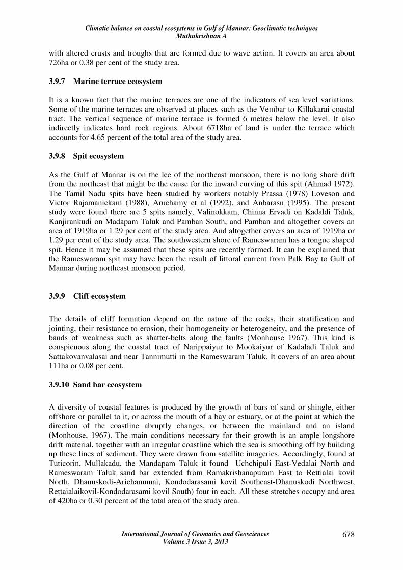
with altered crusts and troughs that are formed due to wave action. It covers an area about
726ha or 0.38 per cent of the study area.
3.9.7 Marine terrace ecosystem
It is a known fact that the marine terraces are one of the indicators of sea level variations.
Some of the marine terraces are observed at places such as the Vembar to Killakarai coastal
tract. The vertical sequence of marine terrace is formed 6 metres below the level. It also
indirectly indicates hard rock regions. About 6718ha of land is under the terrace which
accounts for 4.65 percent of the total area of the study area.
3.9.8 Spit ecosystem
As the Gulf of Mannar is on the lee of the northeast monsoon, there is no long shore drift
from the northeast that might be the cause for the inward curving of this spit (Ahmad 1972).
The Tamil Nadu spits have been studied by workers notably Prassa (1978) Loveson and
Victor Rajamanickam (1988), Aruchamy et al (1992), and Anbarasu (1995). The present
study were found there are 5 spits namely, Valinokkam, Chinna Ervadi on Kadaldi Taluk,
Kanjirankudi on Madapam Taluk and Pamban South, and Pamban and altogether covers an
area of 1919ha or 1.29 per cent of the study area. And altogether covers an area of 1919ha or
1.29 per cent of the study area. The southwestern shore of Rameswaram has a tongue shaped
spit. Hence it may be assumed that these spits are recently formed. It can be explained that
the Rameswaram spit may have been the result of littoral current from Palk Bay to Gulf of
Mannar during northeast monsoon period.
3.9.9 Cliff ecosystem
The details of cliff formation depend on the nature of the rocks, their stratification and
jointing, their resistance to erosion, their homogeneity or heterogeneity, and the presence of
bands of weakness such as shatter-belts along the faults (Monhouse 1967). This kind is
conspicuous along the coastal tract of Narippaiyur to Mookaiyur of Kadaladi Taluk and
Sattakovanvalasai and near Tannimutti in the Rameswaram Taluk. It covers of an area about
111ha or 0.08 per cent.
3.9.10 Sand bar ecosystem
A diversity of coastal features is produced by the growth of bars of sand or shingle, either
offshore or parallel to it, or across the mouth of a bay or estuary, or at the point at which the
direction of the coastline abruptly changes, or between the mainland and an island
(Monhouse, 1967). The main conditions necessary for their growth is an ample longshore
drift material, together with an irregular coastline which the sea is smoothing off by building
up these lines of sediment. They were drawn from satellite imageries. Accordingly, found at
Tuticorin, Mullakadu, the Mandapam Taluk it found Uchchipuli East-Vedalai North and
Rameswaram Taluk sand bar extended from Ramakrishanapuram East to Rettialai kovil
North, Dhanuskodi-Arichamunai, Kondodarasami kovil Southeast-Dhanuskodi Northwest,
Rettaialaikovil-Kondodarasami kovil South) four in each. All these stretches occupy and area
of 420ha or 0.30 percent of the total area of the study area.
Climatic balance on coastal ecosystems in Gulf of Mannar: Geoclimatic techniques
Muthukrishnan A
International Journal of Geomatics and Geosciences
Volume 3 Issue 3, 2013 679
3.9.11 Creek ecosystem
This type of coastal marshy land sheltered estuaries and bays and include extensive areas in
Vembar to Gundar river estuary in the Kadaladi Taluk area occupied in 1152ha or 0.77
percent of the total coastal zone. The basis for the formation of coastal mud-flats and marshes
is the deposition of fine silt by the tides in a sheltered area, helped in some cases by alluvium
brought down by rivers. Then vegetation begins to spread and help the process. The tidal
water flow between them and is more restricted in the creek. It occupies 30km length of
central part of the coastal zone.
3.9.12 Salt flat ecosystem
A salt covered the surface that is formed when a lake in an area of internal drainage in an arid
area dried up. In the present study area a major salt flat lie in and around the Tuticorin and
Valinokkam and distributed for 6902ha or 4.63per cent of the total area under salt production.
3.9.13 Mud flat ecosystem
The land which consists predominantly of mud comes in this category. It is generally found
in the water logged and low lying areas near the coast. In the study area about 440ha (0.3%)
lands are under mud flats which are extending from north of Karampallam Odai and upto
south of Kallar odai and the Vaigai estuary.
3.9.14 Tidal flat/inlet ecosystem
Tidal flats are wide expanse of fine grained soft mud along the shore. They generally, consist
of deposits of clay silt, ooze etc (King 1972). They are further classified into high tide or
supra tidal flats, inter tidal slopes and sub tidal zones. High tide flats are more or less flat and
near high water line. Deposition is provided by the very highest tides. Intertidal slopes are the
area of instability and it’s affected by daily tides. The sub tidal zone is normally exposed
during very low tides. In the study area it found in Valinokkam and head of the Rameswaram
Island. It covers an area about 1793ha or 1.21 per cent.
3.9.15 Tombolo ecosystem
A form of coastal spit comprising a ridge of shingle or sand that joins an Island to the
mainland. The tombolo has been found along the Tuticorin coast formed due the erosion,
indicating tide less seas. It covers an area about 69ha which accounts of 0.05percent of the
total area of the study area.
3.9.16 Island ecosystem
There are 21 emerged islands in the Gulf of Mannar near the coast between Tuticorin and
Dhanuskodi. These islands named in vernacular such as, Van Tivu, Koswari Tivu, Vilangu
shuli Tivu, Kariya shuli Tivu, Uppu Tanni Tivu, shalli Tivu, Nalla Tanni Tivu, Anaipari Tivu,
Plliyarmunai Tivu, Puvaransan putti Tivu, Appa Tivu, Talairi Tivu, Valai Tivu, Muli Tivu,
Musal Tivu, Manali Tivu, Manali Putti Tivu, Pumurichan Tivu, Kurusad Tivu, Kovi Tivu and
Climatic balance on coastal ecosystems in Gulf of Mannar: Geoclimatic techniques
Muthukrishnan A
International Journal of Geomatics and Geosciences
Volume 3 Issue 3, 2013 680
Shingle Tivu. These islands are sedimentary rock types of landforms. It noticed that fringing
reef along the windward side of the islands protects the islands from direct wave action.
Morphology of sandy islands is very dynamic. The morphological variations of islands are
due to natural and anthropogenic agents. The natural agents include erosion, accretion, wave,
current, sea level variation etc. The Islands erosion and accretion are caused mainly by the
action of wave and wave-induced current and longshore current along the shores of islands.
Due to the cyclonic winds are in the northeast and southwest direction is similar to that of
wave direction. The erosion has been identified along the northern side of the islands
(landward side). Evidences of submerged trees and sharp edged coasts are found along the
northern shores of these islands. This is because of the long shore current and tidal current
flows towards the south, along the northern shore of islands erode the coast and these eroded
materials are transported and deposited on seaward side of the coast. While high velocity
waves are moving towards northern shores of islands with the littoral sediments and coming
across the coral reefs, these sediments are dropped on the coral reefs; wave speed reduces and
turns into a wave-induced current. By repeated action of such processes the area between
Islands and reef edge get shallow and reefs submerged. Evidence of submerged reefs is
identified along the southeast of Kursad Tivu. These islands area vary from 1to 10 ha each.
Altogether, they occupy an area 767.31ha or 0.52 per cent.
3.9.17 Lagoon/Paleo lagoon ecosystem
These are usually a form low lying flats and are made up of alluvial deposits with
predominantly clay and silt. Two major lagoons were observed in the coastal zone. One in the
northern part called Periyataruvai near Raghunathapuram village (Ramanathapuram Taluk)
and it extended near Pudumadam (Mandapam Taluk) and another in the central part of the
study area near Valinokkam village (Kadaladi Taluk), these lagoons cover an area of 4134ha,
which accounts of 2.8per cent.
3.9.18 Coral reef ecosystem
Coral reefs tend to occur in warm, tropical, shallow waters. Coral reefs form natural offshore,
backwater and so play an important role in the coast from waves and reefs are particularly
susceptible to environmental impacts. Many problems relating to the reefs are due to the
impacts of tourism (Middleten, 1995). Coral belongs to the phylam coelenterate and classes
of Anthozoa are the major species of the study area. A total 137 such coral species are found
in this area (Tamil Nadu Forest Department, 2002). Some general characteristics of the coral
reefs are follows
1 Coral is a colony of tiny sea anemone like Polyps living together in thousands and
secreting calcareous skeleton of calcium corbonate (CaCO3), they have different colours
and shapes.
2 Coral reef provides an ideal habitat and feeding ground for various marine animals.Coral
reef protects the islands from coastal erosion.
3 Pillai (1975) has drawn attention to the large scale destruction of the coral reef at Manoli
Tivu. The study observed that most of the corals, especially the massive forms such as
Porities, Favia, Favities, Goniastrea and symphyllia were totally removed, and there were
no signs of any reef frame work, the area being now covered with sand, where once reef
existed. The reefs are well growing in all islands of the Gulf of Mannar especially,
Kurusadi Tivu, Valai Tivu, Talairi Tivu and Valai Tivu in the warm conditions to face off
Climatic balance on coastal ecosystems in Gulf of Mannar: Geoclimatic techniques
Muthukrishnan A
International Journal of Geomatics and Geosciences
Volume 3 Issue 3, 2013 681
the coast lines. The grouping Islands are Muli Tivu, Musal Tivu, and Manali Tivu, much
more concentrated in the coral reefs. The coral reefs are distributed 935ha, which
accounts for 0.63percent to the total study area under this study.
3.10 Climate
The study area falls under the hot tropical climate. The months of April to July are the hottest.
The temperature declines to some extent on the outbreak of the northeast monsoon.
3.11 Rainfall
The Rainfall characteristic of the Tuticorin Coast has been studied by using 40 (1965-2004)
years of monthly rainfall data collected from 7 rain gauge stations namely, Mandapam,
Pamban, Vilathikulam, Mudukulathur, Balamorekulam, Ottapidaram and Tuticorin, located
in and around the study area. Accordingly, the spatial distributions of the mean annual,
seasonal and monthly rainfall of the study area are dealt in the following paragraphs:
3.11.1 Mean annual rainfall
The long term mean annual rainfall of the study area is 691.6mm (Table.2). It is less 60 per
cent and while compared with of the state averages mean annual rainfall of 983.3mm.
However, the study area is characterised by significant variations in the quantum of mean
annual rainfall.
Figure 3: Mean annual rainfall
It is observed that the mean annual rainfall varies from spatially form 541.8mm (Tuticorin) to
825.6mm (Pamban) in the study area. Based on the mean annual rainfall amounts, the study
area has been divided into: zones of high rainfall (>775mm); moderate (700-775mm); normal
(625-700mm); low (550-625mm) and very low (<550mm) (Figure 2.7). The high rainfall
zone covers the areas of the Rameswaram Island and most of the villages of the
Climatic balance on coastal ecosystems in Gulf of Mannar: Geoclimatic techniques
Muthukrishnan A
International Journal of Geomatics and Geosciences
Volume 3 Issue 3, 2013 682
Ramanathapuram Taluk that fall within the study area. It extends all along the coast upto the
area just west of Kottagudi Ar. The zone with moderate rainfall lies further the west and
southwest, extending upto the south west of Pal Ar and Valinokkam. Followed by the normal
rainfall zone (625-700mm) lies further south west, extending upto the area just east of
Vembar. Most of the villages of the Kadaladi Taluk fall under the normal rainfall zone.
Further towards south, all along the coast, the low rainfall zone occurs, which extends in an
arcuate shape upto the area just north of Tuticorin. The villages which comes under
Ottapidaram and Villathikulam taluks of Tuticorin District are covers this low rainfall zone.
Further south, the areas of very low rainfall occurs and most of the villages belong to study
area that lie in Tuticorin Taluk fall within this zone. In general, the mean annual rainfall
receives maximum in the northeastern part of the study area (in Rameswaram Island) and it
gradually decreases all along the coast towards the west (Figure 3) and southwest.
3.12 Winter rainfall
Table 2: Tuticorin coast: Long term mean monthly (1965-2003) rainfall ( in mm)
Rainfall during winter season is relatively meager (46.9 mm) and is very less among all
seasons. The season contributes on an average of only 6.7 per cent of the annual rainfall.
Among the rainfall stations of the study area, the winter rainfall varies from 29.7mm in
Villathikulam to 63.4mm in Pamban. Further, the rainfall is relatively high in the
Rameswaram Island (Figure 4) which records 60mm rainfall. Moderate rainfall is ranging
from 50mm to 60mm occurs in the areas of Ramanathapuram Taluk. The normal rainfall
which ranges between 40mm and 50mm is found in the areas of Kadaladi Taluk and along
the narrow coastal stretch, extending upto the southern margin of the study area. Most part of
the area that falls within the Ottapidaram Taluk and western part of Villathikulam Taluk
receives low winter rainfall. Thus it is evident that the winter season rainfall (Fig.4) in the
Climatic balance on coastal ecosystems in Gulf of Mannar: Geoclimatic techniques
Muthukrishnan A
International Journal of Geomatics and Geosciences
Volume 3 Issue 3, 2013 683
study area gradually decreases towards the south along the coast and the west of the southern
portion of the study area.
Figure 4: Winter Rainfall of Tuticorin coast
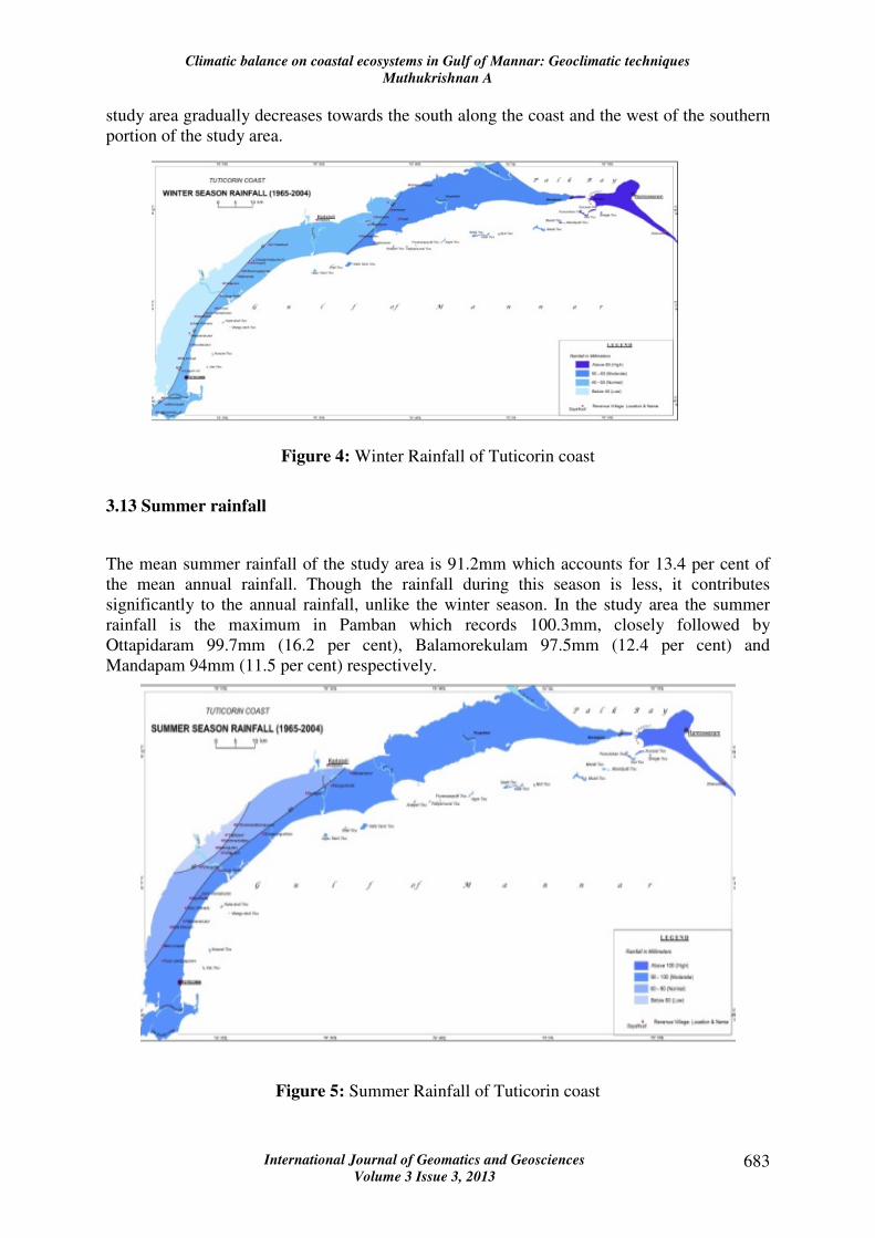
3.13 Summer rainfall
The mean summer rainfall of the study area is 91.2mm which accounts for 13.4 per cent of
the mean annual rainfall. Though the rainfall during this season is less, it contributes
significantly to the annual rainfall, unlike the winter season. In the study area the summer
rainfall is the maximum in Pamban which records 100.3mm, closely followed by
Ottapidaram 99.7mm (16.2 per cent), Balamorekulam 97.5mm (12.4 per cent) and
Mandapam 94mm (11.5 per cent) respectively.
Figure 5: Summer Rainfall of Tuticorin coast
Climatic balance on coastal ecosystems in Gulf of Mannar: Geoclimatic techniques
Muthukrishnan A
International Journal of Geomatics and Geosciences
Volume 3 Issue 3, 2013 684
The summer rainfall (Figure 5) is very less at Villathikulam which records 78mm. The
rainfall during this season is relatively high (>100mm) in the entire Rameswaram island
whereas is moderate (90-100mm) in the mainland, the entire coastal stretch except the
western portion of the southern part of the study area. This zone includes the entire area of
Tuticorin Taluk. Areas with normal rainfall of 80-90mm during this season are confined to
the western part of Ottapidaram and Villathikulam taluks. The areas of the low rainfall of
below 80mm during this period, is restricted to a small portion on the western part of
Villathikulam Taluk. In general, the eastern parts of the study area receive relatively more
rainfall and it gradually decreases towards the western portion in the southern part of the
study area. It is very low, compared with the State mean summer rainfall (132.4mm or 13 per
cent).
3.15 Southwest rainfall
During this season, the study area receives only 75.6mm of rainfall which is less than the
rainfall of the summer season. In several parts of the State, though the southwest monsoon is
the predominant rainy season, its contribution to the mean annual rainfall is very less
(11.2mm) for the study area.
Figure 6: Southwest Rainfall of Tuticorin coast
It is below the State average of 393.9mm (40 per cent) rainfall. Among the rain gauge
stations of the study area, the amount of rainfall during the season varies considerably (Figure
6). It ranges from 29.5mm in Tuticorin to 144.1mm in for Kadaladi. The rainfall during the
winter and summer seasons is relatively higher than the southwest monsoon in the western,
interior parts, especially in the western parts of Kadaladi and Villathikulam Taluks.
3.16 Northeast rainfall
The rainfall of the northeast monsoon season is 477.9mm, much higher than even the total
rainfall of the other three seasons and hence, it is the predominant and the most important
Climatic balance on coastal ecosystems in Gulf of Mannar: Geoclimatic techniques
Muthukrishnan A
International Journal of Geomatics and Geosciences
Volume 3 Issue 3, 2013 685
rainy season of the study area. This season contributes about 68.6 per cent of the total annual
rainfall which is above the State average northeast monsoon rainfall of 41 per cent
(404.7mm). Among the rain gauge stations, the distribution of the rainfall varies from
368.6mm in Villathikulam to 605.2mm in Pamban. However, the percentages of the season’s
rainfall to the annual rainfall give a different picture; the percentage of rainfall during this
season ranges from 59.7 per cent for Kadaladi to 74.1 per cent for Mandapam. In general, the
rainfall gradually decreases from the northeast towards the west, south west and southern
parts of the study area (Fig.7). A trend is much similar to the mean annual rainfall and hence
the northeast monsoon season is important for all agricultural activities. As far as the spatial
distribution of northeast monsoon rainfall is concerned the Rameswaram Island and a small
pocket in the mainland near Mandapam is relatively high rainfall zone which recorded
600mm of rainfall. This is followed by the moderate rainfall of 500-600mm zone, which
includes the entire part of the study area under Ramanathapuram Taluk, and it stretches upto
Valinokkam. The mid portion of the study area adjacent to the Gundar River falls under the
normal rainfall zone and it receives 400-500mm of rainfall. In rest of the areas of the west
and further towards south, the rainfall during this season is relatively less than 400mm.
Figure 7: Northeast Rainfall of Tuticorin coast
3.17 Temperature
The study areas mean minimum temperature various from 18.0o C in January to 26.5°C in
June, and mean maximum temperature varies from 38°C in May to 30.5°C in December. The
relative humidity is high at 79% on an average and it ranges between 80% and 90% in coastal
area owing to the coastal nature.
3.18 Coastal zones and climate change
Climatic balance on coastal ecosystems in Gulf of Mannar: Geoclimatic techniques
Muthukrishnan A
International Journal of Geomatics and Geosciences
Volume 3 Issue 3, 2013 686
The impacts on coastal zones of sea-level rise and climate change include inundation, riverine
flooding, saline intrusion, erosion, and wave damage. The impacts of changes in weather
conditions (winds, waves, storms, and storm surge) may be comparable to those of sea-level
rise alone.
4. Climate modeling
Climate modeling and climate change scenarios for the Tuticorin coast are relatively well
developed. For India, the recently revised (1996) Commonwealth Scientific and Industrial
Research Organization (CSIRO) scenarios for 2030 indicate temperature increases of 0.3-
1.4°C and rainfall changes of up to 10% in magnitude (decreases in winter, increases or
decreases in summer, and overall a tendency for decreases). The projected changes for 2070
are about twice those of the 2030 changes. Increases in the intensity of heavy rainfall events
are indicated. For the study area, the temperature increases are expected to be similar to those
for whole India, but the recent revision indicates the possibility of an increase in westerly
winds (unlike the decreases of previous scenarios)-and hence precipitation increases in the
west and precipitation decreases in the east. The changes in scenarios serve to caution against
over interpretation of impact studies based on any single scenario.
4.1 Coastal zone and climate change
Beaches, estuaries and coastal wetlands, and reefs-including the Great Barrier Reef-have
adapted naturally to past changes in climate and sea level. However, in the future they are
likely to face faster rates of change, and in many cases landward migration will be blocked by
human land uses and infrastructure. Impacts will be complex, both physically and
socioeconomically, and will vary greatly from place to place. There is potential for
considerable damage to the region's low-lying coastal settlements and infrastructure where
populations, tourism, and capital investment are large and growing. Some parts of peninsular
Indian coastline, including a number of coastal cities and indigenous communities in low-
lying coastal settlements and islands, are highly vulnerable. Adaptation options include
integrated coastal zone management; redesign, rebuilding, or relocation of capital assets;
protection of beaches and dunes; development zone control; and retreat plans.
4.2 Impacts
Impacts will vary widely from district to district, crop to crop, and decade to decade. Grain
crops may gain in the first few decades because of the immediate beneficial effect of higher
CO2, but that advantage may be eroded as the delayed rise in temperature becomes greater
and reduces the grain-filling period. Some crops are near their maximum temperature
tolerance and are likely to suffer increasingly as the temperature increases. The possibility of
overall decreased rainfall in the study area would negatively affect rangeland pastoralism and
irrigated agriculture (which is a major source of production). Any changes in global
production, and hence international food commodity prices, would have major economic
impacts. Farming in the region is well adapted to dealing with variability and change through
a variety of natural and market factors-for example, by means of plant breeding,
diversification, seasonal climate prediction, and so forth. Such techniques are likely to be
sufficient to adapt to climate change over the next few decades; in some cases, these
Climatic balance on coastal ecosystems in Gulf of Mannar: Geoclimatic techniques
Muthukrishnan A
International Journal of Geomatics and Geosciences
Volume 3 Issue 3, 2013 687
techniques may facilitate expanded production. As the time horizon extends, however, the
changing climate is likely to become less favorable to agricultural production in fluvial origin
lands of Tuticorin coastal zone, leading to a long-term increase in vulnerability.
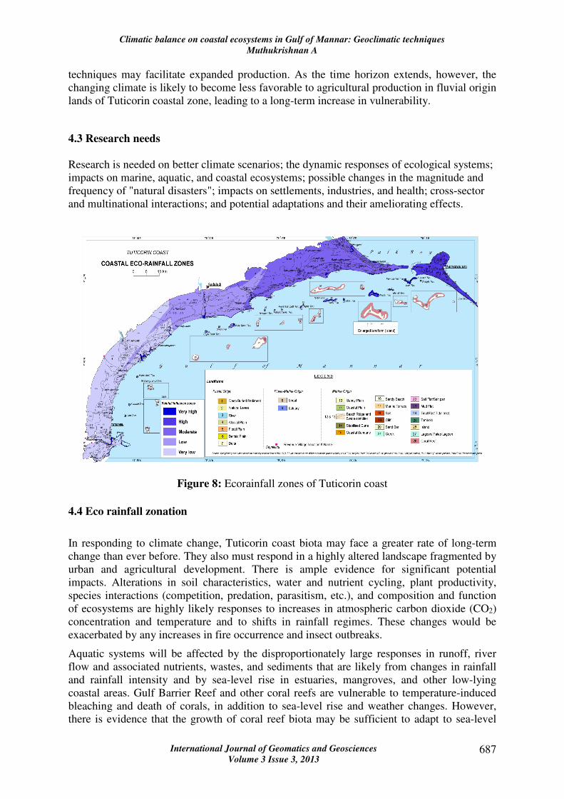
4.3 Research needs
Research is needed on better climate scenarios; the dynamic responses of ecological systems;
impacts on marine, aquatic, and coastal ecosystems; possible changes in the magnitude and
frequency of "natural disasters"; impacts on settlements, industries, and health; cross-sector
and multinational interactions; and potential adaptations and their ameliorating effects.
Figure 8: Ecorainfall zones of Tuticorin coast
4.4 Eco rainfall zonation
In responding to climate change, Tuticorin coast biota may face a greater rate of long-term
change than ever before. They also must respond in a highly altered landscape fragmented by
urban and agricultural development. There is ample evidence for significant potential
impacts. Alterations in soil characteristics, water and nutrient cycling, plant productivity,
species interactions (competition, predation, parasitism, etc.), and composition and function
of ecosystems are highly likely responses to increases in atmospheric carbon dioxide (CO2)
concentration and temperature and to shifts in rainfall regimes. These changes would be
exacerbated by any increases in fire occurrence and insect outbreaks.
Aquatic systems will be affected by the disproportionately large responses in runoff, river
flow and associated nutrients, wastes, and sediments that are likely from changes in rainfall
and rainfall intensity and by sea-level rise in estuaries, mangroves, and other low-lying
coastal areas. Gulf Barrier Reef and other coral reefs are vulnerable to temperature-induced
bleaching and death of corals, in addition to sea-level rise and weather changes. However,
there is evidence that the growth of coral reef biota may be sufficient to adapt to sea-level
Climatic balance on coastal ecosystems in Gulf of Mannar: Geoclimatic techniques
Muthukrishnan A
International Journal of Geomatics and Geosciences
Volume 3 Issue 3, 2013 688
rise. Our knowledge of climate change impacts on aquatic and marine ecosystems is
relatively limited.
4.4.1 Inferences of eco rainfall
In responding to periodical rainfall analysed, Tuticorin coast ecosystems highly inter played
rainfall influenced in various ecosystems. Particularly, the marine ecosystems such as
Table 3: Tuticorin Coastal Zone: Coastal Ecosystem and their characteristics
(Lower rating influences high)
1. Very high influenced zone: 16 ecosystems (Sensitive by nature) such as coral reef,
coastal plain, delta, estuary, marine terrace, cliff, mud flat, river, sand bar, sandy
beach, shoal, spit, stabilised dune, creek, tidal flat, island
2. High influenced zone (MPA) -8 ecosystems coastal sand dune, island, lagoon, sandy
plain, spit, stabilsed dune and tidal flat in under marine protected areas.
Climatic balance on coastal ecosystems in Gulf of Mannar: Geoclimatic techniques
Muthukrishnan A
International Journal of Geomatics and Geosciences
Volume 3 Issue 3, 2013 689
3. Moderate influenced zone (Need for conservation) 11 ecosystems such as alluvial
plain, island, coastal sand dune, delta, deltaic plain, estuary, flood plain, lagoon, mud
flat, natural levee
4. Low influenced zone (Near to sustain) – 6 ecosystems such as river, salt flat, shoal,
spit, stabilized dune, swale and ridges
5. Very low influenced zone: (sustain in nature) -10 ecosystems such as alluvial plain,
deep buried pediment, delta, deltaic plain, flood plain, river, salt flat, sandy plain,
stabilized dune and swale and rides
A greater rate of influence by marine origin ecosystems it various magnitudes of rainfall.
They also must respond in a highly altered landscape fragmented by urban and agricultural
development. There is ample evidence for significant potential impacts. Alterations in soil
characteristics, water and nutrient cycling, plant productivity, species interactions
(competition, predation, parasitism, etc.), and composition and function of ecosystems are
highly likely responses to increases in atmospheric carbon dioxide (CO2) concentration and
temperature and to shifts in rainfall regimes. These changes would be exacerbated by any
increases in fire occurrence and insect outbreaks. Aquatic systems will be affected by the
disproportionately large responses in runoff, riverflow and associated nutrients, wastes, and
sediments that are likely from changes in rainfall and rainfall intensity and by sea-level rise in
estuaries, mangroves, and other low-lying coastal areas. Gulf Barrier Reef and other coral
reefs are vulnerable to temperature-induced bleaching and death of corals, in addition to sea-
level rise and weather changes. However, there is evidence that the growth of coral reef biota
may be sufficient to adapt to sea-level rise. Our knowledge of climate change impacts on
aquatic and marine ecosystems is relatively limited. Tuticorin coast relatively low latitude in
North makes it particularly vulnerable through impacts on its scarce water resources and on
crops presently growing near or above their optimum temperatures, whereas fluvial origin
ecosystem may gain some benefit from the ready availability of suitable crops and the likely
increase in agricultural production. However, there is a wide range of situations in which
vulnerability is thought to be moderate to high-particularly in ecosystems, hydrology, coastal
zones, settlements and industry, and health.
5. References
1. Alaguraja.P, Rama.K, Muthuveerran.P, Manivel.M, (2009), Remote Sensing and GIS
for Coastal Land Use and Environmental Changes in pichavaran, Tamil, India,
Proceeding of the International conference on disaster management and mitigation -
2009, Inter Publication, Coimbatore, pp 271-282.
2. Alaguraja. P Manivel.M, Nagarathinam S.R Sakthivel. R and Yuvaraj D, (2010),
Rainfall Distribution Study in Coimbatore District Using GIS, Books Name Recent
Trends in Water Research Remote Sensing and General Perspectives, I.K
International Publishing House Pvt. Ltd. New Delhi - pp 92-115.
3. Aruchamy, S, Sasikala, S, Saravanakumar, P, and Jaganathan, R., (1992),
Morphology and Evolution of Modern Vaigai Delta: A Remote Sensing Study,
Journal of the Deccan Geographical Society, 20(2), pp 49-62.
4. Bahuguna, A and S. Nayak, (1994), Coral reef Mapping of Tamil Nadu using satellite
data, SAC (ISRO), Ahmedabad, India.
Climatic balance on coastal ecosystems in Gulf of Mannar: Geoclimatic techniques
Muthukrishnan A
International Journal of Geomatics and Geosciences
Volume 3 Issue 3, 2013 690
5. Bahuguna, A. and Nayak, S. (1998), Coral reefs of Indian Coast. Scientific Note,
Space Applications Centre, Ahmedabad. SAC/RSA/RSAG/DOD-COS/SN/16/98, 56
p.
6. Barusseau, Paul, (1997), Methodological guide to integrated coastal management
(Intergovernmental Oceanographic Commission manuals and guides, 36 Paris:
UNESCO, pp 47.
7. Bird, E. C. F., (1985), Coastline Changes—A Global Review. Chichester, England:
John Wiley-Interscience, 219 pp. Bocamazo, L. 1991. Sea Bright to Manasquan, New
Jersey Beach erosion control projects. Shore and Beach 59(3), pp 37-42.
8. Bird, E.C.F, (1984), Coasts: An Introduction to Coastal Geomorphology, 3rd edition,
Basic Blackwell Publishers’ Ltd. (U.K.), pp 81-87 and 190-197.
9. DOD and SAC, (1997), Coral reef maps of India, Department of Ocean Development
and Space Application Centre, Ahmedabad, India.
10. Dwivedi, R. M, (2002), Potential of onboard IRS P4 (OCM) for exploration of
scombroids in the Indian seas. In Management of Scombroid Fishery, CMFRI, Kochi,
pp. 82-89.
11. Ishappa Muniyappa Rathod, Aruchamy.S, (2010), Spatial Analysis of Rainfall
Variation in Coimbatore District Tamil Nadu using GIS International Journal of
Geomatics and Geosciences, 1(2), pp 106-118.
12. Ishappa Muniyappa Rathod. Aruchamy S (2010), Rainfall Trends and Pattern of
Kongu Upland, Tamil Nadu, India using GIS Techniques(2010) International Journal
of Environmental Sciences, 1(2), pp 109-122.
13. Krishnamurthy, K. (1987), The Gulf of Mannar Biosphere Reserve: Project
document-5, Ministry of Environment and Forests, Government of India.
14. Krishnamurthy, K. (1987), The Gulf of Mannar Biosphere Reserve: Project
document-5, Ministry of Environment and Forests, Government of India.
15. Kumaraguru, A.K. (1997), Project title: Ecology of ornamental fishes of export value
in the gulf of mannar, Project report for the period ending 31-1-97, School of energy,
environment and natural resources, Madurai Kamaraj University, Madurai, sponsored
by Department of ocean development, GOI.
16. Natarajan, R., Dwivedi, S. N., and Ramachandran, S., (1991), Coastal zone
management in Tamil Nadu State, India, in Natarajan, R., and et.al, Coastal Zone
Management in Tamil Nadu, India, pp 35-89.
17. Nayak, S. (2000) Critical issues in coastal zone management and role of remote
sensing. In Subtle Issues in Coastal Management, Indian Institute of Remote Sensing,
Dehradun, pp 77-98.
18. Rajamanickam, G. V, (1990), Sea level variation its impact on coastal environment,
Tamil University, Thanjavur, pp 443.
Climatic balance on coastal ecosystems in Gulf of Mannar: Geoclimatic techniques
Muthukrishnan A
International Journal of Geomatics and Geosciences
Volume 3 Issue 3, 2013 691
19. Senthilvelan.A, Ganesh.A, Banukumar.K, (2012), Markov Chain Model for
probability of weekly rainfall in Orathanadu Taluk, Thanjavur District, Tamil Nadu,
International Journal of Geomatics and Geosciences, 3(1), pp 191-203.