SYSTEM IMPLEMENTATION OF COASTAL INUNDATION FORECASTING DEMONSTRATION PROJECT-INDONESIA ( CIFDP-I) A.E Sakya, Nurhayati, N.F Riama, A. Ramdani The Agency for Meteorology Climatology and Geophysics, Indonesia (BMKG) WMO 14th International Workshop on Wave Hindcasting & Forecasting , Key West, Florida November 11, 2015
Transcript
SYSTEM IMPLEMENTATION OF COASTAL INUNDATION FORECASTING
DEMONSTRATION PROJECT-INDONESIA ( CIFDP-I)
A.E Sakya, Nurhayati, N.F Riama, A. Ramdani The Agency for Meteorology Climatology and Geophysics,
Indonesia (BMKG)
WMO
14th International Workshop on Wave Hindcasting & Forecasting , Key West, Florida
November 11, 2015
Issues and Need for Improved Coastal Flood Forecasting & Warnings
∗ Indonesia as archipelagic countries is very prone to coastal hazard ∗ Shallow coastal flooding by extreme wave events and tropical cyclones ∗ Persisting threat of Tsunami ∗ Increased risk of coastal inundation due to sea level rise + land
subsidence.
WMO
Big swell damage Western coast of Sumatera, Padang (18 May 2007)
WMO
Simulation on17-19 Mei 2007, Big swell damage Western coast of Sumatera and Southern coast of Java generated by Tropical Cyclone in Cape of Hope (Southern of Africa ) WMO
CIFDP-Indonesia
“To provide the highest quality forecasting and warnings on coastal inundation to the coastal communities of Indonesia”
∗ to be operated by a responsible national agency (BMKG) ∗ Based on clearly identified user requirements ∗ astronomical tides, waves, riverine flooding, rainfall and sea surface
elevation anomalies in various temporal/spatial scales; ∗ The national partnership
WMO
Timeline
October 2014 Phase 1 Review Phase 2 Kickoff
Phase 0: Project preparation Phase 1:
Information gathering – Project Adaptation
Phase 2: System
Implementation Phase 4 : Live Running &
Evaluation
Phase 3: Pre-operational testing
2013 2014
2015
2017 3-5 Dec.2013 National Stakeholders Workshop 2015 / 2016
Simulated Multi-agency exercises Technical capacity building
2017 Evaluation Workshop with Media partners & users
2016
WMO
∗ CIFDP-Indonesia will be conducted in Jakarta and Semarang ∗ Identification causes of coastal inundation in Jakarta and Semarang. The major causes : High tide + high waves ( wind sea) Swell from South China Sea Riverine Flooding associated with heavy rainfall The land subsidence also an aspect that must be considered
∗ The specific CIFDP-I forecasting systems is resolved two aspect : The increase of Sea level height due to high tide and high waves; The increase of River level height due to heavy rainfall.
CIFDP-Indonesia WMO
Issues and Need for Improved Coastal Flood Forecasting & Warnings
JAKARTA
SEMARANG
WMO
∗ In order to design the CIFDP-I System, it must considered the technical elements, these includes:
- Observation Data - Tidal Prediction - Wind Forcing, - Wave Model - Hydrodynamic model, -River Model - Inundation Model -Bathymetry & DEM - Field Survey Data - Infrastructure : computing capacity - Technical assitance and Training
Current Capability – River Flood Model ; Inundation Model
J-FEWS Product
WMO
The Progress of CIFDP –I
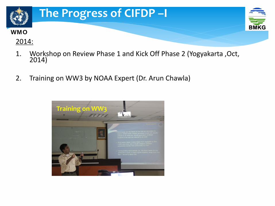
2014: 1. Workshop on Review Phase 1 and Kick Off Phase 2 (Yogyakarta ,Oct,
2014) 2. Training on WW3 by NOAA Expert (Dr. Arun Chawla)
Training on WW3
WMO
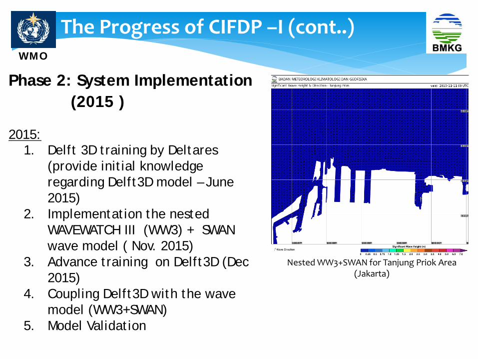
Phase 2: System Implementation (2015 ) 2015:
1. Delft 3D training by Deltares (provide initial knowledge regarding Delft3D model – June 2015)
2. Implementation the nested WAVEWATCH III (WW3) + SWAN wave model ( Nov. 2015)
3. Advance training on Delft3D (Dec 2015)
4. Coupling Delft3D with the wave model (WW3+SWAN)
5. Model Validation
The Progress of CIFDP –I (cont..)
Nested WW3+SWAN for Tanjung Priok Area (Jakarta)
WMO
Nested WW3-SWAN and Delft3D
GFS 0.5 0
Wind Forcing
WRF 10 Km.
WRF 3 Km.
Java
Indonesia
Domain Global
Models
WW3-Global
WW3-Indoneisa
WW3-Indo Hires
SWAN – Northern Java Sea
NCEP-FNL 0.5 0
SWAN
Jakarta & Semarang
Waters
Delf3D
FEWS
WMO
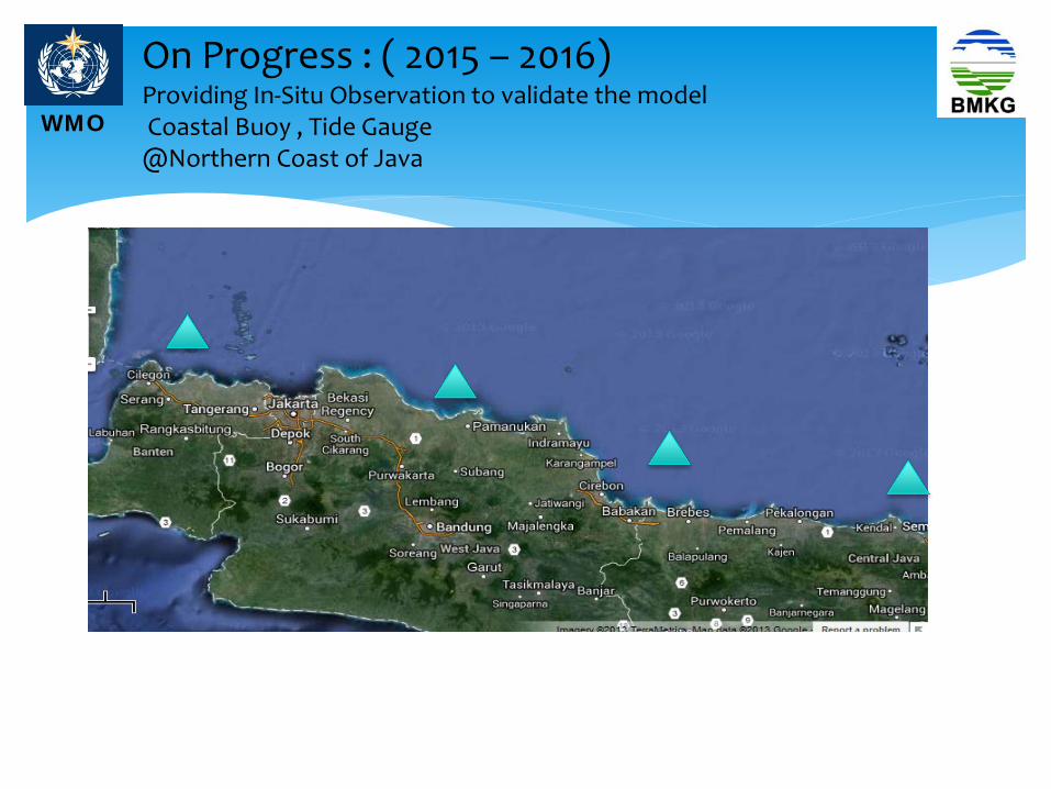
On Progress : ( 2015 – 2016) Providing In-Situ Observation to validate the model Coastal Buoy , Tide Gauge @Northern Coast of Java
WMO
The Way Forward
Continuing Phase 2: System Implementation 2016: 1. Coupling Delft3D with Indundation model (Sobek Model) 2. Integrating Delft3D with FEWS System 3. Pre-Operational testing 4. Model Validation
5. Workshop (Simulated Multi-agency Exercises and Technical Training for users)
Phase 3 : Testing and Operational (2017) 2017: 1. Developing the operational dan disemination system for CIFDP
2. Live running & Evaluation
WMO
Acknowledgment: ∗ WMO: Boram Lee, Edgard Cabrera, A. Oskarsson,
Long Jiang (WMO Secretariat). ∗ PSG : Val Swail, Don Resio, Kevin Horsburgh, Deepak