Intergovernmental Oceanographic Commission Reports of Meetings of Experts and Equivalent Bodies Coastal Ocean Observations Panel First Session San José, Costa Rica 15-17 November, 2000 GOOS Report No. 95 UNESCO
Transcript
Intergovernmental Oceanographic Commission Reports of Meetings of Experts and Equivalent Bodies
Coastal Ocean Observations Panel First Session San José, Costa Rica 15-17 November, 2000 GOOS Report No. 95 UNESCO
Intergovernmental Oceanographic Commission Reports of Meetings of Experts and Equivalent Bodies
Coastal Ocean Observations Panel First Session San José, Costa Rica 15-17 November, 2000
IOC-WMO-UNEP-ICSU/COOP I/3 Paris, November 2000
English only Abstract This report presents the results of the first session of the Coastal Ocean Observations Panel (COOP). The purpose of the meeting was to agree on a strategy to formulate an integrated design plan based on the designs drafted for the Coastal GOOS (C-GOOS), Health of the Oceans (HOTO) and Living Marine Resources (LMR) modules. The system is to be designed to detect and predict the effects of natural and human sources of variability on coastal marine services, ecosystem and human health, and living marine resources. The design is to be completed at COOP II and will provide the blue print for developing an implementation plan for the coastal component of GOOS. The panel agreed on an outline for the new, integrated design plan, discussed content and established an intersession process for completing a draft plan to be discussed, evaluated and completed at COOP-II (June, 2001).
TABLE OF CONTENTS SUMMARY 1. OPENING................................................................................................................... 1
1.1 WELCOMING REMARKS ............................................................................... 1 1.2 TERMS OF REFERENCE FOR COOP............................................................. 1
2. SUMMARY OF DESIGN PLANS ............................................................................ 3 2.1 THE HOTO DESIGN PLAN.............................................................................. 3 2.2 THE LMR DESIGN PLAN................................................................................ 5 2.3 THE C-GOOS DESIGN PLAN.......................................................................... 7
3. OCEAN OBSERVATIONS PANEL FOR CLIMATE............................................ 12 4. RECOMMENDATIONS FROM THE USER’S FORUM....................................... 16 5. BREAK-OUT GROUP WORK................................................................................ 17 6. TOWARDS THE COOP INTEGRATED STRATEGIC DESIGN PLAN.............. 17 6. VENUE FOR COOP-II............................................................................................. 21 7. CLOSURE ................................................................................................................ 21 ANNEXES I. AGENDA II. LIST OF PARTICIPANTS III. REPORTS FROM THE BREAK-OUT WORKING GROUPS ON THE HOTO,
Tom Malone, Co-chairman of the Coastal Ocean Observations Panel (COOP) opened the meeting and welcomed everybody to this first session of the COOP. He also acknowledged the sponsors of GOOS - The World Meteorological Organisation (WMO), the United Nations Environment Programme (UNEP) and the International Council for Science (ICSU) and thanked the Government of Holland, the US National Oceanic and Atmospheric Administration (NOAA), the US GOOS office at Texas A&M University, and the US C-GOOS office at the Horn Point Laboratory of UMCES for providing financial support for this meeting. Tom Malone also thanked Professor Murillo and his staff and the Centro de Investigación en Ciecias del Mar y Limnologia (CIMAR) of the University of Costa Rica for hosting the meeting.
Professor Manuel Murillo, welcomed the meeting participants to CIMAR. In his welcoming remarks he stressed that the successful development of the Global Ocean Observing System (GOOS) as a working network requires flexibility and adaptability to changing needs or demands from the user community as well as to rapidly changing technologies and constraints in its implementation. GOOS will not be implemented as a single system but as a coordinated array of components. Consolidating these components will depend on the existence of specific plans, funding and timely response from the participating institutions and organizations. Among the GOOS design modules, the coastal module is of high priority to most coastal nations. The design of an observing system for all aspects of the coastal oceans represents a serious challenge which will require the full support and contribution of data from coastal nations, as well as taking into account the need of a wide range of users. In order to successfully develop the coastal module of GOOS it would be necessary to make extraordinary efforts for the integration of physical, chemical, biological and geological observations, as well as the consideration of the socio-economic requirements of the participating member states and specifically of the coastal communities. Finally professor Murillo expressed his wishes for a successful meeting.
Following Professor Murillo’s remarks Tom Malone asked the panel members and the observers to introduce themselves. Tom Malone briefly introduced the panel members that were not able to attend the meeting (Eric Dewailly, Johannes Guddal, Jeffrey L. Hyland, Kwame Koranteng, Nadia Pinardi, and Rudolph Wu). 1.2 SCOPE AND TERMS OF REFERENCE FOR COOP Worth Nowlin, chairman of the GOOS Steering Committee (GSC) provided a brief overview of the GOOS design modules, the formation of COOP and its scope and terms of reference.
The design of GOOS was initially carried in five modules under the GSC: Coastal
(C-GOOS); Living Marine Resources (LMR); Health of the Ocean (HOTO); Climate (Ocean Observing Panel for Climate: OOPC) and ad hoc Marine Meteorological and
IOC-WMO-UNEP-ICSU/COOP-I/3 page 2
Oceanographic Services (this ad hoc panel was terminated in 1998 at the GSC-I meeting as it was concluded that there was no need to establish a separate Services Module Panel and that the technical design panels (i.e. OOPC, HOTO, LMR and C-GOOS) should interact with their specific user communities to identify service requirements).
By the end of 2000, the initial strategic design plans for the C-GOOS, LMR and
HOTO modules will have been completed, at which time the GSC has determined that the HOTO, LMR and C-GOOS efforts will be merged to formulate integrated design and implementation plans. GOOS will then develop through two related and convergent components: (i) a basin-scale component concerned primarily with monitoring, forecasting and understanding marine surface conditions and climate variation (OOPC) and (ii) a coastal component concerned primarily with natural and anthropogenically-induced change in coastal and estuarine environments and their impacts on the ecosystems and people (Coastal Ocean Observations Panel). This approach is summarized in The GOOS 1998 prospectus (http://ioc.unesco.org/goos/Prospe98/Contents.html).
The COOP will plan and facilitate implementation of an end-to-end observing system to provide systematic data sets and products to users. Goals are to monitor, assess, and predict effects of natural variations and human activities on the marine environment and ecosystems of the coastal ocean. Principal foci are on issues of ecosystem (including human) health, living marine resources, natural hazards, and safe and efficient marine operations. It is not intended that "coastal" be limited by specific geographic boundaries. Although the emphasis will be on coastal ecosystems (e.g., estuaries, bays, sounds, fjords, open waters of the continental shelf), boundaries should be determined by the problems being addressed and the products that are to be produced. Thus, the broad area of concern extends from semi-enclosed systems in the coastal zone to the continental shelf and the deep ocean as required to provide products relevant to the issues listed above.
The focus of COOP will be on design and implementation of a sustained, integrated system. It must be designed and implemented as an end-to-end system, from measurements to the timely distribution of products. Taken into account must be user requirements, scientific and technical feasibility, and utility. This will require oversight and adjustments to the design and operation as needs and feasibility change. The primary tasks of COOP are to: A. Integrate and refine the design plans drafted by the HOTO, LMR and C-GOOS Panels to develop unified plan that is consistent with the GOOS Design Principles and addresses issues of (1) coastal marine services and natural hazards, (2) ecosystem health and its relation to human health, (3) living marine resources, and (4) related research activities.
B. Develop mechanisms for more effective and sustained involvement of user groups in the design and implementation of this component of GOOS. C. Formulate an implementation plan that is coordinated with the OOPC plan for climate services, research and marine services with due emphasis on (1) Integrated observations; (2) data and information management; (3) data assimilation and modeling for the purposes of prediction and product development; (4) capacity building (that draws on the successes of the WMO, FAO, and IOC including GIPME, HAB, GLOSS and IODE-ODINAFRICA); and (5) national, regional, and global promotion of objectives and benefits of the observing system. D. Define procedures for ongoing evaluation of system components, reliability of data streams, access to data, and applications. E. Selection of observing system elements. (1) Establish criteria and procedures for selecting observing system elements on global and regional scales (from measurements, sensors and platforms to data management, analysis and products). (2) Recommend the elements that will constitute the initial observing system and formulate procedures for developing regional and global communication networks as a mean to exchange data, knowledge, and technologies to improve understanding, predictability and applications. 2. SUMMARY OF DESIGN PLANS 2.1 THE HOTO DESIGN PLAN Tony Knap, Co-chairman of COOP and chairman of the HOTO panel provided a summary of the HOTO design plan (GOOS Report No. ; www...) The Health of the Oceans (HOTO) Module is intended to provide a basis for determining prevailing conditions and trends in the marine environment in relation to the effects of anthropogenic activities, particularly those resulting in the release of contaminants to the environment. Its primary objective is to provide information on the nature and extent of adverse effects, including increased risks, on human health, marine resources, natural change and ocean health. Data collection, biological-monitoring and biological effects assessment will be carried out on both global and regional scales using commonly agreed standards and methodologies. Areas of initial emphasis are: 1) The development of a set of reliable, relatively easily measured indices of biological and ecological stress; 2) Monitoring concentrations and trends of contaminant loading in
IOC-WMO-UNEP-ICSU/COOP-I/3 page 4
coastal zones in relation to community responses; 3) Development of methodologies for the evaluation of assimilative capacities of coastal zones for contaminant introductions; and 4) Reclamation of available data/information on contaminant levels/community responses at regional and national levels as baseline information for HOTO monitoring activities. The term “Health of the Oceans” is operationally defined for the purposes of the HOTO Module of GOOS as a reflection of the condition of the marine environment from the perspective of adverse effects caused by anthropogenic activities, in particular the mobilization of contaminants and the release of human pathogens. Such condition refers to the contemporary status of the ocean and the prognosis for improvement or deterioration in its quality. In global terms, there are a number of issues of contemporary concern in respect to the current health of the oceans. These include: climate change; endangered species; biodiversity; human health; tourism; and eutrophication. All of these issues are reflected in UNCED Agenda 21 and relate collectively to the following classes of contaminants or analytes chosen for attention within the HOTO Module: Aquatic Toxins Nutrients Artificial Radionuclides Petroleum Hydrocarbons (Oil) Dissolved Oxygen Pharmaceuticals Herbicides/Pesticides/Biocides Phytoplankton Abundance/Diversity Human Pathogens Suspended Particulate Matter Litter/Plastics Synthetic Organics/POPs Metals and Organometals Polycyclic Aromatic Hydrocarbons PAHs The measurements of contaminant loads and pathogens are not, in themselves, indicative of biological or ecological effects. Indices must be identified at different levels of biological organization from molecules and individual organisms to populations and communities of organisms. In general, biological and ecological effects occur earlier at molecular and biochemical levels of organization than at population or community levels. The Rapid Assessment of Marine Pollution (RAMP), which targets molecular and biochemical indicators, was adopted as a Pilot Project. The range of anthropogenic activities, that significantly mobilize the contaminants in the classes of concern (as listed above), was identified. These include: Aquaculture, Forestry/Logging, Coastal Development, Marine Transportation, Industrial Discharge, Sea Dumping, Agricultural Practices, Mineral Extraction Processes and Municipal and Urban Waste Discharge. There are also physical disturbances caused by these practices that have a direct effect on the marine environment and these must also being taken into account in the development of the HOTO Module. However, many of the physical disturbances have been outlined by the Coastal GOOS panel. Factors that bear on the selection of time and space scales for HOTO measurements were examined. The first category of these involves managerial considerations that reflect the requirements of customers for interpretative practical
IOC-WMO-UNEP-ICSU/COOP-I/3 page 5
products from the HOTO module. The second category includes scientific considerations relating to the scales of change in response to inputs of contaminants or habitat disturbance. The third category involves considerations relating to the scales of natural variability in the marine environment for substances that are derived from both natural and anthropogenic sources. The major data reporting requirements for the HOTO Module was evaluated. This evaluation was based on the assumption that all data, whether derived from research projects, regional monitoring activities, fisheries research or classified military activities, needs to be made readily available. Past and present data management practices need to be changed for the HOTO Module to have the required impact. GOOS will foster and exploit the development of new technology to increase the cost efficiency of marine observations and improve the users’ ability to access quality data and new technology. Various needs were identified for new technology and it was noted that these technologies must not only apply to chemical and physical measurements but also to biological ones extending, for example, to devices to improve the determination of the community structure of ecosystems as an important element of this module. A major commitment needs to be made by all countries to implement effectively GOOS. Governments must be encouraged to: (i) Make existing data available; (ii) Distribute data products; (iii) Facilitate data exchange; (iv) Develop data networks; (v) Support the collection of satellite and in situ data; (vi) Support data collection by volunteer ships and data buoys; and (vii) Encourage person-to-person networking.
Lastly, the HOTO panel identified a protocol for developing Pilot Projects for assessing ocean health and suggested a format of how a region could commence such a project. A draft paper written on HOTO implementation for Canada is a model for an approach other regions could use in designing a pilot programme (see www. ...). The Panel has also included a component of ocean and human health for the Caribbean as an example. 2.2 THE LMR DESIGN PLAN Dagoberto Arcos, co-chairman of the LMR panel, gave a summary of the LMR design plan (GOOS Report No. 94; www.)
The goal of LMR-GOOS (IOC 1998a) is to: “provide operationally useful information on changes in the state of living marine resources and ecosystems. The objectives are to obtain from various sources relevant oceanographic and climatic data, along with biological, fisheries and other information
IOC-WMO-UNEP-ICSU/COOP-I/3 page 6
on the marine ecosystems, to compile and analyse these data, to describe the varying state of the ecosystems, and to predict future states of the ecosystems, including exploited species, on useful time scales. A consequence of these efforts should be the identification and development of the more powerful and cost-effective means for monitoring marine ecosystems required to meet the LMR-GOOS goal.”
To address these needs, the LMR-GOOS Strategic Design Plan utilizes a broad, ecosystem-based approach that considers living marine resources in relation to their physical, chemical and biological environment. Recognizing the increasing heterogeneity of marine ecosystems from the open ocean toward shore, the approach is structured into three systems – open ocean, coastal ocean and inshore. The inshore system was not addressed due to its heterogeneity and complexity and the lack of specialists in inshore studies on the panel which produced the Strategic Design Plan. Open Ocean System
Because of the large vertical and horizontal scales involved, observations in the open ocean are necessarily minimal, relying on ships of opportunity, remote sensing and fishing industry statistics. In general terms, monitoring of this system could be as follows. An ocean basin would be overflown by satellites measuring sea surface height, winds, temperature, and ocean color. Surface weather would be reported by voluntary observing ships reporting to the World Meteorological Organization (WMO) network. On transects selected to cross major features of circulation or of changes in properties (e.g., ocean fronts), selected merchant and research ships would tow plankton recorders and drop expendable bathythermographs (XBTs) at appropriate intervals (e.g., hourly). Implementation of the Array for Real-time Geostrophic Oceanography (ARGO) program will add valuable information on temperature and currents in the upper ocean. In this minimal system, other ecosystem components and conditions would be observed as follows: Top predators: irregular, reported by observers on fishing and research vessels Commercial finfish: irregular, reported by fishing and research vessels Pelagic forage: irregular, reported by fishing and research vessels Benthos: not observed Zooplankton: irregular, reported by research vessels Phytoplankton: irregular, reported by research vessels Nutrient chemistry: irregular, reported by research vessels Salinity, dissolved oxygen: irregular, reported by research vessels.
A composite picture at quarterly intervals could be built on the framework provided by the satellite data and transect observations, with the irregular data inserted where applicable. This analysis, which would provide the basis for elaboration of useful products, would be made at appropriate basin-scale Regional Analysis Centers. Coastal Ocean System
IOC-WMO-UNEP-ICSU/COOP-I/3 page 7
Due to it productivity and proximity to anthropogenic influences, the coastal ocean is a primary focus of LMR-GOOS. Unlike observing systems for climate, marine pollution and ocean services, there is no ‘one-size-fits-all’ observing system that is equally valid or useful for all coastal marine ecosystems under consideration. Coastal ocean ecosystems, and the processes that drive them, are simply too variable, and the design of specific observing plans must be based on the knowledge of local scientists. Four potential regional LMR observing systems – Scotian Shelf, Gulf of Guinea, Yellow Sea/East China Sea and coastal upwelling systems – were developed as examples, as were design principles for regional LMR-GOOS programs. These are intended to be adapted and customized by local experts.
Data and information management, and the process of transforming data into useful products, comprise an essential element of the LMR-GOOS approach. LMR data products, such as forecasts of ecosystem states, will be produced on an ecosystem scale, typically involving large ocean areas. Regional Analysis Centers (RACs), which would serve to compile data and information on appropriate ecosystem scales, and to generate appropriate forecasts and other data products, should be the fundamental unit on which LMR-GOOS is developed. Existing regional marine science organizations such as ICES or PICES could host RACs, as could existing regional ecosystem observing programs.
A key linkage between the observing program and useful predictions of system dynamics is process studies and modelling. Programs such as the Global Ocean Ecosystems Dynamics (GLOBEC) will provide critical information on physical-chemical-biological processes, develop advanced observing technologies, and identify crucial variables and locations for long time series analyses of climate variability and marine ecosystem response. In turn, LMR-GOOS will provide time series data for research programs. Implementation
The first steps toward implementation of a global LMR-GOOS must be the integration of existing observing systems into a more consistent, ecosystem-based approach utilizing the regional design principles, and a significant increase in capacity to enable full participation throughout the developing world. In many areas, ongoing observing programs such as those identified as LMR components of the GOOS Initial Observing System (IOC 1998b) comprise significant components of a regional system which need only minor augmentation and linkage through a RAC. In other areas, not even rudimentary monitoring capacities exist. The challenge to LMR-GOOS is to identify existing programs and gaps, and to find resources to develop the program on a global scale. 2.3 THE C-GOOS DESIGN PLAN
Tom Malone, chairman of C-GOOS, gave a summary of the C-GOOS design plan
The coastal zone is a unique environment in that it is the only place on the globe where terrestrial, oceanic, atmospheric, and human inputs of energy and matter all converge. It also supports the greatest concentration of living resources and people on the planet. As the number of people living, working and playing in coastal ecosystems increases, the demands on these systems to provide commerce, recreation, and resources and to receive, process, and dilute the effluents of human society will increase. Likewise, the risk that natural hazards pose society also increases. Thus, it should come as no surprise that coastal ecosystems are experiencing unprecedented changes from habitat loss (tidal wetlands, sea grass beds, coral reefs), oxygen depletion, harmful algal blooms, fish kills, and declining fish stocks to beach closures, coastal erosion and flooding. The resulting conflicts between commerce, recreation, development, the utilization of natural resources, and conservation will become increasingly contentious, politically charged, and expensive.
Resolving these conflicts in an informed, timely and cost-effective fashion requires a significant increase in our ability to detect and predict the changes that are occurring coastal ecosystems. This is the purpose of the coastal component of the Global Ocean Observing System. The goal is to build on, enhance and supplement existing observing programs to develop a sustained and integrated observing system that provides the data and knowledge required to: ● manage and restore healthy coastal ecosystems and living resources; ● enable safer and more cost-effective marine operations; ● forecast and mitigate the effects of storms; ● detect and predict the effects of climate change; and ● protect public health. To address these needs, the observing system must ultimately provide information on a broad spectrum of environmental changes that reflect interactions between natural variability and human activities in a complex environmental setting. The system is intended to serve the needs of many user groups including industries (shipping, oil and gas, compliance monitoring, fishing, aquaculture, agriculture, and recreation), government agencies and ministries (management of resource and the environment, land-use and economic development plans), teaching institutions, and the community of research scientists.
This report describes the initial design for the coastal component of the Global Ocean Observing System (C-GOOS). The development of C-GOOS will take place in the context of the Integrated Global Observing Strategy through coordination and collaboration with the GOOS modules (Ocean Observations Panel for Climate, Health of the Oceans, and Living Marine Resources), the Global Climate Observing System (GCOS) and the Global Terrestrial Observing System (GTOS). The plan proposed herein is intended to be the first step in the development of an internationally accepted and supported design plan for C-GOOS. A Global System for the Coastal Environment
IOC-WMO-UNEP-ICSU/COOP-I/3 page 9
C-GOOS is primarily concerned with the coastal marine and estuarine environments of the coastal zone. These are complex environments composed of a diverse mosaic of ecosystems from intertidal beaches, rocky shores and tidal wetlands to lagoons, coral reefs, estuaries, bays, fjords, sounds and the open waters of the EEZ. Since most of the changes the observing system is intended to detect and predict (from changes in the weather and sea state to harmful algal events and oxygen depletion) are local to regional in scale, it is reasonable to ask why a global observing system for coastal ecosystems needed in the first place? A global system is needed for three reasons: (1) local changes are often related to or caused by changes occurring on larger scales in the ocean, on land or in the atmosphere (the propagation of variability from large to small scales); (2) marine ecosystems are highly undersampled and the actual scale of changes are often larger than is perceived; and (3) marine ecosystems are complex and the development of a predictive understanding of the changes occurring in them will require a comparative analysis of many systems (local changes that are globally ubiquitous). Differentiating the effects of human activities from the effects of natural processes requires knowledge of the coherence of changes that are occurring locally on global scales and comparative analysis of such changes in the context of larger scale forcings (the propagation of variability from large to small scales). Furthermore, the problem of undersampling, which severely limits our ability to detect and predict change, cannot be solved by any one nation by itself. Although many changes are local to regional in scale, their boundaries rarely, if ever, correspond to political boundaries. Consideration of larger scales and the development of appropriate technologies will require the sharing of knowledge, data, infrastructure and expertise among nations; capacity building to enable all nations to participate and benefit; and financial commitment on the part of the industrialized world. Clearly, this will require an unprecedented level of coordination and collaboration among nations with coastal interests. Design Considerations
Three general observations form the basis for the design of the observing system:
(1) most of the changes occurring in coastal ecosystems are local in scale and are globally ubiquitous; (2) physical processes structure the pelagic environment and are of fundamental importance to changes in the physical, biological and chemical characteristics of coastal ecosystems; and (3) changes in these characteristics are related through a hierarchy of interactions that can be represented by robust models of ecosystems dynamics (e.g., numerical models of physical processes and coupled physical-biological models). Thus, it is likely that there is a relatively small set of core variables that, if measured with sufficient resolution, for extended periods over large scales, will provide the data and information required to detect and predict changes in coastal ecosystems that benefit a broad spectrum of user groups.
Both detection and prediction depend on the development of an integrated and sustained observing system that provides effective linkages between measurements and data analysis for more timely access to data and delivery of environmental information. The system must be integrated to provide multi-disciplinary (physical, chemical and biological) data and information to many user groups. This is the “value-added” aspect of C-GOOS. The system must also be sustained to capture the scales of variability that
IOC-WMO-UNEP-ICSU/COOP-I/3 page 10
characterize the changes of interest and to provide continuity in the data streams and resulting data products. There are no systems that are integrated (multi-disciplinary observations servicing the needs of many user groups), sustained and global in scope.
C-GOOS will come into being by selectively enhancing, networking and supplementing existing programs. It must also be recognized at the onset that many of the measurements and models required for a comprehensive, fully integrated, multi-disciplinary observing system are not operational, that much work is needed to develop and determine those products that are most useful, and that capabilities and resources vary enormously among nations. These realities underscore the importance and need for enabling research and capacity building. In addition to becoming integrated and sustained, the observing system must achieve the following as it grows and matures: ● produce information that meets the needs of a broad spectrum of user groups; ● provide a more cost-effective means of obtaining and applying environmental
data; ● enable a constructive and timely synergy between the detection of changes and
the hypothesis-driven research required to understand and predict such changes; ● promote the development of new technologies and models required for a fully
integrated, multi-disciplinary system; and ● develop mechanisms to evaluate the functioning of the system and the value of
the information it produces, to incorporate new technologies, and to increase the diversity of user groups it serves.
Design Framework
The observing system is conceived as a global network for the measurement and analysis of a common set of key (core) variables that is regionally and locally customized (e.g., more variables, greater resolution, additional products) to address those issues that are of greatest concern to participating countries. The global network is the focus of the C-GOOS design strategy. Linking user needs to measurements to form an end-to-end, user-driven system requires a managed, two-way flow of data and information among three essential subsystems: ● the observing subsystem (detection); ● the communications network and data management subsystem (integration); and ● the modeling (prediction) and applications subsystem.
The observing subsystem is the measurement end of the system. It consists of the global infrastructure required to measure core variables and transmit data to the communications network and data management subsystem. Recommended core variables are surface winds, air pressure and temperature, precipitation, sea level, bathymetry, temperature, salinity, surface currents and waves, turbidity, sediment type, dissolved nutrients, phytoplankton pigments, and water clarity. The infrastructure must incorporate the mix of platforms, samplers, and sensors required to measure core variables with sufficient spatial and temporal resolution to capture important scales of variability in 4
IOC-WMO-UNEP-ICSU/COOP-I/3 page 11
dimensions. This will require the synthesis of data from remote sensing and in situ measurements involving six interrelated categories of observing elements: (1) coastal observing networks for the near shore (CONNS); (2) global network of coastal tide gauges (GLOSS); (3) fixed platforms, moorings and drifters; (4) ships of opportunity (SOOP) and voluntary observing ships (VOS); (5) remote sensing from satellites and aircraft; and (6) remote sensing from land-based platforms.
Data communications and management link measurements to applications. The objective is to develop a system for both real-time and delayed mode data that allows users to exploit multiple data sets from disparate sources in a timely fashion. A hierarchical system of local, national and supra-national organizations is envisioned to provide data, information, and access to users at each level. Some national and supranational organizations will be developed into synthesis centers that will provide highly processed products (e.g., assimilating data from remote and in situ sources for numerical model predictions requiring substantial computing power). The development of this component of the system should be of the highest priority.
Data assimilation and modeling are critical components of the observing system. Real-time data from remote and in situ sensors will be particularly valuable in that data telemetered from these sources can be assimilated to (1) produce more accurate estimates of the distributions of state variables, (2) develop, test and validate models, and (3) initialize and update models for improved forecasts of coastal environmental conditions and, ultimately, changes in ecosystem health and living resources. A variety of modeling approaches (statistical, empirical, theoretical) will be required. The challenge of developing a cost-effective observing system underscores the importance of the interaction between measurements and modeling. Due to the complexity of coastal ecosystems and the cost of observing them, Observation System Simulation Experiments (OSSEs) will become increasing valuable as tool for assessing the efficacy of different sampling schemes and the usefulness of measuring different variables. Building C-GOOS
Programs that are relevant to the development of C-GOOS are divided into 3 categories: (i) operational programs, (ii) pre-operational pilot projects, and (iii) enabling research. Operational programs provide products to user groups that are in demand and are made possible by sustained data streams and data management systems that guarantee data quality. Pilot projects and enabling research are organized, planned sets of activities with focused objectives, a defined schedule, and a finite life time that are expected to produce results that significantly benefit the global ocean observing system in general and C-GOOS in particular. An important function of pilot projects is to demonstrate the utility of the GOOS “end-to-end, user-driven” approach. Enabling research develops the technologies and knowledge (e.g., sensor and models) required to detect and predict changes.
It is expected that C-GOOS will develop along two tracks: (1) the building of an initial global network through the incorporation of existing operational elements that meet GOOS design requirements and (2) the implementation of pre-operational pilot
IOC-WMO-UNEP-ICSU/COOP-I/3 page 12
projects that demonstrate the utility and cost-effectiveness of the “end-to-end, user driven” approach and contribute to the development of the global network and regional enhancements. Pilot projects will also be an important vehicle for the incorporation of new scientific knowledge and technologies into the observing system (transformation from research applications to operational modes). Both pilot projects and enabling research programs will be essential to capacity building and the scientific advances required to grow the system into a fully integrated and operational observing system. In this regard, mechanisms are needed to enable the exchange of information and technologies among pilot projects so that they may learn from each others successes and failures and to insure the incorporation of GOOS design principles and the development of common techniques, models, and data processing strategies. This is particularly important for the data management subsystem if data and data products are to be exchanged in a timely fashion on regional to global scales.
The successful development of C-GOOS depends on broad-based international support and ongoing sponsorship by nations and private institutions. The annual operating cost of the World Weather Watch in 1992 was about $2 billion U.S. The annual cost of a GOOS at that time was also about $2 billion U.S., most of which was for satellites. Although a cost analysis has yet to be performed for C-GOOS, these figures provide an order of magnitude estimate of the investment that will be required to initiate the core network proposed here. Although government funding will be essential, especially for large capital-intensive components of the observing system such as satellites, funding from the private sector will be required in the long term. In these regards, the importance of National and Regional GOOS Programmes cannot be overemphasized. These programmes are vehicles for implementation. They provide an important means for facilitating the user input required to implement and enhance the core program and for institutionalizing mechanisms for sustainable funding.
Collaboration with key research programs will provide the scientific basis for continued development toward a fully integrated system. The first step is to coordinate and integrate existing efforts to insure continuity and to achieve larger scale regional and global perspectives, minimize redundancy, improve access to data, and produce timely analyses that benefit a broader spectrum of user groups. By building on existing capabilities and infrastructure, and by using a phased implementation approach, work can start immediately to achieve the vision. New technologies, past investments, evolving scientific understanding, advances in data communications and processing, and the will to address pressing societal needs combine to provide the opportunity to initiate an integrated observing system for coastal ecosystems. The major pieces missing are an internationally accepted global design; national and international commitments of assets and funds; and an unprecedented level of collaboration among nations, institutions, data providers and users. 3. OCEAN OBSERVATIONS PANEL FOR CLIMATE (OOPC) Worth Nowlin provided a summary of the work of the OOPC.
IOC-WMO-UNEP-ICSU/COOP-I/3 page 13
OOPC was formed as a "follow-up" to the Oceans Observing System Development Panel (OOSDP). It is sponsored jointly by the World Climate Research Programme (WCRP), the Global Ocean Observing System (GOOS) and the Global Climate Observing System (GCOS). The OOSDP was given the task of formulating a "conceptual design of a long-term, systematic observing system to monitor, describe, and understand the physical and biogeochemical processes that determine ocean circulation and the effects of the ocean on seasonal to decadal climate changes and to provide the observations needed for climate predictions." The OOSDP expired when it completed its comprehensive design for an Ocean Observing System for Climate. The final report "Scientific Design for the Common Module of the GOOS and the GCOS: An Ocean Observing System for Climate" was produced in 1995 (available from the US GOOS Office at Texas A & M University, USA; see also http://www-ocean.tamu.edu/OOSDP/FinalRept/t_of_c.html). The OOPC started its work in 1996 and has continued the further development of the design of the ocean observing system by: ● addressing areas not considered by the OOSDP, ● prioritizing recommended elements, ● considering alternate sampling strategies, and ● assisting in making inventories of available data and products needed for the GCOS-GOOS common module.
The design for the common module between GCOS and GOOS is based on four general goals: ● observations needed to determine necessary ocean surface fields (including sea ice) and fluxes through the surface ● observations needed for the deterministic prediction of the variability of the coupled ocean-atmosphere system on seasonal to interannual time scales and for the regular monitoring of climate variability at monthly to interannual scales ● measurements of the deep ocean essential for monitoring and understanding natural and anthropogenic ocean climate variability at long time scales with a focus mainly on monitoring, understanding, and validation of model simulation rather than model initialization and prediction ● the provision of the infrastructure and techniques, which will ensure that these data are synthesized and used efficiently.
The Terms of Reference for OOPC is available at http://ioc.unesco.org/goos/oopc_tr.htm
An action plan for implementation was published in 1999 (Global Physical Ocean Observations for GOOS/GCOS: An Action Plan for Existing Bodies and Mechanisms, GOOS Report No. 66; http://ioc.unesco.org/goos/docs/GOOS_066_act_pl.htm). This plan provides an overview of where implementation stand vis-à-vis design and what is needed.
The highest priorities for the OOPC are:
● Improved sea surface temperature and surface salinity fields ● Improved surface wind and wind stress ● Observation of ENSO monitoring and prediction ● Monitoring amplitudes and spatial patterns of long-term sea level change ● Regular monitoring of upper ocean thermal and salinity structure ● Improved analyses and forecasts of waves and storm surges ● Improved analyses and forecasts of sea ice.
Worth Nolin noted that this document could be of use in the context of COOP as
there is a large overlap with the physical measurements OOPC recommends and the core physical measurements which the C-GOOS design plan recommends. OceanObs ‘99
One of the major activities for OOPC was the conduct of the First International Conference for the Ocean Observing System for Climate (known as OceanObs '99), held in Saint Raphaël, France 18-22 October 1999. The Conference was attended by 330 people from 20 countries. OceanObs '99 sought consensus on the blend of measurements and on the means for gathering them and addressed the collective needs of both research and operational oceanography. The Conference was bold in its vision and goals, successfully developing a broadly based and sound scientific rationale for the establishment of a sustained system. The rationale for implementing and sustaining the observing system include practical El Niño forecasts, research on climate variability, climate change, and ocean and marine forecasts. The Conference encouraged consideration of, and agreement on, the value of a multi-purpose, integrated system. The Conference considered issues of cost and returns on investment. Highest priority was attached to elements that were reliable, efficient and sustainable, from the perspective of delivering both short and long-term value for the investment. Proven methodologies were preferred to emerging or potential techniques. Remote sensing has become a mature technology for collecting regular, global observations. Sea surface temperature, surface wind vectors, surface wave height and surface topography can all be measured reliably from space. The Conference agreed that for a global system such capacity is fundamental. Consistent with the IGOS Oceans Theme study, continuity was seen as a major issue. A multi-faceted, robust in situ network must also be implemented, in part as a complement to, and to provide calibration for, remotely sensed data, but also for its own intrinsic value in various applications. The primary contributions include: • The surface drifter and observing ships network; • The tropical Pacific ENSO Observing System and its mooring array; and • The global array of profiling floats, Argo, giving around 100,000 annual profiles of temperature and salinity.
An important new paradigm that emerged from the Conference is the widespread
acceptance of the need for rapid release of data, and it was realized as important that in the chain from contribution to product, credit is given to the data suppliers. JCOMM
One of the implementation mechanisms for GOOS will be the WMO-IOC Joint Technical Commission on Oceanography and Marine Meteorology (JCOMM) to which a number of operational observing programs will report to. At the first workshop in preparation of developing an Implementation Action Plan for Global Ocean Observations for GCOS/GOOS (GOOS Report No. 66; http:// ) it became quite clear that an overall co-ordination and management mechanism would be needed for the implementation of GOOS/GCOS and a range of other operational oceanographic and marine meteorological activities.
The process of searching for such a mechanism began in 1996 when the IOC and WMO agreed on the need to facilitate closer cooperation in oceanography to streamline the approach to operational oceanography, streamline existing mechanisms, and eventually regulate and manage operational oceanographic systems. Consultants were engaged to consider the possibilities, and proposed the merger of the WMO's CMM (responsible for marine meteorology) with the joint IOC/WMO IGOSS (responsible for upper ocean measurements, primarily physical), into a Joint Technical Commission for Oceanography and Marine Meteorology. The proposal was endorsed by the CMM and IGOSS in 1997, and formally recommended by the Executive Councils of the IOC and WMO in 1998.
JCOMM's terms of reference are to: (i) further develop the observing networks; (ii) implement data management systems; (iii) deliver products and services; (iv) provide capacity building to Member States; and (v) assist in the documentation and management of the data in international systems.
It is envisaged that JCOMM will have 50% of its members from meteorology and 50% from oceanography. Reporting to it will be specialist advisory panels, including in the first instance panels on (i) the ocean surface (SST and marine meteorology); (ii) the upper ocean (temperature, salinity, carbon dioxide); and (iii) sea level (GLOSS). JCOMM will be advised by GOOS bodies (GSC and I-GOOS), by GCOS and by the World Weather Watch (WWW) of the WMO. In turn it will report to the sponsors: IOC and WMO. The IODE will not be within JCOMM but will be strongly linked to it. While JCOMM is initially focused on global open ocean physical and meteorological measurements, it may also be able to include coastal measurements (including biological and chemical measurements).
JCOMM will meet every four years and the first meeting will be held in Iceland in June 2001. CLIVAR
IOC-WMO-UNEP-ICSU/COOP-I/3 page 16
Climate Variability and Predictability (CLIVAR) is the main focus in World Climate Research Programme (WCRP) for studies of climate variability, extending effective predictions of climate variation and refining the estimates of anthropogenic climate change. CLIVAR is attempting particularly to exploit the "memory" in the slowly changing oceans and to develop understanding of the coupled behavior of the rapidly changing atmosphere and slowly varying land surface, oceans and ice masses as they respond to natural processes, human influences and changes in the Earth's chemistry and biota. CLIVAR will advance the findings of the successfully completed Tropical Ocean and Global Atmosphere (TOGA) project, and will expand on work now underway in WCRP's World Ocean Circulation Experiment. More information about CLIVAR is available at www.clivar.org .
The CLIVAR research community is a user of long term time series and Worth Nowlin noted that this is an area where GOOS/COOP and CLIVAR could share data and be mutual (real-time) data providers. GODAE and Argo pilot projects
Pilot projects are being developed under OOPC to take forward aspects of the GOOS design. The main pilot project is the Global Ocean Data Assimilation Experiment (GODAE), designed to demonstrate the power of integrating satellite and in situ data, the power of model assimilation, and the value of a global system capable of working in real-time. GODAE is needed for open ocean analyses and forecasts, and to establish boundary forcing for regional models to improve forecasting in coastal systems. To feed the requirements of GODAE, and to provide global coverage for the first time of upper ocean temperature and salinity, GOOS is developing the Argo) pilot project, which will use 3000 profiling floats rising from 2000m to the surface every 14 days, each one collecting 100 CTD profiles over a 4 year period, for a total of 300,000 profiles that together provide full global coverage of the ocean interior for the first time. Added to satellite data from the ocean surface these profiles will underpin models of ocean behavior and of climate. More information about these pilot projects can be found at: http://www.bom.gov.au/bmrc/mrlr/nrs/oopc/godae/homepage.html and http://www.argo.ucsd.edu/ . In context of COOP, Worth Nowlin noted that the global models could provide the boundary conditions for coastal models, and vice versa will a coastal observation network be able to provide improved boundary conditions for the global models. 4. RECOMMENDATIONS FROM THE USER’S FORUM
Prior to the COOP panel meeting a two day GOOS User’s Forum had been held from November 13-14, 2000. The objectives of the Forum was to (i) insure that the design and implementation of the coastal component of GOOS reflects the priorities of national and regional GOOS programmes and the needs of user groups represented by these programmes; (ii) strengthen national and regional GOOS programs by facilitating the exchange of information on new technologies, approaches and knowledge among participating nations; and promote the global scale implementation of all components of GOOS. Representatives from 15 countries provided presentations on national and
regional GOOS activities. Following these presentations the Forum participants had been divided into three groups. Each group was asked to discuss and report on the following questions: 1) what mechanisms can be used to involve user groups in the design, implementation and operations of the coastal ocean observing system?; 2) how national and regional priorities could be met by the observing system?; and 3) what processes should be used to enhance capacity. The working group recommendations and the full report from the meeting is available at (GOOS Report No. 92; www. ).
The panel found the First GOOS User’s Forum very useful and it was
recommended to continue having a User’s Forum in connection with future panel meeting. However, it was suggested that some of the GOOS User's Fora should be organized with more narrow regional or thematic foci. The panel also recognized that it will not possible to interact with all user groups. User needs were seen to be best addressed at the national level and the panel should focus on developing a prototype templates for identifying user needs. Finally education, basic marketing and demonstration projects were seen as very important activities for promoting GOOS/COOP. Such activities can also be used to establish dialogues to community action groups and NGOs who in turn can work in support for establishing GOOS. 5. BREAK-OUT GROUP WORK – INTEGRATION OF THE DESIGN PLANS
Following the presentations the meeting participants were divided into three groups. Each group was asked to examine one of the coastal design plans (HOTO, LMR and C-GOOS) and address the following questions: What are the strengths of each plan that should be integrated into the COOP
Design Plan? What are the weaknesses and gaps? What needs to be done to complete a COOP Design plan? Working Group 1 (Botello, Bowen, Depledge, Hall, Shuvall and Thompson) examined the HOTO plan, working group 2 (Arcos, Fogarty, Harrison, Moloney and Wafar) examined the LMR plan, and working group 3 (Calliari, Cullen, Gajewski, Harris, Kawamura and Smirnov) examined the C-GOOS plan.
Following the working group session the chairmen of the working groups provided brief reports on the findings. The reports from Working Group I (HOTO), Working Group II (LMR) and Working Group III (C-GOOS) are listed in ANNEX III.
The panel discussed the working group findings and Tom Malone and Tony Knap developed a tentative outline for the COOP integrated strategic design plan (see section 6). 6. TOWARDS THE COOP INTEGRATED STRATEGIC DESIGN PLAN
IOC-WMO-UNEP-ICSU/COOP-I/3 page 18
The Panel agreed to the tentative outline of the integrated, strategic design plan for the coastal module of the GOOS. Writing assignments in preparation for COOP II are outlined below. It was emphasized that the goal of COOP-II would be to complete the integrated design plan and then turn the focus to the development of an integrated implementation plan. EXECUTIVE SUMMARY [Malone, Knap] PROLOGUE (Overview of IGOS and GOOS, Legal framework, Organization, Merger of HOTO, LMR & C-GOOS and the formations of COOP) [Malone, Knap] I. INTRODUCTION [Malone, Knap]
A. Scope
(COOP is primarily concerned with detecting and predicting physical, biological, and chemical changes in the following coastal ecosystems, i.e., estuaries, bays, fjords, sounds and the open waters of the EEZ. Although the focus of COOP is on coastal ecosystems, the observing system will extend into the open waters of the deep sea as required, e.g., fisheries, contaminants. The OS is to be an operational system that depends on and catalyzes research and development for improved understanding, modeling capabilities, data management systems, sensor technologies, and product development.)
B. Purpose
(The purpose of GOOS is to make more effective use of existing resources and expertise to detect and predict changes and their consequences to people; define the problems and issues to be addressed, e.g., changes occurring in coastal ecosystems from sea state, coastal erosion, and flooding to human health risks, indicators of ecosystem health, habitat loss and the sustainability of living marine resources; linking these changes to natural and anthropogenic forcings.)
C. Heterogeneity of the Coastal Environment
(Discuss characteristics of the coastal environment, time scales of variability, and the rationale for a global system.)
D. Design Principles and Requirements
II. AN INTEGRATED, SYSTEMS APPROACH [Bob Bowen*, Alfonso Botello, Lauro Calliari, Mike Depledge, Guillermo Garcia-Montero, Prof. Morrillo, Hillel Shuval, Keith Thompson]
A. Effects of People on the Environment and Effects of the Environment on People
B. Safe and Efficient Marine Operations
IOC-WMO-UNEP-ICSU/COOP-I/3 page 19
(Detect and predict changes in sea state, currents and water depth for safe and efficient marine operation.)
C. Integrated Coastal Area Management
D. An Ecosystem Approach to Managing Living Marine Resources (To include essential fish habitat, multi-species management, top-down effects on water quality, aquaculture, and introductions of nonindigenous species.)
E. Ecosystem Integrity and Public Health (To include habitat loss and susceptibility to coastal flooding, drugs from the sea, and introductions of nonindigenous species.)
F. A Unified Approach
(Based on the data requirements that are common to a broad range of user groups. An integrated observing system will provide the data and information needed to detect and predict environmental changes in response to the information needs of many user groups, i.e., a system that meets the common requirements for data and information on environmental changes from sea state, natural hazards, and public health to the status of coastal ecosystems and sustaining living resources.)
G. Benefits (Who will benefit and why? Discuss the benefits of more timely detection and prediction of the effects of human activities and natural variability for improved prediction of coastal hazards and effects, safer and more efficient marine operations, improved public health, ICAM, and management and harvesting of LMRs.)
H. Technical and Socio-Political Impediments
III. DESIGN FRAMEWORK [Malone, Knap]
A. Scientific Foundations (e.g., physical processes structure marine ecosystems and causes of change and change are functionally related through a hierarchy of interactions that link most indicators of change discussed above)
B. Conceptual Design (A global network to measure and process the common variables that is regionally enhanced to address issues related to natural hazards, public health, status of coastal ecosystems and living resources.)
C. Elements of an End-to-End System (The 3 Subsystems: Observing, Data Communications & Management, Modeling & Applications.)
IOC-WMO-UNEP-ICSU/COOP-I/3 page 20
IV. THE INITIAL OBSERVING SUBSYSTEM [John Cullen*, Dagoberto Arcos, Lauro Calliari, Mike Depledge, Mike Fogarty, Julie Hall, Glen Harrison, Hiroshi Kawamura, Kwame Koranteng, MVM Wafar]
A. Defining the Common Variables (Describe the rationale and procedure for selecting the common variables. Variables from the following categories will be measured as national and regional enhancements: habitat extent, plankton species and groups, vertebrate and invertebrate "fish", seabirds and mammals, contaminants, and biological indicators of contaminant effects. )
B. The Common Variables (Identify the minimum number of variables required to address a maximum number of issues. Apply the procedure for each of the following operational categories: Status of Coastal Ecosystems, Living Marine Resources, Natural Hazards and Public Health, Safe and Efficient Marine Operations.)
C. National and Regional Enhancements (From the HOTO Plan: Mechanistic links from molecular to ecosystem levels of organization; Combine figures 2 and 3; Expand the RAMP approach to include aquaculture as a priority. Examples of variables to be measured in the categories described above for selected regions, e.g., regions identified in the LMR and HOTO plans.)
D. The Observing Infrastructure (remote sensing, autonomous in situ sensing, sampling)
E. Integration of the Observing Elements and System Design (Move text on OSSE's to this section - the design of effective observing systems)
V. COMBINING OBSERVATIONS AND MODELS [Keith Thompson*, Mike Fogarty, Igor Lavrenov, Coleen Moloney, Savithri Narayanan, Nadia Pinardi]
A. Roles and Status of Models
B. Development and Coupling of Models
C. Timely Access to Reliable Observations
D. The Importance of Data Assimilation
E. Assessing the Skill of Models VI. COMMUNICATIONS NETWORK AND DATA MANAGEMENT SUBSYSTEM [Juliusz Gajewski*, Julie Hall, Savithri Narayanan, Worth Nowlin, Vladimir Smirnov] [NOTE: Take the U.S. out of Figure 3!]
A. Objectives
IOC-WMO-UNEP-ICSU/COOP-I/3 page 21
B. Data Policy
C. Infrastructure (Integrate into this section the concept of Regional Analysis Centers, Regional Analysis Networks, and Global Analysis Centers)
D. Data Types and QA/QC
E. Provision and Evaluation of Data Services
VII. APPLICATIONS [Johannes Guddal, Tony Knap, Worth Nowlin]
A. Product Development and Marketing (e.g., role of the Bulletin, demonstration projects, sustaining interactions between data providers and data users, involving NGOs)
B. Developing the User Group Base (priority groups to target, e.g., operational agencies and NGO's -- importance of entraining NGO's to support the development of a COOS)
VIII. BUILDING AN OPERATIONAL SYSTEM [Malone and Knap]
A. Sustained Observing Systems
B. Pre-Operational Pilot Projects (integrate pilot projects in current plans)
C. Enabling Research (e.g., new technologies, more cost-effective technologies, ecosystem models)
IX. IMPLEMENTING AND SUSTAINING A COOS [Malone and Knap]
A. Roles of National and Regional GOOS Programs
B. Capacity Building
C. Implementing Mechanisms (and first steps) 7. VENUE FOR COOP-II
It was left to Tom Malone, Tony Knap and Thorkild Aarup to explore venue options with the aim at having the COOP II meeting in May/June 2001. 8. CLOSURE
Tom Malone thanked Professor Murillo and his staff for the excellent arrangements and fine logistic support during the meeting. On behalf of IOC and the sponsors of GOOS Thorkild Aarup thanked the participants for attending the meeting.
IOC-WMO-UNEP-ICSU/COOP-I/3
IOC-WMO-UNEP-ICSU/COOP-I/3 Annex I
Annex I
Coastal Ocean Observations panel
15 – 17 November 2000, San José, Costa Rica
15 November (Wednesday) 1. Opening
1.1 Welcoming remarks and logistics (Professor Murillo) 1.2 Introductions and expectations (Individual's introduce themselves and present their thoughts on what we are trying to achieve and why) 1.3 Terms of Reference (Nowlin) 1.4 Goal of COOP-I (Malone and Knap) 1.5 Review Agenda (Malone and Knap)
3. OOPC (Nowlin) 4. Discussion of recommendations from User’s Forum (Malone and Knap) 5. Achieving the Goals of COOP-I: Working Groups (WG), their charges and composition (Malone and Knap) What are the strengths of each plan that should be integrated into the COOP Design Plan? What are the weaknesses and gaps? What needs to be done to complete a COOP Design plan? 6. Evaluate Design Plans 6.1 Plenary: review WG Charges (Malone and Knap) 6.2 Breakout session 6.3 Plenary: Chairs report on status of group discussions 6.4 Breakout session 6.5 Plenary: Chair report on results of group discussions 7. Toward a COOP Design Plan 7.1 Draft preliminary outline
IOC-WMO-UNEP-ICSU/COOP-I/3 Annex II – page 2
7.2 Identify sections that need work 7.3 Intersession Action Plan 8. Time line to complete design and implementation plans 9. Date, venue and goals of COOP-II
IOC-WMO-UNEP-ICSU/COOP-I/3 Annex II
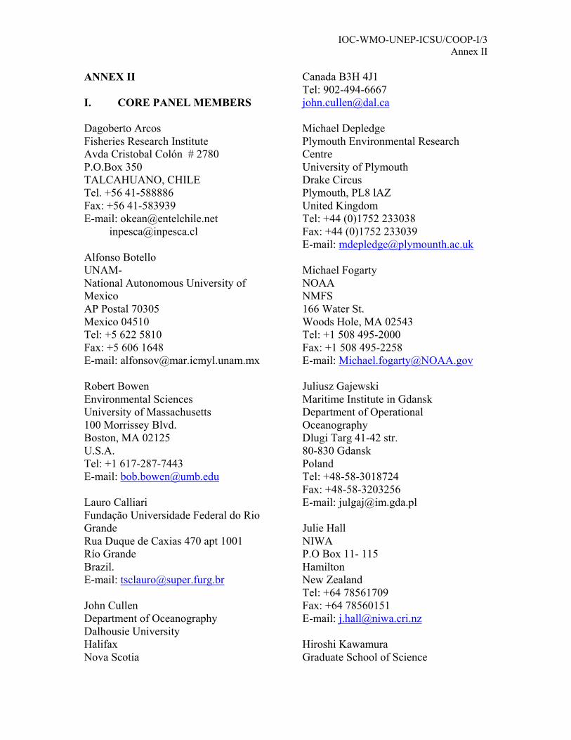
ANNEX II I. CORE PANEL MEMBERS Dagoberto Arcos Fisheries Research Institute Avda Cristobal Colón # 2780 P.O.Box 350 TALCAHUANO, CHILE Tel. +56 41-588886 Fax: +56 41-583939 E-mail: [email protected][email protected] Alfonso Botello UNAM- National Autonomous University of Mexico AP Postal 70305 Mexico 04510 Tel: +5 622 5810 Fax: +5 606 1648 E-mail: [email protected] Robert Bowen Environmental Sciences University of Massachusetts 100 Morrissey Blvd. Boston, MA 02125 U.S.A. Tel: +1 617-287-7443 E-mail: [email protected] Lauro Calliari Fundação Universidade Federal do Rio Grande Rua Duque de Caxias 470 apt 1001 Río Grande Brazil. E-mail: [email protected] John Cullen Department of Oceanography Dalhousie University Halifax Nova Scotia
Canada B3H 4J1 Tel: 902-494-6667 [email protected] Michael Depledge Plymouth Environmental Research Centre University of Plymouth Drake Circus Plymouth, PL8 lAZ United Kingdom Tel: +44 (0)1752 233038 Fax: +44 (0)1752 233039 E-mail: [email protected] Michael Fogarty NOAA NMFS 166 Water St. Woods Hole, MA 02543 Tel: +1 508 495-2000 Fax: +1 508 495-2258 E-mail: [email protected] Juliusz Gajewski Maritime Institute in Gdansk Department of Operational Oceanography Dlugi Targ 41-42 str. 80-830 Gdansk Poland Tel: +48-58-3018724 Fax: +48-58-3203256 E-mail: [email protected] Julie Hall NIWA P.O Box 11- 115 Hamilton New Zealand Tel: +64 78561709 Fax: +64 78560151 E-mail: [email protected] Hiroshi Kawamura Graduate School of Science
Russia. Tohoku University Tel.: +7 812 3521520 Aoba, Sendai 980-8578 Fax: +7 812 3522688 Japan [email protected] E-mail: [email protected]
Anthony Knap (Co-chairman) Keith Thompson Bermuda Biological Station for Research Department of Oceanography 17 Biological Lane Dalhousie University Ferry Reach Halifax St. George's GE 01 Nova Scotia B3H4J1 Bermuda Canada Tel: (441) 297-1880 Tel: +1 902 4943491 Fax: (441) 297-8143 Fax: +1 902 4942885 [email protected] E-mail: [email protected]
MVM Wafar Tom Malone (Co-chairman) National Institute of Oceanography Horn Point Laboratory Dona Paula Univ. of Maryland Center for
Environmental Science P.O. Goa 403 004 India PO Box 775 Tel: +91-832-226253 extn . 4252 2020 Horn Point Road Fax: +91-832-223340 Cambridge, MD 21613 Email: USA [email protected] Tel: +1 410 221 8406 [email protected] Fax: +1 410 221 8473 [email protected] II. OBSERVERS Donald Campbell Coleen Moloney Ministry of Environment & Energy Marine and Coastal Management Costa Rica Private Bag X2 Tel: +506-755-0302 Rogge Bay Fax: +506-758-3996 Cape Town 8012 E-mail: [email protected] South Africa Tel: +27 21 402 3171 Jorge Cortés E-mail: [email protected] CIMAR, Ciudad de la Investigación, Hillel Shuval Universidad de Costa Rica Division of Environmental Sciences Costa Rica Hebrew University of Jerusalem E-mail: [email protected] Israel
Comité Oceanográfico Nacional Cuba Ave 1 y calle 60 Vladimir Smirnov Miramar, Arctic and Antarctic Res. Institute Playa Habana Bering St. Cuba 199397 St. Petersburg
Ocean Sciences Division Bedford Inst. of Oceanography Reena Nursimhulu, P.O. Box- 1006 Mauritius Oceanography Institute Dartmouth, Nova Scotia 4th Floor, France Centre Canada B2Y 4A2 Victoria Avenue Tel: +1 902 426-3879 Quatre-Bornes Fax: Mauritius E-mail: [email protected] Tel: +230-4274434
Fax: +230-4244433 E-mail: [email protected] Igor Lavrenov Arctic and Antarctic Research Institute Gregorio Parrilla Av Bering 38 Str Instituto Español de Oceanografía St Petersburg 199397 Corazón de María 8 Russia 28002 Madrid Tel: +7-812-3523604 España Fax: +7 812 3522688 Tel: +34 91 3473608 E-mail: [email protected] Fax: +34 91 4135597 [email protected] E-mail: [email protected] Manuel Murillo Roberto Pérez CIMAR Institute of Oceanology. Ciudad de la Investigación Ave. 1ra Nro. 18406, Universidad de Costa Rica entre 184 y 186. Costa Rica Playa, Ciudad de La Habana, Tel: +506 207-5080 Cuba. C.P. 12100 Fax: +506 225-5822 Tel/Fax: +53 7 21-6008/33-9112 E-mail: [email protected] E-mail: [email protected] Savithri Narayanan Jan Piechura CanadaMarine Environmental Data
Service Polish Institute of Oceanology PAS 55 Powstñców Warszawy Str Dept. of Fisheries and Oceans 81-712 Sopot WO82
Impact assessment and Surveillance. Poland 2400 d'Estimauville Tel: +48 58 551 72 81 Beauport, QC Fax: +48 58 551 21 30 G1E 7G9, Canada E-mail: [email protected] Tel: +1 418 666 7000 ext 222 E-mail: [email protected] Fax: +1 418 666 2776 E-mail: [email protected] Christos Tziavos National Centre for Marine Research Johannes Guddal AG Kosmas Norwegian Meteorological Institute Ellinikon DNMI Region W., Allegt. 7 Athens N-5007 Bergen Greece Norway Tel: +30-1-9820214 Tel: +47 55 23 66 31 Fax: +30-1-9833095 Fax: +47 55 23 67 03 E-mail: [email protected] E-mail: [email protected] Ariel Troisi Jeffrey L. Hyland Av. Montes de Oca 2124 NOAA National Ocean Service CI270ABV Buenos Aires 219 Fort Johnson Road Argentina Charleston, South Carolina 29412-9110 USA E-mail: [email protected] Tel: +1 843-762-8511 Fax: +1 843-762-8700 José Antonio Vargas E-mail: [email protected] CIMAR Ciudad de la Investigación Kwame Koranteng Universidad de Costa Rica Marine Fisheries Research Division E-mail: [email protected] Ministry of Food and Agriculture
III. IOC P.O. Box BT 62 Tema Ghana Thorkild Aarup E-mail: [email protected] Intergovernmental Oceanographic
Commission Nadia Pinardi UNESCO Corso di Laurea in Scienze Ambientali 1, rue Miollis Bologna University 75732 Paris Cedex 15 Palazzo Rasponi France Piazzale Kennedy 12 Tel: + 33 145 684019 48100 Ravenna Fax: + 33 145 685810 Italy [email protected] Tel: +39-0544-484269
Dpt of biology and Chemistry Tat Chee Avenue Kowloon Hong Kong China Tel: 852-2788-7404, Fax: 852-2788-7406. E-mail: [email protected]
IOC-WMO-UNEP-ICSU/COOP-I/3 Annex III
ANNEX III
REPORTS FROM THE BREAK-OUT WORKING GROUPS
WORKING GROUP I: The HOTO Design Plan A. General comment made regarding the new document by group.
• The document must be integrated and stand alone
• The document must be aimed at a new audience. The user community which means removing jargon and a reading age of approx 12 years old.
• The section which discusses global needs to discuss
The nature of drivers of coastal systems Ubiquitous issues Movements of both ships and people globally
• Global/Regional/National
• These are equal importance and need to be treated as such in the
document. • Precautionary approach NOT principal be used as wording in document.
• A technical writer should be employed to edit the document.
B. Comments on the HOTO document
• The HOTO plan does not have a good linkage between variables and products.
To address this issues we recommend that the HOTO products, users, variables be treated in a similar way to those in the CGOOS plan with the linkages drawn out and tabulated as in the CGOOS plan. This should also be done for the LMR section of the document as well.
• There is a need to modify the CGOOS approach to the following moving down the page in order.
User needs
Products
Models Variables
IOC-WMO-UNEP-ICSU/COOP-I/3 Annex III – page 2
Variable x user needs x benefits** Feasibility Global variable
** This area needs work to sort out how this will be approached. This approach needs to be clearly documented so that we can recommend the approach used for regional and national variable identification. Issues that were identified from HOTO plan that need to be more fully addressed
in the new document are.
● Resolution of time and space.
● Biodiversity Mechanistic links from organism level (ie biomarkers) to ecosystem effects (Mike)
● Combining of Fig 2 and 4
(Bob)
● Broader consideration of user needs. Bob will include this when he writes this section for the new document.
● Modelling section needs to be broadened
(Keith)
● The RAMP approach needs to be extended (Mike)
● There needs to be development of Regional Analysis Centres
(RAC), and Regional Analysis Networks (RAN).
Regional Analysis Networks/Regional Analysis Centers (RAN/RAC) should be established to extend to critical work of GOOS data management into the equally critical areas of data synthesis, analysis and analysis products, capacity building educational programmes, and the facilitation of within region partnerships/exchanges. Part of the mission of these RAN/RACs should be to ensure that user and scientific needs are met at local, national, regional and global scales.
The RAC would be embedded into the RANs.
IOC-WMO-UNEP-ICSU/COOP-I/3 Annex III – page 3
The charge for the RAN’s would be Facilitate exchange and partnerships with users Education programmes at all levels Interactions, both intra and inter RAN. Capacity building Public participation and education Data management QA/QC Development and improvement of products Display technologies Catalogue capabilities of the region
As a sub set within this there would be the RACs. They would focus on issues where economy of scale can assist in completion of tasks or where a central role is needed, i.e.
Economies of scale Product development Display technologies Data management Central facilities Catalogue of capabilities Physical presence of GOOS
The RACs would not be the sole providers of any of the above but would be key plays in development.
IOC-WMO-UNEP-ICSU/COOP-I/3 Annex III – page 4
WORKING GROUP II: The LMR Design Plan The discussions focused on general issues regarding the overall content and “flavour” of the LMR Strategic Design Plan, and also specifically identified elements from the plan that should be carried forward. The discussions are summarized in the section below, with some elements repeated in the proposed document outline for the draft integrated design plan. Summary of general issues 1. The group was concerned about how to move forward with the LMR document. It
was felt that the legacy from the previous panel was not adequately assimilated during the meeting, especially because there appeared to be elements missing from the final report that had been in earlier drafts, and that our group was re-opening discussion on. At the least, these draft reports should be used as background documentation when incorporating some of the elements that were identified as missing, e.g. aquaculture, non-commercial users, habitat quality.
2. It is important to state clearly the questions that are being addressed with GOOS, because the “core” variables should be able to answer these.
3. Concern was expressed that only the needs of paid users were addressed in the LMR plan. It is important to expand the document to ensure that the needs of other user groups are also met.
4. Habitat loss and habitat alteration are major issues that affect a large user community. It is important that these aspects be recorded and monitored in a GOOS.
5. There was much discussion regarding “core” variables. It was noted that measurements of chlorophyll were probably insufficient to serve as indicators of ecosystem state. Other variables should also be considered. Fish catches were suggested to be a coarse but useful indicator of major changes in ecosystems. Other categories of variables could provide more ‘fine-scale’ indications of change. For example, changes in abundance or species composition of ‘small pelagic fish” or changes in abundance or distribution of top predators (e.g. seabirds).
6. There should be a data policy that encourages free and open data exchange, although some data might need to be flagged for specified periods. It was recommended that problems with sensitive variables and data exchange should be dealt with on a case by case basis. Attempts to pre-empt problems could exacerbate them by highlighting areas of potential conflict.
7. Data management and archiving are crucial for the success of GOOS. Standards are required, and there is a need to work closely with existing organizations and structures. Biological data exist as information (in electronic or written format) and as physical samples, and attention must be given to management and exchange of both kinds of data.
8. At present, there are few biological indicators of ecosystem change that are widely used, and it is not clear how general such indicators might be, or what information they convey about the ecosystem. However, there are a number of research programmes investigating these issues. Close links should be established and maintained with these research programmes (e.g. IGBP programmes), so that variables identified for the GOOS are appropriate. Mechanisms to ensure synergy
IOC-WMO-UNEP-ICSU/COOP-I/3 Annex III – page 5
and good communication should be identified. These mechanisms could include liaison groups, as proposed by the LMR Panel for linking to GLOBEC.
Specific points for inclusion in Draft Integrated Design Plan We were provided with two documents to work with. The first was the LMR Strategic Design Plan, and we worked through this document, editing it in places, and discussing aspects that should be omitted from or included in the integrated plan. Edits were made onto the document itself, and those details are not included here. The second document was the draft outline of the integrated plan. Here, we identified some aspects that should be incorporated under the headings that were provided to us. These points are listed below, with some rationale. 1. Introduction 1.1 Scope • Trans-boundary migrations of animals should be mentioned. Need synergy, particularly for understanding ecosystem cause and effect, i.e. good links with research programs, particularly those addressing ecosystem issues. 1.2 Purpose • State the broad objectives of the LMR component. • Include a statement of global problems, such as living resources, ecosystem
changes, biodiversity, regime shifts, species at risk, aquaculture issues such as introduction of non-indigenous species/pathogens (HOTO?), growing aquaculture needs impacting LMR ecosystems (exceed carrying capacity), etc.
LMR COOS is not management, but it should enhance ability to manage effectively. 2. Ecosystem approach • Emphasize the relationship between socio-economics and COOS. • Include a section describing how to incorporate ecosystem considerations into
fisheries management (but put into a perspective of other issues besides fisheries). • Ecosystem effects can be bottom up: environmental forcing such as changes in
physical variables can lead to changes in phytoplankton/macrophytes, etc, or anthropogenic effects of nutrient loading can change system productivity and structures.
• Ecosystem effects can be top-down: changes in fishing pressure can lead to decreases in predator populations (e.g. tunas, rock lobsters) or increases (e.g. seals and whales), causing ecosystem changes.
Teleconnections – need to take these synchronous changes into account, because their detection and understanding require collaboration on a global level 3. Challenges 3.5 LMR data management challenges (see above). 4. Design Framework 5. Initial Observing Subsystem 5.2 Core variables • Catch records of exploited and impacted species can be used to give first indicators
of change, although usually only after the fact, when it’s too late to introduce mitigating measures. Globally, “catches” should be taken to include pelagic-, demersal-, finfish-, invertebrate- and benthic- species, and information should come from commercial, aquacultural, recreational, artesanal, and subsistence fishing sectors.
IOC-WMO-UNEP-ICSU/COOP-I/3 Annex III – page 6
• The backbone of LMR measurements will include fishery independent surveys of major harvested and impacted species, and the occurrences of escape or accidental release of organisms from aquaculture sites (record date, frequency and number of such escapes).
• Global measurements should include habitat extent, where habitat is used in a broad sense to include, for example, coral reefs, suitable habitat for Pacific salmon, submerged aquatic vegetation. The focus should be on characterizing changes over time.
• Also include the extent and location of aquaculture sites – it was suggested that an inventory of aquaculture facilities around the world could be seen as a basic required information set. This would link to the impacts of aquaculture on the coastal environment.
• Plankton measurements, such as conducted through the continuous plankton recorder (CPR) programmes, can be large scale and useful.
• Top predators, represented by seabirds and mammals, are integrators of the ecosystem. They respond to long term changes, and they often characterize changes at a global scale, e.g. high-seas fisheries impact global populations of many species, but first indications are observed in populations of seabirds and mammals.
• Note that measurements at higher trophic levels may help to detect change, but not necessarily to understand change (especially if the causal mechanisms are bottom up). Hence the need to link to research programmes.
Aquaculture: links to GTOS? Consider all clients/users when looking at aquaculture e.g. conflicts among user groups. 5.4 Observing infrastructure Platforms for measurements for LMR issues are not just fishing vessels, also research vessels and ships of opportunity (open ocean) 5.6 Biological sample preservation issues (new sub-heading) 6. Communication network and data management subsystem 6.2 Data policy • The basic unit for data collection and management is national, not regional or
global. • It was recommended that the GOOS data principles be adopted: non-profit and
open exchange of data. Value lies in the data products, not in the raw data. • Regional enhancement of data should conform to the data policy if it is to be part
of GOOS. • Issues of data sensitivity should be handled on a case-by-case basis. • Data sampling technology, QA/QC – work with IOC on this – be positive in
statements regarding “challenges”! End-to-end data management was thoroughly discussed in C-GOOS. This structure will accommodate LMR observational data, but some aspects of quality control will not apply. For example, “standardisation” is often not appropriate, but “intercomparisons” and “intercalibration” can be essential. 6.3 Infrastructure
IOC-WMO-UNEP-ICSU/COOP-I/3 Annex III – page 7
The form of the national/regional analysis centres should be spelled out. In some cases these might be physical locations, whereas in others they will consist of a network linking different centres. 6.4 Biological sample archive/storage and exchange (new sub-heading) 7. Combining observations and model Kinds of models Models are needed for various purposes. Many different groups of model already exist. No single model will be sufficient, and many useful models may not yet have been constructed. We identified some of the current LMR modelling approaches that include ecosystem information. • Ecopath / Ecosim models are trophic models that should be seen as integrating
tools. They require measurements of biomass, production, consumption, catches and diet compositions, and specifically include fisheries as part of the ecosystem.
• Ecosim and Ecospace are dynamic trophic models, and can be used as tools for forecasting.
• Fisheries/stock assessment models. Multi-species models include multi-species virtual population analysis (MSVPA). These models are data-intensive but feasible in some areas.
• Nutrient–phytoplankton-zooplankton-fish (NPZF) models often have environmental forcing, but cannot effectively include fish and fisheries. They essentially focus on bottom-up factors in ecosystem dynamics.
• Important links need to be set up and maintained with JGOFS, GLOBEC, LOICZ, GEOHAB, etc.
Models dealing with habitat (including spatially-based models) will be important. These can address aspects of carrying capacity, and can be related to aquaculture potential productivity, issues of sustainability and resilience. Habitat quantity and quality is also important for benthic communities. Links between observations and models • Links between the GOOS and models should be assessed in terms of what the
models can produce as output, and what they require as input. “Model” here refers to the models described above and also to statistical models, geographical information systems (GIS), time series analyses, etc.
• The data to support models should be obtained from observing systems. These data include catch at size and/or age, diet, mortality, abundance indices for species/stocks, recruitment (for forecasting), space/time abundance, interactions among species/groups, habitat extent, univariate and integrated time series variables, geo-referenced variables (for GIS).
All the above needs to be placed in a perspective of what questions drive GOOS and what answers it will provide. 8. Applications 9. Building an operational system What are the attributes that make something a GOOS project? 9.3 Enabling research • Retrospective experiments
IOC-WMO-UNEP-ICSU/COOP-I/3 Annex III – page 8
10. Implementing and sustaining a COOS 10.2 Capacity building • This is especially critical for data management and modelling. • Links to climate forecasting
IOC-WMO-UNEP-ICSU/COOP-I/3 Annex III – page 9
WORKING GROUP III: The C-GOOS Design Plan The list below provides a summary of the issues that the working group felt should be further addressed in the integrated design plan. Additionally the working group had provided some more detailed editorial/technical comments in the digital version of the C-GOOS design text, and it was left to the COOP Co-chairmen to address these comments in the integrated design plan. Format/presentation issues: ● Readership: impact of document ● Introduction is key ● Use italicized summary statements for each section ● Avoid “comprehensive” lists ● Need more/better figures Core variables: ● Make the selection mechanism absolutely clear ● Emphasize links to models Data types: ● Strengthen emphasis on standardization and harmonization ● Do not specify data delivery mechanism – will change fast ● Combining observations and models ● Strengthen links with outputs from OOPC ● Links with GLOBEC for ecosystem models ● Where does system stop being free? ● Need to translate measurements (optical/acoustic) into estimates of modelled variables ● Assessing skill of models - need for long-term series (eg. Zooplankton) Applications: ● User forums – BOOS examples ● NGOs can be powerful advocates for GOOS. Benefits outweigh the risks ● Delivery to a wide range of users spanning from the ones with access to advanced communications to the ones with no power or computers
IOC-WMO-UNEP-ICSU/COOP-I/3 Annex IV
ANNEX IV
List of acronyms ARGO Array for Real-time Geostrophic Oceanography BOOS Baltic Operational Oceanographic System C-GOOS Coastal Panel of GOOS CIMAR Centro de Investigación en Ciecias del Mar y Limnologia
(University of Costa Rica) CLIVAR Climate Variability and Predictability CONNS Coastal Observing Network for the Near Shore COOP Coastal Ocean Observations Panel COOS Coastal Ocean Observing System CPR Continuous Plankton Recorder FAO Food and Agricultural Organization GCOS Global Climate Observing System GEOHAB Global Ecology of Harmful Algal Blooms GIPME Global Investigation of Pollution in the Marine Environment GIS Geographic Information System GLOBEC Global Ocean Ecosystem Dynamics GLOSS Global Sea Level Observing System GODAE Global Ocean Data Assimilation Experiment GOOS Global Ocean Observing System GOOS-IOS GOOS-Initial Observing System GSC GOOS Steering Committee GTOS Global Terrestrial Observing System HOTO Health of the Oceans ICES International Council for the Exploration of the Sea ICSU International Council for Science IGBP International Geosphere - Biosphere Programme IGOOS IOC-WMO-UNEP Committee for the Global Ocean Observing
System IGOSS Integrated Global Ocean Services System IOC Intergovernmental Oceanographic Commission (of UNESCO) IODE International Ocean Data and Information Exchange
programme JCOMM Joint WMO-IOC Technical Commission for Oceanography and
Marine Meteorology JGOFS Joint Global Ocean Flux Study LMR Living Marine Resources LOICZ Land-Ocean Interactions in the Coastal Zone NGO Non-governmental Organization NOAA National Oceanic and Atmospheric Administration (USA) ODINAFRICA Ocean Data and Information Network for Africa OOPC Ocean Observation Panel for Climate OOSDP Ocean Observing System Development Panel PCB Poly-Chlorinated Biphenyls PICES North Pacific Marine Science Organization POP Persistent Organic Pollutant
IOC-WMO-UNEP-ICSU/COOP-I/3 Annex IV – page 2
RAC Regional Analysis Center RAMP Rapid Assessment of Marine Pollution RAN Regional Analysis Network SOOP Ship of Opportunity Programme SST Sea Surface Temperature TOGA Tropical Ocean and Global Atmosphere TOR Terms of Reference UCR Universidad de Costa Rica (Costa Rica) UNA Universidad Nacional (Costa Rica) UNEP United Nations Environment Programme UNESCO United Nations Educational, Cultural and Scientific
Organization VOS Voluntary Observing Ships WCRP World Climate Research Programme WMO World Meteorological Organization WWW World Weather Watch XBT Expendable Bathytermograph