16
COBRA WIRELESS GPR RADARTEAM SWEDEN AB | GRÄNSVÄGEN 51, 961 37, BODEN, SWEDEN | +46 (0)921-191 91 | WWW.RADARTEAM.SE | [email protected]
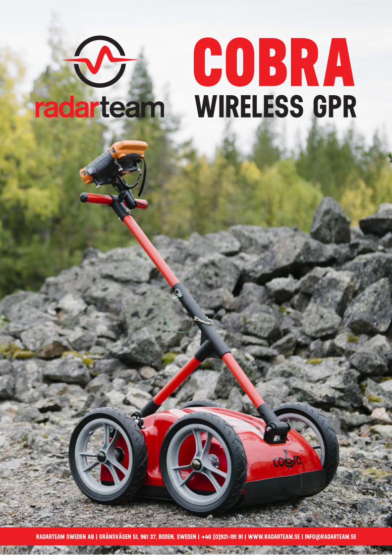
COBRA WIRELESS GPR
RADARTEAM SWEDEN AB | GRÄNSVÄGEN 51, 961 37, BODEN, SWEDEN | +46 (0)921-191 91 | WWW.RADARTEAM.SE | [email protected]
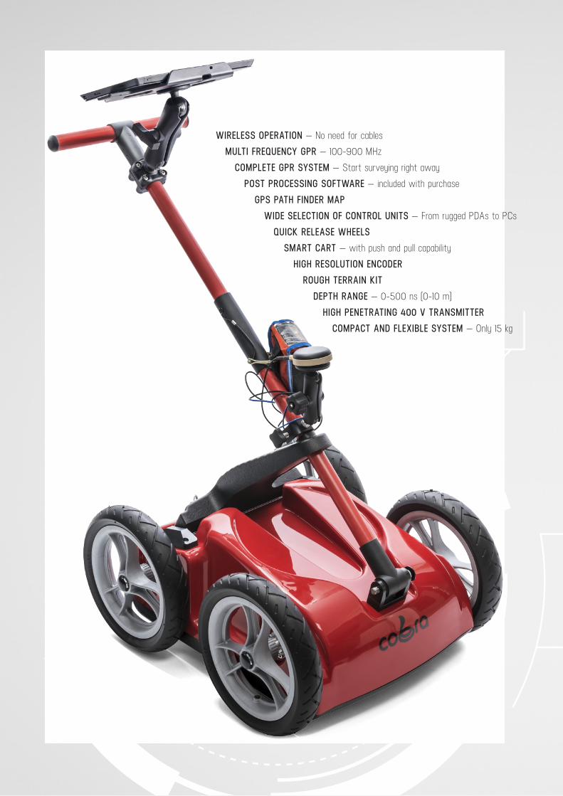
WIRELESS OPERATION — No need for cables
MULTI FREQUENCY GPR — 100-900 MHz
COMPLETE GPR SYSTEM — Start surveying right away
POST PROCESSING SOFTWARE — included with purchase
GPS PATH FINDER MAP
WIDE SELECTION OF CONTROL UNITS — From rugged PDAs to PCs
QUICK RELEASE WHEELS
SMART CART — with push and pull capability
HIGH RESOLUTION ENCODER
ROUGH TERRAIN KIT
DEPTH RANGE — 0-500 ns (0-10 m)
HIGH PENETRATING 400 V TRANSMITTER
COMPACT AND FLEXIBLE SYSTEM — Only 15 kg
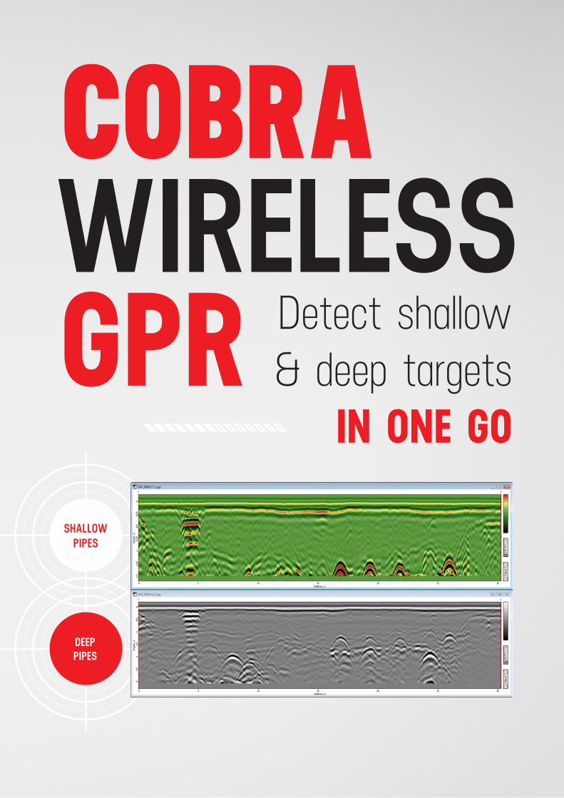
COBRAWIRELESS GPR
DEEP PIPES
SHALLOW PIPES
Detect shallow & deep targets
IN ONE GO
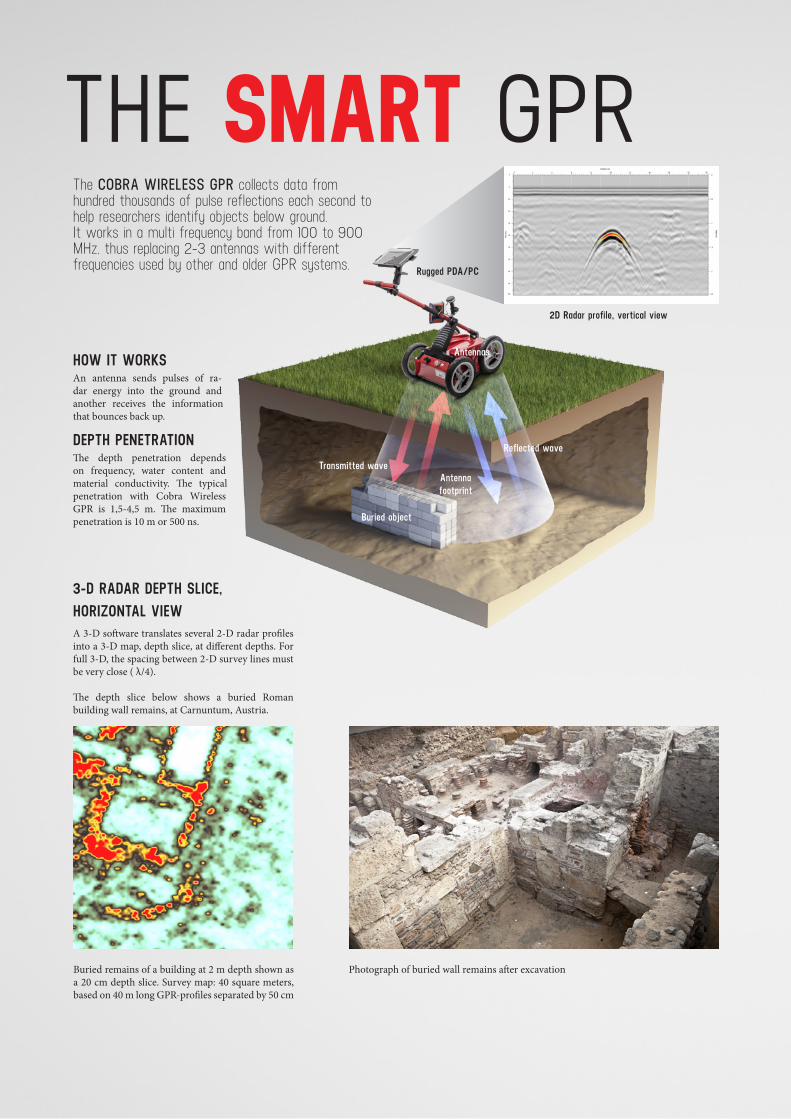
THE SMART GPRThe COBRA WIRELESS GPR collects data from hundred thousands of pulse reflections each second to help researchers identify objects below ground. It works in a multi frequency band from 100 to 900 MHz, thus replacing 2-3 antennas with different frequencies used by other and older GPR systems.
HOW IT WORKSAn antenna sends pulses of ra-dar energy into the ground and another receives the information that bounces back up.
DEPTH PENETRATIONThe depth penetration depends on frequency, water content and material conductivity. The typical penetration with Cobra Wireless GPR is 1,5-4,5 m. The maximum penetration is 10 m or 500 ns.
2D Radar profile, vertical view
Rugged PDA/PC
Antennas
Transmitted wave
Reflected wave
Antenna footprint
Buried object
3-D RADAR DEPTH SLICE, HORIZONTAL VIEWA 3-D software translates several 2-D radar profiles into a 3-D map, depth slice, at different depths. For full 3-D, the spacing between 2-D survey lines must be very close ( λ/4).
The depth slice below shows a buried Roman building wall remains, at Carnuntum, Austria.
Buried remains of a building at 2 m depth shown as a 20 cm depth slice. Survey map: 40 square meters, based on 40 m long GPR-profiles separated by 50 cm
Photograph of buried wall remains after excavation
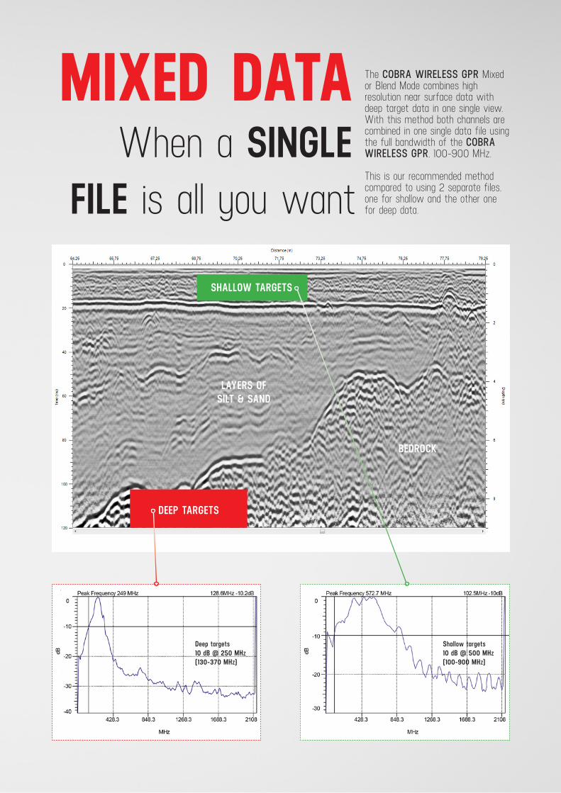
MIXED DATAWhen a SINGLE
FILE is all you want
The COBRA WIRELESS GPR Mixed or Blend Mode combines high resolution near surface data with deep target data in one single view.With this method both channels are combined in one single data file using the full bandwidth of the COBRA WIRELESS GPR, 100-900 MHz.
This is our recommended method compared to using 2 separate files, one for shallow and the other one for deep data.
SHALLOW TARGETS
DEEP TARGETS
LAYERS OF SILT & SAND
BEDROCK
Deep targets 10 dB @ 250 MHz(130-370 MHz)
Shallow targets 10 dB @ 500 MHz(100-900 MHz)
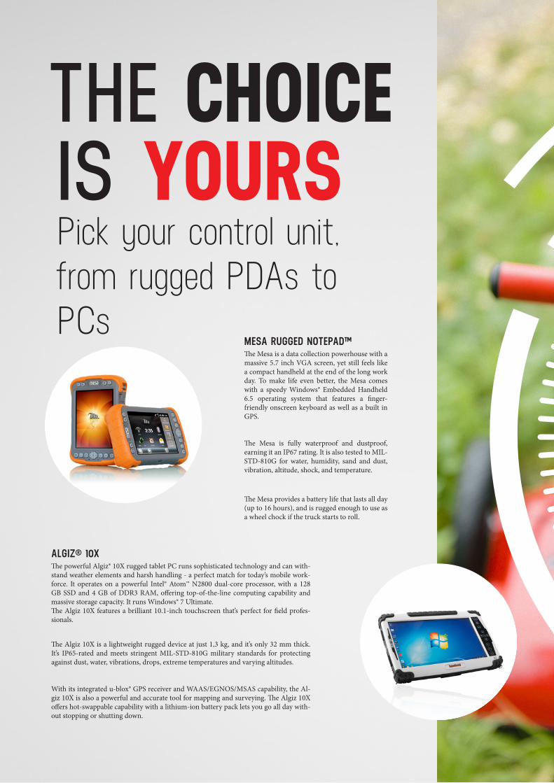
THE CHOICE IS YOURSPick your control unit, from rugged PDAs to PCs
ALGIZ® 10XThe powerful Algiz® 10X rugged tablet PC runs sophisticated technology and can with-stand weather elements and harsh handling - a perfect match for today’s mobile work-force. It operates on a powerful Intel® Atom™ N2800 dual-core processor, with a 128 GB SSD and 4 GB of DDR3 RAM, offering top-of-the-line computing capability and massive storage capacity. It runs Windows® 7 Ultimate.The Algiz 10X features a brilliant 10.1-inch touchscreen that’s perfect for field profes-sionals.
The Algiz 10X is a lightweight rugged device at just 1,3 kg, and it’s only 32 mm thick. It’s IP65-rated and meets stringent MIL-STD-810G military standards for protecting against dust, water, vibrations, drops, extreme temperatures and varying altitudes.
With its integrated u-blox® GPS receiver and WAAS/EGNOS/MSAS capability, the Al-giz 10X is also a powerful and accurate tool for mapping and surveying. The Algiz 10X offers hot-swappable capability with a lithium-ion battery pack lets you go all day with-out stopping or shutting down.
MESA RUGGED NOTEPAD™The Mesa is a data collection powerhouse with a massive 5.7 inch VGA screen, yet still feels like a compact handheld at the end of the long work day. To make life even better, the Mesa comes with a speedy Windows® Embedded Handheld 6.5 operating system that features a finger-friendly onscreen keyboard as well as a built in GPS.
The Mesa is fully waterproof and dustproof, earning it an IP67 rating. It is also tested to MIL-STD-810G for water, humidity, sand and dust, vibration, altitude, shock, and temperature.
The Mesa provides a battery life that lasts all day (up to 16 hours), and is rugged enough to use as a wheel chock if the truck starts to roll.
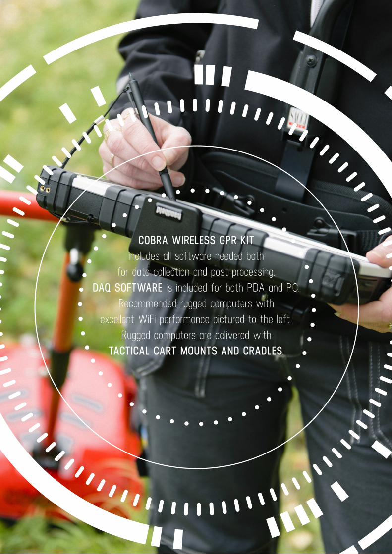
COBRA WIRELESS GPR KIT includes all software needed both
for data collection and post processing. DAQ SOFTWARE is included for both PDA and PC.
Recommended rugged computers with excellent WiFi performance pictured to the left.
Rugged computers are delivered with TACTICAL CART MOUNTS AND CRADLES.
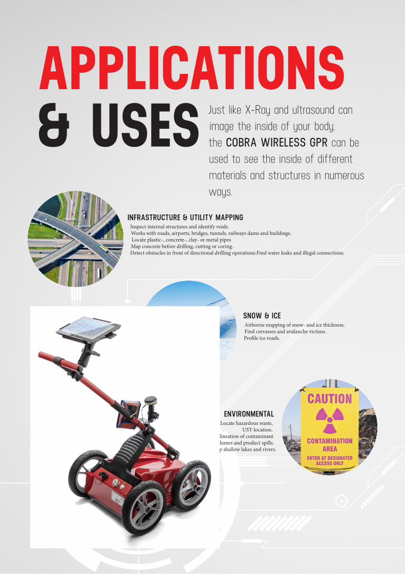
INFRASTRUCTURE & UTILITY MAPPINGInspect internal structures and identify voids. Works with roads, airports, bridges, tunnels, railways dams and buildings. Locate plastic-, concrete-, clay- or metal pipes Map concrete before drilling, cutting or coring. Detect obstacles in front of directional drilling operations.Find water leaks and illegal connections.
ENVIRONMENTALLocate hazardous waste,
UST-location. Delineation of contaminant
plumes and product spills. Map shallow lakes and rivers.
SNOW & ICEAirborne mapping of snow- and ice thickness. Find crevasses and avalanche victims. Profile ice roads.
MILITARY & SECURITYLocate tunnels, bunkers, hidden weapons and drugs. Find land mines and unexploded ordnance (UXO).
Through wall imaging. Rescue operations; locate trapped victims under collapsed buildings and landslides.
APPLICATIONS & USES Just like X-Ray and ultrasound can
image the inside of your body, the COBRA WIRELESS GPR can be used to see the inside of different materials and structures in numerous ways.
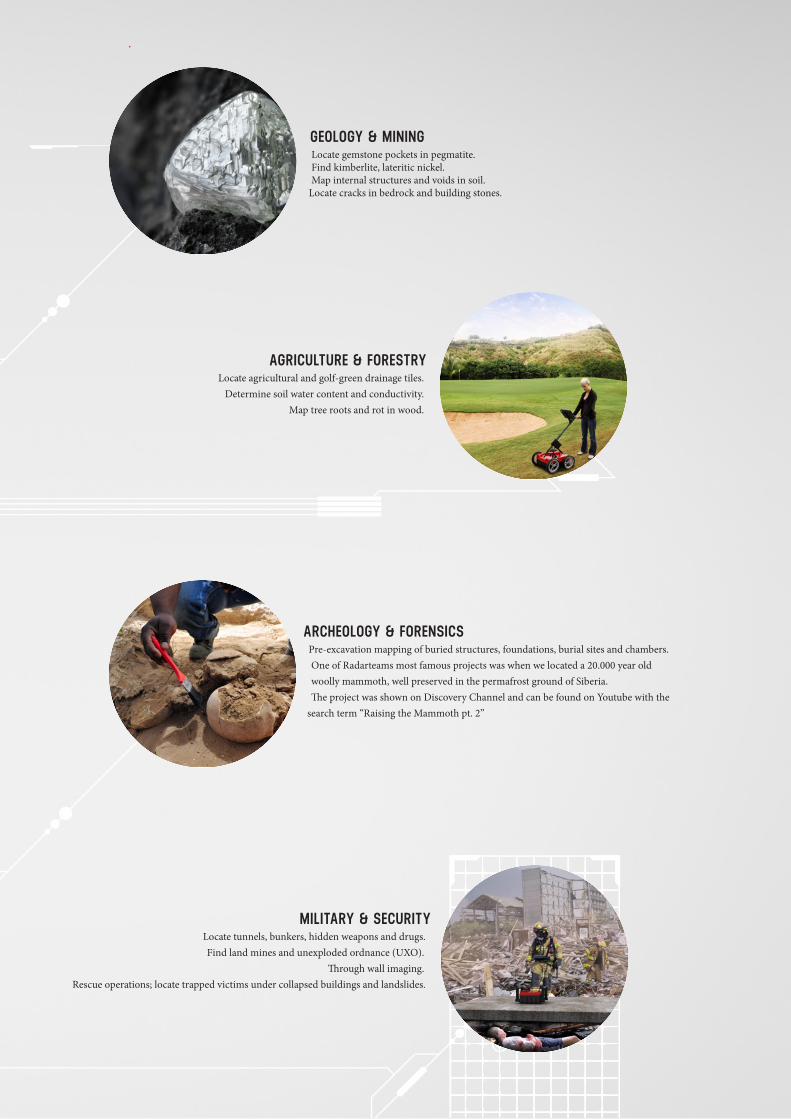
GEOLOGY & MININGLocate gemstone pockets in pegmatite. Find kimberlite, lateritic nickel. Map internal structures and voids in soil.
Locate cracks in bedrock and building stones.
ARCHEOLOGY & FORENSICSPre-excavation mapping of buried structures, foundations, burial sites and chambers. One of Radarteams most famous projects was when we located a 20.000 year old woolly mammoth, well preserved in the permafrost ground of Siberia. The project was shown on Discovery Channel and can be found on Youtube with the
search term “Raising the Mammoth pt. 2”
MILITARY & SECURITYLocate tunnels, bunkers, hidden weapons and drugs. Find land mines and unexploded ordnance (UXO).
Through wall imaging. Rescue operations; locate trapped victims under collapsed buildings and landslides.
AGRICULTURE & FORESTRYLocate agricultural and golf-green drainage tiles.
Determine soil water content and conductivity.Map tree roots and rot in wood.
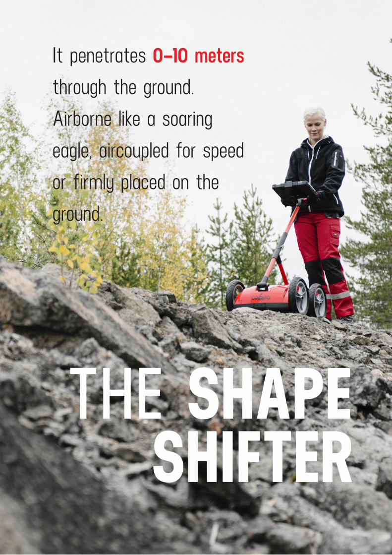
THE SHAPE SHIFTER
It penetrates 0–10 meters through the ground.Airborne like a soaringeagle, aircoupled for speed or firmly placed on the ground.
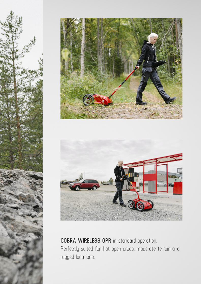
COBRA WIRELESS GPR in standard operation.Perfectly suited for flat open areas, moderate terrain and rugged locations.
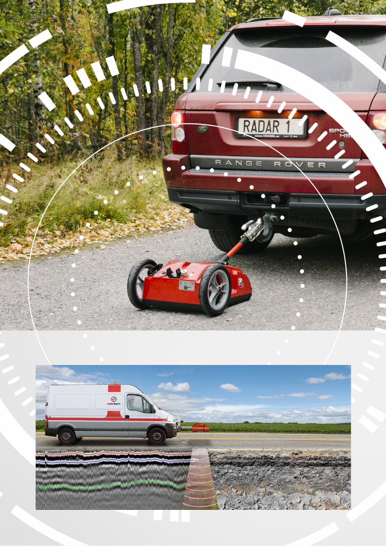
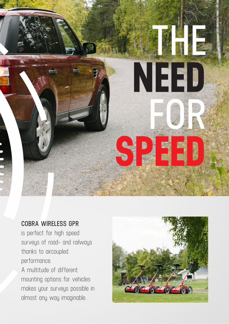
COBRA WIRELESS GPR is perfect for high speed surveys of road- and railways thanks to aircoupled performance.A multitude of different mounting options for vehicles makes your surveys possible in almost any way imaginable.
THE NEED FOR
SPEED

WE AREAIRBORNE
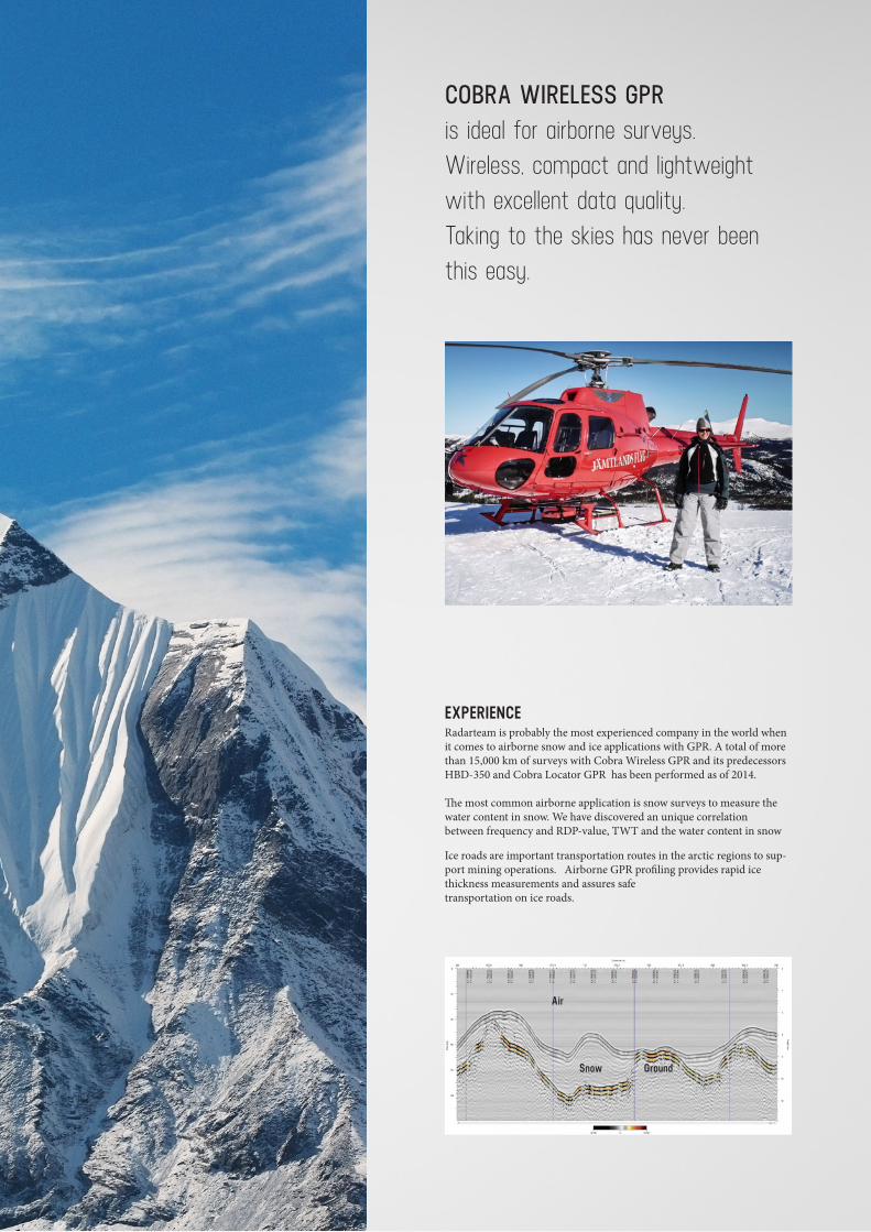
COBRA WIRELESS GPR is ideal for airborne surveys. Wireless, compact and lightweight with excellent data quality.Taking to the skies has never been this easy.
EXPERIENCERadarteam is probably the most experienced company in the world when it comes to airborne snow and ice applications with GPR. A total of more than 15,000 km of surveys with Cobra Wireless GPR and its predecessors HBD-350 and Cobra Locator GPR has been performed as of 2014.
The most common airborne application is snow surveys to measure the water content in snow. We have discovered an unique correlation between frequency and RDP-value, TWT and the water content in snow
Ice roads are important transportation routes in the arctic regions to sup-port mining operations. Airborne GPR profiling provides rapid ice thickness measurements and assures safe transportation on ice roads.
Air
Snow Ground
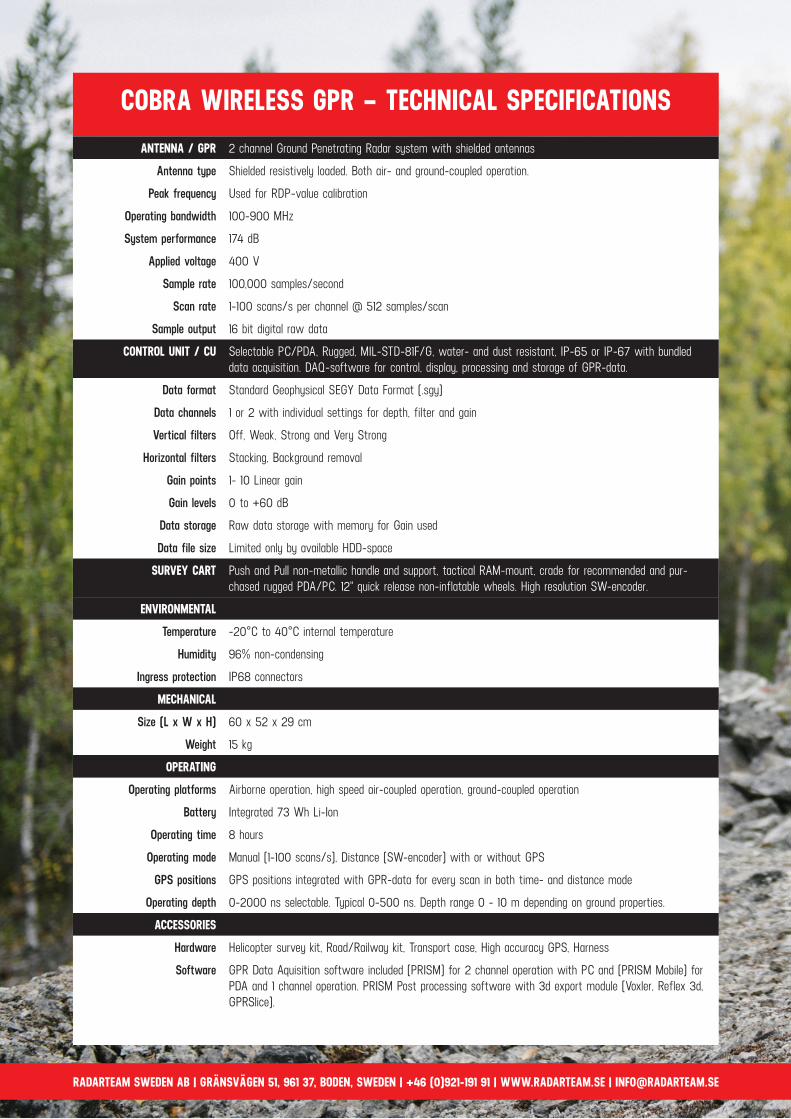
ANTENNA / GPR 2 channel Ground Penetrating Radar system with shielded antennas
Antenna type Shielded resistively loaded. Both air- and ground-coupled operation.
Peak frequency Used for RDP-value calibration
Operating bandwidth 100-900 MHz
System performance 174 dB
Applied voltage 400 V
Sample rate 100,000 samples/second
Scan rate 1-100 scans/s per channel @ 512 samples/scan
Sample output 16 bit digital raw data
CONTROL UNIT / CU Selectable PC/PDA, Rugged, MIL-STD-81F/G, water- and dust resistant, IP-65 or IP-67 with bundled data acquisition. DAQ-software for control, display, processing and storage of GPR-data.
Data format Standard Geophysical SEGY Data Format (.sgy)
Data channels 1 or 2 with individual settings for depth, filter and gain
Vertical filters Off, Weak, Strong and Very Strong
Horizontal filters Stacking, Background removal
Gain points 1- 10 Linear gain
Gain levels 0 to +60 dB
Data storage Raw data storage with memory for Gain used
Data file size Limited only by available HDD-space
SURVEY CART Push and Pull non-metallic handle and support, tactical RAM-mount, crade for recommended and pur-chased rugged PDA/PC. 12" quick release non-inflatable wheels. High resolution SW-encoder.
ENVIRONMENTAL
Temperature -20°C to 40°C internal temperature
Humidity 96% non-condensing
Ingress protection IP68 connectors
MECHANICAL
Size (L x W x H) 60 x 52 x 29 cm
Weight 15 kg
OPERATING
Operating platforms Airborne operation, high speed air-coupled operation, ground-coupled operation
Battery Integrated 73 Wh Li-Ion
Operating time 8 hours
Operating mode Manual (1-100 scans/s), Distance (SW-encoder) with or without GPS
GPS positions GPS positions integrated with GPR-data for every scan in both time- and distance mode
Operating depth 0-2000 ns selectable. Typical 0-500 ns. Depth range 0 - 10 m depending on ground properties.
ACCESSORIES
Hardware Helicopter survey kit, Road/Railway kit, Transport case, High accuracy GPS, Harness
Software GPR Data Aquisition software included (PRISM) for 2 channel operation with PC and (PRISM Mobile) for PDA and 1 channel operation. PRISM Post processing software with 3d export module (Voxler, Reflex 3d, GPRSlice).
COBRA WIRELESS GPR – TECHNICAL SPECIFICATIONS
RADARTEAM SWEDEN AB | GRÄNSVÄGEN 51, 961 37, BODEN, SWEDEN | +46 (0)921-191 91 | WWW.RADARTEAM.SE | [email protected]


