14
Colorado River Compact Administration Program Steve Wolff Colorado River Coordinator Interstate Streams Division Wyoming State Engineer’s Office
| Date post: | 23-Dec-2015 |
| Category: |
Documents |
| Upload: | cory-glenn |
| View: | 220 times |
| Download: | 1 times |
Colorado River Compact Administration Program
Steve WolffColorado River CoordinatorInterstate Streams Division
Wyoming State Engineer’s Office

10 December, 2008 2
Colorado River Compact Administration Program
• Initiated in 2006• Overall purpose of the program is to ensure the
State of Wyoming is the leading authority on the allocation and use of water in the Colorado River Basin of Wyoming, and to protect Wyoming’s apportionments as outlined in the two basin compacts
• Focus is on “man-made depletions” of water from the system

10 December, 2008 3

10 December, 2008 4
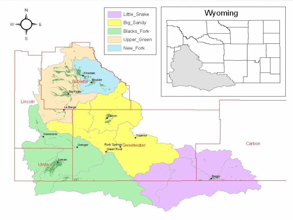
Colorado River Basin - Wyoming
• ~ 17,500 square miles
• Eleven 8-digit HUCs
• >21,000 stream miles (1:100K)
• > 2,000 points of diversion
• > 6,000 active water right permits
10 December, 2008 5

10 December, 2008 6
Data Collection & Tools
• Weather/Climate
• Basin Hydrology/Groundwater
• Evapotranspiration
• Water rights attribution
• Administration/Decision support tools

10 December, 2008 7
Weather/Climate
• Three small weather stations activated in 2007
• Five fully sensored AgriMet stations to be installed in 2009

10 December, 2008 8
Basin Hydrology
• Installing additional measuring points at diversions, streams and reservoirs– Includes recording instrumentation and
telemetry capabilities– 100 upgraded and new sites proposed under
FY09-10 budget– An additional 166 sites have been identified;
instrumentation will depend on funding

10 December, 2008 9
Basin Hydrology
• Compiling better data on M&I use in the
basin
• Building data set for basin hydrology forecast and accounting model
• Groundwater• Inventory of groundwater data being compiled as
part of Wyoming’s Water Planning program
10 December, 2008 10
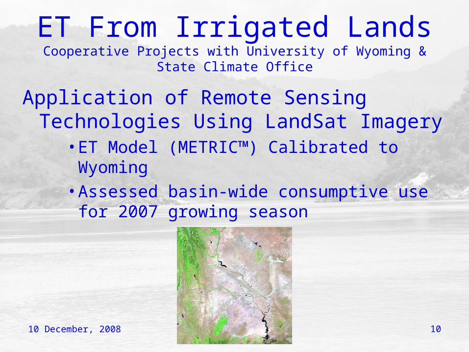
ET From Irrigated LandsCooperative Projects with University of Wyoming & State Climate
Office
Application of Remote Sensing Technologies Using LandSat Imagery
• ET Model (METRIC™) Calibrated to Wyoming
• Assessed basin-wide consumptive use for 2007 growing season

10 December, 2008 11
ET From Irrigated LandsCooperative Projects with University of Wyoming & State Climate
Office
• Installed two eddy covariance towers in July 2008
• Used to develop highly accurate reference ET data sets for given site
• Data used to validate METRIC™ model
• Will also collect scintillometer data in 2009

10 December, 2008 12
Water Rights Attribution
• Mapping and attributing all irrigated lands in the basin
• Field verification and checking work completed during summer/fall 2008
• Project completed in early 2009
10 December, 2008 13
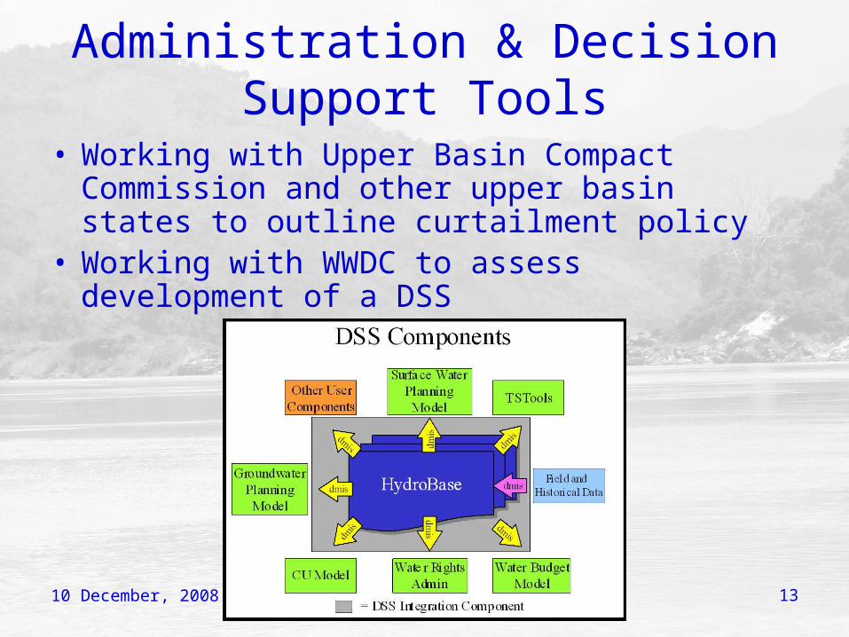
Administration & Decision Support Tools
• Working with Upper Basin Compact Commission and other upper basin states to outline curtailment policy
• Working with WWDC to assess development of a DSS

10 December, 2008 14
QUESTIONS??


