22
COMMUNITY PLAN

COMMUNITY PLAN

NAVAJO
COMMUNITY PLAN
Prepared by the NAVAJO COMMUNITY PLANNERS
and THE CITY OF SAN DIEGO
City of San Diego Planning Department 202 C Street, MS 4A San Diego, CA 92101
Printed on recycled paper.
This information, or this document (or portions thereof), will be made available in alternative formats upon request.
- i -
NAVAJO COMMUNITY PLAN AMENDMENTS
The following amendments have been incorporated into this February 2008 posting of this Plan:
Amendment Date Approved
by Planning Commission
Resolution Number
Date Adopted by City Council
Resolution Number
Navajo Community Plan adopted
July 29, 1982 3946 December 7, 1982 R-257606
Grantville Amendment- updates existing conditions, provides design guidelines, and establishes supplemental development regulations
January 5, 1989 0333-PC April 4, 1989 R-273164
The Circulation and Public Transportation Element was added
August 5, 2002 R-296956
Centerpoint at Grantville May 15, 2007 R-302636
- ii -

MAYOR Pete Wilson COUNCIL Bill Mitchell Bill Cleator Susan Golding Leon William Ed Struiksma Mike Gotch Dick Murphy Lucy Killea CITY ATTORNEY John W. Witt CITY MANAGER Ray T. Blair, Jr. PLANNING COMMISSION John G. Davies, Chairman Dorothy Leonard, Vice Chairman Ron Roberts Marie Widman Fil Chavez Yvonne Larsen Paula Oquita PLANNING DEPARTMENT Jack Van Cleave, Director Mike Stepner, Assistant Director James L. Overstreet Steve Tallian Mary Holt Byron Frohn Tony Pluth Lisa Goehring NAVAJO COMMUNITY PLANNERS, INC. James A. McIntyre, President Bob Osmers Donald M. Robinson, 1st Vice President Herbert Phillips Judy McCarty, 2nd Vice President Mary Plichta Hal Boaz Phyllis Porter James H. Cusack Lou Quintali Dave Futch Karen Sue Sweeting Donald C. Heffner John Todd Bill Myers Jerry Wetter Peder Norby Henry Wilson
- iii -
In addition to the Navajo Community Planners, the following City Department staff has made a significant contribution to development of the Navajo Community Plan. PARK & RECREATION Mason Milliken TRANSPORTATION PLANNING Allen Holden We also wish to thank J. V. Ward, San Diego Unified School District.
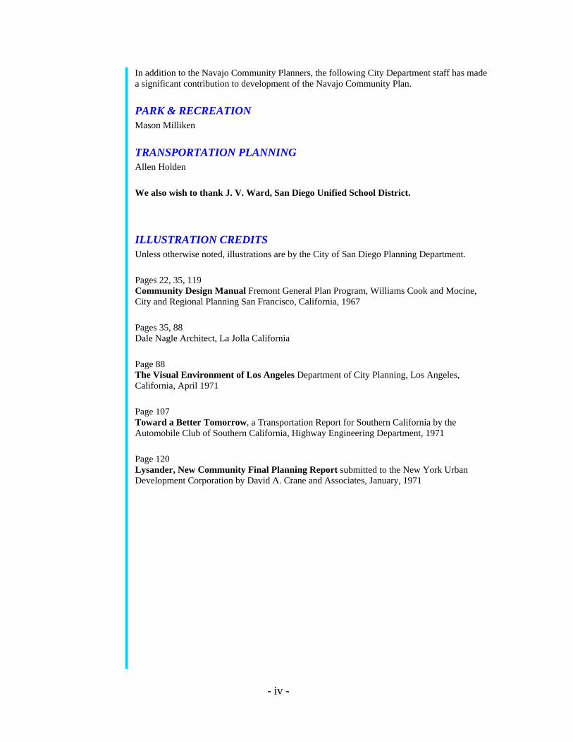
ILLUSTRATION CREDITS Unless otherwise noted, illustrations are by the City of San Diego Planning Department. Pages 22, 35, 119 Community Design Manual Fremont General Plan Program, Williams Cook and Mocine, City and Regional Planning San Francisco, California, 1967 Pages 35, 88 Dale Nagle Architect, La Jolla California Page 88 The Visual Environment of Los Angeles Department of City Planning, Los Angeles, California, April 1971 Page 107 Toward a Better Tomorrow, a Transportation Report for Southern California by the Automobile Club of Southern California, Highway Engineering Department, 1971 Page 120 Lysander, New Community Final Planning Report submitted to the New York Urban Development Corporation by David A. Crane and Associates, January, 1971
- iv -

THE CITY OF
SAN DIEGO CITY ADMINISTRATION BUILDING • 202 C STREET • SAN DIEGO, CALIF 92101
July 29, 1982
The Honorable Mayor and City Council The City Planning Commission City of San Diego, California Herein transmitted is the revision to the Navajo Community Plan. This revision represents a comprehensive, long-range policy guide for the physical development of this community and is intended to replace the community plan adopted by the City Council on November 7, 1973. In June of 1971, the Navajo Community Planners came into existence with the endorsement of the City Council and City Planning Commission. The Committee's purpose is to represent the Navajo area, composed of the communities of Allied Gardens, Grantville, Del Cerro and San Carlos, and to work with the City Manager's office and City Planning Department in a cooperative effort to develop and maintain a plan reflecting the goals and the aspirations of the citizens of the community. The Committee has met regularly with City staff, numerous agencies and individuals directly concerned with the future of the area, and with the citizens at large in well attended public meetings, the result of which is a revised document expressing a cross-section of community and City opinions. Involvement and expertise have been combined to produce a series of working solutions, all based on the assumption that Navajo will continue to grow as a healthy, predominantly single-family, yet varied area in which to live and to work. The Plan is a vitally needed step in realizing the development potential of Navajo for present and future residents of the community, as well as for the people of the City at large. It is recommended that the Planning Commission and the City Council adopt the Plan as revised to serve as a comprehensive policy framework for the long-range development of the Navajo community area. Respectfully submitted,
Jack Van Cleave Planning Director
- v -

NAVAJO COMMUNITY PLANNERS, INC.
P.O. BOX 20304, SAN DIEGO, CALIFORNIA 92120 Dear Community Resident: The goal of the Navajo Community Planners is a Plan which provides for the health, safety and welfare of the existing and future residents and maintains the area as a desirable neighborhood in which to live. The Plan is a cross section of community options and desires blended with professional knowledge and sound planning policy. Throughout many months the volunteer members of the Community Planning Board met with the City Planning Department Staff in workshops with representatives of various City, School and State Departments. Many ideas and concepts were considered and refined to meet the needs of the community, some were rejected. The Plan presented is a comprehensive, long-range policy guide for the Navajo Community. It discusses residential, commercial, industrial, open space, circulation, environmental and community facilities in terms of existing conditions, states projected needs, objectives and proposals for each. We hope you will take advantage of the detailed information to better understand the suggestions for the future of the community. For the Plan to serve as a useful document statements were made as precise as possible. Often it became necessary to use special phrasing and planning vocabulary. A section of definitions and concepts has been included to more clearly establish the concepts as worded in the text. Tables, charts, etc. were included where necessary for explanation and reference. The end result does give the Plan a technical textbook appearance, but it does make material available where and when it is needed. The Navajo Community Plan is simply a first step in the never-ending desire of the citizens to participate in the destiny of their community. We are grateful for your interest in the community and hope you will actively support and participate in the community planning process. Respectfully, NAVAJO COMMUNITY PLANNERS
- vi -
Table of Contents INTRODUCTION Preface....................................................................................................................................... 1 Physiography............................................................................................................................. 4 Background............................................................................................................................... 6 Existing Land Use and Zoning ............................................................................................... 10 Population Characteristics ...................................................................................................... 13 PLAN ELEMENTS Residential............................................................................................................................... 15 Commercial............................................................................................................................. 25 Industrial ................................................................................................................................. 37 Mixed-Use............................................................................................................................... 49 Open Space Retention and Utilization.................................................................................... 73 Parks and Recreation............................................................................................................... 81 Public Schools......................................................................................................................... 93 Other Community Facilities.................................................................................................... 99 Circulation............................................................................................................................. 105 Community Environment ..................................................................................................... 121
PLAN MAP ....................................................................................................................... 126
IMPLEMENTATION.................................................................................................... 130
CONCLUSION ................................................................................................................ 141 STANDARDS AND DEFINITIONS ........................................................................ 143
List of Tables TABLES
Table 1: Density Ranges ......................................................................................................... 16 Table 2: Site and Trade Population Standards for Commercial Centers ................................ 26 Table 3: Site Area and Development Status of Recreational Facilities Servicing Navajo ..... 85 Table 4: Optimum School Enrollment and Usable Site Area Standards ................................ 94 Table 5: Existing Educational Facilities ................................................................................. 95
- vii -

THIS PAGE INTENTIONALLY LEFT BLANK.
- viii -

INTRODUCTION
PREFACE
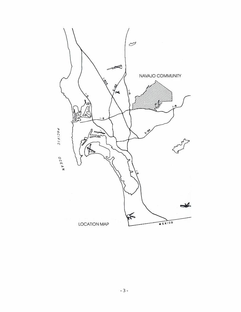
The Navajo area of San Diego is approximately 8,000 acres in size and is located in the easterly portion of the City of San Diego. It includes the community areas of Allied Gardens, Del Cerro, Grantville and San Carlos. It is bounded on the north by Mission Gorge, on the east by the cities of El Cajon and La Mesa, on the south by Highway 8 and on the west by the San Diego River channel. Navajo is conveniently located within the metropolitan area. Employment and shopping are readily accessible within the community and in nearby areas. Grantville, a major employment center, is located within the westerly portion of the community. The Kearny Mesa industrial area, another major employment center, is somewhat farther away, but still convenient to the residents of Navajo. These areas, plus downtown employment centers, are quite accessible by major streets and freeways. In addition to the many industrial facilities within and close to the study area, regional and community shopping centers are located within Navajo and in nearby Kearny Mesa, Mission Valley, La Mesa, El Cajon and downtown San Diego. The overriding objectives for the long-range development of Navajo are to retain the residential character of the area, provide adequate community services, such as police and fire protection, rubbish collection, etc., establish guidelines for the utilization of canyons and hillsides and enhance the environment of the area as a pleasant community in which to live. To assist in accomplishing these objectives, this community plan provides guidelines for public and private development to the year 2000. The Plan represents a policy framework that will enable the community and the City to work jointly on more specific studies and action programs. The Plan is only an initial step.
While this Plan sets forth many proposals for implementation, it does not establish new regulations or legislation nor does it rezone property. However, under the provisions of Section 65860 of the Government Code that requires that the City Zoning Ordinance be consistent with the General Plan, the Plan does establish the guidelines for the future preparation or amendment of City ordinances. Zoning, subdivision, housing, building or other development controls must be enacted separately through the legislative process in order to implement the intent of this Plan. The implementation section of this Plan identifies those steps to be taken.
The need for a flexible document is acknowledged. Nothing can be rigid in view of changing life styles, needs, and technology. However, the recommendations as expressed in this Plan, together with the planning principles, should not be allowed to be eroded by individual interpretations but should be kept intact and followed unless amended by due process.
The Plan discusses the community environment and major land uses: residential, commercial, open space, industrial, community facilities, and circulation. Elements are presented in terms of existing conditions, development potential or projected needs, objectives and proposals. A Plan map presents a composite of all major land use proposals.
- 1 -

Finally, the Plan concludes with an implementation section which sets forth major projects, public and private, needed to carry out the Plan.
Periodic updating of the Plan will be necessary as conditions in the community change. Once adopted by Council, any amendments, additions or deletions from the document will require that the Planning Commission and the City Council follow the same procedure of holding public hearings as was followed in adopting the Plan originally. Future decisions affecting the environment of the area will be based on the general objectives above as well as the specific recommendations that follow.
- 2 -
- 3 -

PHYSIOGRAPHY The community is characterized by a wide variety of natural features typical of many other San Diego areas, including flat mesas, steep canyons, and rolling hills. The most prominent feature in the area is Cowles Mountain. Elevations within the community range from a low of around 100 feet above sea level at the westerly edge of Mission Gorge to 1,591 feet at the peak of Cowles Mountain, the highest point in the City.
Within the slopes of Cowles Mountain, there are approximately 4,250 acres of undeveloped land. Approximately 2,230 acres of this land are in steep slopes of 35 percent or greater; 1,070 acres have slopes of 15-35 percent; and the remaining 950 acres are relatively level with slopes of less than 15 percent. Natural vegetation in the community consists mostly of chaparral, sage, and other cover typical of semiarid regions, with some oak and sycamore trees in the canyons. The soil composition is basically alluvium, slope wash and sedimentary rocks. The high quality hard blue rock located in Mission Gorge is processed into sand and gravel by commercial enterprises.
Three sedimentary formations exist in areas of the community that, when combined, form an unstable soil condition. This unstable condition can be responsible for groundwater seepage and landslides. Measures should be taken when development is proposed in these areas that would reduce the geological hazard impacts to a level of insignificance. One such measure is the application of the Geologic Hazard Overlay category. The overlay identifies areas that, where such soil conditions exist, the developer is to provide an as-built geologic report prior to issuance of building permits by the City, and is required to provide homeowner warranties against landslides for a period of ten years following the first sale of any developed property (Council Resolution No. R-254954 adopted August 31, 1981).
There are several unique features in the area. Mission Gorge on the north is the site of the early Mission Dam and is a state historical landmark. Centered in the southeastern part of the community is Lake Murray, a City-owned reservoir which also serves as a recreation facility. The lake, proposed for continued aquatic recreational use, contains 140 surface acres of water surrounded by approximately 416 acres of City-owned land. A public golf course is located within this area.
Natural runoff from the community drains into the San Diego River to the north and west and Alvarado Canyon to the south. The natural groundwater of the San Diego River is being used by the sand and gravel processors. The river is subject to flooding that, of course, should be considered when allocating land use for the floodplain. Rainfall in the area is slightly less than ten inches a year, which is consistent with the overall San Diego average.
- 4 -

- 5 -

BACKGROUND The study area is closely tied to early California history. Navajo has always been a prime location in the San Diego area--near water, in the vicinity of good land for cultivation and at the crossroads of five major trails: the Mission Trail (now known as Friars Road), Murphy Canyon Road, Yard Road, Alvarado Trail and Mission Gorge Road. California's first mission was located on the Rancheria Nipaguay, adjacent to the area, probably because of the choice location.
Formal dedication of the Presidio of San Diego de Alcala by Father Junipero Serra occurred on July 16, 1769. The City of Saint Didacus began to produce changes on the landscape. The good Fathers needed a guaranteed supply of water; thus, the first irrigation project in California was begun. From 1812 to 1816, Indian laborers constructed what is known as the Old Mission Dam in Mission Gorge with a six-mile transmission ditch to the Mission.
In 1835, the Missions were secularized by the Mexican Government. At that time, Mission Ranch of San Diego de Alcala encompassed 58,875.38 acres. It was the second largest Rancho in San Diego County, extending eastward from the San Diego Pueblo boundary to El Cajon Rancho, and northward from Rancho de la Nacion to what is now Miramar Naval Air Station.
Before secularization, the area (El Cajon Rancho) was included in the lands of the San Diego Mission and was one of the Mission's most valuable grazing areas. As defined by an early land commission, this rancho extended northeasterly from La Mesa to a point north of the San Diego River above EI Monte Park and over the area now occupied by El Cajon, Bostonia, Santee, Lakeside and Flinn Springs.
In 1887, plans for a town site were laid out by the Junipero Land and Water Company. Plans for a Soldier's Home to be located at Grant Circle were included. The official name registered with the post office was Orchard, but the area became known as Grantville in honor of President U. S. Grant.
In 1948, the so-called Waring Tract, comprising approximately 460 acres, was annexed to the City of San Diego. Following this, the Southern Title and Trust Company Tract was annexed in 1951. This second annexation covered 1,152 acres and was subsequently developed as Allied Gardens. Waring Tract No.2 was annexed in 1954. This annexation was one of the largest in the City of San Diego and consisted of almost 5,000 acres.
The San Carlos and Del Cerro communities have been developed within this area. Since the Waring Tract No.2 annexation there have been numerous smaller annexations on the northern periphery lying generally along Mission Gorge. The last annexation was in 1982, with most annexations occurring between 1953 and 1954.
- 6 -

- 7 -

- 8 -
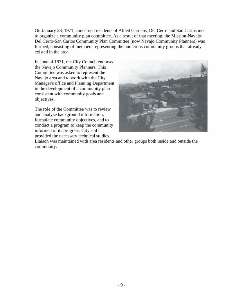
On January 28, 1971, concerned residents of Allied Gardens, Del Cerro and San Carlos met to organize a community plan committee. As a result of that meeting, the Mission-Navajo-Del Cerro-San Carlos Community Plan Committee (now Navajo Community Planners) was formed, consisting of members representing the numerous community groups that already existed in the area.
In June of 1971, the City Council endorsed the Navajo Community Planners. This Committee was asked to represent the Navajo area and to work with the City Manager's office and Planning Department in the development of a community plan consistent with community goals and objectives.
The role of the Committee was to review and analyze background information, formulate community objectives, and to conduct a program to keep the community informed of its progress. City staff provided the necessary technical studies. Liaison was maintained with area residents and other groups both inside and outside the community.
- 9 -

- 10 -
EXISTING LAND USE AND ZONING Of the total zoned land in the Navajo area, 52 percent, or 4,021 acres, is zoned for single-family homes; 4.5 percent, or 353 acres, is zoned for multiple family use; two percent, or 155 acres, is zoned for commercial use; and about three percent, or 238 acres, is zoned for industrial use. The remaining 38.5 percent of the area, or 3029 acres, located predominantly in the southern and eastern sections of the area, including Cowles Mountain, is zoned for
agriculture and the San Diego River floodway.
Public and semi-public uses and single-family homes are the predominant land uses within the community. Public and semi-public uses occupy 39.5 percent of the area or 3,099 acres. Single-family homes occupy approximately 37.5 percent or 2,924 acres while multifamily, commercial, and industrial uses comprise only nine percent of the area or 700 acres. Approximately 14 percent of the developed area is in streets and the remaining area is vacant.

- 11 -

- 12 -

POPULATION CHARACTERISTICS The Navajo community is one of San Diego's established communities. The 1980 census counted 50,005 people in this community. This population count represents an increase of 32,640 people, or 187 percent, since the 1960 census.
Approximately 82 percent of the dwelling units within Navajo are owner occupied. The occupancy rate is 95.01 percent. The development of tract homes is subsiding, while condominium and Planned Residential Development activity in the area is increasing.
The 1975 census shows a decline from 1970 in the number of children in the 0-5 age group within the area. If the trend continues, the demand for additional elementary grade classrooms may not be as acute as previous projections have indicated. As the community grows toward total development, one might expect the age composition to change in the direction of smaller average family size and an increase in the adult population, a trend which seems to be established in older developed areas. NOTE: All statistics compiled by City of San Diego Planning Department.
- 13 -


