25
VOLUME I – NON-TECHNICAL SUMMARY CONNECTION OF THE FOZ TUA HYDROELECTRIC PROJECT TO THE NATIONAL TRANSMISSION GRID, AT 400 kV PRELIMINARY STUDY ENVIRONMENTAL IMPACT STUDY DECEMBER 2013

VOLUME I – NON-TECHNICAL SUMMARY
CONNECTION OF THE FOZ TUA HYDROELECTRIC PROJECT TO THE NATIONAL TRANSMISSION GRID, AT 400 kV
PRELIMINARY STUDY
ENVIRONMENTAL IMPACT STUDY DECEMBER 2013
!
Connection of the FTHP, at 400 kV, to the National Electricity Transmission Grid
EIS, Volume I – Non-Technical Summary 1/24
Conne
CONNECTION OF THE FOZ TUA HYDROELECTRIC PROJECT, AT 400 kV, TO THE NATIONAL ELECTRICITY TRANSMISSION GRID
PRELIMINARY STUDY
ENVIRONMENTAL IMPACT STUDY
PRESENTATION
ECOBASE – Estudos e Soluções Sustentáveis, Lda. presents the Environmental Impact Study (EIS) of the project for the Connection of the Foz Tua Hydroelectric Project, at 400 kV, to the National Electricity Transmission Grid.
This EIS was prepared for EDP - Gestão da Produção de Energia, S.A., the project developer.
Algés, December 2013
Júlio de Jesus,
Technical Director of the Environmental Impact Study (Environmental Engineer - Chartered Member of the Portuguese Engineers Association no. 19972, professional member APAI no. 1)

Connection of the FTHP, at 400 kV, to the National Electricity Transmission Grid
EIS, Volume I – Non-Technical Summary 2/24
Conne
CONNECTION OF THE FOZ TUA HYDROELECTRIC PROJECT, AT 400 kV, TO THE NATIONAL ELECTRICITY TRANSMISSION GRID
PRELIMINARY STUDY
ENVIRONMENTAL IMPACT STUDY
TABLE OF CONTENTS
Volume Description
Volume I Non-Technical Summary
Volume II Report
Volume III Annexes
Volume IV Maps
Connection of the FTHP, at 400 kV, to the National Electricity Transmission Grid
EIS, Volume I – Non-Technical Summary 3/24
Conne
What is the Non-Technical Summary?
The Non-Technical Summary (NTS) is a document that is part of the Environmental Impact Study (EIS), but which is presented separately, in order to facilitate an extensive public disclosure of the study, in particular during the public consultation. The NTS summarises, in plain language, the key information contained in the EIS.
Anyone requiring more in-depth information about the study of the environmental effects of the project for the " Connection of the Foz Tua Hydroelectric Project, at 400 kV, to the National Electricity Transmission Grid"1 may consult the complete EIS, which is available, during the public consultation period, at the Portuguese Environment Agency (APA)2, at the North Regional Coordination and Development Commission (CCDR)3, and at the ten municipal councils where the project is located4: Alijó, Armamar, Carrazeda de Ansiães, Lamego, Peso da Régua, Sabrosa, São João da Pesqueira, Tabuaço, Torre de Moncorvo, and Vila Real5.
The public consultation period will be set by APA in the notice available on the internet site of APA.
EIS - Environmental Impact Study
1 - The Foz Tua Hydroelectric Project (FTHP, AHFT in Portuguese) is better known as the Foz Tua Dam. However, the dam is only one part of the FTHP. The power station and the electrical substation are other parts of the FTHP.
2 - The APA is headquartered in Zambujal, Amadora. Internet site: www.apambiente.pt/index.php Telephone: 214 728 200 3 - The North CCDR is headquartered in Porto Internet site: www.ccdr-n.pt Telephone: 226 086 300
4 - This issue will be discussed in more detail later, but it should be noted that the high number of municipalities is due to the fact that, at this stage of the project (preliminary study phase), there are several hypotheses for the layout of the route.
5 - Internet sites and telephone numbers of the municipal councils:
• Alijó: www.cm-alijo.pt Telephone: 259 957 100 • Armamar: www.cm-armamar.pt Telephone: 254 850 800 • Carrazeda de Ansiães: www.cm-carrazedadeansiaes.pt Telephone: 278 610 200 • Lamego: www.cm-lamego.pt Telephone: 254 609 600 • Peso da Régua: www.cm-pesoregua.pt Telephone: 254 320 230 • Sabrosa: www.sabrosa.pt Telephone: 259 937 120 • São João da Pesqueira: www.sjpesqueira.pt Telephone: 254 489 999 • Tabuaço: www.cm-tabuaco.pt Telephone: 254 780 000 • Torre de Moncorvo: www.cm-moncorvo.pt Telephone: 279 200 220 • Vila Real site: www.cm-vilareal.pt Telephone: 259308100
What is the project under review? What is its goal? What stage is it at? Who is proposing it?
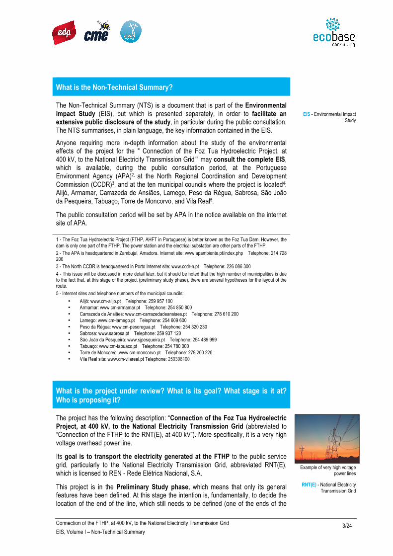
The project has the following description: “Connection of the Foz Tua Hydroelectric Project, at 400 kV, to the National Electricity Transmission Grid (abbreviated to “Connection of the FTHP to the RNT(E), at 400 kV”). More specifically, it is a very high voltage overhead power line.
Its goal is to transport the electricity generated at the FTHP to the public service grid, particularly to the National Electricity Transmission Grid, abbreviated RNT(E), which is licensed to REN - Rede Elétrica Nacional, S.A.
This project is in the Preliminary Study phase, which means that only its general features have been defined. At this stage the intention is, fundamentally, to decide the location of the end of the line, which still needs to be defined (one of the ends of the
Example of very high voltage
power lines
RNT(E) - National Electricity Transmission Grid

Connection of the FTHP, at 400 kV, to the National Electricity Transmission Grid
EIS, Volume I – Non-Technical Summary 4/24
Conne
line being the FTHP substation) and what its routing will be. On a later stage, referred to as the Final Design, the location of the pylons will then be defined and the detailed adjustments will then be made to the circuit, according to the results of the current Environmental Impact Assessment procedure.
The developer of this project is EDP - Gestão da Produção de Energia, S.A., which is the concessionaire6 of the FTHP. It is a company with extensive experience in construction, operation, maintenance and management of thermal and hydro electricity producing centres, such as the large existing hydroelectric developments in the region, along the Douro river basin.
Information about EDP Produção available at:
www.edp.pt
a-nossa-energia.edp.pt
6 - “Concessionaire” means that the construction and operation of the FTHP and the utilization of the water resources, a public good, for hydroelectric production were assigned by the Portuguese State to this company, for a certain number of years (specifically, 75 years).
What is the Environmental Impact Study? And the procedure for Environmental Impact Assessment? And the Environmental Impact Statement?
Certain types of projects are subject to Environmental Impact Assessment (EIA) prior to the authorisation for their implementation. The legal regime of AIA is established in Decree-Law (DL) no. 151-B/2013, of 31st October7. This legislation establishes the rules to be followed in the EIA procedure.
The objectives of EIA are:
− To assess the potential effects (= impacts), positive and negative, of the projects;
− To identify the measures to avoid, reduce or compensate the most negative effects of the projects;
− To indicate the control measures (= monitoring) to be adopted;
prior to a final decision being made on the licensing of the project.
EIA also allows the entities (for example, the municipal councils) and the public concerned (individuals, associations, companies, etc.) to express their views and concerns, contributing to the decision on the project.
The EIA procedure is the responsibility of a Public Administration body, called the EIA Authority. In this case the AIA Authority is the Portuguese Environment Agency. (APA).
An essential tool of the EIA is a document referred to as the Environmental Impact Study (EIS), which is prepared by the developer of the project subject to EIA8. The EIS indicates the possible effects of the project, positive and negative, and the measures it proposes to adopt to avoid, reduce or compensate the more serious negative effects, as well as the measures to enhance the positive effects.
The legal regime of EIA has a tiered-approach, allowing the EIS to focus on different stages of the project: Preliminary Study or Preliminary Design, and Final Design. In the case of electrical high voltage lines it is frequent that EIS be prepared during the Preliminary Study phase, allowing various alternatives of routing for the power line.
The EIA procedure ends with the issuing of an Environmental Impact Statement (“DIA – Declaração de Impacte Ambiental”)9, which can be favourable, favourable
EIA - Environmental Impact Assessment
DL - Decree-Law
APA - Portuguese Environment Agency
When EIA occurs in the Preliminary Study or Preliminary
design phase, licensing of the project is preceded by a phase
of verification of the environmental compliance of
the project, in which the developer delivers a document known as RECAPE- Report on the Environmental Compliance
of the Final Design.

Connection of the FTHP, at 400 kV, to the National Electricity Transmission Grid
EIS, Volume I – Non-Technical Summary 5/24
Conne
with conditions, or unfavourable. The DIA takes into account the advice on the EIS and on the impacts of the project produced by an Assessment Committee, formed by the APA and by other Public Administration bodies, as well as the results of the public consultation held10.
The project can only be licensed11 and built after the issuing of a favourable or conditionally favourable DIA.
DIA - Environmental Impact Statement
DGEG - Directorate-General for Energy and Geology
7 - The Portuguese legislation may be consulted at: www.dre.pt.
8 - The most common situation is for this to be done by a consulting firm hired by the promoter.
9 - The Environmental Impact Statements can be consulted at: aia.apambiente.pt/ipamb_dpp/index.asp. 10 - There are public consultations in all EIA procedures.
11 - The authority that licenses the power lines is the Directorate-General for Energy and Geology (DGEG. Internet site: www.dgeg.pt
When was the EIS carried out? And by whom?
The EIS was carried out between May and December 2013, by the consultancy Ecobase - Estudos e Soluções Sustentáveis, Lda.12, with the participation of a technical team of various experts13.
12 - Internet site: www.ecobaseconsulting.com
13 - The technical team involved in the preparation of the EIS is presented in section 1.6 of the EIS Report and in Annex 3 of the EIS
What is the background to this EIS?
The FTHP is part of the National Programme of Dams of High Hydroelectric Power Potential – PNEPBH14. This infrastructure enables the production of electric energy from a source of renewable energy, the water. The construction of the FTHP only started after its own EIA procedure, where the Environment Impact Statement, conditionally favourable, was issued on 11 May 2009 (and later amended on 18 June 2009). It is under construction, and is expected to be completed by 2016.
In 2005, the competent authority, the Directorate-General for Energy and Geology (DGEG) established that the connection of the FTHP to the RNT(E) should be made at the Armamar Substation. The project for the power line (Foz Tua - Armamar Power Line, at 400 kV), also in the Preliminary Study phase, was submitted to EIA in 2011. An unfavourable Environment Impact Statement proposal was issued, which resulted in the developer requesting the EIA procedure to be terminated. The reasons for the Environment Impact Statement being unfavourable were that not enough alternative options had been considered and that the impact of the project on the Alto Douro Wine Region (ADWR), designated as a World Heritage property, where the project was partially located, had not been correctly assessed15, 16.
Prior to subjecting the project to a new EIA procedure, the developer decided to present a scoping proposal for the EIS to the EIA Authority in November 201217. One of the objectives of this proposal was the selection of the alternatives to be studied in the EIS. Two technical alternatives and nine alternatives of routes and connections points of the grid were presented.
The two technical alternatives were a voltage level of 220 kV, instead of the 400 kV initially stipulated, and an underground power line through part of the route. Both technical alternatives were deemed not to be viable in the scoping proposal, a
Cover of the FTHP EIS

Connection of the FTHP, at 400 kV, to the National Electricity Transmission Grid
EIS, Volume I – Non-Technical Summary 6/24
Conne
conclusion that was later confirmed by the DGEG and included in the EIS. Of the nine alternatives for the routing and the grid connection points, the scoping proposal selected three, which were deemed to be more viable from a technical and environmental perspective.
The scoping proposal was open to public consultation18 between December 2012 and January 2013. In March 2013, the Advice of the Assessment Committee was issued; one main consequence of which was the inclusion of a fourth alternative routing to be analysed in the EIS.
Two of the alternatives selected have variants, i.e. they only differ in a small part of the route layout. As a result, eight alternatives were selected to be analysed in the EIS. hereinafter called “solutions”.
In this EIS, the name of the project was changed from “Foz Tua-Armamar Power Line, at 400 kV” to “Connection of the FTHP, at 400 kV, to the National Electricity Transportation Grid” because, due to fact of another connection point being studied, in addition to the Armamar Substation, the previous name was no longer accurate.
Cover of the EIS of the Foz
Tua-Armamar Line, at 400 kV
Cover of the Scoping Proposal
for the EIS of the Foz Tua-Armamar Power Line, at 400 kV
Signpost for the World Heritage
property, the Alto Douro Wine Region.
14- Internet site: pnbeph.inag.pt/np4/home.html
15 - Internet site with the list of World Heritage properties: whc.unesco.org/en/list (in English, also available in French). ADWR file: whc.unesco.org/en/list/1046 (in English, also available in French and Spanish).
16 - At a national level, this area is designated as a national monument. 17 - The presentation of a scoping proposal by the developer was provided for in DL no. 69/2000 of 3 May as optional. In this document, in addition to the project being identified and briefly described, the environmental factors to be studied, the environmental impacts of the project to be assessed and the methodologies to be followed in the EIS are also proposed. DL no. 69/2000 of 3rd May was repealed by DL no. 151-B/2013 of 31st October, which also allows the developer to submit a scoping proposal and, in the transition to the new EIA legal regime, upholding the validity of previous decisions on scoping proposals. 18 – The public consultation at the scoping phase is optional and is a decision of the developer.
Connection of the FTHP, at 400 kV, to the National Electricity Transmission Grid
EIS, Volume I – Non-Technical Summary 7/24
Conne
What are the alternatives considered in the EIS?
In the EIS, eight routing alternatives were studied for connecting the FTHP to the grid, at 400 kV: Solutions 1, 2SI, 2SM, 2NI, 2NM, 3N, 3S, and 4.
These alternatives are shown in Figure 1, where one realizes that from FTHP, there are six alternatives to connect to the Armamar Substation and there are two alternatives to connecting to a point further east, in the municipality of Torre de Moncorvo, explained hereinafter.
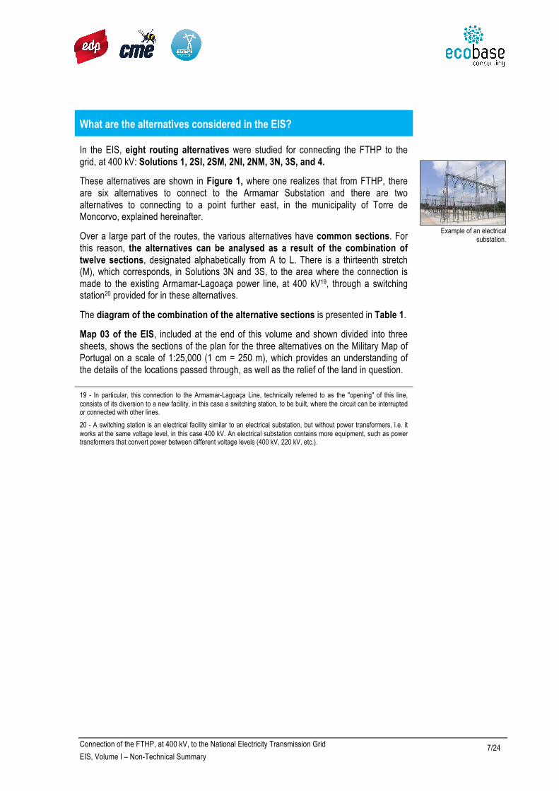
Over a large part of the routes, the various alternatives have common sections. For this reason, the alternatives can be analysed as a result of the combination of twelve sections, designated alphabetically from A to L. There is a thirteenth stretch (M), which corresponds, in Solutions 3N and 3S, to the area where the connection is made to the existing Armamar-Lagoaça power line, at 400 kV19, through a switching station20 provided for in these alternatives.
The diagram of the combination of the alternative sections is presented in Table 1.
Map 03 of the EIS, included at the end of this volume and shown divided into three sheets, shows the sections of the plan for the three alternatives on the Military Map of Portugal on a scale of 1:25,000 (1 cm = 250 m), which provides an understanding of the details of the locations passed through, as well as the relief of the land in question.
Example of an electrical
substation.
19 - In particular, this connection to the Armamar-Lagoaça Line, technically referred to as the "opening" of this line, consists of its diversion to a new facility, in this case a switching station, to be built, where the circuit can be interrupted or connected with other lines.
20 - A switching station is an electrical facility similar to an electrical substation, but without power transformers, i.e. it works at the same voltage level, in this case 400 kV. An electrical substation contains more equipment, such as power transformers that convert power between different voltage levels (400 kV, 220 kV, etc.).

Connection of the FTHP, at 400 kV, to the National Electricity Transmission Grid
EIS, Volume I – Non-Technical Summary 8/24
Conne
Figure 1 – Diagram showing the alternative sections
Table 1 - Alternatives considered in the EIS and breakdown into sections.
Alternatives Description Sections Length (km)
Solution 1 Connection to the Armamar Substation, crossing the river Douro using the corridor of an existing
60 kV power line A+B+C+D 30.2
Solution 2SI
Connection to the Armamar Substation, crossing the river Douro in the Valeira area, as an
independent power line, and crossing river Tua in a Southern corridor (*)
A+B+E+F+GI+H+D 39.3
Solution 2SM
Connection to the Armamar Substation, crossing the river Douro in the Valeira area, as a mixed
power line 400+220 kV, and crossing river Tua in a Southern corridor (*)
A+B+E+F+GM+H+D
39.7
Solution 2NI
Connection to the Armamar Substation, crossing the river Douro in the Valeira area, as an
independent power line, and crossing river Tua in a Northern corridor (*)
A+I+J+F+GI+H+D 42.4
Solution 2NM
Connection to the Armamar Substation, crossing the river Douro in the Valeira area, as a mixed
power line 400+220 kV, and crossing river Tua in a Northern corridor (*)
A+I+J+F+GM+H+D 42.7
Solution 3S Connection to a Switching Station near Torre de Moncorvo, without crossing the river Douro, and
crossing river Tua in a Southern corridor (*) A+B+E+F+K+M 32.3 (**)
Solution 3N Connection to a Switching Station near Torre de Moncorvo, without crossing the river Douro, and
crossing river Tua in a Northern corridor (*) A+I+J+F+K+M 35.3 (**)
Solution 4 Connection to the Armamar Substation, crossing the river Douro in the Régua area, and without
crossing the river Tua A+I+L 42.1
(*) Upstream of Foz Tua dam: 2 km (Northern corridor) or 400 m (Southern corridor) (**) Includes 1.5 km of the opening of the existing Armamar-Lagoaça power line at 400 kV line (section M).

Connection of the FTHP, at 400 kV, to the National Electricity Transmission Grid
EIS, Volume I – Non-Technical Summary 9/24
Conne
Where is the project located?
Figure 2 shows a map of Portugal with the location of the project and the administrative boundaries (by county).
Table 2 shows the municipalities and parishes (marked with the symbol !) crossed by the various project alternatives, taking into account the corridor of 400 m studied for the implementation of the route, as it is usual in the Preliminary Study phase.
It should be noted that in relation to the parishes, this table shows the correspondence between the parishes prior to Law no. 11/2013 of 28 January and the parishes approved by the current law.
To get a more realistic perspective of the areas traversed by the project, it is suggested that you navigate on the aerial photograph of the area using the Google Earth software, which can be downloaded free from the Internet (earth.google.com/intl/pt/).
Figure 2 – Location of the project and administrative boundaries (municipalities).

Connection of the FTHP, at 400 kV, to the National Electricity Transmission Grid
EIS, Volume I – Non-Technical Summary 10/24
Table 2 – Municipalities and parishes crossed by the alternatives being studied (400 m corridor)
Municipalities Current Parishes Parishes prior to Law 11-A/2013
Solutions
1 2SI 2SM 2NI 2NM 3S 3N 4
Alijó
Union of Castedo and Cotas parishes
Castedo ! ! ! ! ! ! ! !
Cotas !
Favaios Favaios !
São Mamede de Ribatua São Mamede de Ribatua ! ! ! ! ! ! ! !
Union of Vale Mendiz, Casal de Loivos and Vilarinho das Cotas parishes
Vale de Mendiz !
Armamar
Aldeias Aldeias !
Union of Ariceira and Goujoim parishes
Aricera ! ! ! ! !
Armamar Armamar ! ! ! ! ! !
Coura ! ! ! ! !
Fontelo Fontelo !
Union of Vila Seca and Santo Adrião parishes
Vila Seca ! ! ! ! !
!
Vacalar Vacalar !
Carrazeda de Ansiães
Union of Castanheiro do Norte and Ribalonga parishes
Castanheiro ! ! ! ! ! ! !
Ribalonga ! ! ! ! ! !
Fonte Longa Fonte Longa ! !
Linhares Linhares ! ! ! ! ! !
Marzagão Marzagão ! ! ! ! ! !
Parambos Parambos ! ! ! ! ! !
Union of Lavandeira, Beira Grande and Selores parishes
Selores
! !
Vilarinho da Castanheira Vilarinho da Castanheira ! !
Lamego Union of Parada do Bispo and Valdigem parishes
Parada do Bispo
!
Peso da Régua
Union of Poiares and Canelas parishes
Canelas !
Poiares !
Union of Galafura and Covelinhas parishes
Covelinhas !
Galafura !
Sabrosa
Gouvinhas Gouvinhas !
Paços Paços !
Union of São Martinho das Antas and Paradela de Guiães parishes
Paradela de Guiães
!
Sabrosa Sabrosa !
Vilarinho de São Romão Vilarinho de São Romão !
São João da Pesqueira
Castanheiro do Sul Castanheiro do Sul ! ! ! ! !
Ervedosa do Douro Ervedosa do Douro ! ! ! ! !
Nagozelo do Douro Nagozelo do Douro !

Connection of the FTHP, at 400 kV, to the National Electricity Transmission Grid
EIS, Volume I – Non-Technical Summary 11/24
Municipalities Current Parishes Parishes prior to Law 11-A/2013
Solutions
1 2SI 2SM 2NI 2NM 3S 3N 4 Union of São João da Pesqueira and Várzea de Trevões parishes
São João da Pesqueira ! ! ! ! !
Soutelo do Douro Soutelo do Douro !
Tabuaço
Union of Barcos and Santa Leocádia parishes
Barcos ! ! ! ! !
Santa Leocádia ! ! ! ! !
Chavães Chavães ! ! ! ! !
Union of Távora and Pereiro parishes
Távora ! ! ! ! !
Union of Pinheiros and Vale Figueira parishes
Pinheiros ! ! ! ! !
Vale de Figueira ! ! ! ! !
Tabuaço Tabuaço ! ! ! ! !
Torre de Moncorvo
Cabeça Boa Cabeça Boa ! !
Castedo Castedo ! !
Torre de Moncorvo Torre de Moncorvo ! !
Vila Real Guiães Guiães !
What are the main features of the project? What are the main activities in the construction of the line? What are the safety distances in high voltage lines?
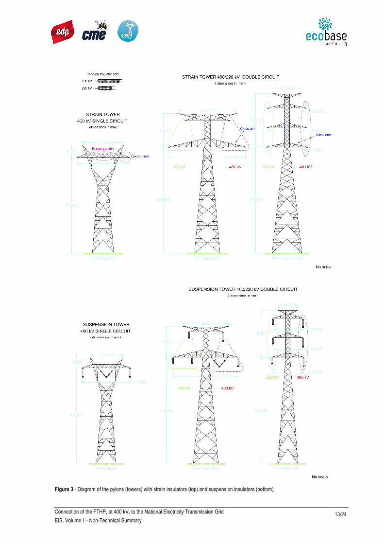
The project basically consists of lines, pylons, and suspension and connection elements (isolator chains). Very high voltage lines are conductor cables built in alloys. The pylons are constituted by steel profiles, similar to those of the existing grid power lines in the area, of four types: "Q" and "Y", for simple lines at 400 kV, and "DL" type and "Special Post” for 400/220 kV dual lines. The diagram of the “Q”, “DL” and “Special Post” pylon types is shown in Figure 3.
The height of the pylons varies between 20.55 m (minimum height of the “Y” type pylons) and 64.60 m (maximum height of the “DL” type pylons).
The pylons for the dual line are only used on the GM section (Solutions 2SM and 2NM), where the sections of the existing lines at 220 kV Valeira–Mogadouro and Valeira– Armamar 1/2 (the designation 1/2 indicates that these are two independent lines – Valeira-Armamar 1 and Valeira-Armamar 2), which share the same pylons for the connection of the FTHP line to the grid. In the D section, dual line pylons may be used from the Tabuaço area to the Armamar Substation.
The pylons support the conducting cables, which transport electric energy, and the ground cables, which are thinner and are placed above the others, and serve as lightning rods. The conductor cables are connected to the pylons by mean of glass isolator chains (strain and suspension restraints).
In relation to the layout of the conductor cables, in the single line sections the cables are placed horizontally (“Q” and “Y” Pylons), on those of the 400/200 kV dual line on

Connection of the FTHP, at 400 kV, to the National Electricity Transmission Grid
EIS, Volume I – Non-Technical Summary 12/24
double vertical bars (“DL” Pylons) or in dual triangle (Special Pylons). Figure 3 illustrates the layout of the conductors according to the pylon type; the connection points of the conductor cables are shown in red.
The pylons are anchored to the ground using four separate concrete blocks. The maximum area of each foundation corresponds to 3.90 m2, and the maximum depth of the buried foundation is 4 m.
For the connection by the Solutions 3N and 3S, a Switching Station in the area of Pocinho / Torre de Moncorvo will be built.
The Switching Station will be a facility with restricted access and will have a platform (land occupation) of approximately 200 m x 150 m where the operating equipment (for the opening of the line) and the safety equipment are housed.
Connection of the FTHP, at 400 kV, to the National Electricity Transmission Grid
EIS, Volume I – Non-Technical Summary 13/24
Figure 3 - Diagram of the pylons (towers) with strain insulators (top) and suspension insulators (bottom).

Connection of the FTHP, at 400 kV, to the National Electricity Transmission Grid
EIS, Volume I – Non-Technical Summary 14/24
Construc)on*Support*Sites*
Vegeta)on*cleaning*surrouding*the*pylons*loca)on*
Right*of**way*cleaning*to*guarantee*the*safety*disances*
Survey*and*opening*of*new*accesses*
Survey*and*stakeout*of*the*pylons*
Opening*of*trenches*
Instala)on*and*anchorage*of*the*bases*
Assembling*of*the*pylons*
Rising*of*the*pylons*and*uncoil*the*cables*
Restoring*of*the*affected*area*
As already mentioned, this EIS seeks to demonstrate the connection between the FTHP and RNT(E), which is considered the most suitable for the environment, due to the project being in Preliminary Study phase, which considers eight possible alternatives for study. Afterwards, the implementation project will be developed for the concrete solution.
Thus, the EIS has to consider, even in the Preliminary Study phase, the main construction activities.
The construction of an overhead power line involves a set of activities, beginning with the installation of the construction support sites and ranging up to the installation of pylons and electrical cables. As an indication, the main activities required to construct a high voltage electric power line are indicated in the Figure 4.
Figure 4 – Simplified diagram of the main construction activities of an overhead power line21
For safety reasons, line cables should be located within the regulatory minimum distances from the ground, trees, buildings, railways and roads, other overhead power lines and other obstacles.
Transport*of*pylons*
Between*the*factory*and*the*storage*area*
Between*the*storage*area*and*the*pylons*loca)on*

Connection of the FTHP, at 400 kV, to the National Electricity Transmission Grid
EIS, Volume I – Non-Technical Summary 15/24
Table 3 shows the values of the minimum distances, for the voltage level of this line, set in the regulations and the values adopted in this project in order to create a less conditioned right of way and increasing the level of safety.
Table 3 - Minimum safety distances of the conductor cables to obstacles
Type of obstacles Minimum distances set in the
regulations22 (m) Minimum distances adopted
in this project (m)
Ground 8,0 14,0
Trees 5,0 8,0
Buildings 6,0 8,0
Roads 10,3 16,0
Electrified railways 16,0 16,0
Non-electrified railways 10,3 15,0
Other overhead powerlines 7,0 7,0
Other obstacles 5,0 7,0
An administrative right of way will also be set - a strip of land with a maximum width of 45 m, centred on the axis of the line - on which some activities or facilities are conditioned, or subject to prior authorisation. The construction of buildings, to guarantee minimum safety distances or the installation of irrigation pivots, will also be conditioned or subject to authorisation. On this band, no forest plantations of fast growing species such as pines and eucalyptus will be allowed, which will be subject to cutting, should they exist in this strip. However, there will be no other significant restrictions to other species of smaller size and slow growth, nor to the continuity of the common agricultural practice. All that may be needed is simply some pruning of trees or tree line, to comply with the safety distances in relation to the conductors.
21 - In the construction activities certain specific care measures will be adopted, namely for the location of the construction support sites preference will be given to areas such as previous construction support sites or industrial warehouses, the opening of accesses will only occur when justified; the opening of trenches will be restored, as a rule, using the excavated material and respecting the morphology of the terrain.
22 - Safety Regulations for High Voltage Power Lines - RSLEAT, approved by Regulatory Decree No. 1/92 of 18th February.
What are the main characteristics of the project implementation area?
In the EIS, the following environmental factors were studied: Geology, Soils, Hydrology, Environmental Quality (which includes Noise and Air Quality), Biodiversity, Land-use Planning. Land-use, Socio-Economy, Landscape, Cultural Heritage and Cultural Landscape – World Heritage ADWR.
In terms of Geology, locations of geological interest were identified, either from a scientific or educational point of view. The only ones located in the vicinity of the project are locations of great interest in the way the relief took shape, forming rock promomtories that rise as natural viewpoints of the river Douro (São Leonardo da Galafura and São Salvador do Mundo) or the canyon formed by the river Douro at
Geology - Science that studies the Earth, its materials and how
they are distributed, and the transformations that took place
during the geological periods.

Connection of the FTHP, at 400 kV, to the National Electricity Transmission Grid
EIS, Volume I – Non-Technical Summary 16/24
“Cachão da Valeira”. Areas of interest were also identified from the point of view of exploitation of mineral resources.
The soils best suited to agriculture are classified as National Agricultural Reserve (RAN). The largest RAN area is in section K, especially when it crosses the floodplain of the Sabor river (Vale da Vilariça).
All the alternatives cross steeply sloping areas, where the soils are subject to high risk of erosion, which was the reason for their integration in the National Ecological Reserve (REN).
The various design solutions are developed in the Douro hydrographic basin, crossing some of its main tributaries: Sabor, Tua and Pinhão rivers, in the right side and on the left side, Torto and Tedo rivers, on the left side.
As for Noise, it was found that all sensitive sites (housing, schools, etc.) have reduced noise levels.
As to the Air Quality, the information provided by the APA was used. For the region “Norte Interior” (Inner North), where the project is located, the air quality is globally classified as good.
With regard to Biodiversity, factor that studies the species of flora and fauna and the habitats, a map was prepared of the habitats found within the 400 m corridor along the alternative routes. Of the 35 habitats identified, between artificial areas, bush land, forests and aquatic habitats, seven can be highlighted: cork oak forest, holm oak forest, chestnut groves, Arbutus unedo (strawberry tree) bushes, mixed cork oak groves, holm oak and juniper groves, oak groves and juniper bushes. The area with the highest concentration of these habitats is where the Douro River is crossed at the Valeira dam (Solutions 2SI, 2Sm, 2NI, 2NM).
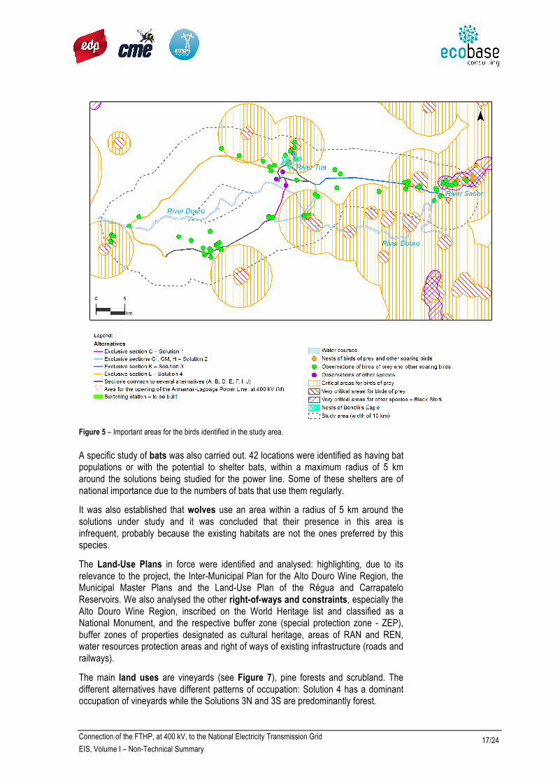
The most important group of the fauna, due to the possibility of collision with the power line cables, is the birds. Within this group, more attention was devoted to the birds of prey, as they have a greater risk of colliding with power lines; many are threatened with extinction in Portugal and have discontinuous distributions. The majority of other species with a higher risk of collision have extended distributions or are poorly represented in the study area, such as waterfowl (e.g., ducks). There are two confirmed Bonelli's Eagle nests in the last section of the Tua River, although apparently neither of the two was occupied at the time of the surveys (end of the Spring of 2013). The monitoring of Baixo Sabor Hydroelectric Project confirmed the occupation of a nest of Egyptian Vulture.
The most important areas for birds are the Tua, Sabor, Douro and Távora rivers. In terms of alternatives, Solutions 3N and 3S are those which have the most important avifauna (Figure 5). For this specific issue, the study area has been extended to a width of 10 km.
RAN - National Agricultural Reserve
REN - National Ecological Reserve
Connection of the FTHP, at 400 kV, to the National Electricity Transmission Grid
EIS, Volume I – Non-Technical Summary 17/24
Figure 5 – Important areas for the birds identified in the study area.
A specific study of bats was also carried out. 42 locations were identified as having bat populations or with the potential to shelter bats, within a maximum radius of 5 km around the solutions being studied for the power line. Some of these shelters are of national importance due to the numbers of bats that use them regularly.
It was also established that wolves use an area within a radius of 5 km around the solutions under study and it was concluded that their presence in this area is infrequent, probably because the existing habitats are not the ones preferred by this species.
The Land-Use Plans in force were identified and analysed: highlighting, due to its relevance to the project, the Inter-Municipal Plan for the Alto Douro Wine Region, the Municipal Master Plans and the Land-Use Plan of the Régua and Carrapatelo Reservoirs. We also analysed the other right-of-ways and constraints, especially the Alto Douro Wine Region, inscribed on the World Heritage list and classified as a National Monument, and the respective buffer zone (special protection zone - ZEP), buffer zones of properties designated as cultural heritage, areas of RAN and REN, water resources protection areas and right of ways of existing infrastructure (roads and railways).
The main land uses are vineyards (see Figure 7), pine forests and scrubland. The different alternatives have different patterns of occupation: Solution 4 has a dominant occupation of vineyards while the Solutions 3N and 3S are predominantly forest.

Connection of the FTHP, at 400 kV, to the National Electricity Transmission Grid
EIS, Volume I – Non-Technical Summary 18/24
In Socioeconomic terms, it was found that the project area is located within one of the rural areas with the most well-known features in the country, the Douro valley, and most of the corridors are located in direct relation with the Alto Douro Wine Region. The economy is based on the agricultural sector. However, there is a very low population density, and a significant ageing.
In terms of Landscape, eight landscape units, i.e., eight major landscapes areas were identified, which are different from each other, either by the type of relief (whether by slopes, or plateaus, etc.) or by the vegetation that grows there, or by the way the land is being used, or due to the housing, etc. But the landscape unit where the greatest part of the alternative routes is located is the Douro Wine Region. A rich landscape of steep, rocky slopes, that the ancient man gathered to build walls and floors, where he cultivated vineyards for his livelihood, producing wines that spread his fame to the four corners of the globe, as well as a quilt of farms and villages, of green fields and orchards, chapels in the mountains, of heights and silent cliffs, of running rivers, dry land forests and thickets, which remains alive and follows the evolution of the times. Due to the many adornments that man and nature have created, it appears that the vast majority of the landscape under analysis is presented as a scenario often of great beauty and sensitivity (high quality and visual sensitivity). This landscape can be greatly affected and changed negatively by the emergence of projects with important dimension such as the power line under study, which is why the EIS carried out a detailed analysis of the characteristics of the area and, at the same time, the characteristics and differences of each of the eight alternative solutions in order to select the one which has the least detrimental effect on the value and beauty of the landscape, its natural value and the values that man attributes to it (cultural values).
The territory in which the project is located has a great wealth and diversity of elements of cultural heritage. A survey was undertaken of asset values, including specific archaeological survey, which produced an inventory of about 40 archaeological occurrences in the 400 m of corridors centred on alternative routes under study.
Through the characteristics of the landscape of the study area described above, because they are so unique, valuable, and authentic, part of this territory includes the Alto Douro Wine Region (ADWR), included since 2001 in the World Heritage List, in the category of Cultural, Evolving and Live Landscapes, and the respective Buffer Zone (ZEP) - Figure 6.
The attributes, i.e. the different elements that constitute the landscape and convey its unique character and the Outstanding Universal Value (OUV) of ADWR, include the following cultural and natural values:
- The systems of terracing the land, the schist walls and other elements, such as addorsed and embedded stairs, built-in shelters, and schist buttresses;
- The traditional walled and cobbled paths and drainage systems;
- The vineyards and the grape genetic heritage;
- The Mediterranean cultures, namely olive, almond and orange groves
- The “mortórios” - Abandoned vineyards (never replanted with vines after the phylloxera disease);
- The historical heritage, designated or under designation process;
- The archaeological sites;

Connection of the FTHP, at 400 kV, to the National Electricity Transmission Grid
EIS, Volume I – Non-Technical Summary 19/24
- The settlements;
- The farms (“quintas”) ;
- The places of religious practice - sanctuaries, chapels and churches, often associated to viewpoints;
- The vernacular heritage, namely shelters (“cardanhos”), barn floor, dovecotes, storage houses;
- The railway lines;
- The mosaic pattern of the landscape;
- The river Douro and its tributaries;
- The steep slopes;
- The mountain ridges;
- The geological heritage sites;
- The Mediterranean woods;
- The riparian galleries.
Figures 7 and 8 show the area of vineyards and the area with terraces (occupied by vineyards, olive trees, orchards and “mortórios”) in the study area of the project.
Figure 6 – Study area and limits of ADV and its Buffer Zone (ZEP).

Connection of the FTHP, at 400 kV, to the National Electricity Transmission Grid
EIS, Volume I – Non-Technical Summary 20/24
Figure 7 – Vineyard area
Figure 8 – Terraces area.

Connection of the FTHP, at 400 kV, to the National Electricity Transmission Grid
EIS, Volume I – Non-Technical Summary 21/24
What are the main effects (impacts) of the project?
The main residual impacts23,24 of the project, deemed to be significant, are the following:
• Conditioning of future land-use planning, particularly for alternative solutions that create a new linear infrastructure corridor;
• Effect on land uses, associated mainly to the location of the pylons;
• Effect on biophysical structure of the landscape and visual impact;
• Effect on the visual setting of archaeological and architectural heritage elements and on the scenic value of attributes that give the Outstanding Universal Value to the Alto Douro Wine Region;
• Possible collision of birds and bats;
• Effect on economic activities and on the quality of life of the populations.
The following were considered as less significant impacts:
• Effect on geological values or geological resources;
• Alteration of local topography;
• Destruction of the soil (in the areas of the foundations of pylons and in the platform for the Switching Station);
• Increase in noise levels
• Destruction or disturbance of vegetation, habitats, fauna or ecological corridors;
• Creation of employment (during the construction phase).
The change in drainage and increased dust concentration (during the construction phase) were considered irrelevant impacts.
As for cumulative impacts25, the other main projects considered were the hydroelectric developments of Foz Tua (all solutions) and Baixo Sabor (Solutions 3N and 3S), the existing and planned wind farms in the proximity of the study area, other overhead power lines, mining projects and existing brownfields.
The main cumulative impacts identified are related to birds (habitat loss and collision with lines), the land-use planning (new infrastructure corridors), the landscape and the Alto Douro Wine Region.
Because the project is located partially in ADWR, a Heritage Impact Study was prepared, following the 2001 guidelines of ICOMOS, UNESCO advisory body under the World Heritage Convention, Cultural and Natural Heritage, regarding the evaluation of the impact projects in properties inscribed on the World Heritage List (the ADWR is a property inscribed on the list). The main conclusion of this study, which is presented separately in the EIS (Annex 28), is that the impacts of this project, in any of its alternatives, are not very significant and do not jeopardise the integrity and authenticity of the Alto Douro Wine Region.
ICOMOS - International Council of Monuments and
Sites
UNESCO - United Nations Educational, Scientific and
Cultural Organization
23 - The impact is the change, or difference, in a specific aspect, between the situation that would occur (at a given location and time) if an action did not take place and what would happen if this action occurred.
24 - The residual impact is the impact that remains after the application of mitigating measures (definition in footnote no. 26).

Connection of the FTHP, at 400 kV, to the National Electricity Transmission Grid
EIS, Volume I – Non-Technical Summary 22/24
25 - Cumulative impacts are the impacts resulting from a set of projects, including the project under review. It is important to evaluate these impacts because the projects, when evaluated individually, may not have a significant impact, but together may have a significant impact.
What are the main measures for mitigating the negative impacts? Was monitoring proposed?
The mitigation measures26 proposed include a careful selection of the elements of the project, such as pylons, switching station, construction support sites and road accesses, in order to avoid or reduce the impacts on the values identified.
Regarding the fauna, in particular the bird species, the most important measure, in addition to avoiding the most sensitive areas, is to place devices on the overhead lines to make them more visible in order to avoid collisions. These devices, called BFD (Bird Flight Diverters), are widely used internationally.
As for the archaeological cultural heritage, monitoring of the construction work is proposed in order to prevent damage in the event of the discovery of archaeological remains during the works.
In the specific case of this project, since there is the likelihood of the crossing of areas of terraced vineyards, included in ADWR and respective Buffer Zone, a special procedure for the construction (Annex 10 of the EIS), with the objective of avoiding and reducing negative impacts on these areas, and it will be further detailed in the Detail Design phase.
The following monitoring programmes are proposed: Geology, Birds, Noise, Socio-Economy, Landscape, Cultural Heritage (archaeological, architectonic and intangible) and Cultural Landscape – World Heritage ADWR.
Several enhancement measures are proposed, such as inventories of cultural heritage assets and its diffusion, enhancement of viewpoints and restoration of brownfields.
BFD - Bird Flight Diverter
26 - Mitigation measures are measures to avoid, reduce or compensate for the negative impacts.

Connection of the FTHP, at 400 kV, to the National Electricity Transmission Grid
EIS, Volume I – Non-Technical Summary 23/24
What alternative was considered as having the least environmental impact? What are the main findings of the EIS?
On a scale of 1 to 10, where 10 represents the solution that has the least environmental impact and the rest are rated by comparison, the results illustrated in Figure 9 were obtained.
Figure 9 - Weighted environmental classification of the alternatives
It can be concluded that there is a set of more favourable alternatives (Solutions 2SM, 3S and 1), showing, clearly, that the alternatives crossing the Tua further upstream (2NI, 2NM and 3N) are worse than the alternatives crossing closer to the dam (2SI, 2SM and 3S). It is also clear that, in the alternatives of the Solution 2 (2SI, 2SM, 2NI e 2SM), the option of the mixed 400/220 kV power line, dismantling the existing 220 kV power lines, is preferable to the solution of the separate 400 kV line.
Table 4 presents an estimate - for the three solutions considered to be more favourable – of the areas occupied by the pylons.
Table 4 – Areas of RAN – National Agricultural Reserve, vineyards and forest occupied by the pylons in Solutions 1, 2SM and 3S
Solutions Area of RAN (m2) Area of vineyards (m2) Area of forest (m2)
1 0 1142 1343
2SM 110 1352 2276
3S 500 645 1336

Connection of the FTHP, at 400 kV, to the National Electricity Transmission Grid
EIS, Volume I – Non-Technical Summary 24/24
Although the assessment of alternatives carried out in the EIS was based on the residual environmental impacts identified and assessed, i.e., considering the adoption of the proposed mitigation measures, it was considered relevant to complement that environmental assessment of the alternatives, with a techno-economic analysis based on the costs of each alternative (ranging between 8.8 and 15.4 million euros). Assigning a weight of 75% to the environmental component and of ß25% to the cost of the project, it is clear that Solution 1 is the most favourable, followed by the Solutions 2SM and 2SI.
The analysis conducted in the EIS also enables the following conclusions to be drawn:
! All of the alternatives analysed are environmentally viable;
! None of the alternatives has significant negative effects on the attributes that give the Alto Douro Wine Region its Outstanding Universal Value;
! None of the alternatives affects the integrity or authenticity of the Alto Douro Wine Region.
It should be added that in the preparation of this study, in general, there were no gaps in information that could affect the conclusions of the EIS.
What are the next steps?
Following the issuance of a favourable or conditional favourable Environmental Impact Statement (DIA), the Final Design of the selected alternative will be developed, making the necessary adjustments and an optimisation of the layout to prevent or reduce the negative impacts identified.
Preceding the licensing process by DGEG, a phase of verification of the environmental compliance of the project Final Design will take place. This phase, which begins with the delivery of a document called RECAPE (expected to be in August 2014), includes a new public consultation.
After the licensing process the construction phase will take place, to be completed in December 2015. Construction activities will be controlled through the implementation of an environmental management system, which will help to avoid or reduce the negative impacts of this phase, thus complying with the measures recommended in the EIS and the RECAPE.
During the operation phase environmental monitoring will take place and additional mitigation measures may be taken if appropriate.
The EIS did not examine the decommissioning phase, given the long life expected for the project, which will be operational for the FTHP concession period (75 years of operation).


