STÁUTW (TSAWOUT) FIRST NATION SUBDIVISION, DEVELOPMENT AND SERVICING LAW CONSOLIDATED VERSION Including Amendments approved by Council on March 26, 2014 TABLE OF CONTENTS PART 1. NAME .............................................................................................................. 1 PART 2. PURPOSE....................................................................................................... 1 PART 3. WHERE THIS LAW APPLIES ......................................................................... 1 PART 4. DEFINITIONS ................................................................................................. 1 PART 5. GENERAL PROVISIONS ................................................................................ 2 PART 6. SUBDIVISION, DEVELOPMENT AND SERVICING ....................................... 3 PART 7. APPLICATIONS AND APPROVALS ............................................................... 4 PART 8. OFFENCES, PENALTIES AND ENFORCEMENT .......................................... 8 PART 9. AMENDING PROCEDURES........................................................................... 9 PART 10. REPEAL AND OTHER BYLAWS .................................................................... 9 PART 11. COMING INTO FORCE .................................................................................. 9 Schedule “A” ................................................................................................................. 11 Schedule “B” ................................................................................................................. 23 Schedule “C” ................................................................................................................. 51 Schedule “D” ................................................................................................................. 56 Schedule “E”.………………………………………………………………………………… 64 Subdivision, Development and Servicing Application Form......................................... 71
Transcript
STÁUTW (TSAWOUT) FIRST NATION
SUBDIVISION, DEVELOPMENT AND SERVICING LAW CONSOLIDATED VERSION
Including Amendments approved by Council on March 26, 2014
TABLE OF CONTENTS
PART 1. NAME.............................................................................................................. 1
PART 2. PURPOSE....................................................................................................... 1
PART 3. WHERE THIS LAW APPLIES ......................................................................... 1
PART 4. DEFINITIONS ................................................................................................. 1
PART 5. GENERAL PROVISIONS................................................................................ 2
PART 6. SUBDIVISION, DEVELOPMENT AND SERVICING ....................................... 3
PART 7. APPLICATIONS AND APPROVALS ............................................................... 4
PART 8. OFFENCES, PENALTIES AND ENFORCEMENT .......................................... 8
PART 9. AMENDING PROCEDURES........................................................................... 9
PART 10. REPEAL AND OTHER BYLAWS .................................................................... 9
PART 11. COMING INTO FORCE .................................................................................. 9
Schedule “E”.………………………………………………………………………………… 64 Subdivision, Development and Servicing Application Form......................................... 71
1
WHEREAS:
A. The members of the STÁUTW First Nation have in common inherent rights, customs, and traditions and the inherent right to self-government which are recognized in the Douglas Treaty and affirmed by Section 35 of the Constitution Act, 1982;
B. The STÁUTW First Nation also chose to assume control of its Indian reserve
lands and resources pursuant to the First Nation Land Management Act, S.C. 1999, c. 24 by entering into the Individual Agreement on First Nation Land Management between Tsawout First Nation and Her Majesty the Queen in Right of Canada, and by adopting the Tsawout First Nation Land Code, which came into force and effect on May 29, 2007; and
C. Under the Tsawout First Nation Land Code, the Council is authorized to make
laws respecting the development, conservation, protection, management, use and possession of First Nation Land, including without limitation, laws relating to development, provision of local services, imposition of user charges, and authorization of subdivisions.
NOW THEREFORE this Tsawout First Nation Subdivision, Development and Servicing Law is hereby enacted as a Law of the Tsawout First Nation.
PART 1. NAME
1.1 This Law may be cited as the Tsawout First Nation Subdivision, Development and Servicing Law, No. 02-2012.
PART 2. PURPOSE
2.1 The purpose of this Law is to promote environmentally sustainable, healthy, safe, convenient and well-planned use of First Nation Land.
PART 3. WHERE THIS LAW APPLIES
3.1 The provisions of this Law apply to the whole area of First Nation Land as defined in the Tsawout First Nation Land Code.
PART 4. DEFINITIONS
4.1 For the purposes of this Law, and unless they are otherwise defined in this Law, terms have the same definitions as in the Tsawout First Nation Land Code.
2
4.2 For the purposes of this Law, the following definitions apply:
“Lands Manager” means the Tsawout First Nation employee responsible for the administration of First Nation Land, or a person authorized by Council to act as his or her delegate;
“Law” means this Subdivision, Development and Servicing Law, 02-2012, and includes its Schedules;
“MMCD” means Master Municipal Construction Documents as prepared by the Master Municipal Construction Documents Association;
“Person” means any natural person, corporation, and, except where stated otherwise, any person who is a Member of the First Nation;
“Registered Professional” has the same definition as in the British Columbia Building Code;
“Riparian Assessment Area” means
(a) for a stream, the 30 metre strip on both sides of the stream, measured from the high water mark;
(b) for a ravine less than 60 metres wide, a strip on both sides of the stream measured from the high water mark to a point that is 30 metres beyond the top of the ravine bank; and
(c) for a ravine 60 metres wide or greater, a strip on both sides of the stream measured from the high water mark to a point that is 10 metres beyond the top of the ravine bank. [new, March 26, 2014]
“Soil” means the topsoil, rock (including gravel, cobbles, or boulders), sand, silt, clay, disintegrated rock particles, humus, organic matter, water, and air, or other substance of which land is composed; [new, March 26, 2014]
“Tree” means a living, erect, self supporting woody plant that is 5 metres or more in height or 10 centimeters in diameter or greater at 1.4 metres above the ground at the base of the tree and any Arbutus (Arbutus menziesii) of any size.
“Water Body” means a lake, pond, stream, canal, ocean, or wetland up to the high water mark, and includes a Watercourse but does not include a sewage or waste treatment lagoon; and [new, March 26, 2014]
“Watercourse” means any natural or artificial depression with well-defined banks and bed 0.6 metres or more below the surrounding land serving to give direction to a current of water at least six (6) months of the year or having a drainage area of two (2) square kilometres or more upstream of the point of consideration. [new, March 26, 2014]
PART 5. GENERAL PROVISIONS 5.1 Headings in this Law are for reference purposes only, and do not form part of this Law.
5.2 In the event that all or any part of any Part, section or paragraph of this Law are
3
found by a court of competent jurisdiction to be invalid, such sections shall be severable, and the remaining portions or sections shall remain in full force and effect.
5.3 In this Law, references to a Part (e.g. Part 1), section (e.g. section 1.1),
paragraph (e.g. paragraph 3.4(a)) is a reference to the specified Part, section, or paragraph of this Law, except where otherwise stated.
PART 6. SUBDIVISION, DEVELOPMENT AND SERVICING
Prohibited Activities without Authorization
6.1 None of the following are permitted within First Nation Land except in strict conformity with the requirements of this Law and any other applicable Laws: (a) subdivision; (b) stratification or other division of legal interests in lands or structures into
strata units, sub-leases or shares; (c) development;
(d) installation of roads, intersections, sewer, water and other infrastructure or connection to any existing roads or infrastructure for the purpose of new development;
(e) construction, alteration, enlargement, addition, demolition or removal of industrial, commercial or residential structures, including the installation, demolition or removal of swimming pools, fences and decks;
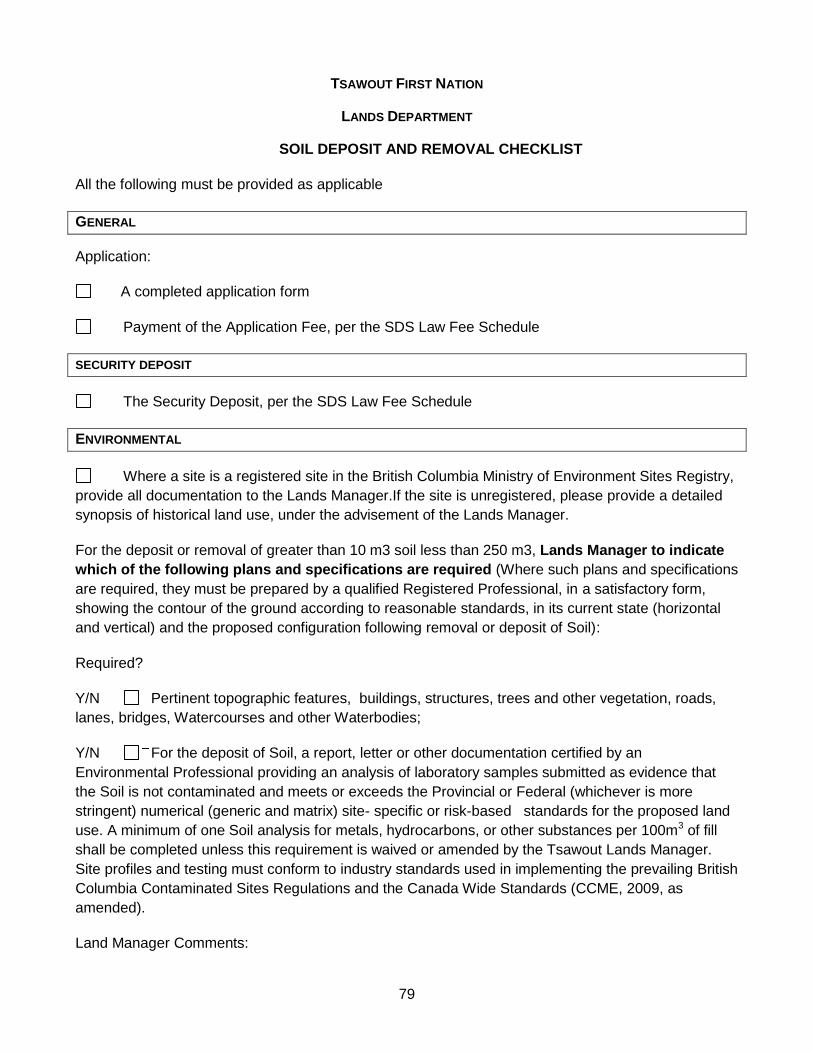
(f) deposit or removal of more than 10 cubic metres of soil; and [amended, March 26, 2014]
(g) cutting, removal or alteration of any Tree. 6.2 Without limiting the generality of section 6.1, the following are prohibited:
(a) subdivision or partitioning of one or more parcels of First Nation Land without subdivision approval by Council in accordance with this Law;
(b) stratification or other division of legal interests in lands or structures into strata units, sub-leases or shares without approval by Council;
(c) construction or use of a street access or exit driveway that is within 7.5 metres of the point of intersection of the road allowance lines of two streets or a street and a lane when such road allowance intersects at an angle of 135° or less; and
(d) carrying out any of the activities set out in paragraphs 6.1 (c), (d), (e), (f) or (g) without a Development Permit. [amended, March 26, 2014]
6.3 Despite sections 6.1 and 6.2, and unless they are to be constructed, carried out,
or installed within Riparian Assessment area, or they involve the likely release of a polluting substance into a water body, the following do not require any approvals under this Law in and of themselves: [amended, March 26, 2014] (a) construction, alteration, enlargement, addition, demolition or removal of any
structure the footprint of which is and remains less than 20 square metres; (b) construction or finishing of trails, driveways, or internal roads for single family
residential sites on which the internal road or driveway is completely within a single parcel of land;
4
(c) landscaping and minor yard work which does not require an excavation deeper than 1.5 metres or the removal or deposit of more than 10 cubic metres of soil; and [amended, March 26, 2014]
(d) installation of trailers and temporary structures provided such trailers and temporary structures have no hook-ups or connections to services.
PART 7. APPLICATIONS AND APPROVALS
7.1 Every applicant applying for an approval to carry out a project, development, activity or procedure set out in section 6.1 or 6.2 shall pay the prescribed fees and submit an application to the Lands Manager in the prescribed form that meets the applicable requirements set out in the following: (a) Schedule A - General Engineering Requirements for Land Development on
First Nation Land; (b) Schedule B - General Requirements for Environmental Assessments on First
Nation Land;
(c) Schedule C - General Requirements for Heritage Assessments on First Nation Land;
(d) Schedule D – General Requirements for Timber Harvesting on First Nation Land;
(d.1) Schedule E – Tsawout First Nation General Requirements for the Deposit and Removal of Soil on First Nation Land; [new, March 26, 2014]
(e) the British Columbia Building Code (including a completed Schedule B forming part of Subsection 2.2.7, Division C of the British Columbia Building Code); and
(f) In any directions from Registered Professionals. 7.2 Applications shall be reviewed and processed in stages, generally in the
following order: (a) Rezoning (if required under any applicable Tsawout zoning and land use law); (b) Subdivision; (c) Approval in Principle of Conceptual Plan; (d) Development Permit Approval; (e) Substantial Completion; and (f) Completion.
7.3 Applicants shall pay the prescribed fee, post any required bonds, and submit
the prescribed application form for each relevant stage set out in this Part. Concurrent Re-zoning Applications
7.4 An applicant may apply for approvals under this Law concurrently with a re- zoning application under any applicable Tsawout zoning or land use law. In the case of concurrent applications: (a) all fees payable under both Laws are due at the time of application; and (b) the applicant is required to provide completed applications under both Laws.
Single Family Exemptions
5
7.5 Despite paragraph 7.1(c), a heritage assessment is not required for construction, alteration, enlargement, addition, demolition or removal of single family homes for Tsawout Members unless the proposed activity requires an excavation deeper than 1.5 metres and/or the deposit or removal or more than 10 cubic metres of soil, gravel or other materials.
Review by Land Management Committee and other Departments
7.6 As soon as practicable after receiving the prescribed fees and a complete application under this Part, the Lands Manager shall: (a) refer the application to a meeting of the Land Management Committee along
with all relevant information and documentation; (b) circulate the application and all relevant information and documentation
to internal Tsawout departments for comment; (c) for applications for subdivisions, multi-family structures, or significant
increases in density, refer the application to all adjacent Permanent Interest holders on First Nation Land; and
(d) if appropriate, refer aspects of the application to the District of Central Saanich.
7.7 The Land Management Committee or Lands Manager shall review the
application and shall provide recommendations to Council about: (a) whether the application should be approved or not; and (b) any suggested modifications, terms or conditions that should be set by
Council. Principles and Factors in Reviewing Applications
7.8 For each application, the Land Management Committee or Lands Manager shall consider the following general principles and factors: [amended, March 26, 2014] (a) the promotion of health, safety, convenience and welfare of Tsawout
members and of residents and occupants and other persons who have a lawful interest in First Nation Land;
(b) well-planned and orderly development of First Nation Land and the preservation of amenities and special features of First Nation Land;
(c) compliance with any applicable Tsawout land use plan, Tsawout zoning and land use law, other Tsawout Law, and applicable federal, provincial and municipal laws and standards;
(d) environmental protection and enhancement; (e) adherence to Tsawout housing policies; (f) provision of community benefits including land and/or funds to Tsawout for
the development of community amenities; (g) protection and enhancement of cultural and heritage resources and sites; (h) compatibility with Tsawout and Saanich culture; (i) viewscapes, aesthetics and visual qualities; (j) ensuring adequate parking, access and emergency access; (k) the character of the proposed activity or project in relation to the character of
the zone, neighbourhood, and the buildings already erected;
6
(l) the conservation of property values; (m)potential impacts on adjacent uses, owners and occupants; (n) the development of the zone, neighbourhood and Reserve in a manner that
contributes to the economic, environmental, cultural and community health of Tsawout and its Members and the occupants of Tsawout Land;
(o) any information provided and any approvals already granted by Council, including any terms or conditions, in relation to the same project or the same parcels of land; and
(p) any other factors which may have an impact on the community or First Nation Land.
Examples of Recommendations
7.9 In making recommendations to Council, the Land Management Committee or Lands Manager may make any relevant recommendations including: [amended, March 26, 2014] (a) any recommendation relating to the general factors set out in section 7.8; (b) whether there should be bonds, deposits or irrevocable letters of credit posted
by the applicant and, if so, in what percentage or amount; (c) dedication of up to 5% of the area included in the application for parks,
greenspace or community use or a cash donation or other contribution in lieu;
(d) preferred lot reconfigurations to ensure viable subdivisions; (e) construction of intersections, access and emergency access routes; (f) construction of parking spaces; (g) construction of sidewalks; (h) purchase and installation of street lights; (i) completion of servicing agreements with the District of Central Saanich; (j) provision of updated plans, reports or studies, including as-built drawings
after the completion of the project; (k) requirements for staging or sequencing of the project including requirements
for interim reports; (l) set-backs or buffers including set-backs or buffers from property lines and
environmental features; (m)noise and dust prevention or mitigation measures; and (n) any other relevant terms or conditions.
7.10 The Lands Manager shall ensure that recommendations from the Land
Management Committee are written up within 7 days after the Land Management Committee meeting.
Lands Manager May Request Further Information
7.11 After reviewing the recommendations from the Land Management Committee and any comments received pursuant to section 7.6, the Lands Manager may request further information, plans, reports, or other relevant material from the applicant which the applicant shall provide.
Timelines
7
7.12 The Lands Manager shall as soon as practicable after having received the comments under section 7.6 and 7.7, or within 7 days of having received the additional information requested under section 7.11, forward the application to Council along with: (a) all relevant documents, maps, plans, reports and other information; (b) recommendations from the Land Management Committee; (c) any comments received from adjacent land-owners, interest-holders or
Members; (d) any comments or recommendations from the Lands Manager and other
Tsawout managers or departments; and (e) any comments from the District of Central Saanich.
Council Decisions
7.13 As soon as practicable after receiving the application and information set out in section 7.12, Council shall decide whether or not to approve the application and, without limiting the generality of Council’s authority, Council may: (a) reject the application; or (b) approve the application with any reasonable terms or conditions, including,
but not limited to terms or conditions relating to the items set out in sections 7.8 and 7.9.
Notice of Completion
7.14 The Lands Manager shall not issue a Notice of Completion until: (a) the Tsawout lands department has received final as-constructed drawings
and plans in digital form and to MMCD standards; (b) each Registered Professional of record for the project has completed
Schedule C-B forming part of subsection 2.2.7, Division C of the British Columbia Building Code;
(c) water and sanitary sewer connection permits have been issued; (d) the proponent and Registered Professional has certified that any conditions of
the Development Permit have been complied with; and (e) the applicant has fulfilled all other reasonable requirements of the First
Nation. 7.15 The holder of any development permit or other approval under this Law shall at all
times bear full responsibility for any accident which may occur, or damage which may be done to any person or property whatsoever, caused directly or indirectly by the work authorized by the development permit or other approval, and shall save harmless and keep indemnified the First Nation from all claims and demands whatsoever in respect of work. [new, March 26, 2014]
8
PART 8. OFFENCES, PENALTIES AND ENFORCEMENT
Penalties
8.1 A person who contravenes this Law, the terms or conditions of an authorization issued under this Law, or an order made by a Court pursuant to this Law, is guilty of an offence and liable on summary conviction to a fine of not more than $10,000 or to imprisonment for a term of not more than three months, or to both.
8.2 A fine payable under paragraph 8.1 shall be remitted to the Tsawout First Nation
by the Court, after reasonable Court costs have been deducted. Enforcement and Stop Work Orders
8.3 The Lands Manager and any Tsawout contractor or employee acting under his or her authority may, at all reasonable times, enter upon any property for the purpose of administering and enforcing this Law. No person shall prevent or obstruct, or attempt to prevent or obstruct, the entry of any authorized official upon any property as authorized under this Law.
8.4 In addition to any other applicable fine, penalty or remedy, Council or the Lands
Manager may at any time:
(a) issue a Stop Work Order to order any Person who has not received full and proper authorization under this Law to cease carrying out any activity, use or construction listed under section 6.1 or 6.2 or any related activity, use or construction;
(b) order any structures, works or installations carried out in violation of this Law to be removed within 30 days, failing which Council may order them to be removed or may have them removed at the expense of the Permanent Interest holder or the Person who constructed or installed the structures, works or installations without proper authorization;
(c) seize and detain any timber, any product manufactured from timber, or any other natural resource when they have reasonable grounds to believe it was not obtained in accordance with the terms of this Law or its Schedules or the terms of any authorization under this Law or its Schedules.
8.5 A Stop Work Order imposed under section 8.4:
(a) may be registered in Court and enforced as a court order; and (b) continues in force until the condition that led to it is remedied or until the
activity that is the subject of the Stop Work Order receives a permit or authorization under this Law.
8.6 If materials are seized under section 8.4:
(a) they may be removed to a place that is appropriate for their protection and, if in the care of a carrier at the time of seizure, the carrier may be directed to move the materials to the place so designated;
(b) the costs of transportation and other charges incurred in the event of a
9
seizure will be included in the costs of seizure and are chargeable to a party found in breach of this Law; and
(c) seizure shall not prejudice or affect any lien to which a carrier may be entitled in respect of the materials to the time of such seizure.
PART 9. AMENDING PROCEDURES
Substantive Amendments
9.1 Substantive amendments to this Law may only be made in accordance with section 7 under Part 2 of the Land Code and, if the amendment relates to a matter listed in paragraph 10.1 (a) through (i) of the Land Code, subsection 10.1 under Part 3 of the Land Code.
Minor Amendments
9.2 Despite section 9.1 of this Law, Council may adopt minor amendments to this Law by unanimous decision at a duly convened meeting, and expressed by band council resolution.
9.3 For the purposes of section 9.2, minor amendments include:
(a) amendments to correct typographical errors;
(b) amendments required to reference any relevant new or amended First Nation laws;
(c) amendments ordered by any court of competent jurisdiction; and (d) amendments which serve to clarify the Law, where there is no reasonable
dispute about the intention underlying the original provision.
PART 10. REPEAL AND OTHER BYLAWS
10.1 The Tsawout First Nation Land Development Procedures Law, No. 01-2010 is hereby repealed in its entirety.
10.2 The Tsawout First Nation Waterworks Bylaw No. 2006-2 and the Tsawout First
Nation Sanitary Sewer System Bylaw No. SEW 2005-01 continue in force and effect except to the extent of any inconsistency with this Law, in which case this Law prevails.
PART 11. COMING INTO FORCE
Date Law Comes into Force
11.1 This Law shall come into force and effect on the date it is enacted by Resolution after complying with the requirements of section 7 of Part 2 of the Tsawout First Nation Land Code.
THIS LAW IS HEREBY ENACTED by Council at a duly convened meeting held on the day of , 2012 at , British Columbia.
GENERAL ENGINEERING REQUIREMENTS FOR LAND DEVELOPMENT
ON FIRST NATION LAND
Tsawout First Nation requires that a Conceptual Design be deemed satisfactory by Tsawout Council and receive an Approval in Principle before any development may proceed. A Final Design must be deemed satisfactory by Tsawout Council before the Tsawout Development Permit is issued.
Information items to be provided at the Conceptual Design/ Approval in Principle Design stage are indicated by [Conceptual], and those to be provided at the Final Design/ Development Permit stage are indicated by [Final].
The applicant is advised that the requirements below are general in nature and are meant to be a guide for submission only. It is possible that some listed requirements may be waived and other new requirements may become applicable as more information on the development is submitted. If the applicant or their consultant or agent regards any of the listed items to be not applicable, they may request a waiver and provide sufficient justification to support their request.
The applicant is further advised that a Tsawout Development Permit must be obtained before any improvement or construction work on Tsawout First Nation Lands may begin, irrespective of whether or not a lease is applicable or has been executed. Any work constructed before obtaining the Tsawout Development Permit is potentially illegal and is done at the applicant's or developer’s own risk. If the applicant cannot produce satisfactory evidence to prove that any construction pre-Development Permit meets all Tsawout laws and standards, such work has to be removed and replaced, all at the applicant's own cost.
The below requirements are based on Aboriginal Affairs and Northern Development Canada’s (AANDC) requirements with some modifications. Tsawout plans to eventually transition to MMCD-based guidelines and it is recommended that applicants follow MMCD requirements where such requirements exceed those of the INAC Standards.
GENERAL
1. Professional Seal and Signature [Conceptual and Final]
All submission reports, designs, drawings, calculations, specifications and technical documents shall bear the seal and signature of a Registered Professional (Professional Engineer or Registered Architect) qualified for the work. Where applicable, each registered professional of record must submit a BC Building Code Schedule B “Assurance of Professional Design and Commitment for Field Review.”
Provided for Conceptual Provided for Final
13
2. INAC Standards [Conceptual and Final] State on the design drawings that all work is designed to meet or exceed the higher of INAC Standards as defined in the INAC Codes Standards and Guidelines and MMCD standards for design drawings. A copy of the INAC Codes-Standards and Guidelines is contained in the INAC General Information Package for Leasing, or may be obtained from INAC upon request. If work is proposed to be designed to standards other than the INAC Standards or MMCD, provide certifications of equivalence from a Registered Professional and obtain pre-approval from Tsawout by providing justifications and a copy of the relevant section of the standard used.
Provided for Conceptual Provided for Final
3. General Plans [Conceptual and Final]
Provide: 1. a Location Plan showing the geographical area of the proposed development and
surrounding roads, highways and topographic features; Provided for Conceptual Provided for Final
2. a Layout Plan showing the Lease Area and legal description of the lands to be
developed and the boundaries of the Tsawout First Nation Reserve and an outline of the footprint proposed development, and
Provided for Conceptual Provided for Final
3. a detailed Site Plan showing all existing and proposed works, buildings, streets,
lanes, highways, intersections, driveways, parking and loading areas, sidewalks, street lighting, utilities and utility easements, streams and other topographic features of the site.
Provided for Conceptual Provided for Final
4. Geotechnical Assessment [Conceptual]
Provide a geotechnical assessment to verify the viability of the development on site. Include the existing and proposed grades and their relations to the elevations on adjoining properties, and details of any necessary excavations.
Provided for Conceptual 5. Off-Site Work [Conceptual and Final]
If work relating to the development is required to be constructed outside of the Lease Area or will encroach onto private or other CP properties, obtain rights-of- way or other legal permissions to accommodate the work. Show such rights-of- way or other permissions on design drawings.
Provided for Conceptual Provided for Final
14
BUILDING
6. Building Plans [Conceptual and Final] Provide conceptual plan and elevations of proposed buildings [Conceptual] and detailed design drawings of architectural, structural, mechanical, plumbing, fire protection and electrical works [Final].
Provided for Conceptual Provided for Final
7. Schedule [Conceptual]
Provide a proposed schedule of construction and an estimated start and completion date.
Provided for Conceptual
8. Professional Certifications [Final]
Provide copy of relevant signed and sealed BC Building Code Schedules A, B-1 and B-2, or equivalent letters of assurance, on architectural, structural, mechanical, plumbing, fire suppression systems, electrical and geotechnical works for the proposed buildings.
Provided for Final WATER SERVICE
9. Conceptual Water Design [Conceptual] Indicate domestic and fire flow requirements, and the proposed water source to meet these demands. Indicate the minimum fire flow available to the development and the minimum pressure available under Maximum Day Plus Fire Flow conditions.
Provided for Conceptual 10. Conceptual Water Design Drawings [Conceptual]
Provide conceptual design drawings to show the existing and the proposed water works to service the development.
Provided for Conceptual 11. Water Supply from Own Well [Conceptual]
Water supply from the development’s own well is only permitted for agricultural/landscaping uses. Domestic and fire flow needs must be met through water supply from an existing water distribution system (see 13).
Provided for Conceptual 12. Water Supply from Surface Water [Conceptual]
Water supply from a surface water body is only permitted for agricultural/landscaping uses. Domestic and fire flow needs must be met through water supply from an existing water distribution system (see 13).
Provided for Conceptual
15
13. Water Supply from Existing System [Conceptual] Verify by network analysis calculations or other means that the existing water distribution system has the capacity to deliver the required domestic and fire flow to the development.
Provided for Conceptual 14. Hydrant Locations [Conceptual]
Indicate sufficient hydrants on the conceptual design drawings such that no current or future proposed building is more than 75 m from a hydrant.
Provided for Conceptual 15. Watermain Looping [Conceptual]
Loop watermains whenever possible to provide redundancy and improve fire flow. Provided for Conceptual
16. Water Service Agreement – where connecting to a water system other than the Tsawout First Nation water service [Conceptual and Final]
Provide letter of intent or draft servicing agreement [Conceptual] and signed servicing agreement [Final] with the owner of the existing water system for providing water service to the development.
Provided for Conceptual Provided for Final
17. Water Service Permit – where connecting to Tsawout First Nation’s water service [Final]
Provide completed application for a Water Service Permit as required under the Tsawout First Nation Waterworks Bylaw No. 2006-2, as amended from time to time [Final]) for providing water service to the development. Permit is to be issued once the requirements of the Bylaw have been met.
Provided for Final 18. Decommissioning Plan for Abandoning Existing Well [Conceptual]
Provide a decommissioning plan if any existing well is to be abandoned. Provided for Conceptual
19. Detailed Water Design Drawings [Final]
Provide detailed design drawings for all proposed water works and treatment facilities to service the development. In particular, show details of connection point to an off-site distribution system, horizontal and vertical profiles of watermains, offsets of watermain from reference objects, horizontal and vertical separation with a sewer, material specifications, trench details, water meters, and details of appurtenances such as valves, air valves, chambers, hydrants, thrust blocks and bearing areas.
Provided for Final
16
20. Disinfection of New Watermain [Final] Indicate on design drawing method and procedure for disinfecting a new watermain. Indicate on design drawing method of disposal of chlorinated water after completing watermain disinfection such that aquatic life will not be adversely impacted.
Provided for Final 21. Service Connection Details, Standards and Identification [Final]
Show on design drawings water service connection details and specify service connections to meet the Canadian Plumbing Code. Specify on design drawings blue marker stakes for identification of any future water service connections.
Provide conceptual design drawings to show the existing and the proposed sanitary facilities to service the development. Developments must be serviced by an existing sanitary sewer system.
Provided for Conceptual 23. Sanitary Service from Existing System [Conceptual]
Verify, through network analysis calculations or other means, that the existing sewer system has the spare capacity to service the development.
Provided for Conceptual 24. Sanitary Service Agreement - where connecting to a sanitary sewer system other than Tsawout First Nation sanitary sewer system [Conceptual and Final]
Provide a letter of intent or draft servicing agreement [Conceptual] and signed servicing agreement [Final] with the owner of the existing sewer system for providing sanitary service to the development.
Provided for Conceptual Provided for Final
25. Sanitary Sewer Connection Permit - where connecting to the Tsawout First Nation sanitary sewer system [Final]
Provide a completed Application for Sewer Connection as required under the Tsawout First Nation Sanitary Sewer System Bylaw No. 2005-01, as amended from time to time [Final] for providing sanitary sewer service to the development. Permit is to be issued once the requirements of the Bylaw have been met.
Provided for Final 26. Oil Separator [Conceptual]
Provide oil separator (at a standard which meets or exceeds the requirements applicable in the District of Central Saanich) for discharge to either the sanitary or the storm system from restaurants, gas stations, machine shops, and anywhere oil can be discharged or spilled.
Provided for Conceptual
17
27. Decommissioning Plan for Abandoning Existing Septic Facilities [Conceptual]
Provide a decommissioning plan if any existing septic facilities are to be abandoned. Plan to meet or exceed standards applicable in the District of Central Saanich.
Provided for Conceptual 28. Detailed Sanitary Design Drawings [Final]
Provide detailed design calculations and drawings for all proposed sanitary works to service the development. In particular, show horizontal and vertical profiles of the sewers and forcemains, offsets of sewer and forcemain from reference objects, material specifications, sewer slopes, invert elevations, manhole rim elevations, sewer trench details, forcemain thrust block bearing areas, and details of manholes, cleanouts, oil separators, air valves and chambers.
Provided for Final 29. Effluent Permit Limits [Final]
Verify that the Effluent Quality Parameters discharged to a disposal or reclaimed water use facility do not exceed the Waste Management Act Municipal Sewage Regulation limits for the particular facility.
Provided for Final
30. Service Connection Details, Standards and Identification [Final]
Show on design drawings sewer service connection details. Provide inspection chamber. Specify service connection to meet the Canadian Plumbing Code. Specify on design drawings red marker stakes for identification of any future sewer service connections.
Provided for Final DRAINAGE
31. Stormwater Management Plan [Conceptual] Provide a stormwater management plan showing how the post-development Minor (1:2 Year) and Major (1:50 Year) flows are to be managed. Show grading of lot and in-conduit, in-ditch, and overland flow paths. Registered Professional must confirm that the Stormwater Management Plan meets or exceeds the requirements applicable in the District of Central Saanich.
Provided for Conceptual 32. Stormwater Disposal by Drywell [Conceptual]
If stormwater runoff is proposed to be disposed of by drywells, verify by calculations that the drywells have the capacity to dispose of a Minor (1:2 year) storm flow.
Provided for Conceptual
18
33. Stormwater Disposal to Surface Water Body [Conceptual] If any stormwater runoff is proposed to be discharged into an adjacent surface water body, provide details of sediment control devices and confirm permission with Department of Fisheries and Oceans and Environment Canada.
Provided for Conceptual 34. Stormwater Disposal to Roadside Ditch [Conceptual]
If any stormwater runoff is proposed to be discharged into an adjacent roadside ditch, confirm permission with the owner of the roadside ditch (either the First Nation, municipal, regional or provincial jurisdiction).
Provided for Conceptual 35. 200 Year Flood Level [Conceptual]
State on the conceptual design drawing that the building habitable floor slab elevation is not less than 0.6 m above the 1:200 year flood level.
Provided for Conceptual 36. Tidal Surge Elevation [Conceptual]
State on the conceptual design drawing that the building habitable floor slab elevation is above a safe tidal surge elevation.
Provided for Conceptual 37. Detailed Drainage Design Drawings [Final]
Provide detailed design drawings for all proposed drainage works servicing the development. In particular, show horizontal and vertical profiles of storm sewers and ditches, offsets of storm sewer from reference objects, material specifications, sewer slopes, invert elevations, manhole rim elevations, trench details, and details of manholes, cleanouts, oil and debris separators, drywells, silt traps and detention ponds.
Provided for Final TOTAL ESTIMATED COST OF WORKS AND SERVICES
38. Total Estimated Cost of Works and Services [Conceptual]
Provide total estimated cost of works and services excluding off-site works and services which are the subject of a servicing agreement with the District of Central Saanich: $
Provided for Conceptual ROADS, ACCESS AND PARKING
39. Parking [Conceptual] Provide the estimated number of parking spaces required for the development and the plans to accommodate them. Minimum number of parking spaces and dimensions must be consistent with the requirements applicable in the District of Central Saanich.
Provided for Conceptual
19
40. Traffic Volume [Conceptual] Provide the estimated volume of traffic in trips per day that will be generated by the development, and an analysis of the impact of the traffic to be generated on the use of nearby and adjacent land.
Provided for Conceptual 41. Conceptual Road Design Drawings [Conceptual]
Provide conceptual design drawings to show the existing and the proposed access and road facilities to service the development, including entry and exit routes and access by fire and emergency vehicles.
Provided for Conceptual 42. Cul-de-Sac Length [Conceptual]
Limit length of any cul-de-sac to 150 m maximum in consideration of emergency access and deployment of fire fighting equipment.
Provided for Conceptual 43. Utilities in Adjacent or Public Roads [Conceptual]
If utilities servicing the development are to be laid crossing or within the fronting road allowance, confirm permission with the owner of the fronting road (adjacent CP-holder, Tsawout, the District of Central Saanich, or the provincial government)
Provided for Conceptual 44. Bridge Across Creek [Conceptual]
Confirm permission from Department of Fisheries and Oceans for access bridge across river or creek.
Provided for Conceptual 45. Access Permit [Conceptual and Final]
Provide letter of intent [Conceptual] and access permit, easement or right-of-way [Final] from the owner of the fronting road (adjacent CP-holder, Tsawout, the District of Central Saanich, or the provincial government) for allowing access to the development.
Provided for Conceptual Provided for Final
46. Detailed Parking Design [Final]
Provide detailed design calculations and drawings for all proposed parking areas and spaces.
Provided for Final 47. Detailed Road Design Drawings [Final]
Provide detailed design calculations and drawings for all proposed roads and access to service the development.
Provided for Final
20
48. Road Details [Final] Show design speed, horizontal and vertical road profile, vertical curve data, cross sections, intersection details and pavement structure on design drawings.
Provided for Final 49. Signage [Conceptual and Final]
Show the proposed [Conceptual] and actual [Final] location, size, height, colour, lighting and orientation of all signs.
Provided for Conceptual Provided for Final
GREENSPACE AND AMENITIES
50. Greenspace and Public Amenities [Conceptual and Final] Show the proposed [Conceptual] and actual [Final] location and treatment of parks, green space, common areas, open spaces, trails, landscaping, fences, recreation features and any other public amenities.
Provided for Conceptual Provided for Final
51. Community Services [Conceptual]
Identify the local community services and public facilities that would be affected by the development, including the projected increase in users of existing community services and public facilities, potential increased costs to Tsawout, and strategies to mitigate any negative impacts to community services and public facilities.
Provided for Conceptual FUEL HANDLING
52. Fuel Storage and Dispensing [Final] For gas station development, provide details of fuel storage tanks, connection piping, dispenser pumps, spill containment, alarm system and an emergency response plan.
Provided for Final FIRE PROTECTION
53. Fire Protection Service Agreement [Conceptual and Final] Provide letter of intent [Conceptual] and service agreement [Final] with either Tsawout or the District of Central Saanich for providing fire protection service to the development.
Provided for Conceptual Provided for Final
21
54. Tsawout's Fire Fighting Capability [Conceptual] If fire protection service is to be obtained from Tsawout, verify the existing capability of Tsawout's equipment and resources to respond to and provide fire fighting service to the development.
Provided for Conceptual UTILITIES
55. Utility Service Agreements [Conceptual and Final] Provide letter of intent [Conceptual] and service agreement [Final] with utility companies for electricity, telephone, gas and solid waste disposal services.
Provided for Conceptual Provided for Final
COMPLETION DOCUMENTATION
56. Health Canada Permits for Individual Homes [Final] Provide written commitment from the Professional Engineer or Registered Architect to provide Health Canada permits for in-ground sewage disposal for individual homes [Final]. Actual permits are to be provided as part of the completion documentation.
Provided for Final 57. Restaurant Permit [Final]
Provide written commitment from the Proponent to provide a copy of Ministry of Health Permit to Operate A Food Service Establishment if kitchen or restaurant service is proposed [Final]. Actual permit is to be provided as part of the completion documentation.
Provided for Final 58. Registration of Rights of Way, Permits and Easements [Final]
Provide written commitment from the Professional Engineer or Registered Architect to provide copies of all registered rights of way plans, permits and easements [Final]. Actual plans and proof of registration must be provided as part of the completion documentation.
Provided for Final 59. Registration of Fuel Storage Tanks [Final]
Provide written commitment from the Professional Engineer or Registered Architect to provide a copy of the registration of all underground storage tanks and exterior aboveground storage tanks larger than 4000 litres [Final]. Actual registration documents are to be provided as part of the completion documentation.
Provided for Final
22
60. Construction Supervision [Final] Provide written commitment from the Professional Engineer to provide all necessary construction supervision, inspection, site testing and record keeping during construction of the site work [Final].
Provided for Final
61. O&M Manuals [Final]
Provide written commitment from the Professional Engineer or Registered Architect to provide Operation & Maintenance Manuals for the electrical and mechanical systems upon completion [Final]. Actual Operation & Maintenance Manuals are to be provided as part of the completion documentation.
Provided for Final 62. As-Built Drawings [Final]
Provide written commitment from the Professional Engineer or Registered Architect to provide accurate as-built drawings upon completion [Final]. Actual as-built drawings are to be provided as part of the completion documentation for all buildings, structures, roads, and works.
Provided for Final 63. Completion Report [Final]
Provide written commitment from the Professional Engineer or Registered Architect to provide a completion report detailing work progress, inspection records, testing results, and problems encountered on site [Final]. Actual completion report is to be provided as part of the completion documentation.
Provided for Final 64. Completion Certification [Final]
Provide written commitment from the Co-ordinating Registered Professional who signed the BC Building Code Schedule A for the building to provide the BC Building Code Schedules C-A and C-B [Final].
Provided for Final
Provide written commitment from the Professional Engineer submitting the supporting services plans to provide an Engineer's Certificate certifying that all work is constructed in accordance with approved drawings and specifications [Final].
Provided for Final
Actual Schedules C-A and C-B and Engineer's Certificate are to be provided as part of the completion documentation.
Provided for Final
23
STÁUTW (Tsawout) First Nation
General Requirements for Environmental
Assessments on First Nation Land
SCHEDULE “B”
TSAWOUT FIRST NATION SUBDIVISION, DEVELOPMENT AND SERVICING LAW, 02-2012 PARAGRAPH
7.1(B)
Approved by Tsawout First Nation Council
March 28, 2012
24
STÁUTW (TSAWOUT) FIRST NATION
GENERAL REQUIREMENTS FOR ENVIRONMENTAL ASSESSMENTS ON
FIRST NATION LAND
TABLE OF CONTENTS 1. INTRODUCTION................................................................................................... 25
3. APPLICATION OF THESE REQUIREMENTS ...................................................... 26
4. PROJECTS AND APPROVALS THAT ARE EXEMPT FROM THE
REQUIREMENT FOR AN ENVIRONMENNTAL ASSESSMENT ........................ 26 5. HARMONIZING ENVIRONMENTAL ASSESSMENTS CONDUCTED
BY MULTIPLE PARTIES....................................................................................... 27 6. THE TSAWOUT FIRST NATION ENVIRONMENTAL ASSESSMENT
Step 2: Determine the scope and Terms of Reference for the environmental assessment.............................................................................................................. 30
Step 3: Conduct the analysis and prepare the environmental assessment report . 31
Step 4: Review the draft environmental assessment report .................................... 31
Step 5: Make the environmental assessment decision ........................................... 32
Step 6: Implement Mitigation and follow-up program, as appropriate ..................... 32
FIGURE 1: Process for conducting an environmental assessment .............................. 34 APPENDIX “A”: Project Description Template ............................................................. 35
APPENDIX “B”: Generic Terms of Reference for Environmental Assessments .......... 43
APPENDIX “C”: Potential topics for inclusion in environmental assessments .............. 47
THE STÁUTW (TSAWOUT) GENERAL REQUIRMENTS FOR ENVIRONMENTAL
ASSESSMENT ON FIRST NATION LANDS
1. INTRODUCTION
An environmental assessment is:
“the process of identifying, predicting, evaluating and mitigating the biophysical, social and other relevant effects of development proposals prior to major decisions being taken and commitments made”
(International Association of Impact Assessment) An environmental assessment examines effects of proposed Projects on soil, air quality, water quality and supply, vegetation, fisheries, wildlife, traffic, noise, community health, economic development, archaeology and a variety of other social, economic, and environmental topics. An environmental assessment also examines the Cumulative Effects of a proposed Project combined with other past and foreseeable future human activities. Environmental assessments also identify ways of avoiding or reducing adverse Environmental Effects.
An environmental assessment is a planning tool, a means of reviewing the effects of development, a process of community engagement, and an instrument for complying with regulatory requirements.
The STÁUTW (Tsawout) First Nation seeks the following benefits through the conduct of environmental assessment of activities on, or uses of, its lands:
Gather information sufficient to enable the Tsawout First Nation to exercise
its decision-making authority over use of its lands Identify components of proposed Projects or plans that could adversely
affect natural or human environments, the community, or the economy Propose ways of avoiding or minimizing adverse effects on environment,
society and culture Improve Project design, construction, and operation Engage the community in the process of reviewing proposed developments Support better development decisions
2. DEFINITIONS
2.1 Unless otherwise defined in Schedule 1 of these Requirements, definitions in these Requirements have the same meaning as in the Subdivision, Development, and Servicing Law and the Tsawout First Nation Land Code.
3.1 These Requirements apply to: (a) all Projects to which the Tsawout Subdivision, Development and Servicing
Law, 2012-02 applies; (b) any grant or disposition of a lease, license or permit in First Nation Land
which must be approved by Council under section 26.6 of the Land Code; (c) any grant by Council of an interest, licence or permit in Band Land under
section 28.1 of the Land Code; (d) land developments on First Nation Land that are approved, regulated, funded
or undertaken by the Tsawout First Nation; and (e) preparation of Tsawout First Nation land use plans or regulations that specify
proposed uses of land, or changes in land use designations (amendments to subdivision, land use, or zoning plans or regulations) for commercial, industrial, or institutional uses.
3.2 As a matter of general application, the scope of an environmental assessment
shall be commensurate with the size and complexity of a Project and its potential Environmental Effects.
3.3 Nothing in these Requirements limits the Lands Manager’s ability to:
(a) require an environmental assessment as part of a Subdivision Approval, Development Permit or leasing, permitting or licensing process if the Lands Manager determines, in his or her sole discretion, that an environmental assessment is warranted in the particular circumstances; or
(b) waive the requirement for an environmental assessment of a Project if the Lands Manager determines that an Environmental Assessment is not warranted in the particular circumstances because the proposed Project clearly does not have the potential to cause adverse Environmental Effects;
subject to the powers of Council under section 3.4. 3.4 A decision by the Lands Manager to waive the requirement for an environmental
assessment is subject to review by Council. 3.5 A decision by the Lands Manager to proceed with an environmental assessment
is not subject to review by Council. 4. PROJECTS AND APPROVALS THAT ARE EXEMPT FROM THE
REQUIREMENT FOR AN ENVIRONMENNTAL ASSESSMENT
4.1 Environmental assessments are not required under the following circumstances, unless otherwise determined by Council: (a) administrative actions that do not affect land or resources; (b) emergency repairs or action needed on an urgent basis to avert or respond to
emergencies; or
27
(c) responses to accidents or threats to public health. 4.2 Consistent with the approach taken by the Canadian Environmental Assessment
Act Exclusion List Regulation, 2007, an environmental assessment will not be required for a Project proposed to occur on First Nation Land that meets all of the following criteria: (a) the affected land is more than 30 meters from a water body, environmentally
sensitive area (as shown in the Tsawout Comprehensive Community Plan 2011), fish habitat, migratory bird habitat, or land considered important for cultural reasons, including traditional use areas;
(b) the Project complies with prevailing Tsawout First Nation land use plans, zoning designations, and subdivision regulations;
(c) for Projects involving construction or expansion of a structure, the Project is on a lot serviced by sewer and water;
(d) the Project would result in the cutting of not more than 7 Trees of 50 cm diameter or less at 1.4 meters height or not more than 4 Trees of 50 cm diameter or greater at 1.4 meters height and would not result in the clearing of more than 10% of the trees from the individual Lot;
(e) the Project would not emit or release substances that have the potential to pollute air or water;
(f) the Project would not result in increases of more than 30 vehicle trips per day to and from First Nation Lands;
(g) the Project would not add more than 20 residents to First Nation Lands; and (h) for commercial or industrial development, the Project would not employ more
than 10 people. (i) an environmental assessment is not otherwise expressly required under this
or any other First Nation Law. [new, March 26, 2014]
4.3 Notwithstanding section 4.2, Council may request an environmental assessment
where community members have raised a reasonable concern or where Council believes on reasonable grounds that the Project may have harmful Environmental Effects
5. HARMONIZING ENVIRONMENTAL ASSESSMENTS CONDUCTED BY
MULTIPLE PARTIES 5.1 The Tsawout First Nation recognizes that federal departments have statutory
requirements to conduct environmental assessments on First Nation Land under the Canadian Environmental Assessment Act (CEAA) under certain circumstances, and components of Projects occurring on lands adjacent to the reserve may be subject to assessment under the British Columbia Environmental Assessment Act (BCEAA). In an effort to avoid duplication, when the Tsawout First Nation determines that an environmental assessment is required for a Project occurring on its lands, or when other governments inform the Tsawout First Nation that their respective legislation requires conduct of an environmental assessment on Tsawout First Nation land or adjacent to Tsawout First Nation land, then the Lands Manager will make best efforts to schedule a meeting of the parties to seek agreement on the following issues:
28
(a) the agency and individual that will be the main contact and coordinator of the environmental assessment for each involved jurisdiction;
(b) the common information requirements under the federal, provincial and Tsawout First Nation’s environmental assessment processes;
(c) the manner by which the parties will develop a specific work plan for each Project undergoing a multi-jurisdictional environmental assessment;
(d) how the parties will co-ordinate their environmental assessment decisions and associated regulatory decisions with respect to a Project; and
(e) for future Projects, how each party will notify the others when an environmental assessment process is initiated under that jurisdictions’ law.
5.2 Tsawout First Nation recognizes that under clause 25.6 of the Framework
Agreement, the Tsawout First Nation and Canada will make best efforts to ensure the Tsawout First Nation’s environmental assessment process will be used where there is overlapping jurisdiction. This priority will be reflected in any environmental assessment harmonization plan developed between the Tsawout First Nation, Canada, and British Columbia under clause 25.7 of the Framework Agreement.
6. THE TSAWOUT FIRST NATION ENVIRONMENTAL ASSESSMENT PROCESS
6.1 For most Projects, the procedures outlined in Part 7 will be followed. Council or the Lands Manager may alter or amend steps as appropriate. The Tsawout First Nation environmental assessment process is designed to meet the requirements of the Framework Agreement, including: (a) that an environmental assessment is triggered in appropriate cases where the
First Nation is approving, regulating, funding or undertaking a Project on First Nation Land (Clause 25.4 of Framework Agreement, Section 21(3) of FNLMA),
(b) the environmental assessment process must be consistent with requirements of the Canadian Environmental Assessment Act (Clause 25.3 of Framework Agreement), and
(c) environmental assessments must be conducted as early as possible in the planning stages of the Project, before an irrevocable decision is made (Clause 25.4 of Framework Agreement).
6.2 For Projects determined to require an environmental assessment, the Proponent
must ensure that an environmental assessment is completed before other approvals are considered by the Tsawout First Nation. Such approvals include negotiating impact benefit agreements, or issuing permits under Tsawout First Nation laws. It is recommended that the Proponent complete all required environmental assessments prior to completing any lease or sub-lease agreements.
29
7. ENVIRONMENTAL ASSESSMENT STEPS
Step 1: Lands Manager determines whether environmental assessment is required
(a) For all Projects identified in Part 3, a detailed Project Description will be prepared by the Proponent and submitted to the Lands Manager. Appendix “A” contains a Project Description template to guide the Proponent’s submission.
(b) Upon receipt of the Project Description, the Lands Manager may forward, or may direct the Proponent to forward, the Project Description to Aboriginal Affairs and Northern Development Canada, the Lands Advisory Board, Fisheries and Oceans Canada, the Canadian Wildlife Service, the District of Central Saanich, the Capital Regional District, or other government departments or authorities. The involvement of other government departments is based on whether those departments have decisions to make or can contribute expert or specialist advice.
(c) Using the information contained in the Project Description, the Lands Manager will determine whether an environmental assessment is required. This decision must be made within 20 working days of receipt of a Project Description deemed complete by the Lands Manager and the Proponent will be provided notice of the decision within that time. The Lands Manager may determine that a further 20 working days is required to obtain input from other government departments or authorities who have been forwarded the Project Description and will provide notice to the Proponent within the first 20 day timeframe if further time is required. Under section 3.5, a decision that an environmental assessment is required is not reviewable by Council.
(d) Under section 3.4, Council may review a determination by the Lands Manager that an environmental assessment is not required for a Project. The Lands Manager will inform Council as soon as practicable of a determination not to require an environmental assessment and provide them with a report setting out the reasons for the determination. Within 15 working days of receiving the Land Manager’s determination, Council will either: 1) confirm the determination of the Lands Manager; or, 2) require an environmental assessment notwithstanding the Lands Manager’s determination. Council may extend this time by 5 working days by providing notice to the Proponent. If further time is required by Council, they will seek agreement with the Proponent on an appropriate timeline for finalizing Council’s decision.
(e) A determination that no environmental assessment is required under these Requirements does not exempt the Proponent from complying with federal environmental assessment requirements or the need to obtain permits under applicable Tsawout First Nation, federal, or provincial laws and regulations.
(f) If the Lands Manager determines that a Project requires preparation of a Tsawout First Nation environmental assessment, the Lands Manager will report this determination to the Proponent and Council.
30
(g) The Lands Manager will post a notice of his or her determination with respect to requiring an environmental assessment in the Tsawout administration office and/or on the Tsawout First Nation website within five working days after the determination is provided to the Proponent.
Step 2: Determine the scope and Terms of Reference for the environmental assessment
(a) If a Project requires preparation of an environmental assessment, the Lands Manager will oversee the development of, and approve, Terms of Reference for the environmental assessment.
(b) Although the Proponent bears responsibility for preparing the Terms of Reference, the Proponent is strongly advised to conduct this step in consultation with the Lands Manager or a Tsawout Environmental Specialist to ensure that the environmental assessment will include information considered necessary by the Tsawout First Nation. This consultation is critical to avoid delays in the environmental assessment process.
(c) As shown in Generic Terms of Reference in Appendix “B”, an environmental assessment report typically includes the following major headings:
1. Project setting: Physical, ecological, social, cultural, and economic setting of the area potentially affected by a Project.
2. Project description: Including design, construction, operation, and decommissioning.
3. Project Effects and Mitigation: Identification of potential Environmental Effects, assessment of the impacts and description of Mitigation measures.
4. Cumulative Effects assessment: Combined environmental, cultural or socio-economic impacts that accumulate from a series of actions, contaminants, or Projects.
5. Commitments: Clear statement of commitments by the Proponent to implement the Mitigation measures described in the environmental assessment.
6. Conclusion: A summary and conclusion of the significance of identified adverse Environmental Effects.
(d) Appendix “C” of this document contains a list of potential topics to be studied in an environmental assessment. The Lands Manager may require that an environmental assessment includes some or all of the topics listed in Appendix “C”, or additional topics at the Lands Manager’s sole discretion.
(e) During preparation of the Terms of Reference, the Proponent will identify any liability concerns and potential requirements for professional expertise and input to mediate those concerns.
(f) The Terms of Reference for an environmental assessment should describe the process to be applied in preparing the assessment, including a list of agencies or individuals to be contacted, description of reports or other deliverables to be prepared, including special studies, and a timeline for the conduct of the work, including meetings and submission of deliverables. The
31
Terms of Reference will specify, where appropriate, the professional qualifications of personnel that will prepare the environmental assessment.
(g) The Lands Manager may retain the assistance of specialists in relevant fields to assist in reviewing Terms of Reference submitted by the Proponent. The Proponent is required to cover any costs incurred by the Tsawout First Nation in retaining such specialist assistance.
(h) Where the Project has the potential to have a significant effect on Band Land or resources, or on the interests of the Tsawout community as a whole, the Lands Manager may: (a) refer the draft Terms of Reference to the Land Management Committee, and, (b) engage the Tsawout community in a review of the Terms of Reference for the environmental assessment. The Lands Manager may circulate the draft Terms of Reference to other governments for review and comment, as deemed necessary and appropriate by the Lands Manager.
(i) Following review, the Lands Manager will determine whether the Terms of Reference include the issues necessary for inclusion in the subsequent environmental assessment, and whether the process for preparing the environmental assessment is considered adequate. The Lands Manager will inform the Proponent of this determination.
Step 3: Conduct the analysis and prepare the environmental assessment report
(a) After the Terms of Reference have been approved by the Lands Manager, the Proponent will assume responsibility for conducting the environmental assessment. Typically, the Proponent retains professionals with the requisite expertise to study specified issues, identify potential Environmental Effects, propose measures to mitigate those effects, and prepare resulting reports.
(b) The Proponent will prepare and submit a stand-alone draft environmental assessment report to the Lands Manager. The report will be accompanied by a table indicating that the topics and actions specified in the Terms of Reference have been completed and will identify the preparers of the report and describe their professional qualifications.
(c) The Tsawout First Nation desires clear environmental assessments that provide information on specified topics and reach clear conclusions about Environmental Effects and Mitigation. Excessive data collection, superfluous text, or unnecessarily complex analysis is discouraged. Honest and unbiased assessment of impacts is an absolute requirement. Failure to meet this requirement will result in the Proponent being required to revise and re-submit the report.
Step 4: Review the draft environmental assessment report
(a) The Lands Manager will determine the process for reviewing the draft environmental assessment and will specify the parties to be involved. The Proponent will be expected to cover the Tsawout First Nation’s costs incurred in reviewing the draft environmental assessment report.
(b) An important function of an environmental assessment is to communicate findings to the community. For large Projects with the potential to affect the
32
entire community, open houses or workshops may be conducted. For smaller Projects, it may be adequate to notify the membership that a report is available for members’ review and comment.
(c) The Lands Manager will forward the draft environmental assessment report to the Land Management Committee, and may direct the Proponent to circulate the draft environmental assessment report to federal or provincial agencies or to local governments for their review and comment.
(d) The Lands Manager may seek independent review of the draft environmental assessment report by expert specialists. The Project Proponent is required to cover the Tsawout First Nation’s costs in retaining such specialists.
(e) The Lands Manager will submit comments on the draft environmental assessment report to the Proponent.
Step 5: Make the environmental assessment decision
(a) Responding to the comments on the draft environmental assessment report provided by the Lands Manager, the Proponent will amend the draft report and submit to the Lands Manager a revised final version of the document.
(b) The Lands Manager will convene the Land Management Committee to review the final environmental assessment report. The Lands Manager also may:
i. obtain comment from specialist experts at the cost of the Proponent, ii. circulate the report to staff of other government agencies, and iii. make the report available to the community for comment.
(c) The Lands Manager, on behalf of the Land Management Committee, will prepare an environmental assessment completion report that:
i. Summarizes comments from the Land Management Committee, specialists, the community, or others on the quality and findings of the environmental assessment report;
ii. Presents conclusions about the nature and significance of potential Environmental Effects and the effectiveness of Mitigation measures identified; and
iii. Provides the comments of the Lands Manager and the Land Management Committee on: 1) the implications of allowing the Project to proceed to other approval processes; and, 2) what conditions may be attached to future approvals or permits that would likely mitigate identified environmental impacts or enhance identified benefits.
(d) Neither the environmental assessment report nor the environmental assessment completion report will conclude whether a Project should proceed, but rather will focus on the potential effects of implementing a Project. Decisions about Project approval or rejection reside with Council, primarily through permits and other approvals issued under the Tsawout Subdivision, Development and Servicing Law. Permits may also be required under other applicable legislation (e.g., Fisheries Act) the issuance of which is not controlled by the Tsawout First Nation.
Step 6: Implement Mitigation and follow-up program, as appropriate
33
(a) The Mitigation measures identified in the report will be incorporated into any design plans, site plans, timber-harvesting Development Permits, construction tender, and implemented with the Project. If so instructed by the Lands Manager, a Proponent may be required to prepare an Environmental Protection Plan that specifies how impacts will be avoided or mitigated, how land will be restored following construction, etc. Mitigation measures will also form part of the conditions of a development permit.
(b) Where appropriate and required by the Lands Manager, the Proponent will prepare and conduct a monitoring program to verify the findings of the environmental assessment and to assess the effectiveness of the Mitigation measures. Alternatively, the Proponent may fund monitoring to be conducted by the Tsawout First Nation, subject to mutual agreement of the Proponent and the Lands Manager.
34
8.
FIGURE 1: Process for conducting an environmental assessment
Project Description submitted
(private sector, TFN business, community member, other)
Initial review by Lands Manager
Determine if EA required
Federal gov’t determines
if CEAA triggered
No Yes
EA required
Council review of “no”
decision
Lands Manager authorizes Proponent
to prepare Terms of Reference
Proponent
informed no EA
needed
EA required
Review of draft Terms of
Reference (Land Management
Committee, agencies, membership)
Council decides whether
Project proceeds to other
approvals
Lands Manager approves
Terms of Reference Proponent prepares
draft EA report
Land Management
Committee prepares EA
Completion Report
Tsawout review
(Land Management
Committee,
Proponent revises EA,
submits final EA report
Lands Manager
refers report to other
governments for
comment
Final EA report
to federal gov’t
Key: Initial review EA design EA conduct Decision
35
APPENDIX “A”: Project Description Template
Proponents are to complete this Project Description and submit to the Tsawout First Nation Lands Manager. Submission of this form initiates the Tsawout First Nation environmental assessment process.
1.0 GENERAL INFORMATION
1.1 Contact Information
Project Title
Proponent Contact (job title)
Address
Telephone Number
Fax Number
Email
If Applicable:
Co-Proponent Name
Contact and title
Address
Telephone Number
Fax Number
Email
If Applicable:
Environmental Consultant
Contact and title
Address
Telephone Number
Fax Number
Email
Reserve Name and Number:
E. Saanich I.R. No. 2
Fulford Harbour I.R. No. 5
1.2 Potential Regulatory Requirements
a) Is there Federal financial support for this Project? Yes No
36
If yes, then from which department?
b) Is there Tsawout First Nation financial support for this Project? □ Yes □ No c) Please list other environmental assessment regimes or potential permits, approvals,
or authorizations from Canada, the province, municipal, or international governments to
which the Project may be subject or require (e.g. Fisheries Act, SARA, Canadian
Environmental Protection Act, Provincial water licence, municipal rezoning, etc.)?
2.0 PROJECT INFORMATION 2.1 Project Title
2.2 Project Description
a) Project rationale (need for the Project, goals, purpose)
b) Briefly describe the Project (its market, permanent or temporary structures, affected
land area, etc.)
37
c) Are there subsequent phases or expansion, or other facilities or activities associated
with the Project that are not included in this Project Description? Yes_ No
If “yes,” please describe:
d) Does this Project involve cutting of trees on Tsawout First Nation land? If so, how
Attach a detailed map of the Project footprint and affected area, conceptual plans, and
other facility designs or plans if available.
2.4 Resource and Material Requirements a) Does this Project involve gravel, sand, or any other non-metallic minerals from
Tsawout First Nation land? If yes, which reserve? What raw materials will be
processed (including gravel, metals, or others)?
38
b) What are the energy sources for the operation of this development (propane, natural
gas, electrical, diesel etc.)? How much energy will be required for its operation?
c) How much water will be used, for what purpose, and from what source?
2.5 Waste Disposal a) What types of wastes will be generated during construction and operation of this
Project?
b) How and where will wastes be disposed?
2.6 Associated Infrastructure
a) Describe infrastructure required by this Project (roads, transit, water supply, power,
sewers, other).
2.7 Project activities
a)Project construction:
39
- Start and finish date:
- List activities in sequence:
- Number of workers
- Total
- Per average day
- Tsawout First Nation members
- Vehicles per day (trucks and cars, maximum and daily average):
- Where will vehicles park:
b) Project operation:
- Project activities:
- Number of workers
40
- Total
- Per average day
- Tsawout First Nation members
- Vehicles per day (trucks and cars, maximum and daily average)
- Where will vehicles park:
- Noise generation:
- Air, water, or other emissions:
c) Decommissioning:
- Activities:
- Materials generated and method of disposal:
41
3.0 ENVIRONMENTAL FEATURES
a) Map and describe the environmental features in the area of the development.
i. Site topography (for facilities and access)
ii. Soils (type and depth, productivity, erodability)
iii. Surface water, such as lakes or streams, nearby
iv. Watercourse crossings or development near water
v. Wetlands or estuaries
vi. Aquifers
vii. Vegetation
viii. Wildlife habitat
ix. Fish habitat
x. Other areas of special concern or environmentally sensitive areas
xi. Known species as identified in the SARA in or adjacent to the proposed Project area
xii. Registered or unregistered archaeological sites or features
xiii. Areas of moderate to high archaeological potential
xiv. Areas used for traditional aboriginal purposes
xv. Visual aesthetic character
b) Other additional information you may want to provide (e.g., community or cultural issues, consultation):
42
4.0 Regulatory requirements
a) Describe permits or approvals needed, and whether applications have been submitted to:
- Tsawout First Nation:
- Local or regional government:
- Federal government:
- Provincial government:
43
APPENDIX “B”: Generic Terms of Reference for Environmental
Assessments
This guide is intended to aid the Project Proponent in preparing Terms of Reference for an environmental assessment. The level of detail to be included should be commensurate with the size, complexity, and potential impacts of a proposed Project.
Summary Briefly describe the Project and the findings of the
environmental assessment.
1. Introduction Provide contextual background information on the Project
and the Proponent and Project justification.
1.1 Proponent Information 1.2 Project Overview (including title and location) 1.3 Regulatory Framework (e.g. funding source, required
permits or approvals)
2. Project description Provide a detailed Project description, covering site
preparation, construction, operation, and decommissioning.
Note: For Projects involving cutting of timber, the
description must include the RPF’s breakdown of volume
and species (based upon a timber cruise) to be cut from the
subject area and the proposed harvesting system.
2.1 Project background and rationale (why is the Project
necessary or desirable?)
2.2 Location of Project area likely to be affected (include
maps)
2.3 Project facilities and associated infrastructure
energy requirements and sources, emissions, traffic,
numbers of employees, numbers of customers, etc.)
2.6 Decommissioning plans
2.7 Alternative means of carrying out the Project and
alternatives to the Project, including the alternative of not
proceeding with the Project
2.8 Relationship of the Project to First Nation Lands and
community
44
3. Project Setting Provide a detailed description of the existing environment in
the Project area including landscape, water bodies,
archaeology, natural resources, wildlife habitat, land use
(traditional and contemporary uses, natural resource
harvesting, residential and commercial uses, etc.). Indicate
the areas affected by the Project. Outline known historical
and contemporary uses by the Tsawout First Nation.
3.1 Geophysical setting
3.2 Atmospheric setting
3.3 Aquatic setting (marine and fresh water, ground water,
drainage, water quality)
3.4 Terrestrial setting (vegetation, wildlife, fisheries, species
of cultural importance, species at risk)
3.5 Land use setting (past, present, and planned uses; land
capability and suitability, archaeological potential)
3.6 Socio-economic setting (traditional and contemporary
economy, community features and activities, visual
aesthetic character)
3.7 First Nations traditional use
4. Agency input Describe input obtained from other government
departments (e.g. Department of Fisheries and Oceans,
Environment Canada, Parks Canada, Health Canada,
Forests, Lands and Natural Resource Operations, Heritage
Conservation Branch, etc.), and provincial and local
governments, as appropriate. Summarize relevant reports
or studies, regulatory requirements or policies,
environmental quality standards, etc. Describe relevance
of local and regional land use plans to use of land,
provision of services, etc. on Tsawout First Nation lands.
5. Engagement of
interested parties
Describe how the following potential interested parties were
engaged in the preparation of the environmental
assessment:
The Tsawout community;
Residents or certificate of possession holders adjacent to, or otherwise affected by, the proposed Project;
Lease holders;
Users of resources potentially affected by the Project;
45
Owners or users of adjacent non-reserve properties that
might be affected; and
Tsawout staff.
Identify issues and concerns raised by the foregoing groups
and explain how the concerns were addressed in the
environmental assessment.
6. Project effects For each of the headings in Section 3, identify specific
potential Project effects. Ensure that potential Project
effects identified by interested parties are included in the
environmental assessment. Describe the methods used to
assess Project impacts, including data sources, field
investigations, sampling, and analysis.1
For each potential Project effect, describe:
The nature of the impact (narrative description);
Spatial extent (footprint, local, regional);
Temporal extent (short term, medium term, long term);
Reversibility (full, partial, irreversible);
Ecological implications (description);
Magnitude (low, moderate, high); and
Significance (significant or less than significant).
Identify Mitigation measures that could avoid, reduce, or
compensate for identified impacts, and identify the effect of
the Mitigation measures on the impact. Describe residual
impacts after Mitigation.
Where a Project causes interactions with species at risk,
specific Mitigation measures must be identified. Mitigation
strategies for species at risk are hierarchical with avoidance
being preferred (e.g. timing, design/location change),
followed by minimization through Project modification or
implementation under special conditions, and lastly,
compensatory Mitigation (e.g. replacement of lost habitat).
1 It is the Proponent’s responsibility to obtain permission for access to, or egress from, the Reserve for all phases of the Project including access to Certificate of Possession or Permanent Interest Holders’ lands.
46
Identify Cumulative Effects of the proposed Project in
combination with past and foreseeable future Projects or
human activities. Excessively large study areas for
Cumulative Effects assessment (e.g., the Capital Regional
District, entire Saanich Peninsula) should be avoided
unless necessary to characterize a specific impact.
6.1 Impact Assessment Methodology
6.2 Construction Phase – Effects Assessment
6.3 Operations and Maintenance Phase – Effects
Assessment
6.4 Decommissioning – Effects Assessment
6.5 Accidents and Malfunctions
6.6 Effects of the Environment on the Project
6.7 Cumulative Effects
7. Commitment to
Mitigation
Summarize the Mitigation measures developed in Section
6, and provide a clear and unequivocal commitment by the
Proponent to fully implement the specified Mitigation
measures. The Mitigation measures may also be used as
conditions of a lease, permit, or funding agreement.
7.1 Summary of Mitigation measures
7.2 Proponent’s commitment to implement Mitigation
measures
8. Conclusion Provide a narrative summary of the Environmental Effects
associated with the proposed Project. Identify significance
and proposed Mitigation strategies. Discuss planned
monitoring activities.
Provide a brief text or table summary of Project effects and
significance, and a conclusion about the potential
environmental, socioeconomic, and cultural effects of the
proposed Project.
8.1 Summary and table
8.2 Conclusion
9. References Provide full references of reports reviewed, websites
APPENDIX “C”: Potential topics for inclusion in environmental assessments
1. Soils and Geology
a. Stability and earth conditions b. Major changes in topography or modification of significant geological features c. Soil erosion, compaction, degradation, or contamination d. Changes in erosion or deposition rates that affect aquatic process, form, and
function e. Import and deposit of soil or fill
2. Air Quality
a. Substantial air emissions or deterioration of ambient air quality b. The creation of objectionable odours
3. Aquatic Ecosystems
a. Physical alterations to natural stream channels or riparian zones b. Changes in flow regime, drainage patterns, infiltration rates, or surface water
runoff (including increases in effective impervious cover) c. Alterations to the level or frequency of flooding d. Discharges into surface waters that affect surface water quality (e.g.,
sediment load, temperature, dissolved oxygen, turbidity e. Changes in aquatic biota (e.g., invertebrate biodiversity, or plant or algae
growth) f. Changes in the quality or quantity of groundwater
4. Vegetation
a. Destruction or degradation of native plant habitat (including terrestrial, riparian, or aquatic vegetation communities)
b. Destruction or damage to any valued, sensitive, or culturally important trees or other plants (e.g. cedar, fir, arbutus, dogwood), including plants of community, landscape, or heritage importance
c. Reduction of the numbers or distribution of rare, threatened, or endangered plant species or plant communities
5. Animal life
a. Significant changes to the population numbers or distribution of native animal species (including birds, mammals, reptiles, fish, benthic organisms, or insects)
b. Any change to the numbers or distribution of rare, threatened or endangered animal species
c. Degradation of existing or potential fish habitat, or wildlife habitat or corridors (including the effects of light, noise, or human activity)
d. Interference in the life cycle of fish or birds (including nests or breeding behaviours)
48
6. Land use and population a. Change to the present or planned land use in an area b. Alteration of the supply of commercial or industrial space c. Changes to population demographics, distribution, and density
7. Mobility, transportation, and circulation
a. Effects on transportation systems or potential increases in vehicular volumes or movements
b. Impacts on parking facilities, or creation of demand for new parking c. Increases in traffic hazards to motor vehicles, bicyclists, or pedestrians d. Alteration of access to or change in pedestrian, bicycle, and transit mobility
including provision and continuity of service e. Potential to increase need for, or provision of, special needs transportation
8. Public services and utilities
a. Increased demand on fire, police, or other emergency services b. Increased school enrolment, or demand for parks or other recreational
facilities for all age groups c. Need for new or expanded public utilities including sanitary sewers, water
mains, storm drains, or garbage collection d. Potential to increase maintenance demands for existing facilities that are
required to accommodate the proposed land use, including social services 9. Aesthetics and built environment
a. Obstructs a scenic vista or view open to the public b. Potential to create an aesthetically offensive site open to public view c. Destruction or modification of a significant landscape feature or viewpoint d. Suitability and quality of urban design and impact on surrounding built
environment e. Consistency with “smart growth” principles of complete, compact, liveable,
and efficient communities 10. Employment and economy
a. Potential to affect existing employment or creation of new employment (permanent or temporary, full-time or part-time)
b. Effect on existing commercial or industrial business c. Potential effect on planned economic development Projects or activities d. Cost or benefit to community (i.e. change tax base and service level)
11. Nuisance (noise, light, glare, odour) and hazards
a. Increase in existing noise levels (other than normal residential noise) b. Creation of new, different, or unusual noise or noise production at
inappropriate times (e.g., late at night) c. Production of new light or glare d. Creation of shading or reduced access to sunlight e. Production of offensive odours and airborne particles
49
f. Production of potentially dangerous transmission waves (i.e., magnetic or microwave)
g. Creation of potential human health hazards 12. Navigable waters
a. Obstruction or reduction of navigability of marine or fresh water courses b. Requirement for federal navigable waters approvals
13. Cultural resources (Proponent should reference data collected to comply with the
General Requirements for Heritage Assessments) a. Potential to alter or destroy an archaeological site b. Effects on areas of cultural importance (for spiritual, traditional use,
ceremonial, resource, or other purposes) c. Effects on historic buildings, structures, objects, or landscapes
14. Cumulative Effects
a. Other past or potential future Projects or human activities in the study area b. Identification of potential Cumulative Effects of the proposed Project with
other past or potential future Projects or human activities in the study area c. Potential actions to mitigate identified Cumulative Effects d. Assessment of residual Cumulative Effects
50
SCHEDULE 1: Definitions CEAA The Canadian Environmental Assessment Act
Cumulative Effect The combined environmental, cultural or socio-economic impacts that
accumulate from a series of actions, contaminants, or Projects.
Although each action may seem to have a small impact, the combined
effect can be significant.
Environmental
Effect
Any change a Project may cause in the physical environment, biota, or
human communities, including archaeological features, heritage
resources, traditional use areas, or economic activities or potential,
health and socio-economic conditions, and includes Cumulative
Effects.
Mitigation The avoidance, elimination, reduction, or control of the adverse
Environmental Effects of a Project, including restitution for damage to
the environment caused by such effects through replacement,
restoration, compensation or other means.
Project “Project” is an initiative that has the potential to affect Tsawout First
Nation environment (land, air, water, biota, or cultural features) and to
affect Tsawout First Nation society, culture, or economic well-being. A
Project includes a development, a subdivision, or a grant or disposition
of a lease, licence or permit in First Nation Land that must be approved
by Council under the Land Code or a Law under the Land Code.
Proponent With respect to a Project, the person, business, other body,
government (including the First Nation government) or government
agency that proposes a Project. Proponents can be developers,
proposed lessees, licence or permit holders, a First Nation member, or
Council.
Scoping The part of the EA process that determines the topics to be examined,
the level of detail, spatial extent or “boundaries” of the EA investigation,
and groups or agencies to be involved.
SARA The Species at Risk Act. Federal legislation to protect rare, threatened,
or endangered species. A Proponent through an EA must ensure that
the potential for Environmental Effects on a species at risk and its
habitat, as defined by SARA, have been adequately assessed.
Pre-Construction
Phase
Involves the design, feasibility study, geotechnical investigations, etc.,
associated with the Project, and precedes land-disturbing activities.
RPF Registered Professional Forester
Construction Phase Involves site preparation, grading, excavation, material delivery and
storage, utility installation, construction, and finishing of a Project.
Post-Construction
Phase
Site restoration, remediation, monitoring, and similar activities occurring
after completion of Project construction.
51
STÁUTW (Tsawout) First Nation
General Requirements for Heritage
Assessments on First Nation Land
SCHEDULE “C”
TSAWOUT FIRST NATION SUBDIVISION, DEVELOPMENT AND SERVICING LAW, 02-2012 PARAGRAPH
7.1(C)
Approved by Tsawout First Nation Council
March 28, 2012
52
STÁUTW (TSAWOUT) FIRST NATION
GENERAL REQUIREMENTS FOR HERITAGE ASSESSMENT
ON FIRST NATION LAND
TABLE OF CONTENTS
1. APPLICATION OF THESE REQUIREMENTS ...................................................... 53
STÁUTW (TSAWOUT) FIRST NATION GENERAL REQUIREMENTS FOR HERITAGE
ASSESSMENTS ON FIRST NATION LAND
1. APPLICATION OF THESE REQUIREMENTS
1.1 These Requirements apply to: (a) all projects on First Nation Land which require a Development Permit under
the Tsawout Subdivision, Development and Servicing Law; (b) any grant or disposition of a lease, license or permit in First Nation Land
which must be approved by Council under section 26.6 of the Land Code; (c) any grant by Council of an interest, licence or permit in Band Land under
section 28.1 of the Land Code; (d) archaeological studies, cultural heritage studies, and/or STAUTW Heritage
Resource Management-Related investigations carried out on First Nation Land; and
(e) other ground-altering activities not exempted from these Requirements by the Tsawout Subdivision, Development and Servicing Law.
1.2 For the purposes of these Requirements, First Nation Land means a First Nation
reserve or any portion thereof that is subject to the Tsawout First Nation Land Code, which came into force and effect on May 29, 2007.
2. PURPOSE
2.1 The purpose of this Policy is to maintain the integrity of STÁUTW history and heritage through the respectful treatment, protection, preservation, and management of STÁUTW heritage objects and sites on First Nation Land.
3. ASSESSMENT REQUIREMENTS
3.1 All potential ground-altering activities, including development-related disturbances and impacts to STÁUTW Heritage Sites and Objects must be considered, assessed, and mitigated though the application of these Requirements. All Heritage Resource assessments and investigations must be conducted by a professional archaeologist who has been approved by Council to carry out assessments and investigations on Tsawout First Nation land.
3.2 Proponents of all projects to which these Requirements apply are required to
follow, in substantially all respects, the processes, guidelines and procedures required by the BC Archaeology Branch, as outlined in the British Columbia Archaeological Resource Management Handbook, as amended or replaced from time to time.
3.3 The BC Archaeology Branch takes the position that it has no jurisdiction over
archaeological resources on First Nation Land, and as such, all reports and
54
forms must be provided to the Tsawout Lands Department, with a copy to the Douglas Treaty Office, at the following addresses:
Copy to: Douglas Treaty Office Tsawout First Nation 7728 Tetayut Road Saanichton B.C. V8M 2C3 Phone: 250-652-9101 Fax: 250-652-9114 Email:
3.4 The exception is site inventory forms, which shall be provided to the BC
Archaeology Branch, with a copy to Tsawout First Nation Lands Department and Douglas Treaty Office.
3.5 An Archaeological Overview Assessment (as that term is defined and understood
by the BC Archaeology Branch) is required for each of the following: (a) Projects requiring a Development Permit under the Tsawout Subdivision,
Development and Servicing Law, unless exempted from this requirement under the Law;
(b) any grant, or disposition of a lease, license or permit in First Nation Land which must be approved by Council under section 26.6 of the Land Code;
(c) any grant by Council of an interest, licence or permit in Band Land under section 28.1 of the Land Code;
(d) other ground-altering activities not exempted from these Requirements by the Subdivision, Development and Servicing Law; [new, March 26, 2014]
[Section 3.6 repealed, March 26, 2014] 3.7 An exemption to the requirement for an Archaeological Overview Assessment
may be granted on application where: (a) the site of the proposed application has been previously developed; and (b) the Land Management Committee is satisfied that the type and character of
the proposed development is such that its potential to disturb or otherwise negatively affect STÁUTW Heritage Sites or Objects is minimal.
55
4. RESEARCH
4.1 Archaeological studies and/or STÁUTW Heritage Resource Management- Related investigations must be conducted by qualified researchers with an appropriate level of experience and training who have been approved by Council to conduct such research on Tsawout First Nation land. All such research on First Nation Land must be carried out in accordance with the processes, guidelines and procedures required by the BC Archaeology Branch, as outlined in the British Columbia Archaeological Resource Management Handbook. Reports and forms must be provided to the Tsawout Lands Department. As noted above, site inventory forms should be provided to the BC Archaeology Branch.
5. ACCESS TO LAND
5.1 Nothing in these Requirements authorizes entry onto land held individually under a Certificate of Possession or Permanent Interest without permission of the CP/Permanent Interest Holder.
6. INCORPORATION OF RESULTS INTO DEVELOPMENT PERMIT / COUNCIL
APPROVAL CONDITIONS
6.1 Council will take into account the results of assessments and investigations conducted pursuant to these Requirements, including any mitigation measures identified, in deciding whether the project should proceed (i.e., whether or not a development permit should be issued under the Tsawout Subdivision, Development and Servicing Law, or whether Council should consent to the grant/disposition, as the case may be). The development permit/ consent may be granted with conditions as Council deems necessary to implement the mitigation measures.
6.2 Where required or appropriate, Council may required a follow-up program to be
designed and implemented to verify that the assessment was accurate and the mitigation measures were effective.
7. COMPLIANCE
7.1 Failure to comply with these Requirements when conducting archaeological work or a STÁUTW Heritage resource investigation may result in the researcher being disqualified from conducting research or investigations on Tsawout First Nation lands in the future.
7.2 Failure to complete the required assessments, including reporting requirements,
may result in denial or delays in processing of the proponent’s development permit application, or any other application, for Council’s consent.
56
STÁUTW (Tsawout) First Nation
General Requirements for Timber Harvesting
on First Nation Land
SCHEDULE “D”
TSAWOUT FIRST NATION SUBDIVISION, DEVELOPMENT AND SERVICING LAW, 02-2012
PARAGRAPH 7.1(D)
Approved by Tsawout First Nation Council
March 28, 2012
57
STÁUTW (TSAWOUT) FIRST NATION
GENERAL REQUIREMENTS FOR TIMBER HARVESTING ON FIRST NATION LAND
9. ACCESS TO LAND ............................................................................................ 62
10. STUMPAGE AND SCALING .............................................................................. 62 11. INCORPORATION OF RESULTS INTO DEVELOPMENT
PERMIT / COUNCIL APPROVAL CONDITIONS ............................................... 62
STAUTW (Tsawout) FIRST NATION GENERAL REQUIREMENTS FOR TIMBER
HARVESTING ON FIRST NATION LANDS
SCHEDULE “D” TSAWOUT FIRST NATION SUBDIVISION, DEVELOPMENT AND SERVICING LAW, 02-2012
PARAGRAPH 7.1(D)
PREAMBLE
We the Council of STÁUTW (Tsawout) First Nation make these Requirements in recognition that the long-term health of Tsawout First Nation Land must be maintained and protected for the benefit of current and future generations and that the use and maintenance of forest resources plays an important role in the economic, social, cultural, physical and spiritual well-being of Tsawout First Nation citizens.
1. APPLICATION OF THESE REQUIREMENTS
1.1 These requirements apply to:
(a) all timber harvesting activities on First Nation Land which require a Development Permit under the Tsawout Subdivision, Development and Servicing Law, 02-2012;
(b) any grant or disposition of a lease, licence or permit in or on First Nation Land which must be approved by Council under section 26.6 of the Land Code; and
(c) any grant or approval by Council of an interest, lease, licence or permit relating to or including timber harvesting activities in or on Band Land under section 28.1 of the Land Code.
1.2 For the purposes of these Requirements, First Nation Land means a First Nation
reserve or any portion thereof that is subject to the Tsawout First Nation Land Code.
2. PURPOSE
2.1 The purpose of this Policy is to maintain the integrity of the Tsawout First Nation local environment, land values, visual integrity, traditional uses and cultural heritage through the respectful treatment, protection, preservation, and management of Tsawout First Nation timber and forest resources.
3. INTERPRETATION
3.1 Unless otherwise defined in Schedule A to these Requirements, the words in these Requirements have the same definitions as those in the Tsawout First
59
Nation Land Code and the Tsawout First Nation Subdivision, Development and Servicing Law.
3.2 In these Requirements, “Registered Professional” means a person who is
certified as a professional arboricultural consultant, is a landscape architect registered with the British Columbia Society of Landscape Architects, or is a Registered Professional Forester.
4. PRELIMINARY PROPOSED HARVEST PLAN
4.1 In addition to these Requirements, applicants for a Development Permit for Timber Harvesting on Tsawout First Nation Land must also meet all relevant requirements set out in the Tsawout First Nation Subdivision, Development and Servicing Law.
4.2 Applicants must submit to the Tsawout Lands Department a preliminary
proposed harvest plan which includes the following information: (a) the area of land proposed for harvesting; (b) the species and volume of timber proposed to be harvested; (c) the location of scaling; (d) who will be the parties to the Development Permit for timber harvesting; (e) who will be the designated purchaser of the timber; (f) whether the timber will be exported from First Nation Land or not; (g) who will obtain a timber mark; (h) where the timber is in whole or in part on Band Land, the proposed benefits
to be provided to Tsawout First Nation; and (i) where the timber is in whole or in part on Certificate of Possession or
Permanent Interest land, a written authorization in the prescribed form from the holder of that interest permitting the harvesting to occur and supporting the proposal.
5. RESPONSE TO PRELIMINARY PROPOSAL
5.1 The Lands Manager will review the preliminary proposed harvest plan and will
inform the applicant in writing within 10 working days of receipt whether the preliminary harvest plan was approved, rejected, or requires modification prior to approval. If approved, the applicant may proceed with preparing an application.
5.2 By approving the preliminary harvest plan, the Lands Manager makes no
representation to the applicant that the application will ultimately be approved by Council.
60
6. APPLICATION REQUIREMENTS
6.1 The applicant will be responsible for the costs of the review of the application by the Lands Manager. The applicant may request a meeting to discuss those costs in advance of the review.
6.2 The applicant must prepare and submit the following:
(a) an environmental assessment and species at risk assessment conducted in accordance with the Tsawout First Nation General Requirements for Environmental Assessments;
(b) an Archeological Overview Assessment conducted in accordance with the Tsawout First Nation General Requirements for Heritage Assessments;
(c) a comprehensive logging plan which includes the description of the areas, volumes and species to be logged, the methods and equipment to be used, the season of the logging, a complete 1:5,000 scale logging plan map; a 1:20,000 scale overview map, and any potential problems or environmental concerns and their appropriate mediations;
(d) an encumbrance check carried out on the First Nations Land Registry and a GPS survey with accuracy to within 1 metre;
(e) other relevant information, including any input provided by the Department of Fisheries and Oceans, Parks Canada, Environment Canada, the BC Ministry of Forests, Lands and Natural Resources or their successors and any other bodies where there is a potential for impact on their areas of concern, expertise or existing encumbrances;
(f) a silviculture prescription or site plan in the provincial format prepared by a registered professional forester where it is intended that the lands be returned to a forested state; and
(g) a copy of the environmental assessment of the proposal and Council’s decision respecting any significant environmental, economic or cultural concerns and the mitigation measures to be used.
7. EXEMPTIONS FROM CERTAIN REQUIREMENTS
7.1 Where the proposed harvesting is to take place on Band Land, the Lands Manager may exempt the applicant from certain of the measures set out in section 6 where the proposed harvesting activity: (a) is for timber for non-commercial use such as firewood for personal,
longhouse, or Elder use; and (b) would result in the cutting of not more than 4 Trees of 50 centimetres
diameter or less at 1.4 metres height or not more than 2 Trees of 50 centimeters diameter or greater at 1.4 meters height; and
(c) would not result in clearing more than 5% of the Trees from the individual lot; (d) does not include Arbutus; and (e) has been reviewed by a Registered Professional for any concerns or issues
and any concerns have been provided in writing to the Lands Manager.
61
7.2 Where the proposed harvesting is to take place on Permanent Interest lands, the Lands Manager may exempt the applicant from certain of the measures set out in section 6 where the proposed harvesting activity: (a) is for timber for non-commercial use; and (b) would result in the cutting of not more than 7 Trees of 50 cm diameter or less
at 1.4 metres height or not more than 4 Trees of 50 cm diameter or greater at 1.4 meters height; and
(c) would not result in clearing more than 10% of the Trees from the individual lot;
(d) does not include Arbutus; and (e) has been reviewed by a Registered Professional for any concerns or issues
and any concerns have been provided in writing to the Lands Manager. 7.3 Where a Development Permit is issued under 7.1 and 7.2, the Lands Manager
may provide in the permit that a minimum of 2 tree seedlings of the same or similar species will be planted for each Tree to be cut, such seedlings to be of species native to Vancouver Island and maintained for a period of not less than two years, or, in lieu of such planting, providing payment to the Tsawout First Nation of fifty dollars per Tree to be cut, such payment to be made before a permit is issued.
7.4 The Lands Manager may issue a Development Permit forthwith for the removal
of a tree where the tree is dead, dying, severely damaged, unstable or severely leaning and in danger of falling.
7.5 The Lands Manager will provide notice to the Lands Management Committee of
any determinations made under this Part and the Lands Management Committee may request an opportunity to reconsider the application and render their own determination in place of the Land Manager’s.
7.6 For Development Permits issued under this Part, the Lands Manager will inform
the applicant within 3 working days of submission of all of the required information whether a Development Permit will be granted and will notify the applicant within that time of any terms and conditions the Land Manager deems necessary to fulfill the purpose of these Requirements. If the Land Management Committee requires a re-determination, that time will be extended by 7 days.
8. PERMITTING
8.1 The Lands Manager will review the application and will make a recommendation to the Lands Management Committee as to whether it should be approved. If the Land Management Committee supports approval, they will instruct the Lands Manager to prepare and forward to Council a draft Development Permit which will incorporate at least the following: (a) the parties to the Development Permit;
62
(b) the volume and species of timber to be harvested and sold; (c) the location of the timber to be harvested detailed on 1:5,000 scale map(s); (d) the date the permit will expire; (e) the party responsible for the harvesting; (f) stumpage for species and grades of timber; (g) the location of scaling; (h) the contingency plan for any fuel or waste spillage; (i) the details of any performance bonds or security deposits required; (j) utilization standards and harvesting practices; (k) actions to be taken for environment and non-timber values protection; (l) environmental assessment and SARA reports; (m)evidence of appropriate insurance coverage and WCB clearance letter; and (n) scaling and timber mark requirements.
8.2 The Lands Management Committee may review the draft Development Permit
prior to submission to Council where the Permit is in relation to Band Land. 9. ACCESS TO LAND
9.1 Nothing in these Requirements authorizes entry onto land held individually under a Certificate of Possession or Permanent Interest without permission of the Certificate of Possession/Permanent Interest Holder.
10. STUMPAGE AND SCALING
10.1 All scaling will be done by a licensed scaler at the applicant or permittee’s cost at the place of cutting or on First Nation Land or at a designated scaling site. Stumpage to be paid to the First Nation, as set out in the Development Permit, will be based on species and grade determined in consultation with a registered professional forester.
11. INCORPORATION OF RESULTS INTO DEVELOPMENT PERMIT / COUNCIL
APPROVAL CONDITIONS
11.1 Council will take into account the results of assessments, investigations and reports conducted pursuant to these Requirements and pursuant to the Subdivision, Development and Servicing Law, including any mitigation measures or contingency plans identified, in deciding whether the harvesting should proceed (i.e., whether or not a Development Permit should be issued under the Tsawout Subdivision, Development and Servicing Law, or whether Council should consent to the grant/disposition, as the case may be). The development permit/ consent may be granted with such conditions as Council deems necessary to implement appropriate mitigation measures and to ensure that sufficient and fair benefits are enjoyed by the First Nation.
11.2 Where required or appropriate, Council may require a follow-up program to be designed and implemented to verify that the assessment was accurate and the mitigation measures were effective. For example, the land is reforested in accordance with a silvaculture or site plan and the trees have reached a free-to- grow status.
12. COMPLIANCE
12.1 Failure to comply with these Requirements, the Subdivision, Development and Servicing Law 02-2012 as amended from time to time, and/or the terms of any issued Development Permit for Timber Harvesting may result in fine, seizure of timber or equipment, civil action or criminal proceedings under section XXVII of the Criminal Code of Canada.
64
STÁUTW (Tsawout) First Nation General
Requirements for the Deposit and
Removal of Soil on First Nation Land
SCHEDULE “E”
TSAWOUT FIRST NATION SUBDIVISION, DEVELOPMENT AND SERVICING LAW
PARAGRAPH 7.1(D.1)
Approved by Tsawout First Nation Council
March 26, 2014
65
STÁUTW (TSAWOUT) FIRST NATION
GENERAL REQUIREMENTS FOR THE DEPOSIT AND REMOVAL OF SOIL ON FIRST NATION
LAND
TABLE OF CONTENTS
1. INTRODUCTION………………………………………………………………………………..66
2. PURPOSE……………………………………………………………………………………….66
3. APPLICATION OF THESE REQUIREMENTS………………………………………………66
4. DEFINITIONS……………………………………………………………………………………66
5. REQUIREMENTS FOR A SOIL REMOVAL AND DEPOSIT PERMIT……………………68
6. STANDARD CONDITIONS…………………………………………………………………….70
7. EXCLUSIONS……………………………………………………………………………………71
8. PENALTIES AND ENFORCEMENT…………………………………………………………..72
9. PERMIT APPLICATION – SOIL DEPOSIT OR REMOVAL…………………………………73
66
STÁUTW (Tsawout) FIRST NATION
GENERAL REQUIREMENTS FOR THE DEPOSIT AND REMOVAL OF SOIL ON FIRST NATION
LAND
1. INTRODUCTION
From 2003 to 2010, Tsawout First Nation and Indian and Northern Affairs Canada conducted
extensive remediation of contaminated Soils on Tsawout Lands within Areas of Environmental
Concern (AEC). To prevent further Contamination from occurring, Tsawout First Nation hereby seeks
to regulate the removal and deposit of Soil as part of our own due diligence process in ensuring the
protection of Tsawout Lands for the benefit of its current and future inhabitants, protecting
environmental quality, and reducing liability associated with the deposit and removal of Soil.
Pursuant to paragraphs 6.1(f) and 6.2(d) of the Tsawout First Nation Subdivision Development and
Servicing Law, deposit or removal of more than 10 cubic metres of Soil on First Nation Land is
prohibited without a Development Permit issued in accordance with the Tsawout First Nation
Subdivision Development and Servicing Law.
2. PURPOSE
2.1 The purpose of these Soil Deposit and Removal Requirements is to:
(a) prevent Contamination of Tsawout First Nation Lands;
(b) prevent adverse environmental effects caused by the transport, deposit, and removal of Soil; and
(c) establish the general requirements that must be included in any application for a Development Permit for, or which includes, the deposit or removal of Soil.
3. APPLICATION OF THESE REQUIREMENTS
3.1 These requirements apply to:
(a) all activities to which the Tsawout First Nation Subdivision, Development and Servicing Law (as amended) applies, including, for greater certainty, activities that are undertaken by the Tsawout First Nation;
(b) any grant or disposition of an Interest or License in First Nation Land which must be approved by Council under section 26.6 of the Land Code; and
(c) any grant by Council of an Interest or License in Community Land under section 28.1 of the Land Code.
4. DEFINITIONS
4.1 Unless otherwise defined in this section, terms used in these Requirements have the same meaning as in the Subdivision, Development and Servicing Law and the Tsawout First Nation Land Code.
67
4.2 For the purposes of these Requirements, the following definitions apply:
“Contamination” means the presence of substances that exceed applicable standards
contained in the British Columbia Contaminated Sites Regulation or the Canada Wide
Standards (CCME, 2009, as amended). Where differences in standards exist, the more
stringent standard shall apply. “Contaminant” has a corresponding definition, meaning a
substance causing contamination.
“Deposit” means the act of moving and placing Soil on a parcel of land on which the
transported Soil did not previously exist.
“Dripline” means the area in the Soil defined by the outermost circumference of the tree
canopy.
“Permit” means a Development Permit – Soil Deposit or Removal authorizing, or which
includes an authorization for, the deposit of Soil on, or the removal of Soil from, First Nation
Land, and establishing the conditions associated with such deposit or removal.
“Person” means an individual, a body corporate, a firm, partnership, association or any other
legal entity or an employee or agent thereof, and for greater certainty, includes the First Nation.
“Environmental Professional” means a person:
(a) that is registered or licensed to practice as a professional in British Columbia with an appropriate professional organization constituted under an Act, acting under that association’s code of ethics and subject to disciplinary action by that association;
(b) qualified to certify whether or not Soil contains Contaminants, and to manage the removal or deposit of Soil in compliance with these Requirements; and
(c) who carries errors and omissions and liability insurance adequate for the tasks undertaken on behalf of an applicant for a Soil Removal or Deposit Permit.
“Removal” means the digging up and transport of Soil from a parcel of land.
“Riparian Assessment Area” means
(a) for a stream, the 30 metre strip on both sides of the stream, measured from the high water mark;
(b) for a ravine less than 60 metres wide, a strip on both sides of the stream measured from the high water mark to a point that is 30 metres beyond the top of the ravine bank; and
(c) for a ravine 60 metres wide or greater, a strip on both sides of the stream measured from the high water mark to a point that is 10 metres beyond the top of the ravine bank.
“Soil” means the topsoil, rock (including gravel, cobbles, or boulders), sand, silt, clay,
disintegrated rock particles, humus, organic matter, water, and air, or other substance of which
land is composed.
“SDS Law” means the Tsawout First Nation Subdivision, Development and Servicing Law as
amended from time to time.
“Stockpile” means to store Soil in a pile with the intention of later removing part of all of the
pile.
68
“Waterbody” means a lake, pond, stream, canal, ocean, or wetland up to the high water mark,
and includes a Watercourse but does not include a sewage or waste treatment lagoon.
“Watercourse” means any natural or artificial depression with well-defined banks and bed 0.6
metres or more below the surrounding land serving to give direction to a current of water at
least six (6) months of the year or having a drainage area of two (2) square kilometres or more
upstream of the point of consideration.
5. REQUIREMENTS FOR A SOIL REMOVAL AND DEPOSIT PERMIT
5.1 Pursuant to section 6.2(d) of the Tsawout First Nation Subdivision, Development and Servicing Law, no Person may deposit Soil on, or remove Soil from, First Nation Land without a Development Permit first being approved by Council accordance with the SDS Law.
5.2 The following are conditions of every Permit:
(a) any Permit authorizing the deposit of Soil shall be limited to authorization to deposit Soil that is free from Contamination; and
(b) any Person undertaking activities pursuant to a Permit may only do so in compliance with these Requirements and the terms and conditions set out in the Permit.
5.3 An application for a Permit must be accompanied by the fee, as set out in the current Tsawout Lands Department Fee Schedule for Subdivision and Development Permit Applications.
5.4 As Security Deposit for the due and proper compliance with all the requirements and conditions of these Requirements, the applicant shall, before receiving a Permit for the Removal or Deposit of Soil, provide a cash deposit, certified cheque, or irrevocable letter of credit drawn upon a chartered bank, in the amount as detailed in the Fee Schedule, based upon the Permit Area within the subject Parcel of Land designated for Soil Deposit or Removal. The duration for the Security Deposit shall be from issuance of the Permit until an Environmental Professional provides written notice to the Lands Manager that all permit conditions have been complied with.
5.5 An application for a Permit for the deposit or removal of Soil in quantities greater than 10 m3 but less than 250 m3 on Tsawout First Nation Land must be accompanied by plans and specifications for the proposed site, as required by the Lands Manager. Where such plans and specifications are required, they must be prepared by a qualified Registered Professional, in a satisfactory form, showing the contour of the ground according to reasonable standards, in its current state (horizontal and vertical) and the proposed configuration following removal or deposit of Soil. The types of information that the Lands Manager may require the applicant to provide regarding the area of the proposed removal or deposit include but are not limited to the following:
(a) Pertinent topographic features, buildings, structures, trees and other vegetation, roads, lanes, bridges, Watercourses and other Waterbodies;
(b) For the deposit of Soil, a report, letter or other documentation certified by an Environmental Professional providing an analysis of laboratory samples submitted as evidence that the Soil is not contaminated and meets or exceeds the Provincial or Federal (whichever is more stringent) numerical (generic and matrix) site- specific or risk-based standards for the proposed land use. A minimum of one Soil analysis for metals, hydrocarbons, or other substances per 100m3 of fill shall be completed unless this requirement is waived or
69
amended by the Tsawout Lands Manager. Site profiles and testing must conform to industry standards used in implementing the prevailing British Columbia Contaminated Sites Regulations and the Canada Wide Standards (CCME, 2009, as amended);
(c) The application is to include the full and complete civic addresses and legal description of both the site of origin of the fill and the site where the Soil is to be deposited on Tsawout First Nation Land, and the use of the land where Soil to be deposited on Tsawout First Nation land originated;
(d) A Traffic Management plan specifying: the origin and destination of the Soil, and the route of transport between the sites; the time and days of the week of removal or deposit; the proposed entry and exit routes of trucks; numbers and frequency of truck traffic for the proposed haul routes; signing and placement of traffic control devices and flaggers that will minimize safety
risks and local disturbance; and road cleaning activities and if necessary, repair commitments.
(e) A Site plan to show:
the proposed final lot elevations in geodetic datums; arrows indicating the direction of slope and drainage on affected properties before and
after Soil removal or deposit; the proposed methods of drainage control on the property including an analysis of the
impacts of the proposed work on local drainage patterns and water quality; the steepness of proposed slopes that will be maintained upon completion of the Soil
removal or deposit operation; drawings of affected land, showing parcel boundaries, waterbodies, watercourses,
structures, vegetation, roads, paths, and culturally important features; sediment and erosion control measures, in accordance with current Best Management
Practices, that will be used to prevent the erosion of stored Soil and associated sedimentation;
the locations of existing Soil and vegetation that will be retained in their natural state; maps and written descriptions identifying locations where Soil will be removed or
deposited, including the volume of the Soil and the volume of, and location where, native Soil from disturbed areas will be stockpiled, and the proposed methods of excavating and storing topsoil;
the proposed location of machinery, buildings, scales, and other proposed structures and improvements;
the proposed method of extraction and processing, including sorting, washing, crushing and any other proposed processing activities, including potential nuisance effects of such activities (noise, dust, use of water, runoff); and
the proposed location of buffer zones and tree cover, including a minimum separation of 15 metres between Soil deposit or removal and the top of bank of a Watercourse or other Waterbody.
5.6 For the removal or deposit of Soil in quantities greater than 250 m3, an Environmental Assessment will be required, pursuant to “Schedule B” of the SDS Law: General Requirements for Environmental Assessments on First Nation Land. If a Permit is issued, the Permittee will be required to comply with all conditions set out in the Environmental Assessment.
5.7 The requirements set out in sections 5.5 and 5.6 do not apply to the removal of Soil in connection with:
(a) the erection of buildings where the removal of Soil is necessary for the construction of basements and foundations; or
(b) the installation or construction of works or services where the removal of Soil is necessary
70
for the installation or construction of works or services; where the person carrying out such activities does so in compliance with all other requirements
of the SDS Law and its Schedules and the conditions of any Development Permit.
5.8 The specific requirements associated with an application for Soil deposit and removal do not relieve the applicant from any other applicable requirement of the SDS Law or its Schedules.
6. STANDARD CONDITIONS
6.1 It shall be a condition of every Permit that any Person undertaking activities pursuant to a Permit shall not:
(a) deposit, cause or permit to be deposited any Soil upon any roads not wholly within the parcel to which the Permit applies, or upon neighbouring properties;
(b) deposit, cause or permit to be deposited any Soil more than 15cm deep within the Dripline of trees 15 cm Diameter at Breast Height (DBH) or more; or
(c) deposit, cause, or permit to be deposited any Soil containing refuse, wood, wood products, wood by-products, wood waste, undecomposed organic matter, petroleum products or by-products, concrete products or by-products, construction materials or debris, or substances or by-products of substances likely to cause Contamination or injury when in place.
6.2 The Permittee shall ensure that areas of removal or deposit of Soil shall be covered with no less that 10 cm of topsoil in accordance with specifications by the Land Manager. The Permittee shall also ensure that such areas are graded and sown with non-invasive vegetation or protective cover using native vegetation wherever possible.
6.3 The Permittee shall maintain all required insurance until an Environmental Professional provides written notice to the Lands Manager that all permit conditions have been complied with.
6.4 Tsawout First Nation accepts no liability for:
(a) ensuring that the deposit or removal of Soil is done in such a manner that is appropriate for the existing and future uses of the land;
(b) the presence of Contamination in the Soil;
(c) for ensuring that conditions attached to any Permit are fully met by the Permittee; or
(d) losses incurred or damages suffered by any Person resulting directly or indirectly from the First Nation’s, including without limitation its Council, employees, contractors and authorized agents’, approval of activities pursuant to the Permit.
6.5 If at any stage of Soil removal or deposit, it appears that continuing work authorized by the Permit is likely to endanger utilities, bridges, drains, property, easements, or roads, or is likely to create conditions that would endanger the health or safety of persons or property, the Tsawout Lands Manager may revoke the Permit or require the Permittee to implement adequate precautions to prevent such danger as a condition for continuing the work.
6.6 The Permittee must retain all records of Soil leaving or entering the site, such records to include the source and volume of Soil or being transported, waybills, and certificates related to quality of the Soil. The records shall be submitted to the Tsawout Lands Manager as
71
prescribed in the Permit terms and conditions.
6.7 When a Permit involves the deposit of Soil, the Permittee must obtain the services of an Environmental Professional to certify that the Soil that has been deposited is free from Contamination.
6.8 When a Permit involves the deposit of Soil for preloading and grade adjustments for buildings or roadways or in any other case is requested by the Tsawout Lands Manager, the Permittee must obtain the services of a Registered Professional to certify that the Soil has been appropriately deposited and compacted for the proposed use.
6.9 The Permittee shall ensure that access to the area in which Soil is being removed or deposited is controlled at all times by a gate or other suitable device to prevent unauthorized dumping or excavation and that the area is free of hazard at all times.
6.10 It is the responsibility of the Permittee to repair any damage to municipal works and to property and to comply with all Tsawout First Nation Laws and By-Laws.
Waterbodies
6.11 (1) Any Person applying to deposit or remove any quantity of Soil within a Riparian Assessment Area, must demonstrate that the application is in substantial compliance with the Riparian Areas Regulation (BC).
(2) It shall be a condition of any Permit authorizing Soil deposit or removal within a Riparian
Assessment Area that the Permittee may only carry out permitted activities in substantial
compliance with the Riparian Areas Regulation (BC).
Utilities and Adjacent Land
6.12 (1) Notwithstanding any other provision of the SDS Law, these Requirements, or a Permit, no Person shall remove Soil from, or deposit Soil on, Tsawout First Nation land if:
(a) such removal or deposit would endanger utilities, or surrounding or neighbouring land or would result in a hazard or Contamination;
(b) such removal or deposit would foul, obstruct or impede the flow of, or access to any Watercourse or other Waterbody, domestic water supply, ditch, drain or sewer; or
(c) such removal or deposit would make impracticable the future subdivision or development of adjacent land.
(2) Despite subsection (1) a Permit may be issued, if, in the view of the Council,
(a) the applicant can implement measures that will prevent results referred to in subsection (1); and
(b) the Permittee agrees to implement such measures as a Permit condition or conditions.
7. EXCLUSIONS
7.1 (1) Pursuant to Paragraph 6.3(c) of the SDS Law, deposit or removal of Soil in quantities of 10 cubic metres or less does not require a Permit unless the deposit or removal is within a
72
Riparian Assessment Area.
(2) Nothing in subsection (1) relieves a Person from any other requirements or conditions
contained in the SDS Law or any other applicable Tsawout Law, By-law, guideline or
resolution, the terms of any lease or other agreement, or the requirements of any other
government or authority having jurisdiction.
8. PENALTIES AND ENFORCEMENT
8.1 In addition to enforcement measures set out in the SDS Law, if Soil is removed or deposited without a Permit in contravention of the SDS Law or these Requirements, then the Person who caused the Soil to be removed or deposited shall pay Tsawout First Nation a penalty in the amount of three dollars ($3.00) for each cubic metre of Soil removed or deposited, and must return the land to its original configuration at his or her own expense, failing which Tsawout may do so at that Person’s expense.
8.2 The Tsawout Lands Manager may give notice to a person of a breach of any provision of the SDS Law, these Requirements, or a Permit issued pursuant thereto and such person shall forthwith cease and desist from removing any further soil from either stockpiles or natural locations or any other place whatsoever, or depositing any Soil until such breach is remedied.
73
TSAWOUT FIRST NATION
PERMIT APPLICATION - SOIL DEPOSIT OR REMOVAL
Tsawout First Nation Subdivision, Development and Servicing Law
Paragraph 6.1(f) and 7.1
[note: this application form is to be used where soil deposit or removal is the ONLY
activity for which the applicant requires a Permit. General development permit
application forms are available from the Tsawout First Nation Lands Department.]
Is this application for Soil removal ____or Soil deposit____?
Applicant Information
Name of Applicant:
(If Company, insert company name and
representative’s name)
Applicant's address:
Applicant's telephone number:
Applicant's fax number:
Applicant's e-mail address:
Land Identification Information
Legal description of Soil Removal Location:
Street address:
Legal description of Soil Deposit Location:
Street address:
74
Land Ownership of Soil Removal Location
Registered Owner:
Address of Owner:
Lease Holder (if applicable):
Address of Lease Holder (if applicable):
Land Ownership of Soil Deposit Location
Registered Owner:
Address of Owner:
Lease Holder (if applicable):
Address of Lease Holder (if applicable):
Soil Removal Information
Name, credentials of qualified professional
providing information:
Reason for removing Soil:
Type of Soil to be removed:
Quantity to be removed: m3
Mean depth of removal m
75
Maximum depth of removal: m
Number of trees > 15 cm DBH affected
Distance from nearest Waterbody or
Watercourse:
m
Will topsoil be stockpiled for reuse?
Location to which Soil will be transported (include
street address and legal description:
Soil Deposit Information
Name, credentials of qualified Environmental
Professional providing information:
Reason for depositing Soil:
Description of Soil to be deposited:
Source / Origin of Soil: (include street
address and legal description of Soil’s site of
origin
Use of land where Soil originated:
Quantity to be deposited: m3
76
Mean depth of deposit:
m
Maximum depth of deposit:
m
Number of trees > 15 cm DBH affected
Distance from nearest Waterbody or
Watercourse:
m
Will topsoil be stockpiled for reuse?
CHECKLIST
I have provided all of the information and documents set out in the attached Soil Removal or Deposit
Application Checklist
If no, please provide an explanation:
CERTIFICATION BY ENVIRONMENTAL PROFESSIONAL:
I hereby attest that the Soil that is the subject of this application is free of contamination and meets the
standards established in the British Columbia Environmental Management Act’s Contaminated Sites
Regulation and the Canada Wide Standards (CCME 2009, as amended):
Signed:
Professional designation:
Date:
Prepared by:___________________________________
(Signature and Seal Required)
77
NOTE: If the applicant is not the registered owner of the property concerned, then the land owner/interest
holder’s signature is required on this application.
I hereby apply for a Development Permit – Soil Deposit or Removal and to the best of my knowledge and belief the information contained in this application is true.
agree to allow any authorized Tsawout Representative or their delegate to enquire into my/our credit history, corporate standing and all other aspects of my/our business relevant to this application.
I accept responsibility for delays in processing caused by incorrect or insufficient submissions. [Contact the Tsawout Lands Department, if you should have any further questions.]
I represent to the Tsawout First Nation, knowing that the Tsawout First Nation relies on this representation and warranty, that the property covered by this application, to the best of my knowledge having done due and diligent inquiry, is not contaminated or polluted in any way that would make it unlawful, unsafe or unsuited for the purpose for which it is intended to be used.
That I understand and acknowledge that neither the issuance of a permit under the Subdivision, Development and Servicing Law, nor the review of plans and supporting documents, shall in any way constitute a representation, warranty or statement by the Tsawout First Nation that the B.C. Building Code, the Subdivision, Development and Servicing Law in force from time to time, or any other law or bylaw of the Tsawout First Nation has been complied with. I confirm that I have relied only on the registered professional(s) and environmental professional(s) of record for the adequacy of plans and supporting documents submitted with this application, and acknowledge that the Tsawout First Nation, in reviewing the plans and supporting documents submitted with this application, has relied on, and is relying exclusively on, the certification by the Environmental Professional and/or Registered Professional which has or may be submitted.
I assume all risks incidental to or that may arise as a result of the of this application and agree to save harmless and indemnify the Tsawout First Nation and its officials, agents, servants and representatives from and against all claims, actions, costs, expenses and demands with respect to death, injury, loss or damage to persons or property arising out of or in connection with this application. I agree to comply with and will cause those whom I employ to comply with, all applicable laws, bylaws, and requirements of the Tsawout First Nation and any other authority having jurisdiction. I understand that no warranty is implied for the approval of this application and that this waiver and indemnity is binding on me, my heirs, executors and assigns.
Payment of the Application Fee, per the SDS Law Fee Schedule
SECURITY DEPOSIT
The Security Deposit, per the SDS Law Fee Schedule
ENVIRONMENTAL
Where a site is a registered site in the British Columbia Ministry of Environment Sites Registry,
provide all documentation to the Lands Manager.If the site is unregistered, please provide a detailed
synopsis of historical land use, under the advisement of the Lands Manager.
For the deposit or removal of greater than 10 m3 soil less than 250 m3, Lands Manager to indicate
which of the following plans and specifications are required (Where such plans and specifications
are required, they must be prepared by a qualified Registered Professional, in a satisfactory form,
showing the contour of the ground according to reasonable standards, in its current state (horizontal
and vertical) and the proposed configuration following removal or deposit of Soil):
Required?
Y/N Pertinent topographic features, buildings, structures, trees and other vegetation, roads,
lanes, bridges, Watercourses and other Waterbodies;
Y/N For the deposit of Soil, a report, letter or other documentation certified by an
Environmental Professional providing an analysis of laboratory samples submitted as evidence that
the Soil is not contaminated and meets or exceeds the Provincial or Federal (whichever is more
stringent) numerical (generic and matrix) site- specific or risk-based standards for the proposed land
use. A minimum of one Soil analysis for metals, hydrocarbons, or other substances per 100m3 of fill
shall be completed unless this requirement is waived or amended by the Tsawout Lands Manager.
Site profiles and testing must conform to industry standards used in implementing the prevailing British
Columbia Contaminated Sites Regulations and the Canada Wide Standards (CCME, 2009, as
amended).
Land Manager Comments:
80
Y/N The application is to include the full and complete civic addresses and legal description of
both the site of origin of the fill and the site where the Soil is to be deposited on Tsawout First Nation
Land, and the use of the land where Soil to be deposited on Tsawout First Nation land originated;
Y/N A Traffic Management plan specifying (Lands Manager to check all that apply)::
the origin and destination of the Soil, and the route of transport between the sites; the time and days of the week of removal or deposit; the proposed entry and exit routes of trucks; numbers and frequency of truck traffic for the proposed haul routes; signing and placement of traffic control devices and flaggers that will minimize safety
risks and local disturbance; and road cleaning activities and if necessary, repair commitments.
Y/N A Site plan to show (Lands Manager to check all that apply):
the proposed final lot elevations in geodetic datums; arrows indicating the direction of slope and drainage on affected properties before and
after Soil removal or deposit; the proposed methods of drainage control on the property including an analysis of the
impacts of the proposed work on local drainage patterns and water quality; the steepness of proposed slopes that will be maintained upon completion of the Soil
removal or deposit operation; drawings of affected land, showing parcel boundaries, waterbodies, watercourses,
structures, vegetation, roads, paths, and culturally important features; sediment and erosion control measures, in accordance with current Best Management
Practices, that will be used to prevent the erosion of stored Soil and associated sedimentation;
the locations of existing Soil and vegetation that will be retained in their natural state; maps and written descriptions identifying locations where Soil will be removed or
deposited, including the volume of the Soil and the volume of, and location where, native Soil from disturbed areas will be stockpiled, and the proposed methods of excavating and storing topsoil;
the proposed location of machinery, buildings, scales, and other proposed structures and improvements;
the proposed method of extraction and processing, including sorting, washing, crushing and any other proposed processing activities, including potential nuisance effects of such activities (noise, dust, use of water, runoff); and
the proposed location of buffer zones and tree cover, including a minimum separation of 15 metres between Soil deposit or removal and the top of bank of a Watercourse or other Waterbody.
Land Manager Comments:
81
For the deposit or removal of soil in quantities greater than 250 m3: An Environmental
Assessment Application per Schedule “B” – General Requirements for Environmental Assessments on
First Nation Land. (applicable / not applicable _________)
Archaeological Assessment:
Copies of all required archaeological assessments and reports as per the Tsawout General
Requirements for Heritage Assessments (applicable / not applicable:__________)
If any of these documents and required information are not attached, please provide an explanation:
All information must be sent to: Tsawout First Nation
Lands Department
7728 Tetayut Rd.
Saanichton B.C. V8M 2C3
Phone: 250-652-9101
Fax: 250-652-9114
For assistance, in completing the application, please contact the above telephone number.
82
TSAWOUT FIRST NATION
SOIL DEPOSIT OR REMOVAL PERMIT NO._______
Tsawout First Nation Subdivision, Development and Servicing Law, s. 6.2(d)
Date of Issue:________________
EXPIRY DATE:______________
(maximum one year)*
*Unless this requirement is waived by the Lands Manager in writing, the Permittee is not relieved of the
obligations, terms and conditions of this Permit until an Environmental Professional provides written notice
to the Lands Manager that all permit conditions have been complied with.
Land Identification Information
Legal Description
Municipal Address
Land Ownership
Registered Owner
Address of owner Lease Holder (if applicable)
Address of Lease Holder (of applicable)
Soil Removal or Deposit Information
Amount Authorized Type of Material Quantity Location
1. to be removed
m3
2. to be deposited
m3
Professional Engineer's Reports
This Permit is subject to compliance with the following reports, which form part of this Permit:
83
1. (Title) (Author) (Date)
2.
3.
Environmental Professional's Reports
This Permit is subject to compliance with the following reports, which form part of this Permit:
1. (Title) (Author) (Date)
2.
3.
Date Monthly Reports are due (if applicable)
1. 7.
2. 8.
3. 9.
4. 10.
5. 11.
6. 12.
PERMIT CONDITIONS
1. Standard Conditions, see attached 2. _______________________________________________ 3. _______________________________________________ 4. _______________________________________________ 5. _______________________________________________
NOTE: The issuance of this Permit does not relieve the permit holder from complying
with all applicable Tsawout, Federal and Provincial Laws.
The Permittee bears full responsibility for any accident which may occur, or damage
which may be done to any person or property whatsoever, caused directly or indirectly
by the work authorized by this Permit, and shall save harmless and keep indemnified the
First Nation from all claims and demands whatsoever in respect of the work.
This Soil Removal or Deposit Permit No. is issued pursuant to the Tsawout First Nation
Subdivision, Development and Servicing Law, section 6.2(d).
___________________________ ____________________
Lands Manager Date
84
STANDARD CONDITIONS
(Excerpted from Part 6 of the SDS Law Schedule “E” – Tsawout First Nation General
Requirements for the Deposit and Removal of Soil on First Nation Land)
6.1 It shall be a condition of every Permit that any Person undertaking activities pursuant to a Permit shall not:
(a) deposit, cause or permit to be deposited any Soil upon any roads not wholly within the parcel to which the Permit applies, or upon neighbouring properties,
(b) deposit, cause or permit to be deposited any Soil more than 15cm deep within the Dripline of trees 15 cm Diameter at Breast Height (DBH) or more, or
(c) deposit, cause, or permit to be deposited any Soil containing refuse, wood, wood products, wood by-products, wood waste, undecomposed organic matter, petroleum products or by-products, concrete products or by-products, construction materials or debris, or substances or by-products of substances likely to cause Contamination or injury when in place.
6.2 The Permittee shall ensure that areas of removal or deposit of Soil shall be covered with no less that 10 cm of topsoil in accordance with specifications by the Land Manager. The Permittee shall also ensure that such areas are graded and sown with non-invasive vegetation or protective cover using native vegetation wherever possible.
6.3 The Permittee shall maintain all required insurance until an Environmental Professional provides written notice to the Lands Manager that all permit conditions have been complied with.
6.4 Tsawout First Nation accepts no liability for: (a) ensuring that the deposit or removal of Soil is done in such a manner that is
appropriate for the existing and future uses of the land; (b) the presence of Contamination in the Soil; (c) for ensuring that conditions attached to any Permit are fully met by the
Permittee; or (d) losses incurred or damages suffered by any Person resulting directly or
indirectly from the First Nation’s, including without limitation its Council, employees, contractors and authorized agents’, approval of activities pursuant to the Permit.
6.5 If at any stage of Soil removal or deposit, it appears that continuing work authorized by the Permit is likely to endanger utilities, bridges, drains, property, easements, or roads, or is likely to create conditions that would endanger the health or safety of persons or property, the Tsawout Lands Manager may revoke the Permit or require the Permittee to implement adequate precautions to prevent such danger as a condition for continuing the work.
6.6 The Permittee must retain all records of Soil leaving or entering the site, such records to include the source and volume of Soil or being transported, waybills, and certificates related to quality of the Soil. The records shall be submitted to the Tsawout Lands Manager as prescribed in the Permit terms and conditions.
85
6.7 When a Permit involves the deposit of Soil, the Permittee must obtain the services of an Environmental Professional to certify that the Soil that has been deposited is free from Contamination.
6.8 When a Permit involves the deposit of Soil for preloading and grade adjustments for buildings or roadways or in any other case is requested by the Tsawout Lands Manager, the Permittee must obtain the services of a Registered Professional to certify that the Soil has been appropriately deposited and compacted for the proposed use.
6.9 The Permittee shall ensure that access to the area in which Soil is being removed or deposited is controlled at all times by a gate or other suitable device to prevent unauthorized dumping or excavation and that the area is free of hazard at all times.
6.10 It is the responsibility of the Permittee to repair any damage to municipal works and to property and to comply with all Tsawout First Nation Laws and By-Laws.
6.11 (1) Any Person applying to deposit or remove any quantity of Soil within a Riparian Assessment Area, must demonstrate that the application is in substantial compliance with the Riparian Areas Regulation (BC). (2) It shall be a condition of any Permit authorizing Soil deposit or removal within a
Riparian Assessment Area that the Permittee may only carry out permitted
activities in substantial compliance with the Riparian Areas Regulation (BC).
6.12 (1) Notwithstanding any other provision of the SDS Law, these Requirements, or a Permit, no Person shall remove Soil from, or deposit Soil on, Tsawout First Nation land if:
(a) such removal or deposit would endanger utilities, or surrounding or neighbouring land or would result in a hazard or Contamination;
(b) such removal or deposit would foul, obstruct or impede the flow of, or access to any Watercourse or other Waterbody, domestic water supply, ditch, drain or sewer; or
(c) such removal or deposit would make impracticable the future subdivision or
development of adjacent land.
(2) Despite subsection (1) a Permit may be issued, if, in the view of the Council,
(a) the applicant can implement measures that will prevent results referred to in subsection (1); and
(b) the Permittee agrees to implement such measures as a Permit condition or conditions.
86
TSAWOUT FIRST NATION
LANDS DEPARTMENT
SUBDIVISION, DEVELOPMENT AND SERVICING APPLICATION FORM
Tsawout First Nation Subdivision, Development and Servicing Law, Section 7.1
APPLICATION INFORMATION APPLICATION TYPE: (mark all applicable boxes): Commercial Development Construction Development Permit Excavation
Industrial Development Institutional Development Infrastructure, Sewer, Water Recreational Development Residential Development Timber Harvesting
Rezoning Roads, Intersections, etc. Other: _
FILE # DATE OF APPPLICATION: APPLICATION #
APPLLICATION FEE $ RECEIPT # DATE RECEIVED:
BOND POSTED (120% of Construction Costs for on-site works) $
DETAILS OF BOND:
DEVELOPER/AGENT INFORMATION DEVELOPER (AGENT) CORPORATE NAME:
INCORPORATION NO. (B.C./ Canada)
GST # HST #
Address of Records Office:
PHONE # (WORK) PHONE # (CELL)
FAX # EMAIL:
NAME OF DIRECTORS:
Have any of the directors gone bankrupt or been a director for a corporation that has gone bankrupt in the past 5 years?
Yes
No
If yes, please provide the name of the director and the details:
Name of the Authorized Representative:
Address: Telephone:
COPY OF DIRECTORS RESOLUTION authorizing representative or an affidavit of execution or proof of authority to use the corporate seal attached to application?
A COPY OF A CORPORATION SEARCH from the past 7 days demonstrating that the corporation is in good standing.
87
CP/PERMANENT INTEREST HOLDER INFORMATION (List all Certificate of Possession/Permanent Interest
Holders) All applications must be signed by both the CP Holder/Permanent Interest Holder and, if there is one, the Corporate, agent or developer applicant.
By signing below I/We hereby authorize the corporation, agent or developer listed below to apply on our behalf. I/We agree to provide all information required for this application and to abide by all relevant Tsawout, Federal, provincial and municipal laws in relation to the application and the project.
OWNER (CP HOLDER 1) PHONE # (WORK)
MAILING ADDRESS: PHONE # (CELL)
CITY/PROVINCE/POSTAL CODE EMAIL:
FAX # SIGNATURE:
OWNER (CP HOLDER 2) PHONE # (WORK)
MAILING ADDRESS: PHONE # (CELL)
CITY/PROVINCE/POSTAL CODE EMAIL:
SIGNATURE: Date:
OWNER (CP HOLDER 3) PHONE # (WORK)
MAILING ADDRESS: PHONE # (CELL)
CITY/PROVINCE/POSTAL CODE EMAIL:
SIGNATURE: Date:
OWNER (CP HOLDER 4) PHONE # (WORK)
MAILING ADDRESS: PHONE # (CELL)
CITY/PROVINCE/POSTAL CODE EMAIL:
SIGNATURE: Date:
OWNER (CP HOLDER 5) PHONE # (WORK)
MAILING ADDRESS: PHONE # (CELL)
CITY/PROVINCE/POSTAL CODE EMAIL:
SIGNATURE: Date:
LEGAL DESCRIPTION LOT #: PLAN #: RESERVE NAME AND NUMBER:
STREET ADDRESS:
EXISTING LAND USE UNDER ANY APPLICABLE TSAWOUT ZONING OR LAND USE LAW/REGULATION:
PROPOSED LAND USE (IF DIFFERENT FROM CURRENT USE):
88
LEASE REGISTRATION # (as contained in Tsawout Lands Registry)
SUBLEASE REGISTRATION # (as contained in Tsawout Lands Registry)
APPLICATION FOR DEVELOPMENT
TYPE NO. OF UNITS BLDG AREA (SQ.FT)
HEIGHT NO. OF STOREYS PARCEL(S) SIZE
GENERAL NATURE OF DEVELOPMENT (attach additional pages if necessary)
CHECKLIST I have provided all of the information and documents set out in the attached Subdivision, Development and Servicing Application Checklist
Yes No
If no, please provide an explanation:
NOTE: If the applicant is not the registered owner of the property concerned, then the land owner/interest holder’s signature is required on this application.
I/we hereby apply for the above approvals and agree to provide all information required for this application
and to abide by all relevant Tsawout, federal, provincial and municipal laws in relation to the
application and the project.
I/we further agree to allow any authorized Tsawout Representative or their delegate to enquire into my/our
credit history, corporate standing and all other aspects of my/our business relevant to this
application.
I accept responsibility for delays in processing caused by incorrect or insufficient submissions. [Contact the
Tsawout Lands Office, if you should have any further questions.]
I represent to the Tsawout First Nation, knowing that the Tsawout First Nation relies on this representation
and warranty, that the property covered by this application, to the best of my knowledge having
done due and diligent inquiry, is not contaminated or polluted in any way that would make it
unlawful, unsafe or unsuited for the purpose for which it is intended to be used.
That I understand and acknowledge that neither the issuance of a permit under the Subdivision,
Development and Servicing Law, nor the review of plans and supporting documents, shall in any way
constitute a representation, warranty or statement by the Tsawout First Nation that the B.C.
Building Code, the Subdivision, Development and Servicing Law in force from time to time, or any
other law or bylaw of the Tsawout First Nation has been complied with. I confirm that I have relied
89
only on the registered professionals of record for the adequacy of plans and supporting documents
submitted with this application.
I acknowledge that the Tsawout First Nation has relied and is relying exclusively on the BC Building Code
Schedule B Letter(s) of Assurance of Professional Design and Commitment for Field Review which
have been or may be submitted in reviewing the plans and supporting documents submitted with
this application.
I assume all risks incidental to or that may arise as a result of the of this application and agree to save
harmless and indemnify the Tsawout First Nation and its officials, agents, servants and
representatives from and against all claims, actions, costs, expenses and demands with respect to
death, injury, loss or damage to persons or property arising out of or in connection with this
application. I agree to comply with or cause those whom I employ to comply with, all applicable
laws, bylaws, and requirements of the Tsawout First Nation and any other authority having
jurisdiction. I understand that no warranty is implied for the approval of this application and that
this waiver and indemnity is binding on me, my heirs, executors and assigns.
I have read and agree with the above paragraphs.
Signature of Applicant/Agent (or its authorized signatory*) Date
Signature of Land Owner/Interest Holder (or its authorized signatory*) Date
* I certify that I have the authority to bind the corporation
OFFICE USE ONLY
APPLICATON IS: COMPLETE INCOMPLETE (PROVIDE COMMENTS BELOW)
Comments:
Date: Name of Staff Member:
Signature:
90
TSAWOUT FIRST NATION
LANDS DEPARTMENT
SUBDIVISION, DEVELOPMENT AND SERVICING CHECKLIST
Tsawout First Nation Subdivision, Development and Servicing Law, Section 7.1
CHECKLIST All of the following must be provided as applicable:
GENERAL
Application: A completed application form and payment of all prescribed fees.
COMMUNITY BENEFITS
Community Benefit Summary (for subdivisions or development of > 4 lots or units for sale or lease to non-Members): In addition to increases to the property tax base, please provide a summary of all proposed benefits to the Tsawout community. This could include donations or dedications of land or facilities for park, recreation or housing or a donation of cash in lieu; greenspace; trails; sidewalks; street lights; training or development opportunities for members; etc.
ENGINEERING
General Engineering Requirements for Land Development on Tsawout Reserve Lands Provision of all plans, documents, and professional seals and signatures as set out in the General Engineering Requirements.
ENVIRONMENTAL
Environmental: Copies of all required environmental assessments and reports as per Tsawout General Requirements for Environmental Assessments
Archaeological Assessment:
Copies of all required archaeological assessments and reports as per the Tsawout General Requirements for Heritage Assessments
FINANCIAL AND INSURANCE
The following are required: Appraisal:
91
For new sub-divisions, multi-family, commercial or industrial developments, an appraisal of the current market value of the land;
A copy of a credit check from within the past 7 days or authorization for Tsawout to carry out a credit check;
A signed statement that the developer or applicant is solvent, is not bankrupt, and knows of no reason why they would have insufficient funds to complete the development or activity;
Proof of insurance including: Comprehensive Public Liability Insurance and Property Damage Insurance providing coverage of
at least $5,000,000 inclusive against liability for bodily injury or death and/or damage to property on an all risk occurrence basis;
Motor Vehicle Insurance for public liability and property damage providing coverage of at least $5,000,000 inclusive on owned, non-owned or hired vehicles;
Completed operations coverage on all-risk occurrence basis of at least $5,000,000 inclusive against liability for bodily injury, death and/or damage to property of others arising out of the existence of any condition in the works when completed or any installation or repair operations during the period of 12 calendar months next ensuing after the issuance of a certificate of substantial completion by Tsawout;
Confirmation in all of the above policies of insurance (except motor vehicle insurance) that Tsawout First Nation is a named insured, and in all policies of insurance that they contain a provision that the insurance shall apply as though a separate policy has been issued to each name insured;
Confirmation in all of the above policies that each contractor engaged in the works shall be named as an additional insured in respect of the performance of the works, and each such policy shall provide that no expiry, cancellation or materials change in the policy shall become effective until after thirty days notice of such cancellation or change shall have been given to Tsawout by registered mail;
Signed confirmation that the applicant will maintain all of the above policies until the development and the works have received final acceptance.
BONDS
The following are required: Posting of a performance bond or irrevocable letter of credit from a bank in a form acceptable to
Tsawout in the amount of $ (120% of the estimated cost) to ensure the completion of the development and installation of infrastructure and improvements (this bond or letter of credit is in addition to any bonds or letters of credit required by the District of Central Saanich for off-site works); and
Posting of a maintenance bond or irrevocable letter of credit from a bank in a form acceptable to Tsawout in the amount of $ (10% of the estimated cost) for a period of one year following to ensure maintenance of the works and services and to correct any deficiencies discovered during the first year of operations.
LEGAL DOCUMENTS
The following documents are required: First Nations Lands Registry search that is less than 30 days old; A copy of all draft or final executed leases, sub-leases, assignments, etc.; A copy of all encumbrances, rights of way, easements, permits; A copy the CLSR plan;
92
A copy of all existing and proposed subdivisions, easements, rights of way, and draft surveys; A signed and witnessed agreement to indemnify Tsawout First Nation against any loss or damage in
relation to the subdivision, development or activity; and Confirmation of right of entry for Tsawout and all authorized officials to inspect the site and any
structures or infrastructure.
All information must be sent to: Tsawout First Nation
Lands Department
7728 Tetayut Rd.
Saanichton B.C. V8M 2C3
Phone: 250-652-9101
Fax: 250-652-9114
For assistance, in completing the application, please contact the above telephone number.