The following file is part of the Arizona Department of Mines and Mineral Resources Mining Collection ACCESS STATEMENT These digitized collections are accessible for purposes of education and research. We have indicated what we know about copyright and rights of privacy, publicity, or trademark. Due to the nature of archival collections, we are not always able to identify this information. We are eager to hear from any rights owners, so that we may obtain accurate information. Upon request, we will remove material from public view while we address a rights issue. CONSTRAINTS STATEMENT The Arizona Geological Survey does not claim to control all rights for all materials in its collection. These rights include, but are not limited to: copyright, privacy rights, and cultural protection rights. The User hereby assumes all responsibility for obtaining any rights to use the material in excess of “fair use.” The Survey makes no intellectual property claims to the products created by individual authors in the manuscript collections, except when the author deeded those rights to the Survey or when those authors were employed by the State of Arizona and created intellectual products as a function of their official duties. The Survey does maintain property rights to the physical and digital representations of the works. QUALITY STATEMENT The Arizona Geological Survey is not responsible for the accuracy of the records, information, or opinions that may be contained in the files. The Survey collects, catalogs, and archives data on mineral properties regardless of its views of the veracity or accuracy of those data. CONTACT INFORMATION Mining Records Curator Arizona Geological Survey 1520 West Adams St. Phoenix, AZ 85007 602-771-1601 http://www.azgs.az.gov [email protected]
Transcript
The following file is part of the
Arizona Department of Mines and Mineral Resources Mining Collection
ACCESS STATEMENT
These digitized collections are accessible for purposes of education and research. We have indicated what we know about copyright and rights of privacy, publicity, or trademark. Due to the nature of archival collections, we are not always able to identify this information. We are eager to hear from any rights owners, so that we may obtain accurate information. Upon request, we will remove material from public view while we address a rights issue.
CONSTRAINTS STATEMENT
The Arizona Geological Survey does not claim to control all rights for all materials in its collection. These rights include, but are not limited to: copyright, privacy rights, and cultural protection rights. The User hereby assumes all responsibility for obtaining any rights to use the material in excess of “fair use.”
The Survey makes no intellectual property claims to the products created by individual authors in the manuscript collections, except when the author deeded those rights to the Survey or when those authors were employed by the State of Arizona and created intellectual products as a function of their official duties. The Survey does maintain property rights to the physical and digital representations of the works.
QUALITY STATEMENT
The Arizona Geological Survey is not responsible for the accuracy of the records, information, or opinions that may be contained in the files. The Survey collects, catalogs, and archives data on mineral properties regardless of its views of the veracity or accuracy of those data.
ARIZONA DEPARTMENT OF MINES AND MINERAL RESOURCES AZMILS DATA
PRIMARY NAME: IVANHOE
ALTERNATE NAMES:
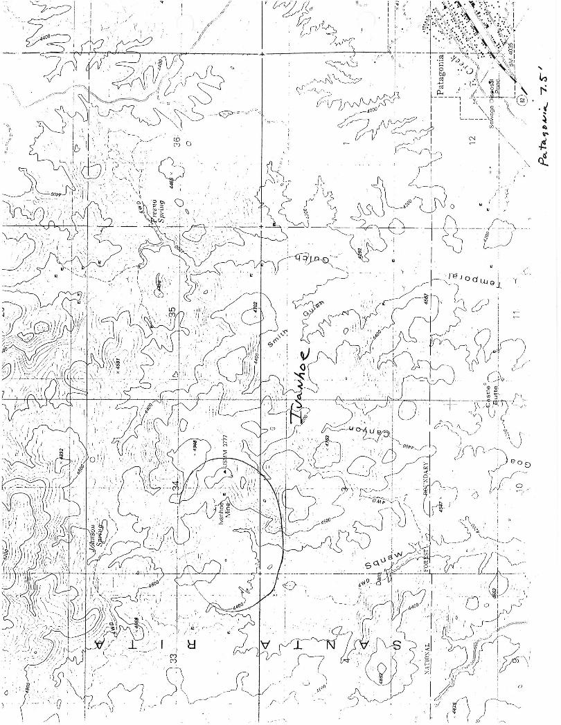
SANTA CRUZ COUNTY MILS NUMBER: 114B
LOCATION: TOWNSHIP 21 S RANGE 15 E SECTION 34 QUARTER SW LATITUDE: N 31DEG 33MIN 42SEC LONGITUDE: W 110DEG 48MIN 02SEC TOPO MAP NAME: MOUNT WRIGHTSON - 15 MIN
CURRENT STATUS: PAST PRODUCER
COMMODITY: SILVER COPPER LEAD GOLD MOLYBDENUM
BIBLIOGRAPHY: KEITH. S.B .. 1975 AZBM INDEX OF MINING PROP. IN SANTA CRUZ CO.
Lacy, W. C., 1960, A Reconnaissance Study of Structure and Mineralization of the Tyndall Mining District, Arizona: BCM -SWD.
Mt. Wrightson 15 1 Quad.
:;:Note: See Rules and Conventions.
)
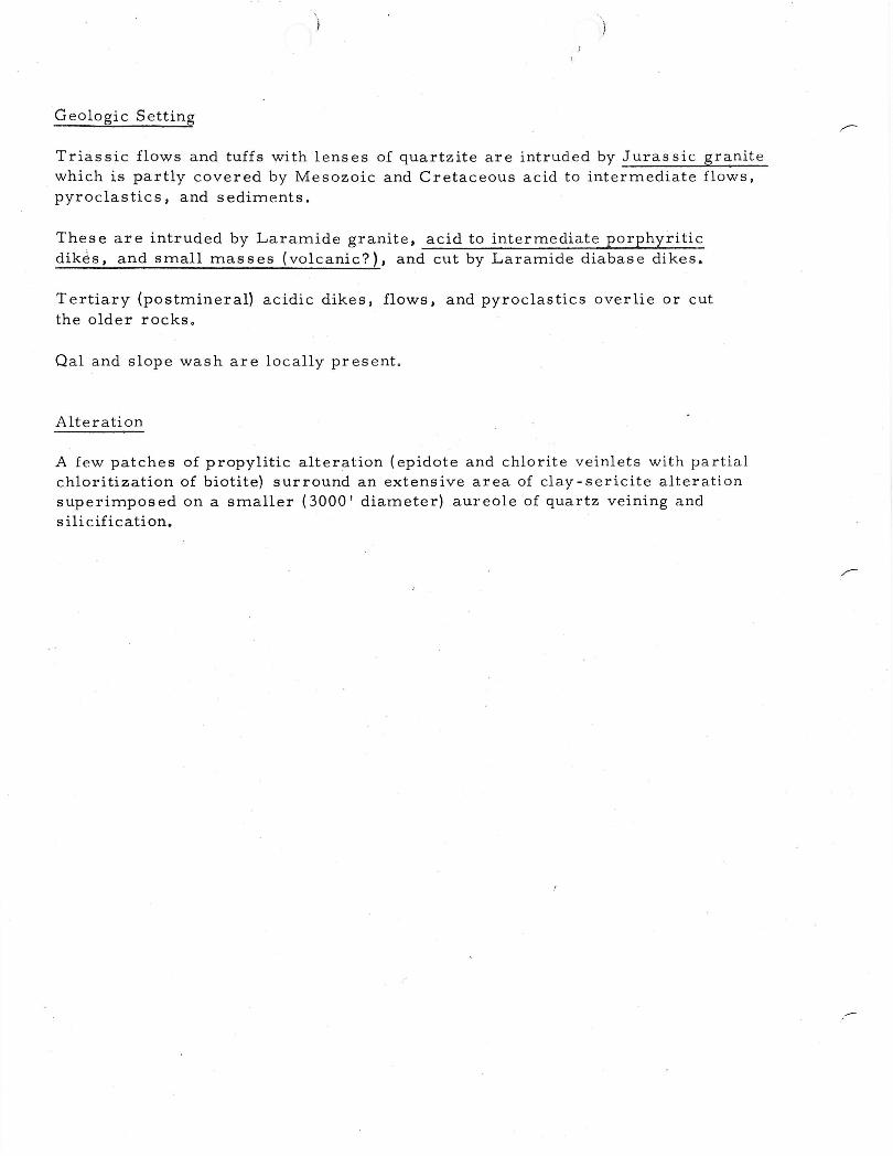
G eolo gi c Setting
Triassic flows and tuffs with lenses of quartzite are intruded by Jurassic granite which is partly covered by Mesozoic and Cretaceous acid to intermediate flows, pyroclastics, and sediments.
These are intruded by Laramide granite, acid to intermediate porphyritic dik~s, and small masses (volcanic?), and cut by Laramide diabase dikes.
Tertiary (postmineral) acidic dikes, flows, and pyroclastics overlie or cut the older rocks o
Qal and slope wash are locally present.
Alteration
A few patches of propylitic alteration (epidote and chlorite veinlets with partial chloritization of biotite) surround an extensive area of clay-sericite alteration superimposed on a smaller (3000' diameter) aureole of quartz veining and silicification.
./
Sulfide System Name ----------------------------------Ivanhoe
II. Diagnostic Reconnaissance Characteristics
AG District Prospect Zoning Outside of Sulfide System .
1. Prospects / Mines Min. Diam. (M) Mines
Metal/Type (feet) I (P) Prospects .Rock Types Deposit Types
eu y IJ uras SIC granlte and
p Cretaceous volcanics
Pb-Zn V It
Ag-Au l/ If
Mn
Other
Other \
B. Dike Swarms
.'. '.'
Rock Types
Length (ft. )
Width (ft. ) o ·
Azimuth ( )
Age
Spatial ReL
Contacts
Other
mportant R
Type
Length . 0
AZImuth ( )
Recognition Factors
Age
Spatial R el.
Contacts
Other
diabase{? )
Laramide{? ) projects Into sulfide svstern
eglona 1 S tructures ot
quartz veining
32,000
285-270 limonites in outcrop color granite red
Laramide cut acros s sulfide
svstprn
mlnerallzed Py, Ag, Au. Pb
h er t h an d ' k 1 e swarms zone 01 structural weakness
72,000
330 alignment & elonja-tion of Trias sic - ure Tertiary intrusi ves
Trias sic -Tertiarv system is elongated rouQ'hlv oarallel to it
irregular
~:: D. Other Reconnaissance: (See back of page)
quartz limonite v
II
I,
Wrench Fault
2900
ssic -
i
transects the range
eins
)
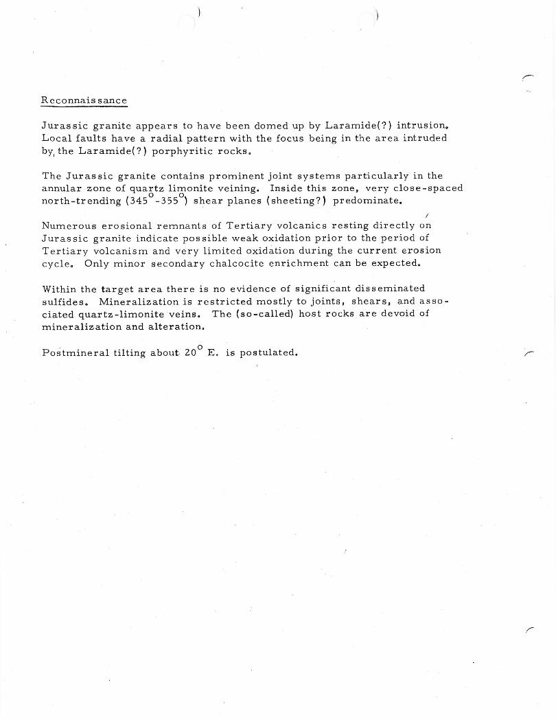
Rcconnais sance
Jurassic granite appears to have been domed up by Laramide{?) intrusion. Local faults have a radial pattern with the focus being in the area intruded bYI the Laramide{?) porphyritic rockso
The Juras sic granite contains prominent joint systems particularly in the annular zone of quartz limonite veining. Inside this zone, very close-spaced north-trending (345
0_355
0) s~ear planes (sheeting?) predominate.
/
Numerous erosional remnants of Tertiary volcanics resting directly on Juras sic granite indicate pos sible weak oxidation prior to the period of Tertiary volcanism and very limited oxidation during the current erosion cycle. Only minor secondary chalcocite enrichment can be expected.
Within the target area there is no evidence of significant disseminated sulfideso Mineralization is restricted mostly to joints, shears, and associated quartz-limonite veins. The (so-called) host rocks are devoid of mineralization and alteration.
Postmineral tilting about. 200
E. is postulated.
-'
S ulfi de Sy stem N am e-::I~v:...!:a:::.;:n::.:l~1.o~e __________ - __
III. Center of Mineralization (zone of best copper)
A. Name Ivanhoe target
~:~:s. Copper Mineralization
Av. Rock 1. Type ):~% Grade Type )::Other Data
a. Primary 1/ b. Enriched only incipient
co Skarn (replac ement)
d. Oxide
e. Mixed I max. 200 I deep
2. Current Mineral In~ry target
a. Tons ; Av. Grade 1. 0 %; Cutoff % ---------------------- ----~---- --------b. Other Credits --------------------------------------------------
30 Past Production
a. Tons modest Av. Grade %; Cutoff % ---------- -------b. Other Credits ____ A~g~_P_b ___ A_u ______________________ ----------------
C. Cover
1. 95+ % Exposed at time of discovery ------------2. Projected Post Mineral Cover
a. Thickness (ft.) -------------------~-----------------------------
pyroclastic s ):: b. Formations Tertiary acidic volcanic flows, sedimentary rocks!
::: co Estimated 4 elevation of base of cover to top of cc blanket (ft. )
no cc blanket expected
3. Premineral Cover
a. Thicknes s (ft. ) --------------------------------------------------
b. Formations _______ J_u_r_a_s_s_l_·c~g~r_a_n_i_t~e ______________________________ __
R 15 E
Prel iminary aeromagnetic map of Area 31. Santa Rita. Geoterrex - aCMe Geophysics Div .. no. 82-90,3 of 3, 1971.
AEROMAGNETIC MAP OF THE IVANHOE AREA SANTA. CRUZ ·COUNTY. AR I ZONA
Scale 1"= 2000' Contour interval 10 and 50 gammas
T 21 S
T 22 S
T C , 000', F I 1 /3 m I I e ,NS.
R15E
'r 2 1 S
--~~~~~~~~~~~~~~~~~~
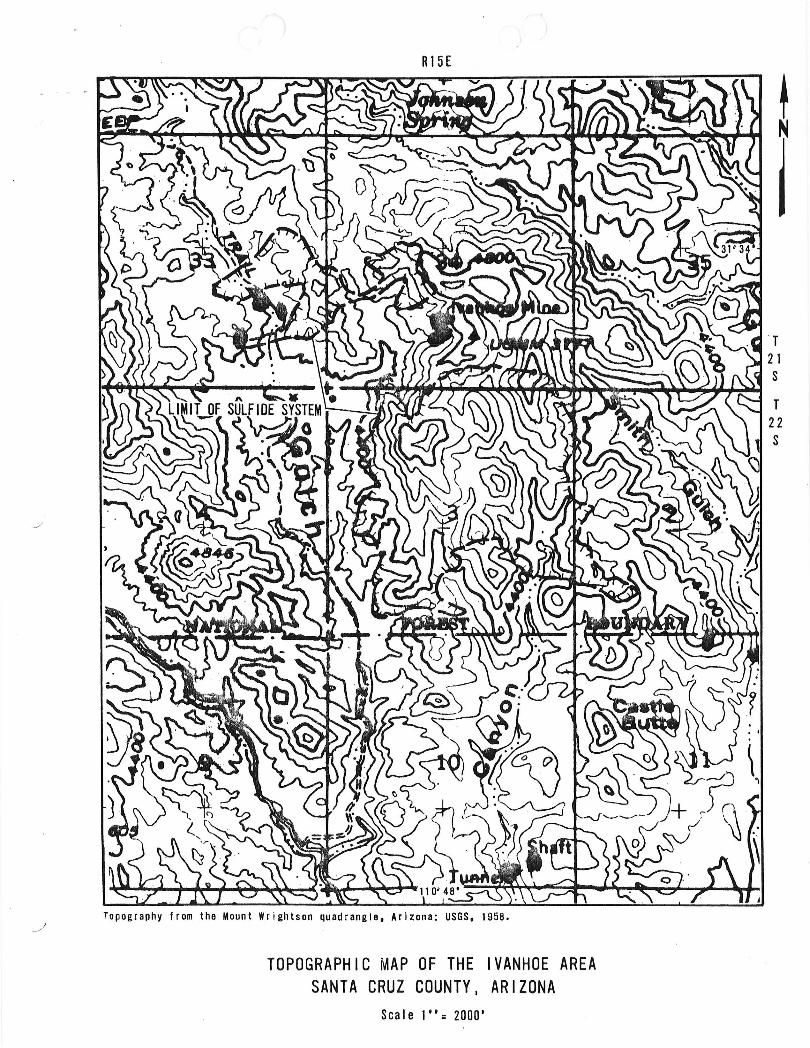
Topography from the Mount Wrightson quadrangle, Arizona: USGS, 1958.
TOPOGRAPHIC MAP OF THE IVANHOE AREA SANTA CRUZ COUNTY. ARIZONA
Scale 1"= 2000'
r 22 S
-'
R15£
Drlwes. H., 1971, Geologic/map of the Mount 'rllht.~n qu.dr,nal •• SE of Tucson, Santa Cruz and Pima Countle., Arizona: USGS. Map 1-614.
r :-: GEOLOG I C,: MAP;:' Ofr:' THE e: I VANHOE :~ AR.EA/~