30

1
Contents
Message from the Director ..................................................................................................................... 2
The CGIS team ............................................................................................................................................. 3 1. Advisory Board .................................................................................................................................................................... 31.1 Chairperson ........................................................................................................................................................................................... 3 1.2 Representatives of key stakeholders ......................................................................................................................................... 3 1.3 Heads of collaborating departments and schools at the University of Pretoria ...................................................... 4 1.4 Ex officio members ............................................................................................................................................................................. 4
2. Staff and collaborators ...................................................................................................................................................... 43. Postgraduate students ...................................................................................................................................................... 53.1 Masters students ................................................................................................................................................................................. 5 3.2 Doctoral students ................................................................................................................................................................................ 6
2015 Highlights .......................................................................................................................................... 8 1. Internal platform at UP ..................................................................................................................................................... 81.1 Unit for Geoinformation and Mapping (UGM) ....................................................................................................................... 8 1.2 Undergraduate teaching .................................................................................................................................................................. 9 1.3 Geoinformatics project .................................................................................................................................................................. 11 1.4 Supporting the GIS lab in the Geography building ............................................................................................................ 12 1.5 Winning students ............................................................................................................................................................................. 12
2. Facilitator of collaborations ......................................................................................................................................... 142.1 Agricultural Research Council (ARC) ...................................................................................................................................... 14 2.2 CSIR Built Environment ................................................................................................................................................................ 14 2.3 CSIR Natural resources and the environment (NRE) ....................................................................................................... 15 2.4 CSIR Meraka Institute .................................................................................................................................................................... 15 2.5 HartRAO ............................................................................................................................................................................................... 15 2.6 South African National Space Agency (SANSA) .................................................................................................................. 16 2.7 Global GeoForAll network ............................................................................................................................................................ 16 2.8 Carnegie African Diaspora Fellowship Program ................................................................................................................ 17 2.9 Student exchange with the Karlsruhe University of Applied Sciences in Germany ............................................ 18 2.10 Survey of the demand for GISc knowledge and skills in South Africa .................................................................... 19 2.11 International Cartographic Association (ICA) and International Society for Photogrammetry and Remote Sensing (ISPRS) ....................................................................................................................................................................... 20
3. Partner to the geoinformation industry of South Africa .................................................................................... 203.1 International Map Year Celebrations ...................................................................................................................................... 20 3.2 Awarenes of geoinformatics as a career ................................................................................................................................ 21 3.3 CE at UP courses for professionals from industry ............................................................................................................. 22 3.4 Guest lectures by industry representatives ......................................................................................................................... 23 3.5 Industry visits by first year students ...................................................................................................................................... 23 3.6 Standards development in South Africa and internationally ....................................................................................... 23 3.7 South African Geomatics Profession Council ....................................................................................................................... 24
4. Research output ............................................................................................................................................................... 244.1 Peer-‐reviewed journal articles .................................................................................................................................................. 24 4.2 Papers presented at refereed conferences ........................................................................................................................... 25 4.3 Peer-‐reviewed chapters in books ............................................................................................................................................. 25 4.4 Other ...................................................................................................................................................................................................... 26 4.5 Masters dissertations and Honours reports ........................................................................................................................ 26
5. Funding ................................................................................................................................................................................ 26
Annex A: Constitution of the Centre for Geoinformation Science (CGIS) ............................. 28

2
Message from the Director 2015 marks the end of the four-‐year period of the initial CGIS business plan, which presented objectives aimed at achieving three adapted goals from the UP Strategic Plan for 2025:
1. To be a leading research-‐intensive university in the field of GISc2. To strengthen the university’s international GISc research profile3. To strengthen the university’s impact on economic and social development through GISc
The first objective was to increase the quality and quantity of GISc related research output by presenting postgraduate students with opportunities to develop research-‐writing skills and to present their research. The second objective focussed on strengthening the international GISc research profile by attracting international students and collaborators. The third objective was to provide continued GISc support to UP staff and students.
In the four years, students had various opportunities to develop their research writing and presentation skills: there was a research-‐writing workshop by Prof Jana Olivier in 2013, students presented their research to each other at various seminars during the years, a first one-‐day postgraduate seminar was held for UP staff and students in 2013 and the ‘Maps in Research’ mini-‐conference in 2015 attracted a wide audience from inside and outside UP.
International collaboration was strengthened through involvement in the International Cartographic Association (ICA), the International Society for Photogrammetry and Remote Sensing (ISPRS), the International Organization for Standardization (ISO), and the GeoForAll initiative. CGIS members have leadership positions in all of these. Locally, the Agricultural Research Council (ARC) and the South African National Space Agency (SANSA) were added to the initial collaborators, CSIR, HartRAO. On the professional side, there is regular interaction with industry representatives and the Geoinformation Society of South Africa (GISSA) through CE at UP courses, guest lectures, student events, hosting of GISSA meetings on campus and surveys of the GISc workforce in South Africa. Since 2013, some CGIS events are registered for continued professional development (CPD) points with the South African Geomatics Council. Through the two JuniorTukkie Geospatial TechCamps in 2014 and 2015, attended by approximately 40 learners from all over South Africa, highschool children were introduced to GISc as a career and hopefully, we will see some of them at UP in future.
Over the years, the Unit for Geoinformation and Mapping has continued to provide UP staff and students with cartographic and geoinformation services and support. There are now more than 500 staff with GIS software licenses and more than 1,000 students who each year use GIS in practical sessions of a wide range of modules.
Much has been achieved in the first four years of CGIS. A salute and thank you to all of you who make CGIS happen! It is now time to reflect and then look forward to plan for the next few years.
Prof Serena Coetzee CGIS: Director June 2016
3
The CGIS team
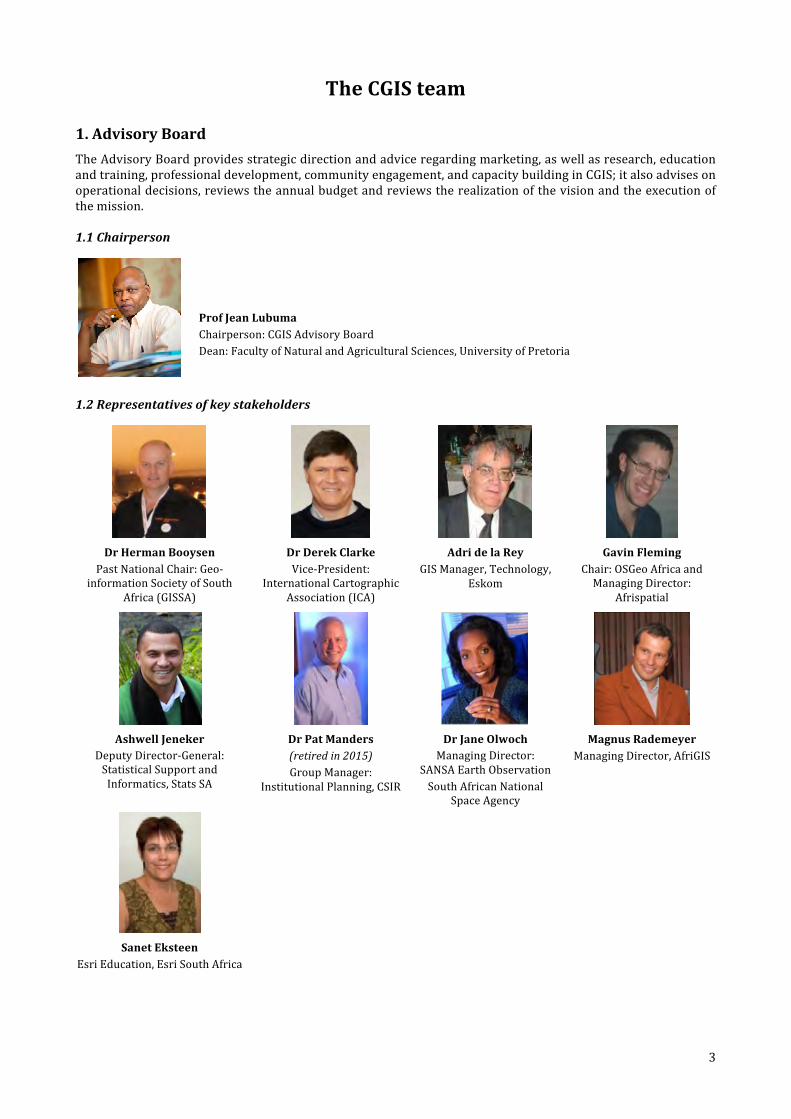
1. Advisory BoardThe Advisory Board provides strategic direction and advice regarding marketing, as well as research, education and training, professional development, community engagement, and capacity building in CGIS; it also advises on operational decisions, reviews the annual budget and reviews the realization of the vision and the execution of the mission.
1.1 Chairperson
Prof Jean Lubuma Chairperson: CGIS Advisory Board Dean: Faculty of Natural and Agricultural Sciences, University of Pretoria
1.2 Representatives of key stakeholders
Dr Herman Booysen Past National Chair: Geo-‐
information Society of South Africa (GISSA)
Dr Derek Clarke Vice-‐President:
International Cartographic Association (ICA)
Adri de la Rey GIS Manager, Technology,
Eskom
Gavin Fleming Chair: OSGeo Africa and Managing Director:
Afrispatial
Ashwell Jeneker Deputy Director-‐General: Statistical Support and Informatics, Stats SA
Dr Pat Manders (retired in 2015) Group Manager:
Institutional Planning, CSIR
Dr Jane Olwoch Managing Director:
SANSA Earth Observation South African National
Space Agency
Magnus Rademeyer Managing Director, AfriGIS
Sanet Eksteen Esri Education, Esri South Africa
4
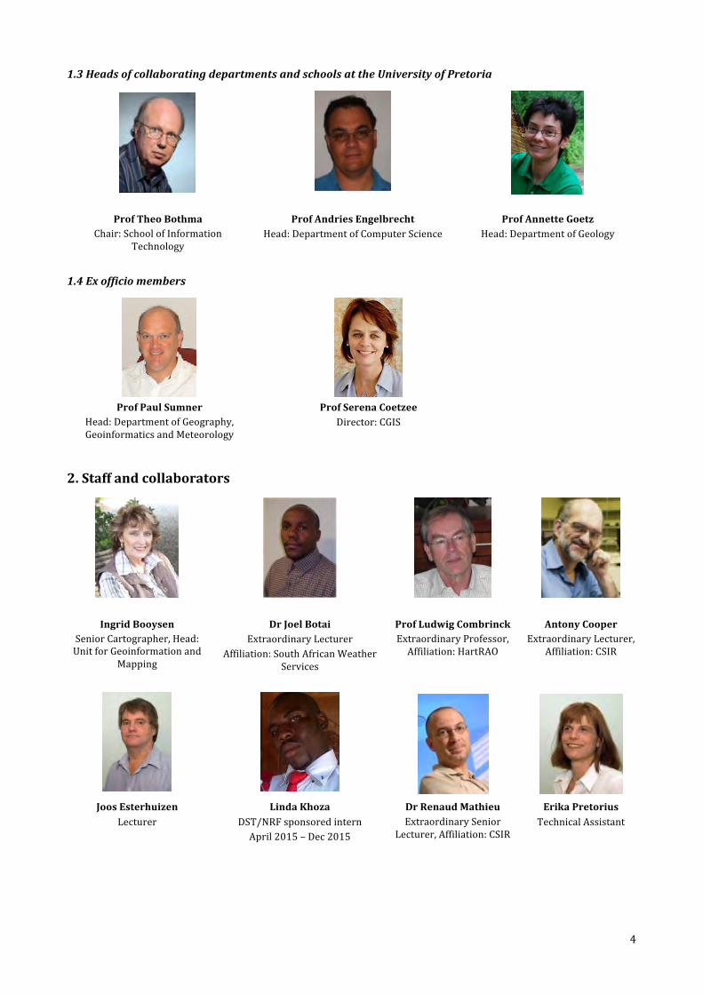
1.3 Heads of collaborating departments and schools at the University of Pretoria
Prof Theo Bothma Chair: School of Information
Technology
Prof Andries Engelbrecht Head: Department of Computer Science
Prof Annette Goetz Head: Department of Geology
1.4 Ex officio members
Prof Paul Sumner Head: Department of Geography, Geoinformatics and Meteorology
Prof Serena Coetzee Director: CGIS
2. Staff and collaborators
Ingrid Booysen Senior Cartographer, Head: Unit for Geoinformation and
Mapping
Dr Joel Botai Extraordinary Lecturer
Affiliation: South African Weather Services
Prof Ludwig Combrinck Extraordinary Professor, Affiliation: HartRAO
Antony Cooper Extraordinary Lecturer,
Affiliation: CSIR
Joos Esterhuizen Lecturer
Linda Khoza DST/NRF sponsored intern April 2015 – Dec 2015
Dr Renaud Mathieu Extraordinary Senior
Lecturer, Affiliation: CSIR
Erika Pretorius Technical Assistant

5
Victoria Rautenbach Lecturer
CGIS student representative
Dr Peter Schmitz Extraordinary Lecturer, CGIS
research focus group on Forensic geography, Affiliation: CSIR
Ms Petronella Tizora Cartographer, Unit for Geoinformation and
Mapping
Philemon Tsela
Lecturer Fritz van der Merwe
Senior Lecturer Dr Konrad Wessels
Extraordinary Lecturer, Affiliation: CSIR
Brendon Wolff-‐Piggott CGIS Research Associate
3. Postgraduate students In 2015, 17 Masters and 20 doctoral students were associated with CGIS through their research. They were enrolled for Masters and PhD studies in Computer Science, Geography, Geoinformatics and Information Technology. Their supervisors were from the Departments of Geography, Geoinformatics and Meteorology (GGM), Computer Science, Wildlife and Animal Sciences, as well as the CSIR, HartRAO, SANSA and the University of Zürich. Degrees are conferred by the respective departments, schools and faculties.
3.1 Masters students
Adeniyi Adeyemi, MSc Geoinformatics Supervisors: Dr Joel Botai (GGM) and Dr Abel Ramoelo (CSIR) Research: Analysis of impervious surfaces and surface temperature over Tshwane metropolitan using in-‐situ and remotely sensed data
Paul Barasa, MSc Geoinformatics Supervisors: Dr Joel Botai (GGM) and Prof Ludwig Combrinck (HartRAO) Research: Integration, evaluation and analysis of meteorological data as applied to satellite and lunar laser ranging
Michelle Bester, MSc Geoinformatics Supervisors: Philemon Tsela (GGM) and Dr Joel Botai (GGM) Research: Monitoring and analysis of growing vegetation endangering the operation of power lines in South Africa using multi-‐spectral satellite imagery
Yvette Bevis, MSc Geoinformatics Supervisors: Victoria Rautenbach (GGM) and Prof Serena Coetzee (GGM) Research: Assessing the effectiveness of 3D uncertainty geovisualisations
Sean Cullen, MSc Geoinformatics Supervisors: Dr Joel Botai (GGM) and Dr Abubekar Hassen (Animal and Wildlife Sciences) Research: Determining remote sensing techniques for pasture quality and quantity
Denise Dale, MSc Geoinformatics Supervisor: Prof Ludwig Combrinck (HartRAO) Research: Development and analysis of a strategic independent VLBI network for Europe to accurately determine Earth orientation parameters needed for precision positioning and navigation on Earth and in space
Niell du Plooy, MSc Geoinformatics Supervisor: Dr Peter Schmitz (CSIR) Research: Mapping and analysing the influence of TNT on Southern African trees, grass and shrubs using in-‐situ hyperspectral data

6
Joos Esterhuizen, MSc Geoinformatics Supervisor: Prof Paul Sumner (GGM) Research: Dune Dynamics and the Sand Movement at the Tugela mouth, Matigulu-‐Nyoni Estuary anf the Umlalazi Estuary
Melissa Hankel, MSc Geoinformatics Supervisors: Graeme McFerren (CSIR Meraka Institute), Prof Serena Coetzee (GGM), Phlilip Frost (CSIR Meraka Institute) Research: Development of a state of the art dynamic fire risk model
Susan Henrico, MA Geography Supervisors: Antony Cooper (CSIR) and Prof Serena Coetzee (GGM) Research: Analysing the practical feasibility of using FOSSGIS in the SANDF geospatial environment
Samy Katumba, MSc Geoinformatics Supervisor: Prof Serena Coetzee (GGM) Research: Evaluating and comparing two metadata vocabularies for effective geospatial data discovery using general purpose web search engines
Mauritz de Bruin, MSc Geography Supervisors: Dr Peter Schmitz (CSIR) and Prof Paul Sumner (GGM) Research: The application of forensic geomorphology in rhino poaching (South Africa)
Zinhle Mashaba, MSc Geoinformatics Supervisors: Dr Joel Botai (GGM), Dr Georg Chirima (ARC) and Celeste Frost (ARC) Research: Land use land cover change analysis based on parametric and non-‐parametric classification schemes
Lisa Mbwia, MSc Geoinformatics Supervisors: Dr Joel Botai (GGM) and Prof Ludwig Combrinck (HartRAO) Research: Analysis of land cover changes of the Hartebeesthoek environment over five decades
Lourens Snyman, MA Geography Supervisor: Prof Serena Coetzee (GGM) Research: Trade area analysis in Gauteng: Identification of socio-‐economic and infrastructural factors that influence trade areas within the retail market
Petronella Tizora, MSc Geoinformatics Supervisors: Alize le Roux (CSIR), Antony Cooper (CSIR), Gerbrand Mans (CSIR) Research: Modeling land use change in the Western Cape
Wesley Walford, MSc Geoinformatics Supervisors: Prof Serena Coetzee (GGM) and Dr Terence van Zyl (CSIR) Research: Prediction of river flow gauge values using a neural network predictive algorithm
3.2 Doctoral students
Abiodun Adeola, PhD Geoinformatics Supervisors: Dr Joel Botai (GGM) and Dr Jane Olwoch (SANSA) Research: Malaria Early Warning System (MEWS) for South Africa
Omolola Adisa, PhD Geoinformatics Supervisor: Dr Joel Botai (GGM), Dr Daniel Darkey (GGM) and Dr Hassen Abubekar (Wildlife and Animal Sciences) Research: Vulnerability of livestock production systems under the Changing Climate: South Africa
Yahaya Aliyu, PhD Geoinformatics Supervisor: Dr Joel Botai (GGM) and Prof Hannes Rautenbach (GGM) Research: Development of pollution emission inventory from sensor based retrievals over part of Kaduna State, Nigeria
Antony Cooper, PhD IT Supervisors: Prof Serena Coetzee (GGM) and Prof Derrick Kourie (Computer Science) Research: An exposition of the nature of volunteered geographic information (VGI) and its suitability for integration into spatial data infrastructures (SDI)
Ivan Henrico, PhD Geoinformatics Supervisors: Dr Joel Botai (GGM) and Prof Ludwig Combrinck (HartRAO) Research: Geometric accuracy improvement of high resolution satellite imagery during orthorectification procedures with the use of ground control points
Sibusiswe Hlela, DPhil Geography Supervisors: Prof Serena Coetzee (GGM) and Antony Cooper (CSIR) Research: Competency model for the geographic information at government departments
7
Olalekan Isioye, PhD Geoinformatics Supervisor: Dr Joel Botai (GGM) and Prof Ludwig Combrinck (HartRAO) Research: Developing a near-‐ real-‐time water vapour system using GNSS for Nigeria
Edward Kurwakumire, PhD Geoinformatics Supervisor: Prof Serena Coetzee (GGM) Research: Supply chain dynamics of geographic information in spatial data infrastructures
Precious Mahlangu, PhD Geoinformatics Supervisor: Dr Renaud Mathieu (CSIR) and Dr Konrad Wessels (CSIR) Research: Multi-‐sensor tree height estimation at local and regional scales in South Africa
Russell Main, PhD Geoinformatics Supervisor: Dr Konrad Wessels (CSIR Meraka Institute) and Dr Renaud Mathieu (CSIR Meraka Institute) Research: Regional scale mapping of woody resources using hyper-‐temporal C-‐band SAR imagery, in the Southern African lowveld
Ermos Malahlela, DPhil Geography Supervisor: Dr Joel Botai (GGM) and Dr Jane Olwoch (SANSA) Research: Spatio-‐temporal analysis of Bovine Anaplasmosis vectors in the African savannah grasslands using satellite data
Webby Miyoba, PhD Geoinformatics Supervisor: Dr Joel Botai (GGM) and Prof Ludwig Combrinck (HartRAO) Research: Development of an integrated and automated space geodetic system for continuous monitoring of vector ties at the Hartebeesthoek radio observatory
Cilence Munghemezulu, PhD Geoinformatics Supervisor: Dr Joel Botai (GGM) and Prof Ludwig Combrinck (HartRAO) Research: Development of an integrated timing and photon detection system for the HartRAO lunar laser ranger
Ivan Muzondo, PhD Geoinformatics Supervisor: Dr Joel Botai (GGM) and Prof Ludwig Combrinck (HartRAO) Research: Analysis and interpretation of current and theoretical development of a more optimal Global Navigation Satellite System network for the African Geodetic Reference Frame
Laven Naidoo, PhD Geoinformatics Supervisor: Dr Konrad Wessels (CSIR Meraka Institute) and Dr Renaud Mathieu (CSIR Meraka Institute) Research: Savannah Woody Structural Assessment in the Greater Kruger National Park region, South Africa, using a Multi-‐frequency, Multi-‐seasonal and Polarimetric Synthetic Aperture Radar (SAR) and optical data integrated approach
Kuhle Ndyamboti, PhD Geoinformatics Supervisor: Dr Renaud Mathieu (CSIR) and Dr Konrad Wessels (CSIR) Research: A multi-‐sensor and multi-‐scale approach to above ground biomass estimation for South Africa’s forests
Wiafe Owusu-‐Banahene, PhD Geoinformatics Supervisor: Prof Serena Coetzee (GGM) Research: Evaluating different options of integrating linked open data into standard geospatial web services for thematic mapping
Victoria Rautenbach, PhD Geoinformatics Supervisor: Prof Serena Coetzee (GGM) and Dr Arzu Çöltekin (University of Zürich) Research: Three-‐dimensional geovisualization for spatial planning
Kisco Sinvula, PhD Geoinformatics Supervisor: Prof Serena Coetzee (GGM) Research: Modelling spatial data infrastructures
Philemon Tsela, PhD Geoinformatics Supervisor: Prof Ludwig Combrinck (HartRAO) Research: Development of a thermal monitoring system and analysis of climate change factors for a Lunar Laser Ranging telescope in South Africa
8
2015 Highlights Activities in 2015 continued to contribute towards achieving the CGIS vision: striving to be an internal platform for GISc at UP, a facilitator of collaborations in GISc research, education and training, and a partner to the GISc industry. Highlights of 2015 activities are provided in this section.
1. Internal platform at UP CGIS aims to be an internal platform at UP from where the excellence of UP individuals and teams involved in GISc research, education and training, professional development and community engagement is supported and strengthened. Information about such internal activities is provided in this section.
1.1 Unit for Geoinformation and Mapping (UGM)
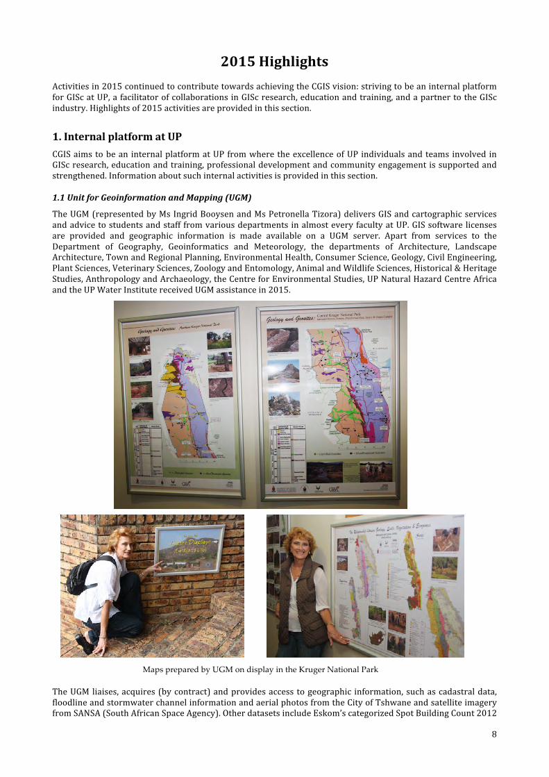
The UGM (represented by Ms Ingrid Booysen and Ms Petronella Tizora) delivers GIS and cartographic services and advice to students and staff from various departments in almost every faculty at UP. GIS software licenses are provided and geographic information is made available on a UGM server. Apart from services to the Department of Geography, Geoinformatics and Meteorology, the departments of Architecture, Landscape Architecture, Town and Regional Planning, Environmental Health, Consumer Science, Geology, Civil Engineering, Plant Sciences, Veterinary Sciences, Zoology and Entomology, Animal and Wildlife Sciences, Historical & Heritage Studies, Anthropology and Archaeology, the Centre for Environmental Studies, UP Natural Hazard Centre Africa and the UP Water Institute received UGM assistance in 2015.
Maps prepared by UGM on display in the Kruger National Park
The UGM liaises, acquires (by contract) and provides access to geographic information, such as cadastral data, floodline and stormwater channel information and aerial photos from the City of Tshwane and satellite imagery from SANSA (South African Space Agency). Other datasets include Eskom’s categorized Spot Building Count 2012
9
which became available in June 2014 and environmental spatial data from SANBI (South African National Biodiversity Institute), the Department of Water Affairs and the Department of Environmental Affairs. Data is kept up to date on a UGM server (FIRE\campus) accessible by staff and students from any UP campus. Another data service provided by UGM is a PC with a SuperCross installation. SuperCross allows cross tabulations of all the parameters for Census 2011 (from StatsSA) can be created. The output, if correctly designed, can be linked directly to any administrative shapefile of South Africa in any GIS for portrayal and analysis. The SuperCross is also available to students and staff on the UGM server (FIRE\campus).
Esri GIS and Exelis ENVI software licenses were acquired (with the aid of faculty funds) for another year period. In 2015, 3,000 licenses were made available for students and staff to use both on and off campus. ArcGIS was installed on approximately 1,200 desktop computers (PCs), laptops and PCs in university laboratories. 91 free ArcGIS Virtual Campus (e-‐learning) courses are included in the annual license. These courses can be accessed and completed by students in their own time. Upon successful completion, the student obtains a certificate. Enrolments are administered by the UGM. In 2015, UP students and staff were registered for 2,052 courses; 67 different courses were accessed. Virtual Campus courses are sometimes prescribed to postgraduate students in other disciplines who want to learn how to use GIS as a tool. They are also used for undergraduate teaching. For example, students complete a Virtual Campus course (in ArcGIS) in their own time in the week prior to the practical session. During the practical session, they have to repeat a similar exercise, making use of QGIS.
Based on the distribution of ArcGIS and ENVI licenses, it is estimated that at least 1,000 students use GIS software in practical sessions of various modules. In addition, there are at least 500 GIS users among UP staff and postgraduate students, who mostly use GIS as a research tool in another discipline (i.e. horizontal research). The actual number is higher due to downloads of open source products directly from the Web without any interaction with the UGM.
Regular lectures to UP staff and students on where to find GIS software and geographic information continued in 2015. Under-‐ and postgraduate students are supported with step-‐by-‐step user-‐friendly manuals for some of the software products (e.g. ArcGIS, SuperCross for Census 2011 data).
The UGM prepares on a continuous basis information panels (including maps) for a project on the description and interpretation of the geology and the identification of geological features in the Kruger National Park. One of the purposes of the project is to identify sites of geological, geomorphologic and associated processes active in the formation of geological features in the park. Posters (maps, photo’s, graphs, artwork, explanatory notes) and models of geological features or landscapes (sitescapes) are included in exhibitions in the park with the aim to introduce, inform and educate the general public on the geological landscape and associated geosites in the Kruger National Park.
1.2 Undergraduate teaching
Undergraduate geoinformatics modules presented by the department are included in many other degrees presented by the department, by ‘neighbouring’ departments in the Faculty of Natural and Agricultural Sciences and by degrees in the Faculties of Education, Humanities and Engineering, Built Environment & Information Technology. See Table 1.
Table 1. Geoinformatics modules in other undergraduate degrees at UP Degree Compulsory modules Elective modules
BSc Environmental Sciences (Faculty of Natural and Agricultural Sciences)
GGY 283, Introductory GIS GIS 310, Geographic information systems GIS 320, Spatial analysis
126 elective credits over three years include geoinformatics modules.
BSc Geography (Faculty of Natural and Agricultural Sciences)
GMC 110, Cartography GGY 283, Introductory GIS GIS 220, Geographic data analysis GIS 310, Geographic information systems GIS 320, Spatial analysis
176 elective credits over three years include geoinformatics modules.
BSc Meteorology (Faculty of Natural and Agricultural Sciences)
GIS 220, Geographic data analysis GMA 220, Remote sensing
162 elective credits over three years include geoinformatics modules.
BSc (Faculty of Natural and Agricultural Sciences)
-‐ Most BSc degrees in the Faculty allow students to take modules from the Department of GGM as elective modules.
BSc Information technology, GGY 156, Aspects of human geography -‐

10
Degree Compulsory modules Elective modules information and knowledge systems (GIS elective group) (Faculty of Engineering, Built Environment and Information Technology)
GGY 166, Geomorphology GMC 110, Cartography GGY 283, Introductory GIS GIS 220, Geographic data analysis GMA 220, Remote sensing GIS 310, Geographic information systems GIS 320, Spatial analysis
BScArch, BScLArch (Faculty of Engineering, Built Environment and Information Technology)
-‐ GGY 283, Introductory GIS
BA, B Political Sciences, B Heritage and Cultural Sciences, B Sports Psychology (Faculty of Humanities)
-‐ GIS 221, GIS Introduction
Students from degree programs presented in many departments and faculties at UP are registered for geoinformatics modules. See Table 2. Take note that Education students. i.e. prospective teachers, are included. The introductory GIS module prepares them for the school curriculum in geography, which includes GIS.
Table 2. Students from other departments and faculties in geoinformatics modules in 2014 Module (listed alphabetically)
Num
ber of students
Faculty of Economic and Managem
ent
Sciences
Faculty of Education
Faculty of Engineering and Inform
ation
Technology
Faculty of Hum
anities
Faculty of Natural and Agricultural
Sciences – BSc Geoinform
atics
Faculty of Natural and Agricultural
Sciences – Other degrees
GGY 283, Introductory GIS 130 48% 13% 8% 13% 18%
GIS 120, Geoinformatics 36 3% 69% 28%
GIS 220, Geographic data analysis 83 1% 2% 72% 24%
GIS 221, GIS introduction 125 22% 2% 6% 69%
GIS 310, Geographic information systems 104 2% 1% 12% 86%
GIS 320, Spatial analysis 84 1% 1% 13% 85%
GMA 220, Remote sensing 92 1% 21% 78%
GMA 320, Remote sensing 40 28% 73%
GMC 110, Cartography 55 5% 45% 49%
GMC 310, Geometrical space and geodesy 24 58% 42%
SUR 220, Surveying 107 70% 20% 10%
Table 3 shows the range of software products used in teaching geoinformatics modules.
Table 3. Software products used in the geoinformatics modules
11
Module Average #students Software product
GMC 110, Cartography 60 QGIS GIS 120, Informatics 32 AfriGIS GISlike, ArcGIS, GeoDa, OpenStreetMap, QGIS, Erdas,
MapInfo GGY 283, Introductory GIS 171 ArcGIS GIS 220, Geographic data analysis 104 Microsoft Excel (R from 2015) GIS 221, GIS Introduction 112 ArcGIS GMA 220, Remote sensing 108 ENVI GIS 310, GIS 85 QGIS, PostgreSQL, PostGIS GMA 320, Remote sensing 49 ENVI, IDL GMC 310, Geometrical and space geodesy 28 Microsoft Excel GIS 320, Spatial analysis 66 GeoDA, QGIS, SAGA GMT 320, Geoinformatics project 16 AfriGIS JavaScript API, Enterprise Architect, deegree, GeoServer,
OpenLayers, PostgreSQL, PostGIS, QGIS COS 787, Spatial databases 42 PostgreSQL, PostGIS, Rasdaman, Enterprise Architect GIS 705, Advanced geospatial data 12 Students may choose any tool to prepare diagrams, such as
Microsoft Visio or Enterprise Architect GIS 704, Spatial statistics and geodesy 12 Microsoft Excel GIS 706, Internet GIS 13 GeoServer, PostgreSQL, PostGIS GMA 705, Advanced remote sensing 13 ENVI, IDL
1.3 Geoinformatics project
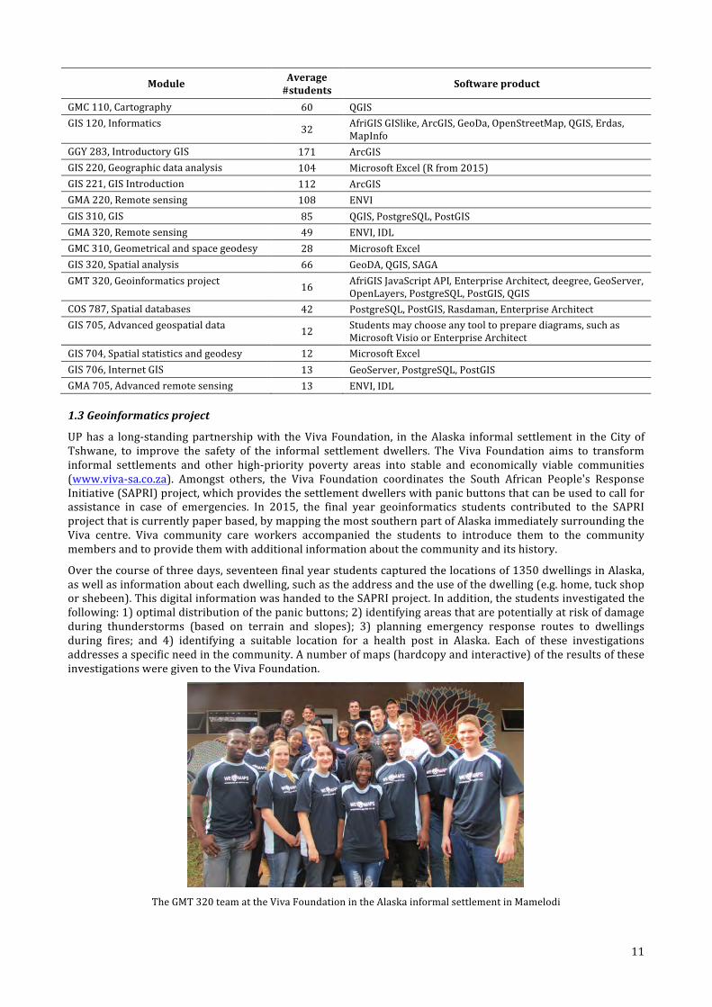
UP has a long-‐standing partnership with the Viva Foundation, in the Alaska informal settlement in the City of Tshwane, to improve the safety of the informal settlement dwellers. The Viva Foundation aims to transform informal settlements and other high-‐priority poverty areas into stable and economically viable communities (www.viva-‐sa.co.za). Amongst others, the Viva Foundation coordinates the South African People's Response Initiative (SAPRI) project, which provides the settlement dwellers with panic buttons that can be used to call for assistance in case of emergencies. In 2015, the final year geoinformatics students contributed to the SAPRI project that is currently paper based, by mapping the most southern part of Alaska immediately surrounding the Viva centre. Viva community care workers accompanied the students to introduce them to the community members and to provide them with additional information about the community and its history.
Over the course of three days, seventeen final year students captured the locations of 1350 dwellings in Alaska, as well as information about each dwelling, such as the address and the use of the dwelling (e.g. home, tuck shop or shebeen). This digital information was handed to the SAPRI project. In addition, the students investigated the following: 1) optimal distribution of the panic buttons; 2) identifying areas that are potentially at risk of damage during thunderstorms (based on terrain and slopes); 3) planning emergency response routes to dwellings during fires; and 4) identifying a suitable location for a health post in Alaska. Each of these investigations addresses a specific need in the community. A number of maps (hardcopy and interactive) of the results of these investigations were given to the Viva Foundation.
The GMT 320 team at the Viva Foundation in the Alaska informal settlement in Mamelodi

12
This community project was integrated into the academic activities of the semester module, GMT 320 (Geoinformatics project). The module provides a unique first learning opportunity for the students to be involved in a real project with a client. Up until then, students work with hypothetical scenarios where “perfect” data and a breakdown of the solution are provided to them. For GMT 320, students have to implement the entire project management process, capture their own data, and then implement an innovative solution with the data they have captured. During GMT 320 students get a first opportunity to work with handheld and differential global positioning system (GPS) devices, and to gain fieldwork experience. This experience is invaluable to the students who will plan projects and capture data in the field during their professional careers.
The final deliverables of the 2015 projects are available here: − Geospatial Pentagon, http://geospatialpentagon.wix.com/gsp2015 − Mamelodi mappers, http://mamelodimappers.wix.com/alaska-‐fire-‐project − Mapping Places, http://heatedalaska.wix.com/mapping-‐at-‐places − Reincarnate, http://reincarnate4321.wix.com/gmt320
1.4 Supporting the GIS lab in the Geography building
In 2015, CGIS procured twenty 23-‐inch displays for the GIS lab in the Geography building. There are now 20 seats with the 23-‐inch screens and 20 seats with two smaller screens. The larger screens are beneficial for students who develop maps or analyse geospatial data during practical sessions or for assignments and research.
The GIS lab (Geography 2-‐3)
1.5 Winning students
2014 Student prize winners
At the Faulty of Natural and Agricultural Science Dean's Award Ceremony in May 2015, the top 2014 students in Geoinformatics were rewarded for their achievements. The photo shows winners and representatives from the sponsors who presented the prizes to students at the ceremony.
From left to right: Mr Wickes van Heerden (CONSAS prize for the best BSc Geoinformatics graduate), Prof Serena Coetzee, Ms
Sizakele Ndebele (SANSA prize for the best third year Geoinformatics student in Remote Sensing), Mr Stuart Martin (GeoTerraImage), Ms Michelle Bester (AfriGIS prize for the best BScHons Geoinformatics student in 2014; GeoTerraImage prize for the best Honours research project in 2014; SANSA prize for the best BScHons Geoinformatics student in Remote
Sensing*), Ms Marna Roos (AfriGIS) and Ms Elbe Janse van Rensburg (CONSAS)
* Prize shared with Mr André Theron who could not attend the ceremony.
17/03/2016, 9:45 AMNews | Geoinformatics - 2014 student prize winners | UP
Page 1 of 3http://www.up.ac.za/en/centre-for-geoinformation-science/news/po…s&slug=news&id=2085675&_zp_sid=cl7ikhll4on98rrh7dg8svlhp9na4opk
You are here - Home - Centre for Geoinformation Science
News
Back to Admin Area
- Author Serena Coetzee
Share this pageShare this page Last edited by Victoria-Justine Rautenbach
Geoinformatics - 2014 student prize winners
22 May 2015
At the recent Dean's Award Ceremony, the top 2014 students in Geoinformatics were rewarded for their achievements.
The photo shows student prize winners and representatives from the sponsors who presented the prizes to students at
the ceremony. From left to right: Mr Wickes van Heerden (CONSAS prize for the best BSc Geoinformatics graduate), Prof
Serena Coetzee, Ms Sizakele Ndbele (SANSA prize for the best third year student in Remote Sensing), Mr Stuart Martin
(GeoTerraImage), Ms Michelle Bester (SANSA prize for the best BSc (Hons) Geoinformatics student in Remote Sensing*;
AfriGIS prize for the best BSc (Hons) Geoinformatics student), Ms Marna Pretorius (AfriGIS) and Ms Elbe van Rensburg
(CONSAS).
* Michelle shares the prize with Mr André Theron who could not attend the ceremony.
Congratulations to the students and thank you to the sponsors!
Tweet
Prize winners and sponsors
MyTUKS Login JuniorTukkie
Careers @ UP Tenders @ UP Media A-Z Site Index
Search WebsiteQuick Links English
About UP Study at UP Faculties Schools and Departments Institutes, Centres and Units Research
Teaching and Learning Library Giving Enterprises Contact us
13
Open Data Day
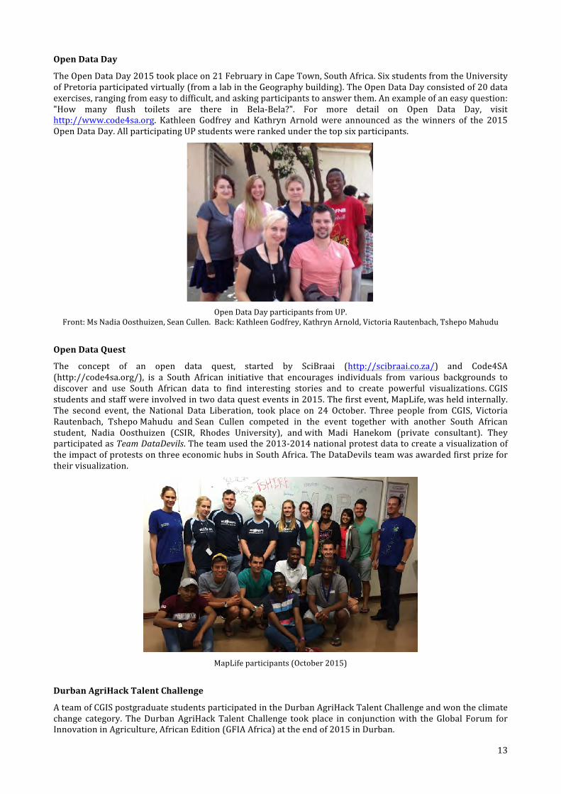
The Open Data Day 2015 took place on 21 February in Cape Town, South Africa. Six students from the University of Pretoria participated virtually (from a lab in the Geography building). The Open Data Day consisted of 20 data exercises, ranging from easy to difficult, and asking participants to answer them. An example of an easy question: "How many flush toilets are there in Bela-‐Bela?". For more detail on Open Data Day, visit http://www.code4sa.org. Kathleen Godfrey and Kathryn Arnold were announced as the winners of the 2015 Open Data Day. All participating UP students were ranked under the top six participants.
Open Data Day participants from UP.
Front: Ms Nadia Oosthuizen, Sean Cullen. Back: Kathleen Godfrey, Kathryn Arnold, Victoria Rautenbach, Tshepo Mahudu
Open Data Quest
The concept of an open data quest, started by SciBraai (http://scibraai.co.za/) and Code4SA (http://code4sa.org/), is a South African initiative that encourages individuals from various backgrounds to discover and use South African data to find interesting stories and to create powerful visualizations. CGIS students and staff were involved in two data quest events in 2015. The first event, MapLife, was held internally. The second event, the National Data Liberation, took place on 24 October. Three people from CGIS, Victoria Rautenbach, Tshepo Mahudu and Sean Cullen competed in the event together with another South African student, Nadia Oosthuizen (CSIR, Rhodes University), and with Madi Hanekom (private consultant). They participated as Team DataDevils. The team used the 2013-‐2014 national protest data to create a visualization of the impact of protests on three economic hubs in South Africa. The DataDevils team was awarded first prize for their visualization.
MapLife participants (October 2015)
Durban AgriHack Talent Challenge
A team of CGIS postgraduate students participated in the Durban AgriHack Talent Challenge and won the climate change category. The Durban AgriHack Talent Challenge took place in conjunction with the Global Forum for Innovation in Agriculture, African Edition (GFIA Africa) at the end of 2015 in Durban.
17/03/2016, 9:47 AMNews | CGIS students excel at Open Data Day | UP
Page 1 of 3http://www.up.ac.za/en/centre-for-geoinformation-science/news/po…s&slug=news&id=2036807&_zp_sid=cl7ikhll4on98rrh7dg8svlhp9na4opk
You are here - Home - Centre for Geoinformation Science
News
Back to Admin Area
- Author Centre for Geoinformation Science
Share this pageShare this page Last edited by Victoria-Justine Rautenbach
CGIS students excel at Open Data Day
25 February 2015
The Open Data Day 2015 took place on 21 February in Cape Town, South Africa. Six students from the University of
Pretoria participated virtually and ultimately Kathleen Godfrey and Kathryn Arnold was announced as the winners of
the 2015 Open Data Day. All of the University of Pretoria students was ranked under the top six participants (Kathleen
Godfrey, Kathryn ArnoldTshepo Mamabolo, Sean Cullen, Nadia Oosthuizen and Victoria Rautenbach).
The Open Data Day constisted of 20 data exercises ranging from easy to difficult and asking participants to try to
answer them. An example of an easy question might be, "How many flush toilets are there in Bela-Bela?". For more
detail on the Open Data Day visit: http://www.code4sa.org.
Click here to see the Open Data Day gallery.
Tweet
MyTUKS Login JuniorTukkie
Careers @ UP Tenders @ UP Media A-Z Site Index
Search WebsiteQuick Links English
About UP Study at UP Faculties Schools and Departments Institutes, Centres and Units Research
Teaching and Learning Library Giving Enterprises Contact us

14
Victoria Rautenbach, Nadia Oosthuizen and Sean Cullen with the winning trophy (Danie Jooste is absent).
The CGIS team developed the Temo le Boso mobile and web application. A video of the wining product is available at https://www.youtube.com/watch?v=8eSBK0c0PgI. The platform (website and app) aims to serve as a decision making tool for farmers when selecting which crop type to plant in their area under future climatic conditions. For the prototype, they used open data from many sources, notably data from the CGIAR Research Program on Climate Change, Agriculture and Food Security (CCAFS), a partner of the activity.
The team received their trophy from a board member of the Southern African Confederation of Agricultural Unions (SACAU), another partner of the activity. The price for the category is 4 000 euros and the opportunity to fully develop the application.
For more information, see the original article at http://durban-‐agrihack.ict4ag.org/index.php/2015/12/03/meet-‐the-‐winners-‐of-‐the-‐durbanagrihack-‐talent-‐challenge/.
2. Facilitator of collaborations CGIS aims to be a facilitator of UP GISc research collaborations, education and training and professional alliances within South Africa and abroad. Ongoing and new collaborations are described in this section.
2.1 Agricultural Research Council (ARC)
CGIS recently established a collaboration with the Geoinformatics Division of the Agricultural Research Council (ARC)-‐Institute for Soil, Climate and Water (ISCW). In 2015, the collaboration was led by Dr J.G Chirima from the ARC and Dr O.J Botai from UP. Currently, ARC has various projects that focus on agricultural applications. For example, remote sensing techniques are used to monitor the health status of various crops (wheat, maize, etc.) and to develop models that allow prediction of crop yield, grazing capacity, ecological modelling, climate systems and land cover/use applications.
The ISCW hosts databases that are national assets, including remote sensing, climate, soil and agriculture datasets. These datasets are used to model the risk and develop early warning systems that have wide application in earth science. CGIS students get exposure to these facilities and datasets, and the opportunity to contribute to the ongoing research at the ISCW. The skills that students acquire are more provide additional opportunities, beyond UP’s current infrastructure. Therefore, ARC-‐ISCW is an important partner to CGIS.
In 2015, the Geoinformatics Division of the ARC hosted one CGIS Masters student, Miss ZO Mashaba, and more postgraduate students are expected to follow in 2016. The students benefit from the ARC through co-‐supervision by Dr J.G Chirima, financial support, use of ARC equipment (spectrometer) and state-‐of-‐the-‐art laboratories and databases. Through this collaboration, students get the opportunity to attend local and/or international conferences through which they can network with other scientists.
2.2 CSIR Built Environment
CGIS has a long-‐standing collaboration with CSIR Built Environement. Collaboration is mainly in the form of lecturing and postgraduate student supervision, but there are also other activities, such as assistance with replacement teaching when lecturers are on sabbaticals, and collaboration on joint research projects.
The CSIR Built Environment has currently two extraordinary lecturers in the Department of GGM, Antony Cooper and Dr Peter Schmitz. Dr Schmitz takes responsibility (as contract lecturer) for the GIS 705, Advanced geospatial fata, module in the BScHons Geoinformatics program. Antony Cooper contributes to lectures in COS 787, Spatial
15
databases, and will contribute to GIS 703, GIS professional practice, in future. Furthermore, Dr Schmitz and Mr Cooper supervise Honours, Masters and PhD students, while Dr Gerbrand Mans co-‐supervises a Masters student and Ms Alize le Roux supervises Masters and Honours students. She will do a few lectures of replacement teaching when Ms Victoria Rautenbach is on sabbatical in 2016.
Dr Schmitz is involved in various projects related to forensic geoscience. For example, he co-‐supervised Mauritz de Bruin MA Environment and Society degree on the application of forensic geomorphology in rhinoceros poaching (South Africa). His Masters dissertation investigated the use of sand grains and their chemical compositions from poaching sites to compare them against samples obtained from suspects. The dissertation received a very good response from Professor Peter Bull, Oxford University, who is an in expert in this study field. Discussions are currently underway with the Green Scorpions from the Department of Environmental Affairs about establishing a baseline for natural cycad populations using the methodologies described in Mauritz de Bruin’s Masters dissertation.
For his research for the MSc in Geoinformatics, Niell du Plooy is currently completing field work looking into the impact of leached explosives on plants. This builds on the Honours project by Rene Smit in 2013. The trees, grasses and shrubs are kept under semi-‐natural conditions, meaning the plants are exposed to nature, but watered on a regular basis. The initial results in the nitrogen, water band and moisture stress indexes using F and P statistics show promising results. The CSIR’s Natural Resources and the Environment (NRE) has a spectrometer to measure light reflectance from leaves or plant canopies. These readings are used to verify spectral readings from remote sensing platforms. In this instance the spectrometer is used in the research on the effect of TNT on plants. The instrument is a FieldSpec from ASD Inc. and has a full range detection capacity from 350 to 2500nm which covers the solar irradiance spectrum. The CSIR NRE has made this instrument available to explosives research on an ongoing basis since 2013.
2.3 CSIR Natural resources and the environment (NRE)
The CSIR’s Earth Observation (EO) research group in the NRE unit is known to provide remote sensing research leadership in the field of Ecosystems Earth Observation in South Africa using hyperspectral, multispectral and Synthetic Aperture Radar (SAR) data products coupled with robust image analysis techniques and tools.
Collaboration between CGIS and the CSIR’s EO research group has led to the provision of: (1) guest lectures on specialised EO topics; (2) hands-‐on practical exercises on LiDAR, SAR and hyperspectral data; (3) access to specialised remote sensing equipment; and (4) cutting-‐edge EO research activities to the CGIS under-‐ and postgraduate students. In particular, experts within the EO research group, such as Dr Renaud Mathieu and Dr Abel Ramoelo, are annually consulted (as extraordinary lecturers) by CGIS remote sensing lecturers for contributions in reviewing and structuring the content of remote sensing modules (i.e. GMA 220, GMA 320 and GMA 705) and also for assisting with the design and execution of cutting-‐edge laboratory exercises that are well synchronized with the theory, particularly for the advanced remote sensing module (GMA 705) offered at postgraduate level.
Furthermore, this collaboration has led to joint supervision of various specialised EO research topics for postgraduates and subsequent publications of results in high impact journals in the field of remote sensing. Overall, the collaboration facilitates the exchange of knowledge and key technical skills between students and experts from the CSIR’s EO research group, coupled with exposure to sophisticated remotely sensed data products, analytical techniques and equipment.
2.4 CSIR Meraka Institute
The Meraka Institute is an operating unit of the CSIR focused on information and communication technology (ICT). Meraka aims to contribute to enhancing quality of life and economic competitiveness in South Africa and the continent through ICT by its research. There are various collaborative activities between CGIS and Meraka.
Dr Konrad Wessels is an extraordinary lecturer in the Department of GGM. He supervises postgraduate students and advises on the content of remote sensing modules in the department. He has also contributed with lectures and practicals. Mr Graeme McFerren takes responsibility (as contract lecturer) for the GIS 706, Internet GIS, module of the BScHons Geoinformatics program. He also supervises Honours and Masters students. Dr Terence van Zyl, formerly from Meraka and now from Wits, co-‐supervises a number of students in the department. Finally, the two JuniorTukkie Geospatial TechCamps in 2014 and 2015, were inspired and co-‐organized by Sives Govender, the research group leader of the EO4ICT research group in the Meraka Institute.
2.5 HartRAO
CGIS and the Hartebeesthoek Radio Astronomy Observatory (HartRAO) have a long standing collaboration that is led by extraordinary professor Ludwig Combrinck (acting director of HartRAO) and Dr Joel Botai (recently
16
moved from UP to South African Weather Service and now an extraordinary lecturer in the Department of GGM). HartRAO can be categorized as a geodetic and astronomical observatory. It has 26 m and 15 m Very Long Baseline Interferometry (VLBI) radio telescopes, Satellite Laser Ranging (SLR) (MOBLAS-‐6), Doppler Orbitography and Radiopositioning Integrated by Satellite (DORIS) station, a network of Global Navigation Satellite Systems (GNSS) stations. The observatory is currently building a VLBI2010 Global Observing System (VGOS) antenna with improved tracking and observational accuracies (mm) as well as the Lunar Laser Ranging (LLR) system.
The observatory defines modern geodesy and its high accuracy requirements in practice. It offers an opportunity for students at CGIS to learn about modern geodesy in practice, as this forms an integral part of the CGIS curriculum. Once a year, third year students have the opportunity to visit the observatory to complement the theory they learn in class. Prof Combrinck has provided supervision and financial support to Honours, Masters and PhD students and HarRAO also has post-‐doctoratal opportunities in the field of geodesy.
Students supervised and co-‐supervised by Prof Combrinck and Dr Botai in the field of geodesy at CGIS are: Mr Cilence Munghemezulu (PhD Geoinformatics), Mr Philemon Tsela (PhD Geoinformatics), Mr Ivan Muzondo (PhD Geoinformatics), Mr O Isioye (PhD Geoinformatics), Mr Webby Miyoba (PhD Geoinformatics), Miss Lisa Nyadzua (MSc Geoinformatics) and Miss Zinhle Mashaba (MSc Geoinformatics). Many of these are international students from different countries in Africa, including Nigeria, Kenya and Zambia.
In 2015, CGIS made a financial contribution to Mr Philemon Tsela’s Thuthuka project, funded by the NRF. The project aims to develop a mathematical model for monitoring and controlling thermal variations on the Lunar laser ranging (LLR) telescope system based in HartRAO, and their effects on the operational and optical performance of the telescope. In 2015, one publication on the topic was published, another accepted and a third one submitted. There is global interest in the modelling approach considered for implementing this project in comparison to existing approaches for different telescope systems, and how this will impact on the overall pointing accuracy of the telescope. In particular, the aforementioned mathematical model currently being developed is expected to contribute toward the achievement of a stringent pointing accuracy requirement of about 0.5 arcseconds to the retroreflectors mounted on the lunar surface. Such an achievement would guarantee future enhanced tests of Earth-‐Moon system dynamics e.g., Moon’s motion around Earth, relative acceleration of both the Earth and Moon toward the Sun as well as the Moon’s gradual recession from the Earth and consequent effect on the Earth’s ocean tides. South Africa is expected to have the first LLR telescope located in the Southern Hemisphere; this would be an addition to the only five capable LLR stations based in the Northern Hemisphere at McDonald Observatory (Texas, U.S.A), Observatoire de la Côte d'Azur (France), Apache Point Observatory (New Mexico, U.S.A.), Matera (Italy) and Wettzell (Germany).
2.6 South African National Space Agency (SANSA)
SANSA’s mandate is “to provide for the promotion and use of space and cooperation in space related activities, foster research in space science, advance scientific engineering through human capital and support the creation of an environment conducive to industrial development in space technologies within the framework of national government policy”.
Since 2011, there has been on-‐going collaboration between SANSA and CGIS. This collaboration is characterized by: (1) joint supervision of MSc and PhD Geoinformatics students’; (2) provision of postgraduate bursaries to both local and international students; (3) organized field trips to SANSA in order for students to get exposure to ground space station equipment and the associated operations such as satellite signal tracking and receipt; (4) provision of satellite-‐derived imagery or Earth Observation (EO) data products as well as, lending of specialised remote sensing equipment, such as the hand-‐held spectroradiometer for acquisition of hyperspectral insitu measurements; and (5) calls for participation in capacity building workshops focusing on EO Science and satellite image processing for both students and staff. For the past few years, SANSA has also sponsored student prizes for the best third year student in remote sensing, and the best Honours student in remote sensing.
These opportunities have been realised through CGIS with remote sensing lectures by Dr Joel Botai and Mr Philemon Tsela in the past 5 years, due to continued support and commitment by SANSA’s executive leadership, in particular Dr Sandile Malinga and Dr Jane Olwoch, who is also an extraordinary lecturer in the department.
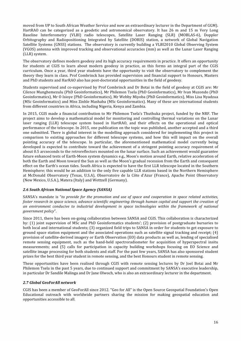
2.7 Global GeoForAll network
CGIS has been a member of GeoForAll since 2012. "Geo for All" is the Open Source Geospatial Foundation's Open Educational outreach with worldwide partners sharing the mission for making geospatial education and opportunities accessible to all.
17
Locations of labs in the GeoForAll network (November 2015). (Source: GeoForAll website,
http://www.geoforall.org/locations/) CGIS uses open source software for geospatial and/or open data in research and education, or contribute to the software and/or data through research. The table below lists open source software used in education in the Department of Geography, Geoinformatics and Meteorology.
Open source software used in Geoinformatics education at UP
Module Semester Open source and open data
GMC 110, Cartography 1st QGIS
GIS 120, Informatics 2nd GeoDa, OpenStreetMap, QGIS
GIS 310, GIS 5th QGIS, PostgreSQL, PostGIS
GIS 320, Spatial analysis 6th QGIS, SAGA, GeoDA
GMT 320, Geoinformatics project 6th deegree, GeoServer, OpenLayers, PostgreSQL, PostGIS, QGIS
*COS 787, Spatial databases 7th PostgreSQL, PostGIS, Rasdaman
GIS 706, Internet GIS 8th GeoServer, PostgreSQL, PostGIS
* Jointly presented with the Department of Computer Science
As part of our open source initiative, Gavin Fleming from Afrispatial, a CGIS Advisory Board Member, presented a five-‐day course on ‘Spatial databases with PostGIS’ through CE at UP in June 2015. In another initiative, Serena Coetzee was guest editor for a special issue of the ISPRS International Journal of Geo-‐Information (ISSN 2220-‐9964) on ‘Open Geospatial Science and Applications’. The special issue aims to showcase the advancement of open geospatial science and applications by building upon the broader progress in open science, the synergies in the developments in open source geospatial software, open data, open standards, open hardware and open access to research publications. The call for papers is available at http://www.mdpi.com/journal/ijgi/special_issues/science-‐applications.
2.8 Carnegie African Diaspora Fellowship Program
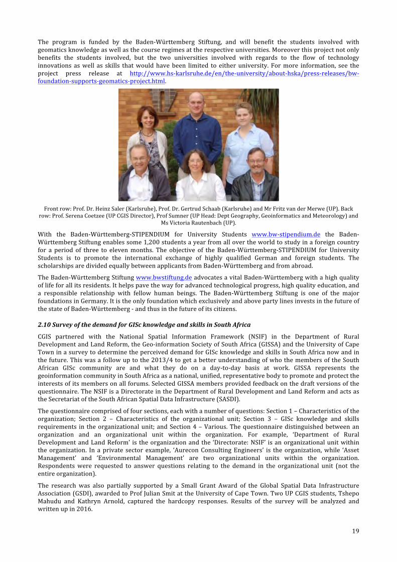
In 2015, CGIS was selected by the Carnegie African Diaspora Fellowship Program (CADFP) in the USA to host an African Diaspora scholar, Dr Paddington Hodza, to collaborate on a project on Geographic Information Science and Technology (GIS&T). Prof Serena Coetzee led the project together with Dr Hodza, a Fellow of the Wyoming Geographic Information Science Center (WyGISC) at the University of Wyoming in Laramie, Wyoming, USA.

18
Front: Sean Cullen (MSc Geoinformatics), Dr Paddington Hodza and Prof Serena Coetzee.
Back: Victoria Rautenbach (PhD Geoinformatics), Linda Khoza (DST/NRF intern) and Danie Jooste (BSc Hons Geoinformatics).
In anticipation of the visit, Prof Coetzee, Dr Hodza and two co-‐authors from the USA and Germany prepared a paper titled ‘Comparing proportional compositions of geospatial technology-‐related programs at three universities’. The study illustrates how a comparison of proportional programme composition can reveal significant differences and similarities that are not obvious when only content is compared. The compositional differences naturally result in graduates with different knowledge and skills, which allow for different career paths to meet different job market needs. Dr Hodza presented the paper at the Geomatics Indaba 2015 held in Kempton Park (Ekurhuleni) in August.
Other activities during Dr Hodza’s one-‐month visit included a workshop on ‘Appreciative GIS’ at the Geomatics Indaba 2015; accompanying third-‐year Geoinformatics students to an informal settlement on the outskirts of Mamelodi, where they participated in a community engagement project; a demonstration of the WyGISC geoportal and brainstorming for a similar implementation at UP; a seminar in Internet GIS designed for postgraduate students; and guest lectures attended by staff, students and industry representatives.
The UP project was one of 17 projects that pair African Diaspora scholars with institutions of higher education and collaborators in Africa to work together on curriculum development, research, graduate teaching, training and mentoring in the months ahead.
This innovative fellowship programme facilitates engagement between scholars born in Africa who are now based in the United States or Canada and scholars living in Africa on mutually beneficial academic activities. The programme is managed by the Institute of International Education (IIE) in collaboration with Quinnipiac University, through Dr Paul Tiyambe Zeleza, who chairs the Advisory Council, and is funded by the Carnegie Corporation of New York.
The Carnegie African Diaspora Fellowship Program (CADFP) Advisory Council, comprising academic leaders from Africa and prominent African Diaspora academics, has remarked on the rapid growth, quality, impact and uniqueness of the programme, which allows African universities to host African Diaspora scholars at their institutions.
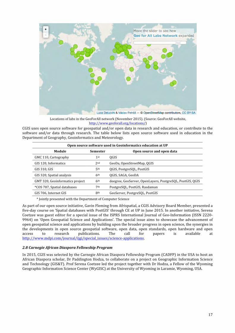
2.9 Student exchange with the Karlsruhe University of Applied Sciences in Germany
In 2015, the Karlsruhe University of Applied Sciences in Germany and the University of Pretoria started a three year project that runs from 9/2015 -‐8/2018, funded by the Baden-‐Württemberg Stiftung within its Baden-‐Württemberg-‐STIPENDIUM for University Students – BWS plus programme. The project, 'Geomatics and participation – study and research in the tension field between a European technology region and an African emerging country', aims at joining students from the technology and innovation region Baden-‐Württemberg and students from the emerging South Africa so that they can benefit from the experiences and knowledge regarding real-‐time Geomatics at the respective universities.
The goal is to start a long-‐term partnership and student exchange programme. For example, in future it could be possible for Honours students to do a semester in Karlsruhe and for their Masters students to join us for a semester in Pretoria. The Masters in Geomatics in Karlsruhe is course-‐based and presented in English. As part of this initial three year project, a group of Honours students will visit Karlsruhe in July next year and there are also three to six-‐month student exchanges planned for Masters and PhD students.
Prof Gertrud Schaab and Prof Heinz Saler (see photo) from the Karlsruhe University of Applied Sciences in Germany visited UP for the project kick-‐off meetings from 21 to 23 September 2015. During their visit, Prof Schaab introduced the Karlsruhe University of Applied Sciences and the project on campus.
17/03/2016, 9:37 AMNews | African Diaspora fellow collaborates on Geographic Information Science and Technology project at UP | UP
Page 2 of 4http://www.up.ac.za/en/centre-for-geoinformation-science/news/po…s&slug=news&id=2153831&_zp_sid=cl7ikhll4on98rrh7dg8svlhp9na4opk
- Author Centre for Geoinformation Science
Share this pageShare this page Last edited by Victoria-Justine Rautenbach
programme, which allows African universities to host African Diaspora scholars at their institutions.
Tweet
Front: Sean Cullen (MSc Geoinformatics), Dr PaddingtonHodza and Prof Serena Coetzee. Back: VictoriaRautenbach (PhD Geoinformatics), Linda Khoza(DST/NRF intern) and Danie Jooste (BSc HonsGeoinformatics).
Categories
Arts & Culture
Research
News
Sport & Athletics
Web Announcements
Centre for Geoinformation Science News See All NewsSee All Video's
No events available!
Events RSS See full Events Calendar
19
The program is funded by the Baden-‐Württemberg Stiftung, and will benefit the students involved with geomatics knowledge as well as the course regimes at the respective universities. Moreover this project not only benefits the students involved, but the two universities involved with regards to the flow of technology innovations as well as skills that would have been limited to either university. For more information, see the project press release at http://www.hs-‐karlsruhe.de/en/the-‐university/about-‐hska/press-‐releases/bw-‐foundation-‐supports-‐geomatics-‐project.html.
Front row: Prof. Dr. Heinz Saler (Karlsruhe), Prof. Dr. Gertrud Schaab (Karlsruhe) and Mr Fritz van der Merwe (UP). Back
row: Prof. Serena Coetzee (UP CGIS Director), Prof Sumner (UP Head: Dept Geography, Geoinformatics and Meteorology) and Ms Victoria Rautenbach (UP).
With the Baden-‐Württemberg-‐STIPENDIUM for University Students www.bw-‐stipendium.de the Baden-‐Württemberg Stiftung enables some 1,200 students a year from all over the world to study in a foreign country for a period of three to eleven months. The objective of the Baden-‐Württemberg-‐STIPENDIUM for University Students is to promote the international exchange of highly qualified German and foreign students. The scholarships are divided equally between applicants from Baden-‐Württemberg and from abroad.
The Baden-‐Württemberg Stiftung www.bwstiftung.de advocates a vital Baden-‐Württemberg with a high quality of life for all its residents. It helps pave the way for advanced technological progress, high quality education, and a responsible relationship with fellow human beings. The Baden-‐Württemberg Stiftung is one of the major foundations in Germany. It is the only foundation which exclusively and above party lines invests in the future of the state of Baden-‐Württemberg -‐ and thus in the future of its citizens.
2.10 Survey of the demand for GISc knowledge and skills in South Africa
CGIS partnered with the National Spatial Information Framework (NSIF) in the Department of Rural Development and Land Reform, the Geo-‐information Society of South Africa (GISSA) and the University of Cape Town in a survey to determine the perceived demand for GISc knowledge and skills in South Africa now and in the future. This was a follow up to the 2013/4 to get a better understanding of who the members of the South African GISc community are and what they do on a day-‐to-‐day basis at work. GISSA represents the geoinformation community in South Africa as a national, unified, representative body to promote and protect the interests of its members on all forums. Selected GISSA members provided feedback on the draft versions of the questionnaire. The NSIF is a Directorate in the Department of Rural Development and Land Reform and acts as the Secretariat of the South African Spatial Data Infrastructure (SASDI).
The questionnaire comprised of four sections, each with a number of questions: Section 1 – Characteristics of the organization; Section 2 – Characteristics of the organizational unit; Section 3 – GISc knowledge and skills requirements in the organizational unit; and Section 4 – Various. The questionnaire distinguished between an organization and an organizational unit within the organization. For example, ‘Department of Rural Development and Land Reform’ is the organization and the ‘Directorate: NSIF’ is an organizational unit within the organization. In a private sector example, ‘Aurecon Consulting Engineers’ is the organization, while ‘Asset Management’ and ‘Environmental Management’ are two organizational units within the organization. Respondents were requested to answer questions relating to the demand in the organizational unit (not the entire organization).
The research was also partially supported by a Small Grant Award of the Global Spatial Data Infrastructure Association (GSDI), awarded to Prof Julian Smit at the University of Cape Town. Two UP CGIS students, Tshepo Mahudu and Kathryn Arnold, captured the hardcopy responses. Results of the survey will be analyzed and written up in 2016.
12/03/2016, 10:12 AMNews | Kick-off: Karlsruhe University of Applied Sciences / UP student exchange programme | UP
Page 2 of 4http://www.up.ac.za/en/centre-for-geoinformation-science/news/pos…uhe-university-of-applied-sciences-up-student-exchange-programme
Share this pageShare this page Last edited by Serena Coetzee
is the only foundation which exclusively and above party lines invests in the future of the state of Baden-Württemberg -
and thus in the future of its citizens.
0
ShareShare
Tweet
Front row: Prof. Dr. Heinz Saler (Karlsruhe), Prof. Dr.Gertrud Schaab (Karlsruhe) and Mr Fritz van der Merwe(UP). Back row: Prof. Serena Coetzee (UP), Prof Sumner(UP Head: Dept Geography, Geoinformatics andMeteorology) and Ms Victoria Rautenbach (UP).
Categories
Arts & Culture
Research
News
Sport & Athletics
Web Announcements
Events RSS See full Events Calendar

20
2.11 International Cartographic Association (ICA) and International Society for Photogrammetry and Remote Sensing (ISPRS)
CGIS members are actively involved in working groups of two International Council for Science (ICSU) member bodies, namely the International Cartographic Association (ICA) and the International Society for Photogrammetry and Remote Sensing (ISPRS).
In 2015, Peter Schmitz was elected as Chair of the ICA Commission on Map Production and Geoinformation Management (http://mapproduction.icaci.org/) and Serena Coetzee took over from Antony Cooper as Chair of the ICA Commission on SDI and Standards (http://sdistandards.icaic.org). In collaboration with the ICA Commission on Open Source Geospatial Technologies, the Open Geospatial Consortium (OGC) and the Brazilian Institute of Geography and Statistics (IBGE), the Commission on SDI and Standards organised a pre-‐conference workshop for the 27th International Cartographic Conference (ICC) on Spatial data infrastructures, standards, open source and open data for geospatial (SDI-‐Open 2015). The workshop was hosted by IBGE in Rio de Janeiro, 20-‐21 August 2015.
Victoria Rautenbach is the research secretary of the ISPRS working group (WG) II/6, Geographical Visualization and Virtual Reality. She is responsible for the day-‐to-‐day operations of the WG, e.g. updating the website and maintaining a social media presence together with the other leadership of the WG. In 2015, the WG was involved in two international events, an International Workshop on Web Mapping, Geoprocessing and Services in July 2015 in Italy and a Geospatial Week on Rendering and Cognition with Images and Hybrid Visualizations, held in October 2015 in France.
Participants of the SDI-‐Open 2015 workshop at IBGE in Rio de Janeiro, Brazil, 20-‐21 August 2015
3. Partner to the geoinformation industry of South Africa CGIS aims to be a partner to the South African geoinformation industry in support of GISc research, education and training, professional development, community engagement. A few highlights from 2015 are presented in this section.
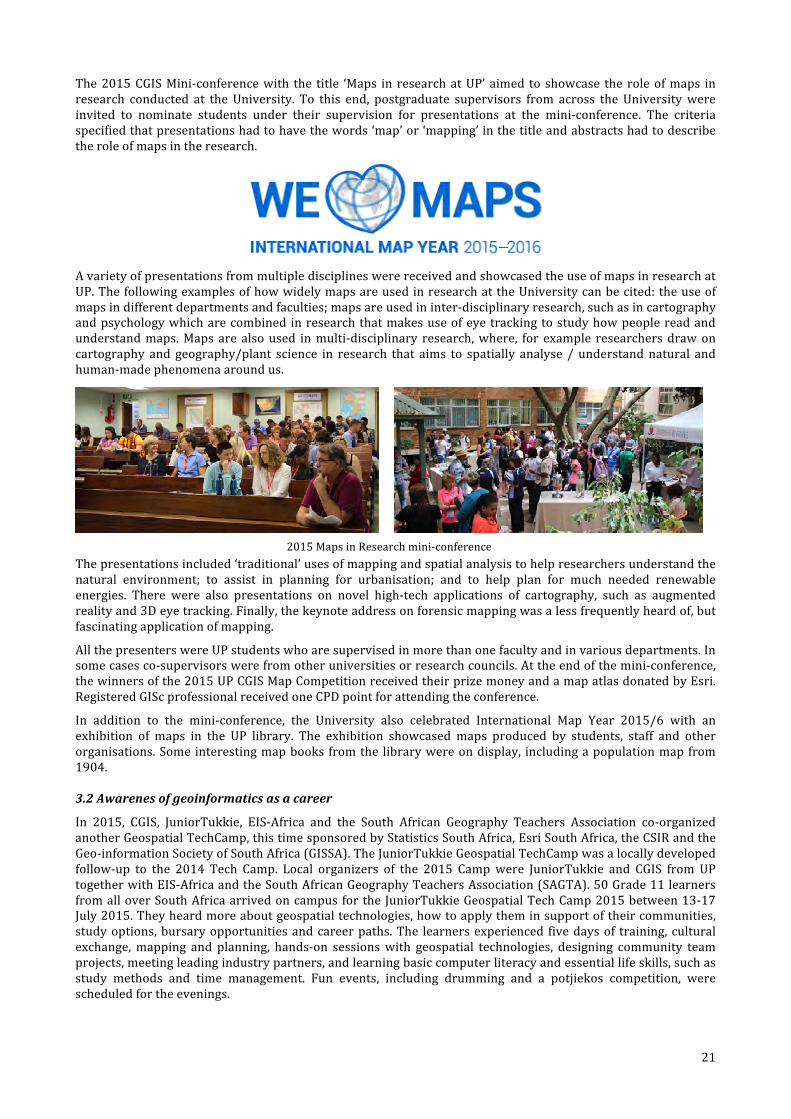
3.1 International Map Year Celebrations
The International Cartographic Association’s (ICA) International Map Year is a worldwide celebration of maps and their unique role in our world. Supported by the United Nations, International Map Year provides opportunities to demonstrate, follow, and get involved in the art, science and technology of making and using maps and geographic information. The purpose of the International Map Year is to make maps visible to citizens and school children in a global context; demonstrate how maps and atlases can be used in society; show how information technology can be used in getting geographic information and producing one’s own maps; to display different types of maps and map production; to show the technical development of mapping and atlas production; to show the necessity of a sustainable development of geographic information infrastructures; and to increase the recruitment of students in the cartography and cartography-‐related disciplines.
The University of Pretoria (UP) celebrated the International Map Year (2015/16) in three ways this year. The first being the Centre for Geo-‐information Science (CGIS) Map Competition, a map assignment challenge for first-‐year and third year students in BSc Geo-‐informatics and most importantly, the 2015 CGIS Mini-‐conference.
21
The 2015 CGIS Mini-‐conference with the title ‘Maps in research at UP’ aimed to showcase the role of maps in research conducted at the University. To this end, postgraduate supervisors from across the University were invited to nominate students under their supervision for presentations at the mini-‐conference. The criteria specified that presentations had to have the words ‘map’ or ‘mapping’ in the title and abstracts had to describe the role of maps in the research.
A variety of presentations from multiple disciplines were received and showcased the use of maps in research at UP. The following examples of how widely maps are used in research at the University can be cited: the use of maps in different departments and faculties; maps are used in inter-‐disciplinary research, such as in cartography and psychology which are combined in research that makes use of eye tracking to study how people read and understand maps. Maps are also used in multi-‐disciplinary research, where, for example researchers draw on cartography and geography/plant science in research that aims to spatially analyse / understand natural and human-‐made phenomena around us.
2015 Maps in Research mini-‐conference
The presentations included ‘traditional’ uses of mapping and spatial analysis to help researchers understand the natural environment; to assist in planning for urbanisation; and to help plan for much needed renewable energies. There were also presentations on novel high-‐tech applications of cartography, such as augmented reality and 3D eye tracking. Finally, the keynote address on forensic mapping was a less frequently heard of, but fascinating application of mapping.
All the presenters were UP students who are supervised in more than one faculty and in various departments. In some cases co-‐supervisors were from other universities or research councils. At the end of the mini-‐conference, the winners of the 2015 UP CGIS Map Competition received their prize money and a map atlas donated by Esri. Registered GISc professional received one CPD point for attending the conference.
In addition to the mini-‐conference, the University also celebrated International Map Year 2015/6 with an exhibition of maps in the UP library. The exhibition showcased maps produced by students, staff and other organisations. Some interesting map books from the library were on display, including a population map from 1904.
3.2 Awarenes of geoinformatics as a career
In 2015, CGIS, JuniorTukkie, EIS-‐Africa and the South African Geography Teachers Association co-‐organized another Geospatial TechCamp, this time sponsored by Statistics South Africa, Esri South Africa, the CSIR and the Geo-‐information Society of South Africa (GISSA). The JuniorTukkie Geospatial TechCamp was a locally developed follow-‐up to the 2014 Tech Camp. Local organizers of the 2015 Camp were JuniorTukkie and CGIS from UP together with EIS-‐Africa and the South African Geography Teachers Association (SAGTA). 50 Grade 11 learners from all over South Africa arrived on campus for the JuniorTukkie Geospatial Tech Camp 2015 between 13-‐17 July 2015. They heard more about geospatial technologies, how to apply them in support of their communities, study options, bursary opportunities and career paths. The learners experienced five days of training, cultural exchange, mapping and planning, hands-‐on sessions with geospatial technologies, designing community team projects, meeting leading industry partners, and learning basic computer literacy and essential life skills, such as study methods and time management. Fun events, including drumming and a potjiekos competition, were scheduled for the evenings.

22
2015 Geospatial TechCamp participants and chaperones
Related activities that raised awareness of geoinformatics as a career in 2015, included the annual UP Open Day in May on which thousands of learners visit UP. They have the opportunity to view the campuses, get a glimpse of student life and find out more about study opportunities and future careers. The geoinformatics degrees are always on display. Students and staff are available to answer any queries from learners. At the annual JuniorTukkie Grade 11 Empowerment Week, geoinformatics staff and students introduced 100+ learners from all over the country (prospective UP students) to geoinformatics.
3.3 CE at UP courses for professionals from industry
CGIS regularly presents courses through CE at UP. In 2015, an introductory and an advanced course in GIS, each running over several months, were presented. There is also a three-‐day introductory GIS course. These courses have provided many people in South Africa with an opportunity to get acquainted with GIS as a tool.
Other courses are more specialized, e.g. an introduction to geoinformation standards and a course in spatial databases with PostGIS. These are typically registered with PLATO for CPD points, thus providing an opportunity for registered GISc practitioners to continue their professional development.
Finally, the GISc professional practice course provides the opportunity for many practitioners who need this certificate in order to meet the academic requirements of the PLATO academic model required for professional registration. Courses listed below were presented in 2015 through CE at UP.
Certificate Course in Introductory Geographic Information Systems Course leader: Erika Pretorius Presenters: Erika Pretorius, Peter Schmitz, Sean Cullen, Joos Esterhuizen and Ingrid Booysen Dates: 30 March – 9 October 2015 (8 modules, 7 workshops)
Certificate Course in Advanced Geographic Information Systems Course leader: Erika Pretorius Presenters: Peter Schmitz, Erika Pretorius, Victoria Rautenbach and Sean Cullen Dates: 28 February – 7 November 2015
Spatial databases with PostGIS Course leader: Serena Coetzee Presenter: Gavin Fleming Dates: 9-‐13 June 2015
Introduction to standards for geographic information Course leader: Serena Coetzee Presenters: Serena Coetzee, Antony Cooper Dates: 9-‐10 November 2015
GISc professional practice Course leader: Serena Coetzee Presenter: Serena Coetzee and Stuart Martin (GeoTerraImage) Dates: July – November 2015
The Basics of GIS Course leader: Erika Pretorius Presenter: Sean Cullen and Danie Jooste Dates: 1 -‐ 3 July 2015
23
3.4 Guest lectures by industry representatives
Every year, GGIS arranges a number of guest lectures by speakers from industry. The lectures give students the opportunity to meet people in the industry and to get updated on state-‐of-‐the-‐art GIS applications. Since 2014, registered GISc professionals can collect CPD points for attending the guest lectures (one CPD point for 10 lectures). Invitations are published on the CGIS website, in the campus news, and on the student web. Invitations are also distributed to a CGIS mailing list, consisting mainly of GISc industry members.
Guest Lecturer Date Topic
Adri de la Rey, Eskom 13 February Some thoughts on geospatial standards
Chris Wray, Gauteng City Region Observatory (GCRO)
27 February Analysing key challenges in the Gauteng City Region (GCR) through a map of the month
Dr Gina Weir-‐Smith, Human Sciences Research Council (HSRC)
13 March Finding the jobless: the spatio-‐temporal variation of South African unemployment trends at sub-‐provincial level
Magnus Rademeyer, AfriGIS 20 March The new age of GIS
Adeline du Toit, Department of Business Management, UP
17 April Application of competitive intelligence to geography, geoinformatics and meteorology
Roger Blewett (AOC) 8 May The point of point clouds
Dr Konrad Wessels, CSIR Meraka Institute
22 May In pursuit of automation in land cover mapping
Dr Paddington Hodza, Wyoming GISc Centre, USA
28 July User experience of geospatial technology
Charl Fouché, AfriGIS 4 August The evolution of GIS deployments due to technology improvements
Michael Breetzke 1 September I have a RPAS/UAV System...Now What?
Geo-‐information Society of South Africa (GISSA)
3 September Industry representatives tell students about their working experiences in the GISc industry
Stuart Martin, GeoTerraImage 29 September Professional registration information session
Derrick O’Brien, City of Tshwane 13 October Utilising GIS at City of Tshwane in support of integrated and coordinated land information management
Dr Renaud Mathieu 20 October Mapping Southern African forest using LIDAR and Synthetic Aperture Radar (SAR) imagery
3.5 Industry visits by first year students
In 2015, the GIS 120 (Geoinformatics) students visited TomTom in Centurion and ITS Engineers (where two Geoinformatics alumni work) in Lynnwood. The majority of these students are enrolled for degrees in Geoinformatics, Meteorology and Geology. The visits allow students a first-‐hand experience of the GISc industry. During the 90-‐minute visit at each organization, students received a presentation and tour of the GIS operations.
TomTom is an international organization that designs and develops innovative products, best known for being a global leader in navigation and mapping products. TomTom also creates GPS sports watches, as well as state-‐of-‐the-‐art fleet management solutions and industry-‐leading location-‐based products.
ITS Engineers is a South African company, specialising in traffic and transportation engineering employing civil engineers, specialist transportation engineers, electronic engineers, town planners, GISc profressionals, transport economists and road safety education specialists.
3.6 Standards development in South Africa and internationally
Antony Cooper, Serena Coetzee and Victoria Rautenbach actively participate in standards development in South Africa and have been nominated by the South African Bureau of Standards (SABS) to represent South Africa at the plenary meetings of the technical committee, ISO/TC 211, Geographic information/Geomatics, of the International Organization for Standardization (ISO) (www.iso.org) for several years now. While the South African Bureau of Standards (SABS) supports them with funding for travel and accommodation, they provide their time free of charge.

24
They share their international experience with their South African colleagues by presenting short courses on geographic information standards, by presenting at workshops and conferences, by arranging workshops, by participating in the sub-‐committee on Standards of the Committee for Spatial Information (CSI), and by taking on leadership roles in the local standards development community. Serena Coetzee leads the ISO 19160, Addressing, and ISO 19160-‐1, Addressing – Part 1: Conceptual model, (published in 2015) and chairs the ISO/TC 211 Program Maintenance Group (PMG). Mr Cooper is convenor of Working Group 7, Information Communities. Victoria Rautenbach chairs the ISO/TC 211 Advisory Group on Outreach. They also actively contribute to the development of South African standard standards, such as SANS 1883 (addressing) and SANS 1876 (feature instance identifiers). A guide for standards implementation was written by the three authors and is now freely available online, see wiki.icaci.org. Students are encouraged to participate in standards development and a number of them are now involved.
UP is a member of the Open Geospatial Consortium (OGC), one of only very few African members, see www.opengeospatial.org. OGC is an international industry consortium of more than 500 companies, government agencies and universities participating in a consensus process to develop publicly available interface standards. Examples of standards are the Geography Markup Language (GML), Keyhole Markup Language (KML) and Web Map Service (WMS). OGC membership gives students access to the OGC portal with the latest information on standards development and happenings at the OGC.
3.7 South African Geomatics Profession Council
Two staff members are registered with the South African Geomatics Profession Council: Joos Esterhuizen, registered surveyor (S0414) and Serena Coetzee, registered GISc Professional (PGP1245). In 2015, Serena Coetzee was appointed to represent academia on the Council.
4. Research output CGIS aims to be a facilitator of UP GISc research collaborations, education and training and professional alliances within South Africa and abroad. Research output published in 2015 is listed with the names of CGIS authors in bold.
4.1 Peer-‐reviewed journal articles
Adeola AM, Botai OJ, Olwoch JM, Rautenbach CJDW, Kalumba AM, Tsela PL, Adisa OM, Nsubuga FWN, Mmtoni P, Ssentongo AA(2015). Application of geographical information system and remote sensing in malaria research and control in South Africa: a review. South African Journal of Infectious Diseases, 1, pp. 1 -‐ 8.
Adeyemi AA, Botai OJ, Ramoelo A, van der Merwe FJ, Tsela PL (2015). Effect of Impervious Surface Area and Vegetation Changes on Mean Surface Temperature over Tshwane Metropolitan Municipality, Gauteng, South Africa. South African Journal of Geomatics, 4 (4), pp. 351 -‐ 368.
Botai C, Botai OJ, Muchuru S, Ngwana I (2015). Hydrometeorological research in South Africa: A Review. Water, 7 pp. 1580 -‐ 1594.
Coetzee SM, Rautenbach V, du Plessis H (2015). A qualitative comparison of South Africa's geomatics professional body's academic model against industry's understanding of SDI knowledge and skills requirements. Journal of Geography in Higher Education, 39 (1), pp. 4 -‐ 17.
Coetzee SM, Smit J (2015). Development of an observatory for spatial planning in South Africa: a best practice review. South African Journal of Geomatics, 4 (3), pp. 326 -‐ 338.
du Plessis I, Liebenberg K, Smit A, Coetzee SM, Kijko A (2015). Preliminary investigation into the cause of acid mine water induced seismicity in Johannesburg. South African Journal of Geomatics, 4 (3), pp. 299 -‐ 308.
Fasina FO, Mokoele JM, Spencer BT, Van Leengoed LAMG, Bevis Y, Booysen I (2015). Spatio-‐temporal patterns and movement analysis of pigs from smallholder farms and implications for African swine fever spread, Limpopo province, South Africa. Onderstepoort Journal of Veterinary Research, 82 (1), pp. 1 -‐ 11.
Fisher J, Witkowski, E, Erasmus B, Mograbi P, Asner G, van Aardt J, Wessels KJ, Mathieu R (2015). What lies beneath: detecting sub-‐canopy changes in savanna woodlands using a three-‐dimensional classification method. Applied Vegetation Science, 18 (3), pp. 528 -‐ 540.
Hodza P, Schaab G, Coetzee SM, van der Merwe FJ, Vogt B (2015). Comparing proportional compositions of geospatial technology-‐related programs at three universities. South African Journal of Geomatics, 4 (3), pp. 240 -‐ 249.
Isioye OA, Combrinck WL, Botai OJ, Munghemezulu C (2015). The potential for observing African weather with GNSS Remote Sensing . Advances in Meteorology, 2015 pp. 1 -‐ 16.
Katumba KS, Coetzee SM (2015). Enhancing the online discovery of geospatial data through taxonomy, folksonomy and semantic annotations. South African Journal of Geomatics, 4 (3), pp. 339 -‐ 350.
25
Komen Kibii, Olwoch J, Rautenbach CJDW, Botai OJ, Adebayo AO (2015). Long-‐Run Relative Importance of Temperature as the Main Driver to Malaria Transmission in Limpopo Province, South Africa: A Simple Econometric Approach. EcoHealth, 12 pp. 131 -‐ 143.
Kleynhans W, Salmon B, Wessels KJ, Olivier J (2015). Rapid detection of new and expanding human settlements in the Limpopo province of South Africa using a spatio-‐temporal change detection method. International Journal of Applied Earth Observation and Geoinformation, 40 pp. 74 -‐ 80.
Mograbi P, Erasmus B, Witkowski, E, Asner G, Wessels KJ, Mathieu R, Knapp D, Martin R, Main R (2015). Biomass Increases Go under Cover: Woody Vegetation Dynamics in South African Rangelands. PLoS One, 10 (5), pp. 1 -‐21.
Naidoo L, Mathieu R, Main RS, Kleynhans W, Wessels KJ, Asner G, Leblon B (2015). Savannah woody structure modelling and mapping using multi-‐frequency (X-‐, C-‐ and L-‐band) Synthetic Aperture Radar data. ISPRS Journal, 105 pp. 234 -‐ 250.
Pretorius E, Pretorius R (2015). Improving the potential of pixel-‐based supervised classification in the absence of quality ground truth data. South African Journal of Geomatics, 4 (3), pp. 250 -‐ 263.
Ramoelo A, Cho M, Mathieu R, Skidmore A (2015). Potential of Sentinel-‐2 spectral configuration to assess rangeland quality . Journal of Applied Remote Sensing, 9 (1), pp. 1 -‐11.
Rautenbach V, Bevis Y, Coetzee SM, Combrinck C (2015). Evaluating procedural modelling for 3D models of informal settlements in urban design activities. South African Journal of Science, 111 (11/12), pp. 1 -‐ 10.
Tesfaye M, Tsidu G, Botai OJ, Sivakumar V, Rautenbach CJDW (2015). Mineral dust aerosol distrbution, its direct and semi-‐direct effects over South Africa on regional climate model simulation. Journal of Arid Environments, 114 pp. 22 -‐ 40.
Tsela PL, Combrinck WL, Botha R, Ngcobo BL (2015). Thermal analysis of the LLR optical telescope tube assembly based in Hartebeesthoek Radio Astronomy Observatory. Acta Geodaetica et Geophysica, 50 (2), pp. 1 -‐ 11.
Urbazaev M, Thiel C, Mathieu R, Naidoo L, Levick S, Smit I, Asner G, Schmullius C (2015). Assessment of the mapping of fractional woody cover in southern African savannas using multi-‐temporal and polarimetric ALOS PALSAR L-‐band images. Remote Sensing of the Environment, 166 pp. 138 -‐ 153.
Rautenbach V, Bevis Y, Coetzee SM, Combrinck C (2015). Evaluating procedural modelling for 3D models of informal settlements in urban design activities. South African Journal of Science, 111 (11/12), pp. 1 -‐ 10.
Schmitz PMU, Eksteen SP, de Bruin S (2015). Towards a new way of measuring service delivery in Gauteng: Calculating a Fortunate Index . South African Journal of Geomatics, 4 (3), pp. 317 -‐ 325.
4.2 Papers presented at refereed conferences
Eksteen S, Coetzee SM, Lyew M, Olivares M, Solis P (2015). Geographic Information Science Education at African and Latin American Universities – A Comparative Review . The 27th International Cartographic Conference (ICC 2015) , Rio de Janeiro, Barzil, 23-‐Aug-‐2015 -‐ 28-‐Aug-‐2015.
Harvey F, Coetzee SM, Iwaniak A and Cooper AK, Are the data sharing problems with SDIs problems of zombies? (abstract only) Proceedings of the 27th International Cartographic Conference, Rio de Janeiro, Brazil, 23-‐28 August 2015.
Jooste D, Rautenbach V, Coetzee SM (2015). Results of an evaluation of augmented reality mobile development frameworks for addresses in augmented reality, Proceedings of the FOSS4G2015 Conference, Seoul, South Korea, September 2015.
Rautenbach V, Coetzee SM, Schiewe J, Coltekin A (2015). An Assessment of Visual Variables for the Cartographic Design of 3D Informal Settlement Models. The 27th International Cartographic Conference (ICC 2015) , Rio de Janeiro, Brazil, 23-‐Aug-‐2015 -‐ 28-‐Aug-‐2015.
Rautenbach V, Coltekin A, Coetzee SM (2015). Exploring the Impact of Visual Complexity Levels in 3D City Models on the Accuracy of Individuals’ Orientation and Cognitive Maps. ISPRS Annals of the Photogrammetry, Remote Sensing and Spatial Information Sciences (GeoVIS'15 Workshop "Rendering and Cognition with Images and Hybrid Visualizations"), La Grande Motte, France, 28-‐Sep-‐2015 -‐ 03-‐Oct-‐2015.
4.3 Peer-‐reviewed chapters in books
Coetzee SM, Wolff-‐Piggott B (2015). A Review of SDI Literature: Searching for Signs of Inverse Infrastructures . In C. Robbi Sluter & C. Madureira Cruz & P. Leal de Menezes (eds.), Cartography – Maps Connecting the World: 27th International Cartographic Conference (ICC 2015), Switzerland, Cham: Springer. (pp. 113-‐127). ISBN 978-‐3-‐319-‐17737-‐3.
le Roux A, Khuluse S, Naude AJS (2015). Creating a High-‐Resolution Social Vulnerability Map in Support of National Decision Makers in South Africa . In C. Robbi Sluter & C. Madureira Cruz & P. Leal de Menezes (eds.), Cartography -‐ Maps Connecting the World: 27th International Cartographic Conference (ICC 2015), Switzerland, Cham: Springer. (pp. 283-‐294). ISBN 978-‐3-‐319-‐17737-‐3.
Schmitz PMU, Cooper AK (2015). Forensic Geography. In R. Zinn & S. Dintwe (eds.), Forensic Investigation: Legislative principles and investigative practice, South Africa, Pretoria: Juta. (pp. 305-‐360). ISBN 978-‐0-‐70218-‐647-‐9.
Schmitz PMU, Cooper AK, Kruger T, Speed K, Barkhuizen M, Lochner H, Linnen C (2015). Space-‐Time Visualization for Investigative and Forensic Purposes. In C. Robbi Sluter & C. Madureira Cruz & P. Leal de Menezes (eds.), Cartography –

26
Maps Connecting the World: 27th International Cartographic Conference (ICC 2015), Switzerland, Cham: Springer. (pp. 267-‐281). ISBN 978-‐3-‐319-‐17737-‐3.
4.4 Other
Coetzee SM, Camboim S, Cooper AK, Anand S, Taylor T, Borba R, Strauch J (eds), 2015. Spatial data infrastructures, standards, open source and open data for geospatial (SDI-‐Open 2015), ISBN 978-‐1-‐77592-‐117-‐2, Rio de Janeiro, Brazil, 21 August 2015, pp1-‐50.
Lubisi SX & Cooper AK, (2015). Investigating the food environment in Hatfield and Hillcrest, Tshwane (poster). Proceedings of the 27th International Cartographic Conference, Rio de Janeiro, Brazil, 23-‐28 August 2015.
ISO 19160-‐1:2015, Addressing – Part 1: Conceptual Model, International Organization for Standardization (ISO), Geneva, Switzerland (Project lead: Coetzee SM; Work group convenor and project expert: Cooper AK).
Anand S, Badard T, Behr F-‐J, Coetzee SM, Delzari L and Köbben B, 2015. Open Geospatial Science and Applications. Special issue in the ISPRS International Journal of Geo-‐Information (ISSN 2220-‐9964).
Schmitz, PMU., Eksteen, S. and de Bruin, S. 2015. Towards a new way of measuring service delivery in Gauteng: Calculating a Fortunate Index (poster). Proceedings of the 27th International Cartographic Conference, Rio de Janeiro, Brazil, 23-‐28 August 2015.
4.5 Masters dissertations and Honours reports
The titles of Masters dissertations and Honours projects of students graduating in 2015 are listed below. Their supervisors were from the Departments of Geography, Geoinformatics and Meteorology (GGM), Computer Science, the UP Natural Hazard Centre Africa and from the CSIR and the HSRC.
Masters dissertations
Adeyemi Adeniyi (2015). Analysis of impervious surfaces and surface temperature over Tshwane metropolitan using in-‐situ and remotely sensed data, supervised by Joel Botai (GGM) and Abel Ramoelo (CSIR).
Nondimizo Dlamini (2015). Investigating the characteristics of expansive soils through remote sensing and in situ measurements, supervised by Joel Botai (GGM) and Moses Cho (CSIR).
Lauren Hankel (2015). Rapid distributed processing of medium velocity geospatial datastreams into contextualised 3D visualisations : evaluating the cloud computing paradigm, supervised by Serena Coetzee (GGM) and Graeme McFerren (CSIR Meraka Institute).
Jared Jacobson (2015). Assessing OpenGL for 2D rendering of geospatial data, supervised by Serena Coetzee (GGM) and Derrick Kourie (Computer Science).
Noh Tewolde (2015). Evaluating a semantic approach to address data interoperability, supervised by Serena Coetzee (GGM).
Honours reports
Thorgny Fjastad (2015). Identifying high risk malaria areas in Mozambique’s Inhassoro and Vilankulo districts, supervised by Fritz van der Merwe (GGM), Leo Braack (Health Sciences) and Serena Coetzee (GGM).
Josina Mafodi (2015). Data cleaning and preliminary spatial analysis of observed fire events in the City of Tshwane, supervised by Alize le Roux (CSIR), Ansie Smit (UP Natural Hazard Centre) and Andrzej Kijko (UP Natural Hazard Centre).
Ndamulelo Mudau (2015). Exploring the use of ontologies for combining different spatial planning regimes, supervised by Serena Coetzee (GGM) and Antony Cooper (CSIR).
Unarine Thidiela (2015). Developing an integrated longitudinal database for unemployment in Gauteng, supervised by Gina Weir-‐Smith (HSRC).
Sulette van der Merwe (2015). A comparison of active fire detection rates of MODIS and VIIRS sensors, supervised by Graeme McFerren (CSIR).
Wickes Van Heerden (2015). Determining the change in the spatial structure of the cities within Gauteng’s metropolitan municipalities, supervised by Alize le Roux (CSIR).
5. Funding There were two main sources of funding from which CGIS day-‐to-‐day operations were covered in 2015: an annual budget allocation from the faculty and profit allocations from CE at UP courses.
Research activities and travel were supported by grants from Armscor (via a funding mechanism through the CSIR); Baden-‐Württemberg Stiftung (BWS); Carnegie African Diaspora Fellowship Program (ADF); CSIR/Meraka Institute; Global Spatial Data Infrastructure Association (GSDI); Esri, the Geo-‐Information Society of South Africa
27
(GISSA); the National Research Foundation (NRF); the South African Bureau of Standards (SABS) and Statistics South Africa.
Geoinformatics student prizes were sponsored by AfriGIS, CONSAS, GeoTerrraImage and the South African National Space Agency (SANSA).
The time spent on CGIS activities by the extraordinary lecturers was funded by their employers, the CSIR, HartRAO and SANSA. The ARC, CSIR, HartRAO and SANSA also support various under-‐ and postgraduate students with bursaries, internships and/or studentships.
28
Annex A: Constitution of the Centre for Geoinformation Science (CGIS)
University of Pretoria
Constitution
Centre for Geoinformation Science (CGIS)
Article 1 – Definition of Terms
a) Advisory Board - As in Article 4 b) CGIS - Centre for Geoinformation Science c) CGIS Director - Director of the CGIS, as in Article 6 d) Dean - Dean of the Faculty of Natural and Agricultural Sciences e) Department - Department Geography, Geoinformatics and Meteorology f) GISc - Geographic Information Science (GISc) g) HOD - Head of the Department Geography, Geoinformatics and Meteorology h) Management Committee - As in Article 5 i) Student representative - As in Article 5 j) UP - University of Pretoria
Article 2 – Vision
In its Vision the UP CGIS strives to be:
• An internal platform at UP from where the excellence of UP individuals and teams involved in GISc research, education and training, professional development and community engagement is supported and strengthened.
• A facilitator of UP GISc research collaborations, education and training and professional alliances within South Africa and abroad.
• A partner to the South African geoinformation industry in support of GISc research, education and training, professional development, community engagement.
Article 3 – Mission
The UP CGIS aims to achieve theVision statements by the following Mission actions:
• Engaging in research, education and training, professional development, community engagement and capacity building, in line with the overall strategy of UP.
• Obtaining funding for GISc research, education and training, professional development and community engagement by establishing new partnerships and alliances, as well as strengthening those already in existence.
• Creating high-level human resource capacity by involving students in GISc research, education and training, professional development and community engagement projects.
• Transferring knowledge and expertise through conferences, seminars, training, training events (e.g. workshops and short courses), publications and other appropriate avenues.
• Communicating and coordinating with other UP departments on GISc research, education and training, professional development and community engagement.
• Collaborating with other UP departments, universities and research institutes on GISc research, education and training, professional development and community engagement.
Article 4 – Advisory Board
• The Advisory Board is responsible for o providing strategic direction and advice regarding marketing, as well as the research, education
and training, professional development, community engagement and capacity building in CGIS; o giving advice on operational decisions; o reviewing the annual budget; and o reviewing the realization of the vision and the execution of the mission of the UP CGIS.
• The Dean is the Chairperson of the Advisory Board. … continues
29
• The Advisory Board consists of the Dean, HOD, the UP CGIS Director (ex officio), the heads of collaborating departments, representatives of key stakeholders as identified from time to time by the CGIS Director in consultation with the Chairperson.
• The Advisory Board meets at least once a year.
Article 5 – Management Committee
• The Management Committee consists of the CGIS Director; selected members of the Department and the Department’s Unit for Cartography; a student representative as appointed by the CGIS Director; and one member per collaborating department.
• The Management Committee is responsible for: o coordinating CGIS research, education and training, professional development and community
engagement activities; o evaluating, and making inputs into, the strategic plan of the CGIS; o evaluating, and making inputs into, the business plan of the CGIS; o identifying opportunities to further the vision, mission of the CGIS.
• The CGIS Director is the Chairperson of the Management Committee. • The Management Committee meets at least once every six months. • A quorum for the Management Committee is half of the members plus one.
Article 6 – Appointment, powers, functions and duties of the CGIS Director
The CGIS Director is appointed in terms of prevailing regulations of the University for the appointment of Directors.
• The CGIS Director is responsible for o preparing the annual strategic plan of the CGIS; o preparing the annual business plan of the CGIS; o preparing the annual financial report of the CGIS; o organising meetings as provided for in this Constitution; o marketing the CGIS outside and within UP; o fundraising for the CGIS; o initiating discussions with potential donors and funders; o financial and budget management; o information management; and o ensuring the realisation of the research, education and training, professional development
activities and community engagement mandate of the CGIS. • The CGIS Director reports to the Dean.
Article 7 – Duties of the Department
The Department will provide
• administrative support for meetings as provided in this Constitution; and • administrative support for the operational and financial management of the CGIS.
Article 8 – Approval and amendments
The Senate Committee for Research of the University of Pretoria is responsible for the
approval of this Constitution and any amendment thereof.


