15
Coordinate Systems & Vertical Datum Issues Mark Seidelmann, PE, GISP Erick Lobao, GISP September 30, 2011 Photo Optional
| Date post: | 26-Dec-2015 |
| Category: |
Documents |
| Upload: | hubert-charles |
| View: | 216 times |
| Download: | 0 times |
Coordinate Systems & Vertical Datum Issues
Mark Seidelmann, PE, GISP
Erick Lobao, GISP
September 30, 2011
Photo Optional
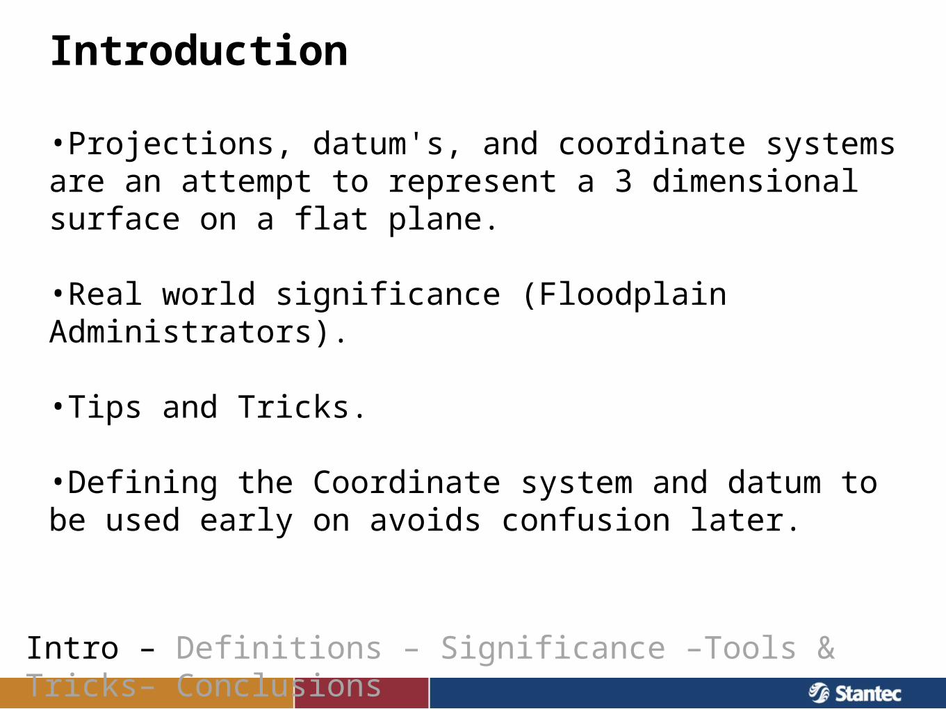
Introduction
Intro – Definitions – Significance –Tools & Tricks– Conclusions
•Projections, datum's, and coordinate systems are an attempt to represent a 3 dimensional surface on a flat plane.
•Real world significance (Floodplain Administrators).
•Tips and Tricks.
•Defining the Coordinate system and datum to be used early on avoids confusion later.
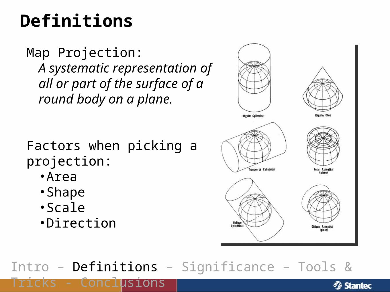
Definitions
Map Projection:A systematic representation of all or part of the surface of a round body on a plane.
Factors when picking a projection:•Area•Shape•Scale•Direction
Intro – Definitions – Significance – Tools & Tricks - Conclusions
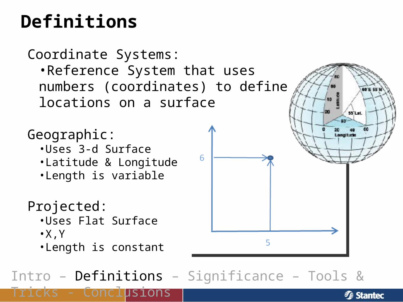
Definitions
Coordinate Systems:•Reference System that uses numbers (coordinates) to define locations on a surface
Geographic:•Uses 3-d Surface•Latitude & Longitude•Length is variable
Projected:•Uses Flat Surface•X,Y•Length is constant
Intro – Definitions – Significance – Tools & Tricks - Conclusions
Definitions
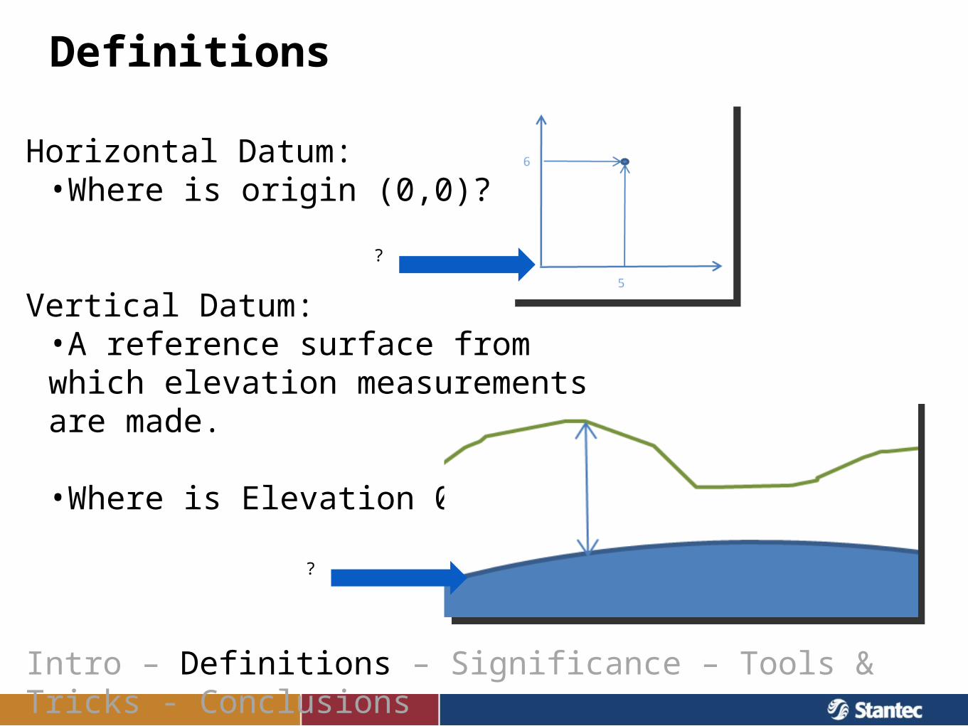
Horizontal Datum:•Where is origin (0,0)?
Vertical Datum:•A reference surface from which elevation measurements are made.
•Where is Elevation 0 ft?
Intro – Definitions – Significance – Tools & Tricks - Conclusions
?
?
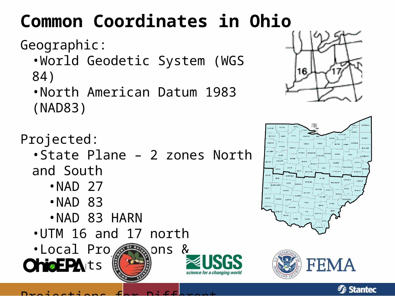
Common Coordinates in OhioGeographic:•World Geodetic System (WGS 84)•North American Datum 1983 (NAD83)
Projected:•State Plane – 2 zones North and South
•NAD 27•NAD 83•NAD 83 HARN
•UTM 16 and 17 north•Local Projections & Monuments
Projections for Different Purposes
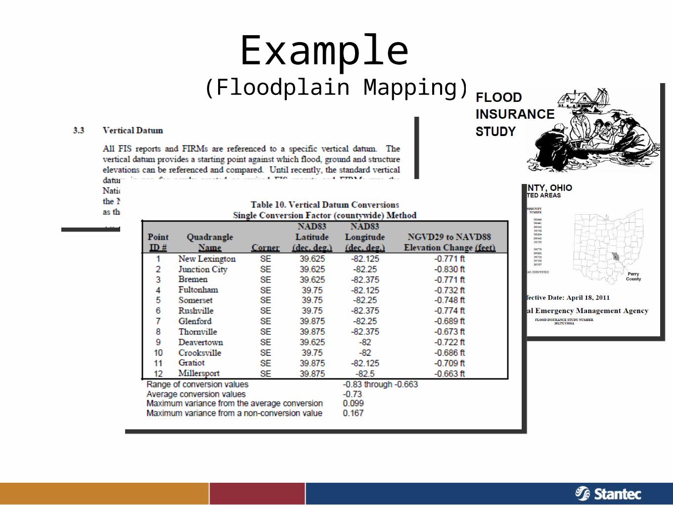
Example (Floodplain Mapping)
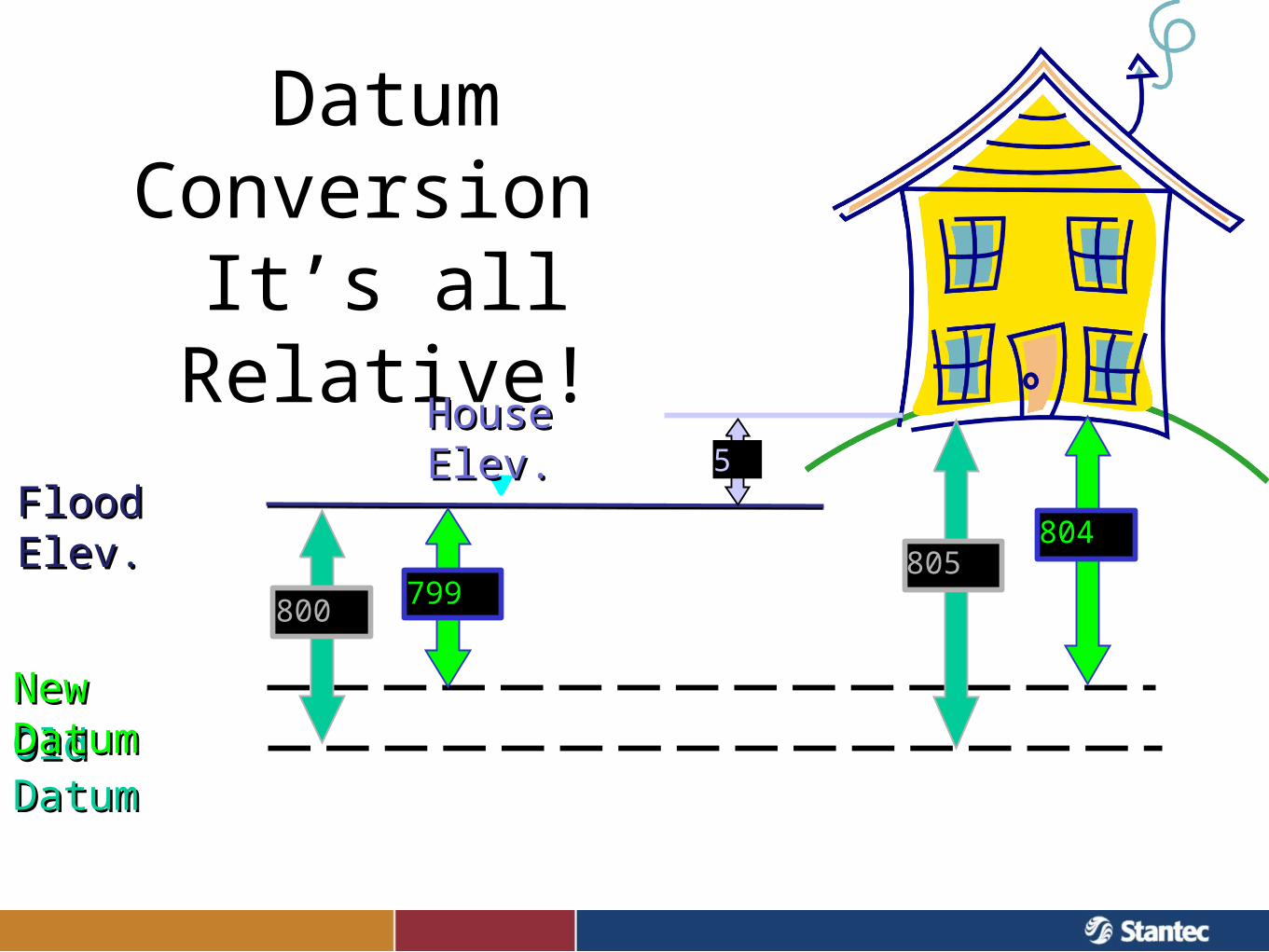
Datum Conversion It’s all Relative!
Old DatumOld DatumNew DatumNew Datum
Flood Elev.Flood Elev.
800800
805805799799
804804
House Elev.House Elev.55
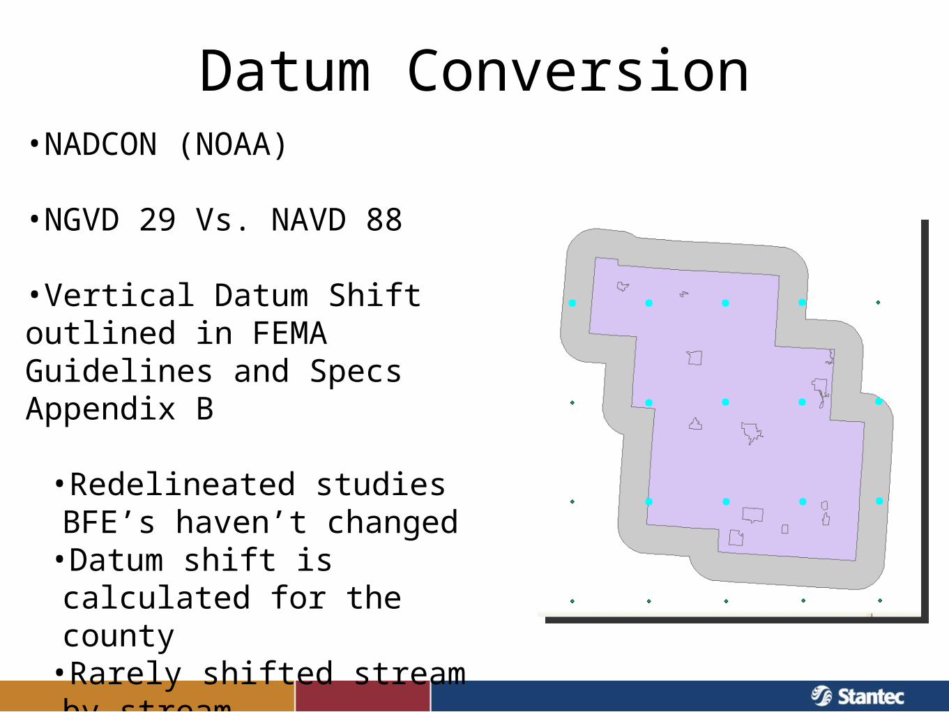
Datum Conversion•NADCON (NOAA)
•NGVD 29 Vs. NAVD 88
•Vertical Datum Shift outlined in FEMA Guidelines and Specs Appendix B
•Redelineated studies BFE’s haven’t changed•Datum shift is calculated for the county•Rarely shifted stream by stream
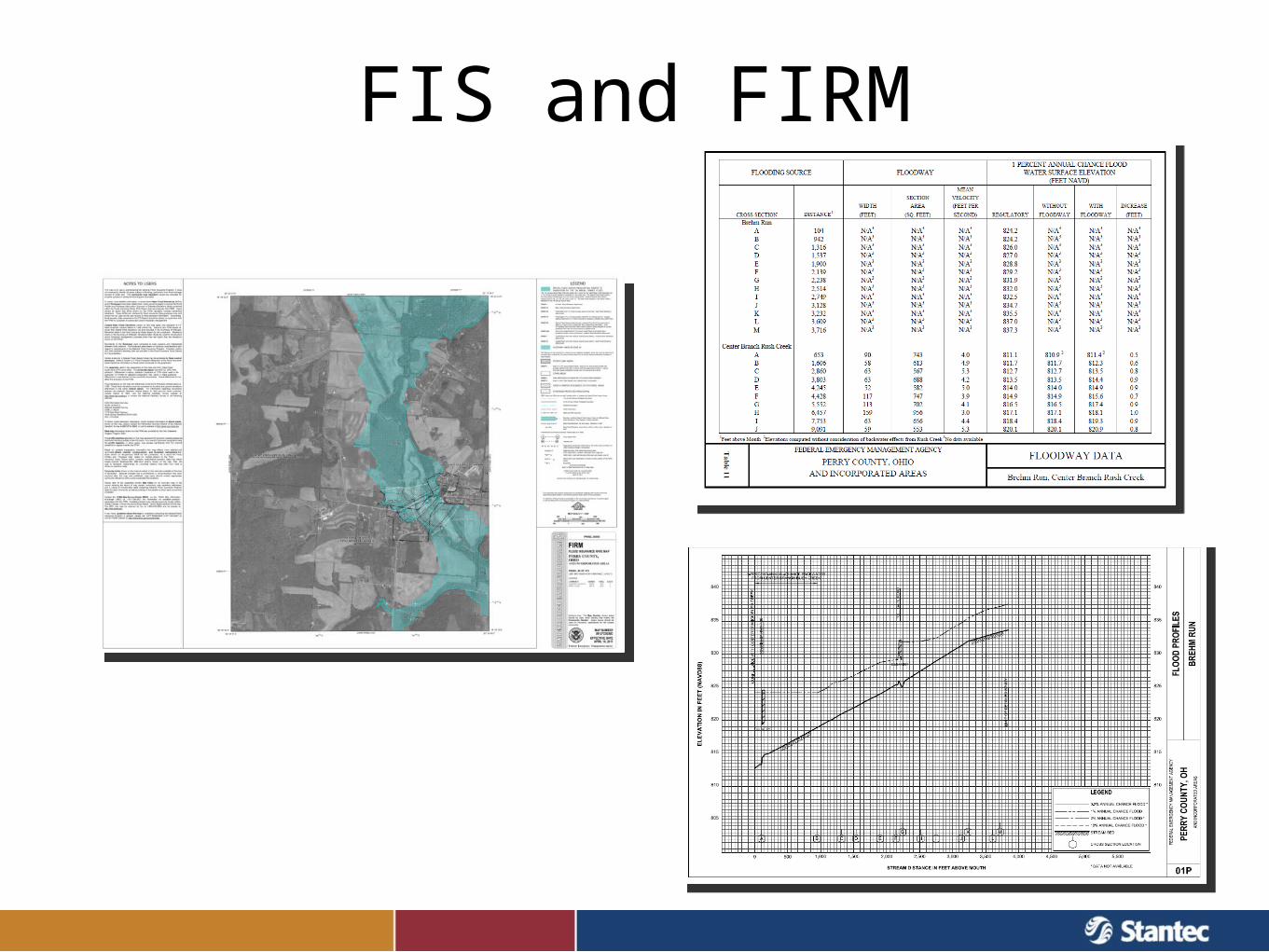
FIS and FIRM
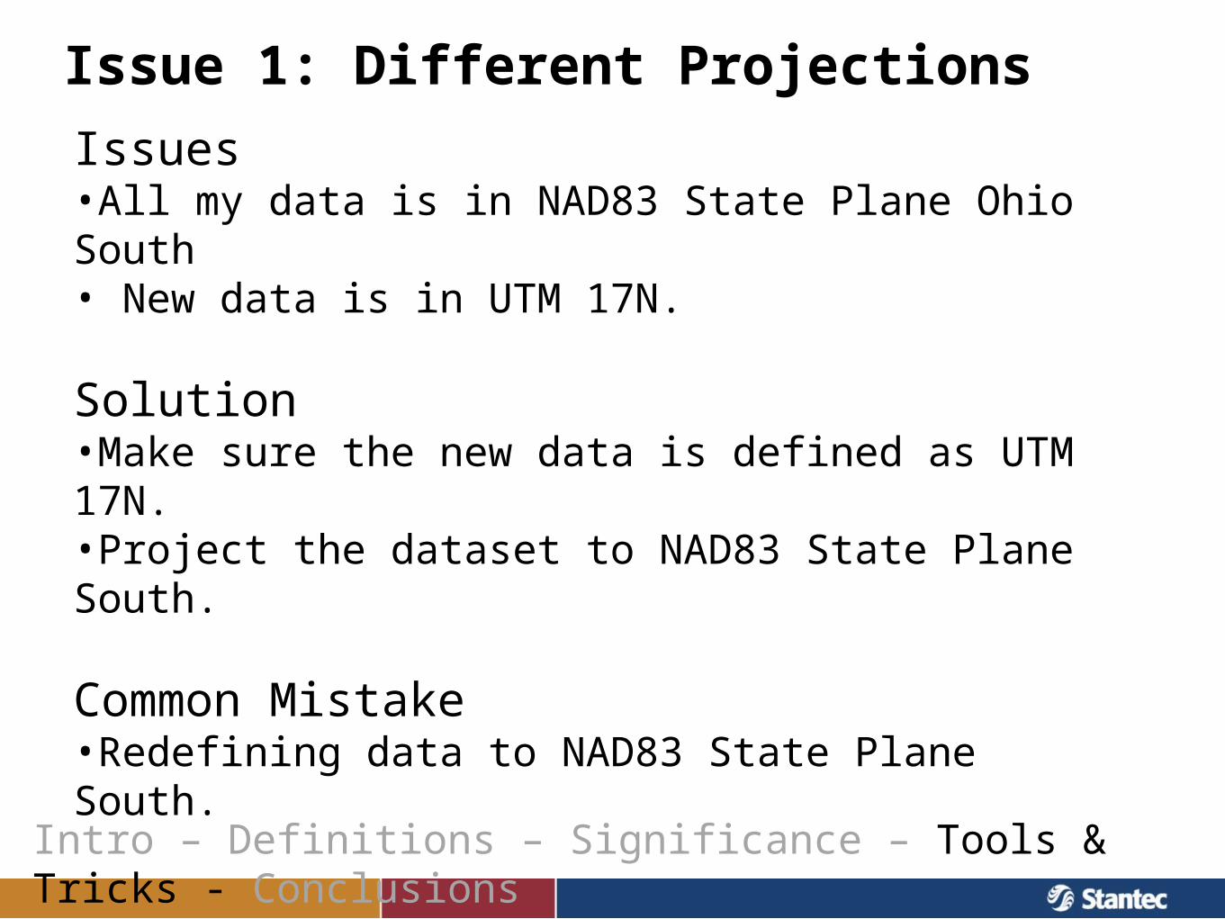
Issue 1: Different Projections
Intro – Definitions – Significance – Tools & Tricks - Conclusions
Issues•All my data is in NAD83 State Plane Ohio South• New data is in UTM 17N.
Solution•Make sure the new data is defined as UTM 17N.•Project the dataset to NAD83 State Plane South.
Common Mistake •Redefining data to NAD83 State Plane South.
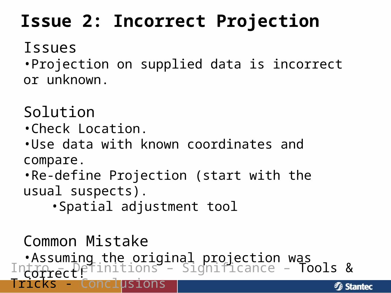
Issue 2: Incorrect Projection
Intro – Definitions – Significance – Tools & Tricks - Conclusions
Issues•Projection on supplied data is incorrect or unknown.
Solution•Check Location.•Use data with known coordinates and compare.•Re-define Projection (start with the usual suspects).
•Spatial adjustment tool
Common Mistake •Assuming the original projection was correct!
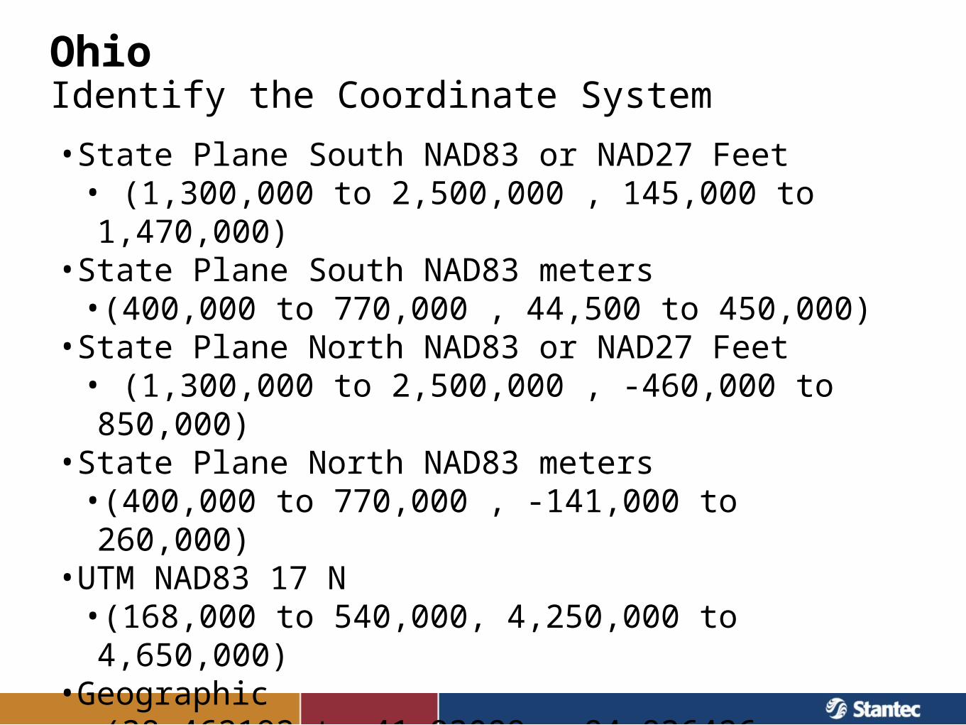
•State Plane South NAD83 or NAD27 Feet• (1,300,000 to 2,500,000 , 145,000 to 1,470,000)
•State Plane South NAD83 meters •(400,000 to 770,000 , 44,500 to 450,000)
•State Plane North NAD83 or NAD27 Feet• (1,300,000 to 2,500,000 , -460,000 to 850,000)
•State Plane North NAD83 meters •(400,000 to 770,000 , -141,000 to 260,000)
•UTM NAD83 17 N•(168,000 to 540,000, 4,250,000 to 4,650,000)
•Geographic•(38.462192 to 41.93089, -84.836426,-80.397949)
OhioIdentify the Coordinate System
Conclusions
Intro – Definitions – Significance – Tools & Tricks - Conclusions
•Knowing the coordinate system and datum of your data is essential.
•Unknown / wrongly defined coordinate systems can cause delays and mistakes.
•Understand impacts of Datum Changes to your data.
Questions?
Intro – Definitions – Significance – Tools & Tricks - Conclusions
Erick Lobao, Stantec, Project Manager, [email protected]
Mark Seidelmann, Stantec, Senior Project Engineer, PE, [email protected]


