32
AU Germany 2016 Presentation material Coordinates in Revit Zsolt Varga Technical Support Specialist l Autodesk GmbH

AU Germany 2016 Presentation material
Coordinates in Revit
Zsolt VargaTechnical Support Specialist l Autodesk GmbH

AU Germany 2016 Presentation material
Why is this topic crucial and scarry to customers?
▪ Because the position of our BIM model is important
▪ …the functionalities to define it in Revit are rather complex
(more flexibility = more chance for confusions)
▪ …users don´t get to practice this feature very often
This presentation clarifies the logic, how the model position is defined in
Autodesk Revit; it highlights correlations between the most important tools and
terms and it helps to prevent misunderstandings, so that the users can enjoy the
complexity and the flexibility of the features offered by Revit for working with the
coordinates.
Overview

AU Germany 2016 Presentation material
▪ Understanding the concept
▪ Explaining/refreshing terms and definitions
▪ Project Base Point & Survey Point: Powerful Tools in Revit
▪ Showing an optimal Workflow with Shared Coordinates
▪ Clarifying misunderstandings / Dos & Don´ts
Aim of the presentation

AU Germany 2016 Presentation material
1. ChallengesAbstraction – Illustrating Reality in a virtual Space
AU Germany 2016 Presentation material
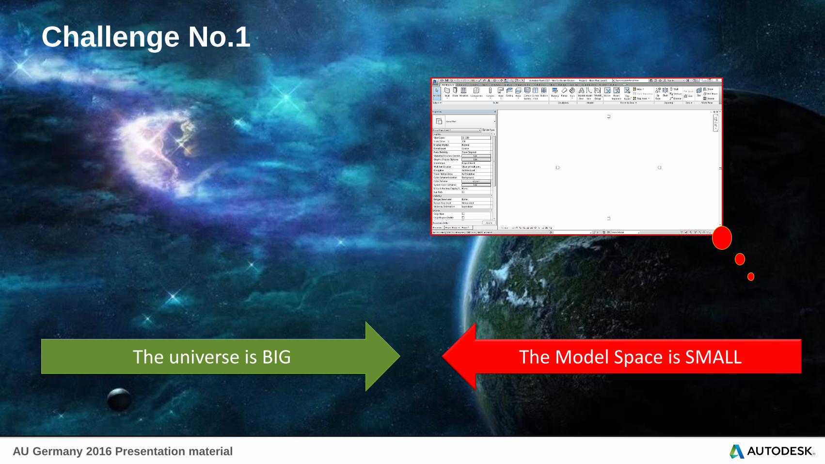
Challenge No.1
The universe is BIG The Model Space is SMALL
AU Germany 2016 Presentation material
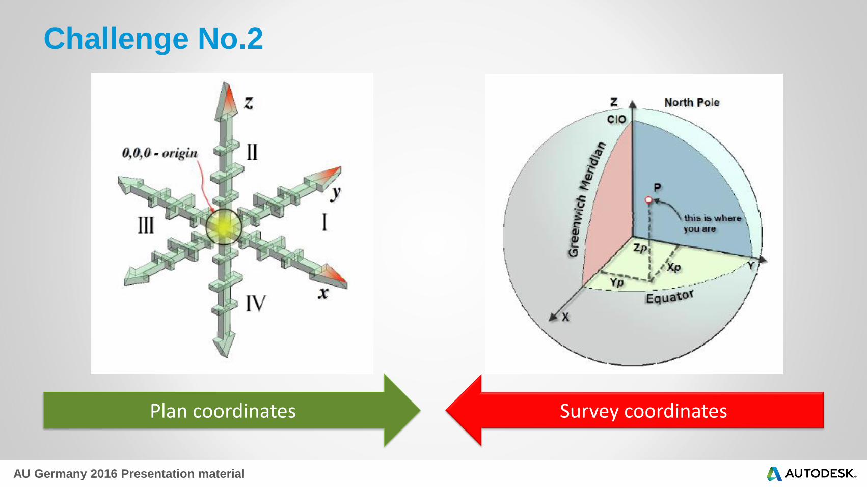
Challenge No.2
Plan coordinates Survey coordinates

AU Germany 2016 Presentation material
Challenge No.3Different Reference Systems in Surveying & Mapping

AU Germany 2016 Presentation material
2. Basics & TermsHow does Revit deal with these challenges
AU Germany 2016 Presentation material
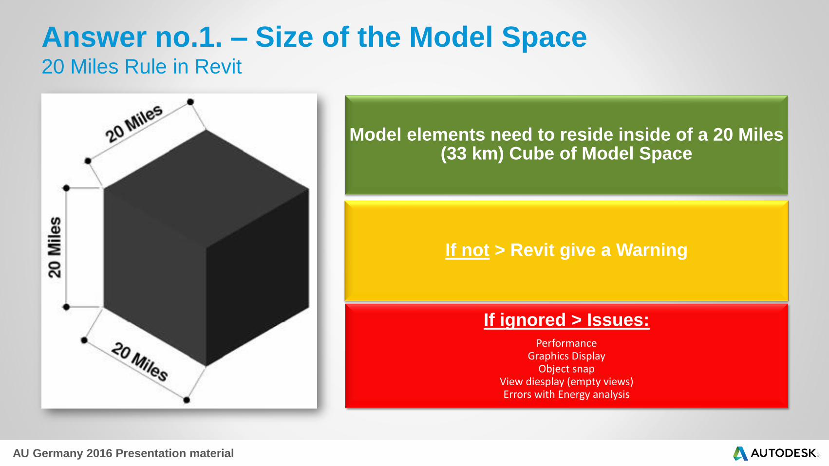
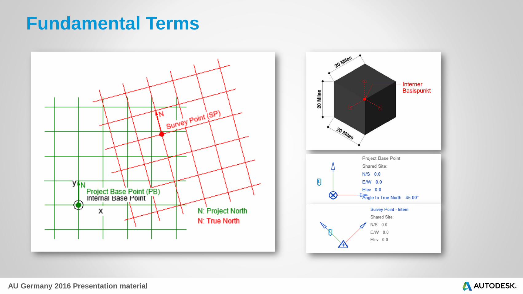
Answer no.1. – Size of the Model Space20 Miles Rule in Revit
Model elements need to reside inside of a 20 Miles (33 km) Cube of Model Space
If not > Revit give a Warning
If ignored > Issues:Performance
Graphics DisplayObject snap
View diesplay (empty views)Errors with Energy analysis
AU Germany 2016 Presentation material
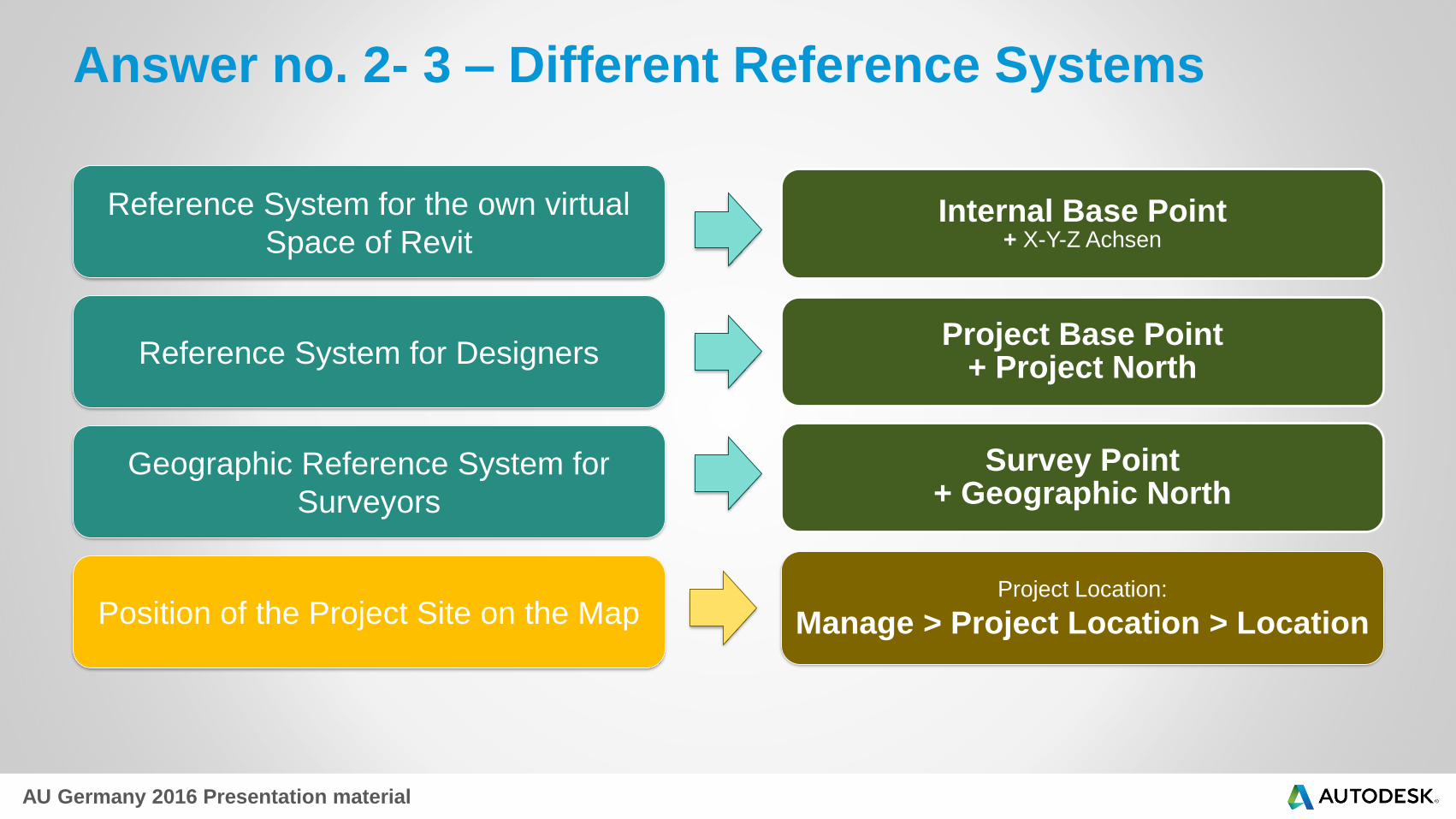
Answer no. 2- 3 – Different Reference Systems
Internal Base Point+ X-Y-Z Achsen
Project Base Point + Project North
Survey Point+ Geographic North
Reference System for the own virtual
Space of Revit
Reference System for Designers
Geographic Reference System for
Surveyors
Position of the Project Site on the MapProject Location:
Manage > Project Location > Location
AU Germany 2016 Presentation material
Fundamental Terms

AU Germany 2016 Presentation material
Project Location
Define Location by:
"Get Location from Survey
Point" function available in
the latest Revit releases, but
not the other way around… >
You CANNOT get shared
coordinates by manually
defining Project Location!
Not to mistake it for Project
coordinates or Shared
Coordinates!
AU Germany 2016 Presentation material
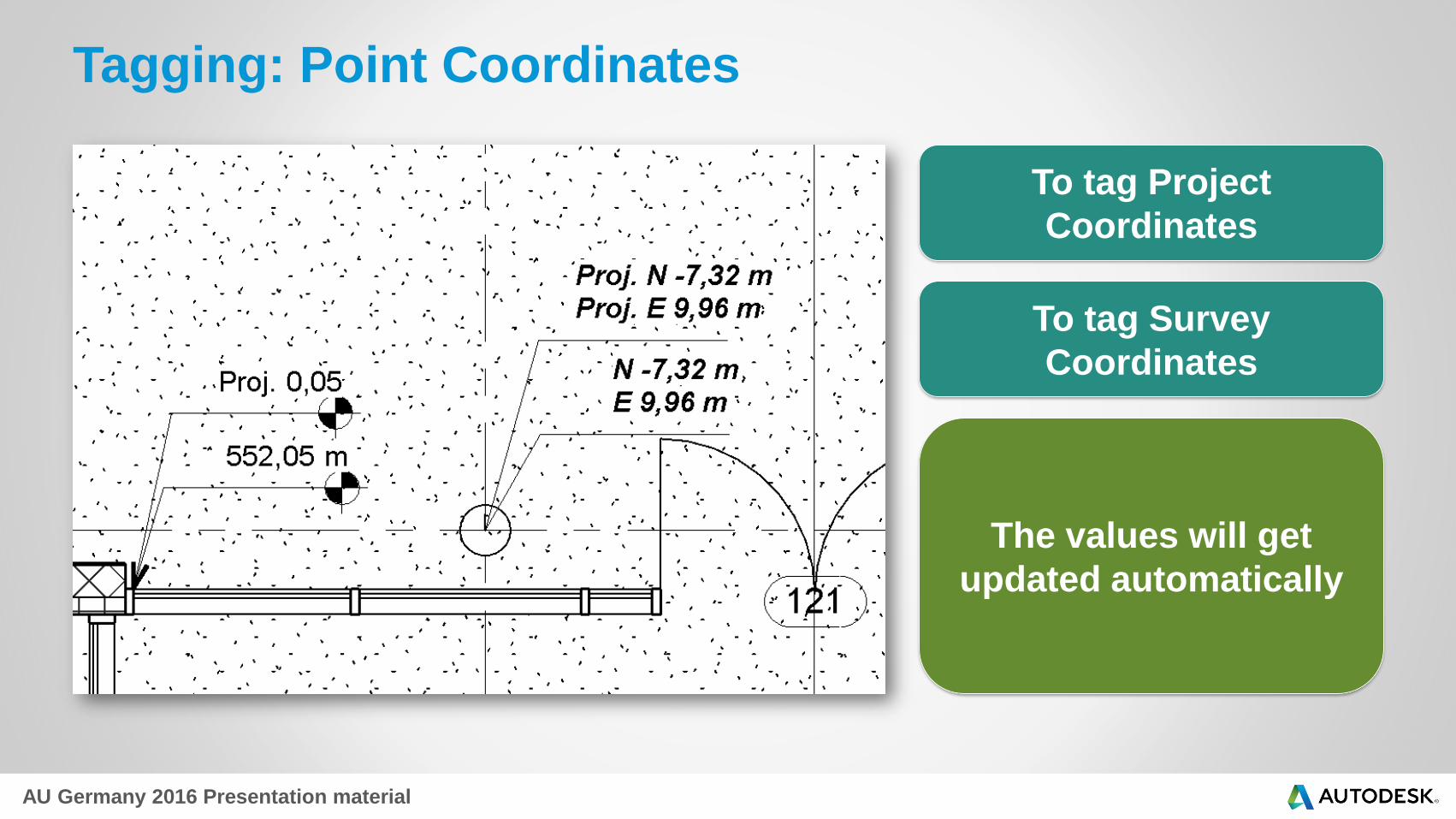
Tagging: Point Coordinates
To tag Project
Coordinates
To tag Survey
Coordinates
The values will get
updated automatically
AU Germany 2016 Presentation material
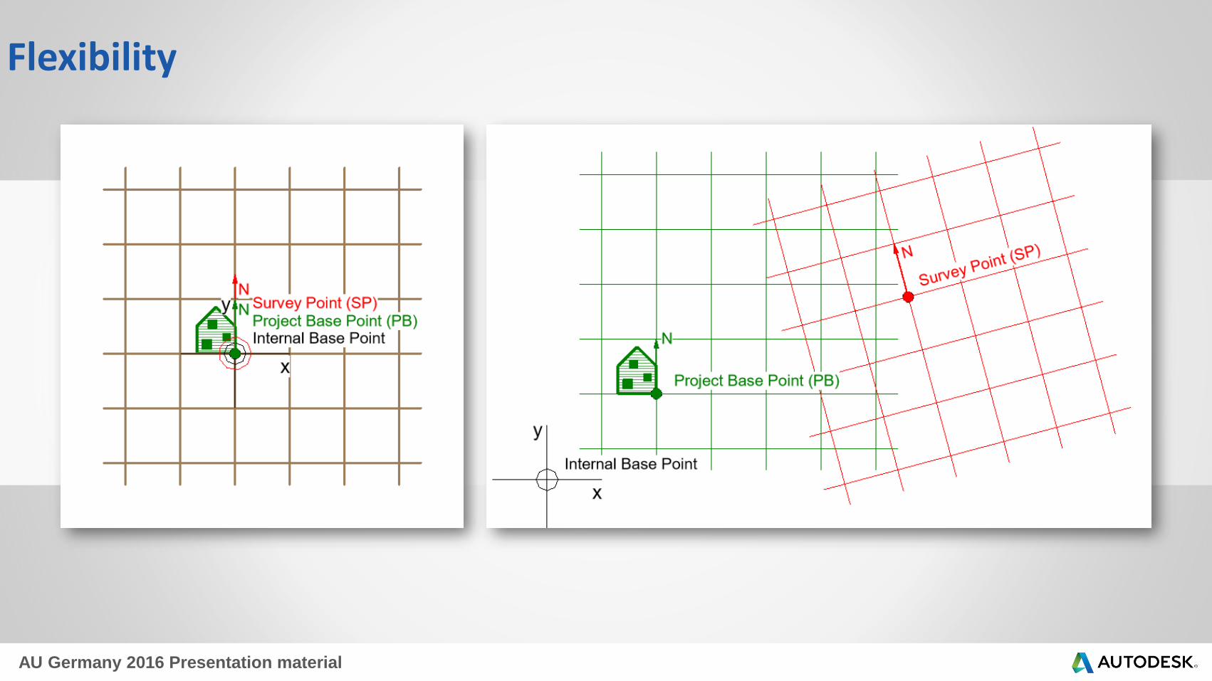
Flexibility

AU Germany 2016 Presentation material
What is that all
good for?

AU Germany 2016 Presentation material
Free Time

AU Germany 2016 Presentation material
3. Praxis – Project PositionUsing the Project Base Point & Survey Point as powerful tools

AU Germany 2016 Presentation material
Adjusting Project-Base Point location
Moving the Project Base Point UNCLIPPED
We move the Project Coordinate System in relation to the
Model Geometry and the Survey Coordinate System im
virtuellem Raum
Project Coordinates of the model elements are changing
Survey coordinates of the same elements stay the same
The project keeps ist position in Revit´s virtual space
AU Germany 2016 Presentation material
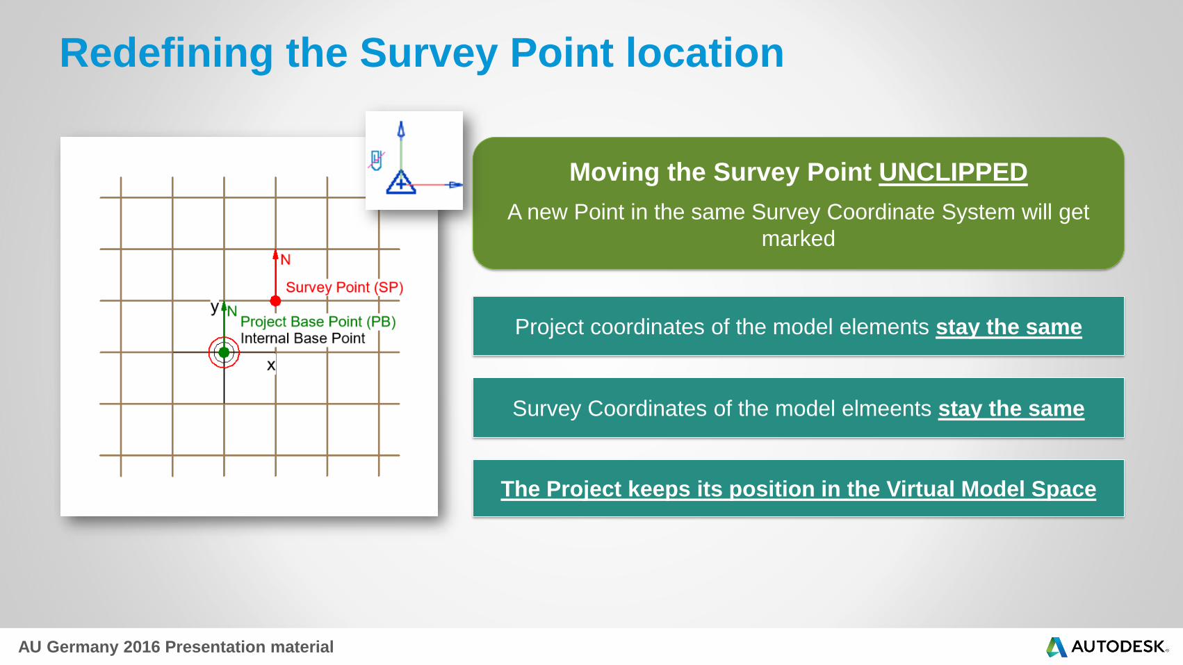
Redefining the Survey Point location
Moving the Survey Point UNCLIPPED
A new Point in the same Survey Coordinate System will get
marked
Project coordinates of the model elements stay the same
Survey Coordinates of the model elmeents stay the same
The Project keeps its position in the Virtual Model Space
AU Germany 2016 Presentation material
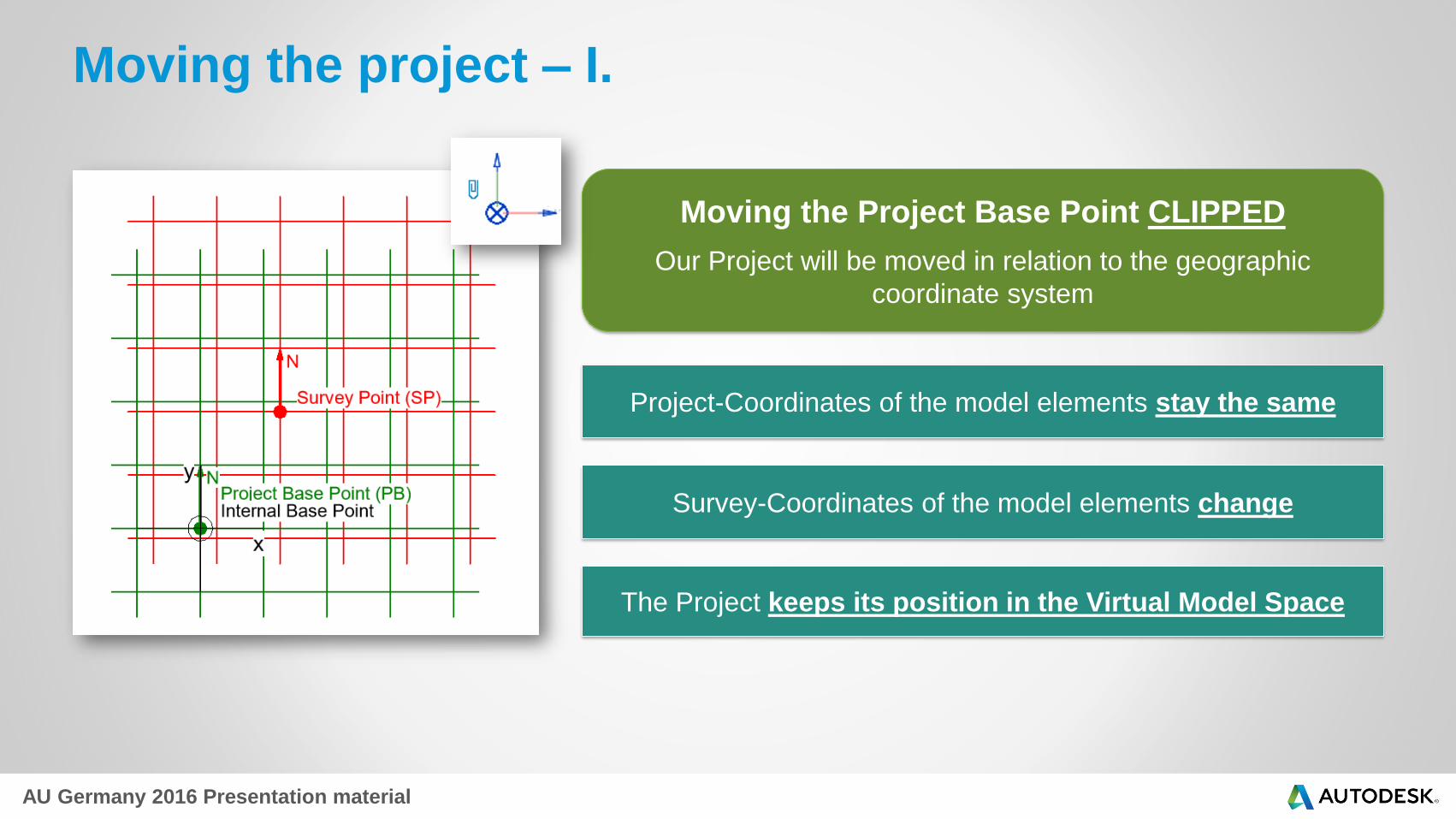
Moving the project – I.
Moving the Project Base Point CLIPPED
Our Project will be moved in relation to the geographic
coordinate system
Project-Coordinates of the model elements stay the same
Survey-Coordinates of the model elements change
The Project keeps its position in the Virtual Model Space

AU Germany 2016 Presentation material
Moving the Project – II.
Moving the Survey Point CLIPPED
The Survey Coordinate System gets moved in relation to the
Project Coordinate System
Project coordinates of the model elements stay the same
Survey coordinates of the model elements change
The project keeps its position in the Virtual Model Space

AU Germany 2016 Presentation material
Moving the Project – III.
AVOID IT AS MUCH AS POSSIBLE
Changing the project position by selecting and
moving model elements
Model elements may accidentally get left hidden in a wrong
position
Losing model element references and connections
Labor intensive, error-prone process
AU Germany 2016 Presentation material
4. Shared Coordinates
AU Germany 2016 Presentation material
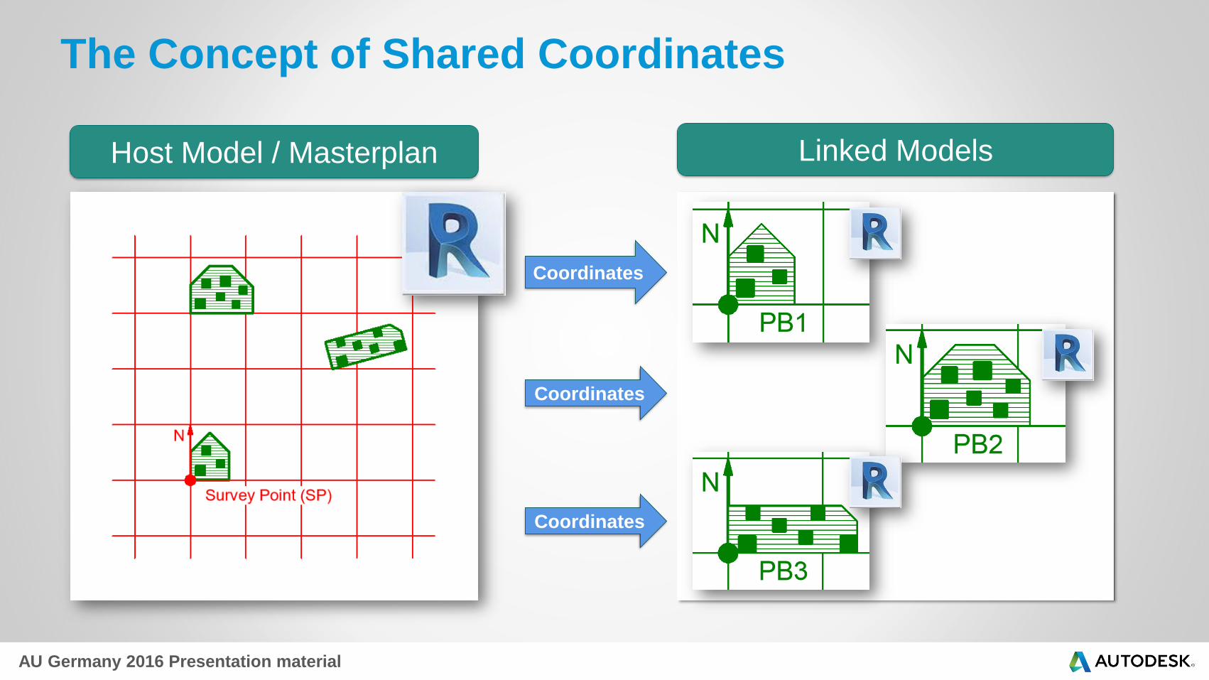
The Concept of Shared Coordinates
Host Model / Masterplan Linked Models
Coordinates
Coordinates
Coordinates
AU Germany 2016 Presentation material
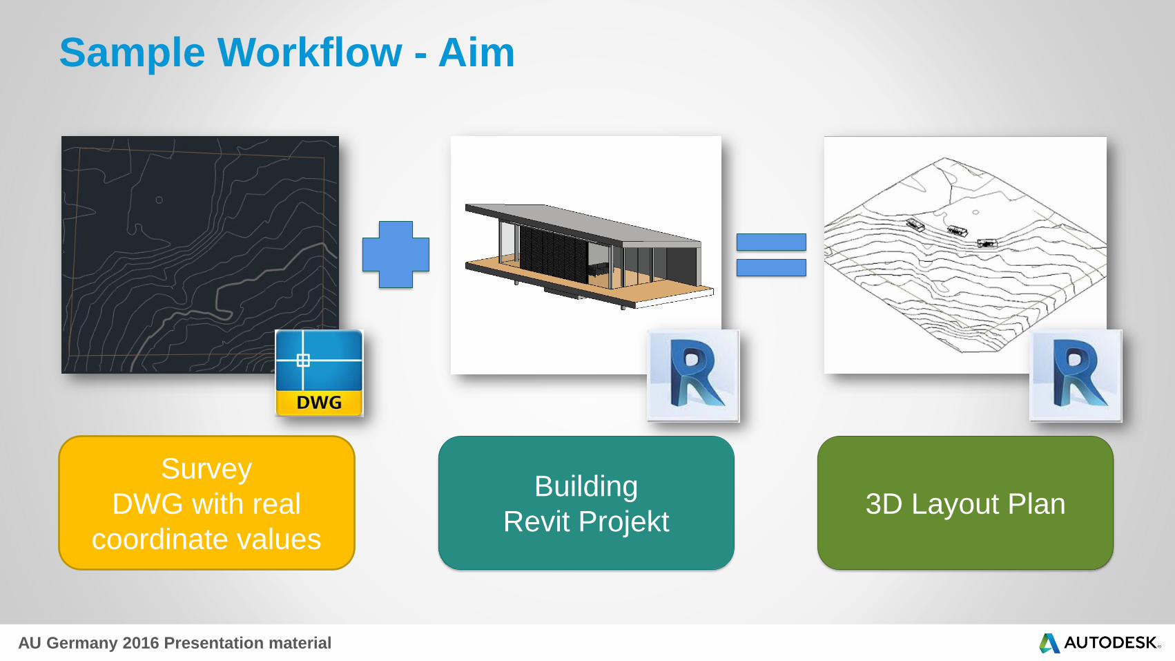
Sample Workflow - Aim
Survey
DWG with real
coordinate values
Building
Revit Projekt3D Layout Plan
AU Germany 2016 Presentation material
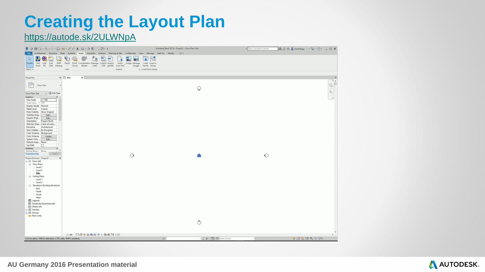
Creating the Layout Planhttps://autode.sk/2ULWNpA

AU Germany 2016 Presentation material
Defining Building Positionhttps://autode.sk/2EwzVFk
AU Germany 2016 Presentation material
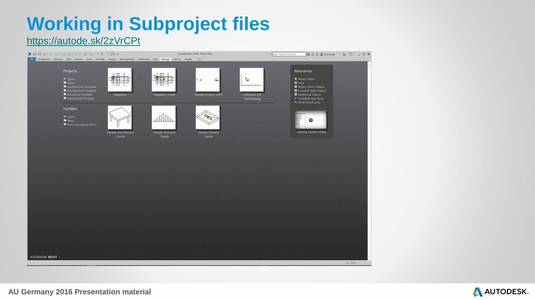
Working in Subproject files https://autode.sk/2zVrCPt

AU Germany 2016 Presentation material
5. General Advise
AU Germany 2016 Presentation material
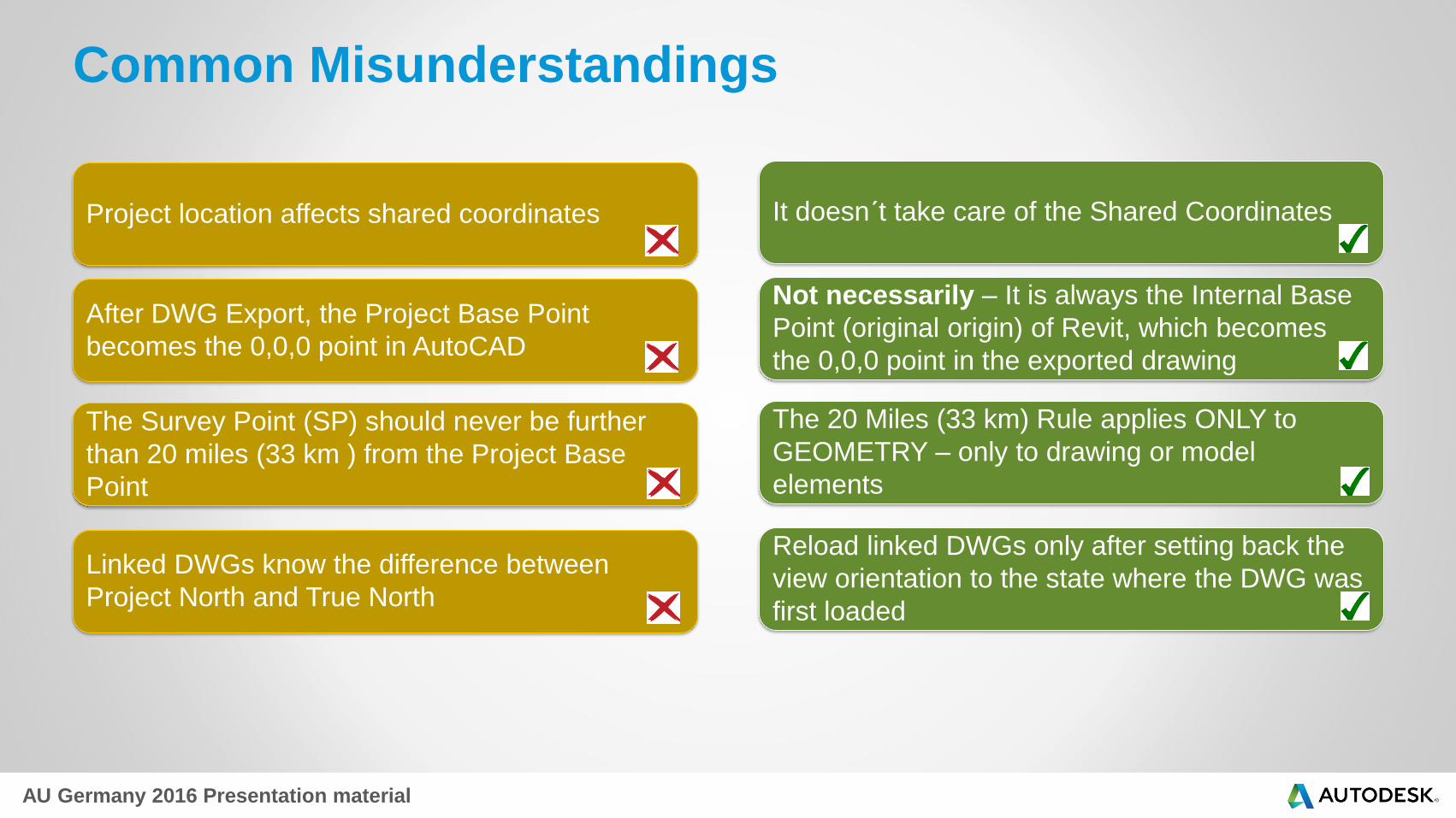
After DWG Export, the Project Base Point
becomes the 0,0,0 point in AutoCAD
The Survey Point (SP) should never be further
than 20 miles (33 km ) from the Project Base
Point
Linked DWGs know the difference between
Project North and True North
It doesn´t take care of the Shared Coordinates
Not necessarily – It is always the Internal Base
Point (original origin) of Revit, which becomes
the 0,0,0 point in the exported drawing
The 20 Miles (33 km) Rule applies ONLY to
GEOMETRY – only to drawing or model
elements
Reload linked DWGs only after setting back the
view orientation to the state where the DWG was
first loaded
Project location affects shared coordinates
Common Misunderstandings

AU Germany 2016 Presentation material
Dos & Don´ts
Dos Don´ts Why
Change the project position using the
Project Base Point or the Survey Point
Don´t try to change the project position by
moving model elements manually
It can lead to errors or losing element
references and connections
Having a rectangular system of model
geometry try to best draw it oriented to the
Project North
Don´t draw or load model elements
oriented to True North, while keeping the
view orientation set to Project North
You can easily end up in creating geometry
with elements „slightly off axis“ – creating
an inaccurate building model
Use the view orientation set to Project
North when drawing
Drawing elements in a view oriented to
True North
You can easily end up in creating geometry
with elements „slightly off axis“ – creating
an inaccurate building model
When using Shared coordinates – export
drawings directly from the model space
Don´t export views with Shared
Coordinates from a Revit Sheet
Revit sheets can have multiple views >
DWG Export > The views will be spread in
the AutoCAD model space > The
coordinates get lost
Respect and consider the warnings of
Revit – Take your time to understand the
correlation between the warnings and your
steps
Don´t ignore the warnings, when Revit is
trying to help
Patience pays off…

Autodesk is a registered trademark of Autodesk, Inc., and/or its subsidiaries and/or affiliates in the USA and/or other countries. All other brand names, product names, or trademarks belong to their respective holders. Autodesk reserves the right to alter product and services offerings, and specifications and pricing at any time without notice, and is not responsible for typographical or graphical errors that may appear in this document. © 2015 Autodesk, Inc. All rights reserved.


