20
Copernicus for coastal zone 29 June, 2017 [email protected] [email protected] The European Marine Observation and Data Network

Copernicus for coastal zone
29 June, [email protected]
The European Marine
Observation and Data Network


There is only one Earth, with only one history, and we get only one chance to record it. Ideas not followed through can be taken up again later. A record not made is gone for good. Editorial - Nature 450, 761 (6 December 2007)
Cost of Ocean Observation in EU Space data: € 400 M per year
In-situ data: > €1 billion per year
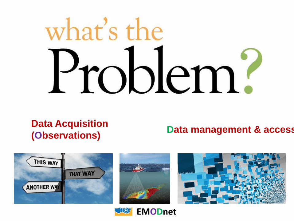
Data Acquisition
(Observations) Data management & access
EMODnet

What can EU do?
A vision for an end-to-end, integrated, inter-operable and user-oriented network of European marine observation and data systems

Vision Target for 2020
• Seamless multi-resolution digital seabed map
of European waters by 2020
– Topography, geology, habitats and ecosystems;
– Highest resolution possible in areas that have
been surveyed;
• Accompanied by timely information on
• Physical, chemical and biological state of the
overlying water column
• Oceanographic forecasts;
• Easily accessible, interoperable and free of
restrictions on use;
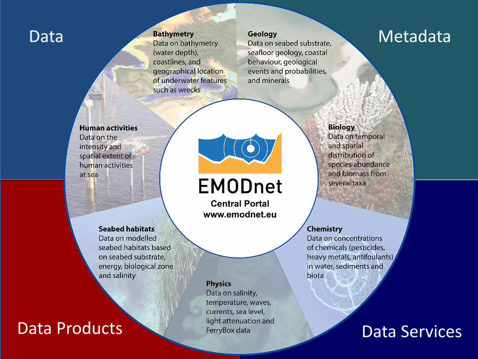
Data Metadata
Data Products Data Services

Data repositories in Member States
EMODnet THEMATIC GROUPS provide access to data and create data products
Central Portal www.EMODnet.eu
service providers services to customers
users
Bathymetry Chemistry Habitats Physics Geology BiologyHuman activity
Are data fit for use? EMODnet Sea-Basin CheckpointsAs surrogate users
OBISGSsEuroGOOS CMEMS SDCSDCHOs RSCsICES
How does it work?
www.EMODnet-ingestion.eu
PANGAEA
access to data and data products from more than one theme
Secretariat – DG MARE - EASME
Steering Committee
Expert UserGroup
RSCs
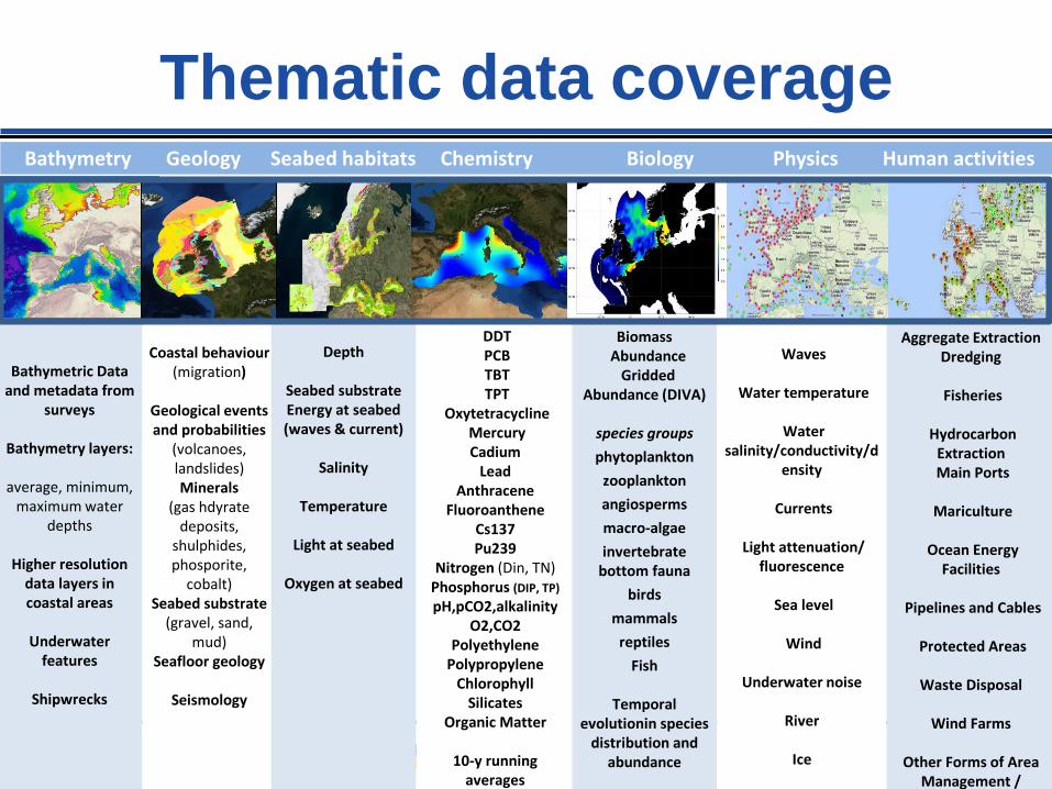
Thematic data coverage
HOW?Bathymetry Geology Seabed habitats Chemistry Biology Physics Human activities
Bathymetric Data and metadata from
surveys
Bathymetry layers:
average, minimum, maximum water
depths
Higher resolution data layers in coastal areas
Underwater features
Shipwrecks
Coastal behaviour(migration)
Geological events and probabilities
(volcanoes, landslides)Minerals
(gas hdyratedeposits,
shulphides, phosporite,
cobalt)Seabed substrate
(gravel, sand, mud)
Seafloor geology
Seismology
Depth
Seabed substrateEnergy at seabed(waves & current)
Salinity
Temperature
Light at seabed
Oxygen at seabed
DDTPCBTBTTPT
OxytetracyclineMercuryCadium
LeadAnthracene
FluoroantheneCs137Pu239
Nitrogen (Din, TN)Phosphorus (DIP, TP)
pH,pCO2,alkalinityO2,CO2
PolyethylenePolypropylene
ChlorophyllSilicates
Organic Matter
10-y running averages
BiomassAbundance
Gridded Abundance (DIVA)
species groups
phytoplankton
zooplankton
angiosperms
macro-algae
invertebrate bottom fauna
birds
mammals
reptiles
Fish
Temporal evolutionin species
distribution and abundance
Waves
Water temperature
Water salinity/conductivity/d
ensity
Currents
Light attenuation/ fluorescence
Sea level
Wind
Underwater noise
River
Ice
Aggregate ExtractionDredging
Fisheries
Hydrocarbon ExtractionMain Ports
Mariculture
Ocean Energy Facilities
Pipelines and Cables
Protected Areas
Waste Disposal
Wind Farms
Other Forms of Area Management /
Designation
www.emodnet-geology.euhttp://www.emodnet-bathymetry.eu
www.emodnet-seabedhabitats.eu
Marenzelleria abundance showing multiple invasions in Baltic Sea
Layers &
products
www.emodnet-humanactivities.eu
www.emodnet-chemistry.eu
http://www.emodnet-biology.eu
www.emodnet-physics.eu
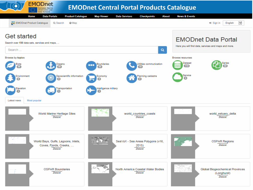
EMODnet Central Portal Products Catalogue

EMODnet bathymetry• UK Met Office & NOC new storm surge
forecast model • Requires tidal solution is accurate which
in turn requires an accurate bathymetry. • Using a bathymetry based on the
EMODnet dataset led to an overall improvement in the model tide significant improvements using EMODnet.
www.emodnet-bathymetry.eu

EMODnet Seabed Habitats
• Joint land use - seabed habitats map
for cumulative impact index (FP7
Pegaso)
Enables a good many uses
• Sensitivity maps for assessing
Seabed Integrity
www.emodnet-seabedhabitats.eu

EMODnet Geology
• Gulf of Finland Regional Plan
for Trade and the Sea Area
• EMODnet-Geology seabed
substrate data provided to
planners.
• Marine geologists (and
biologists) interacted with
planners to evaluate what is
available for marine spatial
planning.
• Information can be understood
by decision-makers
www.emodnet-geology.eu

http://www.emodnet.eu/video
Thank you!
It is all about sharing & bringing people and ideas together

More than just access to data & products
• Reducing fragmented marine data landscape
• Platform for collaboration: bringing together key European
providers, integrators, networks & infrastructures (e.g. EuroGOOS,
CMEMS, SDNet, OBIS, ICES, PANGAEA, RSCs, HOs, GeoSurveys…)
– Stimulate adoption of standards and develop joint solutions for common problems
– Facilitate down- and up-stream integration & interoperability (WMS, WFS, Web Service,
etc.)
• Raising visibility of Europe’s wealth of marine observations &
data resources attracting more users and more providers
• Changing culture towards open data sharing practices &
increased collaboration
• Multi-disciplinary and increasingly global
• Long term infrastructure & service supported by DG MARE

EMODnet CheckpointsMedSea North Sea Arctic Baltic Atlantic Black Sea
20152013 2015201520152013

Targeted at professionals, well-informed experts, policy advisors from 4 main communities:
1. Public sector organisations and authorities
2. Civil society (NGOs, ...)
3. SME’s and large companies from private sector
4. Research Community
Who is it for?


Benefits for data users• Reduced costs for offshore activities
– no need to repeat measurement that made by others
– costs less to assemble data from different sources
• Stimulation of innovation and competition
• Reduced uncertainty in knowledge
• Better policies & management
Benefits for data providers• Increase number/kinds of users - help justify investments
• Contribute to data products - increase visibility
• Make better use of own data via access to others’ data
• May help data providers comply with their obligations
Why is this important?