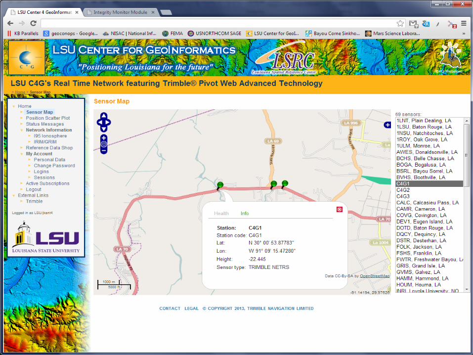
CORS911: REAL-TIME SUBSIDENCE MONITORING OF THE NAPOLEONVILLE SALT DOME SINKHOLE USING GPS LSU Center for GeoInformatics Joshua D. Kent & Larry E. Dunaway 29 th Annual Louisiana Remote Sensing & GIS Workshop Lafayette, LA | April, 24, 2013
Transcript
CORS911: REAL-TIME SUBSIDENCE MONITORING OF THE NAPOLEONVILLE SALT DOME SINKHOLE USING GPS LSU Center for GeoInformatics Joshua D. Kent & Larry E. Dunaway
29th Annual Louisiana Remote Sensing & GIS Workshop Lafayette, LA | April, 24, 2013
PR
ESEN
TATI
ON
O
VER
IVEW
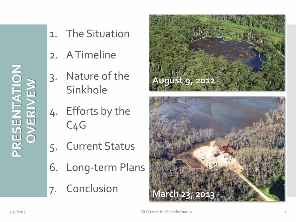
1. The Situation
2. A Timeline
3. Nature of the Sinkhole
4. Efforts by the C4G
5. Current Status
6. Long-term Plans
7. Conclusion
4/30/2013 LSU Center for GeoInformatics 2
August 9, 2012
March 23, 2013
4/30/2013 LSU Center for GeoInformatics 3
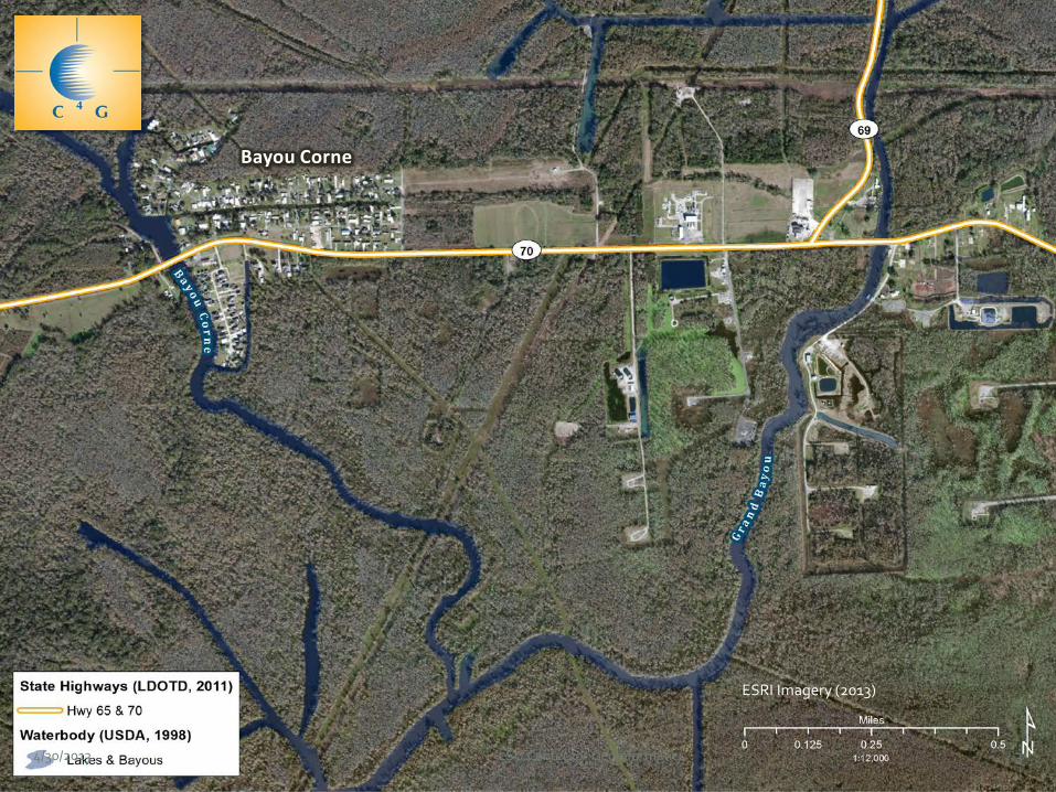
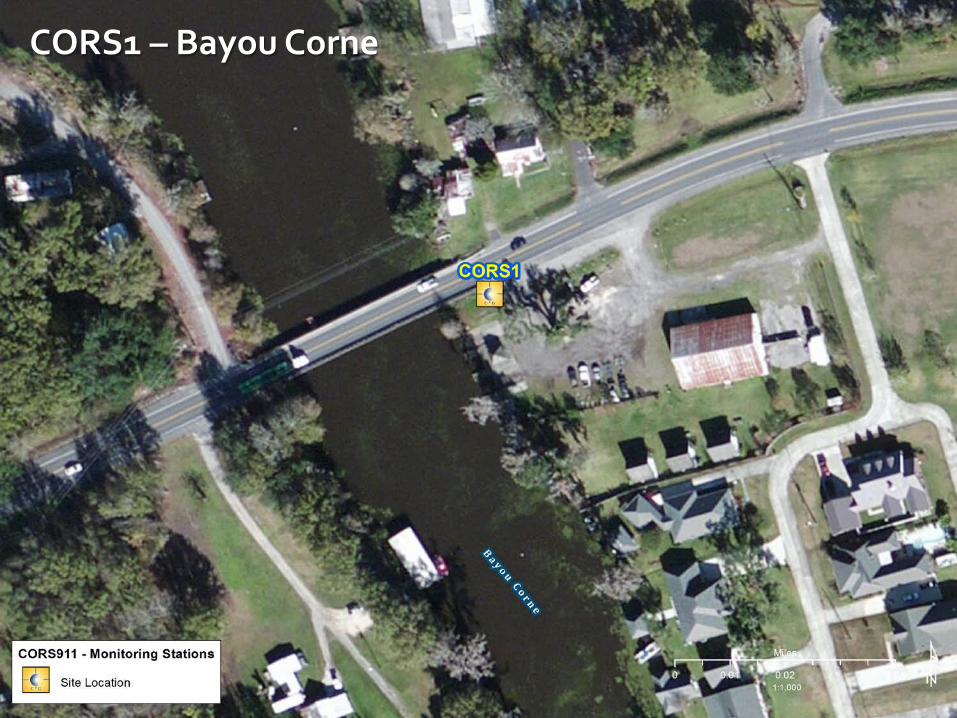
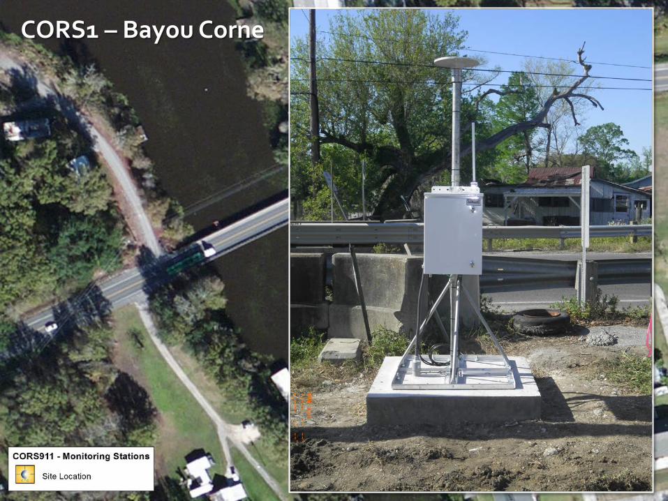
Bayou Corne
ESRI Imagery (2013)
4/30/2013 LSU Center for GeoInformatics 4
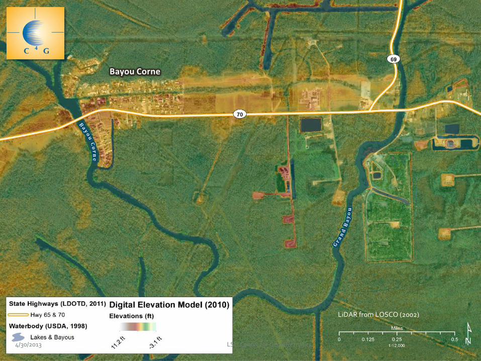
Bayou Corne
LiDAR from LOSCO (2002)
4/30/2013 LSU Center for GeoInformatics 5
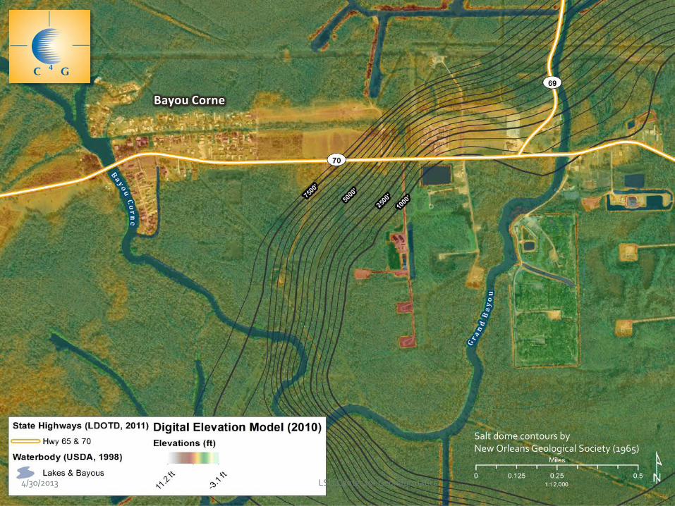
Bayou Corne
Salt dome contours by New Orleans Geological Society (1965)
4/30/2013 LSU Center for GeoInformatics 6
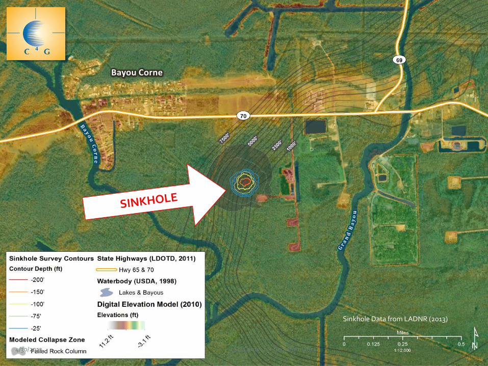
Bayou Corne
Sinkhole Data from LADNR (2013)
4/30/2013 LSU Center for GeoInformatics 7
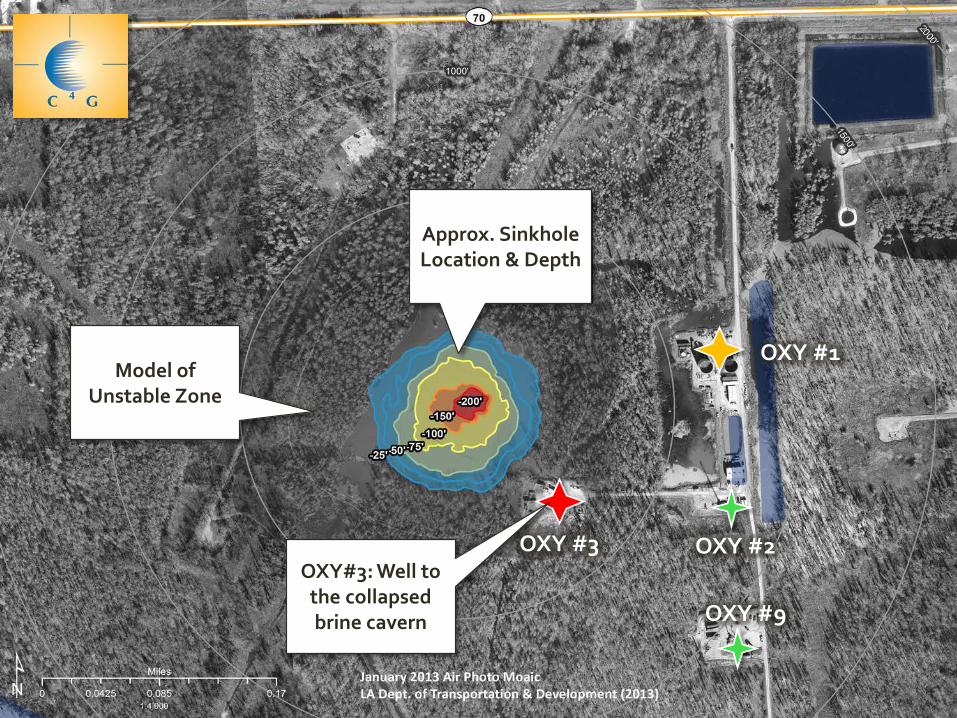
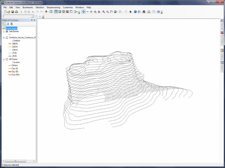
OXY #1
OXY #3 OXY #2
OXY #9
OXY#3: Well to the collapsed brine cavern
Approx. Sinkhole Location & Depth
Model of Unstable Zone
4/30/2013 LSU Center for GeoInformatics 9
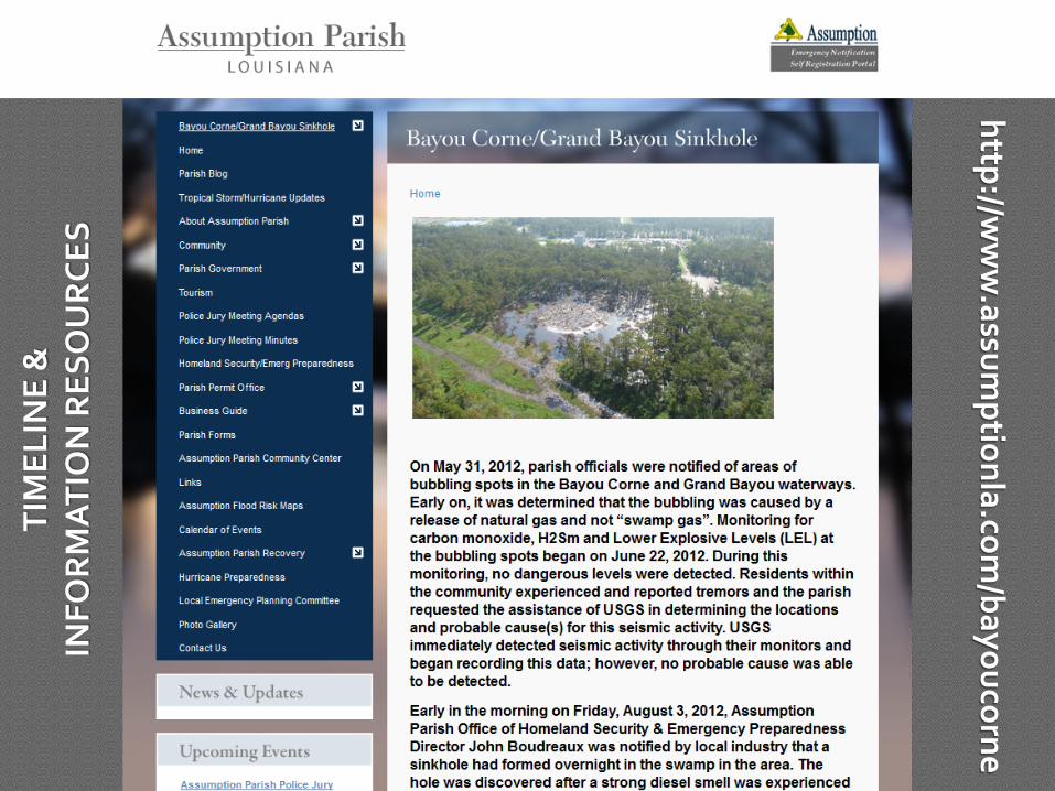
http://ww
w.assum
ptionla.com/bayoucorne
TIM
ELIN
E &
IN
FOR
MA
TIO
N R
ESO
UR
CES
(Mar
ch 2
013)
CUR
REN
T S
ITU
ATI
ON
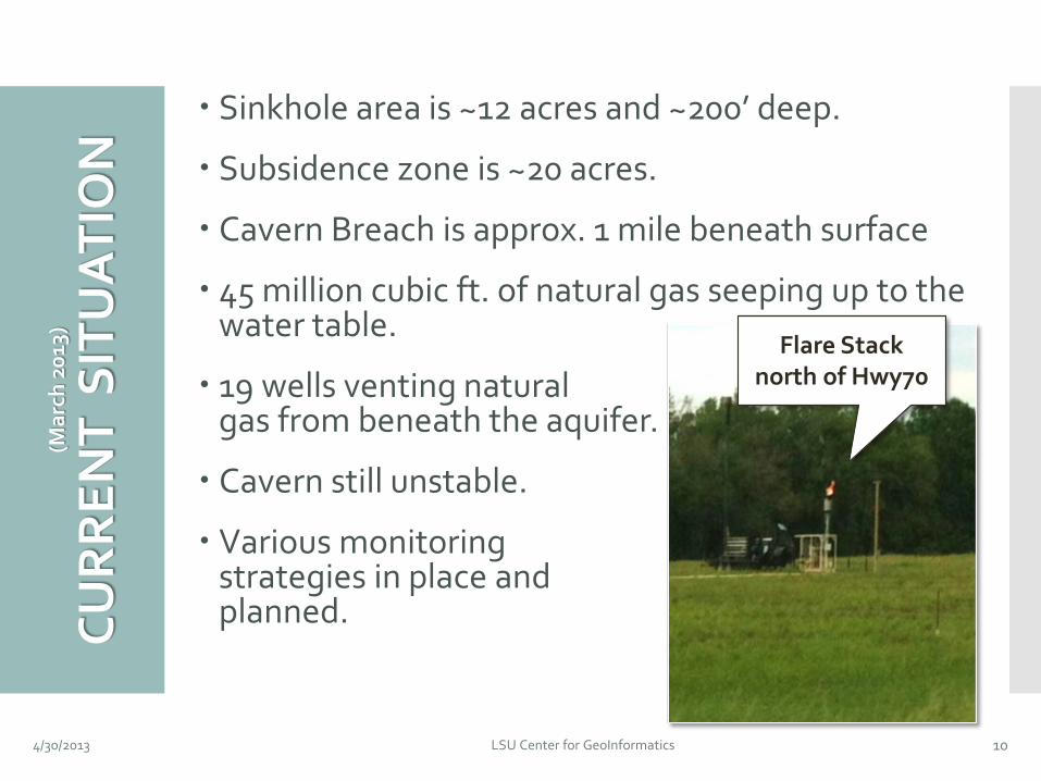
4/30/2013 LSU Center for GeoInformatics 10
Sinkhole area is ~12 acres and ~200’ deep.
Subsidence zone is ~20 acres.
Cavern Breach is approx. 1 mile beneath surface
45 million cubic ft. of natural gas seeping up to the water table.
19 wells venting natural gas from beneath the aquifer.
Cavern still unstable.
Various monitoring strategies in place and planned.
Flare Stack north of Hwy70
BR
IEF
TIM
ELIN
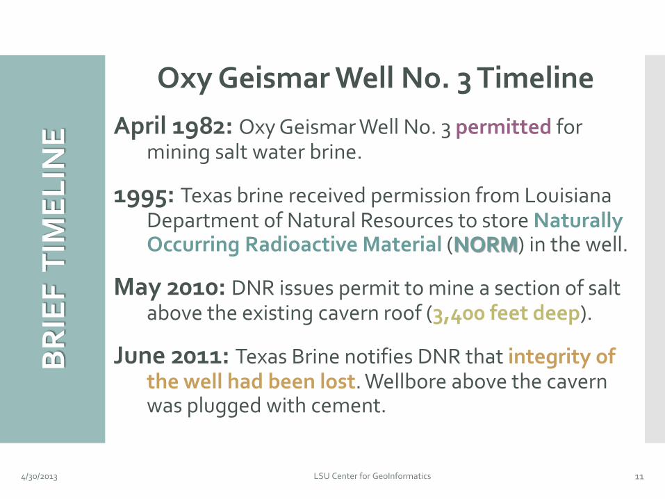
E Oxy Geismar Well No. 3 Timeline
April 1982: Oxy Geismar Well No. 3 permitted for mining salt water brine.
1995: Texas brine received permission from Louisiana Department of Natural Resources to store Naturally Occurring Radioactive Material (NORM) in the well.
May 2010: DNR issues permit to mine a section of salt above the existing cavern roof (3,400 feet deep).
June 2011: Texas Brine notifies DNR that integrity of the well had been lost. Wellbore above the cavern was plugged with cement.
4/30/2013 LSU Center for GeoInformatics 11
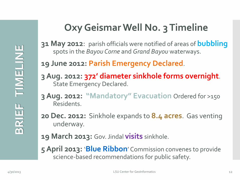
BR
IEF
TIM
ELIN
E Oxy Geismar Well No. 3 Timeline
31 May 2012: parish officials were notified of areas of bubbling spots in the Bayou Corne and Grand Bayou waterways.
19 June 2012: Parish Emergency Declared.
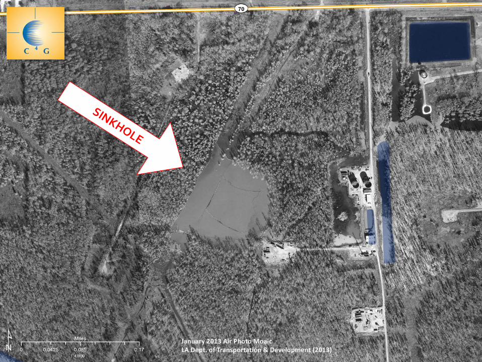
3 Aug. 2012: 372’ diameter sinkhole forms overnight. State Emergency Declared.
3 Aug. 2012: “Mandatory” Evacuation Ordered for >150 Residents.
20 Dec. 2012: Sinkhole expands to 8.4 acres. Gas venting underway.
19 March 2013: Gov. Jindal visits sinkhole.
5 April 2013: ‘Blue Ribbon’ Commission convenes to provide science-based recommendations for public safety.
4/30/2013 LSU Center for GeoInformatics 12
4/30/2013 LSU Center for GeoInformatics 13
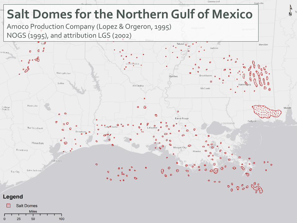
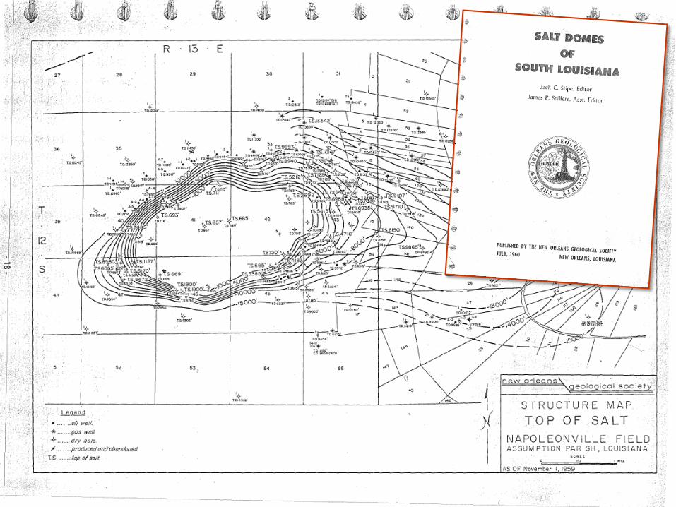
The Napoleonville Saltdome:
Salt Domes for the Northern Gulf of Mexico Amoco Production Company (Lopez & Orgeron, 1995) NOGS (1995), and attribution LGS (2002)
4/30/2013 LSU Center for GeoInformatics 14
4/30/2013 LSU Center for GeoInformatics 16
4/30/2013 LSU Center for GeoInformatics 17
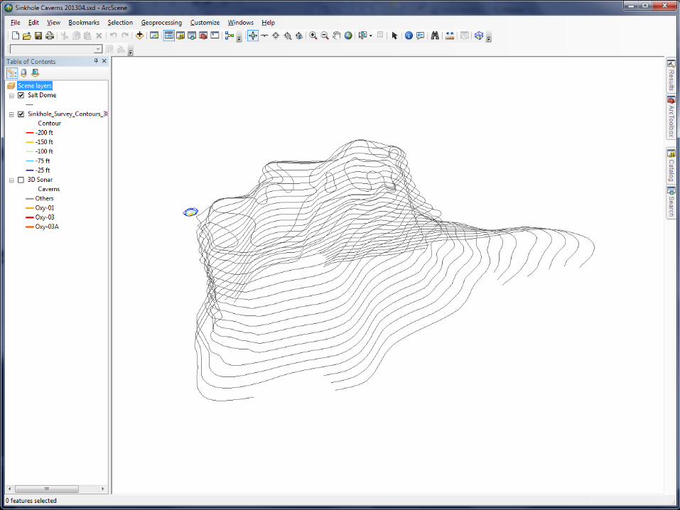
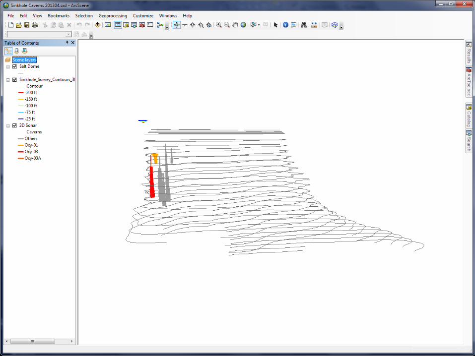
Approximate Location of Cavern
4/30/2013 LSU Center for GeoInformatics 18
Sinkhole Data from LADNR (2013)
4/30/2013 LSU Center for GeoInformatics 19
Sinkhole Data from LADNR (2013)
4/30/2013 LSU Center for GeoInformatics 20
Approximate Location of Cavern
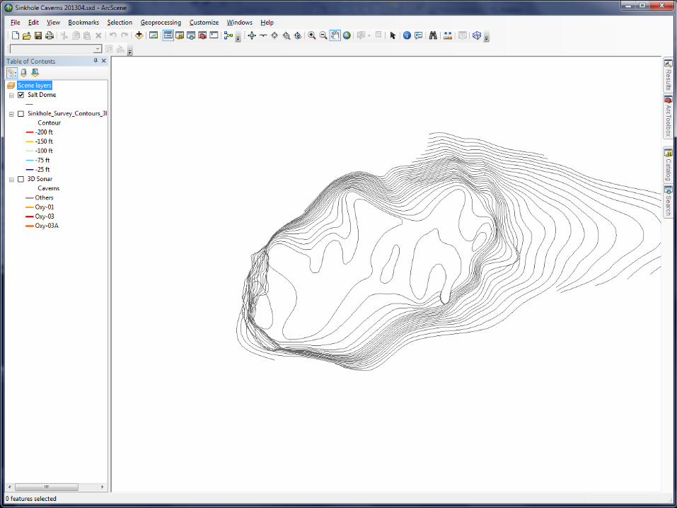
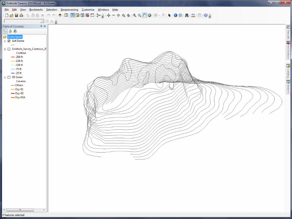
4/30/2013 LSU Center for GeoInformatics 25
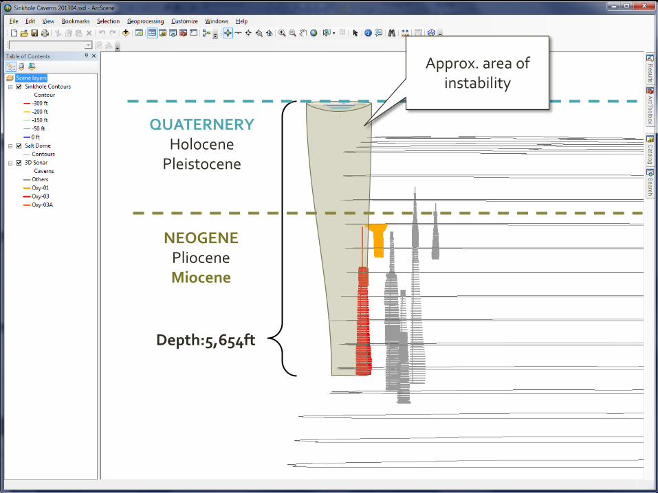
Depth:5,654ft
NEOGENE Pliocene Miocene
QUATERNERY Holocene
Pleistocene
Approx. area of instability
C4G
RES
EAR
CH G
RA
NTS
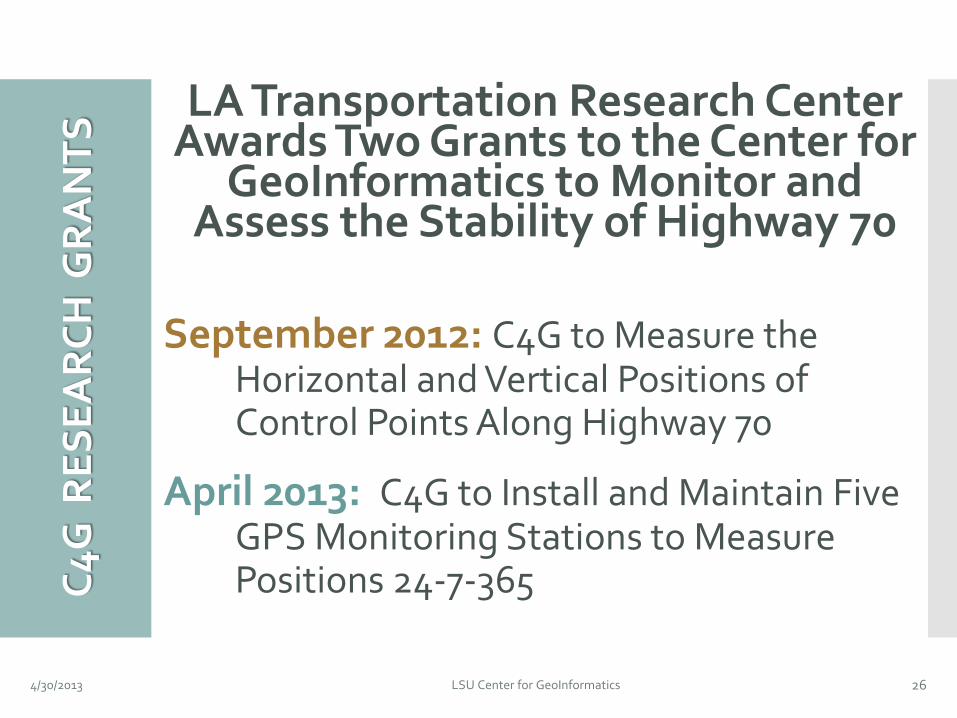
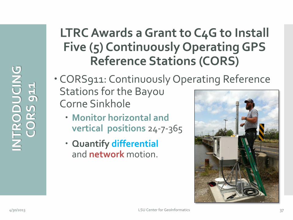
LA Transportation Research Center Awards Two Grants to the Center for
GeoInformatics to Monitor and Assess the Stability of Highway 70
September 2012: C4G to Measure the Horizontal and Vertical Positions of Control Points Along Highway 70
April 2013: C4G to Install and Maintain Five GPS Monitoring Stations to Measure Positions 24-7-365
4/30/2013 LSU Center for GeoInformatics 26
CON
TRO
L P
OIN
T
PR
OJE
CT T
ASK
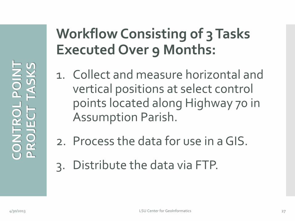
S Workflow Consisting of 3 Tasks Executed Over 9 Months:
1. Collect and measure horizontal and vertical positions at select control points located along Highway 70 in Assumption Parish.
2. Process the data for use in a GIS.
3. Distribute the data via FTP.
4/30/2013 LSU Center for GeoInformatics 27
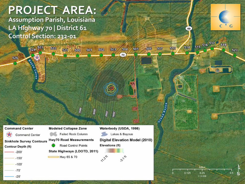
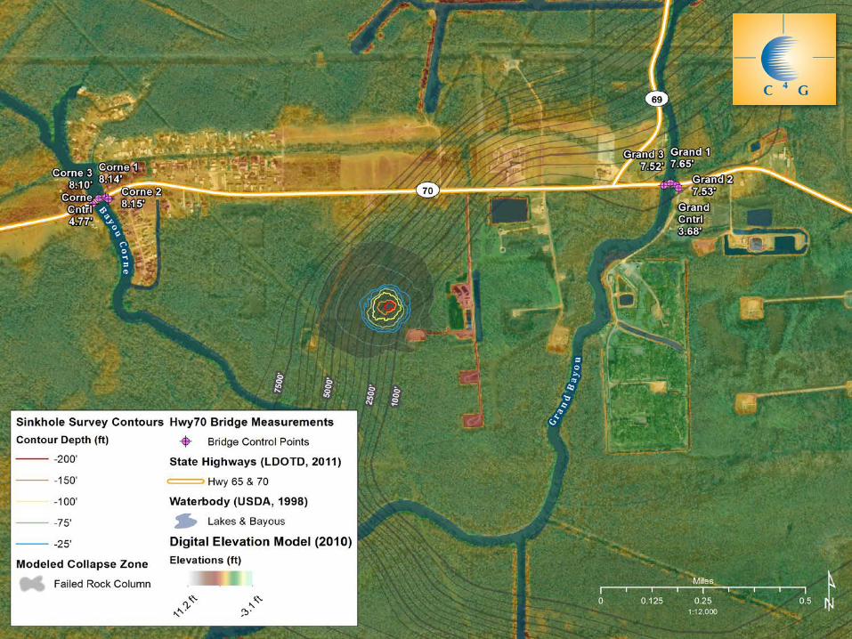
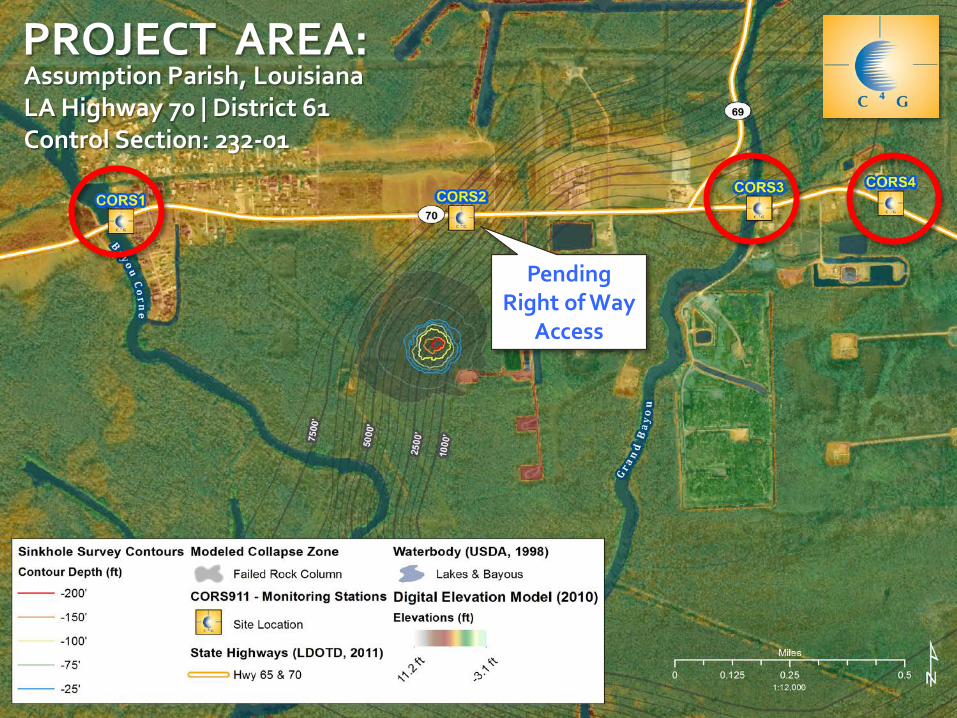
PROJECT AREA: Assumption Parish, Louisiana LA Highway 70 | District 61 Control Section: 232-01
MET
HO
DO
LOG
Y
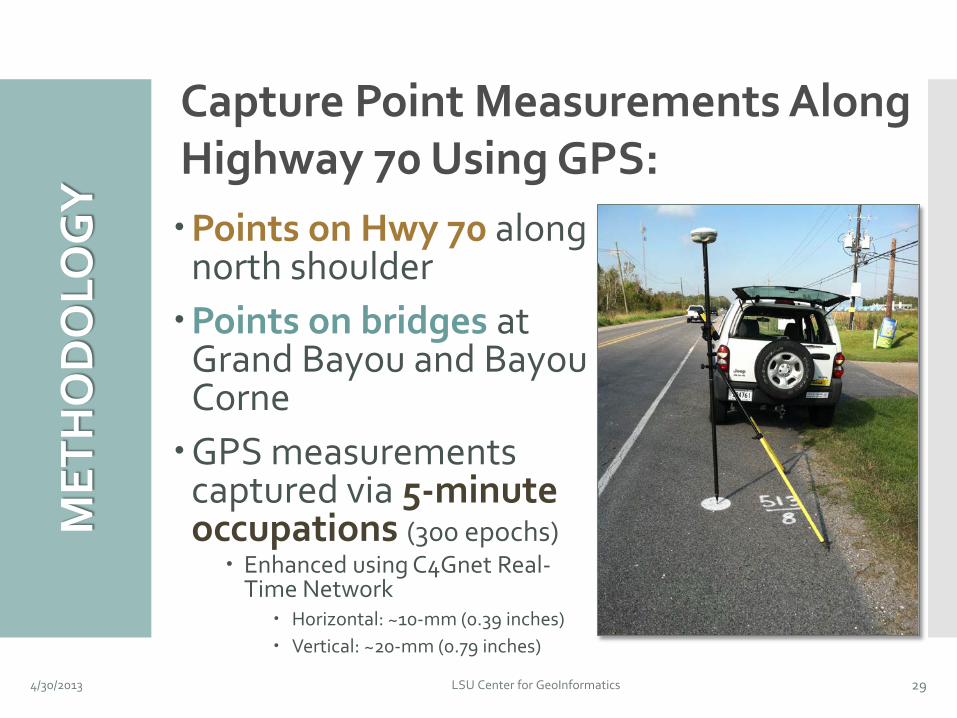
Points on Hwy 70 along north shoulder Points on bridges at
Grand Bayou and Bayou Corne GPS measurements
captured via 5-minute occupations (300 epochs) Enhanced using C4Gnet Real-
Time Network Horizontal: ~10-mm (0.39 inches) Vertical: ~20-mm (0.79 inches)
4/30/2013 LSU Center for GeoInformatics 29
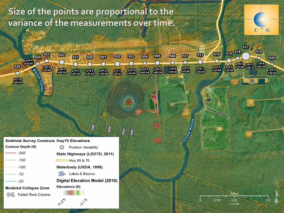
Capture Point Measurements Along Highway 70 Using GPS:
WO
RK
SCH
EDU
LE
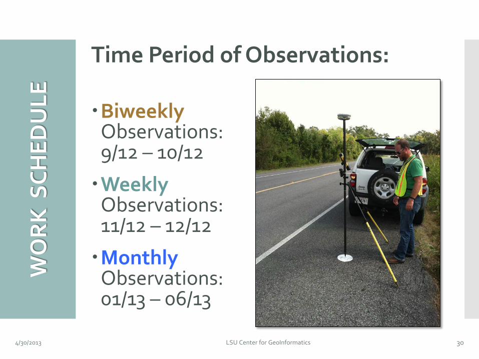
Time Period of Observations: Biweekly
Observations: 9/12 – 10/12
Weekly Observations: 11/12 – 12/12
Monthly Observations: 01/13 – 06/13
4/30/2013 LSU Center for GeoInformatics 30
Size of the points are proportional to the variance of the measurements over time.
MET
HO
DO
LOG
ICA
L
LIM
ITA
TIO
NS
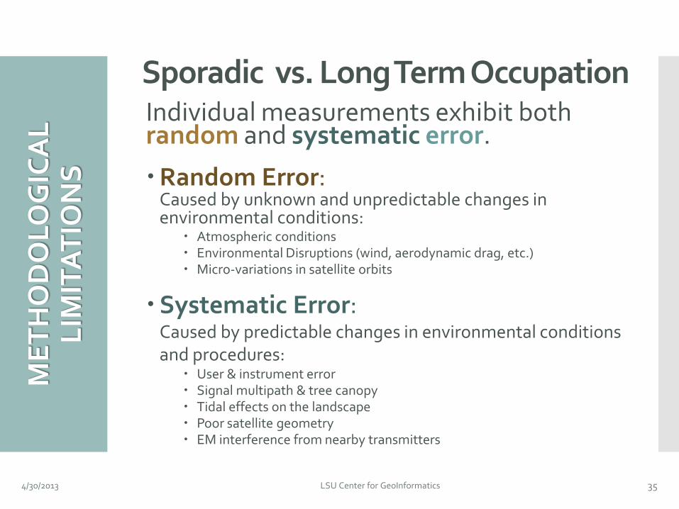
Individual measurements exhibit both random and systematic error.
Random Error: Caused by unknown and unpredictable changes in environmental conditions:
Stations for the Bayou Corne Sinkhole Monitor horizontal and
vertical positions 24-7-365
Quantify differential and network motion.
4/30/2013 LSU Center for GeoInformatics 37
PR
OJE
CT T
ASK
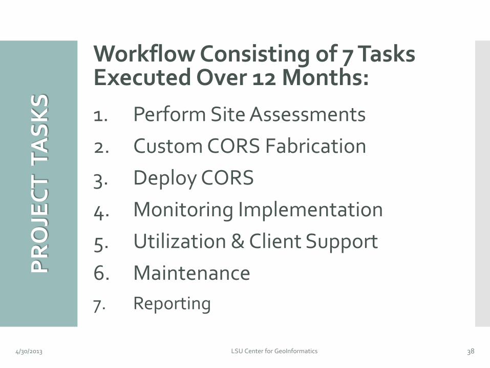
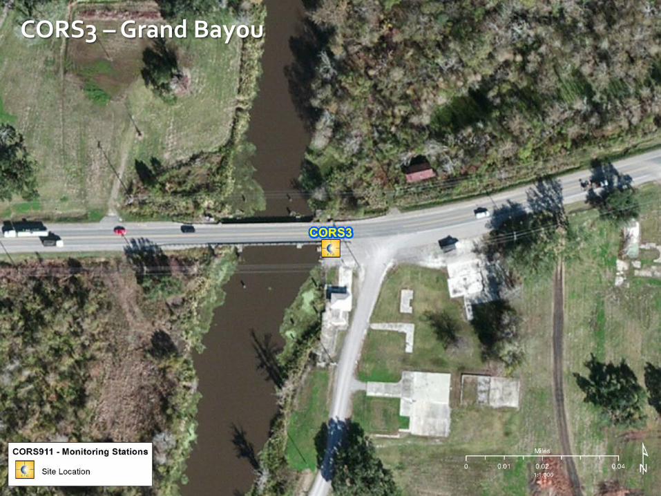
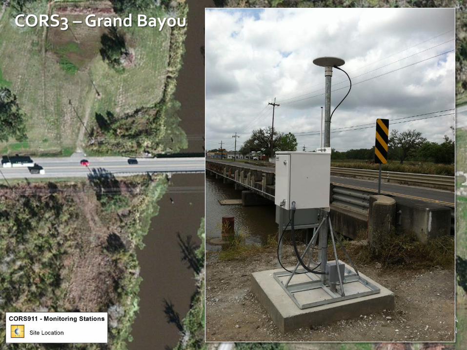
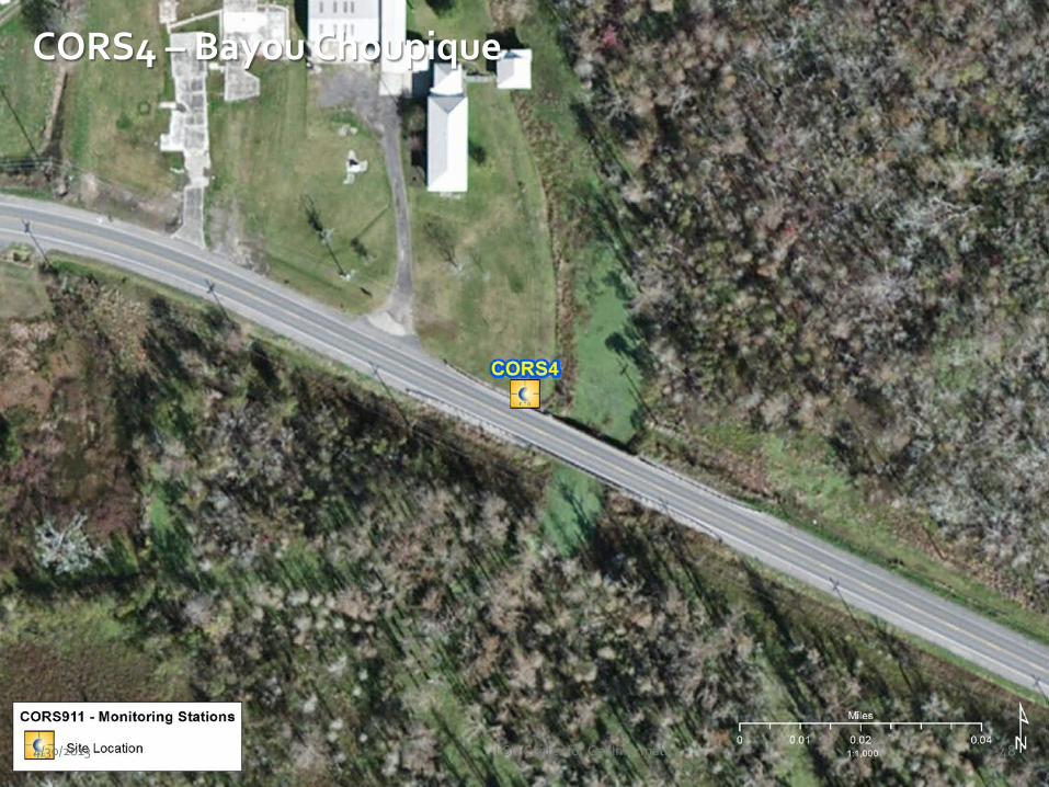
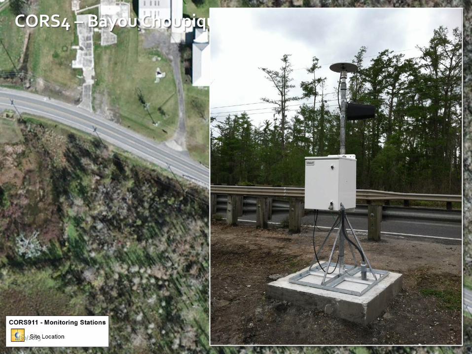
S Workflow Consisting of 7 Tasks Executed Over 12 Months: 1. Perform Site Assessments 2. Custom CORS Fabrication 3. Deploy CORS 4. Monitoring Implementation 5. Utilization & Client Support 6. Maintenance 7. Reporting
4/30/2013 LSU Center for GeoInformatics 38
PROJECT AREA: Assumption Parish, Louisiana LA Highway 70 | District 61 Control Section: 232-01
Pending Right of Way
Access
BEN
EFIT
S O
F A
CO
RS
NET
WO
RK
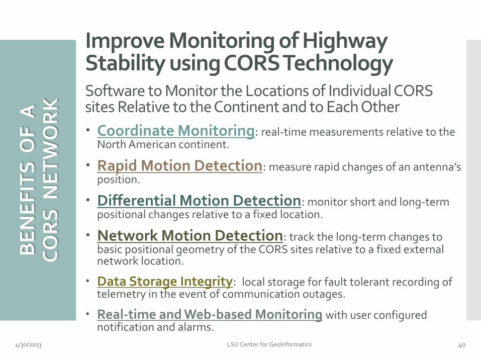
Improve Monitoring of Highway Stability using CORS Technology Software to Monitor the Locations of Individual CORS sites Relative to the Continent and to Each Other Coordinate Monitoring: real-time measurements relative to the
North American continent.
Rapid Motion Detection: measure rapid changes of an antenna’s position.
Differential Motion Detection: monitor short and long-term positional changes relative to a fixed location.
Network Motion Detection: track the long-term changes to basic positional geometry of the CORS sites relative to a fixed external network location.
Data Storage Integrity: local storage for fault tolerant recording of telemetry in the event of communication outages.
Real-time and Web-based Monitoring with user configured notification and alarms.
4/30/2013 LSU Center for GeoInformatics 40
MET
HO
DO
LOG
Y
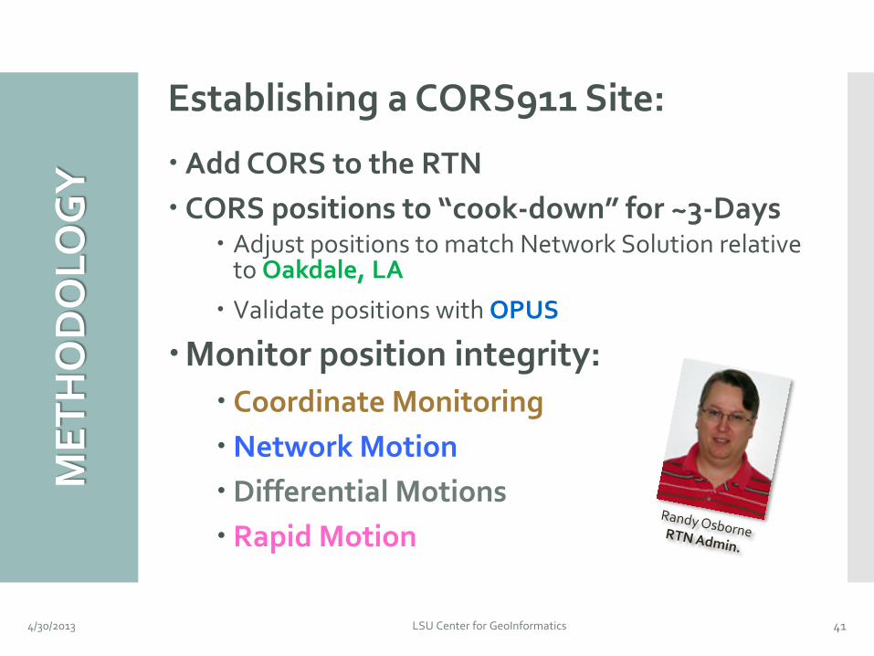
Establishing a CORS911 Site:
Add CORS to the RTN CORS positions to “cook-down” for ~3-Days
Adjust positions to match Network Solution relative to Oakdale, LA
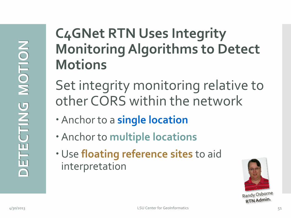
Monitoring Algorithms to Detect Motions Set integrity monitoring relative to other CORS within the network Anchor to a single location
Anchor to multiple locations
Use floating reference sites to aid interpretation
4/30/2013 LSU Center for GeoInformatics 51
4/30/2013 LSU Center for GeoInformatics 52
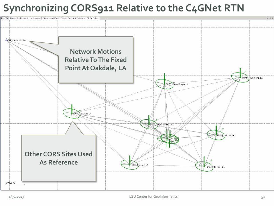
Synchronizing CORS911 Relative to the C4GNet RTN
Network Motions Relative To The Fixed Point At Oakdale, LA
Other CORS Sites Used As Reference
4/30/2013 LSU Center for GeoInformatics 53
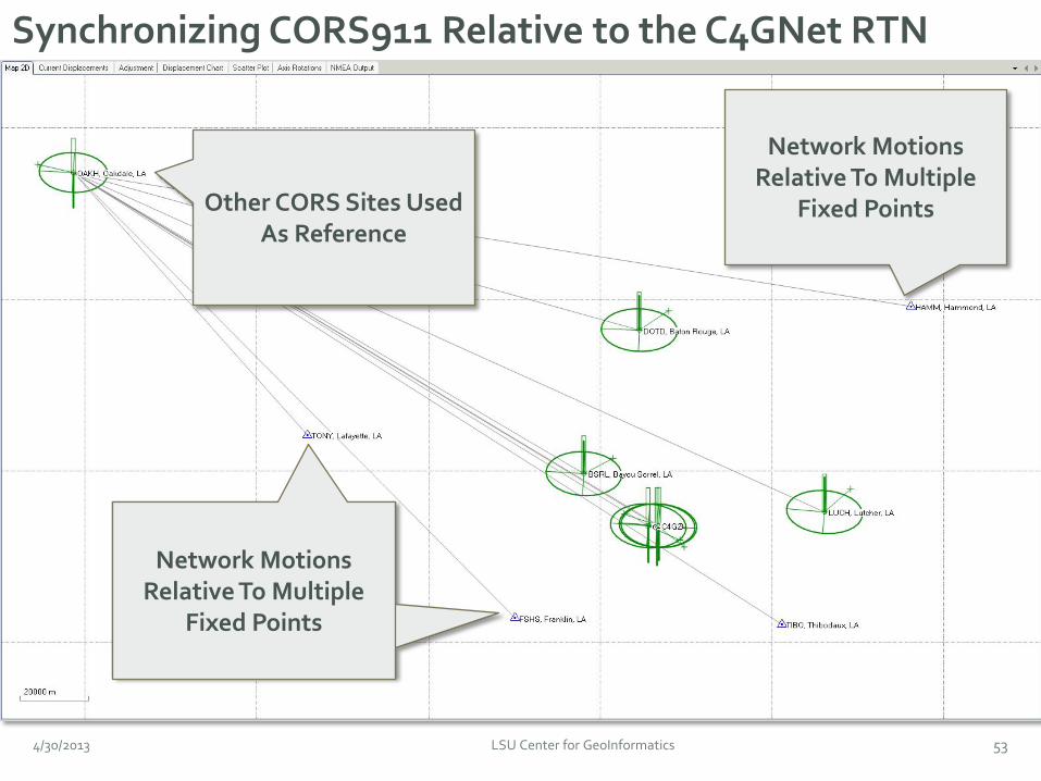
Synchronizing CORS911 Relative to the C4GNet RTN
Other CORS Sites Used As Reference
Network Motions Relative To Multiple
Fixed Points
Network Motions Relative To Multiple
Fixed Points
Network Motions Relative To Multiple
Fixed Points
54
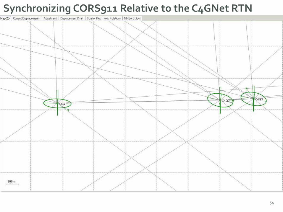
Synchronizing CORS911 Relative to the C4GNet RTN
IMP
LEM
ENTI
NG
AN
A
LER
T S
YTE
M
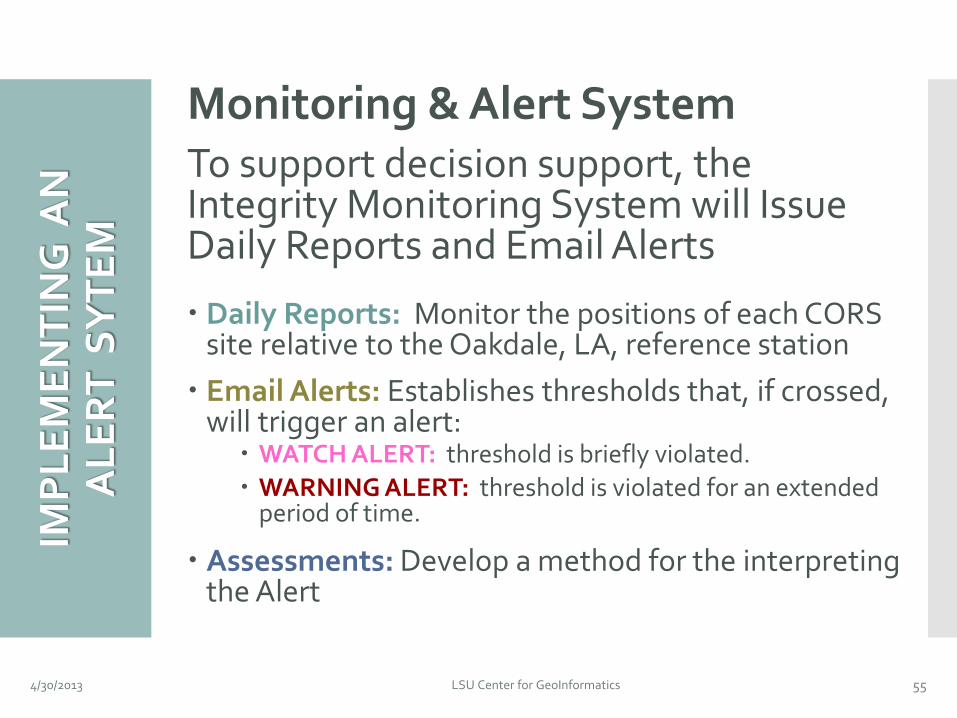
Monitoring & Alert System To support decision support, the Integrity Monitoring System will Issue Daily Reports and Email Alerts
Daily Reports: Monitor the positions of each CORS site relative to the Oakdale, LA, reference station Email Alerts: Establishes thresholds that, if crossed,
will trigger an alert: WATCH ALERT: threshold is briefly violated. WARNING ALERT: threshold is violated for an extended
period of time.
Assessments: Develop a method for the interpreting the Alert
4/30/2013 LSU Center for GeoInformatics 55
INTE
GR
ITY
M
ON
ITO
RIN
G
4/30/2013 LSU Center for GeoInformatics 56
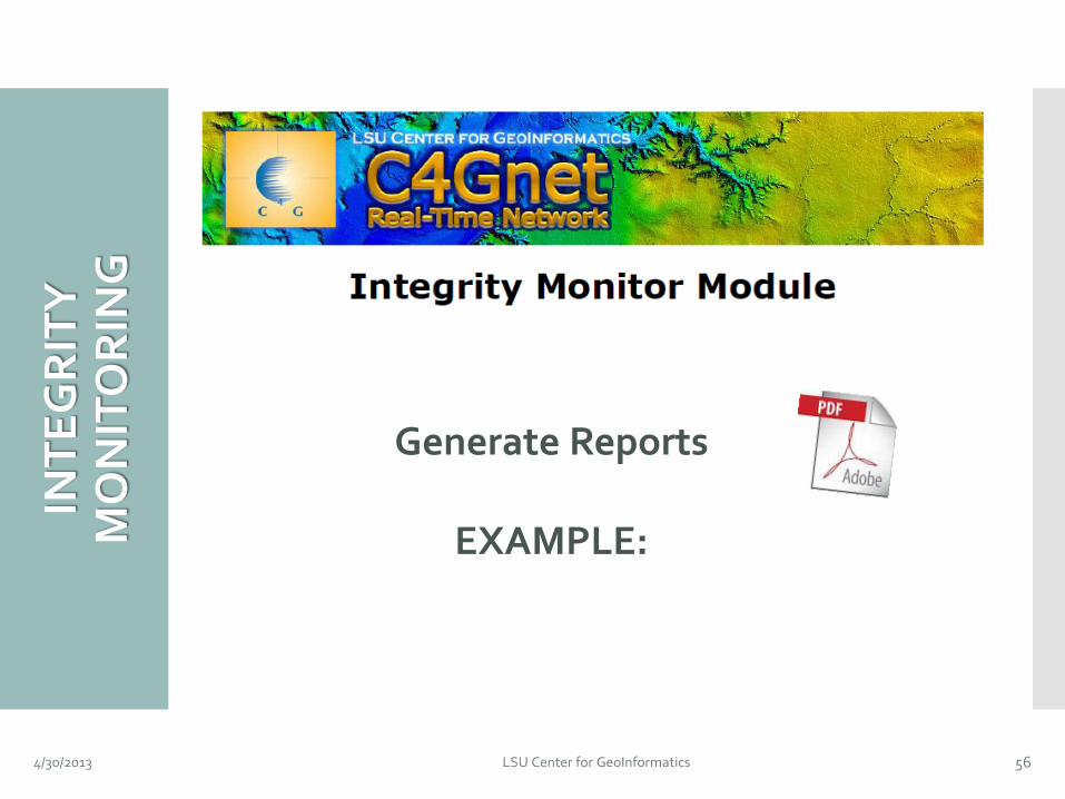
Generate Reports
EXAMPLE:
4/30/2013 LSU Center for GeoInformatics 57
4/30/2013 LSU Center for GeoInformatics 58
4/30/2013 LSU Center for GeoInformatics 59
4/30/2013 LSU Center for GeoInformatics 60
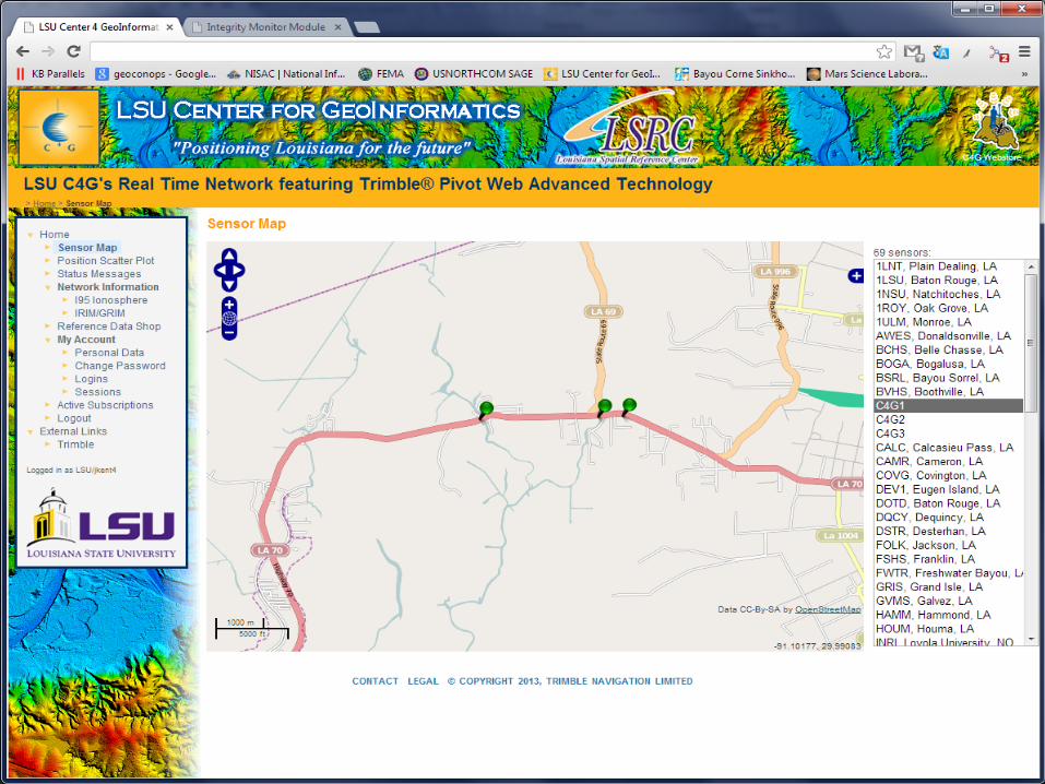
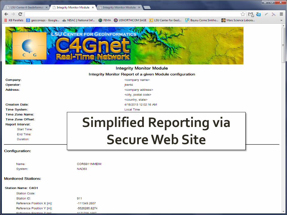
Simplified Reporting via Secure Web Site
EXA
MP
LE
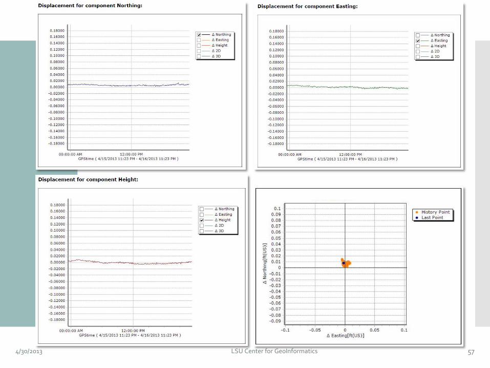
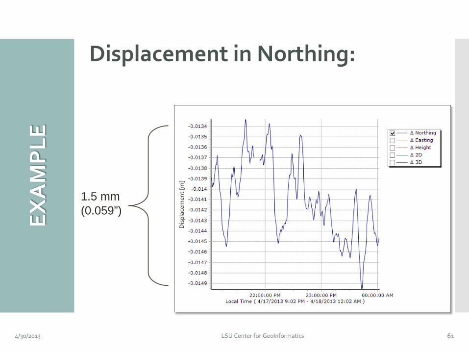
Displacement in Northing:
4/30/2013 LSU Center for GeoInformatics 61
1.5 mm (0.059”)
Dis
plac
emen
t [m
]
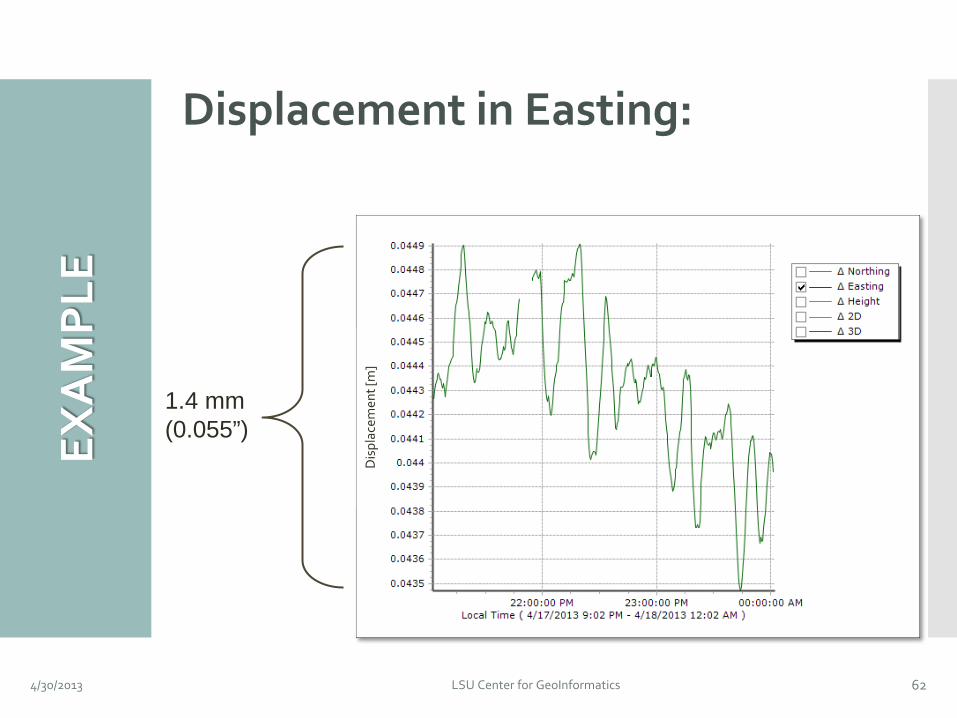
Displacement in Easting:
4/30/2013 LSU Center for GeoInformatics 62
1.4 mm (0.055”)
Dis
plac
emen
t [m
]
EXA
MP
LE
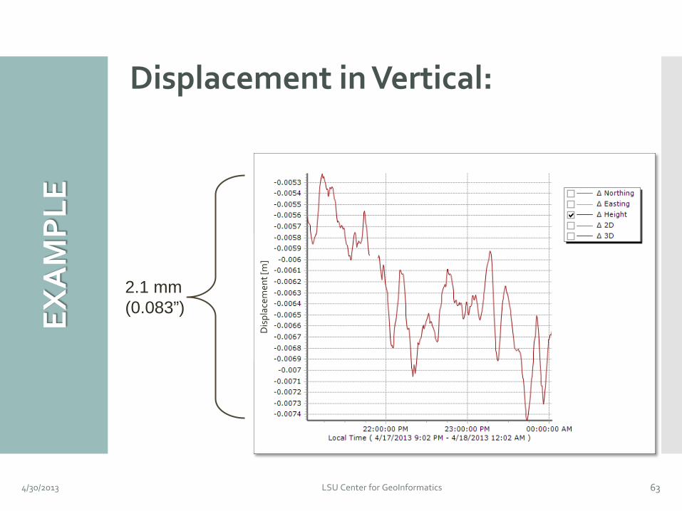
Displacement in Vertical:
4/30/2013 LSU Center for GeoInformatics 63
2.1 mm (0.083”)
Dis
plac
emen
t [m
]
EXA
MP
LE
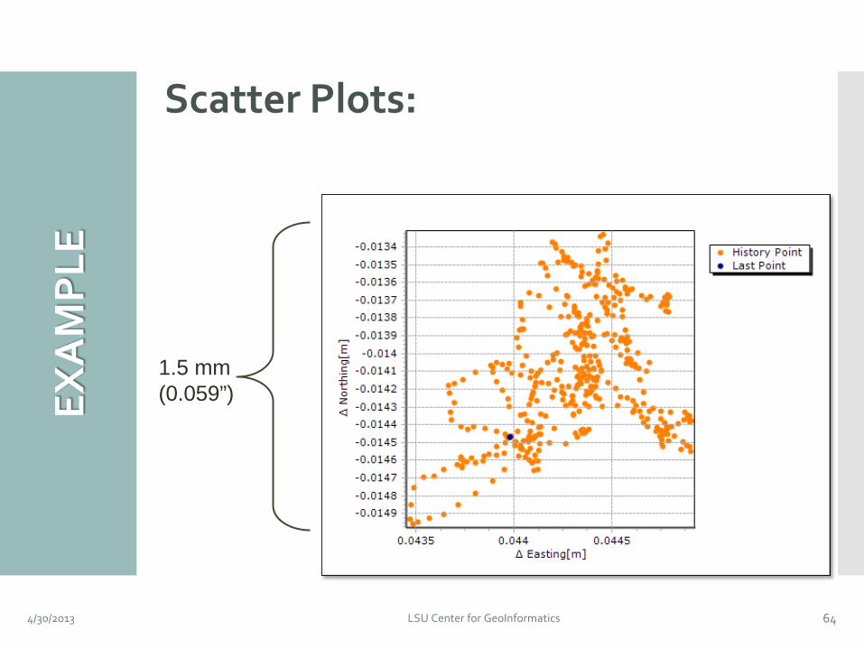
Scatter Plots:
4/30/2013 LSU Center for GeoInformatics 64
1.5 mm (0.059”) EX
AM
PLE
CON
CLU
SIO
NS
Sinkhole in the Napoleonville Salt Dome: Oxy #3 cavern breached the Western wall of
the salt dome.
Unstable material shifted, causing sinkhole to form in the alluvium.
Modeled output will be used to develop a long-term strategies for monitoring in the area.
4/30/2013 LSU Center for GeoInformatics 65
CON
CLU
SIO
NS
Two Advanced Geodetic Monitoring Solutions Implemented by the C4G
Static measurement of horizontal and vertical positions at control points along Hwy 70
Continuous measurement of positions using CORS 911 stations installed along Hwy 70
4/30/2013 LSU Center for GeoInformatics 66
CON
CLU
SIO
NS
The Findings So Far… No discernible movement of Hwy 70 relative
to the sinkhole.
Ad hoc GPS readings exhibit variability associated with random and systematic error.
Long-term occupation using CORS technology was initiated to assess differential motions to provide more reliable measurements.
CORS technologies provides a comprehensive solution with direct access to telemetry in real-time.
4/30/2013 LSU Center for GeoInformatics 67
QU
ESTI
ON
S &
CO
NTA
CT
INFO
Joshua D. Kent, Ph.D. Center for GeoInformatics Louisiana State University Baton Rouge, LA 70803 http://c4g.lsu.edu