34
MUNICIPALIDAD DE GUATEMALA http://www.muniguate.com NAME: PROFILE COUNTRY: GUATEMALA TYPE OF ORGANIZATION: LOCAL GOVERNMENT WEBPAGE:
MUNICIPALIDAD DE GUATEMALA
http://www.muniguate.com
NAME:
PROFILE
COUNTRY:
GUATEMALA TYPE OF ORGANIZATION:
LOCAL GOVERNMENT
WEBPAGE:
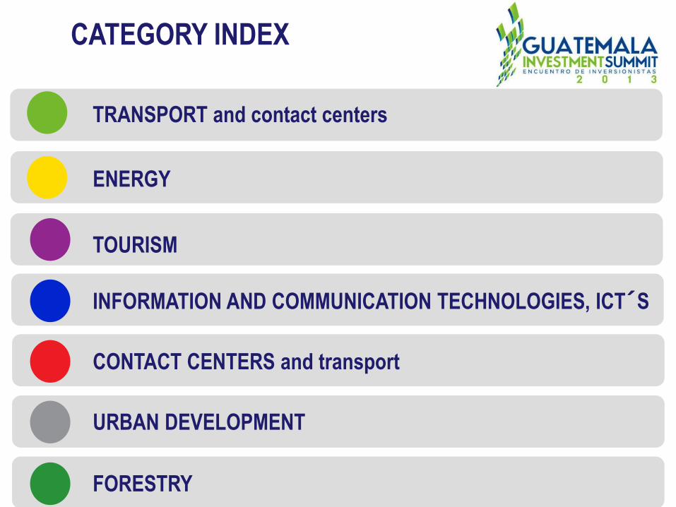
CATEGORY INDEX
TRANSPORT and contact centers
ENERGY
TOURISM
INFORMATION AND COMMUNICATION TECHNOLOGIES, ICT´S
CONTACT CENTERS and transport
URBAN DEVELOPMENT
FORESTRY

Equipamientos urbanos y sociales
Gestión integrada del territorio y vivienda
Vialidad y movilidad urbana
Medio ambiente, gestión de riesgos y cambio climático
Infraestructura y servicios básicos
Sistema de espacios públicos
Fomento Económico
GENERAL SYSTEMS

TRANSPORT
ENERGY
TOURISM
ICT´S
CONTACT CENTERS
URBAN DEVELOPMENT
FORESTRY
+
+
+
+
+
+
+
+
+
+
+
+
+
+
+

PROJECT NAME
GENERAL PROJECT DESCRIPTION
SECTOR Transport and contact centers
PROJECT DEVELOPMENT STATUS
TRANSPORT

PROJECT NAME TRANSPORT
DESCRIPTION OF PROJECT DEVELOPMENT STATUS
TYPE OF PARTNERSHIP
ESTIMATED PROJECT VALUE
NEED FUNDING YES NO
Urban mobilty and contact centers

13 MILLION PEOPLE *Source: Index mundi. Est 2007
Guatemala: location
Guatemala
Guatemala city
60% GDP is generated in the city *SOURCE: Index mundi. Est 2007

32% of daily trips are made in
Ç
using 78% of the road space
68% of daily trips are made in
using 22% of the road space
Guatemala City
1.3 MIO RESIDENTS +2 MIO WORKERS
COMMING FROM SUBURBIAN
GENERATING 3.3MIO
DAILY TRIPS
Anual population growth 3%
Anual vehicle growth 8%

Incomming suburb trips
32%
27%
18% 15%
8%
Atlántico
St. Catarina
Santa Fé Villa Nueva
Mixco
Main city
district
north
south
The central business district
is located in the center of
the city. The main arteries
had reached by 2004 a
point of collapse because of
the high rate of private
vehicle entering from the
suburb everyday. Besides,
the public transport system
was on a uncontrolled
phase.

Land use plan
[ POT ]
That is how, on 2006 the
Municipality started with a
total new land use plan for
the city. This plan was
integrated to a high class
transport system since the
beginning.
The main street (marked on
red) were designed to move
the BRT system.

BRT Masterplan
[ POT ]
[ BRT ] +
The BRT system covers the
main arteries through an
exclusive service,
reinforced with an urban
bus system and bicycle
lanes to cover the complete
demand of the city
movements.

Urban mobility design concept for the new city planning
Underground parking
High quality public space
Bicycle lanes
Mixed land use
BRT Transmetro stations Housing next
Transmetro

start of a new planning: urban mobilty in Guatemal city

Transmetro line Eje Sur
6 of operation (2007) 400milllon users
12.5 KM exclusive bus line78 articulated buses
Main South transfer station-74,000m2 of commercial
space
12 stations 2 intercity transferstations
ESTACIÓN PORTAL PLAZA BARRIOS ESTACIÓN DON BOSCO
ESTACIÓN PORTAL MUNICIPALIDAD ESTACIÓN TREBOL

3 years of operation 60million users
30 SCANIA buses 12 KM exclusive bus line
Prepaid system -SIGA integrated with
Transurbano (urban bus=
Introduction of Braille
ESTACIÓN MONTÚFAR ESTACIÓN IGSS
ESTACIÓN BANCO DE GUATEMALA ESTACIÓN LOS ARCOS
Transmetro Eje Corredor Central
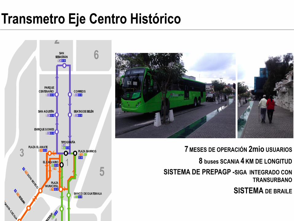
7 MESES DE OPERACIÓN 2mio USUARIOS
8 buses SCANIA 4 KM DE LONGITUD
SISTEMA DE PREPAGP -SIGA INTEGRADO CON
TRANSURBANO
SISTEMA DE BRAILE
SAN MIGUEL PETAPA
AMATITLAN
BARCENAS
VILLA NUEVA
SAN JOSE VILLA NUEVA
CIUDAD PERONIA
PACIFICO
TELÉFONOSBAÑOS PARQUEOS
CENTRA SUR
PLAZA EL AMATE
DON BO
SCO
BOLÍVARSA
NTA
CEC
ILIA
TRÉBOL
MARISCAL
REFORMITA
EL CARM
ENLAS C
HARC
AS
JAVIERMONTE M
ARÍA
PLAZA ESPAÑA
IGSS ZONA 9
SEIS 26
TORRE DEL REFORMADOR
PLAZA DE LA REPÚBLICA
BANCO DE GUATEMALA
LOS ARCOS
PLAZA BARRIOS
SERVICIOS DE ESTACIÓN
Simbología
Servicio Troncal Transmetro
Estaciones
Estación de trasbordo
Facilidades paradiscapacitados
Estaciones
Transporte Extraurbano
Servicios
Baños
Telefono
Parqueo
EL CALVARIO
PLAZAMUNICIPAL
ACUEDU
CTO
MONTÚFAR
TÍVOLI
INDU
STRIA
TERM
INAL
EXPO
SICIÓN
4 GRADO
S SUR
ACCESIBILIDAD
ACCESO CON PASARELA
INFORMACIÓN TAQUILLA GUIAS PARANO VIDENTES
POLICIAMUNICIPALGRADASPASO A NIVEL
ACCESO CON PASO A NIVEL
PASO A NIVEL RAMPA TAQUILLA GUIAS PARANO VIDENTES
POLICIAMUNICIPAL
INFORMACIÓN
EXTRAURBANARUTA CORTA:
BEATAS DE BELÉN
CORREOS
ENRIQUE GOMES
SAN AGUSTÍN
PARQUECENTENARIO
FUERZA AÉREA
SANSEBASTIÁN
PLAZA ARGENTINA
HANGARES
TIPOGRAFÍA
CH
Estaciones
Transmetro Eje Centro Histórico

Detalle horario
Detalle integración rutas urbanas
Transmetro Eje Centro Histórico

…universal access…
Transmetro has impacted for

(-CO2)
High tec bus Euro 4 & 5 Exclusive bus line Integrated transportation system for the city
Transmetro
system reduces
CO2 emissions
along its axes. Environmental
improvement
Transmetro has impacted for

…drive for economic activity around public transport…
Transmetro has impacted for

University conector
2500 viajes diarios
…bikeway integration…
Transmetro has impacted for

…revitalization of public space…
Transmetro has impacted for

Order
Universal acceso
Respect for the
elderly and mothers
Social integration
Citizen service
…civic responsability… Transmetro has impacted for

potential investment for: urban mobilty and contact centers

BRT SYSTEM
Integrated network of mobility
INTEGRATED TRANSFER STATION
UNIVERSAL ACCESS
CONTACT CENTERS
BIKE LANE
INTECITY TRANSFER STATION

275K PAX/DAY
260K PAX/DIA
170K PAX/DIA
70K PAX/DIA
+10K PAX/DIA
65K PAX/DAY
80K PAX/DIA
240K PAX/DIA
• Projection based on actual daily users of public transport
50K PAX/DIA
20K PAX/DAY
2million pedestrian
10K potential cyclists
Daily trips for BRT, Bike and Pedestrian
• Actual movement
+20K PAX/DIA

Potential investment points
Transmetro stations and contact center
Transfer stations– contact centers
Bike system PPP
Existing Transmetro
north
south

275K PAX/DAY
260K PAX/DIA
170K PAX/DIA
70K PAX/DIA
+10K PAX/DIA
65K PAX/DAY
80K PAX/DIA
240K PAX/DIA
• Projection based on actual daily users of public transport
50K PAX/DIA
20K PAX/DAY
2million pedestrian
10K potential cyclists
Daily trips for BRT, Bike and Pedestrian
• Actual movement
+20K PAX/DIA

…connect with Transmetro and other public transport system…
Transferstations to enter the city

Eje Transmetro
Transfer stantiosn
Red Ciclovía PPP
Ejes existente
To enter the city
Main transfer stations
Control of the conections and transfer of the public transport use into the city
Construction cost from a similar project for Transmetro: $400-$500m2/construction (exchange rate $1- Q.7.9)

Eje Transmetro
Transfer stantions
Red Ciclovía PPP
Ejes existente
Intercity transfer
Transfer station B
Connectivity control between different urban transport system in the city
Construction cost from a similar project for Transmetro: $350 - $480 m2/construction (exchange rate $1- Q.7.9) Source: Contrato de donación onerosa nr.343, año 2006. Municipalidad de Guatemala.

Transmetro Centro Histórico
Intercity transfer
Transfer station C

Transmetro stations – contact center
Transfer – contact centers
Bike system PPP
Existing Transmetro
Potential investment points
Current investment schemes
• Private public
partnership
through onerous
donations
• Usufruct in
exchange for
commercial use


