COUNTY OF PLACER Community Development Resource Agency John Marin, Agency Director PLANNING Michael J. Johnson, AICP Planning Director TO: .Honorable Board of Supervisors FROM: Michael 1. Johnson, Planning Director DATE: April 29, 2008 SUBJECT: REQUEST TO APPROVE AMENDED BOUNDARIES FOR AGRICULTURAL PRESERVE 511 AND AGRICULTURAL PRESERVE 512 TO FACILITATE A MINOR BOUNDARY RESOLUTION - JOHN WILSON (PAGP 20080018) ACTION REQUESTED: The Board of Supervisors is being asked to approve resolutions to amend the boundaries of Agricultural Preserve 511 and Agricultural Preserve 512, and to rescind the contract for each Preserve in favor of execution of amended contracts reflecting revised Preserve boundaries. Approval of this request would allow the Parcel Review Committee to approve a Minor Boundary Line Adjustment between the Preserves, for which the applicant has made a concurrent application request. No contracted land would be taken out of contract. BACKGROUND: Project Description The boundary line adjustment would result in the transfer of 20 acres of land from the Alltucker Preserve to the Wilson Preserve in order to accommodate the distribution of family assets. The Alltucker Agricultural Preserve is located on the south side of Fruitvale Road and comprises 192 acres. The Wilson Agricultural Preserve is located on the north side of Fruitvale Road and comprises 70 acres. Each Preserve would be amended to 172 acres and 90 acres, respectively. No new parcels would be created. ANALYSIS: Consistency with the California Land Conservation Act Placer County Administrative Rules for Williamson Act Lands require that boundary line adjustments for contracted lands that would result in a reduction in area of any parcel subject to a land conservation contract shall not be approved unless the reduced area would maintain the minimum parcel size required by zoning and would not reduce the parcel size below the minimum area required to qualify as an Agricultural Preserve, which is 40 acres in the case of non-prime agricultural lands such as these. The applicants would also be required to execute new contracts for each Preserve with an unexpired ten year term. 1
Transcript
COUNTY OF PLACERCommunity Development Resource Agency
John Marin, Agency Director PLANNING
Michael J. Johnson, AICPPlanning Director
TO: .Honorable Board ofSupervisors
FROM: Michael 1. Johnson, Planning Director
DATE: April 29, 2008
SUBJECT: REQUEST TO APPROVE AMENDED BOUNDARIES FORAGRICULTURAL PRESERVE 511 AND AGRICULTURALPRESERVE 512 TO FACILITATE A MINOR BOUNDARYRESOLUTION - JOHN WILSON (PAGP 20080018)
ACTION REQUESTED:The Board of Supervisors is being asked to approve resolutions to amend the boundaries ofAgricultural Preserve 511 and Agricultural Preserve 512, and to rescind the contract for eachPreserve in favor of execution of amended contracts reflecting revised Preserve boundaries.Approval of this request would allow the Parcel Review Committee to approve a MinorBoundary Line Adjustment between the Preserves, for which the applicant has made aconcurrent application request. No contracted land would be taken out of contract.
BACKGROUND:Project DescriptionThe boundary line adjustment would result in the transfer of 20 acres of land from the AlltuckerPreserve to the Wilson Preserve in order to accommodate the distribution of family assets. TheAlltucker Agricultural Preserve is located on the south side of Fruitvale Road and comprises 192acres. The Wilson Agricultural Preserve is located on the north side of Fruitvale Road andcomprises 70 acres. Each Preserve would be amended to 172 acres and 90 acres, respectively.No new parcels would be created.
ANALYSIS:Consistency with the California Land Conservation ActPlacer County Administrative Rules for Williamson Act Lands require that boundary lineadjustments for contracted lands that would result in a reduction in area of any parcel subject to aland conservation contract shall not be approved unless the reduced area would maintain theminimum parcel size required by zoning and would not reduce the parcel size below theminimum area required to qualify as an Agricultural Preserve, which is 40 acres in the case ofnon-prime agricultural lands such as these. The applicants would also be required to executenew contracts for each Preserve with an unexpired ten year term.
1
Staff has determined that the requested amendments are consistent with these requirementsbecause the parcel enrolled in Agricultural Preserve 512 would be reduced from 192 acres to 172acres, because Agricultural Preserve 511 would be enlarged from 70 acres to 90 acres, andbecause the applicants have agreed to execute amended contracts with an unexpired ten-yearterm.
Agricultural Commission Hearing on Proposed Agricultural PreserveOn March 10, 2008, Planning staff presented information on the requested amendments to theAgricultural Commission. The Agricultural Commission concurred with staff's analysis of therequest and unanimously approved a motion (8 to 0 with Commissioner Beard absent) torecommend that the Board of Supervisors approve the requested Preserve and contractamendments.
General Plan ConsistencyThe proposed amendments to Agricultural Preserve 511 and Agricultural Preserve 512 areconsistent with goals and policies of the of the Placer County General Plan because agriculturalland would not be removed from agricultural production, the total area of land enrolled in theWilliamson Act would not be reduced, and neither property would be reduced below Countyzoning requirements or minimum Preserve area requirements of the California LandConservation Act.
Fiscal ImpactThe Assessor's Office has determined that this proposal would have no net fiscal impact.
CONCLUSIONStaff has attached two contracts and two resolutions that, if executed, would rescind contracts forAgricultural Preserve APG-511 and Agricultural Preserve APG-512 in favor of approval of revisedboundaries for each Preserve and execution of amended contracts. The resultant contracts reflectthe property owner's application submittal and have been determined by the AgriculturalCommission to be consistent with the provisions of the California Land Conservation Act andPlacer County requirements for amendment of contracts enrolled in the County's Williamson ActProgram. Staff has prepared Findings of Fact for approval of amendments to the AgriculturalPreserves, execution ofamended contracts for each Preserve, and for a Categorical Exemption fromCEQA.
RECOMMENDATION:Staffrecommends that the Board take the following action:
1. Adopt the Finding in Support of the determination that reSCISSIOn of contracts forAgricultural Preserve 511 and Agricultural Preserve 512 in order to amend the boundaries ofeach Preserve and execute amended contracts is Categorically Exempt from environmentalreview pursuant to Section 15317 of the California Environmental Quality. Act and Class 17,Section 18.36.190 of the Placer County Environmental Review Ordinance (Open spacecontracts or easements).
2. Find that the amendment of Agricultural Preserve 511 and Agricultural Preserve 512 isconsistent with the Placer County General Plan.
3. Find that the amendment of Agricultural Preserve 511 and Agricultural Preserve 512 isconsistent with the requirements of the California Land Conservation Act and the PlacerCounty Administrative Rules for Williamson Act Lands.
4. Approve and authorize the Chair to sign the attached resolutions to rescind contracts forAgricultural Preserve 511 and Agricultural Preserve 512 and execute the attached amendedcontracts for each Preserve.
•MICRA L J. JOHNSON, AICPDirector f Planning
Attached 0 this report for the Board's information/consideration are:
Finding in Support of Categorical Exemption from CEQA andFindings ofFact in Support of rescission ofcontracts for AgriculturalPreserve 511 and Agricultural Preserve 512, amendment of theboundaries of each Preserve, and execution ofnew contractsResolution and Contract amending AGP 511Resolution and Contract amending AGP 512Agricultural Commissioner's Memo dated March 19,2008Vicinity MapExhibit ofResultant Parcels
cc: Christine Turner, Agricultural CommissionerBruce Dear, County AssessorLoren Clark, Director ofNatural Resources and Special ProjectsJohn Wilson, Property OwnerDavid and Catherine Alltucker, Property Owner
O:\PLUS\PLN\ALEX\CLCA\Wilson\PAGP 20080018 - Wilson SR.doc
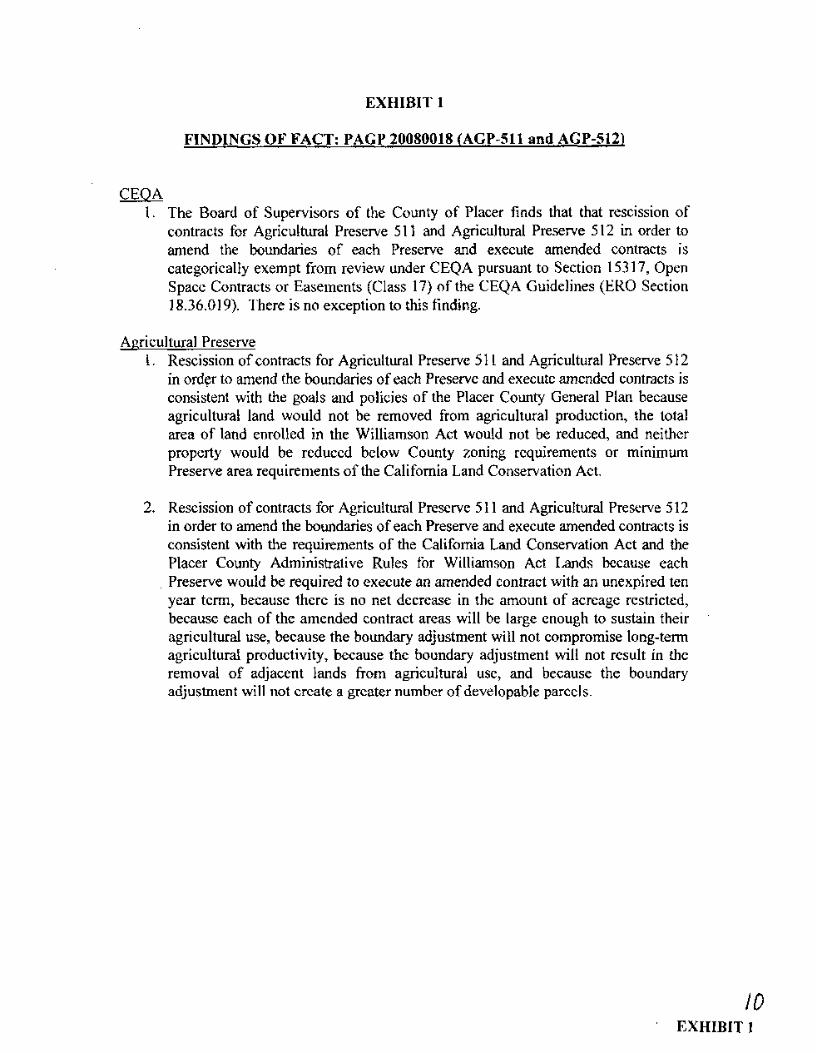
EXHIBIT 1
FINDINGS OF FACT: PAGP 20080018 (AGP-511 and AGP-512)
CEQA1. The Board of Supervisors of the County of Placer finds that that rescission of
contracts for Agricultural Preserve 511 and Agricultural Preserve 512 in order toamend the boundaries of each Preserve and execute amended contracts iscategorically exempt from review under CEQA pursuant to Section 15317, OpenSpace Contracts or Easements (Class 17) of the CEQA Guidelines (ERO Section18.36.019). There is no exception to this finding.
Agricultural Preserve1. Rescission of contracts for Agricultural Preserve 511 and Agricultural Preserve 512
in ord~r to amend the boundaries ofeach Preserve and execute amended contracts isconsistent with the goals and policies of the Placer County General Plan becauseagricultural land would not be removed from agricultural production, the totalarea of land enrolled in the Williamson Act would not be reduced, and neitherproperty would be reduced below County zoning requirements or minimumPreserve area requirements of the California Land Conservation Act.
2. Rescission of contracts for Agricultural Preserve 511 and Agricultural Preserve 512in order to amend the boundaries of each Preserve and execute amended contracts isconsistent with the requirements of the California Land Conservation Act and thePlacer County Administrative Rules for Williamson Act Lands because each
. Preserve would be required to execute an amended contract with an unexpired tenyear term, because there is no net decrease in the amount of acreage restricted,because each of the amended contract areas will be large enough to sustain theiragricultural use, because the boundary adjustment will not compromise long-termagricultural productivity, because the boundary adjustment will not result in theremoval of adjacent lands from agricultural use, and because the boundaryadjustment will not create a greater number ofdevelopable parcels.
10EXHIBIT 1
Before the Board of SupervisorsCounty of Placer, State of California
In the matter of:A RESOLUTION AMENDINGAGRICULTURAL PRESERVE AGP-511
Resolution No.: _FIRST READING: _
The following Resolution was duly passed by the Board of Supervisors of the County of
Placer at a regular meeting held , by the following vote on roll
call:
Ayes:
Noes:
Absent:
Signed and approved by me after its passage.
Attest:Clerk of said Board
Ann Holman
Chairman, Board of Supervisors
Jim Holmes
BE IT RESOLVED BY THE BOARD OF SUPERVISORS OF THE COUNTY OF PLACER,STATE OF CALIFORNIA, AS FOLLOWS:
WHEREAS, pursuant to the provisions of Govemment Code Section 51200, et seq., theboundaries of AgricLiltural Preserve 511 are hereby amended, and the contract forAgricultural Preserve 511 is hereby rescinded in favor of execution of an amendedcontract on that real property described in the Land Conservation Agreement attachedhereto and incorporated herein by reference and illustrated on that map attached as anexhibit thereto.
NOW, THEREFORE, be it resolved that the Chairman be authorized to sign saidAgreement.
EXHIBIT 2 JI
RECORDED BY COUNTY OF PLACER
Return to:Placer County Planning DepartmentPlanning Commission Clerk3091 County Center DriveAuburn, CA 95603
LAND CONSERVATION AGREEMENT - AGP 511 (AMENDED)
THIS AGREEMENT, made and entered into this 29th day of April, 2008, by and between JOHNWILSON, hereinafter called "OWNER" and the COUNTY OF PLACER, hereinafter called "COUNTY".
WITNESSETH:
WHEREAS, OWNER possesses certain real property, located within Placer County, as described andshown in Exhibit "A", attached hereto, which is devoted to the production of agricultural commodities 'forcommercial purposes, and which is located within an Agricultural Preserve previously established; and
WHEREAS, both OWNER and COUNTY desire to limit the use of said property to agricultural purposesin order to discourage premature and unnecessary conversion of such land to urban use, recognizing thatsuch land has substantial public value as open space and that the' preservation of such land in agriculturalproduction constitutes an important physical, social, aesthetic, and economic asset to COUNTY, and bothparties having determined that the highest and best use of such land, during the life of this contract, is foragricultural purposes.
NOW, THEREFORE, the parties, in consideration of the mutual covenants and conditions set forthherein, and the substantial public benefits to be derived therefrom, do a~ree as follows:
1. Authority: This Agreement is made under authority of the Land Conservation Act of1965, Government Code Section 51200 et seq. (The Act). This Agreement amends andsupersedes prior Contract AGP 512, entered into on December 10, 1990, to includeamended Preserve boundaries as shown in Exhibit "A", attached hereto and made a part ofthis record.
2. Limitation on Land Use: During the term of this Agreement, the above-described landshall only be used for the production of plant and animal products for commercialpurposes.
No structures shall be erected upon such land except those directly related to, andcompatible with, production of plant and animal products for commercial purposes, andexcept those residence buildings for such individuals as are engaged in the care, use,operation, or management of said land. Compatible land use shall include, but not belimited to:
A. . Public Utilities: Electric, gas, water, sewer, oil, and communication lines, bothoverhead and underground.
1 fa.
B. Communication equipment buildings and distribution substations.
C. Public Utility substations and service yards.
No division of said land shall be made, except in accordance with COUNTY Ordinancesas from time to time amended.
3. Eminent Domain: When any permissible action in Eminent Domain, for thecondemnation of the fee title of the land under Agreement is filed, or when such land isacquired in lieu of Eminent Domain for a public improvement, by a public agency orperson, the following rules shall apply:
A. If the taking is of the entire acreage, this Agreement shall be null and void as of thedate the action is filed and, thereafter, the contract shall not be binding on anyparty to it.
B. If the taking is of a portion of the entire acreage, this Agreement shall be null-andvoid as to the acreage so taken as of the date the action is filed, and, thereafter, thecontract shall not be binding on any party to it as to such acreage taken.· If, aftersuch taking, the remaining land qualifies for an Agreement under COUNTY'Scriteria, this Agreement shall continue as to such remaining acreage; if it does notqualify, then this Agreement to be null-and-void as to such remaining acreage.
As to such taking, OWNER shall be entitled to compensation for such land as hewould have received if this Agreement had never been executed. OWNER .shallnot be subject to any penalty for termination of the Agreement as hereinaboveprovided.
4. Length of Agreement: This Agreement shall be effective commencing onJanuary 1, 2009, and shall remain ineffect for a period of ten (10) years therefrom, exceptas provided by Paragraph 5 and 6 thereof.
5. Renewal: This Agreement shall be automatically renewed on the first day of January ofeach year, for a period of ten (10) years from the date of said renewal, unless writtennotice of Non-Renewal is given by COUNTY within 60 days of the renewal or byOWNER within 90 days of the renewal date. If notice of Non-Renewal is given asprovided above, this Agreement shall then expire automatically nine (9) years fromJanuary 1st following such notice of Non-Renewal. There is no penalty attached to anynotice of Non-Renewal.
6. Cancellation: This Agreement may be canceled by mutual agreement of all parties to thisAgreement if:
A. COUNTY holds a public hearing on the matter after mailing notice to each andevery OWNER of property under contract or agreement within the agriculturalpreserve in which the agreement property is located, and after publishing notice of
2
such hearing, as specified in Government Code Section 6061; and
B. ~t or before such hearing, less than 51 % of the contracted or agreement acreage insuch preserve protest such cancellation.
It is the intention of the parties hereto that cancellation will not be requested by OWNER, and willnot be approved by COUNTY, except on a clear showing, to the COUNTY'S exclusive judgmentand satisfaction that there has occurred a change of circumstances beyond the control of OWNERand his successors in interest, and that such change would clearly promote the public welfare.
The existence of an opportunity for another use of the land shall not be sufficient reason forcancellation. A potential alternative use of the land may be considered only if there is noproximate land, not subject to a Land Conservation Act Contract or Agreement, suitable for theuse to which it is proposed the subject land be put. The uneconomic character of the existingagricultural use shall not be sufficient reason for cancellation. The uneconomic character of theexisting use may be considered only if there is no other reasonable or comparable agricultural useto which the land may be put.
The cancellation fee shall be 12Yz% of the full market value of the land, when relieved of therestriction, as found by the Assessor. The determination of umestricted value may be made thesubject of an Equalization Hearing.
If, in the COUNTY'S judgment, there has occurred a change of circumstances, beyond the controlof the OWNER or his successors in interest, COUNTY may waive all or part of the penalty, if theWaiver is subject to these findings by the COUNTY:
If the Board of Supervisors finds that it is in the public interest to do so, the Board maywaive any payment or any portion of a payment by the landowner, or may extend thetime for making the payment or a portion of the payment contingent upon the future usemade of the land and its economic return to the landowner for a period of time not toexceed the unexpired period of the contract, had it not been canceled, if all of thefollowing occur:
(l) The cancellation is caused by an involuntary transfer or change in the use whichmay be made of the land and the land is not immediately suitable, nor will beimmediately used, for a purpose which produces a greater economic return to the owner.
(2) The Board has determined that it is in the best interests of the program to conserveagricultural land use that the payment be either deferred or is not required.
(3) The waiver or extension of time is approved by the Secretary of the ResourcesAgency. The Secretary shall approve a waiver or extension of time ifthe secretary findsthat the granting of the waiver or extension of time by the Board of Supervisors isconsistent with the policies of this chapter and that the Board complied with this article.In evaluating a request for a waiver or extension of time, the Secretary shall review thefindings of the Board, the evidence in the record of the Board, and any other evidencethe Secretary may receive concerning the cancellation, waiver, or extension of time.
7. Amendment: It is the intention of the parties hereto that this Agreement will not beamended, except on a clear showing, to the COUNTY'S exclusive judgment and
3 J4
satisfaction, that amendment of this Agreement would be consistent with the COUNTY'Sadministrative rules and The Act, and that any such amendment would clearly promoteagricultural and open space uses.
8. Assessor's Report: The COUNTY'S Assessor shall annually, during the continuation ofthis Agreement, report to the OWNER and to the COUNTY'S Board of Supervisors theequalized, unrestricted assessed value.
9. Pavment: OWNER shall not receive any payment from COUNTY in consideration of theobligations imposed hereunder, it being recognized and agreed that the consideration forthe execution of the within agreement is the substantial public benefit to be derivedtherefrom, and the advantage which might accrue to OWNER as the result of possiblereduction in the assessed value of said property, due to the imposition of the limitations onits use· contained herein, as such factors are relevant to appraising and assessing standardsunder the California Constitution and California Revenue and Taxation Code 402.1, andall amendments thereto, and all other relevant sections therein.
10. Running with Land: This Agreement shall run with the land described above and shall bebinding upon the heirs, successors, and assigns of the parties hereto.
11. Constitutionality: If the Land Conservation Act of 1965, contained in Government CodeSections 51200, et. seq., be declared to be unconstitutional by a Final Judgment of a Courtof the State of California, or the Federal Government, then this Agreement shall be nulland-void.
12. Transfer of Contract: If OWNER enters into a Contract, pursuant to Government CodeSection 51240, on all or any portion of land covered under this Agreement, thisAgreement shall then terminate as to such land covered by such Contract. There shall beno cost or penalty to OWNER for the termination of this Agreement as to such contractedlands.
13. Compatible Uses: As used in this Agreement, the term "Compatible Uses" includes, but isnot limited to the following:
(1) The cultivation of ground, including the preparation of soil, planting or seeding,and the raising and harvesting of trees, timber, fruits, vegetables, flowers, grains,and other stock crops; the raising, feeding, managing and breeding of livestock,poultry, fish, birds, and other animals; greenhouses; the excavation of earth, andthe drilling of wells exclusively for agricultural and domestic uses; single familydwellings for persons who labor full-time on such land, together with barns,corrals, and other outbuildings and structures accessory to the foregoing. The saleon the premises of products produced hereon. The operation of private clubs forhunting and fishing. The packing, storing, and processing of products grown onthe land, together with accessory buildings and structures required therefor.Commercial raising, feeding, managing, breeding, and sale on the premises of fish.
(2) With a valid Land Development Permit issued under the COUNTY Zoning Laws:
4
Stands and other facilities, for the purpose of selling products produced on theland, together with accessory picnic facilities; sales of agricultural productsproduced off the premises, provided that the sale of such products is incidental andsecondary to the sale of agricultural products produced on the premises; noncommercial airstrips, for the use of aircraft used for agricultural purposes, togetherwith accessory buildings and structures required therefor, feeding lots, oil wells,gas wells, mining, seasonal housing for farm labor.
14. All determinations as to whether a use is a compatible use shall be made by the hearingbody with the authority to render a written determination on the propose se, following arecommendation by the Agricultural Comrpission. ': /) /' .. /
{ / ." "IV;('/ /-OWNERS:~ .' . ,'i' /
/~ /
U(Attach Acknowledgementfor each signature)
COUNTY OF PLACER
By:Chairman, Board of Supervisors
CERTIFICATION
The foregoing Instrument is a correct copy of the original on file in this Office.
DATED: ATTEST:----------
Clerk of the Board of Supervisors of the County of Placer, State of California
By:Clerk of the Board
(Attach EXHIBIT "A")
5
CALIFORNIA ALL PURPOSE ACKNOWLEDGMENT
State of California
County of pe.- !tC e(l
) .
)ss.
On 11-(71- & Y before me,~ON ~A,RRINGER, Notary Public, personallyappeared J () ) Jt/ W / ,,'-)l>A/ . ,whoproved to me on the basis of satis actory evidence to be theperson(s) whose name(s)is/are subscribed to the within instrument and acknowledged to me that he/she/theyexecuted the same in his/her/their authorized capacity(ies), and that by his/her/theirsignature(s) on the instrument the person(s), or the entity upon behalf of which theperson(s) acted, executed the instrument.
I certify under PENALTY OF PERJURY under the laws of the State of California that theforegoing paragraph is true and correct. WITNESS my hand and official seal.
Geil Engineering Inc1226 High Street - Auburn. CA 95603·5015Phone (530) 885-0426 Fax (530) 823-1309
JOHN WILSONRESULTANT PARCEL
Parcel One
A portion of the Southwest quarter of Section 5, Township 12 North, Range 7 East, M.D.M..in the unincorporated area of Placer County, California.
Beginning at the Southwest corner of said Section 5 and running thence along the Westline thereof North 1°09' 52" East 26.14 feet to a point on the centerline of Fruitvale Road, acounty rood; thence along said centerline on the following three (3) consecutive courses:(1) along the arc of a curve to the left having a radius of 600 feet, a central angle of8°09'31" and a chord of North 67°53'43" East 85.35 feet to a point of reverse curvature, (2)along the arc of a curve to the right having a radius of 500 feet, a central angle of22°55'32" and a chord of North 75°16'44" East 198.73 feet and (3) North 86°44'30" East657.08 feet; thence, leaving said centerline. South 1°32' West 115.26 feet to a point on theSouth line of the aforementioned Section 5; thence along said South line South 88°05'15"West 925.28 feet to the point of beginning.
Parcel Two
A portion of the Northwest quarter of Section 8, and a portion of the Northeast quarter ofSection 7, all in Township 12 North, Range 7 East, MoO.M.. in the unincorporated area ofPlacer County, California.
Beginning at the Northwest corner of said Section 8 and running thence along the Northline thereof North 88°05' 15" East 925.28 feet; thence South 1°32' West 665.12 feet; thenceSouth 89°45' West 1.196.78 feet; thence due North 637.92 feet to a point on the North lineof the aforementioned Section 7; thence along said North line of Section 7 North 89°44'31"East 290.00 feet to the point of beginning.
Parcel Three
A portion of the Southwest quarter of Section 5. Township 12 North. Range 7 East, M.D.M.,in the unincorporated area of Placer County, California.
All that portion of the West half of the Southwest quarter of said Section 5 lying Northerly ofFruitvale Road excepting the following described parcel: Beginning at a point on theWest line of said Section 5 from which the Southwest corner thereof bears South 1°09'52"West 110.00 feet; thence along said section line North 1°09'52" East 396.00 feet; thence,parallel with the South line of said Section 5 North 88°05'15" East 550.00 feet; thence,parallel with the West line of said Section 5 South 1°09'52" West 396.00 feet; thence.parallel with the South line of said Section 5 South 88°05'15" West 550.00 feet to the pointof beginning.
J¥
Geil Engineering Inc1226 High street . Auburn. CA 95603·5015Phone (530) 885·0426 Fax (530) 823·1309
September 19, 2007
WILSON FAMILY TRUST TO JOHN WILSONTRANSFER PARCEL
Parcel One
A portion of the Southwest quarter of Section 5, Township 12 North, Range 7 East. M.D.M.,in the unincorporated area of Placer County, California.
Beginning at the Southwest corner of said Section 5 and running thence along the Westline thereof North 1°09' 52" East 26.14 feet to a point on the centerline of Fruitvale Road, acounty road; thence along said centerline on the following three (3) consecutive courses:(1) along the arc of a curve to the left having a radius of 600 feet. a central angle of8°09'31" and a chord of North 67°53'43" East 85.35 feet to a point of reverse curvature, (2)along the are of a curve to the right having a radius of 500 feet, a central angle of22°55'32" and a chord of North 75°16'44" East 198.73 feet and (3) North 86°44'30" East657.08 feet; thence, leaving said centerline, South 1°32' West 115.26 feet to a point on theSouth line of the aforementioned Section 5; thence along said South line South 88°05' 15"West 925.28 feet to the point of beginning.
Parcel Two
A portion of the Northwest quarter of Section 8, and a portion of the Northeast quarter ofSection 7, all in Township 12 North, Range 7 East. M.D.M., in the unincorporated area ofPlacer County, California.
Beginning at the Northwest corner of said Section 8 and running thence along the Northline thereof North 88°05' 15" East 925.28 feet; thence South 1°32' West 665.12 feet; thenceSouth 89°45' West 1,196.78 feet; thence due North 637.92 feet to a point on the North lineof the aforementioned Section 7; thence along said North line of Section 7 North 89°44'31"East 290.00 feet to the point of beginning.
Iq
Geil Engineering Inc1226 High Street· Auburn, CA 95603-5015Phone (530) 885-0426 Fax (530) 823-1309
September 19, 2007
WILSON FAMILY TRUSTRESULTANT PARCEL
A portion of the Northwest quarter of Section 8, and a portion of the Northeast quarter ofSection 7, all in Township 12 North, Range 7 East. M.D.M., in the unincorporated area ofPlacer County, California.
The North half of the Northeast quarter of said Section 7 and the Northwest quarter of saidSection 8, excepting the Southerly 550 feet thereof.
Excepting therefrom the following described parcel:
A portion of the Northwest quarter of Section 8, and a portion of the Northeast quarter ofSection 7, all in Township 12 North, Range 7 East. M.D.M., in the unincorporated area ofPlacer County, California.
Beginning at the Northwest corner of said Section 8 and running thence along the Northline thereof North 88°05' 15" East 925.28 feet; thence South 1°32' West 665.12 feet; thenceSouth 89°45' West 1,196.78 feet; thence due North 637.92 feet to a point on the North lineof the aforementioned Section 7; thence along said North line of Section 7 North 89°44/31"East 290.00 feet to the point of beginning.
IN THE UNINCORPORATED TERRITORY OF THE COUNTY OFPLACER, STATE OF CAUFORNIA, BEING A PORTION OF
SECTIONS 5, 7, & 8, TOWNSHIP 12 NORTH, RANGE 7 EAST,M.D.B. & M.
EXHIBIT B-1RESULTANT PARCELS
I
I
-----+-
Jio 500 1000 2000 3000
-~~ !
+
GEIL ENGINEERING1226 HIGH STRU,I
AL:BL:R\. CALlFOf\\IA 9S603i5JO! EE5-0426
-l
PLACER COUNTY, CALIFORNIA
SCALE 1" = 1000' AUGUST, 2007
SHEET :I OF :I
Before the Board of SupervisorsCounty of Placer, State of California
In the matter of:A RESOLUTION AMENDINGAGRICULTURAL PRESERVE AGP-512
Resolution No.:-----FIRST READING: _
The following Resolution was duly passed by the Board of Supervisors of the County of
Placer at a regular meeting held , by the following vote on roll call:
Ayes:
Noes:
Absent:
Signed and approved by me after its passage.
Attest:Clerk of said Board
Ann Holman
Chairman, Board of Supervisors
Jim Holmes
BE IT RESOLVED BY THE BOARD OF SUPERVISORS OF THE COUNTY OF PLACER,STATE OF CALIFORNIA, AS FOLLOWS:
WHEREAS, pursuant to the provisions of Government Code Section 51200, et seq., theboundaries of Agricultural Preserve 512 are hereby amended, and the contract forAgricultural Preserve 512 is hereby rescinded in favor of execution of an amendedcontract on that real property described in the Land Conservation Agreement attachedhereto and incorporated herein by reference and illustrated on that map attached as anexhibit thereto.
NOW, THEREFORE, be it resolved that the Chairman be authorized to sign saidAgreement.
EXHIBIT3)~
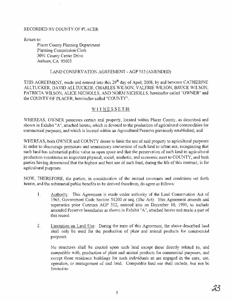
RECORDED BY COUNTY OF PLACER
Return to:Placer County Planning DepartmentPlanning Commission Clerk3091 County Center DriveAuburn, CA 95603
LAND CONSERVATION AGREEMENT - AGP 512 (AMENDED)
THIS AGREEMENT, made and entered into this 29th day of April, 2008, by and between CATHERINEALLTUCKER, DAVID ALLTUCKER, CHARLES WILSON, VALERIE WILSON, BRUCE WILSON,PATRICIA WILSON, ALICE NICHOLLS, AND NORM NICHOLLS, hereinafter called "OWNER" andthe COUNTY OF PLACER, hereinafter called "COUNTY".
WIT N E SSE T H:
WHEREAS, OWNER possesses certain real property, located within Placer County, as described andsho~n in Exhibit "A", attached hereto, which is devoted to the production of agricultural commodities forcommercial purposes, and which is located within an Agricultural Preserve previously established; and
WHEREAS, both OWNER and COUNTY desire to limit the use of said property to agricultural purposesin order to discourage preIl!ature and unnecessary conversion of such land to urban use, recognizing thatsuch land has substantial public value as open space and that the preservation of such land in agriculturalproduction constitutes an important physical, social, aesthetic, and economic asset to COUNTY, and bothparties having determined that the highest and best use of such land, during the life of this contract, is foragricultural purposes.
NOW, THEREFORE, the parties, in consideration of the mutual covenants and conditions set forthherein, and the substantial public benefits to be derived therefrom, do agree as follows:
1. Authority: This Agreement is made under authority of the Land Conservation Act of1965, Government Code Section 51200 et seq. (The Act). This Agreement amends andsupersedes prior Contract AGP 512, entered into on December 10, 1990, to includeamended Preserve boundaries as shown in Exhibit "A", attached hereto and made a part ofthis record.
2. Limitation on Land Use: During the term of this Agreement, the above-described landshall only be used for the production of plant and animal products for commercialpurposes.
No structures shall be erected upon such land except those directly related to, andcompatible with, production of plant and animal products for commercial purposes, andexcept those residence buildings for such individuals as are engaged in the care, use,operation, or management of said land. Compatible land use shall include, but not belimited to:
1
A. Public Utilities: Electric, gas, water, sewer, oil, and communication lines, bothoverhead and underground.
B. Communication equipment buildings and distribution substations.
C. Public Utility substations and service yards.
No division of said land shall be made, except in accordance with COUNTY Ordinancesas from time to time amended.
3. Eminent Domain: When any permissible action in Eminent Domain, for thecondemnation of the fee title of the land under Agreement is filed, or when such land isacquired in lieu of Eminent Domain for a public improvement, by a public agency orperson, the following rules shall apply:
A. If the taking is of the entire acreage, this Agreement shall be null and void as of thedate the action is filed and, thereafter, the contract shall not be binding on anyparty to it.
B. If the taking is of a portion of the entire acreage, this Agreement shall be null-andvoid as to the acreage so taken as of the date the action is filed, and, thereafter, thecontract shall not be binding on any party to it as to such acreage taken. If, aftersuch taking, the remaining land qualifies for an Agreement under COUNTY'Scriteria, this Agreement shall continue as to such remaining acreage; if it does notqualify, then this Agreement to be null-and-void as to such remaining acreage.
As to such taking, OWNER shall be entitled to compensation for such land as hewould have received if this Agreement had never been executed. OWNER shallnot be subject to any penalty for termination of the Agreement as hereinaboveprovided.
4. Length of Agreement: This Agreement shall .be effective commencing onJanuary 1,2009, and shall remain in effect for a period often (10) years therefrom, exceptas provided by Paragraph 5 and 6 thereof.
5. Renewal: This Agreement shall be automatically renewed on the first day of January ofeach year, for a period of ten (l0) years from the date of said renewal, unless writtennotice of Non-Renewal is given by COUNTY within 60 days of the renewal or byOWNER within 90 days of the renewal date. If notice of Non-Renewal is given asprovided above, this Agreement shall then expire automatically nine (9) years fromJanuary 1st following such notice of Non-Renewal. There is no penalty attached to anynotice ofNon-Renewal.
6. Cancellation: This Agreement may be canceled by mutual agreement of all parties to thisAgreement if:
A. COUNTY holds a public hearing on the matter after mailing notice to each and
2
every OWNER of property under contract or agreement within the agriculturalpreserve in which the agreement property is located, and after publishing notice ofsuch hearing, as specified in Government Code Section 6061; and
B. At or before such hearing, less than 51 % of the contracted or agreement acreage insuch preserve protest such cancellation.
It is the intention of the parties hereto that cancellation will not be requested by OWNER, and willnot be approved by COUNTY, except on a clear showing, to the COUNTY'S exclusive judgmentand satisfaction that there has occurred a change of circumstances beyond the control of OWNERand his successors in interest, and that such change would clearly promote the public welfare.
The existence of an opportunity for another use of the land shall not be sufficient reason forcancellation. A potential alternative use of the land may be considered only if there is noproximate land, not subject to a Land Conservation Act Contract or Agreement, suitable for theuse to which it is proposed the subject land be put. The uneconomic character of the existingagricultural use shall not be sufficient reason for cancellation. The uneconomic character of theexisting use may be considered only if there is no other reasonable or comparable agricultural useto which the land may be put.
The cancellation fee shall be 12Yz% of the full market value of the land, when relieved of therestriction, as found by the Assessor. The determination of unrestricted value may be made thesubject of an Equalization Hearing.
If, in the COUNTY'S judgment, there has occurred a change of circumstances, beyond the controlof the OWNER or his successors in interest, COUNTY may waive all or part of the penalty, if theWaiver is subject to these findings by the COUNTY:
If the Board of Supervisors finds that it is in the public interest to do so, the Board maywaive any payment or any portion of a payment by the landowner, or may extend thetime for making the payment or a portion of the payment contingent upon the future usemade of the land and its economic return to the landowner for a period of time not toexceed the unexpired period of the contract, had it not been canceled, if all of thefollowing occur: .
(1) The cancellation is caused by an involuntary transfer or change in the use whichmay be made of the land and the land is not immediately suitable, nor will beimmediately used, for a purpose which produces a greater economic return to the owner.
(2) The Board has determined that it is in the best interests of the program to conserveagricultural land use that the payment be either deferred oris not required.
(3) The waiver or extension of time is approved by the Secretary of the ResourcesAgency. The Secretary shall approve a waiver or extension of time if the secretary findsthat the granting of the waiver or extension of time by the Board of Supervisors isconsistent with the policies of this chapter and that the Board complied with this article.In evaluating a request for a waiver or extension of time, the Secretary shall review thefindings of the Board, the evidence in the record of the Board, and any other evidencethe Secretary may receive concerning the cancellation, waiver, or extension of time.
3
7. Amendment: It is the intention of the parties hereto that this Agreement will not beamended, except on a clear showing, to the COUNTY'S exclusive judgment andsatisfaction, that amendment of this Agreement would be consistent with the COUNTY'Sadministrative rules and The Act, and that any such amendment would clearly promoteagricultural and open space uses.
8. Assessor's Report: The COUNTY'S Assessor shall annually, during the continuation ofthis Agreement, report to the OWNER and to the COUNTY'S Board of Supervisors theequalized, unrestricted assessed value.
9. Payment: OWNER shall not receive any payment from COUNTY in consideration of theobligations imposed hereunder, it being recognized and agreed that the consideration forthe execution of the within agreement is the substantial public benefit to be derivedtherefrom, and the advantage which might accrue to OWNER as the result of possiblereduction in the assessed value of said property, due to the imposition of the limitations onits use contained herein, as such factors are relevant to appraising and assessing standardsunder the California Constitution and California Revenue and Taxation Code 402.1, andall amendments thereto, and all other relevant sections therein.
10. Running with Land: This Agreement shall run with the land described above and shall bebinding upon the heirs, successors, and assigns of the parties hereto.
11. Constitutionality: If the Land Conservation Act of 1965, contained in Government CodeSections 51200, et. seq., be declared to be unconstitutional by a Final Judgment of a Courtof the State of California, or the Federal Government, then this Agreement shall be nulland-void.
12. Transfer of Contract: If OWNER enters into a Contract, pursuant to Government CodeSection 51240, on all or any portion of land covered under this Agreement, thisAgreement shall then terminate as to such land covered by such Contract. There shall beno cost or penalty to OWNER for the termination of this Agreement as tosuch contractedlands.
13. Compatible Uses: As used in this Agreement, the term "Compatible Uses" includes, but isnot limited to the following:
(1) The cultivation of ground, including the preparation of soil, planting or seeding,and the raising and harvesting of trees, timber, fruits, vegetables, flowers, grains,and other stock crops; the raising, feeding, managing and breeding of livestock,poultry, fish, birds, and other animals; greenhouses; the excavation of earth, andthe drilling of wells exclusively for agricultural and domestic uses; single familydwellings for persons who labor full-time on such land, together with barns,corrals, and other outbuildings and structures accessory to the foregoing. The saleon the premises of products produced hereon. The operation of private clubs forhunting and fishing. The packing, storing, and processing of products grown onthe land, together with accessory buildings and structures required therefor.Commercial raising, feeding, managing, breeding, and sale on the premises of fish.
4
· (2) With a valid Land Development Pennit issued under the COUNTY Zoning Laws:Stands and other facilities, for the purpose of selling products produced on theland, together with accessory picnic facilities; sales of agricultural productsproduced off the premises, provided that the sale of such products is incidental andsecondary to the sale of agricultural products produced on the premises; noncommercial airstrips, for the use of aircraft used for agricultural purposes, togetherwith accessory buildings and structures required therefor, feeding lots, oil wells,gas wells, mining, seasonal housing for farm labor.
14. All determinations as to whether a use is a compatible use shall be made by the hearingbody with the authority to render a written determination on the proposed use, following a
recommendation by the AgriculturalCOmmi~~~
OWNERS: .. / 7":>2a es t:r I s~
,, '1~'>----
D· W ,'150 r'\
(Attach Acknowledgementfor each signature)
COUNTY OF PLACER
By:Chairman, Board of Supervisors
5
Stands and other facilities, for the purpose ofselling products produced on the land.together with accessory picnic facilities~ sales ofagricultural products produced offthe premises, provided that the sale of such products is incidental and secondary tothe sale of agricultural products produced on .the premises; non-commercialairstrips, for the use of aircraft used for agricultural purposes, together withaccessory buildings and structures required therefor, feeding lots, oil wells, gaswells, mining, seasonal housing for £ann labor.
14. All detenninations as to whether a use is a compatible use shall be made by the hearingbody with the authority to render a written determination on the proposed use, following a
recommendation by the Agricultural co~~~~. ,.£/~., . _ 3/28/0 CdOWNER$/.M ~: .. .,/.- -~
.. ----·--17~gloe--:-----.........~"""7"'-t---+-
(Attach Acknowledgementfor each signature)
COUNTY OF PLACER
By:Chairman, Board ofSupervisors
CERTIFICATION
5
Stands and other facilities, for the purpose of selling products produced on the land,together with accessory picnic facilities; sales of agricultural products produced offthe premises, provided that the sale of such products is incidental and secondary tothe sale of agricultural products produced on the premises; non~commercial
airstrips, for the use of aircraft used for agricultural purposes, together withaccessory buildings and structures required therefor, feeding lots, oil wells, gaswells, mining, seasonal housing for farm labor.
14. All determinations as to whether a use is a compatible use shall be made by the hearingbody with the authority to render a written determination on the proposed use, following arecommendation by the Agricultural Commission.
OWNERS:
&{)U-Qw~
p~cu O. L,J lQ~
(Attach Acknowledgementfor each signature)
COUNfY OF PLACER
By:Chairman, Board of Supervisors
CERTIFICATION
5
Stands and other facilities, for the purpose of selling products produced on the land,together with accessory picnic facilities; sales of agricultural products produced offthe premises, provided that the sale of such products is incidental and secondary tothe sale of agricultural products produced on the premises; non-commercialairstrips, for the use of aircraft used for agricultural purposes, together withaccessory buildings and structures required therefor, feeding lots, oil wells, gaswells, mining, seasonal housing for farm labor.
14. All determinations as to whether a use is a compatible use shall be made by the hearingbody with the authority to render a written determination on the proposed use, following arecommendation by the Agricultural Commission. '.
OWNERS: (t'2t?C>/{1t4L~W~.. ~~~,;. .., ..
~D~~ .---~----~~. - . <-...
(Attach Acknowledgementfor each signature)
COUNTY OF PLACER
By:Chairman, Board of Supervisors
CERTIFICATION
53D
The foregoing Instrument is a correct copy ofthe original on file in this Office.
DATED: ATTEST:--------
Clerk ofthe Board ofSupervisors ofthe County ofPlacer, State ofCalifornia
personally appeared ~~lQkr~lf~'~~'~~~~~~~~~~=~~~~~~~~~~~~~~~~~~~~
I certify under PENALTY OF PERJURY under the lawsof the State of California that the foregoing paragraph istrue and correct
Y~haFid7inI ) / Y
Signatur /1\,/,""'--
who proved to me on the basis of satisfactory evidence tobe the perso~ whose name~/~ subscribed to thewithin instrument and acknowledged to me that~/tt1€Y executed the same in~/~ authorizedcapacity~ and that by ~r/tRetrSignatu~n theinstrument the person ,or the entity upon behalf ofwhich the person, cted, executed the instrument
Place Notary Seal Above
OPTIONAL --+-1-----------Though the information below is not required by law, it may prove valuable to persons relying on the document
and could prevent fraudulent removal and reattachment of this form to another document.
. """,'".-,,- _ . ± 0 • e ••• 0 • 0 +1'" CHAY HERIe···....·' Commission #1787970:c' Notary PublIc • California II . Sacramento coun:UJ.Gc ••J$~~\·2
Description of Attached Document
Title or Type of Document: '-T""t!.-'.Jhu,-,-t-\::',Ji-I~'.L:\~-:::'c.:..'~,--,v~a",-,~~,---,--",+,-{..:::::~=-c.:.V\'\.Q..-=---J__'-,--A..:::G,--,-P_'o="'-,-,{J~~A-,-,-·\"Nl-~n:-.::o....:::Le=c'-)-J--_
Document Date: ~-'-I3/,-,;2=-=-jg1~'O,-,~~0~ ~_~_~~-,-- Number of Pages: LD f}O!~I r ~~---
Signer(s) Other Than Named Above: --'<,,>....LAL(\,(j"'"'-'JY\J--...-~= _
Top of thumb here Top of thumb here
Signer's Name: _
o Individualo Corporate Officer - Title(s): _
'~"Q.Partner - 0 Limited 0 General
o Attorney in Facto Trustee ----.'-.,,_,,-
o Guardian or Conservatoro Other: '--"
'''-.-"'-
Capacity(ies) Claimed by Signer(s)--------Signer's Name: --... .._
o Individual
o Corporate Officer - Title(s):o Partner - 0 Limited 0 General
o Attorney in Facto Trustee
o Guardian or Conservatoro Other: _
Signer Is Representing: ~ Signer Is Representing: "_,,-'-'"'> ""
who proved to me on the basis of satisfactory evidence tobe the person(.8JWhose nam~~ubscribed to the~hin instrument and acknowledged to me that
~/shE!7'ttre'Yexecutedthe same iJ:]j:iiS/her7rFieir"authorizedcapacity(l~nd, that by~~ signature(.eh:m theinstrument the person ,or the entity upon behalf ofwhich the person acted, executed the instrument.
I certify under PENALTY OF PERJURY under the lawsof the State of California that the foregoing paragraph istrue and correct.
Place Notary Seal AboveSignature'-"~A_+_''=''''__;:c__c____,.,_~__=_:_:c_------
OPTIONAL --+?------------Though the information below is not required by law, it may prove valuable to persons relying on the document
and could prevent fraudulent removal and reattachment of this form to another document.
Description of Attached Document \
Title or Type of Document: k"d CowBP (VCl:hvy, (-\-5r~(M..Q~ ~ ttt PSIa( f't1JV\Q ~~c( )Document Date;'?> i8~/()S2 Number of Pages: (9 0'-/clf- _
I I I USigner(s) Other Than Named Above: '=:"~-=-=-'~=---===- _
Top of thumb here Top of thumb here
Signer's Name: -,-- _
o Individualo Corporate Officer - Title(s): _
" .._0 Partner - 0 Limited 0 GeneralCJ'A!tocney in Facto Trustee-'....
}(/ (/ (7 NO'~ ~ b. ~ ~J'\ . '{' ,::> IN [t H'- . i n K
}Here Insert Name and Title of th'e OffiBr
State of California
County of S uT rEf\.
On '-I jw los; before me,r -f7 Date
personally appeared ~~~)~H~'~~·~~L~t~~~C~:~~~~·~~.~·\~~~I~L~.~~t~)~~l~~~~~.~~'~~~~~~/~~~~~~~-~~~f~~~Name(s) of Signer(s)
".D JI '" I"V/ L/.S 0 (\)
who proved to me on the basis of satisfactory evidence tobe the person(s) whosename(s) is/are subscribed to thewithin instrument and acknowledged to me thathe/she/they executed the same in his/her/their authorizedcapacity(ies), and that by his/her/their signature(s) on the'instrument the person(s), or the entity upon behalf ofwhich the person(s) acted, executed the instrument.
~.. R. P. SI\!_GH.. COMM. # i:J43690 s:
• NOTARY PUBLICCAUFORNIA G)SACRAMl:NTo COUNTY 0
COMM. EXP. JAN. 10. 7iYJ9 ..
Place Notary Seal Above
I certify under PENALTY OF PERJURY under the lawsof the State of California that the foregoing paragraph istrue and correct.
WITNESS my hand and fficial seal.t
Signature ------'--=-'I.iI~-7"+1'_l___=."._-----~
AGtP 512-I\c,Rl::---S JYJF' rJ rNumber of Pages: _-,-,S__=-_I'-,IX!~,,--f _
OPTIONAL ------------Though the information below is not required by law, it may prove valuable to persons relying on the document
and could prevent fraudulent removal and reattachment of this form to another document.
Description of Attached Document
'. LA D /? " ,.... (,., \;!" ~-,/- k \Title or Type of Document: N Lt·; i\l~ I:~ '=' J-~' i U, \J
Document Date: hI L,t! Q E:Signer(s) Other-Than Named Above:
Capacity(ies) Claimed by Signer(s)
Top of thumb here
Signer's Name: _
o Individual
o Corporate Officer - Title(s):
o Partner - 0 Limited 0 Generalo Attorney in Facto Trustee Top of thumb here.
o Guardian or Conservatoro Other: _
Signer's Name: _
o Individualo Corporate Officer - Title(s): _
o Partner - 0 Limited 0 Generalo Attorney in Fact
o Trustee
o Guardian or Conservatoro Other: _
Signer Is Representing: _ Signer Is Representing: _
WASHINGTON SHORT·FORM INDIVIDUAL ACKNOWLEDGMENT IRCW42.44.1001
~A&7£:~~~~~~~~~~A&7£<M&,!;cq~~
State of Washington
County of ~lA-~ c;.
I certify that I know or have satisfactory evidence that _9"'---'-A--'--\-.....:..:c:e.-=~--:-C--:=-'\_\Cl-:-::-w__' ,--'-\.....:s.=-O_~-=-_Name of Signer
is the person who appeared before me, and said
person acknowledged that he@ signed this
instrument and acknowledged it to be his/her free
and voluntary act for the uses and purposes
mentioned in the instrument.
~ /4/ oi?Month/DaylYear
Y Public")
Signature of Notarizing Officer
My appointment expires
\0 \ 'd-6 \ \CJPlace Notary Seal Above
Notary Public'l\State of Washington ,
TAMARA LLONEYMY COMMISSION EXPIRES
OCTOBEAao, 2010'~~~~t<?~" .
------------- OPTIONAL-------------Although the information in this section is not required by law, it may prove valuable to
persons relying on the document and could prevent fraudulent removal andreattachment of this form to another document.
Right Thumbprintof Signer
Top of thumb here
Description of Attached Doc.ument
Title or Type of Document: Lf\~d Cow~e0 At~o~ ~De£E~;}.J f_.
Document Date: Number of Pages: __'A,t:=:--"---_'-9-"- _
Signer(s) Other Than Named Above: B·~CJ-W~~ \~(J ~
, 'd r 55.County of J.......,l{""'-).....)~O""-'-'O-::"'- _
On 4/7-1 D~ before me, _--Il"".4-+-iU-J44-=L:..;,.'(r.:::...L::::=.-l..J...L.=;...+-!-----l..."~.Ia_....\.4__=_....Jo.CL"-'-'-~---(Date) 0 N' .
personally appeared __.:.J.-) Ice. W' fen oU'-"'S'"'-- _Name of Signer(s)
"',;:._...-...::-"'n>"',.;J~.:. ..~"""w~
,I ~ ~i{~. EMILY C. STERLING ~~:' I' CO~ISSION1623752 Qo e. N01ARY PUl.JC.cAUFOf1N"- If
, NEVADA COl.tHY --'-
~~l
Place Notary Seal and/or Any Stamp above
o Personally known to me-OR- .
~roved to me on the basis of satisfactory evidence to bethe person(~ whose name(.t) @are subscribed to thewithin instrument and acknowledged tCJ me that@1e/they executed the same in @his/their authorizedcapacity(1eG.) and that by~iS/thetf- signature(j) on theinstrument t~e person~)'or the entity upon behalf of whichthe person(1) acted, executed the instrument.
Optional InformationLaw does not require the information below. This information could be of great value to any person/persons relyingon this document and r.ould prevent fraudulent and/or the reattachment of this document to an unauthorizeddocument(s).
DESCRIPTION OF ATTACHED DOCUMENT
TITLE OR TYPE OF DOCUMENT LCLh d C01S&Vol1on Agv-tQmmfDATE OF DOCUMENT ' NUMBER OF PAGESSIGNER(S) IF DIFFERENT THAN ABOVE ~~·L.J.:....A~ ,.__---- _OTHER INFORMATION --,- _
37I"?\ "r\l\" )"I;VT An \T nf TnT 10 (,C'? ,fT)..T A n C' COl TOOT Tee' _ 0 eno nr:=D JTr;I\,fJj 1J.rV • f:" 6. Y-1. 1 (LO 1,_0 I d7 • ururur nilt;:lTVnllhl ir.sp.m;n.::lr.~ (';om
California AJI':Pur ose Acknowled ement
State of California
County of Ug.AJOdCL-
On yl·~ 'U)QY before me, -:I..o<L..LLJ~~~~L:.!.....!.:4-i~~~~~-!..P..::::L)..:::b:...!..j ;...:)G=--_(Date) N
personally appeared _---=----~Q:><:...:..V"-'m.....:.....;.~WO~_'__=____:_~~'-'--'-':::...-.!...;..L.-------------
o Personally known to me-OR-
Proved to me. on the basis of sati~actory evidence to bethe person(1) whose name}8) @fclre subscribed to thewithin instrument and acknowledged to me thatshe/~lhey executed the same in her~/their authorizedcapacitY0~ and tha+-by her@their signature~) on theinstrument the person~ or the entity upon behalf of whichthe person(pJ acted, executed the instrument.
_:':'_~'.<>.;<':~'~';~;'r,:'~~l'.~~i.~;~~:~;C"':::';' V(:S;(~;;n~.> EMILY C. STERUNG-R po.
Optional InformationLaw does not require the information below. This information could be of great value to any person/persons relyingon this document and could prevent fraudulent and/or the reattachment of this document to an unauthorizeddocument(s).
DESCRIPTION OF ATTACHED DOCUMEN
TITLE OR TYPE OF DOCUMENT !~"""""~l..!.!--""'="-~"-=:':"-':"'=~~::.:-!-L---7"'r-'o.::::..>."""-~.e:::-~--- _
DATE OF DOCUMENTSIGNER(S) IF DIFFERE-N-T-T-H-A-N-A-B-O-V-E-_~-N~'-,--,JT-'A::~~~~~~~~~~~ _OTHER INFORMATION . _
A portion of the Southwest quarter of Section 5, Township 12 North. Range 7 East, MoO.M.,in the unincorporated area of Placer County, California.
Beginning at the Southwest corner of said Section 5 and running thence along the Westline thereof North 1°09'52" East 26.14 feet to a point on thecenterline of Fruitvale Road, acounty road; thence along said centerline on the following three (3) consecutive courses:(1) along the arc of a curve to the left having a radius of 600 feet. a central angle of8°09'31" and a chordof North 67°53'43" East 85.35 feet to a point of reverse curvature, (2)along the arc of a curve to the right having a radius of 500 feet. a central angle of22°55'32" and a chord of North 75°16' 44" East 198.73 feet and (3) North 86°44'30" East657.08 feet; thence. leaving said centerline, South 1°32' West 115.26 feet to a point on theSouth line of the aforementioned Section 5; thence along said South line South 88°05' 15".West 925.28 feet to the point of beginning.
Parcel Two
A portion of the Northwest quarter of Section 8, and a portion of the Northeast quarter ofSection 7, all in Township 12 North, Range 7 East. M.D.M., in the unincorporated area ofPlacer County, California.
Beginning at the Northwest corner of said Section 8 and running thence along the Northline thereof North 88°05'15" East 925.28 feet; thence South 1°32' West 665.12 feet; thenceSouth 89°45' West 1.196.78 feet; thence due North 637.92 feet to a pointon the North lineof the aforementioned Section 7; thence along said North line of Section 7 North 89°44'31"East 290.00 feet to the point of beginning.
Parcel Three
A portion of the Southwest quarter of Section 5, Township 12 North, Range 7 East, MoO.M.,in the unincorporated area of Placer County, California.
All that portion of the West half of the Southwest quarter of said Section 5 lying Northerly ofFruitvale Road excepting the following described parcel: Beginning at a point on theWest line of said Section 5 from which the Southwest corner thereof bears South 1°09' 52"West 110.00 feet: thence along said section line North 1°09' 52" East 396.00 feet; thence,parallel with the South line of said Section 5 North 88°05'15" East 550.00 feet; thence,parallel with the West line of said Section 5 South 1°09'52" West 396.00 feet; thence,parallel with the South line of said Section 5 South 88°05' IS" West 550.00 feet to the pointof beginning.
Geil Engineering Inc1226 High street . Auburn, CA 95603·5015Phone (530) 885·0426 Fax (530) 823·1309
September 19, 2007
WILSON FAMILY TRUST TO JOHN WILSONTRANSFER PARCEL
Parcel One
Aportion of the Southwest quarter of Section 5, Township 12 North, Range 7 East, MoO.M.,in the unincorporated area of Placer County, California.
Beginning at the Southwest corner of said Section 5 and running thence along the Westline thereof North 1°09'52" East 26.14 feet to a point on the centerline of Fruitvale Road, acounty road; thence along said centerline on the following three (3) consecutive courses:(1 ) along the arc of a curve to the left having a radius of 600 feet, a central angle of8°09'31" and a chord of North 67°53'43" East 85.35 feet to a point of reverse curvature, (2)along the arc of a curve to the right having a radius of 500 feet, a central angle of22°55'32" and a chord of North 75°16'44" East 198.73 feet and (3) North 86°44'30" East657.08 feet; thence, leaving said centerline, South 1°32' West 115.26 feet to a point on theSouth line of the aforementioned Section 5; thence along said South line South 88°05'15"West 925.28 feet to the point of beginning.
Parcel Two
A portion of the Northwest quarter of Section 8, and a portion of the Northeast quarter ofSection 7, all in Township 12 North, Range 7 East, M.D.M.. in the unincorporated area ofPlacer County, California.
Beginning at the Northwest corner of said Section 8 and running thence along the Northline thereof North 88°05' 15" East 925.28 feet; thence South 1°32' West 665.12 feet; thenceSouth 89°45' West 1,196.78 feet; thence due North 637.92 feet to a point on the North lineof the aforementioned Section 7; thence along said North line of Section 7 North 89°44'31"East 290.00 feet to the point of beginning.
Geil Engineering Inc1226 High Street . Auburn, CA 95603·5015Phone (530) 885·0426 Fax (530) 823·1309
September 19,2007
WILSON FAMILY TRUSTRESULTANT PARCEL
A portion of the Northwest quarter of Section 8, and a portion of the Northeast quarter ofSection 7, all in Township 12 North, Range 7 East. M.D.M., in the unincorporated area ofPlacer County, California.
The North half of the Northeast quarter of said Section 7 and the Northwest quarter of saidSection 8, excepting the Southerly 550 feet thereof.
Excepting therefrom the following described parcel:
A portion of the Northwest quarter of Section 8, and ci portion of the Northeast quarter ofSection 7, all in Township 12 North, Range 7 East, MoO.M., in the unincorporated area ofPlacer County, California.
Beginning at the Northwest corner of said Section 8 and running thence along the Northline thereof North 88°05'15" East 925.28 feet: thence South 1°32' West 665.12 feet; thenceSouth 89°45' West 1,196.78 feet; thence due North 637.92 feet to a point on the North lineof the aforementioned Section 7; thence along said North line of Section 7 North 89°44'31"East 290.00 feet to the point of beginning.
1/
JOHN WILSONRESULTANT
1\
..#-''I ~ -J-+-G IS I l . __
WILSON FAMILY TRUST RESULTANT
,IN THE UNINCORPORATED TERRITORY OF THE COUNTY OFPLACER, STATE OF CAliFORNIA, BEING A PORTION OF
SECTIONS 5, 7, & 8, TOWNSHIP 12 NORTH, RANGE 7 EAST,M.D.B. & M.
EXHIBIT B-1RESULTANT PARCELS
II
-----+------+!i
GEIL ,ENGINEERING1226 HIGH STRU:.'!
ALBLR\, CALlFOR\IA 9c:>5(J3
:530} 555,0426
- -I
PLACER COUNTY, CALIFORNIA
SCALE 1'; = 1000' AUGUST, 2007
SHEET 3 OF 3,
PLACER COUNTY DEPARTMENT OFAGRICULTURE
WEIGHTS AND MEASURES
11477 E Avenue, Auburn, CA 95603-2799 (530) 889-7372 FAX (530) 823-1698
CHRISTINE E. TURNERAgricultural Commissioner/Sealer of Weights and Measures
March 19,2008
TO:
FROM:
Placer County Board of Supervisors
Christine E. Turner, Agricultural Commissioner/Sealer
SUBJECT: Proposed Boundary Line Adjustment Between Agricultural Preserve 511and Agricultural Preserve 512 - PAGP 20080018
During the Agricultural Commission's March 10, 2008 meeting, the Commission votedunanimously, 8 - 0 (one member absent), to recommend the Board of Supervisors approve aBoundary Line Adjustment Between Agricultural Preserve 511 and Agricultural Preserve 512.The boundary line adjustment will transfer 20 acres ofland from AGP 512, reducing it to 172acres, to AGP 511, increasing it to 90 acres. The properties are located at 4065 Fruitvale Roadand 4070 Fruitvale Road in rural Lincoln.
The properties include both irrigated and non-irrigated pasture land utilized for year-round cattlegrazing and will continue to meet the minimum qualifications for Williamson Act contracts. Theboundary line adjustment is consistent with the goals and policies of the Placer County GeneralPlan and consistent with the California land Conservation Act the Placer County AdministrativeRules for Williamson Act Lands.
cc: Placer County Planning DepartmentPlacer County Agricultural Commission
13EXHIBIT 4
...
41EXHIBITS
-..,
.~ \
}\ ............\.
:z
PtRKSCT
N1V1HHOl
'. ,I
JOHN WILSONRESULTANT
[\
IG J~ ~J.-+- ---:--t
----r-'----l'I"j ~ ~
WILSON FAMILY TRUST RESULTANT
IN THE UNINCORPORATED TERRITORY OF THE COUNTY OFPLACER, STATE OF CALIFORNIA, BEING A PORTION OF
SECTIONS 5, 7, & 8, TOWNSHIP 12 NORTH, RANGE 7 EAST,M.D.B. & M.
+- - -'- ---1 . RESULTANT PARCELS
SHEET 3 OF 3
AUGUST, 2007
PLACER COUNTY, CALIFORNIA
SCALE 1" = 1000'1226 HIGH STRU.'IALBLR\, CALlFOR\IA 956fJ3
!53U,~S5'042G
GEIL ENGINEERINGo 500 1000 2000 3000
~ !
~~
II
-----i------
I1036 W Main 8t 0 Grass Valley, CA 95945 0 (530) 273-6185
From Auburn & Lincoln: 1-800-222-4102 FAX: 477-2646 www.nid.dst.ca.us
April 17, 2008
Placer County Board of SupervisorsAttn: Ann Holman, Clerk of the Board175 Fulweiler Avenue, Room 101Auburn, CA 95603
RECEIVED
APR 21 2008CLERK OF THE
BOARD OF SUPERVISORS
Re: Request for Approval of Amended Boundaries for Agricultural Preserve511 and Agricultural Preserve 512 to Facilitate a Minor BoundaryResolution - Wilson (PAGP 20080018)
Placer County APN: 031-010-085; 031-330-038 & 040
To Whom It May Concern:
Thank you for the opportunity to review the referenced document. We would like' .to have the following comments on file.
The referenced parcels are within the boundaries of the Nevada Irrigation DistrictPer our Account No. 23488, irrigation water is delivered to the parcels from theAuburn Ravine II Canal. This facility is a raw water source for irrigation purposesonly and the water will not be utilized for human consumption.
Additionally, the District's Markell Canal is located in the northerly portion of APN031-330-038.
The District anticipates that approval of the referenced request will have noimpact on our facilities or activities; however, we reserve further commentpending an opportunity to review a map or site plan showing the boundarychanges.
If you have any questions please call me at 530-273-6185 ext. 240.
Sincerely,
~6-~Bill GannBusiness Coordinator
Cc: Central file, w/a file
The District will provide a dependable, quality water supply. strive to be goodstclnlrds of thc \\atcrsheds and conserve the avai lable resources.
287,000 ACRES SITUATED IN NEVADA, PLACER, SIERRA & YUBA COUNTIES
,.., ,-rc- d.. "/ - o' 9I. ..' ,c' I r::_I_~_. {L...._,'._._.._._.