Issue No. 4, Winter 2011 Working Together...Creating a Plan for Your Community ILLINOIS ROUTE 131 GREEN BAY ROAD www.dot.il.gov www.IL131Project.com D uring recent months, the Illinois Department of Transportation (IDOT) has continued to solicit stakeholder input on the development of alternatives to address needs identified by the Illinois Route 131 Green Bay Road Phase I Preliminary Engineering and Environmental Study. This ongoing public involvement process included the third and fourth Corridor Planning and Technical Advisory Groups meetings as well as a third public meeting. PROBLEM STATEMENT Regional growth and travel demand on Illinois Route 131 from Russell Road to Sunset Avenue are creating safety and operational deficiencies along the roadway and at its intersections. The insufficient capacity of the roadway to handle the demand creates conges- tion, hampers intersection operations, limits safe access to adjacent properties, and leads to safety issues for motorists, pedestrians, and bicyclists. Both pedestrian access to adjacent land uses and bicycle accessibility through and across the corridor are limited. Solutions to these transportation deficiencies must be developed while minimizing impacts to the surrounding environment. The solutions should also consider the communities’ efforts to coordinate land use and area developments, and facilitate economic growth along the route. INSIDE THIS ISSUE Refinement of Preliminary Alternatives p3 Opportunities to Get Involved p3 REFINED PROJECT ALTERNATIVES p3–4 CPG/TAG #4 p5 Next Steps p5 You’re Invited! p6 www.dot.il.gov www.IL131Project.com The law states that bicycle and pedestrian facilities shall be given full consideration into state highway projects. In keeping with this law, IDOT made several recent revisions to its policies and procedures including selection guidelines for pedestrian/bicycle infrastructure as well as the proportion of construction costs that is paid for by the state and by the local agency. As part of IDOT’s policies, the local agency is responsible for main- tenance and some cost participation for the bicycle and pedestrian facility. For a roadway of IL Rte. 131’s classification and characteristics to be compliant with IDOT policy, bicycle use on the roadway in a lane shared with vehicles or on a paved shoulder is not recommended due to high traffic volume and speed. Separate pedestrian and bicycle facilities should be provided along the roadway as part of this project. This means that none of the Preliminary Alternatives A1, A2, B1 and B2 can be carried forward without adding dedi- cated pedestrian and bicycle accommodations throughout the project limits. RECAP OF RECENT MEETINGS Corridor Planning and Technical Advisory Groups : MEETING #3 EVALUATION CRITERIA At the third CPG/TAG meeting, held on April 26, 2010, members discussed evaluation criteria and were presented with a set of four Preliminary Alternatives, developed by the study team based on stakeholder input gathered to date, data collection and technical analysis. CPG/TAG members reviewed the four prelimi- nary alternatives, providing suggestions for possible revisions. All Preliminary Alternatives proposed widening to two through lanes in each direction to increase roadway capacity and minimize delay. The alignment was shifted to avoid impacts to Waukegan Savanna Forest Preserve, Benton-Greenwood Cemetery, and Thunderhawk and Shepherd’s Crook Golf Courses. Pedestrian and bicycle accommodations were proposed only to provide a link for a Lake County Forest Preserve trail. To carry these alternatives forward, additional bicycle and pedestrian facilities would be necessary. (See “Complete Streets” section below) • Environmental impacts to parks, wetlands, forest preserves, and cemeteries • Accessibility • Identified needs such as safety, operations/ mobility, and capacity • Residential, industrial, agricultural and commercial property impacts • Construction cost COMPLETE STREETS The Illinois Complete Streets Law led to significant design changes in the potential alternatives for improvements to Illinois Route 131. continued to page 2
Transcript
Construction Cost
Land Acquisition
Residential Impact
Commercial Impact
Agricultural Impact
Industrial Impact
Safety
Capacity
Operartions/Mobility
Pedestrian/Bicycle Accomodation
Wetland Impact
Archaeological Site Impact
Floodplain Impact
Special Waste Sites Impact
IMPACTS
ALTERNATIVE
RATI
NG
ESTI
MAT
ED C
OST
SRE
QUIR
ED R
IGHT-
OF-
WAY
Total
Section 4(f ) Lands Impact
NEE
DS
(1-5)
(1-5)
(1-5)
(1-5)
(1-5)
(1-5)
(1-5)
(1-5)
(1-5)
(1-5)
(1-5)
(1-5)
(1-5)
(1-5)
(1-5)
3.00
1.00
1.00
1.33
2.33
3.67
4,58
4.00
3.92
3.93
1.00
TBD
5.00
2.67
5.00
42.43
2.67
4.00
4.00
3.67
3.67
4.33
3.42
3.83
3.43
5.00
3.00
TBD
5.00
2.67
5.0
53.68
ALTERNATIVE E1 ALTERNATIVE E2
Project Total
Sunset Avenue to Russell Road
AFFE
CTED
ENVIR
ONM
ENT
NOTES: Construction cost does not include path/sidewalk construction or land acquisition costs
SCORES for each category range 1 to 5: 1 = negative; or less favorable; 3 = neutral; 5 = positive, or more favorable
BLUE SCORES = objective scores from PWG based on the average values for each specific category
RED SCORES = subjective scores from CPG/TAG responses at November 30, 2010 meeting
Estimated Construction Cost (not including path/sidewalk)
Estimated Construction Cost ofShared Use Path and Sidewalk
Estimated Construction Cost ofRetaining Walls
Land Acquisition Cost
Number of Parcels withPartial Acquisition
Residential Acquisition
Potential Residential Acquisition
Commercial Acquisition
Potential Commercial Acquisition
Farmland Acquisition
Farmland Parcels Impacted
Industrial Acquisition
Potential Industrial Relocations
IMPACTS
ALTERNATIVE
UNIT
S
ESTI
MAT
ED C
OST
SRE
QUIR
ED R
IGHT-
OF-
WAY
Total Potential Right-of-WayAcquisition
Impacted Wetlands
Impacted Archaeological Sites
Floodplain Encroachment
Special Waste Sites Impacted
Impacts to Section 4(f ) Lands
AFFE
CTED
ENVIR
ONM
ENT
$
$
$
$
each
ac
each
ac
each
ac
each
ac
each
ac
ac
ac
ac
each
ac
$53,402,000
$3,527,000
$o
$10,053,000
358
32.28
46
5.30
7
5.26
9
5.75
1
48.59
2.67
TBD
0
27
0
$55,967,000
$4,245,000
$2,616,000
$7,056,000
413
21.5
4
4.00
1
3.91
9
4.69
1
34.1
2.35
TBD
0
7
0
ALTERNATIVE E1 ALTERNATIVE E2
Project Total
Sunset Avenue to Russell Road
NOTES: Preliminary cost estimate, subject to change
Construction cost estimate includes construction engineering
Construction cost estimate does not include path/sidewalk construction or land acquisition costs
All impacts are potential: measures may exist to further minimize property acquisition, relocations, and other impacts
Section 4(f ) examples: nature preserves, golf courses, and other designated areas
Issue No. 4, Winter 2011
Working Together...Creating a Plan for Your Community
IllINoIs Route 131 GReeN Bay Road
www.dot.il.gov www.Il131Project.com
5
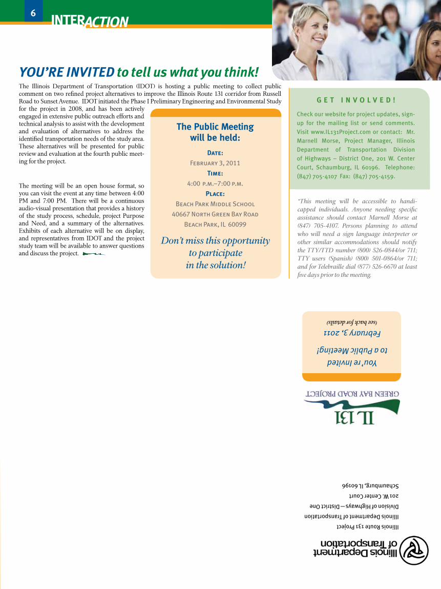
the Public Meeting will be held:
Date:
February 3, 2011
Time:
4:00 p.m.–7:00 p.m.
Place:
Beach Park Middle School
40667 North Green Bay Road
Beach Park, IL 60099
Don’t miss this opportunity to participate
in the solution!
during recent months, the Illinois Department of Transportation (IDOT) has continued to solicit stakeholder input on the development of alternatives to address needs identified by the Illinois
Route 131 Green Bay Road Phase I Preliminary Engineering and Environmental Study. This ongoing public involvement process included the third and fourth Corridor Planning and Technical Advisory Groups meetings as well as a third public meeting.
P R o B l e M s t a t e M e N t
Regional growth and travel demand on Illinois Route 131 from Russell Road to Sunset Avenue are creating safety and operational deficiencies along the roadway and at its intersections. The insufficient capacity of the roadway to handle the demand creates conges-tion, hampers intersection operations, limits safe access to adjacent properties, and leads to safety issues for motorists, pedestrians, and bicyclists. Both pedestrian access to adjacent land uses and bicycle accessibility through and across the corridor are limited.
Solutions to these transportation deficiencies must be developed while minimizing impacts to the surrounding environment. The solutions should also consider the communities’ efforts to coordinate land use and area developments, and facilitate economic growth along the route.
INs Ide thIs Issue
Refinement of Preliminary Alternatives p3
Opportunities to Get Involved p3
REFINED PRojEct AltERNAtIvEs p3–4
CPG/TAG #4 p5
Next Steps p5
You’re Invited! p6
6
G e t I N v o l v e d !
Check our website for project updates, sign-
up for the mailing list or send comments.
Visit www.IL131Project.com or contact: Mr.
Marnell Morse, Project Manager, Illinois
Department of Transportation Division
of Highways – District One, 201 W. Center
Court, Schaumburg, IL 60196. Telephone:
(847) 705-4107 Fax: (847) 705-4159.
*This meeting will be accessible to handi-capped individuals. Anyone needing specific assistance should contact Marnell Morse at (847) 705-4107. Persons planning to attend who will need a sign language interpreter or other similar accommodations should notify the TTY/TTD number (800) 526-0844/or 711; TTY users (Spanish) (800) 501-0864/or 711; and for Telebraille dial (877) 526-6670 at least five days prior to the meeting.
You’re Invited
to a Public Meeting!
February 3, 2011 (see back for details)
Illinois Route 131 Project
Illinois Department of Transportation
Division of Highways—District One
201 W. Center Court
Schaumburg, IL 60196
www.dot.il.gov www.Il131Project.com
Next StepS
After stakeholder input has been collected for the Refined Alternatives, the next step in the study process is to determine the preferred alternative and document the environmental impacts. This involves a five-step process:
• determine preferred alternative
• Complete analysis of preferred alternative impacts
• Prepare environmental documentation
• achieve preferred alternative consensus from CPG and taG
• Present preferred alternative and environmental document at Public hearing
The Refined Alternatives will be rated against the approved project Purpose and Need. Along with detailed environmental and technical studies, this process will further refine the alternatives and ultimately result in the selection of the Preferred Alternative.
The law states that bicycle and pedestrian facilities shall be given full consideration into state highway projects. In keeping with this law, IDOT made several recent revisions to its policies and procedures including selection guidelines for pedestrian/bicycle infrastructure as well as the proportion of construction costs that is paid for by the state and by the local agency. As part of IDOT’s policies, the local agency is responsible for main-tenance and some cost participation for the bicycle and pedestrian facility.
For a roadway of IL Rte. 131’s classification and characteristics to be compliant with IDOT policy, bicycle use on the roadway in a lane shared with vehicles or on a paved shoulder is not recommended due to high traffic volume and speed. Separate pedestrian and bicycle facilities should be provided along the roadway as part of this project. This means that none of the Preliminary Alternatives A1, A2, B1 and B2 can be carried forward without adding dedi-cated pedestrian and bicycle accommodations throughout the project limits.
ReCAp OF ReCeNt MeetINGS
Corridor Planning and Technical Advisory Groups : MeeTING #3 evaluatIoN CRIteRIa
At the third CPG/TAG meeting, held on April 26, 2010, members discussed evaluation criteria and were presented with a set of four Preliminary Alternatives, developed by the study team based on stakeholder input gathered to date, data collection and technical analysis.
CPG/TAG members reviewed the four prelimi-nary alternatives, providing suggestions for possible revisions.
All Preliminary Alternatives proposed widening to two through lanes in each direction to increase roadway capacity and minimize delay. The alignment was shifted to avoid impacts to Waukegan Savanna Forest Preserve, Benton-Greenwood Cemetery, and Thunderhawk and Shepherd’s Crook Golf Courses. Pedestrian and bicycle accommodations were proposed only to provide a link for a Lake County Forest Preserve trail. To carry these alternatives forward, additional bicycle and pedestrian facilities would be necessary. (See “Complete Streets” section below)
• environmental impacts to parks, wetlands, forest preserves, and cemeteries
• Accessibility
• Identified needs such as safety, operations/ mobility, and capacity
• Residential, industrial, agricultural and commercial property impacts
• Construction cost
CPG/TAG #4
CoMPlete stReets
The Illinois Complete Streets Law led to significant design changes in the potential alternatives for improvements to Illinois Route 131.
The fourth CPG/TAG meeting was held on November 30, 2010. Participants reviewed the Refined Alternatives and provided their comments and suggestions. Each Refined Alternative was rated on the degree to which it addresses the Needs of the project. The results are included below. These tables also include rankings provided by the project team for several catego-ries that required engineering analysis. The scores resulting from CPG/TAG MEETING #4 input are shown in red.
You’re InvIted to tell us what you think!The Illinois Department of Transportation (IDOT) is hosting a public meeting to collect public comment on two refined project alternatives to improve the Illinois Route 131 corridor from Russell Road to Sunset Avenue. IDOT initiated the Phase I Preliminary Engineering and Environmental Study for the project in 2008, and has been actively engaged in extensive public outreach efforts and technical analysis to assist with the development and evaluation of alternatives to address the identified transportation needs of the study area. These alternatives will be presented for public review and evaluation at the fourth public meet-ing for the project.
The meeting will be an open house format, so you can visit the event at any time between 4:00 PM and 7:00 PM. There will be a continuous audio-visual presentation that provides a history of the study process, schedule, project Purpose and Need, and a summary of the alternatives. Exhibits of each alternative will be on display, and representatives from IDOT and the project study team will be available to answer questions and discuss the project.
continued to page 2
PRelIMINaRy alteRNatIves a1 aNd B1 WeRe CoMBINed to foRM
RefINed alteRNatIve e1. thIs alteRNatIve Would PRoPose 10-foot
shouldeRs aNd oPeN dItChes thRouGhout the PRojeCt. dItChes
ColleCt RuNoff fRoM the hIGhWay aNd adjaCeNt aReas, helP lIMIt eRosIoN,
aNd May Be attRIButed to hIGheR WateR qualItIes as uNWaNted PaRtICles aRe
aBsoRBed By CeRtaIN soIl tyPes. to BRING the desIGN INto CoMPlIaNCe WIth
CoMPlete stReets, a 10-foot shaRed-use Path Would Be loCated oN oNe sIde
of the hIGhWay aNd a 5-foot sIdeWalk Is oN the otheR sIde.
PRelIMINaRy alteRNatIves a2 aNd B2 WeRe CoMBINed to foRM RefINed alteRNatIve e2. thIs alteRNatIve Would PRoPose CuRB aNd GutteR thRouGhout the PRojeCt, WhICh RequIRes CoMPaRatIvely less RoW thaN a shouldeR aNd dItCh desIGN. to BRING the alteRNatIve INto CoMPlI-aNCe WIth CoMPlete stReets, a 10-foot shaRed-use Path Would Be PRoPosed oN the Both sIdes of the hIGhWay. a 5-foot sIdeWalk Could Be
suBstItuted foR the shaRed-use Path oN oNe sIde.
Waukegan Regional airport: The Waukegan Port District is engaged in a study to expand facilities at the airport, and the preferred alternatives involve extending the runway across and over IL Rte. 131. Using FAA funding, property has been acquired on both sides of the highway. A compressed at-grade cross section with curb and gutter on the outside edges and the shared-use path on one side of the roadway would be proposed along airport property as an interim improvement to minimize impacts to the airport’s future expansion plans.
Alternative
Refined Alternative E1
Alternative
Refined Alternative E2
Including all stakeholders in both the identification of issues and concerns
as well as potential solutions is critical to the success of any project. IDOT’s
Context Sensitive Solutions (CSS) designation for this project involves exten-
sive public outreach efforts to the affected stakeholders and community at
large, and includes a variety of methods including one-on-one meetings,
public meetings, CPG/TAG meetings, newsletters and the project website,
in order to keep the public informed of study progress and opportunities for
participation. The study has now reached a key milestone with the develop-
ment of refined alternatives, and the level of committed public participation
has never been more important. Your meaningful and continued involvement
in the IL Route 131 Study is strongly encouraged. Please visit the project
website at www.IL131Project.com for up-to-date information and to express
your comments and concerns.
The third Public Meeting was held on Wednesday, May 26, 2010 and was attended by 61 stakeholders. The purpose of the meeting was to present preliminary alter-natives and solicit public input. The same four prelimi-nary alternatives were displayed at Public Meeting #3. Study team members were in attendance to answer questions, and participants were encouraged to provide comments/suggestions.
NORTH
HorizonVillage
Park
ThunderhawkPublic
Golf ClubBonnie BrookMunicipal Golf Course
WaukeganSports Park
WaukeganRegionalAirport
DavidPark
BevierPark
Russell Rd.
IL Rte. 173
Wadsw
orth Rd.
Sunset Ave.
Green Bay Road (IL Rte. 131)
Lewis Rd.
Kenosha Rd.
Delany Rd.
Ninth St.
21st St.
29th St.
33rd St.
Yorkhouse Rd. 173
131
WaukeganSavanna
Forest Preserve
Shepherd’s Crook
Golf Course
Alternative Alternative
2 3 4
www.dot.il.gov www.Il131Project.comWorking Together...Creating a Plan for Your Community
The project study team considered the concerns raised by stakeholders as the preliminary alternatives were refined.• The concerns include roadway user safety and drainage problems along the highway.
• Stakeholders expressed preferences for Kenosha Road intersection realignment and asked that public outreach efforts improve.
• Preferences vary regarding the benefits and disadvantages of shoulder vs. curbed designs, and barrier vs. flush median treatment.
• Finally, local residents are concerned about impacts to their property and land acquisition procedures.
sunset avenue to Illinois Route 173: The geometry used in Preliminary Alternative A1 is a good solution for the first two sections of IL Rte. 131. The 13’ flush median TWLTL will allow access to homes and businesses, as there are some areas with more than 30 access points per mile. Alignment shifts would avoid impacts to the Waukegan Savanna Forest Preserve, Benton-Greenwood Cemetery, and ThunderHawk Golf Course.
Illinois Route 173 to Russell Road: North of IL Rte. 173, Refined Alternative E1 is based on the geometry of Preliminary Alternative B1. The 22-foot barrier median is a safe design that will reduce conflict points while providing access manage-ment for future development. Median breaks would be provided approximately every 1/4-mile and at signalized intersections to permit passenger cars to make U-turns for access to driveways and other cross-streets. An alignment shift would avoid impacts to Shepherd’s Crook Golf Course.
sunset avenue to Wadsworth Road: Preliminary Alternative A2 would be used in the first section of the project. The 13’ flush TWLTL will provide access to the homes and businesses, as there are more than 30 access points per mile. The increased potential for conflicts between left turning traffic is outweighed by greater mobility since the left turn volumes are small. Dedicated left turn lanes would be provided at signalized intersections. The alignment would be shifted to avoid impacting the Waukegan Savanna Forest Preserve.
Wadsworth Road to Russell Road: In the northern two sections, Refined Alternative E2 is based on Preliminary Alternative B2. The 22-foot barrier median provides a greater degree of access manage-ment for future development than the flush median, is a safe design that eliminates many conflict points created by unrestricted left turns, and is proposed in this section because there are fewer driveways and cross streets. Breaks in the median would be provided approximately every 1/4-mile and at all signalized intersections to accommodate U-turns for access to minor streets and driveways.
Alignment shifts would be provided to avoid impacts at Benton-Greenwood Cemetery, ThunderHawk Golf Course, and Shepherd’s Crook Golf Course.
a1
AlteRNAtIve A2• Flush median, 13-foot two-way left turn lane
• Replaces 10-foot paved shoulder of Alternative A1 with Type B-6.24 curb and gutter - Requires less RoW than the shoulder and open ditch of Alternative A1
• Storm sewer installation would be necessary for drainage
• Includes 22-foot barrier median - Provides a barrier between oncoming traffic and reduces possible conflict points - limits accessibility to minor intersecting streets and driveways - Median openings and left turn lanes proposed at approximately 1/4 mile intervals to allow U-turns and access to streets and driveways
• Proposes 10-foot paved shoulder
AlteRNAtIve B1
AlteRNAtIve B2• Includes 22-foot barrier median
• Replaces 10-foot shoulder of B1 with Type B-6.24 curb and gutter - Requires less RoW than paved shoulder and open ditch of B1
• Storm sewer installation would be necessary for drainage
• Flush median, 13-foot two-way left turn lane, unrestricted access to driveways and unsignalized intersections along the corridor
• Dedicated left turn lanes at major intersections, with a 6-foot concrete median along the length of the turn lane
• 10-foot paved shoulder to accommodate stranded motorists and emergency vehicles
• Open grass ditch of approximately 25 feet from edge of shoulder to right-of-way (ROW) to provide three feet of depth and a 4-foot wide ditch bottom at desirable ditch slopes
AlteRNAtIve A1
alteRNatIves:
• Provide pedestrian and bicycle connection from Waukegan Savanna Forest Preserve to Waukegan Sports Park with a separate bike path
• Add a right turn lane into Beach Road for south bound traffic and provide sufficient storage
GeNeRal CoMMeNts:
• Lake County Forest Preserve prefers a separate trail vs. on-road/shoulder, and ditch vs. curb/ gutter
• Airport coordination - Maintain existing grade of Yorkhouse Road and Blossom Street (access to Waukegan Fire Station) - Alignment shift for construction - Continue to meet airport team
CpG/tAG member comments puBlIC MeetING #3 comments
Evaluation Criteria: Each alternative was rated based on the evaluation criteria, which was developed with stakeholder input and is shown on page 1.
Purpose and Need: A major factor in the evaluation of the project alternatives is how the proposed solutions will address the PURPOSE of the project and the NEED for improvements. Through public involvement and technical analysis, the project Purpose was identified:
the PuRPose of the IllINoIs Route 131 eNGINeeR-
ING study Is to IMPRove safety aNd fuNCtIoNal-
Ity aloNG IllINoIs Route 131 fRoM Russell Road to
suNset aveNue. IMPRoveMeNts to thIs Route aRe
NeCessaRy to addRess Issues of RoadWay aNd INteR-
seCtIoN CaPaCIty aNd effICIeNCy; eNhaNCe vehICulaR,
PedestRIaN, aNd BICyCle aCCoMModatIoN aNd safety;
aNd BRING the RoadWay INto CoMPlIaNCe WIth
CuRReNt Idot staNdaRds.
The same data identified three key transportation NEEDS:
• Improve safety
• Improve capacity
• Improve operations and mobility
OF pRelIMINARy
The preliminary alternatives were refined based on
stakeholder input from previous meetings, identified
project elements, the project purpose and needs,
analysis of the existing environment,
technical analysis of design requirements and
constraints, and previous studies of the project area.
a2
B1
B2
continued from page 1ts
CPG/TAG member comments concerning the alternatives included:
Since the project area is composed of three distinct sections, the preliminary alternatives were evaluated for each of the three sections to arrive at the refined alternatives.
Get INvOlveD
kenosha Road: Several alternatives for the realignment of Kenosha Road were considered.
One alternative would align Kenosha Road with 28th Street. Another alternative would extend Kenosha Road due south to intersect with 29th Street west of IL Route 131. A third alternative would realign Kenosha Road to intersect IL Rte. 131 in a “T” intersection about halfway between 29th Street and 21st Street. A fourth alternative considered would close Kenosha Road at IL Rte. 131 and use 21st Street for access to Kenosha Road. This would route extra traffic onto 21st Street, would diminish the continuity of this county route, and may cause potential negative impacts regarding access to residential areas along Kenosha Road.
Another alternative would create a “T” intersection about 1000 feet north of 29th Street. This option creates the least impact and provides sufficient intersection spacing. It is shown to the left.
The project study team will coordinate with the Lake County Division of Transportation and other agen-cies to determine the preferred alternative for the Kenosha Road intersection.
SECTION 1: Sunset Avenue to Wadsworth Road The existing ROW is narrow and there are many low-volume streets and driveways. Land use in this section is primarily residential.
SECTION 2: Wadsworth Road to IL Rte. 173 The existing ROW widens at some locations and there are fewer intersecting streets and driveways. Residential land use dominates the area, although a TIF Redevelopment area has been proposed.
SECTION 3: IL Rte. 173 north to Russell Road This section has wider existing ROW in some locations and the fewest driveways and inter-secting streets of the three sections. Land use is mixed, including industrial, agricultural, commercial, and residential.
O P P O R T U N I T I E S T O G E T I N V O L V E D
ReCAp OF ReCeNt MeetINGS
E2}E1}
ReFINeD pROJeCtAlternatives
Alternatives
Refinement
Construction Cost
Land Acquisition
Residential Impact
Commercial Impact
Agricultural Impact
Industrial Impact
Safety
Capacity
Operartions/Mobility
Pedestrian/Bicycle Accomodation
Wetland Impact
Archaeological Site Impact
Floodplain Impact
Special Waste Sites Impact
IMPACTS
ALTERNATIVE
RATI
NG
ESTI
MAT
ED C
OST
SRE
QUIR
ED R
IGHT-
OF-
WAY
Total
Section 4(f ) Lands Impact
NEE
DS
(1-5)
(1-5)
(1-5)
(1-5)
(1-5)
(1-5)
(1-5)
(1-5)
(1-5)
(1-5)
(1-5)
(1-5)
(1-5)
(1-5)
(1-5)
3.00
1.00
1.00
1.33
2.33
3.67
4,58
4.00
3.92
3.93
1.00
TBD
5.00
2.67
5.00
42.43
2.67
4.00
4.00
3.67
3.67
4.33
3.42
3.83
3.43
5.00
3.00
TBD
5.00
2.67
5.0
53.68
ALTERNATIVE E1 ALTERNATIVE E2
Project Total
Sunset Avenue to Russell Road
AFFE
CTED
ENVIR
ONM
ENT
NOTES: Construction cost does not include path/sidewalk construction or land acquisition costs
SCORES for each category range 1 to 5: 1 = negative; or less favorable; 3 = neutral; 5 = positive, or more favorable
BLUE SCORES = objective scores from PWG based on the average values for each specific category
RED SCORES = subjective scores from CPG/TAG responses at November 30, 2010 meeting
Estimated Construction Cost (not including path/sidewalk)
Estimated Construction Cost ofShared Use Path and Sidewalk
Estimated Construction Cost ofRetaining Walls
Land Acquisition Cost
Number of Parcels withPartial Acquisition
Residential Acquisition
Potential Residential Acquisition
Commercial Acquisition
Potential Commercial Acquisition
Farmland Acquisition
Farmland Parcels Impacted
Industrial Acquisition
Potential Industrial Relocations
IMPACTS
ALTERNATIVE
UNIT
S
ESTI
MAT
ED C
OST
SRE
QUIR
ED R
IGHT-
OF-
WAY
Total Potential Right-of-WayAcquisition
Impacted Wetlands
Impacted Archaeological Sites
Floodplain Encroachment
Special Waste Sites Impacted
Impacts to Section 4(f ) Lands
AFFE
CTED
ENVIR
ONM
ENT
$
$
$
$
each
ac
each
ac
each
ac
each
ac
each
ac
ac
ac
ac
each
ac
$53,402,000
$3,527,000
$o
$10,053,000
358
32.28
46
5.30
7
5.26
9
5.75
1
48.59
2.67
TBD
0
27
0
$55,967,000
$4,245,000
$2,616,000
$7,056,000
413
21.5
4
4.00
1
3.91
9
4.69
1
34.1
2.35
TBD
0
7
0
ALTERNATIVE E1 ALTERNATIVE E2
Project Total
Sunset Avenue to Russell Road
NOTES: Preliminary cost estimate, subject to change
Construction cost estimate includes construction engineering
Construction cost estimate does not include path/sidewalk construction or land acquisition costs
All impacts are potential: measures may exist to further minimize property acquisition, relocations, and other impacts
Section 4(f ) examples: nature preserves, golf courses, and other designated areas
Issue No. 4, Winter 2011
Working Together...Creating a Plan for Your Community
IllINoIs Route 131 GReeN Bay Road
www.dot.il.gov www.Il131Project.com
5
the Public Meeting will be held:
Date:
February 3, 2011
Time:
4:00 p.m.–7:00 p.m.
Place:
Beach Park Middle School
40667 North Green Bay Road
Beach Park, IL 60099
Don’t miss this opportunity to participate
in the solution!
during recent months, the Illinois Department of Transportation (IDOT) has continued to solicit stakeholder input on the development of alternatives to address needs identified by the Illinois
Route 131 Green Bay Road Phase I Preliminary Engineering and Environmental Study. This ongoing public involvement process included the third and fourth Corridor Planning and Technical Advisory Groups meetings as well as a third public meeting.
P R o B l e M s t a t e M e N t
Regional growth and travel demand on Illinois Route 131 from Russell Road to Sunset Avenue are creating safety and operational deficiencies along the roadway and at its intersections. The insufficient capacity of the roadway to handle the demand creates conges-tion, hampers intersection operations, limits safe access to adjacent properties, and leads to safety issues for motorists, pedestrians, and bicyclists. Both pedestrian access to adjacent land uses and bicycle accessibility through and across the corridor are limited.
Solutions to these transportation deficiencies must be developed while minimizing impacts to the surrounding environment. The solutions should also consider the communities’ efforts to coordinate land use and area developments, and facilitate economic growth along the route.
INs Ide thIs Issue
Refinement of Preliminary Alternatives p3
Opportunities to Get Involved p3
REFINED PRojEct AltERNAtIvEs p3–4
CPG/TAG #4 p5
Next Steps p5
You’re Invited! p6
6
G e t I N v o l v e d !
Check our website for project updates, sign-
up for the mailing list or send comments.
Visit www.IL131Project.com or contact: Mr.
Marnell Morse, Project Manager, Illinois
Department of Transportation Division
of Highways – District One, 201 W. Center
Court, Schaumburg, IL 60196. Telephone:
(847) 705-4107 Fax: (847) 705-4159.
*This meeting will be accessible to handi-capped individuals. Anyone needing specific assistance should contact Marnell Morse at (847) 705-4107. Persons planning to attend who will need a sign language interpreter or other similar accommodations should notify the TTY/TTD number (800) 526-0844/or 711; TTY users (Spanish) (800) 501-0864/or 711; and for Telebraille dial (877) 526-6670 at least five days prior to the meeting.
You’re Invited
to a Public Meeting!
February 3, 2011 (see back for details)
Illinois Route 131 Project
Illinois Department of Transportation
Division of Highways—District One
201 W. Center Court
Schaumburg, IL 60196
www.dot.il.gov www.Il131Project.com
Next StepS
After stakeholder input has been collected for the Refined Alternatives, the next step in the study process is to determine the preferred alternative and document the environmental impacts. This involves a five-step process:
• determine preferred alternative
• Complete analysis of preferred alternative impacts
• Prepare environmental documentation
• achieve preferred alternative consensus from CPG and taG
• Present preferred alternative and environmental document at Public hearing
The Refined Alternatives will be rated against the approved project Purpose and Need. Along with detailed environmental and technical studies, this process will further refine the alternatives and ultimately result in the selection of the Preferred Alternative.
The law states that bicycle and pedestrian facilities shall be given full consideration into state highway projects. In keeping with this law, IDOT made several recent revisions to its policies and procedures including selection guidelines for pedestrian/bicycle infrastructure as well as the proportion of construction costs that is paid for by the state and by the local agency. As part of IDOT’s policies, the local agency is responsible for main-tenance and some cost participation for the bicycle and pedestrian facility.
For a roadway of IL Rte. 131’s classification and characteristics to be compliant with IDOT policy, bicycle use on the roadway in a lane shared with vehicles or on a paved shoulder is not recommended due to high traffic volume and speed. Separate pedestrian and bicycle facilities should be provided along the roadway as part of this project. This means that none of the Preliminary Alternatives A1, A2, B1 and B2 can be carried forward without adding dedi-cated pedestrian and bicycle accommodations throughout the project limits.
ReCAp OF ReCeNt MeetINGS
Corridor Planning and Technical Advisory Groups : MeeTING #3 evaluatIoN CRIteRIa
At the third CPG/TAG meeting, held on April 26, 2010, members discussed evaluation criteria and were presented with a set of four Preliminary Alternatives, developed by the study team based on stakeholder input gathered to date, data collection and technical analysis.
CPG/TAG members reviewed the four prelimi-nary alternatives, providing suggestions for possible revisions.
All Preliminary Alternatives proposed widening to two through lanes in each direction to increase roadway capacity and minimize delay. The alignment was shifted to avoid impacts to Waukegan Savanna Forest Preserve, Benton-Greenwood Cemetery, and Thunderhawk and Shepherd’s Crook Golf Courses. Pedestrian and bicycle accommodations were proposed only to provide a link for a Lake County Forest Preserve trail. To carry these alternatives forward, additional bicycle and pedestrian facilities would be necessary. (See “Complete Streets” section below)
• environmental impacts to parks, wetlands, forest preserves, and cemeteries
• Accessibility
• Identified needs such as safety, operations/ mobility, and capacity
• Residential, industrial, agricultural and commercial property impacts
• Construction cost
CPG/TAG #4
CoMPlete stReets
The Illinois Complete Streets Law led to significant design changes in the potential alternatives for improvements to Illinois Route 131.
The fourth CPG/TAG meeting was held on November 30, 2010. Participants reviewed the Refined Alternatives and provided their comments and suggestions. Each Refined Alternative was rated on the degree to which it addresses the Needs of the project. The results are included below. These tables also include rankings provided by the project team for several catego-ries that required engineering analysis. The scores resulting from CPG/TAG MEETING #4 input are shown in red.
You’re InvIted to tell us what you think!The Illinois Department of Transportation (IDOT) is hosting a public meeting to collect public comment on two refined project alternatives to improve the Illinois Route 131 corridor from Russell Road to Sunset Avenue. IDOT initiated the Phase I Preliminary Engineering and Environmental Study for the project in 2008, and has been actively engaged in extensive public outreach efforts and technical analysis to assist with the development and evaluation of alternatives to address the identified transportation needs of the study area. These alternatives will be presented for public review and evaluation at the fourth public meet-ing for the project.
The meeting will be an open house format, so you can visit the event at any time between 4:00 PM and 7:00 PM. There will be a continuous audio-visual presentation that provides a history of the study process, schedule, project Purpose and Need, and a summary of the alternatives. Exhibits of each alternative will be on display, and representatives from IDOT and the project study team will be available to answer questions and discuss the project.
continued to page 2
Construction Cost
Land Acquisition
Residential Impact
Commercial Impact
Agricultural Impact
Industrial Impact
Safety
Capacity
Operartions/Mobility
Pedestrian/Bicycle Accomodation
Wetland Impact
Archaeological Site Impact
Floodplain Impact
Special Waste Sites Impact
IMPACTS
ALTERNATIVE
RATI
NG
ESTI
MAT
ED C
OST
SRE
QUIR
ED R
IGHT-
OF-
WAY
Total
Section 4(f ) Lands Impact
NEE
DS
(1-5)
(1-5)
(1-5)
(1-5)
(1-5)
(1-5)
(1-5)
(1-5)
(1-5)
(1-5)
(1-5)
(1-5)
(1-5)
(1-5)
(1-5)
3.00
1.00
1.00
1.33
2.33
3.67
4,58
4.00
3.92
3.93
1.00
TBD
5.00
2.67
5.00
42.43
2.67
4.00
4.00
3.67
3.67
4.33
3.42
3.83
3.43
5.00
3.00
TBD
5.00
2.67
5.0
53.68
ALTERNATIVE E1 ALTERNATIVE E2
Project Total
Sunset Avenue to Russell Road
AFFE
CTED
ENVIR
ONM
ENT
NOTES: Construction cost does not include path/sidewalk construction or land acquisition costs
SCORES for each category range 1 to 5: 1 = negative; or less favorable; 3 = neutral; 5 = positive, or more favorable
BLUE SCORES = objective scores from PWG based on the average values for each specific category
RED SCORES = subjective scores from CPG/TAG responses at November 30, 2010 meeting
Estimated Construction Cost (not including path/sidewalk)
Estimated Construction Cost ofShared Use Path and Sidewalk
Estimated Construction Cost ofRetaining Walls
Land Acquisition Cost
Number of Parcels withPartial Acquisition
Residential Acquisition
Potential Residential Acquisition
Commercial Acquisition
Potential Commercial Acquisition
Farmland Acquisition
Farmland Parcels Impacted
Industrial Acquisition
Potential Industrial Relocations
IMPACTS
ALTERNATIVE
UNIT
S
ESTI
MAT
ED C
OST
SRE
QUIR
ED R
IGHT-
OF-
WAY
Total Potential Right-of-WayAcquisition
Impacted Wetlands
Impacted Archaeological Sites
Floodplain Encroachment
Special Waste Sites Impacted
Impacts to Section 4(f ) Lands
AFFE
CTED
ENVIR
ONM
ENT
$
$
$
$
each
ac
each
ac
each
ac
each
ac
each
ac
ac
ac
ac
each
ac
$53,402,000
$3,527,000
$o
$10,053,000
358
32.28
46
5.30
7
5.26
9
5.75
1
48.59
2.67
TBD
0
27
0
$55,967,000
$4,245,000
$2,616,000
$7,056,000
413
21.5
4
4.00
1
3.91
9
4.69
1
34.1
2.35
TBD
0
7
0
ALTERNATIVE E1 ALTERNATIVE E2
Project Total
Sunset Avenue to Russell Road
NOTES: Preliminary cost estimate, subject to change
Construction cost estimate includes construction engineering
Construction cost estimate does not include path/sidewalk construction or land acquisition costs
All impacts are potential: measures may exist to further minimize property acquisition, relocations, and other impacts
Section 4(f ) examples: nature preserves, golf courses, and other designated areas
Issue No. 4, Winter 2011
Working Together...Creating a Plan for Your Community
IllINoIs Route 131 GReeN Bay Road
www.dot.il.gov www.Il131Project.com
5
the Public Meeting will be held:
Date:
February 3, 2011
Time:
4:00 p.m.–7:00 p.m.
Place:
Beach Park Middle School
40667 North Green Bay Road
Beach Park, IL 60099
Don’t miss this opportunity to participate
in the solution!
during recent months, the Illinois Department of Transportation (IDOT) has continued to solicit stakeholder input on the development of alternatives to address needs identified by the Illinois
Route 131 Green Bay Road Phase I Preliminary Engineering and Environmental Study. This ongoing public involvement process included the third and fourth Corridor Planning and Technical Advisory Groups meetings as well as a third public meeting.
P R o B l e M s t a t e M e N t
Regional growth and travel demand on Illinois Route 131 from Russell Road to Sunset Avenue are creating safety and operational deficiencies along the roadway and at its intersections. The insufficient capacity of the roadway to handle the demand creates conges-tion, hampers intersection operations, limits safe access to adjacent properties, and leads to safety issues for motorists, pedestrians, and bicyclists. Both pedestrian access to adjacent land uses and bicycle accessibility through and across the corridor are limited.
Solutions to these transportation deficiencies must be developed while minimizing impacts to the surrounding environment. The solutions should also consider the communities’ efforts to coordinate land use and area developments, and facilitate economic growth along the route.
INs Ide thIs Issue
Refinement of Preliminary Alternatives p3
Opportunities to Get Involved p3
REFINED PRojEct AltERNAtIvEs p3–4
CPG/TAG #4 p5
Next Steps p5
You’re Invited! p6
6
G e t I N v o l v e d !
Check our website for project updates, sign-
up for the mailing list or send comments.
Visit www.IL131Project.com or contact: Mr.
Marnell Morse, Project Manager, Illinois
Department of Transportation Division
of Highways – District One, 201 W. Center
Court, Schaumburg, IL 60196. Telephone:
(847) 705-4107 Fax: (847) 705-4159.
*This meeting will be accessible to handi-capped individuals. Anyone needing specific assistance should contact Marnell Morse at (847) 705-4107. Persons planning to attend who will need a sign language interpreter or other similar accommodations should notify the TTY/TTD number (800) 526-0844/or 711; TTY users (Spanish) (800) 501-0864/or 711; and for Telebraille dial (877) 526-6670 at least five days prior to the meeting.
You’re Invited
to a Public Meeting!
February 3, 2011 (see back for details)
Illinois Route 131 Project
Illinois Department of Transportation
Division of Highways—District One
201 W. Center Court
Schaumburg, IL 60196
www.dot.il.gov www.Il131Project.com
Next StepS
After stakeholder input has been collected for the Refined Alternatives, the next step in the study process is to determine the preferred alternative and document the environmental impacts. This involves a five-step process:
• determine preferred alternative
• Complete analysis of preferred alternative impacts
• Prepare environmental documentation
• achieve preferred alternative consensus from CPG and taG
• Present preferred alternative and environmental document at Public hearing
The Refined Alternatives will be rated against the approved project Purpose and Need. Along with detailed environmental and technical studies, this process will further refine the alternatives and ultimately result in the selection of the Preferred Alternative.
The law states that bicycle and pedestrian facilities shall be given full consideration into state highway projects. In keeping with this law, IDOT made several recent revisions to its policies and procedures including selection guidelines for pedestrian/bicycle infrastructure as well as the proportion of construction costs that is paid for by the state and by the local agency. As part of IDOT’s policies, the local agency is responsible for main-tenance and some cost participation for the bicycle and pedestrian facility.
For a roadway of IL Rte. 131’s classification and characteristics to be compliant with IDOT policy, bicycle use on the roadway in a lane shared with vehicles or on a paved shoulder is not recommended due to high traffic volume and speed. Separate pedestrian and bicycle facilities should be provided along the roadway as part of this project. This means that none of the Preliminary Alternatives A1, A2, B1 and B2 can be carried forward without adding dedi-cated pedestrian and bicycle accommodations throughout the project limits.
ReCAp OF ReCeNt MeetINGS
Corridor Planning and Technical Advisory Groups : MeeTING #3 evaluatIoN CRIteRIa
At the third CPG/TAG meeting, held on April 26, 2010, members discussed evaluation criteria and were presented with a set of four Preliminary Alternatives, developed by the study team based on stakeholder input gathered to date, data collection and technical analysis.
CPG/TAG members reviewed the four prelimi-nary alternatives, providing suggestions for possible revisions.
All Preliminary Alternatives proposed widening to two through lanes in each direction to increase roadway capacity and minimize delay. The alignment was shifted to avoid impacts to Waukegan Savanna Forest Preserve, Benton-Greenwood Cemetery, and Thunderhawk and Shepherd’s Crook Golf Courses. Pedestrian and bicycle accommodations were proposed only to provide a link for a Lake County Forest Preserve trail. To carry these alternatives forward, additional bicycle and pedestrian facilities would be necessary. (See “Complete Streets” section below)
• environmental impacts to parks, wetlands, forest preserves, and cemeteries
• Accessibility
• Identified needs such as safety, operations/ mobility, and capacity
• Residential, industrial, agricultural and commercial property impacts
• Construction cost
CPG/TAG #4
CoMPlete stReets
The Illinois Complete Streets Law led to significant design changes in the potential alternatives for improvements to Illinois Route 131.
The fourth CPG/TAG meeting was held on November 30, 2010. Participants reviewed the Refined Alternatives and provided their comments and suggestions. Each Refined Alternative was rated on the degree to which it addresses the Needs of the project. The results are included below. These tables also include rankings provided by the project team for several catego-ries that required engineering analysis. The scores resulting from CPG/TAG MEETING #4 input are shown in red.
You’re InvIted to tell us what you think!The Illinois Department of Transportation (IDOT) is hosting a public meeting to collect public comment on two refined project alternatives to improve the Illinois Route 131 corridor from Russell Road to Sunset Avenue. IDOT initiated the Phase I Preliminary Engineering and Environmental Study for the project in 2008, and has been actively engaged in extensive public outreach efforts and technical analysis to assist with the development and evaluation of alternatives to address the identified transportation needs of the study area. These alternatives will be presented for public review and evaluation at the fourth public meet-ing for the project.
The meeting will be an open house format, so you can visit the event at any time between 4:00 PM and 7:00 PM. There will be a continuous audio-visual presentation that provides a history of the study process, schedule, project Purpose and Need, and a summary of the alternatives. Exhibits of each alternative will be on display, and representatives from IDOT and the project study team will be available to answer questions and discuss the project.