32
Create a new workspace

Create a new workspace


Create a new project

Insert domain (right click on your project name)

Give it a name
Choose an empty folder (created before)
Choose MOHID Land option

Insert domain (right click on your domain name)

Choose the modules that you will need
Confirm the modules with the files inside \Aula\data

Topography – Digital elevation model creationBing –Aerial option

Select the area where is your watershed
• You will run the Montargil Sub basin – Sorraia, Tejo, Portugal
• To easily find the watershed check the next slide

Select the area where is your watershed
• Select the shapefile LU or Soils from the folder “Aula\General data\Other\Vegetation or \Porous media\Soils ID

Select HGT nasa to download points data

Create grid file

Create DEM grid data file

DEM - Remove depressions
1º
2º
3º save your file!

Delineate watershed

Cross sections

Porous Media

Vegetation map creation
• Select \General Data\Other\Vegetation\LU.shp
Choose the right feature
Use the file:\General Data\Other\CorrepondManning_Imperm.txt
Put the ID from the file correspondent to the GSEL21 column

Manning map creation
• Same steps as the previous (Vegetation map creation), but corresponding GSEL21 to the ManningRunoff column values

Impermeability map creation
• Same steps as the previous (Manning map creation), but corresponding GSEL21 to the Impermeability column values

Choose your output points - RIVER
• Open the “MoinhoNovo.shp” file in MOHID Studio

Choose your output points - LAND
• Open your “Vegetation.dat” map (grid data created)
• Try to figure it out the ids to agriculture (AGRR) and forest (FRSD)
• Peak two points correspondent to that vegetation IDs

Define the topography
Choose your DEM_ND.dat fileRight click - Properties
Uncheck this option if you changed this already. Should be empty!!

Prepare your simulation input files:
• Copy the module files from \Aula\data, to your new project (paste in your new data folder)
• Edit them, especially the paths to your files (created in MOHID Studio)

Run the model!!
HDF5 format results
Time series format results
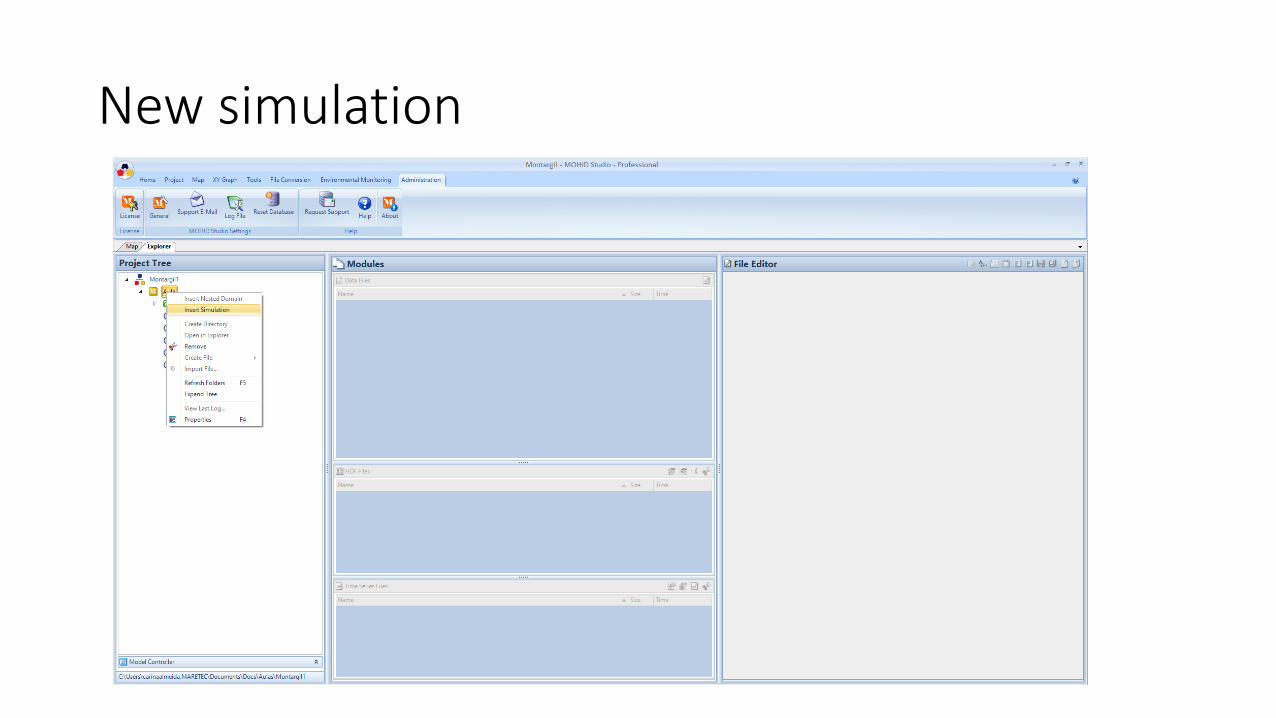
New simulation

New simulation
Add the modules needed

Continuous Simulation

Continuous Simulation

Choose the end dateDo not change the start date!!!

Run New Sim OR Continuous Sim
Create a new folder for your Run results

New Sim OR Continuous Sim
! In Keywords with
finishing_INI
Without ! In
Keywords withfinishing
_INI


