39
Topics to be covered: Competition For Coasts Coping With The Pressure Increasing Risk Coastal Management Fieldwork & Research – Zakynthos
| Date post: | 31-Dec-2015 |
| Category: |
Documents |
| Upload: | ciaran-cooke |
| View: | 67 times |
| Download: | 0 times |
Topics to be covered: Competition For Coasts Coping With The Pressure Increasing Risk Coastal Management Fieldwork & Research – Zakynthos
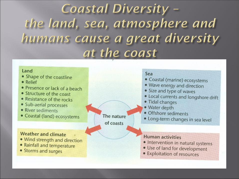
AIMS•To understand that physical factors create a
variety of different coastal environments•To consider how humans use different
coastal environments and how they can also threaten them
Key Question to consider: Why do coasts vary so much?
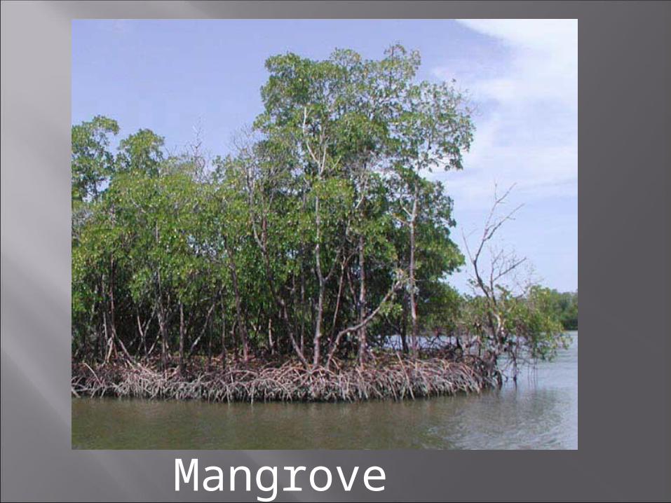
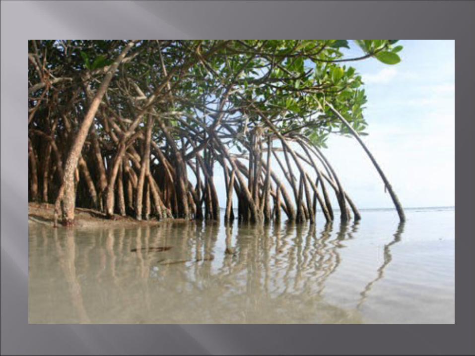
Mangrove Coastline

Tropical Coastline
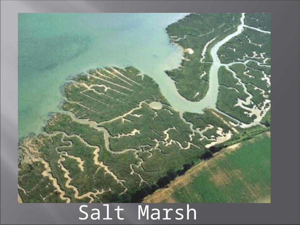
Salt Marsh coasts
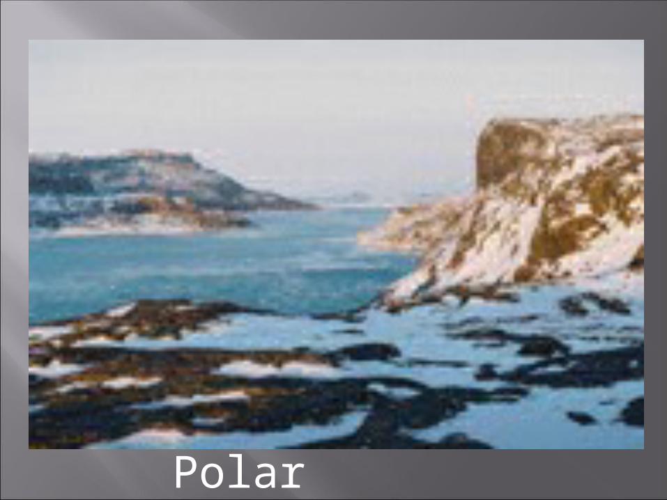
Polar Coastline
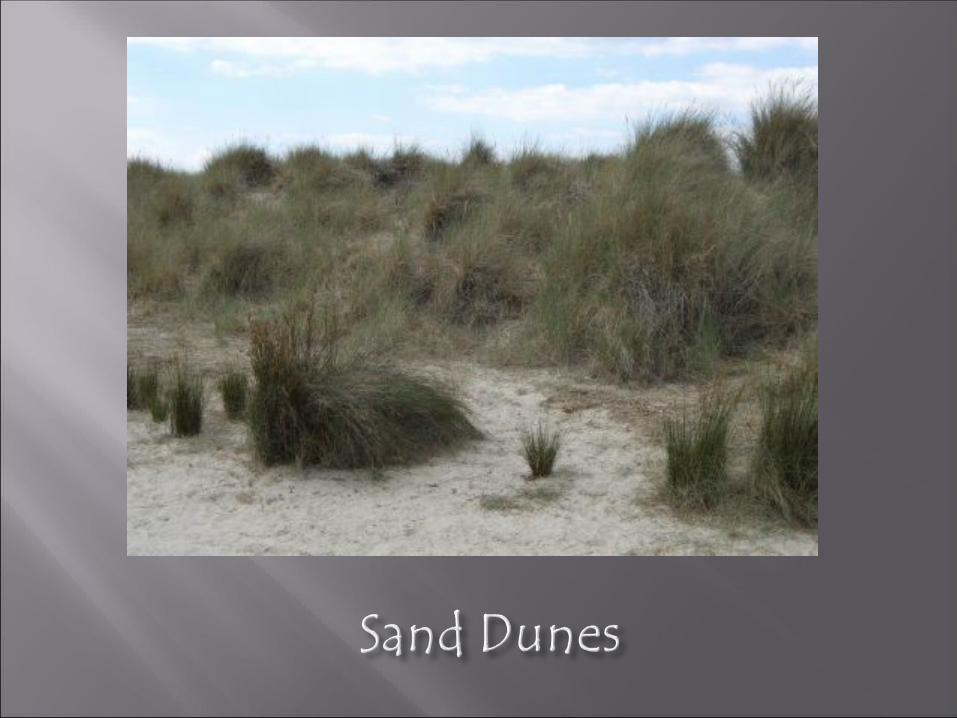
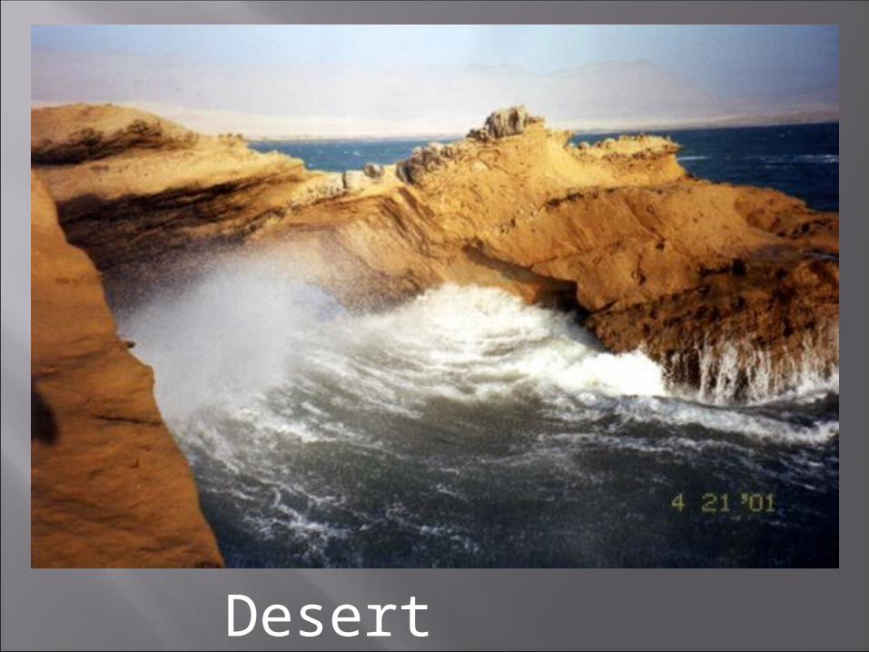
Desert Coastline
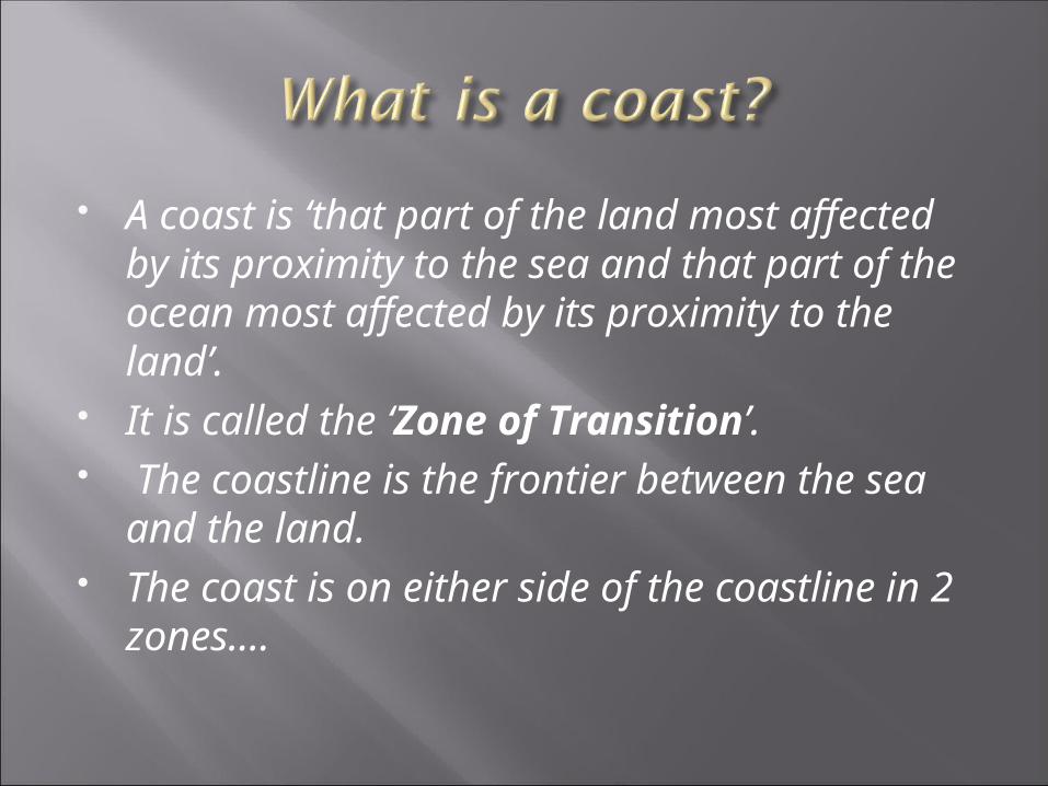
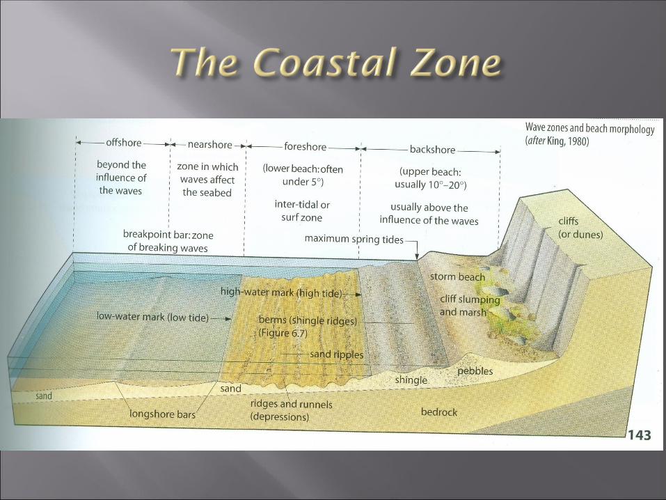
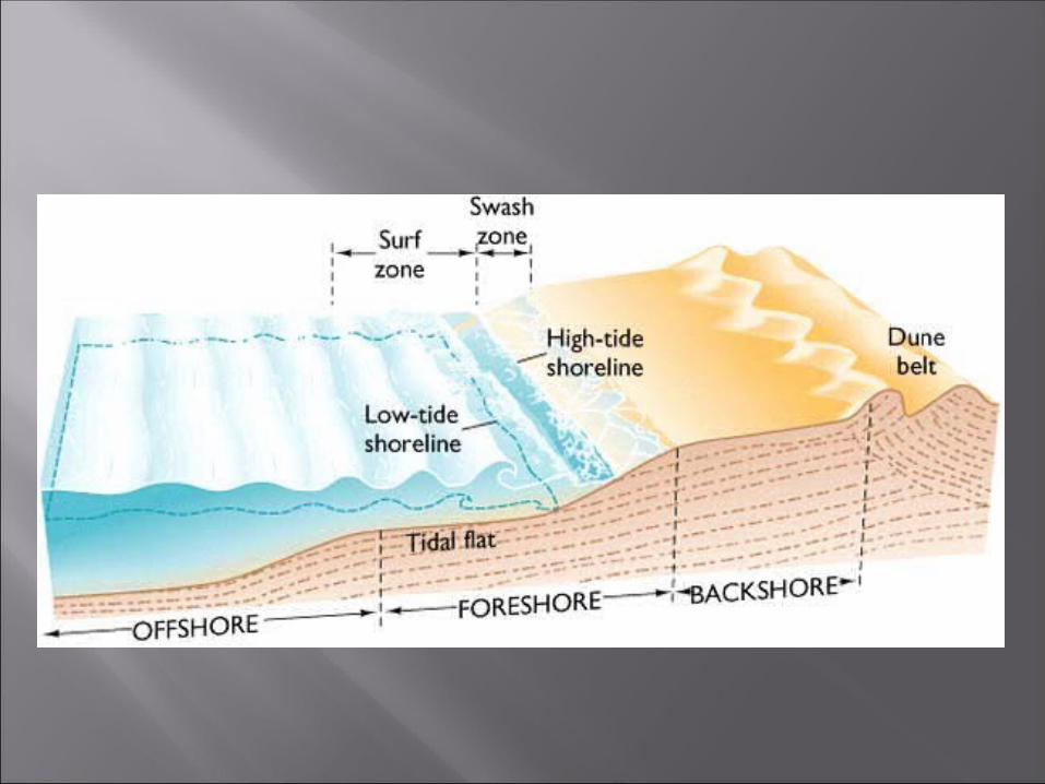
A coast is ‘that part of the land most affected by its proximity to the sea and that part of the ocean most affected by its proximity to the land’.
It is called the ‘Zone of Transition’. The coastline is the frontier between the
sea and the land. The coast is on either side of the
coastline in 2 zones....
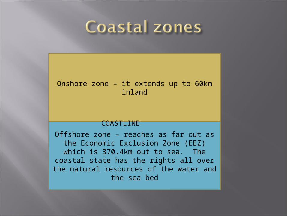
Onshore zone – it extends up to 60km inland
Offshore zone – reaches as far out as the Economic Exclusion Zone (EEZ) which is
370.4km out to sea. The coastal state has the rights all over the natural resources of
the water and the sea bed
COASTLINE
What is the difference between the coastline and the coastal zone?
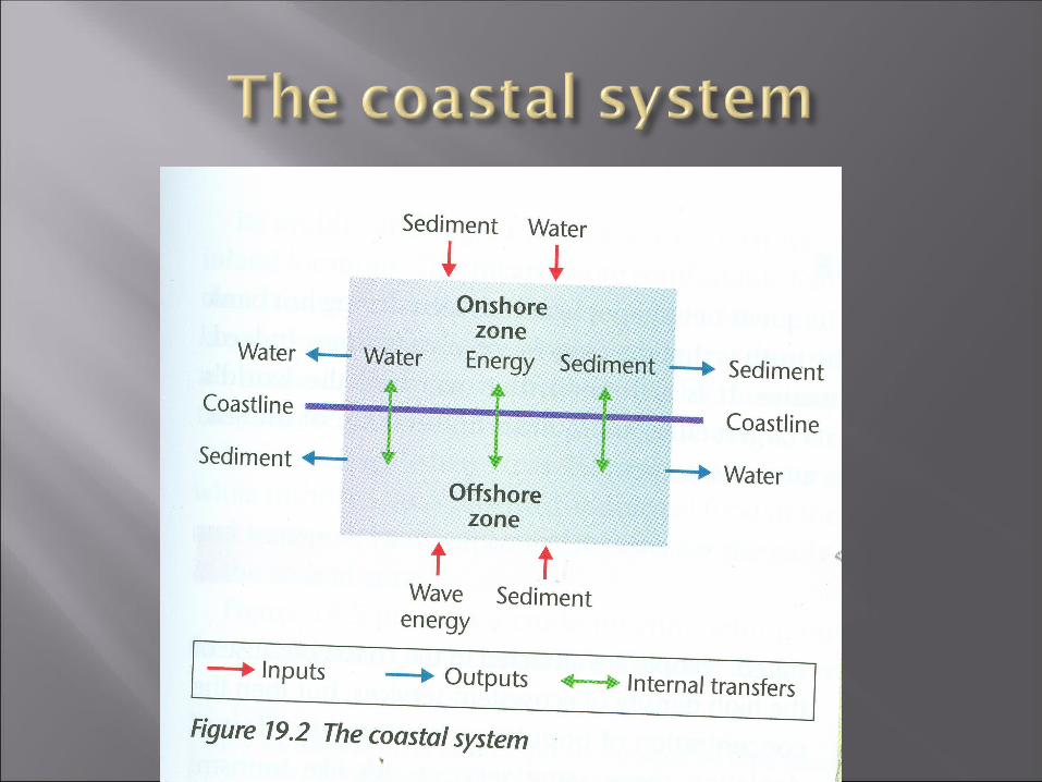
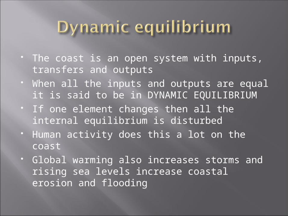
The coast is an open system with inputs, transfers and outputs
When all the inputs and outputs are equal it is said to be in DYNAMIC EQUILIBRIUM
If one element changes then all the internal equilibrium is disturbed
Human activity does this a lot on the coast Global warming also increases storms and
rising sea levels increase coastal erosion and flooding
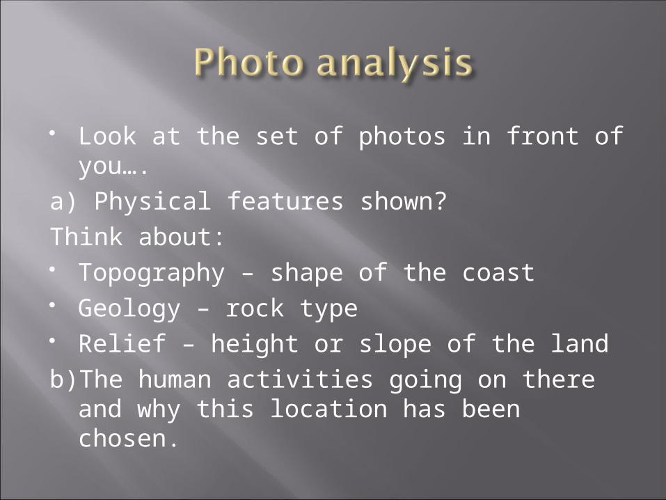
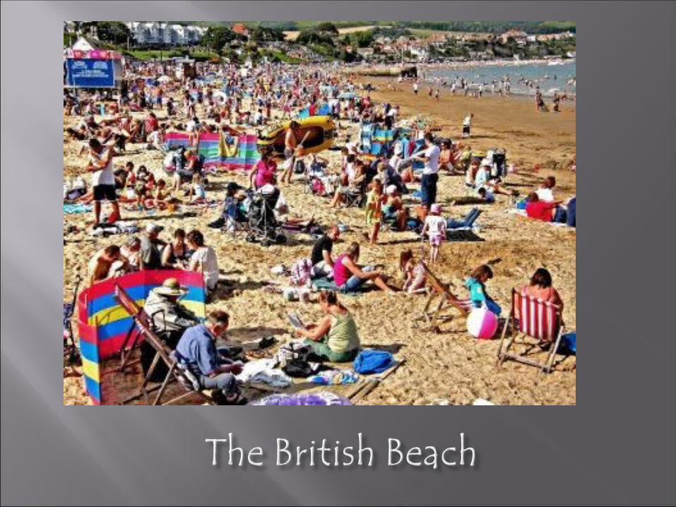
Look at the set of photos in front of you….
a) Physical features shown?Think about: Topography – shape of the coast Geology – rock type Relief – height or slope of the landb)The human activities going on there and
why this location has been chosen.
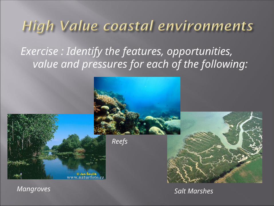
Exercise : Identify the features, opportunities, value and pressures for each of the following:
Mangroves
Reefs
Salt Marshes
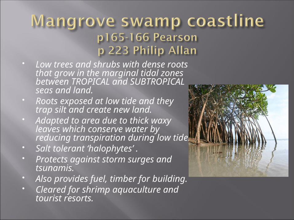
Low trees and shrubs with dense roots that grow in the marginal tidal zones between TROPICAL and SUBTROPICAL seas and land.
Roots exposed at low tide and they trap silt and create new land.
Adapted to area due to thick waxy leaves which conserve water by reducing transpiration during low tide.
Salt tolerant ‘halophytes’ . Protects against storm surges and
tsunamis. Also provides fuel, timber for
building. Cleared for shrimp aquaculture
and tourist resorts.
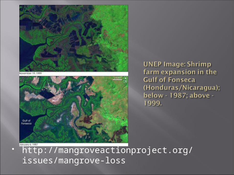
http://mangroveactionproject.org/issues/mangrove-loss
We have already lost over half of the world's original mangrove forest area, estimated at 32 million hectares (app. 80 million acres).
In 2007, less than 15 million hectares (37 million acres) of mangroves remained.
About half of mangrove loss has occurred in the last 50 years, mostly in the last two decades, due to:
shrimp farming tourism urbanisation agriculture expansion roadways Marinas and other intrusive developments. The current rate of mangrove loss is approximately 1% per annum
(according to the Food and Agriculture Organization - FAO), or roughly 150,000 hectares (370,050 acres) of mangrove wetlands lost each year.
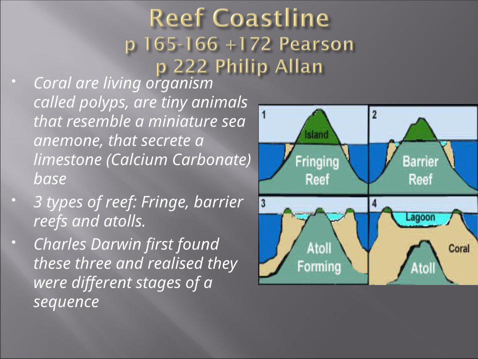
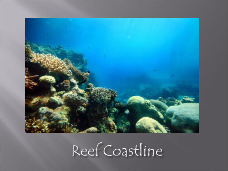
Coral are living organism called polyps, are tiny animals that resemble a miniature sea anemone, that secrete a limestone (Calcium Carbonate) base
3 types of reef: Fringe, barrier reefs and atolls.
Charles Darwin first found these three and realised they were different stages of a sequence
Great Barrier Reef in Australia is the world’s largest coral reef at 1500km long and comprises of 2900 different reefs
Helps dissipate wave energy Fragile and open to exploitation
Conditions necessary for reef growth Coral reefs are found largely between the tropics of Capricorn and Cancer where: water temperatures are warm. Corals are unable to thrive in water that is much
below 16 C and grow best with a range of 18-30 C. In the tropics there is little annual variation in sea temperature. (But coral reefs are either restricted or absent from along the west coast of the Americas, as well as the west coast of Africa. This is due primarily to upwelling and strong cold coastal currents that reduce water temperatures in these areas.)
salinity is at favourable level. Freshwater kills coral and this is clearly seen where rivers flow out into coastal reef areas. Corals are restricted from off the coastline of South Asia from Pakistan to Bangladesh. They are also restricted along the coast around north-eastern South America and Bangladesh due to the release of vast quantities of freshwater from the Amazon and Ganges Rivers respectively.
.
clear water prevails. Silt that discharges at a river mouth will blanket the coral and affect the feeding mechanism of the corals and animals on the reef. For example at the mouth of the Amazon coral reef is absent due to the huge quantities of silt that are released.
brightly lit waters that are fully penetrated by the sun’s rays. So corals are restricted to depths rarely exceeding 37metres. Beyond this limit too little light is absorbed and the algae that feed the corals cannot be supported
See worksheet on the blog and text books
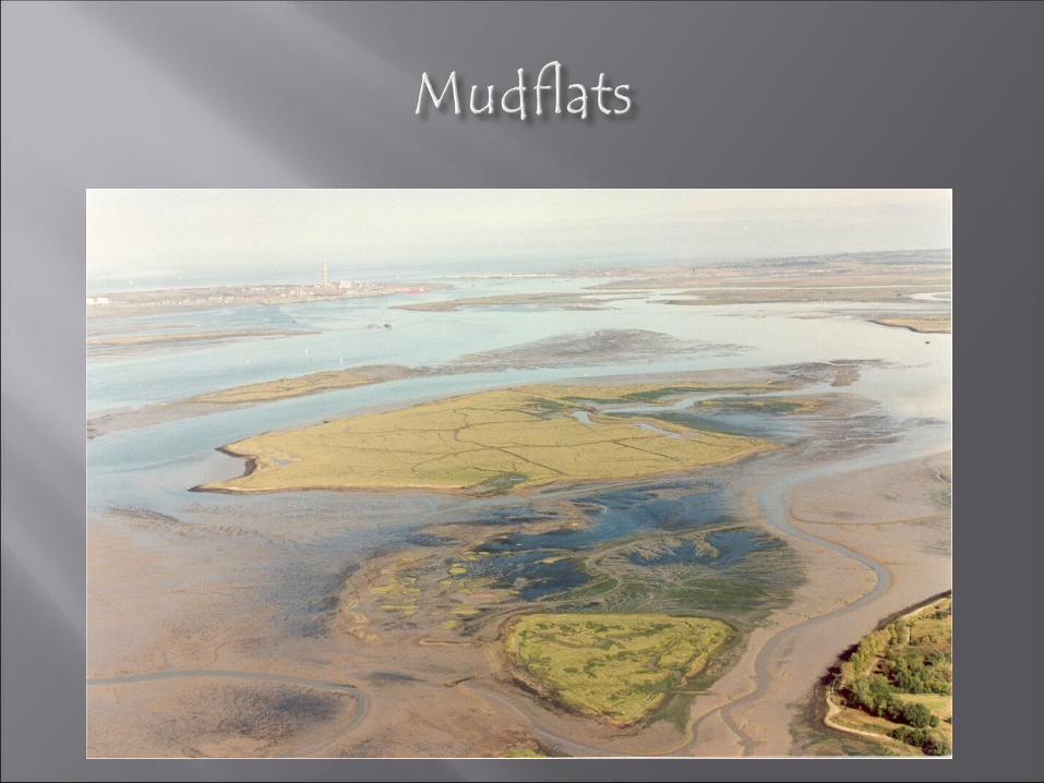
Occur in estuaries where fresh water and sea waters mix.
Defined as the vegetation that occurs on muddy shores where boggy ground is either flooded by sea water daily or less often.
Form on the shore due to a lack of wave action and the tide.
Incoming tide moves across the sheltered shore bringing sediment and detritus, the lack of wave action results in this material settling out at slack water.
Accretion takes place; sediment builds up forming soil and can even raise the level of mud.
Abiotic Factors: (Non Living) Saline Mud/Soil: Seawater deposits salts (solutes) in the
sediment. Causing problems for plants growing. Waterlogged Soil: The air spaces within the soil are
filled with water rather than air. Roots need oxygen for respiration as much as other parts of the plant. Long-term waterlogging creates an anaerobic condition of black mud, which is toxic to plants.
Drag and Scour: The tidal movement across the surface causes a sideways drag on the plant. With two tides a day this will possibly uproot the plants. The water contains sediment like sand and mud particles and this will scour the plants like being buffed with sandpaper.
Biotic (living) Salt tolerant plants grow - Halophytes. May even be submerged
for part of the day.See Pearson p165 Valuable ecosystems as reduce tidal energy and provide a vital
habitat to many wading birds.Threats Reclamation eg for farming Industrial pollution Agricultural pollution causes eutrophication Shipping and bating causes wash which leads to die back in
vegetation Marinas and recreation adds pressure Global warming – high impact storms, changing temperature
and rainfall affects the plants and sea level change.
Fill in the sheets about the features, value, opportunities and pressures of these 3 high value ecosystems
Sorting out succession…..on your Pearson CD ROM