58
CPDC GeoDesign Studio Full Engagement
| Date post: | 12-Aug-2015 |
| Category: |
Documents |
| Upload: | philip-evans |
| View: | 82 times |
| Download: | 0 times |
CPDC GeoDesign Studio
Full Engagement
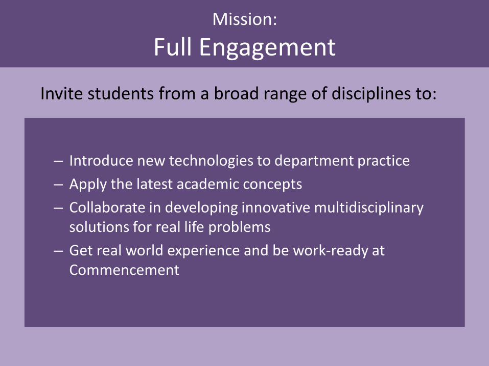
Mission:
Full Engagement
– Introduce new technologies to department practice – Apply the latest academic concepts – Collaborate in developing innovative multidisciplinary
solutions for real life problems – Get real world experience and be work-ready at
Commencement
Invite students from a broad range of disciplines to:

In their own words and pictures…
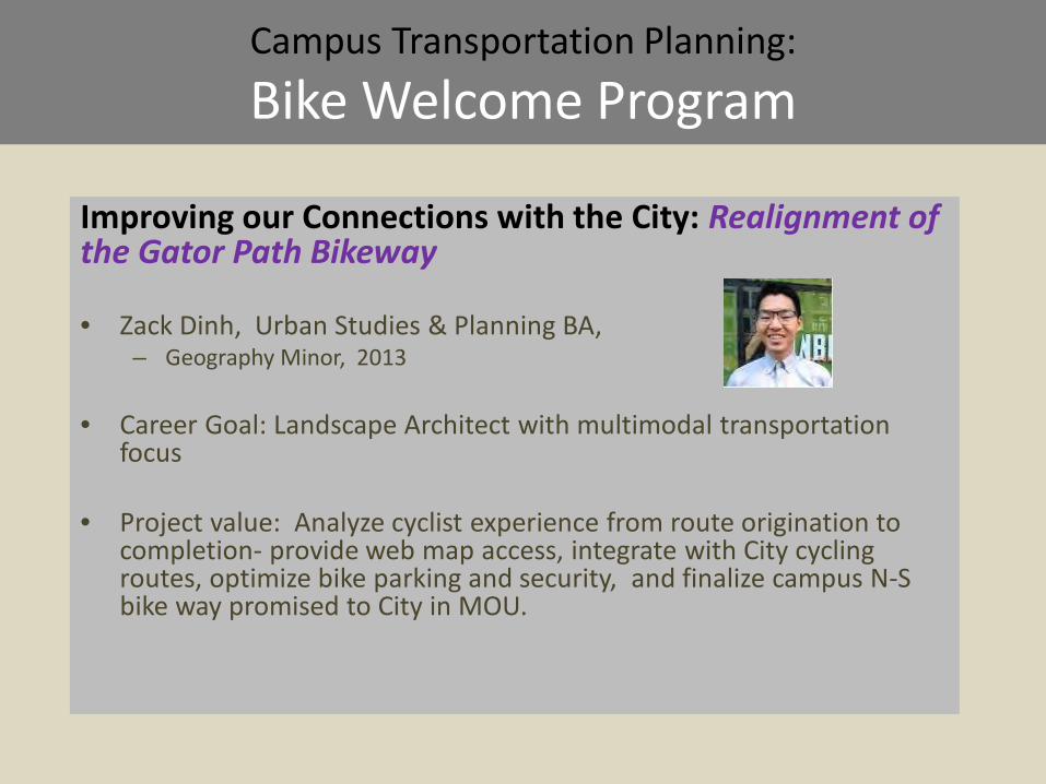
Campus Transportation Planning:
Bike Welcome Program
Improving our Connections with the City: Realignment of the Gator Path Bikeway
• Zack Dinh, Urban Studies & Planning BA,
– Geography Minor, 2013
• Career Goal: Landscape Architect with multimodal transportation focus
• Project value: Analyze cyclist experience from route origination to completion- provide web map access, integrate with City cycling routes, optimize bike parking and security, and finalize campus N-S bike way promised to City in MOU.
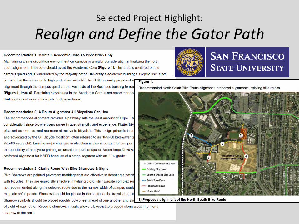
Selected Project Highlight:
Realign and Define the Gator Path
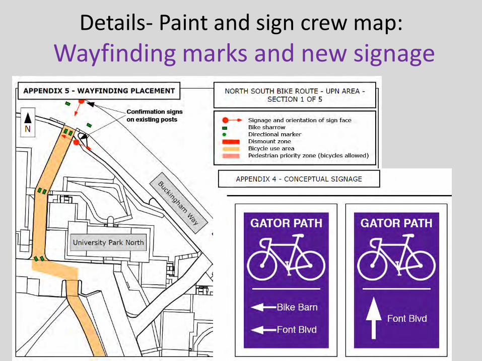
Details- Paint and sign crew map: Wayfinding marks and new signage
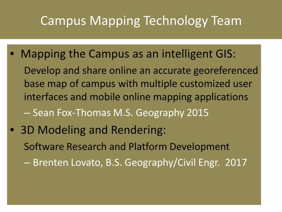
Campus Mapping Technology Team
• Mapping the Campus as an intelligent GIS: Develop and share online an accurate georeferenced base map of campus with multiple customized user interfaces and mobile online mapping applications – Sean Fox-Thomas M.S. Geography 2015
• 3D Modeling and Rendering: Software Research and Platform Development – Brenten Lovato, B.S. Geography/Civil Engr. 2017
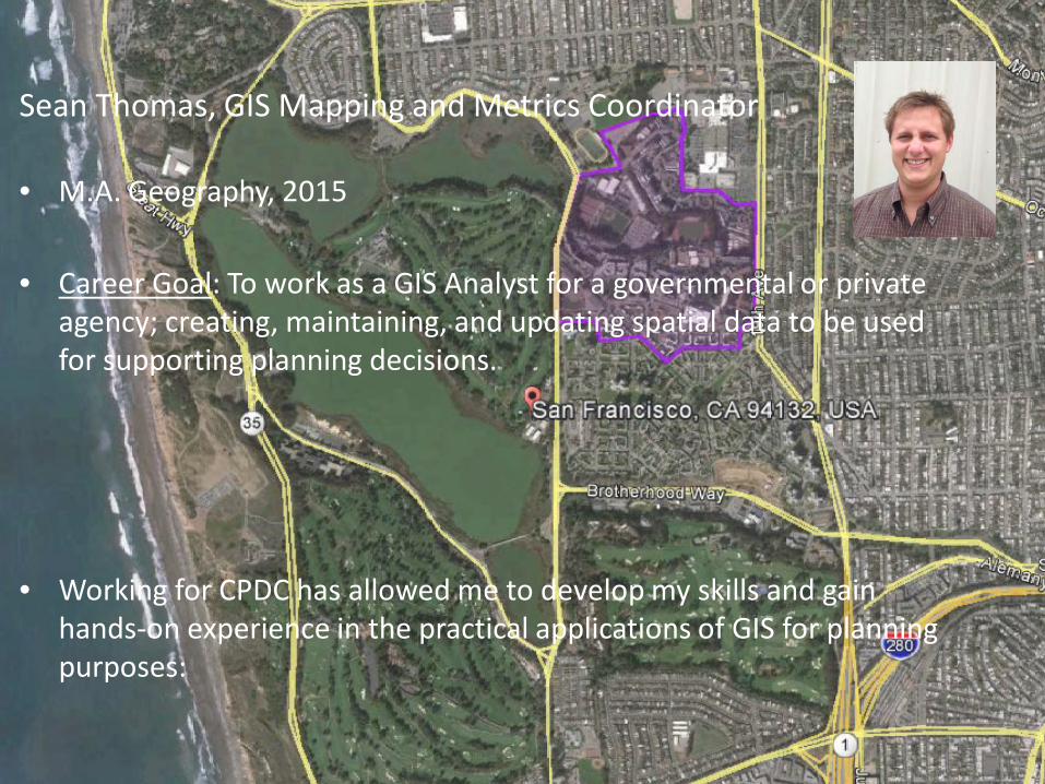
Sean Thomas, GIS Mapping and Metrics Coordinator • M.A. Geography, 2015 • Career Goal: To work as a GIS Analyst for a governmental or private
agency; creating, maintaining, and updating spatial data to be used for supporting planning decisions.
• Working for CPDC has allowed me to develop my skills and gain hands-on experience in the practical applications of GIS for planning purposes:
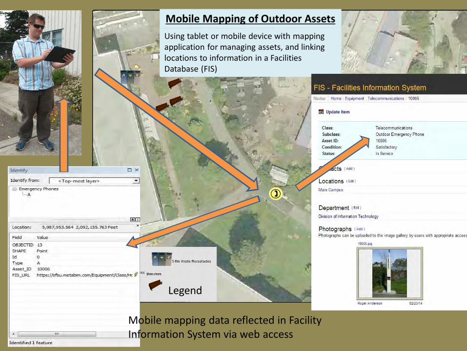
Mobile Mapping of Outdoor Assets Using tablet or mobile device with mapping application for managing assets, and linking locations to information in a Facilities Database (FIS)
Mobile mapping data reflected in Facility Information System via web access
Legend
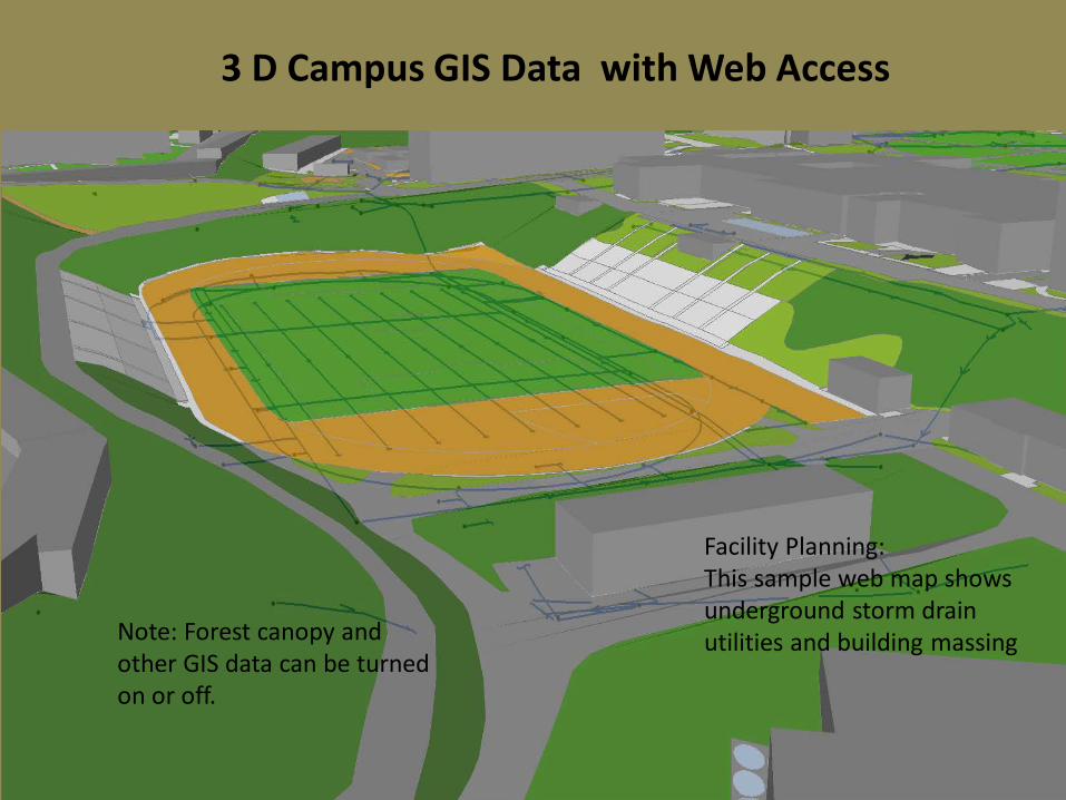
3 D Campus GIS Data with Web Access
Facility Planning: This sample web map shows underground storm drain utilities and building massing Note: Forest canopy and
other GIS data can be turned on or off.
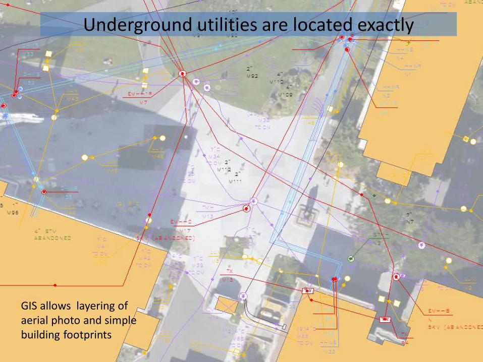
Underground utilities are located exactly
GIS allows layering of aerial photo and simple building footprints
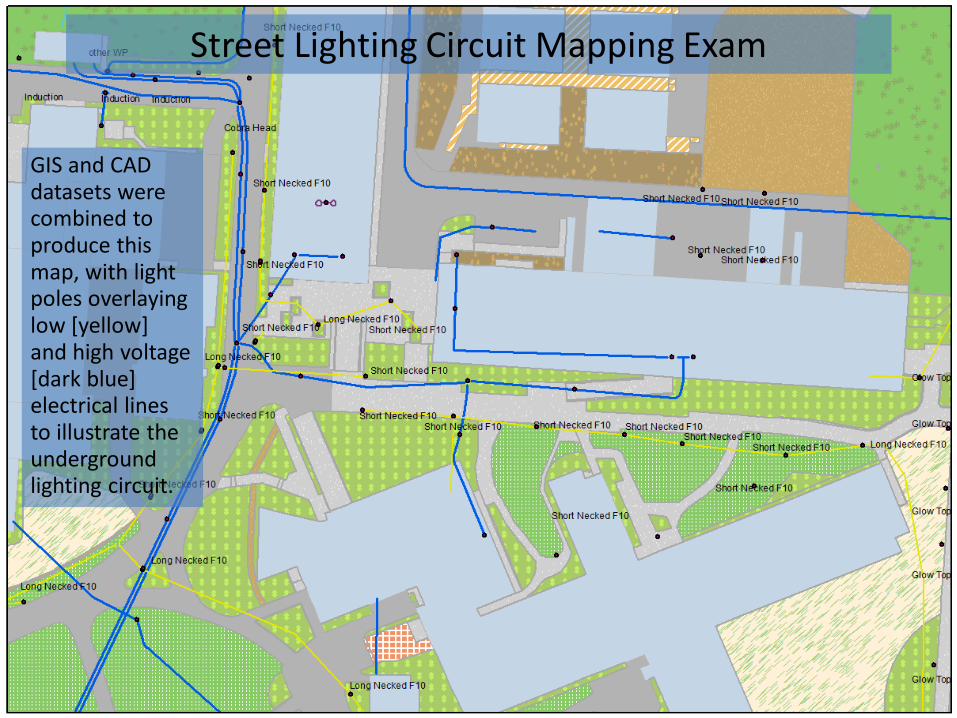
GIS and CAD datasets were combined to produce this map, with light poles overlaying low [yellow] and high voltage [dark blue] electrical lines to illustrate the underground lighting circuit.
Street Lighting Circuit Mapping Exam
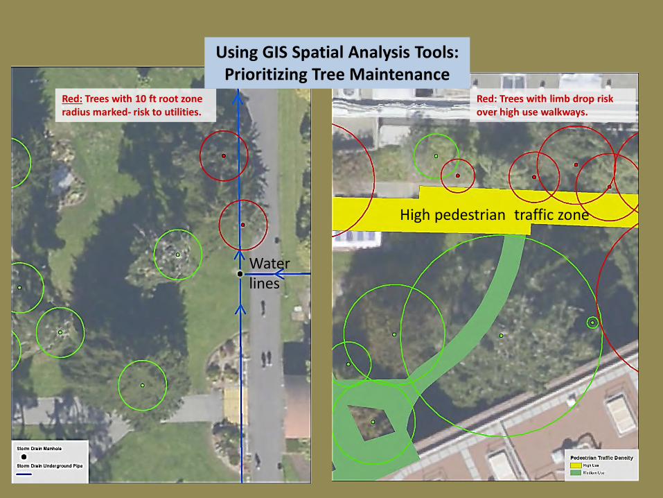
Red: Trees with 10 ft root zone radius marked- risk to utilities.
Red: Trees with limb drop risk over high use walkways.
Using GIS Spatial Analysis Tools: Prioritizing Tree Maintenance
Water lines
High pedestrian traffic zone
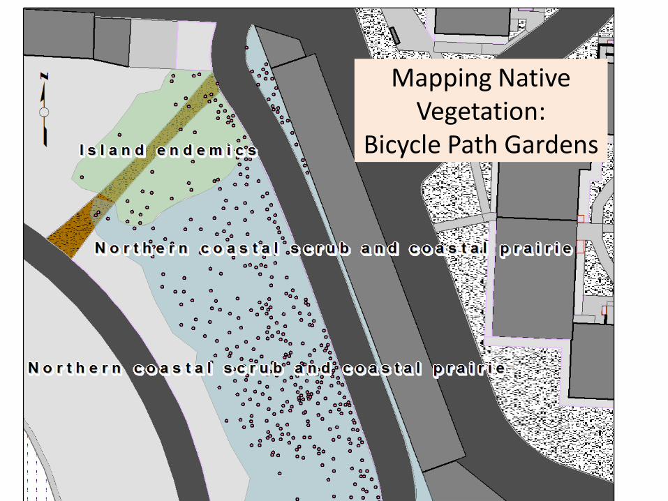
Mapping Native Vegetation:
Bicycle Path Gardens
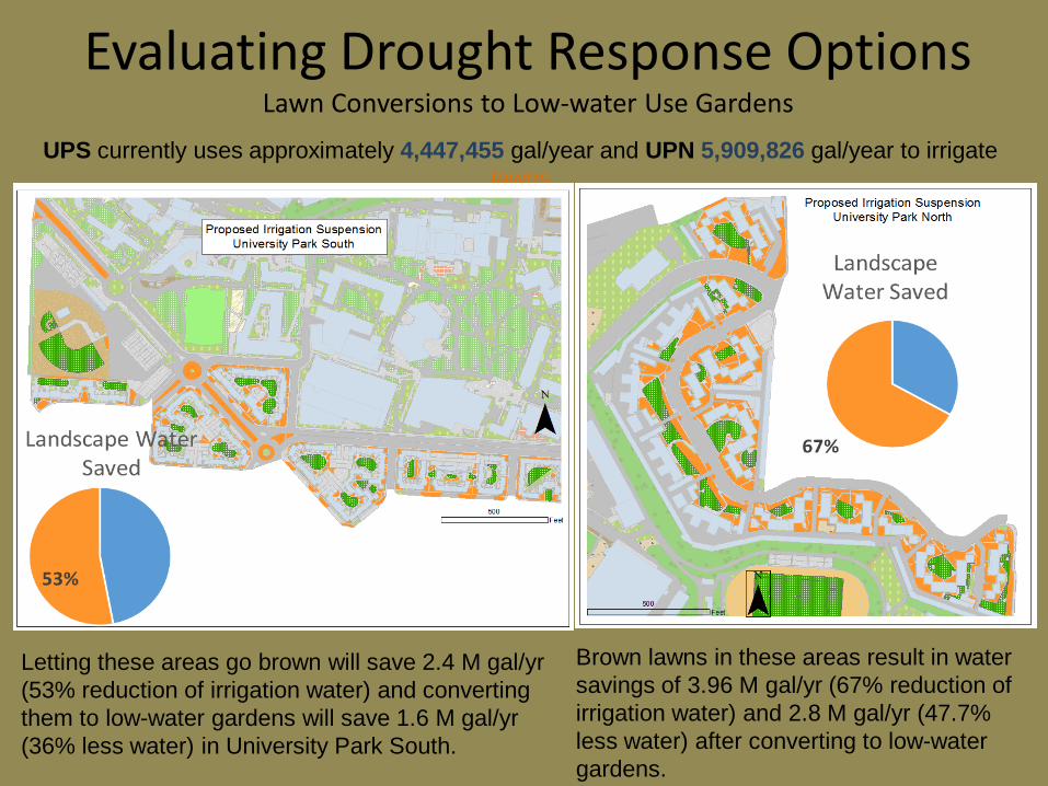
Evaluating Drought Response Options Lawn Conversions to Low-water Use Gardens
UPS currently uses approximately 4,447,455 gal/year and UPN 5,909,826 gal/year to irrigate lawns
Letting these areas go brown will save 2.4 M gal/yr (53% reduction of irrigation water) and converting them to low-water gardens will save 1.6 M gal/yr (36% less water) in University Park South.
Brown lawns in these areas result in water savings of 3.96 M gal/yr (67% reduction of irrigation water) and 2.8 M gal/yr (47.7% less water) after converting to low-water gardens.
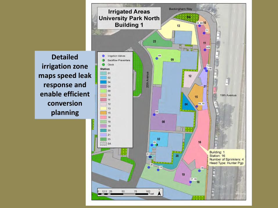
Detailed irrigation zone
maps speed leak response and
enable efficient conversion
planning
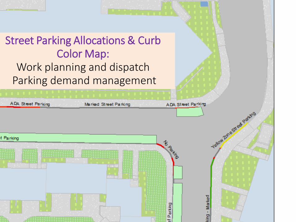
Street Parking Allocations & Curb Color Map:
Work planning and dispatch Parking demand management
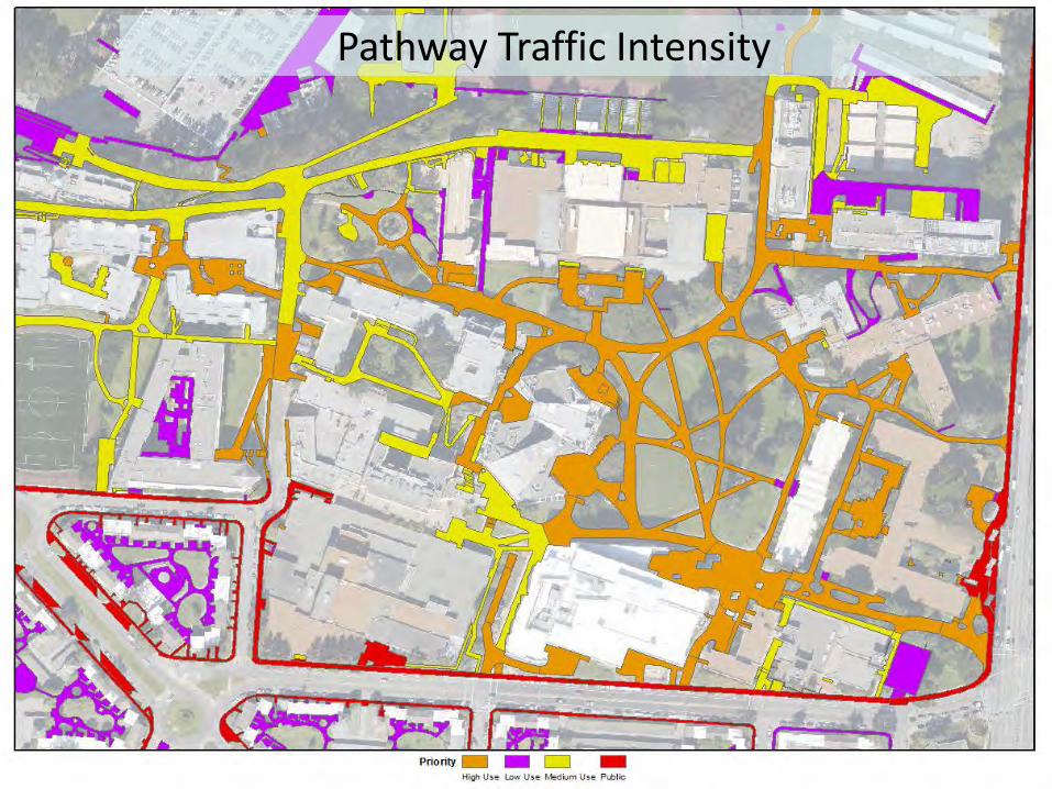
Pathway Traffic Intensity
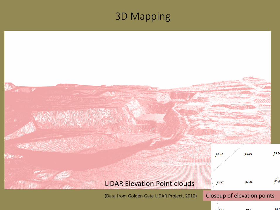
LiDAR Elevation Point clouds (Data from Golden Gate LiDAR Project, 2010)
3D Mapping
Closeup of elevation points
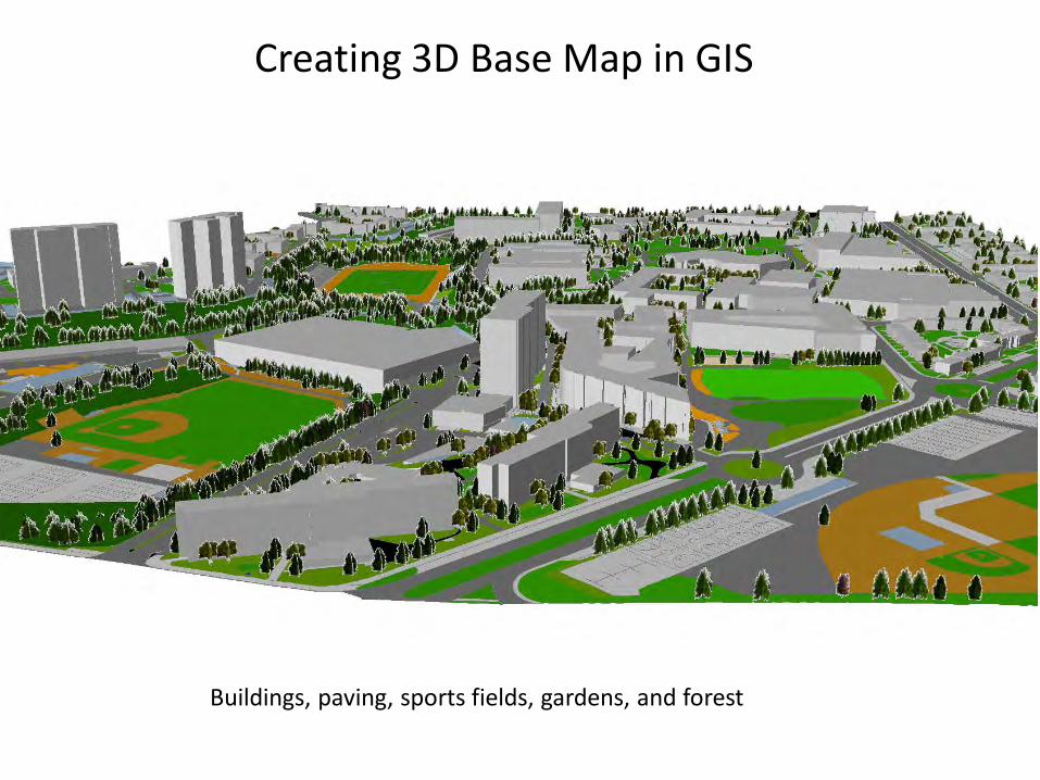
Creating 3D Base Map in GIS
Buildings, paving, sports fields, gardens, and forest
• User groups: – Physical Planning and Development – University Police – Geography and Environmental Sciences Program – Classes:Urban Planning, Biology, Engineering, etc.
Campus GIS Basemap and Attribute Database
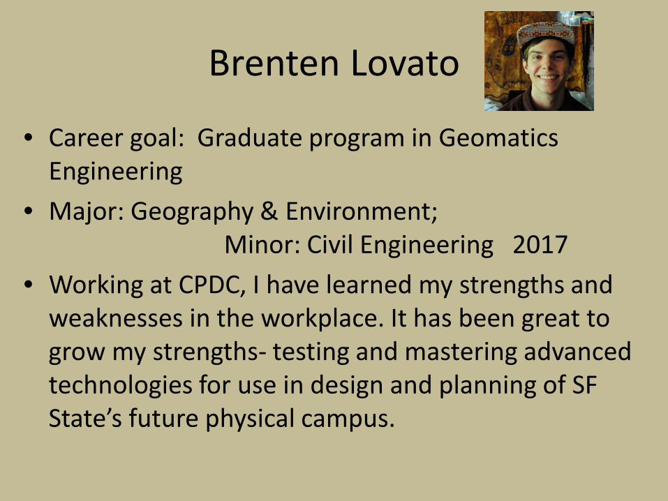
Brenten Lovato
• Career goal: Graduate program in Geomatics Engineering
• Major: Geography & Environment; Minor: Civil Engineering 2017
• Working at CPDC, I have learned my strengths and weaknesses in the workplace. It has been great to grow my strengths- testing and mastering advanced technologies for use in design and planning of SF State’s future physical campus.
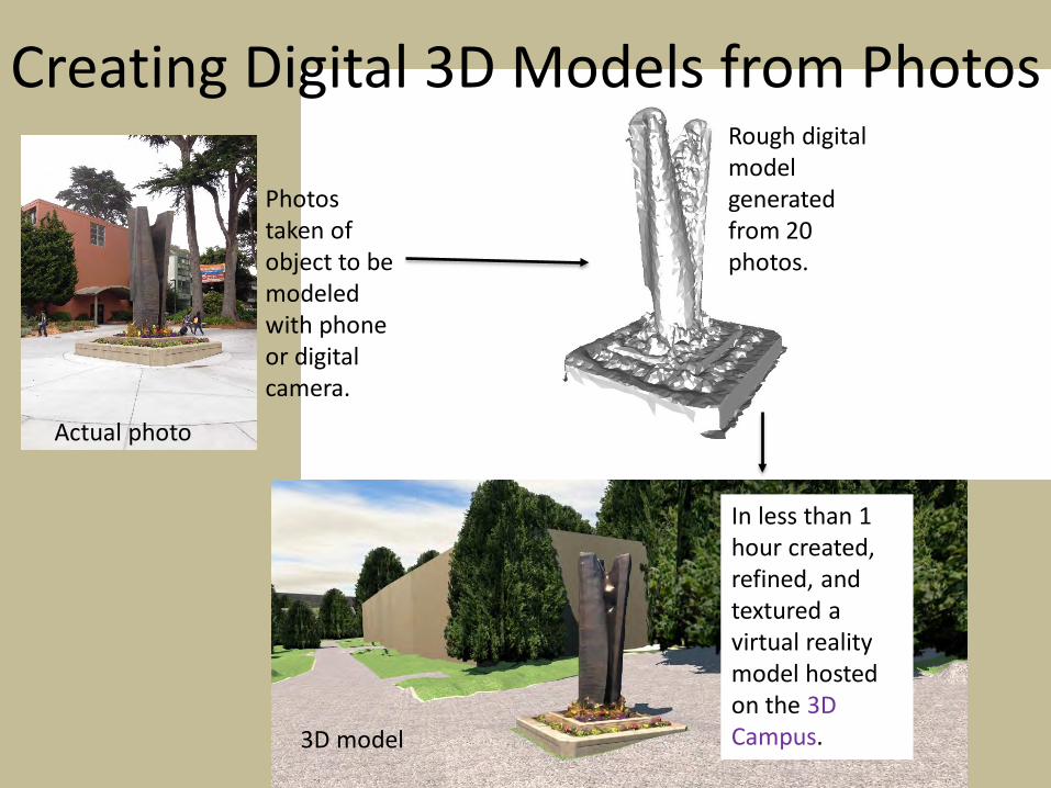
Creating Digital 3D Models from Photos
Photos taken of object to be modeled with phone or digital camera.
Rough digital model generated from 20 photos.
In less than 1 hour created, refined, and textured a virtual reality model hosted on the 3D Campus.
Actual photo
3D model
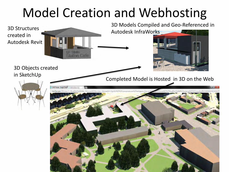
Model Creation and Webhosting
3D Objects created in SketchUp
3D Models Compiled and Geo-Referenced in Autodesk InfraWorks
Completed Model is Hosted in 3D on the Web
3D Structures created in Autodesk Revit
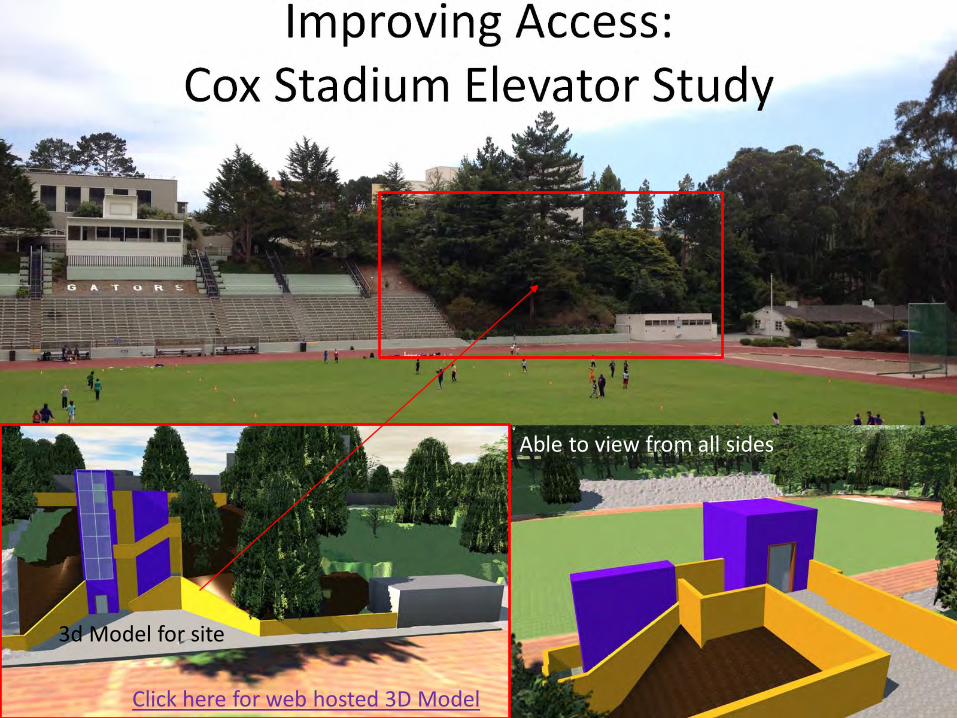
Click here for web hosted 3D Model
Able to view from all sides
3d Model for site
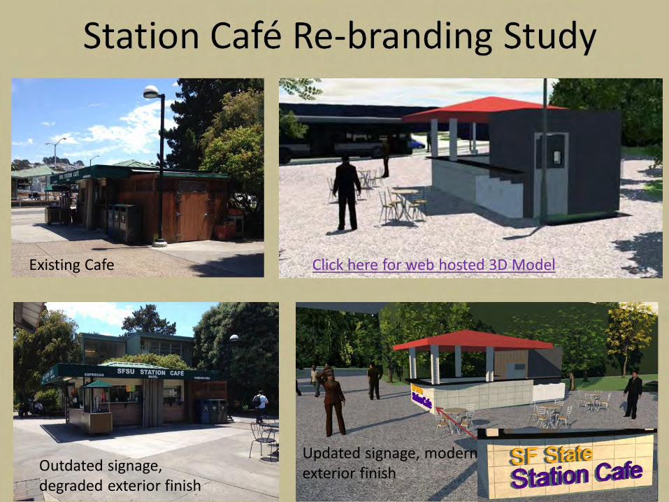
Click here for web hosted 3D Model Existing Cafe
Outdated signage, degraded exterior finish
Updated signage, modern exterior finish
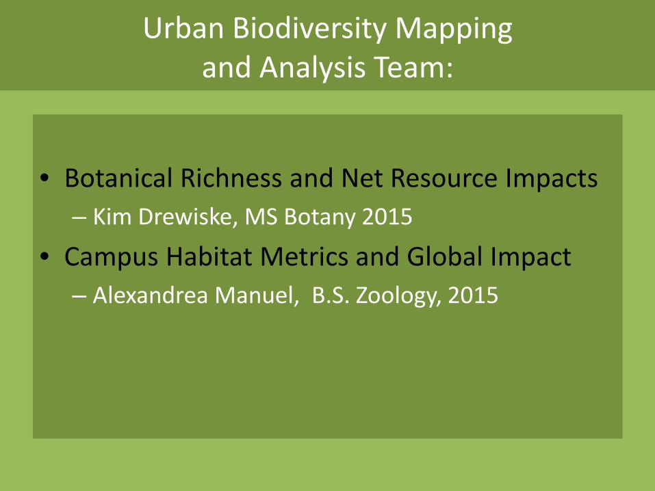
Urban Biodiversity Mapping
and Analysis Team:
• Botanical Richness and Net Resource Impacts
– Kim Drewiske, MS Botany 2015
• Campus Habitat Metrics and Global Impact – Alexandrea Manuel, B.S. Zoology, 2015
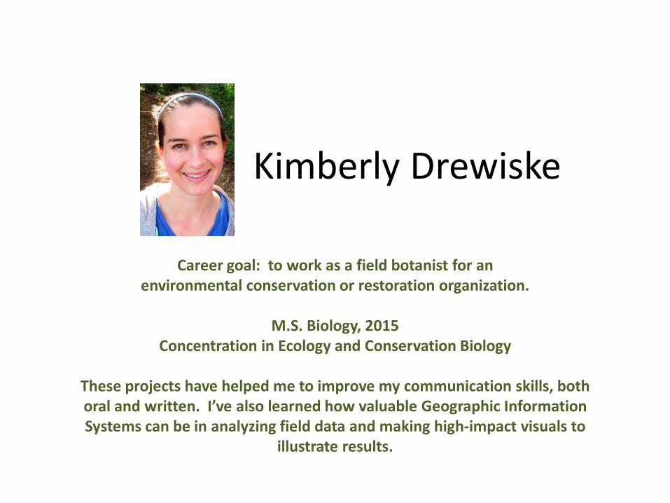
Kimberly Drewiske
Career goal: to work as a field botanist for an environmental conservation or restoration organization.
M.S. Biology, 2015
Concentration in Ecology and Conservation Biology
These projects have helped me to improve my communication skills, both oral and written. I’ve also learned how valuable Geographic Information Systems can be in analyzing field data and making high-impact visuals to
illustrate results.
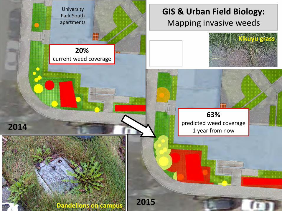
2014
2015
University Park South apartments
Dandelions on campus
20% current weed coverage
63% predicted weed coverage
1 year from now
GIS & Urban Field Biology: Mapping invasive weeds
Kikuyu grass
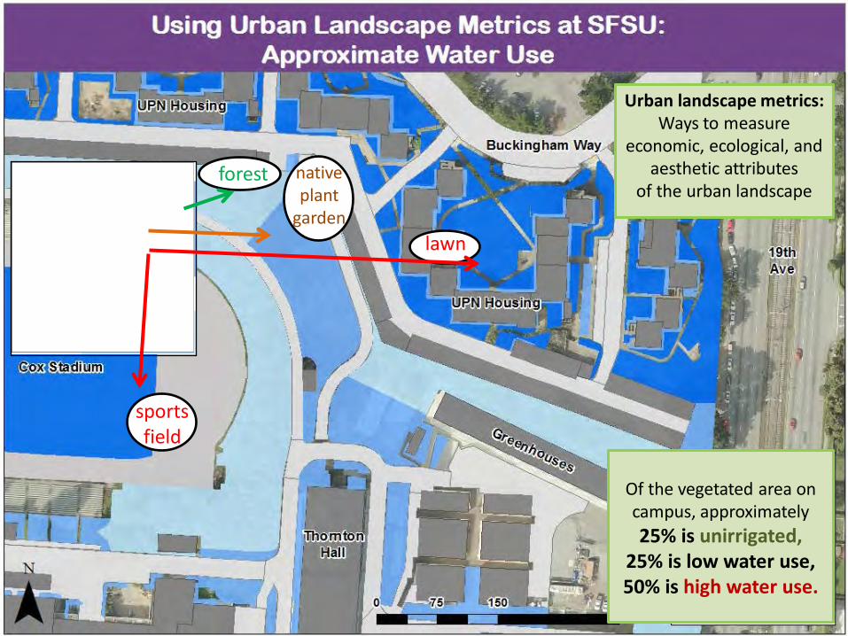
Urban landscape metrics: Ways to measure
economic, ecological, and aesthetic attributes
of the urban landscape
sports field
lawn
forest native plant
garden
Of the vegetated area on campus, approximately 25% is unirrigated,
25% is low water use, 50% is high water use.
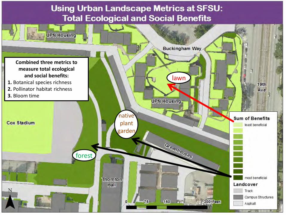
Combined three metrics to measure total ecological
and social benefits: 1. Botanical species richness 2. Pollinator habitat richness 3. Bloom time
lawn
native plant
garden
forest
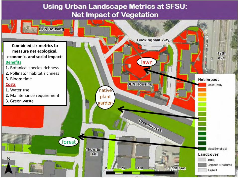
Mapping six attributes of the landscape Combined six metrics to measure net ecological,
economic, and social impact: Benefits 1. Botanical species richness 2. Pollinator habitat richness 3. Bloom time Costs 1. Water use 2. Maintenance requirement 3. Green waste
lawn
forest
native plant
garden
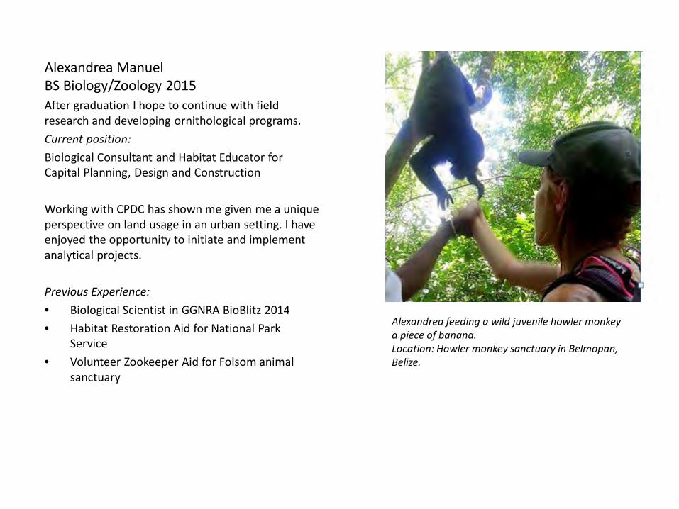
Alexandrea Manuel BS Biology/Zoology 2015 After graduation I hope to continue with field research and developing ornithological programs. Current position: Biological Consultant and Habitat Educator for Capital Planning, Design and Construction Working with CPDC has shown me given me a unique perspective on land usage in an urban setting. I have enjoyed the opportunity to initiate and implement analytical projects. Previous Experience: • Biological Scientist in GGNRA BioBlitz 2014 • Habitat Restoration Aid for National Park
Service • Volunteer Zookeeper Aid for Folsom animal
sanctuary
Alexandrea feeding a wild juvenile howler monkey a piece of banana. Location: Howler monkey sanctuary in Belmopan, Belize.
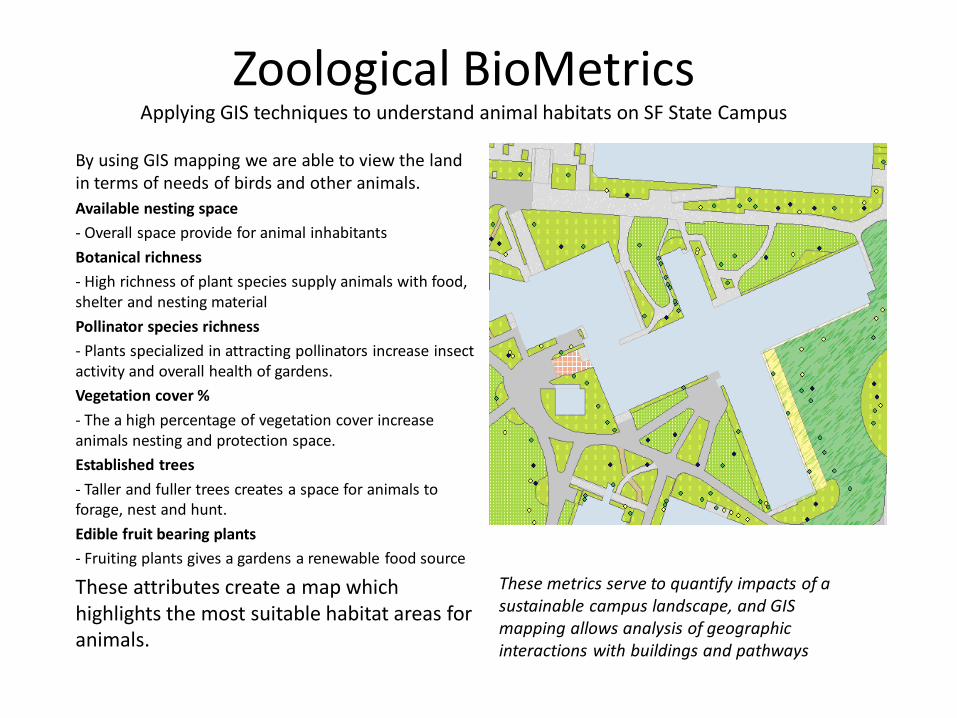
Zoological BioMetrics
Applying GIS techniques to understand animal habitats on SF State Campus
By using GIS mapping we are able to view the land in terms of needs of birds and other animals. Available nesting space - Overall space provide for animal inhabitants Botanical richness - High richness of plant species supply animals with food, shelter and nesting material Pollinator species richness - Plants specialized in attracting pollinators increase insect activity and overall health of gardens. Vegetation cover % - The a high percentage of vegetation cover increase animals nesting and protection space. Established trees - Taller and fuller trees creates a space for animals to forage, nest and hunt. Edible fruit bearing plants - Fruiting plants gives a gardens a renewable food source
These attributes create a map which highlights the most suitable habitat areas for animals.
These metrics serve to quantify impacts of a sustainable campus landscape, and GIS mapping allows analysis of geographic interactions with buildings and pathways
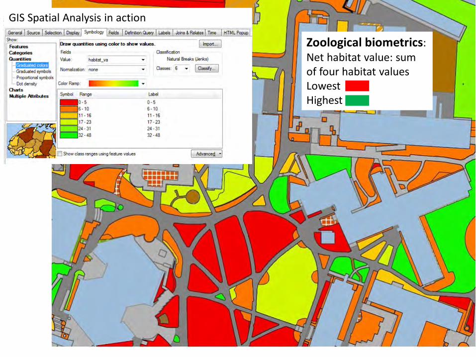
Zoological biometrics: Net habitat value: sum of four habitat values Lowest Highest
GIS Spatial Analysis in action
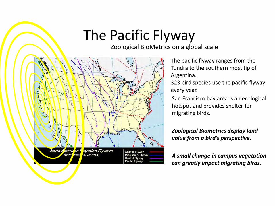
The Pacific Flyway
San Francisco bay area is an ecological hotspot and provides shelter for migrating birds. Zoological Biometrics display land value from a bird’s perspective. A small change in campus vegetation can greatly impact migrating birds.
The pacific flyway ranges from the Tundra to the southern most tip of Argentina. 323 bird species use the pacific flyway every year.
Zoological BioMetrics on a global scale
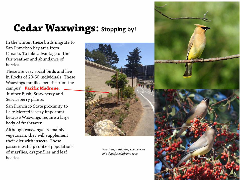
Cedar Waxwings: Stopping by!
In the winter, these birds migrate to San Francisco bay area from Canada. To take advantage of the fair weather and abundance of berries. These are very social birds and live in flocks of 20-60 individuals. These Waxwings families benefit from the campus’ Pacific Madrone, Juniper Bush, Strawberry and Serviceberry plants. San Francisco State proximity to Lake Merced is very important because Waxwings require a large body of freshwater. Although waxwings are mainly vegetarian, they will supplement their diet with insects. These passerines help control populations of mayflies, dragonflies and leaf beetles.
Waxwings enjoying the berries of a Pacific Madrone tree
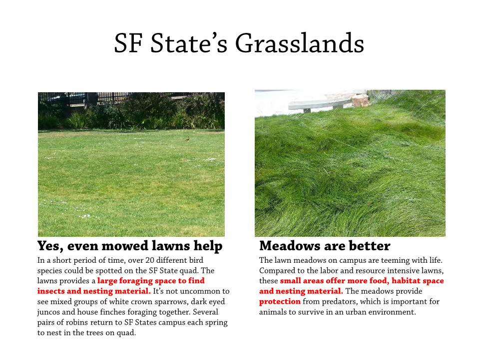
SF State’s Grasslands
Meadows are better The lawn meadows on campus are teeming with life. Compared to the labor and resource intensive lawns, these small areas offer more food, habitat space and nesting material. The meadows provide protection from predators, which is important for animals to survive in an urban environment.
Yes, even mowed lawns help In a short period of time, over 20 different bird species could be spotted on the SF State quad. The lawns provides a large foraging space to find insects and nesting material. It’s not uncommon to see mixed groups of white crown sparrows, dark eyed juncos and house finches foraging together. Several pairs of robins return to SF States campus each spring to nest in the trees on quad.
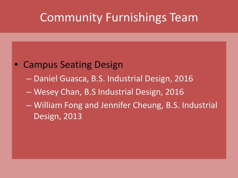
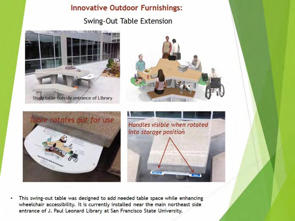
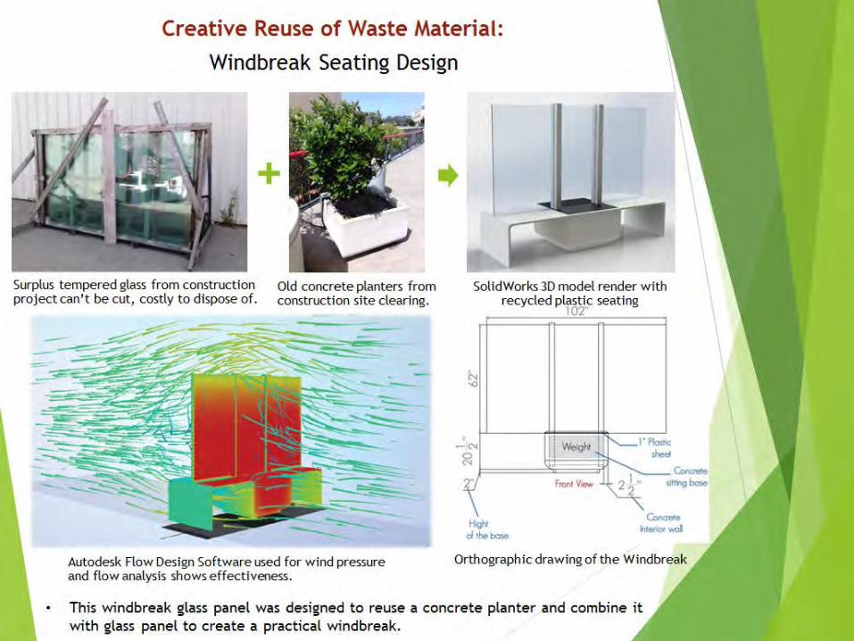
Community Furnishings Team
• Campus Seating Design
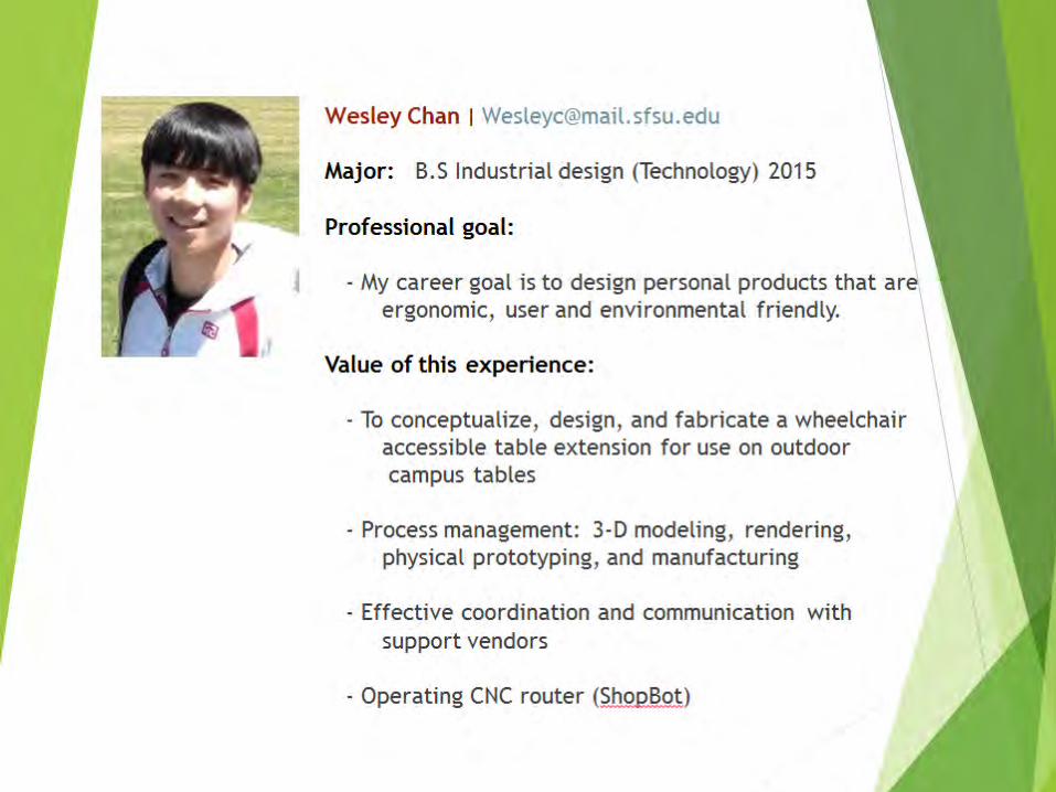
– Daniel Guasca, B.S. Industrial Design, 2016 – Wesey Chan, B.S Industrial Design, 2016 – William Fong and Jennifer Cheung, B.S. Industrial
Design, 2013
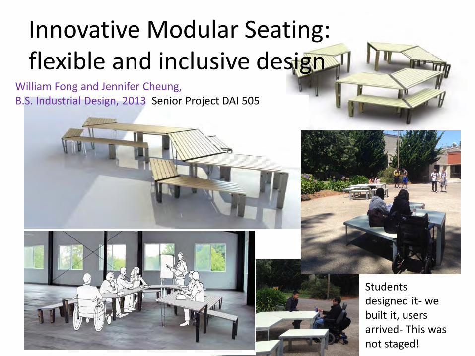
Innovative Modular Seating: flexible and inclusive design
Students designed it- we built it, users arrived- This was not staged!
William Fong and Jennifer Cheung, B.S. Industrial Design, 2013 Senior Project DAI 505
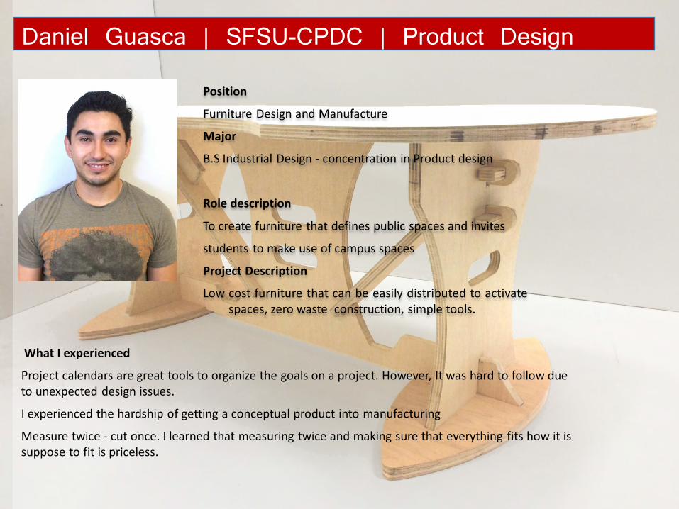
Position
Furniture Design and Manufacture
Major
B.S Industrial Design - concentration in Product design
Role description
To create furniture that defines public spaces and invites
students to make use of campus spaces
Project Description
Low cost furniture that can be easily distributed to activate spaces, zero waste construction, simple tools.
Daniel Guasca | SFSU-CPDC | Product Design
What I experienced
Project calendars are great tools to organize the goals on a project. However, It was hard to follow due to unexpected design issues.
I experienced the hardship of getting a conceptual product into manufacturing
Measure twice - cut once. I learned that measuring twice and making sure that everything fits how it is suppose to fit is priceless.
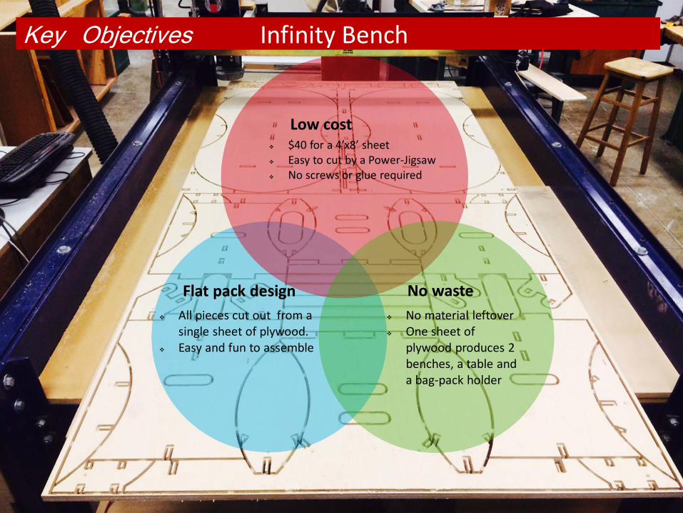
Key Objectives
No material leftover One sheet of
plywood produces 2 benches, a table and a bag-pack holder
All pieces cut out from a single sheet of plywood.
Easy and fun to assemble
Flat pack design No waste
$40 for a 4’x8’ sheet Easy to cut by a Power-Jigsaw No screws or glue required
Low cost
Infinity Bench
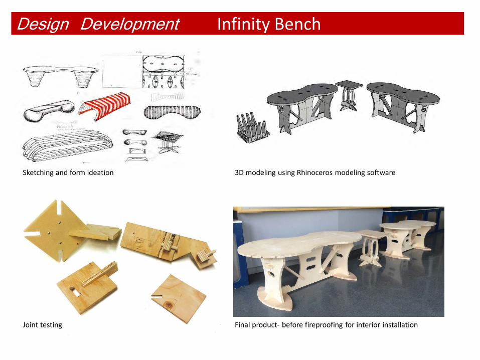
Design Development
3D modeling using Rhinoceros modeling software
Joint testing Final product- before fireproofing for interior installation
Sketching and form ideation
Infinity Bench
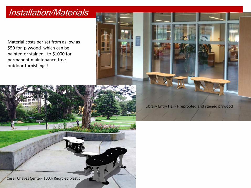
Installation/Materials
Joint testing
Library Entry Hall- Fireproofed and stained plywood
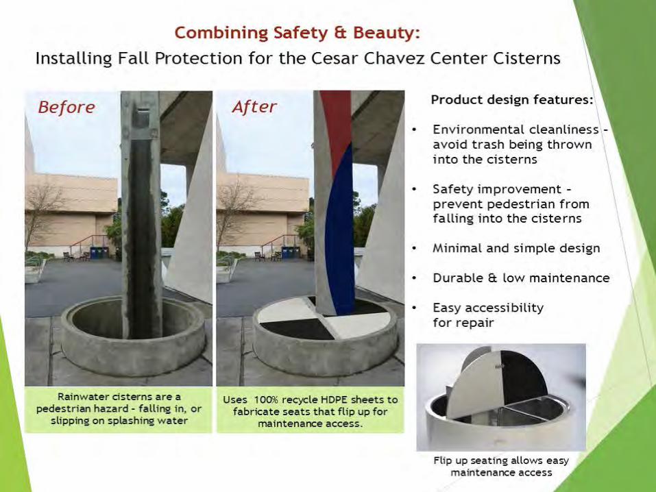
Cesar Chavez Center- 100% Recycled plastic
Material costs per set from as low as $50 for plywood which can be painted or stained, to $1000 for permanent maintenance-free outdoor furnishings!
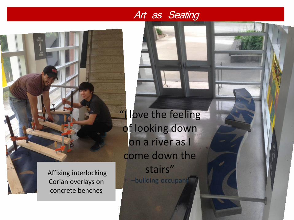
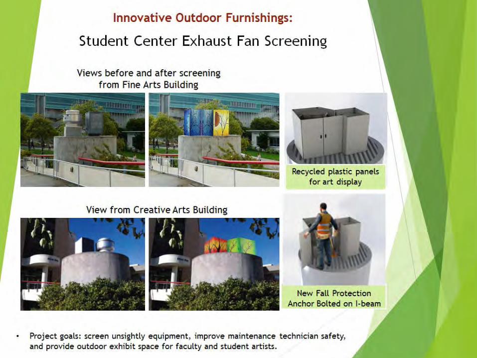
Art as Seating
“I love the feeling of looking down
on a river as I come down the
stairs” –building occupant
Affixing interlocking Corian overlays on concrete benches
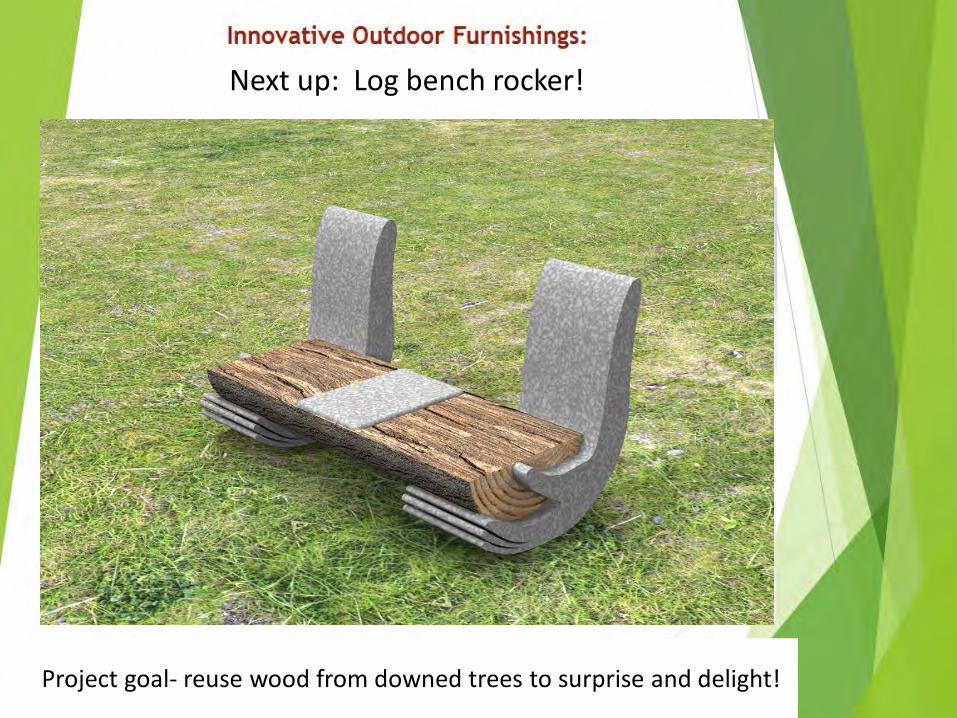
Next up: Log bench rocker!
Project goal- reuse wood from downed trees to surprise and delight!
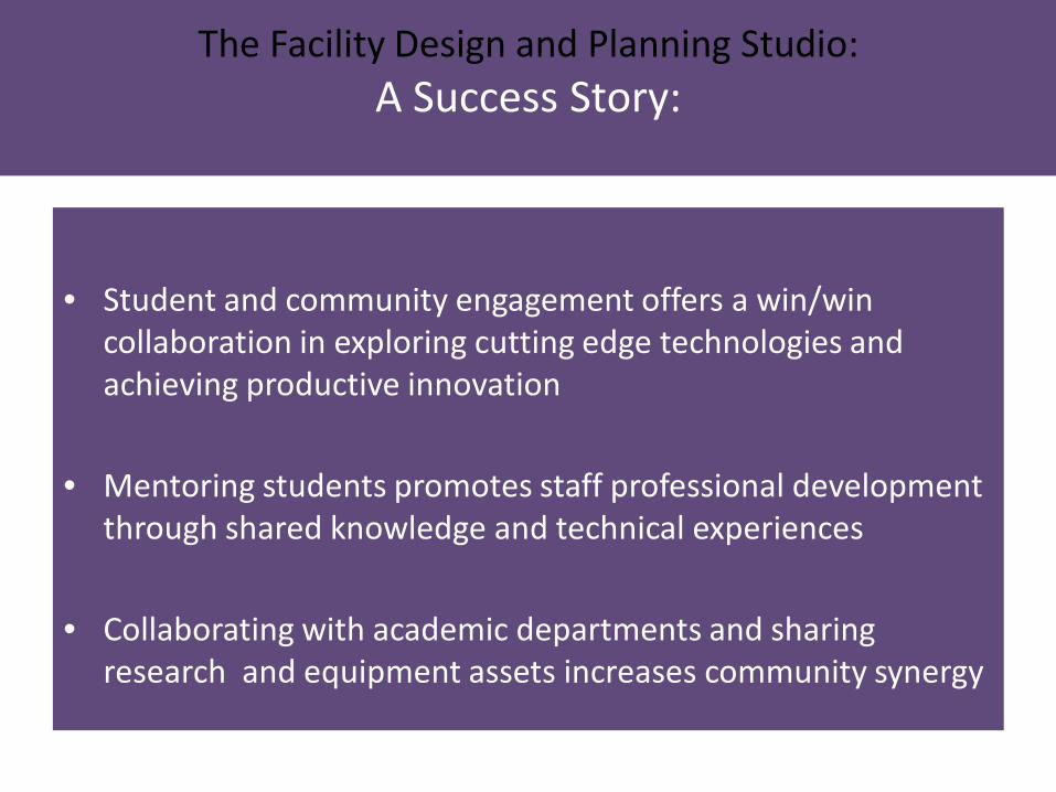
The Facility Design and Planning Studio: A Success Story:
• Student and community engagement offers a win/win collaboration in exploring cutting edge technologies and achieving productive innovation
• Mentoring students promotes staff professional development through shared knowledge and technical experiences
• Collaborating with academic departments and sharing research and equipment assets increases community synergy
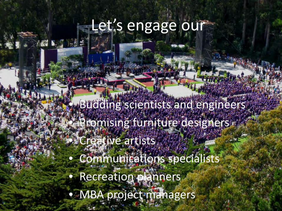
Let’s engage our
• Budding scientists and engineers • Promising furniture designers • Creative artists • Communications specialists • Recreation planners • MBA project managers
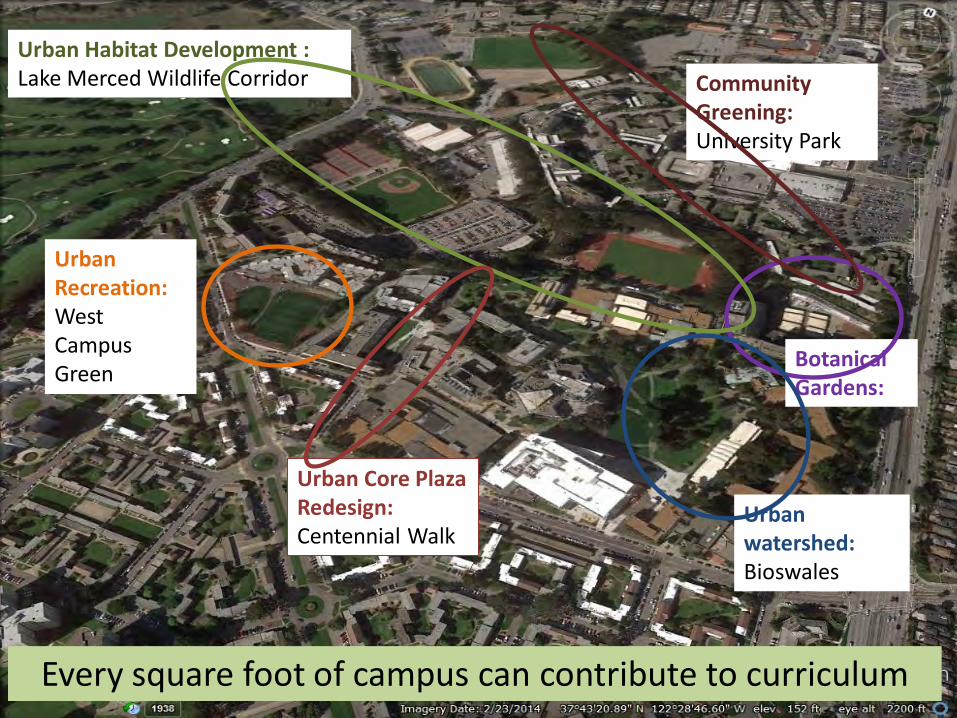
Botanical Gardens:
Urban Recreation: West Campus Green
Urban Habitat Development : Lake Merced Wildlife Corridor
Urban Core Plaza Redesign: Centennial Walk
Community Greening: University Park
Urban watershed: Bioswales
Every square foot of campus can contribute to curriculum
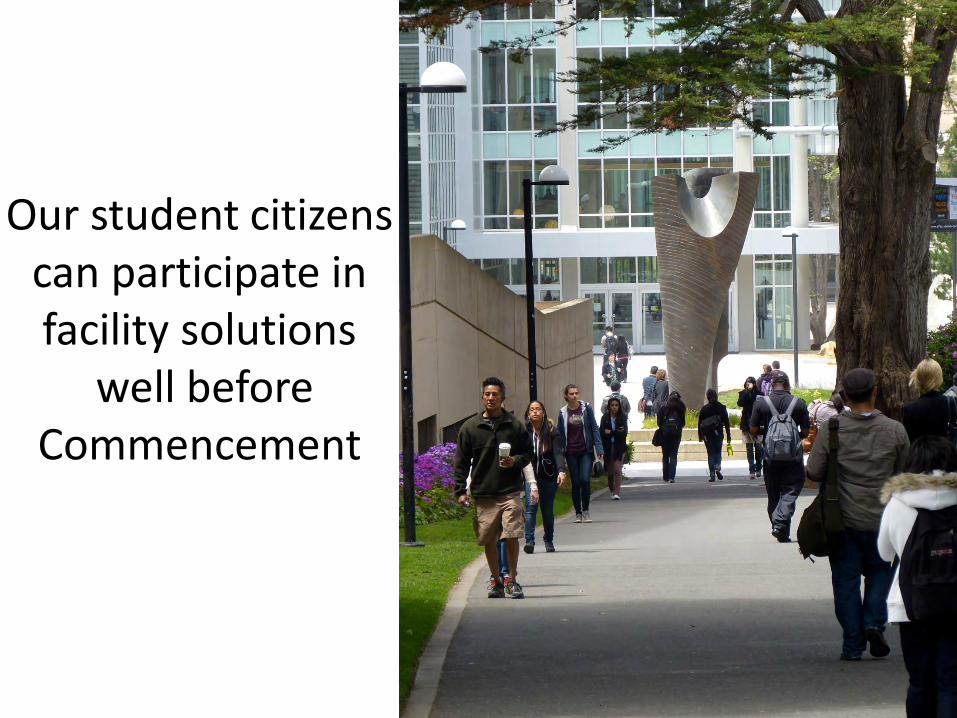
Our student citizens can participate in facility solutions
well before Commencement

Let’s put students to work!

Phil Evans Director, Site Planning
[email protected] 415-338-2712
Seth Hiatt, Associate Director Institute for Geographic Information Science Geography, College of Science and Engineering (415) 338-3566 [email protected]
Tom Parker, Professor Biology, College of Science and Engineering (415) 338-2375 [email protected]
Ricardo Gomes, Professor Design and Industry, College of Liberal and Creative Arts (415) 338-2229 [email protected]
Thank you!


