25
Geospatial Sensor Webs Conference 2018 Current Developments in the Sensor Web Community Dr. Simon Jirka, [email protected]

Geospatial Sensor Webs Conference 2018
Current Developments in the Sensor Web Community
Dr. Simon Jirka, [email protected]

Geospatial Sensor Webs Conference 2018
Agenda
● Projects○ RIESGOS○ MuDak-WRM○ WaCoDiS○ CreatingInterfaces○ SeaDataCloud○ ECMWF Summer of Weather Code○ CITRAM
● 52°North Sensor Web and Processing Components○ 52°North SOS Server○ Eventing API○ Helgoland Toolbox○ sos4R○ Sensor Web Architecture Evolution
● Questions and Discussion
2

Geospatial Sensor Webs Conference 2018
Projects
3

Geospatial Sensor Webs Conference 2018
RIESGOS
● Started in November 2017
● Innovative research on multi risk analysis with
respect to various natural hazards in the Andes
region and related cascading effects
● Development of web services and integration
into a modular multi-risk information system
demonstrator
● http://www.riesgos.de/
4

Geospatial Sensor Webs Conference 2018
RIESGOS
5
Geospatial Sensor Webs Conference 2018
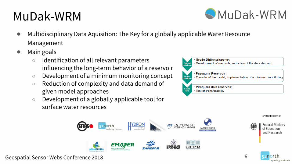
MuDak-WRM● Multidisciplinary Data Aquisition: The Key for a globally applicable Water Resource
Management
● Main goals
○ Identification of all relevant parameters influencing the long-term behavior of a reservoir
○ Development of a minimum monitoring concept○ Reduction of complexity and data demand of
given model approaches○ Development of a globally applicable tool for
surface water resources
6

Geospatial Sensor Webs Conference 2018
MuDak-WRM
7
Geospatial Sensor Webs Conference 2018
WaCoDiS● Combination of heterogeneous data sources and existing interoperable web-based
information systems
● Connection to the Copernicus infrastructure and the extension of INSPIRE-compliant Sensor
Web technology to deal with big raster data
● Innovative analyses of high temporal resolution Sentinel-1 and Sentinel-2 Copernicus
satellite data that contributes to the exploration of heavy rain effects on agricultural areas
● Integration of in-situ and satellite data into domain-oriented models to optimize the
simulation of pollutant flows
● https://wacodis.fbg-hsbo.de/
8
Geospatial Sensor Webs Conference 2018
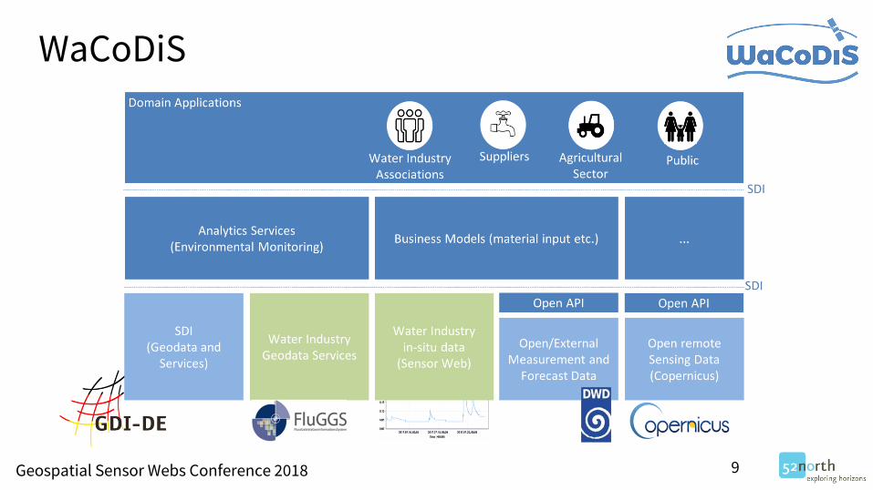
WaCoDiS
9

Geospatial Sensor Webs Conference 2018
CreatingInterfaces● Building capacity for integrated governance at the
Food-Water-Energy-nexus in cities on the water
● Fostering knowledge exchange and cooperation
among local stakeholders on the FWE nexus
● Development and testing of innovative approaches for local knowledge co-creation and
participation
10

Geospatial Sensor Webs Conference 2018
SeaDataCloud● H2020 project
● Started in November 2016
● Follow-up project of SeaDataNet
● Pan-European infrastructure, developed by NODCs and major research institutes from 34
countries
● Infrastructure driving several portals of the European Marine Observation and Data network
(EMODnet)
● Role of 52°North
○ Support project networking activities○ Submission of standards and best practices to ISO, OGC, W3C, INSPIRE○ Development of strategies for governance of standards and development of common
services○ Provide integrated online services for ingesting autonomous observatory data○ Development of SOS viewing services for operational data streams
11

Geospatial Sensor Webs Conference 2018
SeaDataCloud● Main activity until now: SWE Ingestion Service
12

Geospatial Sensor Webs Conference 2018
SeaDataCloud
13

Geospatial Sensor Webs Conference 2018
ECMWF Summer of Weather Code● Development of a tool to search the web
systematically, identifying data sources for
observed environmental data
● Allowing improvement of the forecast model,
the post-processing of forecasts, the verification
of forecasts, development of future forecasts
products
● Workflow○ Translate keywords into several languages○ Indexes a subset of the web, seeded by a
Google search with the translated keywords○ Score the resulting pages in regards to the
question “does contain/link to data?”○ Extract metadata about the data from the
pages (where possible)
14

Geospatial Sensor Webs Conference 2018
ECMWF Summer of Weather Code
15

Geospatial Sensor Webs Conference 2018
ECMWF Summer of Weather Code
16

Geospatial Sensor Webs Conference 2018
CITRAM● Citizen Science for Traffic Management
● Started on the 1st of September 2018
● Improve the availability of traffic flow and
quality data
● Input for optimizing the control of traffic lights
● Generate recommendations for drivers how to improve the efficiency
● Use and enhance the enviroCar platform for collecting new data based on a citizen science
approach
● Partners○ City of Chemnitz○ City of Hamm○ City of Krefeld○ Technische Hochschule Deggendorf○ TSC Beratende Ingenieure für Verkehrswesen GmbH & Co. KG○ 52°North
17

Geospatial Sensor Webs Conference 2018
52°North Sensor Web Components
18

Geospatial Sensor Webs Conference 2018
52°North SOS Server
● SensorThings API Module○ Support of the OGC Sensor Things API standard○ Additional module in addition to SOS and Sensor Web REST-API interfaces○ Currently in development
● Harmonised Data Model○ Common approach for SOS, Sensor Web REST API, STA Module○ Modular approach○ Simplified core
● MQTT Connector○ Facilitate the integration of Internet of Things data streams○ Connect to MQTT brokers○ Parsing of payloads sent via MQTT and loading into the SOS database
19

Geospatial Sensor Webs Conference 2018
Eventing API
● Web-based architecture for detecting and communicating critical
measurement values
● Developed in cooperation with the Wupperverband○ Baseline from the COLABIS project○ Further development as part of WaCoDiS
● Based on ○ OGC Sensor Observation Service○ OGC Publish/Subscribe standard
● Eventing REST API provides means to subscribe to event rules○ Pattern that is based on a specific threshold for a specific phenomenon at a given
measuring station
20

Geospatial Sensor Webs Conference 2018
Eventing API● Examples
○ Rise of gauge above the threshold○ Staying above the threshold○ Fall below the threshold○ Sensor failure
● Push-based messages are provided via different communication channels; by
default, the operator is informed by email.
● Next steps○ Integration of the eventing architecture into Helgoland○ Investigate event processing tools
● Presentation at the INSPIRE Conference
21

Geospatial Sensor Webs Conference 2018
Helgoland Toolbox● Encapsulate building blocks for client development
● Several modules available, e.g.
● Additional modules in the (near) future: eventing, processing, integration of raster data
● Contributions by several projects: COLABIS, MuDak-WRM, WaCoDiS
● Based on Angular
● Available on Github: https://github.com/52North/helgoland-toolbox
22

Geospatial Sensor Webs Conference 2018
sos4R
● New development activities planned for fall 2018○ Improve support of the SOS 2.0 standard○ Include support of the SOS 2.0 Hydrology Profile○ Better abstraction from the SWE concepts increase user friendliness
23

Geospatial Sensor Webs Conference 2018
Sensor Web Architecture Evolution
24
Sensor Web
Database
Database Access Service
Harvester
OGC STA
Instances
External
SOS
Instances
Proprietary
Data Access
Services
SWE
Ingestion
Service
MQTT
CSV from
HTTP, FTP,
…
…
Sensor Web
REST-APISOS OGC STA
Helgoland sensorweb4R sos4R SMLE
Eventing API
Note: Two modes for the
Sensor Web Database
1. Native Database Mode
2. Proxy Mode
sensorweby

Geospatial Sensor Webs Conference 2018 25
Questions and Discussion
https://52north.github.io/sensor-web-tutorial/


