16
Presented by: Date: Vivek Baijal October 29, 2014 Delivering a Curated User Experience: A Configurable Map Viewer for Multiple Data Sources and Large Imagery Database Database

Presented by:
Date:
Vivek Baijal
October 29, 2014
Delivering a Curated User
Experience: A Configurable
Map Viewer for Multiple Data
Sources and Large Imagery
Database Database
Page 2
The Problem (1)
• Fisheries & Oceans Canada (FOC) has a large portfolio of
properties: • Light Houses
• Coast Guard Bases
• Aids to Navigation (Lights, Ranges)
• Docks & Wharfs
• Harbours
• Some of them are contaminated with pollutants
• FOC has a contaminated site program to remediate these
sites
• To improve delivery of contaminated site program at FOC,
provide non GIS users a spatial view of FOC properties &
sites
Page 3
The Problem (2)
• Provide bilingual map-based access to facility locations over the FOC Intranet – Locate and zoom to sites
– Display internal web map services (e.g. Management Boundaries, Air Photo Imagery Orthophotos, Bathymetry)
– Display external web map services (e.g. Geogratis – topographic data)
– Map-based access to tabular business data, site photos, documentation
Page 4
The Problem (3)
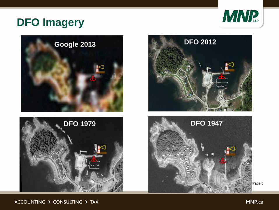
• FOC has a vast amount of aerial imagery of sites going
back to the 1940’s
• FOC would like the ability to view changes over time
• FOC has access to all the marine charts in Canada and
needs to provide access to them in an organized way
Page 5
DFO Imagery
Google 2013 DFO 2012
DFO 1979 DFO 1947
Page 6
DFO Imagery
• Demo screenshots removed due to
confidentiality and security concerns

Page 7
Additional Requirements - External
Services
• A goal of the project is to make use of as many external
GIS web services as possible from provincial
governments, federal government, local governments,
and private sources.
– WMS
– Standard Web Services
– BING Imagery
– Bing Address Search
– Open Streets
– ESRI Base maps
– NOAA
– Environment Canada Weather
Page 8
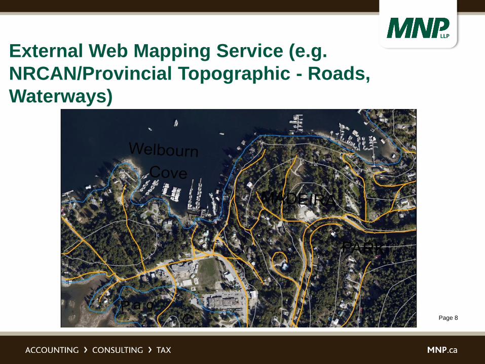
External Web Mapping Service (e.g.
NRCAN/Provincial Topographic - Roads,
Waterways)
Page 9
The Challenge
• Organize all this data
• Provide easy-to-use, seamless access to non-GIS users
• The benefits of the data without the burden of managing
myriad data layers or complex navigation

Page 10
Solution – OECGIS (1)
• Office of Environmental Coordination (OEC)
• Based on MNP’s highly configurable viewer
• Doesn’t need any coding to add in new data sources
• There is a management tool that allows administrators to
control access to map services and to organize map
galleries
• Provides access to a large, multi-year imagery database
• Provides “change-over-time” image viewing capability
• ArcGIS Server Image Server Extension integration
• Configurable sophisticated query tool – free text search

Page 11
Solution - OECGIS (2)
• Is a “Small Footprint” Infrastructural component for
enterprise spatial data management
• Is a tool for a curated and managed user experience
– Managed access to external data sources
– Configurable layer management
• Any tabular data that has a geo referenced link can easily
be plugged in
– FOC is considering this application to be the front end to
several internal systems
Page 12
OECGIS Viewer
• Demo screenshots removed due to
confidentiality and security concerns

Page 13
OECGIS Architecture
• ESRI ArcGIS Server
• ESRI Image Server Extension
– Serve up mosaic imagery – built with Python scripts
– Allows for change over time analysis
• Built using the ESRI JavaScript API
• Brower Based Application
• HTML 5/JavaScript Compatible
• ASP.NET MVC 4 App
• Visual Studio 2012

Page 14
OECGIS Architecture

Page 15
Key Points
Functionality that users loved:
• Pre-configured Map Galleries
• Pre-configured Layer categories
• Dynamic “change over time” tool
• Google-like free text search + spatial filters
Lessons learned:
To provide a more organized and effective user experience:
• Configurable layer management
• Configurable sophisticated query tool - to spatially enable any tabular
business database
• ArcGIS Server Image Server Extension integration