23
DEVELOPMENT GUIDE A GUIDE TO LAND DEVELOPMENT RIDGECREST, CA

DEVELOPMENT GUIDEA GUIDE TO LAND DEVELOPMENT RIDGECREST, CA

Table of ContentsGetting Started
General Plan
Annexation
Zoning
Lot Line Adjustment/Parcel Merger
Residential (Projects involving a one or two family home are considered
residential)
Getting Started
New (or Additions to) Residential Property
Residential Setback Requirements
Residential Project & Remodeling Permits
Commercial (Any Projects Not involving a one or two family homes are
considered commercial)
Getting Started
Tract/Parcel Map Application/Subdivision
Grading Permit & Plan
Site Plan Review
Conditional Use Permit
Signing Application
FAQ

Getting StartedBefore submitting applications for residential or commercial
development projects, applicants are encouraged to research
the property to verify existing conditions and obtain accurate
submittal information that will be required throughout the
process. The information obtained should then be submitted
along with the appropriate application and plans to the City.
This will minimize delays, and make the development
process smoother so the project can begin as quickly as
possible. 100 W. California Ave.
Ridgecrest, CA 93555
City Hall Hours:
Mon.-Thurs.
7:30 am-5:30 pm

General PlanEvery city and county in California is required by State
law to prepare and maintain a planning document called
a general plan. A general plan is designed to serve as the
jurisdiction’s “constitution” or “blueprint” for future
decisions concerning land use, infrastructure, public
services, and resource conservation. All specific plans,
subdivisions, public works projects, and zoning
decisions made by the City must be consistent with the
general plan.
Ridgecrest’s General Plan

AnnexationIf the property is outside the City Limits and needs city services,
it needs to be annexed into the City. Annexation can be initiated
by the City, or the property owner may request a voluntary
petition for annexation. In either case, annexations would require
approval by the City Council.
Typical Milestones:
• Accept voluntary petition and set schedule
• 1st statutory public hearing
• 2nd statutory public hearing
• Public hearing and 1st reading of the ordinance by City Council
• 2nd Reading of ordinance and Council action
Checklist/Application:
Does the property require annexation?
Click map to see
online zoning map
with city limits
Annexation Change Application
NOTE: Corresponding fee to be calculated upon application

ZoningZoning is the tool by which land use within the City is governed.
Zoning is carried out in accordance with the General Plan to provide
beneficial and appropriate development, protect the character and
established pattern of development in each area, and minimize land
use incompatibility.
Typical Milestones:• Approximate 6 month process
• 30 day staff review & 30 day environmental review
• Public notices to property owners within 300’ of the tract
• Planning Public Hearing and Recommendation
• City Council Public Hearing and 1st Reading of the Ordinance
• City Council 2nd Reading of the Ordinance and Action:
• Approval -may proceed to site development or subdivision
• Denial -must wait 12 months to reapply
Checklist/Application:
Does the current zoning allow the
proposed use?
Click map to see
online zoning map
with city limits
Zoning Change Application
NOTE: Corresponding fee to be calculated upon application
Lot Line Adjustment/Parcel MergerA lot line adjustment is the process that is used to change property lines of
existing parcels. The process can be used to do a number of things, such as:
combine up to four (4) adjacent parcels into one (1) parcel, alter the
boundary between up to four (4) parcels, or reconfigure the shapes of up to
four (4) parcels. The lot line adjustment process is not used to create
additional parcels.
Parcel Merger allows you to merge neighboring properties.
Typical Milestones:
• Under normal circumstances, the lot line adjustment process does not require any
public hearings or notifications. As such, the processing of this kind of request is
very quick.
• This process does require a licensed surveyor and is processed through the
county.
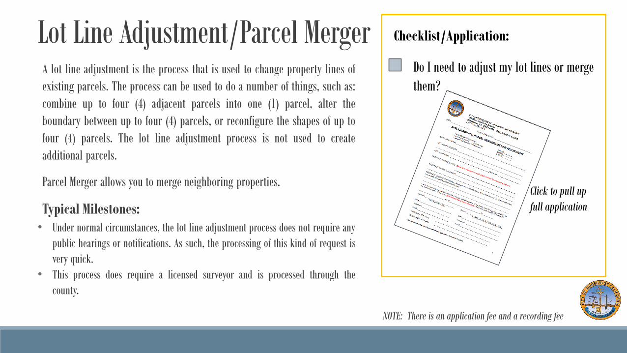
Checklist/Application:
Do I need to adjust my lot lines or merge
them?
Click to pull up
full application
NOTE: There is an application fee and a recording fee

ResidentialPROJECTS INVOLVING A ONE OR TWO FAMILY HOME ARE CONSIDERED RESID ENTIAL

Getting StartedThe building department regulates the construction of all new,
remodeled and existing residential buildings as mandated by the
State of California and the City of Ridgecrest's building codes.
These codes encompass building, electric, plumbing, and
mechanical. The purpose of these codes is to provide the standards
to safeguard life or limb, health, property and public welfare by
regulating and controlling the design, construction, quality of
materials, use and occupancy, location and maintenance of all
buildings and structures within this jurisdiction.
Note: The City currently uses the 2016 California Building,
Mechanical, Plumbing and Electric Codes.
For information on contracting for all types of construction projects or to check
the current status of a contractor's license, please visit www.cslb.ca.gov .
Building Counter Phone Number: 760-499-5072
Mon.-Thurs.: 7:30 am-5:30 pm
Fri.: 7:30-11:00 am

New (or Additions to) Residential Property The first step in the residential review process is to submit a site plan. Site
plans for residential projects do not have to be done by a design professional
if you already know the location of your property corners. The plan should
be drawn to scale with appropriate measurements shown. The site plan will
be reviewed by staff and appropriate comments will be returned to you. Infill
development may require compliant curbs, gutters, sidewalks, driveway
approaches, and an encroachment permit. New buildings may required a
grading permit for over 50 cubic yards of dirt, and for over 200 cubic yards a
permit and plan. All new residential construction will require, at a
minimum, a scaled floor plan drawing.
The city of Ridgecrest’s Loads and Zones are as follows:
Exposure: C
Wind Load: 110 mph
Snow Load: None
Climate Zone: 14
Frost Depth: 0
Checklist/Application:
Does the project have a proper site plan?
Building Permit Application
NOTE: Corresponding fee to be calculated upon application

Residential Setback RequirementsNo structure may be constructed within the 20 ft front yard
setbacks. The 10 ft back yard setback may include accessory
structures (sheds, carports) provided they do not encroach into a
utility easement. Side yard setbacks are 5 ft on one side and not
less than 10ft on the other side. Setbacks also include utility
easements, which no building or projection of a building, may
extend into, and the right of way which is 10 ft from the face of
curb.
Note: Building permits are required and only issued for
construction if the setback requirements are met. Permits are
required before the construction of structures. Sheds over 120
square feet require a permit.
Checklist:
Does the project comply with the following?
10 ft
5/10 ft
10 ft
20 ft
5/10 ft
5 ft
NOTE: Corresponding fee to be calculated upon application

Residential Project & Remodeling PermitsResidential permit requirements vary depending on the type of work being performed. A
permit fee and special permit is required for remodels or alterations, additions, and several
other types of residential work such as installing a retaining wall, hot water heater, windows,
air conditioner, or swimming pool or spa.
Why is a building permit required?
• A building permit is required by law and is intended to protect life and property.
• When you obtain a building permit, you have the comfort of knowing that your project is being
reviewed and inspected by qualified personnel who are trained and experienced in this line of work.
• Most projects begin with a plan review before a permit is issued. A large majority of potential
problems are discovered at this stage and resolved before the project even begins. This saves
unnecessary construction delays, time, and money, as opposed to discovering the errors in the field
after materials are delivered and/or installed.
• During the construction of your project, an experienced building inspector performs periodic
inspections to verify the work is properly completed and meets code requirements. The inspector may
also be able to provide suggestions or recommendations since they, most likely, have experienced
similar situations in the past!
Checklist/Application:
Do I need to apply for a building permit?
Click to pull up
full application

CommercialANY PROJECTS NOT INVOLVING A ONE OR TWO FAMILY HOMES ARE CONSIDE RED
COMMERCIAL
Getting StartedCommercial projects require a full review process including a site plan
review. The first step in the commercial development process is to
submit a full set of building plans including a site plan. Before
submitting applications for commercial development projects,
applicants are encouraged to research the property to verify existing
conditions and obtain accurate submittal information that will be
required throughout the process. The information obtained should
then be submitted along with the appropriate application and plans to
the City. This will minimize delays, and make the development process
smoother so the project can begin as quickly as possible. Scheduling a
pre-application meeting with staff is highly encouraged at the
beginning of every project, and is free of charge.
For questions or to schedule a meeting
contact Heather Spurlock at 760-499-5063.
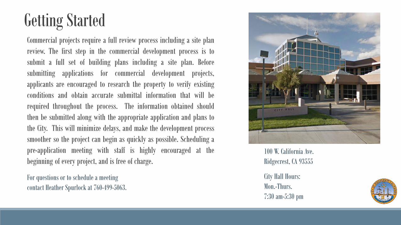
100 W. California Ave.
Ridgecrest, CA 93555
City Hall Hours:
Mon.-Thurs.
7:30 am-5:30 pm

Tract/Parcel Map Application/SubdivisionA tract map is one of the processes used to subdivide real property into smaller lots.
Typically, the tract map is used to create five (5) or more lots. This type of subdivision is
normally associated with full urban improvements, which would include paved streets, curb,
gutter and sidewalk, fire hydrants, street lights, comprehensive drainage system, water and
sewer service, and other infrastructure found in urban areas. A parcel map is for less than five
(5) lots.
Applicants for tract maps are typically “developers” (those who are in the business of
developing residential properties). A significant investment is involved in gaining approval of,
and constructing, a tract. Other less costly and less complex processes are available to
individual landowners who wish to subdivide their large parcel into fewer pieces.
Establishing a lighting/landscaping district is required. A drainage plan is required, and
possibly a drainage district.
Typically, a licensed land surveyor or registered civil engineer will submit the application on
behalf of the developer. (Due to the technical nature of the mapping process, state and local
laws require that the tract map be prepared by a licensed land surveyor or registered civil
engineer, licensed to survey in California.) Once an application is submitted to this office, it
will be reviewed to determine completeness.
Checklist/Application:
Does the site need a tract or parcel map?
(cont.)
NOTE: Conditions will be recommended by the city
engineer, and will require approval from planning
commission.

Tract/Parcel Map Application/Subdivision Checklist/Application:
Does the site need a tract or parcel map? The California Environmental Quality Act (CEQA) requires that an environmental study be
prepared for some types of projects. Tract maps are rarely exempt from an environmental
review. The environmental study can take the form of a Negative Declaration, a Mitigated
Negative Declaration, or an Environmental Impact Report. Technical reports may also be
required. These may include: a biota report, an archaeological survey, a soils report, a
geologic hazard report, a traffic study, and a groundwater analysis, among other studies/
reports. These studies will be used to assess the existing physical condition of the property
and to determine the impacts the tract map (construction of one (1) residence per parcel) will
have upon the environment.
After a tract map application has been formally accepted as complete, the map is sent to
governmental agencies, utility companies, and the public for review and comment. A Notice
of Public Hearing is sent to all of the property owners within 300 feet of the site and is
published in the local newspaper. (If an environmental study is required, the map is not
circulated for review until the environmental document has been prepared.) The tract map
process consists of two (2) distinct phases: the “tentative map” process and the “final map”
process. (cont.)

Tract/Parcel Map Application/Subdivision Checklist/Application:
Does the site need a tract or parcel map? Unless an environmental document is required, a tract map will typically take at least nine (9)
months to process. An applicant can expect to receive an initial written response within in thirty
(30) days of the submittal of an application for preliminary review. A typical tract will undergo
multiple preliminary reviews until it has been determined that the application can be accepted as
complete. Once the application is deemed complete and formally accepted, the Planning Commission
meeting would occur in approximately thirty (30) days. The public hearing would normally be held
within fifty (50) calendar days of acceptance of the application.
If an environmental study is required, the processing time is lengthened considerably. Typically,
ninety (90) to one hundred and twenty (120) days are added onto the process for a Negative
Declaration or a Mitigated Negative Declaration and twelve (12) to eighteen (18) months for an
Environmental Impact Review.
The life of an approved tentative tract map is for an initial period of thirty-six (36) months from the
effective date of its approval. An applicant or their representative may also request up to three (3)
extensions of time, the total of which cannot exceed thirty-six (36) months.

Grading Permit & Plan It is unlawful for any person, firm or corporation, or any agent who is in possession or control of land to disturb the
surface or subsurface of land by excavation, leveling, cultivating, grading, or by distributing or spreading soil on land,
or by any other action likely to cause or contribute to wind erosion of soil without first obtaining a permit from the
City Engineer. The following provisions govern the permits:
a. A grading permit is required when an amount of material between 51 cubic yards and 199 cubic yards of material
is moved. If any portion of the material is fill, and is in the building footprint, a compaction report is also required.
i. An application must be filled out by the Contractor performing the work and must state the sum total amount of materials being
cut and filled.
ii. The Contractor must state the method that he will employ for abating fugitive dust and sand due to a wind blown event.
b. An engineered grading plan and grading permit are required when 200 cubic yards or more of material is moved.
If any amount of the material is fill, a compaction report is also required. The engineered grading plan is required to
be prepared by a registered Civil Engineer.
i. An application must be filled out by the Contractor performing the work and must state the sum total amount of materials being
cut and filled.
ii. The Contractor must state the method that he will employ for abating fugitive dust and sand due to a wind blown event.
iii. A City provided grading certification form is required to be signed by the Soils Engineer and rough and finish grade
certification is required to be signed by the Registered Civil Engineer preparing the plan.
c. A grading permit is not required when the lot is less than 10,000 square feet and no more than 50 cubic yards of
material is moved. However, if any portion of the material is fill, and is in the building footprint, a compaction report
is required.
d. A permit is not required for normal landscaping, cultivation of existing plantings, improvement of landscaping or
planting on single lots, or for farming operations. However, adequate protective measures shall be provided in the
course of any grading causing wind blown dust and sand.
Checklist/Application:
Does my site require a grading plan and/or
permit?
Grading Permit Application
Engineered Grading Application

Site Plan ReviewA site development plan is a set of engineering and architectural drawings that
shows a proposed or existing project. Key elements of a site development plan are
property boundaries, topography, vegetations, proposed and/or existing structures,
easements, and roadways.
Typical Milestones:
• The Director of Community Development, directed by City staff, and such utility
service representatives as may be available shall, within 21 working days after
completion of filing, conduct a review of the submitted project. The applicant
shall be invited to attend the review meeting.
• The Director of Community Development shall, within 15 working days after the
review, prepare and mail to the applicant a site plan review letter summarizing
the Code requirements and recommendations of staff. (Ord. No. 86-29, § 4)
• The applicant may appeal any of the conditions set forth in the Director's letter of
determination by filing a written request for review with the Planning
Commission within 30 calendar days of the date of the Director's letter.
cont.
Checklist/Application:
Is my project ready for site plan review?
Conditional Use PermitCertain uses of land or types of businesses specified in the Zoning Ordinance require a
conditional use permit application. Approval of a conditional use permit requires the
submittal of an application form, plot plan, and payment of filing fees. The conditional use
permit application requires a public hearing before the Planning Commission, and all
surrounding property owners within 300 feet of the site of the proposed use are notified of
the public hearing by mail. In instances where a majority of parcels abutting the project site
are one acre or larger in size, the notification radius is expanded to 1,000 feet of the site.
Once a conditional use permit is approved, the conditional use permit provides that certain
conditions be satisfied before building permits can be issued or the use otherwise
commences. Conditional use permits are normally permanent approvals and may be
transferred automatically to future property owners of the site.
Typical Milestones:
• If the application is determined to be incomplete, the applicant will be notified in writing of what
additional information will be required to complete the application. A typical conditional use permit
will require six (6) weeks to process from the time an application is accepted as complete. In cases
where a Negative Declaration is required, processing time will be approximately four (4) months.
• Where an Environmental Impact Report is required, applicants should allow ten (10) to twelve (12)
months to process the application.
Checklist/Application:
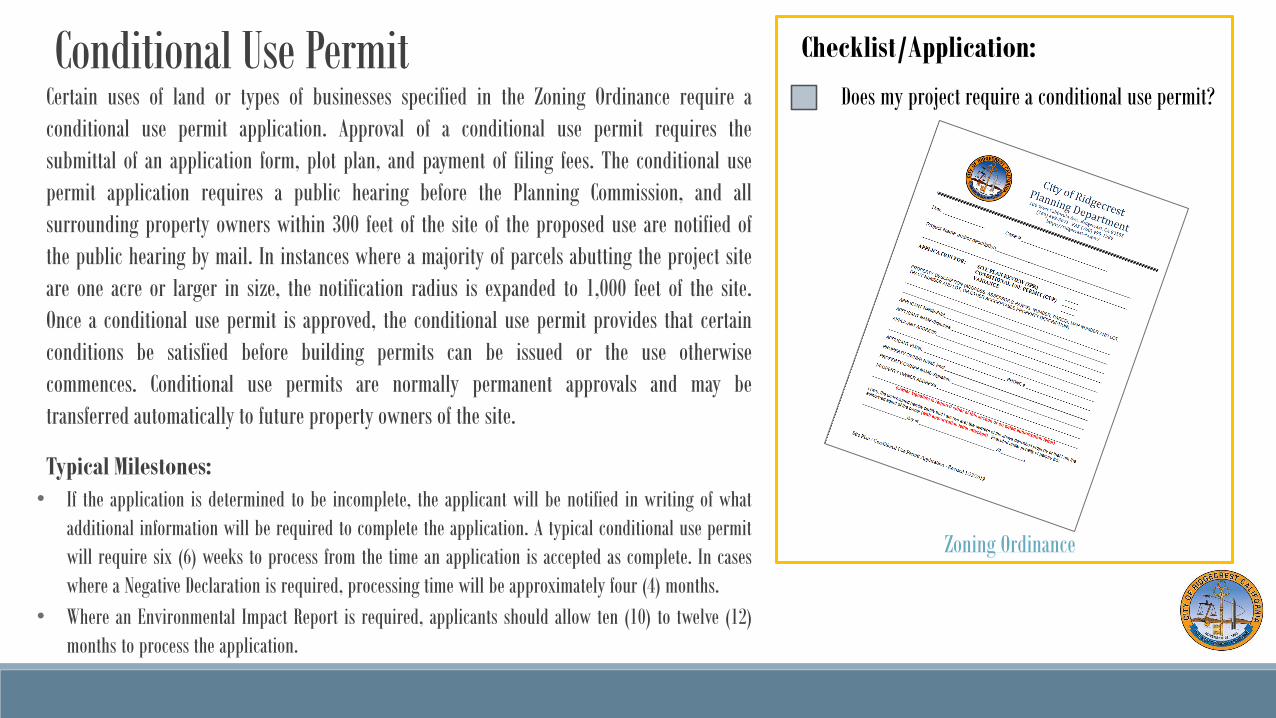
Does my project require a conditional use permit?
Zoning Ordinance

Signing ApplicationSign permits require a separate submittal and require approval before applying for a
building permit.
Typical Milestones:
• PLANNING APPROVAL: Planning will review this application against the Municipal
Code Section 20.26 Signs. You will be notified within 14 days if your sign
conforms to the Code.
• BUILDING PERMITS: After Planning Approval you must apply for a Building Permit.
Depending on your type of sign, the plan check process may take 8 weeks.
Checklist/Application:
Do I need a sign for my project?

FAQ1. What is exempt from a building permit?
See the California Building Code (CBC) section 105 at https://codes.iccsafe.org/content/chapter/9990/
2. What permits are considered over-the-counter?
Residential building permits that do not require plans/drawings such as: Electrical Panel replace/upgrade, Plumbing/gas line replace/repair, Reroof/Re-
cover, Mechanical (replace HVAC, AC, Furnace), and Water Heater can be issued immediately over-the-counter to a property owner or licensed contractor.
3. Can I install my own Photovoltaic System on my house?
Yes, we need 2 complete sets on 8 x 14 or 11 x 17 size paper with the following information: show roof set back, wind uplift calculation for at least 110
mph, all the equipment being installed with their UL listings, the roof mount install directions, a single line electrical diagram signed by the electrician,
and all warning labels.
If ground mount please include the footing requirements for the system and a site plan of your property showing the location in relation to all buildings,
fences/property line and pools in lieu of the roof top set back.
Any roof top system under 10 Kw can be inspected after the system is completely installed. Ground mount systems and roof top over 10 kw require at least
2 inspections, flashing (before panels are installed) and final (after panels installed.
4. Can I get 2 inspections on the same day?
No, the building inspector will inspect your work only 1 time per day. If you wish to have additional or after hours inspections you need to make
arrangements with either Kern County or Willdan directly. (cont.)

FAQ (cont.)5. What time will the building inspector arrive to do the inspection? Or can I schedule a specific time?
Unfortunately the City staff will not be able to predict this for you. The Kern County Building Inspector downloads all the requested inspections, creates a
route according to the GPS route system then will begin his route either from Ridgecrest City Hall or outside the city such as Tehachapi or Bakersfield. The
inspector will generally start in the south end of Ridgecrest and work north doing all inspections both inside and outside city limits in the order assigned.
The best we can do is ask the inspector to give you a “head up” call prior to arriving to your location. Most inspections will occur between 8:30 am to 3 pm.
This varies with the number of locations and type of inspections they are assigned.
6. Can I get a copy of my house plans?
According to the 2016 California Building Code we are not required to keep completed permit plans over 180 days, therefore we do not keep plans more than
1 year unless the SFR plans are a current standard plans being used by a developer. We lack space for storage so only non-residential plans are kept.
7. Can I view permits for my property online?
Not yet, all property files are available for viewing by the public at the building counter during their business hours. For faster service please call the city
staff to pull the file prior to arriving.
8. Can I get a permit online?
Not at this time. You may email the city staff a permit application, required plans and required energy documents. The staff will try to process your
permit request by the next business day. They will email you the permit number and fees due. Please mail the check (no credit accepted at this time)
and self –addressed and stamped envelope to have the permit, job card and receipt mailed back to you.


