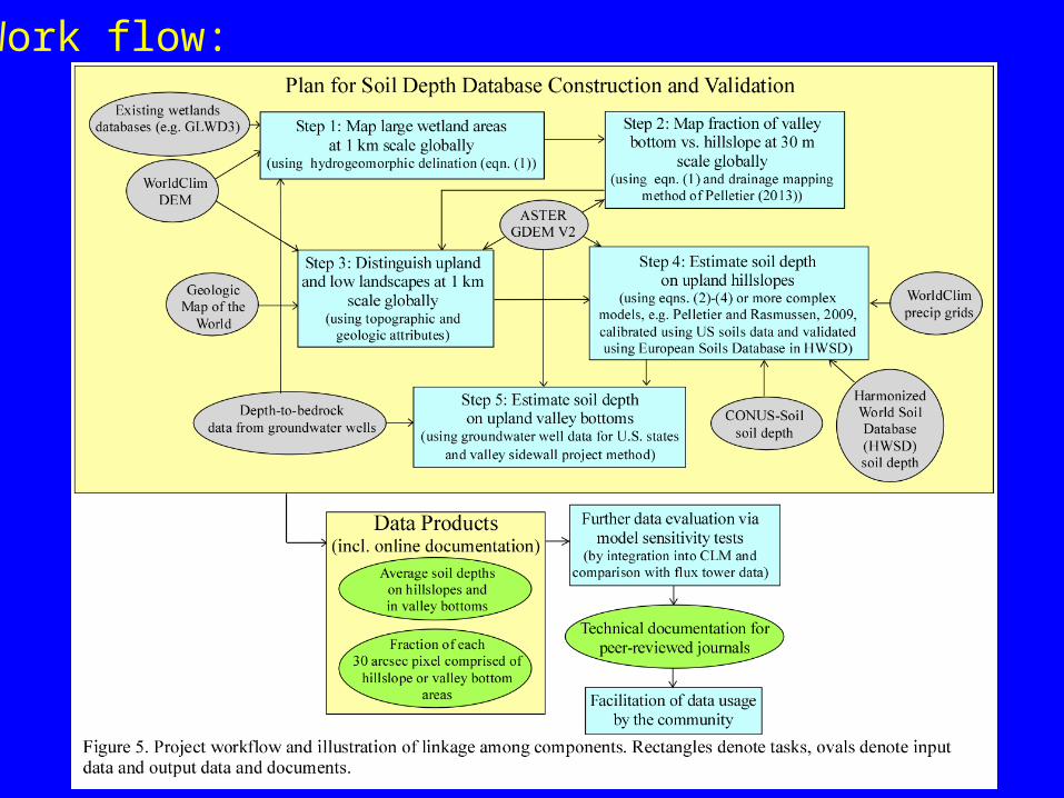
Development of a High-Resolution Global Soil Depth Dataset Jon D. Pelletier Geosciences Dept., University of Arizona Deliverable: gridded high-resolution global data for soil depth/depth-to-bedrock from 0-50 m. Four grids will be produced: Average hillslope soil depth within each 1 km pixel, average valley bottom soil depth, fraction of each pixel that is hillslope, fraction that is valley bottom/wetland. Land surface will be divided into: upland hillslopes, upland valley bottoms, and lowlands. Different soil depth estimation methods for each.
Transcript
Development of a High-Resolution Global Soil Depth DatasetJon D. Pelletier
Geosciences Dept., University of Arizona
Deliverable: gridded high-resolution global data for soil depth/depth-to-bedrock from 0-50 m. Four grids will be produced: Average hillslope soil depth within each 1 km pixel, average valley bottom soil depth, fraction of each pixel that is hillslope, fraction that is valley bottom/wetland.
Land surface will be divided into: upland hillslopes, upland valley bottoms, and lowlands. Different soil depth estimation methods for each.
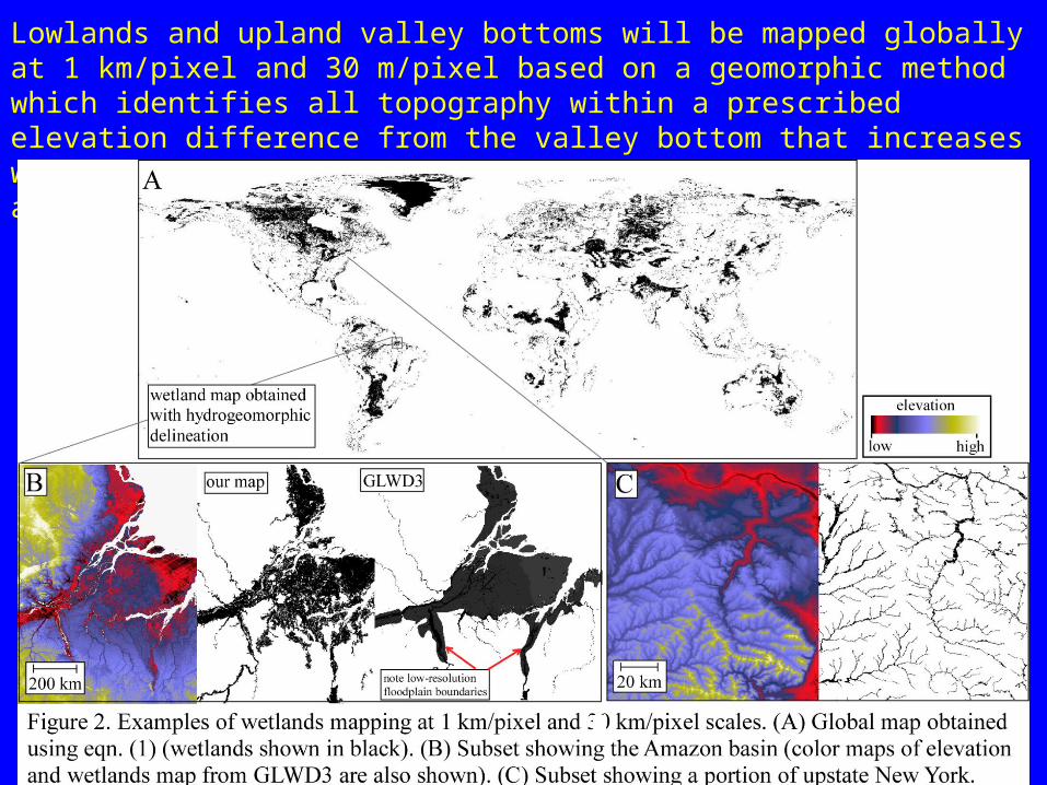
Lowlands and upland valley bottoms will be mapped globally at 1 km/pixel and 30 m/pixel based on a geomorphic method which identifies all topography within a prescribed elevation difference from the valley bottom that increases with increasing drainage area. In areas that are wetlands at 1 km/pixel scale, soil depth will be > 50 m.
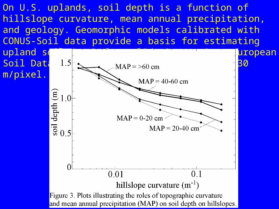
On U.S. uplands, soil depth is a function of hillslope curvature, mean annual precipitation, and geology. Geomorphic models calibrated with CONUS-Soil data provide a basis for estimating upland soil depth for validation against European Soil Database and prediction worldwide at 30 m/pixel.
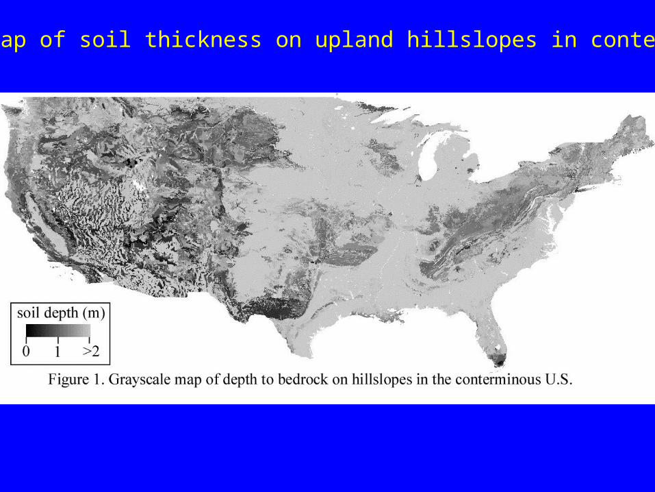
Resulting map of soil thickness on upland hillslopes in conterminous U.S.
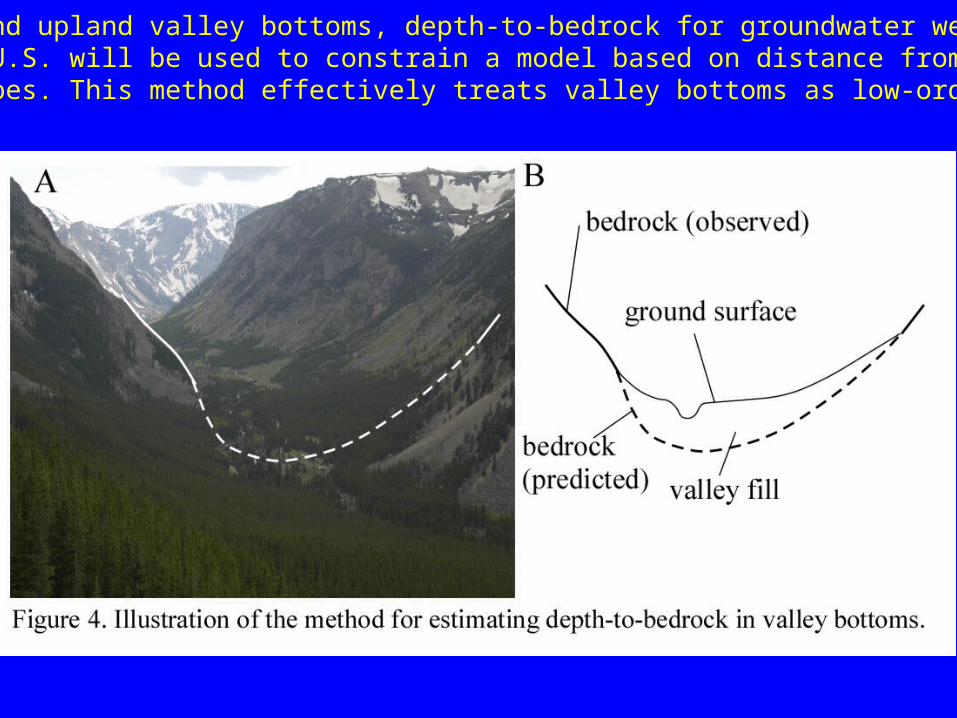
In lowlands and upland valley bottoms, depth-to-bedrock for groundwater wells for conterminous U.S. will be used to constrain a model based on distance from nearby steep hillslopes. This method effectively treats valley bottoms as low-order polynomialsurfaces.


![[Pelletier S.W.] Alkaloids Chemical and org](https://static.documents.pub/doc/80x56/5536165f4a7959361a8b4854/pelletier-sw-alkaloids-chemical-and-org.jpg)