Development of a Hydrogeologic Geodatabase for Determining the Availability of Selected Borehole Geophysical Parameters Lake Okeechobee, Florida Aaron Collier PhD Candidate University of Texas at San Antonio Abstract When conducting an investigation of the subsurface a geoscientist will often locate specific borehole geophysical data for the area of study. This process of locating spatially where the geophysical logs have been conducted and what specific parameters have been run in each logging suite can often be difficult and take the investigator several hours or even days depending upon the size of the study area. As part of the Comprehensive Everglades Restoration Plan’s (CERP) Aquifer Storage and Recovery feasibility study, Sonic logs need to be identified in order to convert the vertical axis of time in seismic reflection studies to an axis of depth. In an effort to eliminate this step and save geoscientists time and money a process for building a functional hydrogeologic geodatabase is proposed that would allow a GIS user to efficiently locate and identify borehole geophysical parameters of interest within his/her study area. Such a hydrogeologic geodatabase was constructed and applied to a study area contained within a ten-mile radius of Lake Ockeechobee, located in southern Florida. The spatial and non-spatial data were downloaded from the South Florida Water Management District’s online environmental database (DBHYDRO) and were imported in Microsoft Access for the creation of a functional geodatabase. A comprehensive examination of the data quality showed that ~40% of the geophysical data posted on DBHYDRO had incorrectly listed the depths at which the data was collected. After the data inspection was completed a one-to-many relationship class was created to allow for querying between the two datasets. Using the geodatabase 9 of the 44 wells with geophysical data were quickly identified as having the Sonic logs needed for time-to-depth conversions. The percentage of wells with Sonic data (~20%) was not surprising considering the time and money it costs to run this particular geophysical log. The construction and utilization of a geodatabase as an alternative to conventional data storage methods has proven to save significant time and money when locating specific geophysical parameters. Introduction The Comprehensive Everglades Restoration Plan (CERP) – jointly being conducted by the U.S. Army Corps of Engineers (USACE) and South Florida Water Management District (SFWMD) – is focused on storing available surface water to help relieve the stresses that local pumping has put on the Surfical Aquifer System. The Aquifer Storage and Recovery (ASR) technology has been
Transcript
Development of a Hydrogeologic Geodatabase for Determining the Availability of Selected Borehole Geophysical Parameters
Lake Okeechobee, Florida
Aaron Collier PhD Candidate
University of Texas at San Antonio
Abstract When conducting an investigation of the subsurface a geoscientist will often locate specific borehole geophysical data for the area of study. This process of locating spatially where the geophysical logs have been conducted and what specific parameters have been run in each logging suite can often be difficult and take the investigator several hours or even days depending upon the size of the study area. As part of the Comprehensive Everglades Restoration Plan’s (CERP) Aquifer Storage and Recovery feasibility study, Sonic logs need to be identified in order to convert the vertical axis of time in seismic reflection studies to an axis of depth. In an effort to eliminate this step and save geoscientists time and money a process for building a functional hydrogeologic geodatabase is proposed that would allow a GIS user to efficiently locate and identify borehole geophysical parameters of interest within his/her study area. Such a hydrogeologic geodatabase was constructed and applied to a study area contained within a ten-mile radius of Lake Ockeechobee, located in southern Florida. The spatial and non-spatial data were downloaded from the South Florida Water Management District’s online environmental database (DBHYDRO) and were imported in Microsoft Access for the creation of a functional geodatabase. A comprehensive examination of the data quality showed that ~40% of the geophysical data posted on DBHYDRO had incorrectly listed the depths at which the data was collected. After the data inspection was completed a one-to-many relationship class was created to allow for querying between the two datasets. Using the geodatabase 9 of the 44 wells with geophysical data were quickly identified as having the Sonic logs needed for time-to-depth conversions. The percentage of wells with Sonic data (~20%) was not surprising considering the time and money it costs to run this particular geophysical log. The construction and utilization of a geodatabase as an alternative to conventional data storage methods has proven to save significant time and money when locating specific geophysical parameters.
Introduction
The Comprehensive Everglades Restoration Plan (CERP) – jointly being conducted by the U.S. Army Corps of Engineers (USACE) and South Florida Water Management District (SFWMD) – is focused on storing available surface water to help relieve the stresses that local pumping has put on the Surfical Aquifer System. The Aquifer Storage and Recovery (ASR) technology has been
identified as a major storage option, particularly in the vicinity of Lake Okeechobee, where available water has been identified. The concept behind Aquifer Storage and Recovery in south Florida is when water levels are relatively high in Lake Okeechobee and the surrounding canals a percentage of that excess water will be treated and injected into the subsurface and stored for future agricultural, industrial, and domestic use. The percentage of water injected is freshwater that has historically been lost to either the Atlantic Ocean or the Gulf of Mexico. The target aquifer for the CERP ASR project is the Upper Floridan Aquifer, a highly vuggy limestone aquifer, located approximately 1,000 feet below ground surface (bgs). The Upper Floridan Aquifer in the vicinity of Lake Okeechobee contains brackish water with a total dissolved solids (TDS) of approximately 5,000 mg/L.
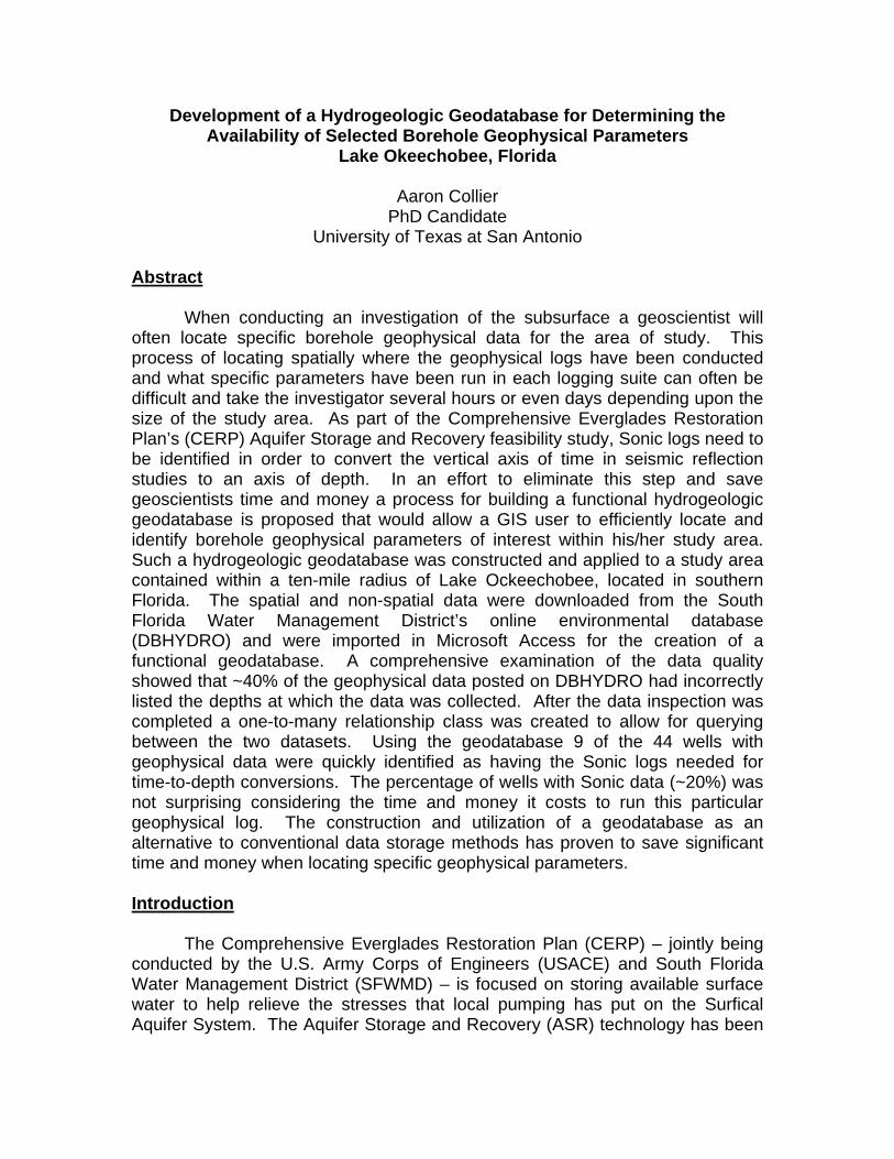
The Lake Okeechobee ASR Pilot Project, currently underway, was designed to address some of the technical and regulatory uncertainties of storing treated surface water via ASR systems. Extensive shallow seismic reflection surveys have been conducted in and around Lake Ockeechobee in order to determine the thickness and structure of the underlying geology (Figure 1). Processed seismic data is often presented with the vertical axis in units of time (milliseconds), which has little use for a geoscientist who is interested in knowing the depth at which structural features occur. Therefore, a conversion from time to depth is needed. By using the borehole geophysical technique known as a Sonic tool, such a conversion can be made. The time to depth conversion, also known in the geophysical industry as synthetic seismograms, is accomplished by matching strong reflection signals found in the surface seismic with similar reflections measured at depth with the before mentioned Sonic tool. As part of my dissertation, I have been charged with determining the availability of borehole geophysical logs that are suitable for the creation of these synthetic seismograms. By creating a functional GIS geodatabase, specific borehole geophysical parameters can easily be identified as potential control points for the creation of synthetic seismograms. Data Used
The majority of data used in this project will come from the South Florida Water Management District’s (SFWMD) environmental database, DBHYDRO. DBHYDRO is an online database hosted by the SFWMD that stores meteorologic, hydrologic, hydrogeologic and water quality data. The online database contains real time and historical data for the 16 county region covered by the SFWMD. A browser is available that allows a user to search DBHYDRO, using one or a number of criteria. The database then generates a summary of the data that meet the specified criteria. A user can then select data of interest and have the data displayed on his/her screen as either tables or graphs. The data used in this project can be obtained on the SFWMD’s website at http://my.sfwmd.gov/portal/page?_pageid=2235,4688582&_dad=portal&_schema=PORTAL (Figure 2).
Methodology
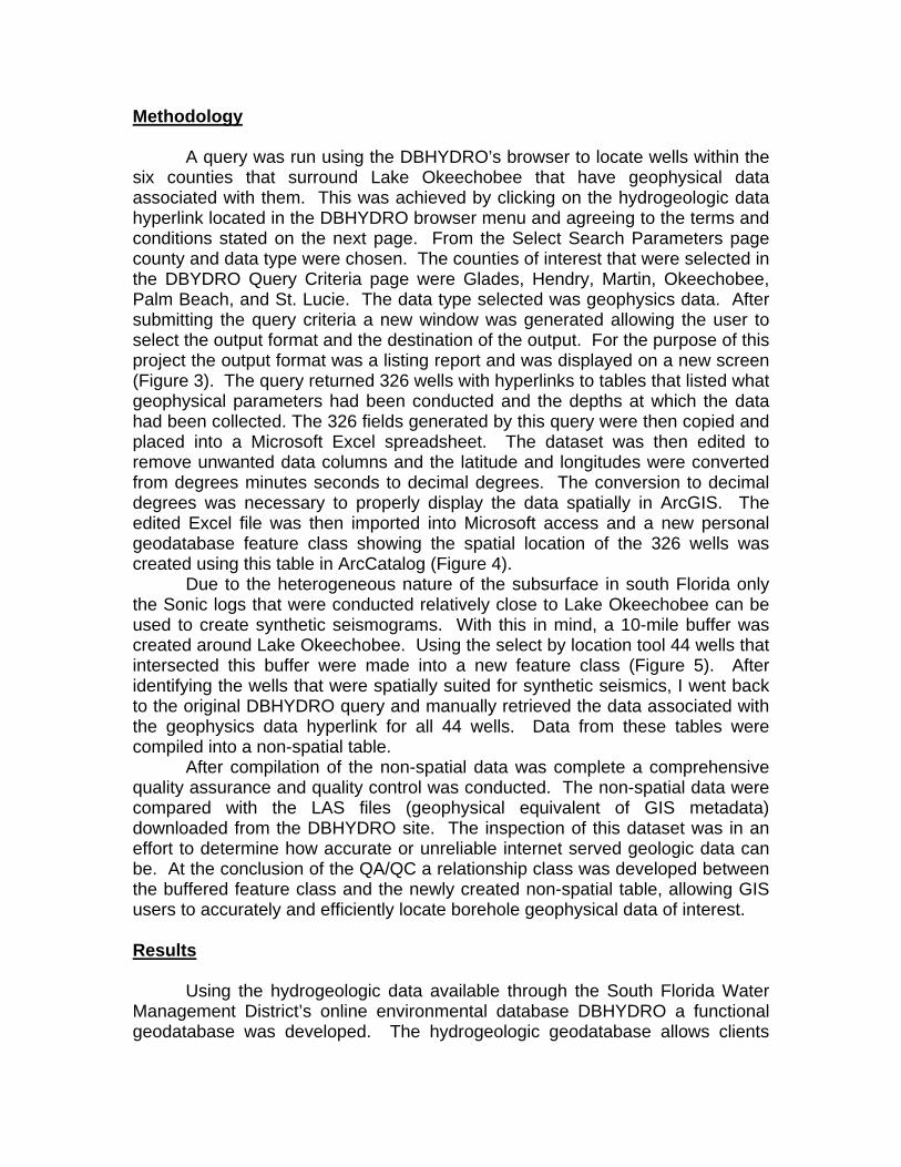
A query was run using the DBHYDRO’s browser to locate wells within the six counties that surround Lake Okeechobee that have geophysical data associated with them. This was achieved by clicking on the hydrogeologic data hyperlink located in the DBHYDRO browser menu and agreeing to the terms and conditions stated on the next page. From the Select Search Parameters page county and data type were chosen. The counties of interest that were selected in the DBYDRO Query Criteria page were Glades, Hendry, Martin, Okeechobee, Palm Beach, and St. Lucie. The data type selected was geophysics data. After submitting the query criteria a new window was generated allowing the user to select the output format and the destination of the output. For the purpose of this project the output format was a listing report and was displayed on a new screen (Figure 3). The query returned 326 wells with hyperlinks to tables that listed what geophysical parameters had been conducted and the depths at which the data had been collected. The 326 fields generated by this query were then copied and placed into a Microsoft Excel spreadsheet. The dataset was then edited to remove unwanted data columns and the latitude and longitudes were converted from degrees minutes seconds to decimal degrees. The conversion to decimal degrees was necessary to properly display the data spatially in ArcGIS. The edited Excel file was then imported into Microsoft access and a new personal geodatabase feature class showing the spatial location of the 326 wells was created using this table in ArcCatalog (Figure 4).
Due to the heterogeneous nature of the subsurface in south Florida only the Sonic logs that were conducted relatively close to Lake Okeechobee can be used to create synthetic seismograms. With this in mind, a 10-mile buffer was created around Lake Okeechobee. Using the select by location tool 44 wells that intersected this buffer were made into a new feature class (Figure 5). After identifying the wells that were spatially suited for synthetic seismics, I went back to the original DBHYDRO query and manually retrieved the data associated with the geophysics data hyperlink for all 44 wells. Data from these tables were compiled into a non-spatial table.
After compilation of the non-spatial data was complete a comprehensive quality assurance and quality control was conducted. The non-spatial data were compared with the LAS files (geophysical equivalent of GIS metadata) downloaded from the DBHYDRO site. The inspection of this dataset was in an effort to determine how accurate or unreliable internet served geologic data can be. At the conclusion of the QA/QC a relationship class was developed between the buffered feature class and the newly created non-spatial table, allowing GIS users to accurately and efficiently locate borehole geophysical data of interest. Results Using the hydrogeologic data available through the South Florida Water Management District’s online environmental database DBHYDRO a functional geodatabase was developed. The hydrogeologic geodatabase allows clients
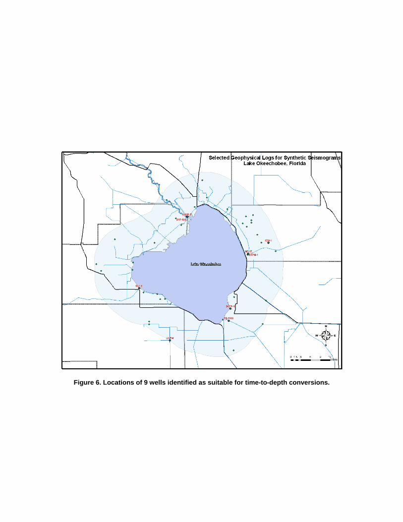
and/or researchers working in the proximity of Lake Okeechobee to locate specific hydrogeologic data needed for their studies within a matter of minutes instead of several hours or even days. For example, prior to the development of this geodatabase the 326 wells that resulted from the online query were manually inspected online for wells that had Sonic logs. This process took over 5 hours and only resulted in 37 of the 326 wells (~11%) having the data needed for creation of synthetic seismograms. Once the geodatabase was completed, a similar analysis was done with the wells contained in the 10-mile radius. This time, it took only 5 minutes to identify the 9 wells (~20%) that had the appropriate data (Figure 6). In an effort to demonstrate how unreliable internet served geologic data can be, a comprehensive inspection of the data was conducted using LAS files for each of the geophysical runs as a control. When compared with the LAS files ~40% of the geophysical suites posted on the South Florida Water Management District’s website had erroneous data. Discussion The percentage of wells that had Sonic data was not significantly different from the 10% that was originally hypothesized at the beginning of this project. The high percentage of Sonic data (~20%) from the 10-mile radius was not surprising. The South Florida Water Management District for the last five years has made a tremendous effort to upgrade their logging suites in the area of Lake Okeechobee. It is important to note that after all their effort, the South Florida Water Management District still have only 20% of the logs in the area with the data needed for time-to-depth conversions. The discovery that ~40% of the geophysical data posted on DBHYDRO was erroneous showed that geologic databases posted on the internet are not always reliable. The majority of error found in the database was the reported depths at which the measurements were taken. It was not uncommon to find data posted that showed a borehole geophysical parameter being measured at a much shallower starting depth than what was actually recorded in the LAS file. The depth displacement between recorded and actual measurements averaged over 100 feet. As a geoscientist this can be a crucial error if you are interested in the depth interval that was not recorded. There were also 17 cases where the reported geophysical logs had not been measured throughout the entire section and had a value of –999.25 in the LAS data column. This analysis shows that when using databases such as DBHYDRO, it is always a good idea to conduct some “spot checking” to see what kind of percent error might be associated with the dataset. The use of a hydrogeologic geodatabase has been proven to be a powerful tool in subsurface investigations. The ability of a geodatabase to accurately and efficiently locate data of interest and display the spatial location of that data is a tool that should be utilized by every state agency. A similar geodatabase should be constructed for the state of Texas. The TWDB, with adequate funding, could require the numerous water conservation districts to be
responsible for constructing and maintaining such a database for their geographic areas. This would allow the scientific community in Texas access to readily available databases that can be used to quickly identify the locations of information needed for a particular study. Acknowledgments I would like to thank the South Florida Water Management district for their support of my dissertation and their willingness to work with an unknown graduate student from Texas. I would also like to thank Dr. Xie for his comments and allowing me to make some revisions to this report after already having turned it in. References No references to the scientific literature were used in the writing of this report.
Figures
Figure 1. Location of seismic lines run by CH2M Hill in 2002.
Figure 2. South Florida Water Management District’s DBHYRO homepage.
Figure 3. Listing of selected search criteria and output parameters used in DBHYDRO
query.
Figure 4. Geographic extent of available geophysical logs for Glades, Hendry, Martin,
Okeechobee, Palm Beach and St. Lucie counties.
Figure 5. Geographic extent of available geophysical logs for Glades, Hendry, Martin,
Okeechobee, Palm Beach and St. Lucie counties within a 10-mile buffer.
Figure 6. Locations of 9 wells identified as suitable for time-to-depth conversions.