Development of a Query Language for GML based on XPath * Jes´ us M. Almendros-Jim´ enez University of Almer´ ıa Almeria, Spain [email protected]Antonio Becerra-Ter´ on University of Almer´ ıa Almeria, Spain [email protected]Francisco Garc´ ıa-Garc´ ıa University of Almer´ ıa Almeria, Spain [email protected]Abstract Geography Markup Language (GML) has been established as the standard language for the trans- port, storage and modelling of geographic information. In this paper we study how to adapt the XPath query language to GML documents. With this aim, we have defined a semantic based XPath language which is not based on the (tree-based) syntactic structure of GML documents, instead it is based on the “semantic structure” of GML documents. In other words, the proposed XPath language is based on the GML schema. We have developed a system called UALGIS, in order to implement the approach. Such system stores GML documents by means of the PostGIS RDBMS. In order to execute semantic-based XPath queries we have defined a translation of the queries into SQL. Such translation takes into account the GML schema. Finally, the system allows to visualize the result. With this aim, the result of a query is exported to the Keyhole Markup Language (KML) format. 1 Introduction The Geography Markup Language (GML) [7, 20, 21, 8] has been established as the standard language for the transport, storage and modeling of geographic information. GML is a dialect of the eXtensible Markup Language (XML) [27], which adapts XML to Geo-spatial data. XML allows to describe the structure of Web data by means of a tree. The tree structure is used to describe relations between data: for instance, a paper tag contains author, title and publisher as subtree tags and the subtree publisher can be described by means of name of the journal, country, editors, etc. The need for querying XML documents has motivated the design of the XPath query language [28]. The XPath language allows to specify the path of the XML tree to be retrieved. In addition, XPath allows to constraint the query by means of boolean conditions about the attributes and tags of the selected nodes. For instance, we can specify in a query that we would like to retrieve the editors of the journals in which “Becerra” has published a paper as follows: /papers/paper[author = “Becerra”]/journal/editor XPath can be used for retrieving the GML elements. However, due to the usual syntactic structure of GML documents XPath should be adapted to this special case. GML allows to describe spatial objects including, if any, their geometry, together with the coordinate reference system, topology, among oth- ers. However, usually, GML documents do not use the tree-based structure of XML documents for the representation of spatial objects. Usually, GML documents store spatial objects as a sequence of XML elements, and they are stored as children of the tree root [18, 30]. It makes the tree-based XPath useless in most of the cases. The reason for storing spatial objects as a sequence of children of the root is that the tree structure is not used for representing spatial relations. One could think that a subtree of a node represents, for instance, the spatial objects enveloped by the node. However, it is not true in general. GML allows the specification of relations between spatial objects. However, GML allows to define a vocabulary of relations between spatial objects. For instance, the European INSPIRE Directive [12] has defined a certain vocabulary of GML whose aim is to create a spatial data infrastructure in the European * This work has been partially supported by the Spanish MICINN under grant TIN2008-06622-C03-03. 3
Transcript
Development of a Query Language for GML based on XPath∗
Geography Markup Language (GML) has been established as the standard language for the trans-port, storage and modelling of geographic information. In this paper we study how to adapt theXPath query language to GML documents. With this aim, we have defined a semantic based XPathlanguage which is not based on the (tree-based) syntactic structure of GML documents, instead it isbased on the “semantic structure” of GML documents. In other words, the proposed XPath languageis based on the GML schema. We have developed a system called UALGIS, in order to implementthe approach. Such system stores GML documents by means of the PostGIS RDBMS. In order toexecute semantic-based XPath queries we have defined a translation of the queries into SQL. Suchtranslation takes into account the GML schema. Finally, the system allows to visualize the result.With this aim, the result of a query is exported to the Keyhole Markup Language (KML) format.
1 Introduction
The Geography Markup Language (GML) [7, 20, 21, 8] has been established as the standard languagefor the transport, storage and modeling of geographic information. GML is a dialect of the eXtensibleMarkup Language (XML) [27], which adapts XML to Geo-spatial data. XML allows to describe thestructure of Web data by means of a tree. The tree structure is used to describe relations between data:for instance, a paper tag contains author, title and publisher as subtree tags and the subtree publishercan be described by means of name of the journal, country, editors, etc. The need for querying XMLdocuments has motivated the design of the XPath query language [28]. The XPath language allowsto specify the path of the XML tree to be retrieved. In addition, XPath allows to constraint the queryby means of boolean conditions about the attributes and tags of the selected nodes. For instance, wecan specify in a query that we would like to retrieve the editors of the journals in which “Becerra” haspublished a paper as follows:
/papers/paper[author = “Becerra”]/journal/editor
XPath can be used for retrieving the GML elements. However, due to the usual syntactic structure ofGML documents XPath should be adapted to this special case. GML allows to describe spatial objectsincluding, if any, their geometry, together with the coordinate reference system, topology, among oth-ers. However, usually, GML documents do not use the tree-based structure of XML documents for therepresentation of spatial objects. Usually, GML documents store spatial objects as a sequence of XMLelements, and they are stored as children of the tree root [18, 30]. It makes the tree-based XPath uselessin most of the cases. The reason for storing spatial objects as a sequence of children of the root is thatthe tree structure is not used for representing spatial relations. One could think that a subtree of a noderepresents, for instance, the spatial objects enveloped by the node. However, it is not true in general.GML allows the specification of relations between spatial objects. However, GML allows to define avocabulary of relations between spatial objects. For instance, the European INSPIRE Directive [12] hasdefined a certain vocabulary of GML whose aim is to create a spatial data infrastructure in the European
∗This work has been partially supported by the Spanish MICINN under grant TIN2008-06622-C03-03.
Development of a query language for GML based on XPath Almendros, Becerra, and Garcıa
Union in order to share information through public organizations. However, the syntatic structure ofGML documents do not necessarily take into account the “semantic structure” of such vocabulary. Suchvocabulary can be seen as a GML schema in such a way that spatial objects and relations between themconforms the schema. Usually, GML documents contain spatial objects in which spatial relations arespecified by means of the linking mechanism of XML documents. Using XPath for GML documents,we could follow the links of the GML document in order to retrieve relationships between spatial objects,however, it makes XPath queries very sophisticated.
In this paper we study how to adapt the XPath query language to GML documents. With this aim, wehave defined a semantic based XPath language which is not based on the (tree-based) syntactic structureof GML documents, rather than, it is based on the “semantic structure” of GML documents. In otherwords, the proposed XPath language is based on the GML schema instead of the syntactic structure.
We have developed a system called UALGIS, available via Web in http://indalog.ual.es/ualgis/testGMaps.jsp in order to implement the approach. Such system stores GML documentsby means of the PostGIS [25]. In order to execute semantic-based XPath queries we have defined atranslation of the queries into SQL. Such translation takes into account the GML schema. Finally, thesystem allows to visualize the result. With this aim, the result of a query is exported to the KeyholeMarkup Language (KML) format [6].
1.1 Related Work
Spatial data can be handled by well-known relational database management systems (RDBMS) like:SpatialSQL [11], GeoSQL [13], Oracle Spatial [26] and PostGIS [25]. Basically, they are based onextensions of the relational model for storing spatial objects and extensions of the SQL query languagefor the retrieval of spatial queries.
In the case of GML data, the Web Feature Service (WFS) is a standard of the OpenGis Consortium(OGC) [22] for data manipulation of geographic features stored on a Web site (i.e. a Web Feature Server)using HTTP requests. The expressiveness of this language is very poor compared with query languageslike SQL. GQuery [4] is a proposal for adding spatial operators to XQuery [5], the standard XML querylanguage. Manipulation of trees and sub-trees are carried out by means of XQuery, while spatial process-ing is performed using geometric functions which use the JTS Topology Suite [1]. JTS is an open sourceAPI that provides a spatial object model and a set of spatial operators. The GeoXQuery approach [14]extends the Saxon XQuery processor [16] with function libraries that provide geo-spatial operations. Itis also based on JTS and provides a GML to Scalable Vector Graphics (SVG) [29] transformation libraryfor the XQuery processor in order to show query results.
With respect to GQuery and GeoXQuery, our proposal can be seen as a specific query language forGML instead of considering ad-hoc mechanisms for querying GML in XPath and XQuery. Our approachis focused on the XPath query language which is a sublanguage of the XQuery language. Our work canbe seen as the first step to use XQuery as query language for GML documents. However, our proposalis based on the semantic structure of GML documents instead of the syntactic one used in GQueryand GeoXQuery. With respect to geometric functions, we are not still interested in queries involvinggeometric operations. Our current approach is mainly interested to querying semantic spatial relationsexpressed in GML documents which do not depend on the geometry of the objects. In any case, we willconsider the extension of our work to geometric operations in the future by using the PostGIS library.Finally, our system is able to export the result of queries in order to visualize them, but instead of usingSVG like in GeoXQuery, we export to KML.
GML Query [19] is also a contribution in this research line that stores GML documents in a spatialRDBMS. This approach performs a simplification of the GML schema that is then mapped to its corre-sponding relational schema. The basic values of spatial objects are stored as values of the tables. Once
Development of a query language for GML based on XPath Almendros, Becerra, and Garcıa
the document is stored, spatial queries can be expressed using the XQuery language with spatial func-tions. The queries are translated to their equivalent in SQL which are executed by means of the spatialRDBMS. This approach has some similarities with our. Firstly, the storage of GML documents in a spa-tial RDBMS. In our system, we store GML documents by means of the PostGIS RDBMS. Secondly, inour approach the queries are expressed in XPath and are translated into SQL. However, our XPath-basedquery language is properly based on the GML schema.
Another problem related to GML is how to visualize GML documents. The are several technologies(i.e. SVG, VRML, HTML, among others) to specify how to show the content of GML documents. KML[6] is an XML-based language focused on geographic data visualization, including annotation of mapsand images, as well as controlling the display in the sense of where to go and where to look. From thisperspective, KML is complementary to GML and most of the major standards of the OGC includingWeb Feature Service (WFS) [23] and Web Map Service (WMS) [24]. We have decided to export ourGML query result to KML due to the advantages that offer this technology (i.e. APIs, WFS, WMS) andbecause it has been approved by the OGC as standard for the exchange and representation of geographicdata in three dimensions. In this way the results can be interpreted by different GIS or Earth browsers.Other approaches return the output in SVG format but it has as disadvantage that it is just a graphicalformat. KML can display the results without losing the GML semantics and allows to include meta-data.
The rest of this article is organized as follows. Section 2 will present the GML data model andschema. Section 3 will define the semantic-based XPath language. Section 4 will describe the systemand finally Section 5 will conclude and present future work.
2 GML Data Model
Next, we show an example of GML document representing the center of a city:
As above mentioned, this GML document describes a center of a city. This description includes tagsfor CityCenter and cityCenterMember’s of a city, such as buildings, blocks and ways. However, a GMLdata model provides mechanisms for structuring GML documents. For instance, the previous GML doc-ument can be also represented as follows:
where instead of using linking mechanisms of XML (i.e. xlink:href), the elements of the GMLdocument are nested. However, it is normally recommended to avoid nesting of GML elements in orderto do not increase the complexity of GML documents. From the point of view of using XPath forquerying GML documents, it makes not easy to express complex queries w.r.t. GML documents. Ourapproach aims to propose a semantic version of XPath in which the result of the query does not dependon the syntactic structure of the GML document. In other words, nesting of elements is not relevant inour approach because we will follow the GML schema to define queries. Next will present a standard ofGML schemas to be used in our approach.
2.1 INSPIRE Directive
The European INSPIRE Directive [12] aims to create a spatial data infrastructure in the European Unionto share information through public organizations and facilitate public access across Europe. Further-more, the spatial information considered under this policy is extensive and covers a wide range of areasand topics. INSPIRE is based on several common principles:
• Data should be collected once and should be stored where they can be maintained more efficiently.
• It must be able to easily combine the spatial information from different sources across Europe andshare it with other users and applications.
• It should be possible to collect information at some detail level and share it with all levels, e.g.detailed for local analysis, general for global strategic purposes,. . .
• Geographic information should be transparent and readily available.
7
Development of a query language for GML based on XPath Almendros, Becerra, and Garcıa
• It must be easy to find which geographic information is available, how it can be used to meet aspecific need, and under which conditions can be acquired and used.
Figure 1: GML Schema of the City Center
The INSPIRE directive defines 34 topics on spatial data needed for application development. TheINSPIRE directive defines GML schemas for each one of these topics. We have followed this directivein our approach in order to make our proposal more interesting in the real world.
For instance, the Figure 1 shows an example of GML schema for cities. This schema uses an UMLProfile for its definition called HollowWorld [9] which is based on Table E.1 of ISO 19136:2007 (GML3.2.1) [2] and is used by the INSPIRE Directive. It describes the elements (i.e. the members) of a citycenter. A city center contains differents entities like locals, buildings, blocks, monuments and ways. Lo-cals can be bars, shops and banks. Buildings can be buildings of interest, and ways can be roundabouts,streets and squares.The GML schema also includes spatial relationships between the entities: locals are‘locatedAt” buildings that “belongsTo” blocks which can be “nextTo” Ways. Monuments can be also
8
Development of a query language for GML based on XPath Almendros, Becerra, and Garcıa
“locatedAt” a way. GML allows to describe entities by means of the Feature type. In addition, theINSPIRE directive provides Data types for geographical entity naming.
In our system, we have used data available from IDEAndalucıa [15] which is part of the geo-servicesof the INSPIRE directive. This is an Andalusian Cartographic System Geo-portal available to search,locate, view, download or request some type of geographic information referring to the territory of An-dalusia in Spain. IDEAndalucıa provides various services, such as WMS (Web Map Server) and WFS(Web Feature Service) with data available in GML format. By a GetFeature request to a WFS server aGML document is returned with all the Features of a selected type that are within the limits defined in ageographical rectangle or GML Bounding Box.
3 Development of a Query language for GML based on XPath
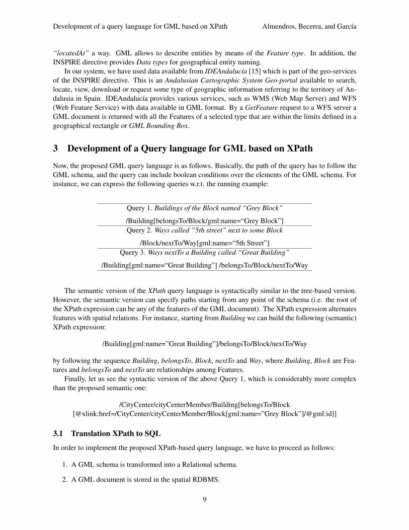
Now, the proposed GML query language is as follows. Basically, the path of the query has to follow theGML schema, and the query can include boolean conditions over the elements of the GML schema. Forinstance, we can express the following queries w.r.t. the running example:
Query 1. Buildings of the Block named “Grey Block”
/Building[belongsTo/Block/gml:name=“Grey Block”]Query 2. Ways called ”5th street” next to some Block
/Block/nextTo/Way[gml:name=“5th Street”]Query 3. Ways nextTo a Building called “Great Building”
The semantic version of the XPath query language is syntactically similar to the tree-based version.However, the semantic version can specify paths starting from any point of the schema (i.e. the root ofthe XPath expression can be any of the features of the GML document). The XPath expression alternatesfeatures with spatial relations. For instance, starting from Building we can build the following (semantic)XPath expression:
by following the sequence Building, belongsTo, Block, nextTo and Way, where Building, Block are Fea-tures and belongsTo and nextTo are relationships among Features.
Finally, let us see the syntactic version of the above Query 1, which is considerably more complexthan the proposed semantic one:
In order to implement the proposed XPath-based query language, we have to proceed as follows:
1. A GML schema is transformed into a Relational schema.
2. A GML document is stored in the spatial RDBMS.
9
Development of a query language for GML based on XPath Almendros, Becerra, and Garcıa
3. A XPath query is translated into an equivalent SQL query.
4. The result of the query is exported to GML or KML format.
3.1.1 Transforming the GML Schema into a Relational Schema
For data storage the first thing to do is to transform the GML schema into a relational schema of PostGIS.For this transformation we proceed as follows:
• A table is created for each element of Feature type.
• Attributes of elements of Feature type are mapped to columns of the tables.
• Geometric attributes of elements of Feature type are mapped to columns of PostGIS geometrytype.
• Spatial relations between elements of Feature type are represented in two ways:
– A one to one relationship is mapped to a column that references the primary key of theelements in the spatial relation.
– A one to many relationship is mapped to a table, with the name of the spatial relation, withcolumns containing the primary keys (i.e. foreign keys) of the elements in the spatial relation.
– A many to many relationship is mapped as two one-to-many relationships, one for eachdirection of the relationship.
• Feature inheritance is represented by table inheritance provided by PostGIS.
Figure 2 shows the result of the transformation of some elements of the GML schema represented inFigure 1.
Figure 2: A Fragment of Relational schema of the City Center
3.1.2 Storage of GML documents in the Spatial RDBMS
The GML documents are stored in the spatial RDBMS as follows. Firstly, features instances are addedto tables. Secondly, spatial relations are added to columns (in the case of one to one relationships) andto tables (in the case of one to many and many to many relationships). Next, we show the table instancesof the running example:
10
Development of a query language for GML based on XPath Almendros, Becerra, and Garcıa
Table: Buildingogc fid name belongsTo
B1 Great Building BL1B2 Small Building BL2. . . . . . . . .
We can now define the translation of XPath-based queries into SQL queries, using the transformation ofthe GML Schema into the Relational Schema. The translation is as follows:
1. Case /A/p/B where p is a one to one relationship: Select B.* From A,B Where A.p = B.id
2. Case /A/p/B where p is a one to many relationship or a many to many relationship: Select B.* FromA,A p,B Where A p.A = A.id and A p.B = B.id
3. Case /A/p1/B/p2/C where p1,p2 are one to one relationships: Select C.* From (Select B.* FromA,A p1,B Where A p1.A = A.id and A p1.B = B.id) B, C Where B.p2=C.id
4. Case /A/p1/B/p2/C where p2 is a one to one relationship and p1 is a one to one relationship: SelectC.* From (Select B.* From A,A p1,B Where A p1.A = A.id and A p1.B = B.id) B, B p2,C WhereB p2.B = B.id and B p2.C = C.id
5. Case /A[cond]/p/B[cond2] where p is a one to one relationship: Select B.* From A,B Where A.p =B.id and cond and cond2
6. Case /A[cond]/p/B[cond2] where p is a one to many relationship: Select B.* From A,A p,B WhereA p.A = A.id and A p.B = B.id and cond and cond2
7. Similarly, the rest of the cases
11
Development of a query language for GML based on XPath Almendros, Becerra, and Garcıa
Now, we show the translation into SQL expressions of the XPath queries of Section 3 w.r.t. the GMLschema represented by Figure 1.
Query 1. Buildings of the Block named “Grey Block”XPath Query SQL Expression
PostGIS natively provides several functions for the conversion of stored geometries to GML and KMLformats:
• AsGML. Returns the geometry as a GML element. We can choose the spatial reference system.
12
Development of a query language for GML based on XPath Almendros, Becerra, and Garcıa
• AsKML. It works similarly to AsGML but returning it as a KML geometry. We cannot choose thespatial reference system since it is fixed to WGS84.
These functions are only responsible for generating the geometry in GML / KML format but it is stillrequired the export tables as GML and KML elements. With this aim, PostGIS provides two tables asfollows:
• Geometry columns table: It stores a catalog with the schema names, table names, column namesof the geometric data and their spatial reference system.
• Spatial ref sys table: It contains a collection of spatial reference systems and stores informationabout the projections for transforming from one system to another.
4 UALGIS System
For validating the proposed query language a Web Geographic Information System, called UALGIS,has been implemented (available in http://indalog.ual.es/ualgis/testGMaps.jsp). The mainfeatures of the system can be summarized as follows:
• Storage of GML documents with PostGIS.
• GML / KML document creation using dom4j [17].
• Querying of elements of feature type of the database.
• XPath-based querying.
• Google Maps-based client for displaying the resut of queries.
The system has been built by using the Java Eclipse Galileo [10] as IDE. For project management,we have used Maven 2 [3], which has been used for handling library dependences required for theconstruction of the GIS. The system architecture includes PostGIS version 1.4 server for data storageand a Tomcat version 6.0 server that handles the logic and presentation layers of the application. For thepresentation layer, pages are programmed using JSP, HTML and AJAX for interacting with the server.Figure 3 shows the architecture.
Figure 3: UALGIS System Architecture
The FeatureManager component is responsible for the management of Features stored in the database.It is responsible for translating XPath queries into SQL queries. The FeatureManager is also responsiblefor transforming the database rows to an object model that can be processed by the DocumentManagercomponent. The DocumentManager component is responsible for handling documents in GML/KMLformat. It is also responsible for transforming the objects returned by FeatureManager onto KML /
Development of a query language for GML based on XPath Almendros, Becerra, and Garcıa
GML documents. It also supports the reverse process, i.e. the extraction of features from GML/KMLdocuments. For creating and reading documents the dom4j library is used. This is an Open Source XMLFramework for Java that allows reading, writing and navigation of XML documents. It also includes aprocessing model based on events for large documents or XML streams and includes support for XMLSchema validation types. On the client side, the Web GIS is a map browser with support for KML. It isbased on the Google Maps API including a fast and efficient 2D browser that provides features like zoom-ing, panning, searching and displaying geographical names and information about geographic entities.Figure 4 shows a snapshot of the UALGIS system.
Figure 4: Snapshot of UALGIS
5 Conclusion and Future Work
In this paper we have studied how to adapt the XPath query language to GML documents. With thisaim, we have defined a semantic based XPath language which is not based on the (tree-based) syntacticstructure of GML documents, instead it is based on the “semantic structure” of GML documents. Wehave developed a system called UALGIS, in order to implement the approach. Such system stores GMLdocuments by means of the PostGIS RDBMS. In order to execute semantic-based XPath queries wehave defined a translation of the queries into SQL. Such translation takes into account the GML schema.Finally, the system allows to visualize the result. With this aim, the result of a query is exported to theKML format. As future work different techniques as GML filtering, indexing, etc.. will be studied in
14
Development of a query language for GML based on XPath Almendros, Becerra, and Garcıa
order to improve the performance of the UALGIS system. On the other hand, we would like to extendour work to the XQuery language. The extension should be also based on the semantic of GML. Finally,we would like to combine our GML query language with ontologies. Its use would improve the kind ofqueries and answers obtained from GML documents.
References[1] Java Topology Suite (JTS). In Shashi Shekhar and Hui Xiong, editors, Encyclopedia of GIS, page 601.
Springer, 2008.[2] Iso 19136. In Ling Liu and M. Tamer Ozsu, editors, Encyclopedia of Database Systems, pages 15–75.
Springer US, 2009.[3] Apache Software Foundation. Apache Maven. http://maven.apache.org/.[4] O. Boucelma and F.M. Colonna. GQuery: a Query Language for GML. In Proc. of the 24th Urban Data
Management Symposium, pages 27–29, 2004.[5] D. Chamberlin, Denise Draper, Mary Fernandez, Michael Kay, Jonathan Robie, Michael Rys, Jerome
Simeon, Jim Tivy, and Philip Wadler. XQuery from the Experts. Addison Wesley, Boston, USA, 2004.[6] OpenGIS Consortium. KML 2.2 Reference - An OGC Best Practice. http://www.opengeospatial.org/
2010.[8] J.E. Corcoles and P. Gonzalez. GML as Database. Handbook of Research on Geoinformatics, page 1, 2009.[9] Simon Cox. HollowWorld. https://www.seegrid.csiro.au/twiki/bin/view/AppSchemas/
HollowWorld, 2009.[10] Eclipse Foundation. Eclipse. http://www.eclipse.org/.[11] Max J. Egenhofer. Spatial SQL: A Query and Presentation Language. IEEE Trans. Knowl. Data Eng.,
6(1):86–95, 1994.[12] European Union. InspireE. http://inspire.jrc.ec.europa.eu/.[13] F.Wang, J.Sha, H.Chen, and S.Yang. GeoSQL:a Spatial Query Language for Object-Oriented GIS. In Proc.
of the 2nd International Workshop on Computer Science and Information Technologies, 2000.[14] C.H. Huang, T.R. Chuang, D.P. Deng, and H.M. Lee. Building GML-native web-based geographic informa-
tion systems. Computers & Geosciences, 2009.[15] Junta de Andalucia. IDEAndalucia. http://www.andaluciajunta.es/IDEAndalucia/IDEA.shtml.[16] M. Kay and S. Limited. Ten reasons why Saxon XQuery is fast. IEEE Data Engineering Bulletin, 1990.[17] C. Kochmer and E. Frandsen. JSP and XML: integrating XML and web services in your JSP application.
Sams, 2002.[18] R. Lake. Geography mark-up language (GML). Wiley, 2004.[19] Yuzhen Li, Jun Li, and Shuigeng Zhou. GML Storage: A Spatial Database Approach. In Shan Wang,
Dongqing Yang, Katsumi Tanaka, Fabio Grandi, Shuigeng Zhou, Eleni E. Mangina, Tok Wang Ling, Il-YeolSong, Jihong Guan, and Heinrich C. Mayr, editors, ER (Workshops), volume 32–89 of Lecture Notes inComputer Science, pages 55–66. Springer, 2004.
[20] C.T. Lu, R.F. Dos Santos, L.N. Sripada, and Y. Kou. Advances in GML for geospatial applications. Geoin-formatica, 11(1):131–157, 2007.
[21] A.P. Need. Querying GML. Handbook of Research on Geoinformatics, page 11, 2009.[22] OpenGis Consortium (OGC). OpenGis Specifications. http://www.opengeospatial.org, 2003.[23] OpenGis Consortium (OGC). WFS Specifications. http://www.opengeospatial.org/standards/wms,
Development of a query language for GML based on XPath Almendros, Becerra, and Garcıa
[26] Siva Ravada and Jayant Sharma. Oracle8i Spatial: Experiences with Extensible Databases. In Ralf HartmutGuting, Dimitris Papadias, and Frederick H. Lochovsky, editors, SSD, volume 16–51 of Lecture Notes inComputer Science, pages 355–359. Springer, 1999.
[27] W3C. Extensible Markup Language (XML). Technical report, 2007.[28] W3C. XML Path Language (XPath) 2.0. Technical report, 2007.[29] W3C Recommendation. Scalable Vector Graphics (SVG) 1.0 Specification, 2001.[30] S. Wei, G. Joos, and W. Reinhardt. Management of Spatial Features with GML. In Proceedings of the 4th
AGILE Conference on Geographic Information Science, Brno, Czech Republic, pages 370–375, 2001.