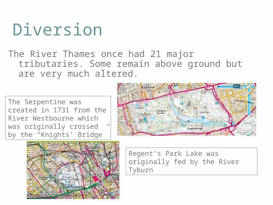
DiversionThe River Thames once had 21 major tributaries. Some
remain above ground but are very much altered.
The Serpentine was created in 1731 from the River Westbourne which was originally crossed by the “Knights’ Bridge”
Regent’s Park Lake was originally fed by the River Tyburn
Other London ExamplesThe Romans covered some tributaries of the Thames.
River Walbrook was completely covered by the 1460s.
Hampstead and Highgate Ponds were created from two streams of the River Fleet (as in Fleet Street).
Those tributaries used for ornamental lakes were all eventually diverted away because they became too polluted.
Peckham Rye was originally “the village by the river Peck”.
River Brent “disappears” under buildings
River Brent flowing in a sinuous pattern
Straightening and Altering
Both the current and historical map indicate the original course of the River Derwent (Yorkshire)
Additional, straight channels were created
Changing SinuosityMap of part of the Yorkshire Derwent
Locations where there appears to have been change in the channel course in historic times
Meander loops have become more exaggerated. This river is prone to producing cut-offs (ox-bows) as shown
Identifying Change (i)
There are clues to change over time on the current map. The lake is called Llyn Nantlle Uchaf; “uchaf” means “upper” in Welsh. Look at the remnants of an industrial past in this area.
Identifying Change (ii)
On the historic map, the extent of change to the Afon Drws-y-Coed and Afon Llyfni becomes apparent. The smaller lake (Isaf) was drained to protect the quarry.


![[ Digimap ] The internet map collection for UK academia Dr Hugh Buchanan User Support Co-ordinator Data Library, University of Edinburgh.](https://static.documents.pub/doc/80x56/56649ca15503460f9495f60a/-digimap-the-internet-map-collection-for-uk-academia-dr-hugh-buchanan-user.jpg)


