GRIP - Global Risk Identification Programme, UNDP Bureau for Crisis Prevention and Recovery, +41 22 9178399, [email protected], www.gripweb.org Training Workshop on Drought Risk Assessment for the Agricultural Sector – Ljubljana, Slovenia, Sept. 20-24, 2010 Disaster Risk Assessment: Disaster Risk Mapping Dr. Jianping Yan Disaster Risk Assessment Specialist
Transcript
GRIP - Global Risk Identification Programme, UNDP Bureau for Crisis Prevention and Recovery, +41 22 9178399, [email protected], www.gripweb.org
Training Workshop on Drought Risk Assessment for the Agricultural Sector – Ljubljana, Slovenia, Sept. 20-24, 2010
Disaster Risk Assessment:Disaster Risk Mapping
Dr. Jianping YanDisaster Risk Assessment Specialist
GRIP - Global Risk Identification Programme, UNDP Bureau for Crisis Prevention and Recovery, +41 22 9178399, [email protected], www.gripweb.org
Training Workshop on Drought Risk Assessment for the Agricultural Sector – Ljubljana, Slovenia, Sept. 20-24, 2010
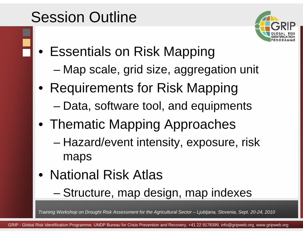
Session Outline
• Essentials on Risk Mapping– Map scale, grid size, aggregation unit
• Requirements for Risk Mapping– Data, software tool, and equipments
GRIP - Global Risk Identification Programme, UNDP Bureau for Crisis Prevention and Recovery, +41 22 9178399, [email protected], www.gripweb.org
Training Workshop on Drought Risk Assessment for the Agricultural Sector – Ljubljana, Slovenia, Sept. 20-24, 2010
What is Risk Mapping?
• Risk mapping is the process of establishing the spatial and temporal extent of risk (combining information on probability and consequences).
• Risk mapping requires combining maps of hazards, exposure, and vulnerability functions.
• The results of risk mapping are usually presented in the form of maps that show the magnitude and nature of the risk.
•
GRIP - Global Risk Identification Programme, UNDP Bureau for Crisis Prevention and Recovery, +41 22 9178399, [email protected], www.gripweb.org
Training Workshop on Drought Risk Assessment for the Agricultural Sector – Ljubljana, Slovenia, Sept. 20-24, 2010
MappingScale
ApplicationLevel
Purposes of GIS Application Data Requirements
1:1,000,000 or smaller
National Formulation of national disaster risk management strategy;Inventory of major hazards in the country;Identification of areas affected or threatened for an entire country
National scale information is as required. The required details of the input data is low.
1:100,000-1:1,000,000
Provincial Draft regional development projects or large engineering projects;Utilised more for spatial analysis at this scale, although the type of analysis will mostly be qualitative, due to the lack of detailed information.
The required details of the input data is still rather low.
1:25,000 -1:100,000
District or county
Conduct the prefeasibility study of developmental projects;GIS analysis capabilities are used extensively for hazard zonation.
Sufficiently detailed slope information is required to generate Digital Elevation Models, and derivative products such as slope maps.
1:5,000 -1:25,000
Municipality or Community
Formulate projects at feasibility levels;Generate hazard and risk map for existing settlements and cities;Planning disaster preparedness and disaster relief activities.
The hazard data is more quantitative, derived from laboratory testing of materials and in field measurements.
1:2,000 or larger
Site Planning and design of engineering structure and in detail engineering measures to mitigate natural hazards;Data management and 3D visualization.
Nearly all of the data is of a quantitative nature .
Map Scale
GRIP - Global Risk Identification Programme, UNDP Bureau for Crisis Prevention and Recovery, +41 22 9178399, [email protected], www.gripweb.org
Training Workshop on Drought Risk Assessment for the Agricultural Sector – Ljubljana, Slovenia, Sept. 20-24, 2010
Resolution
GRIP - Global Risk Identification Programme, UNDP Bureau for Crisis Prevention and Recovery, +41 22 9178399, [email protected], www.gripweb.org
Training Workshop on Drought Risk Assessment for the Agricultural Sector – Ljubljana, Slovenia, Sept. 20-24, 2010
Exposure Mapping
GRIP - Global Risk Identification Programme, UNDP Bureau for Crisis Prevention and Recovery, +41 22 9178399, [email protected], www.gripweb.org
Training Workshop on Drought Risk Assessment for the Agricultural Sector – Ljubljana, Slovenia, Sept. 20-24, 2010
GRIP - Global Risk Identification Programme, UNDP Bureau for Crisis Prevention and Recovery, +41 22 9178399, [email protected], www.gripweb.org
Training Workshop on Drought Risk Assessment for the Agricultural Sector – Ljubljana, Slovenia, Sept. 20-24, 2010
• Base maps• Basic data• Intermediate data
Requirements – Data
GRIP - Global Risk Identification Programme, UNDP Bureau for Crisis Prevention and Recovery, +41 22 9178399, [email protected], www.gripweb.org
Training Workshop on Drought Risk Assessment for the Agricultural Sector – Ljubljana, Slovenia, Sept. 20-24, 2010
GRIP - Global Risk Identification Programme, UNDP Bureau for Crisis Prevention and Recovery, +41 22 9178399, [email protected], www.gripweb.org
Training Workshop on Drought Risk Assessment for the Agricultural Sector – Ljubljana, Slovenia, Sept. 20-24, 2010
GRIP - Global Risk Identification Programme, UNDP Bureau for Crisis Prevention and Recovery, +41 22 9178399, [email protected], www.gripweb.org
Training Workshop on Drought Risk Assessment for the Agricultural Sector – Ljubljana, Slovenia, Sept. 20-24, 2010
• GIS– ArcGIS, MapInfo
• Image processing – ERDAS
Requirements – Software Tools
GRIP - Global Risk Identification Programme, UNDP Bureau for Crisis Prevention and Recovery, +41 22 9178399, [email protected], www.gripweb.org
Training Workshop on Drought Risk Assessment for the Agricultural Sector – Ljubljana, Slovenia, Sept. 20-24, 2010
Risk Mapping Process
GRIP - Global Risk Identification Programme, UNDP Bureau for Crisis Prevention and Recovery, +41 22 9178399, [email protected], www.gripweb.org
Training Workshop on Drought Risk Assessment for the Agricultural Sector – Ljubljana, Slovenia, Sept. 20-24, 2010
GRIP - Global Risk Identification Programme, UNDP Bureau for Crisis Prevention and Recovery, +41 22 9178399, [email protected], www.gripweb.org
Training Workshop on Drought Risk Assessment for the Agricultural Sector – Ljubljana, Slovenia, Sept. 20-24, 2010
Hazard Intensity Maps
Sources: Grunthal et. al., 2006
Return Period =1000 yrs
Return Period = 500 yrs
Return Period = 2000 yrs
GRIP - Global Risk Identification Programme, UNDP Bureau for Crisis Prevention and Recovery, +41 22 9178399, [email protected], www.gripweb.org
Training Workshop on Drought Risk Assessment for the Agricultural Sector – Ljubljana, Slovenia, Sept. 20-24, 2010
Sources: GNS, 2003
Hazard Intensity Maps
GRIP - Global Risk Identification Programme, UNDP Bureau for Crisis Prevention and Recovery, +41 22 9178399, [email protected], www.gripweb.org
Training Workshop on Drought Risk Assessment for the Agricultural Sector – Ljubljana, Slovenia, Sept. 20-24, 2010
Event Intensity Maps
GRIP - Global Risk Identification Programme, UNDP Bureau for Crisis Prevention and Recovery, +41 22 9178399, [email protected], www.gripweb.org
Training Workshop on Drought Risk Assessment for the Agricultural Sector – Ljubljana, Slovenia, Sept. 20-24, 2010
Event Intensity Maps
GRIP - Global Risk Identification Programme, UNDP Bureau for Crisis Prevention and Recovery, +41 22 9178399, [email protected], www.gripweb.org
Training Workshop on Drought Risk Assessment for the Agricultural Sector – Ljubljana, Slovenia, Sept. 20-24, 2010
Ground Shaking Hazard Map of the western side of City of Manila
GRIP - Global Risk Identification Programme, UNDP Bureau for Crisis Prevention and Recovery, +41 22 9178399, [email protected], www.gripweb.org
Training Workshop on Drought Risk Assessment for the Agricultural Sector – Ljubljana, Slovenia, Sept. 20-24, 2010
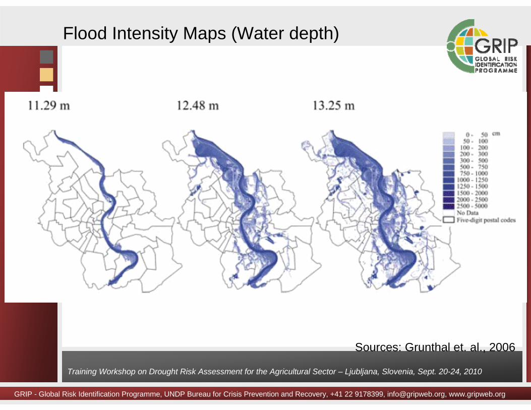
Flood Intensity Maps (Water depth)
Sources: Grunthal et. al., 2006
GRIP - Global Risk Identification Programme, UNDP Bureau for Crisis Prevention and Recovery, +41 22 9178399, [email protected], www.gripweb.org
Training Workshop on Drought Risk Assessment for the Agricultural Sector – Ljubljana, Slovenia, Sept. 20-24, 2010
Flood Hazard Intensity Map
GRIP - Global Risk Identification Programme, UNDP Bureau for Crisis Prevention and Recovery, +41 22 9178399, [email protected], www.gripweb.org
Training Workshop on Drought Risk Assessment for the Agricultural Sector – Ljubljana, Slovenia, Sept. 20-24, 2010
Quality control
GRIP - Global Risk Identification Programme, UNDP Bureau for Crisis Prevention and Recovery, +41 22 9178399, [email protected], www.gripweb.org
Training Workshop on Drought Risk Assessment for the Agricultural Sector – Ljubljana, Slovenia, Sept. 20-24, 2010
Quality control
GRIP - Global Risk Identification Programme, UNDP Bureau for Crisis Prevention and Recovery, +41 22 9178399, [email protected], www.gripweb.org
Training Workshop on Drought Risk Assessment for the Agricultural Sector – Ljubljana, Slovenia, Sept. 20-24, 2010
Quality control
GRIP - Global Risk Identification Programme, UNDP Bureau for Crisis Prevention and Recovery, +41 22 9178399, [email protected], www.gripweb.org
Training Workshop on Drought Risk Assessment for the Agricultural Sector – Ljubljana, Slovenia, Sept. 20-24, 2010
Flood Hazard Zoning Map
GRIP - Global Risk Identification Programme, UNDP Bureau for Crisis Prevention and Recovery, +41 22 9178399, [email protected], www.gripweb.org
Training Workshop on Drought Risk Assessment for the Agricultural Sector – Ljubljana, Slovenia, Sept. 20-24, 2010
Exposure Mapping
– Population in terms of its poverty or vulnerability; – Buildings in terms of their structure type (wood-framed,
concrete-framed, steel-framed, etc. ) and functionality (i.e. residential, commercial, industrial, and public);
– Livelihoods, i.e. livestock, crops, industries (the number, location and extent of exposure);
– Critical facilities, i.e. healthcare (hospitals, clinics, basic health unit, etc.), educational institutions (university, college, school, etc.), warehouses, stockpiles, banks, police stations, fire stations, etc.; and
– Infrastructures, i.e. roads, bridges, airports, ports, railways,dams, telecommunication network, power supply, etc.
GRIP - Global Risk Identification Programme, UNDP Bureau for Crisis Prevention and Recovery, +41 22 9178399, [email protected], www.gripweb.org
Training Workshop on Drought Risk Assessment for the Agricultural Sector – Ljubljana, Slovenia, Sept. 20-24, 2010
GRIP - Global Risk Identification Programme, UNDP Bureau for Crisis Prevention and Recovery, +41 22 9178399, [email protected], www.gripweb.org
Training Workshop on Drought Risk Assessment for the Agricultural Sector – Ljubljana, Slovenia, Sept. 20-24, 2010
Choropleth Method
• Approaches– Proxy based– Geo-referenced
GRIP - Global Risk Identification Programme, UNDP Bureau for Crisis Prevention and Recovery, +41 22 9178399, [email protected], www.gripweb.org
Training Workshop on Drought Risk Assessment for the Agricultural Sector – Ljubljana, Slovenia, Sept. 20-24, 2010
Gridded Method
GRIP - Global Risk Identification Programme, UNDP Bureau for Crisis Prevention and Recovery, +41 22 9178399, [email protected], www.gripweb.org
Training Workshop on Drought Risk Assessment for the Agricultural Sector – Ljubljana, Slovenia, Sept. 20-24, 2010
Dysametric method
GRIP - Global Risk Identification Programme, UNDP Bureau for Crisis Prevention and Recovery, +41 22 9178399, [email protected], www.gripweb.org
Training Workshop on Drought Risk Assessment for the Agricultural Sector – Ljubljana, Slovenia, Sept. 20-24, 2010
Vulnerability curves for typical building types(Sauter and Shah, 1978)
Vulnerability functions
GRIP - Global Risk Identification Programme, UNDP Bureau for Crisis Prevention and Recovery, +41 22 9178399, [email protected], www.gripweb.org
Training Workshop on Drought Risk Assessment for the Agricultural Sector – Ljubljana, Slovenia, Sept. 20-24, 2010
Damage functions for Water Treatment Plants (ATC-25)
Recovery functions for Water Treatment Plants (ATC-25)
Development of recovery functions
GRIP - Global Risk Identification Programme, UNDP Bureau for Crisis Prevention and Recovery, +41 22 9178399, [email protected], www.gripweb.org
Training Workshop on Drought Risk Assessment for the Agricultural Sector – Ljubljana, Slovenia, Sept. 20-24, 2010
Earthquake Risk Maps
Sources: Grunthal et. al., 2006
AEP = 0.1% AEP = 0.05%
AEP =Annual Exceedance Probability
GRIP - Global Risk Identification Programme, UNDP Bureau for Crisis Prevention and Recovery, +41 22 9178399, [email protected], www.gripweb.org
Training Workshop on Drought Risk Assessment for the Agricultural Sector – Ljubljana, Slovenia, Sept. 20-24, 2010
Flood Risk Map
1% AEP = 100 Yr Return Period
GRIP - Global Risk Identification Programme, UNDP Bureau for Crisis Prevention and Recovery, +41 22 9178399, [email protected], www.gripweb.org
Training Workshop on Drought Risk Assessment for the Agricultural Sector – Ljubljana, Slovenia, Sept. 20-24, 2010
Flood Risk Map-Potential damage in million EURO/ha-Annual Probability = 0.2%-Scale 1:200,000
GRIP - Global Risk Identification Programme, UNDP Bureau for Crisis Prevention and Recovery, +41 22 9178399, [email protected], www.gripweb.org
Training Workshop on Drought Risk Assessment for the Agricultural Sector – Ljubljana, Slovenia, Sept. 20-24, 2010
Map Template
GRIP - Global Risk Identification Programme, UNDP Bureau for Crisis Prevention and Recovery, +41 22 9178399, [email protected], www.gripweb.org
Training Workshop on Drought Risk Assessment for the Agricultural Sector – Ljubljana, Slovenia, Sept. 20-24, 2010