Geological Sciences University of Leeds Leeds United Kingdom LS2 1HE SOEE3073: INDEPENDENT MAPPING PROJECT Geology of the Coniston area Student: Joe Rogers - 200697491 Supervisor: Dr Crispin Little
Transcript
Geological SciencesUniversity of LeedsLeedsUnited KingdomLS2 1HE
SOEE3073: INDEPENDENT MAPPING PROJECT
Geology of the Coniston area
Student: Joe Rogers - 200697491
Supervisor: Dr Crispin Little
January 22nd 2015
Word Count:8249
ii
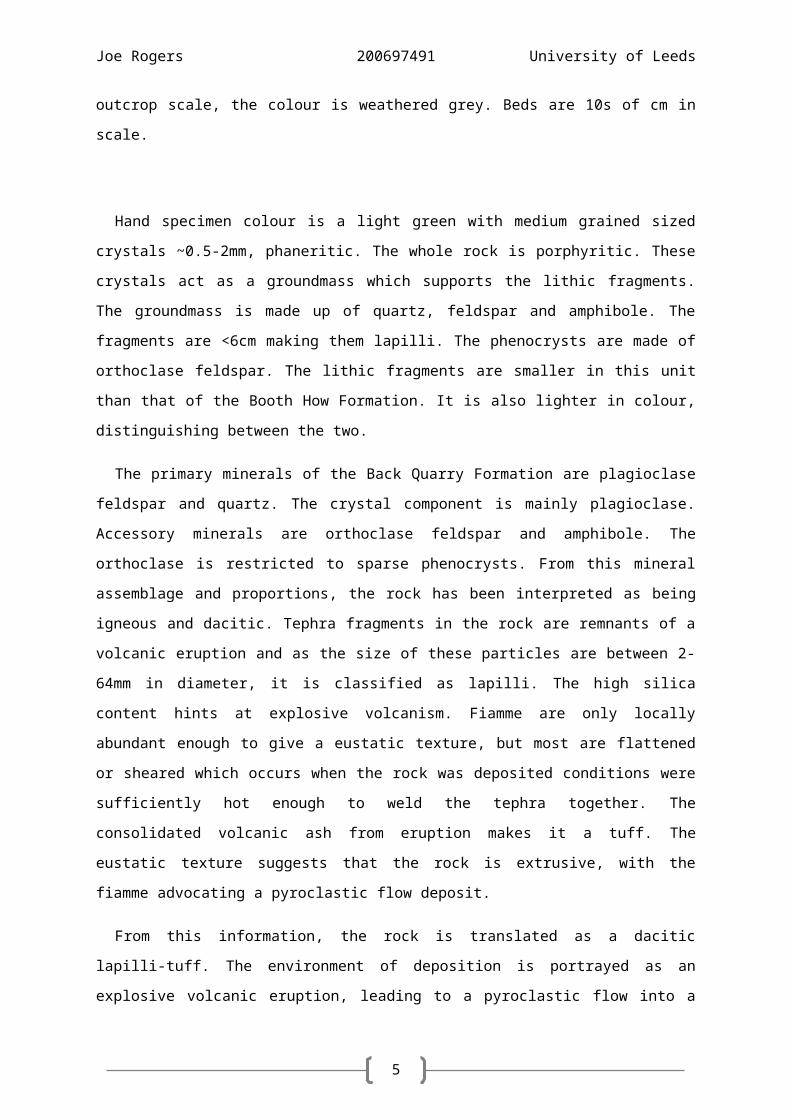
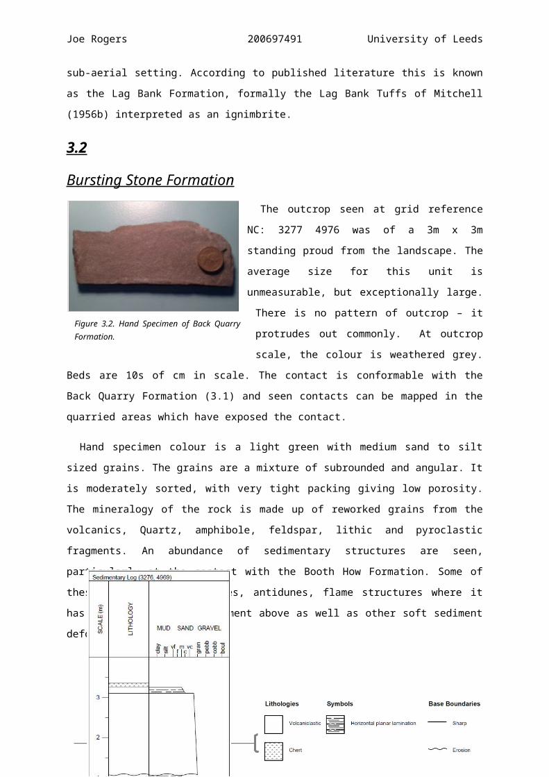
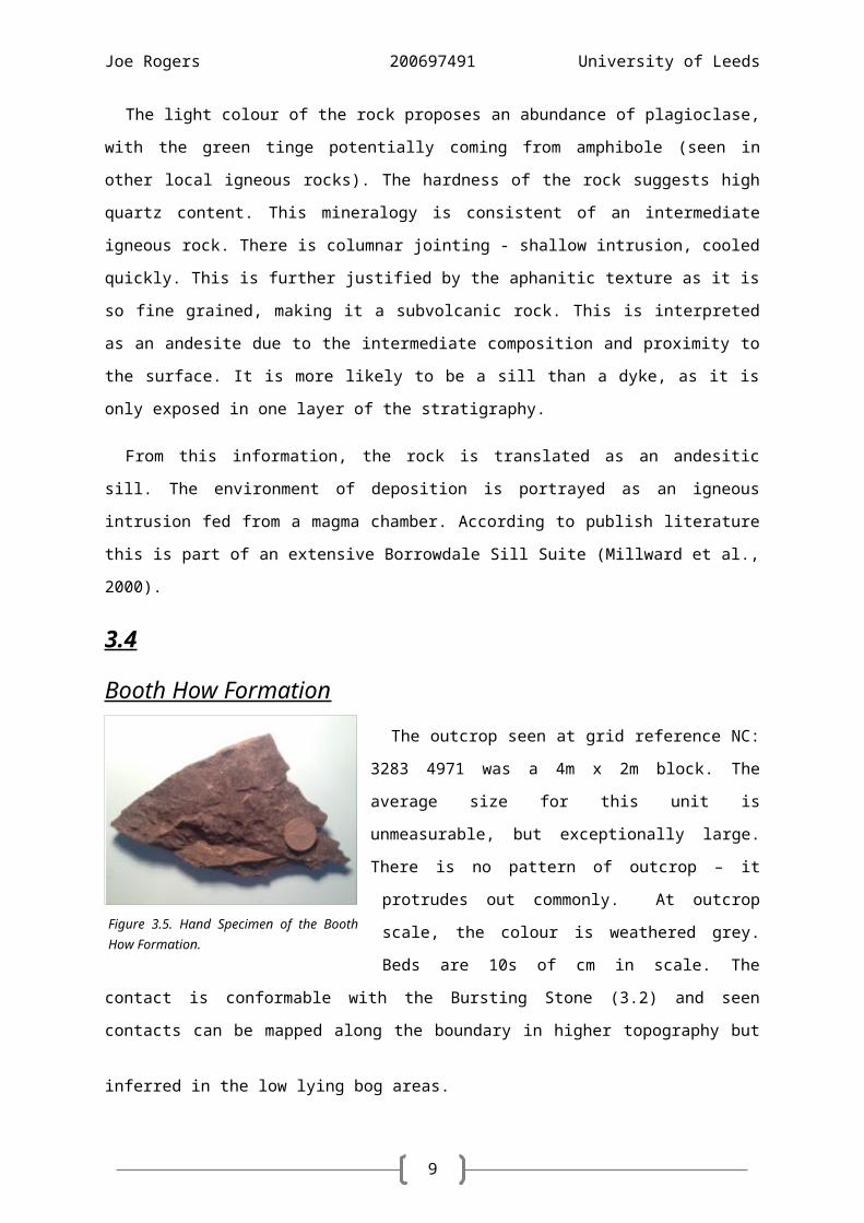
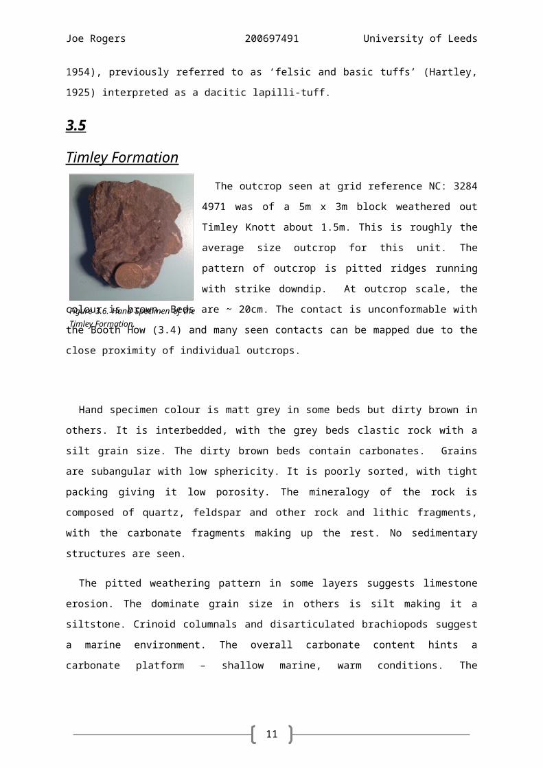
Joe Rogers 200697491 University of Leeds
Student ID
iii
Submission of work accompanied by this form indicatesyour compliance with the following statement:
I am aware that the University defines plagiarism as presenting someone else’s work, in whole or in part, as your own.
I promise that in the attached submission I have not presented anyone else’s work, in whole or in part, as my own and I have not colluded with others in the preparation of this work. Where I have taken advantage of the work of others, including group work, I have given full acknowledgement and include the names of all group members on this cover sheet. I have read and understood the University’s published rules on plagiarism and also any more detailed rules specified at School or module level. I know that if I commit plagiarism I can be expelled from the University and that it is my responsibility to be aware of the University’s regulations on plagiarism. I re-confirm my consent to the University copying and distributing any or all of my work in any form and using third parties (who may be based outside the EU/EEA) to monitor breaches of regulations, to verify whether my work contains plagiarised material, and for quality assurance purposes. I confirm that I have declared all mitigating circumstances that may be relevant to the assessment of this piece of work and that I wish to have taken into account. I am also aware of the penalties imposed for the late submission of coursework (at a rate of 5 marks per day that work is late).
Is this work late? Yes No
Do you have an extension? Yes No
Is this group work? Yes No
Joe Rogers 200697491 University of Leeds
Abstract
The mapping area covers a 10km2 area to the west of Torver and Coniston. The northern
section is made up of ~2km pyro/volcanoclastic deposits uncomfortably overlaying ~2km of
sedimentary rocks. Deposition of the volcanics came from arc-volcanism, producing explosive
pyroclastic flows, volcanic bombs and ash fall deposits. This is due to the closure of the Iapetus
Ocean between the Mid-Late Ordovician. This was followed by a period of sedimentation,
commencing in the Late Ordovician through to the End Silurian (~450-420Ma). It began by filling
the accommodation space created by migrating fore-arc basin. Marine transgression into the basin
provided the marine conditions for sediments to be reworked, fauna to thrive and density
currents to flow. Thermal contraction of the Lake District batholith produced extensive fault
systems. Terrane docking during the Caledonian orogeny (~490-390Ma) as Avalonia collided with
Laurentia created the regional structure. Cleavage propagated in both the volcanics and
sediments, overprinting existing fabric. This too produced the major fold through the district, the
Westmoorland Monocline. Late Devensian glaciation and lesser glacial periods beforehand eroded
the topography to present day geomorphology. This left behind an abundance of glacial till, which
was added to by further superficial deposits in the Holocene.
School of Earth & EnvironmentCOVER SHEET FOR ASSESSED WORKAll coursework submitted to the office MUST have a cover sheet stapled to the front.
If there are no staples, use a paperclip or a treasury tag.ENSURE YOU PUT YOUR WORK INTO THE CORRECT BOX.
Module Code
Module Name
Module Leader
Declaration
_ _ _ _ _ _ _ _
SOEE _ _ _ _
Deadline Date
Date Submitted
Degree Programme
Put your full name in the box. DO NOT FOLD OR FASTEN DOWN THE CORNER! Office staff will staple this down for anonymity before
passing it to staff once they have made a record of your submission. If you fasten it down yourself, this record will not be made.
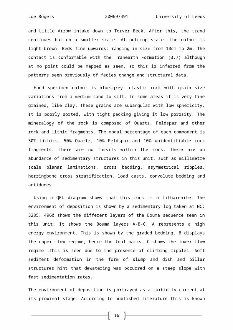
Using a QFL diagram shows that this rock is a litharenite. The environment of deposition is shown
by a sedimentary log taken at NC: 3285, 4960 shows the different layers of the Bouma sequence
seen in this unit. It shows the Bouma layers A-B-C. A represents a high energy environment. This is
shown by the graded bedding. B displays the upper flow regime, hence the tool marks. C shows the
lower flow regime .This is seen due to the presence of climbing ripples. Soft sediment deformation in
the form of slump and dish and pillar structures hint that dewatering was occurred on a steep slope
with fast sedimentation rates.
The environment of deposition is portrayed as a turbidity current at its proximal stage. According to
published literature this is known as the Birk Riggs Formation (Kneller, 1990a) interpreted as
sandstone, siltstone and mudstone turbidites.
13
Joe Rogers 200697491 University of Leeds
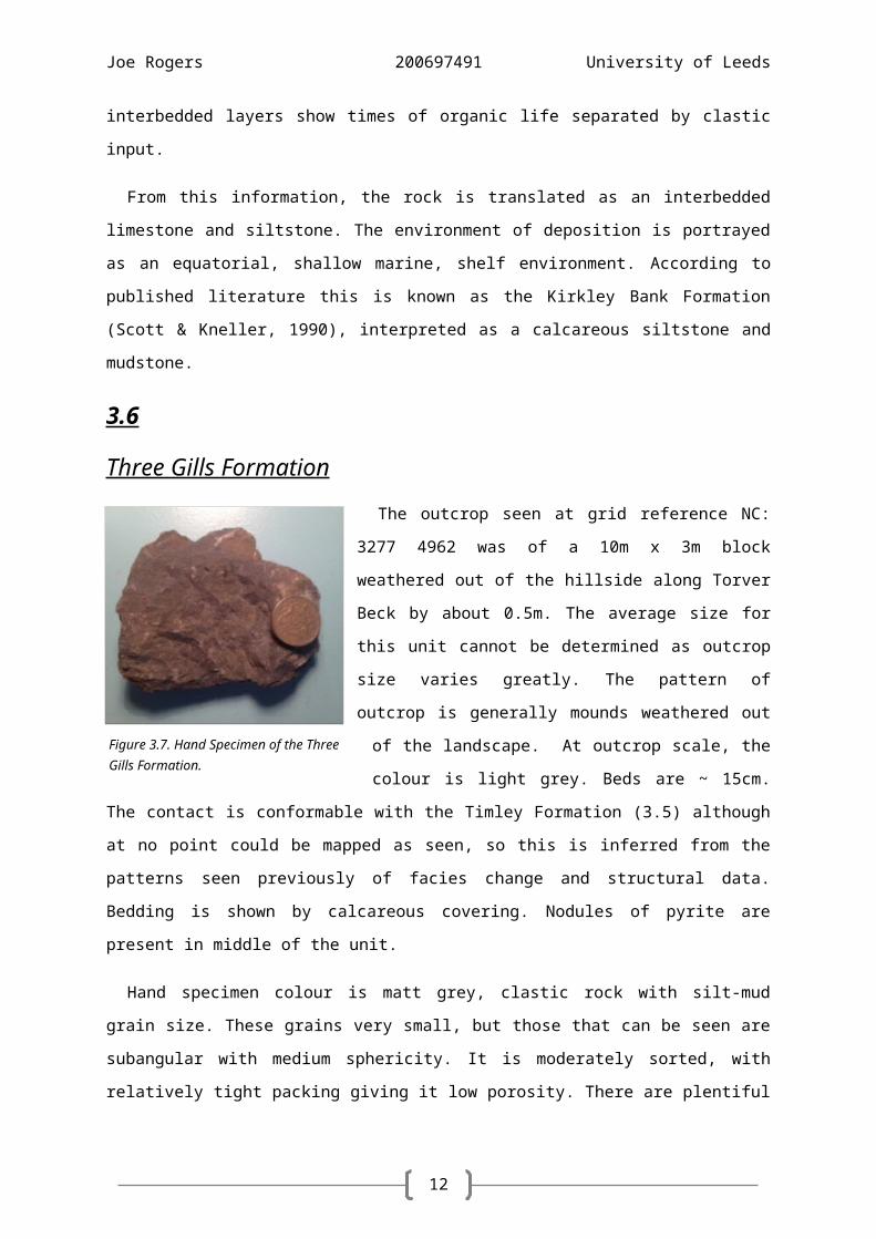
3.9
Wide Close Formation
Figure 3.10. QFL diagram showing the position of the New Intake Formation.
Figure 3.11. Sedimentary log through the New Intake Formation at NC: 3285 4960.
14
Figure 3.12. Hand Specimen of the Wide Close Formation.
Joe Rogers 200697491 University of Leeds
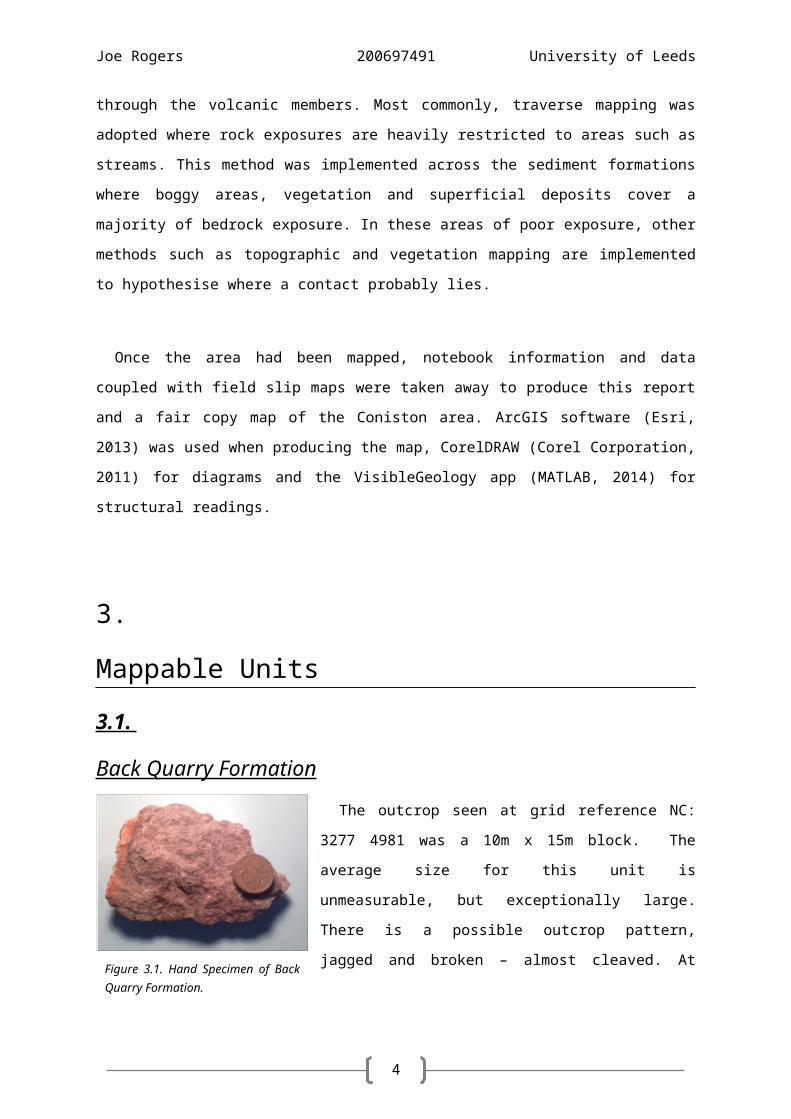
The outcrop seen at grid reference NC: 3289 4958
was of a 6m x 1m block weathered out of the hillside
by about 1m. The average size and shape of this unit
is very small, many too small to be mapped at 3m x
1m x 1m. The shape is weathered and heavily
vegetated due to it protruding out of the landscape.
The outcrop pattern is scarce, with exposure limited.
However there are valleys in the mapping area
which the outcrop can be seen in the valley sides, for
example, at NC 3281 4952 the unit is exposed all along. Bedding and cleavage is difficult to measure
due to the poor nature of the outcrop. This pattern follows the strike of the valleys. Outcrop colour
is a heavily weathered grey and beds are ~15cm in size. The contact is conformable with the New
Intake Formation (3.8), but not seen. It is at its clearest in the valley areas where one side is New
Intake whereas the other is Wide Close and this follows the structural readings for both units. The
unit is almost identical to the Tranearth Formation (3.7) but can be distinguished between by the
size and abundance of planar laminations which is greater in the latter. No other units are of this
colour with laminations.
Hand specimen colour is tarnished grey, clastic rock with silt grain size. These grains are
subangular with low sphericity. It is poorly sorted, with tight packing giving it low porosity. There are
no fossils seen within the rock, clearly no bioturbation. Sedimentary structures are seen, mainly
millimetre scale planar laminations being the distinctive feature in this unit as well as the kinked
cleavage.
The average grain size throughout the rock is silt making it a siltstone. The layers of coarser grains
show laminations. These laminations are possible low-density turbidity currents. The lack of
bioturbation suggests an anoxic, deep marine setting. Kinked bands suggest sandstone-shale
sequences, similar to cyclic sequences seen in the turbidite sequences, siltstone beds are banded
across the landscape then where there are spaces between outcrops down dip, this could be where
the mud layers have eroded away.
From this information, the rock is translated as a laminated siltstone. The environment of
deposition is portrayed as a deep, shelf environment with sediment input from minor turbidity
currents. According to published literature this is known as the Wray Castle Formation (Kneller,
1990b) interpreted as laminated siltstone, with subordinate thin graded beds of mudstone, siltstone
and, rarely, fine-grained sandstone. Similarly to the Brathay Formation, literature discusses
15
Figure 3.13. Hand Specimen of the Bleathwaite Formation.
Joe Rogers 200697491 University of Leeds
graptolite fauna – this is crucial in determining the relative ages and thus differentiating between the
units.
3.10
Bleathwaite Formation
The outcrop as seen at grid reference NC: 3290 4954
was of a 10m x 2m block standing proud by about 1.5m
from the ground. This is the average size and shape for
most of the outcrops seen in this unit. There is a regular
outcrop pattern of proud - but smoothed - sandstone
ridges parallel to strike, all dipping down topography. At
outcrop scale, the colour is dark brown. Beds range in
size from 20cm to >1m. The contact is conformable with
the Wide Close Formation 3.9) although at no point could be mapped as seen, so this is inferred
from the patterns seen previously of facies change and structural data. The unit is very similar to that
of the New Intake Formation (3.7) but can be distinguished by the smaller grain size. All other units
are different in colour and therefore easy to tell apart.
Hand specimen colour is metallic grey, clastic rock with grain size variations from a fine sand to
silt. In some areas it is very fine grained, like clay. These grains are subangular with low sphericity. It
is poorly sorted, with tight packing giving it low porosity. The mineralogy of the rock is composed of
quartz, feldspar, and other rock and lithic fragments. There are no fossils within the rock. Few
sedimentary structures are seen, but millimetre scale planar laminations, groove marks and what
could be ripple marks at the base of some beds are present.
Using a QFL diagram shows that this rock is a sublitharenite. The environment of deposition is
shown by a sedimentary log taken at NC: 3294 4955 shows the different layers of the Bouma
sequence seen in this unit. It shows the Bouma layers A-B.
From this information, the rock is translated as a turbidite sequence. The environment of
deposition is portrayed as a high density turbidity current at its proximal stage. According to
published literature this is known as the Gawthwaite Formation (Lawrence et al., 1986) interpreted
as thin to medium bedded sandstone with many intercalated thin beds of graded siltstone and
mudstone.
16
Joe Rogers 200697491 University of Leeds
Figure 3.14. QFL diagram showing the position of the Bleathwaite Formation.
17
Joe Rogers 200697491 University of Leeds
Figure 3.15. Sedimentary log through the Bleathwaite Formation at NC: 3294 4955.
Figure 3.16. Ripple marks at NC: 3289, 4964, looking 140° determining paleocurrent direction in the New Intake Formation.
Figure 3.17. Rose diagram showing reconstructed paleocurrent direction (~163°).
18
Joe Rogers 200697491 University of Leeds
4.
Structure
The Lower Palaeozoic rocks of the Lake District record the Early Palaeozoic history of the
northern margin of Eastern Avalonia. This microcontinent rifted from Gondwana and drifted north
from the high southerly latitudes during the Ordovician and early Silurian (about 60°S to 30°S;
Torsvik & Trench, 1991). Structures now preserved in the region record events at the continental
margin during that migration (Millward et al., 2000).
Stereonet Data
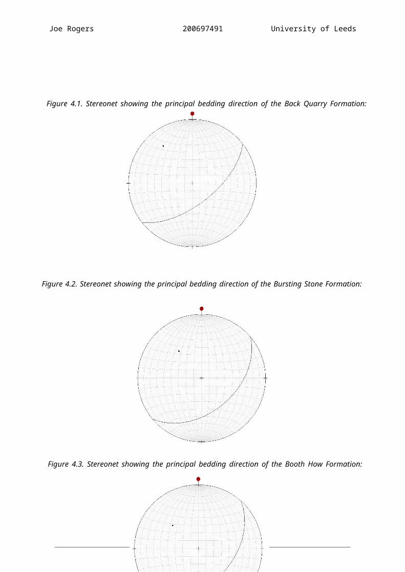
Figure 4.1. Stereonet showing the principal bedding direction of the Back Quarry Formation: 056/55 SE.
Figure 4.2. Stereonet showing the principal bedding direction of the Bursting Stone Formation: 052/63 SE.
19
Joe Rogers 200697491 University of Leeds
Figure 4.4. Stereonet showing the principal bedding direction of the Timley Formation: 042/45 SE.
Figure 4.3. Stereonet showing the principal bedding direction of the Booth How Formation: 050/46 SE.
20
Joe Rogers 200697491 University of Leeds
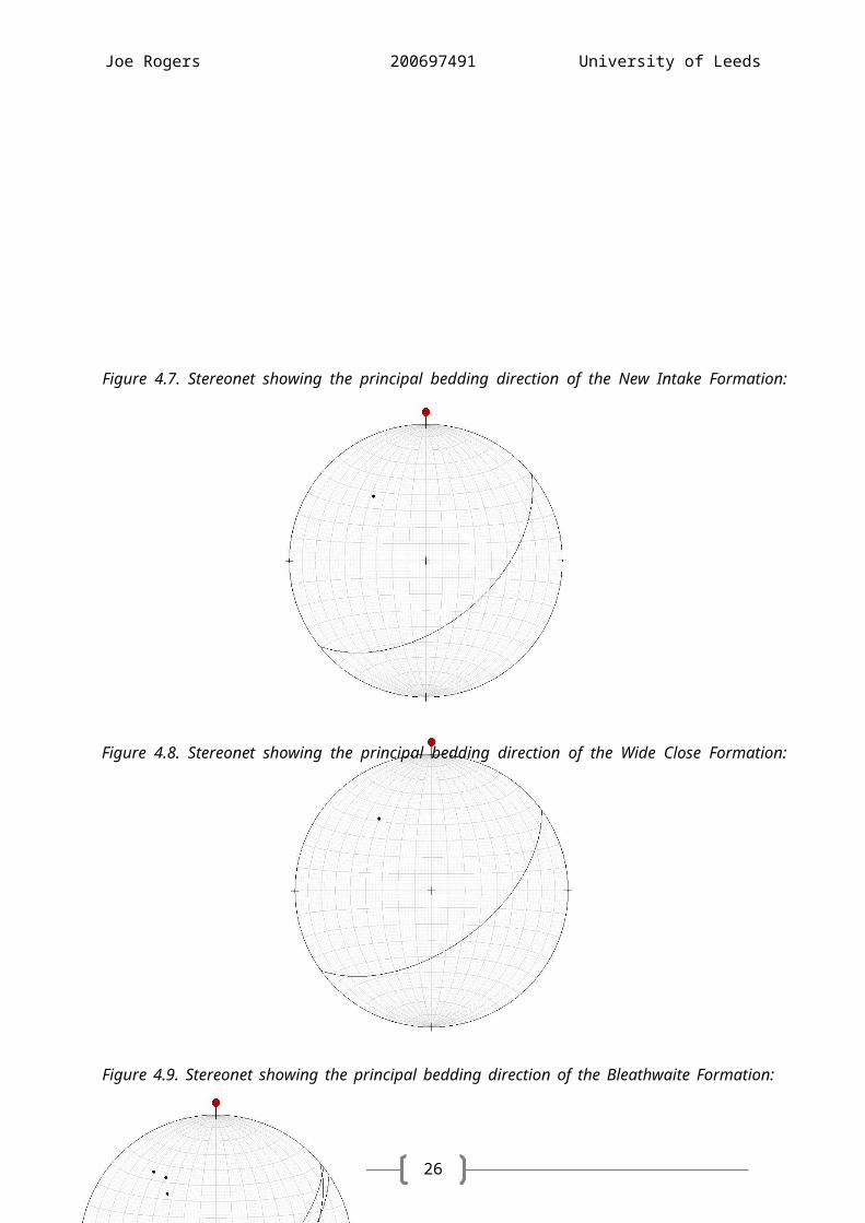
Figure 4.7. Stereonet showing the principal bedding direction of the New Intake Formation: 049/45 SE.
Figure 4.6. Stereonet showing the principal bedding direction of the Tranearth Formation: 041/41 SE.
Figure 4.5. Stereonet showing the principal bedding direction of the Three Gills Formation: 043/44 SE.
21
Joe Rogers 200697491 University of Leeds
Figure 4.10. Stereonet showing the relationship between principal bedding direction of each of the volcanic formations, and the 3-D projection into the earth to show real dip.
Figure 4.9. Stereonet showing the principal bedding direction of the Bleathwaite Formation: 055/54 SE.
Figure 4.8. Stereonet showing the principal bedding direction of the Wide Close Formation: 051/51 SE.
22
Joe Rogers 200697491 University of Leeds
Above are stereonets showing bedding from both the volcanic and sediment formations. All beds
(excluding intrusions) are dipping approximately south-east. The volcanic members are difficult to
measure, as good bedding is sparse. Measurable bedding is mainly located on the boundary
between the contacts. The sediment units on the other hand are abundant in good bedding surfaces.
Cleavage is clear in both the volcanic and sediment formations. Although not enough data was
acquired to create average stereonets, it is noted that a majority of the beds cleave in a south-east
direction; however the cleavage is that steep that it is occasionally difficult to determine which
direction exactly. Consequently, some of the volcanic units measure a north-westerly cleavage,
despite this a majority follow the trend of the sediments a dip south-east.
4.2
Faulting
The complex fault pattern of the Lake District has a polyphase evolution involving reactivation of
some volcanotectonic faults, Acadian deformation and later, Late Palaeozoic extensional tectonism
(Millward et al., 2000).
The faults in the northern part of the mapping area are a consequence of the thermal contraction
of the Lake District batholith (Branney & Soper, 1988). Most of these measured the study area
downthrow to the west - corresponding with the location of the batholith. In the north-east part of
the mapping area there is an extensive section of faulting. These faults run through from the
Bursting Stone Formation, down stratigraphy before ending in the Three Gills Formation. These
faults run directly through gullies carved by streams, which hint at a point of weakness. The average
strike of these faults was ~325°. The throw on the faults averages at 50m, leaving the stratigraphy -
particularly in the Timley Formation - severely distorted. Some appear to have formed conjugate
faults, for example at NC: 3285 4971. Others have joined into other faults to make a complex fault
web. Some faults in this area then continue on up stratigraphy into the largest fault mapped in the
area, first seen at NC 3280 4978. This fault runs at ~25° through a large proportion of rock units,
seen from the Bursting Stone Formation down into the Three Gills Formation. Further up dip, at NC:
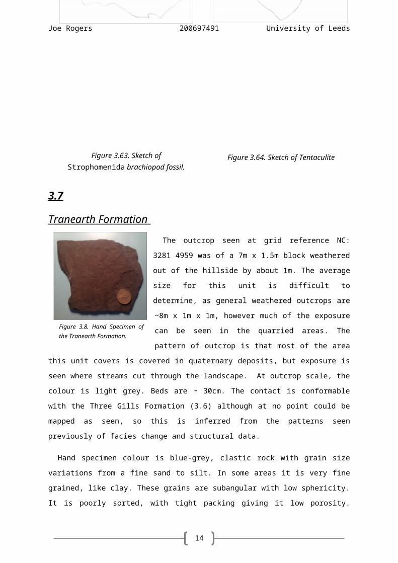
3276 4972 another fault runs parallel along the same strike as before, like a sister fault.
Figure 4.11. Stereonet showing the relationship between principal bedding direction of each of the sediment formations, and the 3-D projection into the earth to show real dip.
23
Joe Rogers 200697491 University of Leeds
The density of faults over the mapping area varies, with the large proportion situated in the
northern section around the volcanic units, whereas in the sedimentary faulting is far sparser. It is
only seen in some areas dotted across the unit boundaries.
The fault system appears to be normal, with some oblique motion which is to be expected as real
faults do not coincide exactly to models created in the classroom.
It is difficult to infer relative movement on the faults in certain parts of the mapping area, as
there is significant erosion in both the siltstone dominated beds such as the Three Gills and Wide
Close Formations, as well as the limestone interbedded Timley Formation.
Quartz veins, which are identifiable by their white colour with strong vitreous lustre, coupled
with the ability to scratch a hand lens - are seen in areas of structural extension. This fluid fill
occupies accommodated space, particularly in areas of faulting. For example, at NC: 3285 4972,
quartz veins are abundant within 5-10m of a mapped fault, lying parallel to the fold axis.
Literature states the presence of the ‘Park Gill Thrust’. A thrust fault which gently ramps down-
sequence, lying close to the Coniston Group (Millward et al., 2000). Despite this, in the field no
evidence was seen of such fault. Some quartz veins were witnessed but not enough to justify a fault.
This is not surprising, as it is stated that this thrust rarely produces any stratigraphical offset.
4.3
Folding
Although no folds were seen intra-unit, there is evidence for large
scale folding across a regional scale. Within the Bursting Stone
formation, there are evidence of minor folds (see figure 4.12.) These
folds show vergence, suggesting that the unit is located on the south-
east facing limb of a fold. The limbs of the minor fold are parasitic (see
figure 4.13.), short wavelength folds formed within a larger wavelength
fold structure - normally associated with differences in bed thickness. Figure 4.31. Photograph of minor fold verging NW at NC:3264 4951, looking 176°.
24
Joe Rogers 200697491 University of Leeds
Figure 4.32. Sketch of a parasitic minor fold at NC: 3272 4976. This shows a vergence direction to the NW.
25
Joe Rogers 200697491 University of Leeds
5.
Quaternary Geology
5.1
Superficial Deposits
Superficial deposits have too been mapped along with bedrock geology. These unconsolidated
sediments overlay significant proportions of the study area.
Till is widely distributed over the mapping area. It is
extremely poorly sorted and contains some very large clasts,
which can be traced to other units in the mapping area. It
makes up a majority of the bogs found in the central area,
where the steep mountainous north has a break in slope
before flattening out. Peat is only found in one area at NC:
3284 4966 in the boggy flat central region. The lack of
exposure limits an approximation of peat land coverage; this
outcrop is 10m x 0.5m. Alluvium forms present day
floodplains around the extensive network of rivers,
particularly in the low lying areas of Torver beck NC: 3280
4942.
5.2
Glaciation
Figure 5.1. Photograph of exposed section of glacial till, note the unsorted randomly sized clasts at NC:3285 4978, looking 354°.
26
Joe Rogers 200697491 University of Leeds
Over time the Lake District has been heavily glaciated in various Ice Ages producing a
characteristic geomorphology of wide U-shaped valleys, steep ridges with England’s highest
mountain and deepest and longest lakes.
Evidence for glaciation in the mapping area can be seen in glacial striations,
NC: 3285 4960 (see figure 5.2). This gives a direction of ice travel, where glacier
movement carves into the unit below by dragging rock fragments using them as
a cutting tool. From the striations seen, the general ice movement has been
calculated at 212°.
Glaciation is also visible from rouche moutonnée, present at NR: 3287 4963
(see figure 5.3). The passage of glacial ice over underlying bedrock can result in
ripple like asymmetrical erosional formations. Like a ripple, abrasion on the
stoss (up-dip) side of the rock and plucking on the lee (down-dip) gives rise to its
geomorphology. All the sides and edges have been smoothed and eroded in the
direction that the glacier passed over it. From the rouche moutonnée seen, the
general ice movement has been calculated at 231°.
More signs of glacial activity are shown by the presence of
glacial erratics (see figure 5.4). These pieces of rock differ in
type to that mapped at the site they are situated on. They
have been transported most probably by glacier flow - and
deposited away from their source. They are found in various
locations across the mapping area, all down-dip from the steep
topography seen on the northern horizon. The location of the
boulder cannot determine ice movement as it has just been
deposited without a trail, although it does help give a sense
of where it may have come from by picturing it relative to
the terrain up-dip.
Figure 5.4. Photograph of glacial erratic with possible source and flow direction in background at NC: 3275 4957, looking 303°.
Figure 5.3. Photograph of rouche moutonnée.
Figure 5.2. Photograph of straiations.
27
Joe Rogers 200697491 University of Leeds
This leads onto how the topography of the study area helps to predict how the landscape was
sculpted by ice movement. By looking at the mapping area as a whole and then by studying the
landforms the progression of ice can be determined.
Looking at figure 5.6 of the entire area, it is noticeable that in the north there is a high
mountainous zone, with each peak separated by U-shaped valleys. Centrally there is flat terrain
before reaching large rolling hills in the south. A view of the north from the low lying central region
is shown in figure 5.5.
5.3
Figure 5.5. Photograph of updip topography. Glacial cirque with headwall shows the geomorphology left by previous glaciation at NC:3274 4958, looking 311°.
Figure 5.6. Satellite image of the eastern mapping area – it shows the steep glaciated topography in the background down into the smooth low lying foreland (Google Inc., 2014).
Figure 5.5. Photograph looking 311° from NC: 3274 4958 of the steep northern topography from low lying ground in the south.
28
Joe Rogers 200697491 University of Leeds
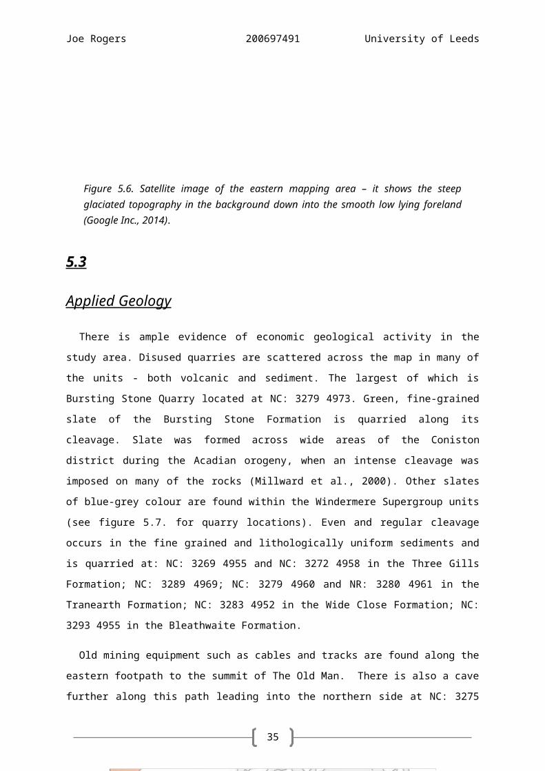
Applied Geology
There is ample evidence of economic geological activity in the study area. Disused quarries are
scattered across the map in many of the units - both volcanic and sediment. The largest of which is
Bursting Stone Quarry located at NC: 3279 4973. Green, fine-grained slate of the Bursting Stone
Formation is quarried along its cleavage. Slate was formed across wide areas of the Coniston district
during the Acadian orogeny, when an intense cleavage was imposed on many of the rocks (Millward
et al., 2000). Other slates of blue-grey colour are found within the Windermere Supergroup units
(see figure 5.7. for quarry locations). Even and regular cleavage occurs in the fine grained and
lithologically uniform sediments and is quarried at: NC: 3269 4955 and NC: 3272 4958 in the Three
Gills Formation; NC: 3289 4969; NC: 3279 4960 and NR: 3280 4961 in the Tranearth Formation; NC:
3283 4952 in the Wide Close Formation; NC: 3293 4955 in the Bleathwaite Formation.
Old mining equipment such as cables and tracks are found along the eastern footpath to the
summit of The Old Man. There is also a cave further along this path leading into the northern side at
NC: 3275 4980, which is likely to be attributed to the former Coniston copper mines . Other minerals
were too extracted by various companies over the years; the primary minerals found at Coniston
are: arsenopyrite; chalcopyrite; iron pyrites; malachite; tennantite and tetrahedrite (Mineexplorer,
2011).
Figure 5.7. Location a prominent slate quarries and metalliferous mining in the Ambleside district (Millward et al., 2000).
29
Joe Rogers 200697491 University of Leeds
6.
Discussion
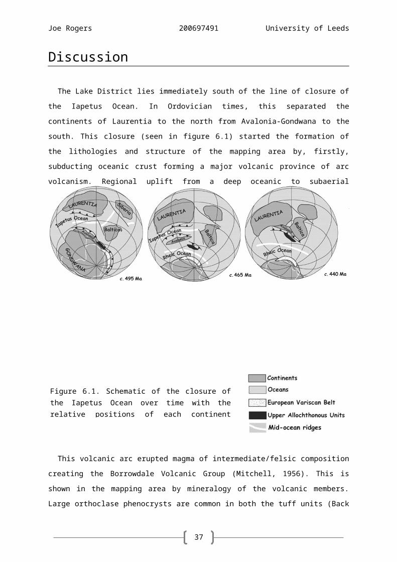
The Lake District lies immediately south of the line of closure of the Iapetus Ocean. In Ordovician
times, this separated the continents of Laurentia to the north from Avalonia-Gondwana to the south.
This closure (seen in figure 6.1) started the formation of the lithologies and structure of the mapping
area by, firstly, subducting oceanic crust forming a major volcanic province of arc volcanism.
Regional uplift from a deep oceanic to subaerial environment took place prior to building of the first
volcanoes. Uplift may have been the inevitable consequence of the generation of large volumes of
magma that preceded volcanism at the continental margin (Cooper & Hughes, 1993).
Figure 6.1. Schematic of the closure of the Iapetus Ocean over time with the relative positions of each continent (Stone, 2012).
30
Joe Rogers 200697491 University of Leeds
This volcanic arc erupted magma of intermediate/felsic composition creating the Borrowdale
Volcanic Group (Mitchell, 1956). This is shown in the mapping area by mineralogy of the volcanic
members. Large orthoclase phenocrysts are common in both the tuff units (Back Quarry & Booth
How Formations). This magmatism was explosive (Branney, 1991). Proof in the field comes from the
presence of fiamme, which occur in in pyroclastic fall deposits and ignimbrites. These make up ¾ of
the volcanic units in the mapping area.
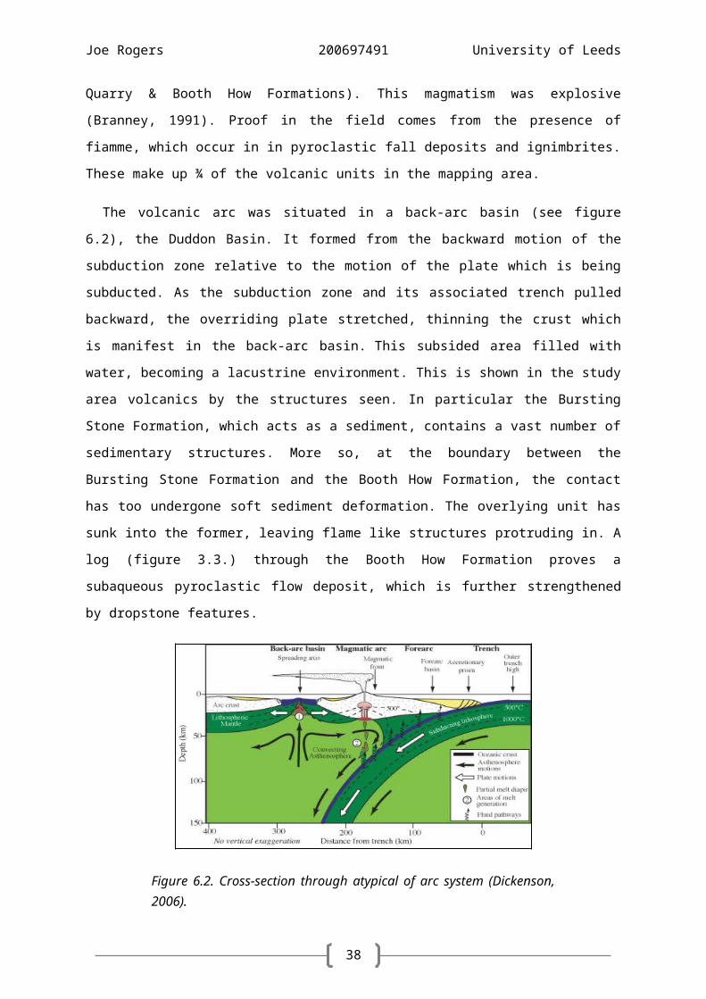
The volcanic arc was situated in a back-arc basin (see figure 6.2), the Duddon Basin. It formed
from the backward motion of the subduction zone relative to the motion of the plate which is being
subducted. As the subduction zone and its associated trench pulled backward, the overriding plate
stretched, thinning the crust which is manifest in the back-arc basin. This subsided area filled with
water, becoming a lacustrine environment. This is shown in the study area volcanics by the
structures seen. In particular the Bursting Stone Formation, which acts as a sediment, contains a vast
number of sedimentary structures. More so, at the boundary between the Bursting Stone Formation
and the Booth How Formation, the contact has too undergone soft sediment deformation. The
overlying unit has sunk into the former, leaving flame like structures protruding in. A log (figure 3.3.)
through the Booth How Formation proves a subaqueous pyroclastic flow deposit, which is further
strengthened by dropstone features.
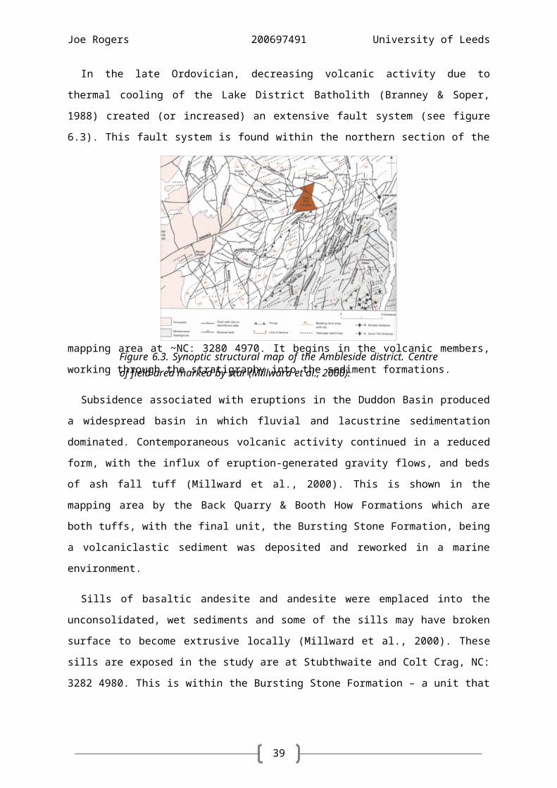
In the late Ordovician, decreasing volcanic activity due to thermal cooling of the Lake District
Batholith (Branney & Soper, 1988) created (or increased) an extensive fault system (see figure 6.3).
This fault system is found within the northern section of the mapping area at ~NC: 3280 4970. It
begins in the volcanic members, working through the stratigraphy into the sediment formations.
Figure 6.2. Cross-section through atypical of arc system (Dickenson, 2006).
31
Joe Rogers 200697491 University of Leeds
Subsidence associated with eruptions in the Duddon Basin produced a widespread basin in which
fluvial and lacustrine sedimentation dominated. Contemporaneous volcanic activity continued in a
reduced form, with the influx of eruption-generated gravity flows, and beds of ash fall tuff (Millward
et al., 2000). This is shown in the mapping area by the Back Quarry & Booth How Formations which
are both tuffs, with the final unit, the Bursting Stone Formation, being a volcaniclastic sediment was
deposited and reworked in a marine environment.
Sills of basaltic andesite and andesite were emplaced into the unconsolidated, wet sediments and
some of the sills may have broken surface to become extrusive locally (Millward et al., 2000). These
sills are exposed in the study are at Stubthwaite and Colt Crag, NC: 3282 4980. This is within the
Bursting Stone Formation – a unit that originally deposited was reworked marine sediment, proving
a strong correlation.
The final products of the volcanic episode are not preserved, probably because emplacement of
laccolithic elements of the Lake District Batholith gave rise to greater uplift in the west of the district
resulting in erosion to form the south-westward overstepping relationship seen at the
unconformable base of the overlying Windermere Supergroup (Millward et al., 2000). The
discordant relationships at the unconformity are inferred as a marine transgression across a
subsiding, subaerial volcanic field (Branney & Soper 1988).
The Windermere basin was formed by the evolving Iapetus Ocean system. Prior to its formation,
the Southern Uplands accretionary prism, flanking the edge of the Laurentian continent, was
advancing towards Avalonia. The load of the mountains formed during this collision weighed down
the Avalonian plate, causing the development of accommodation space from lithospheric flexure
(see figure 6.4). As magmatism waned, thermal contraction too allowed marine conditions to
become established across the eroded and thermally subsiding volcanic pile (Millward et al., 2000). A
marked increase in subsidence and the corresponding increase in sedimentation rate is associated
with the foreland basin migrating southward across the Lake District during the final stages of the
closure of the Iapetus Ocean (Kneller, 1991; King, 1992).
With late Ordovician cessation of volcanism and deformation of the Acadian Orogeny, (Soper et
al., 1987) came deposition within the Windermere Basin. Sedimentation began in the Caradoc, ~455
Ma and lasted until the Pridoli, ~ 419 Ma, terminated by erosion. The rate of sediment accumulation
accelerated with time due to the increasing proximity of the Avalon mountain belt. This
sedimentation formed the Windermere Supergroup, a sequence of folded and cleaved,
predominantly marine sedimentary rocks, which unconformably overlies the Borrowdale Volcanic
Group (Millward et al. 2000). In the initial shallow waters, carbonate facies developed creating the
Dent Group (a subgroup of the Windermere Supergroup). This primary carbonate facies is
represented in the study area by the Timley Formation. This was followed by deepening water
deposits represented by the Stockdale group, a series of mud and siltstones, which display a
sedimentation rate high enough to preserve annual variation. This variation is seen in the
laminations of the Tranearth, New Intake and Wide Close Formations. Finally, a series of sediment
gravity currents flowed into the basin swamping the siltstones beneath. This created a series of
sandy turbidites known as the Coniston Group. The turbidite sequence is just seen in the mapping
area at the southern edge as the youngest unit, the Bleathwaite Formation.
The variation in graptolite fauna is pragmatic in distinguishing between separate units within the
Dent and Stockdale groups. The abundance of different species can be used to split rock units into
graptolite zones. However, it the field area no graptolite fossils were recovered – only a large array
of brachiopods.
About two million years ago, the Lake District was a mountain massif broken by river valleys
radiating outwards from the centre. A period of climatic oscillations led to a series of ice ages during
which the ice flowed out from the central core, following the river valleys, deepening and widening
them, and depositing streamlined till and other depositional features on the lower land (Royal
Geographical Society, 2014) (see figure 6.5 for ice movement direction). The last glacial period in
Britain and Ireland was the Devensian glaciation; ~110,000 - 12,000 years ago (Clayton, 2006). This
shaped the glacial geomorphology and features glaciation features such as striations and U-shaped
valleys seen in the field area.
33
Joe Rogers 200697491 University of Leeds
The dominant deposit resulting from the Late Devensian glaciation is till, now forming extensive,
featureless spreads (British Geological Survey, 1998; Chapter 12). These spreads are mapped
extensively as superficial deposits covering the sediment members in the study area.
The mapping area lies on a south-facing monocline, the Westmorland Monocline, the steep limb
of which incorporates the north-western margin of the Windermere Supergroup (Kneller & Bell,
1993). The Bannisdale Syncline is the major, asymmetric synclinorial structure that bounds the
monocline on its south-east side (Millward et al., 2000). Evidence for the Bannisdale Syncline comes
from minor folds in volcanic members at NC: 3263 4956 and NC: 3275 4975. They display a north-
westerly vergence showing that the mapping area is situated on the southern limb of the syncline
(see figure 6.6). Cleavage too developed in the Early Devonian (Soper et al., 1987). Cleavage is
steeply inclined, trending 060° to 070° (Millward et al., 2000), witnessed in the mapping area with an
average of 74°.
Figure 6.6. Cross-section through Ambleside district showing the location of the mapping area relative to regional structure (Treagus, 1992).
Figure 6.5. Movement of ice in the Ambleside district. Calculated ice direction is shown by arrow (222°), similar to literature direction (Millward et al., 2000).
34
Joe Rogers 200697491 University of Leeds
7.
Conclusion
The bedrock geology of the Coniston mapping area is dominated by two distinct lithological
groups. The northern area is primarily made up of volcanic formations of both ignimbrite and
volcaniclastic rocks. The latter is intruded by other igneous provinces in the far north-east. The
southern area is comprised of sediment members ranging from mudstone to sandstone, with the
presence of turbidite sequences in the extreme south. The two groups are separated by an angular
unconformity below the Booth How Formation.
The volcanic group was deposited in a mixture of sub-aqueous, sub-aerial and lacustrine
environments as pyroclastic flow and ash fall deposits, with some reworked into volcaniclastics
before being deformed to a shallow dip. The sediment formations were initially deposited in a
shallow marine, shelf environment as calcareous siltstone before marine transgression and
regression led to variations in depth of marine depositional environments, varying from mudstone,
siltstone to sandstone. High-density, sediment laden currents flowing down dip into deep marine
abyssal settings resulted in the turbidite sequences. Sedimentation is continuous; however the
fluctuating rate of clastic influx from source affects what and how much can be deposited in these
environments.
Regional deformation occurred in two separate phases. The initial developed post deposition of
the volcanic group.
The major fault system which trends NW/SE was created either due to thermal contraction of the
cooling Lake District Batholith, continuing fore-arc subduction or plate collision of the Acadian
Orogeny. The direction of motion of the faults is an oblique-slip movement.
The geomorphology of the area was shaped by preceding glacial events, but predominantly by
the late Devensian ice age. It has shaped the landscape into characteristic ‘U’-shaped valleys with
associated cirques and hanging valleys.
The superficial geology of the mapping area covers a majority of the sediment group and
significant parts of the volcanic in lower topography areas. Glacial till, a remnant of previous
glaciation, is stricken over the low lying sediments in the southern areas and covers the
volcaniclastics in the west. Localised peat and alluvium at river banks is too seen.
35
Joe Rogers 200697491 University of Leeds
Bibliography
Allen, P.M. & Cooper, D.C. (1986) “The stratigraphy and composition of the Latterbarrow and
Redmain sandstones, Lake District, England”. Geological Journal. 21: 59-76.
Branney, M.J. & Soper, N.J. (1988) “Ordovician Volcano-Tectonics in the English Lake District”.
Journal of the Geological Society. 145(3): 367-376.
Branney, M.J. (1991) “Eruption and depositional facies of the Whorneyside Tuff Formation, English
Lake District: an exponentially large-magnitude phreatoplinian eruption”. Geological Society of